Totale Sonnenfinsternis vom 04.06.-0240
| Wochentag: | Montag |
| Maximale Dauer der Verfinsterung: | 06m08s |
| Maximale Breite des Finsternispfades: | 258 km |
| Saroszyklus: | 72 |
| Bedeckungsgrad: | 100% |
| Magnitude: | 1.0641 |
| Gamma: | -0.5807 |
Wo kann man die Sonnenfinsternis vom 04.06.-0240 sehen?
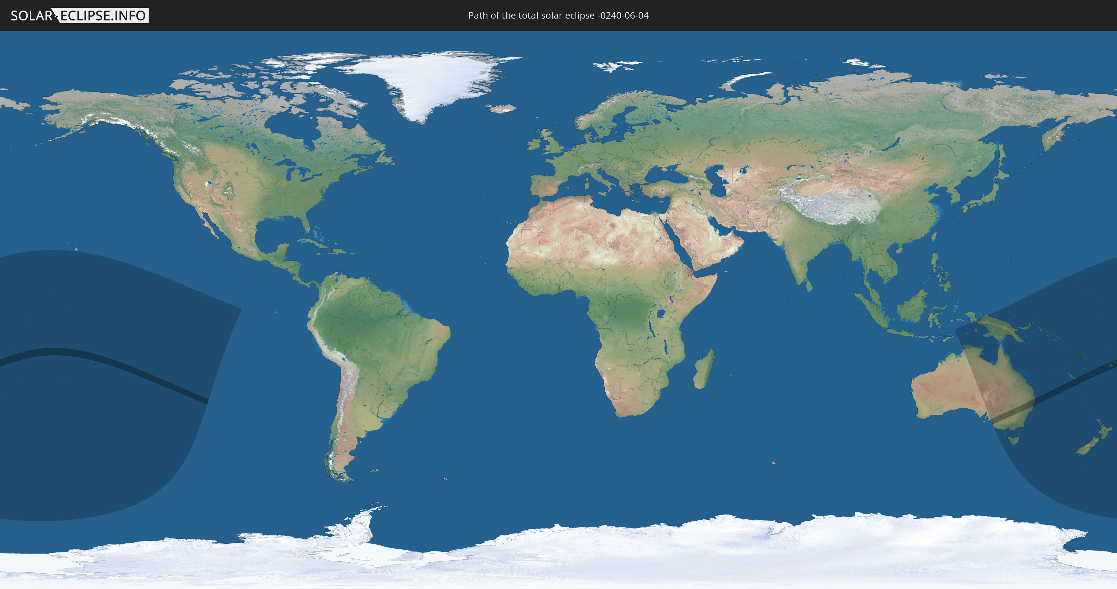
Die Sonnenfinsternis am 04.06.-0240 kann man in 25 Ländern als partielle Sonnenfinsternis beobachten.
Der Finsternispfad verläuft durch 10 Länder. Nur in diesen Ländern ist sie als totale Sonnenfinsternis zu sehen.
In den folgenden Ländern ist die Sonnenfinsternis total zu sehen
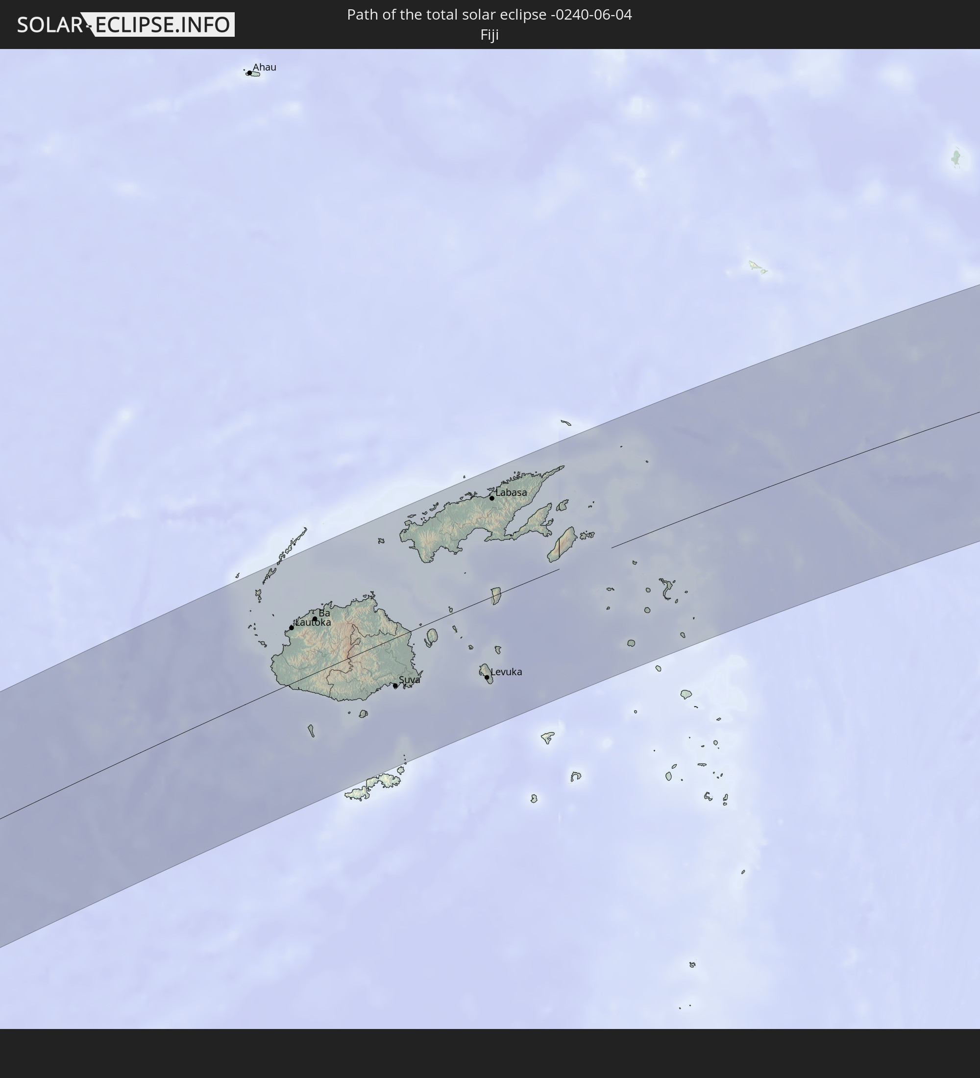 Fidschi
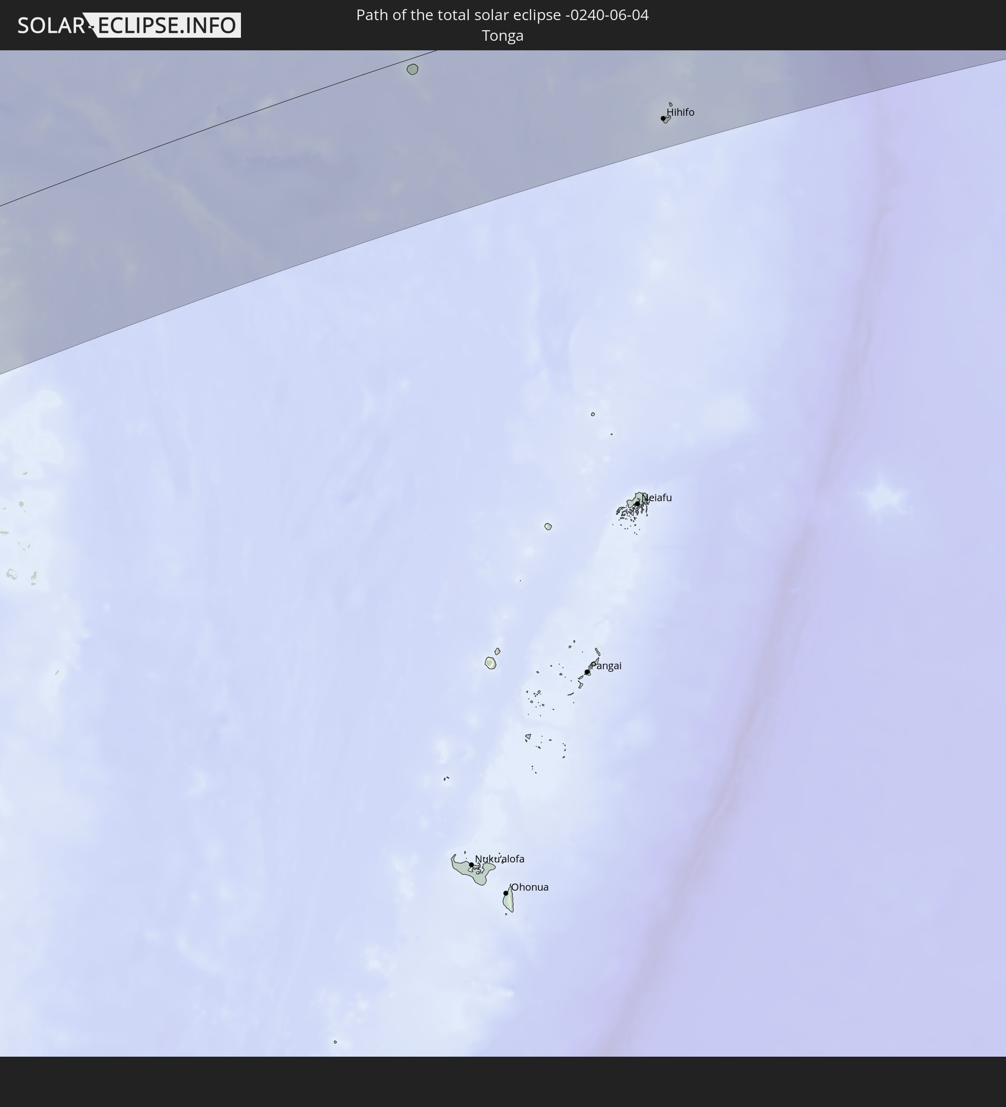 Tonga
Tonga
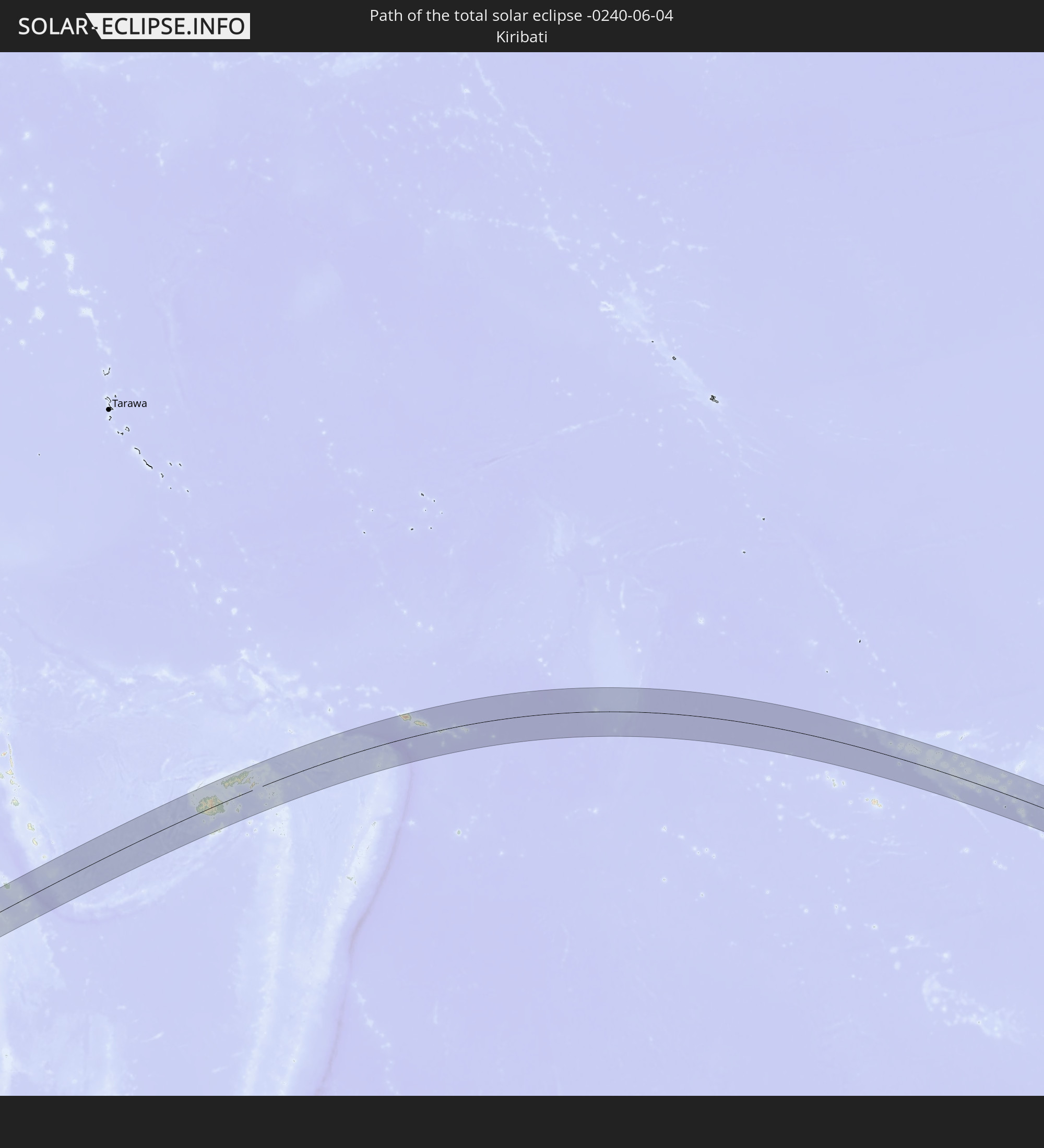 Kiribati
 Samoa
Samoa
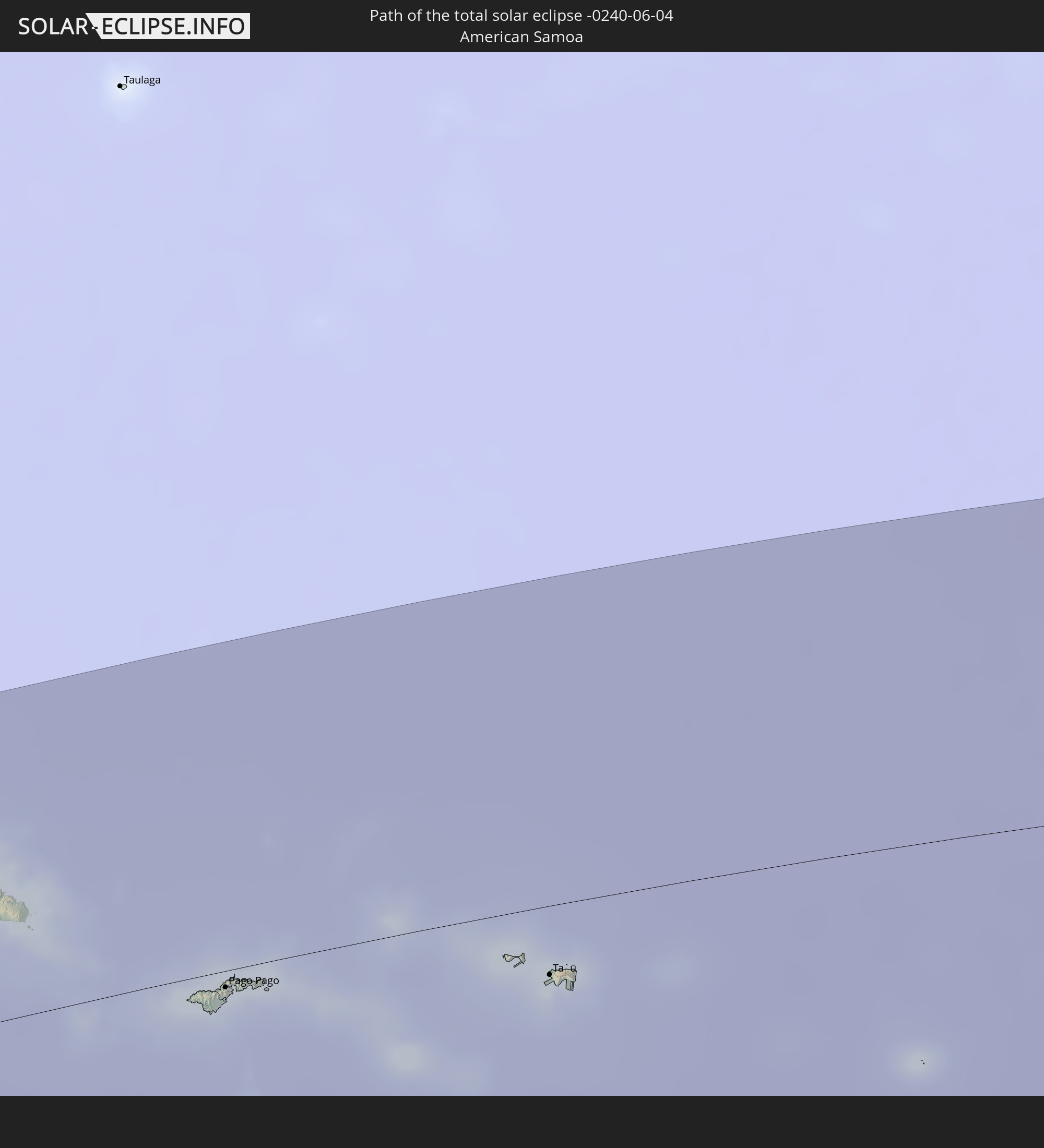 Amerikanisch-Samoa
 Cookinseln
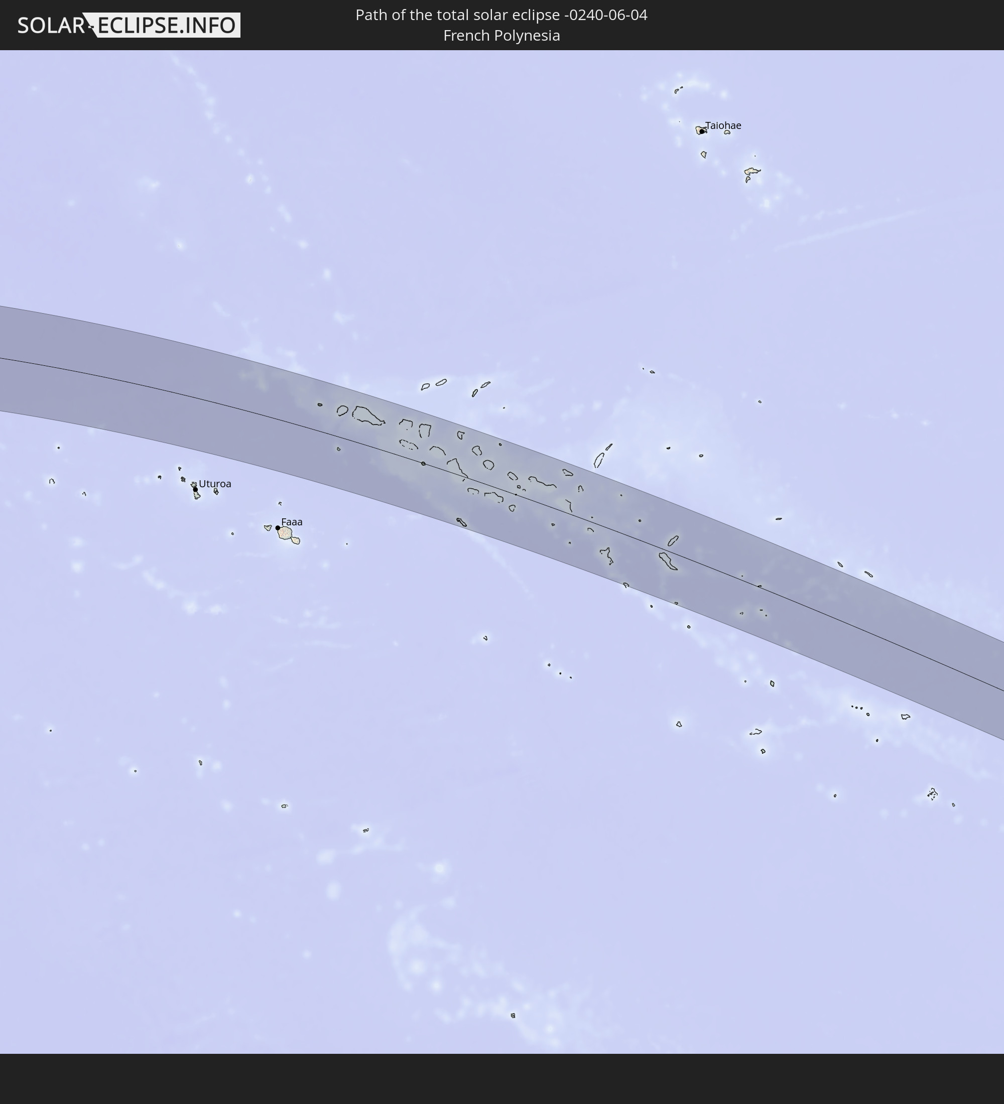 Französisch-Polynesien
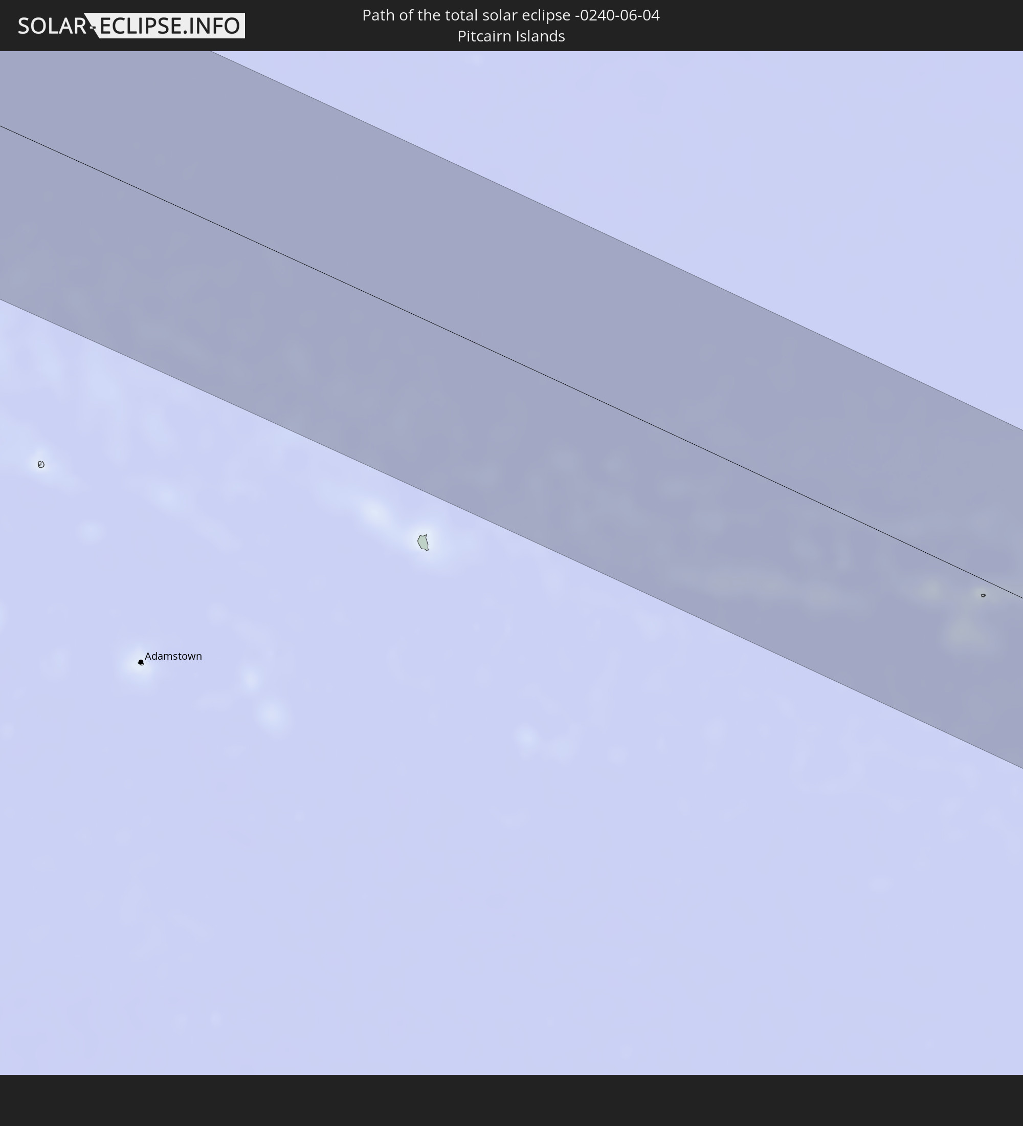 Pitcairninseln
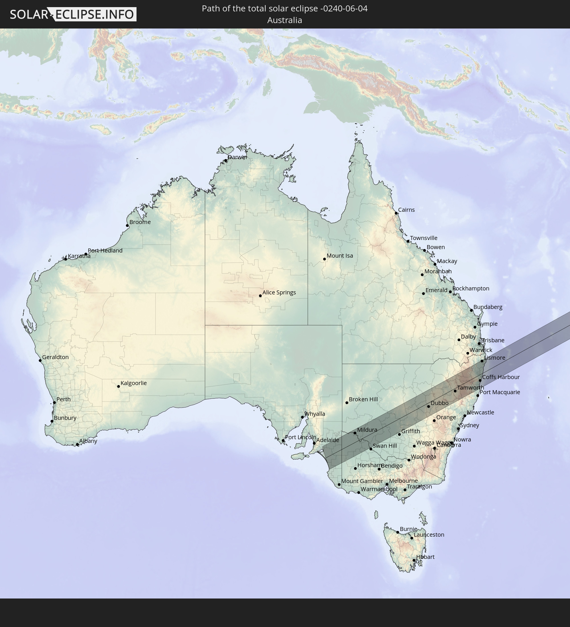 Australien
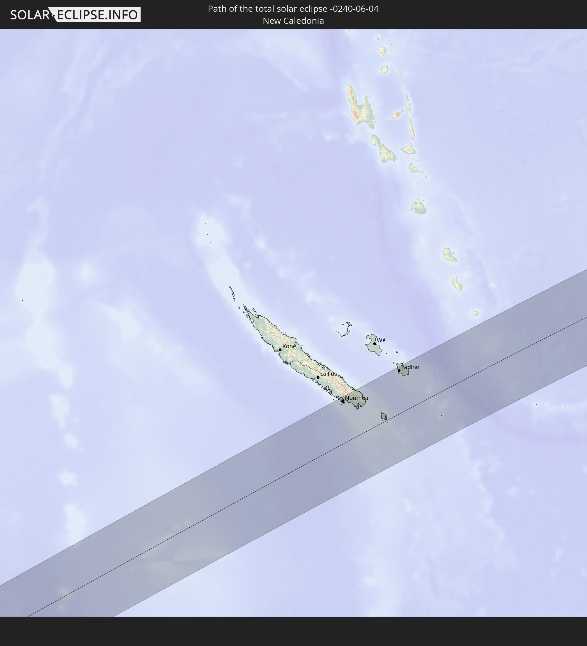 Neukaledonien
In den folgenden Ländern ist die Sonnenfinsternis partiell zu sehen
 Fidschi
 Vereinigte Staaten
 Neuseeland
 United States Minor Outlying Islands
 Wallis und Futuna
 Tonga
Tonga
 Kiribati
 Samoa
Samoa
 Tokelau
 Amerikanisch-Samoa
 Niue
Niue
 Cookinseln
 Französisch-Polynesien
 Pitcairninseln
 Indonesien
 Australien
 Föderierte Staaten von Mikronesien
 Papua-Neuguinea
 Salomonen
 Neukaledonien
 Marshallinseln
 Vanuatu
 Nauru
Nauru
 Norfolkinsel
 Tuvalu
Wie wird das Wetter während der totalen Sonnenfinsternis am 04.06.-0240?
Wo ist der beste Ort, um die totale Sonnenfinsternis vom 04.06.-0240 zu beobachten?
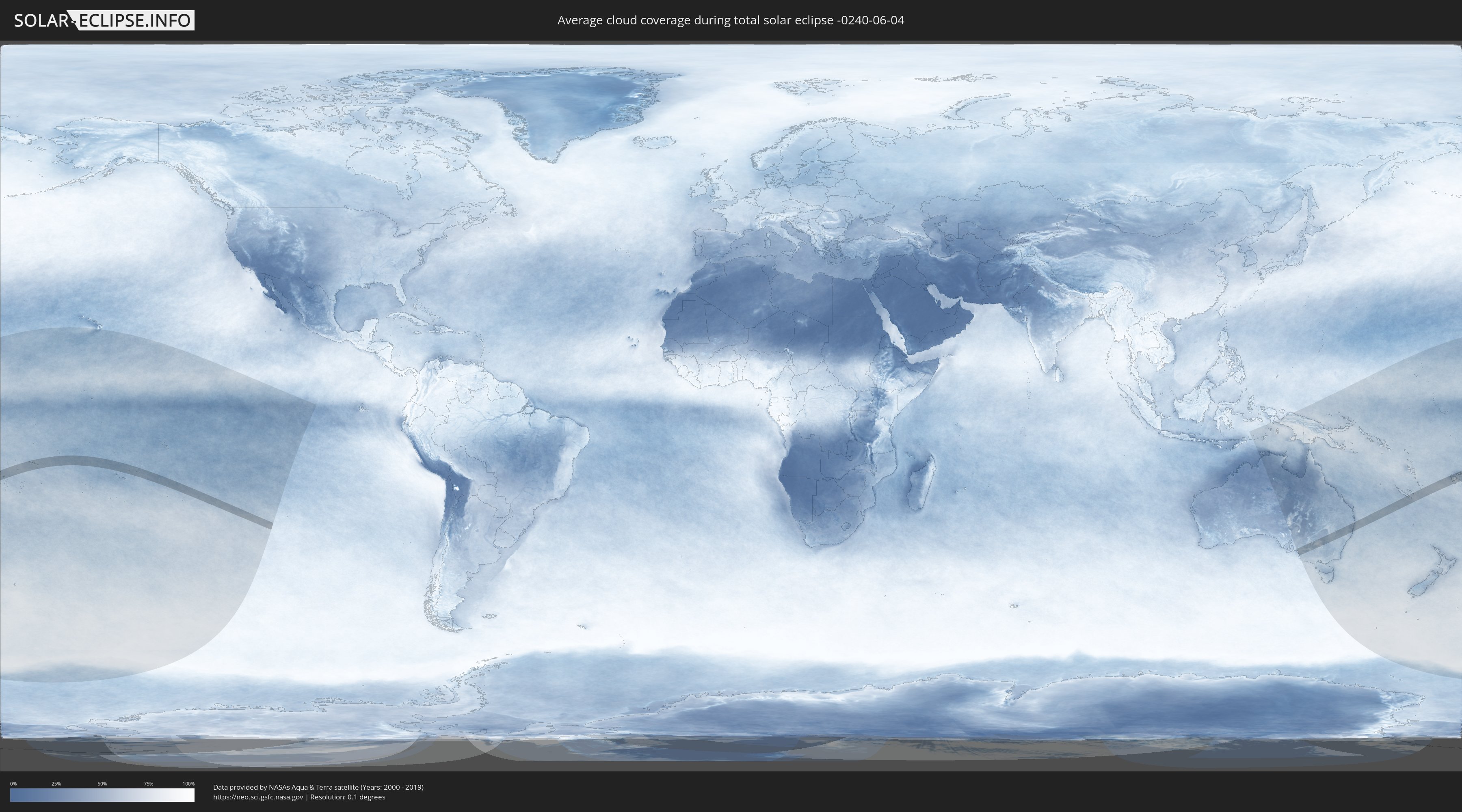
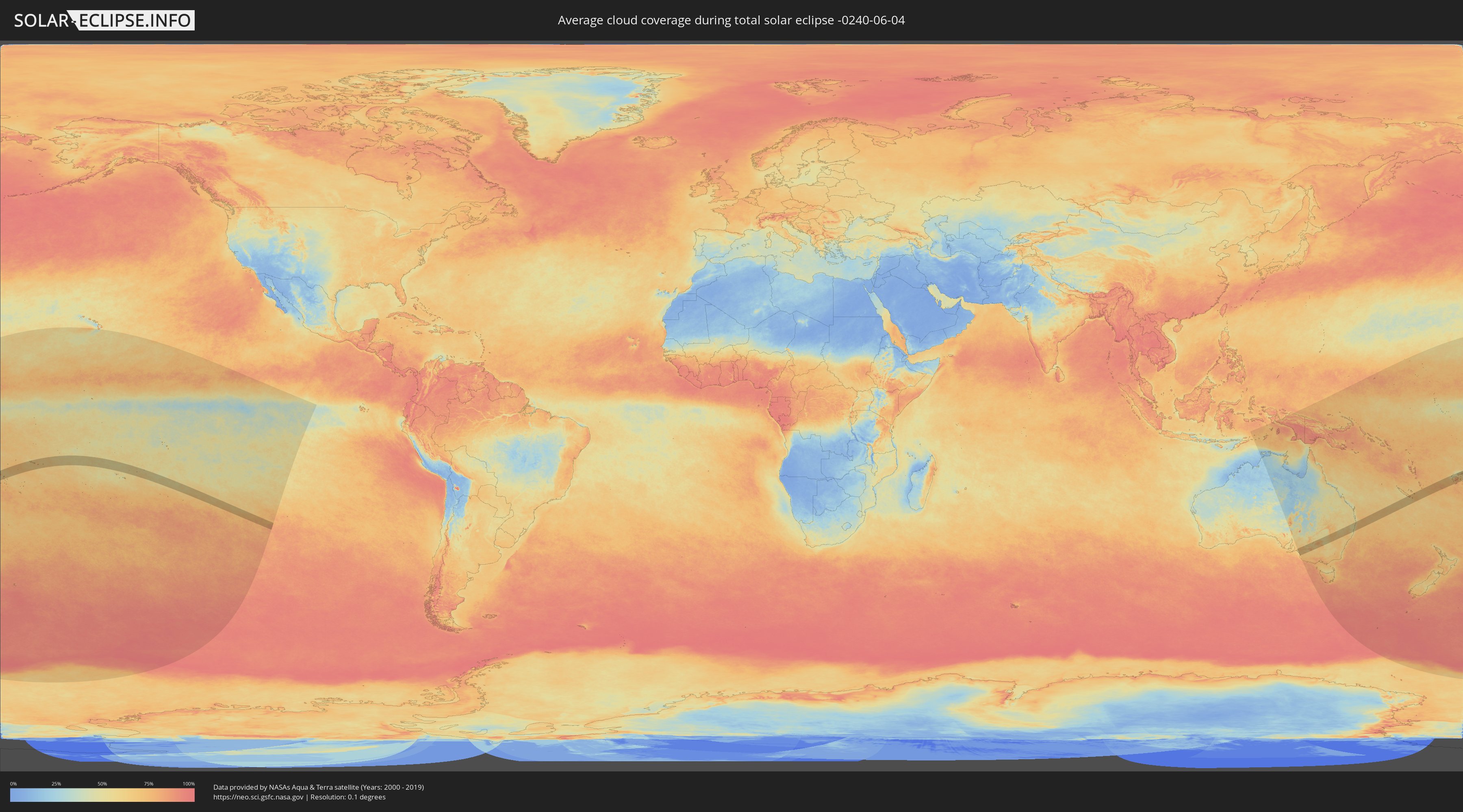
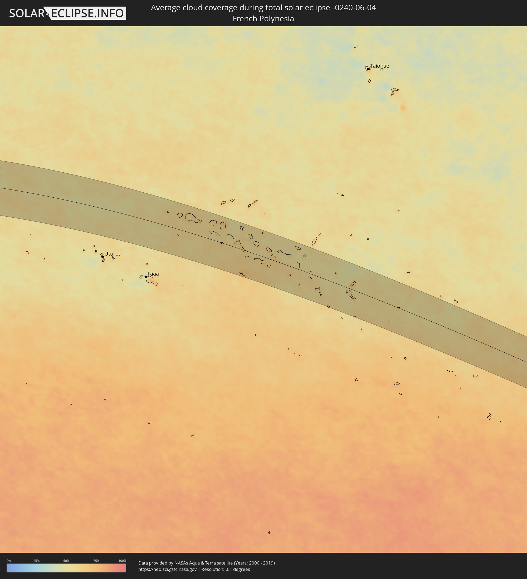
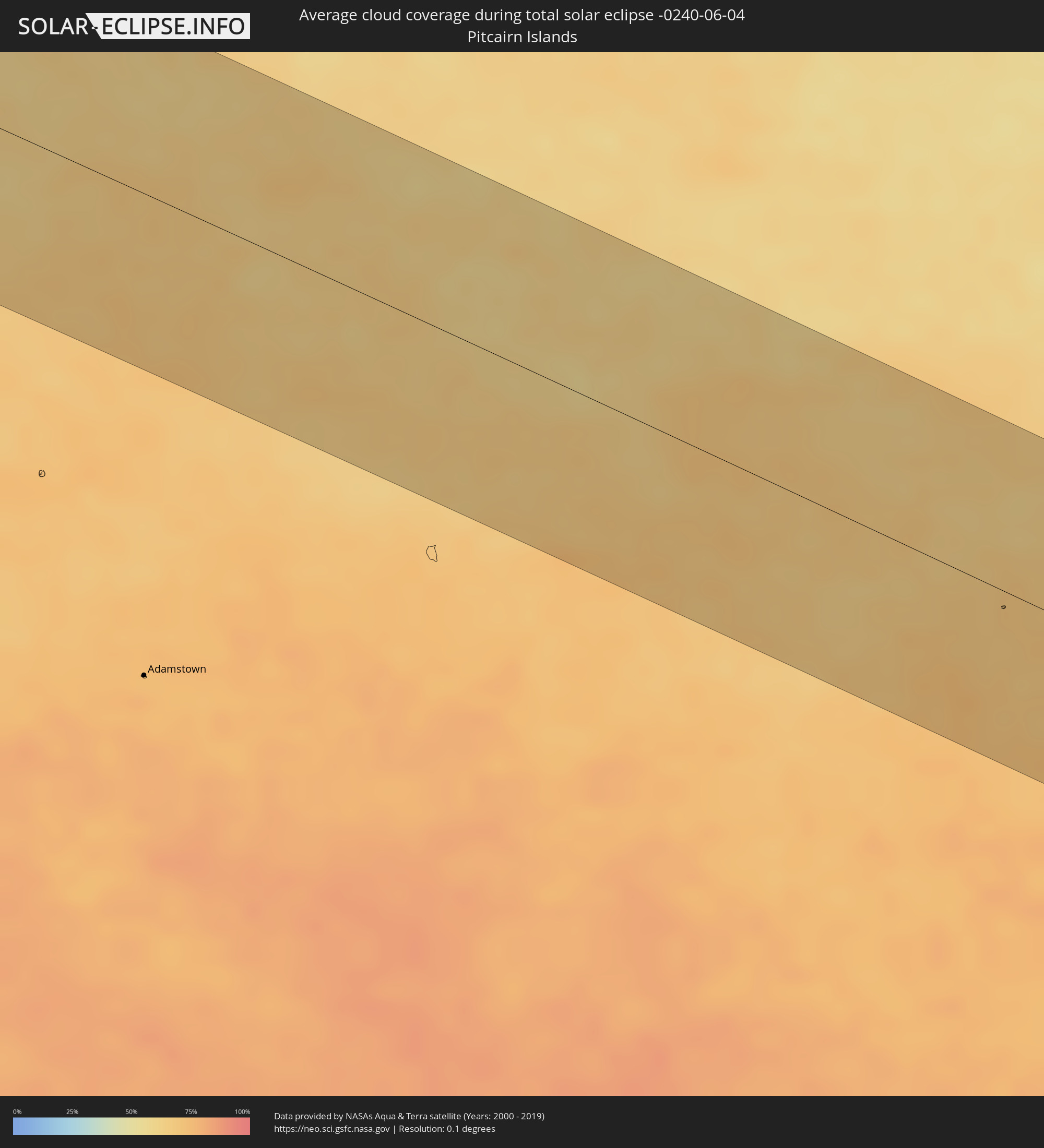
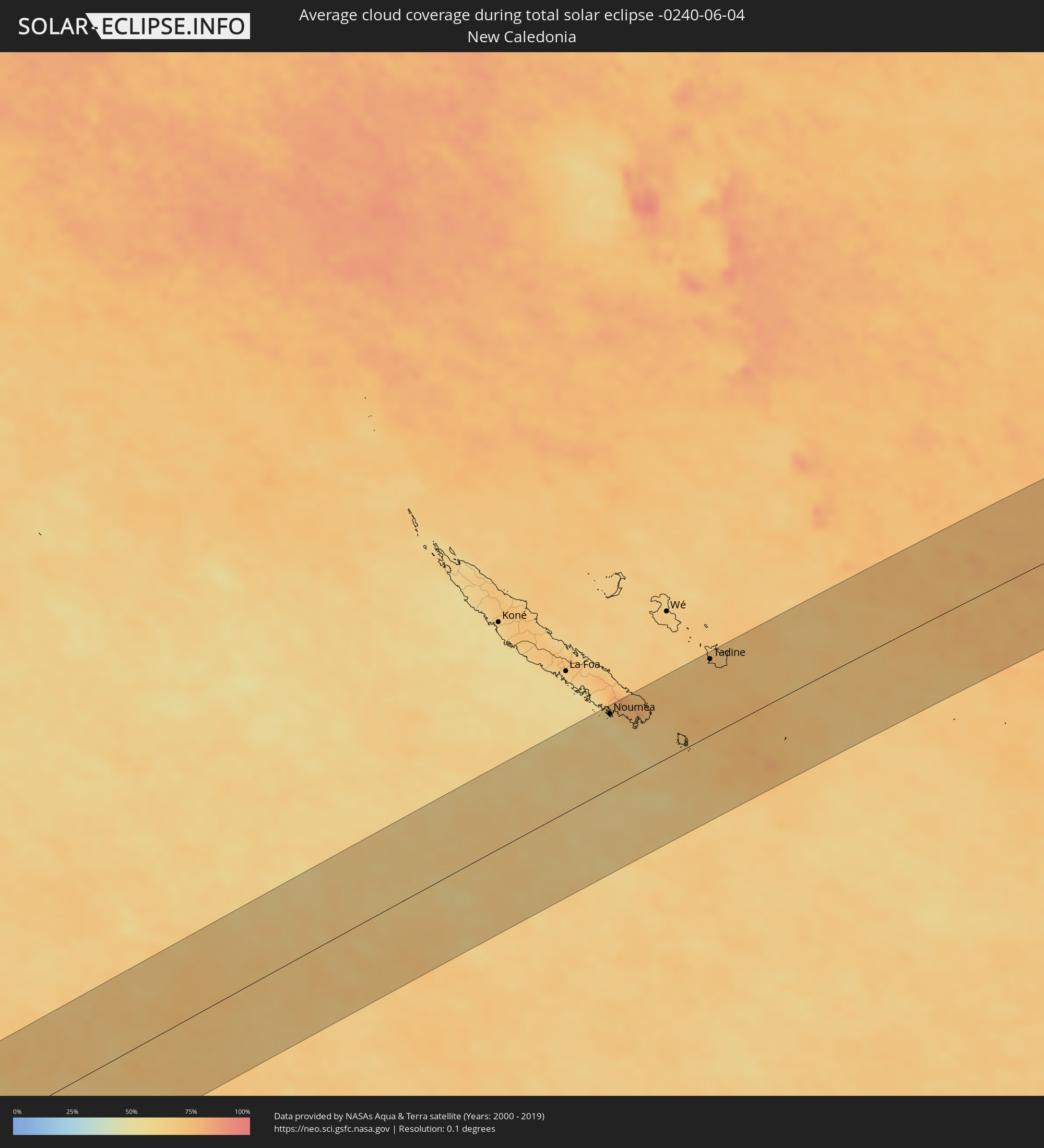
Die folgenden Karten zeigen die durchschnittliche Bewölkung für den Tag, an dem die totale Sonnenfinsternis
stattfindet. Mit Hilfe der Karten lässt sich der Ort entlang des Finsternispfades eingrenzen,
der die besten Aussichen auf einen klaren wolkenfreien Himmel bietet.
Trotzdem muss man immer lokale Gegenenheiten beachten und sollte sich genau über das Wetter an seinem
gewählten Beobachtungsort informieren.
Die Daten stammen von den beiden NASA-Satelliten
AQUA und TERRA
und wurden über einen Zeitraum von 19 Jahren (2000 - 2019) gemittelt.
Detaillierte Länderkarten
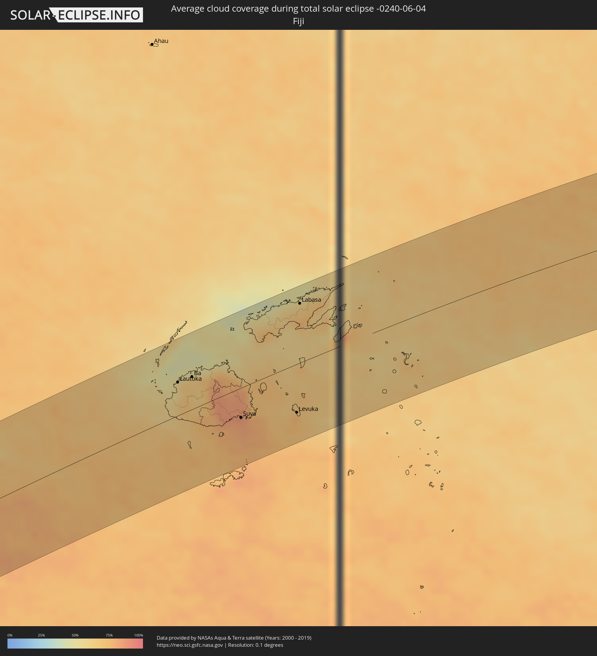 Fidschi
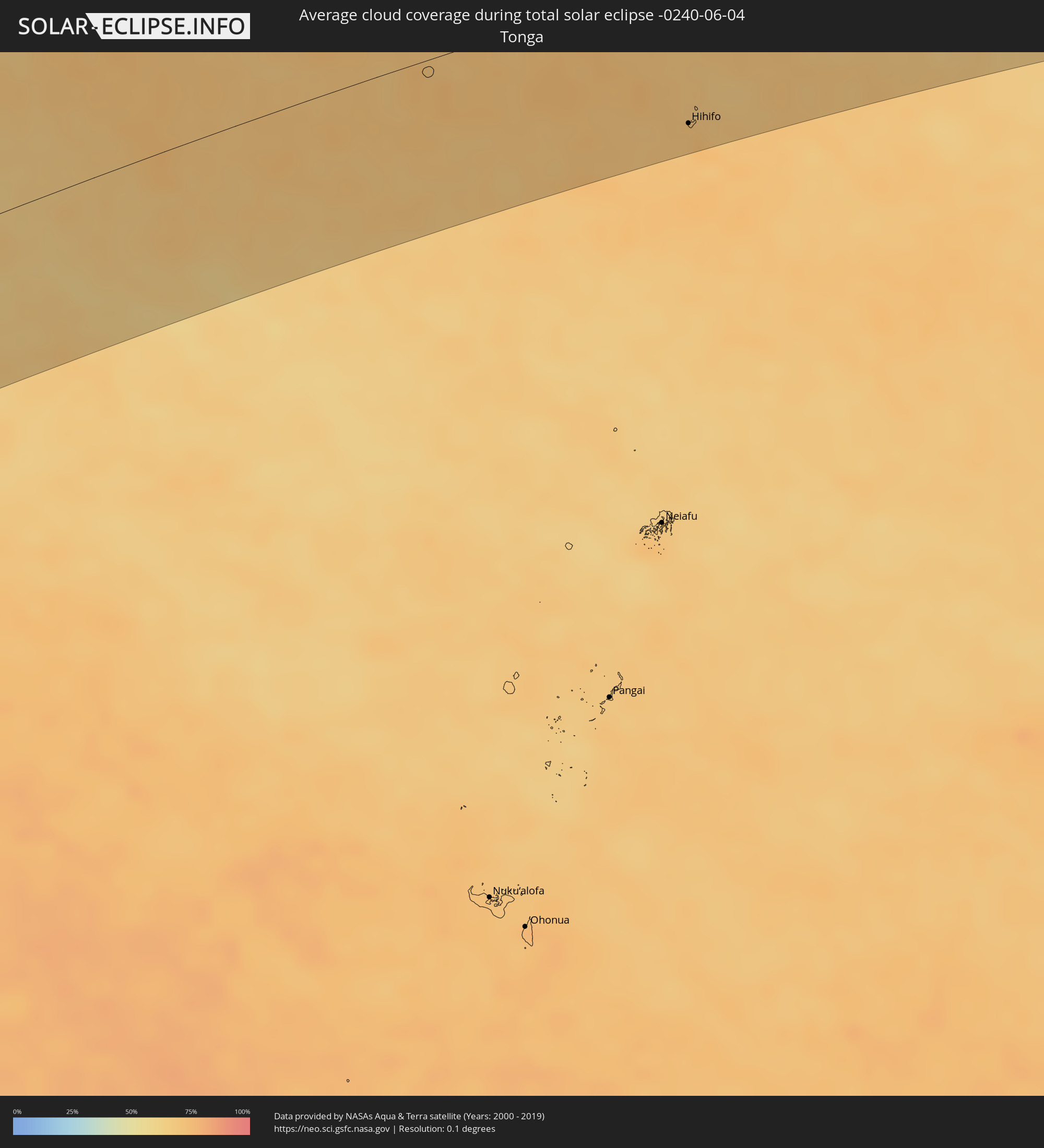 Tonga
Tonga
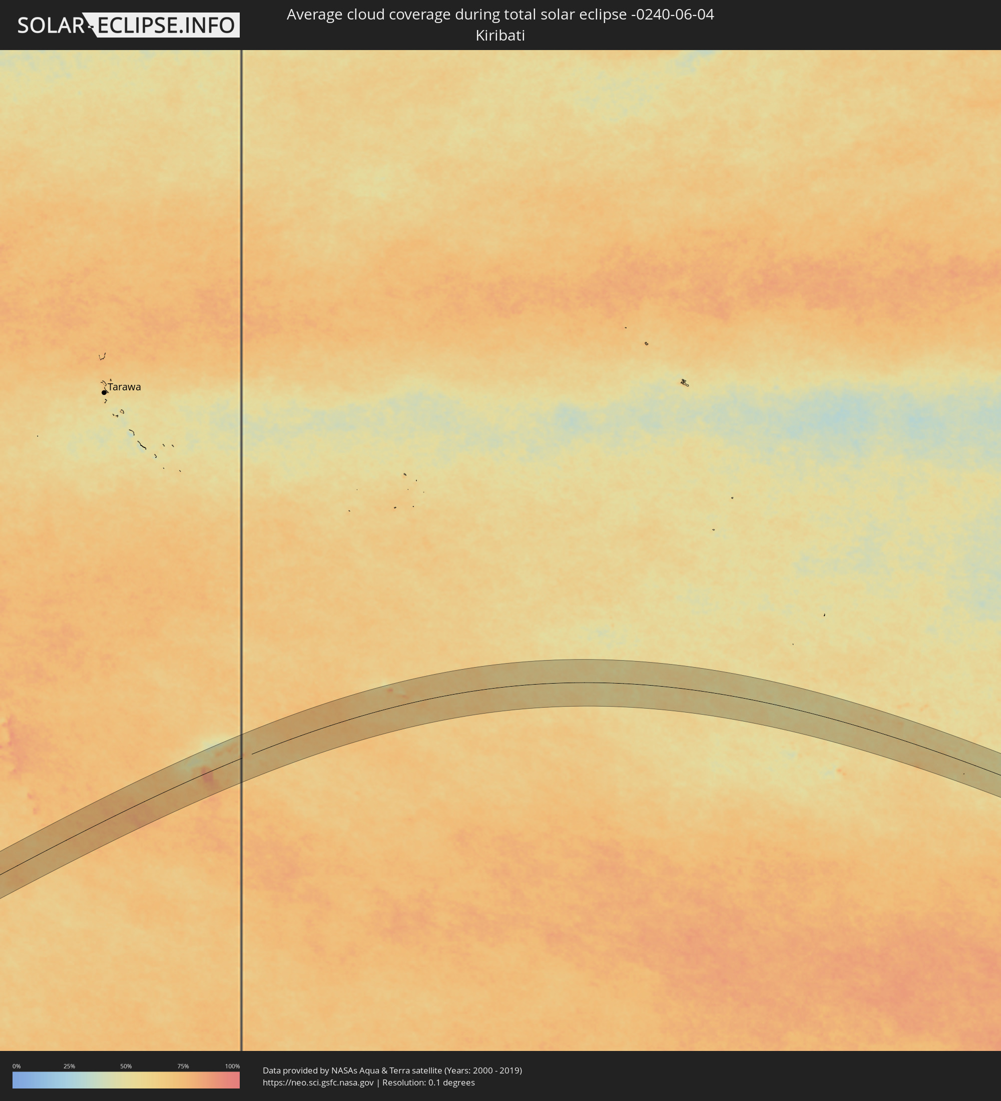 Kiribati
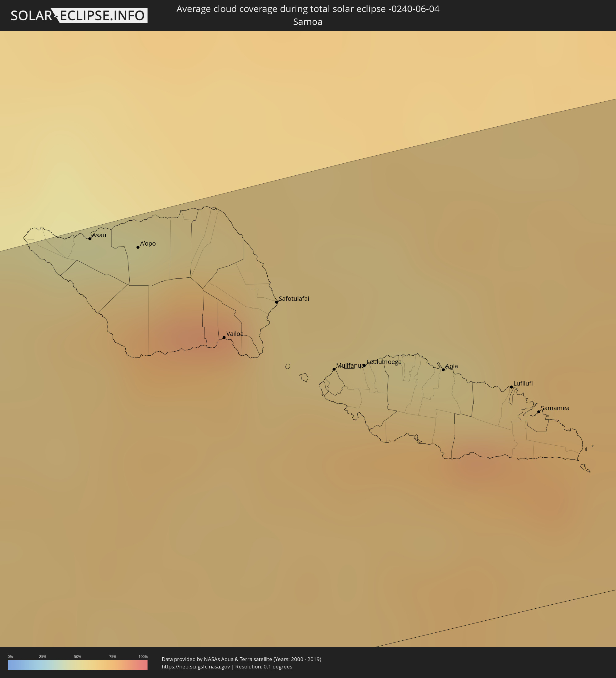 Samoa
Samoa
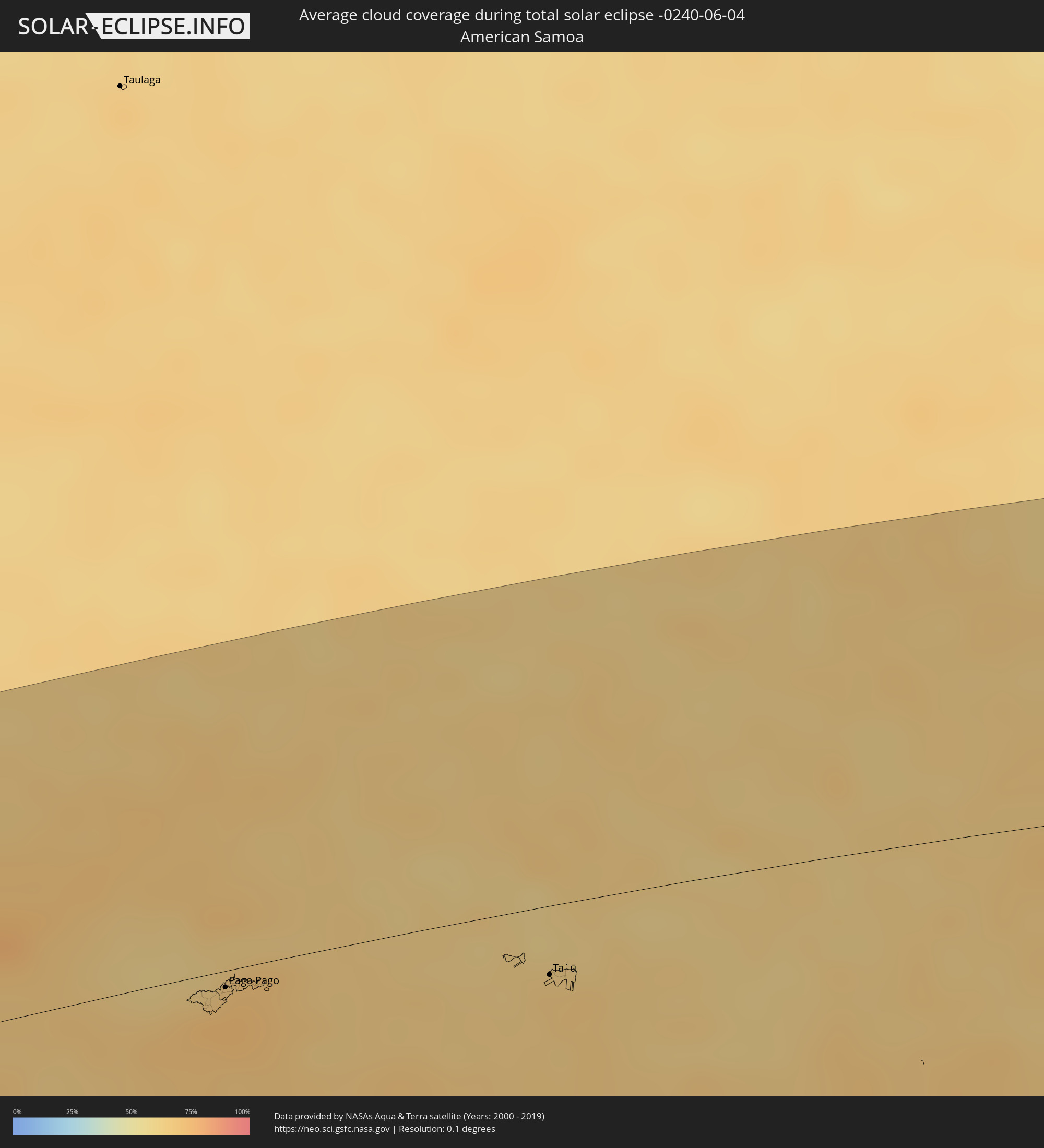 Amerikanisch-Samoa
 Cookinseln
 Französisch-Polynesien
 Pitcairninseln
 Australien
 Neukaledonien
Orte im Finsternispfad
Die nachfolgene Tabelle zeigt Städte und Orte mit mehr als 5.000 Einwohnern, die sich im Finsternispfad befinden. Städte mit mehr als 100.000 Einwohnern sind dick gekennzeichnet. Mit einem Klick auf den Ort öffnet sich eine Detailkarte die die Lage des jeweiligen Ortes zusammen mit dem Verlauf der zentralen Finsternis präsentiert.
| Ort | Typ | Dauer der Verfinsterung | Ortszeit bei maximaler Verfinsterung | Entfernung zur Zentrallinie | Ø Bewölkung |
|
Hihifo, Niuas
|
total | - | 11:04:08 UTC+12:20 | 105 km | 70% |
|
Asau, Vaisigano
|
total | - | 11:21:16 UTC-11:26 | 124 km | 60% |
|
A’opo, Gagaifomauga
|
total | - | 11:21:37 UTC-11:26 | 118 km | 62% |
|
Vailoa, Palauli
|
total | - | 11:22:11 UTC-11:26 | 90 km | 67% |
|
Safotulafai, Fa‘asaleleaga
|
total | - | 11:22:36 UTC-11:26 | 95 km | 62% |
|
Mulifanua, Aiga-i-le-Tai
|
total | - | 11:22:59 UTC-11:26 | 74 km | 64% |
|
Leulumoega, A'ana
|
total | - | 11:23:13 UTC-11:26 | 73 km | 64% |
|
Apia, Tuamasaga
|
total | - | 11:23:48 UTC-11:26 | 67 km | 61% |
|
Lufilufi, Atua
|
total | - | 11:24:18 UTC-11:26 | 59 km | 77% |
|
Samamea, Va‘a-o-Fonoti
|
total | - | 11:24:29 UTC-11:26 | 51 km | 73% |
|
Tāfuna, Western District
|
total | - | 11:30:58 UTC-11:22 | 12 km | 73% |
|
Pago Pago, Eastern District
|
total | - | 11:31:03 UTC-11:22 | 6 km | 73% |
|
Ta`ū, Manu'a
|
total | - | 11:34:43 UTC-11:22 | 27 km | 66% |
|
Mildura, Victoria
|
total | - | 07:42:10 UTC+10:00 | 63 km | 64% |
|
Dubbo, New South Wales
|
total | - | 07:44:14 UTC+10:00 | 30 km | 66% |
|
Wellington, New South Wales
|
total | - | 07:44:40 UTC+10:00 | 76 km | 67% |
|
Gunnedah, New South Wales
|
total | - | 07:44:34 UTC+10:00 | 18 km | 61% |
|
South Tamworth, New South Wales
|
total | - | 07:45:08 UTC+10:00 | 25 km | 67% |
|
Tamworth, New South Wales
|
total | - | 07:45:07 UTC+10:00 | 24 km | 67% |
|
Inverell, New South Wales
|
total | - | 07:44:29 UTC+10:00 | 97 km | 55% |
|
Armidale, New South Wales
|
total | - | 07:45:20 UTC+10:00 | 1 km | 66% |
|
Glen Innes, New South Wales
|
total | - | 07:44:57 UTC+10:00 | 71 km | 64% |
|
Gordon, New South Wales
|
total | - | 07:45:30 UTC+10:00 | 68 km | 52% |
|
South Grafton, New South Wales
|
total | - | 07:45:54 UTC+10:00 | 19 km | 55% |
|
Grafton, New South Wales
|
total | - | 07:45:53 UTC+10:00 | 21 km | 55% |
|
Nambucca, New South Wales
|
total | - | 07:46:28 UTC+10:00 | 74 km | 52% |
|
Nambucca Heads, New South Wales
|
total | - | 07:46:30 UTC+10:00 | 76 km | 52% |
|
Casino, New South Wales
|
total | - | 07:45:33 UTC+10:00 | 96 km | 59% |
|
Toormina, New South Wales
|
total | - | 07:46:24 UTC+10:00 | 52 km | 50% |
|
Coffs Harbour, New South Wales
|
total | - | 07:46:23 UTC+10:00 | 47 km | 49% |
|
Lismore, New South Wales
|
total | - | 07:45:43 UTC+10:00 | 90 km | 62% |
|
East Lismore, New South Wales
|
total | - | 07:45:44 UTC+10:00 | 88 km | 62% |
|
Goonellabah, New South Wales
|
total | - | 07:45:45 UTC+10:00 | 88 km | 62% |
|
Ballina, New South Wales
|
total | - | 07:45:59 UTC+10:00 | 71 km | 59% |
|
East Ballina, New South Wales
|
total | - | 07:46:00 UTC+10:00 | 70 km | 59% |
|
Byron Bay, New South Wales
|
total | - | 07:45:55 UTC+10:00 | 91 km | 55% |
|
Nouméa, South Province
|
total | - | 09:04:59 UTC+11:05 | 96 km | 62% |
|
Mont-Dore, South Province
|
total | - | 09:05:09 UTC+11:05 | 92 km | 66% |
|
Tadine, Loyalty Islands
|
total | - | 09:07:12 UTC+11:05 | 99 km | 72% |
|
Nadi, Western
|
total | - | 10:16:14 UTC+11:55 | 33 km | 58% |
|
Lautoka, Western
|
total | - | 10:16:20 UTC+11:55 | 51 km | 64% |
|
Ba, Western
|
total | - | 10:16:52 UTC+11:55 | 50 km | 63% |
|
Suva, Central
|
total | - | 10:18:39 UTC+11:55 | 45 km | 83% |
|
Levuka, Eastern
|
total | - | 10:20:48 UTC+11:55 | 74 km | 73% |
|
Labasa, Northern
|
total | - | 10:21:09 UTC+11:55 | 92 km | 65% |