Totale Sonnenfinsternis vom 27.10.-0332
| Wochentag: | Donnerstag |
| Maximale Dauer der Verfinsterung: | 01m53s |
| Maximale Breite des Finsternispfades: | 75 km |
| Saroszyklus: | 57 |
| Bedeckungsgrad: | 100% |
| Magnitude: | 1.0209 |
| Gamma: | -0.3312 |
Wo kann man die Sonnenfinsternis vom 27.10.-0332 sehen?

Die Sonnenfinsternis am 27.10.-0332 kann man in 46 Ländern als partielle Sonnenfinsternis beobachten.
Der Finsternispfad verläuft durch 6 Länder. Nur in diesen Ländern ist sie als totale Sonnenfinsternis zu sehen.
In den folgenden Ländern ist die Sonnenfinsternis total zu sehen
 Demokratische Republik Kongo
 Tansania
 Mosambik
 Madagaskar
 Mauritius
 Australien
In den folgenden Ländern ist die Sonnenfinsternis partiell zu sehen
 Antarktika
 Neuseeland
 Libyen
 Angola
 Namibia
 Demokratische Republik Kongo
 Tschad
 Zentralafrikanische Republik
 Südafrika
 Botswana
 Sudan
Sudan
 Sambia
 Ägypten
 Simbabwe
 Lesotho
 Ruanda
 Burundi
 Tansania
 Uganda
 Mosambik
 Swasiland
 Malawi
 Äthiopien
 Kenia
Kenia
 Saudi-Arabien
 Eritrea
 Französische Süd- und Antarktisgebiete
 Somalia
 Dschibuti
 Jemen
Jemen
 Madagaskar
 Komoren
 Mayotte
 Seychellen
 Oman
Oman
 Réunion
 Mauritius
 Britisches Territorium im Indischen Ozean
 Heard und McDonaldinseln
 Malediven
 Indonesien
 Kokosinseln
 Weihnachtsinsel
 Australien
 Osttimor
 Papua-Neuguinea
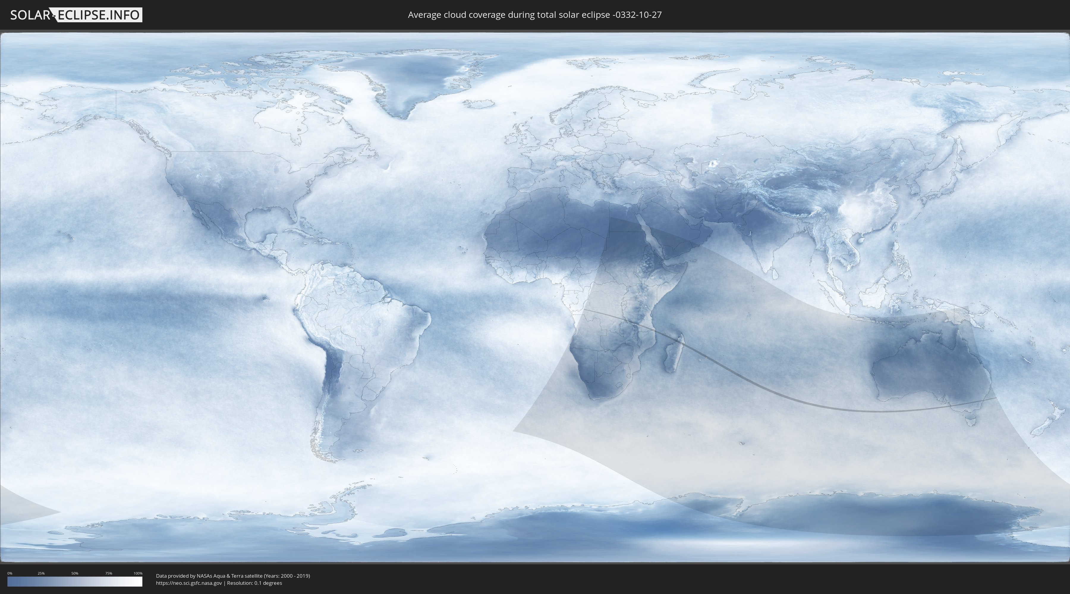
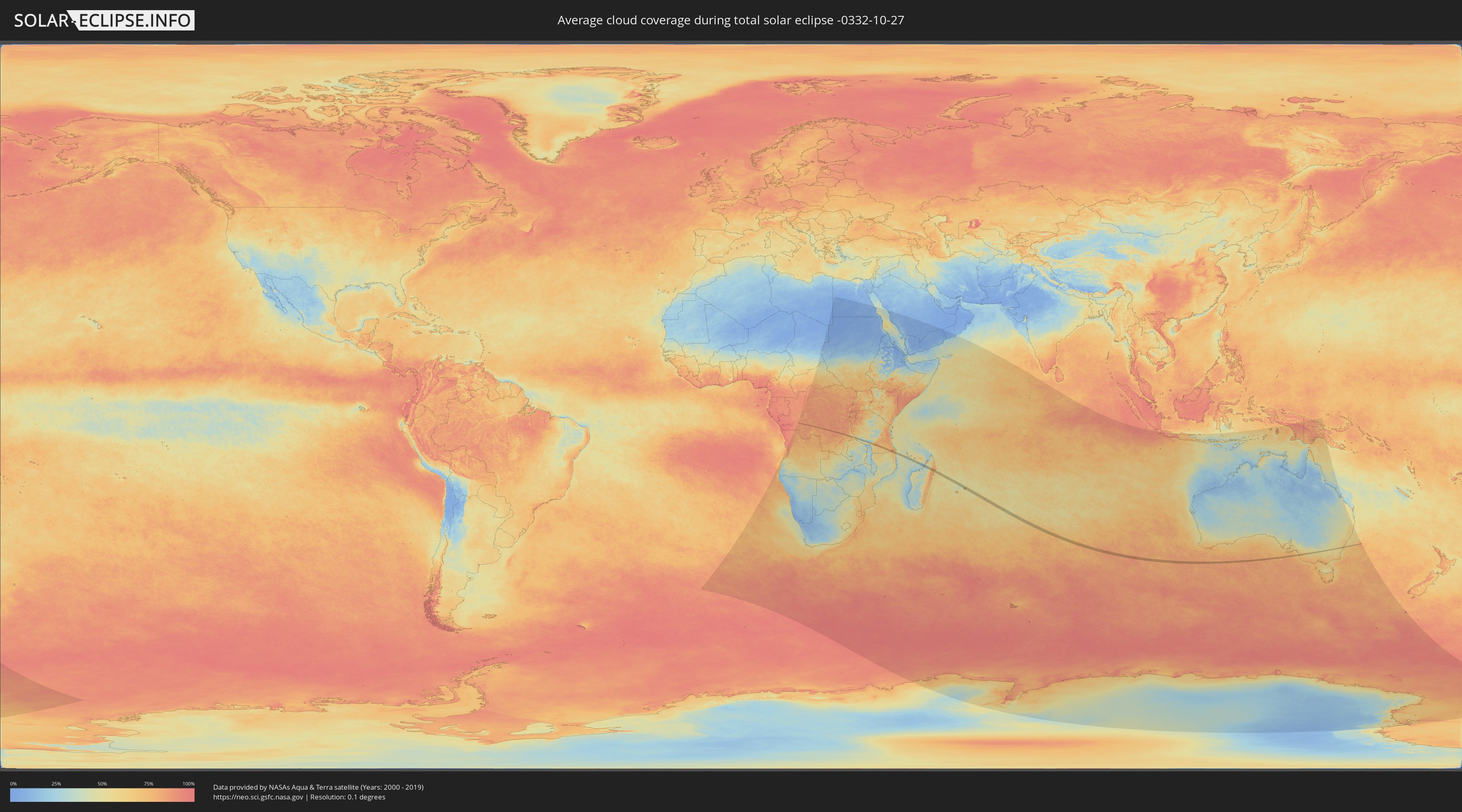
Wie wird das Wetter während der totalen Sonnenfinsternis am 27.10.-0332?
Wo ist der beste Ort, um die totale Sonnenfinsternis vom 27.10.-0332 zu beobachten?
Die folgenden Karten zeigen die durchschnittliche Bewölkung für den Tag, an dem die totale Sonnenfinsternis
stattfindet. Mit Hilfe der Karten lässt sich der Ort entlang des Finsternispfades eingrenzen,
der die besten Aussichen auf einen klaren wolkenfreien Himmel bietet.
Trotzdem muss man immer lokale Gegenenheiten beachten und sollte sich genau über das Wetter an seinem
gewählten Beobachtungsort informieren.
Die Daten stammen von den beiden NASA-Satelliten
AQUA und TERRA
und wurden über einen Zeitraum von 19 Jahren (2000 - 2019) gemittelt.
Detaillierte Länderkarten
 Demokratische Republik Kongo
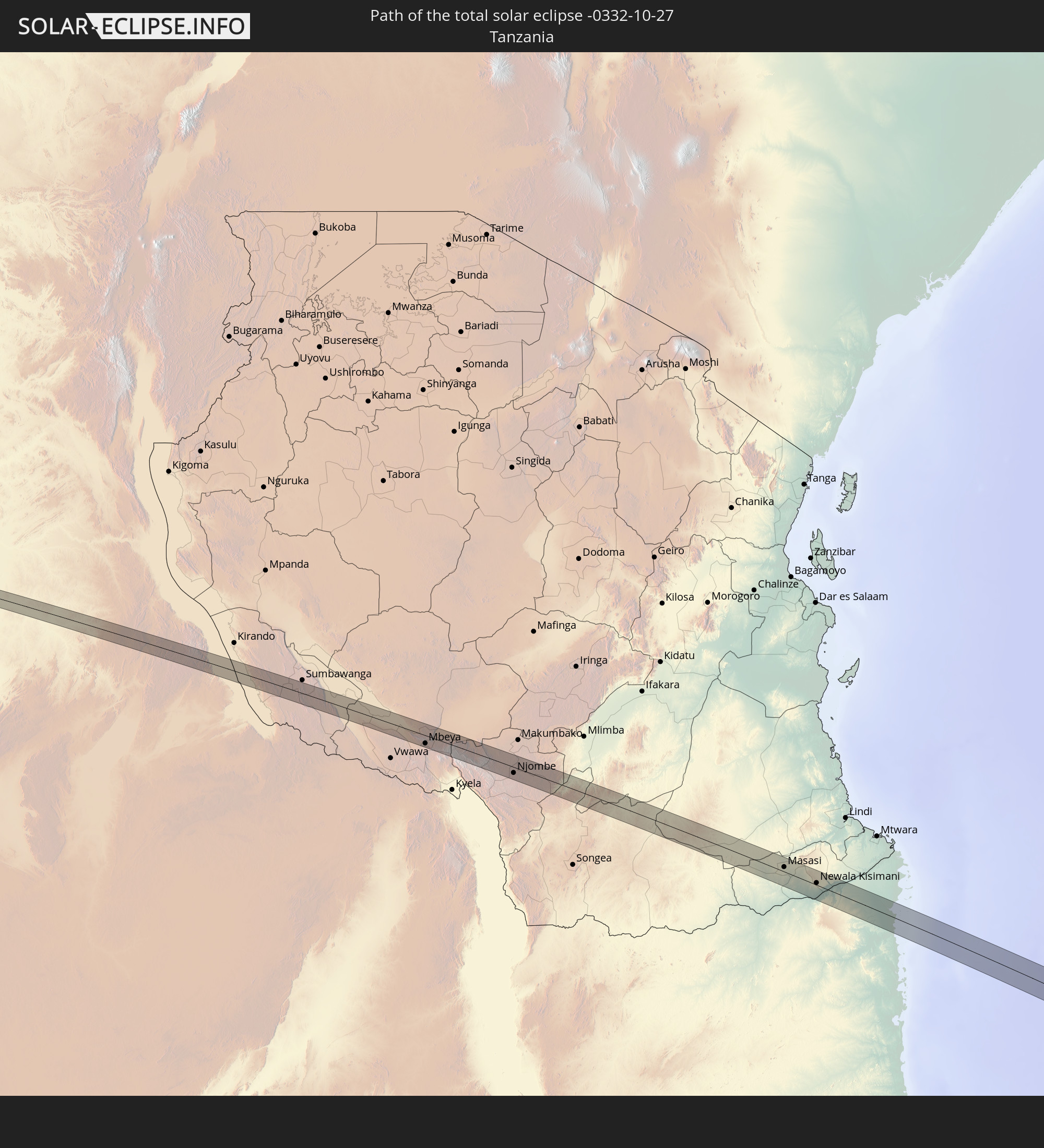
 Tansania
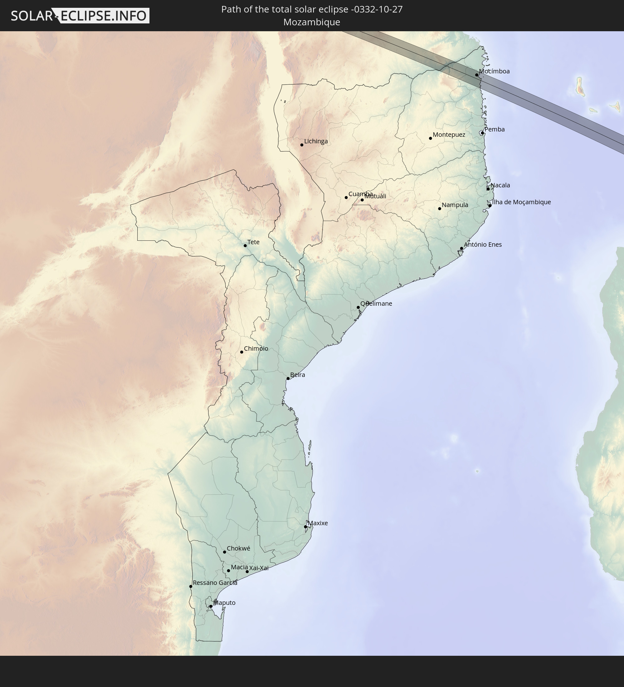
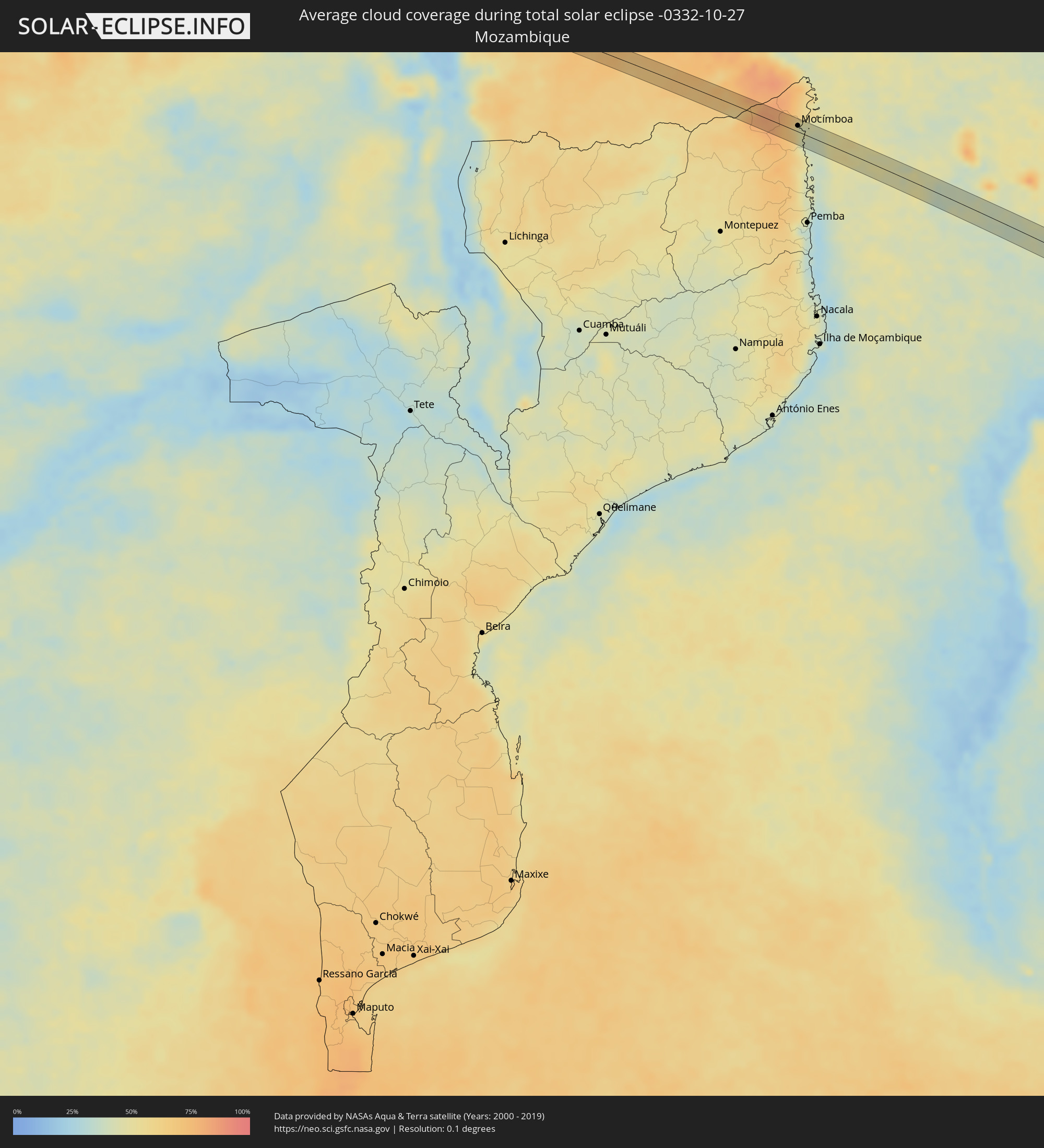 Mosambik
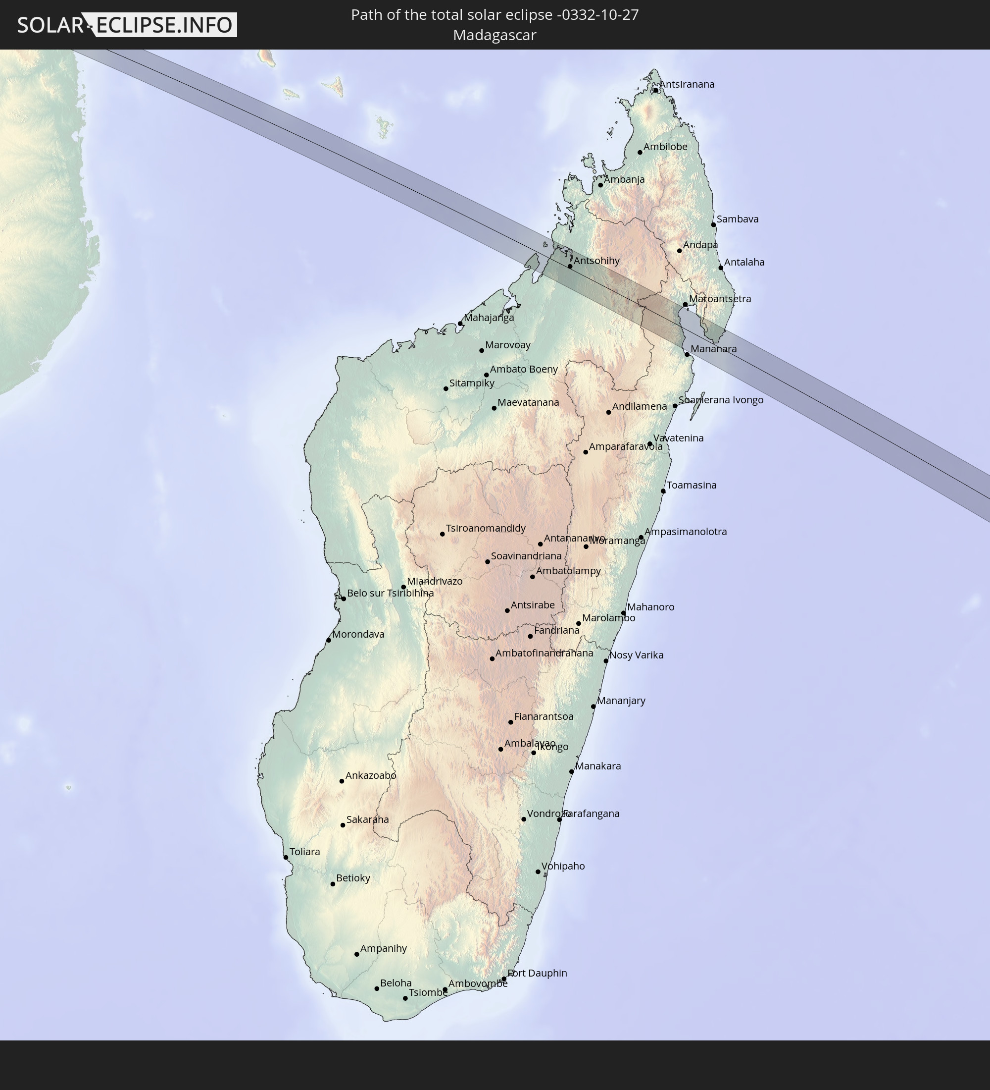
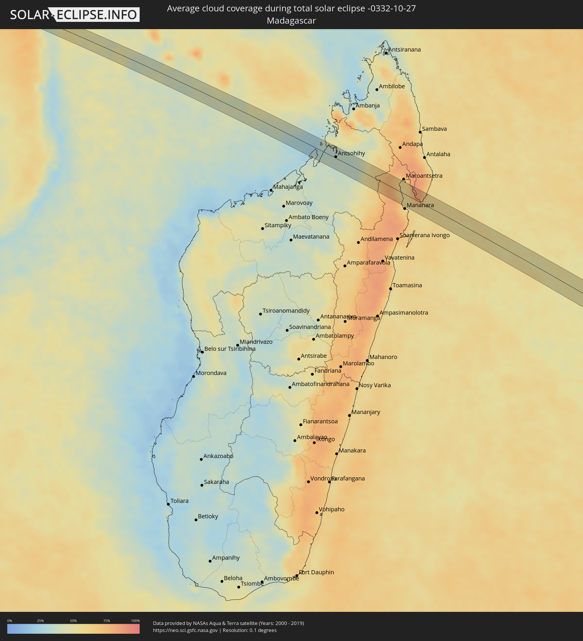 Madagaskar
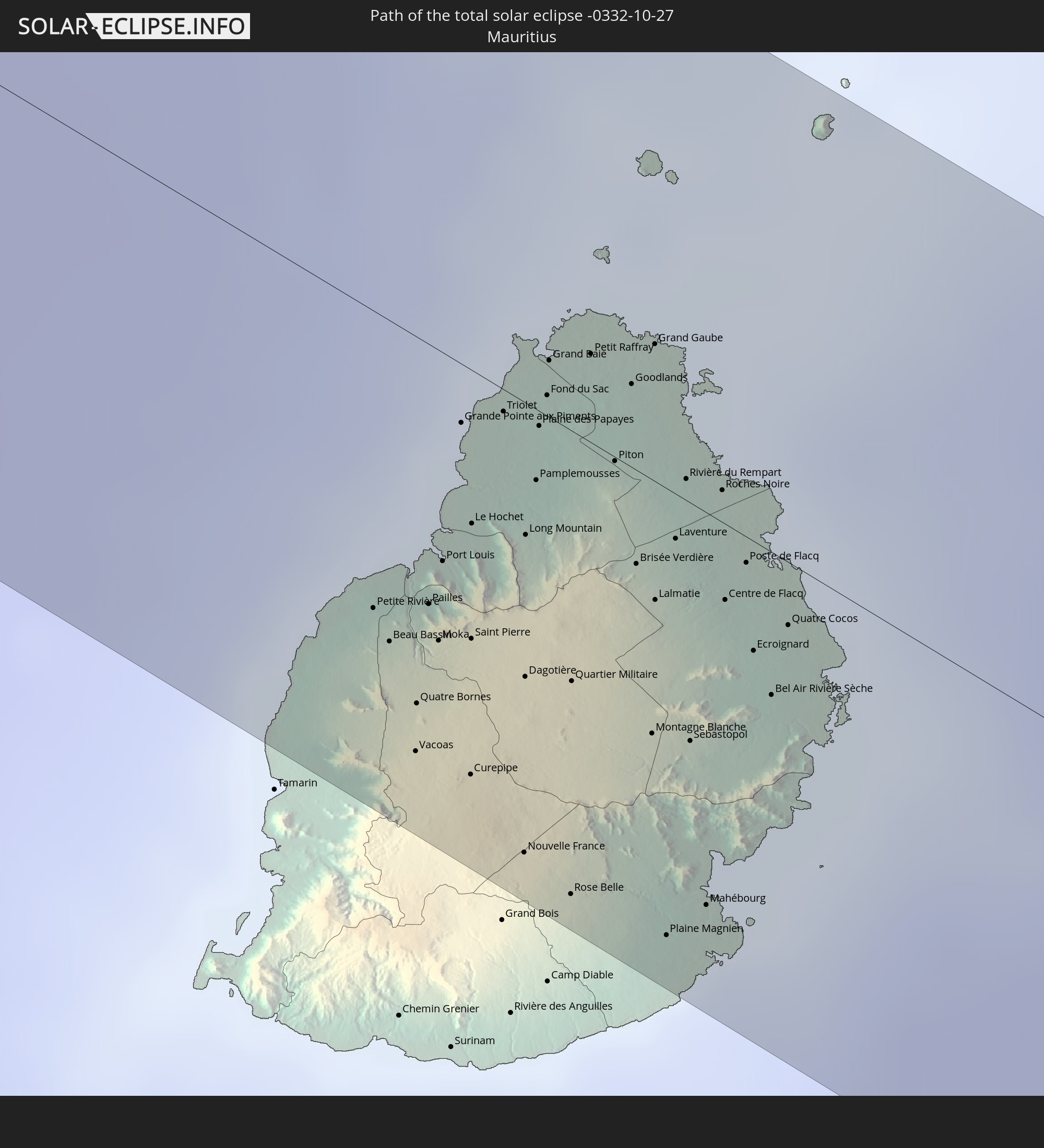
 Mauritius
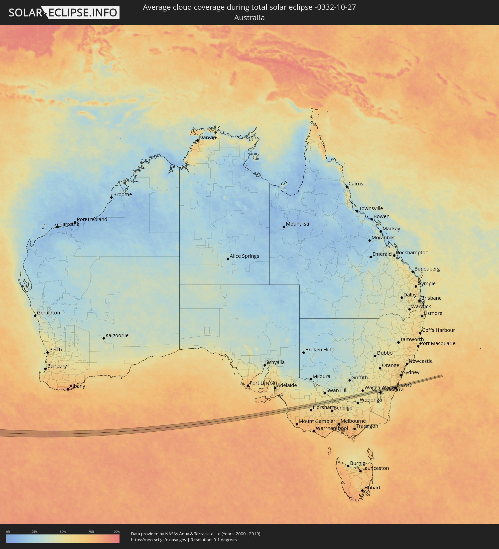 Australien
Orte im Finsternispfad
Die nachfolgene Tabelle zeigt Städte und Orte mit mehr als 5.000 Einwohnern, die sich im Finsternispfad befinden. Städte mit mehr als 100.000 Einwohnern sind dick gekennzeichnet. Mit einem Klick auf den Ort öffnet sich eine Detailkarte die die Lage des jeweiligen Ortes zusammen mit dem Verlauf der zentralen Finsternis präsentiert.
| Ort | Typ | Dauer der Verfinsterung | Ortszeit bei maximaler Verfinsterung | Entfernung zur Zentrallinie | Ø Bewölkung |
|
Bulungu, Bandundu
|
total | - | 04:52:14 UTC+00:13 | 5 km | 80% |
|
Demba, Kasaï-Occidental
|
total | - | 06:49:36 UTC+02:10 | 4 km | 84% |
|
Kabinda, Kasaï-Oriental
|
total | - | 06:50:16 UTC+02:10 | 12 km | 88% |
|
Nkove, Rukwa
|
total | - | 07:10:11 UTC+02:27 | 4 km | 59% |
|
Mbeya, Mbeya
|
total | - | 07:12:07 UTC+02:27 | 12 km | 53% |
|
Ulenje, Mbeya
|
total | - | 07:12:16 UTC+02:27 | 7 km | 61% |
|
Igurusi, Mbeya
|
total | - | 07:12:15 UTC+02:27 | 7 km | 59% |
|
Matamba, Njombe
|
total | - | 07:12:26 UTC+02:27 | 2 km | 61% |
|
Chimala, Mbeya
|
total | - | 07:12:19 UTC+02:27 | 13 km | 48% |
|
Njombe, Njombe
|
total | - | 07:13:11 UTC+02:27 | 9 km | 59% |
|
Masasi, Mtwara
|
total | - | 07:17:00 UTC+02:27 | 7 km | 69% |
|
Chiungutwa, Mtwara
|
total | - | 07:17:20 UTC+02:27 | 3 km | 67% |
|
Namalenga, Mtwara
|
total | - | 07:17:29 UTC+02:27 | 5 km | 61% |
|
Lulindi, Mtwara
|
total | - | 07:17:21 UTC+02:27 | 10 km | 68% |
|
Newala Kisimani, Mtwara
|
total | - | 07:17:36 UTC+02:27 | 3 km | 60% |
|
Luchingu, Mtwara
|
total | - | 07:17:35 UTC+02:27 | 10 km | 68% |
|
Mahuta, Mtwara
|
total | - | 07:17:37 UTC+02:27 | 19 km | 73% |
|
Mocímboa, Cabo Delgado
|
total | - | 07:01:51 UTC+02:10 | 10 km | 44% |
|
Antsohihy, Sofia
|
total | - | 07:30:26 UTC+02:27 | 3 km | 35% |
|
Vacoas, Plaines Wilhems
|
total | - | 09:14:23 UTC+03:50 | 28 km | 80% |
|
Pailles, Moka
|
total | - | 09:14:13 UTC+03:50 | 18 km | 76% |
|
Moka, Moka
|
total | - | 09:14:16 UTC+03:50 | 20 km | 76% |
|
Port Louis, Port Louis
|
total | - | 09:14:11 UTC+03:50 | 14 km | 76% |
|
Grande Pointe aux Piments, Pamplemousses
|
total | - | 09:14:03 UTC+03:50 | 4 km | 73% |
|
Le Hochet, Pamplemousses
|
total | - | 09:14:11 UTC+03:50 | 10 km | 73% |
|
Terre Rouge, Pamplemousses
|
total | - | 09:14:10 UTC+03:50 | 9 km | 73% |
|
Morcellemont Saint André, Pamplemousses
|
total | - | 09:14:08 UTC+03:50 | 3 km | 79% |
|
Nouvelle France, Grand Port
|
total | - | 09:14:38 UTC+03:50 | 31 km | 78% |
|
Dagotière, Moka
|
total | - | 09:14:25 UTC+03:50 | 19 km | 84% |
|
Long Mountain, Pamplemousses
|
total | - | 09:14:15 UTC+03:50 | 9 km | 79% |
|
Pamplemousses, Pamplemousses
|
total | - | 09:14:12 UTC+03:50 | 5 km | 79% |
|
Plaine des Papayes, Pamplemousses
|
total | - | 09:14:08 UTC+03:50 | 1 km | 79% |
|
Fond du Sac, Pamplemousses
|
total | - | 09:14:07 UTC+03:50 | 1 km | 66% |
|
Grand Baie, Rivière du Rempart
|
total | - | 09:14:05 UTC+03:50 | 4 km | 66% |
|
Rose Belle, Grand Port
|
total | - | 09:14:44 UTC+03:50 | 32 km | 78% |
|
Quartier Militaire, Moka
|
total | - | 09:14:29 UTC+03:50 | 17 km | 84% |
|
Petit Raffray, Rivière du Rempart
|
total | - | 09:14:07 UTC+03:50 | 6 km | 66% |
|
New Grove, Grand Port
|
total | - | 09:14:47 UTC+03:50 | 31 km | 78% |
|
Piton, Rivière du Rempart
|
total | - | 09:14:17 UTC+03:50 | 0 km | 79% |
|
Goodlands, Rivière du Rempart
|
total | - | 09:14:12 UTC+03:50 | 6 km | 66% |
|
Brisée Verdière, Flacq
|
total | - | 09:14:25 UTC+03:50 | 6 km | 84% |
|
Bon Accueil, Flacq
|
total | - | 09:14:27 UTC+03:50 | 7 km | 80% |
|
Montagne Blanche
|
total | - | 09:14:39 UTC+03:50 | 17 km | 76% |
|
Grand Gaube, Rivière du Rempart
|
total | - | 09:14:11 UTC+03:50 | 9 km | 57% |
|
Lalmatie, Flacq
|
total | - | 09:14:29 UTC+03:50 | 8 km | 80% |
|
Plaine Magnien, Grand Port
|
total | - | 09:14:54 UTC+03:50 | 30 km | 67% |
|
Laventure, Flacq
|
total | - | 09:14:27 UTC+03:50 | 3 km | 70% |
|
Rivière du Rempart, Rivière du Rempart
|
total | - | 09:14:23 UTC+03:50 | 1 km | 70% |
|
Beau Vallon, Grand Port
|
total | - | 09:14:55 UTC+03:50 | 28 km | 67% |
|
Mahébourg, Grand Port
|
total | - | 09:14:55 UTC+03:50 | 27 km | 67% |
|
Centre de Flacq, Flacq
|
total | - | 09:14:35 UTC+03:50 | 5 km | 80% |
|
Poste de Flacq, Flacq
|
total | - | 09:14:33 UTC+03:50 | 2 km | 80% |
|
Ecroignard, Flacq
|
total | - | 09:14:40 UTC+03:50 | 7 km | 80% |
|
Tumut, New South Wales
|
total | - | 17:57:36 UTC+10:00 | 6 km | 51% |
|
Nowra, New South Wales
|
total | - | 17:57:56 UTC+10:00 | 9 km | 64% |
|
Bomaderry, New South Wales
|
total | - | 17:57:58 UTC+10:00 | 6 km | 64% |
|
Kiama, New South Wales
|
total | - | 17:58:05 UTC+10:00 | 9 km | 62% |