Totale Sonnenfinsternis vom 08.08.-0672
| Wochentag: | Freitag |
| Maximale Dauer der Verfinsterung: | 03m59s |
| Maximale Breite des Finsternispfades: | 232 km |
| Saroszyklus: | 44 |
| Bedeckungsgrad: | 100% |
| Magnitude: | 1.0572 |
| Gamma: | 0.5867 |
Wo kann man die Sonnenfinsternis vom 08.08.-0672 sehen?

Die Sonnenfinsternis am 08.08.-0672 kann man in 23 Ländern als partielle Sonnenfinsternis beobachten.
Der Finsternispfad verläuft durch 7 Länder. Nur in diesen Ländern ist sie als totale Sonnenfinsternis zu sehen.
In den folgenden Ländern ist die Sonnenfinsternis total zu sehen
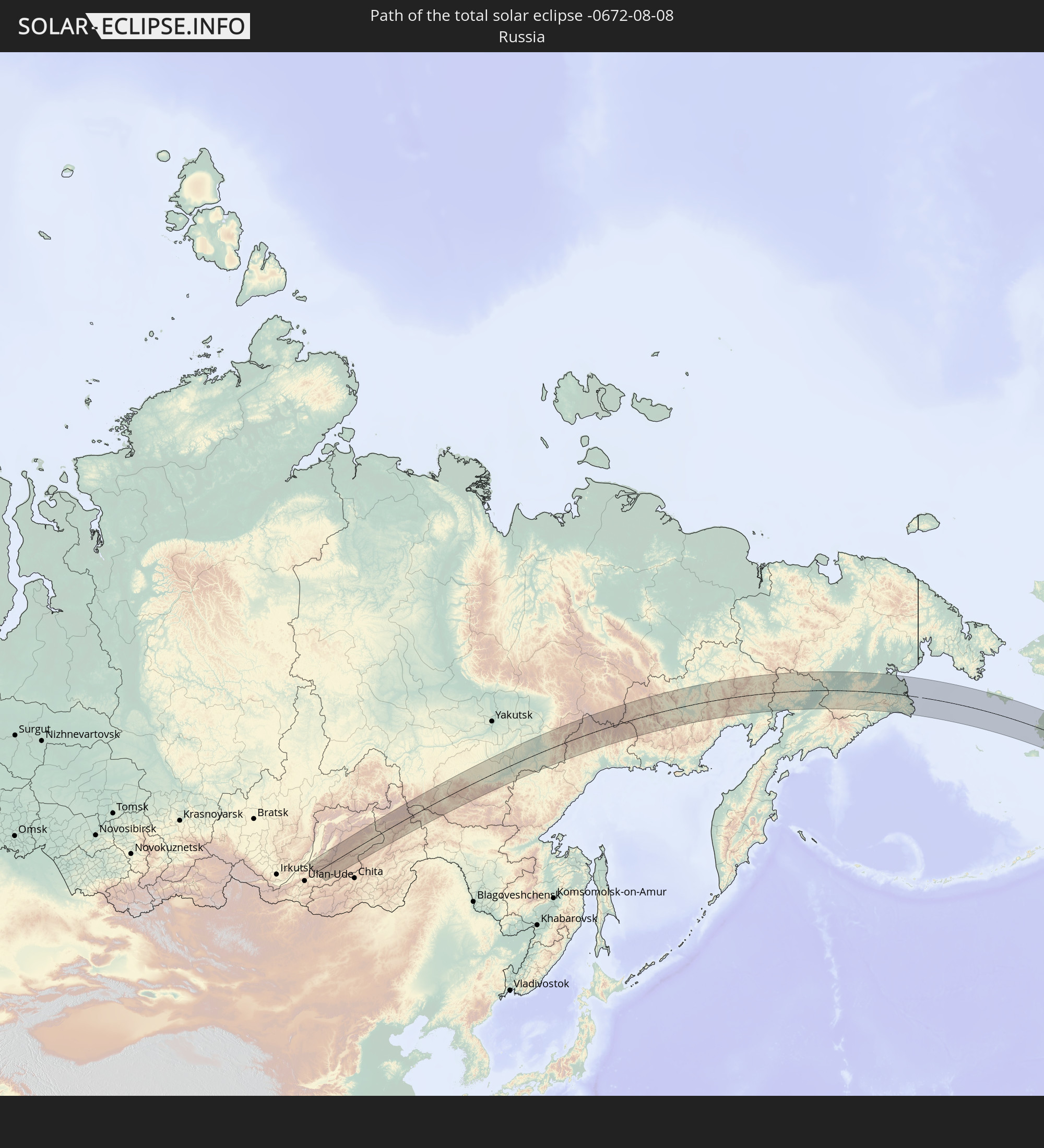 Russland
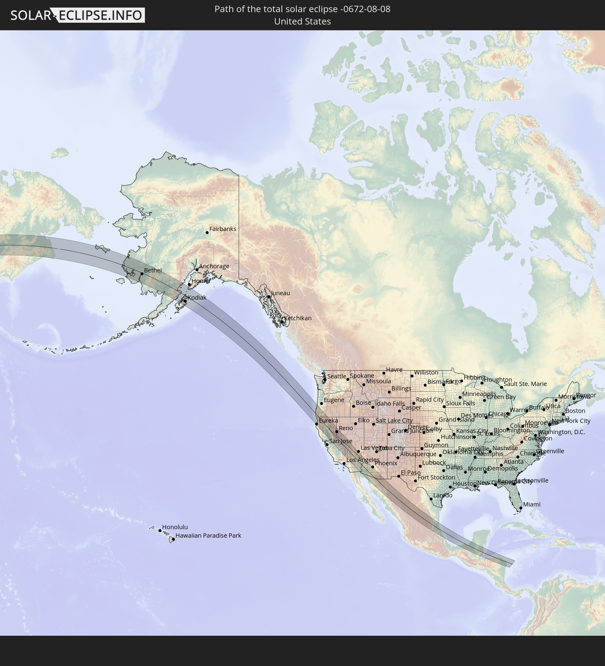 Vereinigte Staaten
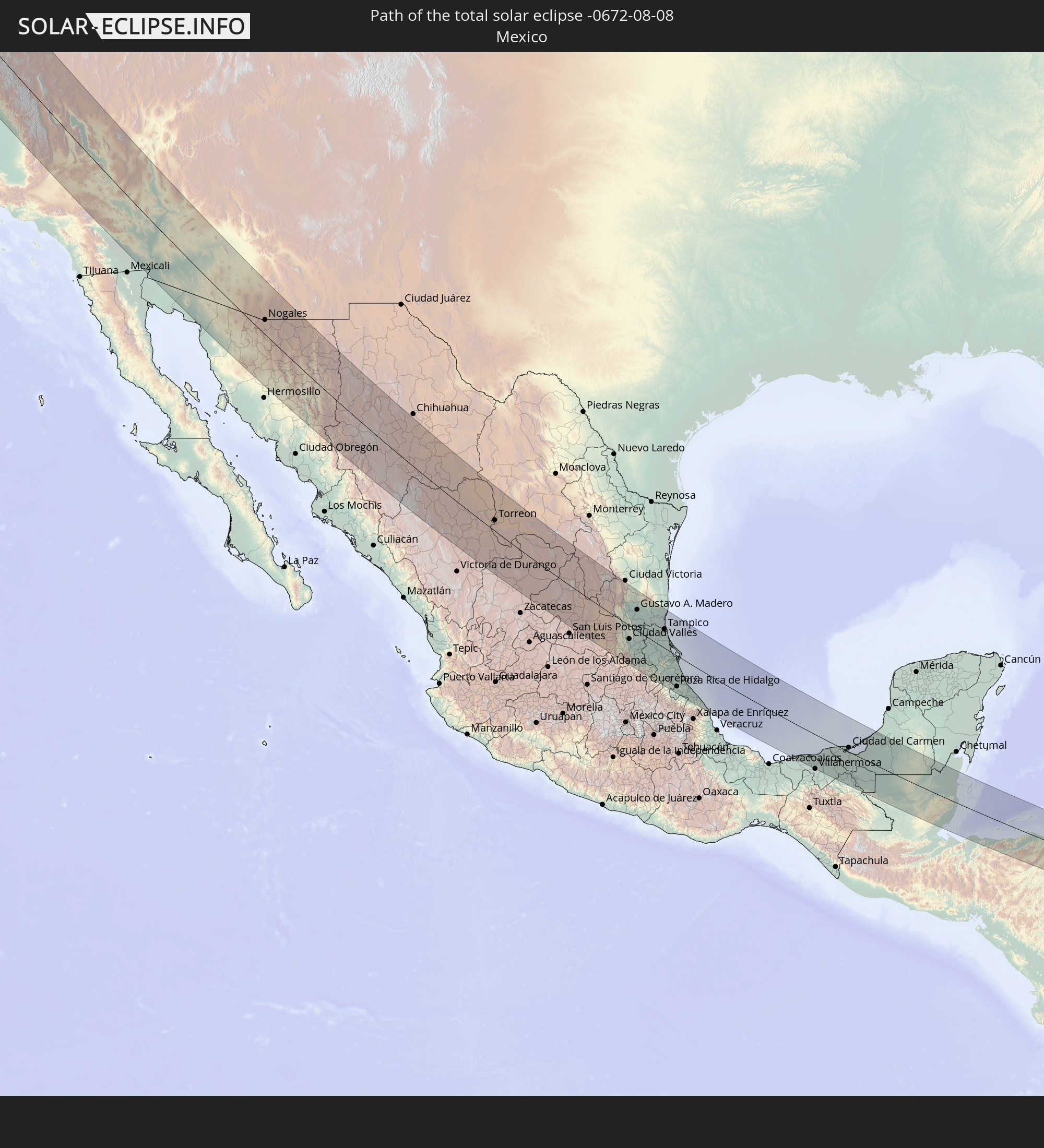 Mexiko
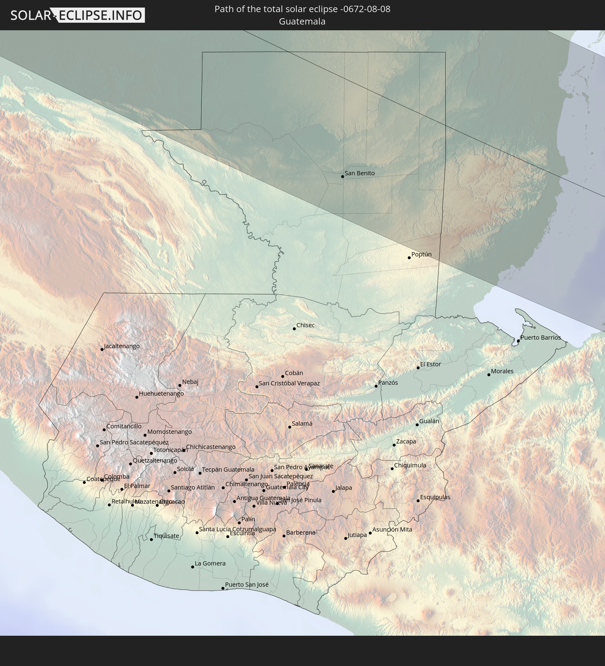 Guatemala
 Honduras
 Belize
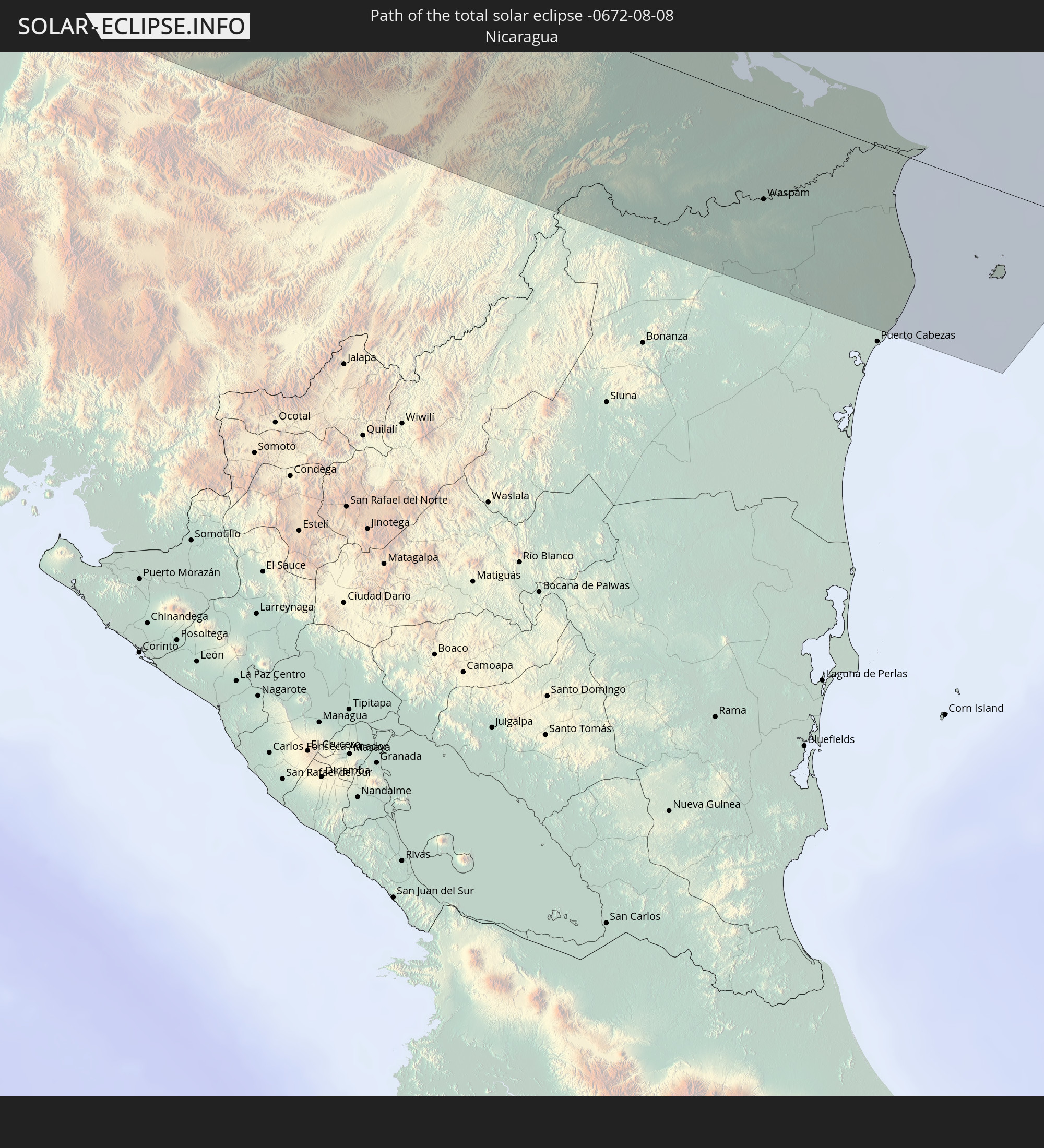 Nicaragua
In den folgenden Ländern ist die Sonnenfinsternis partiell zu sehen


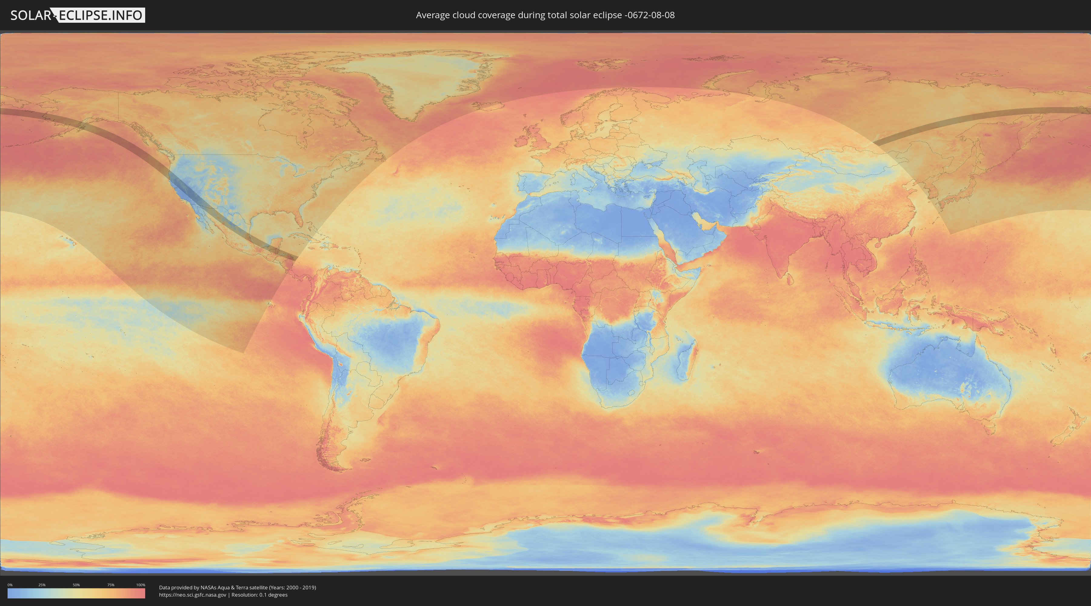
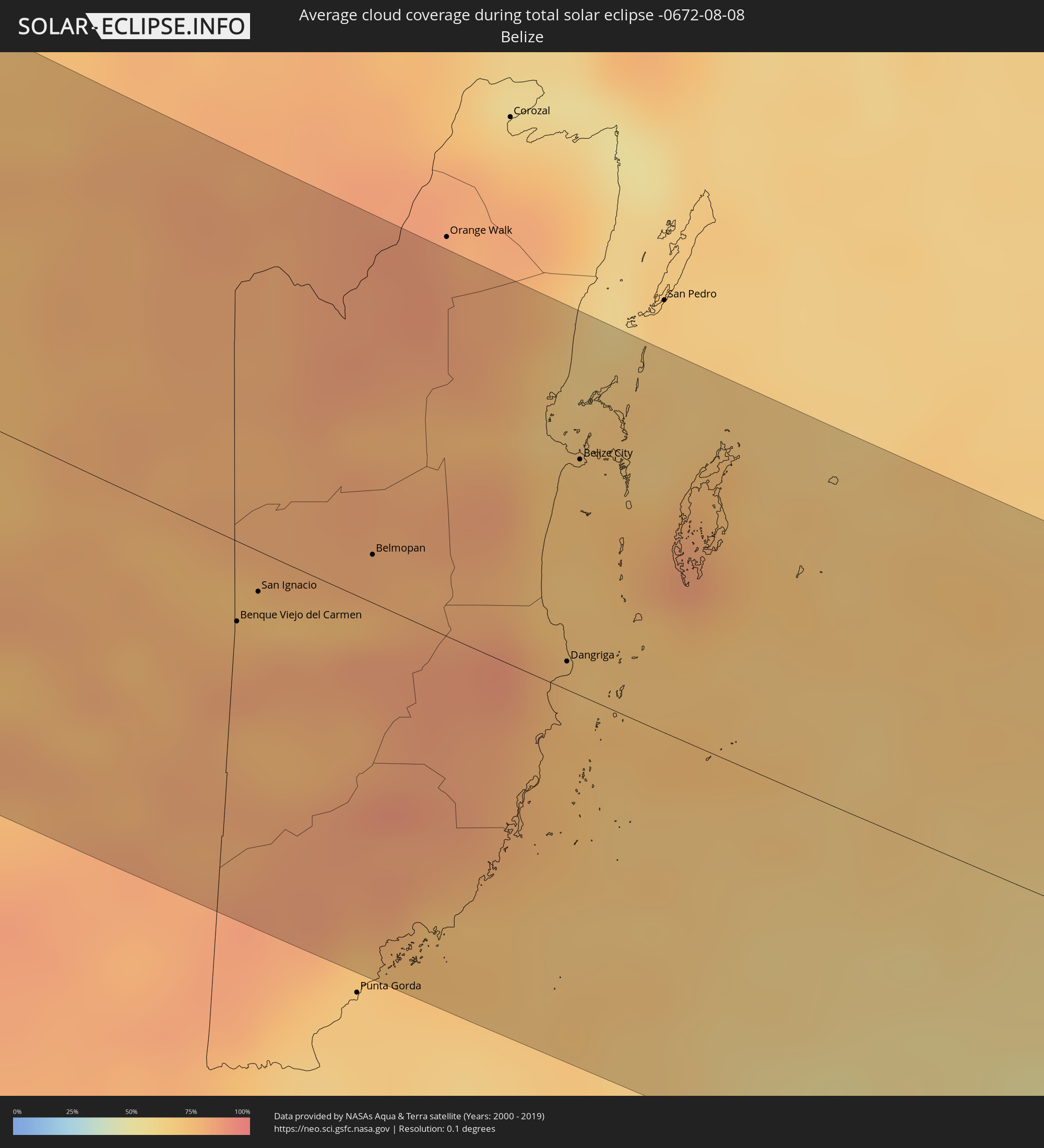
Wie wird das Wetter während der totalen Sonnenfinsternis am 08.08.-0672?
Wo ist der beste Ort, um die totale Sonnenfinsternis vom 08.08.-0672 zu beobachten?
Die folgenden Karten zeigen die durchschnittliche Bewölkung für den Tag, an dem die totale Sonnenfinsternis
stattfindet. Mit Hilfe der Karten lässt sich der Ort entlang des Finsternispfades eingrenzen,
der die besten Aussichen auf einen klaren wolkenfreien Himmel bietet.
Trotzdem muss man immer lokale Gegenenheiten beachten und sollte sich genau über das Wetter an seinem
gewählten Beobachtungsort informieren.
Die Daten stammen von den beiden NASA-Satelliten
AQUA und TERRA
und wurden über einen Zeitraum von 19 Jahren (2000 - 2019) gemittelt.

Detaillierte Länderkarten
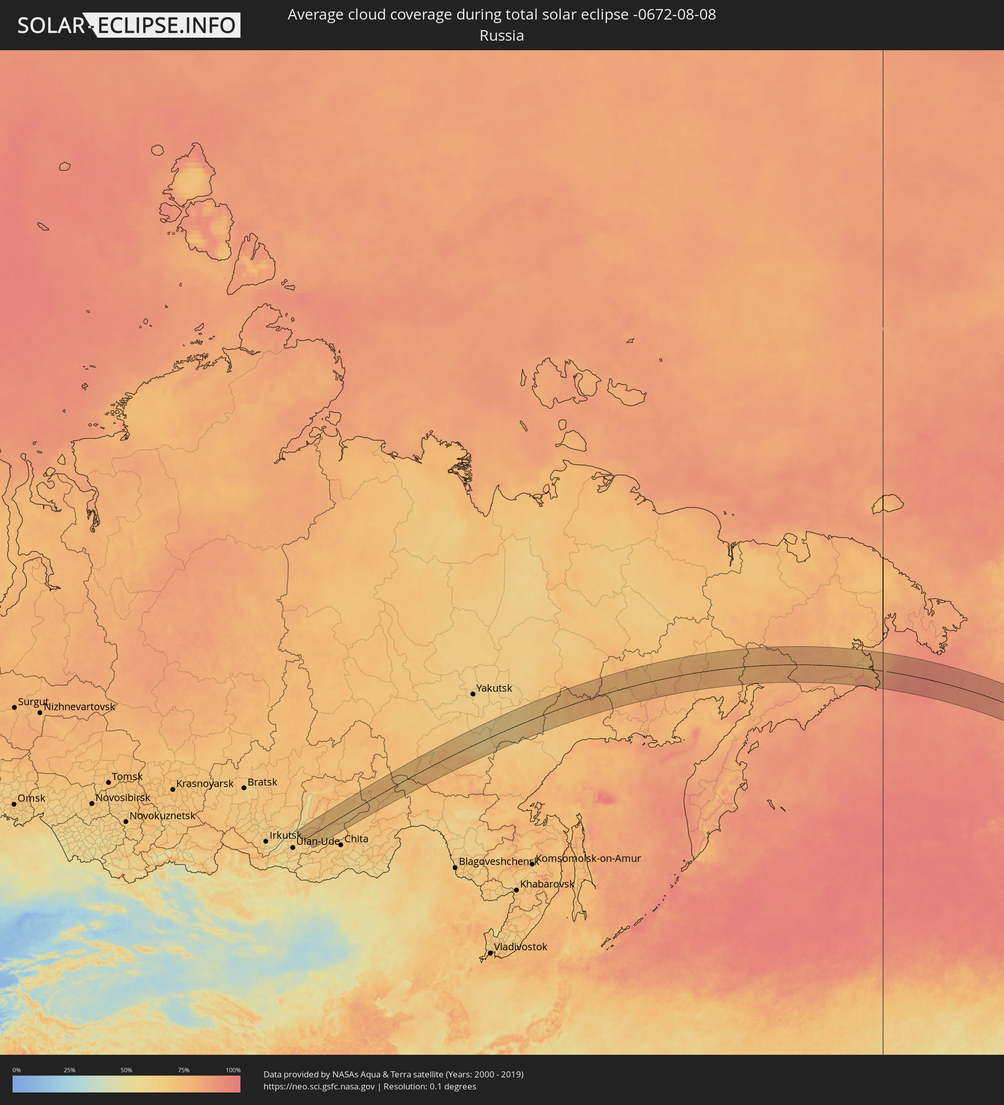 Russland
 Vereinigte Staaten
 Mexiko
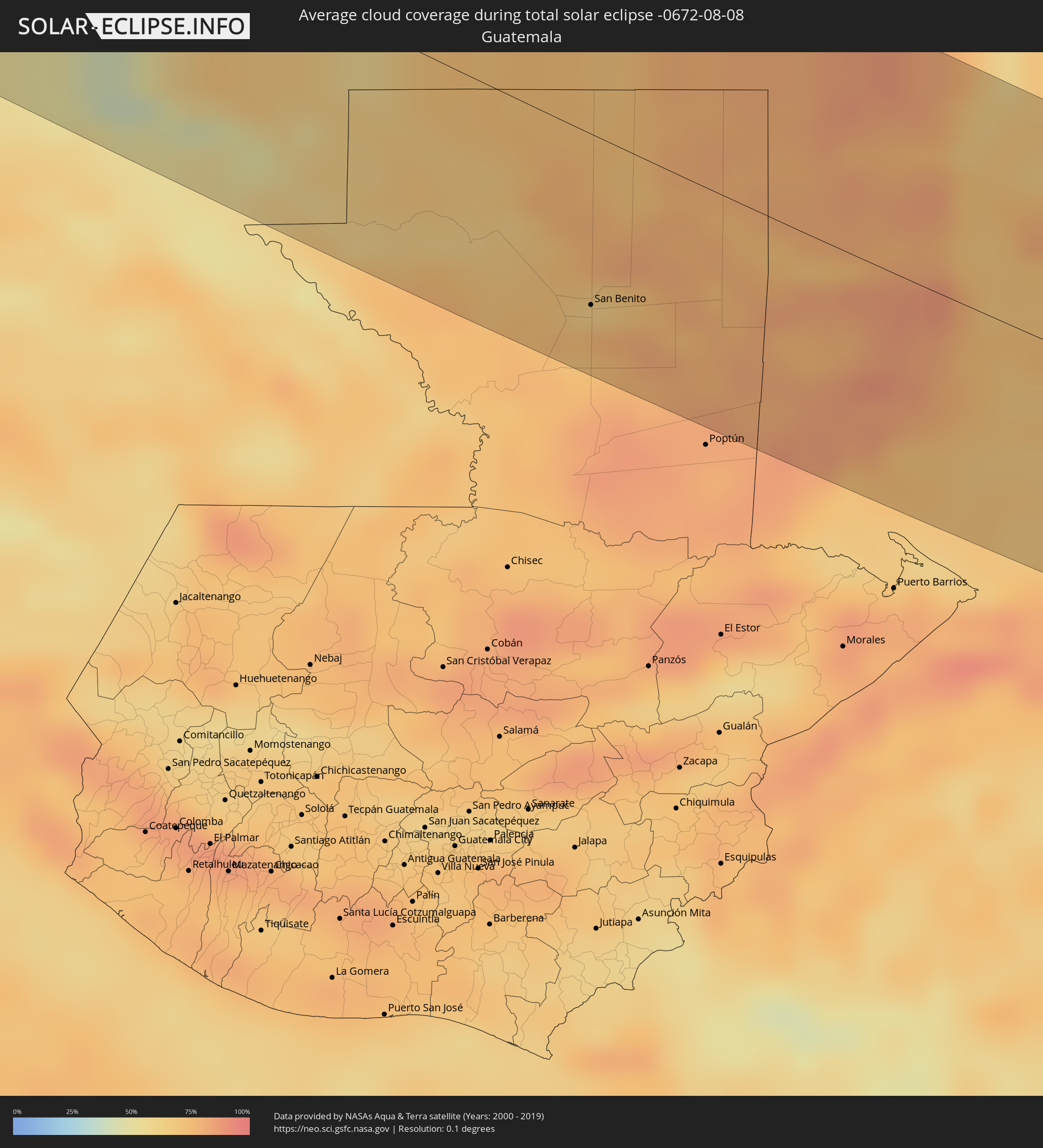 Guatemala
 Honduras
 Belize
 Nicaragua
Orte im Finsternispfad
Die nachfolgene Tabelle zeigt Städte und Orte mit mehr als 5.000 Einwohnern, die sich im Finsternispfad befinden. Städte mit mehr als 100.000 Einwohnern sind dick gekennzeichnet. Mit einem Klick auf den Ort öffnet sich eine Detailkarte die die Lage des jeweiligen Ortes zusammen mit dem Verlauf der zentralen Finsternis präsentiert.
| Ort | Typ | Dauer der Verfinsterung | Ortszeit bei maximaler Verfinsterung | Entfernung zur Zentrallinie | Ø Bewölkung |
 Eureka, California
|
total | - | 14:59:01 UTC-08:00 | 113 km | 65% |
|
Grants Pass, Oregon
|
total | - | 14:56:43 UTC-08:00 | 63 km | 20% |
|
Medford, Oregon
|
total | - | 14:57:21 UTC-08:00 | 84 km | 22% |
|
Redding, California
|
total | - | 15:01:01 UTC-08:00 | 15 km | 12% |
|
Chico, California
|
total | - | 15:03:07 UTC-08:00 | 43 km | 11% |
|
Woodland, California
|
total | - | 15:05:09 UTC-08:00 | 120 km | 8% |
|
Yuba City, California
|
total | - | 15:04:25 UTC-08:00 | 72 km | 10% |
|
Sacramento, California
|
total | - | 15:05:34 UTC-08:00 | 106 km | 5% |
|
Elk Grove, California
|
total | - | 15:06:00 UTC-08:00 | 111 km | 7% |
|
Rancho Cordova, California
|
total | - | 15:05:43 UTC-08:00 | 93 km | 5% |
|
Lincoln, California
|
total | - | 15:05:09 UTC-08:00 | 74 km | 8% |
|
Roseville, California
|
total | - | 15:05:25 UTC-08:00 | 81 km | 6% |
|
El Dorado Hills, California
|
total | - | 15:05:43 UTC-08:00 | 72 km | 8% |
|
Reno, Nevada
|
total | - | 15:05:11 UTC-08:00 | 73 km | 16% |
|
Carson City, Nevada
|
total | - | 15:05:54 UTC-08:00 | 55 km | 15% |
|
Ridgecrest, California
|
total | - | 15:14:09 UTC-08:00 | 78 km | 6% |
|
Pahrump, Nevada
|
total | - | 15:14:15 UTC-08:00 | 80 km | 9% |
|
Spring Valley, Nevada
|
total | - | 15:14:56 UTC-08:00 | 123 km | 14% |
|
Yuma, Arizona
|
total | - | 15:21:31 UTC-08:00 | 100 km | 26% |
|
Bullhead City, Arizona
|
total | - | 16:17:08 UTC-07:00 | 96 km | 11% |
|
Lake Havasu City, Arizona
|
total | - | 16:18:30 UTC-07:00 | 65 km | 14% |
|
Buckeye, Arizona
|
total | - | 16:21:34 UTC-07:00 | 93 km | 37% |
|
Avondale, Arizona
|
total | - | 16:21:34 UTC-07:00 | 110 km | 35% |
 Heroica Caborca, Sonora
|
total | - | 16:02:40 UTC-07:23 | 95 km | 36% |
|
Maricopa, Arizona
|
total | - | 16:22:25 UTC-07:00 | 102 km | 41% |
|
Casa Grande, Arizona
|
total | - | 16:22:54 UTC-07:00 | 104 km | 32% |
|
Marana, Arizona
|
total | - | 16:23:58 UTC-07:00 | 104 km | 32% |
|
Oro Valley, Arizona
|
total | - | 16:24:11 UTC-07:00 | 120 km | 36% |
|
Magdalena de Kino, Sonora
|
total | - | 16:03:26 UTC-07:23 | 35 km | 44% |
|
Nogales, Sonora
|
total | - | 16:02:15 UTC-07:23 | 41 km | 48% |
|
Tucson, Arizona
|
total | - | 16:24:30 UTC-07:00 | 111 km | 31% |
|
Sierra Vista, Arizona
|
total | - | 16:26:00 UTC-07:00 | 95 km | 48% |
|
Cananea, Sonora
|
total | - | 16:03:08 UTC-07:23 | 54 km | 50% |
|
Cuauhtémoc, Chihuahua
|
total | - | 16:27:10 UTC-07:05 | 61 km | 43% |
|
Hidalgo del Parral, Chihuahua
|
total | - | 16:30:00 UTC-07:05 | 32 km | 47% |
|
Ciudad Camargo, Chihuahua
|
total | - | 16:28:56 UTC-07:05 | 108 km | 31% |
|
Torreon, Coahuila
|
total | - | 17:01:54 UTC-06:36 | 31 km | 26% |
|
Matamoros, Coahuila
|
total | - | 17:01:58 UTC-06:36 | 39 km | 34% |
|
Río Grande, Zacatecas
|
total | - | 17:04:38 UTC-06:36 | 102 km | 47% |
|
Parras de la Fuente, Coahuila
|
total | - | 17:02:20 UTC-06:36 | 99 km | 47% |
|
Matehuala, San Luis Potosí
|
total | - | 17:05:19 UTC-06:36 | 23 km | 41% |
|
Río Verde, San Luis Potosí
|
total | - | 17:07:55 UTC-06:36 | 98 km | 54% |
|
Ciudad Valles, San Luis Potosí
|
total | - | 17:07:56 UTC-06:36 | 44 km | 64% |
|
Ciudad Mante, Tamaulipas
|
total | - | 17:06:51 UTC-06:36 | 41 km | 58% |
|
Gustavo A. Madero, Tamaulipas
|
total | - | 17:06:41 UTC-06:36 | 60 km | 57% |
|
Huejutla de Reyes, Hidalgo
|
total | - | 17:09:10 UTC-06:36 | 84 km | 70% |
|
Tantoyuca, Veracruz
|
total | - | 17:08:53 UTC-06:36 | 54 km | 78% |
|
Pánuco, Veracruz
|
total | - | 17:07:54 UTC-06:36 | 33 km | 67% |
|
Tampico, Tamaulipas
|
total | - | 17:07:36 UTC-06:36 | 57 km | 62% |
|
Temapache, Veracruz
|
total | - | 17:09:19 UTC-06:36 | 50 km | 76% |
|
Poza Rica de Hidalgo, Veracruz
|
total | - | 17:10:04 UTC-06:36 | 89 km | 83% |
|
Tuxpan de Rodríguez Cano, Veracruz
|
total | - | 17:09:28 UTC-06:36 | 51 km | 64% |
|
Papantla de Olarte, Veracruz
|
total | - | 17:10:11 UTC-06:36 | 92 km | 86% |
|
Comalcalco, Tabasco
|
total | - | 17:12:55 UTC-06:36 | 92 km | 74% |
|
Paraiso, Tabasco
|
total | - | 17:12:44 UTC-06:36 | 78 km | 67% |
|
Ciudad del Carmen, Campeche
|
total | - | 17:12:17 UTC-06:36 | 13 km | 44% |
|
Tenosique de Pino Suárez, Tabasco
|
total | - | 17:13:41 UTC-06:36 | 85 km | 60% |
|
Escárcega, Campeche
|
total | - | 17:12:11 UTC-06:36 | 60 km | 66% |
 La Libertad, Petén
|
total | - | 17:48:51 UTC-06:02 | 94 km | 73% |
|
San Benito, Petén
|
total | - | 17:48:39 UTC-06:02 | 72 km | 77% |
|
San Andrés, Petén
|
total | - | 17:48:36 UTC-06:02 | 67 km | 65% |
|
Flores, Petén
|
total | - | 17:48:39 UTC-06:02 | 71 km | 77% |
|
Santa Ana, Petén
|
total | - | 17:48:47 UTC-06:02 | 80 km | 76% |
|
Dolores, Petén
|
total | - | 17:49:02 UTC-06:02 | 91 km | 83% |
|
Melchor de Mencos, Petén
|
total | - | 17:48:20 UTC-06:02 | 24 km | 79% |
 Benque Viejo del Carmen, Cayo
|
total | - | 17:57:35 UTC-05:52 | 22 km | 79% |
|
San Ignacio, Cayo
|
total | - | 17:57:29 UTC-05:52 | 12 km | 74% |
|
Belmopan, Cayo
|
total | - | 17:57:18 UTC-05:52 | 25 km | 80% |
|
Dangriga, Stann Creek
|
total | - | 17:57:32 UTC-05:52 | 8 km | 70% |
|
Belize City, Belize
|
total | - | 17:56:54 UTC-05:52 | 63 km | 72% |
 Puerto Cortez, Cortés
|
total | - | 18:02:43 UTC-05:48 | 96 km | 77% |
|
Baracoa, Cortés
|
total | - | 18:02:46 UTC-05:48 | 99 km | 77% |
|
Tela, Atlántida
|
total | - | 18:02:40 UTC-05:48 | 84 km | 65% |
|
San Juan Pueblo, Atlántida
|
total | - | 18:02:50 UTC-05:48 | 93 km | 84% |
|
La Ceiba, Atlántida
|
total | - | 18:02:31 UTC-05:48 | 56 km | 66% |
|
Olanchito, Yoro
|
total | - | 18:02:46 UTC-05:48 | 78 km | 61% |
|
Coxen Hole, Bay Islands
|
total | - | 18:01:49 UTC-05:48 | 16 km | 60% |
|
Sabá, Colón
|
total | - | 18:02:42 UTC-05:48 | 64 km | 72% |
|
Tocoa, Colón
|
total | - | 18:02:24 UTC-05:48 | 34 km | 68% |
|
Trujillo, Colón
|
total | - | 18:02:07 UTC-05:48 | 9 km | 64% |
 Waspam, Atlántico Norte (RAAN)
|
total | - | 18:06:30 UTC-05:45 | 54 km | 92% |
|
Puerto Lempira, Gracias a Dios
|
total | - | 18:02:12 UTC-05:48 | 25 km | 78% |
 Ust’-Barguzin, Respublika Buryatiya
|
total | - | 04:01:31 UTC+06:57 | 88 km | 62% |
|
Barguzin, Respublika Buryatiya
|
total | - | 04:01:31 UTC+06:57 | 86 km | 67% |
|
Khorinsk, Respublika Buryatiya
|
total | - | 04:00:03 UTC+06:57 | 60 km | 66% |
|
Sosnovo-Ozerskoye, Respublika Buryatiya
|
total | - | 03:59:49 UTC+06:57 | 86 km | 63% |
|
Neryungri, Sakha
|
total | - | 05:43:36 UTC+08:38 | 96 km | 74% |
|
Chul’man, Sakha
|
total | - | 05:43:47 UTC+08:38 | 87 km | 72% |
|
Aldan, Sakha
|
total | - | 05:45:54 UTC+08:38 | 75 km | 74% |
|
Nizhniy Kuranakh, Sakha
|
total | - | 05:46:09 UTC+08:38 | 94 km | 71% |
|
Tommot, Sakha
|
total | - | 05:46:17 UTC+08:38 | 86 km | 69% |
|
Susuman, Magadan
|
total | - | 07:30:18 UTC+10:14 | 44 km | 73% |