Totale Sonnenfinsternis vom 27.06.-1265
| Wochentag: | Mittwoch |
| Maximale Dauer der Verfinsterung: | 05m39s |
| Maximale Breite des Finsternispfades: | 279 km |
| Saroszyklus: | 26 |
| Bedeckungsgrad: | 100% |
| Magnitude: | 1.0773 |
| Gamma: | 0.4405 |
Wo kann man die Sonnenfinsternis vom 27.06.-1265 sehen?
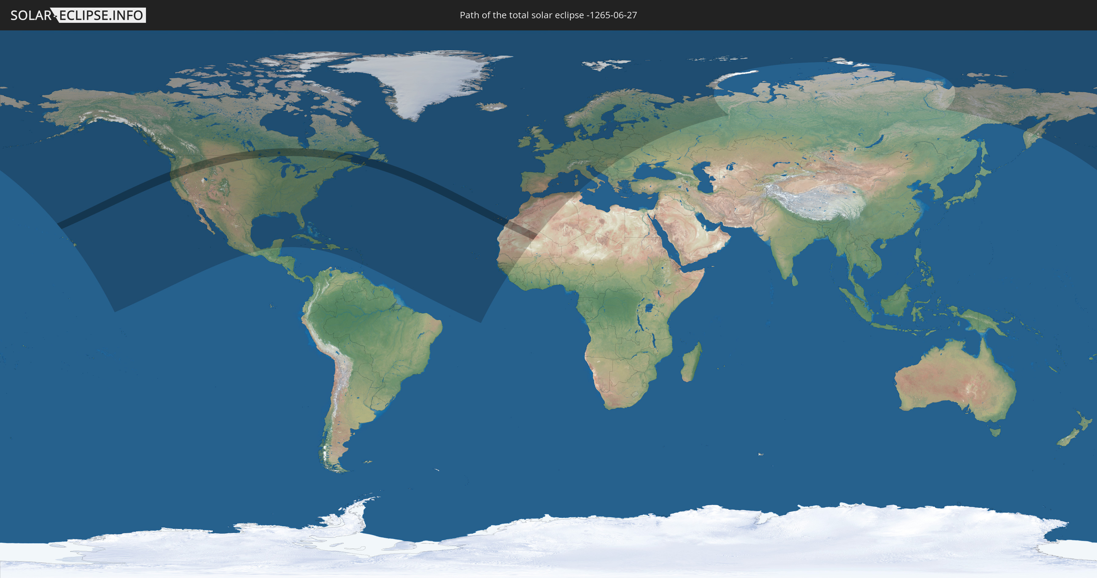
Die Sonnenfinsternis am 27.06.-1265 kann man in 83 Ländern als partielle Sonnenfinsternis beobachten.
Der Finsternispfad verläuft durch 6 Länder. Nur in diesen Ländern ist sie als totale Sonnenfinsternis zu sehen.
In den folgenden Ländern ist die Sonnenfinsternis total zu sehen
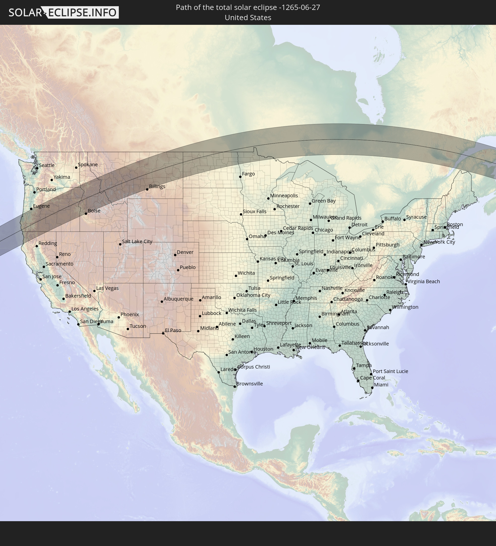 Vereinigte Staaten
 Kanada
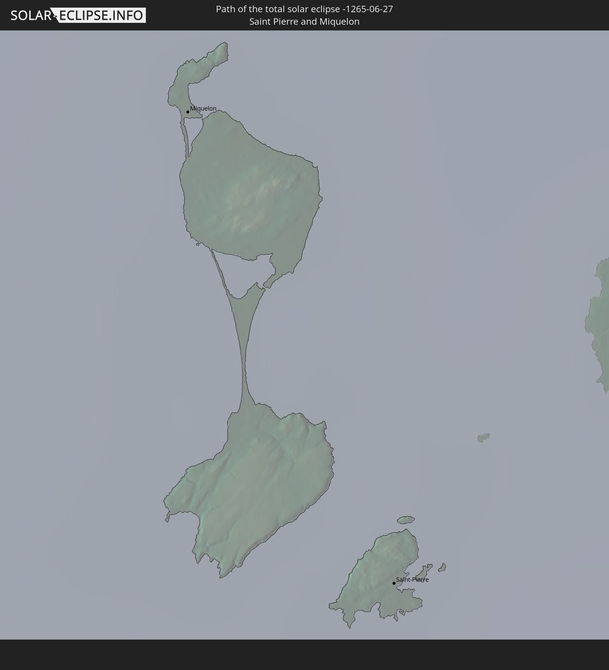 Saint-Pierre und Miquelon
 Spanien
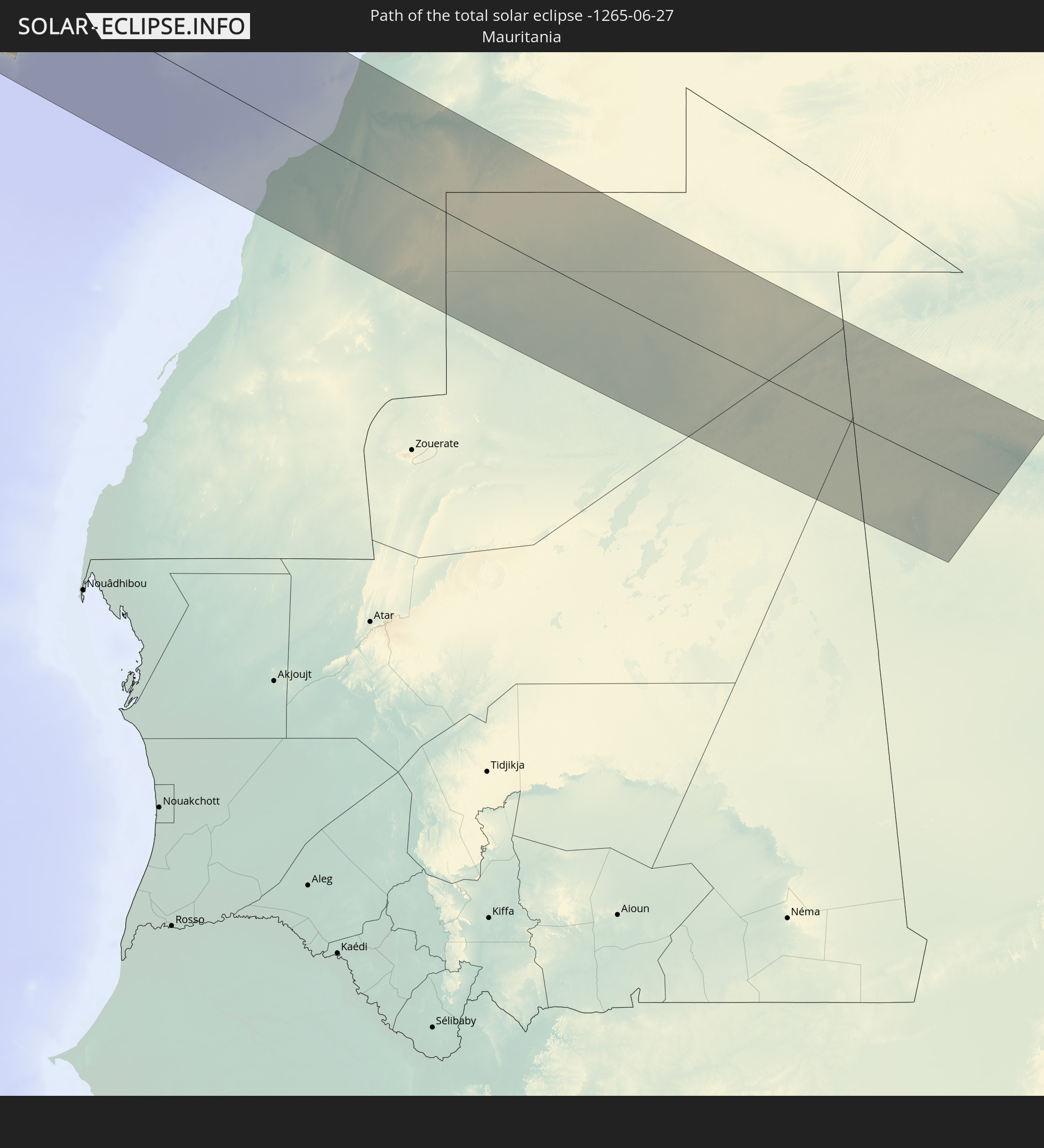 Mauretanien
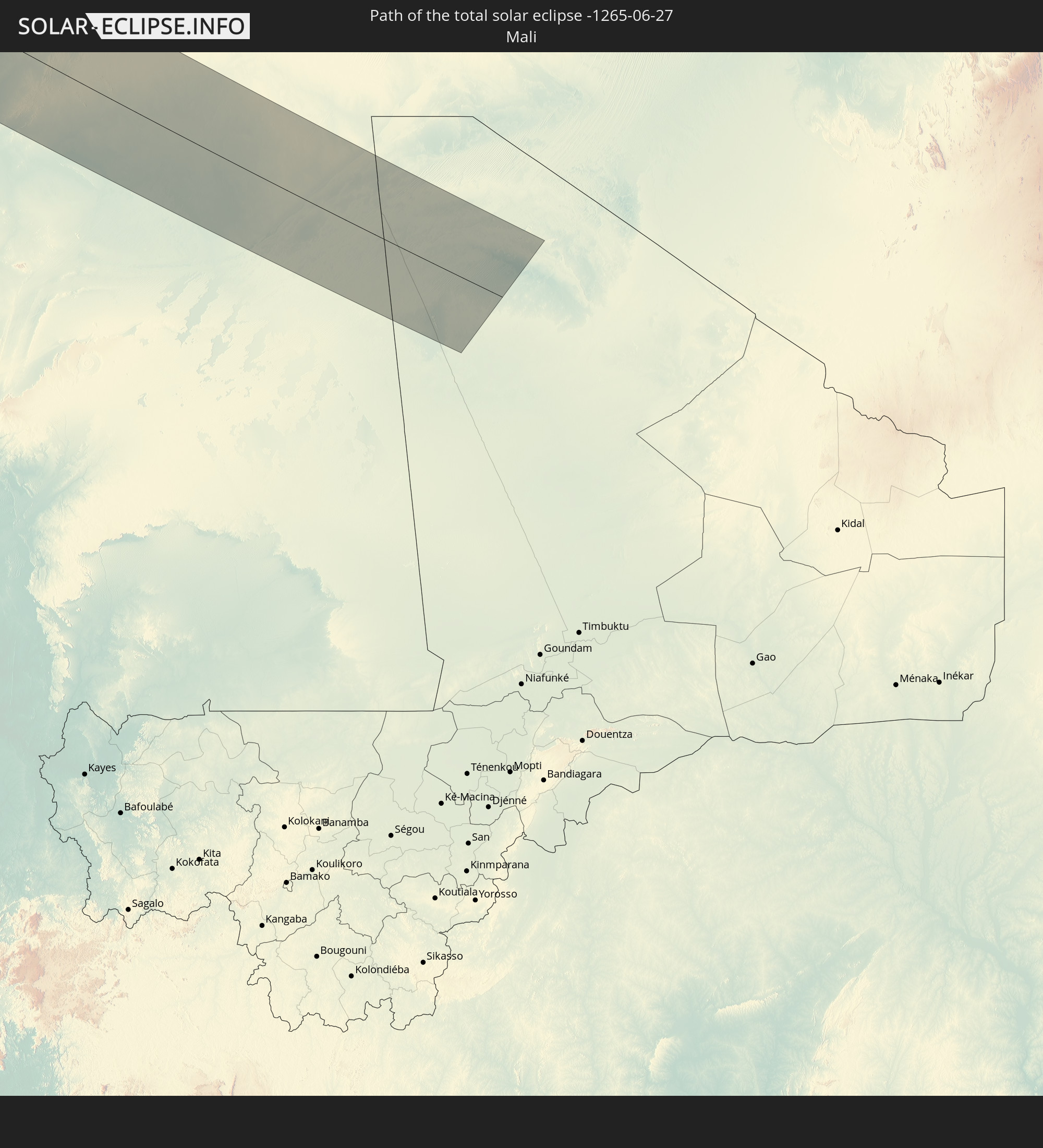 Mali
Mali
In den folgenden Ländern ist die Sonnenfinsternis partiell zu sehen
 Russland
 Vereinigte Staaten
 United States Minor Outlying Islands
 Kanada
 Mexiko
 Grönland
 Kuba
Kuba
 Kaimaninseln
 Bahamas
 Jamaika
 Haiti
Haiti
 Turks- und Caicosinseln
 Dominikanische Republik
 Puerto Rico
 Amerikanische Jungferninseln
 Bermuda
 Britische Jungferninseln
 Anguilla
 Saint-Martin
 Saint-Barthélemy
 St. Kitts und Nevis
 Antigua und Barbuda
 Montserrat
 Guadeloupe
 Dominica
 St. Vincent und die Grenadinen
 Martinique
 St. Lucia
 Barbados
 Saint-Pierre und Miquelon
 Portugal
 Kap Verde
 Island
 Spanien
 Senegal
 Mauretanien
 Gambia
 Guinea-Bissau
 Guinea
 Marokko
 Mali
Mali
 Irland
 Spitzbergen
 Algerien
 Vereinigtes Königreich
 Färöer
 Gibraltar
 Frankreich
 Isle of Man
 Guernsey
 Jersey
 Andorra
 Belgien
 Niederlande
 Norwegen
 Luxemburg
 Deutschland
 Schweiz
 Italien
 Monaco
 Tunesien
 Dänemark
 Liechtenstein
 Österreich
 Schweden
 Tschechien
 San Marino
 Vatikanstadt
 Slowenien
 Kroatien
 Polen
Polen
 Bosnien und Herzegowina
 Ungarn
 Slowakei
 Serbien
 Åland Islands
 Rumänien
 Finnland
 Litauen
 Lettland
 Estland
 Ukraine
 Weißrussland
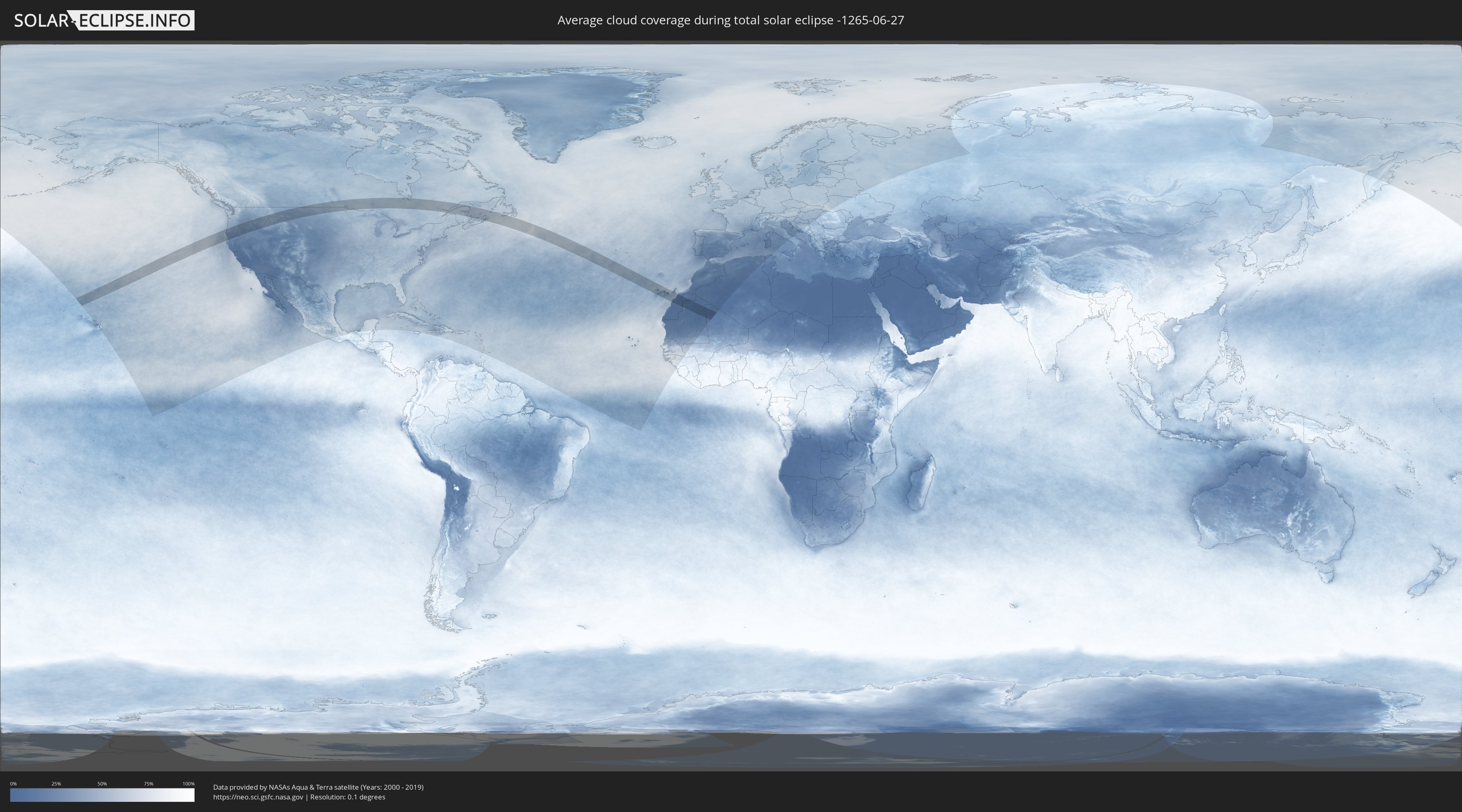
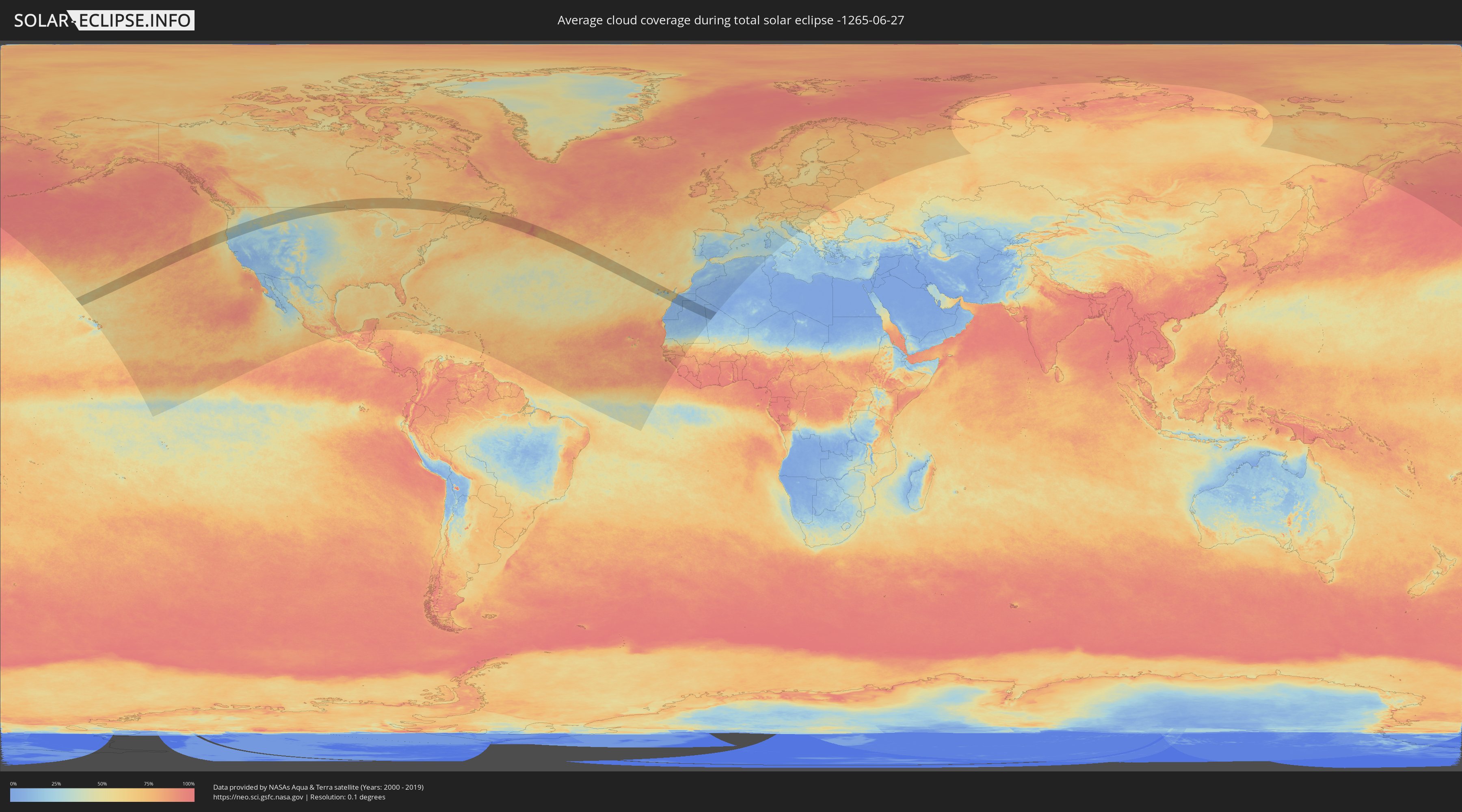
Wie wird das Wetter während der totalen Sonnenfinsternis am 27.06.-1265?
Wo ist der beste Ort, um die totale Sonnenfinsternis vom 27.06.-1265 zu beobachten?
Die folgenden Karten zeigen die durchschnittliche Bewölkung für den Tag, an dem die totale Sonnenfinsternis
stattfindet. Mit Hilfe der Karten lässt sich der Ort entlang des Finsternispfades eingrenzen,
der die besten Aussichen auf einen klaren wolkenfreien Himmel bietet.
Trotzdem muss man immer lokale Gegenenheiten beachten und sollte sich genau über das Wetter an seinem
gewählten Beobachtungsort informieren.
Die Daten stammen von den beiden NASA-Satelliten
AQUA und TERRA
und wurden über einen Zeitraum von 19 Jahren (2000 - 2019) gemittelt.
Detaillierte Länderkarten
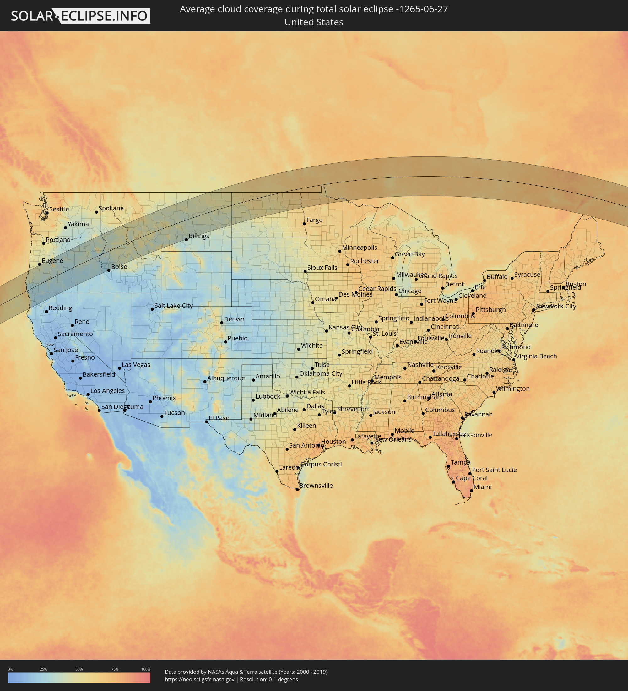 Vereinigte Staaten
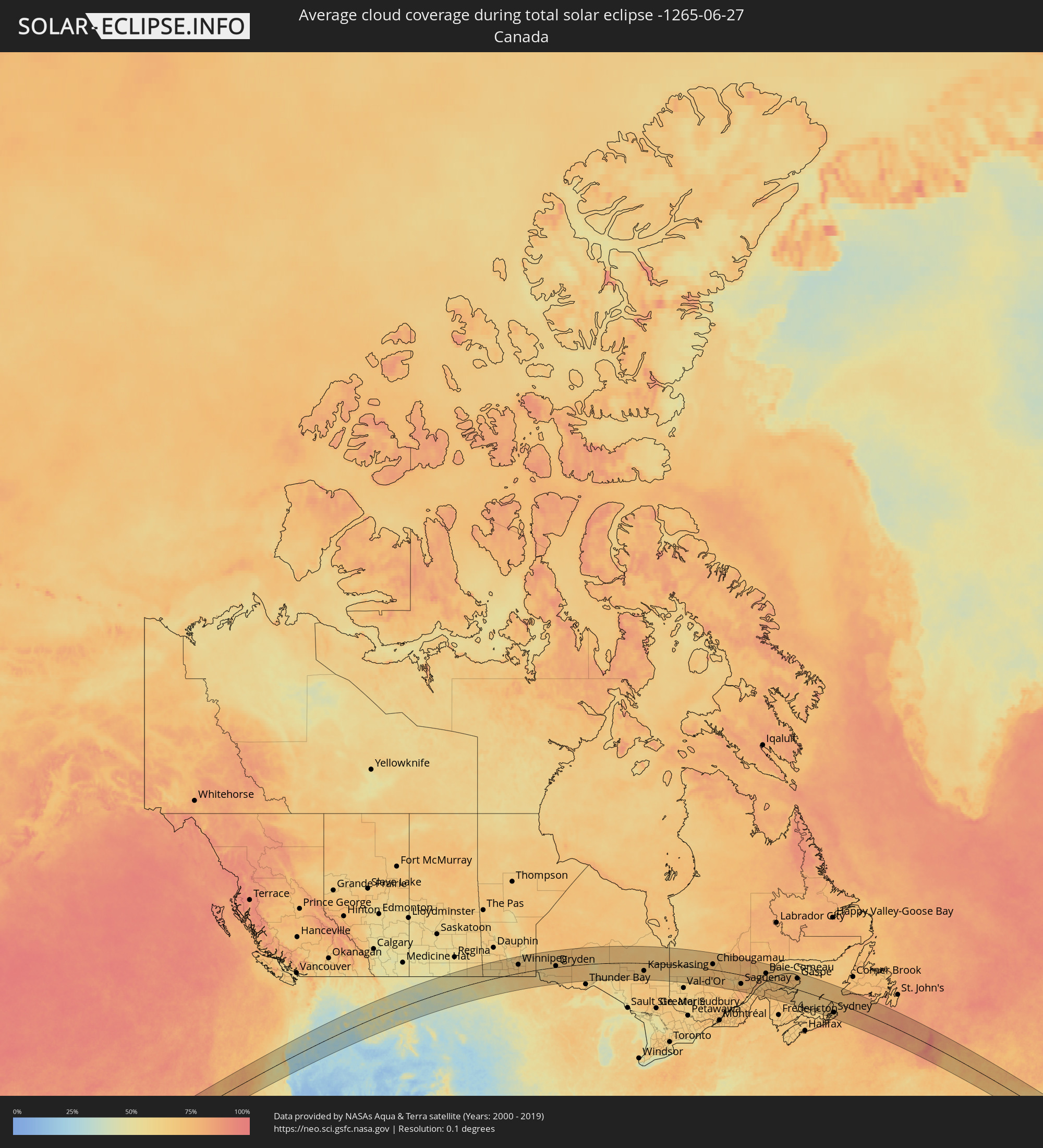 Kanada
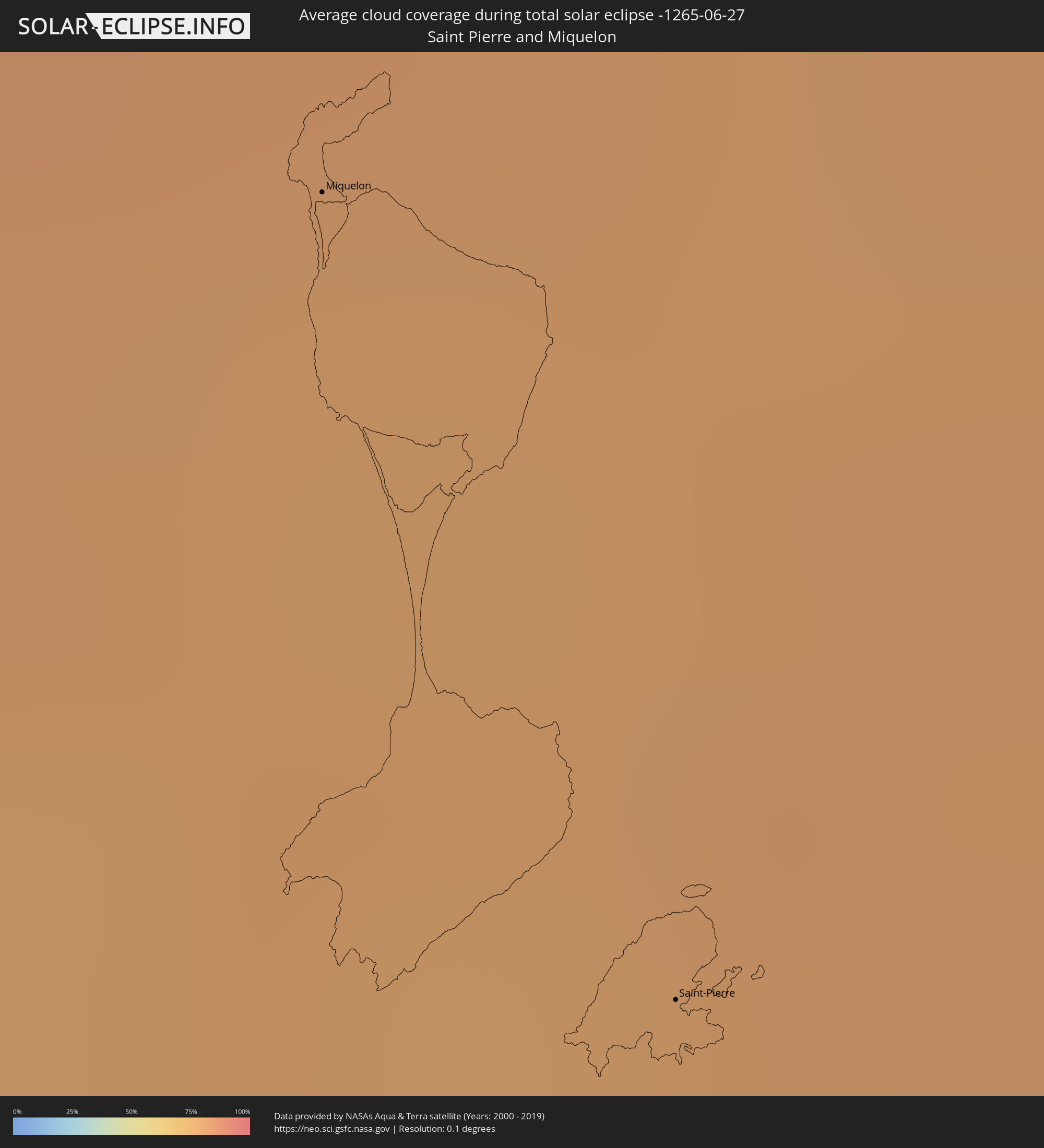 Saint-Pierre und Miquelon
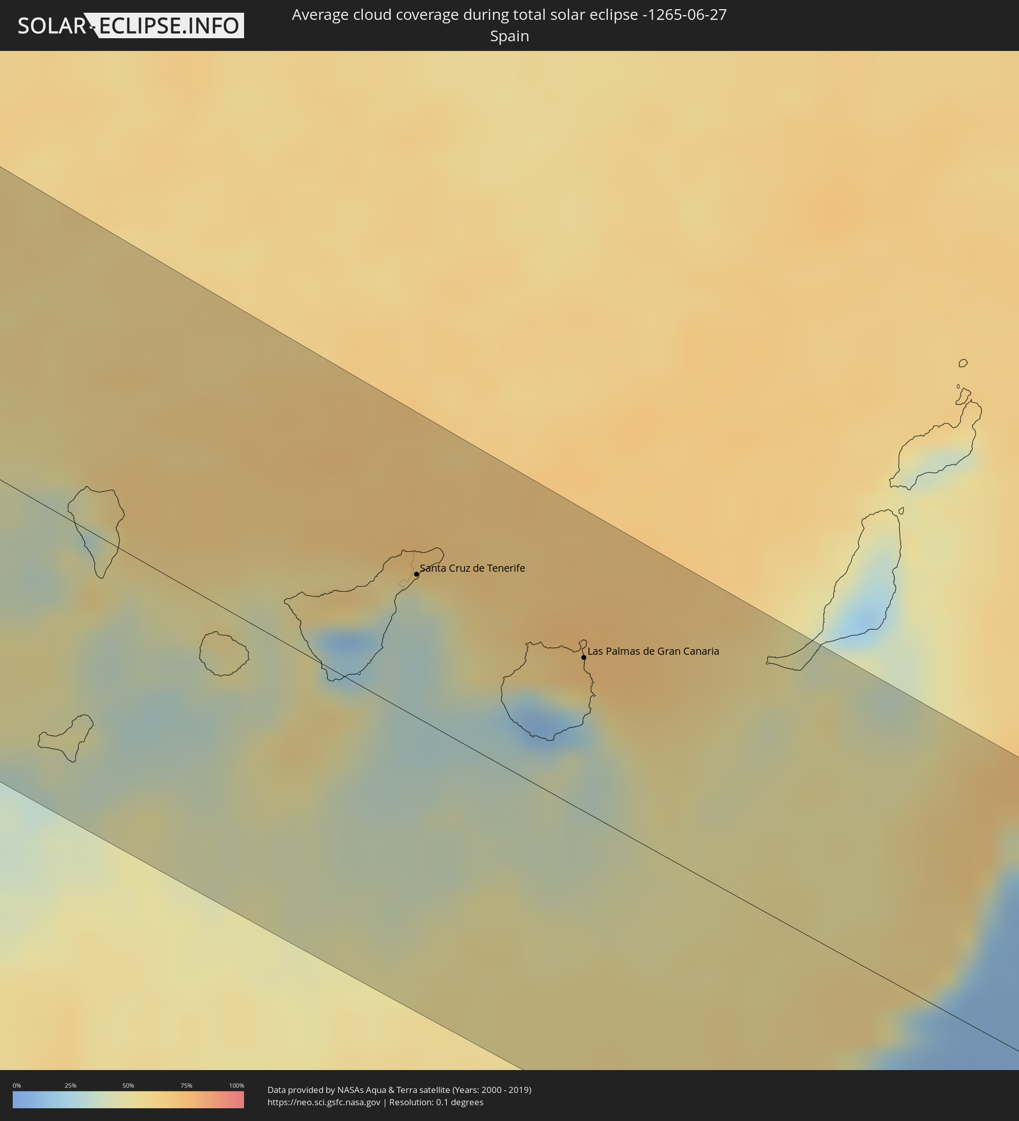 Spanien
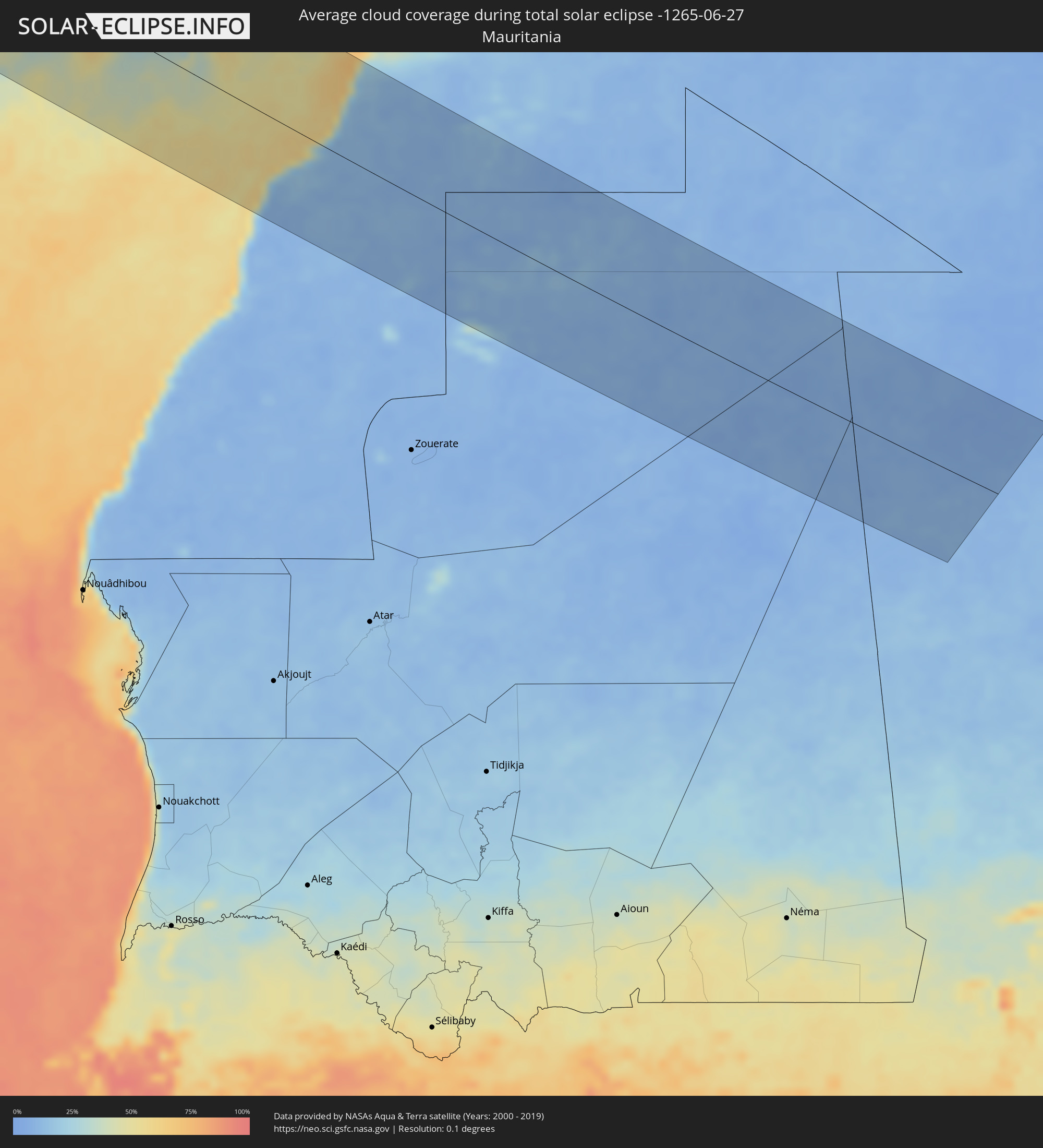 Mauretanien
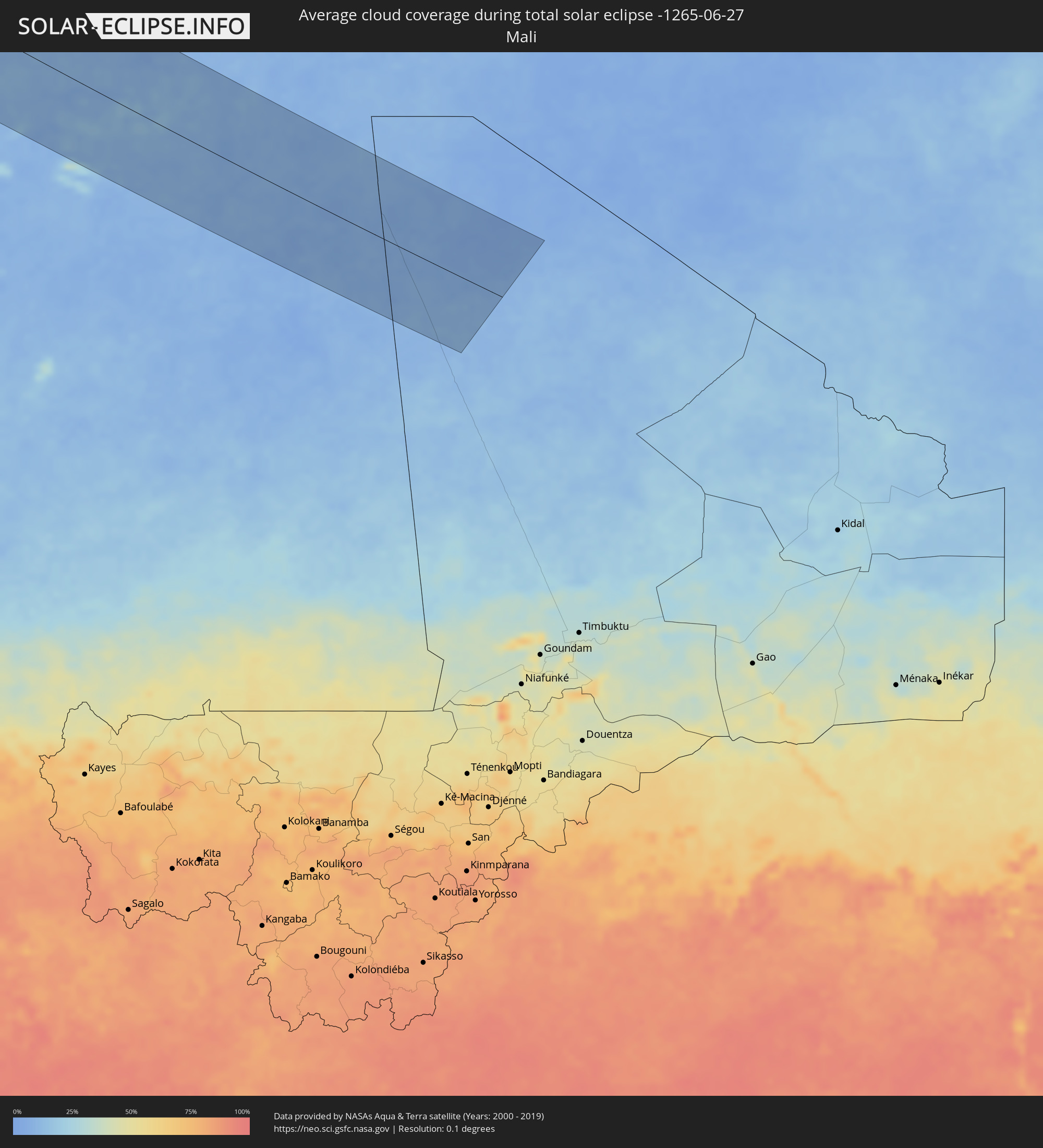 Mali
Mali
Orte im Finsternispfad
Die nachfolgene Tabelle zeigt Städte und Orte mit mehr als 5.000 Einwohnern, die sich im Finsternispfad befinden. Städte mit mehr als 100.000 Einwohnern sind dick gekennzeichnet. Mit einem Klick auf den Ort öffnet sich eine Detailkarte die die Lage des jeweiligen Ortes zusammen mit dem Verlauf der zentralen Finsternis präsentiert.
| Ort | Typ | Dauer der Verfinsterung | Ortszeit bei maximaler Verfinsterung | Entfernung zur Zentrallinie | Ø Bewölkung |
|
North Bend, Oregon
|
total | - | 08:13:55 UTC-08:00 | 118 km | 42% |
|
Coos Bay, Oregon
|
total | - | 08:13:52 UTC-08:00 | 114 km | 42% |
|
Crescent City, California
|
total | - | 08:11:36 UTC-08:00 | 46 km | 51% |
|
McKinleyville, California
|
total | - | 08:10:33 UTC-08:00 | 130 km | 50% |
|
Roseburg, Oregon
|
total | - | 08:14:19 UTC-08:00 | 66 km | 40% |
|
Grants Pass, Oregon
|
total | - | 08:13:14 UTC-08:00 | 11 km | 29% |
|
Sutherlin, Oregon
|
total | - | 08:14:35 UTC-08:00 | 82 km | 39% |
|
Cottage Grove, Oregon
|
total | - | 08:15:21 UTC-08:00 | 113 km | 42% |
|
Springfield, Oregon
|
total | - | 08:15:44 UTC-08:00 | 136 km | 42% |
|
Medford, Oregon
|
total | - | 08:13:26 UTC-08:00 | 39 km | 28% |
|
White City, Oregon
|
total | - | 08:13:36 UTC-08:00 | 29 km | 27% |
|
Eagle Point, Oregon
|
total | - | 08:13:42 UTC-08:00 | 28 km | 25% |
|
Ashland, Oregon
|
total | - | 08:13:23 UTC-08:00 | 59 km | 29% |
|
Yreka, California
|
total | - | 08:12:48 UTC-08:00 | 107 km | 24% |
|
Klamath Falls, Oregon
|
total | - | 08:14:11 UTC-08:00 | 90 km | 24% |
|
Bend, Oregon
|
total | - | 08:17:08 UTC-08:00 | 76 km | 32% |
|
Redmond, Oregon
|
total | - | 08:17:34 UTC-08:00 | 92 km | 27% |
|
Prineville, Oregon
|
total | - | 08:17:53 UTC-08:00 | 83 km | 30% |
|
La Grande, Oregon
|
total | - | 08:21:47 UTC-08:00 | 91 km | 36% |
|
Baker City, Oregon
|
total | - | 08:21:16 UTC-08:00 | 27 km | 29% |
|
Ontario, Oregon
|
total | - | 09:21:07 UTC-07:00 | 78 km | 27% |
|
Caldwell, Idaho
|
total | - | 09:20:54 UTC-07:00 | 124 km | 25% |
|
Eagle, Idaho
|
total | - | 09:21:17 UTC-07:00 | 131 km | 24% |
|
Missoula, Montana
|
total | - | 09:27:58 UTC-07:00 | 120 km | 45% |
|
Anaconda, Montana
|
total | - | 09:28:09 UTC-07:00 | 12 km | 46% |
|
Butte, Montana
|
total | - | 09:28:27 UTC-07:00 | 13 km | 43% |
|
Helena Valley West Central, Montana
|
total | - | 09:29:49 UTC-07:00 | 42 km | 41% |
|
Helena, Montana
|
total | - | 09:29:45 UTC-07:00 | 34 km | 42% |
|
Helena Valley Southeast, Montana
|
total | - | 09:29:55 UTC-07:00 | 33 km | 42% |
|
Great Falls, Montana
|
total | - | 09:31:44 UTC-07:00 | 108 km | 39% |
|
Bozeman, Montana
|
total | - | 09:29:46 UTC-07:00 | 89 km | 35% |
|
Williston, North Dakota
|
total | - | 10:42:05 UTC-06:00 | 8 km | 47% |
|
Estevan, Saskatchewan
|
total | - | 09:45:19 UTC-06:58 | 85 km | 55% |
|
Minot, North Dakota
|
total | - | 10:45:24 UTC-06:00 | 44 km | 59% |
|
Brandon, Manitoba
|
total | - | 10:48:44 UTC-06:00 | 108 km | 60% |
|
Portage la Prairie, Manitoba
|
total | - | 10:51:10 UTC-06:00 | 96 km | 63% |
|
Morden, Manitoba
|
total | - | 10:50:50 UTC-06:00 | 8 km | 63% |
|
Winkler, Manitoba
|
total | - | 10:51:03 UTC-06:00 | 5 km | 64% |
|
Winnipeg, Manitoba
|
total | - | 10:52:45 UTC-06:00 | 70 km | 72% |
|
Selkirk, Manitoba
|
total | - | 10:53:19 UTC-06:00 | 95 km | 65% |
|
Steinbach, Manitoba
|
total | - | 10:53:10 UTC-06:00 | 25 km | 69% |
|
Thief River Falls, Minnesota
|
total | - | 10:52:56 UTC-06:00 | 136 km | 63% |
|
Fort Frances, Ontario
|
total | - | 10:57:37 UTC-06:00 | 115 km | 64% |
|
Dryden, Ontario
|
total | - | 10:59:17 UTC-06:00 | 10 km | 67% |
|
Kapuskasing, Ontario
|
total | - | 12:15:49 UTC-05:00 | 65 km | 71% |
|
La Sarre, Quebec
|
total | - | 12:21:18 UTC-05:00 | 120 km | 62% |
|
Amos, Quebec
|
total | - | 12:23:11 UTC-05:00 | 139 km | 60% |
|
Chibougamau, Quebec
|
total | - | 12:28:47 UTC-05:00 | 45 km | 72% |
|
Saint-Félicien, Quebec
|
total | - | 12:32:31 UTC-05:00 | 70 km | 66% |
|
Roberval, Quebec
|
total | - | 12:32:57 UTC-05:00 | 82 km | 67% |
|
Dolbeau-Mistassini, Quebec
|
total | - | 12:32:44 UTC-05:00 | 42 km | 67% |
|
Pont Rouge, Quebec
|
total | - | 12:32:58 UTC-05:00 | 39 km | 67% |
|
Alma, Quebec
|
total | - | 12:33:52 UTC-05:00 | 70 km | 65% |
|
Jonquière, Quebec
|
total | - | 12:34:36 UTC-05:00 | 78 km | 68% |
|
Saguenay, Quebec
|
total | - | 12:34:53 UTC-05:00 | 76 km | 68% |
|
Rivière-du-Loup, Quebec
|
total | - | 12:37:45 UTC-05:00 | 115 km | 67% |
|
Rimouski, Quebec
|
total | - | 12:38:52 UTC-05:00 | 30 km | 65% |
|
Mont-Joli, Quebec
|
total | - | 12:39:17 UTC-05:00 | 10 km | 65% |
|
Baie-Comeau, Quebec
|
total | - | 12:38:50 UTC-05:00 | 60 km | 73% |
|
Matane, Quebec
|
total | - | 12:40:06 UTC-05:00 | 29 km | 66% |
|
Campbellton, New Brunswick
|
total | - | 13:27:41 UTC-04:14 | 43 km | 69% |
|
Bathurst, New Brunswick
|
total | - | 13:29:36 UTC-04:14 | 63 km | 72% |
|
Miramichi, New Brunswick
|
total | - | 13:30:22 UTC-04:14 | 123 km | 67% |
|
Chandler, Quebec
|
total | - | 12:44:45 UTC-05:00 | 35 km | 70% |
|
Gaspé, Quebec
|
total | - | 12:44:35 UTC-05:00 | 91 km | 71% |
|
Sydney Mines, Nova Scotia
|
total | - | 13:39:01 UTC-04:14 | 79 km | 65% |
|
Sydney, Nova Scotia
|
total | - | 13:39:11 UTC-04:14 | 88 km | 67% |
|
Glace Bay, Nova Scotia
|
total | - | 13:39:26 UTC-04:14 | 76 km | 65% |
|
Miquelon, Miquelon-Langlade
|
total | - | 14:12:50 UTC-03:44 | 119 km | 78% |
|
Saint-Pierre, Saint-Pierre
|
total | - | 14:13:30 UTC-03:44 | 92 km | 79% |
|
Los Llanos de Aridane, Canary Islands
|
total | - | 17:46:14 UTC-01:01 | 1 km | 42% |
|
Santa Cruz de la Palma, Canary Islands
|
total | - | 17:46:12 UTC-01:01 | 9 km | 53% |
|
San Sebastián de la Gomera, Canary Islands
|
total | - | 17:46:51 UTC-01:01 | 17 km | 41% |
|
Santiago del Teide, Canary Islands
|
total | - | 17:46:37 UTC-01:01 | 17 km | 38% |
|
Guía de Isora, Canary Islands
|
total | - | 17:46:42 UTC-01:01 | 11 km | 50% |
|
Icod de los Vinos, Canary Islands
|
total | - | 17:46:32 UTC-01:01 | 30 km | 54% |
|
Arona, Canary Islands
|
total | - | 17:46:50 UTC-01:01 | 5 km | 48% |
|
San Miguel De Abona, Canary Islands
|
total | - | 17:46:50 UTC-01:01 | 8 km | 42% |
|
San Isidro, Canary Islands
|
total | - | 17:46:51 UTC-01:01 | 9 km | 42% |
|
La Orotava, Canary Islands
|
total | - | 17:46:30 UTC-01:01 | 41 km | 43% |
|
Santa Úrsula, Canary Islands
|
total | - | 17:46:27 UTC-01:01 | 46 km | 43% |
|
Lomo de Arico, Canary Islands
|
total | - | 17:46:45 UTC-01:01 | 21 km | 30% |
|
La Victoria de Acentejo, Canary Islands
|
total | - | 17:46:27 UTC-01:01 | 48 km | 43% |
|
La Matanza de Acentejo, Canary Islands
|
total | - | 17:46:26 UTC-01:01 | 50 km | 47% |
|
Sauzal, Canary Islands
|
total | - | 17:46:24 UTC-01:01 | 53 km | 47% |
|
Güimar, Canary Islands
|
total | - | 17:46:35 UTC-01:01 | 38 km | 33% |
|
Candelaria, Canary Islands
|
total | - | 17:46:32 UTC-01:01 | 45 km | 35% |
|
Tegueste, Canary Islands
|
total | - | 17:46:21 UTC-01:01 | 63 km | 40% |
|
Santa Cruz de Tenerife, Canary Islands
|
total | - | 17:46:24 UTC-01:01 | 61 km | 40% |
|
San Nicolás, Canary Islands
|
total | - | 17:46:54 UTC-01:01 | 38 km | 22% |
|
Mogán, Canary Islands
|
total | - | 17:47:01 UTC-01:01 | 30 km | 17% |
|
Puerto Rico, Canary Islands
|
total | - | 17:47:07 UTC-01:01 | 22 km | 34% |
|
Gáldar, Canary Islands
|
total | - | 17:46:43 UTC-01:01 | 59 km | 29% |
|
Guia, Canary Islands
|
total | - | 17:46:43 UTC-01:01 | 59 km | 41% |
|
Moya, Canary Islands
|
total | - | 17:46:46 UTC-01:01 | 58 km | 41% |
|
Maspalomas, Canary Islands
|
total | - | 17:47:08 UTC-01:01 | 25 km | 32% |
|
Playa del Ingles, Canary Islands
|
total | - | 17:47:08 UTC-01:01 | 25 km | 32% |
|
Firgas, Canary Islands
|
total | - | 17:46:45 UTC-01:01 | 60 km | 41% |
|
Teror, Canary Islands
|
total | - | 17:46:48 UTC-01:01 | 56 km | 49% |
|
Santa Lucía, Canary Islands
|
total | - | 17:46:58 UTC-01:01 | 42 km | 20% |
|
Vega de San Mateo, Canary Islands
|
total | - | 17:46:52 UTC-01:01 | 52 km | 25% |
|
Santa Brígida, Canary Islands
|
total | - | 17:46:50 UTC-01:01 | 55 km | 25% |
|
Valsequillo de Gran Canaria, Canary Islands
|
total | - | 17:46:53 UTC-01:01 | 51 km | 25% |
|
Las Palmas de Gran Canaria, Canary Islands
|
total | - | 17:46:45 UTC-01:01 | 66 km | 57% |
 Laayoune Plage
|
total | - | 17:56:25 UTC-00:52 | 65 km | 30% |
|
Laâyoune / El Aaiún, Oued Ed-Dahab-Lagouira
|
total | - | 17:56:20 UTC-00:52 | 80 km | 12% |
|
Gueltat Zemmour, Laâyoune-Boujdour-Sakia El Hamra
|
total | - | 17:58:15 UTC-00:52 | 77 km | 11% |
|
Smara, Oued Ed-Dahab-Lagouira
|
total | - | 17:56:31 UTC-00:52 | 113 km | 12% |