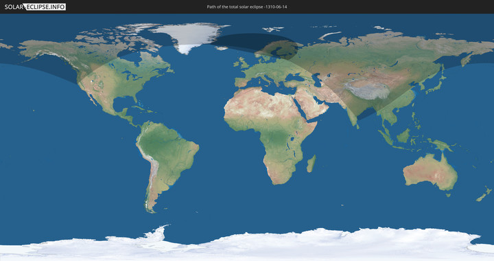
Totale Sonnenfinsternis vom 14.06.-1310
| Wochentag: | Donnerstag |
| Maximale Dauer der Verfinsterung: | 02m48s |
| Maximale Breite des Finsternispfades: | 0 km |
| Saroszyklus: | 45 |
| Bedeckungsgrad: | 100% |
| Magnitude: | 1.0593 |
| Gamma: | 0.9907 |
Wo kann man die Sonnenfinsternis vom 14.06.-1310 sehen?
Die Sonnenfinsternis am 14.06.-1310 kann man in 28 Ländern als partielle Sonnenfinsternis beobachten.
Der Finsternispfad verläuft durch 10 Länder. Nur in diesen Ländern ist sie als totale Sonnenfinsternis zu sehen.
In den folgenden Ländern ist die Sonnenfinsternis total zu sehen
In den folgenden Ländern ist die Sonnenfinsternis partiell zu sehen
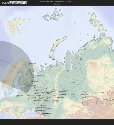
 Russland
 Vereinigte Staaten
 Kanada
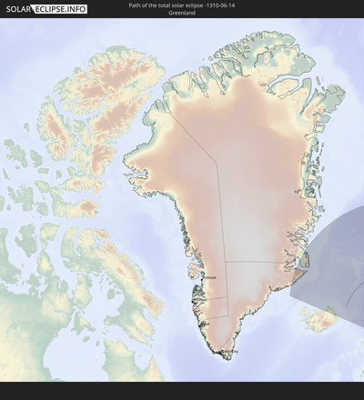
 Grönland
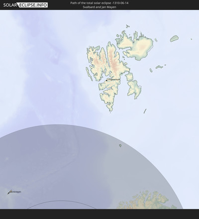
 Spitzbergen
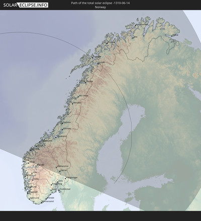
 Norwegen
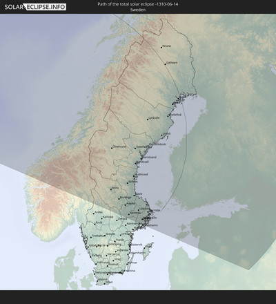
 Schweden
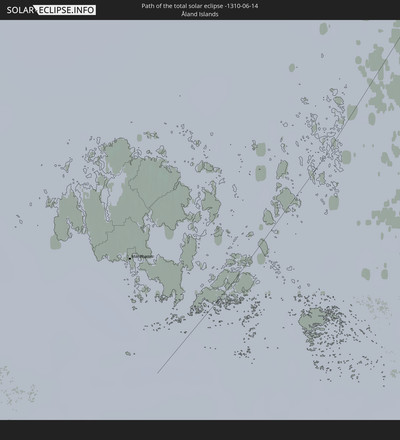
 Åland Islands
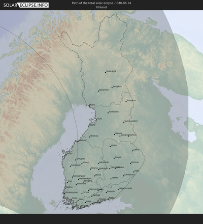
 Finnland
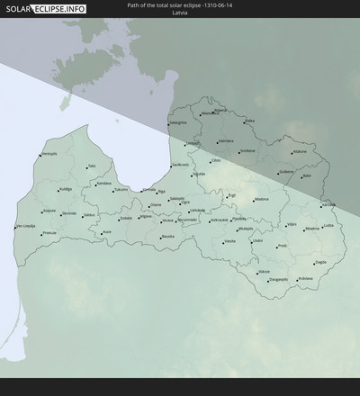
 Lettland
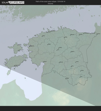
 Estland
 Weißrussland
 Iran
Iran
 Kasachstan
 Turkmenistan
 Usbekistan
 Afghanistan
 Pakistan
 Tadschikistan
 Indien
 Kirgisistan
 Volksrepublik China
 Nepal
Nepal
 Mongolei
 Bangladesch
 Bhutan
 Myanmar
 Nordkorea
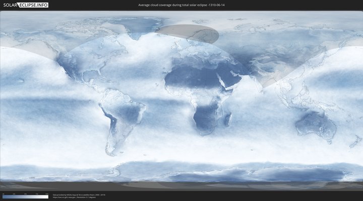
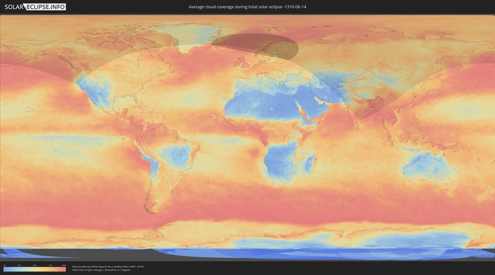
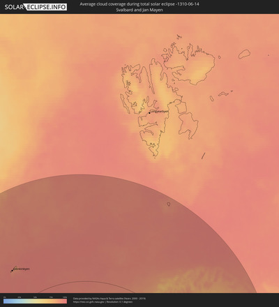
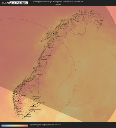
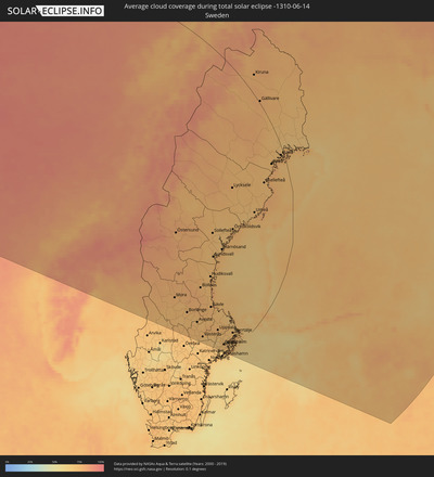
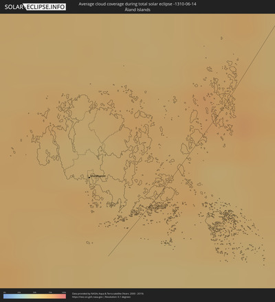
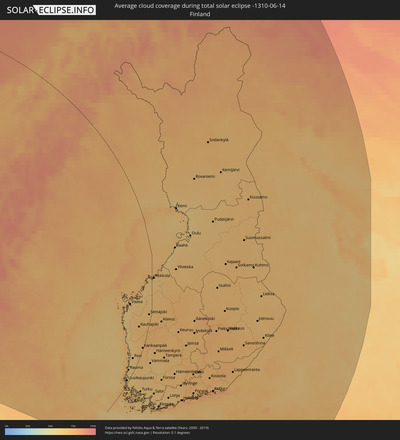
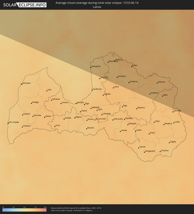
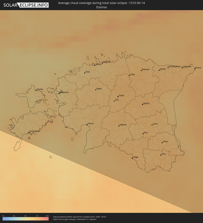
Wie wird das Wetter während der totalen Sonnenfinsternis am 14.06.-1310?
Wo ist der beste Ort, um die totale Sonnenfinsternis vom 14.06.-1310 zu beobachten?
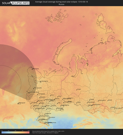
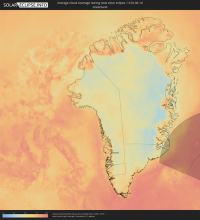
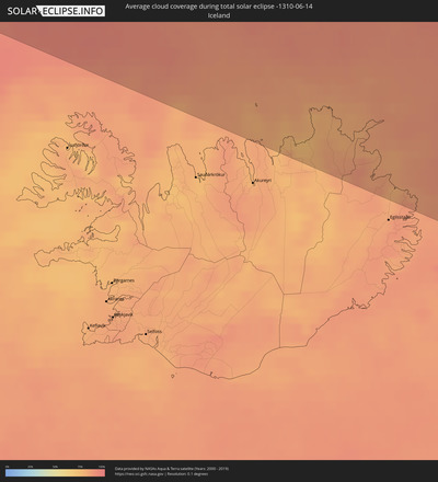
Die folgenden Karten zeigen die durchschnittliche Bewölkung für den Tag, an dem die totale Sonnenfinsternis
stattfindet. Mit Hilfe der Karten lässt sich der Ort entlang des Finsternispfades eingrenzen,
der die besten Aussichen auf einen klaren wolkenfreien Himmel bietet.
Trotzdem muss man immer lokale Gegenenheiten beachten und sollte sich genau über das Wetter an seinem
gewählten Beobachtungsort informieren.
Die Daten stammen von den beiden NASA-Satelliten
AQUA und TERRA
und wurden über einen Zeitraum von 19 Jahren (2000 - 2019) gemittelt.
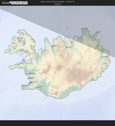
Detaillierte Länderkarten
Orte im Finsternispfad
Die nachfolgene Tabelle zeigt Städte und Orte mit mehr als 5.000 Einwohnern, die sich im Finsternispfad befinden. Städte mit mehr als 100.000 Einwohnern sind dick gekennzeichnet. Mit einem Klick auf den Ort öffnet sich eine Detailkarte die die Lage des jeweiligen Ortes zusammen mit dem Verlauf der zentralen Finsternis präsentiert.
| Ort | Typ | Dauer der Verfinsterung | Ortszeit bei maximaler Verfinsterung | Entfernung zur Zentrallinie | Ø Bewölkung |
 Egilsstaðir, East
|
total | - | 00:29:10 UTC-01:28 | 194 km | 84% |
 Olonkinbyen, Jan Mayen
|
total | - | 02:56:48 UTC+01:00 | 217 km | 88% |
 Førde, Sogn og Fjordane
|
total | - | 02:42:15 UTC+01:00 | 797 km | 80% |
 Ålesund, Møre og Romsdal
|
total | - | 02:42:52 UTC+01:00 | 804 km | 82% |
 Molde, Møre og Romsdal
|
total | - | 02:42:29 UTC+01:00 | 764 km | 84% |
 Kristiansund, Møre og Romsdal
|
total | - | 02:42:27 UTC+01:00 | 744 km | 79% |
 Trondheim, Sør-Trøndelag
|
total | - | 02:41:12 UTC+01:00 | 621 km | 81% |
 Lillehammer, Oppland
|
total | - | 02:39:08 UTC+01:00 | 548 km | 73% |
 Gjøvik, Oppland
|
total | - | 02:38:43 UTC+01:00 | 530 km | 73% |
 Stjørdalshalsen, Nord-Trøndelag
|
total | - | 02:40:55 UTC+01:00 | 596 km | 84% |
 Brumunddal, Hedmark
|
total | - | 02:38:39 UTC+01:00 | 518 km | 72% |
 Hamar, Hedmark
|
total | - | 02:38:29 UTC+01:00 | 510 km | 73% |
 Jessheim, Akershus
|
total | - | 02:37:52 UTC+01:00 | 498 km | 69% |
 Råholt, Akershus
|
total | - | 02:37:58 UTC+01:00 | 498 km | 71% |
 Steinkjer, Nord-Trøndelag
|
total | - | 02:41:06 UTC+01:00 | 539 km | 82% |
 Namsos, Nord-Trøndelag
|
total | - | 02:41:30 UTC+01:00 | 507 km | 82% |
 Elverum, Hedmark
|
total | - | 02:38:16 UTC+01:00 | 485 km | 75% |
 Kongsvinger, Hedmark
|
total | - | 02:37:24 UTC+01:00 | 452 km | 70% |
 Mosjøen, Nordland
|
total | - | 02:41:54 UTC+01:00 | 344 km | 84% |
 Mo i Rana, Nordland
|
total | - | 02:41:52 UTC+01:00 | 276 km | 85% |
 Bodø, Nordland
|
total | - | 02:42:42 UTC+01:00 | 187 km | 77% |
 Östersund, Jämtland
|
total | - | 02:38:35 UTC+01:00 | 423 km | 77% |
 Örebro, Örebro
|
total | - | 02:34:35 UTC+01:00 | 281 km | 72% |
 Borlänge, Dalarna
|
total | - | 02:35:34 UTC+01:00 | 269 km | 75% |
 Falun, Dalarna
|
total | - | 02:35:34 UTC+01:00 | 263 km | 75% |
 Eskilstuna, Södermanland
|
total | - | 02:33:52 UTC+01:00 | 207 km | 71% |
 Harstad, Troms
|
total | - | 02:43:16 UTC+01:00 | 0 km | 76% |
 Västerås, Västmanland
|
total | - | 02:34:05 UTC+01:00 | 199 km | 69% |
 Sandviken, Gävleborg
|
total | - | 02:34:55 UTC+01:00 | 206 km | 75% |
 Enköping, Uppsala
|
total | - | 02:33:47 UTC+01:00 | 170 km | 69% |
 Gävle, Gävleborg
|
total | - | 02:34:45 UTC+01:00 | 190 km | 73% |
 Sundsvall, Västernorrland
|
total | - | 02:36:21 UTC+01:00 | 275 km | 71% |
 Narvik, Nordland
|
total | - | 02:42:30 UTC+01:00 | 7 km | 82% |
 Södertälje, Stockholm
|
total | - | 02:33:02 UTC+01:00 | 154 km | 70% |
 Uppsala, Uppsala
|
total | - | 02:33:40 UTC+01:00 | 137 km | 76% |
 Upplands Väsby, Stockholm
|
total | - | 02:33:10 UTC+01:00 | 126 km | 72% |
 Stockholm, Stockholm
|
total | - | 02:32:54 UTC+01:00 | 124 km | 72% |
 Haninge, Stockholm
|
total | - | 02:32:42 UTC+01:00 | 129 km | 70% |
 Åkersberga, Stockholm
|
total | - | 02:32:54 UTC+01:00 | 106 km | 71% |
 Örnsköldsvik, Västernorrland
|
total | - | 02:36:29 UTC+01:00 | 214 km | 72% |
 Tromsø, Troms
|
total | - | 02:43:10 UTC+01:00 | 134 km | 80% |
 Mariehamn, Mariehamns stad
|
total | - | 03:12:22 UTC+01:39 | 29 km | 71% |
 Kiruna, Norrbotten
|
total | - | 02:40:38 UTC+01:00 | 35 km | 76% |
 Umeå, Västerbotten
|
total | - | 02:36:15 UTC+01:00 | 135 km | 71% |
 Skellefteå, Västerbotten
|
total | - | 02:36:54 UTC+01:00 | 88 km | 71% |
 Piteå, Norrbotten
|
total | - | 02:37:15 UTC+01:00 | 49 km | 72% |
 Rauma, Satakunta
|
total | - | 03:12:33 UTC+01:39 | 18 km | 62% |
 Vaasa, Ostrobothnia
|
total | - | 03:14:35 UTC+01:39 | 76 km | 66% |
 Boden, Norrbotten
|
total | - | 02:37:43 UTC+01:00 | 21 km | 72% |
 Pori, Satakunta
|
total | - | 03:12:47 UTC+01:39 | 21 km | 65% |
 Luleå, Norrbotten
|
total | - | 02:37:14 UTC+01:00 | 10 km | 72% |
 Turku, Southwest Finland
|
total | - | 03:11:25 UTC+01:39 | 54 km | 66% |
 Kuressaare, Saare
|
total | - | 03:08:10 UTC+01:39 | 220 km | 71% |
 Kokkola, Central Ostrobothnia
|
total | - | 03:14:38 UTC+01:39 | 7 km | 66% |
 Alta, Finnmark Fylke
|
total | - | 02:41:49 UTC+01:00 | 278 km | 77% |
 Haapsalu, Lääne
|
total | - | 03:08:17 UTC+01:39 | 210 km | 63% |
 Tampere, Pirkanmaa
|
total | - | 03:11:43 UTC+01:39 | 77 km | 70% |
 Lohja, Uusimaa
|
total | - | 03:10:13 UTC+01:39 | 151 km | 67% |
 Salacgrīva, Salacgrīvas
|
total | - | 03:04:08 UTC+01:36 | 335 km | 63% |
 Keila, Harjumaa
|
total | - | 03:08:11 UTC+01:39 | 225 km | 65% |
 Hämeenlinna, Häme
|
total | - | 03:10:48 UTC+01:39 | 133 km | 70% |
 Pärnu, Pärnumaa
|
total | - | 03:07:09 UTC+01:39 | 293 km | 66% |
 Espoo, Uusimaa
|
total | - | 03:09:50 UTC+01:39 | 182 km | 73% |
 Limbaži, Limbažu Rajons
|
total | - | 03:03:39 UTC+01:36 | 369 km | 66% |
 Tallinn, Harjumaa
|
total | - | 03:08:08 UTC+01:39 | 232 km | 65% |
 Rapla, Raplamaa
|
total | - | 03:07:39 UTC+01:39 | 262 km | 69% |
 Nurmijärvi, Uusimaa
|
total | - | 03:10:02 UTC+01:39 | 175 km | 71% |
 Hyvinge, Uusimaa
|
total | - | 03:10:12 UTC+01:39 | 169 km | 72% |
 Aloja, Aloja
|
total | - | 03:03:50 UTC+01:36 | 356 km | 69% |
 Helsinki, Uusimaa
|
total | - | 03:09:39 UTC+01:39 | 197 km | 76% |
 Maardu, Harjumaa
|
total | - | 03:08:01 UTC+01:39 | 242 km | 63% |
 Stalbe, Pārgaujas
|
total | - | 03:03:19 UTC+01:36 | 393 km | 71% |
 Vantaa, Uusimaa
|
total | - | 03:09:44 UTC+01:39 | 195 km | 71% |
 Mazsalaca, Mazsalaca
|
total | - | 03:03:50 UTC+01:36 | 356 km | 69% |
 Järvenpää, Uusimaa
|
total | - | 03:09:54 UTC+01:39 | 188 km | 72% |
 Matīši, Burtnieki
|
total | - | 03:03:36 UTC+01:36 | 373 km | 69% |
 Cēsis, Cēsu Rajons
|
total | - | 03:03:07 UTC+01:36 | 408 km | 74% |
 Rūjiena, Rūjienas
|
total | - | 03:03:43 UTC+01:36 | 365 km | 69% |
 Kocēni, Kocēni
|
total | - | 03:03:18 UTC+01:36 | 395 km | 73% |
 Priekuļi, Priekuļi
|
total | - | 03:03:04 UTC+01:36 | 412 km | 73% |
 Valmiera, Valmieras Rajons
|
total | - | 03:03:16 UTC+01:36 | 397 km | 73% |
 Türi, Järvamaa
|
total | - | 03:07:04 UTC+01:39 | 304 km | 71% |
 Naukšēni, Naukšēni
|
total | - | 03:03:37 UTC+01:36 | 372 km | 72% |
 Oulu, Northern Ostrobothnia
|
total | - | 03:14:52 UTC+01:39 | 127 km | 64% |
 Murmuiža, Beverīna
|
total | - | 03:03:11 UTC+01:36 | 404 km | 72% |
 Paide, Järvamaa
|
total | - | 03:07:05 UTC+01:39 | 305 km | 73% |
 Viljandi, Viljandimaa
|
total | - | 03:06:30 UTC+01:39 | 343 km | 71% |
 Lahti, Päijänne Tavastia
|
total | - | 03:10:10 UTC+01:39 | 192 km | 74% |
 Porvoo, Uusimaa
|
total | - | 03:09:30 UTC+01:39 | 220 km | 71% |
 Strenči, Strenči
|
total | - | 03:03:13 UTC+01:36 | 401 km | 70% |
 Jyväskylä, Central Finland
|
total | - | 03:11:33 UTC+01:39 | 152 km | 74% |
 Smiltene, Smiltene
|
total | - | 03:02:52 UTC+01:36 | 426 km | 72% |
 Tapa, Lääne-Virumaa
|
total | - | 03:07:16 UTC+01:39 | 299 km | 74% |
 Valka, Valkas Rajons
|
total | - | 03:03:11 UTC+01:36 | 404 km | 72% |
 Valga, Valgamaa
|
total | - | 03:05:36 UTC+01:39 | 406 km | 72% |
 Jaunpiebalga, Jaunpiebalga
|
total | - | 03:02:32 UTC+01:36 | 451 km | 73% |
 Rakvere, Lääne-Virumaa
|
total | - | 03:07:09 UTC+01:39 | 313 km | 74% |
 Jõgeva, Jõgevamaa
|
total | - | 03:06:28 UTC+01:39 | 353 km | 72% |
 Elva, Tartu
|
total | - | 03:05:52 UTC+01:39 | 390 km | 72% |
 Ape, Apes Novads
|
total | - | 03:02:32 UTC+01:36 | 452 km | 73% |
 Tartu, Tartu
|
total | - | 03:05:52 UTC+01:39 | 393 km | 73% |
 Gulbene, Gulbenes Rajons
|
total | - | 03:02:07 UTC+01:36 | 482 km | 70% |
 Kotka, Kymenlaakso
|
total | - | 03:08:55 UTC+01:39 | 279 km | 78% |
 Kiviõli, Ida-Virumaa
|
total | - | 03:06:49 UTC+01:39 | 342 km | 73% |
 Võru, Võrumaa
|
total | - | 03:05:06 UTC+01:39 | 445 km | 73% |
 Alūksne, Alūksnes Rajons
|
total | - | 03:02:12 UTC+01:36 | 477 km | 72% |
 Põlva, Põlvamaa
|
total | - | 03:05:20 UTC+01:39 | 431 km | 71% |
 Balvi, Balvu Rajons
|
total | - | 03:01:46 UTC+01:36 | 508 km | 72% |
 Mikkeli, Southern Savonia
|
total | - | 03:10:08 UTC+01:39 | 247 km | 74% |
 Kohtla-Järve, Ida-Virumaa
|
total | - | 03:06:42 UTC+01:39 | 354 km | 71% |
 Jõhvi, Ida-Virumaa
|
total | - | 03:06:35 UTC+01:39 | 363 km | 71% |
 Viļaka, Viļaka
|
total | - | 03:01:35 UTC+01:36 | 522 km | 73% |
 Kuopio, Northern Savo
|
total | - | 03:11:20 UTC+01:39 | 237 km | 72% |
 Kārsava, Karsava
|
total | - | 03:01:08 UTC+01:36 | 553 km | 71% |
 Sillamäe, Ida-Virumaa
|
total | - | 03:06:26 UTC+01:39 | 377 km | 72% |
 Lappeenranta, South Karelia
|
total | - | 03:08:56 UTC+01:39 | 315 km | 75% |
 Narva, Ida-Virumaa
|
total | - | 03:06:11 UTC+01:39 | 399 km | 72% |
 Pskov, Pskov
|
total | - | 03:55:37 UTC+02:30 | 507 km | 71% |
 Kingisepp, Leningradskaya Oblast'
|
total | - | 03:57:14 UTC+02:30 | 419 km | 75% |
 Vyborg, Leningradskaya Oblast'
|
total | - | 03:58:43 UTC+02:30 | 357 km | 72% |
 Sosnovyy Bor, Leningradskaya Oblast'
|
total | - | 03:57:36 UTC+02:30 | 414 km | 73% |
 Joensuu, North Karelia
|
total | - | 03:10:00 UTC+01:39 | 346 km | 69% |
 Luga, Leningradskaya Oblast'
|
total | - | 03:55:51 UTC+02:30 | 517 km | 76% |
 Peterhof, St.-Petersburg
|
total | - | 03:57:10 UTC+02:30 | 455 km | 74% |
 Kurortnyy, Leningradskaya Oblast'
|
total | - | 03:57:29 UTC+02:30 | 441 km | 73% |
 Krasnoye Selo, St.-Petersburg
|
total | - | 03:56:53 UTC+02:30 | 472 km | 75% |
 Gatchina, Leningradskaya Oblast'
|
total | - | 03:56:41 UTC+02:30 | 483 km | 75% |
 Sertolovo, Leningradskaya Oblast'
|
total | - | 03:57:19 UTC+02:30 | 456 km | 71% |
 Saint Petersburg, St.-Petersburg
|
total | - | 03:57:01 UTC+02:30 | 473 km | 78% |
 Kolpino, St.-Petersburg
|
total | - | 03:56:39 UTC+02:30 | 496 km | 74% |
 Vsevolozhsk, Leningradskaya Oblast'
|
total | - | 03:56:55 UTC+02:30 | 486 km | 71% |
 Tosno, Leningradskaya Oblast'
|
total | - | 03:56:15 UTC+02:30 | 522 km | 75% |
 Velikiy Novgorod, Novgorod
|
total | - | 03:54:51 UTC+02:30 | 599 km | 72% |
 Kirishi, Leningradskaya Oblast'
|
total | - | 03:55:33 UTC+02:30 | 583 km | 77% |
 Volkhov, Leningradskaya Oblast'
|
total | - | 03:55:59 UTC+02:30 | 573 km | 71% |
 Monchegorsk, Murmansk
|
total | - | 04:05:57 UTC+02:30 | 516 km | 74% |
 Murmansk, Murmansk
|
total | - | 04:07:16 UTC+02:30 | 558 km | 81% |
 Apatity, Murmansk
|
total | - | 04:05:15 UTC+02:30 | 528 km | 70% |
 Severomorsk, Murmansk
|
total | - | 04:07:17 UTC+02:30 | 573 km | 82% |
 Tikhvin, Leningradskaya Oblast'
|
total | - | 03:55:03 UTC+02:30 | 647 km | 73% |
 Petrozavodsk, Republic of Karelia
|
total | - | 03:57:20 UTC+02:30 | 598 km | 67% |
