Ringförmige Sonnenfinsternis vom 20.01.0204
| Wochentag: | Freitag |
| Maximale Dauer der Verfinsterung: | 07m51s |
| Maximale Breite des Finsternispfades: | 256 km |
| Saroszyklus: | 73 |
| Bedeckungsgrad: | 93.2% |
| Magnitude: | 0.9324 |
| Gamma: | -0.1522 |
Wo kann man die Sonnenfinsternis vom 20.01.0204 sehen?
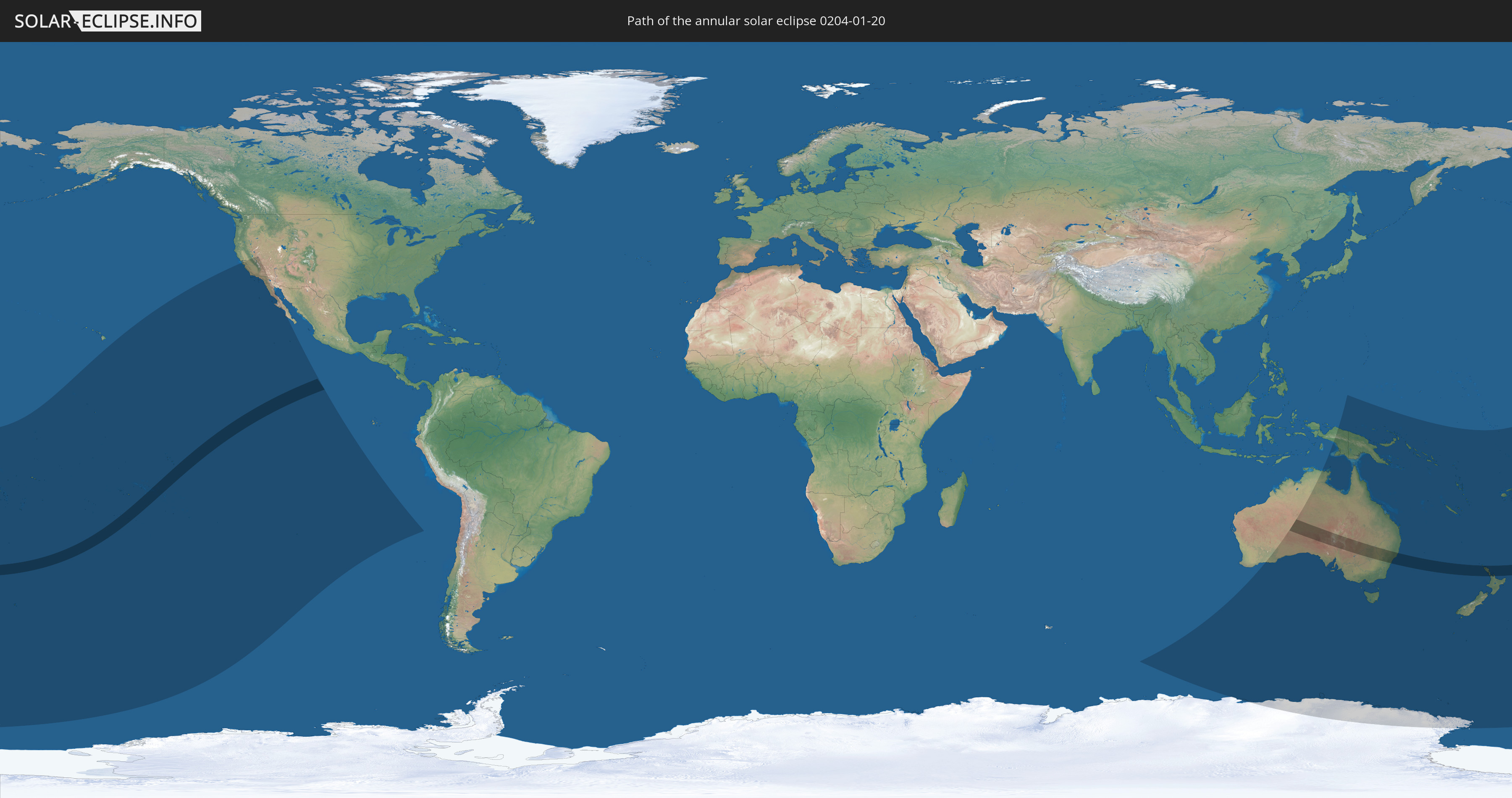
Die Sonnenfinsternis am 20.01.0204 kann man in 25 Ländern als partielle Sonnenfinsternis beobachten.
Der Finsternispfad verläuft durch 4 Länder. Nur in diesen Ländern ist sie als ringförmige Sonnenfinsternis zu sehen.
In den folgenden Ländern ist die Sonnenfinsternis ringförmig zu sehen
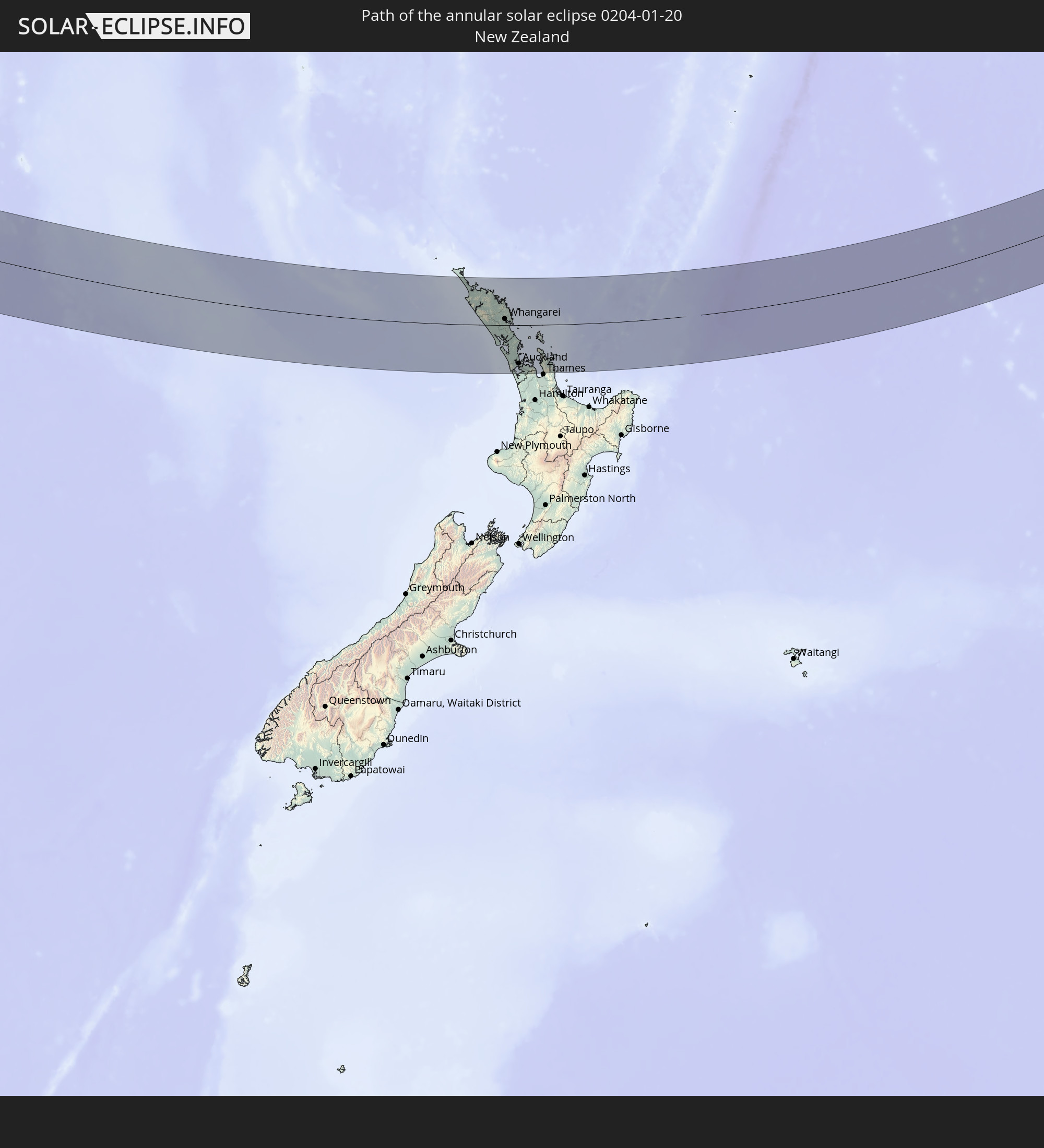 Neuseeland
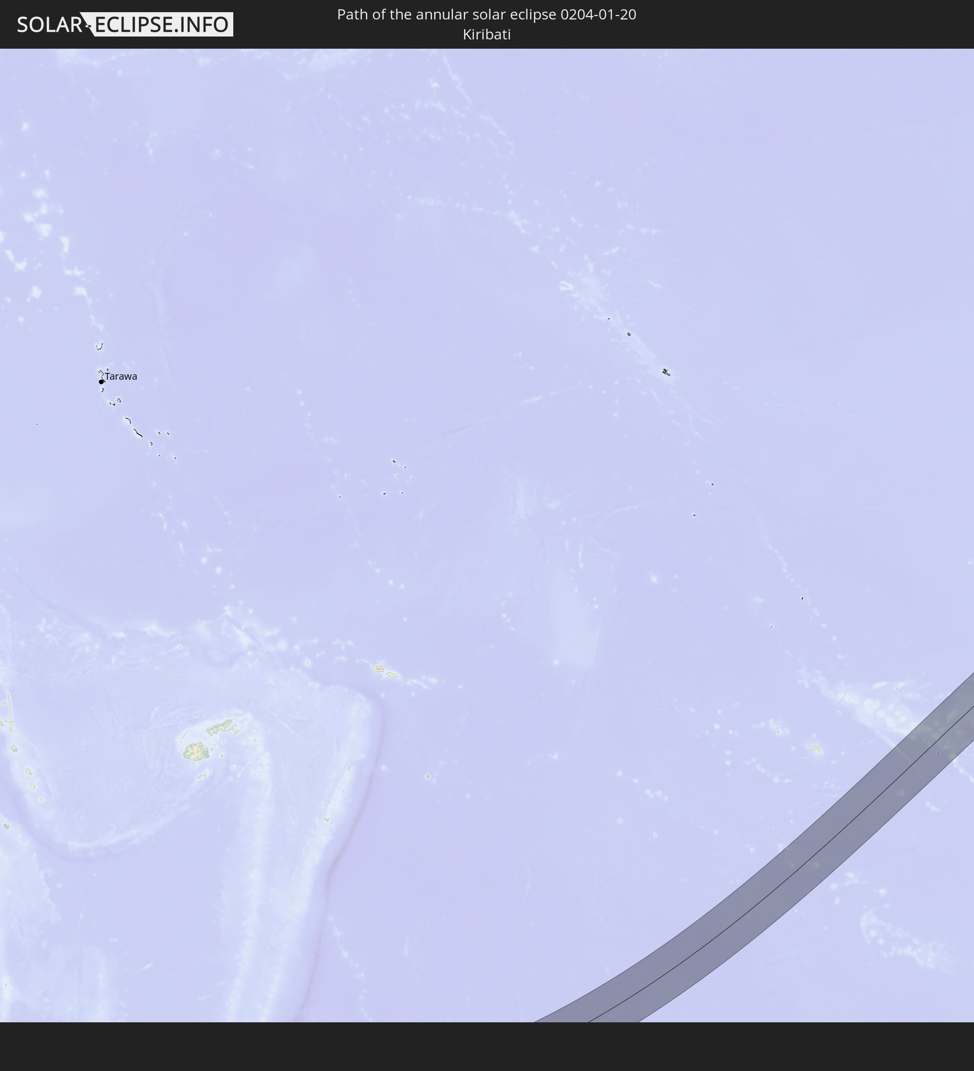 Kiribati
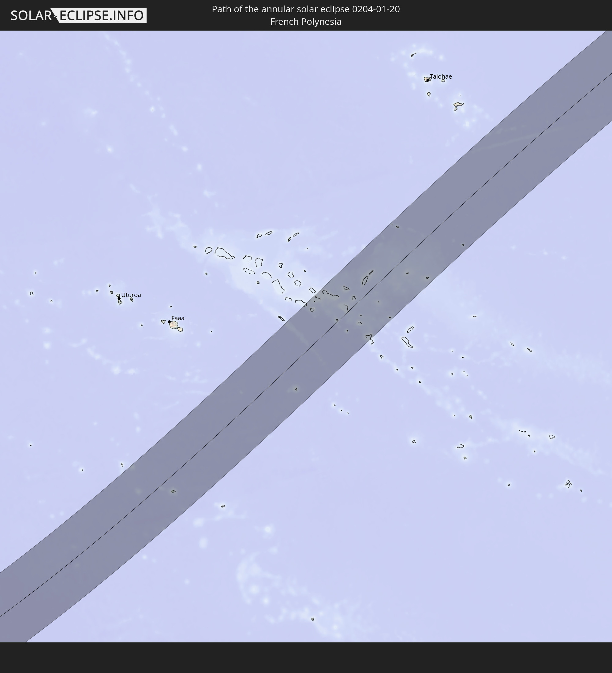 Französisch-Polynesien
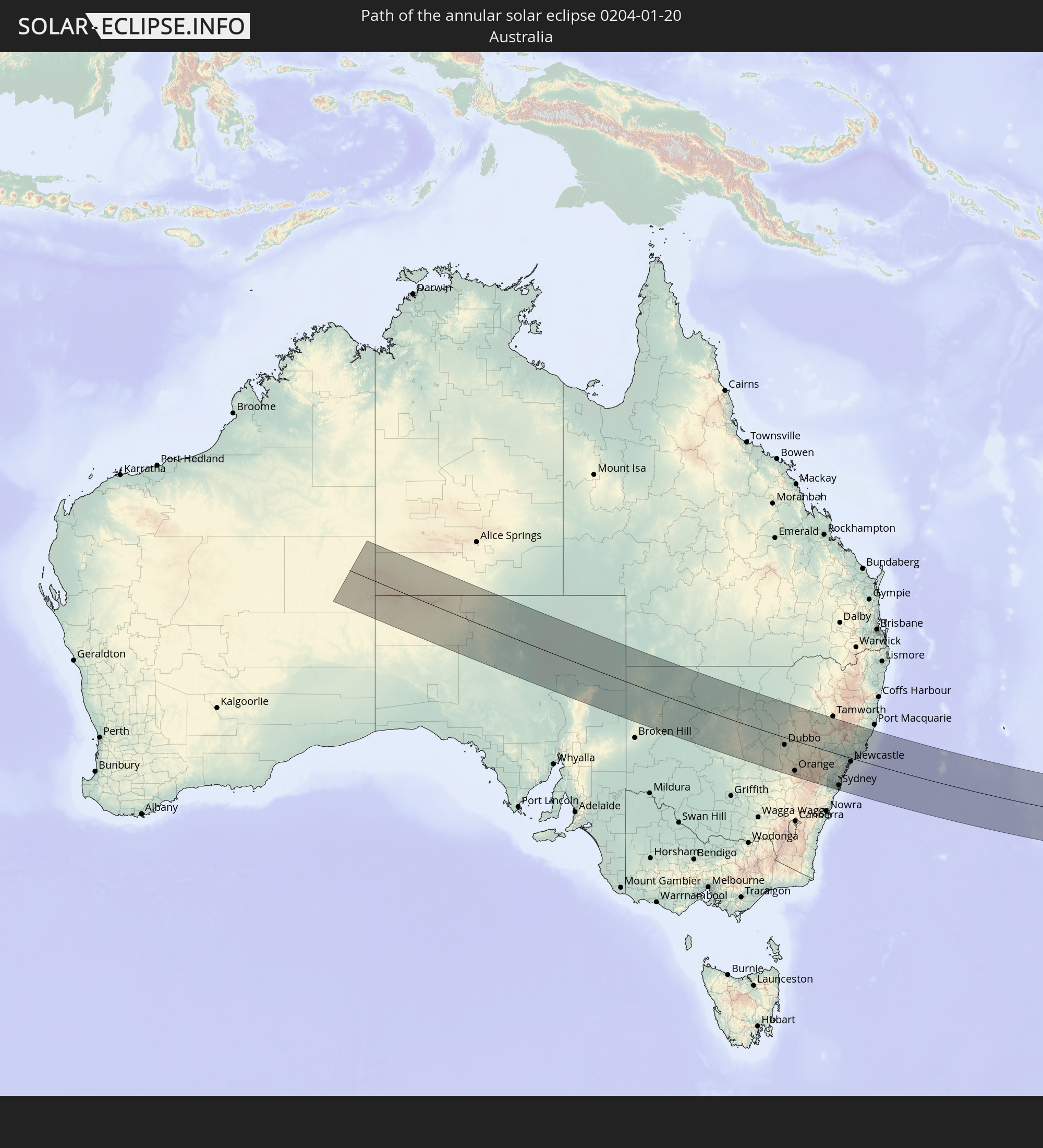 Australien
In den folgenden Ländern ist die Sonnenfinsternis partiell zu sehen
 Fidschi
 Antarktika
 Vereinigte Staaten
 Neuseeland
 United States Minor Outlying Islands
 Wallis und Futuna
 Tonga
Tonga
 Kiribati
 Samoa
Samoa
 Tokelau
 Amerikanisch-Samoa
 Niue
Niue
 Cookinseln
 Französisch-Polynesien
 Pitcairninseln
 Mexiko
 Chile
Chile
 Indonesien
 Australien
 Papua-Neuguinea
 Salomonen
 Neukaledonien
 Vanuatu
 Norfolkinsel
 Tuvalu
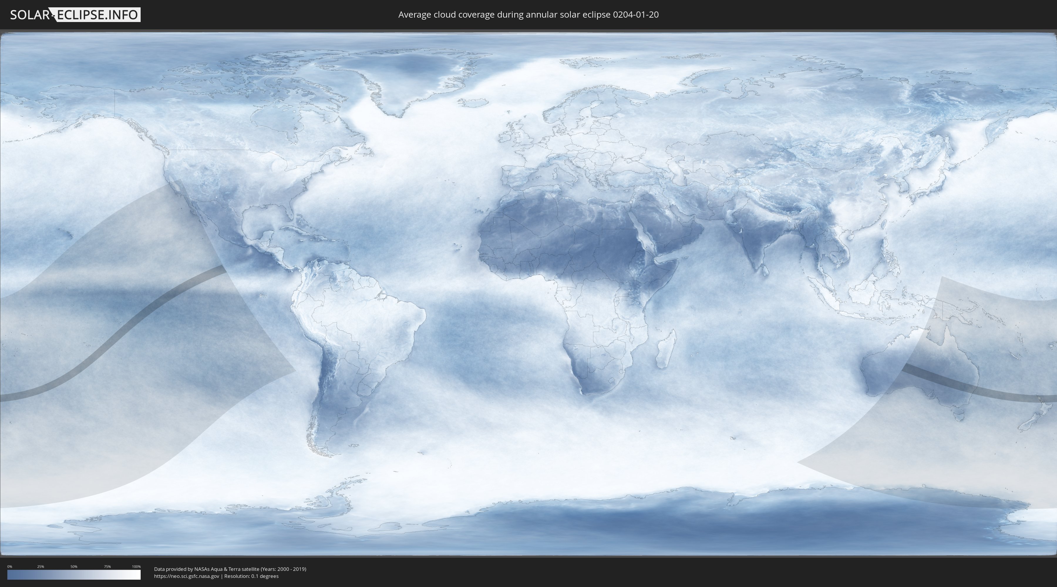
Wie wird das Wetter während der ringförmigen Sonnenfinsternis am 20.01.0204?
Wo ist der beste Ort, um die ringförmige Sonnenfinsternis vom 20.01.0204 zu beobachten?
Die folgenden Karten zeigen die durchschnittliche Bewölkung für den Tag, an dem die ringförmige Sonnenfinsternis
stattfindet. Mit Hilfe der Karten lässt sich der Ort entlang des Finsternispfades eingrenzen,
der die besten Aussichen auf einen klaren wolkenfreien Himmel bietet.
Trotzdem muss man immer lokale Gegenenheiten beachten und sollte sich genau über das Wetter an seinem
gewählten Beobachtungsort informieren.
Die Daten stammen von den beiden NASA-Satelliten
AQUA und TERRA
und wurden über einen Zeitraum von 19 Jahren (2000 - 2019) gemittelt.

Detaillierte Länderkarten
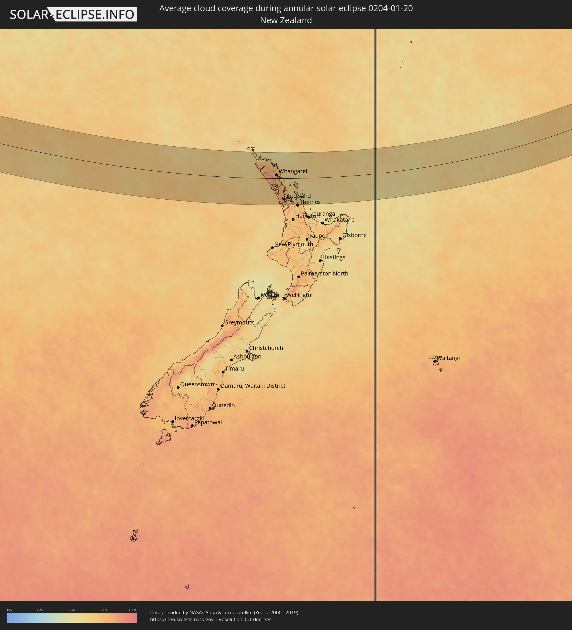 Neuseeland
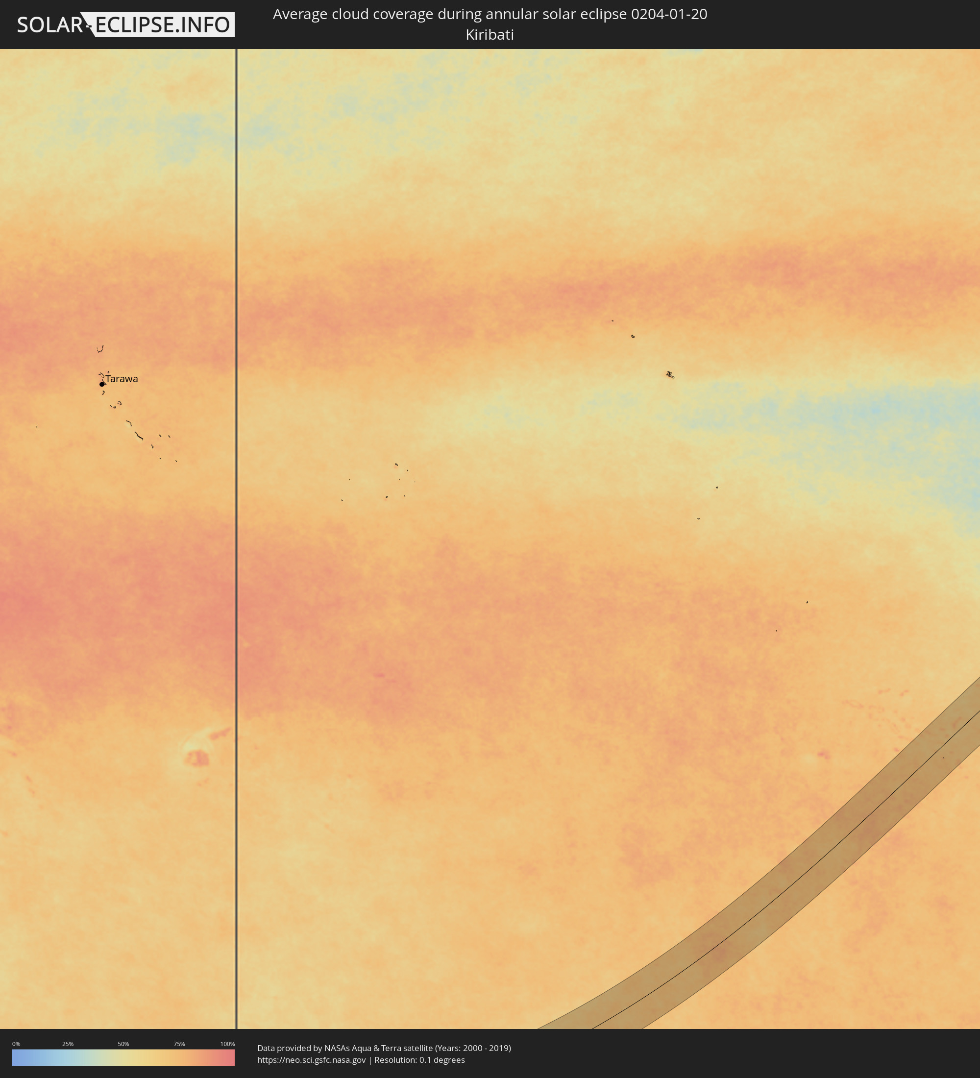 Kiribati
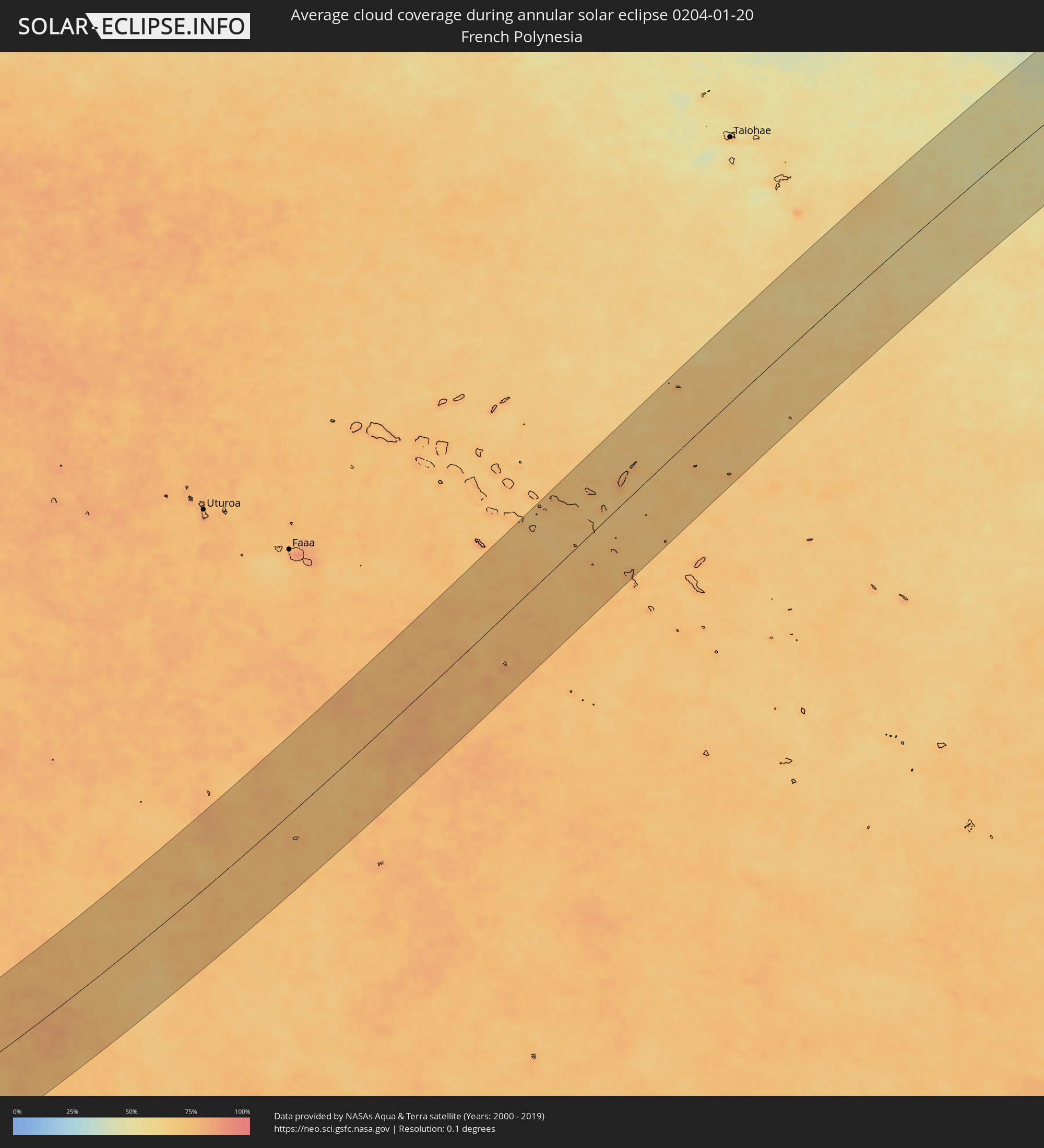 Französisch-Polynesien
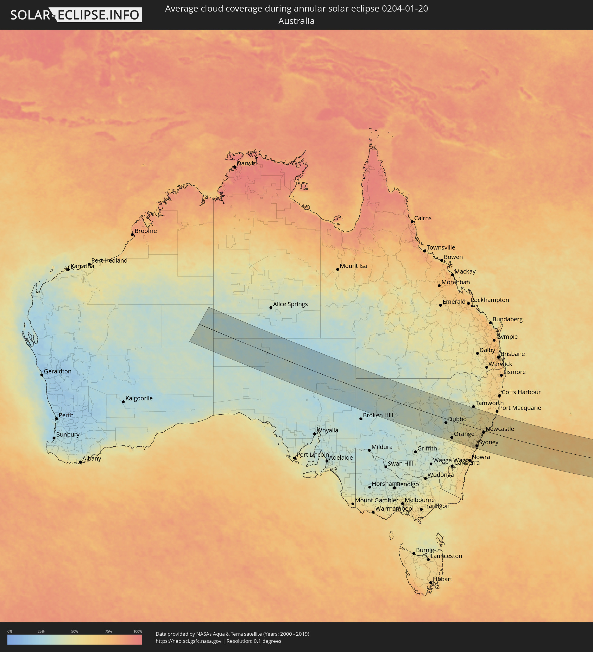 Australien
Orte im Finsternispfad
Die nachfolgene Tabelle zeigt Städte und Orte mit mehr als 5.000 Einwohnern, die sich im Finsternispfad befinden. Städte mit mehr als 100.000 Einwohnern sind dick gekennzeichnet. Mit einem Klick auf den Ort öffnet sich eine Detailkarte die die Lage des jeweiligen Ortes zusammen mit dem Verlauf der zentralen Finsternis präsentiert.
| Ort | Typ | Dauer der Verfinsterung | Ortszeit bei maximaler Verfinsterung | Entfernung zur Zentrallinie | Ø Bewölkung |
|
Parkes, New South Wales
|
ringförmig | - | 07:12:29 UTC+10:00 | 139 km | 43% |
|
Dubbo, New South Wales
|
ringförmig | - | 07:11:57 UTC+10:00 | 32 km | 39% |
|
Orange, New South Wales
|
ringförmig | - | 07:13:08 UTC+10:00 | 128 km | 49% |
|
Bathurst, New South Wales
|
ringförmig | - | 07:13:31 UTC+10:00 | 128 km | 51% |
|
Mudgee, New South Wales
|
ringförmig | - | 07:12:49 UTC+10:00 | 41 km | 47% |
|
Kelso, New South Wales
|
ringförmig | - | 07:13:32 UTC+10:00 | 128 km | 51% |
|
Lithgow, New South Wales
|
ringförmig | - | 07:13:55 UTC+10:00 | 120 km | 55% |
|
Gunnedah, New South Wales
|
ringförmig | - | 07:11:54 UTC+10:00 | 150 km | 40% |
|
Katoomba, New South Wales
|
ringförmig | - | 07:14:14 UTC+10:00 | 140 km | 58% |
|
Blaxland, New South Wales
|
ringförmig | - | 07:14:27 UTC+10:00 | 135 km | 55% |
|
Glenmore Park, New South Wales
|
ringförmig | - | 07:14:32 UTC+10:00 | 138 km | 55% |
|
Cambridge Park, New South Wales
|
ringförmig | - | 07:14:32 UTC+10:00 | 132 km | 55% |
|
South Windsor, New South Wales
|
ringförmig | - | 07:14:28 UTC+10:00 | 116 km | 55% |
|
Riverstone, New South Wales
|
ringförmig | - | 07:14:34 UTC+10:00 | 121 km | 55% |
|
Muswellbrook, New South Wales
|
ringförmig | - | 07:13:22 UTC+10:00 | 31 km | 49% |
|
Glenfield, New South Wales
|
ringförmig | - | 07:14:50 UTC+10:00 | 150 km | 57% |
|
Cabramatta West, New South Wales
|
ringförmig | - | 07:14:47 UTC+10:00 | 143 km | 58% |
|
Rouse Hill, New South Wales
|
ringförmig | - | 07:14:36 UTC+10:00 | 120 km | 55% |
|
Blacktown, New South Wales
|
ringförmig | - | 07:14:40 UTC+10:00 | 129 km | 57% |
|
Stanhope Gardens, New South Wales
|
ringförmig | - | 07:14:38 UTC+10:00 | 124 km | 55% |
|
Fairfield Heights, New South Wales
|
ringförmig | - | 07:14:46 UTC+10:00 | 138 km | 58% |
|
Beaumont Hills, New South Wales
|
ringförmig | - | 07:14:38 UTC+10:00 | 121 km | 55% |
|
Chipping Norton, New South Wales
|
ringförmig | - | 07:14:49 UTC+10:00 | 142 km | 57% |
|
Northmead, New South Wales
|
ringförmig | - | 07:14:44 UTC+10:00 | 129 km | 57% |
|
Merrylands, New South Wales
|
ringförmig | - | 07:14:47 UTC+10:00 | 134 km | 57% |
|
Glenhaven, New South Wales
|
ringförmig | - | 07:14:40 UTC+10:00 | 119 km | 57% |
|
Bankstown, New South Wales
|
ringförmig | - | 07:14:53 UTC+10:00 | 141 km | 57% |
|
Berala, New South Wales
|
ringförmig | - | 07:14:51 UTC+10:00 | 137 km | 57% |
|
Lugarno, New South Wales
|
ringförmig | - | 07:14:57 UTC+10:00 | 148 km | 57% |
|
Ermington, New South Wales
|
ringförmig | - | 07:14:48 UTC+10:00 | 130 km | 58% |
|
Beecroft, New South Wales
|
ringförmig | - | 07:14:45 UTC+10:00 | 123 km | 57% |
|
Oatley, New South Wales
|
ringförmig | - | 07:14:58 UTC+10:00 | 147 km | 57% |
|
Pennant Hills, New South Wales
|
ringförmig | - | 07:14:45 UTC+10:00 | 121 km | 57% |
|
Mortdale, New South Wales
|
ringförmig | - | 07:14:58 UTC+10:00 | 145 km | 57% |
|
Belfield, New South Wales
|
ringförmig | - | 07:14:54 UTC+10:00 | 139 km | 58% |
|
Concord West, New South Wales
|
ringförmig | - | 07:14:51 UTC+10:00 | 133 km | 58% |
|
Hornsby Heights, New South Wales
|
ringförmig | - | 07:14:42 UTC+10:00 | 114 km | 57% |
|
Hornsby, New South Wales
|
ringförmig | - | 07:14:44 UTC+10:00 | 117 km | 57% |
|
Macquarie Park, New South Wales
|
ringförmig | - | 07:14:49 UTC+10:00 | 124 km | 58% |
|
Mount Colah, New South Wales
|
ringförmig | - | 07:14:44 UTC+10:00 | 114 km | 57% |
|
Croydon, New South Wales
|
ringförmig | - | 07:14:54 UTC+10:00 | 136 km | 58% |
|
Summer Hill, New South Wales
|
ringförmig | - | 07:14:56 UTC+10:00 | 136 km | 58% |
|
Pymble, New South Wales
|
ringförmig | - | 07:14:48 UTC+10:00 | 120 km | 57% |
|
Hunters Hill, New South Wales
|
ringförmig | - | 07:14:53 UTC+10:00 | 130 km | 58% |
|
Arncliffe, New South Wales
|
ringförmig | - | 07:14:59 UTC+10:00 | 140 km | 58% |
|
Brighton-Le-Sands, New South Wales
|
ringförmig | - | 07:15:00 UTC+10:00 | 143 km | 58% |
|
Drummoyne, New South Wales
|
ringförmig | - | 07:14:54 UTC+10:00 | 131 km | 56% |
|
Killara, New South Wales
|
ringförmig | - | 07:14:50 UTC+10:00 | 122 km | 54% |
|
Lilyfield, New South Wales
|
ringförmig | - | 07:14:56 UTC+10:00 | 133 km | 56% |
|
Singleton, New South Wales
|
ringförmig | - | 07:13:49 UTC+10:00 | 6 km | 54% |
|
Lane Cove North, New South Wales
|
ringförmig | - | 07:14:52 UTC+10:00 | 126 km | 54% |
|
Lindfield, New South Wales
|
ringförmig | - | 07:14:51 UTC+10:00 | 124 km | 54% |
|
Camperdown, New South Wales
|
ringförmig | - | 07:14:57 UTC+10:00 | 135 km | 56% |
|
Balmain, New South Wales
|
ringförmig | - | 07:14:56 UTC+10:00 | 131 km | 56% |
|
Artarmon, New South Wales
|
ringförmig | - | 07:14:54 UTC+10:00 | 127 km | 54% |
|
Chatswood, New South Wales
|
ringförmig | - | 07:14:53 UTC+10:00 | 125 km | 54% |
|
Wollstonecraft, New South Wales
|
ringförmig | - | 07:14:55 UTC+10:00 | 128 km | 54% |
|
Mascot, New South Wales
|
ringförmig | - | 07:15:00 UTC+10:00 | 138 km | 56% |
|
Botany, New South Wales
|
ringförmig | - | 07:15:01 UTC+10:00 | 140 km | 56% |
|
Haberfield, New South Wales
|
ringförmig | - | 07:14:58 UTC+10:00 | 133 km | 56% |
|
Alexandria, New South Wales
|
ringförmig | - | 07:14:59 UTC+10:00 | 135 km | 56% |
|
North Sydney, New South Wales
|
ringförmig | - | 07:14:56 UTC+10:00 | 128 km | 54% |
|
Sydney, New South Wales
|
ringförmig | - | 07:14:57 UTC+10:00 | 131 km | 56% |
|
Forestville, New South Wales
|
ringförmig | - | 07:14:52 UTC+10:00 | 121 km | 54% |
|
Cammeray, New South Wales
|
ringförmig | - | 07:14:55 UTC+10:00 | 126 km | 54% |
|
Neutral Bay, New South Wales
|
ringförmig | - | 07:14:56 UTC+10:00 | 128 km | 54% |
|
Darlinghurst, New South Wales
|
ringförmig | - | 07:14:58 UTC+10:00 | 132 km | 56% |
|
Matraville, New South Wales
|
ringförmig | - | 07:15:03 UTC+10:00 | 140 km | 58% |
|
Woollahra, New South Wales
|
ringförmig | - | 07:15:00 UTC+10:00 | 133 km | 56% |
|
Bondi Junction, New South Wales
|
ringförmig | - | 07:15:00 UTC+10:00 | 133 km | 56% |
|
Allambie Heights, New South Wales
|
ringförmig | - | 07:14:54 UTC+10:00 | 120 km | 54% |
|
Bellevue Hill, New South Wales
|
ringförmig | - | 07:15:00 UTC+10:00 | 132 km | 53% |
|
Balgowlah, New South Wales
|
ringförmig | - | 07:14:55 UTC+10:00 | 122 km | 53% |
|
Bondi, New South Wales
|
ringförmig | - | 07:15:01 UTC+10:00 | 133 km | 53% |
|
Bronte, New South Wales
|
ringförmig | - | 07:15:01 UTC+10:00 | 134 km | 53% |
|
Bondi Beach, New South Wales
|
ringförmig | - | 07:15:01 UTC+10:00 | 132 km | 53% |
|
North Bondi, New South Wales
|
ringförmig | - | 07:15:01 UTC+10:00 | 132 km | 53% |
|
Freshwater, New South Wales
|
ringförmig | - | 07:14:56 UTC+10:00 | 120 km | 53% |
|
Narrabeen, New South Wales
|
ringförmig | - | 07:14:53 UTC+10:00 | 113 km | 56% |
|
Dee Why, New South Wales
|
ringförmig | - | 07:14:55 UTC+10:00 | 116 km | 53% |
|
Umina, New South Wales
|
ringförmig | - | 07:14:44 UTC+10:00 | 92 km | 57% |
|
Newport, New South Wales
|
ringförmig | - | 07:14:51 UTC+10:00 | 106 km | 56% |
|
Narara, New South Wales
|
ringförmig | - | 07:14:39 UTC+10:00 | 78 km | 56% |
|
Cessnock, New South Wales
|
ringförmig | - | 07:14:10 UTC+10:00 | 17 km | 57% |
|
Berkeley Vale, New South Wales
|
ringförmig | - | 07:14:40 UTC+10:00 | 70 km | 56% |
|
Bateau Bay, New South Wales
|
ringförmig | - | 07:14:43 UTC+10:00 | 73 km | 56% |
|
Kurri Kurri, New South Wales
|
ringförmig | - | 07:14:14 UTC+10:00 | 12 km | 58% |
|
Gorokan, New South Wales
|
ringförmig | - | 07:14:38 UTC+10:00 | 58 km | 57% |
|
Rutherford, New South Wales
|
ringförmig | - | 07:14:11 UTC+10:00 | 0 km | 57% |
|
Maitland, New South Wales
|
ringförmig | - | 07:14:13 UTC+10:00 | 1 km | 57% |
|
Rathmines, New South Wales
|
ringförmig | - | 07:14:30 UTC+10:00 | 33 km | 55% |
|
Eleebana, New South Wales
|
ringförmig | - | 07:14:30 UTC+10:00 | 26 km | 55% |
|
Belmont North, New South Wales
|
ringförmig | - | 07:14:32 UTC+10:00 | 29 km | 55% |
|
Raymond Terrace, New South Wales
|
ringförmig | - | 07:14:22 UTC+10:00 | 2 km | 57% |
|
Newcastle, New South Wales
|
ringförmig | - | 07:14:32 UTC+10:00 | 16 km | 57% |
|
Medowie, New South Wales
|
ringförmig | - | 07:14:27 UTC+10:00 | 6 km | 52% |
|
Port Stephens, New South Wales
|
ringförmig | - | 07:14:34 UTC+10:00 | 15 km | 56% |
|
Nelson Bay, New South Wales
|
ringförmig | - | 07:14:38 UTC+10:00 | 16 km | 56% |
|
Taree, New South Wales
|
ringförmig | - | 07:14:11 UTC+10:00 | 111 km | 53% |
|
Forster, New South Wales
|
ringförmig | - | 07:14:27 UTC+10:00 | 83 km | 58% |
|
Kerikeri, Northland Region
|
ringförmig | - | 09:14:49 UTC+11:30 | 73 km | 77% |
|
Whangarei, Northland Region
|
ringförmig | - | 09:15:41 UTC+11:30 | 17 km | 80% |
|
Waitakere, Auckland
|
ringförmig | - | 09:16:41 UTC+11:30 | 115 km | 75% |
|
North Shore, Auckland
|
ringförmig | - | 09:16:49 UTC+11:30 | 102 km | 73% |
|
Auckland, Auckland
|
ringförmig | - | 09:16:52 UTC+11:30 | 109 km | 75% |
|
Mangere, Auckland
|
ringförmig | - | 09:16:57 UTC+11:30 | 120 km | 72% |
|
Manukau City, Auckland
|
ringförmig | - | 09:17:07 UTC+11:30 | 123 km | 77% |
|
Takanini, Auckland
|
ringförmig | - | 09:17:10 UTC+11:30 | 129 km | 77% |
|
Pakuranga, Auckland
|
ringförmig | - | 09:17:09 UTC+11:30 | 111 km | 76% |
|
Papakura, Auckland
|
ringförmig | - | 09:17:15 UTC+11:30 | 131 km | 77% |