Totale Sonnenfinsternis vom 13.11.0570
| Wochentag: | Dienstag |
| Maximale Dauer der Verfinsterung: | 02m46s |
| Maximale Breite des Finsternispfades: | 180 km |
| Saroszyklus: | 100 |
| Bedeckungsgrad: | 100% |
| Magnitude: | 1.0409 |
| Gamma: | -0.6534 |
Wo kann man die Sonnenfinsternis vom 13.11.0570 sehen?
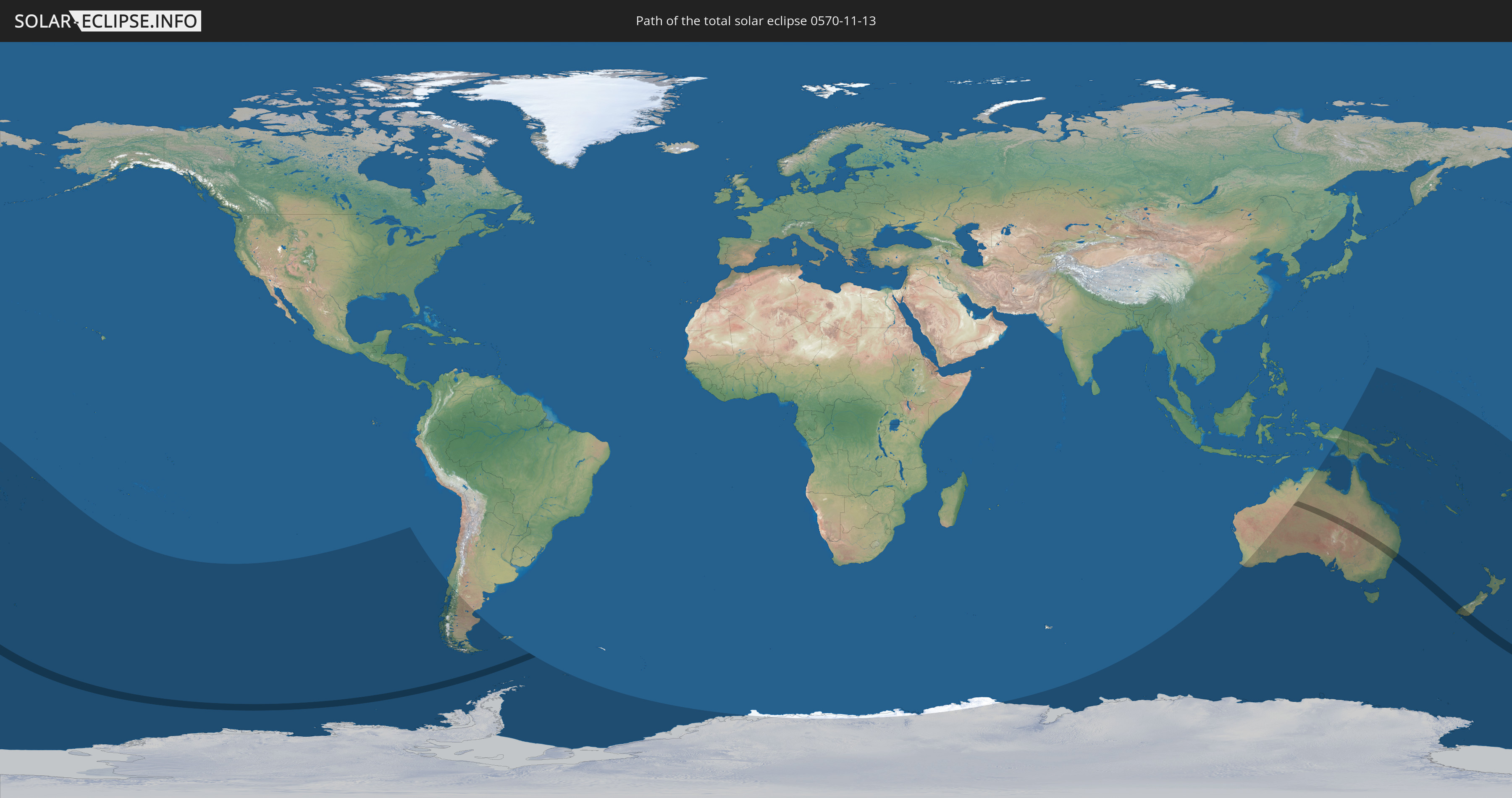
Die Sonnenfinsternis am 13.11.0570 kann man in 22 Ländern als partielle Sonnenfinsternis beobachten.
Der Finsternispfad verläuft durch 2 Länder. Nur in diesen Ländern ist sie als totale Sonnenfinsternis zu sehen.
In den folgenden Ländern ist die Sonnenfinsternis total zu sehen
 Neuseeland
 Australien
In den folgenden Ländern ist die Sonnenfinsternis partiell zu sehen


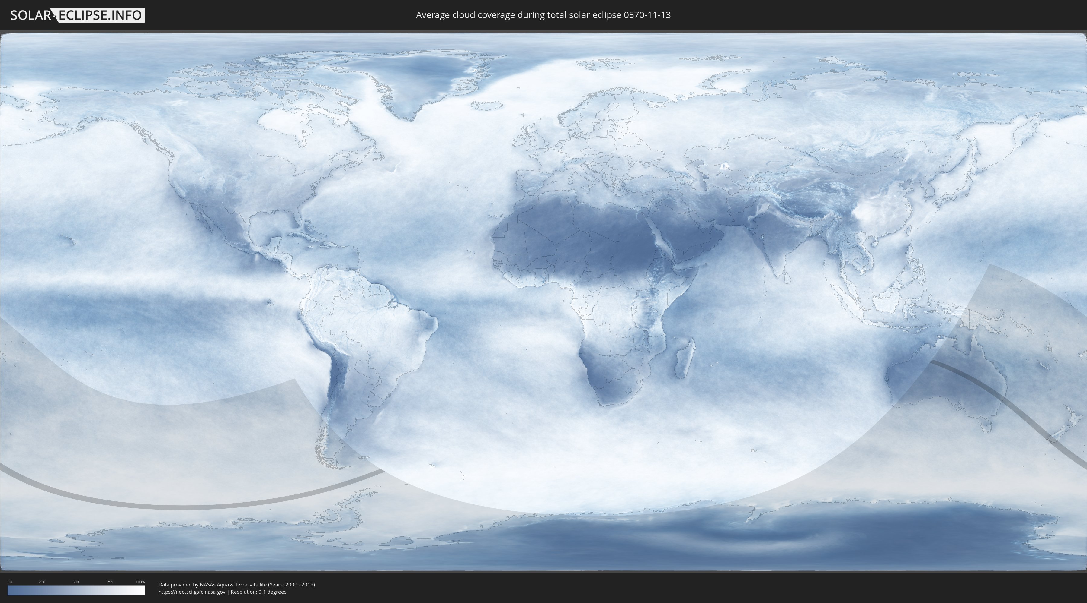
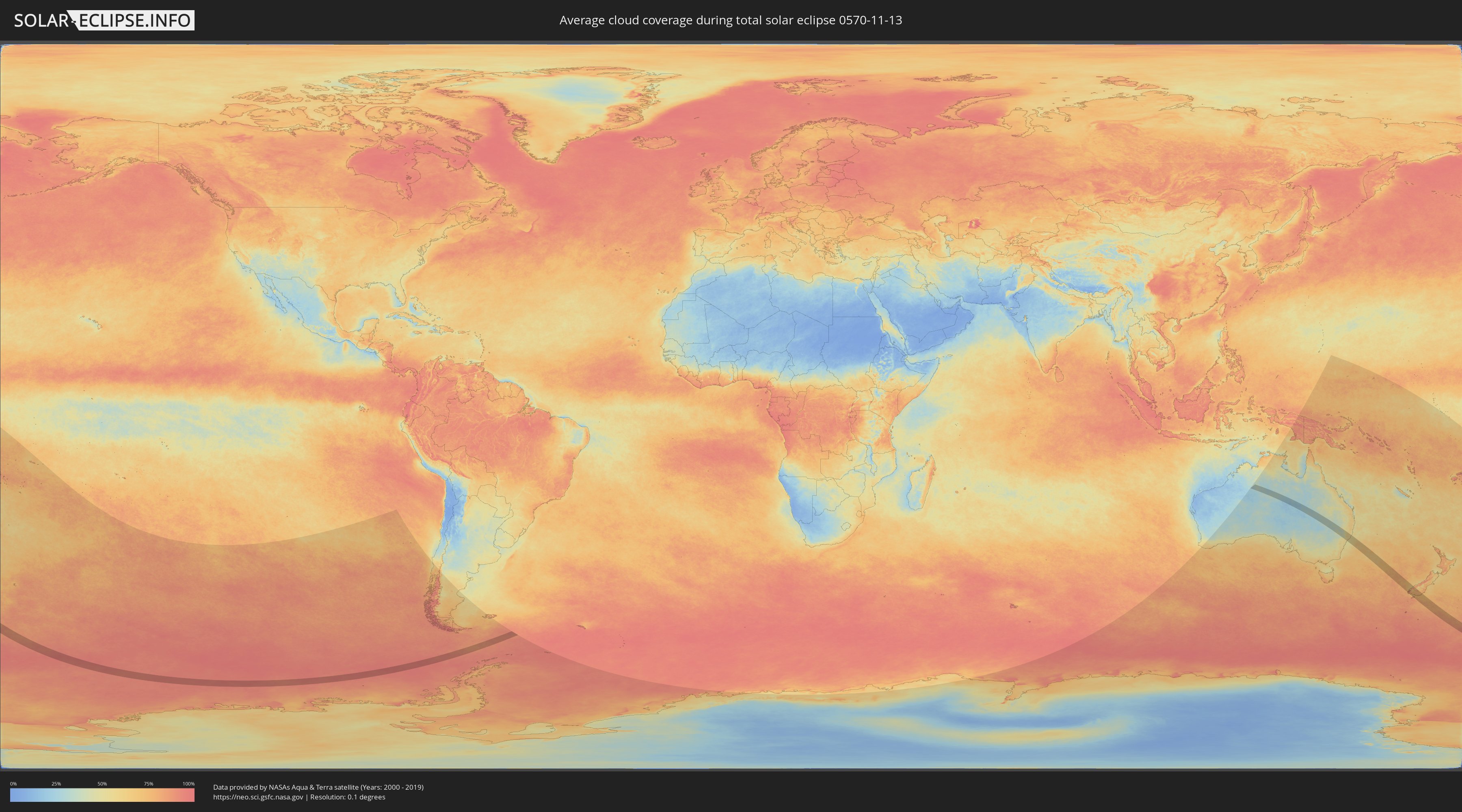
Wie wird das Wetter während der totalen Sonnenfinsternis am 13.11.0570?
Wo ist der beste Ort, um die totale Sonnenfinsternis vom 13.11.0570 zu beobachten?
Die folgenden Karten zeigen die durchschnittliche Bewölkung für den Tag, an dem die totale Sonnenfinsternis
stattfindet. Mit Hilfe der Karten lässt sich der Ort entlang des Finsternispfades eingrenzen,
der die besten Aussichen auf einen klaren wolkenfreien Himmel bietet.
Trotzdem muss man immer lokale Gegenenheiten beachten und sollte sich genau über das Wetter an seinem
gewählten Beobachtungsort informieren.
Die Daten stammen von den beiden NASA-Satelliten
AQUA und TERRA
und wurden über einen Zeitraum von 19 Jahren (2000 - 2019) gemittelt.
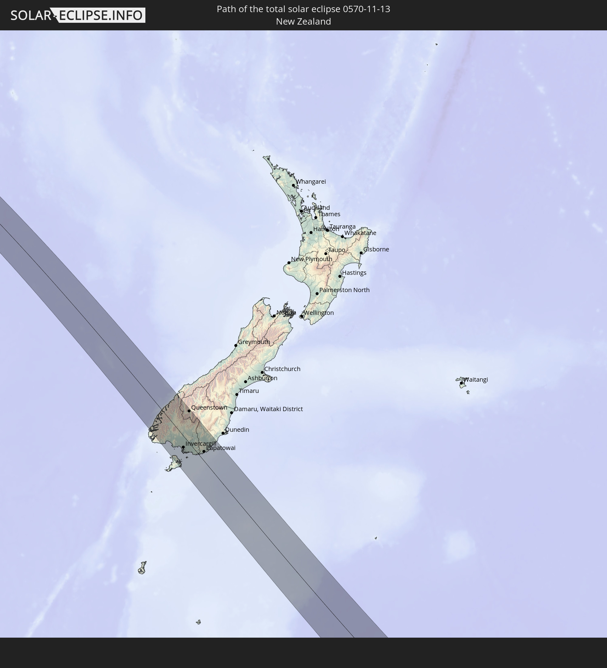
Detaillierte Länderkarten
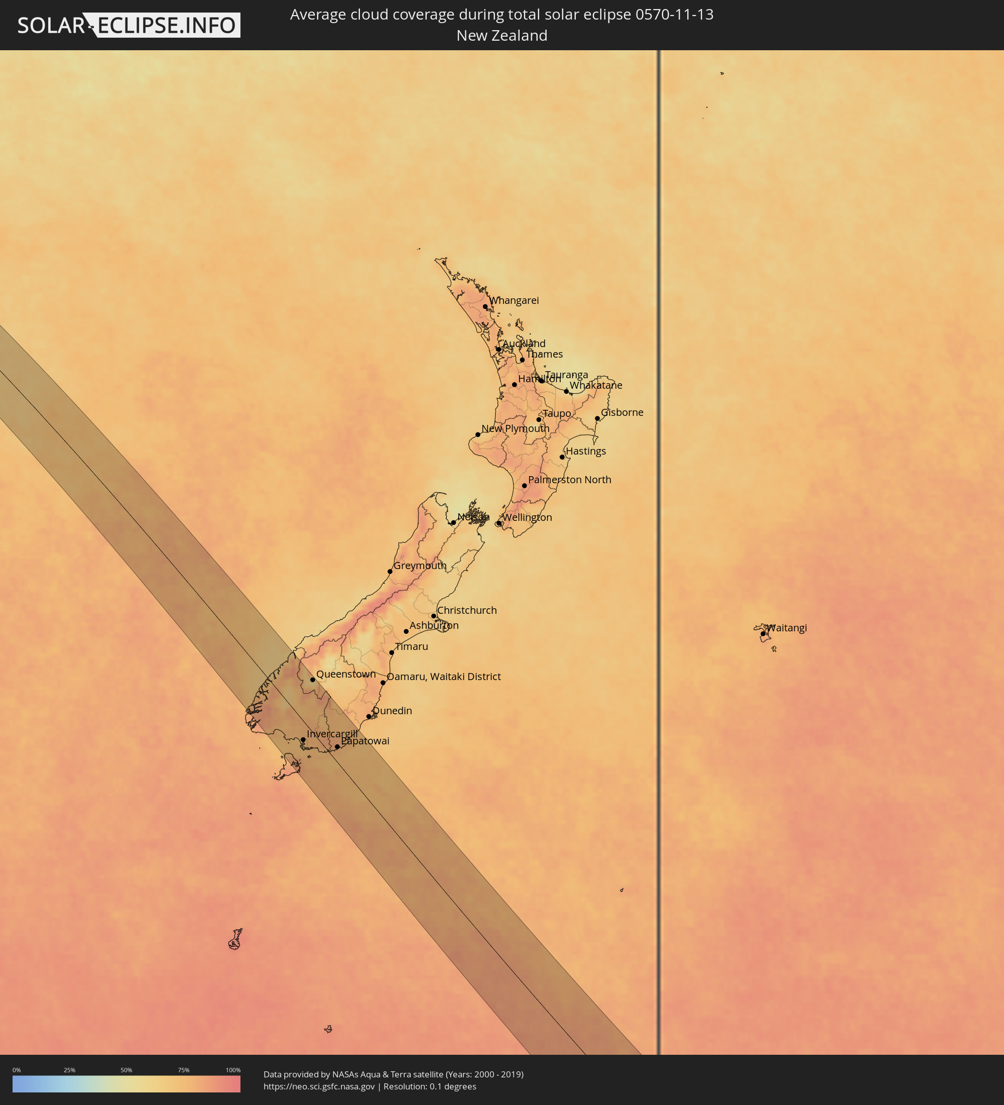 Neuseeland
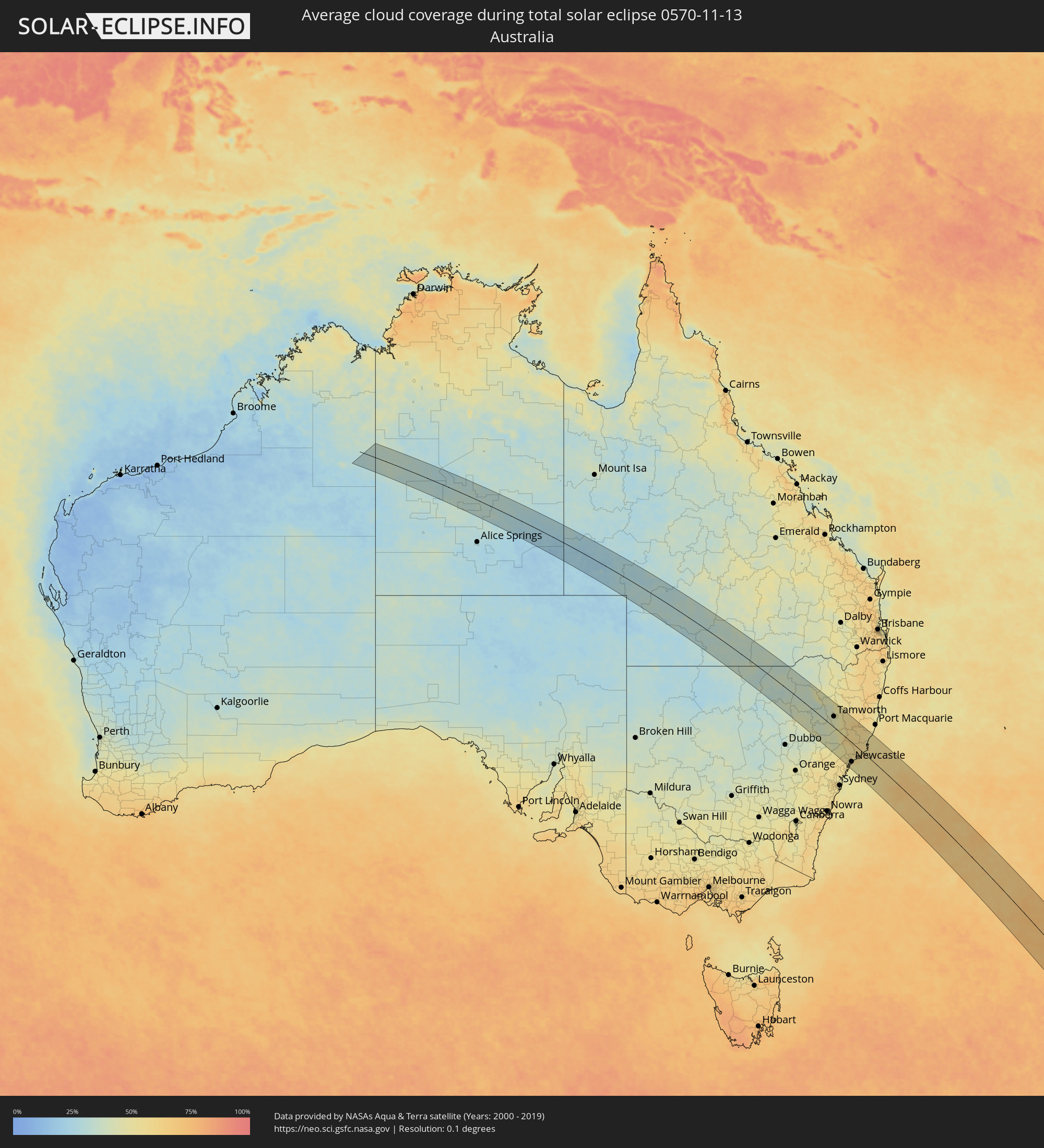 Australien
Orte im Finsternispfad
Die nachfolgene Tabelle zeigt Städte und Orte mit mehr als 5.000 Einwohnern, die sich im Finsternispfad befinden. Städte mit mehr als 100.000 Einwohnern sind dick gekennzeichnet. Mit einem Klick auf den Ort öffnet sich eine Detailkarte die die Lage des jeweiligen Ortes zusammen mit dem Verlauf der zentralen Finsternis präsentiert.
| Ort | Typ | Dauer der Verfinsterung | Ortszeit bei maximaler Verfinsterung | Entfernung zur Zentrallinie | Ø Bewölkung |
 Narrabri, New South Wales
|
total | - | 06:58:06 UTC+10:00 | 34 km | 36% |
|
Gunnedah, New South Wales
|
total | - | 06:59:14 UTC+10:00 | 28 km | 39% |
|
Muswellbrook, New South Wales
|
total | - | 07:01:28 UTC+10:00 | 67 km | 45% |
|
South Tamworth, New South Wales
|
total | - | 06:59:35 UTC+10:00 | 42 km | 42% |
|
Tamworth, New South Wales
|
total | - | 06:59:34 UTC+10:00 | 43 km | 42% |
|
Singleton, New South Wales
|
total | - | 07:02:03 UTC+10:00 | 76 km | 54% |
|
Cessnock, New South Wales
|
total | - | 07:02:32 UTC+10:00 | 83 km | 57% |
|
Kurri Kurri, New South Wales
|
total | - | 07:02:33 UTC+10:00 | 74 km | 56% |
|
Rutherford, New South Wales
|
total | - | 07:02:23 UTC+10:00 | 62 km | 54% |
|
Maitland, New South Wales
|
total | - | 07:02:25 UTC+10:00 | 62 km | 53% |
|
East Maitland, New South Wales
|
total | - | 07:02:27 UTC+10:00 | 62 km | 55% |
|
Rathmines, New South Wales
|
total | - | 07:02:56 UTC+10:00 | 89 km | 56% |
|
Toronto, New South Wales
|
total | - | 07:02:54 UTC+10:00 | 86 km | 56% |
|
Eleebana, New South Wales
|
total | - | 07:02:52 UTC+10:00 | 82 km | 56% |
|
Charlestown, New South Wales
|
total | - | 07:02:49 UTC+10:00 | 77 km | 52% |
|
Belmont North, New South Wales
|
total | - | 07:02:56 UTC+10:00 | 84 km | 52% |
|
Elermore Vale, New South Wales
|
total | - | 07:02:45 UTC+10:00 | 73 km | 53% |
|
Mayfield, New South Wales
|
total | - | 07:02:44 UTC+10:00 | 69 km | 53% |
|
Raymond Terrace, New South Wales
|
total | - | 07:02:30 UTC+10:00 | 53 km | 54% |
|
Newcastle, New South Wales
|
total | - | 07:02:48 UTC+10:00 | 71 km | 54% |
|
Medowie, New South Wales
|
total | - | 07:02:31 UTC+10:00 | 49 km | 52% |
|
Port Stephens, New South Wales
|
total | - | 07:02:31 UTC+10:00 | 41 km | 55% |
|
Corlette, New South Wales
|
total | - | 07:02:32 UTC+10:00 | 37 km | 55% |
|
Nelson Bay, New South Wales
|
total | - | 07:02:33 UTC+10:00 | 33 km | 55% |
|
Taree, New South Wales
|
total | - | 07:01:17 UTC+10:00 | 62 km | 52% |
|
Forster, New South Wales
|
total | - | 07:01:45 UTC+10:00 | 51 km | 57% |
 Invercargill, Southland
|
total | - | 09:05:47 UTC+11:30 | 35 km | 73% |
|
Queenstown, Otago
|
total | - | 09:03:29 UTC+11:30 | 89 km | 61% |
|
Gore, Southland
|
total | - | 09:05:41 UTC+11:30 | 34 km | 78% |
|
Papatowai, Otago
|
total | - | 09:06:57 UTC+11:30 | 36 km | 77% |