Totale Sonnenfinsternis vom 21.11.0960
| Wochentag: | Freitag |
| Maximale Dauer der Verfinsterung: | 02m52s |
| Maximale Breite des Finsternispfades: | 117 km |
| Saroszyklus: | 106 |
| Bedeckungsgrad: | 100% |
| Magnitude: | 1.0338 |
| Gamma: | -0.2228 |
Wo kann man die Sonnenfinsternis vom 21.11.0960 sehen?
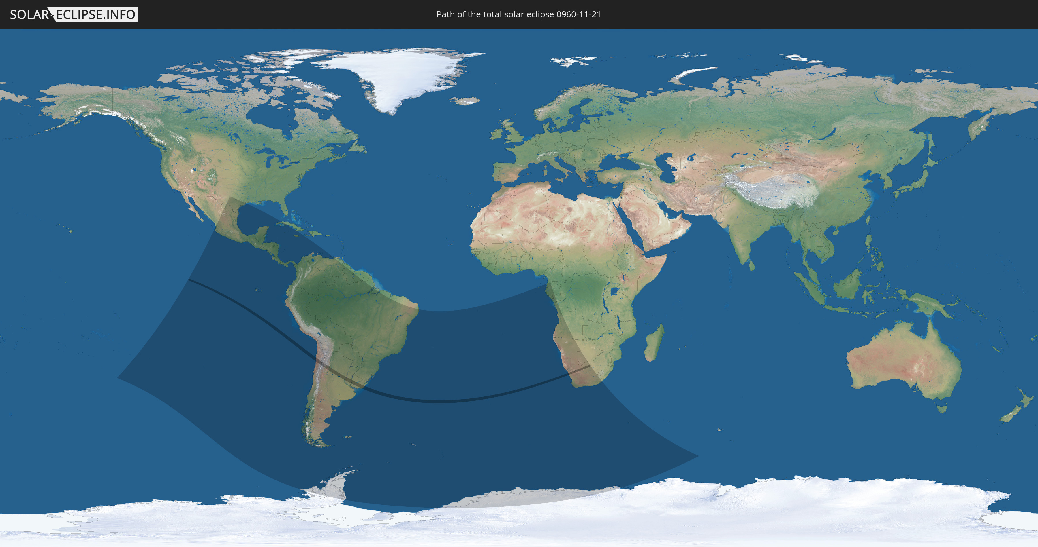
Die Sonnenfinsternis am 21.11.0960 kann man in 41 Ländern als partielle Sonnenfinsternis beobachten.
Der Finsternispfad verläuft durch 5 Länder. Nur in diesen Ländern ist sie als totale Sonnenfinsternis zu sehen.
In den folgenden Ländern ist die Sonnenfinsternis total zu sehen
 Chile
Chile
 Argentinien
 Uruguay
 Namibia
 Südafrika
In den folgenden Ländern ist die Sonnenfinsternis partiell zu sehen
 Antarktika
 Vereinigte Staaten
 Pitcairninseln
 Mexiko
 Chile
Chile
 Guatemala
 Ecuador
 El Salvador
 Honduras
 Belize
 Nicaragua
 Costa Rica
 Kuba
Kuba
 Panama
 Kolumbien
 Kaimaninseln
 Peru
Peru
 Jamaika
 Brasilien
 Argentinien
 Venezuela
 Aruba
Aruba
 Bolivien
 Paraguay
 Falklandinseln
 Guyana
 Uruguay
 Suriname
 Französisch-Guayana
 Südgeorgien und die Südlichen Sandwichinseln
 St. Helena
 Bouvetinsel
 Äquatorialguinea
 São Tomé und Príncipe
 Gabun
Gabun
 Republik Kongo
 Angola
 Namibia
 Demokratische Republik Kongo
 Südafrika
 Botswana
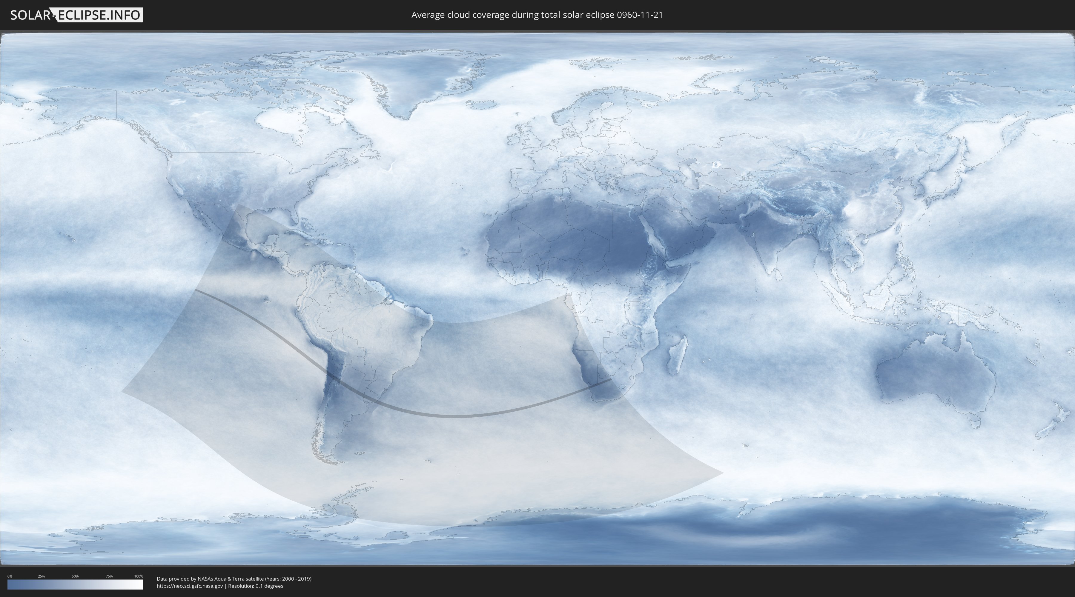
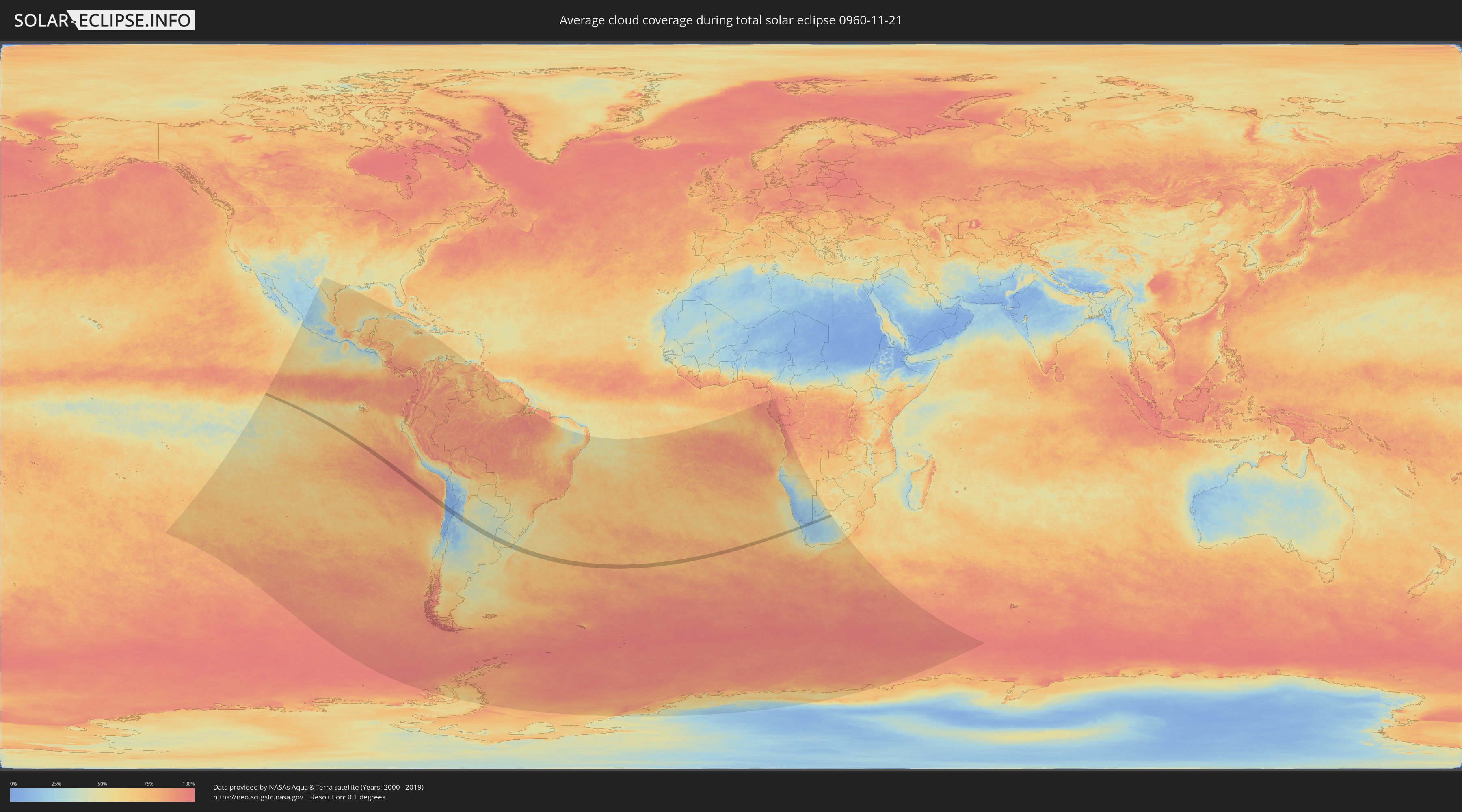
Wie wird das Wetter während der totalen Sonnenfinsternis am 21.11.0960?
Wo ist der beste Ort, um die totale Sonnenfinsternis vom 21.11.0960 zu beobachten?
Die folgenden Karten zeigen die durchschnittliche Bewölkung für den Tag, an dem die totale Sonnenfinsternis
stattfindet. Mit Hilfe der Karten lässt sich der Ort entlang des Finsternispfades eingrenzen,
der die besten Aussichen auf einen klaren wolkenfreien Himmel bietet.
Trotzdem muss man immer lokale Gegenenheiten beachten und sollte sich genau über das Wetter an seinem
gewählten Beobachtungsort informieren.
Die Daten stammen von den beiden NASA-Satelliten
AQUA und TERRA
und wurden über einen Zeitraum von 19 Jahren (2000 - 2019) gemittelt.
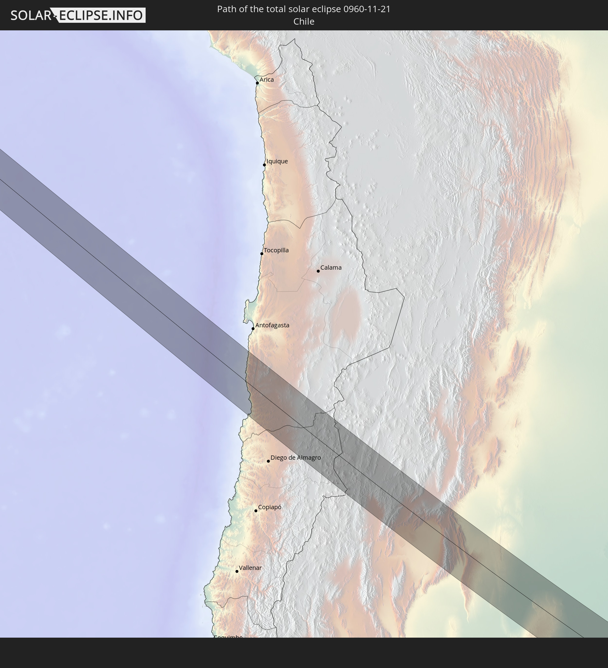
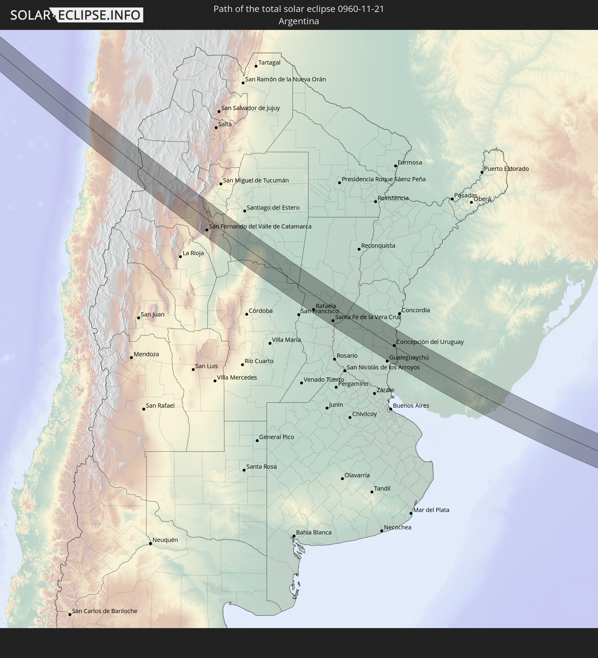
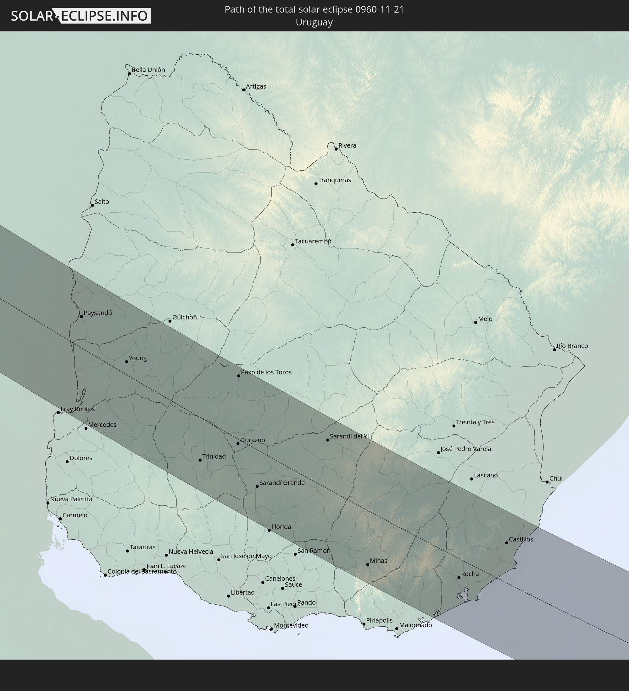
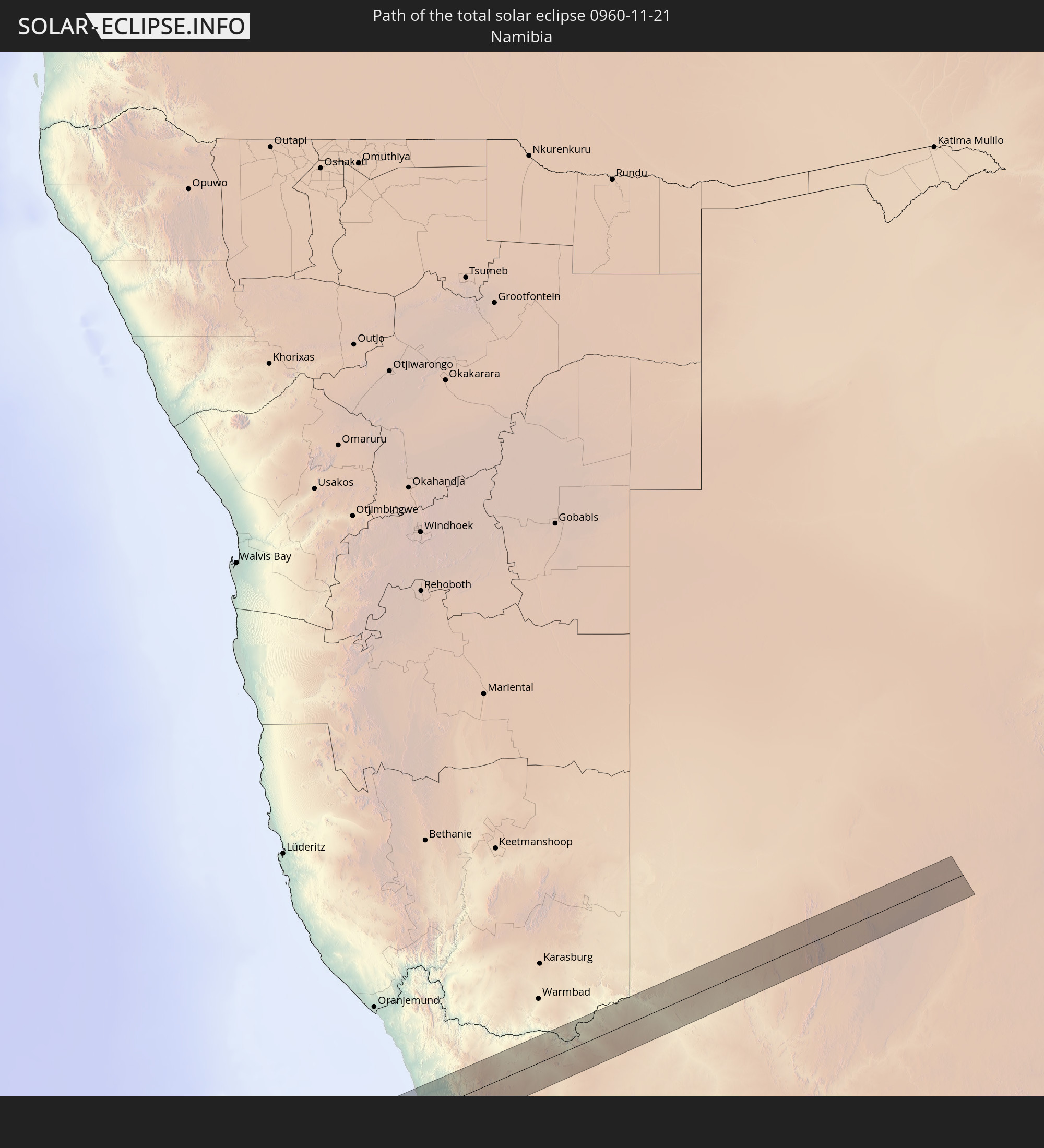
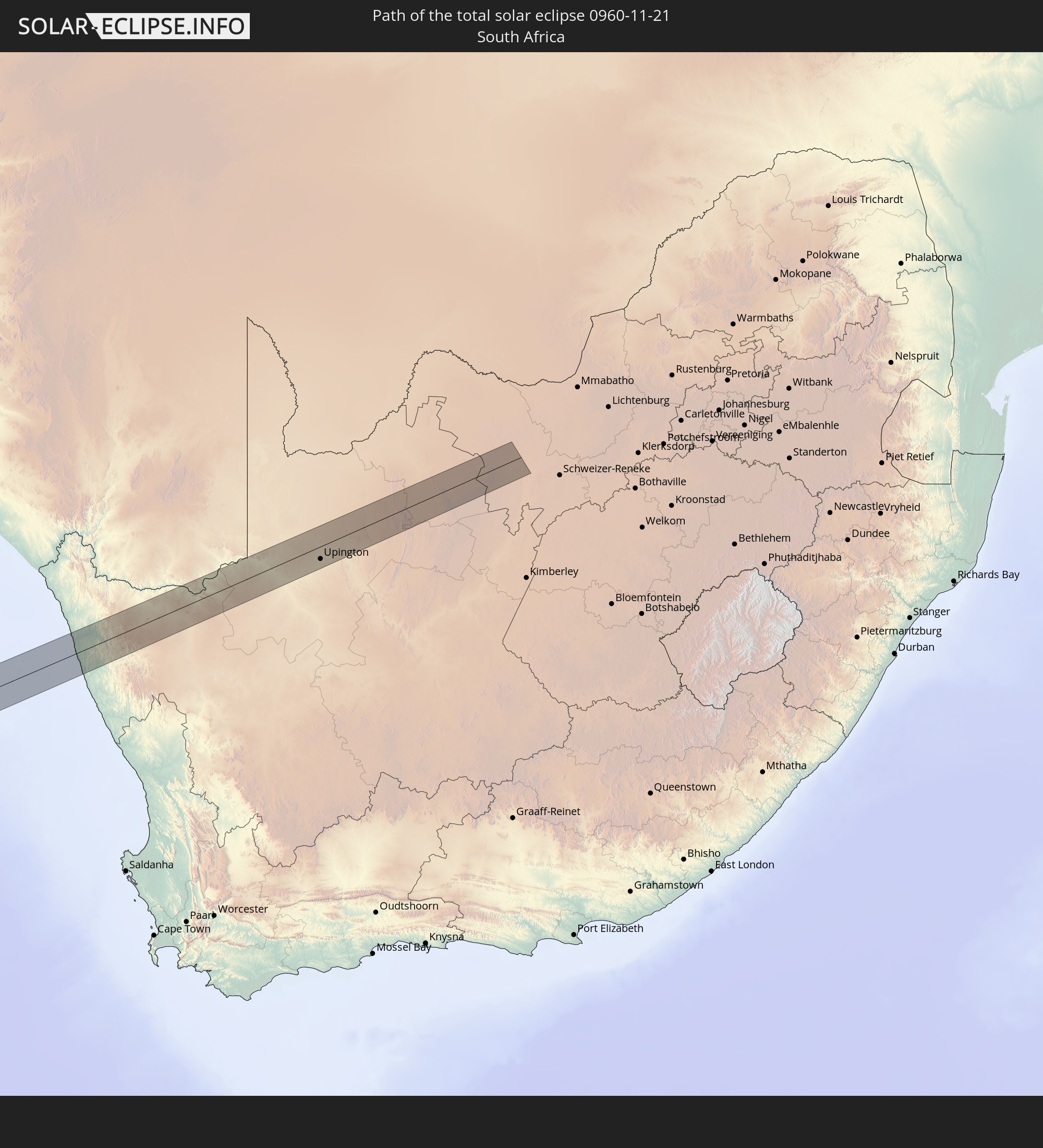
Detaillierte Länderkarten
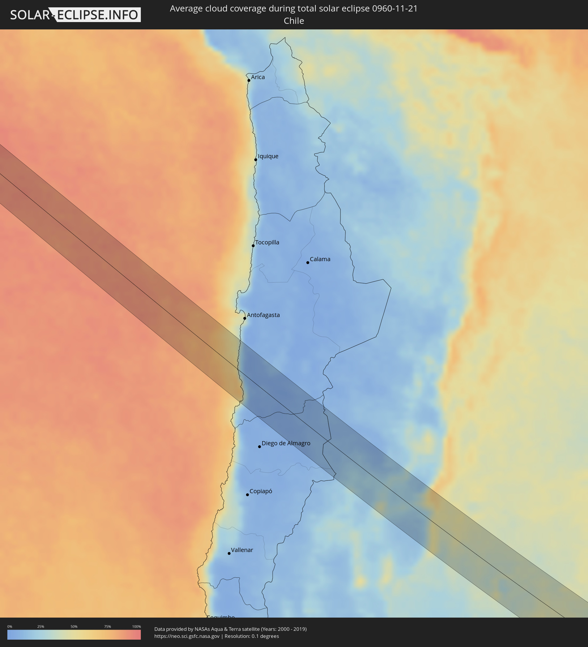 Chile
Chile
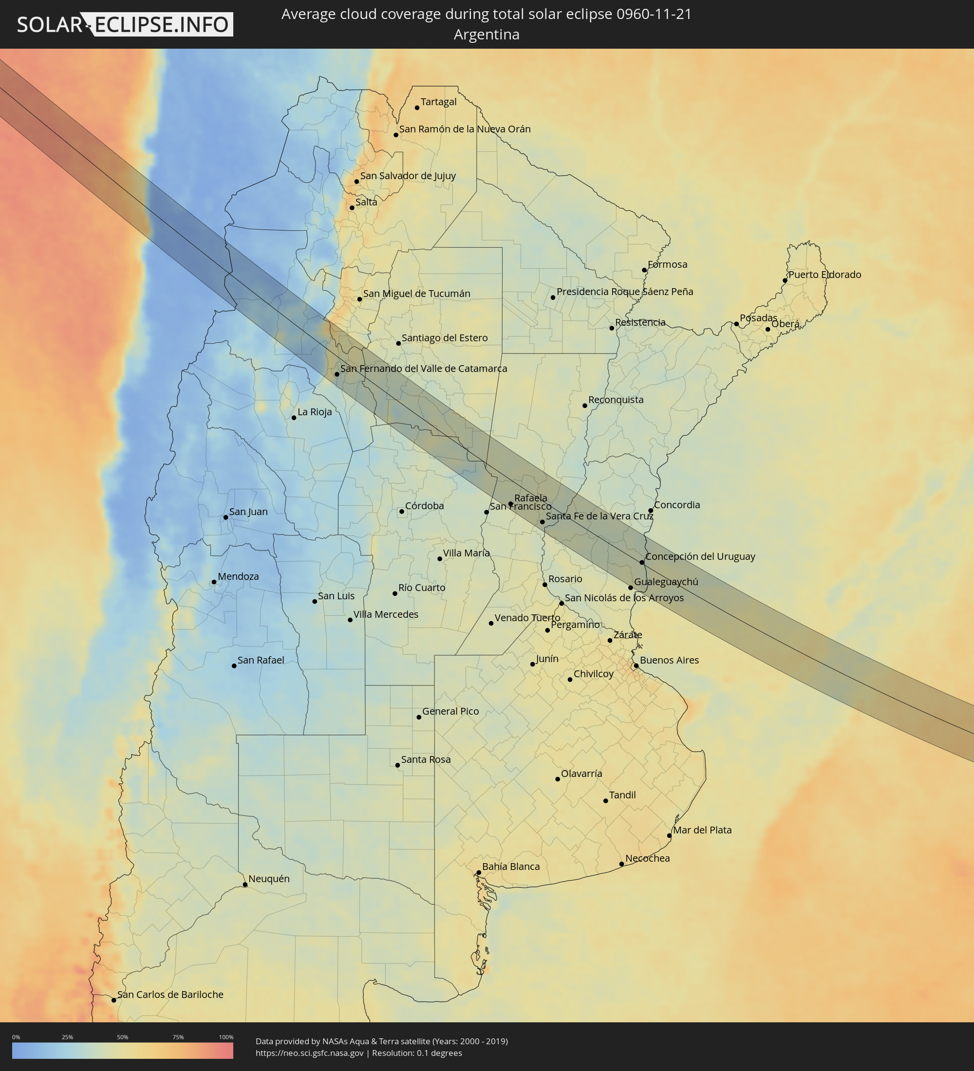 Argentinien
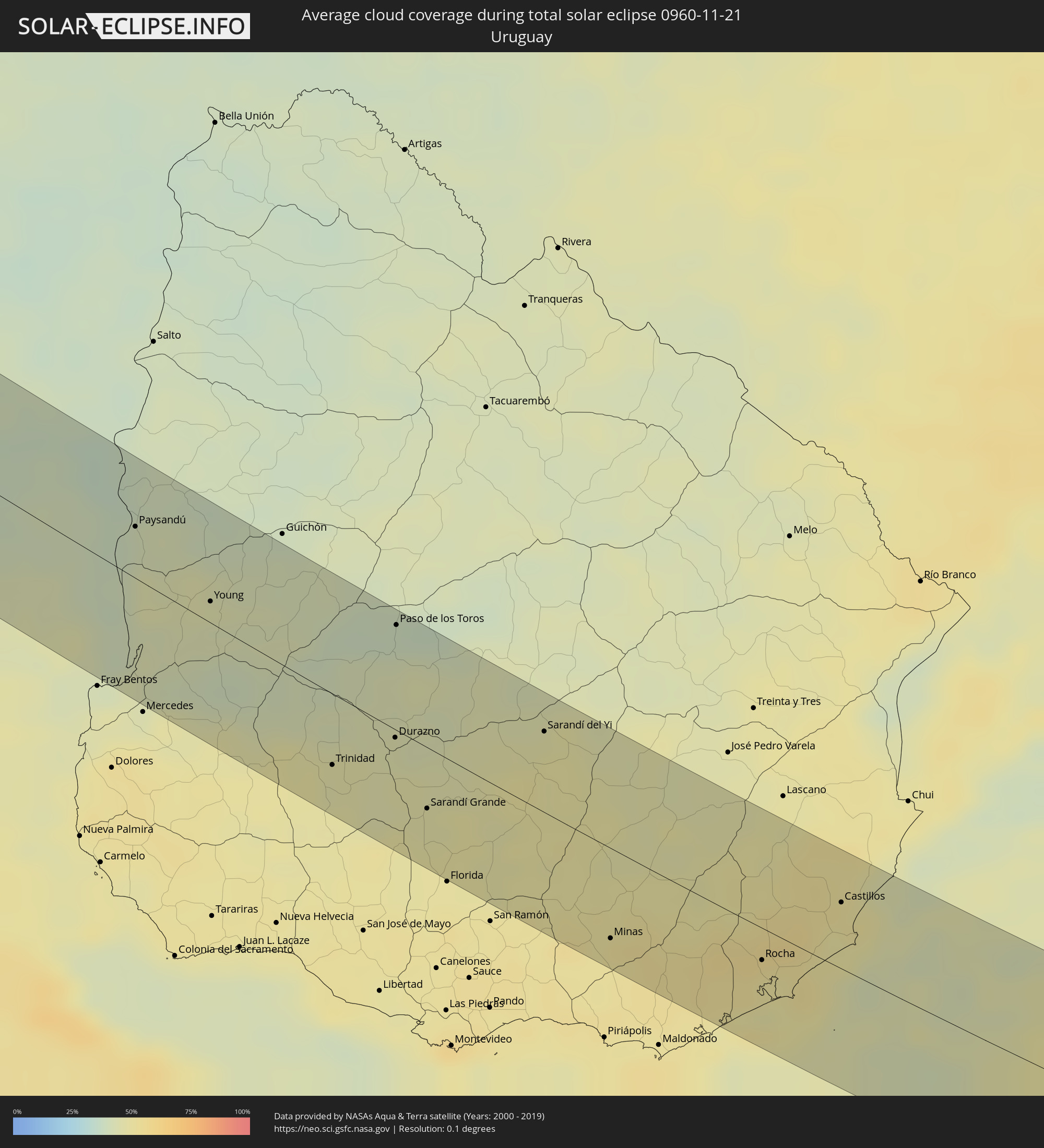 Uruguay
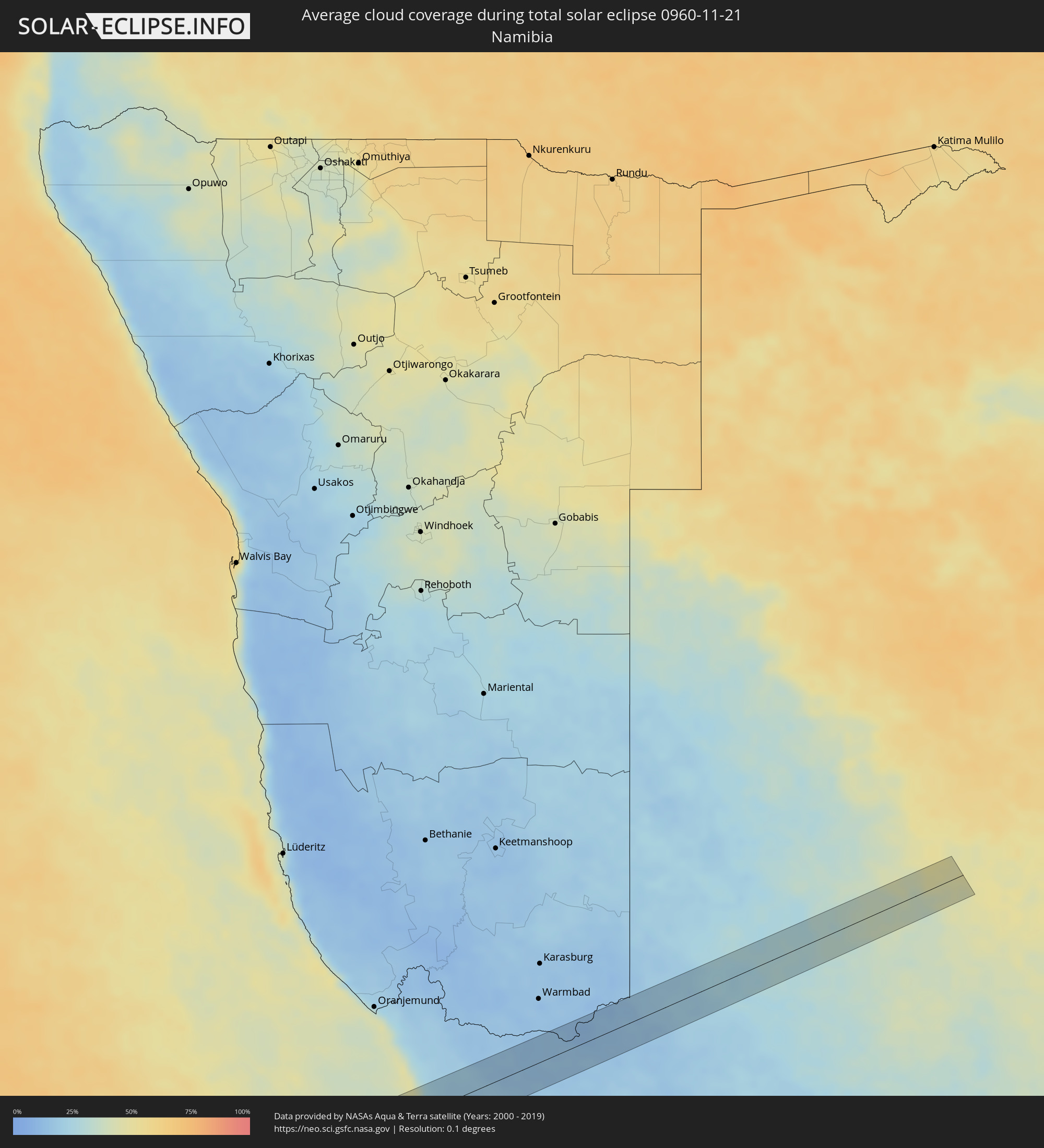 Namibia
 Südafrika
Orte im Finsternispfad
Die nachfolgene Tabelle zeigt Städte und Orte mit mehr als 5.000 Einwohnern, die sich im Finsternispfad befinden. Städte mit mehr als 100.000 Einwohnern sind dick gekennzeichnet. Mit einem Klick auf den Ort öffnet sich eine Detailkarte die die Lage des jeweiligen Ortes zusammen mit dem Verlauf der zentralen Finsternis präsentiert.
| Ort | Typ | Dauer der Verfinsterung | Ortszeit bei maximaler Verfinsterung | Entfernung zur Zentrallinie | Ø Bewölkung |
|
Taltal, Antofagasta
|
total | - | 09:50:59 UTC-04:42 | 54 km | 37% |
|
Andalgalá, Catamarca Province
|
total | - | 10:27:41 UTC-04:16 | 10 km | 22% |
|
San Fernando del Valle de Catamarca, Catamarca Province
|
total | - | 10:30:06 UTC-04:16 | 35 km | 32% |
|
La Cocha, Tucumán Province
|
total | - | 10:29:18 UTC-04:16 | 39 km | 46% |
|
Los Altos, Catamarca Province
|
total | - | 10:29:54 UTC-04:16 | 19 km | 47% |
|
Icaño, Catamarca Province
|
total | - | 10:31:41 UTC-04:16 | 49 km | 34% |
|
Villa Ojo de Agua, Santiago del Estero Province
|
total | - | 10:35:37 UTC-04:16 | 8 km | 36% |
|
Brinkmann, Cordoba Province
|
total | - | 10:40:57 UTC-04:16 | 42 km | 39% |
|
Morteros, Cordoba Province
|
total | - | 10:40:47 UTC-04:16 | 25 km | 42% |
|
Ceres, Santa Fe Province
|
total | - | 10:39:33 UTC-04:16 | 54 km | 40% |
|
Sunchales, Santa Fe Province
|
total | - | 10:41:59 UTC-04:16 | 23 km | 40% |
|
Rafaela, Santa Fe Province
|
total | - | 10:42:36 UTC-04:16 | 48 km | 42% |
|
San Cristóbal, Santa Fe Province
|
total | - | 10:41:37 UTC-04:16 | 53 km | 43% |
|
Esperanza, Santa Fe Province
|
total | - | 10:43:59 UTC-04:16 | 37 km | 43% |
|
Santo Tomé, Santa Fe Province
|
total | - | 10:44:38 UTC-04:16 | 48 km | 39% |
|
Recreo, Santa Fe Province
|
total | - | 10:44:26 UTC-04:16 | 30 km | 39% |
|
Santa Fe de la Vera Cruz, Santa Fe Province
|
total | - | 10:44:43 UTC-04:16 | 42 km | 40% |
|
Laguna Paiva, Santa Fe Province
|
total | - | 10:44:18 UTC-04:16 | 9 km | 42% |
|
San Justo, Santa Fe Province
|
total | - | 10:43:37 UTC-04:16 | 42 km | 43% |
|
Paraná, Entre Ríos Province
|
total | - | 10:45:13 UTC-04:16 | 42 km | 43% |
|
San Benito, Entre Ríos Province
|
total | - | 10:45:27 UTC-04:16 | 43 km | 43% |
|
Viale, Entre Ríos Province
|
total | - | 10:46:26 UTC-04:16 | 28 km | 42% |
|
Villa Hernandarias, Entre Ríos Province
|
total | - | 10:45:30 UTC-04:16 | 32 km | 40% |
|
Villa María Grande, Entre Ríos Province
|
total | - | 10:46:20 UTC-04:16 | 4 km | 40% |
|
Bovril, Entre Ríos Province
|
total | - | 10:46:45 UTC-04:16 | 50 km | 41% |
|
Maciá, Entre Ríos Province
|
total | - | 10:48:05 UTC-04:16 | 26 km | 38% |
|
Rosario del Tala, Entre Ríos Province
|
total | - | 10:48:47 UTC-04:16 | 26 km | 38% |
|
Villaguay, Entre Ríos Province
|
total | - | 10:48:22 UTC-04:16 | 21 km | 37% |
|
Urdinarrain, Entre Ríos Province
|
total | - | 10:49:51 UTC-04:16 | 50 km | 44% |
|
Villa Elisa, Entre Ríos Province
|
total | - | 10:50:04 UTC-04:16 | 24 km | 40% |
|
Concepción del Uruguay, Entre Ríos Province
|
total | - | 10:50:51 UTC-04:16 | 2 km | 39% |
|
Paysandú, Paysandú
|
total | - | 11:22:54 UTC-03:44 | 25 km | 39% |
|
Young, Río Negro
|
total | - | 11:24:21 UTC-03:44 | 10 km | 43% |
|
Trinidad, Flores
|
total | - | 11:26:58 UTC-03:44 | 34 km | 46% |
|
Trinidad, Flores
|
total | - | 11:27:01 UTC-03:44 | 36 km | 46% |
|
Durazno, Durazno
|
total | - | 11:27:33 UTC-03:44 | 4 km | 45% |
|
Paso de los Toros, Tacuarembó
|
total | - | 11:26:47 UTC-03:44 | 51 km | 39% |
|
Sarandí Grande, Florida
|
total | - | 11:28:24 UTC-03:44 | 30 km | 47% |
|
Sarandí del Yi, Durazno
|
total | - | 11:29:20 UTC-03:44 | 39 km | 49% |
|
Minas, Lavalleja
|
total | - | 11:31:29 UTC-03:44 | 44 km | 51% |
|
Rocha, Rocha
|
total | - | 11:33:28 UTC-03:44 | 16 km | 50% |
|
Castillos, Rocha
|
total | - | 11:34:07 UTC-03:44 | 32 km | 50% |
|
Springbok, Northern Cape
|
total | - | 18:25:45 UTC+01:30 | 11 km | 20% |
|
Upington, Northern Cape
|
total | - | 18:26:15 UTC+01:30 | 19 km | 24% |
|
Kathu, Northern Cape
|
total | - | 18:26:26 UTC+01:30 | 14 km | 32% |
|
Kuruman, Northern Cape
|
total | - | 18:26:30 UTC+01:30 | 5 km | 38% |