Totale Sonnenfinsternis vom 17.07.1814
| Wochentag: | Sonntag |
| Maximale Dauer der Verfinsterung: | 06m33s |
| Maximale Breite des Finsternispfades: | 254 km |
| Saroszyklus: | 133 |
| Bedeckungsgrad: | 100% |
| Magnitude: | 1.0774 |
| Gamma: | 0.1641 |
Wo kann man die Sonnenfinsternis vom 17.07.1814 sehen?
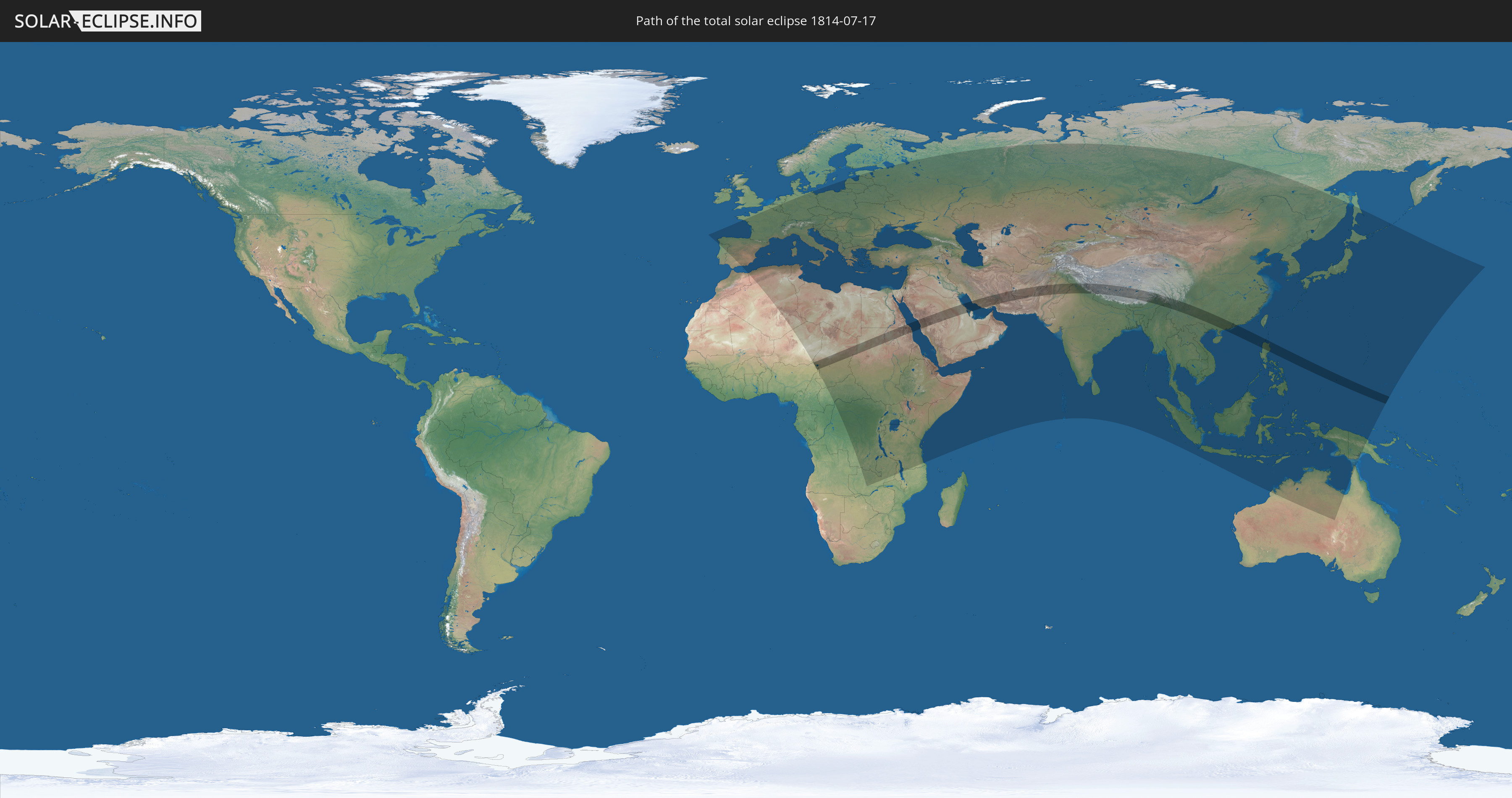
Die Sonnenfinsternis am 17.07.1814 kann man in 119 Ländern als partielle Sonnenfinsternis beobachten.
Der Finsternispfad verläuft durch 20 Länder. Nur in diesen Ländern ist sie als totale Sonnenfinsternis zu sehen.
In den folgenden Ländern ist die Sonnenfinsternis total zu sehen
 Nigeria
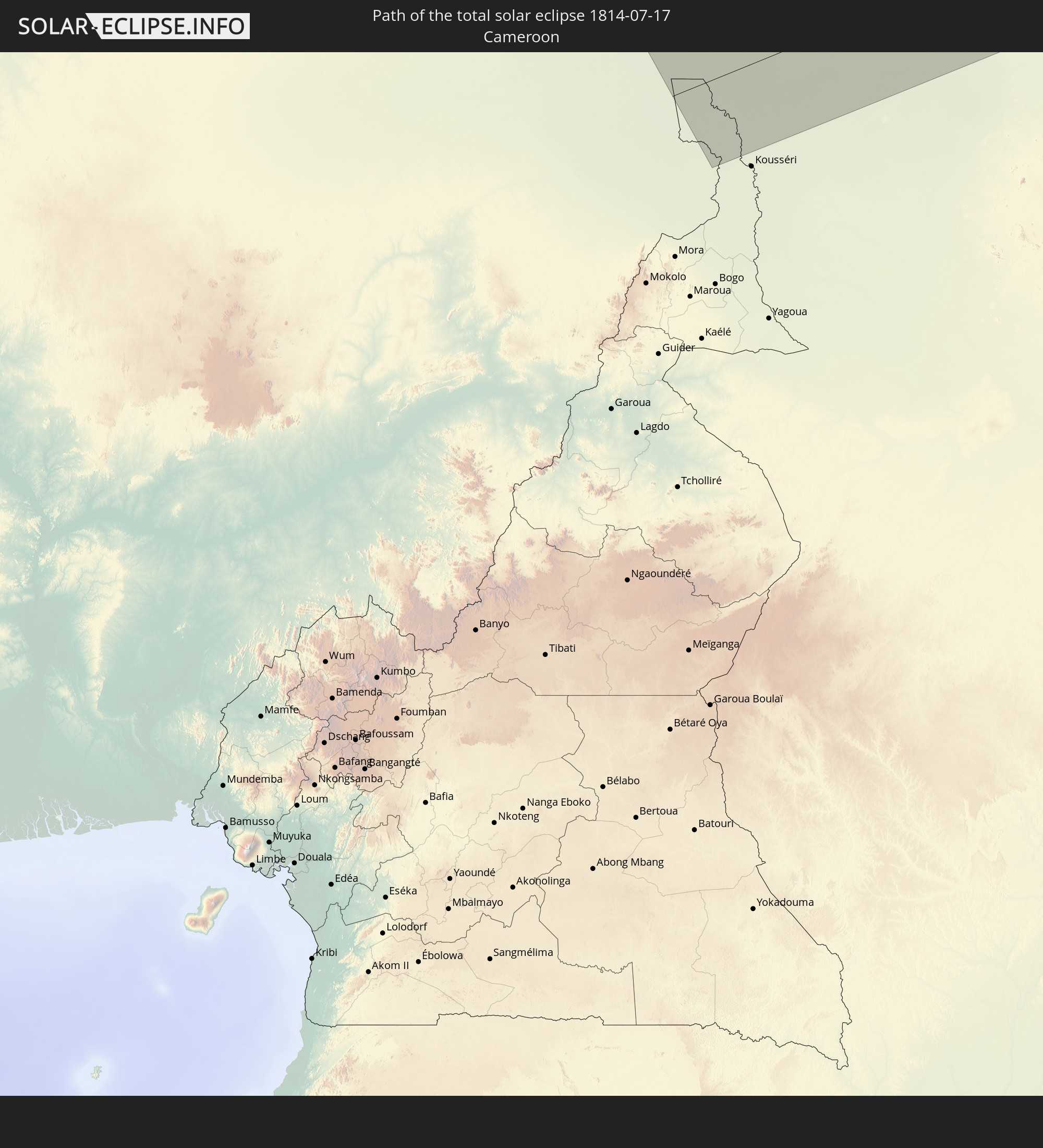 Kamerun
 Tschad
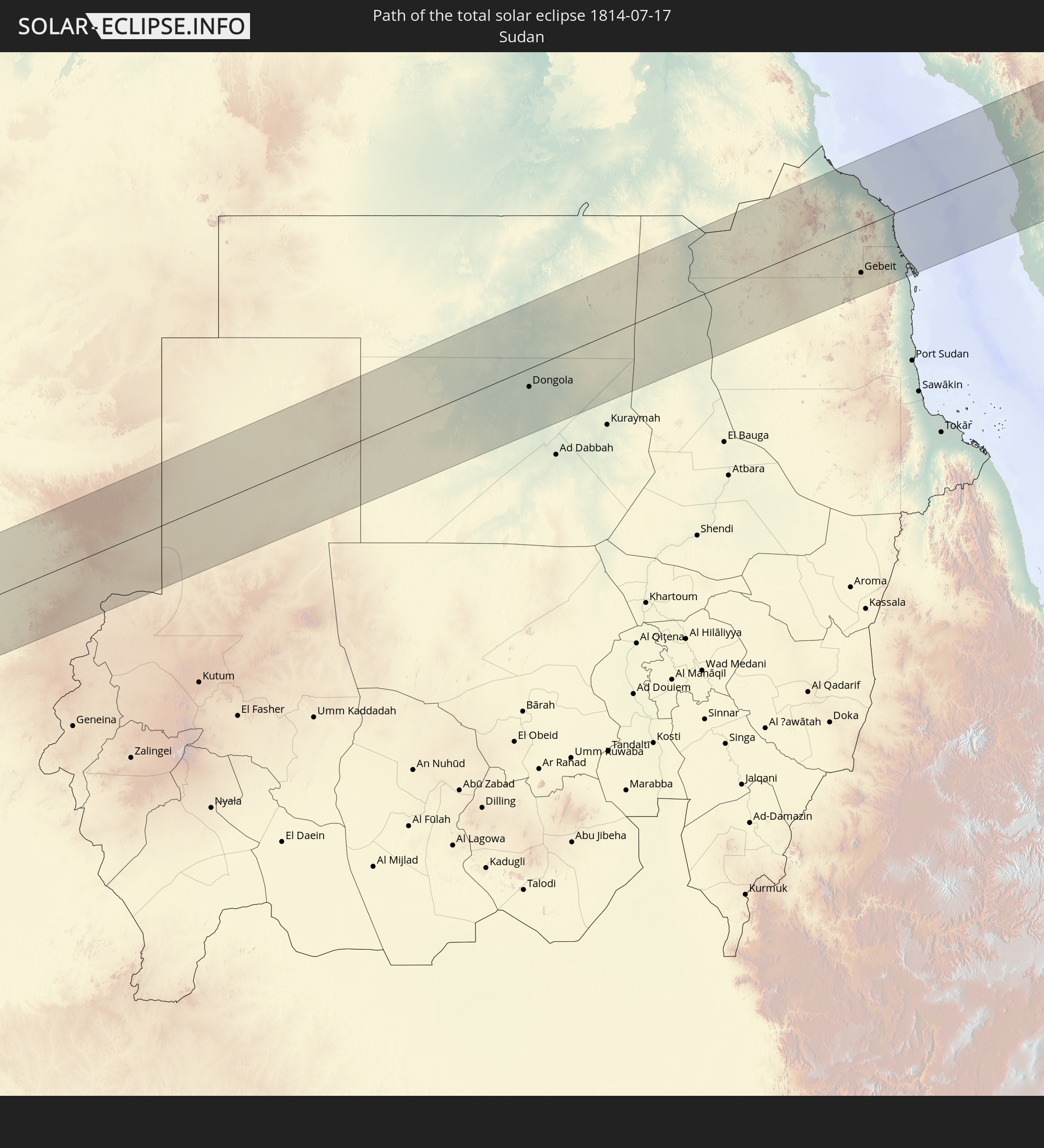 Sudan
Sudan
 Ägypten
 Saudi-Arabien
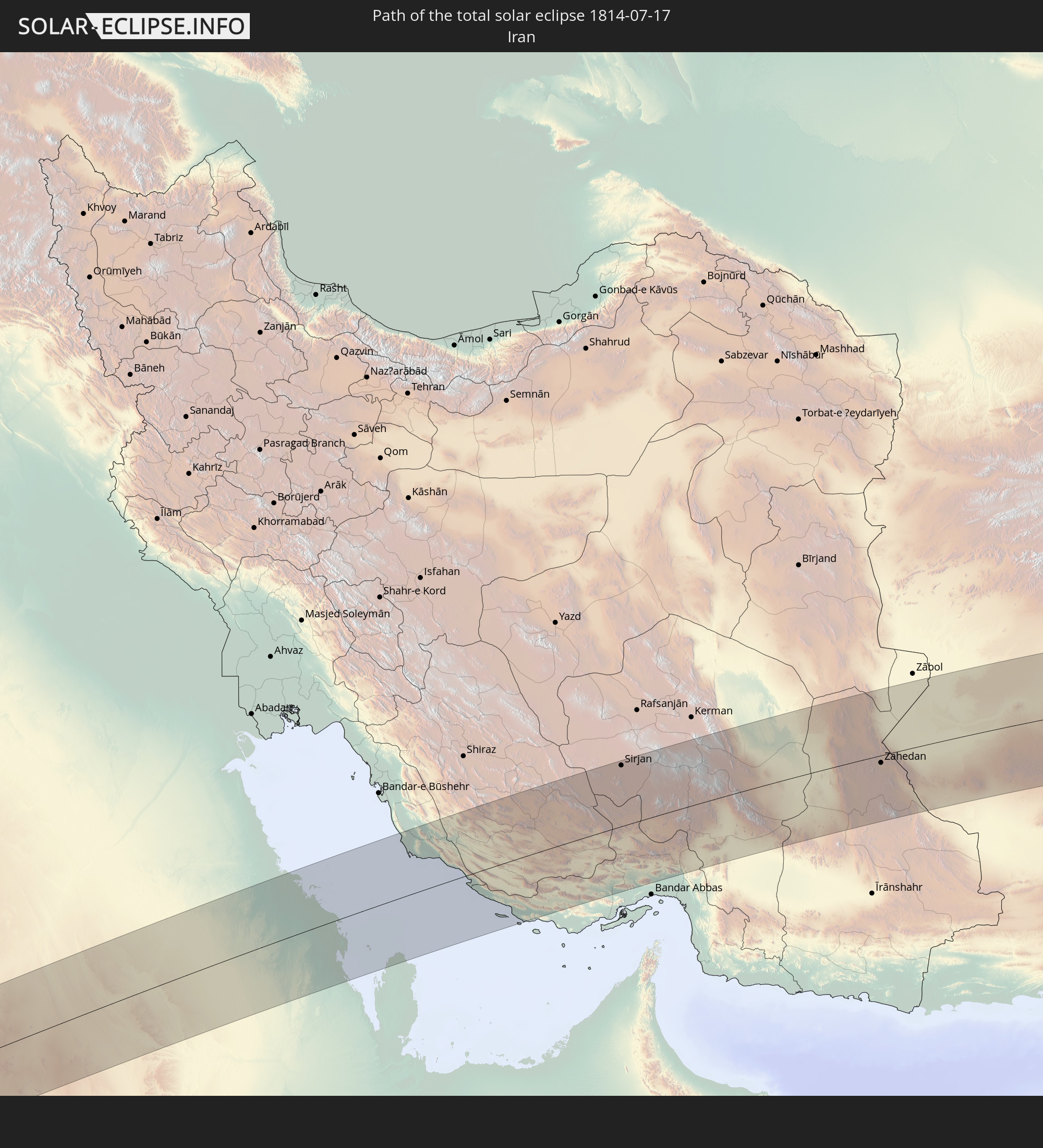 Iran
Iran
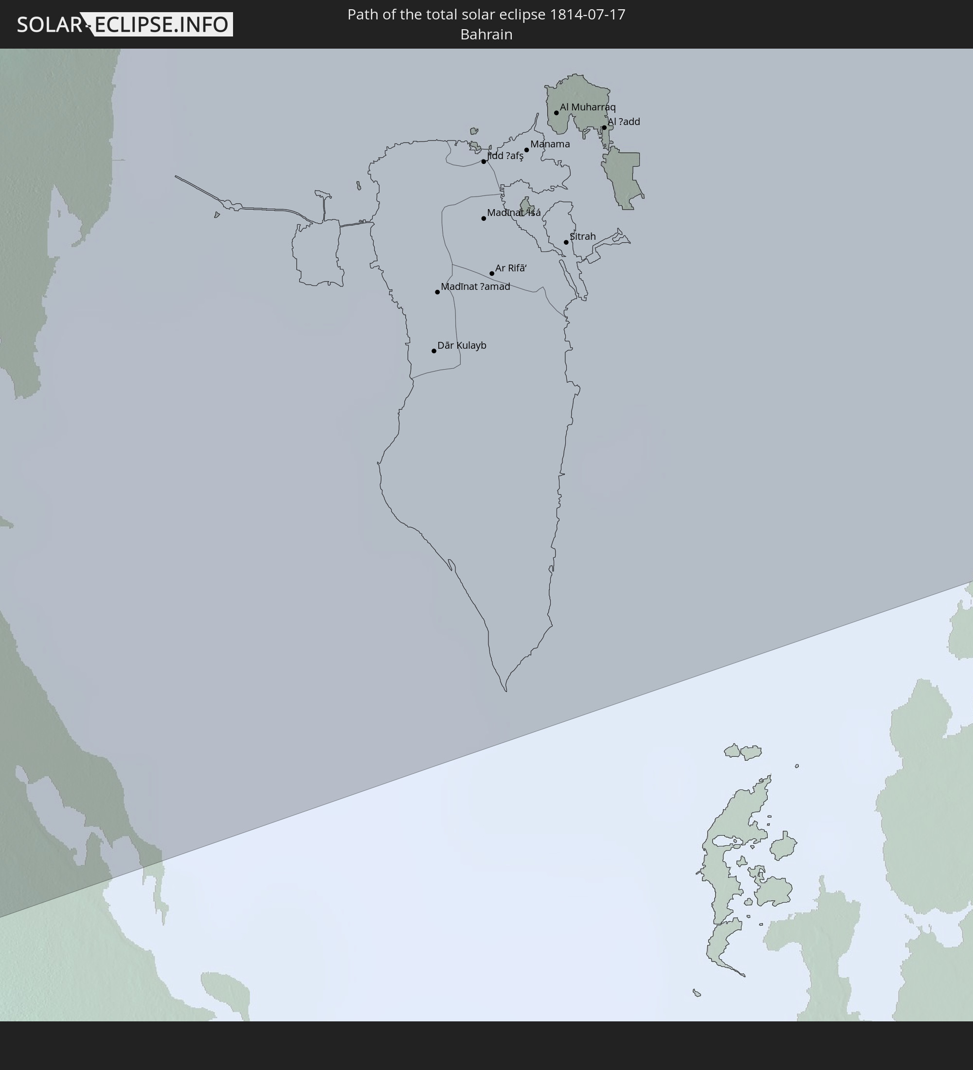 Bahrain
 Katar
Katar
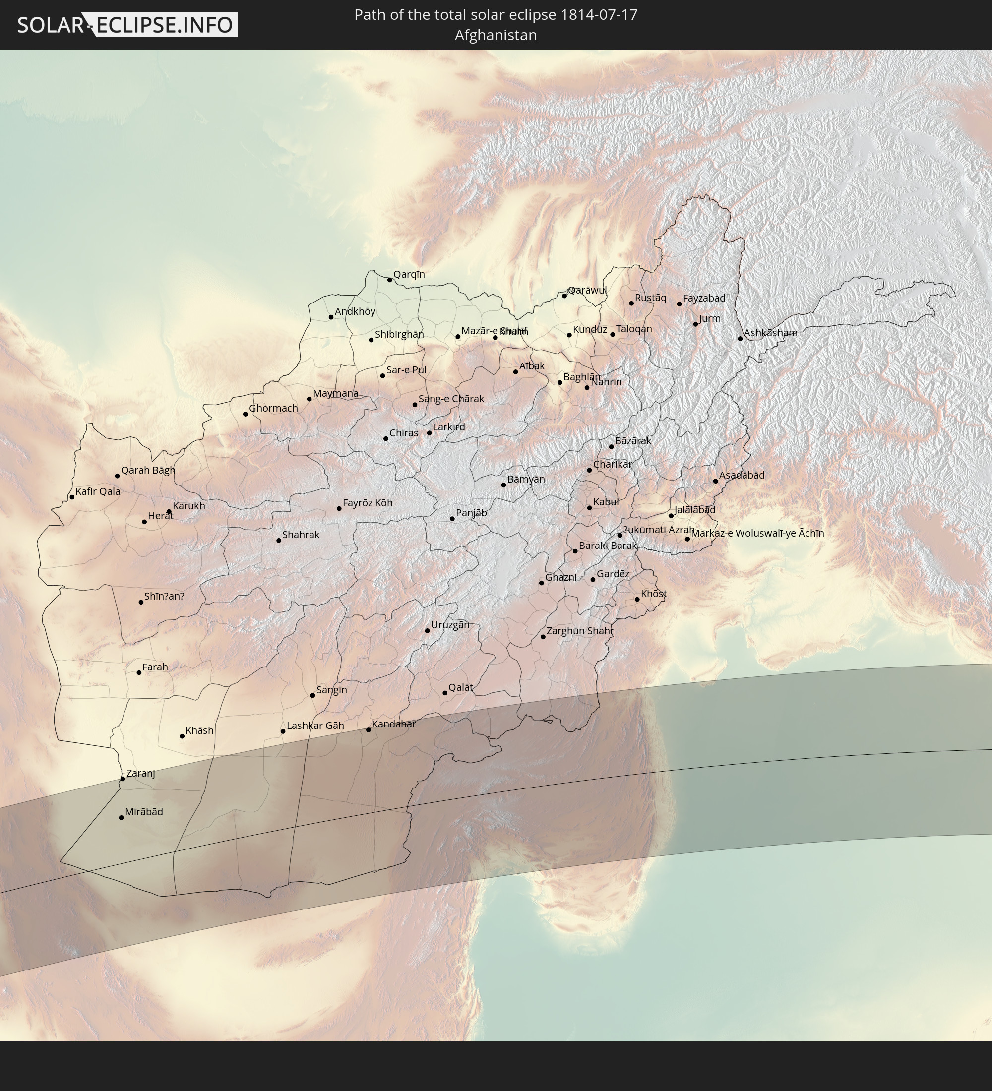 Afghanistan
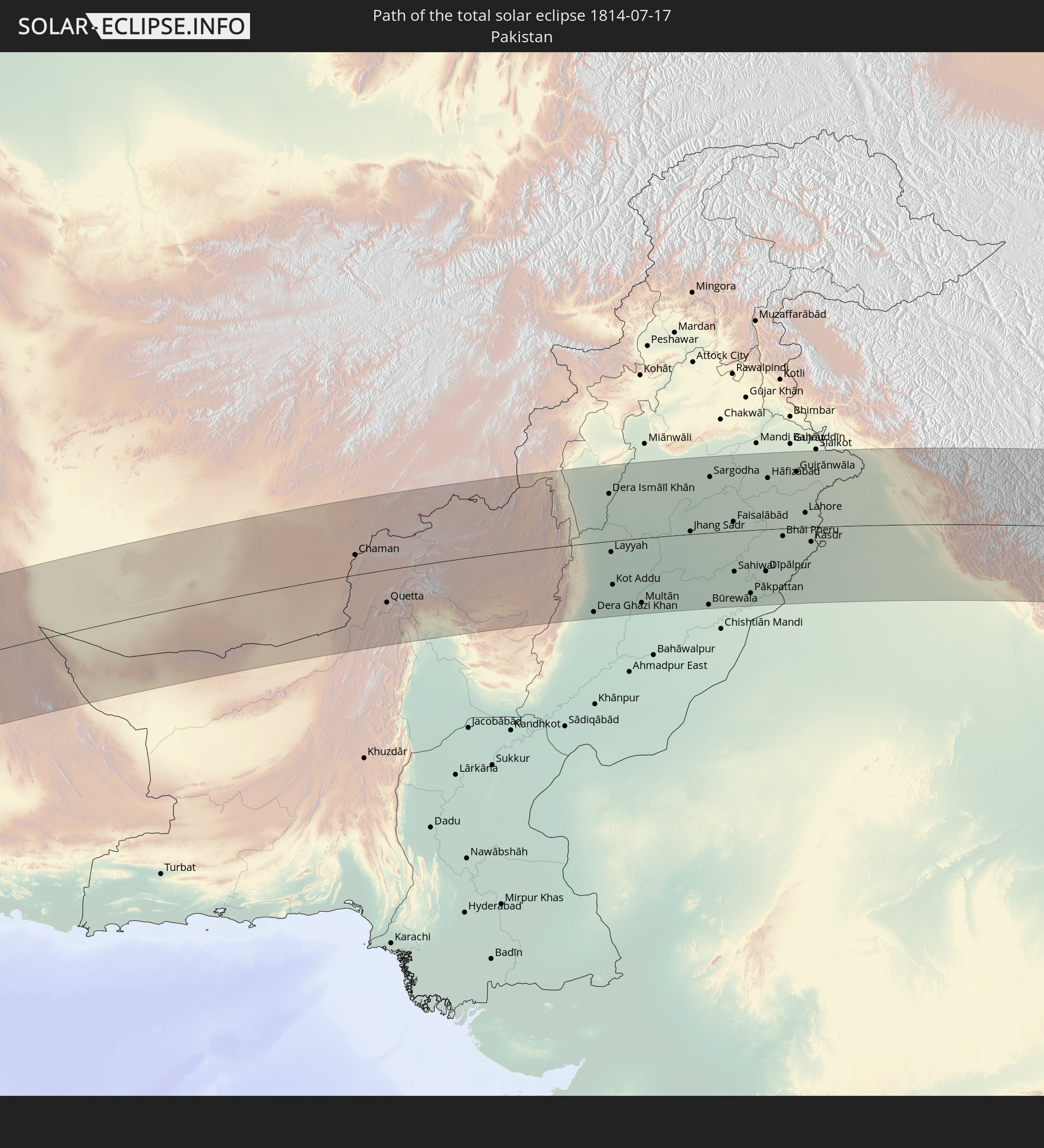 Pakistan
 Indien
 Volksrepublik China
 Nepal
Nepal
 Myanmar
 Macau
Macau
 Hongkong
 Taiwan
 Philippinen
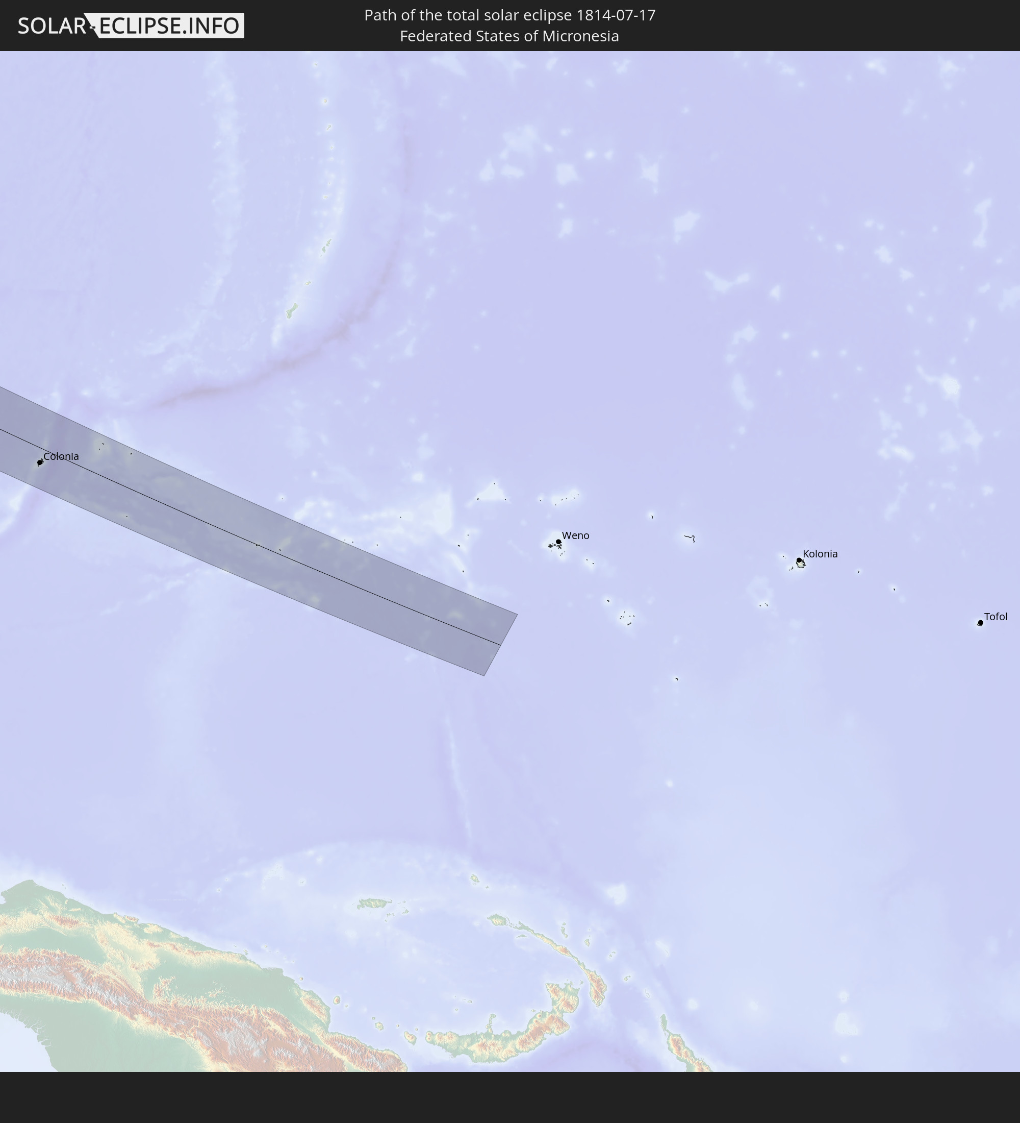 Föderierte Staaten von Mikronesien
In den folgenden Ländern ist die Sonnenfinsternis partiell zu sehen
 Russland
 Portugal
 Spanien
 Algerien
 Frankreich
 Niger
Niger
 Andorra
 Belgien
 Nigeria
 Niederlande
 Luxemburg
 Deutschland
 Schweiz
 Italien
 Monaco
 Tunesien
 Dänemark
 Kamerun
 Libyen
 Liechtenstein
 Österreich
 Tschechien
 Demokratische Republik Kongo
 San Marino
 Vatikanstadt
 Slowenien
 Tschad
 Kroatien
 Polen
Polen
 Malta
Malta
 Zentralafrikanische Republik
 Bosnien und Herzegowina
 Ungarn
 Slowakei
 Montenegro
 Serbien
 Albanien
 Griechenland
 Rumänien
 Mazedonien
 Litauen
 Lettland
 Estland
 Sudan
Sudan
 Sambia
 Ukraine
 Bulgarien
 Weißrussland
 Ägypten
 Türkei
 Moldawien
 Ruanda
 Burundi
 Tansania
 Uganda
 Mosambik
 Republik Zypern
 Malawi
 Äthiopien
 Kenia
Kenia
 Staat Palästina
 Israel
 Saudi-Arabien
 Jordanien
 Libanon
 Syrien
 Eritrea
 Irak
Irak
 Georgien
 Somalia
 Dschibuti
 Jemen
Jemen
 Armenien
 Iran
Iran
 Aserbaidschan
 Seychellen
 Kasachstan
 Kuwait
 Bahrain
 Katar
Katar
 Vereinigte Arabische Emirate
 Oman
Oman
 Turkmenistan
 Usbekistan
 Afghanistan
 Pakistan
 Tadschikistan
 Indien
 Kirgisistan
 Malediven
 Volksrepublik China
 Sri Lanka
 Nepal
Nepal
 Mongolei
 Bangladesch
 Bhutan
 Myanmar
 Indonesien
 Thailand
 Malaysia
 Laos
Laos
 Vietnam
 Kambodscha
 Singapur
 Australien
 Macau
Macau
 Hongkong
 Brunei
 Taiwan
 Philippinen
 Japan
Japan
 Osttimor
 Nordkorea
 Südkorea
 Palau
Palau
 Föderierte Staaten von Mikronesien
 Papua-Neuguinea
 Guam
Guam
 Nördliche Marianen
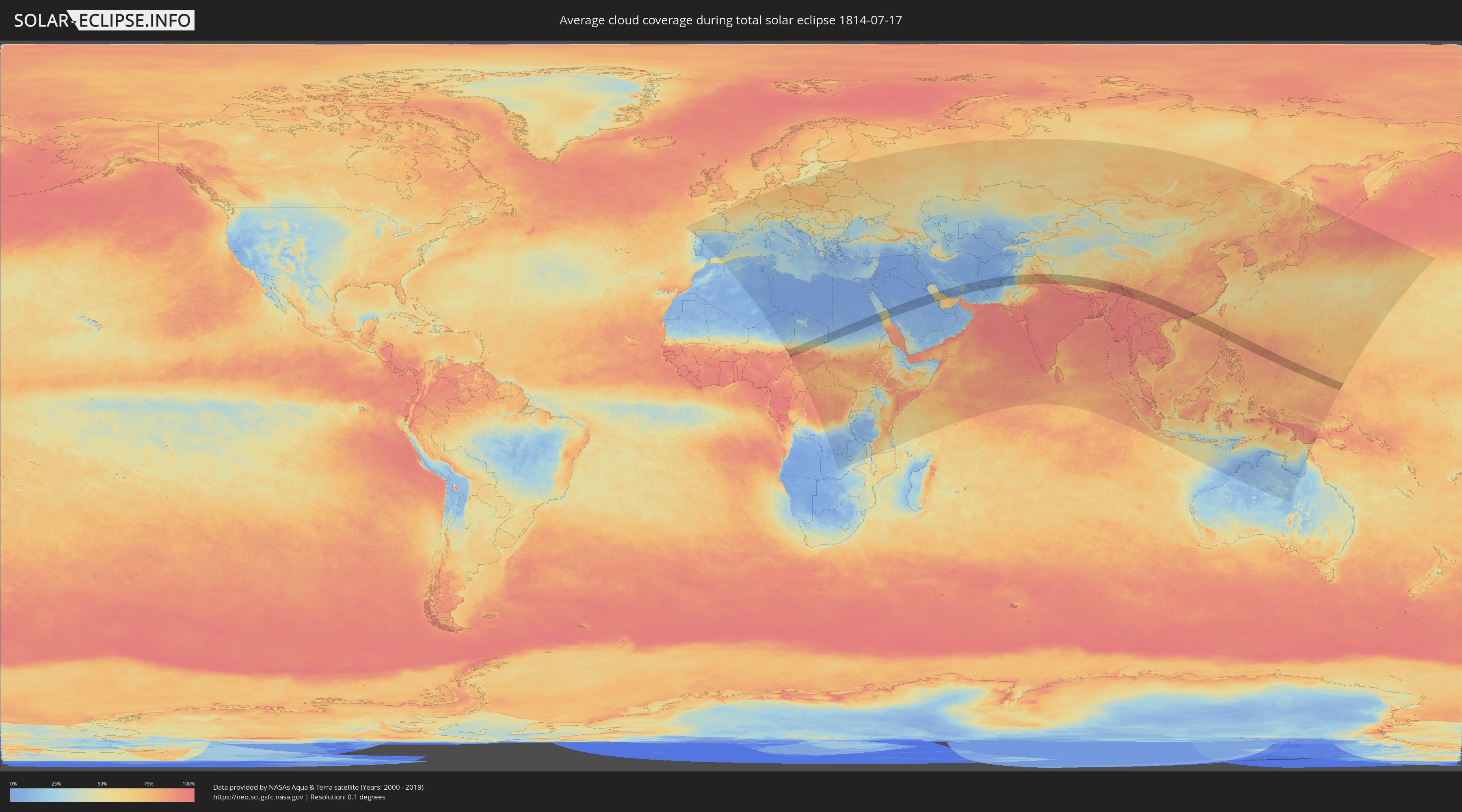
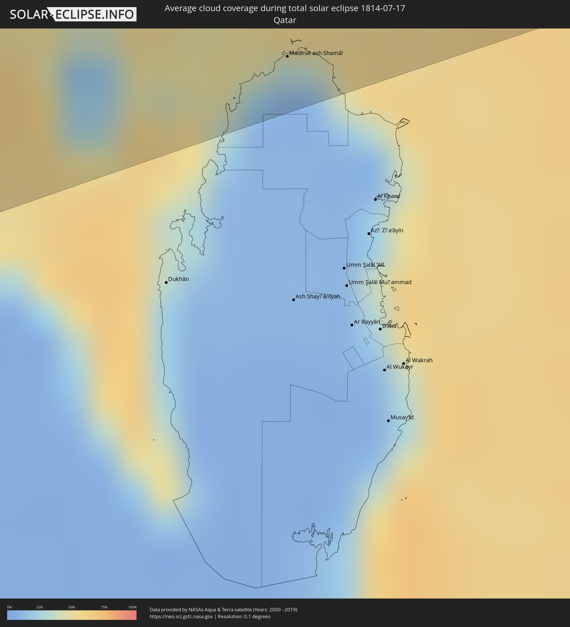
Wie wird das Wetter während der totalen Sonnenfinsternis am 17.07.1814?
Wo ist der beste Ort, um die totale Sonnenfinsternis vom 17.07.1814 zu beobachten?
Die folgenden Karten zeigen die durchschnittliche Bewölkung für den Tag, an dem die totale Sonnenfinsternis
stattfindet. Mit Hilfe der Karten lässt sich der Ort entlang des Finsternispfades eingrenzen,
der die besten Aussichen auf einen klaren wolkenfreien Himmel bietet.
Trotzdem muss man immer lokale Gegenenheiten beachten und sollte sich genau über das Wetter an seinem
gewählten Beobachtungsort informieren.
Die Daten stammen von den beiden NASA-Satelliten
AQUA und TERRA
und wurden über einen Zeitraum von 19 Jahren (2000 - 2019) gemittelt.

Detaillierte Länderkarten
 Nigeria
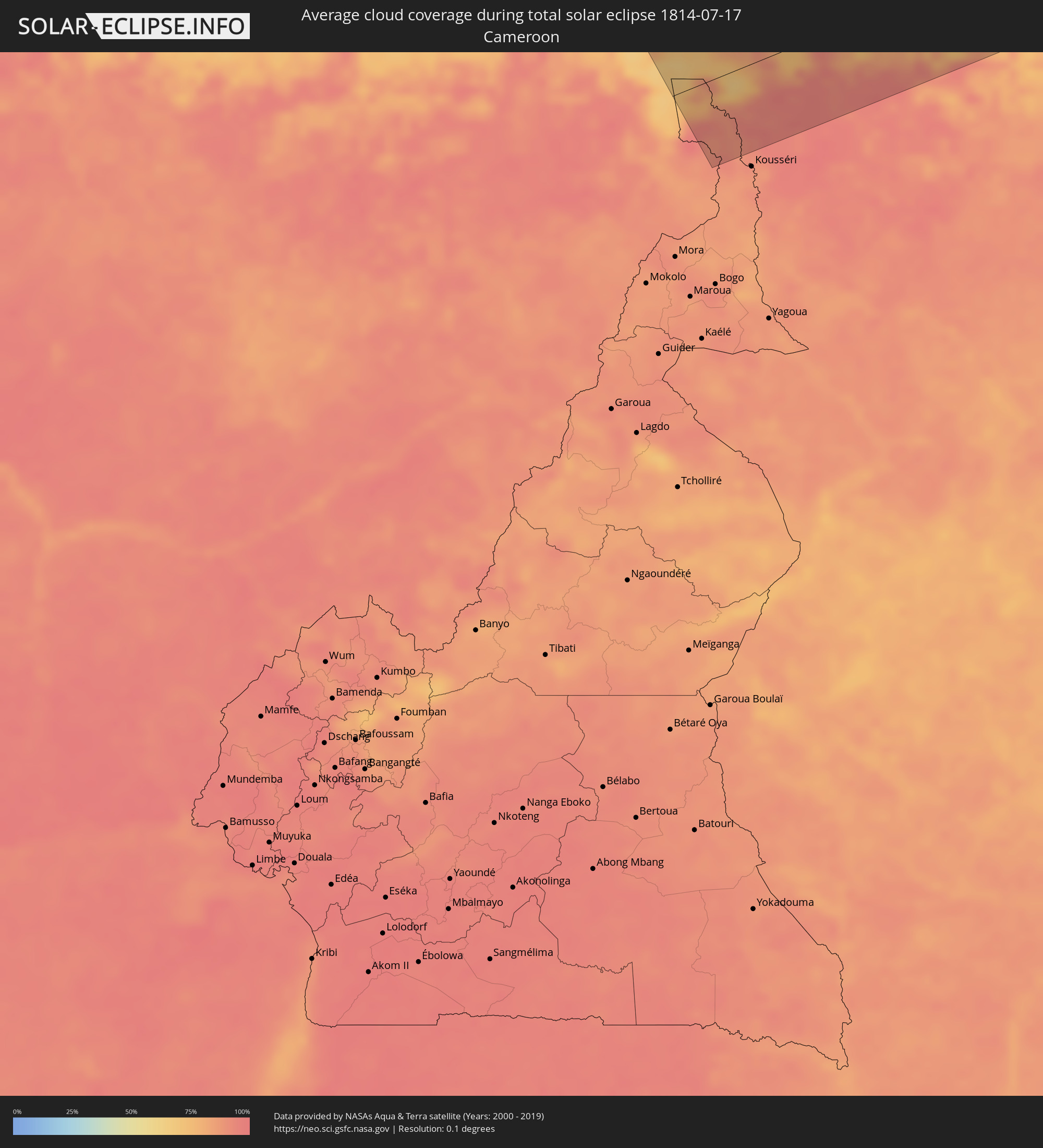 Kamerun
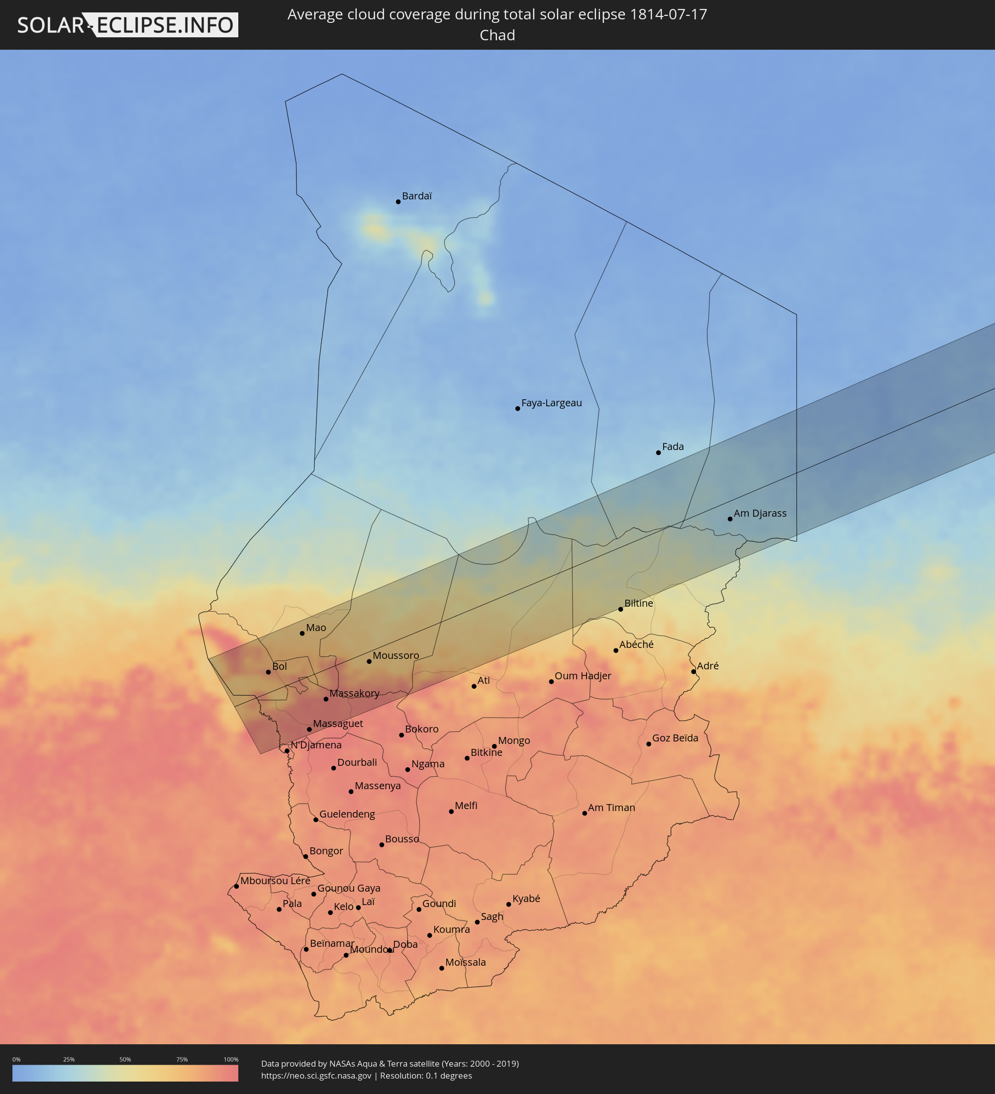 Tschad
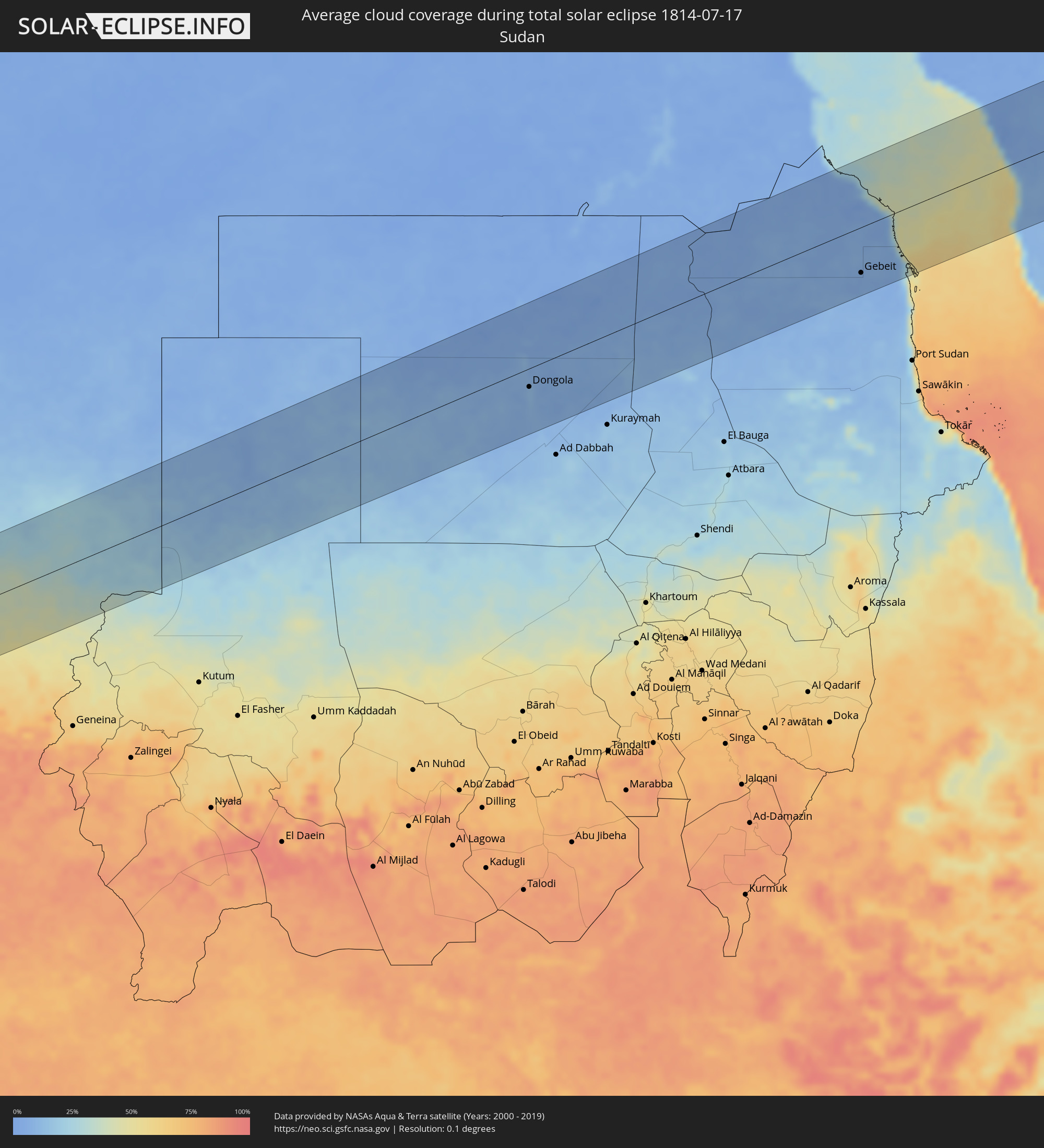 Sudan
Sudan
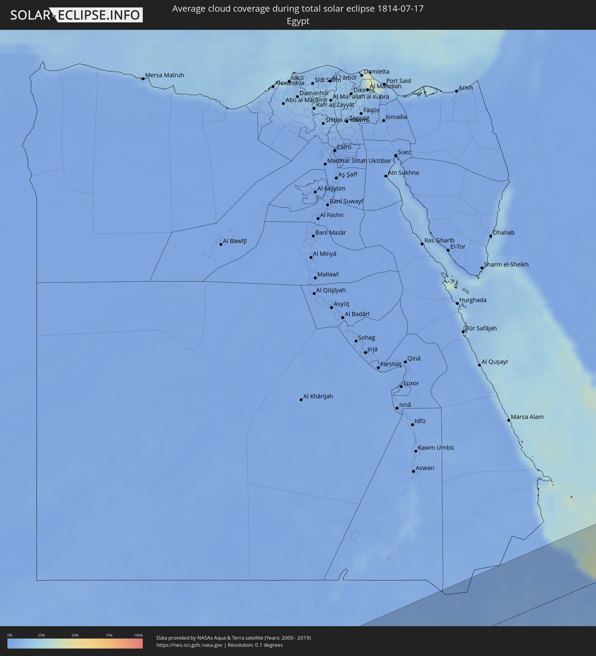 Ägypten
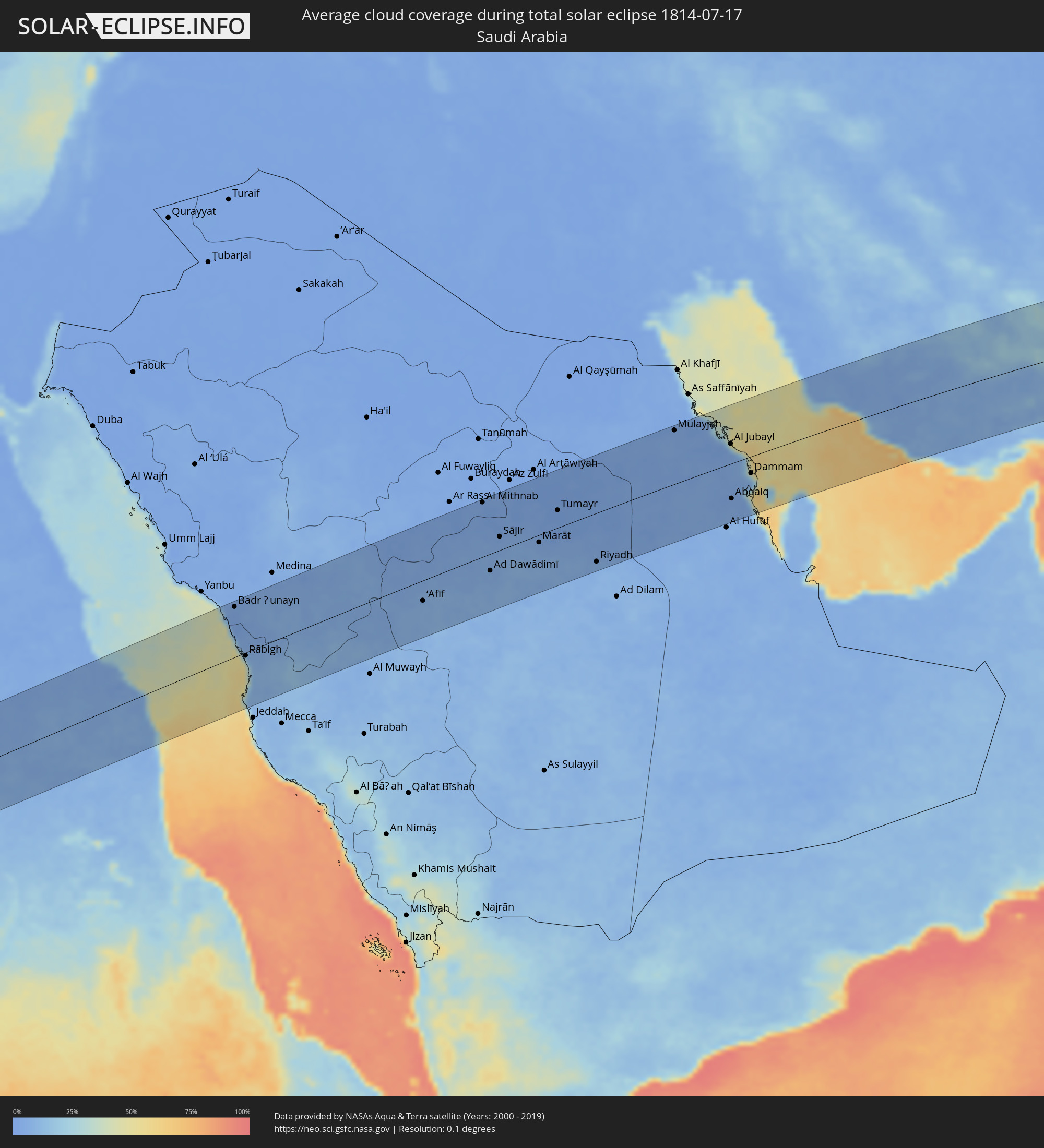 Saudi-Arabien
 Iran
Iran
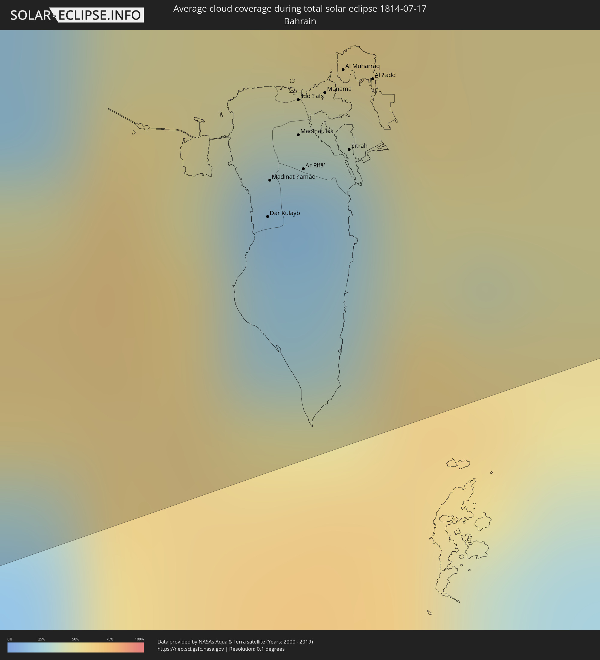 Bahrain
 Katar
Katar
 Afghanistan
 Pakistan
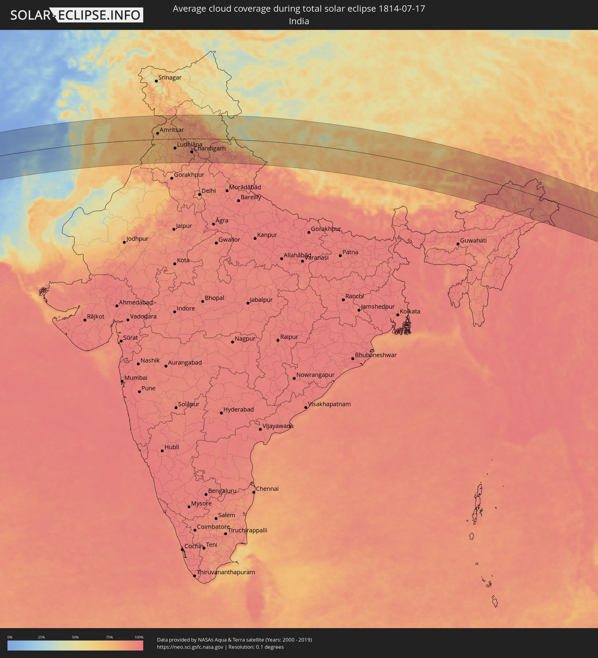 Indien
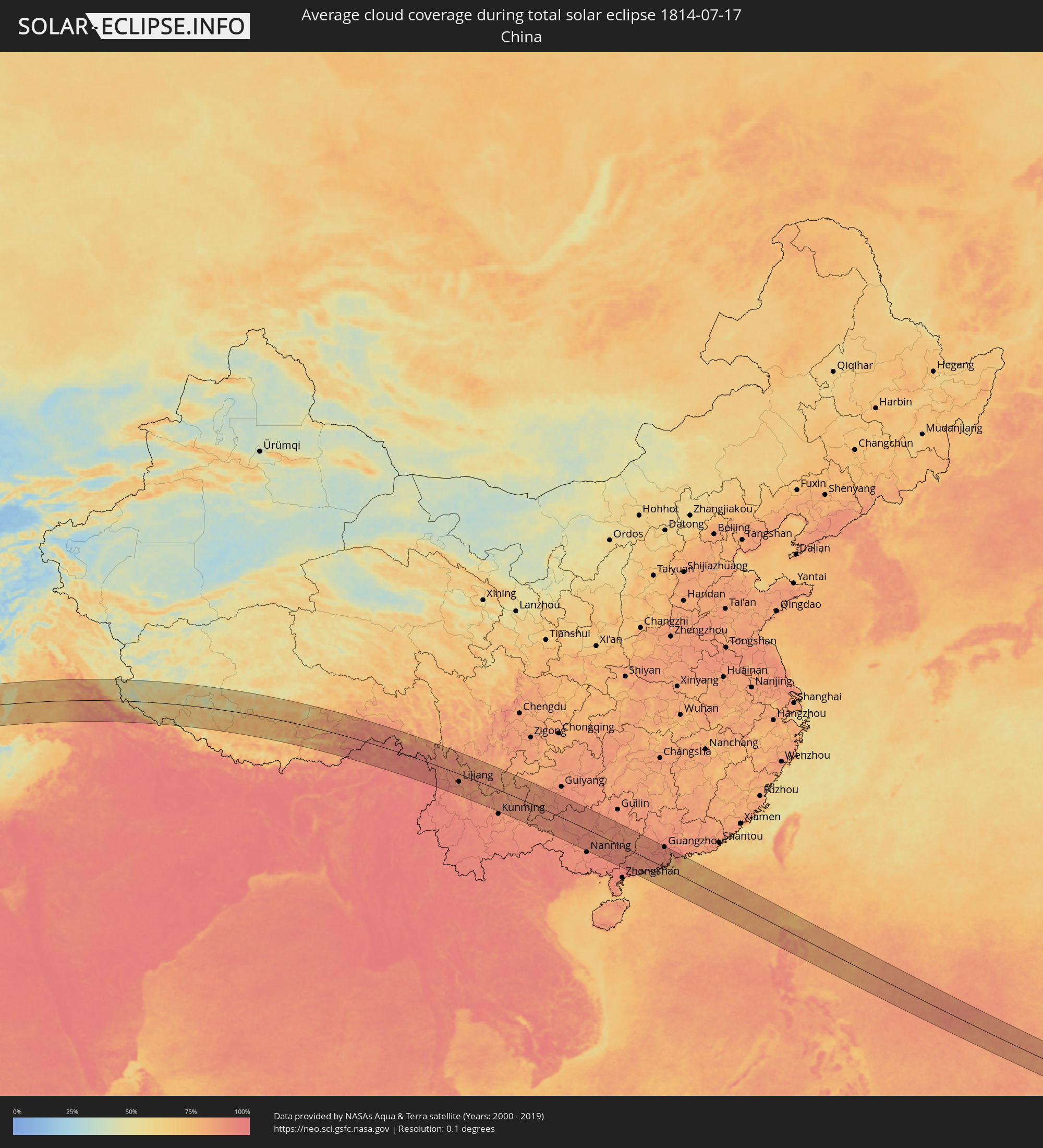 Volksrepublik China
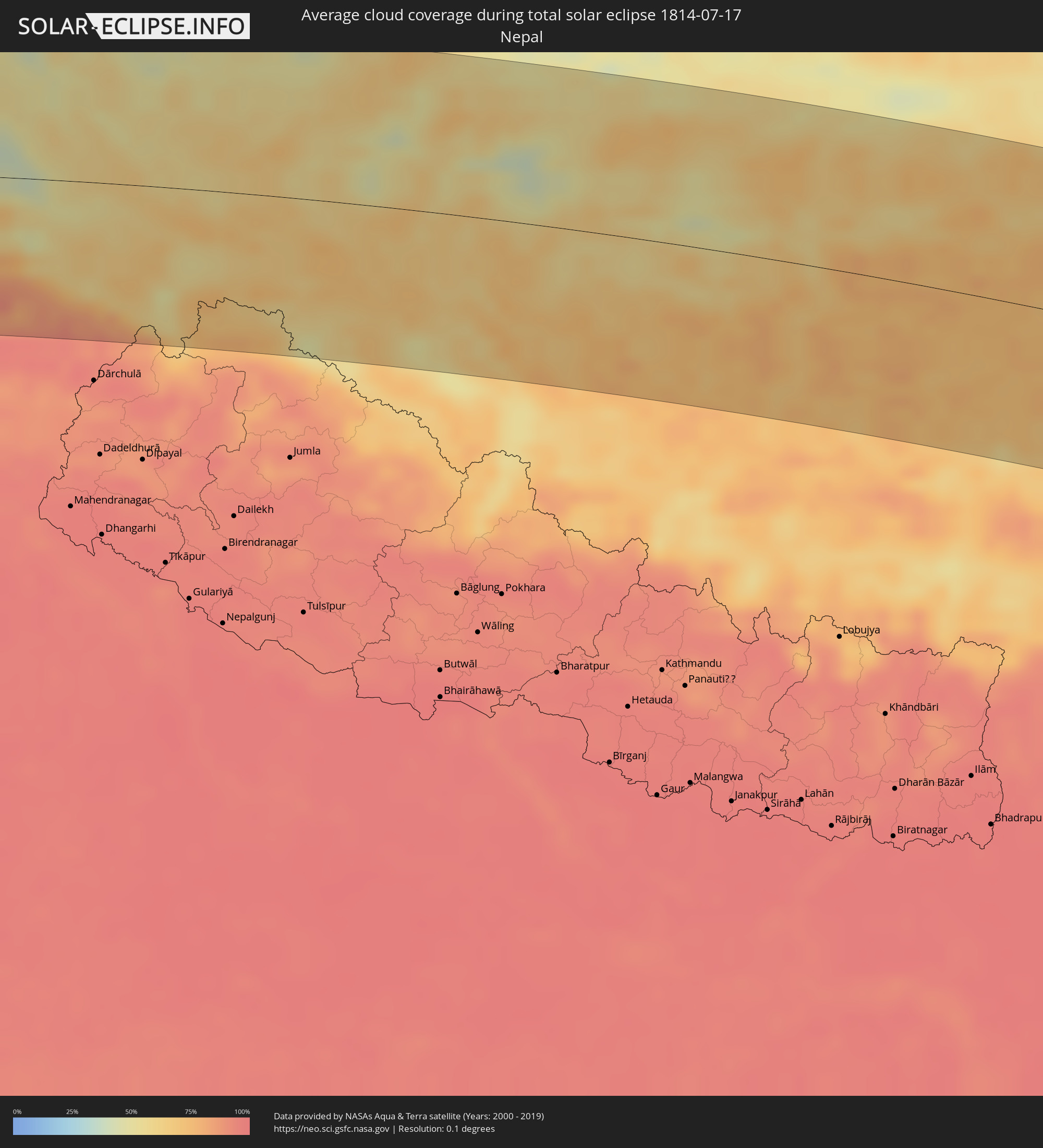 Nepal
Nepal
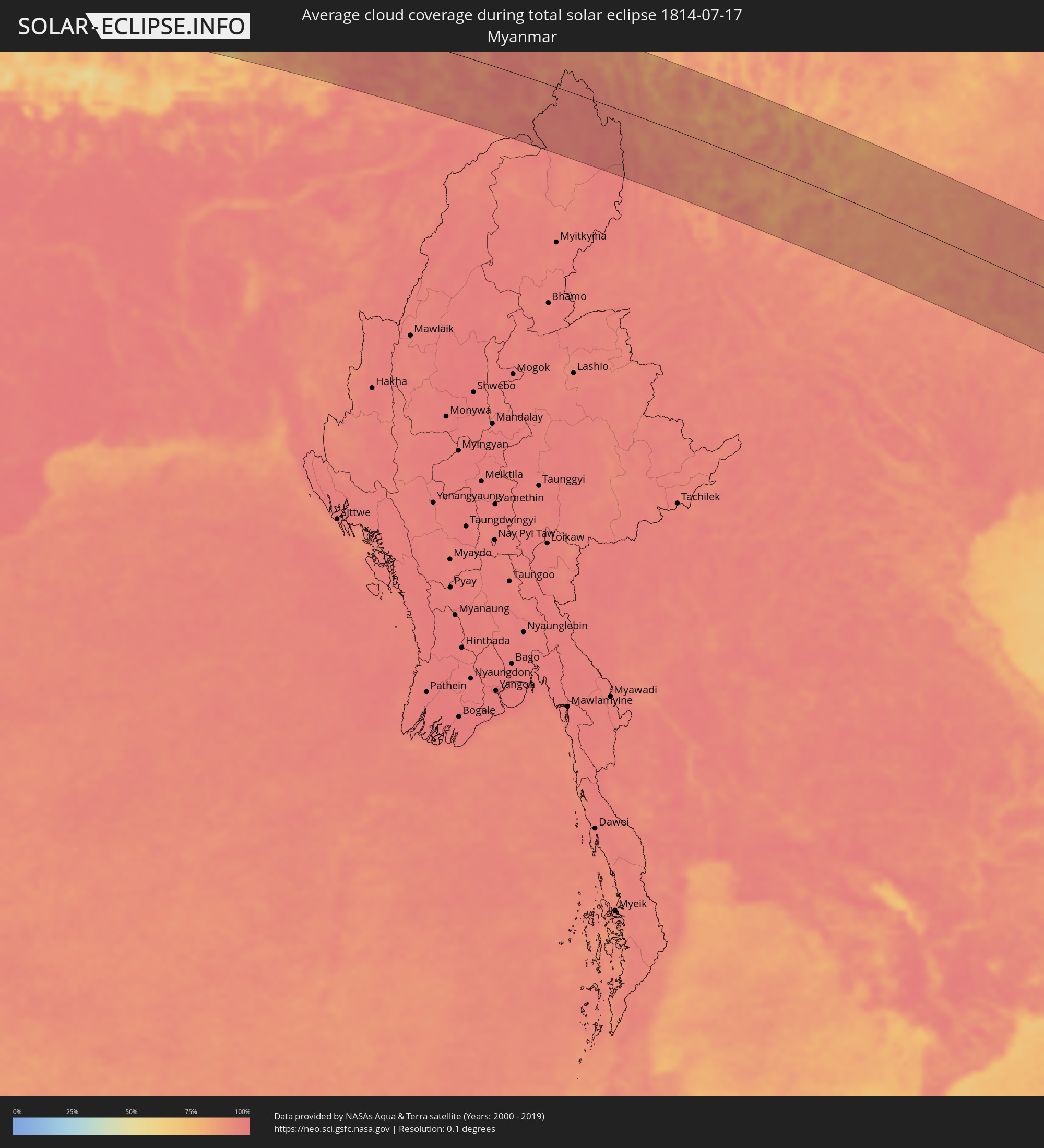 Myanmar
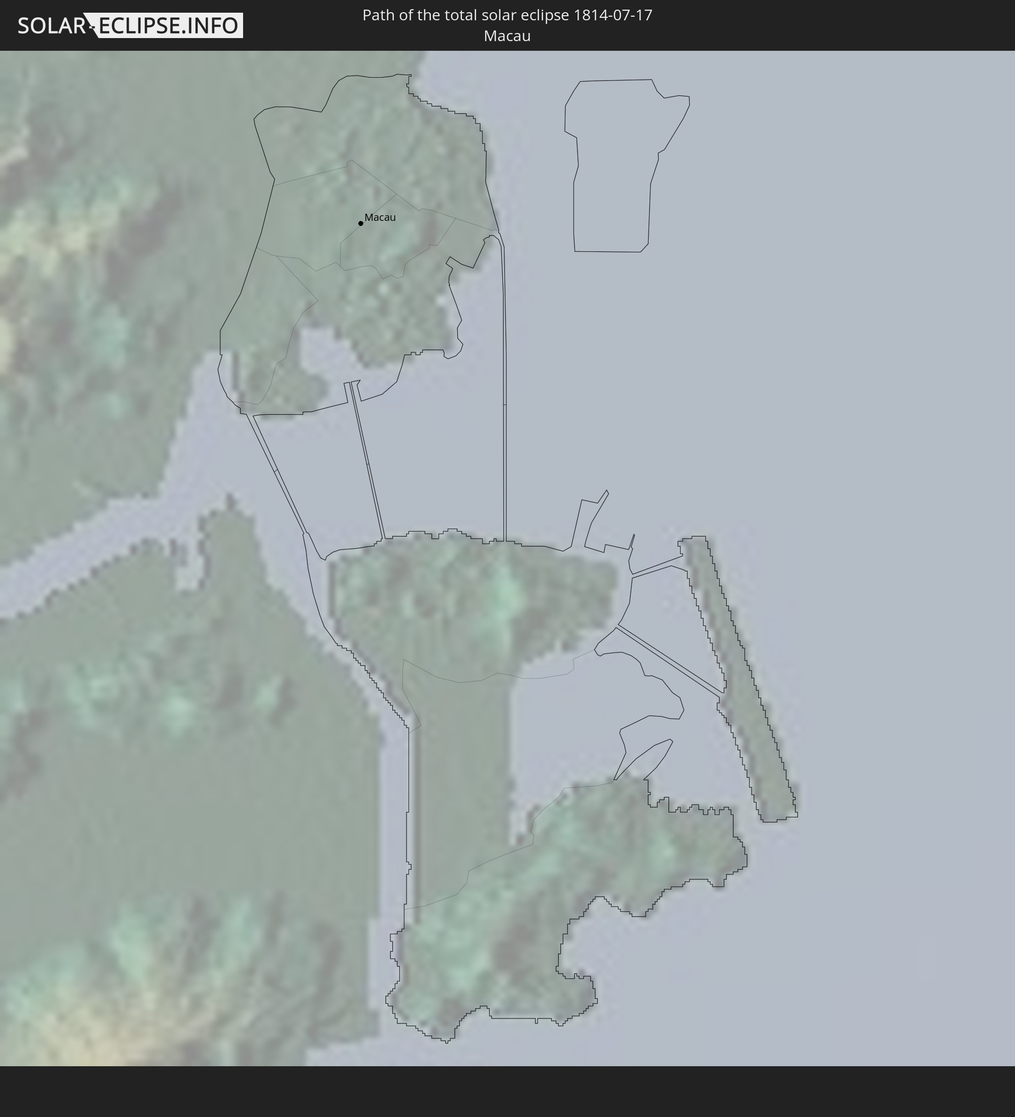
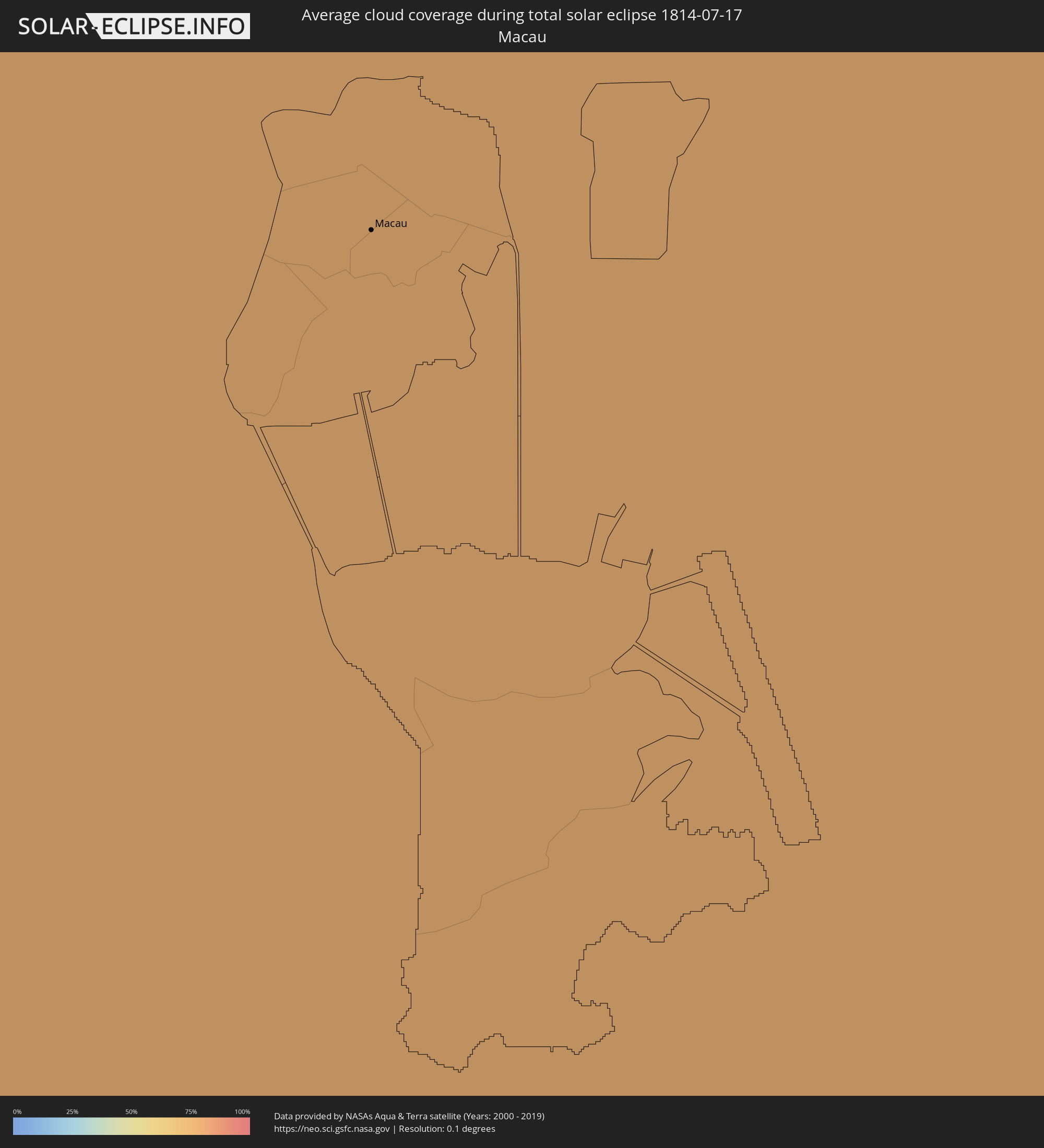 Macau
Macau
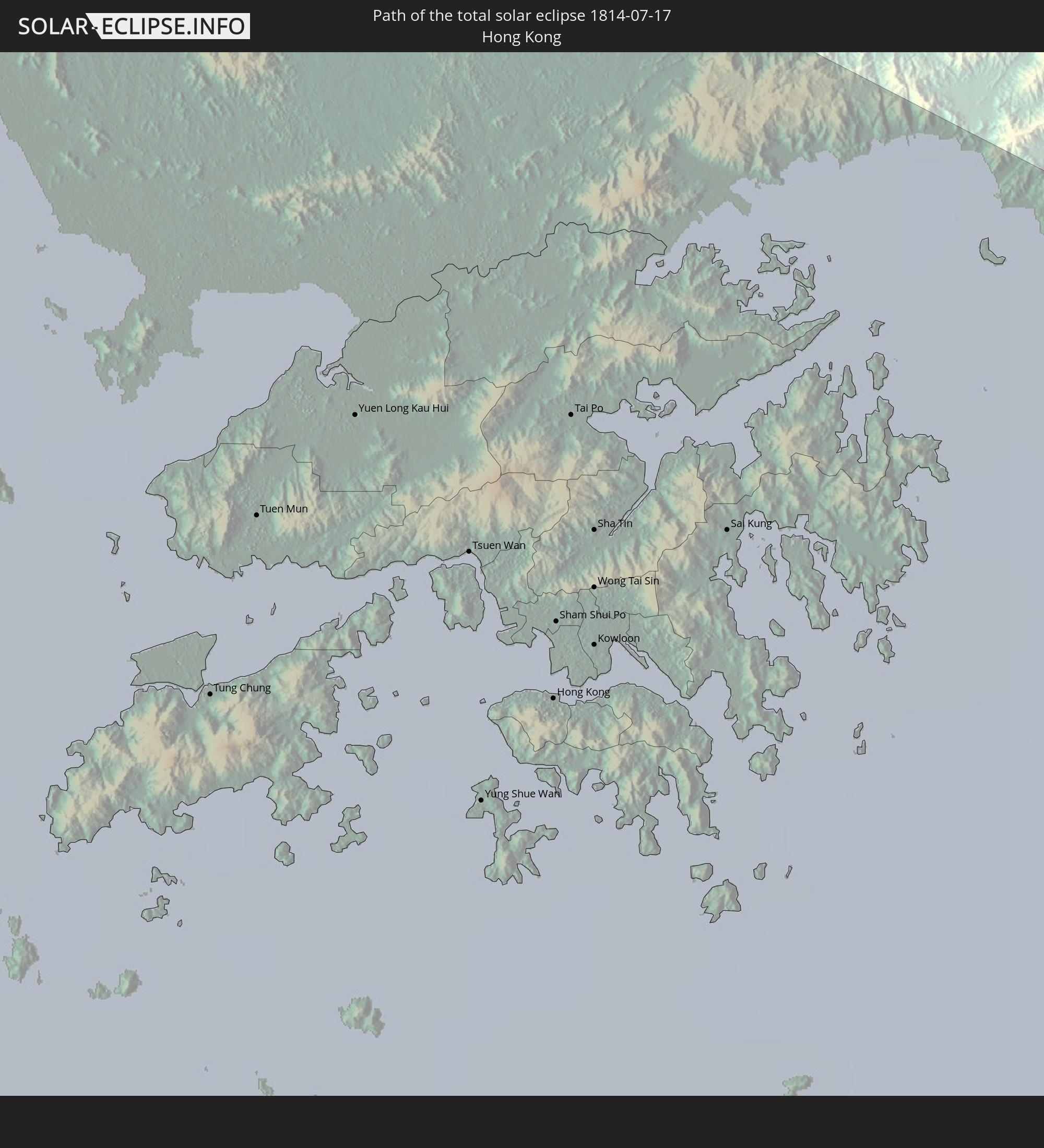
 Hongkong
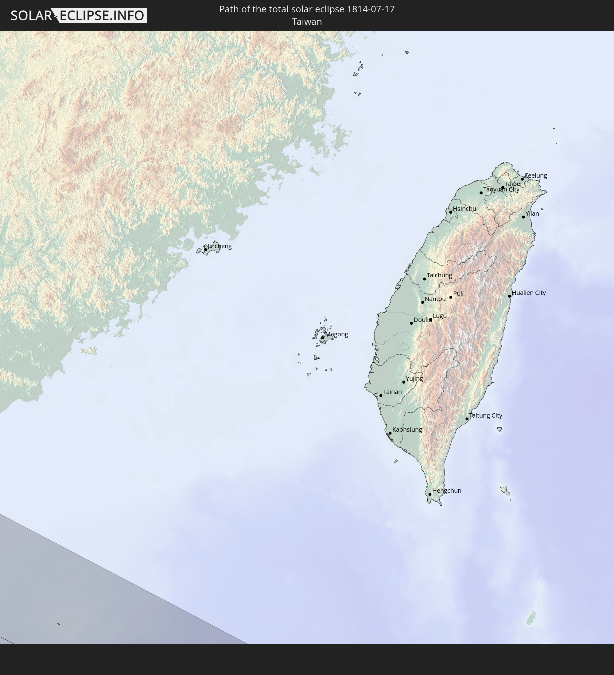
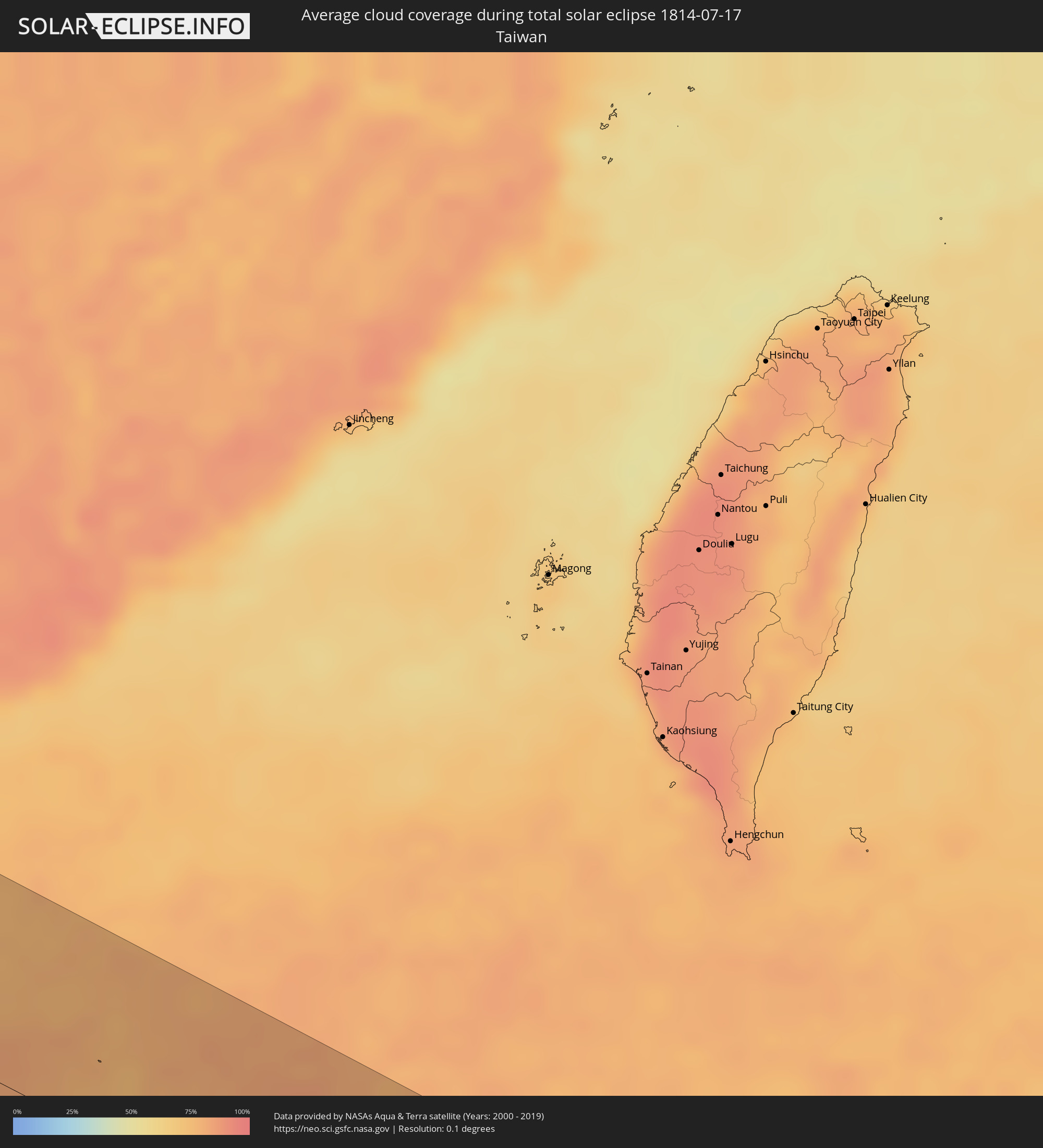 Taiwan
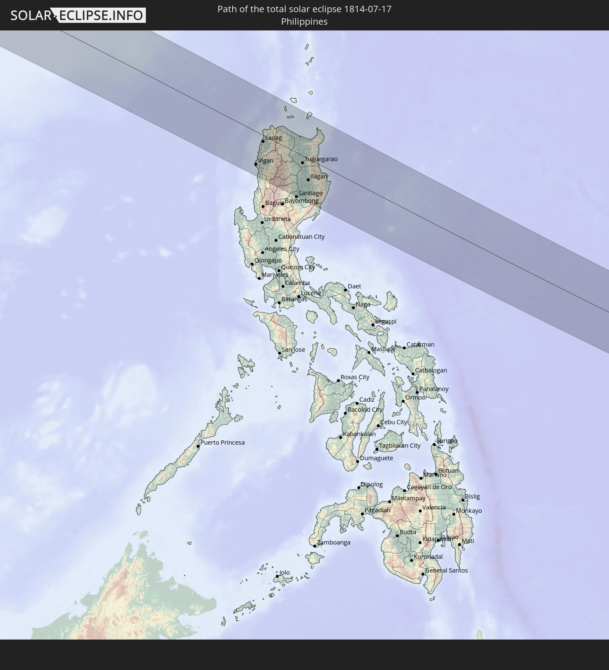
 Philippinen
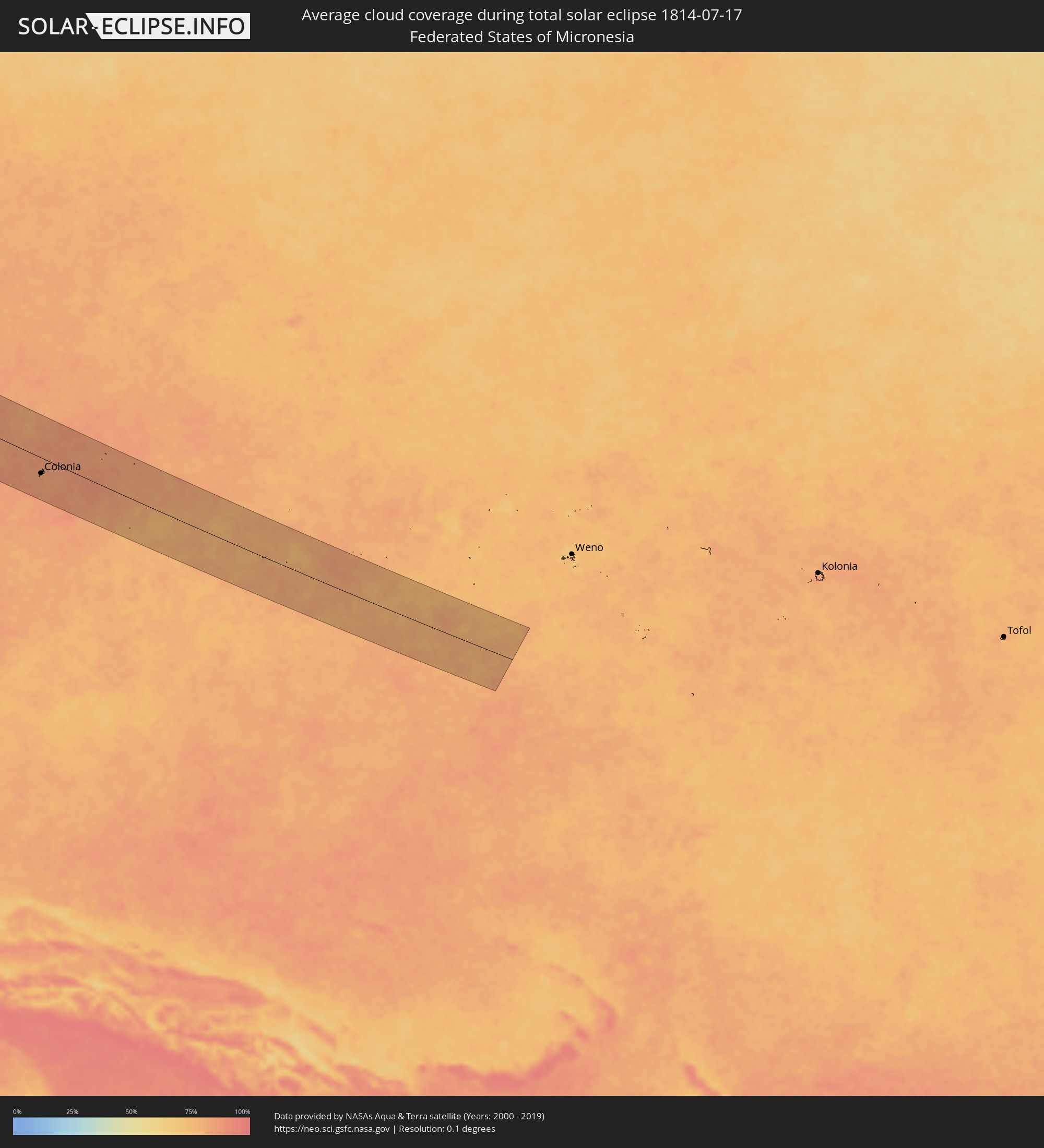 Föderierte Staaten von Mikronesien
Orte im Finsternispfad
Die nachfolgene Tabelle zeigt Städte und Orte mit mehr als 5.000 Einwohnern, die sich im Finsternispfad befinden. Städte mit mehr als 100.000 Einwohnern sind dick gekennzeichnet. Mit einem Klick auf den Ort öffnet sich eine Detailkarte die die Lage des jeweiligen Ortes zusammen mit dem Verlauf der zentralen Finsternis präsentiert.
| Ort | Typ | Dauer der Verfinsterung | Ortszeit bei maximaler Verfinsterung | Entfernung zur Zentrallinie | Ø Bewölkung |
|
Makary, Far North
|
total | - | 05:02:03 UTC+00:13 | 46 km | 94% |
|
Bol, Lac
|
total | - | 05:49:04 UTC+01:00 | 35 km | 80% |
|
Mao, Kanem
|
total | - | 05:49:20 UTC+01:00 | 79 km | 67% |
|
Massaguet, Hadjer-Lamis
|
total | - | 05:48:27 UTC+01:00 | 96 km | 95% |
|
Massakory, Hadjer-Lamis
|
total | - | 05:48:40 UTC+01:00 | 54 km | 96% |
|
Moussoro, Barh el Gazel
|
total | - | 05:48:54 UTC+01:00 | 19 km | 76% |
|
Am Djarass, Ennedi-Est
|
total | - | 05:50:06 UTC+01:00 | 33 km | 24% |
|
Argo, Northern State
|
total | - | 07:04:03 UTC+02:10 | 6 km | 9% |
|
Dongola, Northern State
|
total | - | 07:03:48 UTC+02:10 | 31 km | 11% |
|
Gebeit, Red Sea
|
total | - | 07:08:05 UTC+02:10 | 77 km | 5% |
|
Badr Ḩunayn, Al Madīnah al Munawwarah
|
total | - | 08:08:51 UTC+03:06 | 104 km | 3% |
|
Rābigh, Makkah
|
total | - | 08:08:07 UTC+03:06 | 7 km | 30% |
|
‘Afīf, Ar Riyāḑ
|
total | - | 08:12:18 UTC+03:06 | 42 km | 7% |
|
Al Mithnab, Al-Qassim
|
total | - | 08:15:23 UTC+03:06 | 112 km | 2% |
|
Ad Dawādimī, Ar Riyāḑ
|
total | - | 08:14:15 UTC+03:06 | 35 km | 6% |
|
Riyadh, Ar Riyāḑ
|
total | - | 08:16:50 UTC+03:06 | 100 km | 6% |
|
Al Qurayn, Eastern Province
|
total | - | 08:20:58 UTC+03:06 | 117 km | 7% |
|
Al Jubayl, Eastern Province
|
total | - | 08:22:31 UTC+03:06 | 41 km | 20% |
|
Abqaiq, Eastern Province
|
total | - | 08:21:30 UTC+03:06 | 72 km | 3% |
|
Umm as Sāhik, Eastern Province
|
total | - | 08:22:29 UTC+03:06 | 5 km | 8% |
|
Tārūt, Eastern Province
|
total | - | 08:22:34 UTC+03:06 | 18 km | 18% |
|
Raḩīmah, Eastern Province
|
total | - | 08:22:43 UTC+03:06 | 4 km | 47% |
|
Dammam, Eastern Province
|
total | - | 08:22:31 UTC+03:06 | 34 km | 8% |
|
Khobar, Eastern Province
|
total | - | 08:22:30 UTC+03:06 | 54 km | 26% |
|
Dār Kulayb, Southern Governorate
|
total | - | 08:41:57 UTC+03:26 | 86 km | 24% |
|
Madīnat Ḩamad, Central Governorate
|
total | - | 08:42:00 UTC+03:26 | 81 km | 24% |
|
Madīnat ‘Īsá, Southern Governorate
|
total | - | 08:42:06 UTC+03:26 | 77 km | 19% |
|
Jidd Ḩafş, Manama
|
total | - | 08:42:09 UTC+03:26 | 72 km | 19% |
|
Ar Rifā‘, Southern Governorate
|
total | - | 08:42:04 UTC+03:26 | 81 km | 25% |
|
Manama, Manama
|
total | - | 08:42:12 UTC+03:26 | 72 km | 22% |
|
Al Muharraq, Muharraq
|
total | - | 08:42:16 UTC+03:26 | 70 km | 39% |
|
Sitrah, Manama
|
total | - | 08:42:11 UTC+03:26 | 81 km | 22% |
|
Al Ḩadd, Muharraq
|
total | - | 08:42:19 UTC+03:26 | 72 km | 46% |
|
Madīnat ash Shamāl, Madīnat ash Shamāl
|
total | - | 08:42:55 UTC+03:26 | 103 km | 11% |
|
Fasā, Fars
|
total | - | 08:48:36 UTC+03:25 | 118 km | 6% |
|
Gerāsh, Fars
|
total | - | 08:48:06 UTC+03:25 | 32 km | 6% |
|
Dārāb, Fars
|
total | - | 08:49:44 UTC+03:25 | 71 km | 7% |
|
Sirjan, Kerman
|
total | - | 08:52:06 UTC+03:25 | 113 km | 13% |
|
Bam, Kerman
|
total | - | 08:56:08 UTC+03:25 | 5 km | 5% |
|
Zahedan, Sistan and Baluchestan
|
total | - | 09:00:53 UTC+03:25 | 14 km | 4% |
|
Mīrābād, Nimroz
|
total | - | 09:37:42 UTC+04:00 | 66 km | 5% |
|
Zaranj, Nimroz
|
total | - | 09:38:09 UTC+04:00 | 123 km | 4% |
|
Rūdbār, Nimroz
|
total | - | 09:38:54 UTC+04:00 | 19 km | 4% |
|
‘Alāqahdārī Dīshū, Helmand
|
total | - | 09:40:27 UTC+04:00 | 36 km | 5% |
|
Markaz-e Ḩukūmat-e Darwēshān, Helmand
|
total | - | 09:42:42 UTC+04:00 | 95 km | 3% |
|
Kandahār, Kandahar
|
total | - | 09:46:02 UTC+04:00 | 121 km | 0% |
|
Quetta, Balochistān
|
total | - | 10:16:02 UTC+04:28 | 54 km | 14% |
|
Dera Ghazi Khan, Punjab
|
total | - | 10:24:00 UTC+04:28 | 116 km | 58% |
|
Multān, Punjab
|
total | - | 10:26:00 UTC+04:28 | 108 km | 63% |
|
Jhang Sadr, Punjab
|
total | - | 10:28:22 UTC+04:28 | 5 km | 69% |
|
Sargodha, Punjab
|
total | - | 10:29:26 UTC+04:28 | 93 km | 67% |
|
Chiniot, Punjab
|
total | - | 10:30:01 UTC+04:28 | 50 km | 71% |
|
Faisalābād, Punjab
|
total | - | 10:30:10 UTC+04:28 | 16 km | 69% |
|
Sahiwal, Punjab
|
total | - | 10:29:58 UTC+04:28 | 68 km | 73% |
|
Okāra, Punjab
|
total | - | 10:30:50 UTC+04:28 | 54 km | 75% |
|
Shahkot, Punjab
|
total | - | 10:31:08 UTC+04:28 | 31 km | 74% |
|
Sheikhupura, Punjab
|
total | - | 10:32:19 UTC+04:28 | 44 km | 73% |
|
Gujrānwāla, Punjab
|
total | - | 10:32:56 UTC+04:28 | 93 km | 72% |
|
Lahore, Punjab
|
total | - | 10:33:08 UTC+04:28 | 24 km | 73% |
|
Kasūr, Punjab
|
total | - | 10:33:17 UTC+04:28 | 24 km | 76% |
|
Amritsar, Punjab
|
total | - | 11:27:22 UTC+05:21 | 31 km | 75% |
|
Moga, Punjab
|
total | - | 11:27:55 UTC+05:21 | 60 km | 77% |
|
Batāla, Punjab
|
total | - | 11:28:11 UTC+05:21 | 50 km | 74% |
|
Barnāla, Punjab
|
total | - | 11:28:46 UTC+05:21 | 110 km | 80% |
|
Jalandhar, Punjab
|
total | - | 11:28:59 UTC+05:21 | 4 km | 81% |
|
Pathānkot, Punjab
|
total | - | 11:29:19 UTC+05:21 | 101 km | 79% |
|
Ludhiāna, Punjab
|
total | - | 11:29:35 UTC+05:21 | 51 km | 82% |
|
Māler Kotla, Punjab
|
total | - | 11:29:36 UTC+05:21 | 93 km | 84% |
|
Khanna, Punjab
|
total | - | 11:30:27 UTC+05:21 | 74 km | 86% |
|
Patiāla, Punjab
|
total | - | 11:30:50 UTC+05:21 | 116 km | 87% |
|
Chandigarh, Chandigarh
|
total | - | 11:31:51 UTC+05:21 | 71 km | 88% |
|
Ambāla, Haryana
|
total | - | 11:31:50 UTC+05:21 | 113 km | 92% |
|
Shimla, Himachal Pradesh
|
total | - | 11:32:48 UTC+05:21 | 30 km | 88% |
|
Dehra Dūn, Uttarakhand
|
total | - | 11:34:55 UTC+05:21 | 116 km | 95% |
|
Lijiang, Yunnan
|
total | - | 15:10:02 UTC+08:00 | 46 km | 85% |
|
Dadukou, Sichuan
|
total | - | 15:13:24 UTC+08:00 | 25 km | 86% |
|
Liupanshui, Guizhou
|
total | - | 15:19:18 UTC+08:00 | 102 km | 85% |
|
Anshun, Guizhou
|
total | - | 15:21:41 UTC+08:00 | 111 km | 89% |
|
Wuzhou, Guangxi Zhuang Autonomous Region
|
total | - | 15:33:49 UTC+08:00 | 66 km | 88% |
|
Yangjiang, Guangdong
|
total | - | 15:36:46 UTC+08:00 | 66 km | 90% |
|
Yunfu, Guangdong
|
total | - | 15:35:33 UTC+08:00 | 44 km | 90% |
|
Zhaoqing, Guangdong
|
total | - | 15:36:00 UTC+08:00 | 76 km | 90% |
|
Jiangmen, Guangdong
|
total | - | 15:37:27 UTC+08:00 | 58 km | 91% |
|
Foshan, Guangdong
|
total | - | 15:36:57 UTC+08:00 | 104 km | 91% |
|
Guangzhou, Guangdong
|
total | - | 15:37:00 UTC+08:00 | 119 km | 92% |
|
Shiqi, Guangdong
|
total | - | 15:37:56 UTC+08:00 | 65 km | 93% |
|
Macau, Macau
|
total | - | 15:12:43 UTC+07:34 | 41 km | 85% |
|
Zhuhai, Guangdong
|
total | - | 15:38:29 UTC+08:00 | 50 km | 76% |
|
Tung Chung, Islands
|
total | - | 15:15:40 UTC+07:36 | 68 km | 79% |
|
Tuen Mun, Tuen Mun
|
total | - | 15:15:35 UTC+07:36 | 80 km | 83% |
|
Yuen Long Kau Hui, Yuen Long
|
total | - | 15:15:35 UTC+07:36 | 89 km | 88% |
|
Shenzhen, Guangdong
|
total | - | 15:38:49 UTC+08:00 | 100 km | 90% |
|
Tsuen Wan, Tsuen Wan
|
total | - | 15:15:47 UTC+07:36 | 84 km | 85% |
|
Yung Shue Wan
|
total | - | 15:15:58 UTC+07:36 | 70 km | 76% |
|
Hong Kong, Central and Western
|
total | - | 15:15:57 UTC+07:36 | 78 km | 83% |
|
Central, Central and Western
|
total | - | 15:15:57 UTC+07:36 | 78 km | 83% |
|
Sham Shui Po, Sham Shui Po
|
total | - | 15:15:54 UTC+07:36 | 83 km | 83% |
|
Tai Po, Tai Po
|
total | - | 15:15:46 UTC+07:36 | 95 km | 88% |
|
Wan Chai, Wanchai
|
total | - | 15:15:59 UTC+07:36 | 79 km | 83% |
|
Kowloon, Kowloon City
|
total | - | 15:15:57 UTC+07:36 | 83 km | 83% |
|
Wong Tai Sin, Wong Tai Sin
|
total | - | 15:15:54 UTC+07:36 | 86 km | 85% |
|
Sha Tin, Sha Tin
|
total | - | 15:15:52 UTC+07:36 | 89 km | 85% |
|
Sai Kung, Sai Kung
|
total | - | 15:15:59 UTC+07:36 | 93 km | 80% |
|
Vigan, Ilocos
|
total | - | 15:51:55 UTC+08:00 | 89 km | 83% |
|
Batac City, Ilocos
|
total | - | 15:51:33 UTC+08:00 | 33 km | 88% |
|
Laoag, Ilocos
|
total | - | 15:51:25 UTC+08:00 | 17 km | 88% |
|
Claveria, Cagayan Valley
|
total | - | 15:51:25 UTC+08:00 | 47 km | 78% |
|
Tabuk, Cordillera
|
total | - | 15:53:03 UTC+08:00 | 46 km | 88% |
|
Ramon, Cagayan Valley
|
total | - | 15:53:52 UTC+08:00 | 111 km | 84% |
|
Roxas, Cagayan Valley
|
total | - | 15:53:34 UTC+08:00 | 74 km | 87% |
|
Aparri, Cagayan Valley
|
total | - | 15:52:13 UTC+08:00 | 49 km | 78% |
|
Magapit, Aguiguican, Cagayan Valley
|
total | - | 15:52:32 UTC+08:00 | 27 km | 83% |
|
Alicia, Cagayan Valley
|
total | - | 15:54:01 UTC+08:00 | 104 km | 81% |
|
Tuguegarao, Cagayan Valley
|
total | - | 15:53:07 UTC+08:00 | 20 km | 84% |
|
Cabagan, Cagayan Valley
|
total | - | 15:53:22 UTC+08:00 | 36 km | 80% |
|
Ilagan, Cagayan Valley
|
total | - | 15:53:47 UTC+08:00 | 58 km | 80% |
|
San Mariano, Cagayan Valley
|
total | - | 15:54:05 UTC+08:00 | 68 km | 84% |
|
Colonia, Yap
|
total | - | 18:09:09 UTC+10:00 | 40 km | 86% |