Totale Sonnenfinsternis vom 22.07.2028
| Wochentag: | Samstag |
| Maximale Dauer der Verfinsterung: | 05m10s |
| Maximale Breite des Finsternispfades: | 230 km |
| Saroszyklus: | 146 |
| Bedeckungsgrad: | 100% |
| Magnitude: | 1.056 |
| Gamma: | -0.6056 |
Wo kann man die Sonnenfinsternis vom 22.07.2028 sehen?

Die Sonnenfinsternis am 22.07.2028 kann man in 33 Ländern als partielle Sonnenfinsternis beobachten.
Der Finsternispfad verläuft durch 4 Länder. Nur in diesen Ländern ist sie als totale Sonnenfinsternis zu sehen.
In den folgenden Ländern ist die Sonnenfinsternis total zu sehen
 Neuseeland
 Kokosinseln
 Weihnachtsinsel
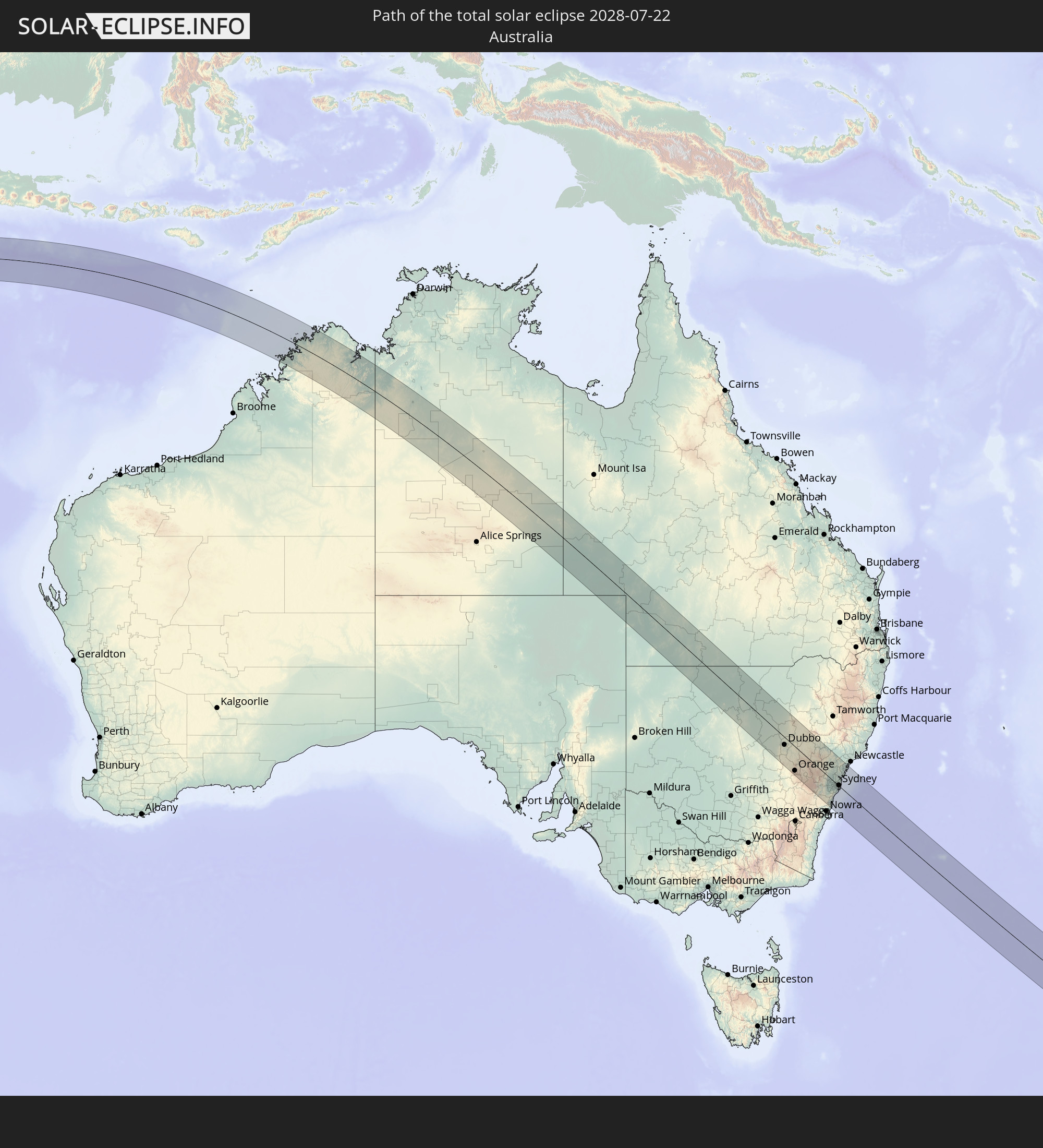 Australien
In den folgenden Ländern ist die Sonnenfinsternis partiell zu sehen
 Antarktika
 Fidschi
 Neuseeland
 Tonga
Tonga
 Niue
Niue
 Indien
 Malediven
 Volksrepublik China
 Sri Lanka
 Myanmar
 Indonesien
 Kokosinseln
 Thailand
 Malaysia
 Laos
Laos
 Vietnam
 Kambodscha
 Singapur
 Weihnachtsinsel
 Australien
 Macau
Macau
 Hongkong
 Brunei
 Taiwan
 Philippinen
 Osttimor
 Palau
Palau
 Föderierte Staaten von Mikronesien
 Papua-Neuguinea
 Salomonen
 Neukaledonien
 Vanuatu
 Norfolkinsel
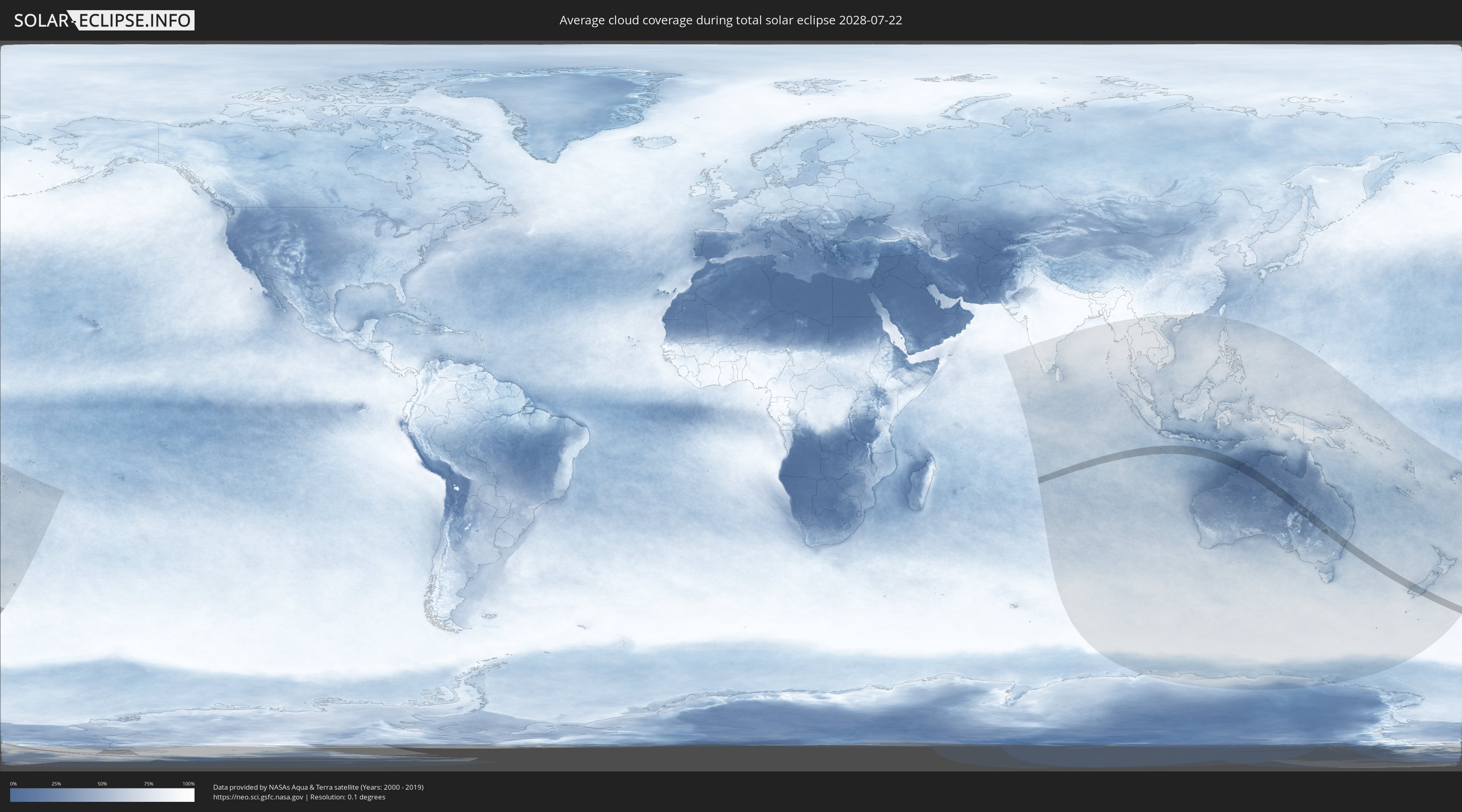
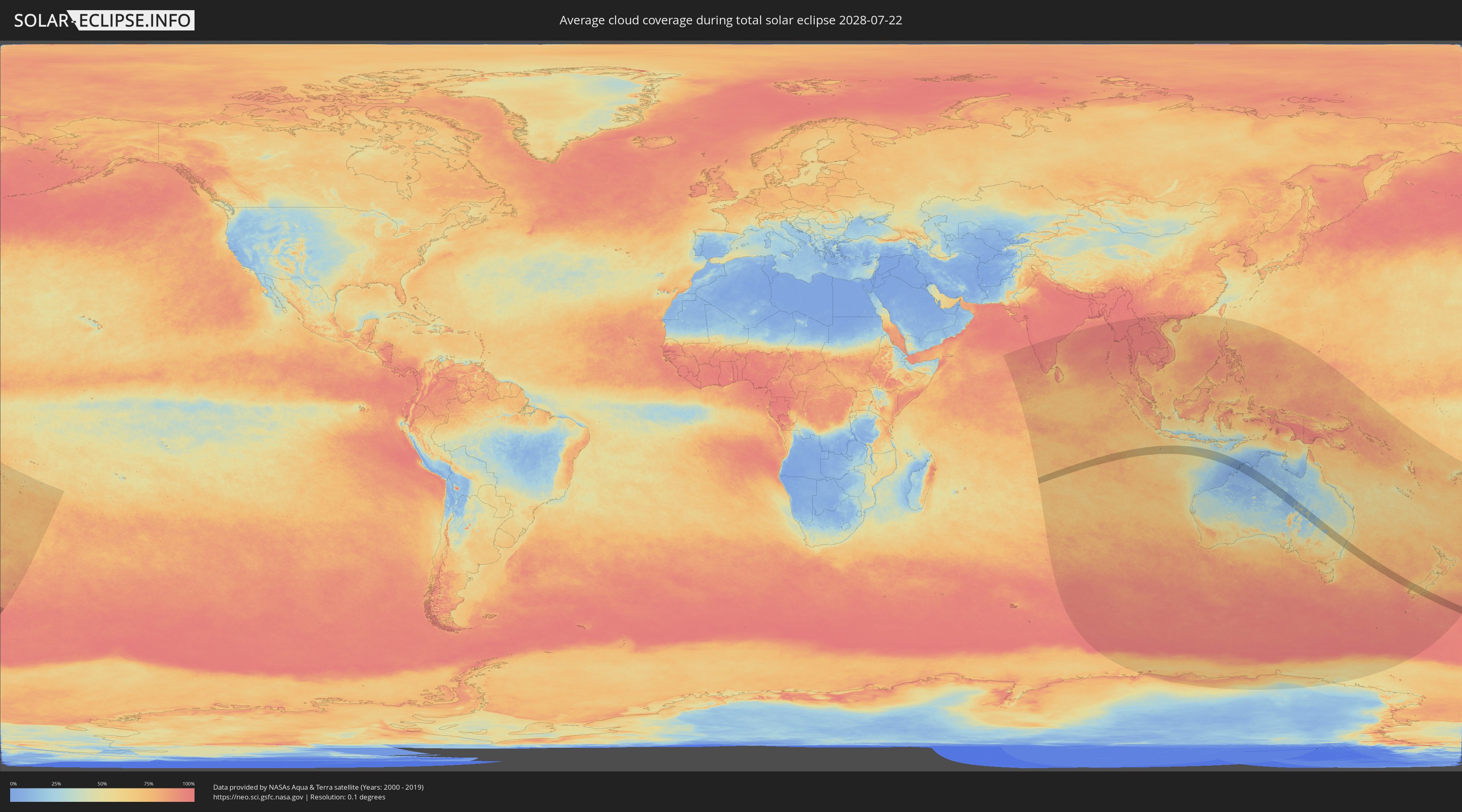
Wie wird das Wetter während der totalen Sonnenfinsternis am 22.07.2028?
Wo ist der beste Ort, um die totale Sonnenfinsternis vom 22.07.2028 zu beobachten?
Die folgenden Karten zeigen die durchschnittliche Bewölkung für den Tag, an dem die totale Sonnenfinsternis
stattfindet. Mit Hilfe der Karten lässt sich der Ort entlang des Finsternispfades eingrenzen,
der die besten Aussichen auf einen klaren wolkenfreien Himmel bietet.
Trotzdem muss man immer lokale Gegenenheiten beachten und sollte sich genau über das Wetter an seinem
gewählten Beobachtungsort informieren.
Die Daten stammen von den beiden NASA-Satelliten
AQUA und TERRA
und wurden über einen Zeitraum von 19 Jahren (2000 - 2019) gemittelt.
Detaillierte Länderkarten
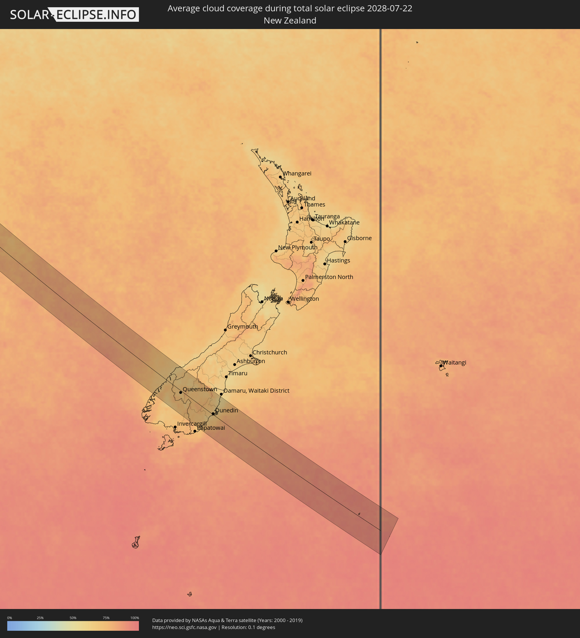 Neuseeland
 Kokosinseln
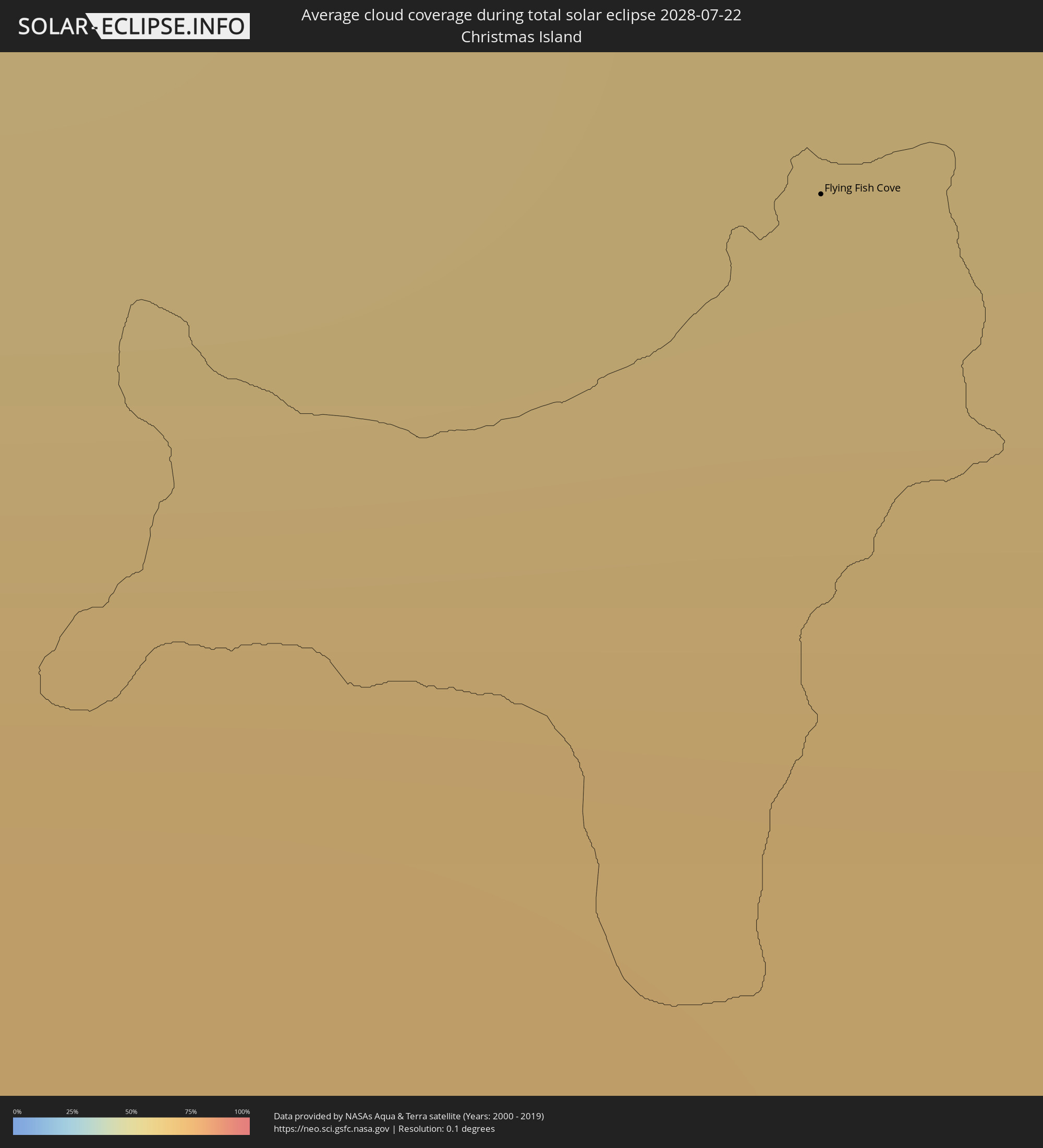 Weihnachtsinsel
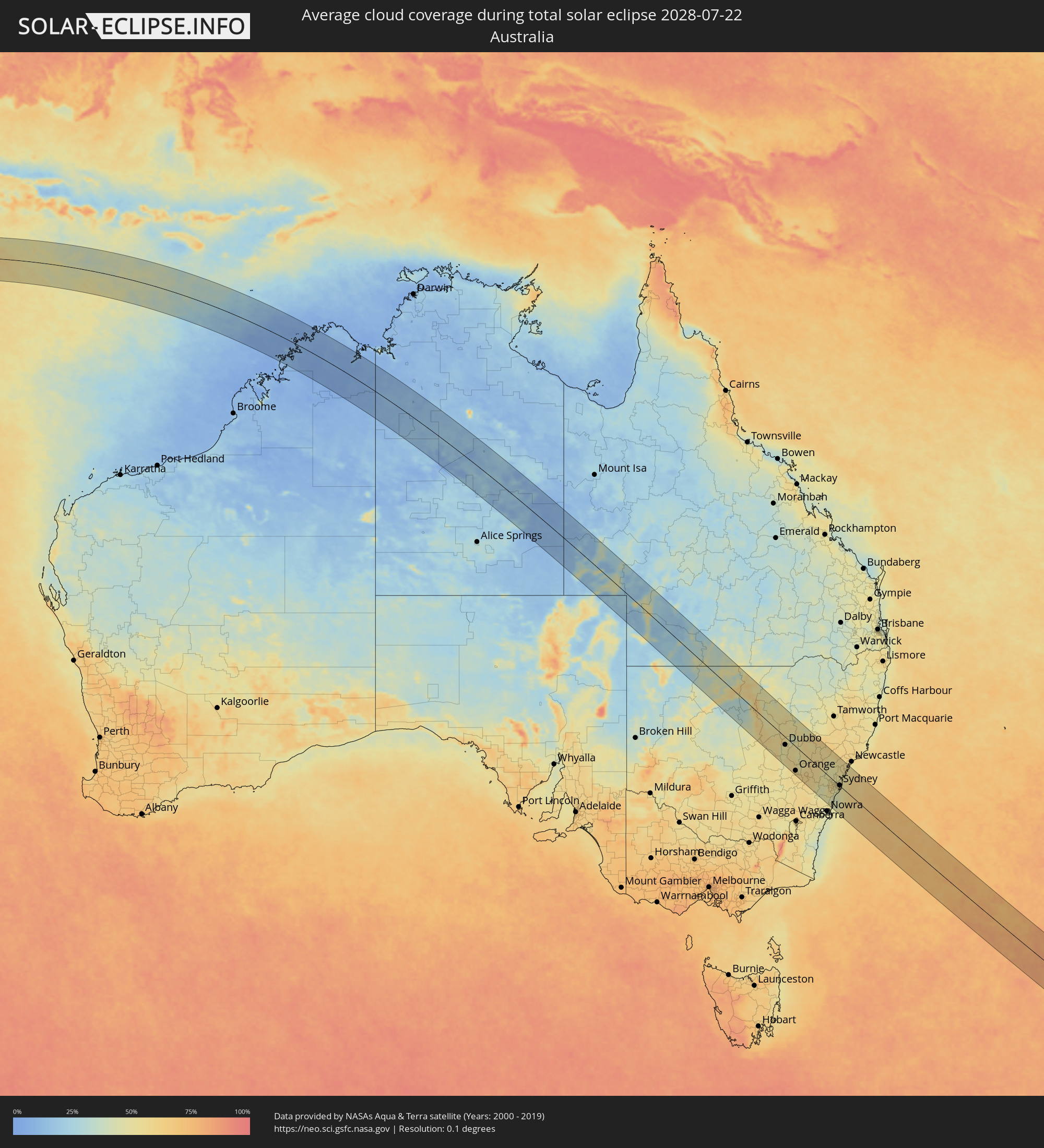 Australien
Orte im Finsternispfad
Die nachfolgene Tabelle zeigt Städte und Orte mit mehr als 5.000 Einwohnern, die sich im Finsternispfad befinden. Städte mit mehr als 100.000 Einwohnern sind dick gekennzeichnet. Mit einem Klick auf den Ort öffnet sich eine Detailkarte die die Lage des jeweiligen Ortes zusammen mit dem Verlauf der zentralen Finsternis präsentiert.
| Ort | Typ | Dauer der Verfinsterung | Ortszeit bei maximaler Verfinsterung | Entfernung zur Zentrallinie | Ø Bewölkung |
|
West Island
|
total | - | 08:13:37 UTC+06:30 | 21 km | 74% |
|
Flying Fish Cove
|
total | - | 08:56:39 UTC+07:00 | 40 km | 66% |
|
Kununurra, Western Australia
|
total | - | 11:01:02 UTC+08:00 | 94 km | 8% |
|
Dubbo, New South Wales
|
total | - | 13:57:11 UTC+10:00 | 25 km | 52% |
|
Orange, New South Wales
|
total | - | 13:58:13 UTC+10:00 | 80 km | 57% |
|
Bathurst, New South Wales
|
total | - | 13:58:58 UTC+10:00 | 61 km | 62% |
|
Mudgee, New South Wales
|
total | - | 13:58:45 UTC+10:00 | 7 km | 56% |
|
Kelso, New South Wales
|
total | - | 13:58:59 UTC+10:00 | 60 km | 62% |
|
Lithgow, New South Wales
|
total | - | 13:59:46 UTC+10:00 | 32 km | 55% |
|
Katoomba, New South Wales
|
total | - | 14:00:04 UTC+10:00 | 41 km | 50% |
|
Mittagong, New South Wales
|
total | - | 14:00:24 UTC+10:00 | 93 km | 53% |
|
Glenmore Park, New South Wales
|
total | - | 14:00:36 UTC+10:00 | 25 km | 57% |
|
Cambridge Park, New South Wales
|
total | - | 14:00:39 UTC+10:00 | 18 km | 56% |
|
Richmond, New South Wales
|
total | - | 14:00:40 UTC+10:00 | 4 km | 56% |
|
South Windsor, New South Wales
|
total | - | 14:00:45 UTC+10:00 | 2 km | 56% |
|
Kiama, New South Wales
|
total | - | 14:01:00 UTC+10:00 | 86 km | 47% |
|
Barrack Heights, New South Wales
|
total | - | 14:01:00 UTC+10:00 | 77 km | 44% |
|
Riverstone, New South Wales
|
total | - | 14:00:51 UTC+10:00 | 3 km | 57% |
|
Ingleburn, New South Wales
|
total | - | 14:00:55 UTC+10:00 | 30 km | 49% |
|
Fairy Meadow, New South Wales
|
total | - | 14:01:01 UTC+10:00 | 61 km | 44% |
|
Wollongong, New South Wales
|
total | - | 14:01:01 UTC+10:00 | 63 km | 44% |
|
Corrimal, New South Wales
|
total | - | 14:01:02 UTC+10:00 | 59 km | 44% |
|
Rouse Hill, New South Wales
|
total | - | 14:00:55 UTC+10:00 | 0 km | 57% |
|
Blacktown, New South Wales
|
total | - | 14:00:56 UTC+10:00 | 7 km | 57% |
|
Fairfield Heights, New South Wales
|
total | - | 14:00:59 UTC+10:00 | 14 km | 54% |
|
Beaumont Hills, New South Wales
|
total | - | 14:00:57 UTC+10:00 | 0 km | 57% |
|
Merrylands, New South Wales
|
total | - | 14:01:02 UTC+10:00 | 9 km | 55% |
|
Helensburgh, New South Wales
|
total | - | 14:01:07 UTC+10:00 | 37 km | 44% |
|
Glenhaven, New South Wales
|
total | - | 14:01:02 UTC+10:00 | 3 km | 55% |
|
Heathcote, New South Wales
|
total | - | 14:01:08 UTC+10:00 | 28 km | 44% |
|
Bankstown, New South Wales
|
total | - | 14:01:07 UTC+10:00 | 13 km | 52% |
|
Lugarno, New South Wales
|
total | - | 14:01:09 UTC+10:00 | 18 km | 48% |
|
Jannali, New South Wales
|
total | - | 14:01:11 UTC+10:00 | 19 km | 46% |
|
Belfield, New South Wales
|
total | - | 14:01:12 UTC+10:00 | 8 km | 52% |
|
Concord West, New South Wales
|
total | - | 14:01:11 UTC+10:00 | 4 km | 53% |
|
Hornsby Heights, New South Wales
|
total | - | 14:01:10 UTC+10:00 | 12 km | 52% |
|
Hornsby, New South Wales
|
total | - | 14:01:10 UTC+10:00 | 9 km | 52% |
|
Macquarie Park, New South Wales
|
total | - | 14:01:12 UTC+10:00 | 4 km | 53% |
|
Caringbah, New South Wales
|
total | - | 14:01:16 UTC+10:00 | 18 km | 46% |
|
Summer Hill, New South Wales
|
total | - | 14:01:16 UTC+10:00 | 4 km | 52% |
|
Camperdown, New South Wales
|
total | - | 14:01:19 UTC+10:00 | 2 km | 52% |
|
Haberfield, New South Wales
|
total | - | 14:01:21 UTC+10:00 | 1 km | 52% |
|
Alexandria, New South Wales
|
total | - | 14:01:21 UTC+10:00 | 1 km | 52% |
|
North Sydney, New South Wales
|
total | - | 14:01:21 UTC+10:00 | 5 km | 51% |
|
Sydney, New South Wales
|
total | - | 14:01:21 UTC+10:00 | 2 km | 52% |
|
Cammeray, New South Wales
|
total | - | 14:01:22 UTC+10:00 | 7 km | 51% |
|
Bronte, New South Wales
|
total | - | 14:01:27 UTC+10:00 | 3 km | 50% |
|
Fairlight, New South Wales
|
total | - | 14:01:26 UTC+10:00 | 12 km | 51% |
|
Narrabeen, New South Wales
|
total | - | 14:01:27 UTC+10:00 | 21 km | 50% |
|
Dee Why, New South Wales
|
total | - | 14:01:28 UTC+10:00 | 18 km | 51% |
|
Umina, New South Wales
|
total | - | 14:01:26 UTC+10:00 | 37 km | 50% |
|
Bateau Bay, New South Wales
|
total | - | 14:01:37 UTC+10:00 | 58 km | 51% |
|
Queenstown, Otago
|
total | - | 16:16:29 UTC+12:00 | 8 km | 65% |
|
Dunedin, Otago
|
total | - | 16:17:10 UTC+12:00 | 3 km | 66% |