Totale Sonnenfinsternis vom 23.08.2044
| Wochentag: | Dienstag |
| Maximale Dauer der Verfinsterung: | 02m04s |
| Maximale Breite des Finsternispfades: | 453 km |
| Saroszyklus: | 126 |
| Bedeckungsgrad: | 100% |
| Magnitude: | 1.0364 |
| Gamma: | 0.9613 |
Wo kann man die Sonnenfinsternis vom 23.08.2044 sehen?
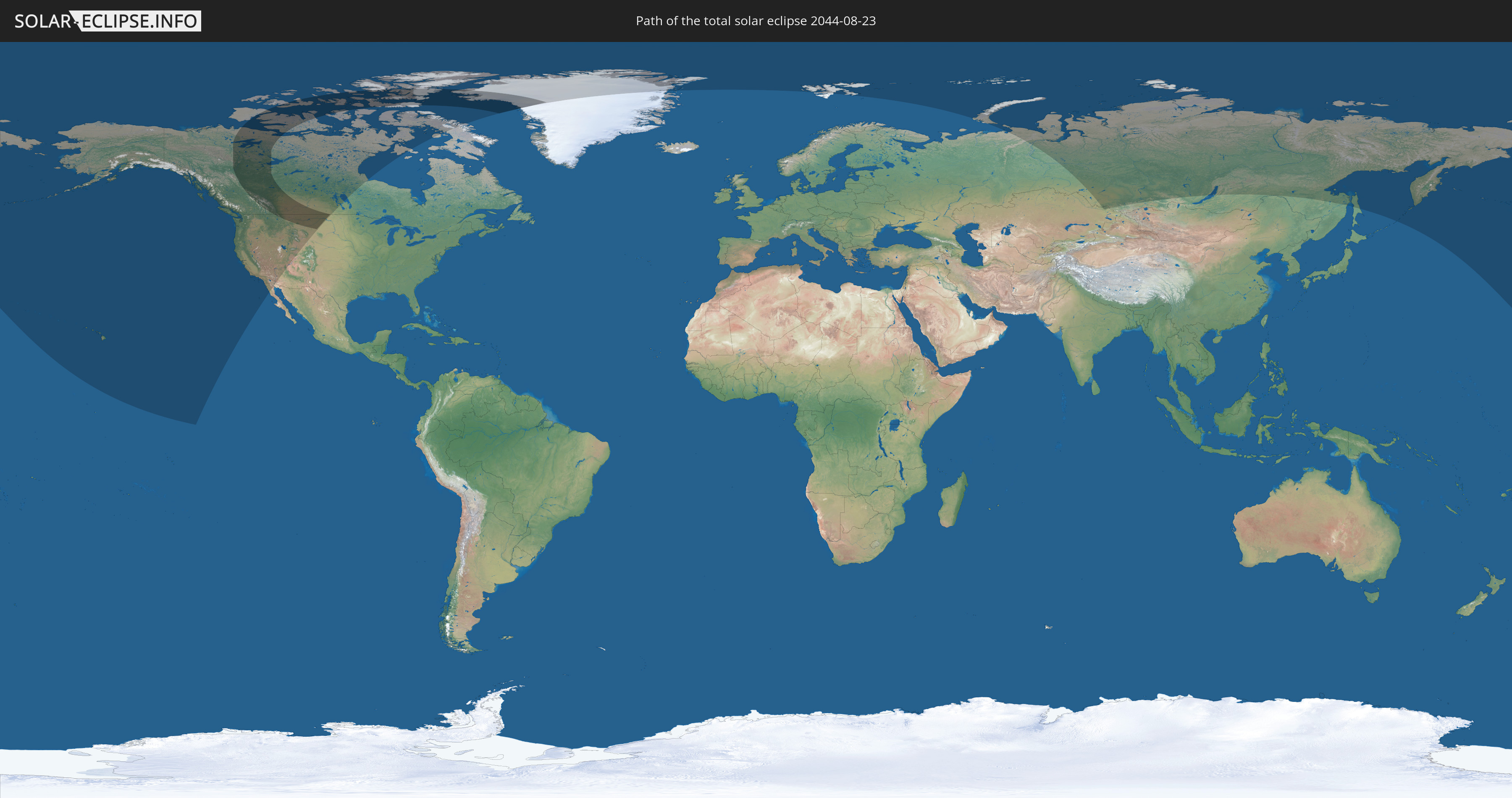
Die Sonnenfinsternis am 23.08.2044 kann man in 9 Ländern als partielle Sonnenfinsternis beobachten.
Der Finsternispfad verläuft durch 3 Länder. Nur in diesen Ländern ist sie als totale Sonnenfinsternis zu sehen.
In den folgenden Ländern ist die Sonnenfinsternis total zu sehen
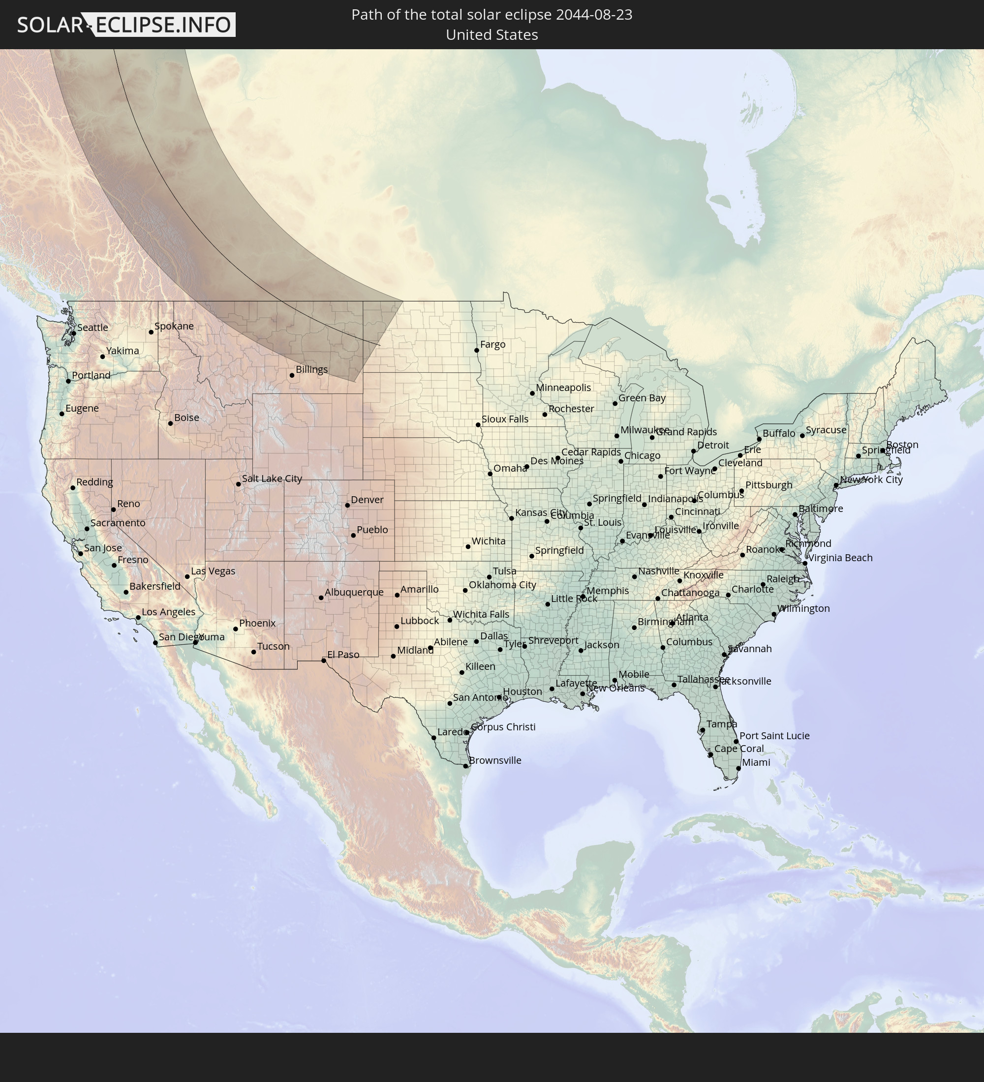 Vereinigte Staaten
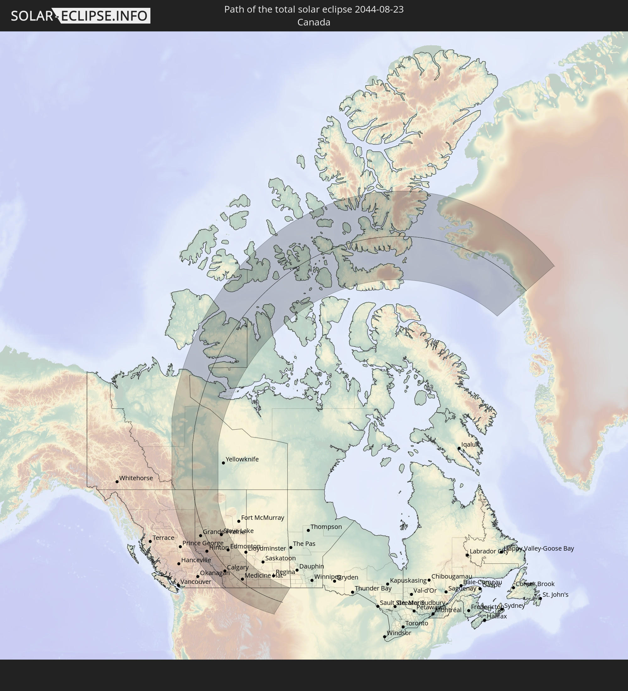 Kanada
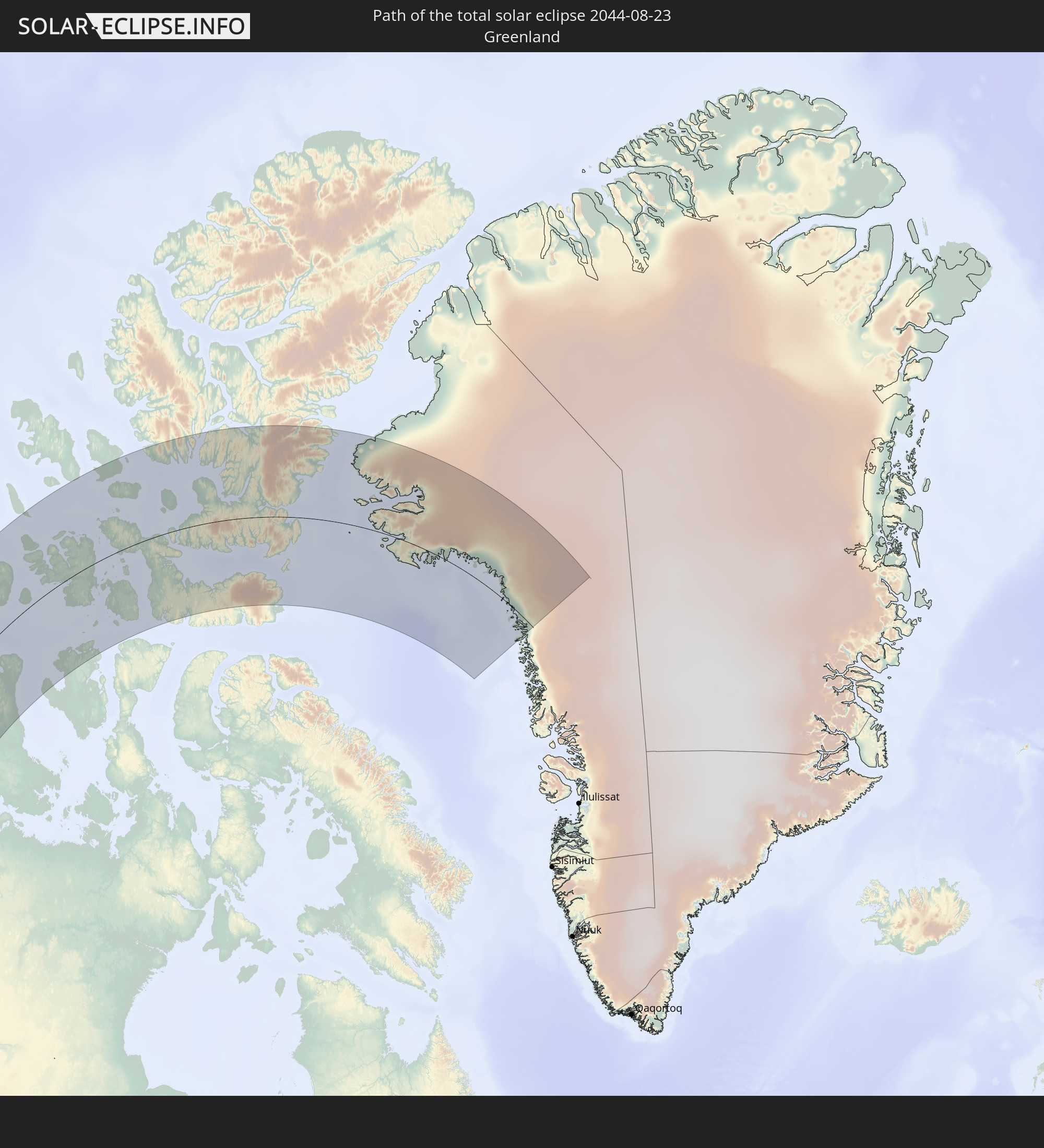 Grönland
In den folgenden Ländern ist die Sonnenfinsternis partiell zu sehen


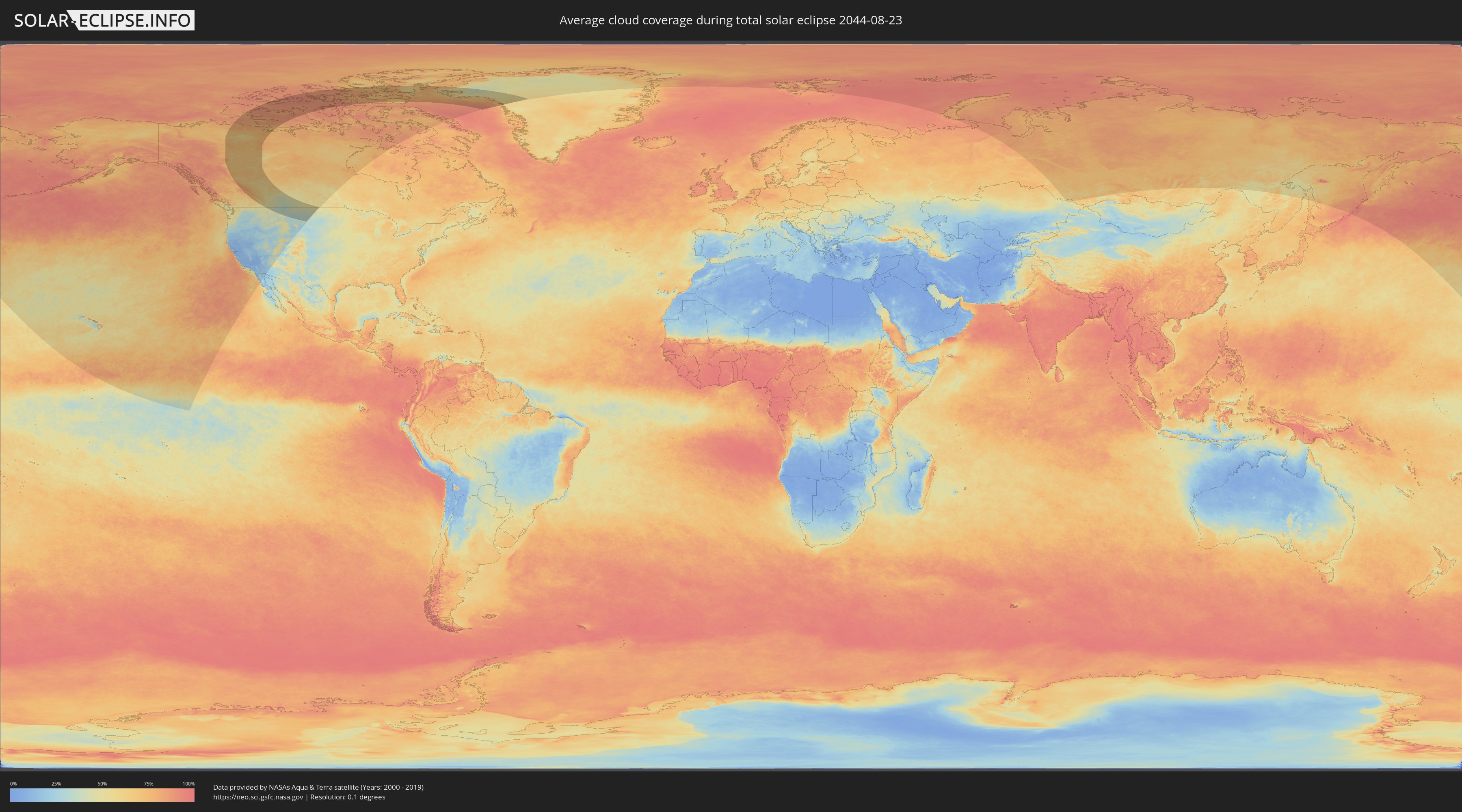
Wie wird das Wetter während der totalen Sonnenfinsternis am 23.08.2044?
Wo ist der beste Ort, um die totale Sonnenfinsternis vom 23.08.2044 zu beobachten?
Die folgenden Karten zeigen die durchschnittliche Bewölkung für den Tag, an dem die totale Sonnenfinsternis
stattfindet. Mit Hilfe der Karten lässt sich der Ort entlang des Finsternispfades eingrenzen,
der die besten Aussichen auf einen klaren wolkenfreien Himmel bietet.
Trotzdem muss man immer lokale Gegenenheiten beachten und sollte sich genau über das Wetter an seinem
gewählten Beobachtungsort informieren.
Die Daten stammen von den beiden NASA-Satelliten
AQUA und TERRA
und wurden über einen Zeitraum von 19 Jahren (2000 - 2019) gemittelt.

Detaillierte Länderkarten
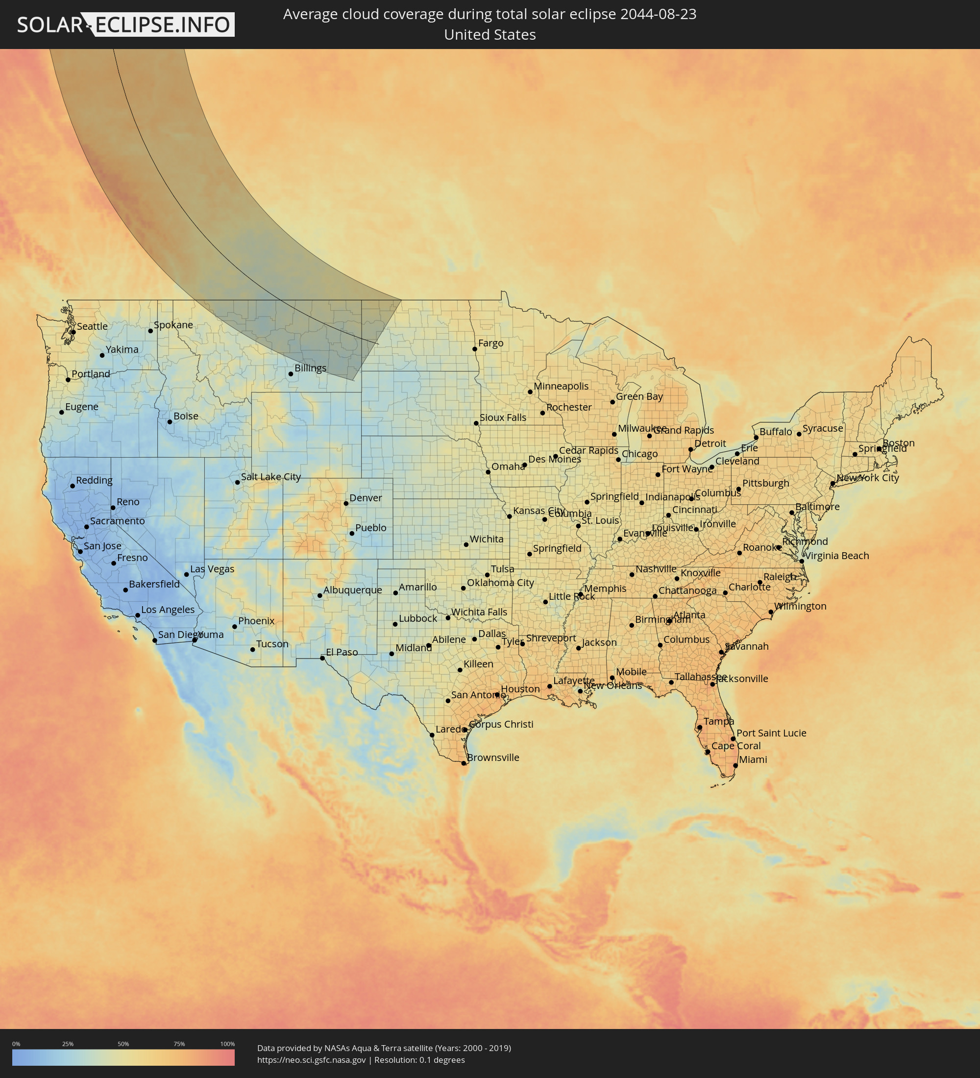 Vereinigte Staaten
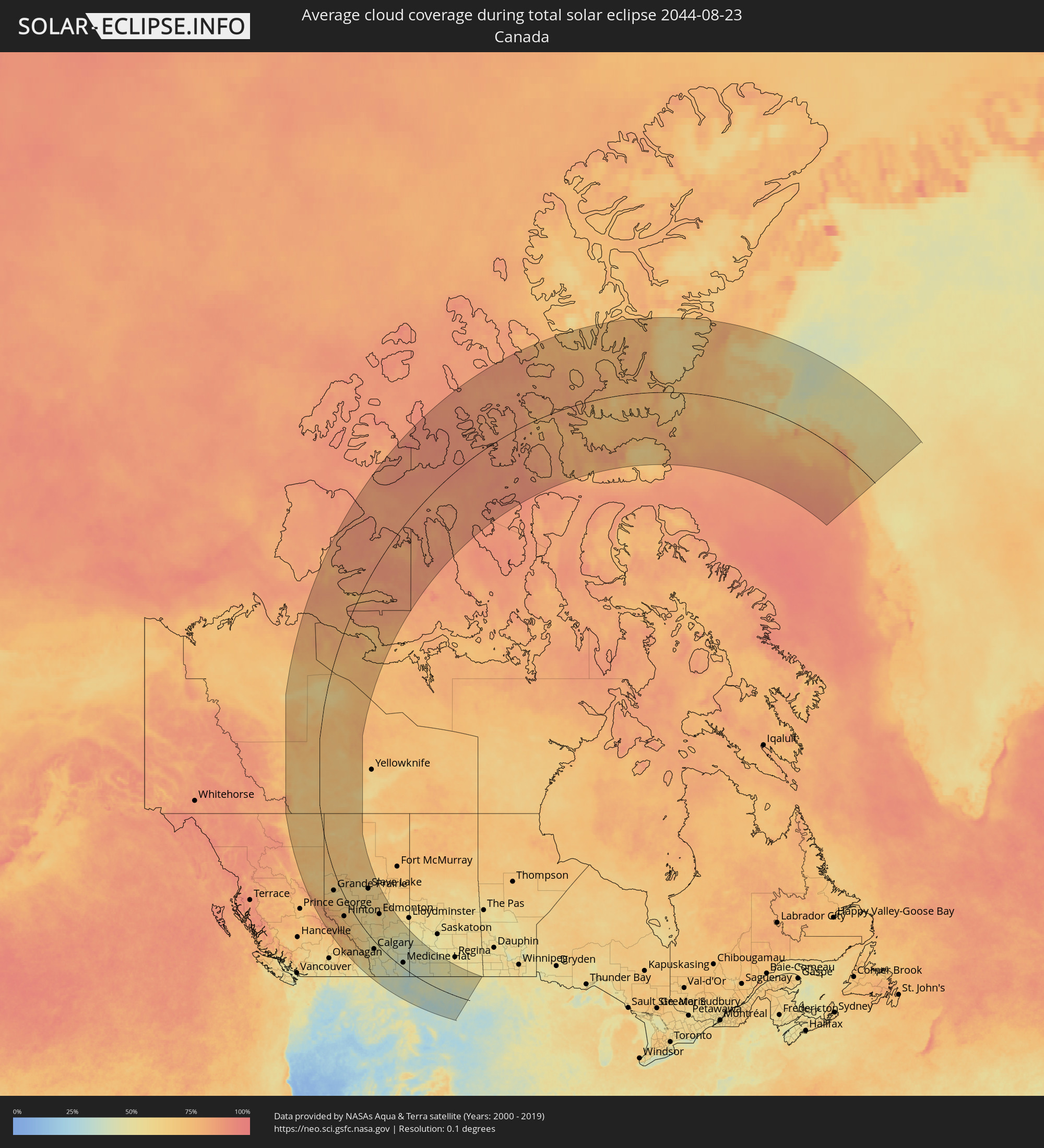 Kanada
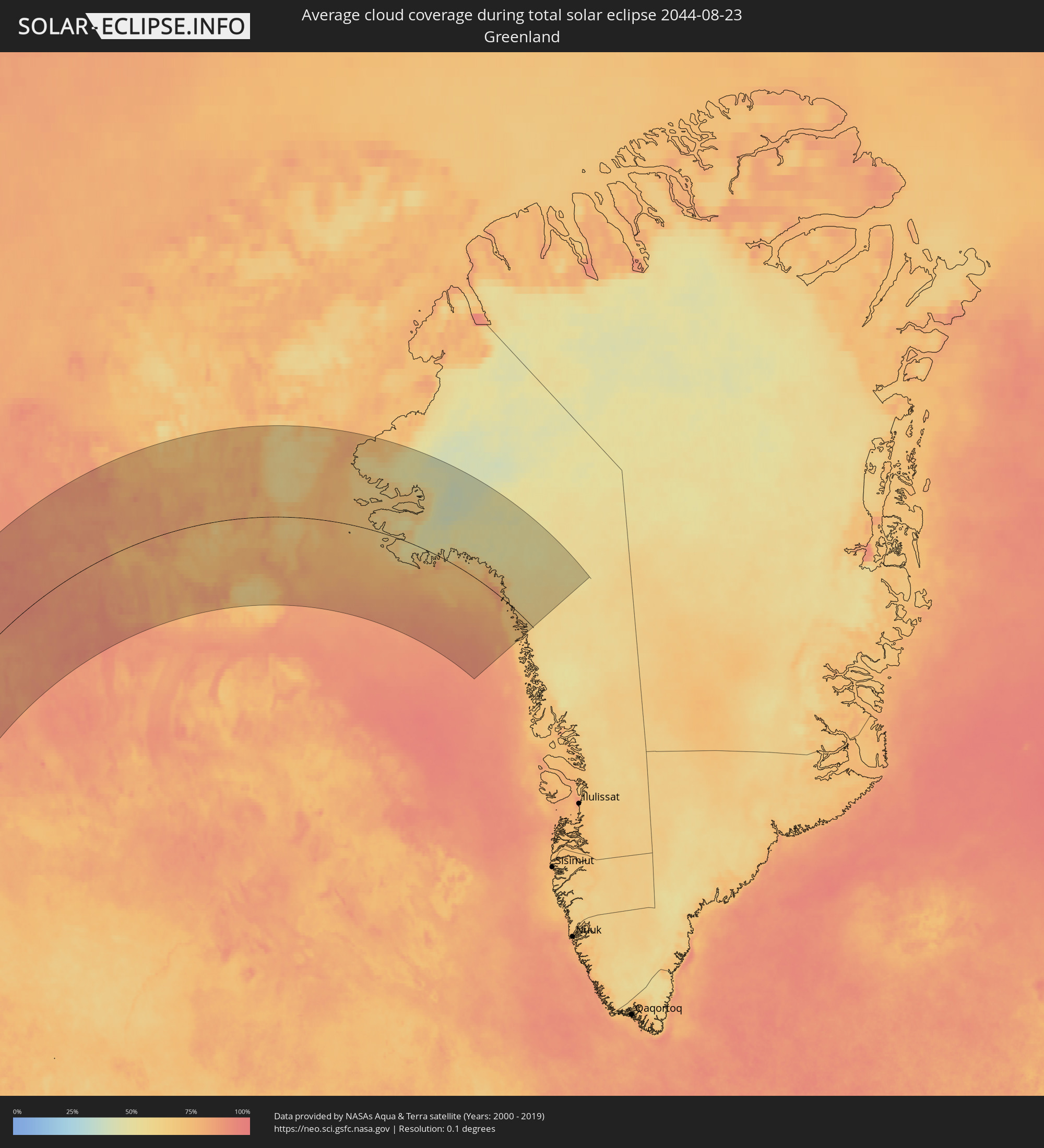 Grönland
Orte im Finsternispfad
Die nachfolgene Tabelle zeigt Städte und Orte mit mehr als 5.000 Einwohnern, die sich im Finsternispfad befinden. Städte mit mehr als 100.000 Einwohnern sind dick gekennzeichnet. Mit einem Klick auf den Ort öffnet sich eine Detailkarte die die Lage des jeweiligen Ortes zusammen mit dem Verlauf der zentralen Finsternis präsentiert.
| Ort | Typ | Dauer der Verfinsterung | Ortszeit bei maximaler Verfinsterung | Entfernung zur Zentrallinie | Ø Bewölkung |
 Fort St. John, British Columbia
|
total | - | 18:30:37 UTC-07:00 | 125 km | 62% |
|
Dawson Creek, British Columbia
|
total | - | 18:31:32 UTC-07:00 | 109 km | 64% |
|
Grande Prairie, Alberta
|
total | - | 18:32:39 UTC-07:00 | 52 km | 61% |
|
Hinton, Alberta
|
total | - | 18:35:51 UTC-07:00 | 74 km | 67% |
|
Peace River, Alberta
|
total | - | 18:30:40 UTC-07:00 | 81 km | 68% |
|
Edson, Alberta
|
total | - | 18:35:28 UTC-07:00 | 2 km | 63% |
|
Whitecourt, Alberta
|
total | - | 18:34:24 UTC-07:00 | 76 km | 58% |
|
Banff, Alberta
|
total | - | 18:39:42 UTC-07:00 | 111 km | 62% |
|
Canmore, Alberta
|
total | - | 18:39:51 UTC-07:00 | 107 km | 60% |
|
Fernie, British Columbia
|
total | - | 18:42:36 UTC-07:00 | 216 km | 49% |
|
Drayton Valley, Alberta
|
total | - | 18:36:02 UTC-07:00 | 60 km | 56% |
|
Rocky Mountain House, Alberta
|
total | - | 18:37:32 UTC-07:00 | 8 km | 53% |
|
Slave Lake, Alberta
|
total | - | 18:32:19 UTC-07:00 | 186 km | 60% |
|
Cochrane, Alberta
|
total | - | 18:39:35 UTC-07:00 | 54 km | 50% |
|
Olds, Alberta
|
total | - | 18:38:29 UTC-07:00 | 10 km | 52% |
|
Sylvan Lake, Alberta
|
total | - | 18:37:33 UTC-07:00 | 49 km | 57% |
|
Calgary, Alberta
|
total | - | 18:39:47 UTC-07:00 | 44 km | 51% |
|
Airdrie, Alberta
|
total | - | 18:39:20 UTC-07:00 | 23 km | 52% |
|
Stony Plain, Alberta
|
total | - | 18:35:23 UTC-07:00 | 134 km | 63% |
|
Okotoks, Alberta
|
total | - | 18:40:20 UTC-07:00 | 64 km | 50% |
|
Spruce Grove, Alberta
|
total | - | 18:35:23 UTC-07:00 | 138 km | 64% |
|
Westlock, Alberta
|
total | - | 18:34:17 UTC-07:00 | 178 km | 64% |
|
High River, Alberta
|
total | - | 18:40:34 UTC-07:00 | 70 km | 48% |
|
Red Deer, Alberta
|
total | - | 18:37:36 UTC-07:00 | 60 km | 58% |
|
Devon, Alberta
|
total | - | 18:35:39 UTC-07:00 | 138 km | 65% |
|
Lacombe, Alberta
|
total | - | 18:37:15 UTC-07:00 | 78 km | 58% |
|
Morinville, Alberta
|
total | - | 18:34:53 UTC-07:00 | 169 km | 66% |
|
St. Albert, Alberta
|
total | - | 18:35:10 UTC-07:00 | 160 km | 61% |
|
Ponoka, Alberta
|
total | - | 18:36:52 UTC-07:00 | 101 km | 58% |
|
Leduc, Alberta
|
total | - | 18:35:49 UTC-07:00 | 141 km | 64% |
|
Edmonton, Alberta
|
total | - | 18:35:18 UTC-07:00 | 164 km | 62% |
|
Beaumont, Alberta
|
total | - | 18:35:39 UTC-07:00 | 154 km | 63% |
|
Strathmore, Alberta
|
total | - | 18:39:42 UTC-07:00 | 9 km | 50% |
|
Silver Berry, Alberta
|
total | - | 18:35:28 UTC-07:00 | 163 km | 62% |
|
Wild Rose, Alberta
|
total | - | 18:35:26 UTC-07:00 | 164 km | 62% |
|
Wetaskiwin, Alberta
|
total | - | 18:36:20 UTC-07:00 | 132 km | 62% |
|
Sherwood Park, Alberta
|
total | - | 18:35:21 UTC-07:00 | 170 km | 60% |
|
Fort Saskatchewan, Alberta
|
total | - | 18:34:59 UTC-07:00 | 188 km | 66% |
|
Camrose, Alberta
|
total | - | 18:36:11 UTC-07:00 | 163 km | 59% |
|
Lethbridge, Alberta
|
total | - | 18:41:58 UTC-07:00 | 92 km | 43% |
|
Stettler, Alberta
|
total | - | 18:37:24 UTC-07:00 | 120 km | 54% |
|
Coaldale, Alberta
|
total | - | 18:41:54 UTC-07:00 | 81 km | 47% |
|
Taber, Alberta
|
total | - | 18:41:43 UTC-07:00 | 54 km | 46% |
|
Vegreville, Alberta
|
total | - | 18:35:15 UTC-07:00 | 237 km | 63% |
|
Brooks, Alberta
|
total | - | 18:40:18 UTC-07:00 | 26 km | 47% |
 Great Falls, Montana
|
total | - | 18:45:27 UTC-07:00 | 224 km | 38% |
|
Wainwright, Alberta
|
total | - | 18:36:15 UTC-07:00 | 254 km | 51% |
|
Medicine Hat, Alberta
|
total | - | 18:41:02 UTC-07:00 | 34 km | 42% |
|
Havre, Montana
|
total | - | 18:43:22 UTC-07:00 | 61 km | 35% |
|
Lewistown, Montana
|
total | - | 18:45:47 UTC-07:00 | 195 km | 40% |
|
Swift Current, Saskatchewan
|
total | - | 19:40:04 UTC-06:00 | 175 km | 45% |
|
Miles City, Montana
|
total | - | 18:45:55 UTC-07:00 | 147 km | 34% |
|
Sidney, Montana
|
total | - | 18:43:20 UTC-07:00 | 34 km | 41% |
|
Williston, North Dakota
|
total | - | 19:42:29 UTC-06:00 | 93 km | 41% |
|
Estevan, Saskatchewan
|
total | - | 19:40:44 UTC-06:00 | 212 km | 51% |