Totale Sonnenfinsternis vom 22.01.2270
| Wochentag: | Samstag |
| Maximale Dauer der Verfinsterung: | 03m29s |
| Maximale Breite des Finsternispfades: | 130 km |
| Saroszyklus: | 145 |
| Bedeckungsgrad: | 100% |
| Magnitude: | 1.0385 |
| Gamma: | 0.056 |
Wo kann man die Sonnenfinsternis vom 22.01.2270 sehen?
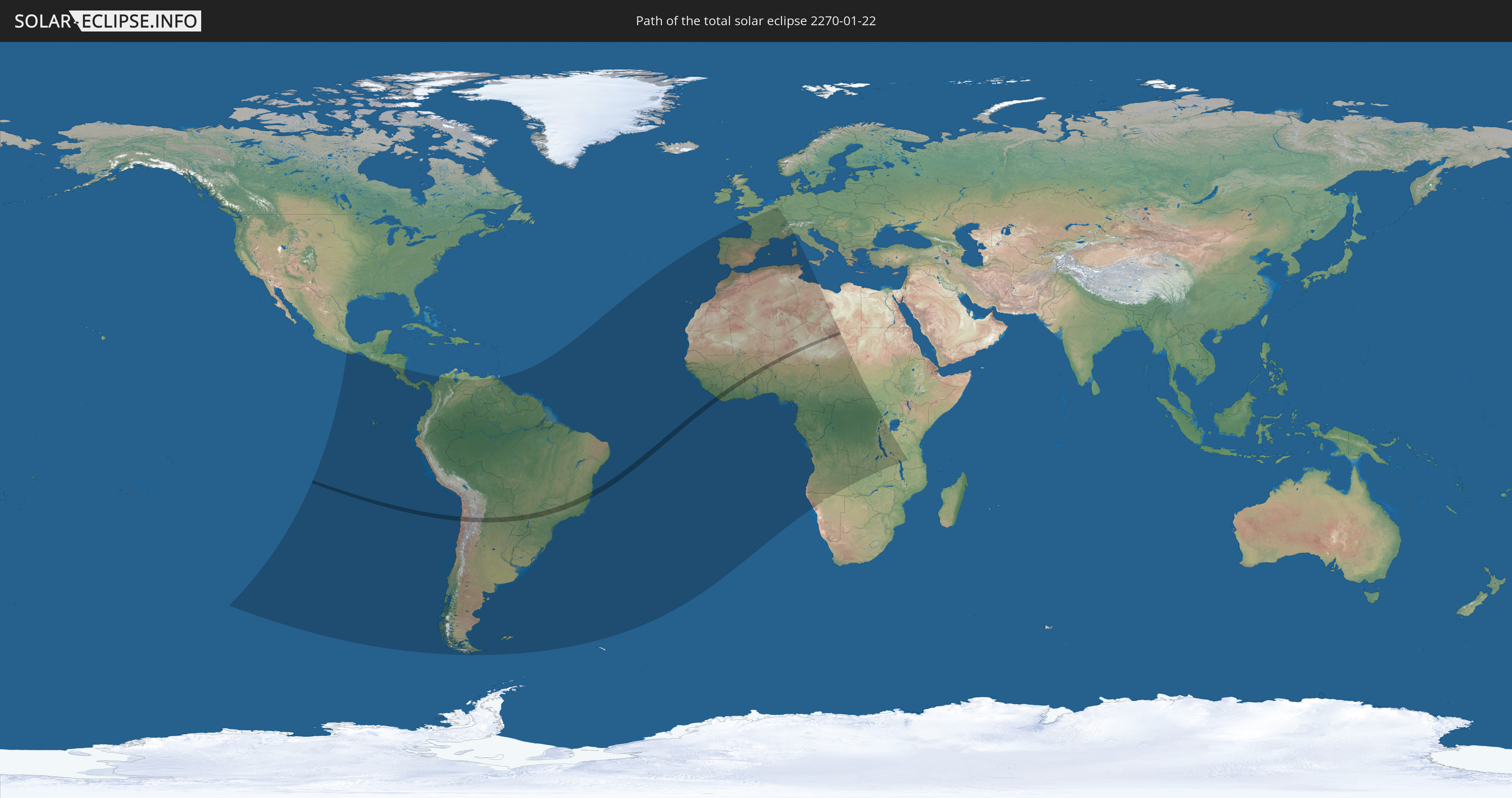
Die Sonnenfinsternis am 22.01.2270 kann man in 70 Ländern als partielle Sonnenfinsternis beobachten.
Der Finsternispfad verläuft durch 13 Länder. Nur in diesen Ländern ist sie als totale Sonnenfinsternis zu sehen.
In den folgenden Ländern ist die Sonnenfinsternis total zu sehen
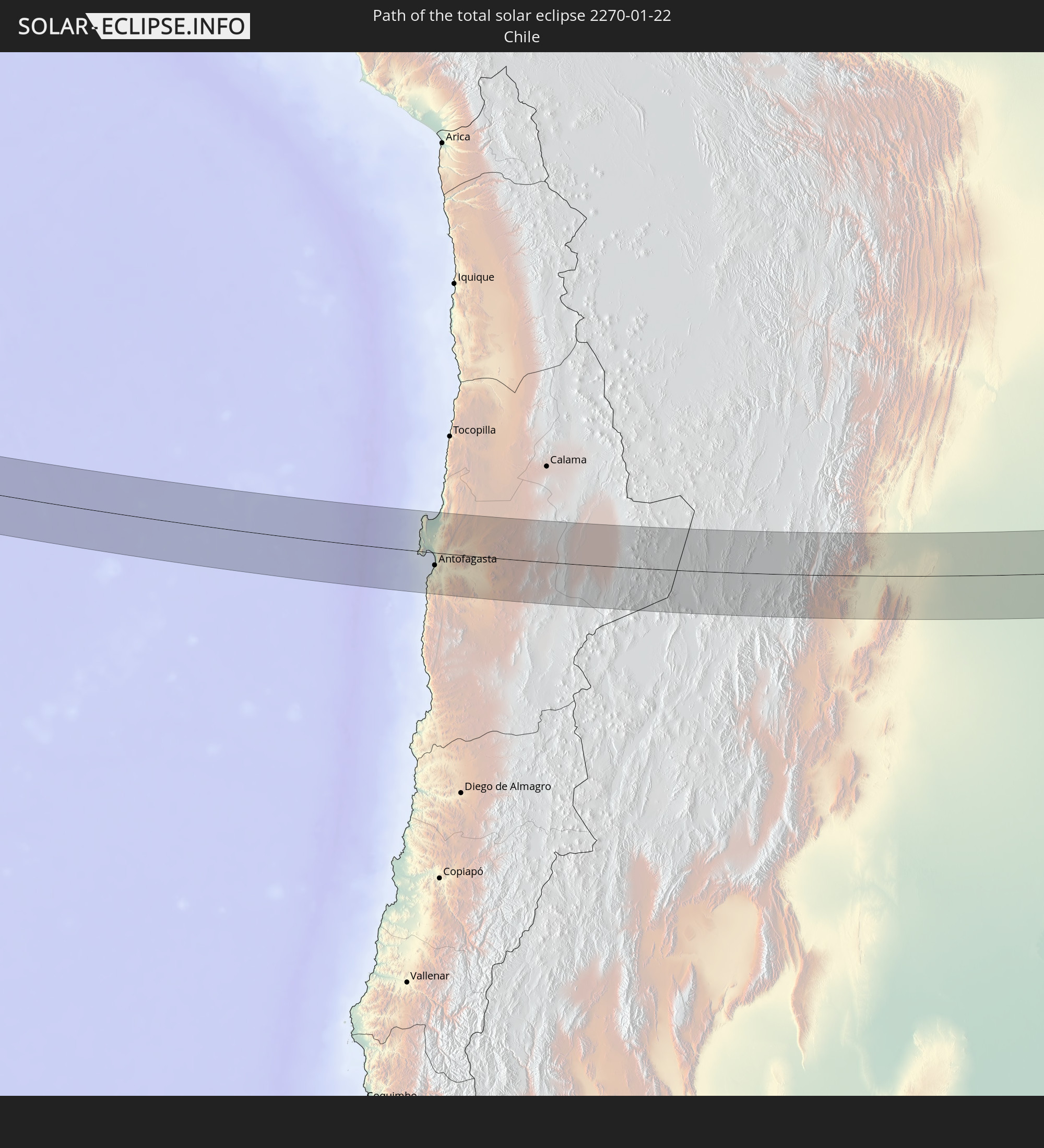 Chile
Chile
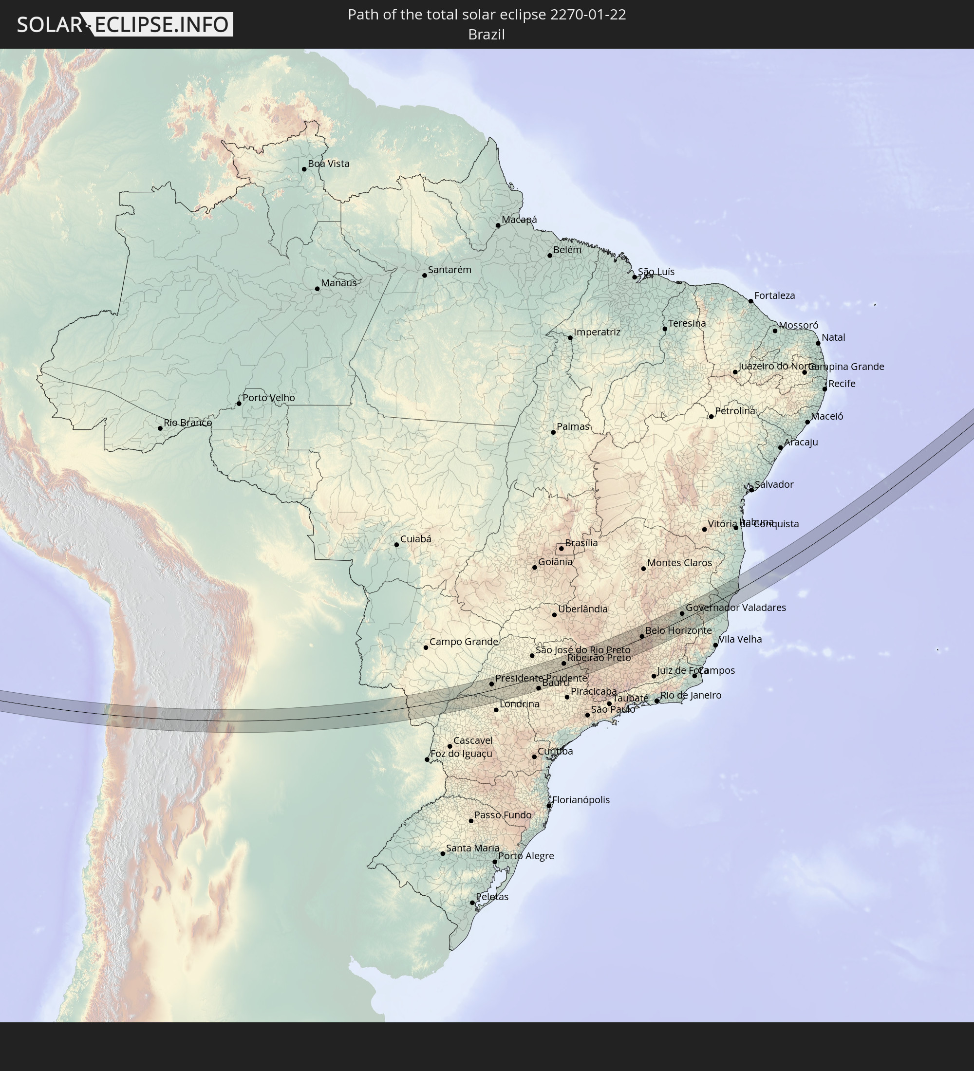 Brasilien
 Argentinien
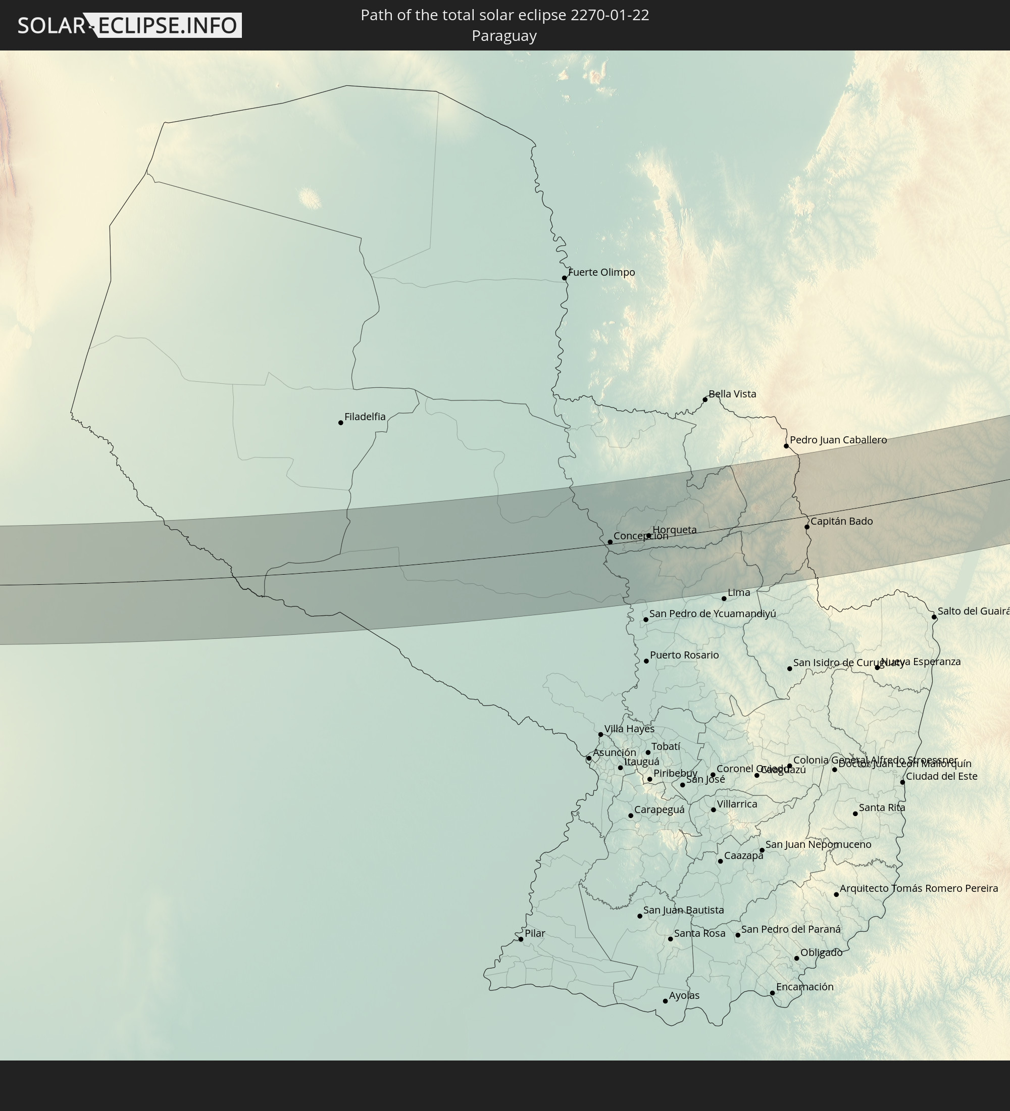 Paraguay
 Liberia
 Elfenbeinküste
 Burkina Faso
 Ghana
Ghana
 Togo
Togo
 Niger
Niger
 Benin
Benin
 Nigeria
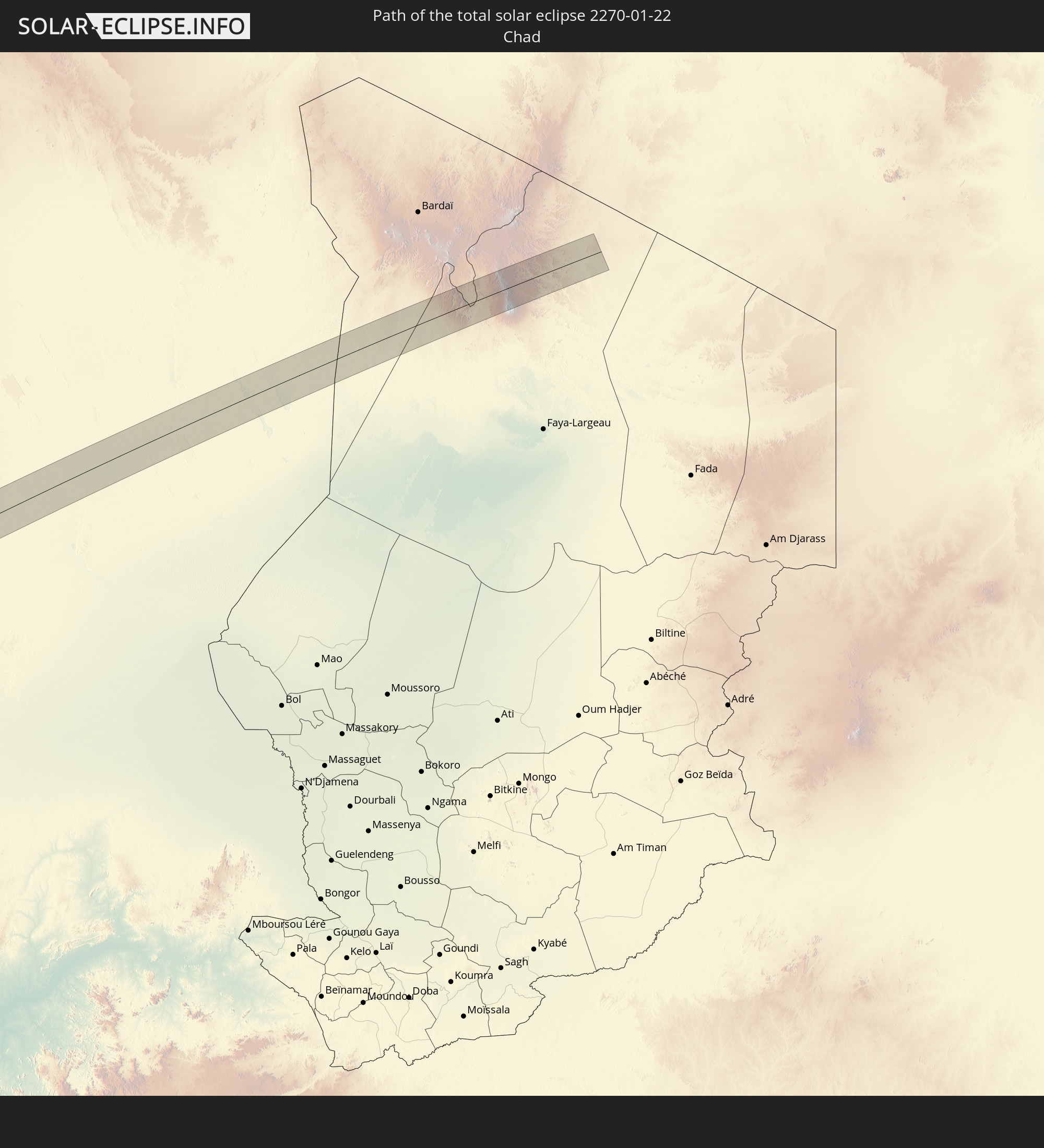 Tschad
In den folgenden Ländern ist die Sonnenfinsternis partiell zu sehen
 Mexiko
 Chile
Chile
 Guatemala
 Ecuador
 El Salvador
 Honduras
 Nicaragua
 Costa Rica
 Panama
 Kolumbien
 Peru
Peru
 Brasilien
 Argentinien
 Venezuela
 Bolivien
 Paraguay
 Trinidad und Tobago
 Falklandinseln
 Guyana
 Uruguay
 Suriname
 Französisch-Guayana
 Portugal
 Kap Verde
 Spanien
 Senegal
 Mauretanien
 Gambia
 Guinea-Bissau
 Guinea
 St. Helena
 Sierra Leone
 Marokko
 Mali
Mali
 Liberia
 Algerien
 Elfenbeinküste
 Burkina Faso
 Gibraltar
 Frankreich
 Ghana
Ghana
 Togo
Togo
 Niger
Niger
 Benin
Benin
 Andorra
 Belgien
 Nigeria
 Äquatorialguinea
 Luxemburg
 Schweiz
 São Tomé und Príncipe
 Italien
 Monaco
 Tunesien
 Kamerun
 Gabun
Gabun
 Libyen
 Republik Kongo
 Angola
 Namibia
 Demokratische Republik Kongo
 Tschad
 Zentralafrikanische Republik
 Sudan
Sudan
 Sambia
 Ruanda
 Burundi
 Tansania
 Uganda
 Malawi
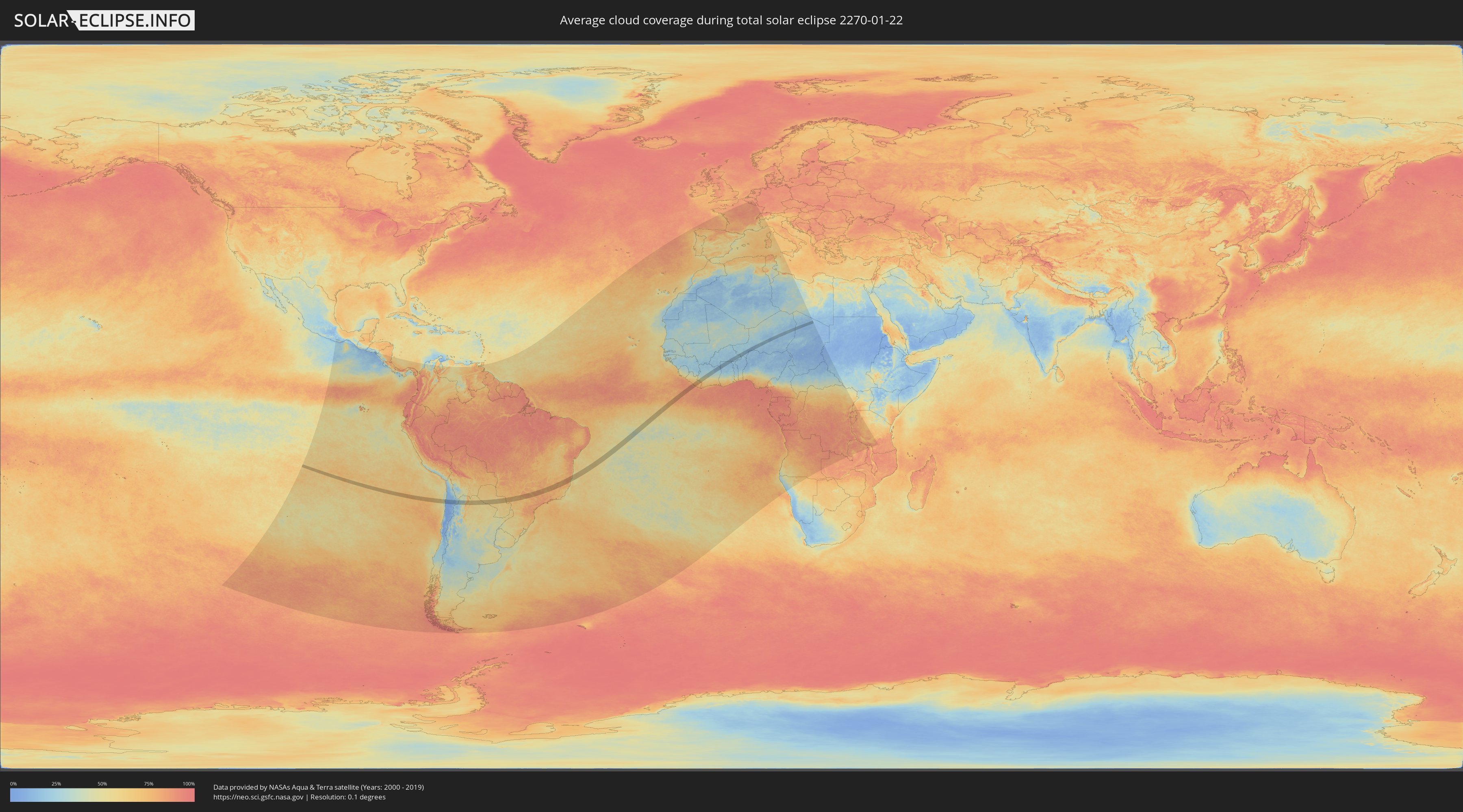
Wie wird das Wetter während der totalen Sonnenfinsternis am 22.01.2270?
Wo ist der beste Ort, um die totale Sonnenfinsternis vom 22.01.2270 zu beobachten?
Die folgenden Karten zeigen die durchschnittliche Bewölkung für den Tag, an dem die totale Sonnenfinsternis
stattfindet. Mit Hilfe der Karten lässt sich der Ort entlang des Finsternispfades eingrenzen,
der die besten Aussichen auf einen klaren wolkenfreien Himmel bietet.
Trotzdem muss man immer lokale Gegenenheiten beachten und sollte sich genau über das Wetter an seinem
gewählten Beobachtungsort informieren.
Die Daten stammen von den beiden NASA-Satelliten
AQUA und TERRA
und wurden über einen Zeitraum von 19 Jahren (2000 - 2019) gemittelt.

Detaillierte Länderkarten
 Chile
Chile
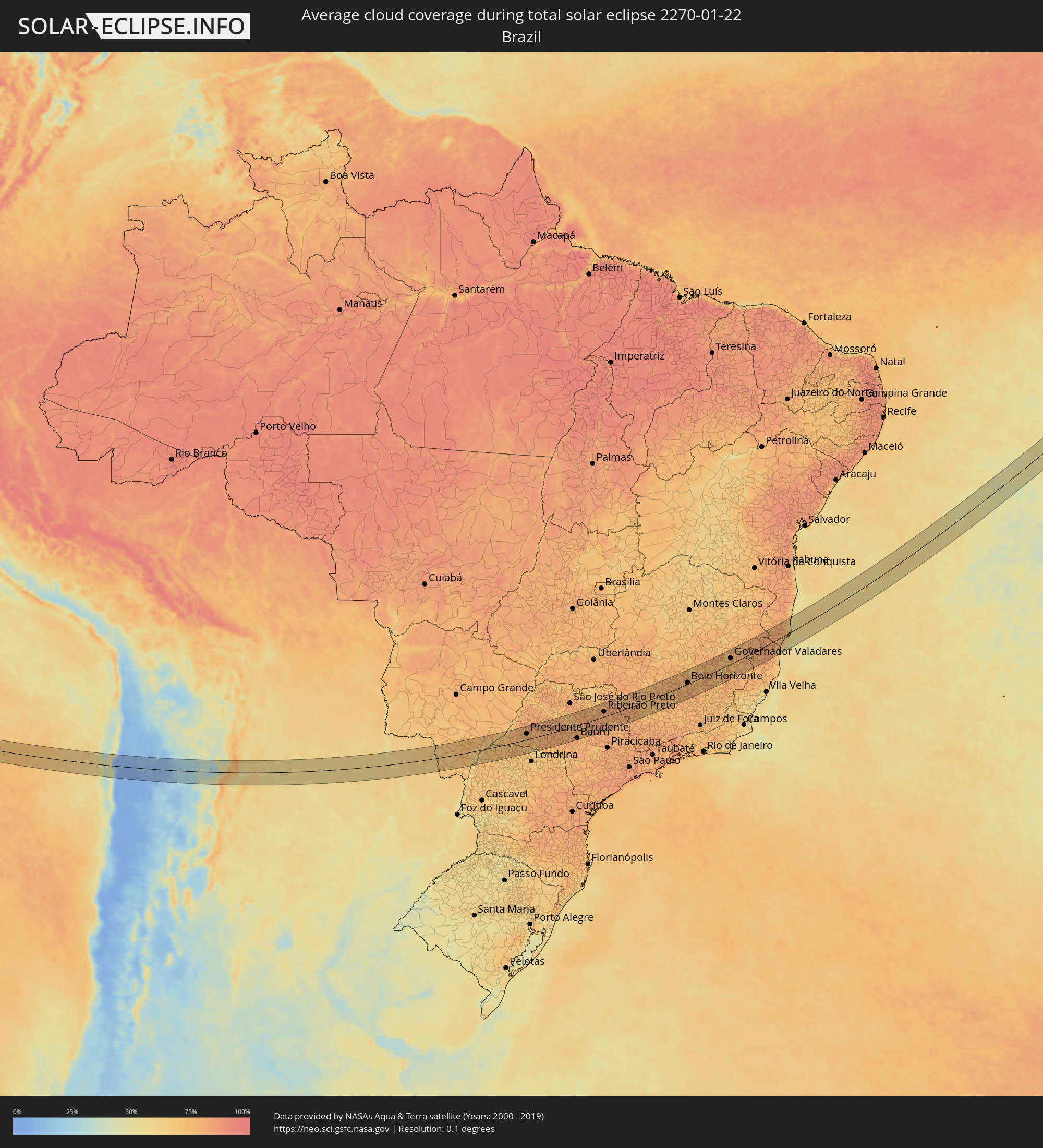 Brasilien
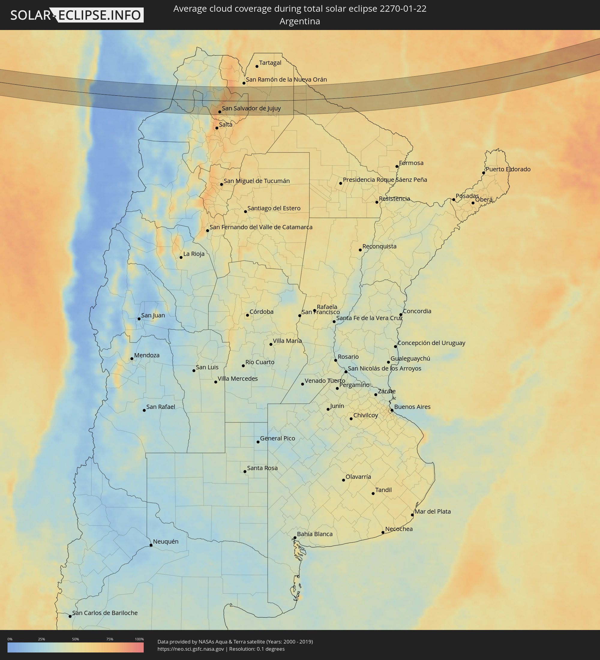 Argentinien
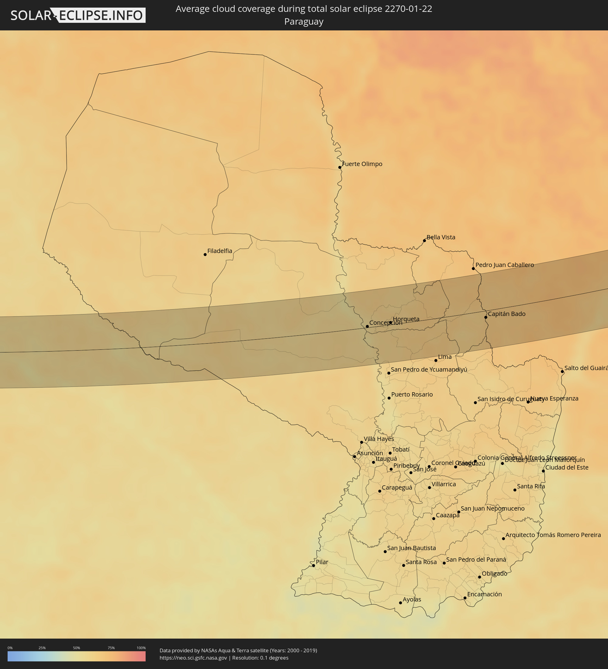 Paraguay
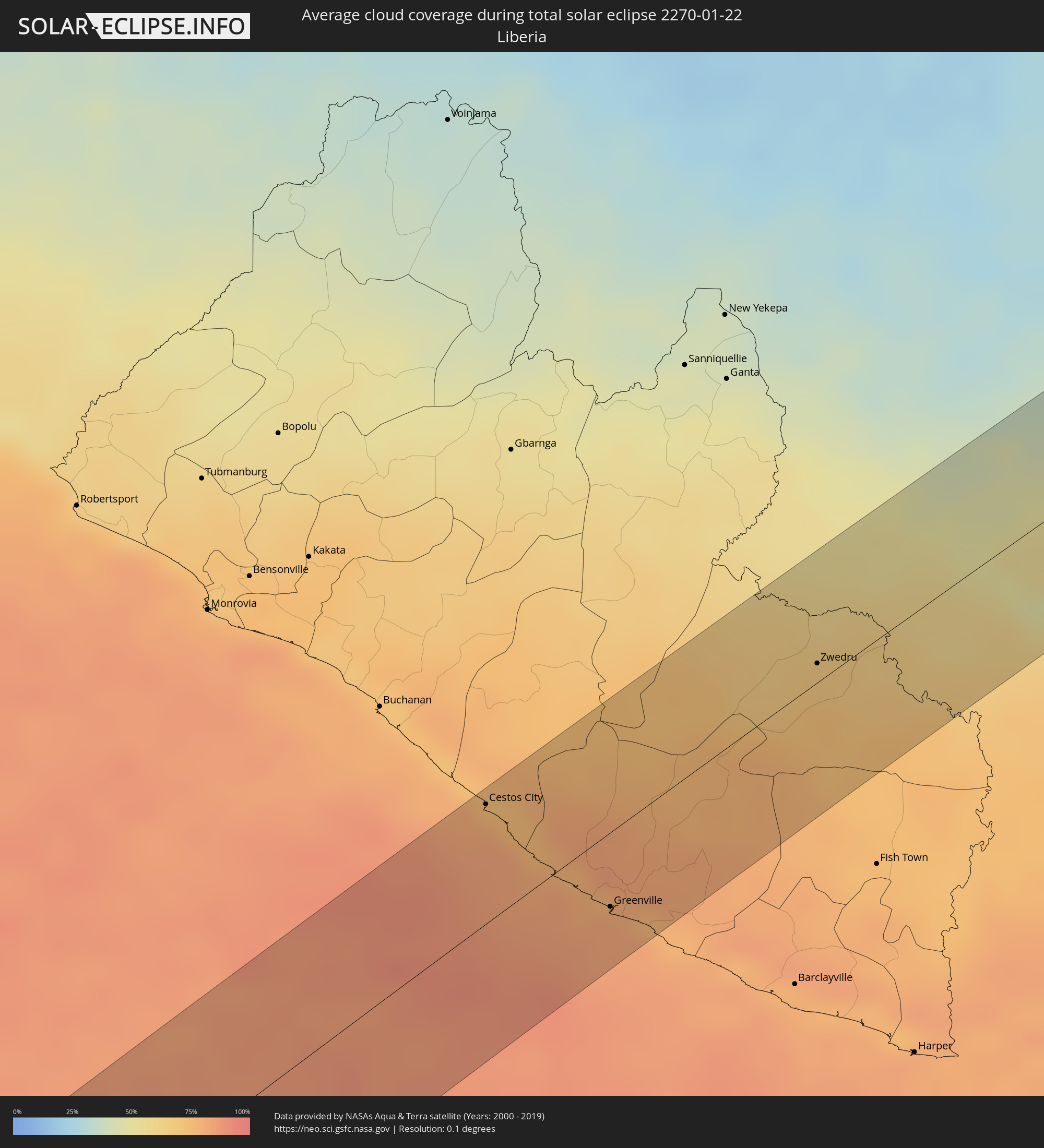 Liberia
 Elfenbeinküste
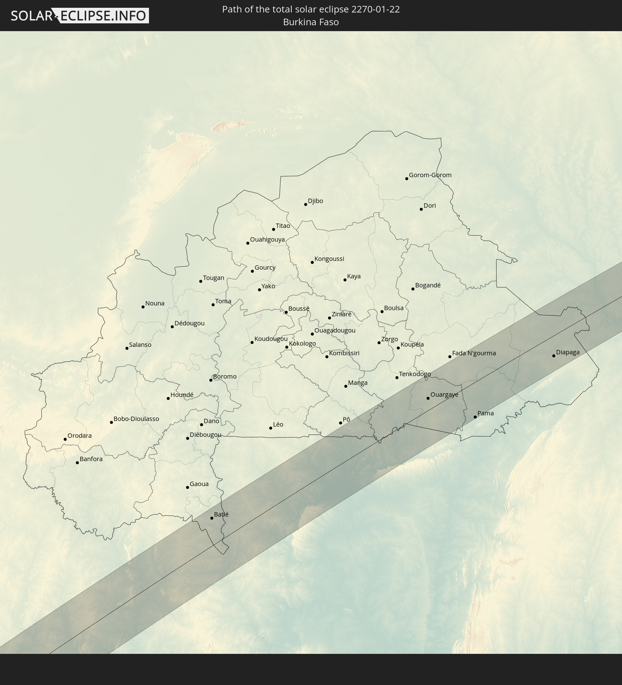
 Burkina Faso
 Ghana
Ghana
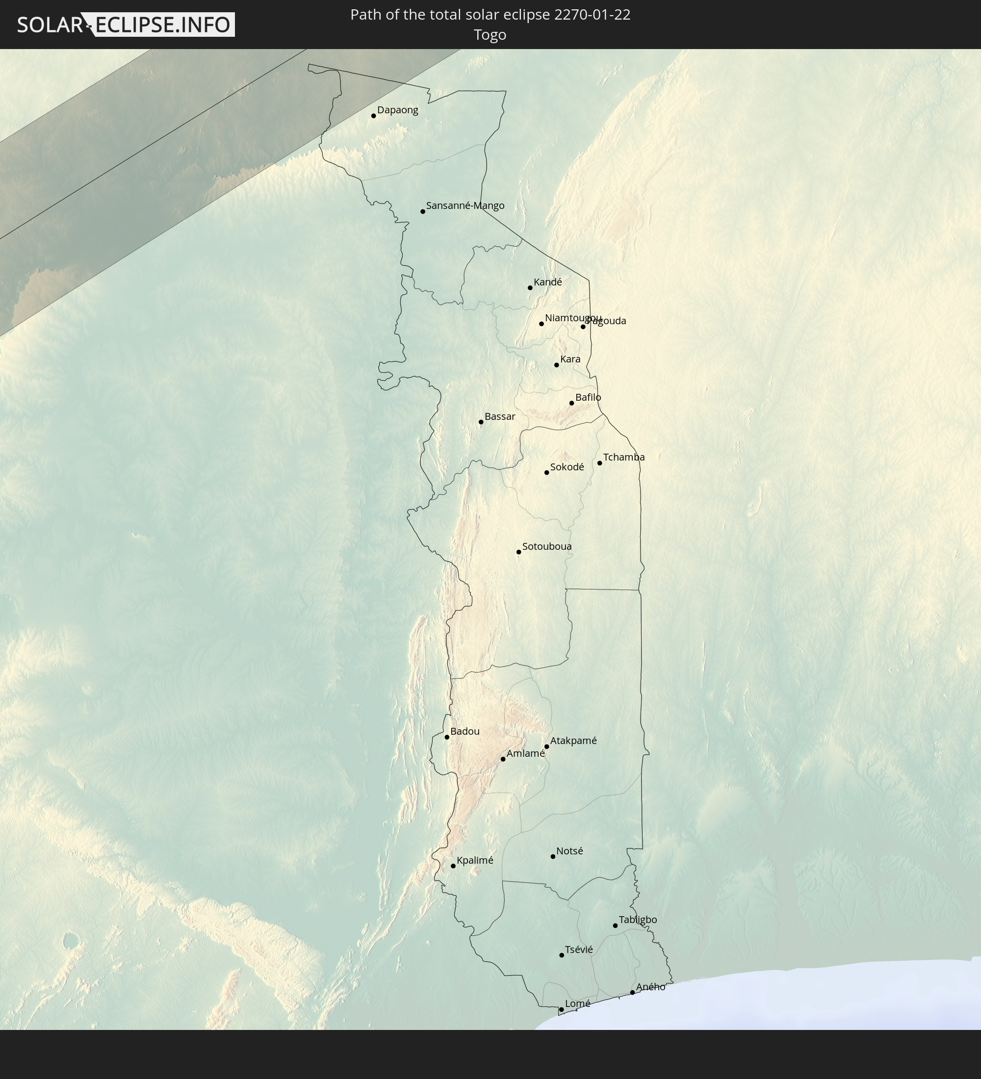
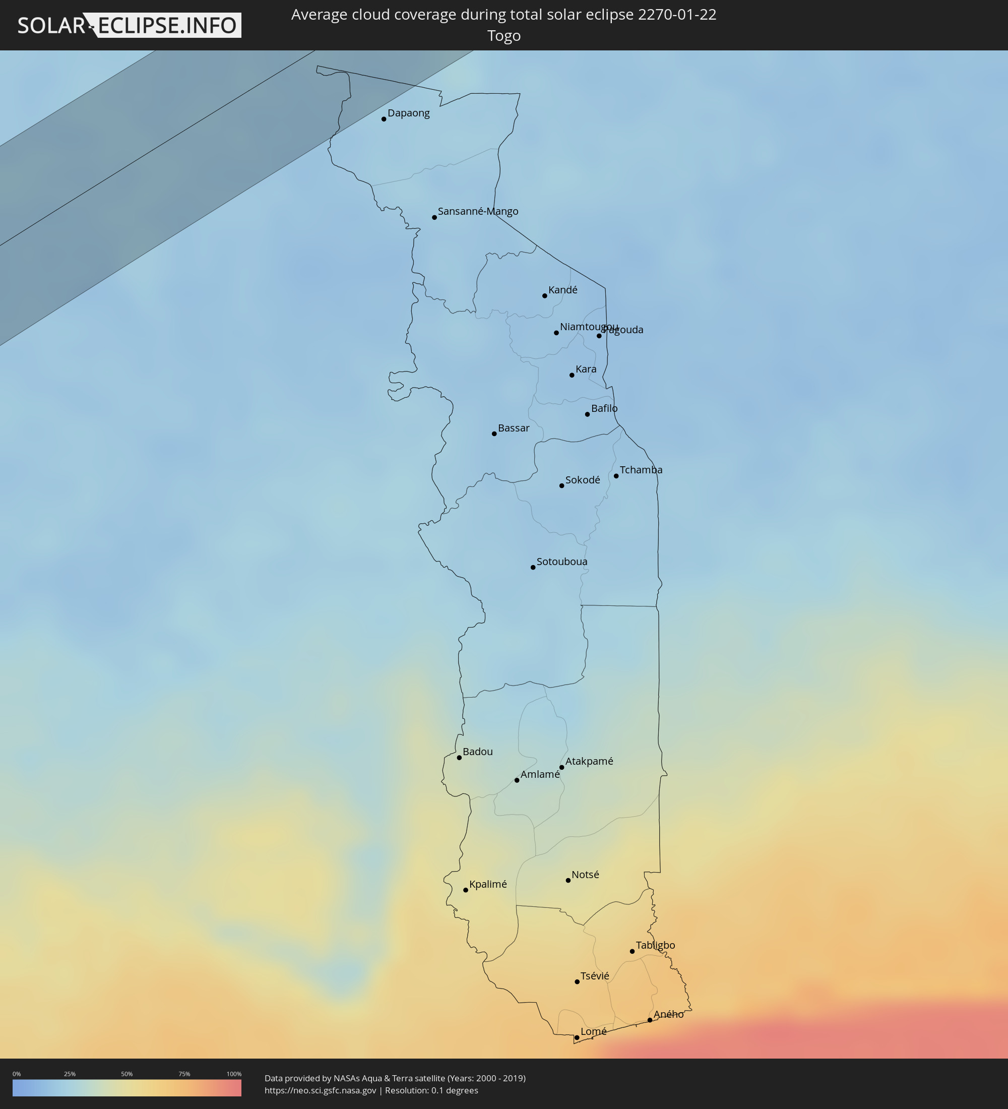 Togo
Togo
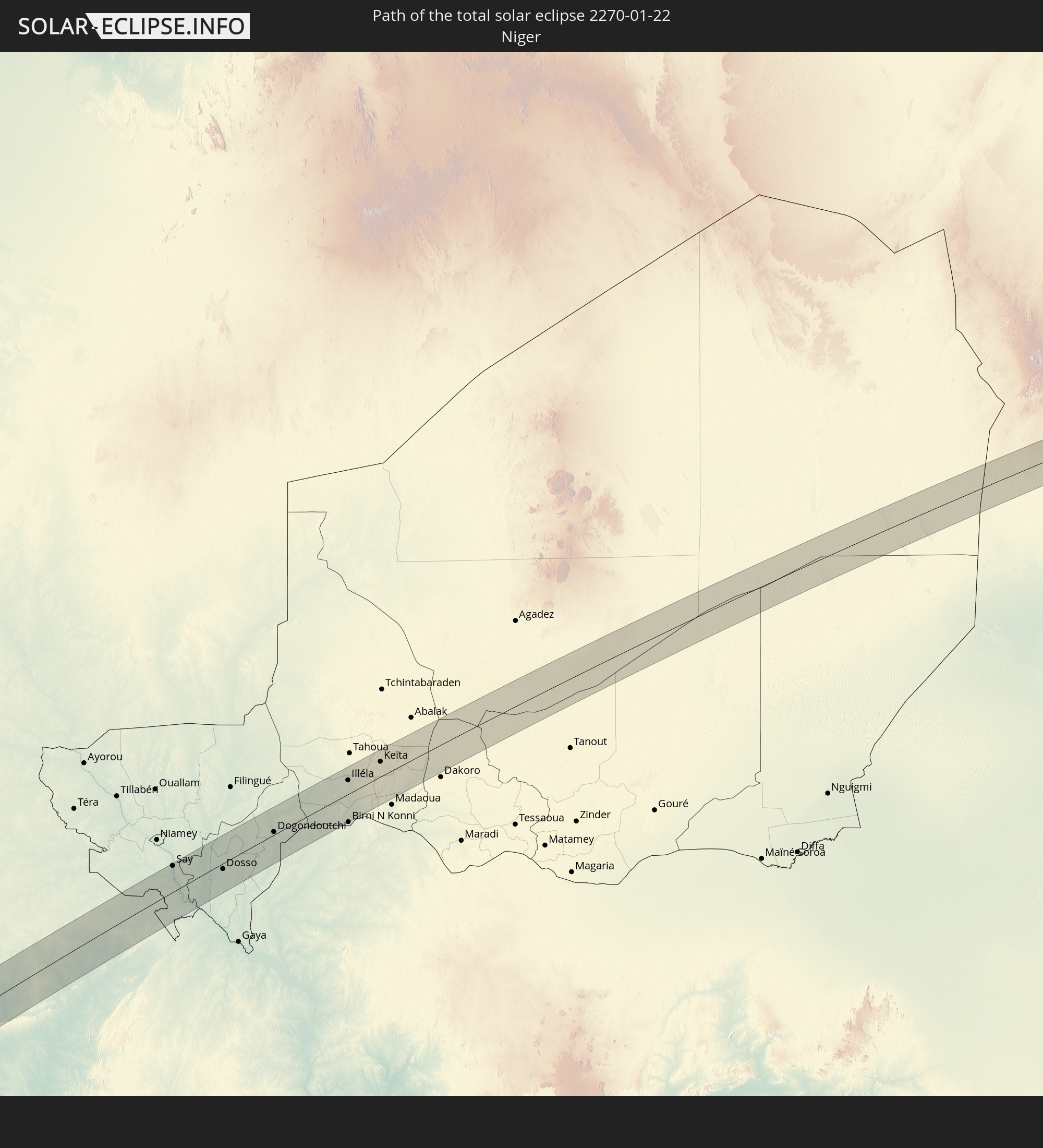
 Niger
Niger
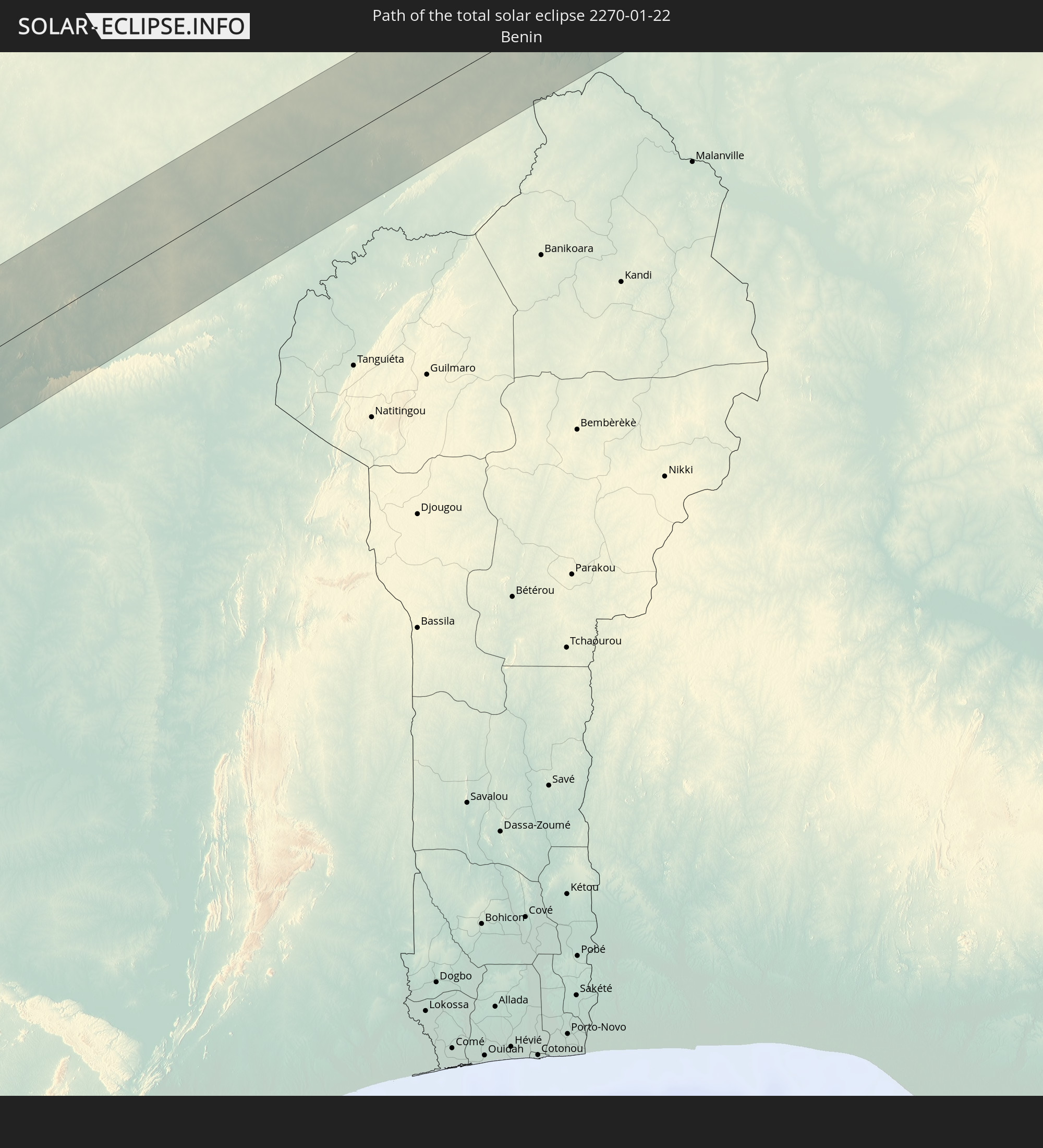
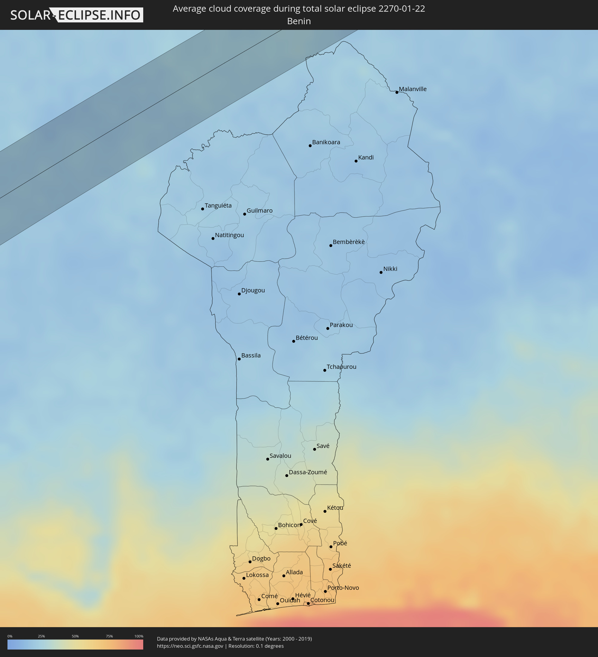 Benin
Benin
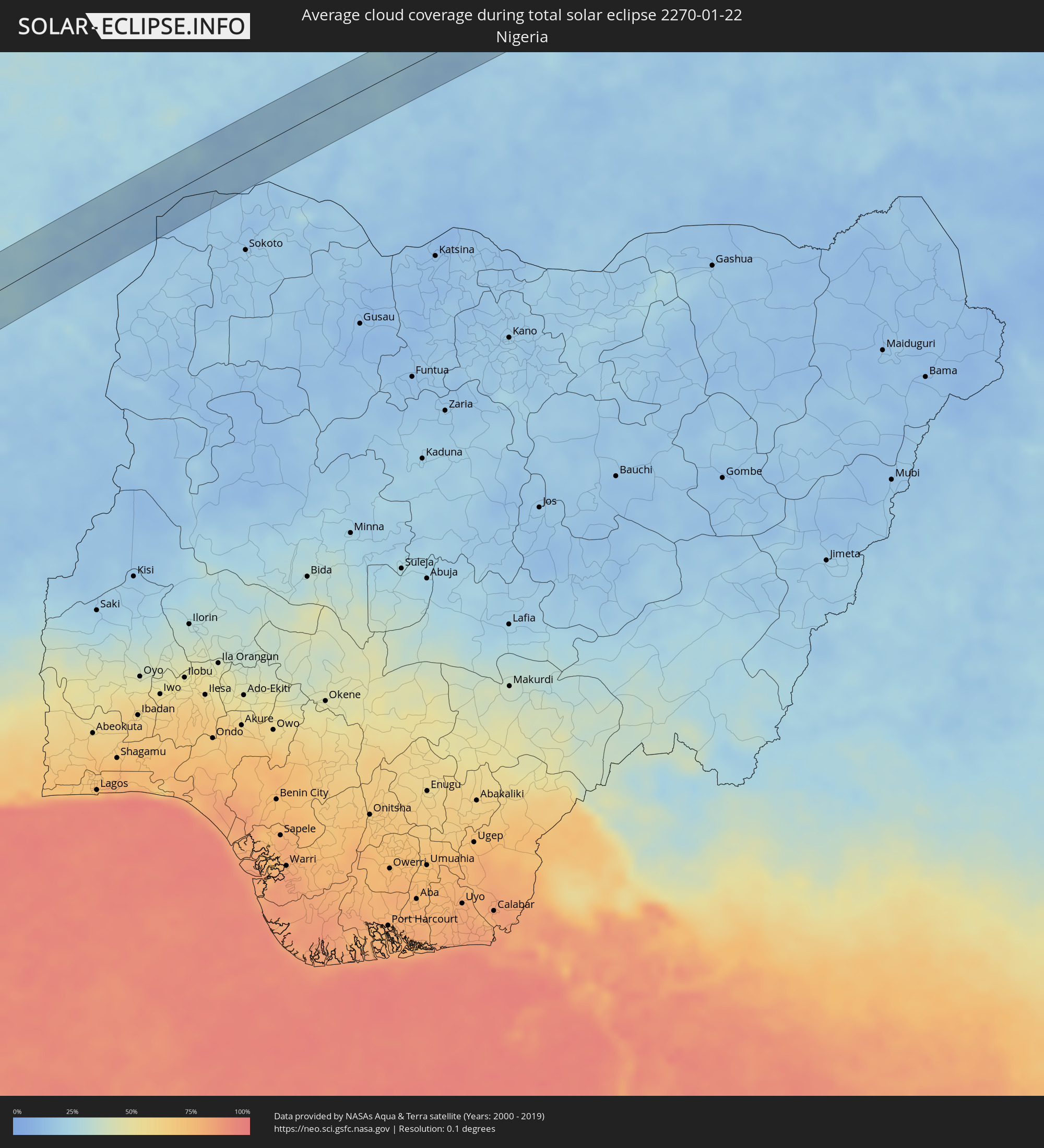 Nigeria
 Tschad
Orte im Finsternispfad
Die nachfolgene Tabelle zeigt Städte und Orte mit mehr als 5.000 Einwohnern, die sich im Finsternispfad befinden. Städte mit mehr als 100.000 Einwohnern sind dick gekennzeichnet. Mit einem Klick auf den Ort öffnet sich eine Detailkarte die die Lage des jeweiligen Ortes zusammen mit dem Verlauf der zentralen Finsternis präsentiert.
| Ort | Typ | Dauer der Verfinsterung | Ortszeit bei maximaler Verfinsterung | Entfernung zur Zentrallinie | Ø Bewölkung |
|
Antofagasta, Antofagasta
|
total | - | 10:16:34 UTC-03:00 | 17 km | 12% |
|
Tilcara, Jujuy Province
|
total | - | 10:24:35 UTC-03:00 | 21 km | 43% |
|
San Salvador de Jujuy, Jujuy Province
|
total | - | 10:24:39 UTC-03:00 | 47 km | 64% |
|
Palpalá, Jujuy Province
|
total | - | 10:24:47 UTC-03:00 | 54 km | 59% |
|
San Pedro, Jujuy Province
|
total | - | 10:25:23 UTC-03:00 | 51 km | 55% |
|
Ingenio La Esperanza, Jujuy Province
|
total | - | 10:25:26 UTC-03:00 | 50 km | 55% |
|
Fraile Pintado, Jujuy Province
|
total | - | 10:25:31 UTC-03:00 | 18 km | 56% |
|
Libertador General San Martín, Jujuy Province
|
total | - | 10:25:33 UTC-03:00 | 3 km | 58% |
|
Calilegua, Jujuy Province
|
total | - | 10:25:35 UTC-03:00 | 0 km | 58% |
|
Caimancito, Jujuy Province
|
total | - | 10:25:54 UTC-03:00 | 4 km | 53% |
|
Yuto, Jujuy Province
|
total | - | 10:26:07 UTC-03:00 | 15 km | 52% |
|
Palma Sola, Jujuy Province
|
total | - | 10:26:24 UTC-03:00 | 20 km | 65% |
|
Ingeniero Guillermo N. Juárez, Formosa Province
|
total | - | 10:30:54 UTC-03:00 | 18 km | 56% |
|
Concepción, Concepción
|
total | - | 10:39:56 UTC-03:00 | 1 km | 57% |
|
Horqueta, Concepción
|
total | - | 10:40:45 UTC-03:00 | 3 km | 61% |
|
Capitán Bado, Amambay
|
total | - | 10:44:06 UTC-03:00 | 11 km | 67% |
|
Presidente Prudente, São Paulo
|
total | - | 10:54:19 UTC-03:00 | 27 km | 80% |
|
Assis, São Paulo
|
total | - | 10:56:13 UTC-03:00 | 57 km | 74% |
|
Marília, São Paulo
|
total | - | 10:57:41 UTC-03:00 | 21 km | 80% |
|
Bauru, São Paulo
|
total | - | 10:59:44 UTC-03:00 | 58 km | 81% |
|
Araraquara, São Paulo
|
total | - | 11:02:21 UTC-03:00 | 31 km | 83% |
|
Sertãozinho, São Paulo
|
total | - | 11:03:26 UTC-03:00 | 33 km | 78% |
|
São Carlos, São Paulo
|
total | - | 11:02:50 UTC-03:00 | 63 km | 81% |
|
Ribeirão Preto, São Paulo
|
total | - | 11:03:50 UTC-03:00 | 23 km | 83% |
|
Passos, Minas Gerais
|
total | - | 11:07:17 UTC-03:00 | 29 km | 77% |
|
Divinópolis, Minas Gerais
|
total | - | 11:12:15 UTC-03:00 | 23 km | 77% |
|
Pará de Minas, Minas Gerais
|
total | - | 11:13:17 UTC-03:00 | 40 km | 78% |
|
Itaúna, Minas Gerais
|
total | - | 11:13:07 UTC-03:00 | 17 km | 77% |
|
Esmeraldas, Minas Gerais
|
total | - | 11:14:09 UTC-03:00 | 38 km | 76% |
|
Betim, Minas Gerais
|
total | - | 11:14:12 UTC-03:00 | 12 km | 75% |
|
Ribeirão das Neves, Minas Gerais
|
total | - | 11:14:43 UTC-03:00 | 28 km | 78% |
|
Ibirité, Minas Gerais
|
total | - | 11:14:29 UTC-03:00 | 1 km | 76% |
|
Belo Horizonte, Minas Gerais
|
total | - | 11:14:54 UTC-03:00 | 6 km | 76% |
|
Santa Luzia, Minas Gerais
|
total | - | 11:15:19 UTC-03:00 | 18 km | 75% |
|
Itabira, Minas Gerais
|
total | - | 11:17:04 UTC-03:00 | 6 km | 80% |
|
Timóteo, Minas Gerais
|
total | - | 11:18:34 UTC-03:00 | 16 km | 73% |
|
Ipatinga, Minas Gerais
|
total | - | 11:19:00 UTC-03:00 | 9 km | 67% |
|
Governador Valadares, Minas Gerais
|
total | - | 11:21:18 UTC-03:00 | 26 km | 74% |
|
São Mateus, Espírito Santo
|
total | - | 11:26:43 UTC-03:00 | 63 km | 72% |
|
Cestos City, River Cess
|
total | - | 15:58:50 UTC+00:00 | 47 km | 74% |
|
Greenville, Sinoe
|
total | - | 15:58:54 UTC+00:00 | 29 km | 81% |
|
Zwedru, Grand Gedeh
|
total | - | 16:00:51 UTC+00:00 | 7 km | 67% |
|
Guiglo, Montagnes
|
total | - | 16:01:54 UTC+00:00 | 9 km | 53% |
|
Bangolo, Montagnes
|
total | - | 16:02:22 UTC+00:00 | 51 km | 41% |
|
Duekoué, Montagnes
|
total | - | 16:02:13 UTC+00:00 | 18 km | 51% |
|
Vavoua, Sassandra-Marahoué
|
total | - | 16:03:35 UTC+00:00 | 21 km | 37% |
|
Daloa, Sassandra-Marahoué
|
total | - | 16:03:08 UTC+00:00 | 27 km | 48% |
|
Zuénoula, Sassandra-Marahoué
|
total | - | 16:03:59 UTC+00:00 | 1 km | 37% |
|
Béoumi, Vallée du Bandama
|
total | - | 16:04:35 UTC+00:00 | 8 km | 31% |
|
Botro, Vallée du Bandama
|
total | - | 16:04:58 UTC+00:00 | 9 km | 31% |
|
Sakassou, Vallée du Bandama
|
total | - | 16:04:37 UTC+00:00 | 46 km | 37% |
|
Katiola, Vallée du Bandama
|
total | - | 16:05:23 UTC+00:00 | 5 km | 28% |
|
Bouaké, Vallée du Bandama
|
total | - | 16:05:02 UTC+00:00 | 41 km | 33% |
|
Dabakala, Vallée du Bandama
|
total | - | 16:06:06 UTC+00:00 | 16 km | 30% |
|
Bouna, Zanzan
|
total | - | 16:07:53 UTC+00:00 | 18 km | 18% |
|
Batié, Sud-Ouest
|
total | - | 16:08:26 UTC+00:00 | 35 km | 20% |
|
Wa, Upper West
|
total | - | 16:08:50 UTC+00:00 | 27 km | 16% |
|
Navrongo, Upper East
|
total | - | 16:10:21 UTC+00:00 | 23 km | 21% |
|
Bolgatanga, Upper East
|
total | - | 16:10:25 UTC+00:00 | 1 km | 21% |
|
Bawku, Upper East
|
total | - | 16:10:58 UTC+00:00 | 10 km | 18% |
|
Ouargaye, Centre-Est
|
total | - | 16:11:27 UTC+00:00 | 15 km | 19% |
|
Pama, Est
|
total | - | 16:11:38 UTC+00:00 | 46 km | 24% |
|
Diapaga, Est
|
total | - | 16:12:44 UTC+00:00 | 27 km | 21% |
|
Say, Tillabéri
|
total | - | 17:13:39 UTC+01:00 | 41 km | 25% |
|
Dosso, Dosso
|
total | - | 17:13:59 UTC+01:00 | 9 km | 18% |
|
Dogondoutchi, Dosso
|
total | - | 17:14:41 UTC+01:00 | 4 km | 15% |
|
Illéla, Tahoua
|
total | - | 17:15:35 UTC+01:00 | 21 km | 16% |
|
Keïta, Tahoua
|
total | - | 17:15:55 UTC+01:00 | 23 km | 17% |
|
Bouza, Tahoua
|
total | - | 17:15:51 UTC+01:00 | 23 km | 18% |