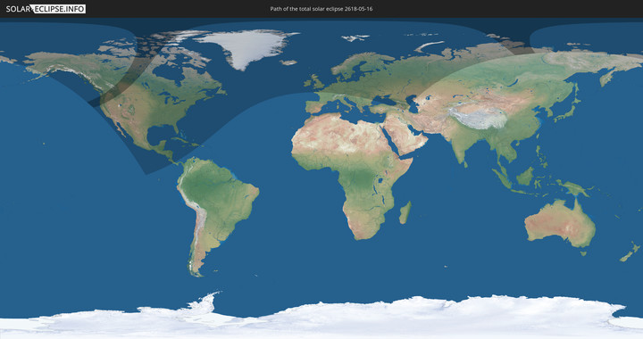
Totale Sonnenfinsternis vom 16.05.2618
| Wochentag: | Samstag |
| Maximale Dauer der Verfinsterung: | 03m24s |
| Maximale Breite des Finsternispfades: | 447 km |
| Saroszyklus: | 167 |
| Bedeckungsgrad: | 100% |
| Magnitude: | 1.0612 |
| Gamma: | 0.8919 |
Wo kann man die Sonnenfinsternis vom 16.05.2618 sehen?
Die Sonnenfinsternis am 16.05.2618 kann man in 62 Ländern als partielle Sonnenfinsternis beobachten.
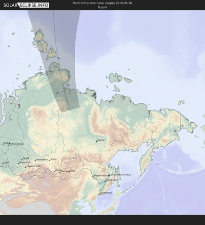
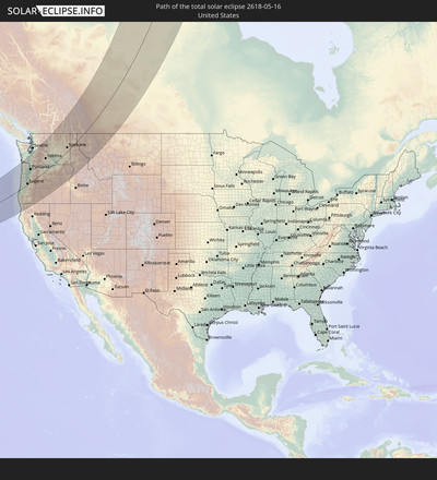
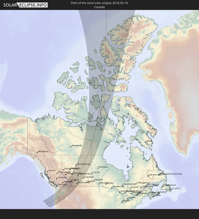
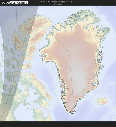
Der Finsternispfad verläuft durch 4 Länder. Nur in diesen Ländern ist sie als totale Sonnenfinsternis zu sehen.
In den folgenden Ländern ist die Sonnenfinsternis total zu sehen
In den folgenden Ländern ist die Sonnenfinsternis partiell zu sehen
 Russland
 Vereinigte Staaten
 United States Minor Outlying Islands
 Kanada
 Mexiko
 Grönland
 Guatemala
 El Salvador
 Honduras
 Belize
 Nicaragua
 Costa Rica
 Kuba
Kuba
 Panama
 Kolumbien
 Kaimaninseln
 Bahamas
 Jamaika
 Haiti
Haiti
 Turks- und Caicosinseln
 Dominikanische Republik
 Bermuda
 Saint-Pierre und Miquelon
 Island
 Irland
 Spitzbergen
 Vereinigtes Königreich
 Färöer
 Frankreich
 Isle of Man
 Guernsey
 Jersey
 Belgien
 Niederlande
 Norwegen
 Luxemburg
 Deutschland
 Schweiz
 Dänemark
 Österreich
 Schweden
 Tschechien
 Slowenien
 Polen
Polen
 Ungarn
 Slowakei
 Serbien
 Åland Islands
 Rumänien
 Finnland
 Litauen
 Lettland
 Estland
 Ukraine
 Weißrussland
 Türkei
 Moldawien
 Georgien
 Armenien
 Iran
Iran
 Aserbaidschan
 Kasachstan
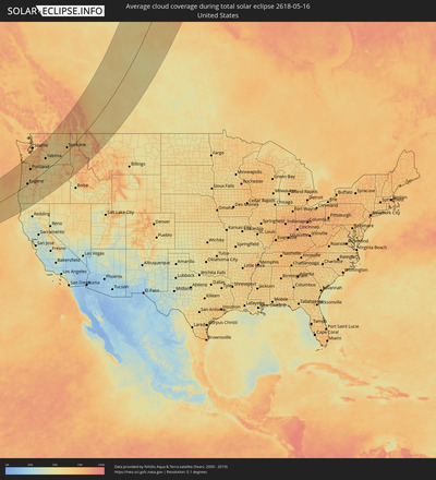
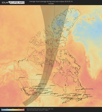
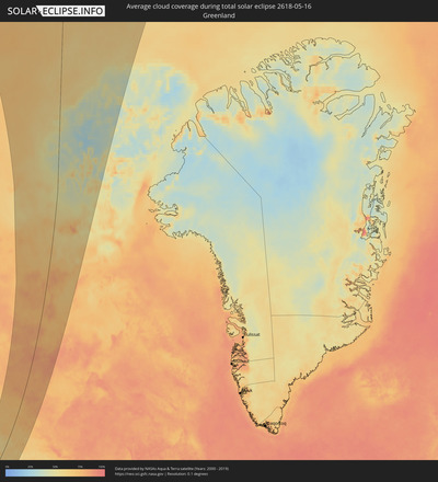
Wie wird das Wetter während der totalen Sonnenfinsternis am 16.05.2618?
Wo ist der beste Ort, um die totale Sonnenfinsternis vom 16.05.2618 zu beobachten?
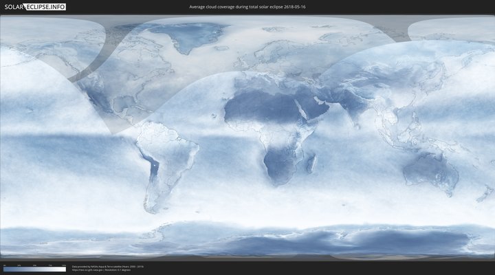
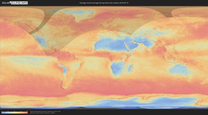
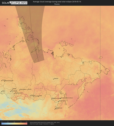
Die folgenden Karten zeigen die durchschnittliche Bewölkung für den Tag, an dem die totale Sonnenfinsternis
stattfindet. Mit Hilfe der Karten lässt sich der Ort entlang des Finsternispfades eingrenzen,
der die besten Aussichen auf einen klaren wolkenfreien Himmel bietet.
Trotzdem muss man immer lokale Gegenenheiten beachten und sollte sich genau über das Wetter an seinem
gewählten Beobachtungsort informieren.
Die Daten stammen von den beiden NASA-Satelliten
AQUA und TERRA
und wurden über einen Zeitraum von 19 Jahren (2000 - 2019) gemittelt.
Detaillierte Länderkarten
Orte im Finsternispfad
Die nachfolgene Tabelle zeigt Städte und Orte mit mehr als 5.000 Einwohnern, die sich im Finsternispfad befinden. Städte mit mehr als 100.000 Einwohnern sind dick gekennzeichnet. Mit einem Klick auf den Ort öffnet sich eine Detailkarte die die Lage des jeweiligen Ortes zusammen mit dem Verlauf der zentralen Finsternis präsentiert.
| Ort | Typ | Dauer der Verfinsterung | Ortszeit bei maximaler Verfinsterung | Entfernung zur Zentrallinie | Ø Bewölkung |
 North Bend, Oregon
|
total | - | 05:25:48 UTC-08:00 | 1 km | 62% |
 Coos Bay, Oregon
|
total | - | 05:25:44 UTC-08:00 | 3 km | 62% |
 Crescent City, California
|
total | - | 05:23:29 UTC-08:00 | 155 km | 63% |
 Florence, Oregon
|
total | - | 05:26:34 UTC-08:00 | 49 km | 65% |
 Newport, Oregon
|
total | - | 05:27:29 UTC-08:00 | 107 km | 66% |
 Lincoln City, Oregon
|
total | - | 05:27:56 UTC-08:00 | 134 km | 70% |
 Astoria, Oregon
|
total | - | 05:29:40 UTC-08:00 | 235 km | 71% |
 Green, Oregon
|
total | - | 05:25:08 UTC-08:00 | 60 km | 58% |
 Roseburg, Oregon
|
total | - | 05:25:12 UTC-08:00 | 56 km | 60% |
 Grants Pass, Oregon
|
total | - | 05:24:06 UTC-08:00 | 129 km | 54% |
 Dallas, Oregon
|
total | - | 05:27:38 UTC-08:00 | 98 km | 66% |
 Sutherlin, Oregon
|
total | - | 05:25:26 UTC-08:00 | 41 km | 59% |
 Corvallis, Oregon
|
total | - | 05:27:06 UTC-08:00 | 64 km | 63% |
 Monmouth, Oregon
|
total | - | 05:27:30 UTC-08:00 | 88 km | 64% |
 McMinnville, Oregon
|
total | - | 05:28:01 UTC-08:00 | 119 km | 66% |
 Independence, Oregon
|
total | - | 05:27:30 UTC-08:00 | 86 km | 65% |
 Eugene, Oregon
|
total | - | 05:26:18 UTC-08:00 | 9 km | 63% |
 Cornelius, Oregon
|
total | - | 05:28:25 UTC-08:00 | 139 km | 67% |
 Cottage Grove, Oregon
|
total | - | 05:25:56 UTC-08:00 | 15 km | 61% |
 Salem, Oregon
|
total | - | 05:27:34 UTC-08:00 | 87 km | 66% |
 Hillsboro, Oregon
|
total | - | 05:28:24 UTC-08:00 | 136 km | 69% |
 Newberg, Oregon
|
total | - | 05:28:04 UTC-08:00 | 116 km | 66% |
 Chehalis, Washington
|
total | - | 05:30:05 UTC-08:00 | 234 km | 71% |
 Centralia, Washington
|
total | - | 05:30:09 UTC-08:00 | 238 km | 71% |
 Longview, Washington
|
total | - | 05:29:18 UTC-08:00 | 188 km | 68% |
 Lebanon, Oregon
|
total | - | 05:26:56 UTC-08:00 | 45 km | 65% |
 Rockcreek, Oregon
|
total | - | 05:28:24 UTC-08:00 | 133 km | 71% |
 Medford, Oregon
|
total | - | 05:23:46 UTC-08:00 | 160 km | 55% |
 White City, Oregon
|
total | - | 05:23:55 UTC-08:00 | 150 km | 53% |
 Woodburn, Oregon
|
total | - | 05:27:48 UTC-08:00 | 96 km | 65% |
 Oak Hills, Oregon
|
total | - | 05:28:23 UTC-08:00 | 131 km | 70% |
 Saint Helens, Oregon
|
total | - | 05:28:51 UTC-08:00 | 158 km | 66% |
 Eagle Point, Oregon
|
total | - | 05:23:57 UTC-08:00 | 149 km | 50% |
 Cedar Hills, Oregon
|
total | - | 05:28:19 UTC-08:00 | 126 km | 70% |
 Stayton, Oregon
|
total | - | 05:27:17 UTC-08:00 | 63 km | 65% |
 Silverton, Oregon
|
total | - | 05:27:35 UTC-08:00 | 81 km | 65% |
 West Haven-Sylvan, Oregon
|
total | - | 05:28:19 UTC-08:00 | 125 km | 70% |
 Sweet Home, Oregon
|
total | - | 05:26:41 UTC-08:00 | 24 km | 63% |
 Ashland, Oregon
|
total | - | 05:23:31 UTC-08:00 | 179 km | 56% |
 Felida, Washington
|
total | - | 05:28:35 UTC-08:00 | 139 km | 66% |
 Portland, Oregon
|
total | - | 05:28:18 UTC-08:00 | 121 km | 68% |
 Salmon Creek, Washington
|
total | - | 05:28:34 UTC-08:00 | 137 km | 68% |
 Minnehaha, Washington
|
total | - | 05:28:30 UTC-08:00 | 132 km | 68% |
 Yreka, California
|
total | - | 05:22:50 UTC-08:00 | 226 km | 47% |
 Mount Vista, Washington
|
total | - | 05:28:36 UTC-08:00 | 138 km | 68% |
 Jennings Lodge, Oregon
|
total | - | 05:28:05 UTC-08:00 | 107 km | 67% |
 Oregon City, Oregon
|
total | - | 05:28:02 UTC-08:00 | 103 km | 67% |
 Walnut Grove, Washington
|
total | - | 05:28:29 UTC-08:00 | 130 km | 68% |
 Gladstone, Oregon
|
total | - | 05:28:04 UTC-08:00 | 105 km | 67% |
 Molalla, Oregon
|
total | - | 05:27:43 UTC-08:00 | 84 km | 67% |
 Mill Plain, Washington
|
total | - | 05:28:25 UTC-08:00 | 123 km | 67% |
 Damascus, Oregon
|
total | - | 05:28:05 UTC-08:00 | 102 km | 69% |
 Fairview, Oregon
|
total | - | 05:28:15 UTC-08:00 | 111 km | 69% |
 Gresham, Oregon
|
total | - | 05:28:11 UTC-08:00 | 107 km | 69% |
 Summit, Washington
|
total | - | 05:30:38 UTC-08:00 | 247 km | 69% |
 South Hill, Washington
|
total | - | 05:30:35 UTC-08:00 | 241 km | 69% |
 Sandy, Oregon
|
total | - | 05:27:59 UTC-08:00 | 90 km | 70% |
 Sumner, Washington
|
total | - | 05:30:40 UTC-08:00 | 244 km | 69% |
 Prairie Ridge, Washington
|
total | - | 05:30:32 UTC-08:00 | 234 km | 69% |
 Lake Morton-Berrydale, Washington
|
total | - | 05:30:49 UTC-08:00 | 248 km | 68% |
 Enumclaw, Washington
|
total | - | 05:30:35 UTC-08:00 | 232 km | 72% |
 Klamath Falls, Oregon
|
total | - | 05:23:13 UTC-08:00 | 219 km | 51% |
 Hood River, Oregon
|
total | - | 05:28:12 UTC-08:00 | 81 km | 60% |
 Bend, Oregon
|
total | - | 05:25:42 UTC-08:00 | 73 km | 57% |
 The Dalles, Oregon
|
total | - | 05:27:56 UTC-08:00 | 55 km | 53% |
 Redmond, Oregon
|
total | - | 05:25:58 UTC-08:00 | 61 km | 56% |
 Prineville, Oregon
|
total | - | 05:25:54 UTC-08:00 | 75 km | 55% |
 Ellensburg, Washington
|
total | - | 05:29:51 UTC-08:00 | 142 km | 59% |
 Yakima, Washington
|
total | - | 05:29:15 UTC-08:00 | 107 km | 59% |
 Wenatchee, Washington
|
total | - | 05:30:26 UTC-08:00 | 165 km | 61% |
 Toppenish, Washington
|
total | - | 05:28:51 UTC-08:00 | 78 km | 58% |
 East Wenatchee Bench, Washington
|
total | - | 05:30:26 UTC-08:00 | 163 km | 61% |
 Sunnyside, Washington
|
total | - | 05:28:41 UTC-08:00 | 58 km | 56% |
 Grandview, Washington
|
total | - | 05:28:32 UTC-08:00 | 47 km | 56% |
 Ephrata, Washington
|
total | - | 05:30:04 UTC-08:00 | 117 km | 56% |
 West Richland, Washington
|
total | - | 05:28:28 UTC-08:00 | 24 km | 57% |
 Hermiston, Oregon
|
total | - | 05:27:45 UTC-08:00 | 19 km | 55% |
 Moses Lake, Washington
|
total | - | 05:29:43 UTC-08:00 | 87 km | 53% |
 Othello, Washington
|
total | - | 05:29:13 UTC-08:00 | 57 km | 57% |
 Kennewick, Washington
|
total | - | 05:28:16 UTC-08:00 | 5 km | 54% |
 Pendleton, Oregon
|
total | - | 05:27:21 UTC-08:00 | 58 km | 61% |
 College Place, Washington
|
total | - | 05:27:49 UTC-08:00 | 47 km | 63% |
 Walla Walla, Washington
|
total | - | 05:27:50 UTC-08:00 | 48 km | 62% |
 La Grande, Oregon
|
total | - | 05:26:38 UTC-08:00 | 123 km | 64% |
 Baker City, Oregon
|
total | - | 05:25:44 UTC-08:00 | 183 km | 59% |
 Trail, British Columbia
|
total | - | 05:32:25 UTC-08:00 | 157 km | 66% |
 Castlegar, British Columbia
|
total | - | 05:32:44 UTC-08:00 | 170 km | 70% |
 Cheney, Washington
|
total | - | 05:29:51 UTC-08:00 | 26 km | 66% |
 Spokane, Washington
|
total | - | 05:30:05 UTC-08:00 | 32 km | 67% |
 Fairwood, Washington
|
total | - | 05:30:15 UTC-08:00 | 40 km | 67% |
 Mead, Washington
|
total | - | 05:30:14 UTC-08:00 | 37 km | 67% |
 Nelson, British Columbia
|
total | - | 05:32:58 UTC-08:00 | 164 km | 78% |
 Dishman, Washington
|
total | - | 05:30:03 UTC-08:00 | 24 km | 68% |
 Veradale, Washington
|
total | - | 05:30:01 UTC-08:00 | 20 km | 69% |
 Pullman, Washington
|
total | - | 05:28:34 UTC-08:00 | 55 km | 63% |
 Liberty Lake, Washington
|
total | - | 05:30:02 UTC-08:00 | 17 km | 69% |
 Clarkston, Washington
|
total | - | 05:28:03 UTC-08:00 | 87 km | 61% |
 Lewiston, Idaho
|
total | - | 05:28:03 UTC-08:00 | 89 km | 61% |
 Coeur d'Alene, Idaho
|
total | - | 05:29:58 UTC-08:00 | 1 km | 67% |
 Sandpoint, Idaho
|
total | - | 05:30:52 UTC-08:00 | 33 km | 61% |
 Kimberley, British Columbia
|
total | - | 06:32:59 UTC-07:00 | 104 km | 69% |
 Cranbrook, British Columbia
|
total | - | 06:32:40 UTC-07:00 | 80 km | 67% |
 Banff, Alberta
|
total | - | 06:35:22 UTC-07:00 | 185 km | 81% |
 Canmore, Alberta
|
total | - | 06:35:11 UTC-07:00 | 167 km | 83% |
 Fernie, British Columbia
|
total | - | 06:32:33 UTC-07:00 | 42 km | 79% |
 Rocky Mountain House, Alberta
|
total | - | 06:37:14 UTC-07:00 | 225 km | 68% |
 Cochrane, Alberta
|
total | - | 06:35:13 UTC-07:00 | 124 km | 71% |
 Kalispell, Montana
|
total | - | 06:30:18 UTC-07:00 | 96 km | 63% |
 Evergreen, Montana
|
total | - | 06:30:21 UTC-07:00 | 95 km | 63% |
 Olds, Alberta
|
total | - | 06:36:09 UTC-07:00 | 142 km | 65% |
 Sylvan Lake, Alberta
|
total | - | 06:37:03 UTC-07:00 | 174 km | 65% |
 Calgary, Alberta
|
total | - | 06:34:56 UTC-07:00 | 93 km | 69% |
 Airdrie, Alberta
|
total | - | 06:35:21 UTC-07:00 | 107 km | 67% |
 Stony Plain, Alberta
|
total | - | 06:39:05 UTC-07:00 | 242 km | 57% |
 Missoula, Montana
|
total | - | 06:28:08 UTC-07:00 | 214 km | 63% |
 Okotoks, Alberta
|
total | - | 06:34:23 UTC-07:00 | 66 km | 67% |
 Spruce Grove, Alberta
|
total | - | 06:39:04 UTC-07:00 | 237 km | 58% |
 High River, Alberta
|
total | - | 06:34:08 UTC-07:00 | 50 km | 67% |
 Red Deer, Alberta
|
total | - | 06:36:56 UTC-07:00 | 155 km | 64% |
 Devon, Alberta
|
total | - | 06:38:46 UTC-07:00 | 217 km | 59% |
 Lacombe, Alberta
|
total | - | 06:37:15 UTC-07:00 | 164 km | 62% |
 Morinville, Alberta
|
total | - | 06:39:29 UTC-07:00 | 237 km | 56% |
 St. Albert, Alberta
|
total | - | 06:39:12 UTC-07:00 | 227 km | 59% |
 Ponoka, Alberta
|
total | - | 06:37:35 UTC-07:00 | 168 km | 62% |
 Leduc, Alberta
|
total | - | 06:38:35 UTC-07:00 | 201 km | 57% |
 Edmonton, Alberta
|
total | - | 06:39:03 UTC-07:00 | 213 km | 58% |
 Beaumont, Alberta
|
total | - | 06:38:42 UTC-07:00 | 198 km | 58% |
 Strathmore, Alberta
|
total | - | 06:34:51 UTC-07:00 | 54 km | 61% |
 Silver Berry, Alberta
|
total | - | 06:38:53 UTC-07:00 | 202 km | 58% |
 Wild Rose, Alberta
|
total | - | 06:38:54 UTC-07:00 | 203 km | 58% |
 Wetaskiwin, Alberta
|
total | - | 06:38:03 UTC-07:00 | 173 km | 60% |
 Sherwood Park, Alberta
|
total | - | 06:38:59 UTC-07:00 | 202 km | 59% |
 Fort Saskatchewan, Alberta
|
total | - | 06:39:18 UTC-07:00 | 208 km | 56% |
 Camrose, Alberta
|
total | - | 06:38:05 UTC-07:00 | 146 km | 60% |
 Lethbridge, Alberta
|
total | - | 06:32:32 UTC-07:00 | 70 km | 57% |
 Stettler, Alberta
|
total | - | 06:36:53 UTC-07:00 | 97 km | 59% |
 Coaldale, Alberta
|
total | - | 06:32:32 UTC-07:00 | 80 km | 56% |
 Taber, Alberta
|
total | - | 06:32:35 UTC-07:00 | 101 km | 58% |
 Vegreville, Alberta
|
total | - | 06:38:50 UTC-07:00 | 129 km | 58% |
 Brooks, Alberta
|
total | - | 06:33:53 UTC-07:00 | 62 km | 58% |
 Wainwright, Alberta
|
total | - | 06:37:36 UTC-07:00 | 22 km | 60% |
 Bonnyville, Alberta
|
total | - | 06:40:03 UTC-07:00 | 97 km | 57% |
 Medicine Hat, Alberta
|
total | - | 06:32:51 UTC-07:00 | 167 km | 59% |
 Cold Lake, Alberta
|
total | - | 06:40:22 UTC-07:00 | 77 km | 56% |
 Lloydminster, Saskatchewan
|
total | - | 06:38:19 UTC-07:00 | 1 km | 58% |
 North Battleford, Saskatchewan
|
total | - | 07:37:22 UTC-06:00 | 126 km | 57% |
