Ringförmige Sonnenfinsternis vom 15.01.2708
| Wochentag: | Mittwoch |
| Maximale Dauer der Verfinsterung: | 09m38s |
| Maximale Breite des Finsternispfades: | 306 km |
| Saroszyklus: | 162 |
| Bedeckungsgrad: | 92.1% |
| Magnitude: | 0.9212 |
| Gamma: | -0.2277 |
Wo kann man die Sonnenfinsternis vom 15.01.2708 sehen?

Die Sonnenfinsternis am 15.01.2708 kann man in 36 Ländern als partielle Sonnenfinsternis beobachten.
Der Finsternispfad verläuft durch 5 Länder. Nur in diesen Ländern ist sie als ringförmige Sonnenfinsternis zu sehen.
In den folgenden Ländern ist die Sonnenfinsternis ringförmig zu sehen
 Tonga
Tonga
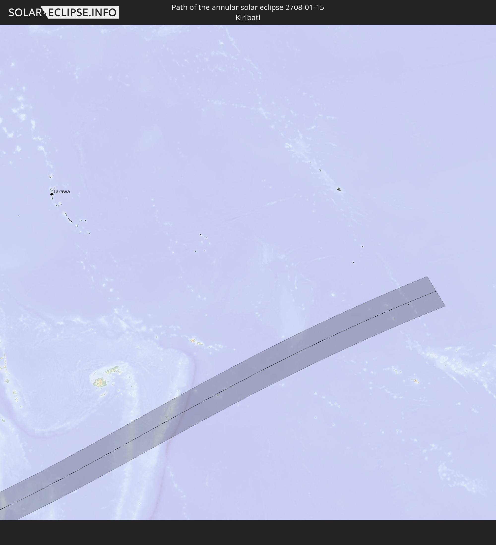 Kiribati
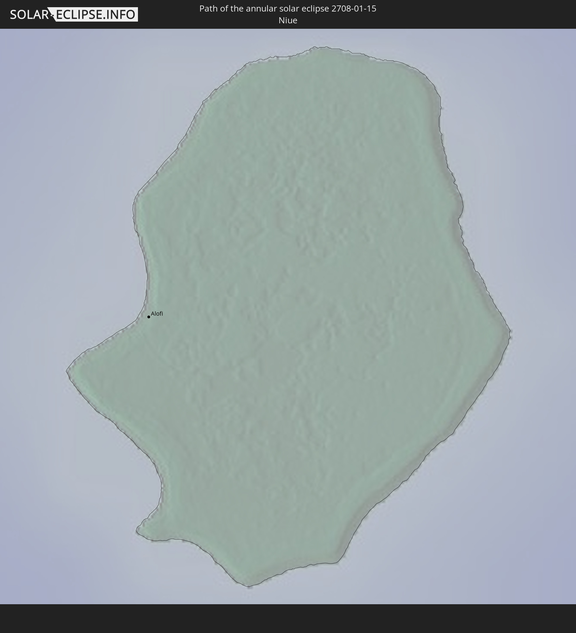 Niue
Niue
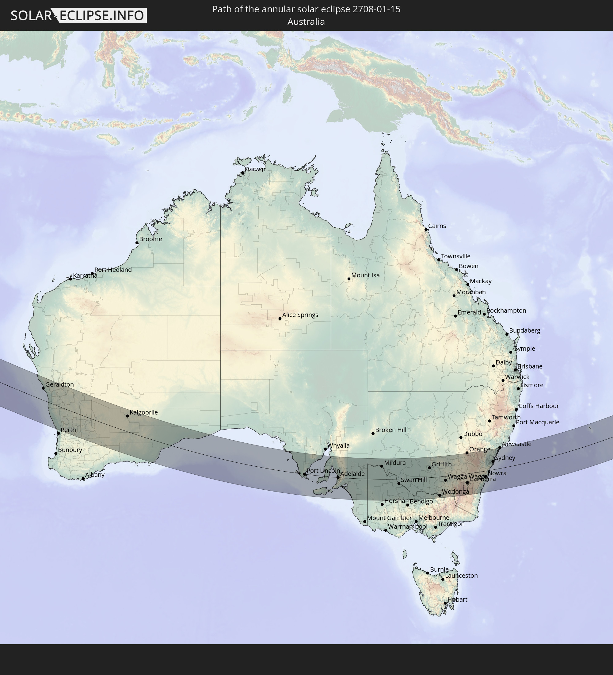 Australien
 Norfolkinsel
In den folgenden Ländern ist die Sonnenfinsternis partiell zu sehen
 Antarktika
 Fidschi
 Neuseeland
 United States Minor Outlying Islands
 Wallis und Futuna
 Tonga
Tonga
 Kiribati
 Samoa
Samoa
 Tokelau
 Amerikanisch-Samoa
 Niue
Niue
 Cookinseln
 Französisch-Polynesien
 Französische Süd- und Antarktisgebiete
 Indien
 Heard und McDonaldinseln
 Myanmar
 Indonesien
 Kokosinseln
 Thailand
 Malaysia
 Vietnam
 Kambodscha
 Singapur
 Weihnachtsinsel
 Australien
 Brunei
 Osttimor
 Papua-Neuguinea
 Salomonen
 Neukaledonien
 Marshallinseln
 Vanuatu
 Nauru
Nauru
 Norfolkinsel
 Tuvalu
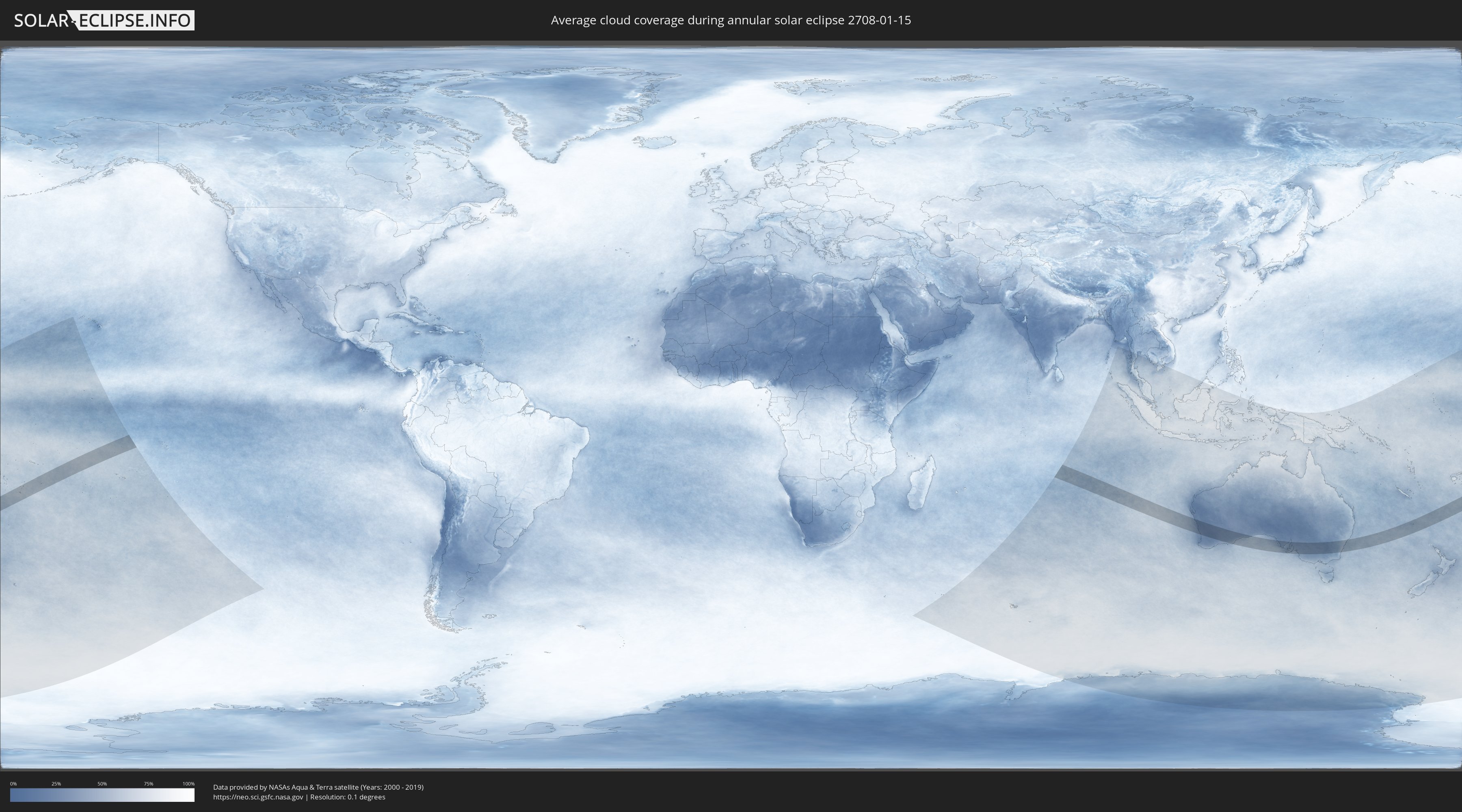
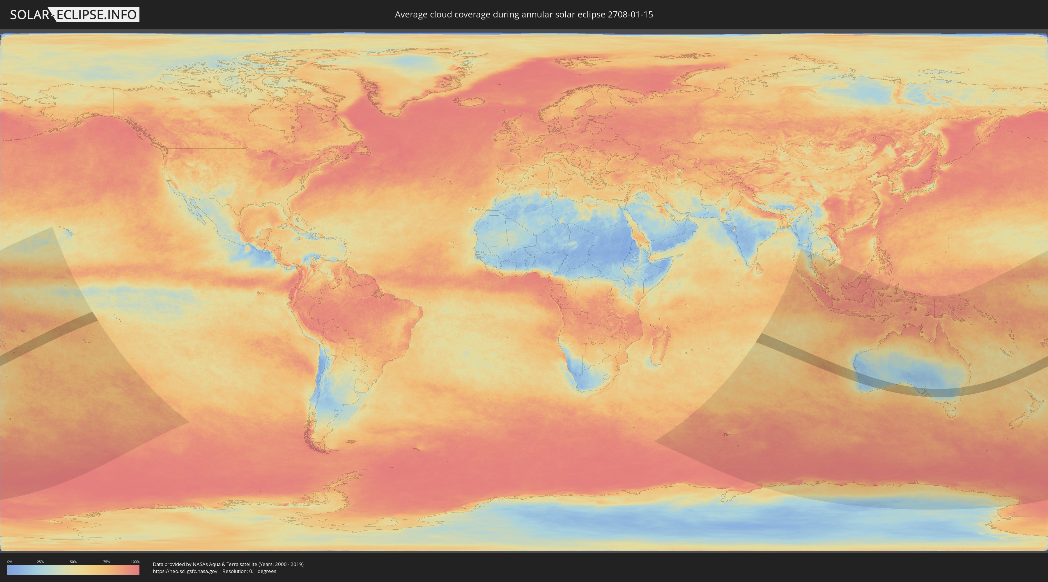
Wie wird das Wetter während der ringförmigen Sonnenfinsternis am 15.01.2708?
Wo ist der beste Ort, um die ringförmige Sonnenfinsternis vom 15.01.2708 zu beobachten?
Die folgenden Karten zeigen die durchschnittliche Bewölkung für den Tag, an dem die ringförmige Sonnenfinsternis
stattfindet. Mit Hilfe der Karten lässt sich der Ort entlang des Finsternispfades eingrenzen,
der die besten Aussichen auf einen klaren wolkenfreien Himmel bietet.
Trotzdem muss man immer lokale Gegenenheiten beachten und sollte sich genau über das Wetter an seinem
gewählten Beobachtungsort informieren.
Die Daten stammen von den beiden NASA-Satelliten
AQUA und TERRA
und wurden über einen Zeitraum von 19 Jahren (2000 - 2019) gemittelt.
Detaillierte Länderkarten
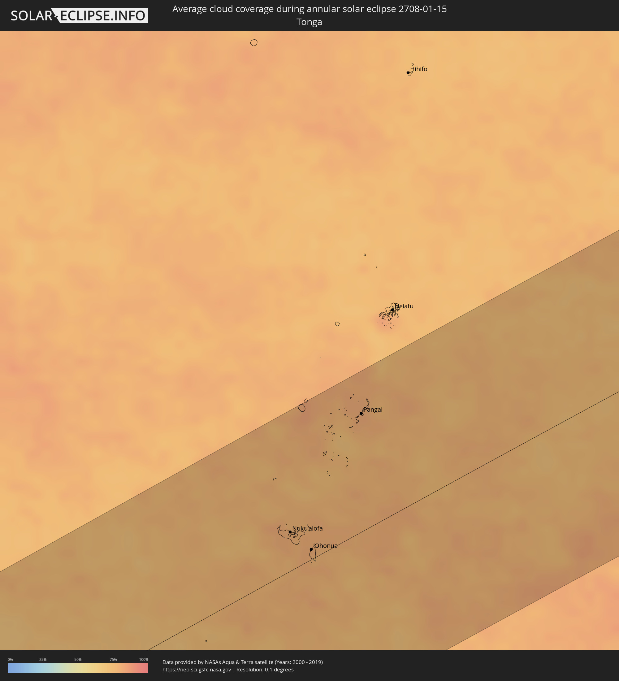 Tonga
Tonga
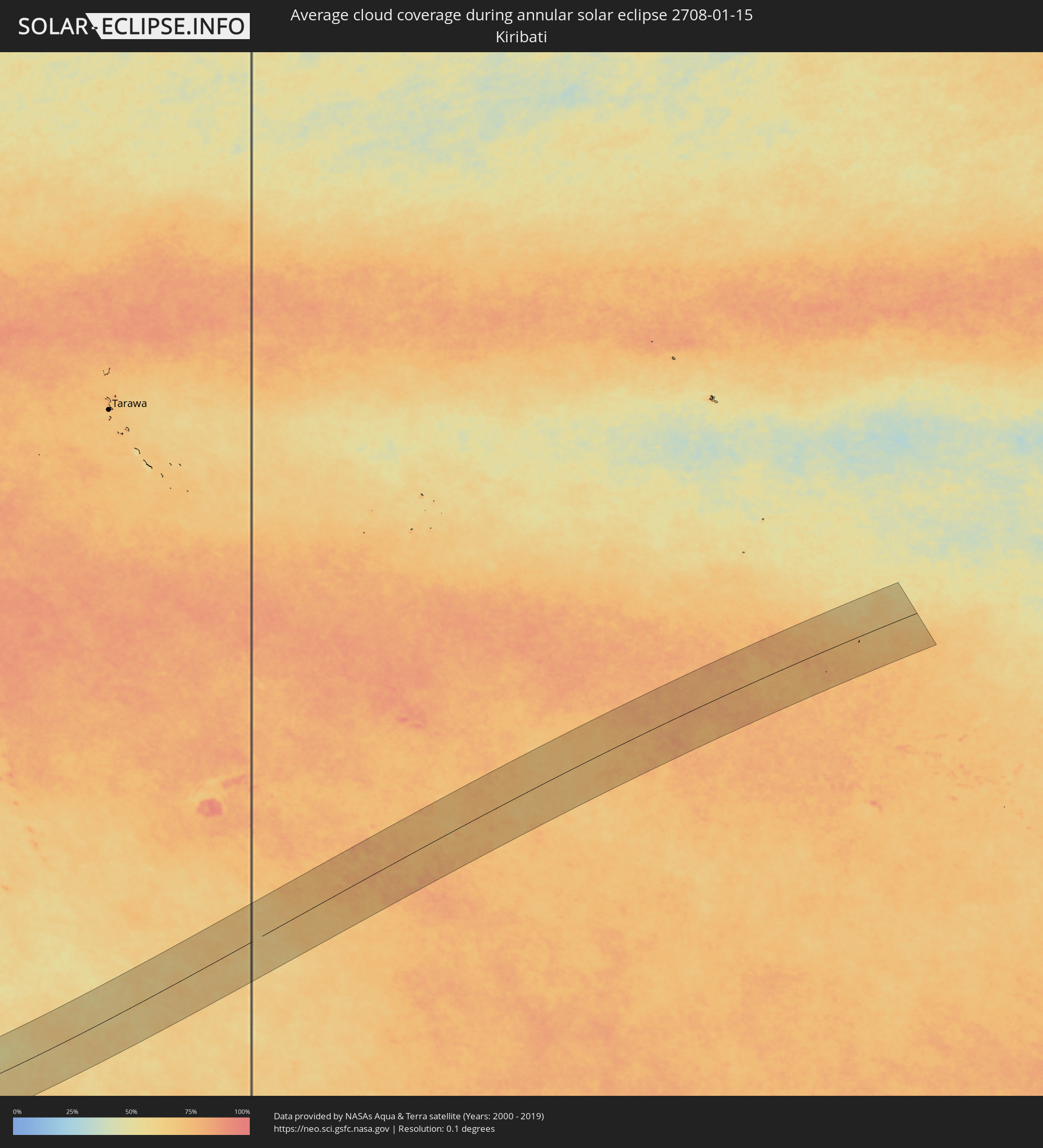 Kiribati
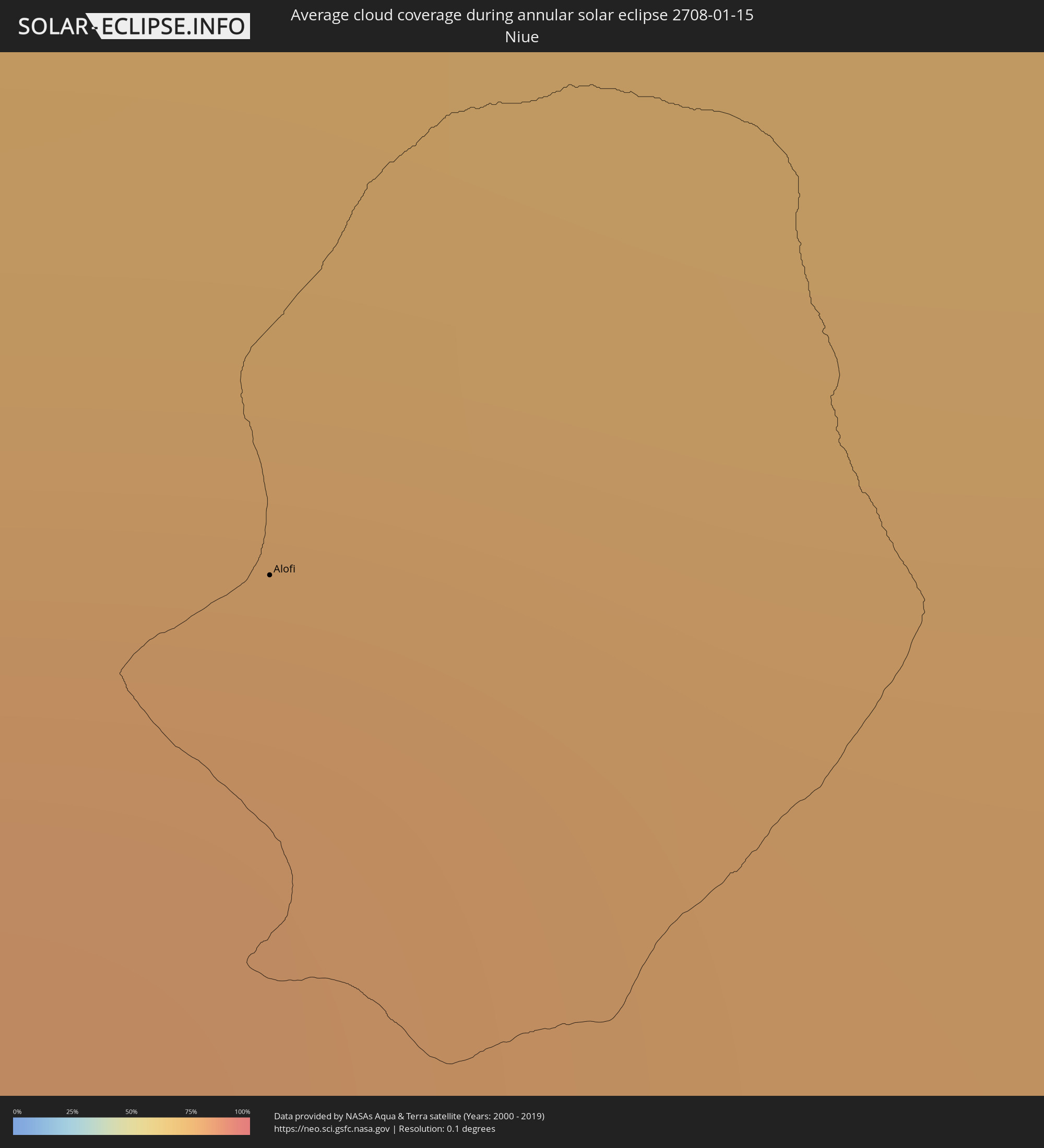 Niue
Niue
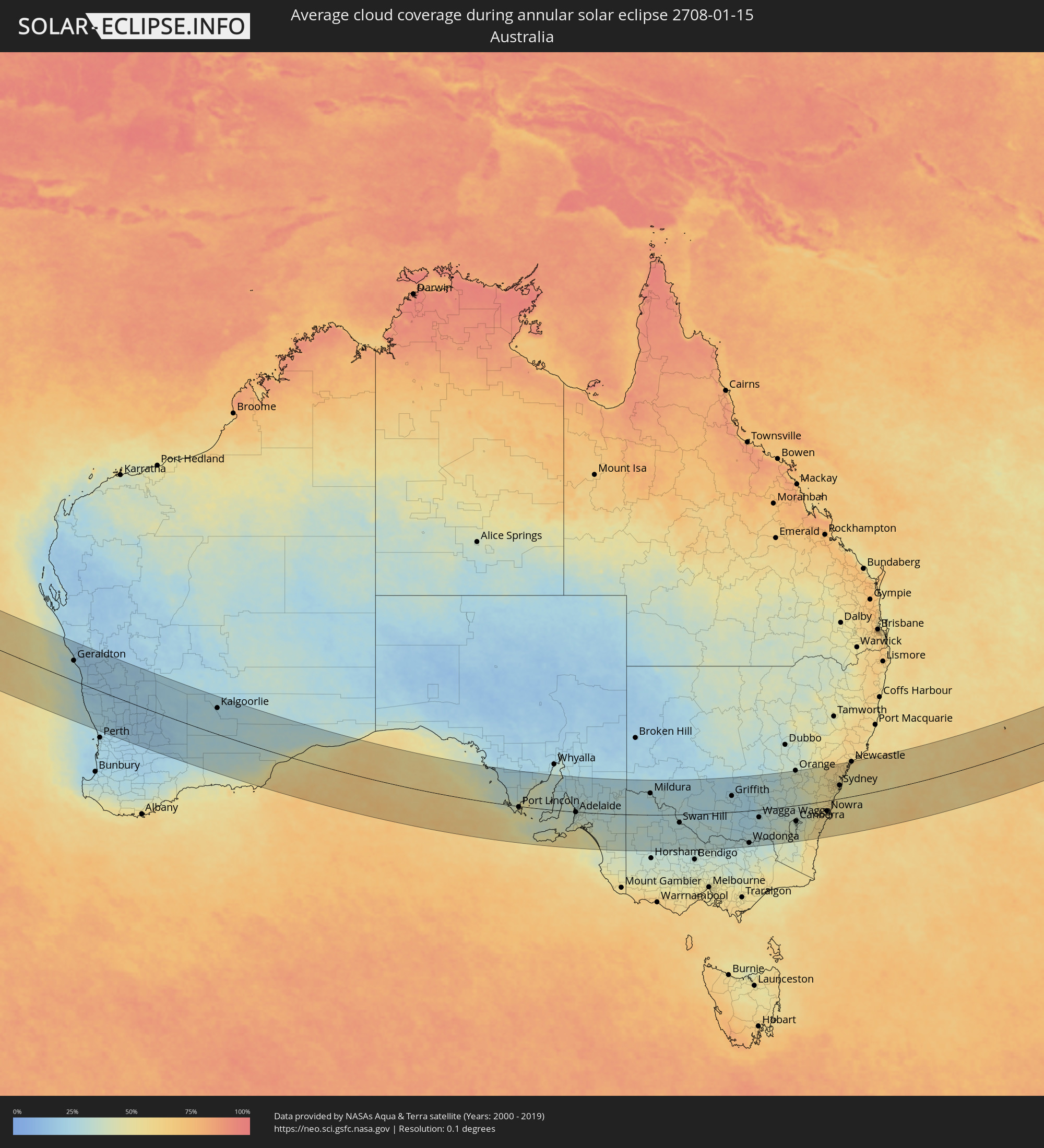 Australien
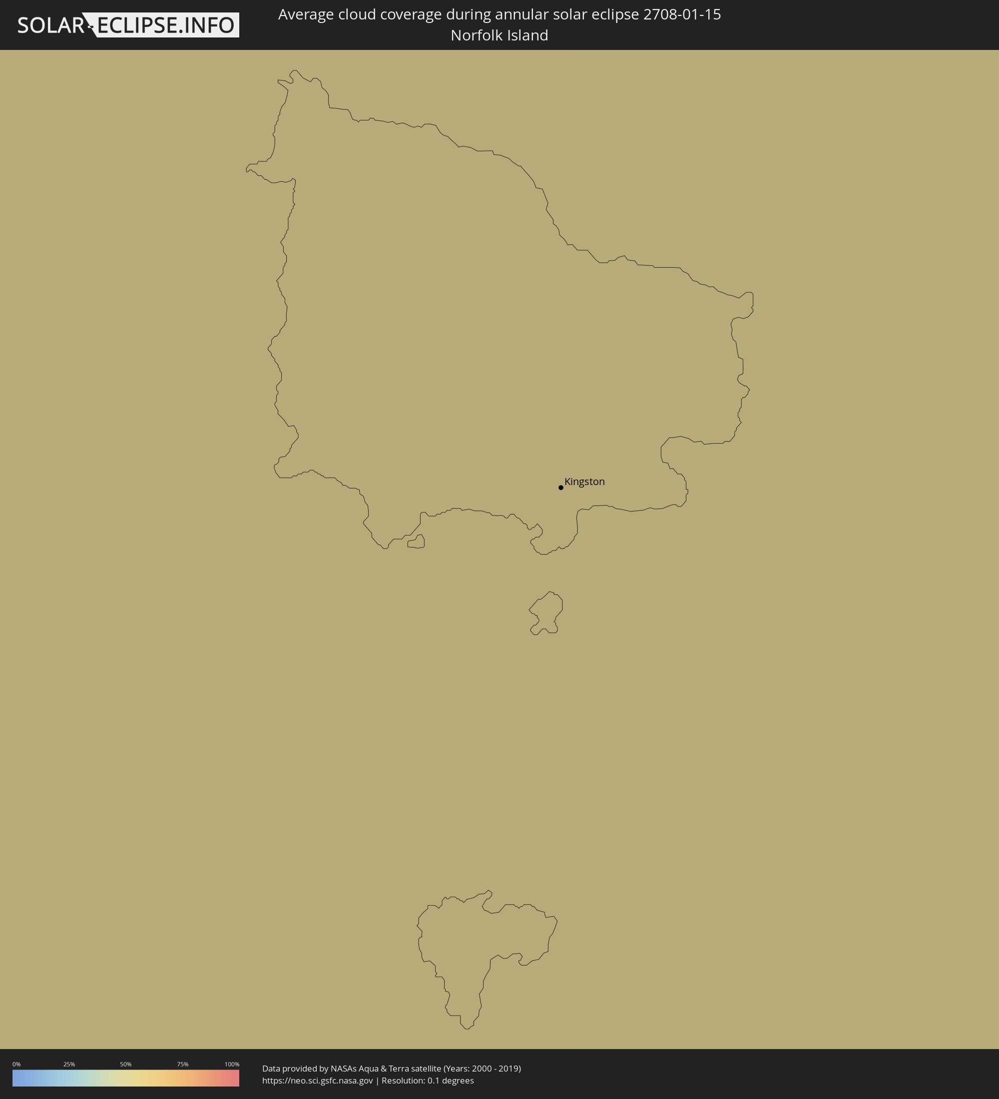 Norfolkinsel
Orte im Finsternispfad
Die nachfolgene Tabelle zeigt Städte und Orte mit mehr als 5.000 Einwohnern, die sich im Finsternispfad befinden. Städte mit mehr als 100.000 Einwohnern sind dick gekennzeichnet. Mit einem Klick auf den Ort öffnet sich eine Detailkarte die die Lage des jeweiligen Ortes zusammen mit dem Verlauf der zentralen Finsternis präsentiert.
| Ort | Typ | Dauer der Verfinsterung | Ortszeit bei maximaler Verfinsterung | Entfernung zur Zentrallinie | Ø Bewölkung |
|
Nuku‘alofa, Tongatapu
|
ringförmig | - | 16:49:30 UTC+13:00 | 42 km | 79% |
|
‘Ohonua, ʻEua
|
ringförmig | - | 16:49:27 UTC+13:00 | 10 km | 79% |
|
Pangai, Ha‘apai
|
ringförmig | - | 16:52:12 UTC+13:00 | 129 km | 79% |
|
Alofi
|
ringförmig | - | 16:56:36 UTC-11:00 | 18 km | 76% |
|
Geraldton, Western Australia
|
ringförmig | - | 08:46:40 UTC+08:00 | 87 km | 30% |
|
Kalgoorlie, Western Australia
|
ringförmig | - | 08:59:53 UTC+08:00 | 113 km | 26% |
|
Port Lincoln, South Australia
|
ringförmig | - | 12:06:27 UTC+10:30 | 4 km | 50% |
|
Morphett Vale, South Australia
|
ringförmig | - | 12:13:46 UTC+10:30 | 25 km | 35% |
|
Adelaide, South Australia
|
ringförmig | - | 12:13:54 UTC+10:30 | 2 km | 34% |
|
Victor Harbor, South Australia
|
ringförmig | - | 12:14:15 UTC+10:30 | 70 km | 51% |
|
Golden Grove, South Australia
|
ringförmig | - | 12:14:12 UTC+10:30 | 15 km | 33% |
|
Gawler, South Australia
|
ringförmig | - | 12:14:10 UTC+10:30 | 36 km | 32% |
|
Mount Barker, South Australia
|
ringförmig | - | 12:14:42 UTC+10:30 | 15 km | 36% |
|
Murray Bridge, South Australia
|
ringförmig | - | 12:15:51 UTC+10:30 | 19 km | 36% |
|
Mildura, Victoria
|
ringförmig | - | 12:53:50 UTC+11:00 | 94 km | 30% |
|
Swan Hill, Victoria
|
ringförmig | - | 12:57:59 UTC+11:00 | 35 km | 32% |
|
Echuca, Victoria
|
ringförmig | - | 13:01:23 UTC+11:00 | 128 km | 33% |
|
Deniliquin, New South Wales
|
ringförmig | - | 13:02:00 UTC+11:00 | 62 km | 30% |
|
Kyabram, Victoria
|
ringförmig | - | 13:02:13 UTC+11:00 | 149 km | 35% |
|
Griffith, New South Wales
|
ringförmig | - | 13:05:23 UTC+11:00 | 70 km | 27% |
|
Leeton, New South Wales
|
ringförmig | - | 13:06:23 UTC+11:00 | 39 km | 25% |
|
Albury, New South Wales
|
ringförmig | - | 13:07:32 UTC+11:00 | 134 km | 30% |
|
North Albury, New South Wales
|
ringförmig | - | 13:07:34 UTC+11:00 | 132 km | 30% |
|
Wagga Wagga, New South Wales
|
ringförmig | - | 13:09:02 UTC+11:00 | 33 km | 31% |
|
Tumut, New South Wales
|
ringförmig | - | 13:11:30 UTC+11:00 | 60 km | 35% |
|
Young, New South Wales
|
ringförmig | - | 13:12:06 UTC+11:00 | 48 km | 34% |
|
Cowra, New South Wales
|
ringförmig | - | 13:13:30 UTC+11:00 | 96 km | 37% |
|
Orange, New South Wales
|
ringförmig | - | 13:14:59 UTC+11:00 | 152 km | 40% |
|
Canberra, Australian Capital Territory
|
ringförmig | - | 13:14:07 UTC+11:00 | 69 km | 37% |
|
Bathurst, New South Wales
|
ringförmig | - | 13:16:22 UTC+11:00 | 131 km | 41% |
|
Goulburn, New South Wales
|
ringförmig | - | 13:16:06 UTC+11:00 | 18 km | 41% |
|
Lithgow, New South Wales
|
ringförmig | - | 13:18:01 UTC+11:00 | 116 km | 46% |
|
Batemans Bay, New South Wales
|
ringförmig | - | 13:16:54 UTC+11:00 | 129 km | 57% |
|
Katoomba, New South Wales
|
ringförmig | - | 13:18:24 UTC+11:00 | 88 km | 51% |
|
Bowral, New South Wales
|
ringförmig | - | 13:18:17 UTC+11:00 | 3 km | 54% |
|
Ulladulla, New South Wales
|
ringförmig | - | 13:17:56 UTC+11:00 | 95 km | 57% |
|
Nowra, New South Wales
|
ringförmig | - | 13:18:34 UTC+11:00 | 45 km | 57% |
|
Glenmore Park, New South Wales
|
ringförmig | - | 13:19:26 UTC+11:00 | 74 km | 54% |
|
Kiama, New South Wales
|
ringförmig | - | 13:19:26 UTC+11:00 | 25 km | 54% |
|
Ingleburn, New South Wales
|
ringförmig | - | 13:19:53 UTC+11:00 | 48 km | 55% |
|
Riverstone, New South Wales
|
ringförmig | - | 13:20:05 UTC+11:00 | 83 km | 58% |
|
Wollongong, New South Wales
|
ringförmig | - | 13:19:42 UTC+11:00 | 1 km | 57% |
|
Blacktown, New South Wales
|
ringförmig | - | 13:20:11 UTC+11:00 | 73 km | 58% |
|
Bankstown, New South Wales
|
ringförmig | - | 13:20:26 UTC+11:00 | 55 km | 57% |
|
Hornsby, New South Wales
|
ringförmig | - | 13:20:46 UTC+11:00 | 77 km | 56% |
|
Caringbah, New South Wales
|
ringförmig | - | 13:20:37 UTC+11:00 | 39 km | 52% |
|
North Sydney, New South Wales
|
ringförmig | - | 13:21:00 UTC+11:00 | 61 km | 54% |
|
Sydney, New South Wales
|
ringförmig | - | 13:20:59 UTC+11:00 | 57 km | 53% |
|
Bronte, New South Wales
|
ringförmig | - | 13:21:08 UTC+11:00 | 53 km | 51% |
|
Dee Why, New South Wales
|
ringförmig | - | 13:21:20 UTC+11:00 | 69 km | 52% |
|
Umina, New South Wales
|
ringförmig | - | 13:21:32 UTC+11:00 | 93 km | 55% |
|
Bateau Bay, New South Wales
|
ringförmig | - | 13:22:05 UTC+11:00 | 106 km | 49% |
|
Rathmines, New South Wales
|
ringförmig | - | 13:22:41 UTC+11:00 | 142 km | 59% |
|
Newcastle, New South Wales
|
ringförmig | - | 13:23:20 UTC+11:00 | 151 km | 57% |
|
Kingston
|
ringförmig | - | 15:11:14 UTC+12:00 | 58 km | 55% |