Totale Sonnenfinsternis vom 04.12.2746
| Wochentag: | Mittwoch |
| Maximale Dauer der Verfinsterung: | 04m15s |
| Maximale Breite des Finsternispfades: | 186 km |
| Saroszyklus: | 154 |
| Bedeckungsgrad: | 100% |
| Magnitude: | 1.0454 |
| Gamma: | 0.5864 |
Wo kann man die Sonnenfinsternis vom 04.12.2746 sehen?
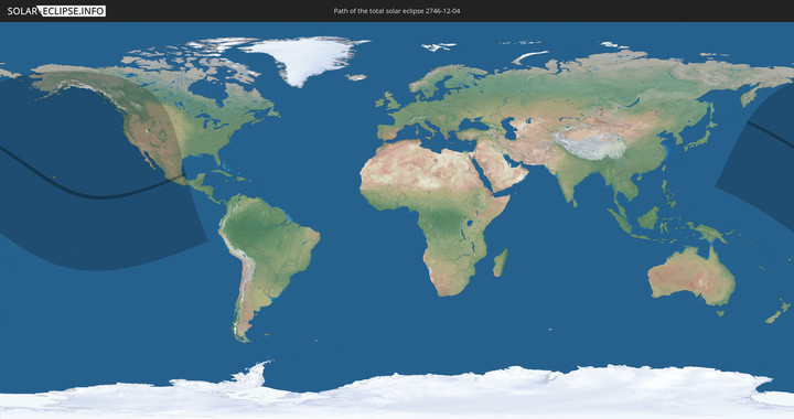
Die Sonnenfinsternis am 04.12.2746 kann man in 14 Ländern als partielle Sonnenfinsternis beobachten.
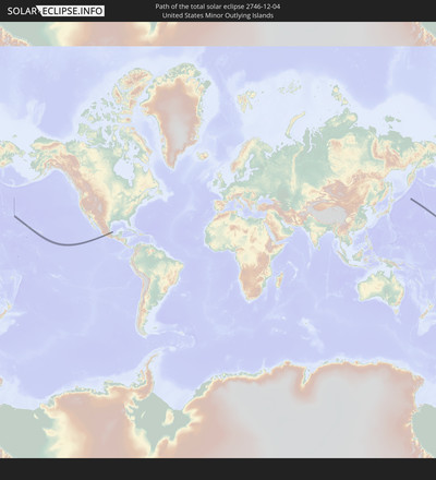
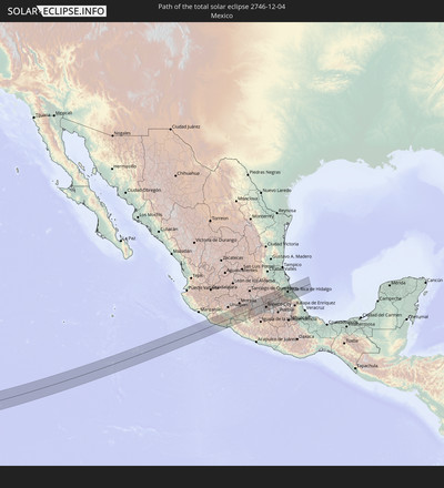
Der Finsternispfad verläuft durch 2 Länder. Nur in diesen Ländern ist sie als totale Sonnenfinsternis zu sehen.
In den folgenden Ländern ist die Sonnenfinsternis total zu sehen
In den folgenden Ländern ist die Sonnenfinsternis partiell zu sehen
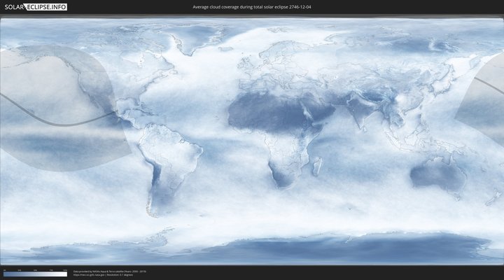
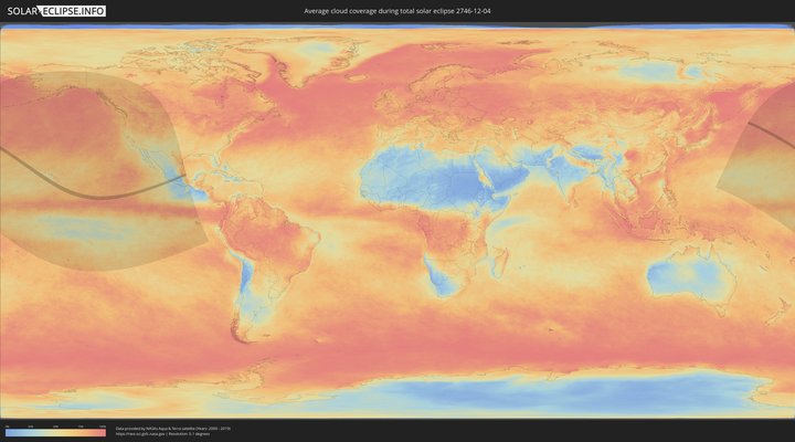
Wie wird das Wetter während der totalen Sonnenfinsternis am 04.12.2746?
Wo ist der beste Ort, um die totale Sonnenfinsternis vom 04.12.2746 zu beobachten?
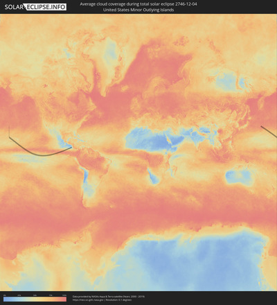
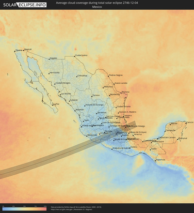
Die folgenden Karten zeigen die durchschnittliche Bewölkung für den Tag, an dem die totale Sonnenfinsternis
stattfindet. Mit Hilfe der Karten lässt sich der Ort entlang des Finsternispfades eingrenzen,
der die besten Aussichen auf einen klaren wolkenfreien Himmel bietet.
Trotzdem muss man immer lokale Gegenenheiten beachten und sollte sich genau über das Wetter an seinem
gewählten Beobachtungsort informieren.
Die Daten stammen von den beiden NASA-Satelliten
AQUA und TERRA
und wurden über einen Zeitraum von 19 Jahren (2000 - 2019) gemittelt.
Detaillierte Länderkarten
Orte im Finsternispfad
Die nachfolgene Tabelle zeigt Städte und Orte mit mehr als 5.000 Einwohnern, die sich im Finsternispfad befinden. Städte mit mehr als 100.000 Einwohnern sind dick gekennzeichnet. Mit einem Klick auf den Ort öffnet sich eine Detailkarte die die Lage des jeweiligen Ortes zusammen mit dem Verlauf der zentralen Finsternis präsentiert.
| Ort | Typ | Dauer der Verfinsterung | Ortszeit bei maximaler Verfinsterung | Entfernung zur Zentrallinie | Ø Bewölkung |
 Aguililla, Michoacán
|
total | - | 17:34:24 UTC-06:00 | 49 km | 28% |
 Arteaga, Michoacán
|
total | - | 17:35:01 UTC-06:00 | 10 km | 34% |
 Buenos Aires, Michoacán
|
total | - | 17:35:16 UTC-06:00 | 44 km | 29% |
 La Mira Tumbiscatio, Michoacán
|
total | - | 17:34:46 UTC-06:00 | 23 km | 27% |
 Ciudad Lázaro Cárdenas, Michoacán
|
total | - | 17:35:21 UTC-06:00 | 52 km | 28% |
 Antúnez, Michoacán
|
total | - | 17:34:33 UTC-06:00 | 54 km | 27% |
 Antúnez (Morelos), Michoacán
|
total | - | 17:34:33 UTC-06:00 | 54 km | 27% |
 Buenos Aires, Michoacán
|
total | - | 17:34:31 UTC-06:00 | 59 km | 28% |
 Nueva Italia de Ruiz, Michoacán
|
total | - | 17:34:36 UTC-06:00 | 51 km | 27% |
 La Huacana, Michoacán
|
total | - | 17:34:49 UTC-06:00 | 33 km | 29% |
 Ario de Rosales, Michoacán
|
total | - | 17:34:41 UTC-06:00 | 54 km | 38% |
 Puruarán, Michoacán
|
total | - | 17:34:53 UTC-06:00 | 35 km | 24% |
 Pedernales, Michoacán
|
total | - | 17:34:52 UTC-06:00 | 37 km | 24% |
 Tacámbaro de Codallos, Michoacán
|
total | - | 17:34:48 UTC-06:00 | 46 km | 26% |
 Huetamo de Núñez, Michoacán
|
total | - | 17:35:36 UTC-06:00 | 39 km | 21% |
 Ciudad Hidalgo, Michoacán
|
total | - | 17:34:56 UTC-06:00 | 56 km | 30% |
 Tuxpan, Michoacán
|
total | - | 17:35:05 UTC-06:00 | 39 km | 27% |
 Luvianos, México
|
total | - | 17:35:38 UTC-06:00 | 30 km | 25% |
 Heróica Zitácuaro, Michoacán
|
total | - | 17:35:15 UTC-06:00 | 22 km | 25% |
 Villa Luvianos, México
|
total | - | 17:35:41 UTC-06:00 | 34 km | 21% |
 Rincón de Nicolás Romero (Cedros Tercera Manzana), Michoacán
|
total | - | 17:35:18 UTC-06:00 | 17 km | 33% |
 Colorines, México
|
total | - | 17:35:31 UTC-06:00 | 11 km | 26% |
 Tejupilco de Hidalgo, México
|
total | - | 17:35:46 UTC-06:00 | 41 km | 20% |
 Valle de Bravo, México
|
total | - | 17:35:33 UTC-06:00 | 12 km | 30% |
 El Oro de Hidalgo, México
|
total | - | 17:35:04 UTC-06:00 | 50 km | 26% |
 San Bartolo, México
|
total | - | 17:35:33 UTC-06:00 | 10 km | 30% |
 Amanalco de Becerra, México
|
total | - | 17:35:31 UTC-06:00 | 5 km | 32% |
 Temascalcingo de José María Velazco, México
|
total | - | 17:35:02 UTC-06:00 | 56 km | 22% |
 Jesús del Monte, México
|
total | - | 17:35:41 UTC-06:00 | 26 km | 31% |
 San Miguel Tenochtitlán, México
|
total | - | 17:35:12 UTC-06:00 | 37 km | 23% |
 San Lorenzo Tlacotepec, México
|
total | - | 17:35:10 UTC-06:00 | 42 km | 23% |
 Atlacomulco de Fabela, México
|
total | - | 17:35:12 UTC-06:00 | 39 km | 23% |
 La Concepción de los Baños, México
|
total | - | 17:35:18 UTC-06:00 | 26 km | 22% |
 Acambay, México
|
total | - | 17:35:05 UTC-06:00 | 54 km | 24% |
 El Cóporo, México
|
total | - | 17:35:38 UTC-06:00 | 16 km | 26% |
 Barrio de México, México
|
total | - | 17:35:38 UTC-06:00 | 16 km | 26% |
 San Pedro Los Baños, México
|
total | - | 17:35:22 UTC-06:00 | 19 km | 19% |
 Jocotitlán, México
|
total | - | 17:35:19 UTC-06:00 | 26 km | 20% |
 Emiliano Zapata (Santo Domingo), México
|
total | - | 17:35:25 UTC-06:00 | 13 km | 19% |
 Santo Domingo de Guzmán, México
|
total | - | 17:35:25 UTC-06:00 | 14 km | 19% |
 San Antonio Acahualco, México
|
total | - | 17:35:40 UTC-06:00 | 19 km | 26% |
 San Francisco Tlalcilalcalpan, México
|
total | - | 17:35:39 UTC-06:00 | 17 km | 26% |
 Ixtlahuaca de Rayón, México
|
total | - | 17:35:26 UTC-06:00 | 11 km | 19% |
 Santiago Acutzilapan, México
|
total | - | 17:35:16 UTC-06:00 | 33 km | 23% |
 San Juan de las Huertas, México
|
total | - | 17:35:42 UTC-06:00 | 22 km | 36% |
 Ejido San Lorenzo Cuauhtenco, México
|
total | - | 17:35:40 UTC-06:00 | 17 km | 26% |
 La Cabecera, México
|
total | - | 17:35:37 UTC-06:00 | 12 km | 19% |
 San Bartolo del Llano, México
|
total | - | 17:35:26 UTC-06:00 | 12 km | 18% |
 Fraccionamiento Colinas del Sol, México
|
total | - | 17:35:36 UTC-06:00 | 10 km | 19% |
 Conjunto Urbano la Loma I, México
|
total | - | 17:35:39 UTC-06:00 | 15 km | 22% |
 Santa Cruz Cuauhtenco, México
|
total | - | 17:35:43 UTC-06:00 | 23 km | 29% |
 Coatepec Harinas, México
|
total | - | 17:35:59 UTC-06:00 | 60 km | 18% |
 San Antonio Buenavista, México
|
total | - | 17:35:43 UTC-06:00 | 23 km | 22% |
 Cacalomacan, México
|
total | - | 17:35:43 UTC-06:00 | 24 km | 22% |
 Calixtlahuaca, México
|
total | - | 17:35:40 UTC-06:00 | 16 km | 22% |
 San Buenaventura, México
|
total | - | 17:35:43 UTC-06:00 | 24 km | 22% |
 Santiago Tlacotepec, México
|
total | - | 17:35:45 UTC-06:00 | 28 km | 29% |
 San Juan Tilapa, Morelos
|
total | - | 17:35:46 UTC-06:00 | 29 km | 29% |
 Toluca, México
|
total | - | 17:35:43 UTC-06:00 | 23 km | 22% |
 Zaragoza de Guadalupe, Morelos
|
total | - | 17:35:50 UTC-06:00 | 37 km | 24% |
 Villa Guerrero, México
|
total | - | 17:35:59 UTC-06:00 | 56 km | 24% |
 Villa Guerrero, México
|
total | - | 17:35:59 UTC-06:00 | 57 km | 24% |
 San Bartolomé Tlaltelulco, Morelos
|
total | - | 17:35:47 UTC-06:00 | 30 km | 21% |
 Santa María Nativitas, México
|
total | - | 17:35:47 UTC-06:00 | 31 km | 21% |
 Santa Ana Ixtlahuatzingo (Santa Ana), México
|
total | - | 17:35:59 UTC-06:00 | 56 km | 24% |
 Calimaya de Díaz González, México
|
total | - | 17:35:50 UTC-06:00 | 37 km | 21% |
 San Bartolomé Atlatlahuca, México
|
total | - | 17:35:55 UTC-06:00 | 47 km | 24% |
 San Miguel Totocuitlapilco, Morelos
|
total | - | 17:35:48 UTC-06:00 | 31 km | 21% |
 Tenancingo, México
|
total | - | 17:36:00 UTC-06:00 | 59 km | 24% |
 Tenango de Arista, México
|
total | - | 17:35:54 UTC-06:00 | 44 km | 24% |
 San Mateo Mexicaltzingo, México
|
total | - | 17:35:49 UTC-06:00 | 33 km | 21% |
 Santa María Rayón, México
|
total | - | 17:35:52 UTC-06:00 | 40 km | 24% |
 San Nicolás Tolentino, México
|
total | - | 17:35:42 UTC-06:00 | 19 km | 19% |
 San Antonio la Isla, México
|
total | - | 17:35:51 UTC-06:00 | 39 km | 21% |
 Ex-Rancho San Dimas, México
|
total | - | 17:35:51 UTC-06:00 | 38 km | 21% |
 Chapultepec, México
|
total | - | 17:35:50 UTC-06:00 | 35 km | 21% |
 Atizapán, México
|
total | - | 17:35:48 UTC-06:00 | 31 km | 20% |
 La Constitución Toltepec, México
|
total | - | 17:35:43 UTC-06:00 | 21 km | 20% |
 El Cerrillo Vista Hermosa, México
|
total | - | 17:35:45 UTC-06:00 | 24 km | 20% |
 Santa María Jajalpa, México
|
total | - | 17:35:55 UTC-06:00 | 46 km | 24% |
 Jilotepec de Molina Enríquez, México
|
total | - | 17:35:15 UTC-06:00 | 40 km | 25% |
 Xonacatlán, México
|
total | - | 17:35:41 UTC-06:00 | 16 km | 21% |
 San Pedro Tultepec, Morelos
|
total | - | 17:35:48 UTC-06:00 | 31 km | 20% |
 San Pedro Tlaltizapan, Morelos
|
total | - | 17:35:52 UTC-06:00 | 38 km | 20% |
 Santa María Zolotepec, México
|
total | - | 17:35:42 UTC-06:00 | 16 km | 21% |
 Almoloya del Río, México
|
total | - | 17:35:54 UTC-06:00 | 43 km | 20% |
 San Pedro Cholula, México
|
total | - | 17:35:49 UTC-06:00 | 32 km | 20% |
 San Pedro Chochula, Morelos
|
total | - | 17:35:49 UTC-06:00 | 32 km | 20% |
 San Mateo Atarasquíllo, Morelos
|
total | - | 17:35:47 UTC-06:00 | 27 km | 20% |
 Ocoyoacac, México
|
total | - | 17:35:49 UTC-06:00 | 32 km | 20% |
 San Nicolás Coatepec, Morelos
|
total | - | 17:35:57 UTC-06:00 | 47 km | 29% |
 Santiago Tílapa, Morelos
|
total | - | 17:35:54 UTC-06:00 | 42 km | 25% |
 Xalatlaco, México
|
total | - | 17:35:55 UTC-06:00 | 43 km | 25% |
 Quinto Barrio (Ejido Cahuacán), México
|
total | - | 17:35:34 UTC-06:00 | 2 km | 26% |
 Progreso Industrial, México
|
total | - | 17:35:35 UTC-06:00 | 1 km | 26% |
 Huixquilucan, México
|
total | - | 17:35:48 UTC-06:00 | 28 km | 26% |
 Veintidós de Febrero, México
|
total | - | 17:35:36 UTC-06:00 | 2 km | 21% |
 San Francisco Chimalpa, Morelos
|
total | - | 17:35:45 UTC-06:00 | 20 km | 25% |
 Tula de Allende, Hidalgo
|
total | - | 17:35:15 UTC-06:00 | 43 km | 22% |
 Tepeji de Ocampo, Hidalgo
|
total | - | 17:35:22 UTC-06:00 | 28 km | 21% |
 San Francisco Chimalpa, México
|
total | - | 17:35:45 UTC-06:00 | 20 km | 25% |
 San Marcos, Hidalgo
|
total | - | 17:35:15 UTC-06:00 | 44 km | 22% |
 Zacamulpa, México
|
total | - | 17:35:49 UTC-06:00 | 29 km | 25% |
 Atengo, Hidalgo
|
total | - | 17:35:10 UTC-06:00 | 55 km | 22% |
 El Llano, Hidalgo
|
total | - | 17:35:15 UTC-06:00 | 43 km | 22% |
 San Miguel Vindho, Hidalgo
|
total | - | 17:35:19 UTC-06:00 | 36 km | 23% |
 Santiago Cuautlalpan, México
|
total | - | 17:35:35 UTC-06:00 | 3 km | 23% |
 Tezontepec de Aldama, Hidalgo
|
total | - | 17:35:10 UTC-06:00 | 54 km | 22% |
 Ciudad López Mateos, México
|
total | - | 17:35:40 UTC-06:00 | 8 km | 21% |
 Presas, Hidalgo
|
total | - | 17:35:13 UTC-06:00 | 50 km | 22% |
 San Mateo Xoloc, México
|
total | - | 17:35:35 UTC-06:00 | 4 km | 23% |
 Doxey, Hidalgo
|
total | - | 17:35:16 UTC-06:00 | 43 km | 21% |
 Tlahuelilpan, Hidalgo
|
total | - | 17:35:15 UTC-06:00 | 46 km | 21% |
 Santa Cruz del Monte, México
|
total | - | 17:35:32 UTC-06:00 | 9 km | 21% |
 Atitalaquia, Hidalgo
|
total | - | 17:35:18 UTC-06:00 | 38 km | 21% |
 Tlaxcoapan, Hidalgo
|
total | - | 17:35:17 UTC-06:00 | 42 km | 21% |
 Vista Hermosa, México
|
total | - | 17:35:45 UTC-06:00 | 17 km | 20% |
 Huehuetoca, México
|
total | - | 17:35:30 UTC-06:00 | 15 km | 21% |
 San Pedro Xalpa, Morelos
|
total | - | 17:35:31 UTC-06:00 | 13 km | 21% |
 Teoloyucan, México
|
total | - | 17:35:35 UTC-06:00 | 5 km | 21% |
 Apaxco de Ocampo, México
|
total | - | 17:35:24 UTC-06:00 | 28 km | 21% |
 Tlalpan, Mexico City
|
total | - | 17:35:57 UTC-06:00 | 42 km | 25% |
 Tetepango, Hidalgo
|
total | - | 17:35:18 UTC-06:00 | 40 km | 21% |
 Tequixquiac, México
|
total | - | 17:35:28 UTC-06:00 | 20 km | 17% |
 Mexico City, Mexico City
|
total | - | 17:35:51 UTC-06:00 | 30 km | 19% |
 Ajacuba, Hidalgo
|
total | - | 17:35:20 UTC-06:00 | 38 km | 19% |
 Puerto Escondido (Tepeolulco Puerto Escondido), México
|
total | - | 17:35:46 UTC-06:00 | 19 km | 17% |
 Jaltenco, México
|
total | - | 17:35:37 UTC-06:00 | 2 km | 18% |
 Tepatepec, Hidalgo
|
total | - | 17:35:13 UTC-06:00 | 52 km | 19% |
 Fraccionamiento la Trinidad, México
|
total | - | 17:35:33 UTC-06:00 | 9 km | 18% |
 Nextlalpan, México
|
total | - | 17:35:38 UTC-06:00 | 0 km | 16% |
 Ecatepec, México
|
total | - | 17:35:44 UTC-06:00 | 13 km | 17% |
 Jilotzingo, México
|
total | - | 17:35:32 UTC-06:00 | 12 km | 17% |
 Santa María Tonatitla, México
|
total | - | 17:35:41 UTC-06:00 | 6 km | 16% |
 Santa María Ajoloapan, México
|
total | - | 17:35:27 UTC-06:00 | 23 km | 16% |
 Paseos de San Juan, México
|
total | - | 17:35:38 UTC-06:00 | 2 km | 16% |
 San Bartolo Cuautlalpan, México
|
total | - | 17:35:36 UTC-06:00 | 5 km | 16% |
 Santo Tomas Chiconautla, México
|
total | - | 17:35:45 UTC-06:00 | 13 km | 17% |
 San Francisco Tecoxpa, Mexico City
|
total | - | 17:36:06 UTC-06:00 | 59 km | 24% |
 San Francisco Zacacalco, Morelos
|
total | - | 17:35:31 UTC-06:00 | 15 km | 16% |
 Tizayuca, Hidalgo
|
total | - | 17:35:36 UTC-06:00 | 5 km | 16% |
 Granjas Ampliación Santa Rosa, México
|
total | - | 17:35:48 UTC-06:00 | 20 km | 17% |
 Santa María Chimalhuacán, México
|
total | - | 17:35:57 UTC-06:00 | 38 km | 17% |
 El Pino, México
|
total | - | 17:36:00 UTC-06:00 | 45 km | 18% |
 Actopan, Hidalgo
|
total | - | 17:35:16 UTC-06:00 | 48 km | 23% |
 Arenal, México
|
total | - | 17:35:59 UTC-06:00 | 43 km | 18% |
 Profesor Carlos Hank González, México
|
total | - | 17:35:59 UTC-06:00 | 44 km | 18% |
 San Miguel Xico Viejo, México
|
total | - | 17:36:04 UTC-06:00 | 54 km | 20% |
 Tolcayuca, Hidalgo
|
total | - | 17:35:32 UTC-06:00 | 15 km | 15% |
 Tezoyuca, México
|
total | - | 17:35:50 UTC-06:00 | 22 km | 18% |
 Temascalapa, México
|
total | - | 17:35:39 UTC-06:00 | 1 km | 17% |
 San Agustín Tlaxiaca, Hidalgo
|
total | - | 17:35:25 UTC-06:00 | 30 km | 16% |
 Chiautla, México
|
total | - | 17:35:53 UTC-06:00 | 28 km | 18% |
 Zapotlán de Juárez, Hidalgo
|
total | - | 17:35:32 UTC-06:00 | 15 km | 15% |
 Teotihuacán de Arista, México
|
total | - | 17:35:46 UTC-06:00 | 14 km | 16% |
 Jorge Jiménez Cantú, México
|
total | - | 17:36:05 UTC-06:00 | 54 km | 23% |
 Acayuca, Hidalgo
|
total | - | 17:35:31 UTC-06:00 | 19 km | 17% |
 San Martín de las Pirámides, México
|
total | - | 17:35:46 UTC-06:00 | 14 km | 18% |
 Tepetlaoxtoc de Hidalgo, México
|
total | - | 17:35:53 UTC-06:00 | 28 km | 19% |
 Otumba de Gómez Farías, México
|
total | - | 17:35:49 UTC-06:00 | 18 km | 18% |
 Pachuca de Soto, Hidalgo
|
total | - | 17:35:29 UTC-06:00 | 24 km | 20% |
 Campestre Villas del Álamo, Hidalgo
|
total | - | 17:35:31 UTC-06:00 | 21 km | 20% |
 Mineral del Monte, Hidalgo
|
total | - | 17:35:30 UTC-06:00 | 24 km | 20% |
 Atotonilco el Grande, Hidalgo
|
total | - | 17:35:23 UTC-06:00 | 39 km | 33% |
 Zempoala, Hidalgo
|
total | - | 17:35:41 UTC-06:00 | 1 km | 18% |
 Tlanalapa, Hidalgo
|
total | - | 17:35:47 UTC-06:00 | 12 km | 19% |
 Ciudad Sahagun, Hidalgo
|
total | - | 17:35:50 UTC-06:00 | 18 km | 19% |
 Calpulalpan, Tlaxcala
|
total | - | 17:35:59 UTC-06:00 | 37 km | 22% |
 Emiliano Zapata, Hidalgo
|
total | - | 17:35:57 UTC-06:00 | 31 km | 21% |
 Emiliano Zapata, Hidalgo
|
total | - | 17:35:57 UTC-06:00 | 31 km | 21% |
 Ciudad de Nanacamilpa, Tlaxcala
|
total | - | 17:36:05 UTC-06:00 | 48 km | 20% |
 Javier Rojo Gómez, Hidalgo
|
total | - | 17:35:40 UTC-06:00 | 6 km | 26% |
 Tulancingo, Hidalgo
|
total | - | 17:35:41 UTC-06:00 | 5 km | 26% |
 Parque Urbano Napateco, Hidalgo
|
total | - | 17:35:38 UTC-06:00 | 10 km | 25% |
 Tlaxco, Tlaxcala
|
total | - | 17:36:10 UTC-06:00 | 53 km | 18% |
 Huauchinango, Puebla
|
total | - | 17:35:44 UTC-06:00 | 1 km | 52% |
 Necaxa, Puebla
|
total | - | 17:35:44 UTC-06:00 | 4 km | 59% |
 Tenango de las Flores, Puebla
|
total | - | 17:35:45 UTC-06:00 | 2 km | 59% |
 Zacatlán, Puebla
|
total | - | 17:35:58 UTC-06:00 | 27 km | 34% |
 Xicotepec de Juárez, Puebla
|
total | - | 17:35:42 UTC-06:00 | 8 km | 63% |
 La Ceiba, Veracruz
|
total | - | 17:35:20 UTC-06:00 | 54 km | 76% |
 Filomeno Mata, Puebla
|
total | - | 17:35:52 UTC-06:00 | 11 km | 66% |
 Venustiano Carranza, Puebla
|
total | - | 17:35:38 UTC-06:00 | 19 km | 75% |
 Coyutla, Veracruz
|
total | - | 17:35:51 UTC-06:00 | 8 km | 66% |
 Zacapoaxtla, Puebla
|
total | - | 17:36:11 UTC-06:00 | 49 km | 50% |
 Tihuatlan, Veracruz
|
total | - | 17:35:31 UTC-06:00 | 35 km | 80% |
 Ciudad de Cuetzalan, Puebla
|
total | - | 17:36:05 UTC-06:00 | 37 km | 65% |
 Ciudad de Cuetzalan, Puebla
|
total | - | 17:36:05 UTC-06:00 | 37 km | 65% |
 Tlatlauquitepec, Puebla
|
total | - | 17:36:14 UTC-06:00 | 55 km | 41% |
 Ciudad de Tlatlauquitepec, Puebla
|
total | - | 17:36:14 UTC-06:00 | 55 km | 52% |
 Poza Rica de Hidalgo, Veracruz
|
total | - | 17:35:42 UTC-06:00 | 13 km | 77% |
 Tuxpan de Rodríguez Cano, Veracruz
|
total | - | 17:35:22 UTC-06:00 | 54 km | 76% |
 Santiago de la Peña, Veracruz
|
total | - | 17:35:24 UTC-06:00 | 51 km | 66% |
 Papantla de Olarte, Veracruz
|
total | - | 17:35:49 UTC-06:00 | 1 km | 73% |
 Agua Dulce, Veracruz
|
total | - | 17:35:54 UTC-06:00 | 11 km | 73% |
 Tlapacoyan, Veracruz
|
total | - | 17:36:15 UTC-06:00 | 55 km | 66% |
 Gutiérrez Zamora, Veracruz
|
total | - | 17:35:55 UTC-06:00 | 11 km | 72% |
 Martínez de la Torre, Veracruz
|
total | - | 17:36:14 UTC-06:00 | 51 km | 68% |
 Vega de San Marcos, Veracruz
|
total | - | 17:36:11 UTC-06:00 | 44 km | 75% |
 San Rafael, Veracruz
|
total | - | 17:36:13 UTC-06:00 | 47 km | 75% |
