Totale Sonnenfinsternis vom 03.08.2771
| Wochentag: | Dienstag |
| Maximale Dauer der Verfinsterung: | 03m05s |
| Maximale Breite des Finsternispfades: | 704 km |
| Saroszyklus: | 148 |
| Bedeckungsgrad: | 100% |
| Magnitude: | 1.059 |
| Gamma: | 0.959 |
Wo kann man die Sonnenfinsternis vom 03.08.2771 sehen?
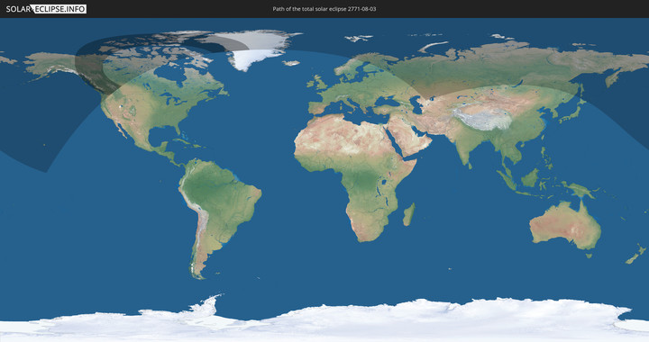
Die Sonnenfinsternis am 03.08.2771 kann man in 13 Ländern als partielle Sonnenfinsternis beobachten.
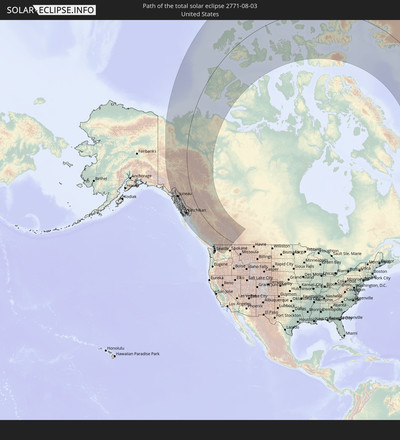
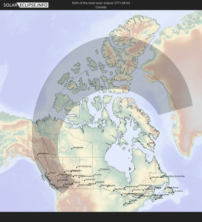
Der Finsternispfad verläuft durch 3 Länder. Nur in diesen Ländern ist sie als totale Sonnenfinsternis zu sehen.
In den folgenden Ländern ist die Sonnenfinsternis total zu sehen
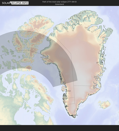
In den folgenden Ländern ist die Sonnenfinsternis partiell zu sehen
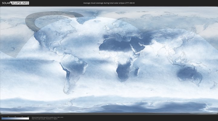
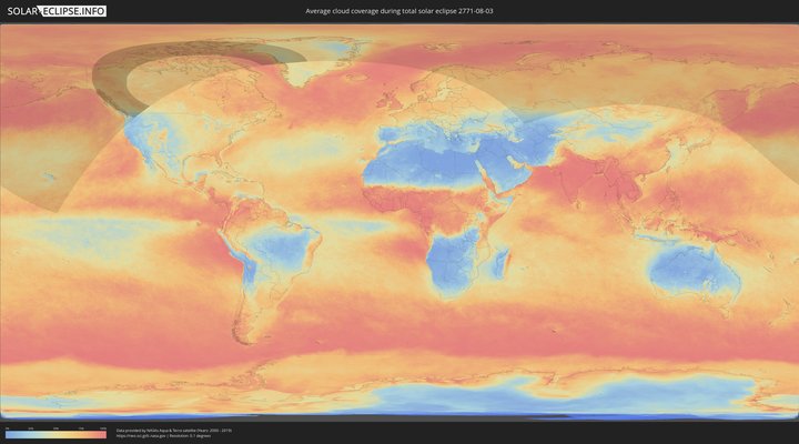
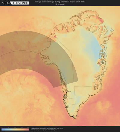
Wie wird das Wetter während der totalen Sonnenfinsternis am 03.08.2771?
Wo ist der beste Ort, um die totale Sonnenfinsternis vom 03.08.2771 zu beobachten?
Die folgenden Karten zeigen die durchschnittliche Bewölkung für den Tag, an dem die totale Sonnenfinsternis
stattfindet. Mit Hilfe der Karten lässt sich der Ort entlang des Finsternispfades eingrenzen,
der die besten Aussichen auf einen klaren wolkenfreien Himmel bietet.
Trotzdem muss man immer lokale Gegenenheiten beachten und sollte sich genau über das Wetter an seinem
gewählten Beobachtungsort informieren.
Die Daten stammen von den beiden NASA-Satelliten
AQUA und TERRA
und wurden über einen Zeitraum von 19 Jahren (2000 - 2019) gemittelt.
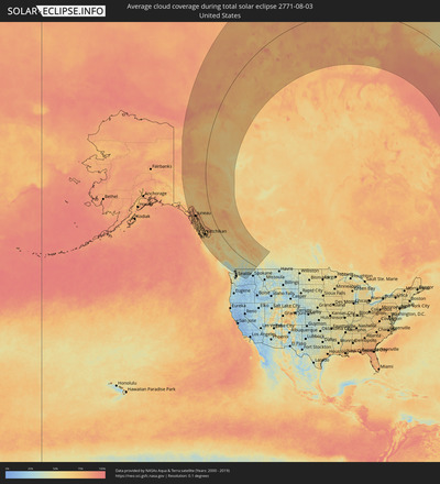
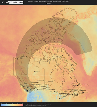
Detaillierte Länderkarten
Orte im Finsternispfad
Die nachfolgene Tabelle zeigt Städte und Orte mit mehr als 5.000 Einwohnern, die sich im Finsternispfad befinden. Städte mit mehr als 100.000 Einwohnern sind dick gekennzeichnet. Mit einem Klick auf den Ort öffnet sich eine Detailkarte die die Lage des jeweiligen Ortes zusammen mit dem Verlauf der zentralen Finsternis präsentiert.
| Ort | Typ | Dauer der Verfinsterung | Ortszeit bei maximaler Verfinsterung | Entfernung zur Zentrallinie | Ø Bewölkung |
 Whitehorse, Yukon
|
total | - | 19:06:54 UTC-08:00 | 227 km | 65% |
 Juneau, Alaska
|
total | - | 18:11:00 UTC-09:00 | 272 km | 79% |
 Ketchikan, Alaska
|
total | - | 18:15:30 UTC-09:00 | 259 km | 67% |
 Prince Rupert, British Columbia
|
total | - | 19:16:54 UTC-08:00 | 247 km | 73% |
 Kitimat, British Columbia
|
total | - | 19:16:54 UTC-08:00 | 174 km | 58% |
 Terrace, British Columbia
|
total | - | 19:16:09 UTC-08:00 | 142 km | 57% |
 Smithers, British Columbia
|
total | - | 19:15:21 UTC-08:00 | 49 km | 60% |
 Campbell River, British Columbia
|
total | - | 19:22:07 UTC-08:00 | 306 km | 33% |
 Courtenay, British Columbia
|
total | - | 19:22:32 UTC-08:00 | 322 km | 36% |
 Port Alberni, British Columbia
|
total | - | 19:23:07 UTC-08:00 | 352 km | 33% |
 Powell River, British Columbia
|
total | - | 19:22:08 UTC-08:00 | 288 km | 31% |
 Parksville, British Columbia
|
total | - | 19:22:49 UTC-08:00 | 323 km | 33% |
 Nanaimo, British Columbia
|
total | - | 19:22:54 UTC-08:00 | 320 km | 34% |
 Ladysmith, British Columbia
|
total | - | 19:23:07 UTC-08:00 | 330 km | 36% |
 Sechelt, British Columbia
|
total | - | 19:22:23 UTC-08:00 | 285 km | 38% |
 Duncan, British Columbia
|
total | - | 19:23:23 UTC-08:00 | 344 km | 31% |
 North Cowichan, British Columbia
|
total | - | 19:23:17 UTC-08:00 | 338 km | 31% |
 Gibsons, British Columbia
|
total | - | 19:22:24 UTC-08:00 | 281 km | 40% |
 North Saanich, British Columbia
|
total | - | 19:23:26 UTC-08:00 | 342 km | 37% |
 West Vancouver, British Columbia
|
total | - | 19:22:19 UTC-08:00 | 269 km | 42% |
 Richmond, British Columbia
|
total | - | 19:22:36 UTC-08:00 | 285 km | 38% |
 West End, British Columbia
|
total | - | 19:22:26 UTC-08:00 | 275 km | 39% |
 Vancouver, British Columbia
|
total | - | 19:22:28 UTC-08:00 | 277 km | 38% |
 Ladner, British Columbia
|
total | - | 19:22:41 UTC-08:00 | 290 km | 39% |
 North Vancouver, British Columbia
|
total | - | 19:22:21 UTC-08:00 | 269 km | 39% |
 Hanceville, British Columbia
|
total | - | 19:18:30 UTC-08:00 | 45 km | 45% |
 Whistler, British Columbia
|
total | - | 19:21:09 UTC-08:00 | 194 km | 47% |
 Burnaby, British Columbia
|
total | - | 19:22:23 UTC-08:00 | 268 km | 41% |
 New Westminster, British Columbia
|
total | - | 19:22:27 UTC-08:00 | 272 km | 39% |
 Delta, British Columbia
|
total | - | 19:22:33 UTC-08:00 | 277 km | 41% |
 Anmore, British Columbia
|
total | - | 19:22:16 UTC-08:00 | 260 km | 41% |
 Port Moody, British Columbia
|
total | - | 19:22:19 UTC-08:00 | 263 km | 41% |
 Surrey, British Columbia
|
total | - | 19:22:34 UTC-08:00 | 277 km | 38% |
 White Rock, British Columbia
|
total | - | 19:22:41 UTC-08:00 | 284 km | 35% |
 Prince George, British Columbia
|
total | - | 19:15:22 UTC-08:00 | 123 km | 59% |
 Coquitlam, British Columbia
|
total | - | 19:22:17 UTC-08:00 | 258 km | 41% |
 Birch Bay, Washington
|
total | - | 19:22:48 UTC-08:00 | 291 km | 35% |
 Pitt Meadows, British Columbia
|
total | - | 19:22:21 UTC-08:00 | 261 km | 41% |
 Langley, British Columbia
|
total | - | 19:22:30 UTC-08:00 | 271 km | 38% |
 Oak Harbor, Washington
|
total | - | 19:23:40 UTC-08:00 | 344 km | 37% |
 Walnut Grove, British Columbia
|
total | - | 19:22:24 UTC-08:00 | 264 km | 42% |
 Anacortes, Washington
|
total | - | 19:23:20 UTC-08:00 | 322 km | 39% |
 Maple Ridge, British Columbia
|
total | - | 19:22:19 UTC-08:00 | 258 km | 42% |
 Ferndale, Washington
|
total | - | 19:22:51 UTC-08:00 | 291 km | 37% |
 Langley, British Columbia
|
total | - | 19:22:30 UTC-08:00 | 269 km | 41% |
 Camano, Washington
|
total | - | 19:23:48 UTC-08:00 | 350 km | 36% |
 Quesnel, British Columbia
|
total | - | 19:16:42 UTC-08:00 | 65 km | 50% |
 Bellingham, Washington
|
total | - | 19:22:56 UTC-08:00 | 295 km | 38% |
 Aldergrove, British Columbia
|
total | - | 19:22:30 UTC-08:00 | 267 km | 43% |
 Lynden, Washington
|
total | - | 19:22:39 UTC-08:00 | 276 km | 40% |
 Stanwood, Washington
|
total | - | 19:23:38 UTC-08:00 | 338 km | 37% |
 Sudden Valley, Washington
|
total | - | 19:22:56 UTC-08:00 | 292 km | 40% |
 Mount Vernon, Washington
|
total | - | 19:23:22 UTC-08:00 | 319 km | 40% |
 Burlington, Washington
|
total | - | 19:23:17 UTC-08:00 | 314 km | 40% |
 Tulalip, Washington
|
total | - | 19:23:51 UTC-08:00 | 350 km | 38% |
 Abbotsford, British Columbia
|
total | - | 19:22:24 UTC-08:00 | 258 km | 42% |
 Sedro-Woolley, Washington
|
total | - | 19:23:12 UTC-08:00 | 308 km | 41% |
 Marysville, Washington
|
total | - | 19:23:49 UTC-08:00 | 347 km | 38% |
 Williams Lake, British Columbia
|
total | - | 19:17:50 UTC-08:00 | 15 km | 49% |
 Arlington, Washington
|
total | - | 19:23:36 UTC-08:00 | 332 km | 41% |
 West Lake Stevens, Washington
|
total | - | 19:23:53 UTC-08:00 | 350 km | 40% |
 Lake Stevens, Washington
|
total | - | 19:23:50 UTC-08:00 | 346 km | 40% |
 Chilliwack, British Columbia
|
total | - | 19:22:08 UTC-08:00 | 235 km | 36% |
 Fort St. John, British Columbia
|
total | - | 20:11:11 UTC-07:00 | 374 km | 61% |
 Merritt, British Columbia
|
total | - | 19:20:18 UTC-08:00 | 101 km | 38% |
 Kamloops, British Columbia
|
total | - | 19:19:18 UTC-08:00 | 31 km | 35% |
 Wenatchee, Washington
|
total | - | 19:23:54 UTC-08:00 | 335 km | 22% |
 East Wenatchee, Washington
|
total | - | 19:23:55 UTC-08:00 | 335 km | 22% |
 East Wenatchee Bench, Washington
|
total | - | 19:23:53 UTC-08:00 | 333 km | 22% |
 Dawson Creek, British Columbia
|
total | - | 20:11:44 UTC-07:00 | 376 km | 64% |
 Quincy, Washington
|
total | - | 19:23:58 UTC-08:00 | 336 km | 20% |
 Summerland, British Columbia
|
total | - | 19:20:34 UTC-08:00 | 103 km | 36% |
 Penticton, British Columbia
|
total | - | 19:20:42 UTC-08:00 | 111 km | 35% |
 West Kelowna, British Columbia
|
total | - | 19:20:09 UTC-08:00 | 75 km | 38% |
 Ephrata, Washington
|
total | - | 19:23:43 UTC-08:00 | 317 km | 20% |
 Kelowna, British Columbia
|
total | - | 19:20:05 UTC-08:00 | 69 km | 36% |
 Okanagan, British Columbia
|
total | - | 19:19:20 UTC-08:00 | 19 km | 39% |
 Salmon Arm, British Columbia
|
total | - | 19:18:50 UTC-08:00 | 13 km | 45% |
 Vernon, British Columbia
|
total | - | 19:19:27 UTC-08:00 | 25 km | 39% |
 Grande Prairie, Alberta
|
total | - | 20:12:07 UTC-07:00 | 408 km | 62% |
 Revelstoke, British Columbia
|
total | - | 19:17:57 UTC-08:00 | 85 km | 50% |
 Trail, British Columbia
|
total | - | 19:20:24 UTC-08:00 | 78 km | 34% |
 Castlegar, British Columbia
|
total | - | 19:20:07 UTC-08:00 | 57 km | 39% |
 Hinton, Alberta
|
total | - | 20:14:15 UTC-07:00 | 324 km | 66% |
 Nelson, British Columbia
|
total | - | 19:19:39 UTC-08:00 | 24 km | 46% |
 Edson, Alberta
|
total | - | 20:13:32 UTC-07:00 | 388 km | 61% |
 Banff, Alberta
|
total | - | 20:16:33 UTC-07:00 | 199 km | 63% |
 Canmore, Alberta
|
total | - | 20:16:35 UTC-07:00 | 197 km | 62% |
 Drayton Valley, Alberta
|
total | - | 20:13:26 UTC-07:00 | 412 km | 57% |
 Rocky Mountain House, Alberta
|
total | - | 20:14:36 UTC-07:00 | 335 km | 57% |
 Cochrane, Alberta
|
total | - | 20:16:03 UTC-07:00 | 238 km | 50% |
 Olds, Alberta
|
total | - | 20:15:03 UTC-07:00 | 308 km | 55% |
 Sylvan Lake, Alberta
|
total | - | 20:14:18 UTC-07:00 | 360 km | 53% |
 Airdrie, Alberta
|
total | - | 20:15:41 UTC-07:00 | 267 km | 53% |
 Red Deer, Alberta
|
total | - | 20:14:15 UTC-07:00 | 364 km | 60% |
 Lacombe, Alberta
|
total | - | 20:13:56 UTC-07:00 | 386 km | 58% |
 Ponoka, Alberta
|
total | - | 20:13:35 UTC-07:00 | 411 km | 61% |
 Stettler, Alberta
|
total | - | 20:13:41 UTC-07:00 | 411 km | 54% |
