Total solar eclipse of 10/01/-0023
| Day of week: | Friday |
| Maximum duration of eclipse: | 02m09s |
| Maximum width of eclipse path: | 124 km |
| Saros cycle: | 82 |
| Coverage: | 100% |
| Magnitude: | 1.0281 |
| Gamma: | -0.6597 |
Wo kann man die Sonnenfinsternis vom 10/01/-0023 sehen?
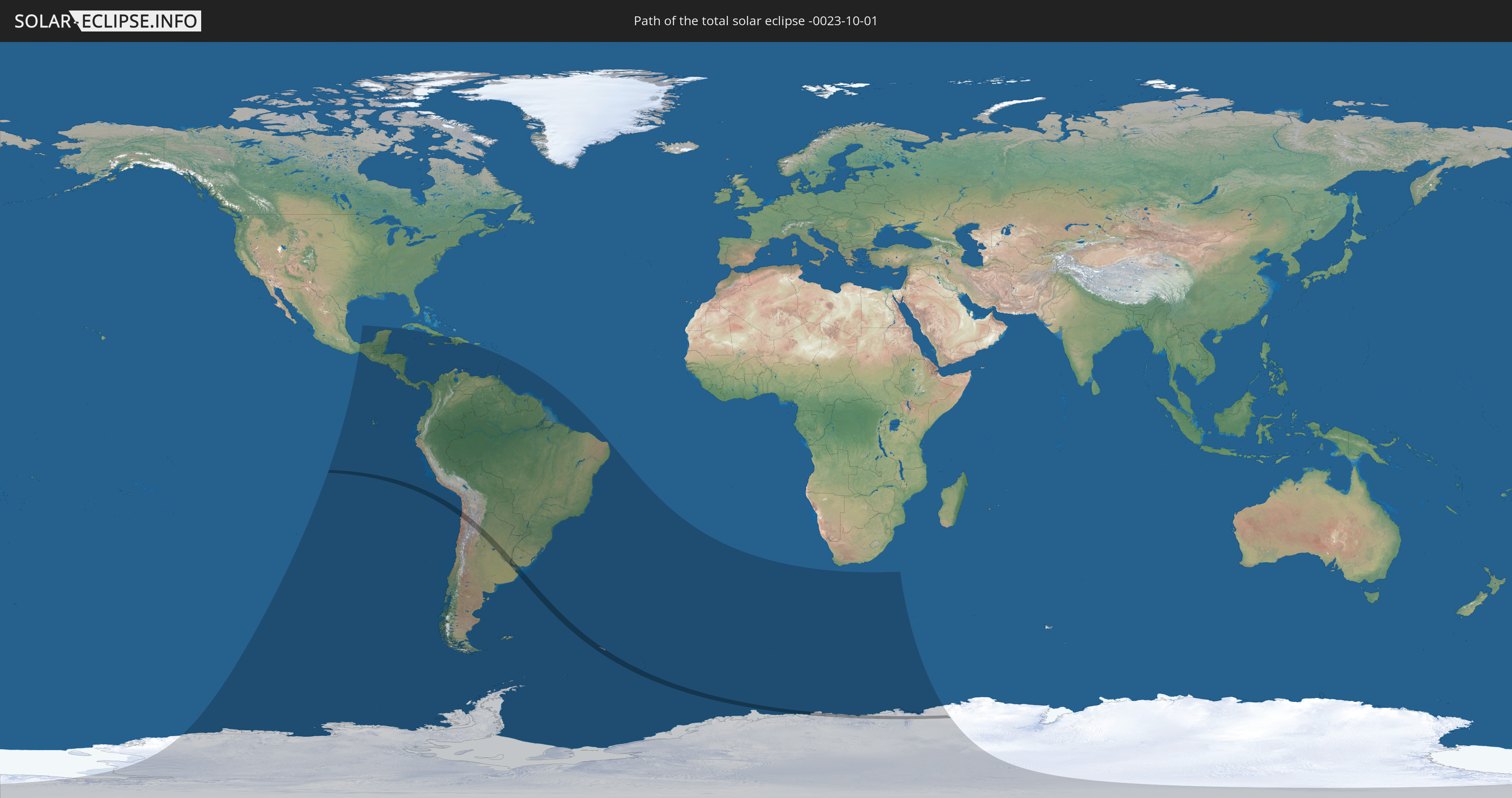
Die Sonnenfinsternis am 10/01/-0023 kann man in 41 Ländern als partielle Sonnenfinsternis beobachten.
Der Finsternispfad verläuft durch 5 Länder. Nur in diesen Ländern ist sie als total Sonnenfinsternis zu sehen.
In den folgenden Ländern ist die Sonnenfinsternis total zu sehen
 Antarctica
 Chile
Chile
 Argentina
 Uruguay
 South Georgia and the South Sandwich Islands
In den folgenden Ländern ist die Sonnenfinsternis partiell zu sehen
 Antarctica
 United States Minor Outlying Islands
 Mexico
 Chile
Chile
 Guatemala
 Ecuador
 El Salvador
 Honduras
 Belize
 Nicaragua
 Costa Rica
 Cuba
Cuba
 Panama
 Colombia
 Cayman Islands
 Peru
Peru
 Jamaica
 Haiti
Haiti
 Brazil
 Argentina
 Venezuela
 Dominican Republic
 Aruba
Aruba
 Bolivia
 Puerto Rico
 Paraguay
 Trinidad and Tobago
 Grenada
 Dominica
 Saint Vincent and the Grenadines
 Falkland Islands
 Guyana
 Martinique
 Saint Lucia
 Barbados
 Uruguay
 Suriname
 French Guiana
 South Georgia and the South Sandwich Islands
 Saint Helena, Ascension and Tristan da Cunha
 Bouvet Island
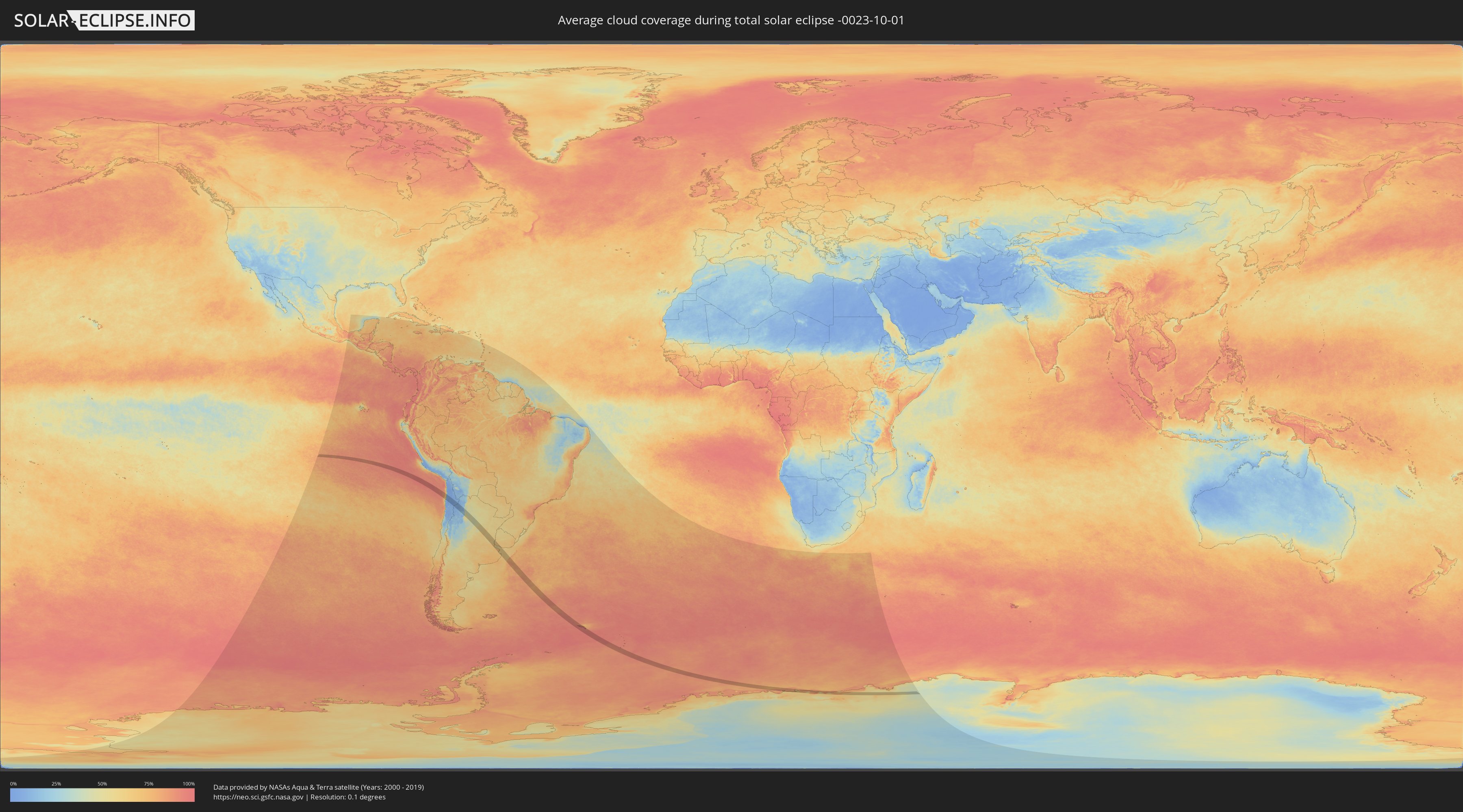
How will be the weather during the total solar eclipse on 10/01/-0023?
Where is the best place to see the total solar eclipse of 10/01/-0023?
The following maps show the average cloud coverage for the day of the total solar eclipse.
With the help of these maps, it is possible to find the place along the eclipse path, which has the best
chance of a cloudless sky.
Nevertheless, you should consider local circumstances and inform about the weather of your chosen
observation site.
The data is provided by NASAs satellites
AQUA and TERRA.
The cloud maps are averaged over a period of 19 years (2000 - 2019).

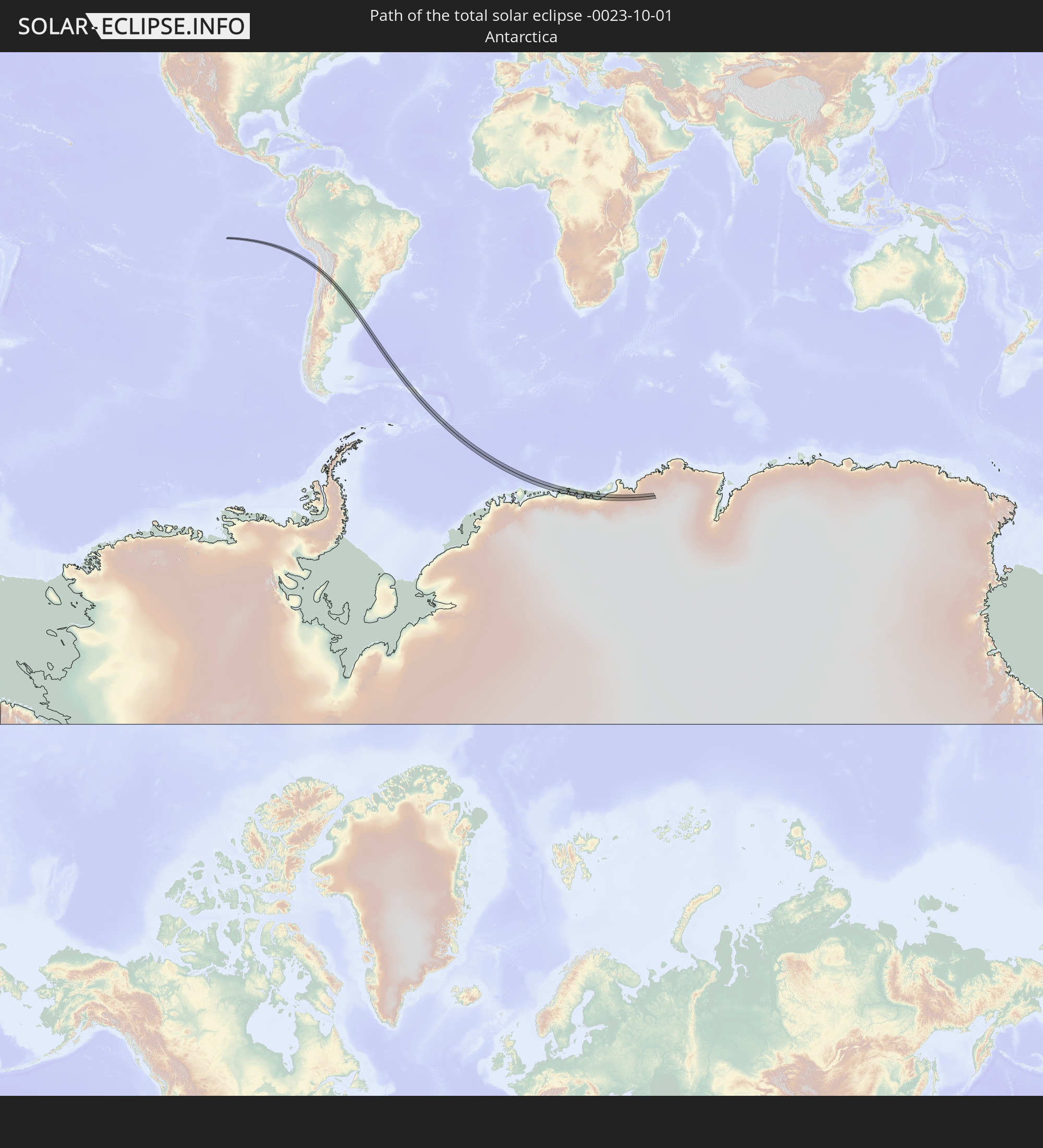
Detailed country maps
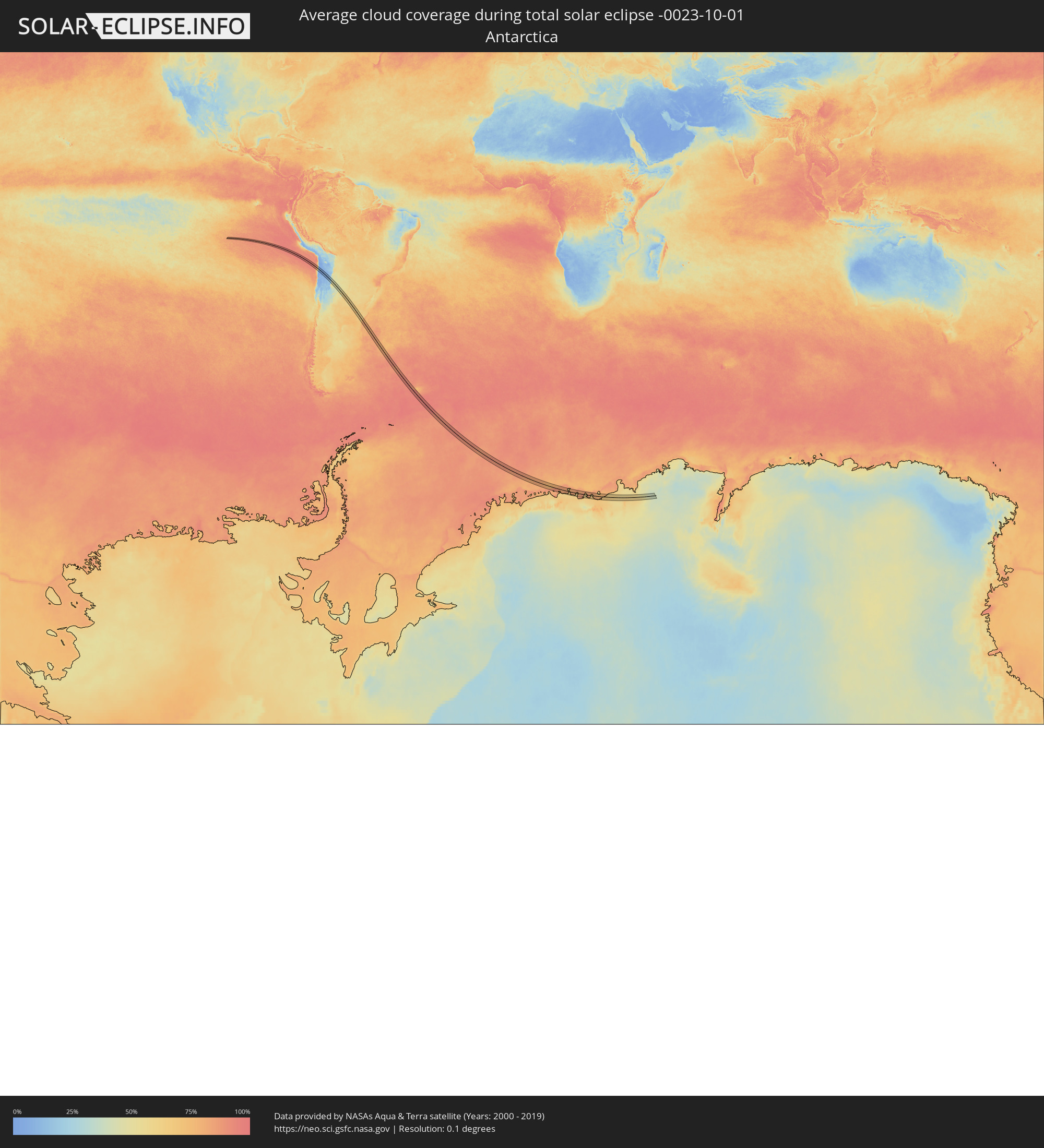 Antarctica
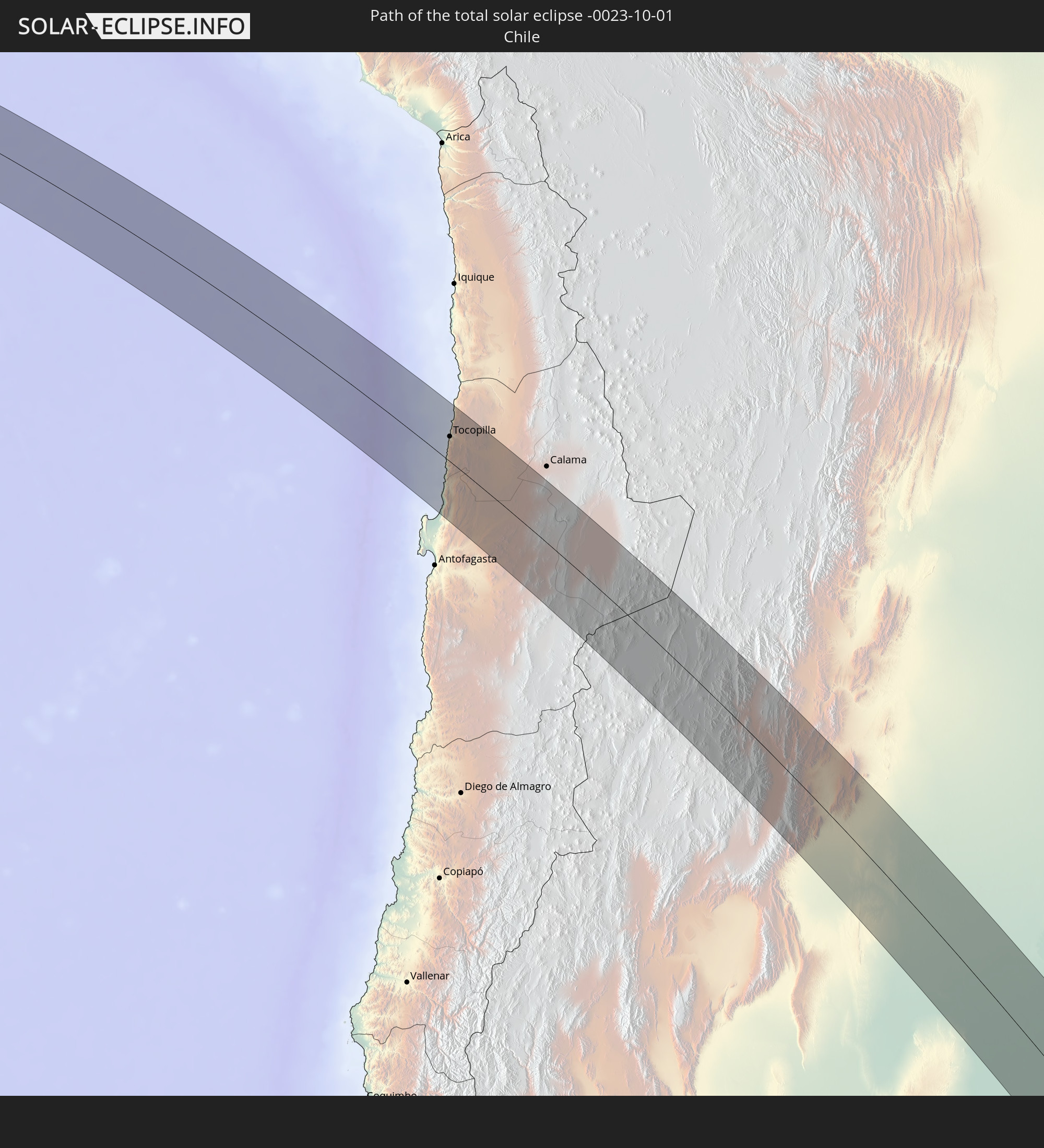
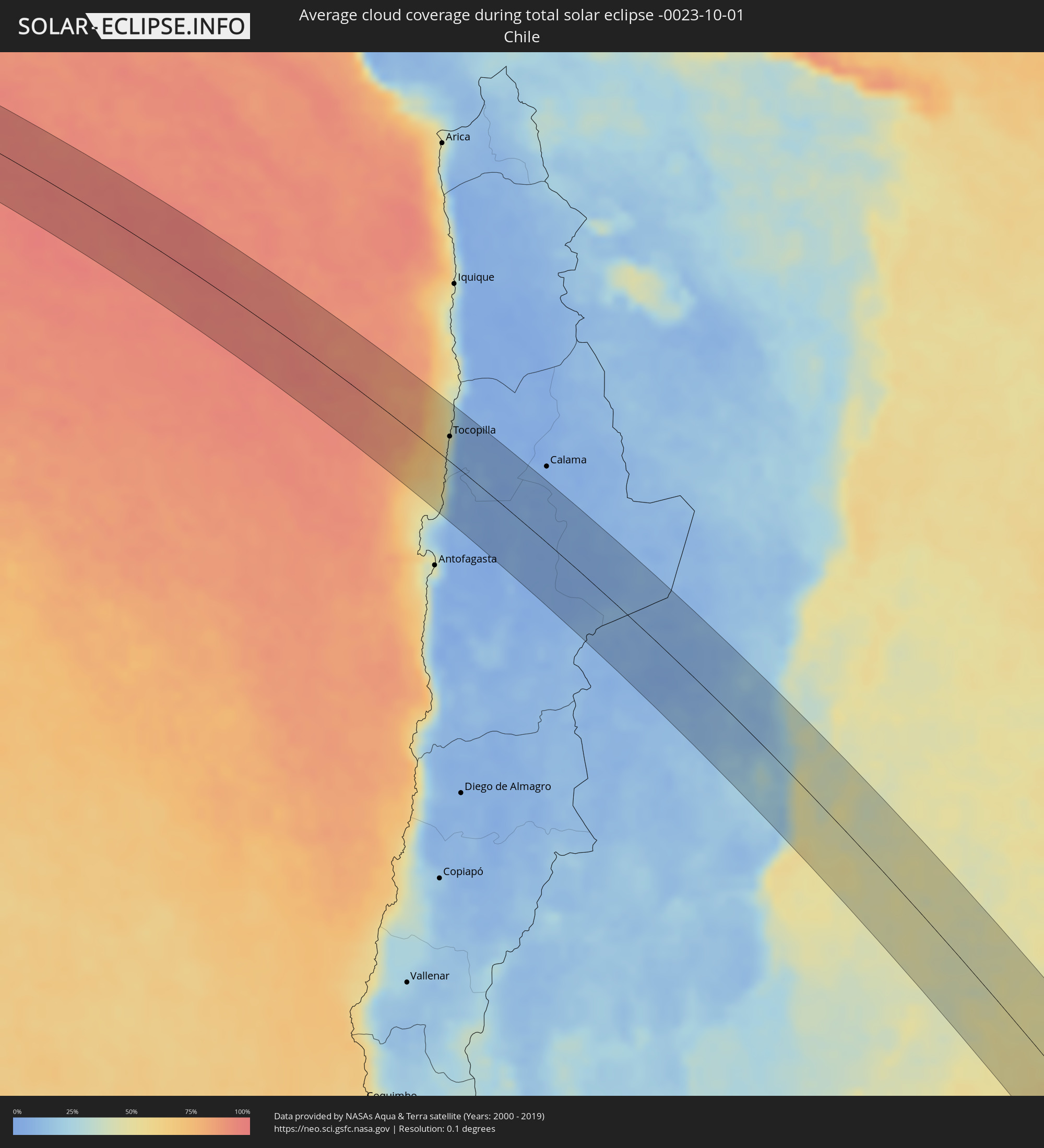 Chile
Chile
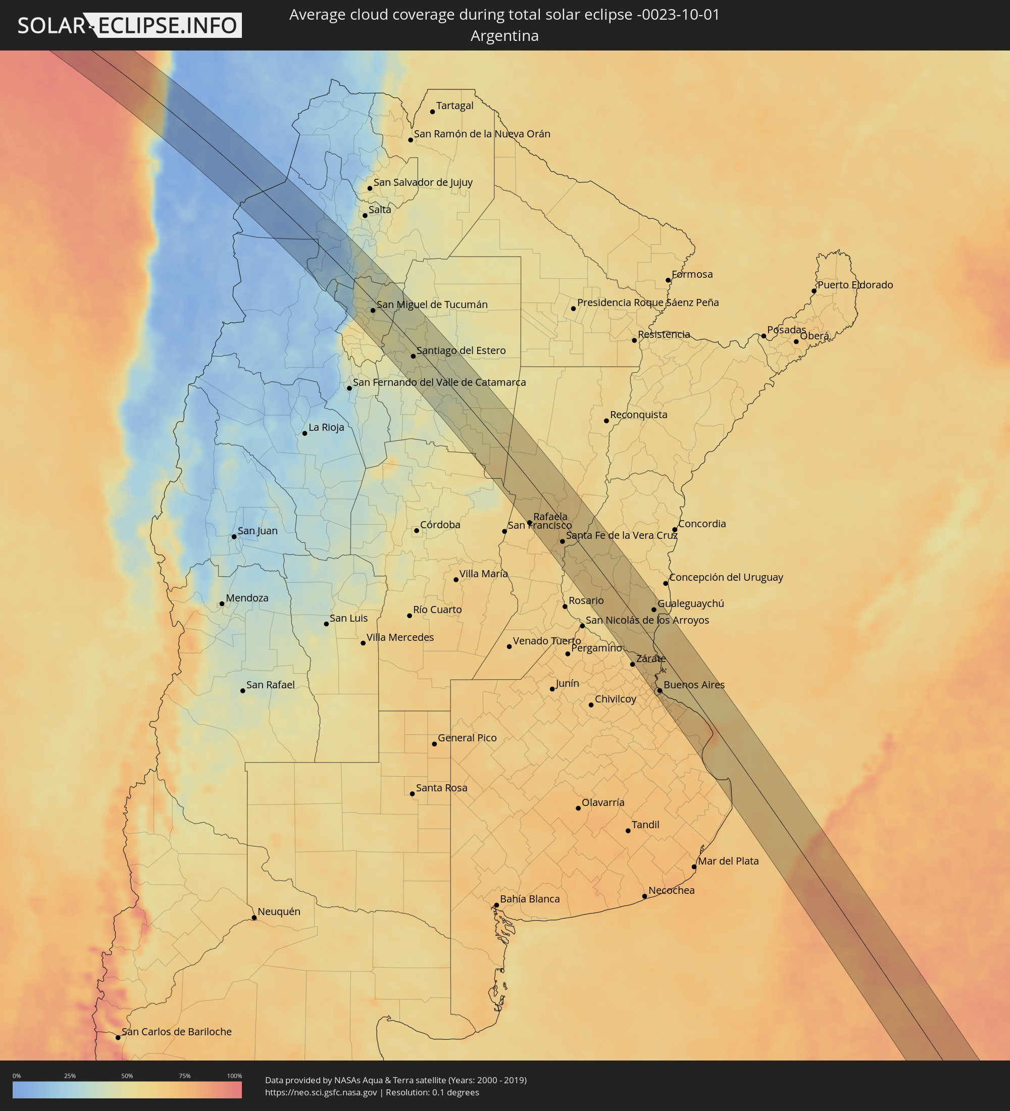 Argentina
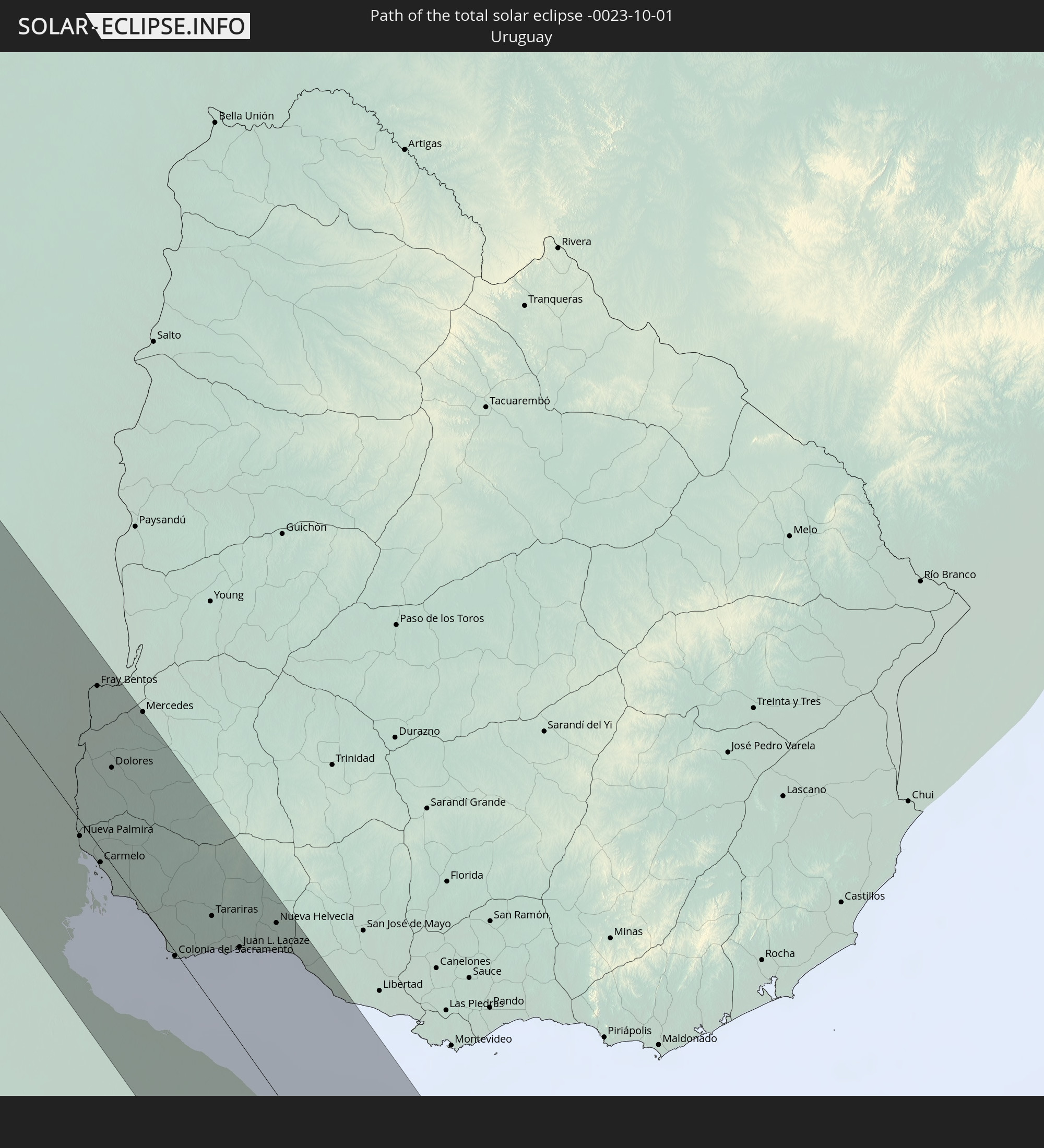
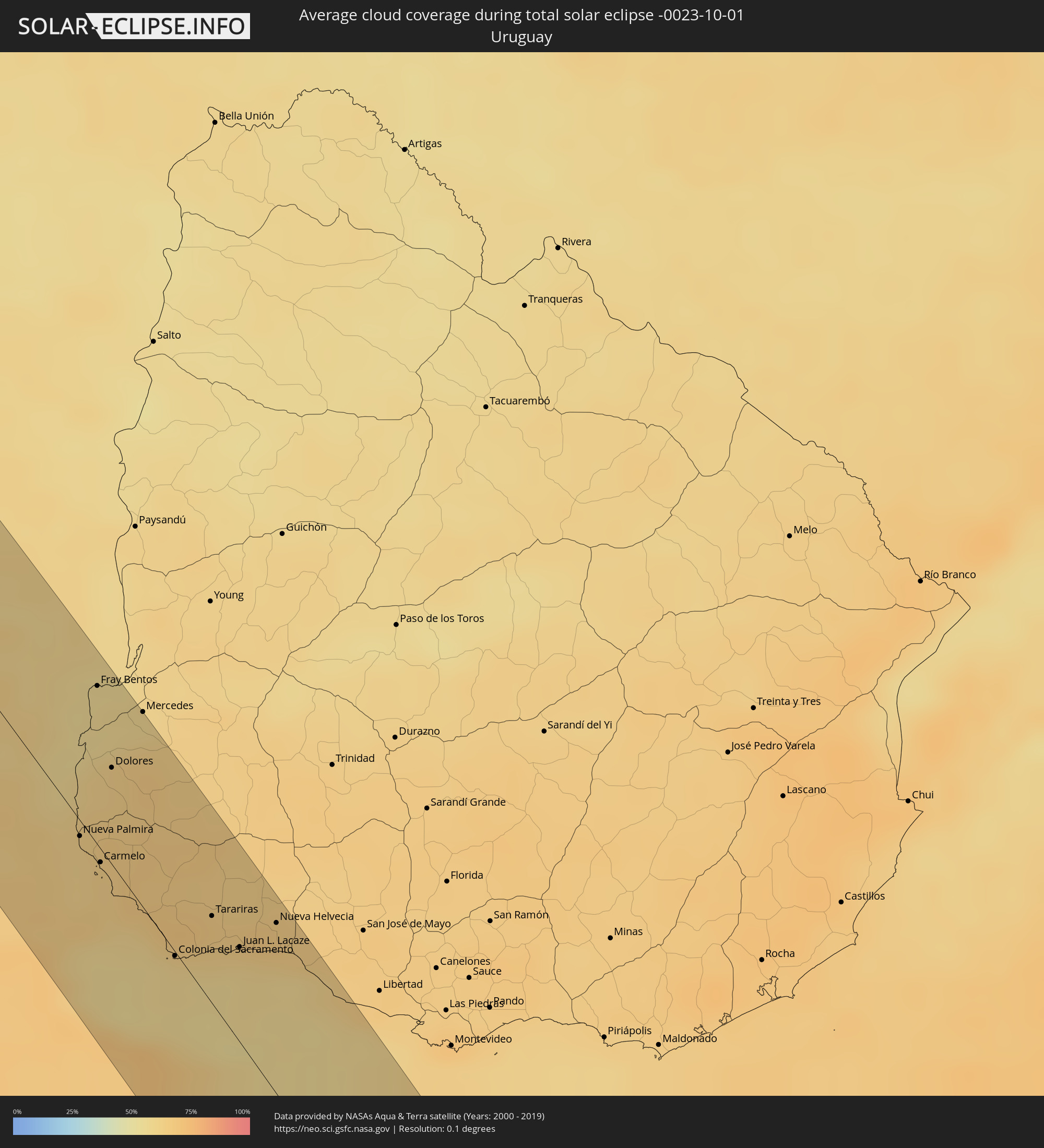 Uruguay
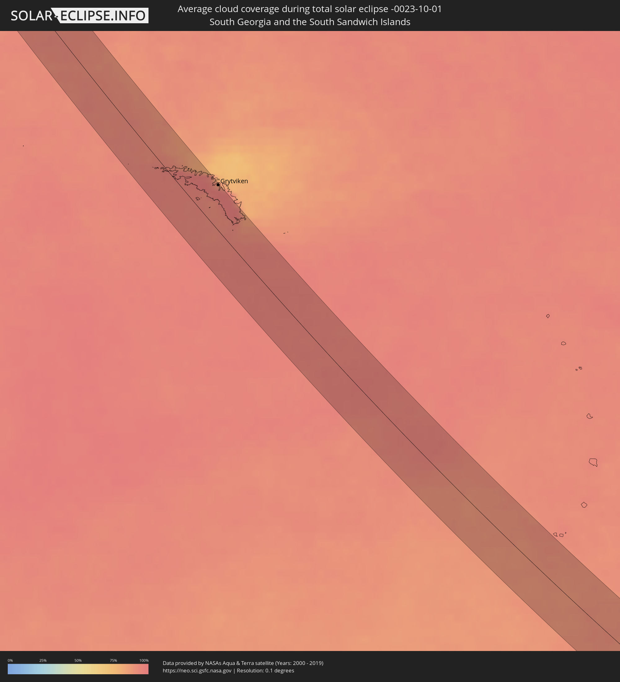 South Georgia and the South Sandwich Islands
Cities inside the path of the eclipse
The following table shows all locations with a population of more than 5,000 inside the eclipse path. Cities which have more than 100,000 inhabitants are marked bold. A click at the locations opens a detailed map.
| City | Type | Eclipse duration | Local time of max. eclipse | Distance to central line | Ø Cloud coverage |
|
Tocopilla, Antofagasta
|
total | - | 08:24:28 UTC-04:42 | 26 km | 38% |
|
Cafayate, Salta Province
|
total | - | 09:02:44 UTC-04:16 | 13 km | 28% |
|
Monteros, Tucumán Province
|
total | - | 09:05:28 UTC-04:16 | 63 km | 51% |
|
Famaillá, Tucumán Province
|
total | - | 09:05:21 UTC-04:16 | 48 km | 51% |
|
Simoca, Tucumán Province
|
total | - | 09:05:49 UTC-04:16 | 60 km | 51% |
|
Yerba Buena, Tucumán Province
|
total | - | 09:04:58 UTC-04:16 | 23 km | 47% |
|
Bella Vista, Tucumán Province
|
total | - | 09:05:25 UTC-04:16 | 39 km | 48% |
|
Trancas, Tucumán Province
|
total | - | 09:03:49 UTC-04:16 | 25 km | 41% |
|
Tafí Viejo, Tucumán Province
|
total | - | 09:04:52 UTC-04:16 | 13 km | 46% |
|
San Miguel de Tucumán, Tucumán Province
|
total | - | 09:05:06 UTC-04:16 | 17 km | 45% |
|
Alderetes, Tucumán Province
|
total | - | 09:05:11 UTC-04:16 | 10 km | 45% |
|
Termas de Río Hondo, Santiago del Estero Province
|
total | - | 09:06:51 UTC-04:16 | 41 km | 45% |
|
Santiago del Estero, Santiago del Estero Province
|
total | - | 09:08:10 UTC-04:16 | 20 km | 45% |
|
Clodomira, Santiago del Estero Province
|
total | - | 09:07:52 UTC-04:16 | 6 km | 46% |
|
Añatuya, Santiago del Estero Province
|
total | - | 09:11:12 UTC-04:16 | 36 km | 47% |
|
Morteros, Cordoba Province
|
total | - | 09:16:44 UTC-04:16 | 62 km | 61% |
|
Ceres, Santa Fe Province
|
total | - | 09:15:09 UTC-04:16 | 1 km | 56% |
|
Tostado, Santa Fe Province
|
total | - | 09:14:04 UTC-04:16 | 60 km | 56% |
|
Sunchales, Santa Fe Province
|
total | - | 09:17:44 UTC-04:16 | 45 km | 59% |
|
Rafaela, Santa Fe Province
|
total | - | 09:18:26 UTC-04:16 | 61 km | 61% |
|
San Cristóbal, Santa Fe Province
|
total | - | 09:16:53 UTC-04:16 | 23 km | 58% |
|
San Carlos Centro, Santa Fe Province
|
total | - | 09:19:53 UTC-04:16 | 64 km | 63% |
|
Esperanza, Santa Fe Province
|
total | - | 09:19:32 UTC-04:16 | 32 km | 64% |
|
Santo Tomé, Santa Fe Province
|
total | - | 09:20:10 UTC-04:16 | 35 km | 60% |
|
Recreo, Santa Fe Province
|
total | - | 09:19:52 UTC-04:16 | 20 km | 64% |
|
Santa Fe de la Vera Cruz, Santa Fe Province
|
total | - | 09:20:11 UTC-04:16 | 28 km | 62% |
|
Laguna Paiva, Santa Fe Province
|
total | - | 09:19:35 UTC-04:16 | 2 km | 63% |
|
Diamante, Entre Ríos Province
|
total | - | 09:21:07 UTC-04:16 | 52 km | 58% |
|
San Justo, Santa Fe Province
|
total | - | 09:18:39 UTC-04:16 | 38 km | 61% |
|
Paraná, Entre Ríos Province
|
total | - | 09:20:36 UTC-04:16 | 21 km | 59% |
|
San Benito, Entre Ríos Province
|
total | - | 09:20:49 UTC-04:16 | 19 km | 60% |
|
Crespo, Entre Ríos Province
|
total | - | 09:21:28 UTC-04:16 | 25 km | 61% |
|
General Ramírez, Entre Ríos Province
|
total | - | 09:21:54 UTC-04:16 | 27 km | 63% |
|
Victoria, Entre Ríos Province
|
total | - | 09:22:50 UTC-04:16 | 53 km | 59% |
|
Viale, Entre Ríos Province
|
total | - | 09:21:32 UTC-04:16 | 8 km | 58% |
|
Villa María Grande, Entre Ríos Province
|
total | - | 09:21:16 UTC-04:16 | 30 km | 60% |
|
Gualeguay, Entre Ríos Province
|
total | - | 09:24:56 UTC-04:16 | 25 km | 62% |
|
Rosario del Tala, Entre Ríos Province
|
total | - | 09:23:30 UTC-04:16 | 44 km | 60% |
|
Larroque, Entre Ríos Province
|
total | - | 09:25:07 UTC-04:16 | 5 km | 62% |
|
Urdinarrain, Entre Ríos Province
|
total | - | 09:24:35 UTC-04:16 | 37 km | 62% |
|
Tigre, Buenos Aires
|
total | - | 09:28:22 UTC-04:16 | 54 km | 69% |
|
San Isidro, Buenos Aires
|
total | - | 09:28:32 UTC-04:16 | 53 km | 66% |
|
Gualeguaychú, Entre Ríos Province
|
total | - | 09:25:42 UTC-04:16 | 44 km | 58% |
|
Villa Santa Rita, Buenos Aires F.D.
|
total | - | 09:28:52 UTC-04:16 | 59 km | 70% |
|
Villa Lugano, Buenos Aires F.D.
|
total | - | 09:29:00 UTC-04:16 | 63 km | 69% |
|
Colegiales, Buenos Aires F.D.
|
total | - | 09:28:50 UTC-04:16 | 54 km | 68% |
|
Nueva Palmira, Colonia
|
total | - | 09:59:28 UTC-03:44 | 5 km | 61% |
|
Retiro, Buenos Aires F.D.
|
total | - | 09:28:56 UTC-04:16 | 50 km | 68% |
|
Buenos Aires, Buenos Aires F.D.
|
total | - | 09:29:00 UTC-04:16 | 51 km | 68% |
|
Fray Bentos, Río Negro
|
total | - | 09:58:09 UTC-03:44 | 52 km | 56% |
|
Carmelo, Colonia
|
total | - | 09:59:53 UTC-03:44 | 4 km | 63% |
|
Quilmes, Buenos Aires
|
total | - | 09:29:22 UTC-04:16 | 50 km | 68% |
|
Dolores, Soriano
|
total | - | 09:59:03 UTC-03:44 | 31 km | 62% |
|
La Plata, Buenos Aires
|
total | - | 09:30:08 UTC-04:16 | 40 km | 70% |
|
Colonia del Sacramento, Colonia
|
total | - | 10:01:21 UTC-03:44 | 1 km | 58% |
|
Tarariras, Colonia
|
total | - | 10:01:16 UTC-03:44 | 28 km | 64% |
|
Juan L. Lacaze, Colonia
|
total | - | 10:01:47 UTC-03:44 | 30 km | 60% |
|
Rosario, Colonia
|
total | - | 10:01:43 UTC-03:44 | 45 km | 65% |
|
Nueva Helvecia, Colonia
|
total | - | 10:01:50 UTC-03:44 | 54 km | 66% |
|
San Clemente del Tuyú, Buenos Aires
|
total | - | 09:34:29 UTC-04:16 | 40 km | 64% |
|
Grytviken
|
total | - | 12:41:36 UTC-02:00 | 52 km | 96% |