Total solar eclipse of 05/29/-0036
| Day of week: | Thursday |
| Maximum duration of eclipse: | 03m28s |
| Maximum width of eclipse path: | 683 km |
| Saros cycle: | 56 |
| Coverage: | 100% |
| Magnitude: | 1.0674 |
| Gamma: | 0.9432 |
Wo kann man die Sonnenfinsternis vom 05/29/-0036 sehen?

Die Sonnenfinsternis am 05/29/-0036 kann man in 14 Ländern als partielle Sonnenfinsternis beobachten.
Der Finsternispfad verläuft durch 5 Länder. Nur in diesen Ländern ist sie als total Sonnenfinsternis zu sehen.
In den folgenden Ländern ist die Sonnenfinsternis total zu sehen
 Russia
 Svalbard and Jan Mayen
 Norway
 Sweden
 Finland
In den folgenden Ländern ist die Sonnenfinsternis partiell zu sehen


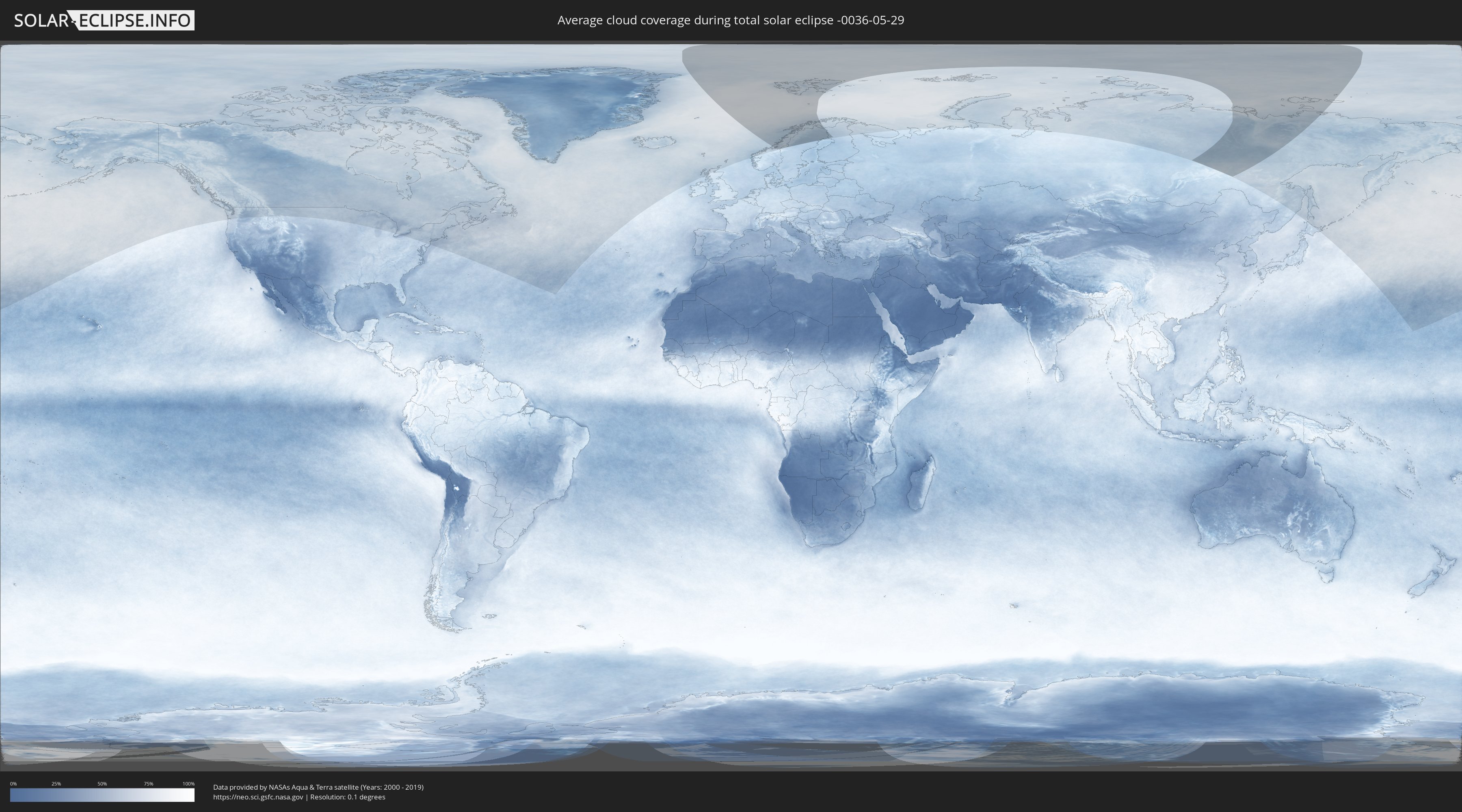
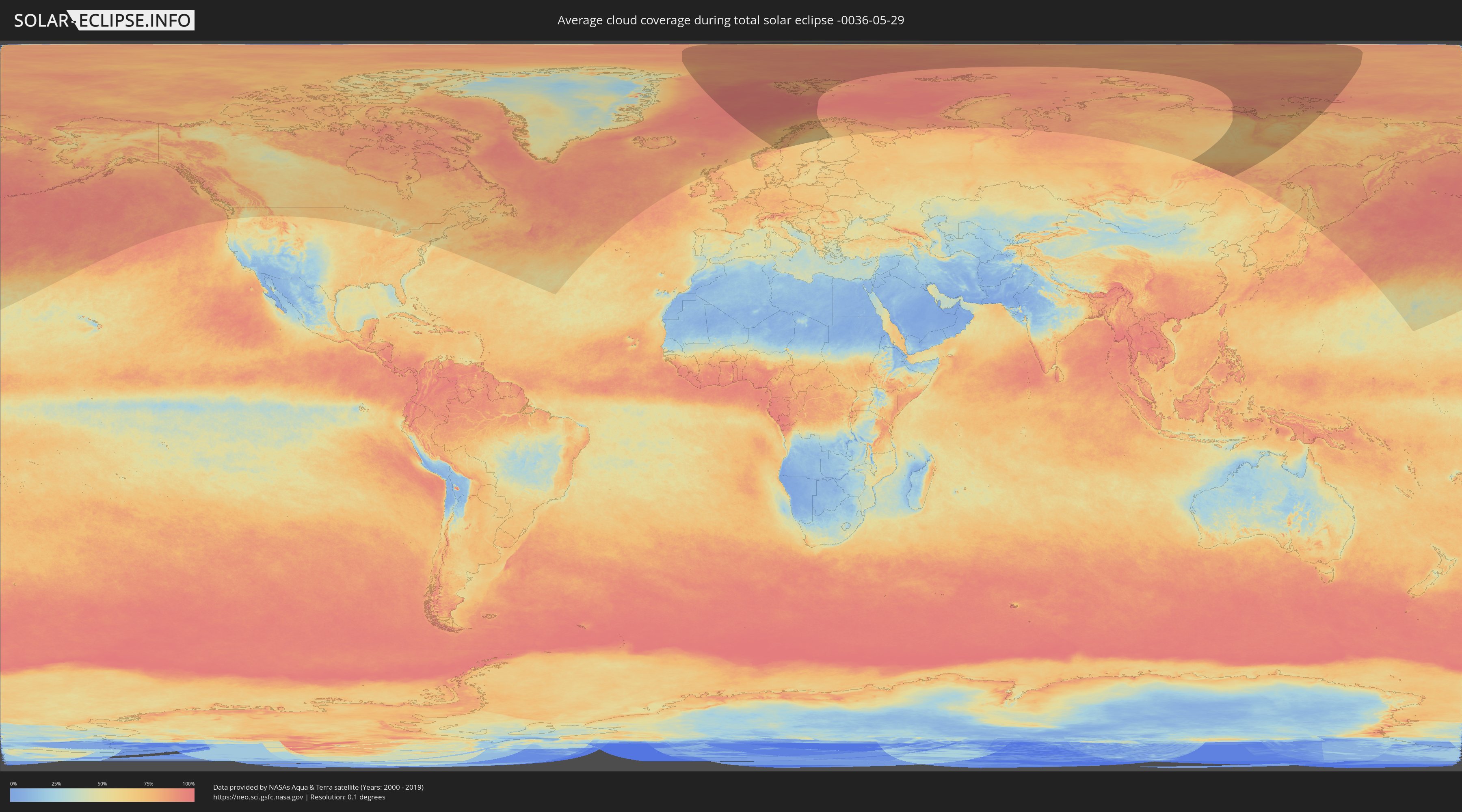
How will be the weather during the total solar eclipse on 05/29/-0036?
Where is the best place to see the total solar eclipse of 05/29/-0036?
The following maps show the average cloud coverage for the day of the total solar eclipse.
With the help of these maps, it is possible to find the place along the eclipse path, which has the best
chance of a cloudless sky.
Nevertheless, you should consider local circumstances and inform about the weather of your chosen
observation site.
The data is provided by NASAs satellites
AQUA and TERRA.
The cloud maps are averaged over a period of 19 years (2000 - 2019).
Detailed country maps
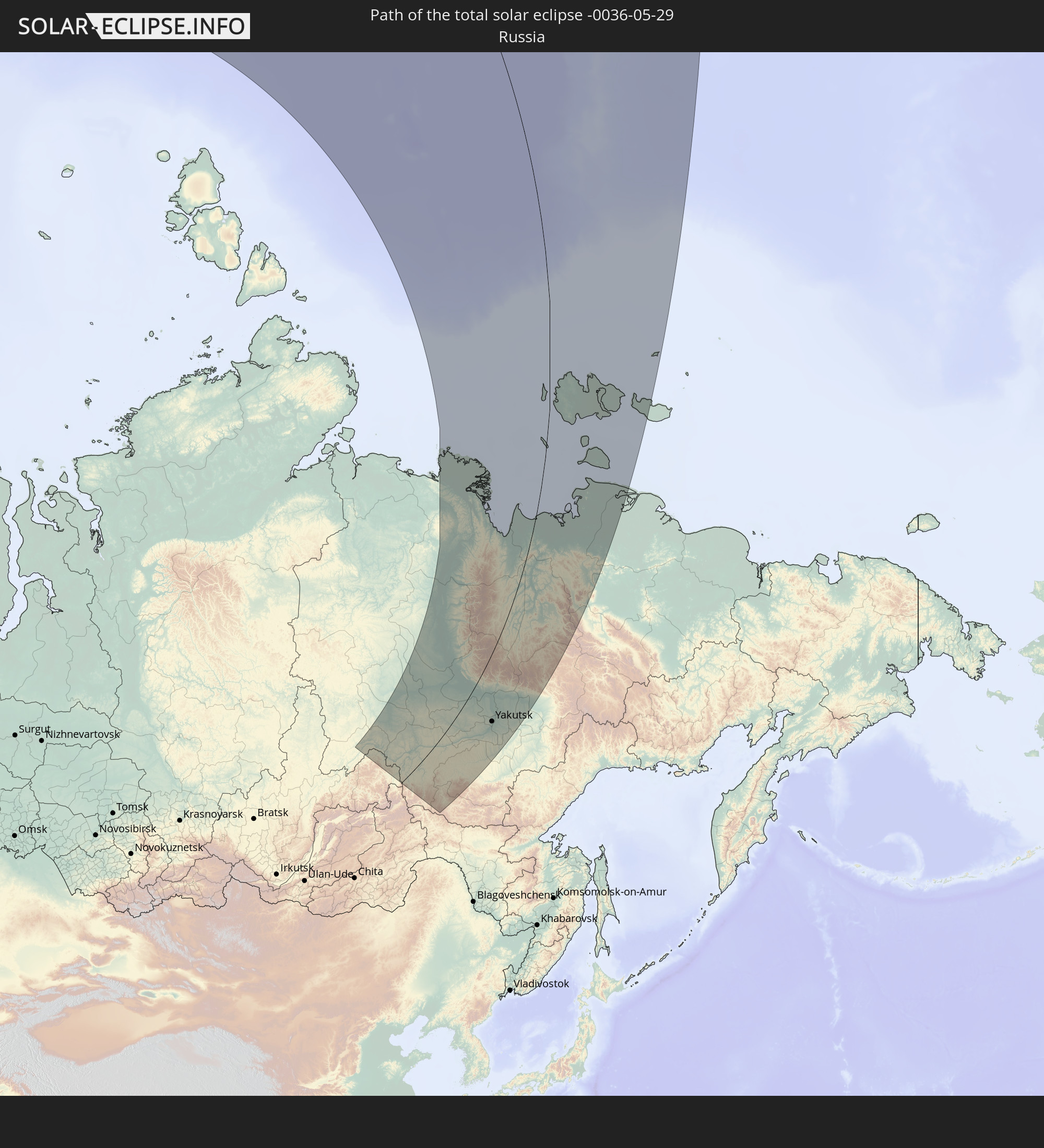
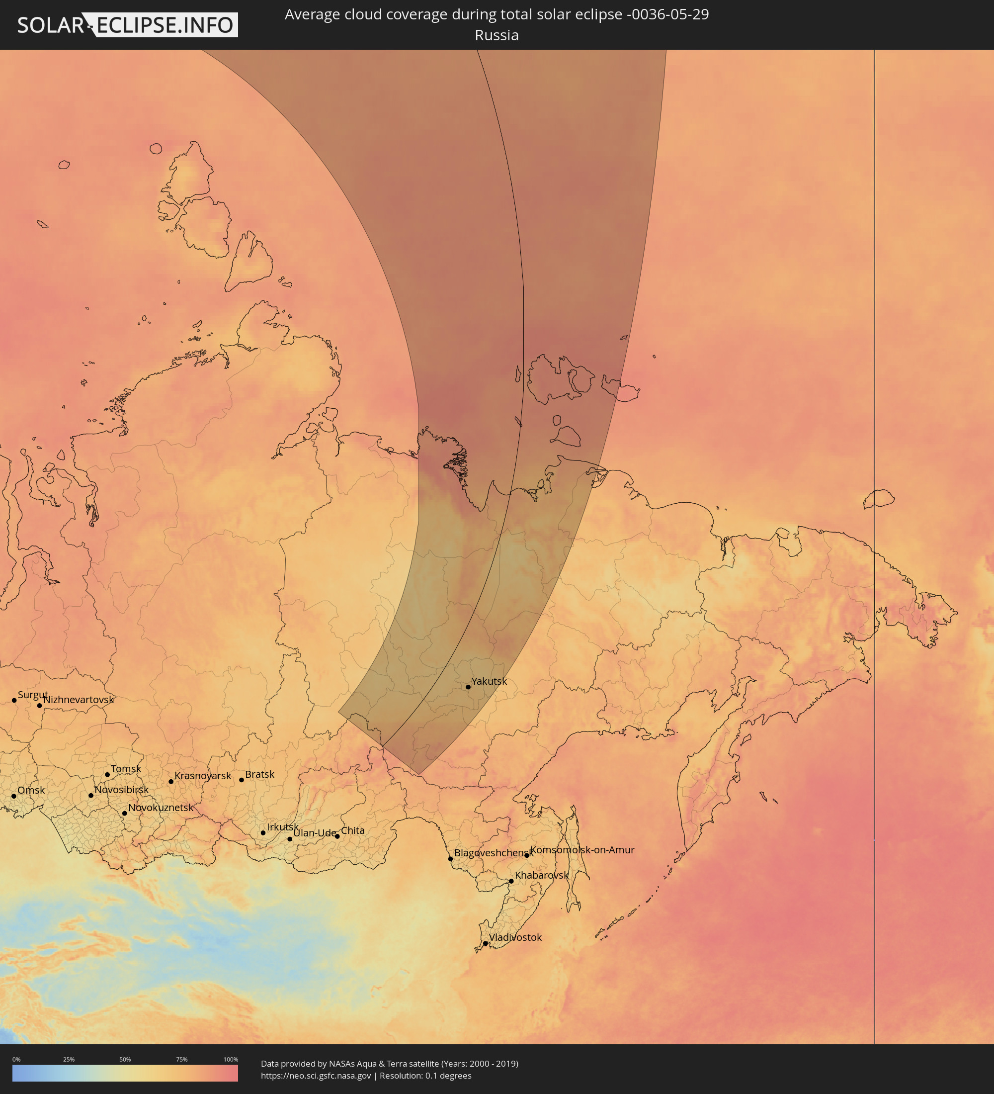 Russia
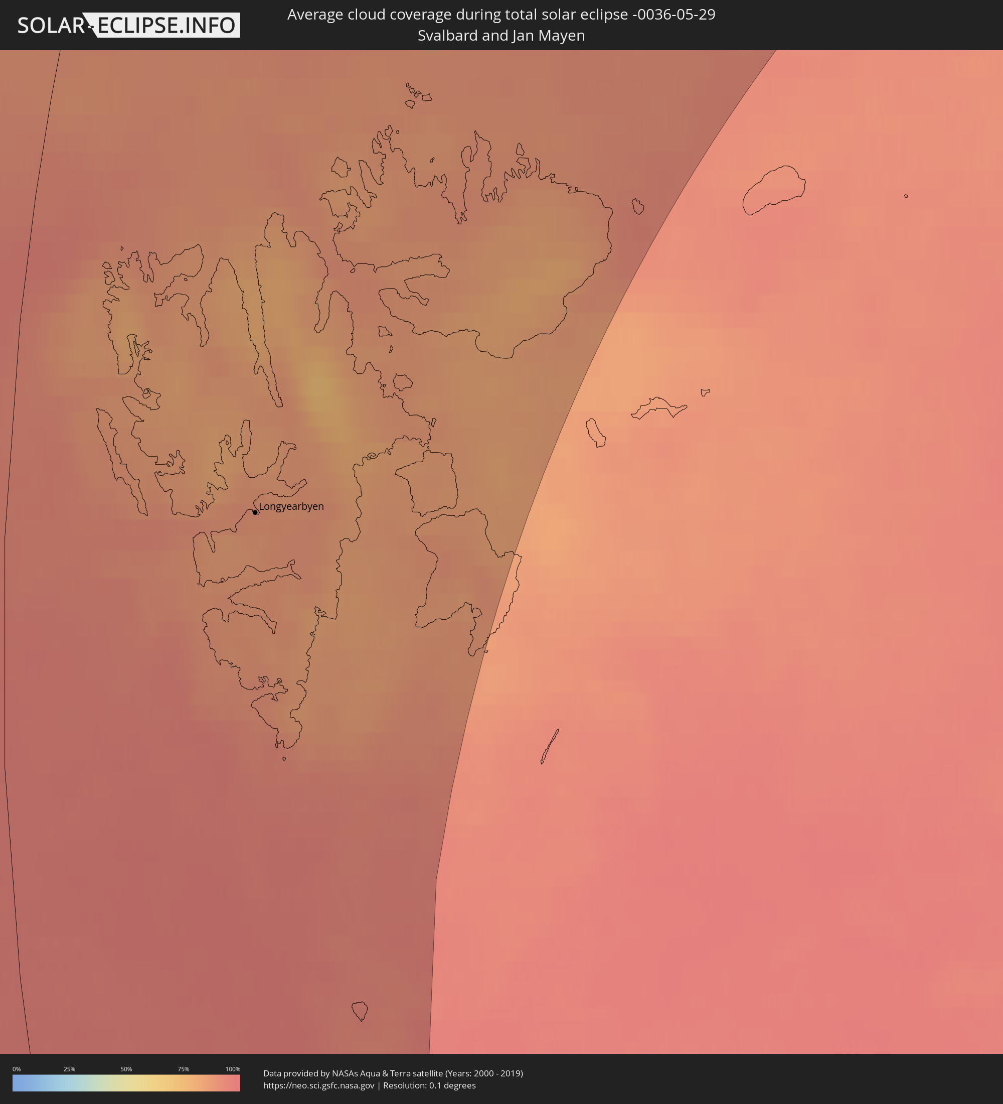 Svalbard and Jan Mayen
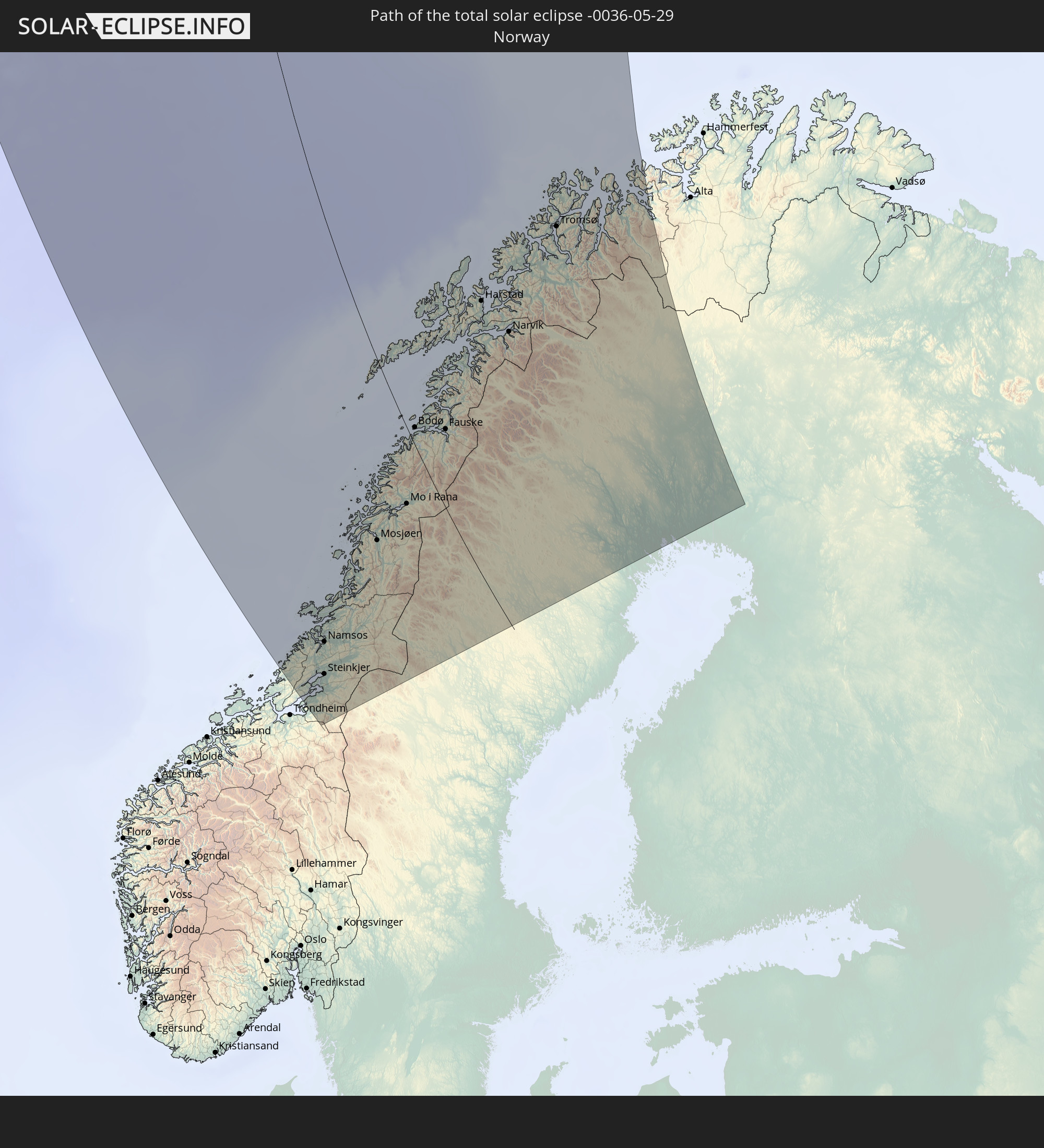
 Norway
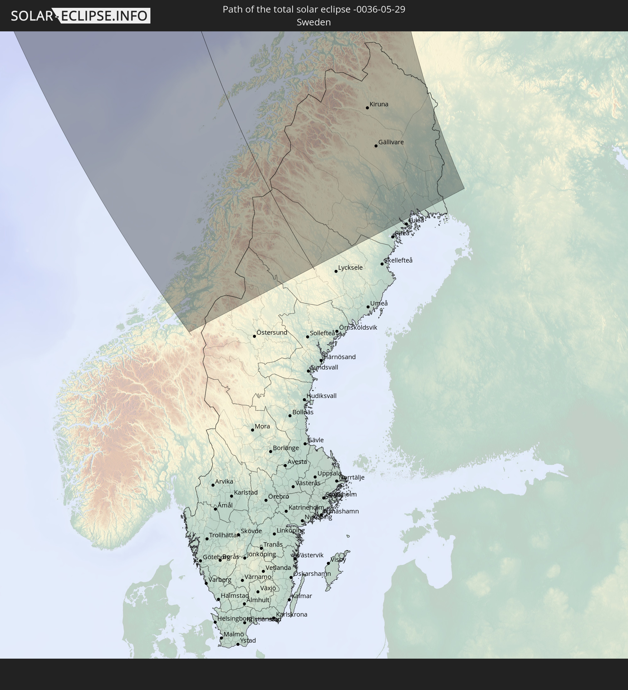
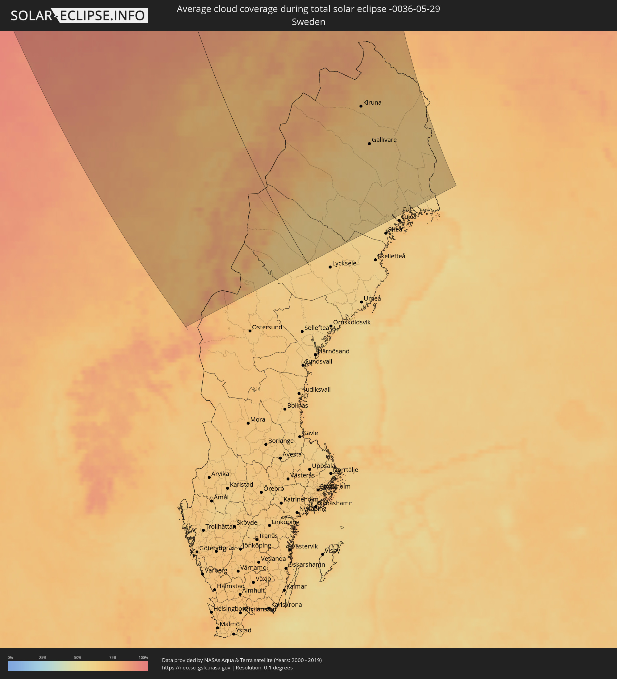 Sweden
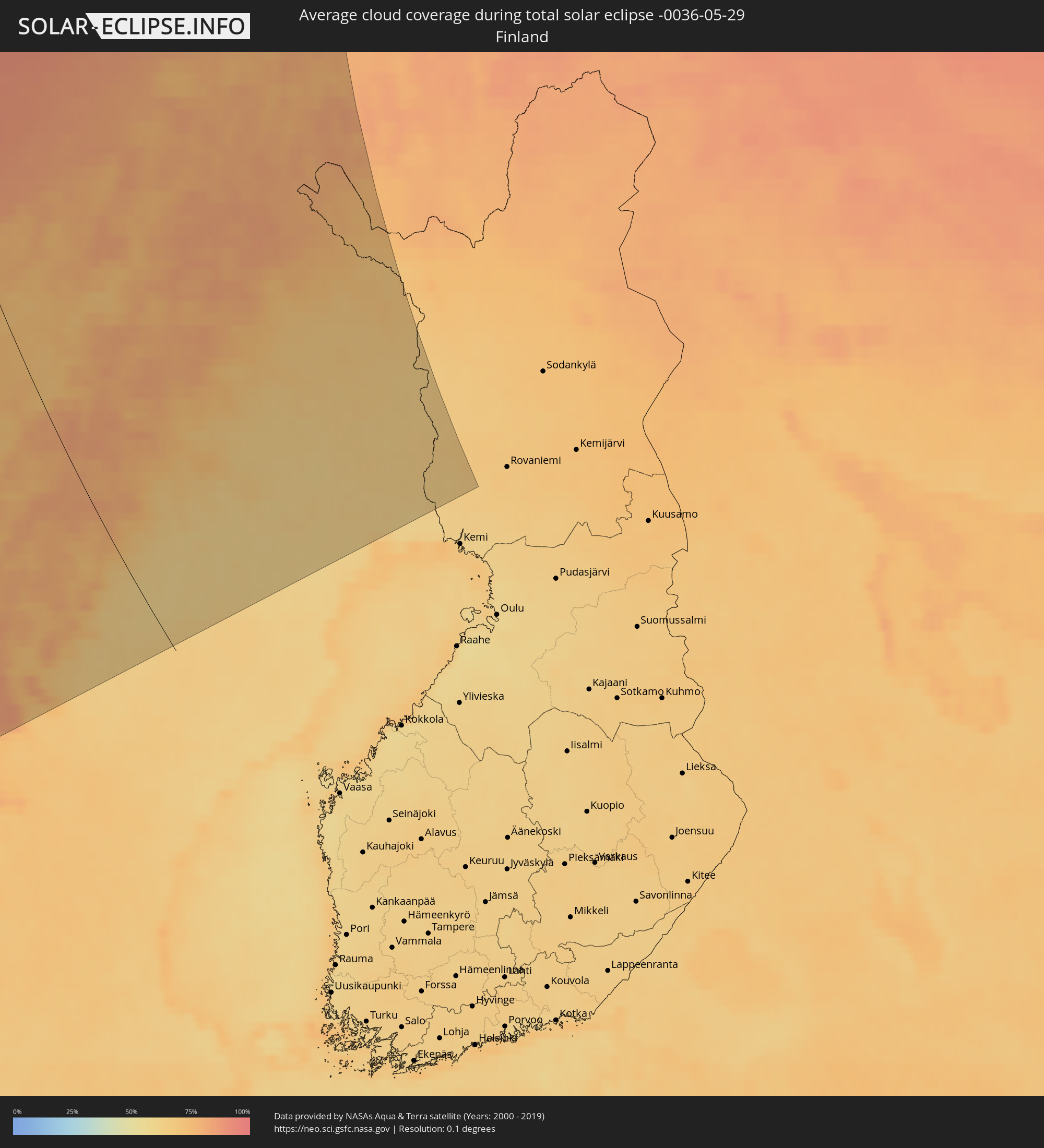 Finland
Cities inside the path of the eclipse
The following table shows all locations with a population of more than 5,000 inside the eclipse path. Cities which have more than 100,000 inhabitants are marked bold. A click at the locations opens a detailed map.
| City | Type | Eclipse duration | Local time of max. eclipse | Distance to central line | Ø Cloud coverage |
 Levanger, Nord-Trøndelag
|
total | - | 21:29:32 UTC+01:00 | 309 km | 73% |
|
Verdal, Nord-Trøndelag
|
total | - | 21:29:24 UTC+01:00 | 299 km | 74% |
|
Steinkjer, Nord-Trøndelag
|
total | - | 21:29:12 UTC+01:00 | 284 km | 71% |
|
Namsos, Nord-Trøndelag
|
total | - | 21:28:47 UTC+01:00 | 257 km | 73% |
|
Sandnessjøen, Nordland
|
total | - | 21:26:49 UTC+01:00 | 122 km | 75% |
|
Mosjøen, Nordland
|
total | - | 21:26:43 UTC+01:00 | 110 km | 77% |
|
Mo i Rana, Nordland
|
total | - | 21:25:49 UTC+01:00 | 47 km | 78% |
|
Bodø, Nordland
|
total | - | 21:24:50 UTC+01:00 | 10 km | 70% |
|
Fauske, Nordland
|
total | - | 21:24:23 UTC+01:00 | 48 km | 76% |
 Longyearbyen, Svalbard
|
total | - | 21:13:50 UTC+01:00 | 182 km | 86% |
|
Harstad, Troms
|
total | - | 21:22:30 UTC+01:00 | 155 km | 76% |
|
Narvik, Nordland
|
total | - | 21:22:24 UTC+01:00 | 176 km | 81% |
|
Tromsø, Troms
|
total | - | 21:20:41 UTC+01:00 | 273 km | 80% |
 Kiruna, Norrbotten
|
total | - | 21:21:32 UTC+01:00 | 263 km | 69% |
|
Gällivare, Norrbotten
|
total | - | 21:21:52 UTC+01:00 | 251 km | 66% |
|
Malmberget, Norrbotten
|
total | - | 21:21:50 UTC+01:00 | 253 km | 65% |
|
Älvsbyn, Norrbotten
|
total | - | 21:22:46 UTC+01:00 | 196 km | 61% |
|
Boden, Norrbotten
|
total | - | 21:22:17 UTC+01:00 | 232 km | 61% |
 Ylitornio, Lapland
|
total | - | 22:00:42 UTC+01:39 | 336 km | 63% |
 Lensk, Sakha
|
total | - | 04:02:17 UTC+08:38 | 342 km | 68% |
|
Suntar, Sakha
|
total | - | 04:02:25 UTC+08:38 | 327 km | 63% |
|
Nyurba, Sakha
|
total | - | 04:03:21 UTC+08:38 | 367 km | 65% |
|
Verkhnevilyuysk, Sakha
|
total | - | 04:02:38 UTC+08:38 | 291 km | 63% |
|
Olyokminsk, Sakha
|
total | - | 03:59:03 UTC+08:38 | 88 km | 71% |
|
Vilyuysk, Sakha
|
total | - | 04:02:24 UTC+08:38 | 251 km | 64% |
|
Aldan, Sakha
|
total | - | 03:54:33 UTC+08:38 | 252 km | 82% |
|
Nizhniy Kuranakh, Sakha
|
total | - | 03:54:44 UTC+08:38 | 241 km | 80% |
|
Tommot, Sakha
|
total | - | 03:54:32 UTC+08:38 | 264 km | 80% |
|
Berdigestyakh, Sakha
|
total | - | 03:58:12 UTC+08:38 | 64 km | 66% |
|
Tiksi, Sakha
|
total | - | 04:10:26 UTC+08:38 | 213 km | 89% |
|
Mokhsogollokh, Sakha
|
total | - | 03:56:22 UTC+08:38 | 205 km | 68% |
|
Pokrovsk, Sakha
|
total | - | 03:56:23 UTC+08:38 | 208 km | 69% |
|
Namtsy, Sakha
|
total | - | 03:57:47 UTC+08:38 | 153 km | 66% |
|
Yakutsk, Sakha
|
total | - | 03:56:52 UTC+08:38 | 198 km | 68% |
|
Markha, Sakha
|
total | - | 03:56:58 UTC+08:38 | 193 km | 69% |
|
Zhatay, Sakha
|
total | - | 03:56:59 UTC+08:38 | 194 km | 68% |
|
Mayya, Sakha
|
total | - | 03:56:15 UTC+08:38 | 240 km | 69% |
|
Borogontsy, Sakha
|
total | - | 03:57:09 UTC+08:38 | 219 km | 65% |
|
Churapcha, Sakha
|
total | - | 03:55:46 UTC+08:38 | 316 km | 67% |
|
Ytyk-Kyuyël’, Sakha
|
total | - | 03:55:51 UTC+08:38 | 341 km | 69% |