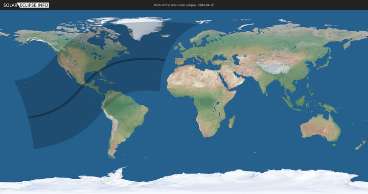
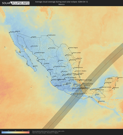
Total solar eclipse of 04/12/-0284
| Day of week: | Friday |
| Maximum duration of eclipse: | 05m47s |
| Maximum width of eclipse path: | 243 km |
| Saros cycle: | 63 |
| Coverage: | 100% |
| Magnitude: | 1.0731 |
| Gamma: | 0.227 |
Wo kann man die Sonnenfinsternis vom 04/12/-0284 sehen?
Die Sonnenfinsternis am 04/12/-0284 kann man in 54 Ländern als partielle Sonnenfinsternis beobachten.
Der Finsternispfad verläuft durch 3 Länder. Nur in diesen Ländern ist sie als total Sonnenfinsternis zu sehen.
In den folgenden Ländern ist die Sonnenfinsternis total zu sehen
In den folgenden Ländern ist die Sonnenfinsternis partiell zu sehen
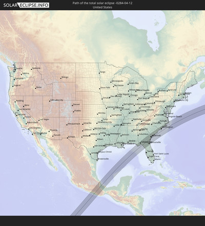
 United States
 United States Minor Outlying Islands
 Kiribati
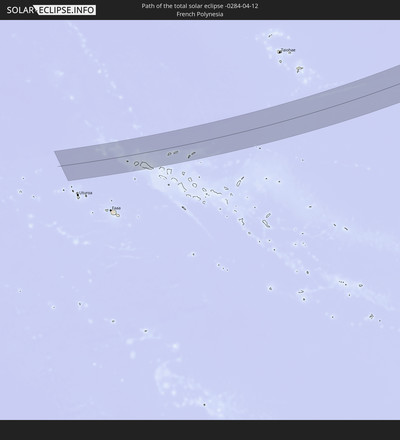
 French Polynesia
 Canada
 Pitcairn Islands
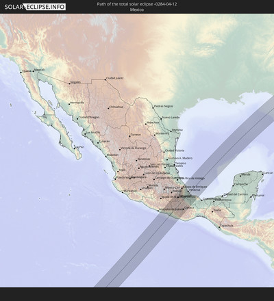
 Mexico
 Chile
Chile
 Greenland
 Guatemala
 Ecuador
 El Salvador
 Honduras
 Belize
 Nicaragua
 Costa Rica
 Cuba
Cuba
 Panama
 Colombia
 Cayman Islands
 Peru
Peru
 The Bahamas
 Jamaica
 Haiti
Haiti
 Brazil
 Venezuela
 Turks and Caicos Islands
 Dominican Republic
 Aruba
Aruba
 Puerto Rico
 United States Virgin Islands
 Bermuda
 British Virgin Islands
 Anguilla
 Collectivity of Saint Martin
 Saint Barthélemy
 Saint Kitts and Nevis
 Antigua and Barbuda
 Montserrat
 Trinidad and Tobago
 Guadeloupe
 Grenada
 Dominica
 Saint Vincent and the Grenadines
 Guyana
 Martinique
 Saint Lucia
 Barbados
 Saint Pierre and Miquelon
 Portugal
 Cabo Verde
 Iceland
 Svalbard and Jan Mayen
 Faroe Islands
How will be the weather during the total solar eclipse on 04/12/-0284?
Where is the best place to see the total solar eclipse of 04/12/-0284?
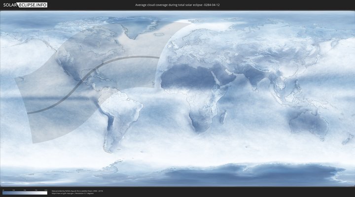
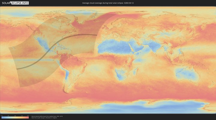
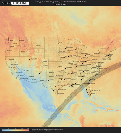
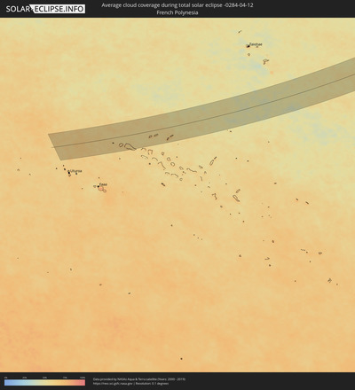
The following maps show the average cloud coverage for the day of the total solar eclipse.
With the help of these maps, it is possible to find the place along the eclipse path, which has the best
chance of a cloudless sky.
Nevertheless, you should consider local circumstances and inform about the weather of your chosen
observation site.
The data is provided by NASAs satellites
AQUA and TERRA.
The cloud maps are averaged over a period of 19 years (2000 - 2019).
Detailed country maps
Cities inside the path of the eclipse
The following table shows all locations with a population of more than 5,000 inside the eclipse path. Cities which have more than 100,000 inhabitants are marked bold. A click at the locations opens a detailed map.
| City | Type | Eclipse duration | Local time of max. eclipse | Distance to central line | Ø Cloud coverage |
 San Marcos, Guerrero
|
total | - | 11:12:47 UTC-06:36 | 109 km | 24% |
 Cruz Grande, Guerrero
|
total | - | 11:13:05 UTC-06:36 | 82 km | 29% |
 Ayutla de los Libres, Guerrero
|
total | - | 11:13:37 UTC-06:36 | 97 km | 26% |
 Copala, Guerrero
|
total | - | 11:13:06 UTC-06:36 | 62 km | 37% |
 Marquelia, Guerrero
|
total | - | 11:13:19 UTC-06:36 | 47 km | 33% |
 San Luis Acatlán, Guerrero
|
total | - | 11:13:55 UTC-06:36 | 57 km | 27% |
 Malinaltepec, Guerrero
|
total | - | 11:14:54 UTC-06:36 | 84 km | 41% |
 Tlapa de Comonfort, Guerrero
|
total | - | 11:15:40 UTC-06:36 | 98 km | 29% |
 Cuajinicuilapa de Santa Maria, Guerrero
|
total | - | 11:13:47 UTC-06:36 | 7 km | 22% |
 Ometepec, Guerrero
|
total | - | 11:14:14 UTC-06:36 | 22 km | 26% |
 Pinotepa, Oaxaca
|
total | - | 11:14:07 UTC-06:36 | 32 km | 25% |
 Acatlán de Osorio, Puebla
|
total | - | 11:17:53 UTC-06:36 | 103 km | 17% |
 Santiago Juxtlahuaca, Oaxaca
|
total | - | 11:16:12 UTC-06:36 | 37 km | 39% |
 Putla Villa de Guerrero, Oaxaca
|
total | - | 11:15:43 UTC-06:36 | 8 km | 27% |
 Jamiltepec, Oaxaca
|
total | - | 11:14:24 UTC-06:36 | 55 km | 27% |
 Ciudad de Huajuapan de León, Oaxaca
|
total | - | 11:17:33 UTC-06:36 | 53 km | 28% |
 Heroica Ciudad de Tlaxiaco, Oaxaca
|
total | - | 11:16:38 UTC-06:36 | 6 km | 37% |
 Yehualtepec, Puebla
|
total | - | 11:19:43 UTC-06:36 | 116 km | 23% |
 Santa María la Alta, Puebla
|
total | - | 11:19:20 UTC-06:36 | 101 km | 28% |
 Palmarito Tochapán, Puebla
|
total | - | 11:19:58 UTC-06:36 | 122 km | 24% |
 Xaltepec, Puebla
|
total | - | 11:19:58 UTC-06:36 | 118 km | 24% |
 San Marcos Tlacoyalco, Puebla
|
total | - | 11:19:35 UTC-06:36 | 102 km | 22% |
 Cuacnopalan, Puebla
|
total | - | 11:20:01 UTC-06:36 | 105 km | 29% |
 Magdalena Cuayucatepec, Puebla
|
total | - | 11:19:32 UTC-06:36 | 84 km | 24% |
 Ciudad Serdán, Puebla
|
total | - | 11:20:28 UTC-06:36 | 113 km | 34% |
 Santiago Miahuatlán, Puebla
|
total | - | 11:19:36 UTC-06:36 | 80 km | 23% |
 Tlachichuca, Puebla
|
total | - | 11:20:46 UTC-06:36 | 120 km | 36% |
 San José Esperanza, Puebla
|
total | - | 11:20:17 UTC-06:36 | 100 km | 30% |
 Tehuacán, Puebla
|
total | - | 11:19:31 UTC-06:36 | 70 km | 23% |
 San Gabriel Chilac, Puebla
|
total | - | 11:19:19 UTC-06:36 | 56 km | 21% |
 Miahuatlán, Puebla
|
total | - | 11:19:21 UTC-06:36 | 49 km | 21% |
 Tlanalapan, Puebla
|
total | - | 11:21:17 UTC-06:36 | 118 km | 43% |
 Maltrata, Veracruz
|
total | - | 11:20:25 UTC-06:36 | 86 km | 37% |
 Ajalpan, Puebla
|
total | - | 11:19:35 UTC-06:36 | 53 km | 23% |
 Asunción Nochixtlán, Oaxaca
|
total | - | 11:17:48 UTC-06:36 | 17 km | 30% |
 San Gabriel Casa Blanca, Oaxaca
|
total | - | 11:19:20 UTC-06:36 | 27 km | 23% |
 Unión y Progreso, Veracruz
|
total | - | 11:20:48 UTC-06:36 | 78 km | 53% |
 Orizaba, Veracruz
|
total | - | 11:20:48 UTC-06:36 | 75 km | 53% |
 Atzacan, Veracruz
|
total | - | 11:20:56 UTC-06:36 | 78 km | 53% |
 Rafael Delgado, Veracruz
|
total | - | 11:20:46 UTC-06:36 | 70 km | 55% |
 Teotitlán de Flores Magón, Oaxaca
|
total | - | 11:19:25 UTC-06:36 | 20 km | 21% |
 Chocaman, Veracruz
|
total | - | 11:21:14 UTC-06:36 | 82 km | 55% |
 Cuautlapán, Veracruz
|
total | - | 11:20:59 UTC-06:36 | 71 km | 55% |
 Monte Blanco, Veracruz
|
total | - | 11:21:10 UTC-06:36 | 77 km | 55% |
 Xico, Veracruz
|
total | - | 11:22:05 UTC-06:36 | 110 km | 56% |
 Zongolica, Veracruz
|
total | - | 11:20:36 UTC-06:36 | 54 km | 59% |
 Córdoba (Santa Leticia), Veracruz
|
total | - | 11:21:07 UTC-06:36 | 70 km | 55% |
 Teocelo, Veracruz
|
total | - | 11:22:04 UTC-06:36 | 104 km | 56% |
 Huatusco de Chicuellar, Veracruz
|
total | - | 11:21:36 UTC-06:36 | 87 km | 59% |
 Córdoba, Veracruz
|
total | - | 11:21:09 UTC-06:36 | 64 km | 56% |
 Xalapa de Enríquez, Veracruz
|
total | - | 11:22:27 UTC-06:36 | 111 km | 56% |
 Amatlán de los Reyes, Veracruz
|
total | - | 11:21:06 UTC-06:36 | 60 km | 60% |
 San Francisco Telixtlahuaca, Oaxaca
|
total | - | 11:18:01 UTC-06:36 | 54 km | 28% |
 Lomas Verdes, Veracruz
|
total | - | 11:22:27 UTC-06:36 | 106 km | 56% |
 Santiago Suchilquitongo, Oaxaca
|
total | - | 11:17:59 UTC-06:36 | 60 km | 28% |
 Colonia Santa Bárbara, Veracruz
|
total | - | 11:22:27 UTC-06:36 | 105 km | 56% |
 Naolinco de Victoria, Veracruz
|
total | - | 11:22:46 UTC-06:36 | 116 km | 57% |
 Cuichapa, Veracruz
|
total | - | 11:21:02 UTC-06:36 | 51 km | 60% |
 Tuzamapan, Veracruz
|
total | - | 11:22:17 UTC-06:36 | 97 km | 55% |
 Jacarandas, Veracruz
|
total | - | 11:22:29 UTC-06:36 | 103 km | 56% |
 Huautla de Jiménez, Puebla
|
total | - | 11:19:48 UTC-06:36 | 2 km | 44% |
 San Lorenzo Cacaotepec, Oaxaca
|
total | - | 11:17:52 UTC-06:36 | 75 km | 25% |
 Villa de Etla, Oaxaca
|
total | - | 11:18:01 UTC-06:36 | 69 km | 27% |
 Zimatlán de Álvarez, Oaxaca
|
total | - | 11:17:22 UTC-06:36 | 95 km | 25% |
 San Pablo Huixtepec, Oaxaca
|
total | - | 11:17:16 UTC-06:36 | 99 km | 22% |
 Cuilapan de Guerrero, Oaxaca
|
total | - | 11:17:36 UTC-06:36 | 88 km | 25% |
 Trinidad Zaachila, Oaxaca
|
total | - | 11:17:31 UTC-06:36 | 93 km | 25% |
 Ejutla de Crespo, Oaxaca
|
total | - | 11:16:51 UTC-06:36 | 122 km | 24% |
 Paso del Macho, Veracruz
|
total | - | 11:21:41 UTC-06:36 | 54 km | 58% |
 Cuitláhuac, Veracruz
|
total | - | 11:21:22 UTC-06:36 | 43 km | 55% |
 Oaxaca, Oaxaca
|
total | - | 11:17:52 UTC-06:36 | 86 km | 26% |
 Cosolapa, Veracruz
|
total | - | 11:21:00 UTC-06:36 | 24 km | 61% |
 Santa Cruz Amilpas, Oaxaca
|
total | - | 11:17:56 UTC-06:36 | 89 km | 26% |
 Cosolapa, Oaxaca
|
total | - | 11:21:01 UTC-06:36 | 24 km | 61% |
 Tlalixtac de Cabrera, Oaxaca
|
total | - | 11:18:01 UTC-06:36 | 91 km | 26% |
 Santa María del Tule, Oaxaca
|
total | - | 11:17:59 UTC-06:36 | 94 km | 24% |
 Rinconada, Veracruz
|
total | - | 11:22:42 UTC-06:36 | 70 km | 55% |
 Isla Soyaltepec, Oaxaca
|
total | - | 11:20:34 UTC-06:36 | 21 km | 49% |
 Tlacolula de Matamoros, Oaxaca
|
total | - | 11:18:05 UTC-06:36 | 114 km | 23% |
 Paso de Ovejas, Veracruz
|
total | - | 11:22:47 UTC-06:36 | 55 km | 51% |
 Soledad de Doblado, Veracruz
|
total | - | 11:22:21 UTC-06:36 | 36 km | 58% |
 Villa Zempoala, Veracruz
|
total | - | 11:23:09 UTC-06:36 | 64 km | 50% |
 Cabezas, Veracruz
|
total | - | 11:23:03 UTC-06:36 | 57 km | 50% |
 Valle Nacional, Oaxaca
|
total | - | 11:20:02 UTC-06:36 | 67 km | 51% |
 Fraccionamiento Geovillas los Pinos, Veracruz
|
total | - | 11:23:01 UTC-06:36 | 33 km | 51% |
 Piedras Negras, Veracruz
|
total | - | 11:22:14 UTC-06:36 | 4 km | 57% |
 El Tejar, Veracruz
|
total | - | 11:22:51 UTC-06:36 | 17 km | 53% |
 La Isla, Veracruz
|
total | - | 11:21:56 UTC-06:36 | 18 km | 57% |
 Veracruz, Veracruz
|
total | - | 11:23:06 UTC-06:36 | 24 km | 49% |
 Tuxtepec, Oaxaca
|
total | - | 11:20:57 UTC-06:36 | 58 km | 53% |
 Boca del Río, Veracruz
|
total | - | 11:23:00 UTC-06:36 | 14 km | 50% |
 Antón Lizardo, Veracruz
|
total | - | 11:23:07 UTC-06:36 | 3 km | 45% |
 Playa Vicente, Veracruz
|
total | - | 11:20:59 UTC-06:36 | 102 km | 52% |
 Cosamaloapan de Carpio, Veracruz
|
total | - | 11:22:05 UTC-06:36 | 63 km | 53% |
 Heroica Alvarado, Veracruz
|
total | - | 11:22:57 UTC-06:36 | 36 km | 41% |
 Tlacotalpan, Veracruz
|
total | - | 11:22:49 UTC-06:36 | 56 km | 47% |
 Tesechoacan, Veracruz
|
total | - | 11:21:52 UTC-06:36 | 91 km | 53% |
 Lerdo de Tejada, Veracruz
|
total | - | 11:23:05 UTC-06:36 | 66 km | 50% |
 Angel R. Cabadas, Veracruz
|
total | - | 11:23:09 UTC-06:36 | 74 km | 50% |
 San Andres Tuxtla, Veracruz
|
total | - | 11:23:16 UTC-06:36 | 104 km | 48% |
 Quincy, Florida
|
total | - | 13:39:08 UTC-05:00 | 107 km | 54% |
 Tallahassee, Florida
|
total | - | 13:39:26 UTC-05:00 | 76 km | 56% |
 Cairo, Georgia
|
total | - | 13:40:09 UTC-05:00 | 109 km | 58% |
 Thomasville, Georgia
|
total | - | 13:40:28 UTC-05:00 | 92 km | 59% |
 Moultrie, Georgia
|
total | - | 13:41:14 UTC-05:00 | 111 km | 57% |
 Perry, Florida
|
total | - | 13:40:10 UTC-05:00 | 6 km | 54% |
 Adel, Georgia
|
total | - | 13:41:46 UTC-05:00 | 86 km | 61% |
 Valdosta, Georgia
|
total | - | 13:41:37 UTC-05:00 | 50 km | 55% |
 Live Oak, Florida
|
total | - | 13:41:24 UTC-05:00 | 14 km | 62% |
 Douglas, Georgia
|
total | - | 13:43:11 UTC-05:00 | 84 km | 57% |
 Lake City, Florida
|
total | - | 13:41:50 UTC-05:00 | 44 km | 61% |
 High Springs, Florida
|
total | - | 13:41:26 UTC-05:00 | 78 km | 60% |
 Alachua, Florida
|
total | - | 13:41:37 UTC-05:00 | 95 km | 61% |
 Waycross, Georgia
|
total | - | 13:43:37 UTC-05:00 | 30 km | 59% |
 Gainesville, Florida
|
total | - | 13:41:39 UTC-05:00 | 110 km | 59% |
 Macclenny, Florida
|
total | - | 13:42:49 UTC-05:00 | 66 km | 62% |
 Starke, Florida
|
total | - | 13:42:24 UTC-05:00 | 97 km | 58% |
 Jesup, Georgia
|
total | - | 13:44:52 UTC-05:00 | 38 km | 55% |
 Middleburg, Florida
|
total | - | 13:42:59 UTC-05:00 | 100 km | 62% |
 Asbury Lake, Florida
|
total | - | 13:43:01 UTC-05:00 | 104 km | 61% |
 Nassau Village-Ratliff, Florida
|
total | - | 13:43:38 UTC-05:00 | 64 km | 62% |
 Statesboro, Georgia
|
total | - | 13:46:02 UTC-05:00 | 107 km | 52% |
 Lakeside, Florida
|
total | - | 13:43:13 UTC-05:00 | 100 km | 59% |
 Bellair-Meadowbrook Terrace, Florida
|
total | - | 13:43:19 UTC-05:00 | 97 km | 57% |
 Orange Park, Florida
|
total | - | 13:43:22 UTC-05:00 | 101 km | 57% |
 Kingsland, Georgia
|
total | - | 13:44:11 UTC-05:00 | 45 km | 60% |
 Jacksonville, Florida
|
total | - | 13:43:39 UTC-05:00 | 89 km | 60% |
 Fruit Cove, Florida
|
total | - | 13:43:24 UTC-05:00 | 109 km | 58% |
 Yulee, Florida
|
total | - | 13:44:07 UTC-05:00 | 65 km | 59% |
 Hinesville, Georgia
|
total | - | 13:45:37 UTC-05:00 | 43 km | 54% |
 St. Marys, Georgia
|
total | - | 13:44:20 UTC-05:00 | 60 km | 53% |
 Dock Junction, Georgia
|
total | - | 13:44:58 UTC-05:00 | 19 km | 53% |
 Brunswick, Georgia
|
total | - | 13:44:57 UTC-05:00 | 26 km | 53% |
 Country Club Estates, Georgia
|
total | - | 13:45:04 UTC-05:00 | 21 km | 53% |
 Fernandina Beach, Florida
|
total | - | 13:44:24 UTC-05:00 | 70 km | 53% |
 Saint Simon Mills, Georgia
|
total | - | 13:45:07 UTC-05:00 | 28 km | 49% |
 Atlantic Beach, Florida
|
total | - | 13:44:05 UTC-05:00 | 104 km | 53% |
 Neptune Beach, Florida
|
total | - | 13:44:04 UTC-05:00 | 106 km | 53% |
 Jacksonville Beach, Florida
|
total | - | 13:44:03 UTC-05:00 | 107 km | 53% |
 Ponte Vedra Beach, Florida
|
total | - | 13:43:59 UTC-05:00 | 113 km | 55% |
 Saint Simons Island, Georgia
|
total | - | 13:45:09 UTC-05:00 | 32 km | 49% |
 Richmond Hill, Georgia
|
total | - | 13:46:12 UTC-05:00 | 34 km | 51% |
 Pooler, Georgia
|
total | - | 13:46:30 UTC-05:00 | 47 km | 54% |
 Rincon, Georgia
|
total | - | 13:46:44 UTC-05:00 | 63 km | 53% |
 Georgetown, Georgia
|
total | - | 13:46:23 UTC-05:00 | 34 km | 53% |
 Port Wentworth, Georgia
|
total | - | 13:46:41 UTC-05:00 | 45 km | 54% |
 Garden City, Georgia
|
total | - | 13:46:39 UTC-05:00 | 42 km | 54% |
 Savannah, Georgia
|
total | - | 13:46:42 UTC-05:00 | 36 km | 51% |
 Skidaway Island, Georgia
|
total | - | 13:46:37 UTC-05:00 | 20 km | 52% |
 Whitemarsh Island, Georgia
|
total | - | 13:46:46 UTC-05:00 | 26 km | 60% |
 Wilmington Island, Georgia
|
total | - | 13:46:49 UTC-05:00 | 22 km | 60% |
 Bluffton, South Carolina
|
total | - | 13:47:16 UTC-05:00 | 37 km | 50% |
 Laurel Bay, South Carolina
|
total | - | 13:47:38 UTC-05:00 | 52 km | 52% |
 Hilton Head Island, South Carolina
|
total | - | 13:47:25 UTC-05:00 | 29 km | 45% |
 Burton, South Carolina
|
total | - | 13:47:43 UTC-05:00 | 47 km | 52% |
 Port Royal, South Carolina
|
total | - | 13:47:42 UTC-05:00 | 40 km | 52% |
 Beaufort, South Carolina
|
total | - | 13:47:48 UTC-05:00 | 44 km | 52% |
 Walterboro, South Carolina
|
total | - | 13:48:20 UTC-05:00 | 86 km | 54% |
 Summerville, South Carolina
|
total | - | 13:49:14 UTC-05:00 | 70 km | 60% |
 Centerville, South Carolina
|
total | - | 13:49:13 UTC-05:00 | 68 km | 60% |
 Sangaree, South Carolina
|
total | - | 13:49:19 UTC-05:00 | 69 km | 61% |
 Ladson, South Carolina
|
total | - | 13:49:18 UTC-05:00 | 64 km | 61% |
 Goose Creek, South Carolina
|
total | - | 13:49:25 UTC-05:00 | 59 km | 59% |
 Hanahan, South Carolina
|
total | - | 13:49:22 UTC-05:00 | 53 km | 57% |
 Moncks Corner, South Carolina
|
total | - | 13:49:41 UTC-05:00 | 78 km | 55% |
 North Charleston, South Carolina
|
total | - | 13:49:22 UTC-05:00 | 44 km | 57% |
 Charleston, South Carolina
|
total | - | 13:49:21 UTC-05:00 | 35 km | 55% |
 Mount Pleasant, South Carolina
|
total | - | 13:49:29 UTC-05:00 | 33 km | 55% |
 Georgetown, South Carolina
|
total | - | 13:51:00 UTC-05:00 | 56 km | 56% |
 Red Hill, South Carolina
|
total | - | 13:51:41 UTC-05:00 | 111 km | 55% |
 Conway, South Carolina
|
total | - | 13:51:51 UTC-05:00 | 86 km | 55% |
 Murrells Inlet, South Carolina
|
total | - | 13:51:34 UTC-05:00 | 59 km | 53% |
 Red Hill, South Carolina
|
total | - | 13:51:53 UTC-05:00 | 83 km | 55% |
 Garden City, South Carolina
|
total | - | 13:51:40 UTC-05:00 | 61 km | 53% |
 Socastee, South Carolina
|
total | - | 13:51:46 UTC-05:00 | 69 km | 54% |
 Myrtle Beach, South Carolina
|
total | - | 13:51:57 UTC-05:00 | 64 km | 53% |
 Whiteville, North Carolina
|
total | - | 13:52:53 UTC-05:00 | 114 km | 56% |
 North Myrtle Beach, South Carolina
|
total | - | 13:52:24 UTC-05:00 | 65 km | 54% |
 Little River, South Carolina
|
total | - | 13:52:33 UTC-05:00 | 67 km | 52% |
 Oak Island, North Carolina
|
total | - | 13:53:18 UTC-05:00 | 48 km | 53% |
 Long Beach, North Carolina
|
total | - | 13:53:21 UTC-05:00 | 45 km | 53% |
 Boiling Spring Lakes, North Carolina
|
total | - | 13:53:33 UTC-05:00 | 54 km | 53% |
 Leland, North Carolina
|
total | - | 13:53:48 UTC-05:00 | 74 km | 57% |
 Wilmington, North Carolina
|
total | - | 13:53:55 UTC-05:00 | 66 km | 56% |
 Silver Lake, North Carolina
|
total | - | 13:53:54 UTC-05:00 | 57 km | 53% |
 Carolina Beach, North Carolina
|
total | - | 13:53:49 UTC-05:00 | 45 km | 57% |
 Myrtle Grove, North Carolina
|
total | - | 13:53:56 UTC-05:00 | 54 km | 53% |
 Kings Grant, North Carolina
|
total | - | 13:54:05 UTC-05:00 | 65 km | 55% |
 Masonboro, North Carolina
|
total | - | 13:54:02 UTC-05:00 | 56 km | 57% |
 Murraysville, North Carolina
|
total | - | 13:54:08 UTC-05:00 | 67 km | 55% |
 Ogden, North Carolina
|
total | - | 13:54:10 UTC-05:00 | 64 km | 55% |
 Half Moon, North Carolina
|
total | - | 13:55:13 UTC-05:00 | 98 km | 55% |
 Jacksonville, North Carolina
|
total | - | 13:55:12 UTC-05:00 | 90 km | 55% |
 Piney Green, North Carolina
|
total | - | 13:55:19 UTC-05:00 | 81 km | 51% |
 New Bern, North Carolina
|
total | - | 13:56:05 UTC-05:00 | 104 km | 54% |
 James City, North Carolina
|
total | - | 13:56:05 UTC-05:00 | 102 km | 54% |
 Havelock, North Carolina
|
total | - | 13:56:06 UTC-05:00 | 76 km | 52% |
 Morehead City, North Carolina
|
total | - | 13:56:13 UTC-05:00 | 53 km | 57% |
