Total solar eclipse of 07/03/-0381
| Day of week: | Monday |
| Maximum duration of eclipse: | 04m13s |
| Maximum width of eclipse path: | 246 km |
| Saros cycle: | 69 |
| Coverage: | 100% |
| Magnitude: | 1.0606 |
| Gamma: | 0.5837 |
Wo kann man die Sonnenfinsternis vom 07/03/-0381 sehen?

Die Sonnenfinsternis am 07/03/-0381 kann man in 38 Ländern als partielle Sonnenfinsternis beobachten.
Der Finsternispfad verläuft durch 6 Länder. Nur in diesen Ländern ist sie als total Sonnenfinsternis zu sehen.
In den folgenden Ländern ist die Sonnenfinsternis total zu sehen
 Russia
 United States
 India
India
 China
China
 Nepal
Nepal
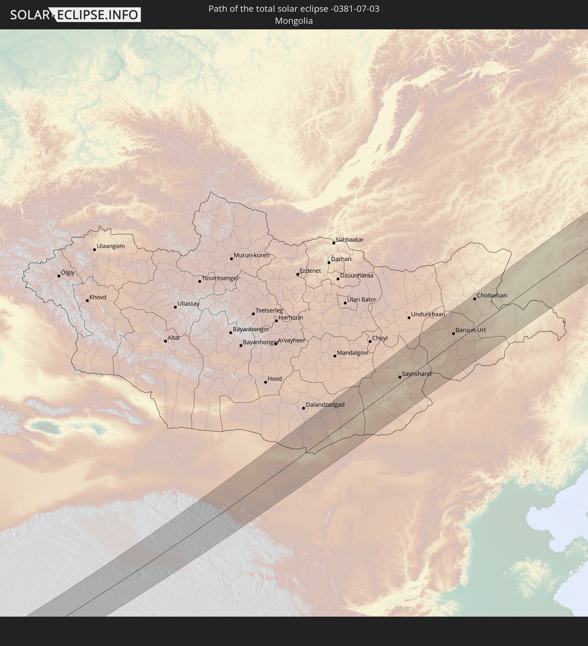 Mongolia
In den folgenden Ländern ist die Sonnenfinsternis partiell zu sehen
 Russia
 United States
 United States Minor Outlying Islands
 Canada
 Mexico
 Greenland
 Iceland
 Svalbard and Jan Mayen
 Norway
 Sweden
 Finland
 Kazakhstan
 Uzbekistan
 Afghanistan
 Pakistan
 Tajikistan
 India
India
 Kyrgyzstan
 China
China
 Nepal
Nepal
 Mongolia
 Bangladesh
 Bhutan
 Myanmar
 Indonesia
 Thailand
 Malaysia
 Laos
Laos
 Vietnam
 Cambodia
 Singapore
 Macau
Macau
 Hong Kong
 Taiwan
 Philippines
 Japan
Japan
 North Korea
 South Korea
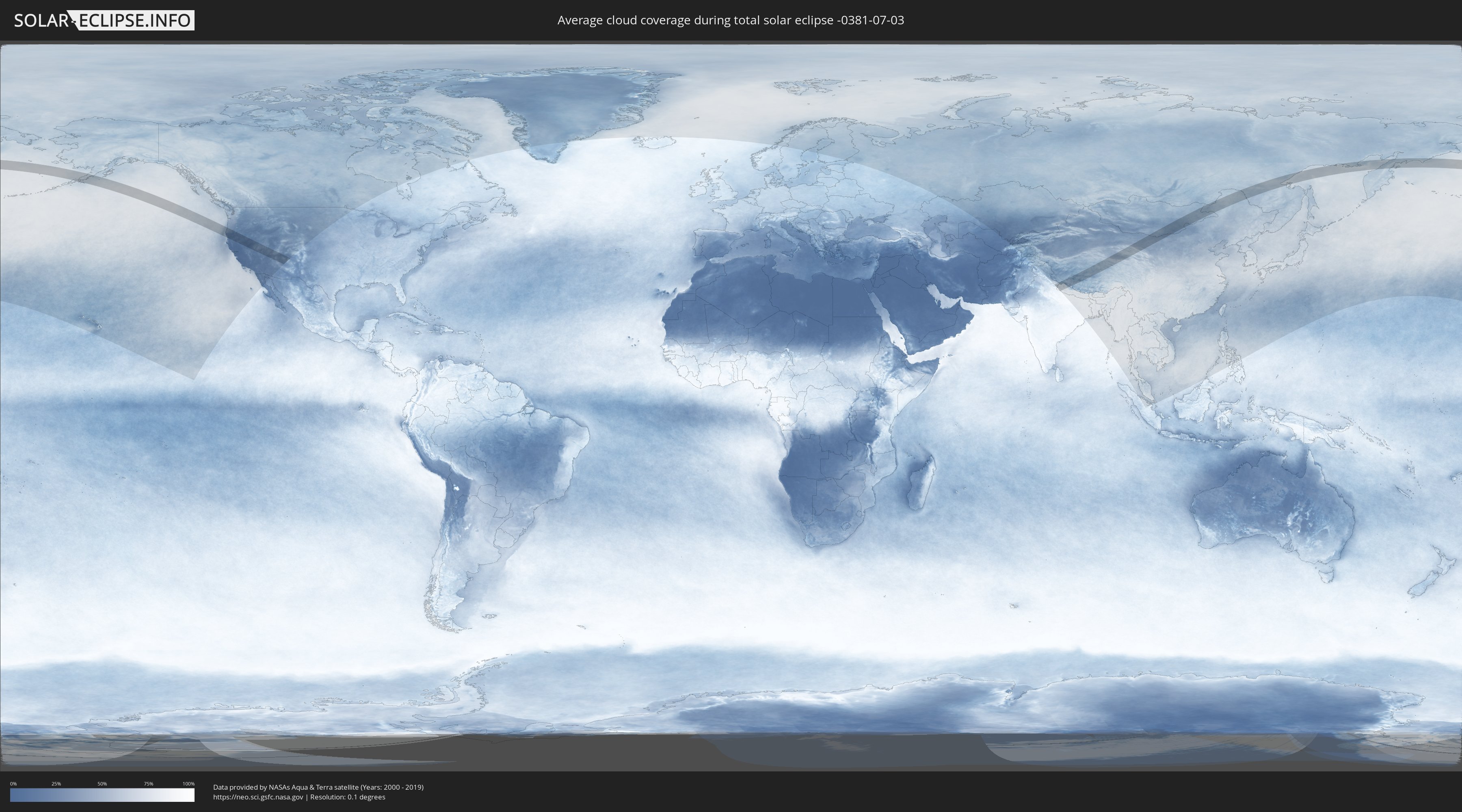
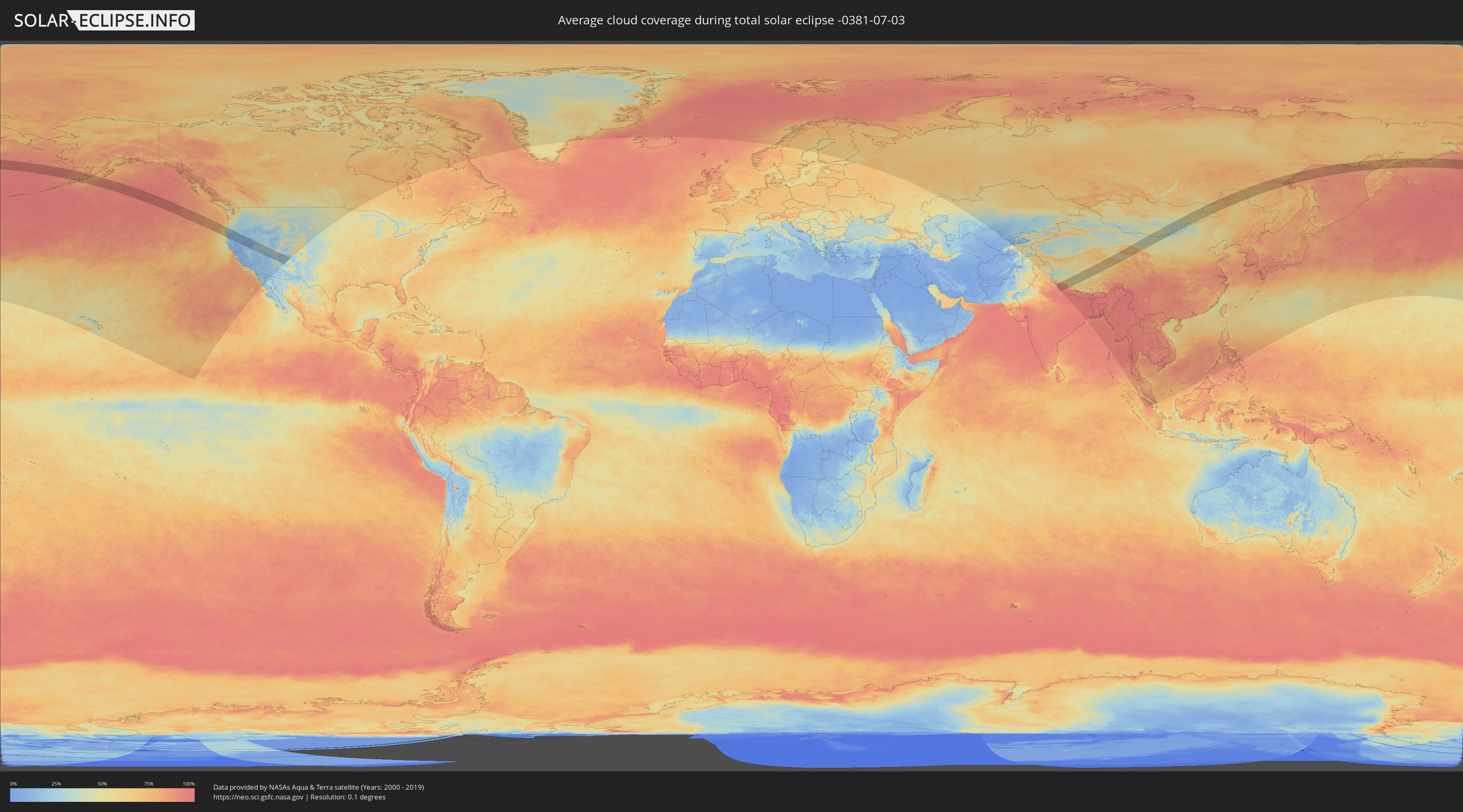
How will be the weather during the total solar eclipse on 07/03/-0381?
Where is the best place to see the total solar eclipse of 07/03/-0381?
The following maps show the average cloud coverage for the day of the total solar eclipse.
With the help of these maps, it is possible to find the place along the eclipse path, which has the best
chance of a cloudless sky.
Nevertheless, you should consider local circumstances and inform about the weather of your chosen
observation site.
The data is provided by NASAs satellites
AQUA and TERRA.
The cloud maps are averaged over a period of 19 years (2000 - 2019).
Detailed country maps
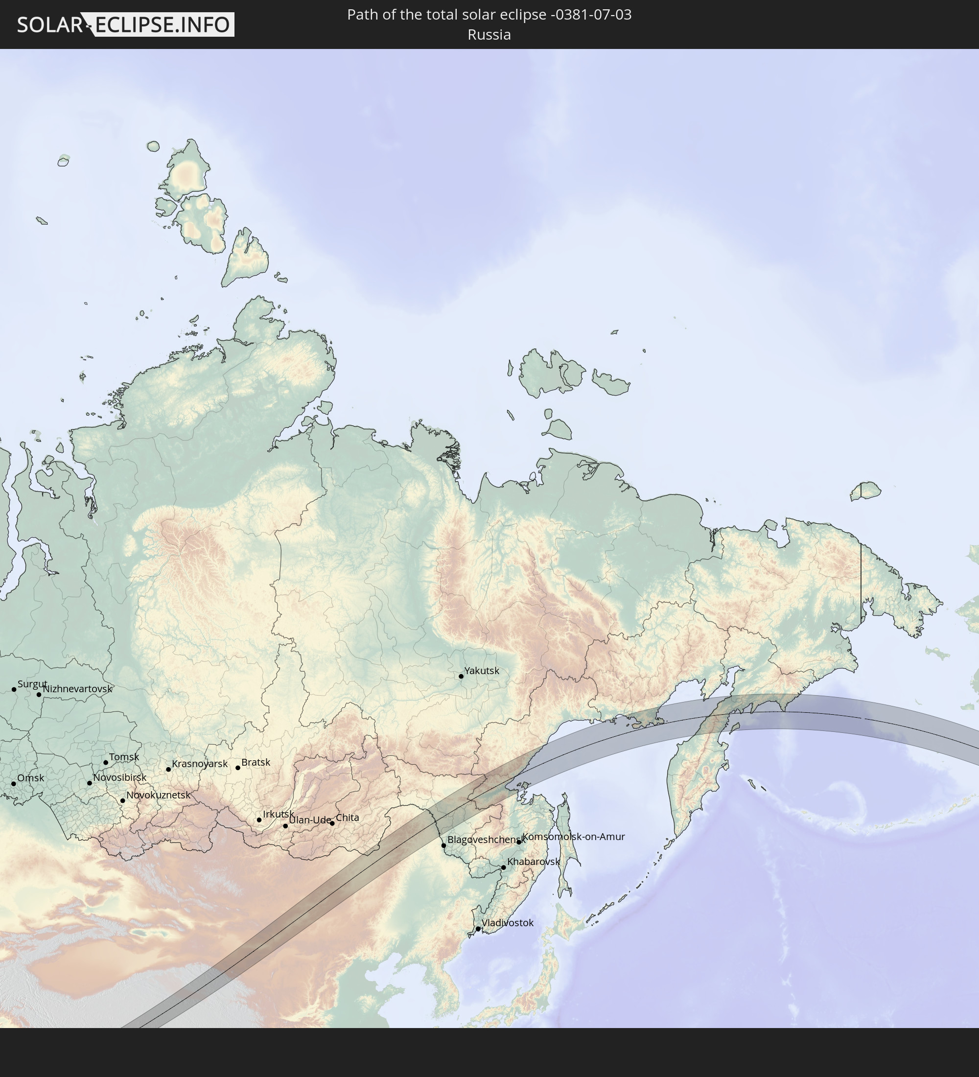
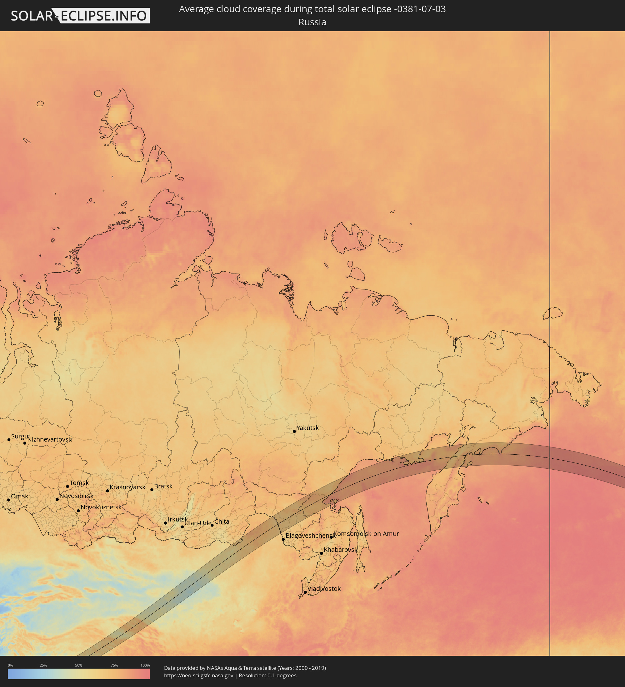 Russia
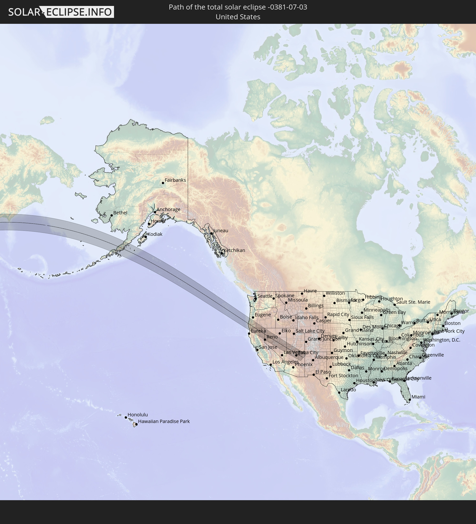
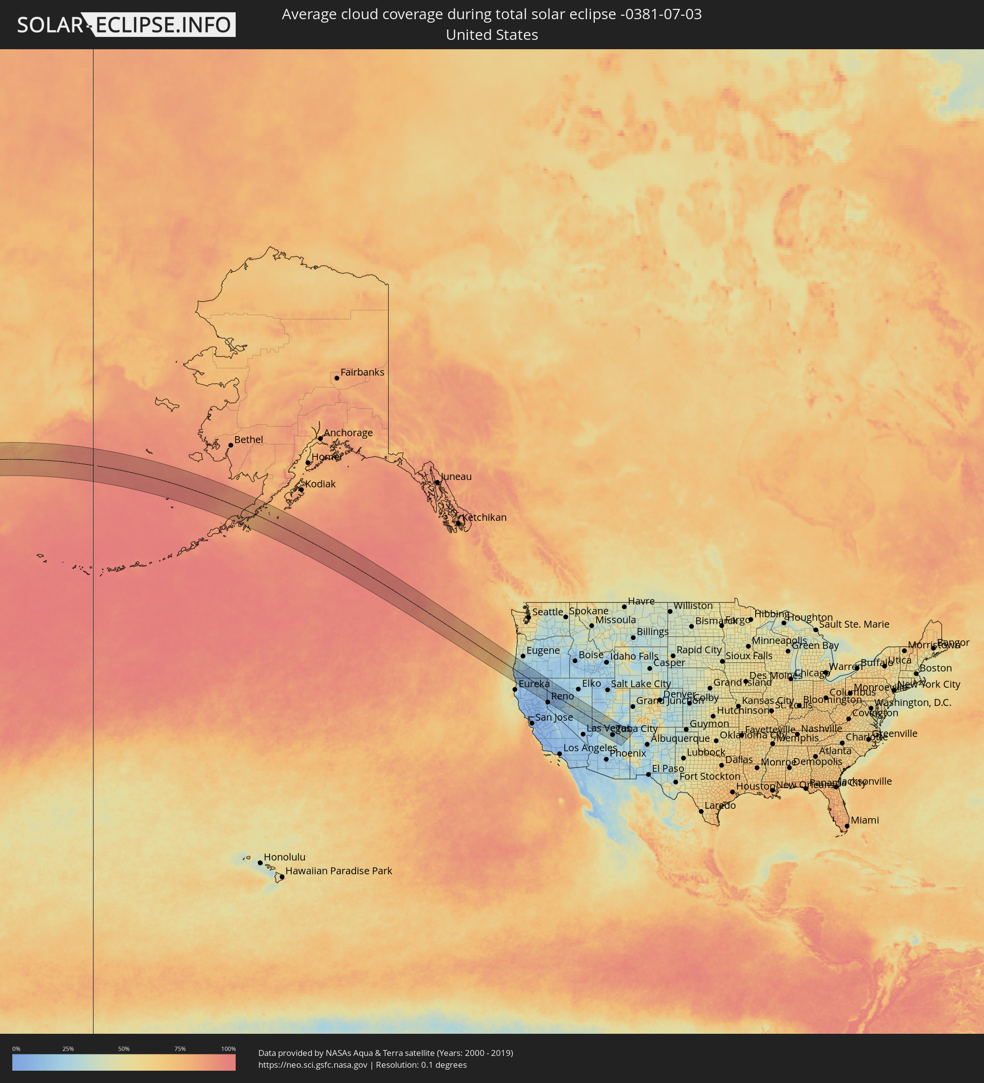 United States
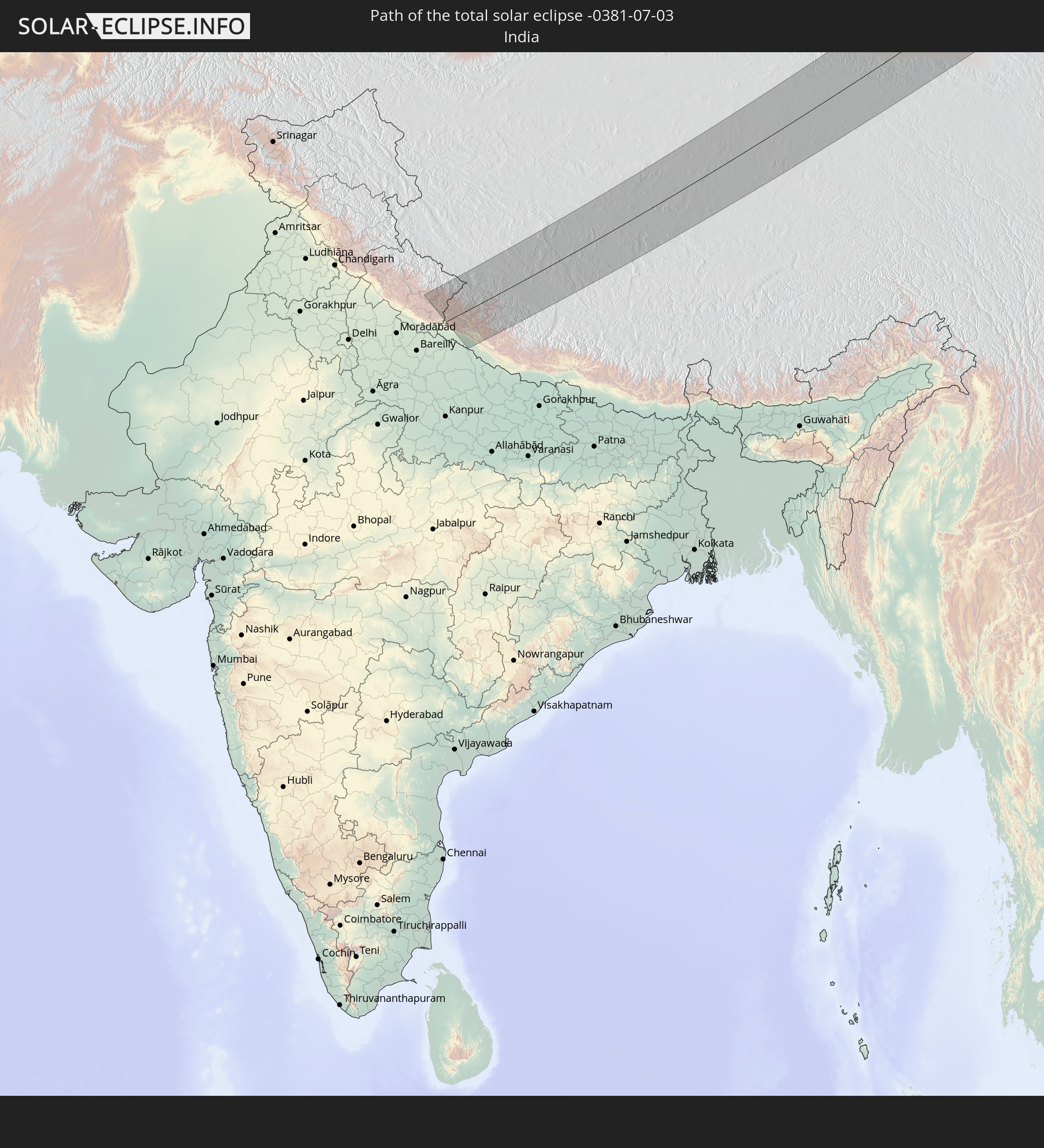
 India
India
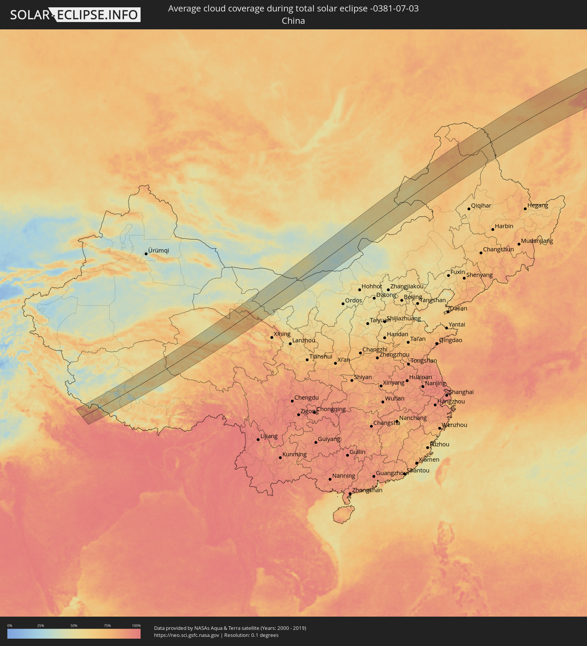 China
China
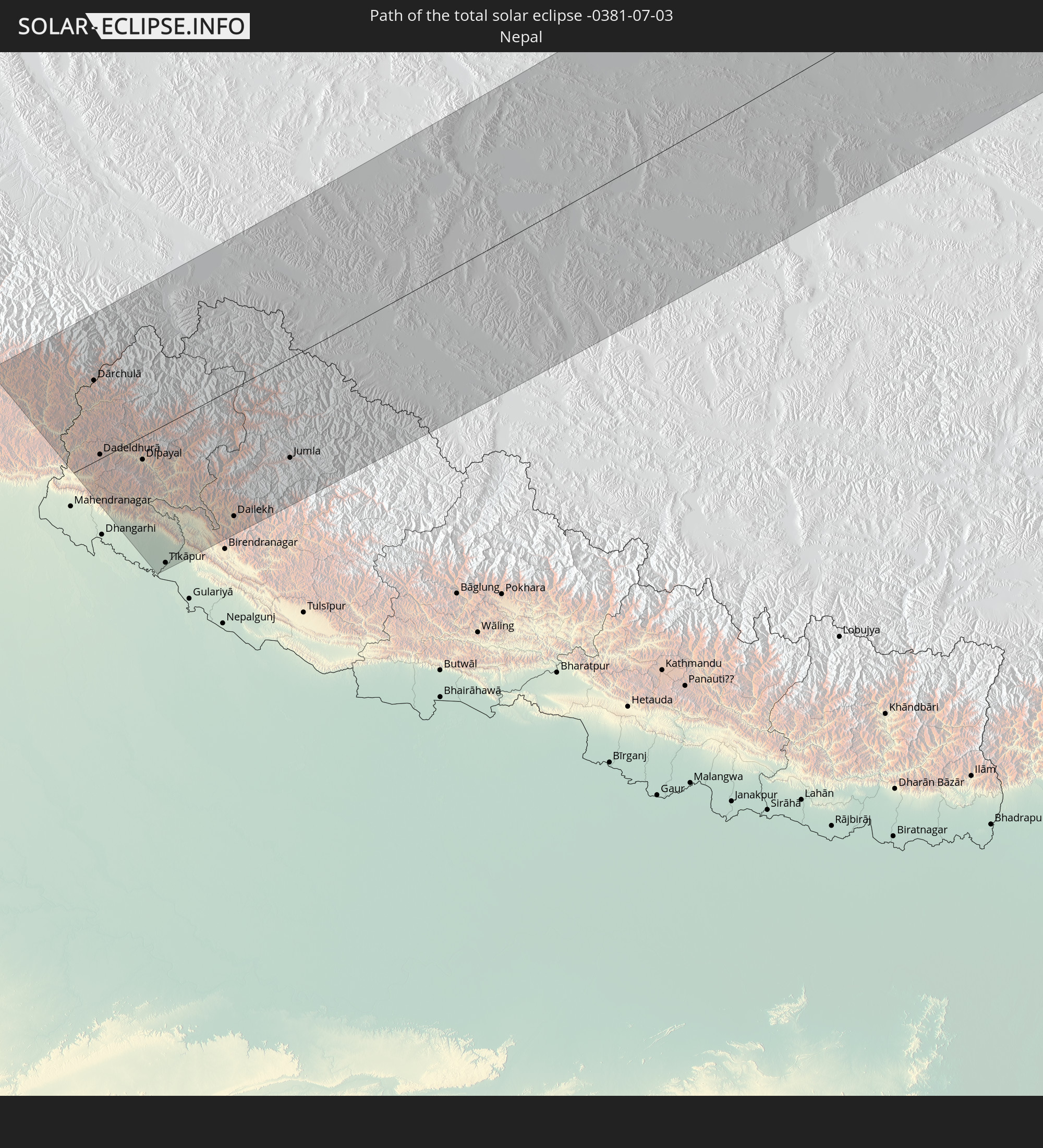
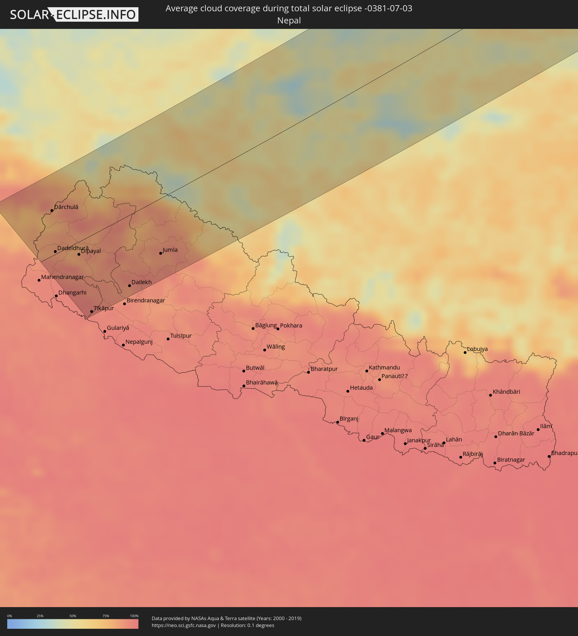 Nepal
Nepal
 Mongolia
Cities inside the path of the eclipse
The following table shows all locations with a population of more than 5,000 inside the eclipse path. Cities which have more than 100,000 inhabitants are marked bold. A click at the locations opens a detailed map.
| City | Type | Eclipse duration | Local time of max. eclipse | Distance to central line | Ø Cloud coverage |
|
Brookings, Oregon
|
total | - | 18:25:50 UTC-08:00 | 73 km | 44% |
|
North Bend, Oregon
|
total | - | 18:24:05 UTC-08:00 | 56 km | 35% |
|
Coos Bay, Oregon
|
total | - | 18:24:08 UTC-08:00 | 53 km | 35% |
|
Crescent City, California
|
total | - | 18:26:12 UTC-08:00 | 97 km | 53% |
|
Green, Oregon
|
total | - | 18:24:19 UTC-08:00 | 72 km | 26% |
|
Roseburg, Oregon
|
total | - | 18:24:14 UTC-08:00 | 78 km | 26% |
|
Grants Pass, Oregon
|
total | - | 18:25:14 UTC-08:00 | 6 km | 12% |
|
Sutherlin, Oregon
|
total | - | 18:24:01 UTC-08:00 | 96 km | 28% |
|
Roseburg North, Oregon
|
total | - | 18:24:10 UTC-08:00 | 84 km | 27% |
|
Central Point, Oregon
|
total | - | 18:25:16 UTC-08:00 | 19 km | 11% |
|
Medford, Oregon
|
total | - | 18:25:19 UTC-08:00 | 16 km | 12% |
|
White City, Oregon
|
total | - | 18:25:11 UTC-08:00 | 27 km | 11% |
|
Eagle Point, Oregon
|
total | - | 18:25:08 UTC-08:00 | 33 km | 11% |
|
Talent, Oregon
|
total | - | 18:25:25 UTC-08:00 | 12 km | 15% |
|
Ashland, Oregon
|
total | - | 18:25:28 UTC-08:00 | 11 km | 14% |
|
Yreka, California
|
total | - | 18:26:02 UTC-08:00 | 28 km | 13% |
|
Klamath Falls, Oregon
|
total | - | 18:25:18 UTC-08:00 | 58 km | 13% |
|
Altamont, Oregon
|
total | - | 18:25:19 UTC-08:00 | 57 km | 11% |
|
Susanville, California
|
total | - | 18:27:20 UTC-08:00 | 68 km | 13% |
|
Cold Springs, Nevada
|
total | - | 18:28:04 UTC-08:00 | 103 km | 15% |
|
Reno, Nevada
|
total | - | 18:28:12 UTC-08:00 | 110 km | 11% |
|
Sun Valley, Nevada
|
total | - | 18:28:07 UTC-08:00 | 102 km | 11% |
|
Spanish Springs, Nevada
|
total | - | 18:28:03 UTC-08:00 | 93 km | 10% |
|
Fernley, Nevada
|
total | - | 18:27:59 UTC-08:00 | 79 km | 12% |
|
Fallon, Nevada
|
total | - | 18:28:02 UTC-08:00 | 68 km | 10% |
|
Ivins, Utah
|
total | - | 19:29:03 UTC-07:00 | 57 km | 16% |
|
Santa Clara, Utah
|
total | - | 19:29:04 UTC-07:00 | 60 km | 15% |
|
Saint George, Utah
|
total | - | 19:29:05 UTC-07:00 | 62 km | 15% |
|
Washington, Utah
|
total | - | 19:29:01 UTC-07:00 | 55 km | 16% |
|
Hurricane, Utah
|
total | - | 19:28:54 UTC-07:00 | 38 km | 17% |
|
Cedar City, Utah
|
total | - | 19:28:17 UTC-07:00 | 29 km | 27% |
|
Enoch, Utah
|
total | - | 19:28:10 UTC-07:00 | 39 km | 28% |
|
Page, Arizona
|
total | - | 19:28:27 UTC-07:00 | 23 km | 23% |
|
Tuba City, Arizona
|
total | - | 19:29:09 UTC-07:00 | 44 km | 23% |
|
Bāgeshwar, Uttarakhand
|
total | - | 05:01:48 UTC+05:21 | 94 km | 77% |
|
Pithorāgarh, Uttarakhand
|
total | - | 05:01:21 UTC+05:21 | 48 km | 81% |
|
Dhārchula, Uttarakhand
|
total | - | 05:01:28 UTC+05:21 | 63 km | 78% |
|
Dārchulā, Western Region
|
total | - | 05:01:28 UTC+05:21 | 62 km | 78% |
|
Dadeldhurā, Far Western
|
total | - | 05:21:00 UTC+05:41 | 11 km | 90% |
|
Dipayal, Far Western
|
total | - | 05:20:48 UTC+05:41 | 23 km | 82% |
|
Tīkāpur, Far Western
|
total | - | 05:19:57 UTC+05:41 | 102 km | 95% |
|
Burang, Tibet Autonomous Region
|
total | - | 07:40:29 UTC+08:00 | 74 km | 52% |
|
Dailekh, Mid Western
|
total | - | 05:20:03 UTC+05:41 | 96 km | 91% |
|
Jumla, Mid Western
|
total | - | 05:20:17 UTC+05:41 | 74 km | 87% |
|
Zhangye, Gansu
|
total | - | 07:47:30 UTC+08:00 | 47 km | 52% |
|
Saynshand, East Gobi Aymag
|
total | - | 07:06:17 UTC+07:07 | 30 km | 37% |
|
Baruun-Urt, Sühbaatar
|
total | - | 07:10:33 UTC+07:07 | 35 km | 51% |
|
Choibalsan, East Aimak
|
total | - | 07:13:27 UTC+07:07 | 103 km | 53% |
|
Zabaykal’sk, Transbaikal Territory
|
total | - | 08:49:01 UTC+08:38 | 124 km | 63% |
|
Manzhouli, Inner Mongolia
|
total | - | 08:10:02 UTC+08:00 | 115 km | 64% |
|
Jalai Nur, Inner Mongolia
|
total | - | 08:09:56 UTC+08:00 | 90 km | 61% |
|
Priargunsk, Transbaikal Territory
|
total | - | 08:51:17 UTC+08:38 | 114 km | 65% |
|
Hailar, Inner Mongolia
|
total | - | 08:10:47 UTC+08:00 | 18 km | 69% |
|
Yakeshi, Inner Mongolia
|
total | - | 08:11:36 UTC+08:00 | 53 km | 66% |
|
Genhe, Inner Mongolia
|
total | - | 08:14:36 UTC+08:00 | 53 km | 74% |
|
Oroqen Zizhiqi, Inner Mongolia
|
total | - | 08:15:52 UTC+08:00 | 56 km | 68% |
|
Jagdaqi, Inner Mongolia
|
total | - | 08:15:56 UTC+08:00 | 83 km | 68% |
|
Tahe, Heilongjiang
|
total | - | 08:19:29 UTC+08:00 | 72 km | 68% |
|
Zeya, Amur
|
total | - | 09:02:41 UTC+08:38 | 113 km | 68% |
|
Shimanovsk, Amur
|
total | - | 09:00:20 UTC+08:38 | 68 km | 65% |
|
Magadan, Magadan
|
total | - | 11:09:31 UTC+10:14 | 104 km | 77% |
|
Ola, Magadan
|
total | - | 11:10:04 UTC+10:14 | 98 km | 86% |