Annular solar eclipse of 09/12/-0488
| Day of week: | Wednesday |
| Maximum duration of eclipse: | 04m30s |
| Maximum width of eclipse path: | 1132 km |
| Saros cycle: | 46 |
| Coverage: | 93.6% |
| Magnitude: | 0.9359 |
| Gamma: | 0.9761 |
Wo kann man die Sonnenfinsternis vom 09/12/-0488 sehen?
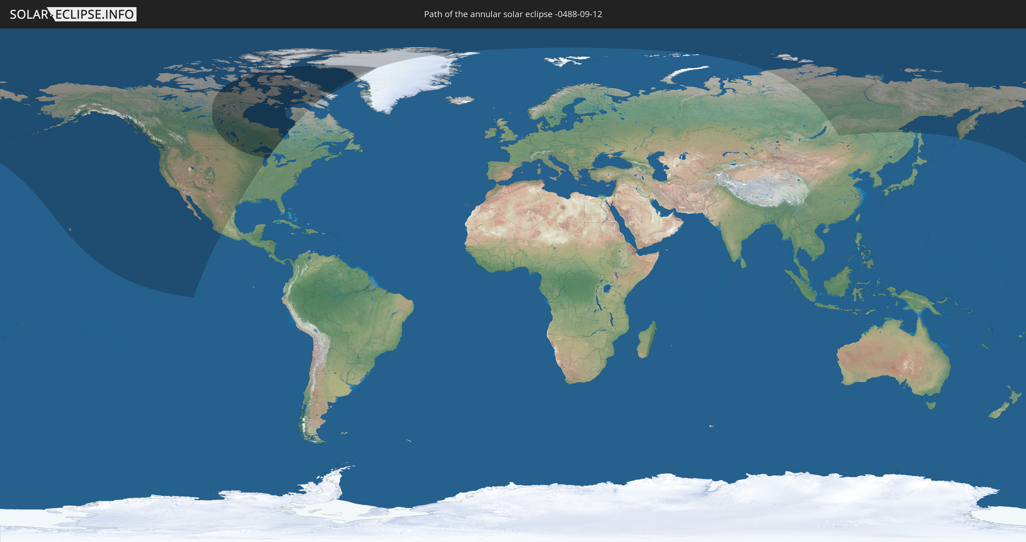
Die Sonnenfinsternis am 09/12/-0488 kann man in 6 Ländern als partielle Sonnenfinsternis beobachten.
Der Finsternispfad verläuft durch 3 Länder. Nur in diesen Ländern ist sie als annular Sonnenfinsternis zu sehen.
In den folgenden Ländern ist die Sonnenfinsternis annular zu sehen
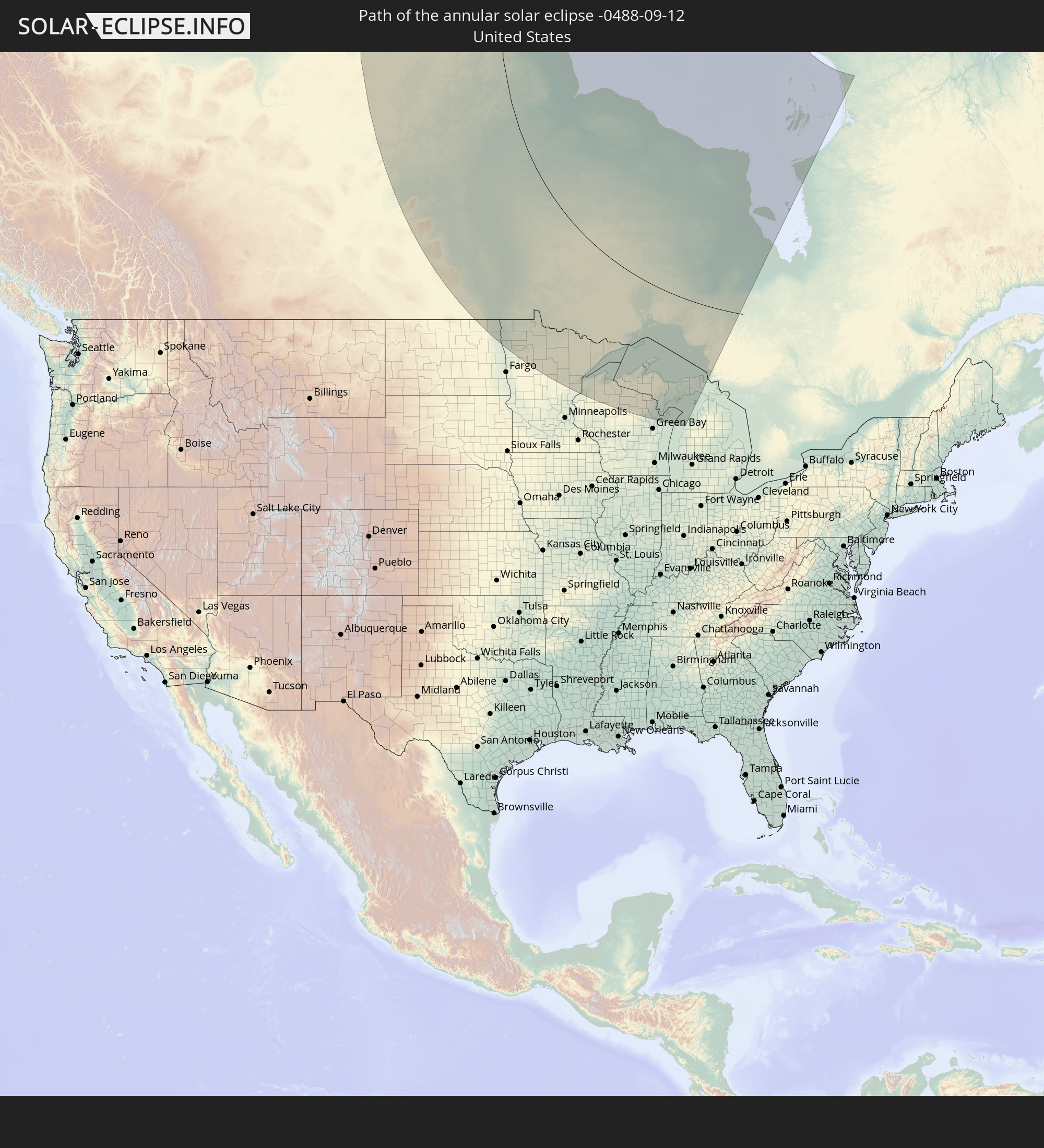 United States
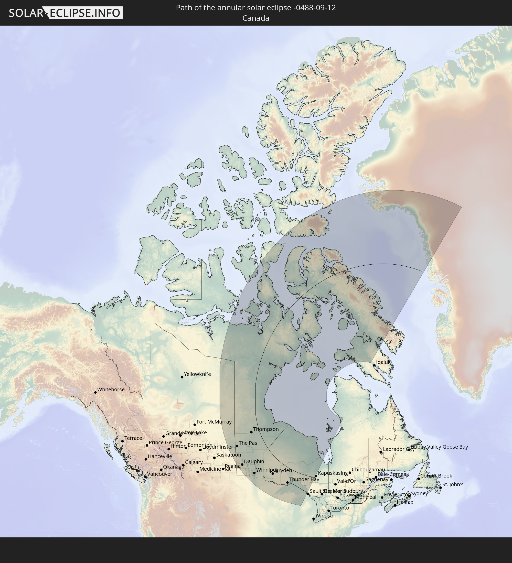 Canada
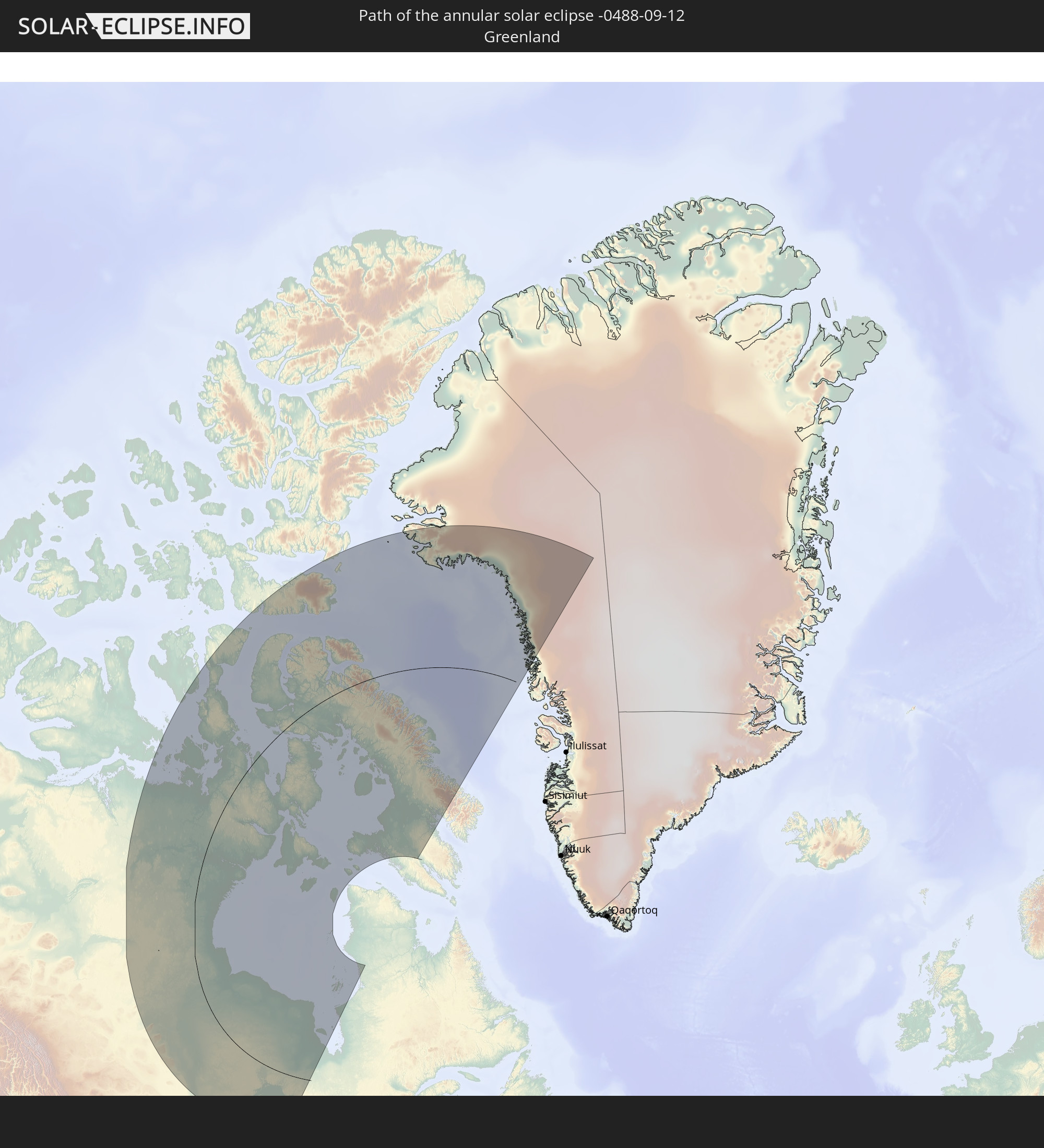 Greenland
In den folgenden Ländern ist die Sonnenfinsternis partiell zu sehen


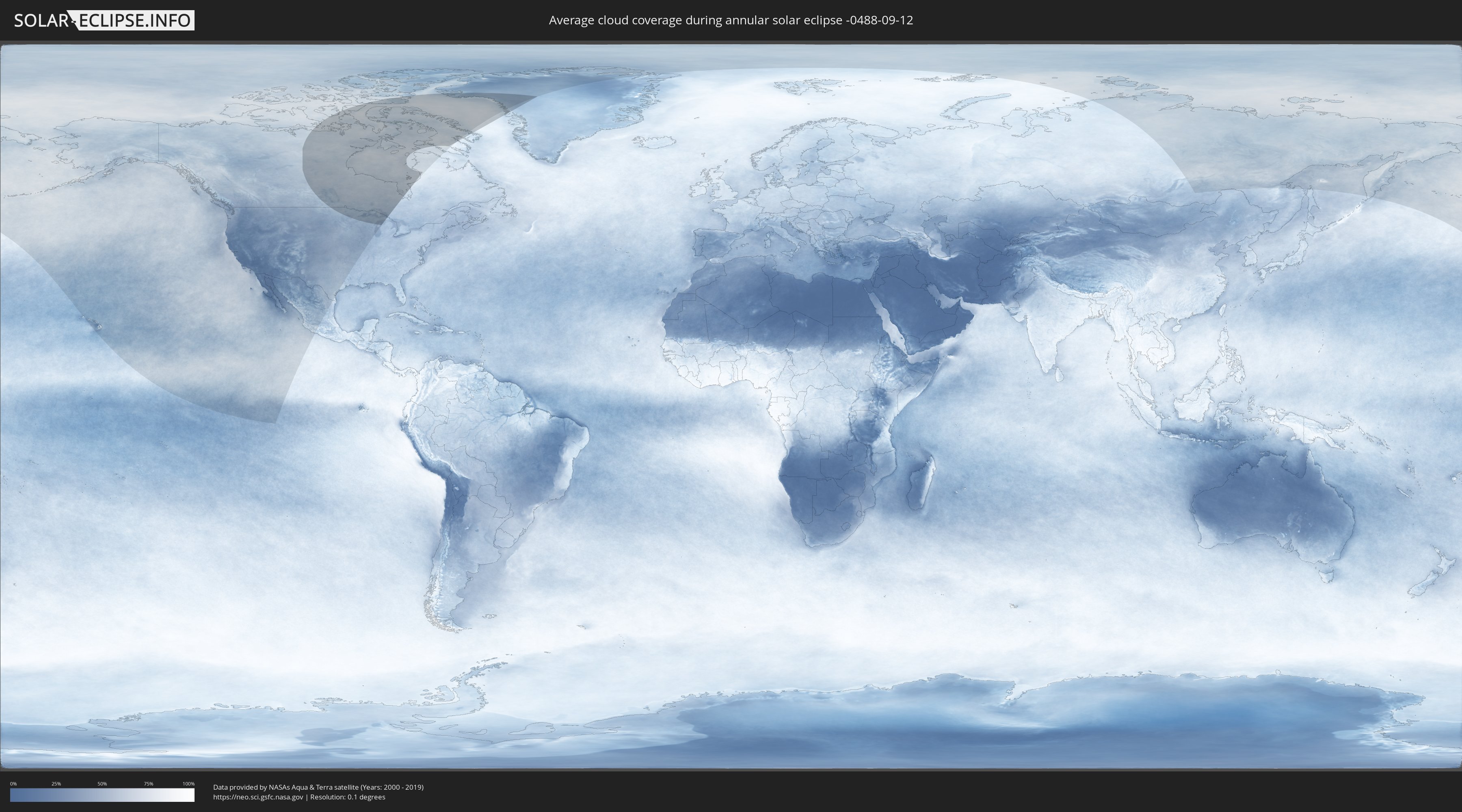
How will be the weather during the annular solar eclipse on 09/12/-0488?
Where is the best place to see the annular solar eclipse of 09/12/-0488?
The following maps show the average cloud coverage for the day of the annular solar eclipse.
With the help of these maps, it is possible to find the place along the eclipse path, which has the best
chance of a cloudless sky.
Nevertheless, you should consider local circumstances and inform about the weather of your chosen
observation site.
The data is provided by NASAs satellites
AQUA and TERRA.
The cloud maps are averaged over a period of 19 years (2000 - 2019).

Detailed country maps
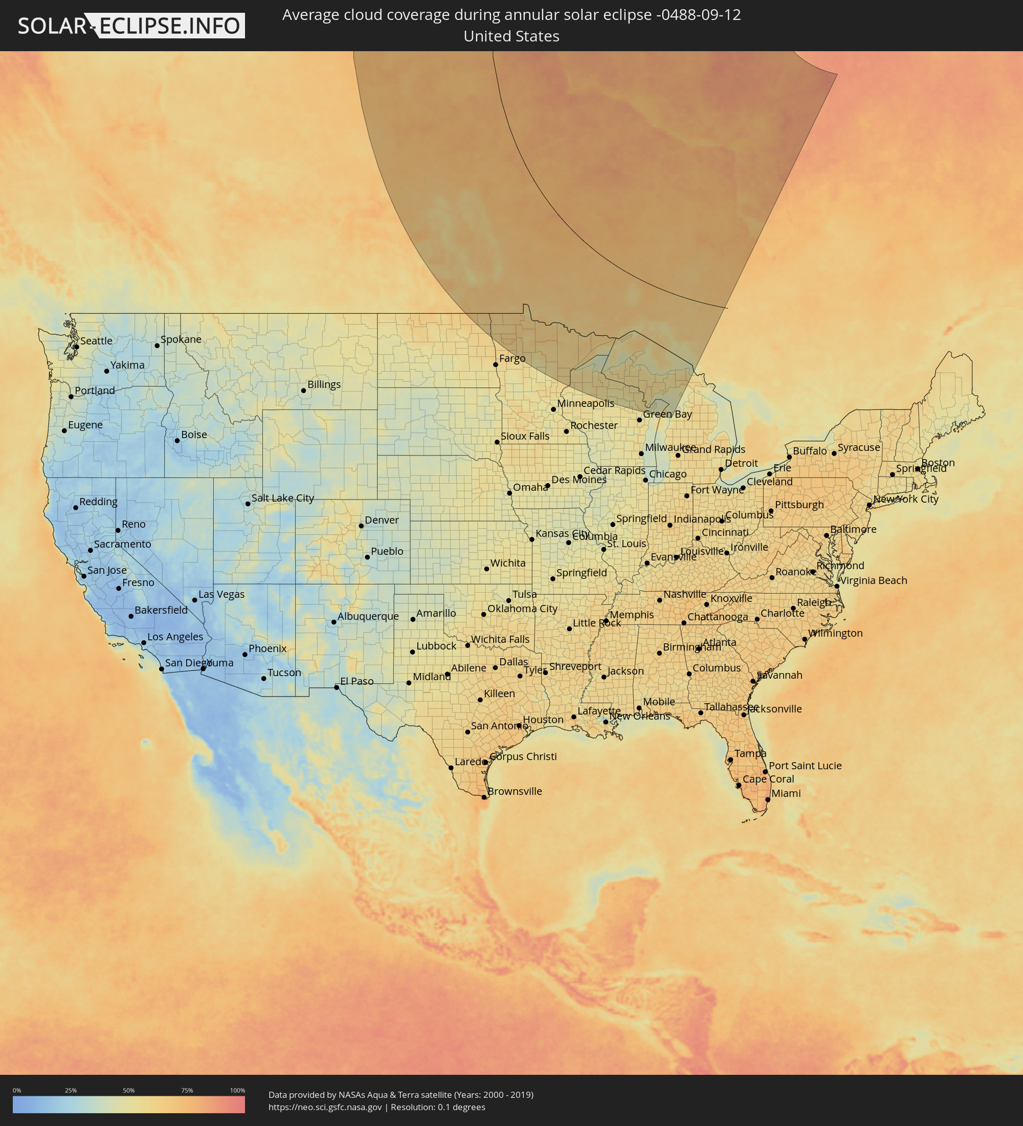 United States
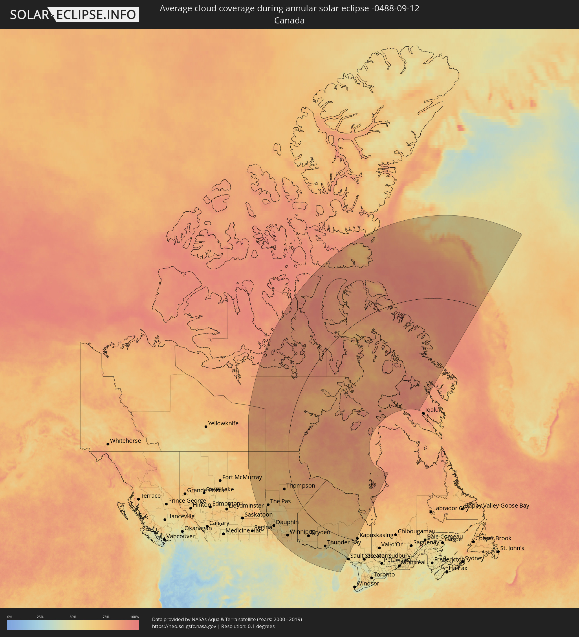 Canada
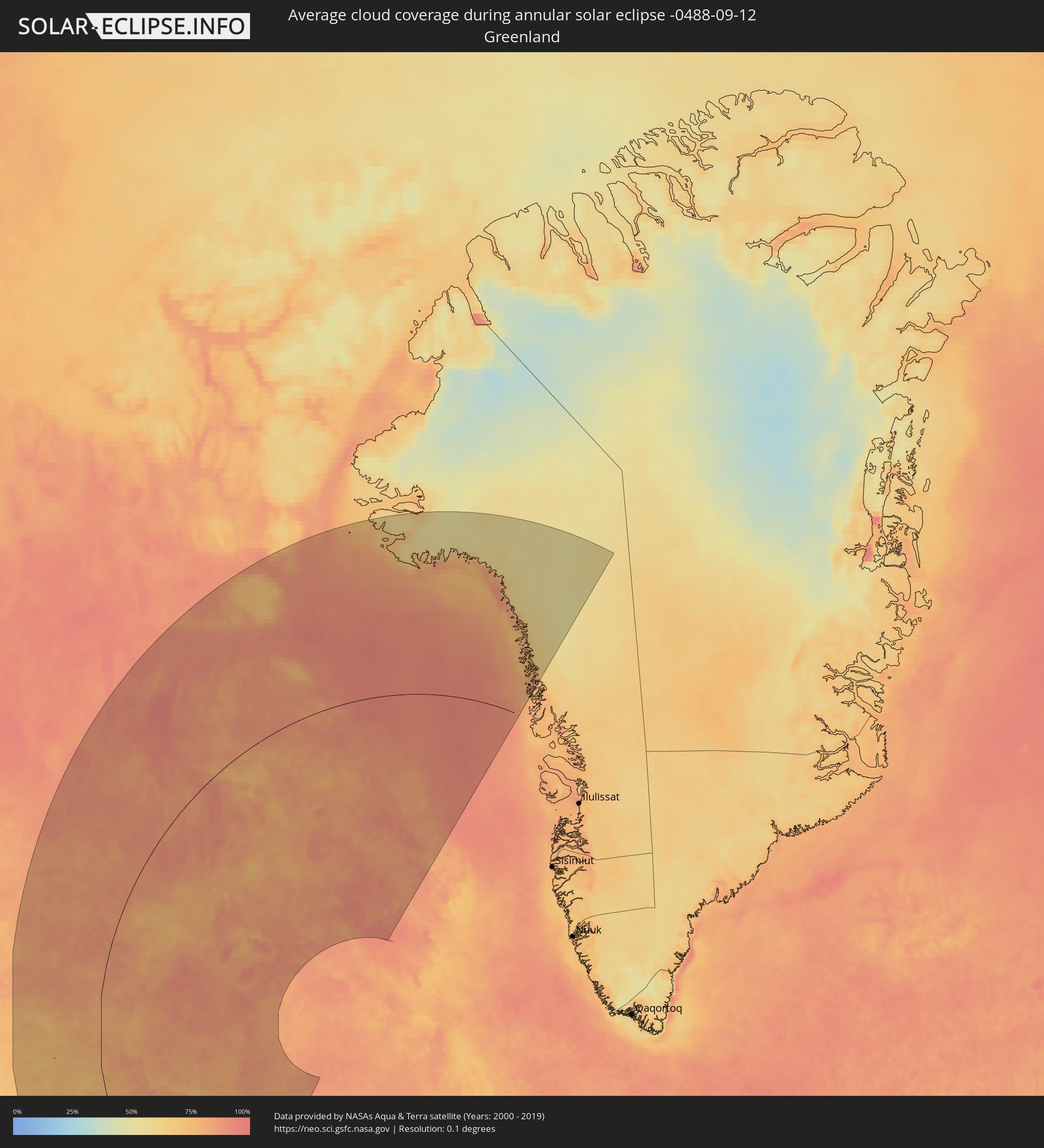 Greenland
Cities inside the path of the eclipse
The following table shows all locations with a population of more than 5,000 inside the eclipse path. Cities which have more than 100,000 inhabitants are marked bold. A click at the locations opens a detailed map.
| City | Type | Eclipse duration | Local time of max. eclipse | Distance to central line | Ø Cloud coverage |
 Flin Flon, Manitoba
|
annular | - | 17:48:56 UTC-06:00 | 392 km | 71% |
|
The Pas, Manitoba
|
annular | - | 17:51:01 UTC-06:00 | 401 km | 72% |
|
Dauphin, Manitoba
|
annular | - | 17:56:45 UTC-06:00 | 491 km | 69% |
|
Portage la Prairie, Manitoba
|
annular | - | 17:59:20 UTC-06:00 | 482 km | 68% |
|
Morden, Manitoba
|
annular | - | 18:00:57 UTC-06:00 | 534 km | 63% |
|
Winkler, Manitoba
|
annular | - | 18:00:59 UTC-06:00 | 526 km | 64% |
|
Thompson, Manitoba
|
annular | - | 17:47:28 UTC-06:00 | 116 km | 75% |
|
Winnipeg, Manitoba
|
annular | - | 17:59:35 UTC-06:00 | 430 km | 70% |
|
Selkirk, Manitoba
|
annular | - | 17:59:05 UTC-06:00 | 397 km | 67% |
|
Steinbach, Manitoba
|
annular | - | 18:00:20 UTC-06:00 | 436 km | 67% |
 Crookston, Minnesota
|
annular | - | 18:03:52 UTC-06:00 | 581 km | 60% |
|
Thief River Falls, Minnesota
|
annular | - | 18:03:11 UTC-06:00 | 531 km | 63% |
|
Bemidji, Minnesota
|
annular | - | 18:04:28 UTC-06:00 | 532 km | 59% |
|
Grand Rapids, Minnesota
|
annular | - | 18:04:53 UTC-06:00 | 499 km | 58% |
|
International Falls, Minnesota
|
annular | - | 18:02:11 UTC-06:00 | 367 km | 61% |
|
Fort Frances, Ontario
|
annular | - | 18:02:12 UTC-06:00 | 366 km | 61% |
|
Hibbing, Minnesota
|
annular | - | 18:04:29 UTC-06:00 | 458 km | 62% |
|
Dryden, Ontario
|
annular | - | 17:59:50 UTC-06:00 | 232 km | 66% |
|
Virginia, Minnesota
|
annular | - | 18:04:16 UTC-06:00 | 433 km | 59% |
|
Cloquet, Minnesota
|
annular | - | 18:05:49 UTC-06:00 | 508 km | 58% |
|
Hermantown, Minnesota
|
annular | - | 18:05:38 UTC-06:00 | 492 km | 58% |
|
Duluth, Minnesota
|
annular | - | 18:05:40 UTC-06:00 | 490 km | 55% |
|
Superior, Wisconsin
|
annular | - | 18:05:48 UTC-06:00 | 496 km | 54% |
|
Ashland, Wisconsin
|
annular | - | 18:05:55 UTC-06:00 | 467 km | 55% |
|
Ironwood, Michigan
|
annular | - | 18:06:06 UTC-06:00 | 458 km | 56% |
|
Rhinelander, Wisconsin
|
annular | - | 18:07:33 UTC-06:00 | 521 km | 50% |
|
Thunder Bay, Ontario
|
annular | - | 19:02:18 UTC-05:00 | 234 km | 63% |
|
Iron River, Michigan
|
annular | - | 18:06:35 UTC-06:00 | 452 km | 55% |
|
Houghton, Michigan
|
annular | - | 19:04:38 UTC-05:00 | 343 km | 55% |
|
Kingsford, Michigan
|
annular | - | 18:07:03 UTC-06:00 | 469 km | 56% |
|
Iron Mountain, Michigan
|
annular | - | 18:07:00 UTC-06:00 | 466 km | 56% |
|
Ishpeming, Michigan
|
annular | - | 19:05:41 UTC-05:00 | 386 km | 55% |
|
Marinette, Wisconsin
|
annular | - | 18:08:16 UTC-06:00 | 533 km | 49% |
|
Menominee, Michigan
|
annular | - | 18:08:15 UTC-06:00 | 531 km | 49% |
|
Marquette, Michigan
|
annular | - | 19:05:32 UTC-05:00 | 374 km | 55% |
|
Sturgeon Bay, Wisconsin
|
annular | - | 18:08:42 UTC-06:00 | 556 km | 50% |
|
Escanaba, Michigan
|
annular | - | 19:06:58 UTC-05:00 | 451 km | 48% |
|
Kapuskasing, Ontario
|
annular | - | 18:59:13 UTC-05:00 | 30 km | 66% |