Total solar eclipse of 03/09/-0506
| Day of week: | Wednesday |
| Maximum duration of eclipse: | 03m59s |
| Maximum width of eclipse path: | 288 km |
| Saros cycle: | 41 |
| Coverage: | 100% |
| Magnitude: | 1.0594 |
| Gamma: | -0.7454 |
Wo kann man die Sonnenfinsternis vom 03/09/-0506 sehen?
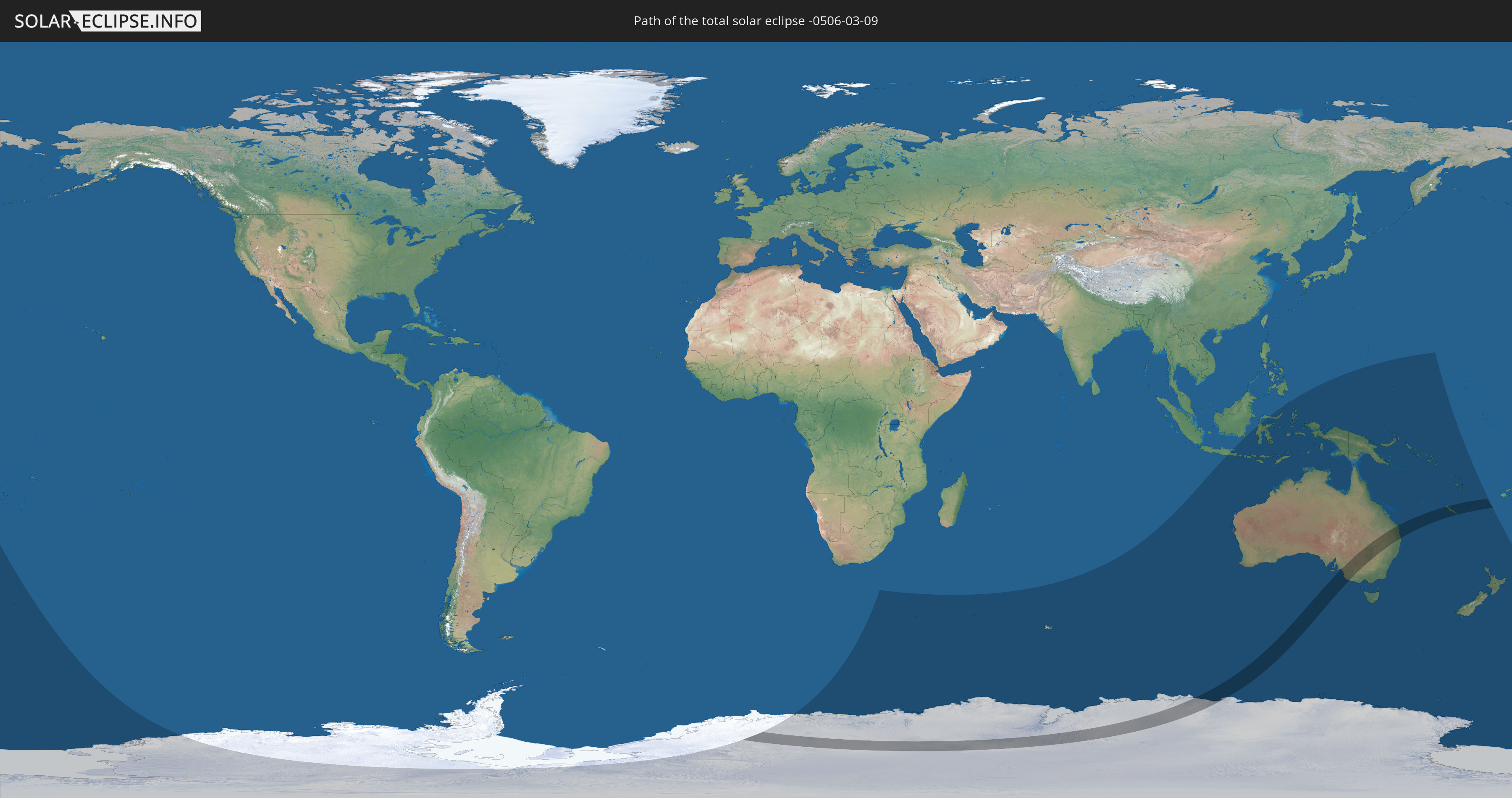
Die Sonnenfinsternis am 03/09/-0506 kann man in 15 Ländern als partielle Sonnenfinsternis beobachten.
Der Finsternispfad verläuft durch 4 Länder. Nur in diesen Ländern ist sie als total Sonnenfinsternis zu sehen.
In den folgenden Ländern ist die Sonnenfinsternis total zu sehen
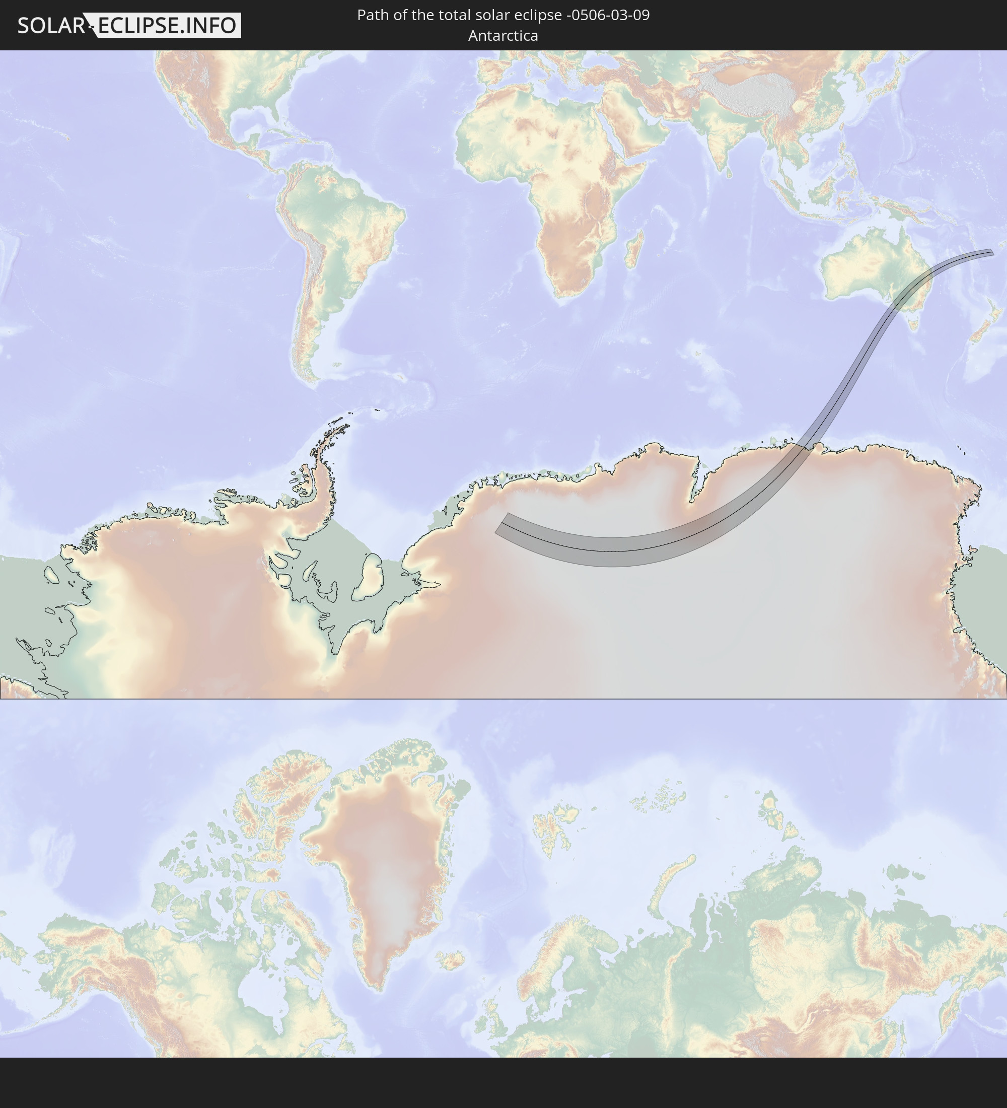 Antarctica
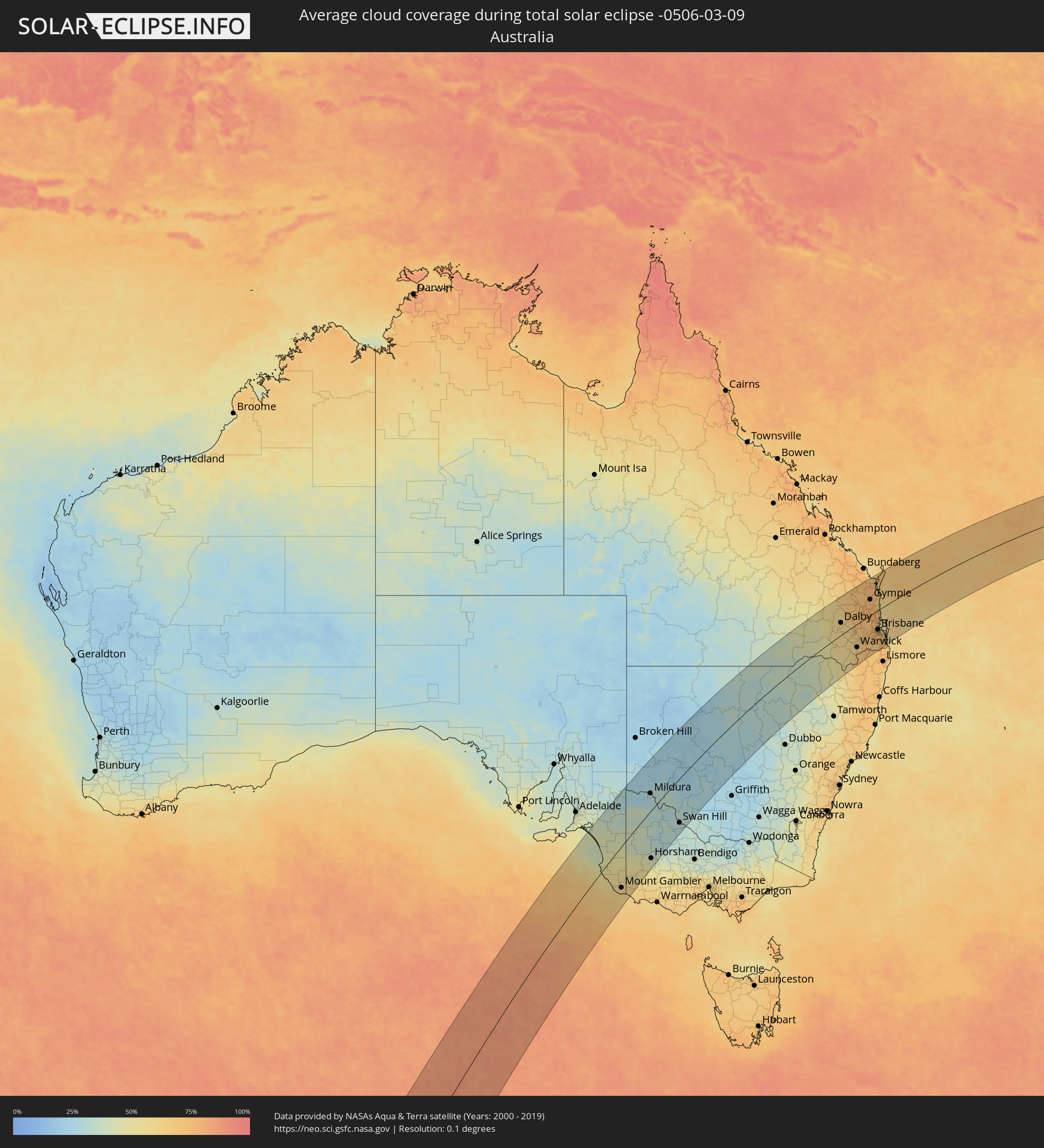
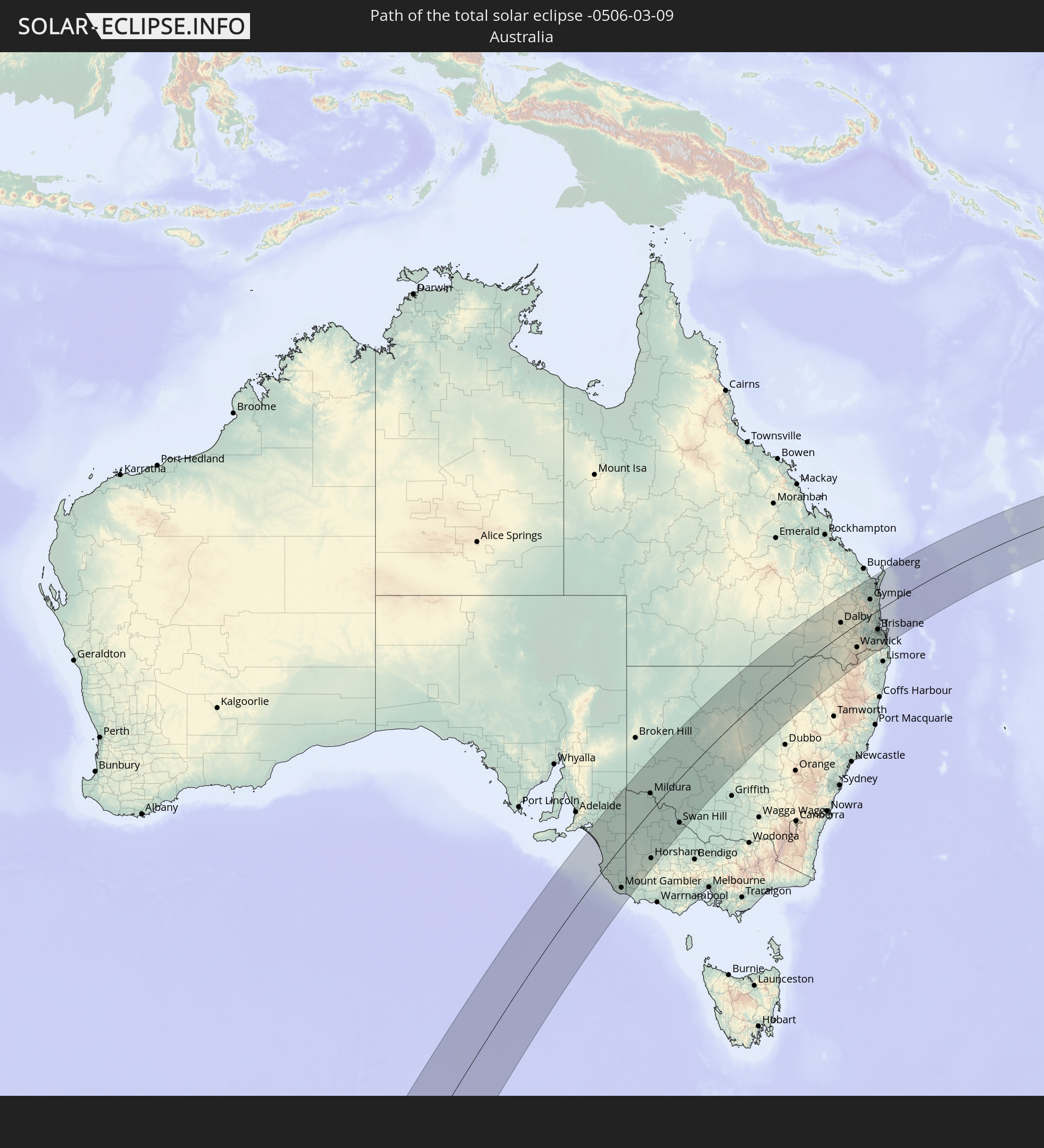 Australia
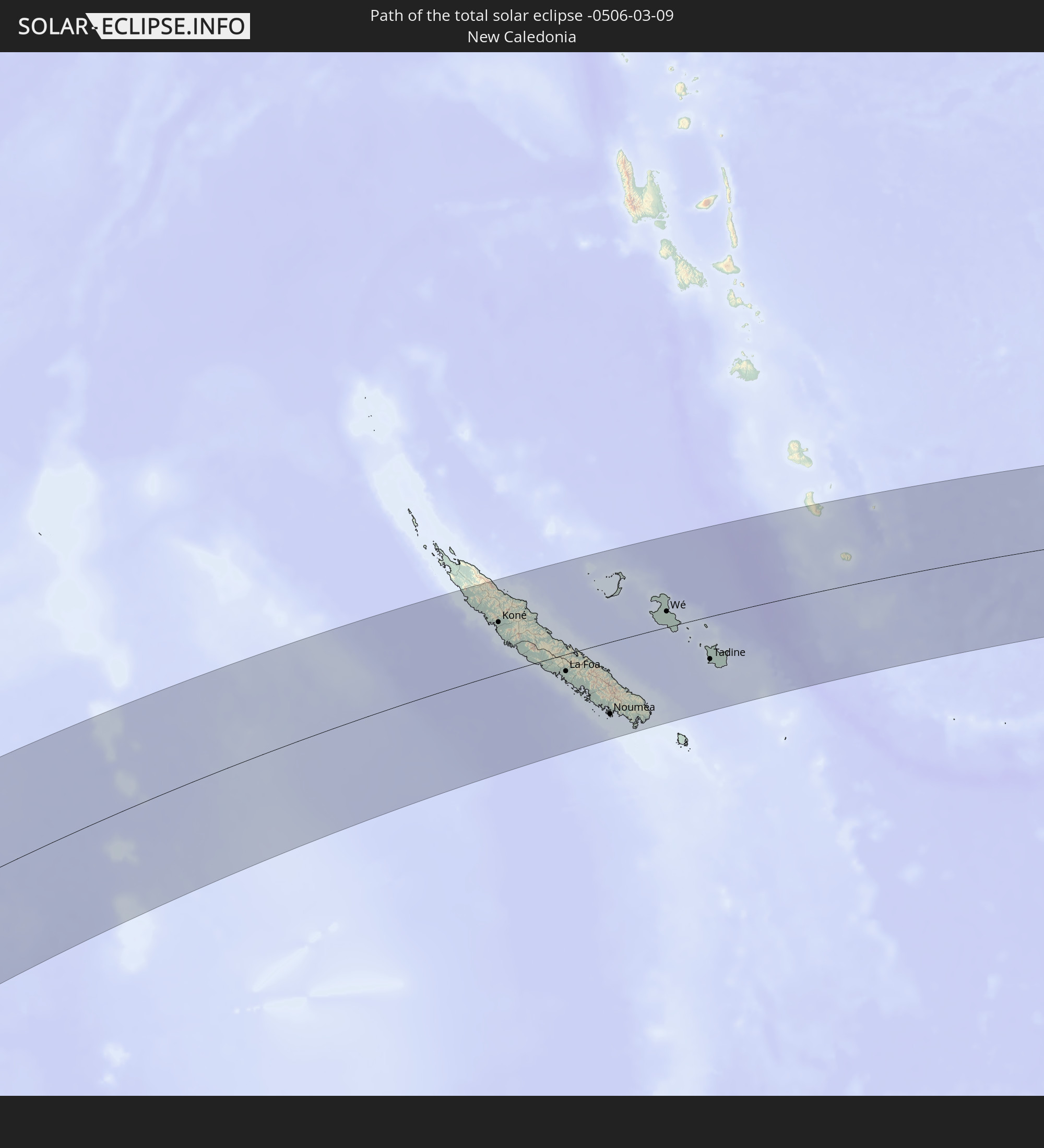 New Caledonia
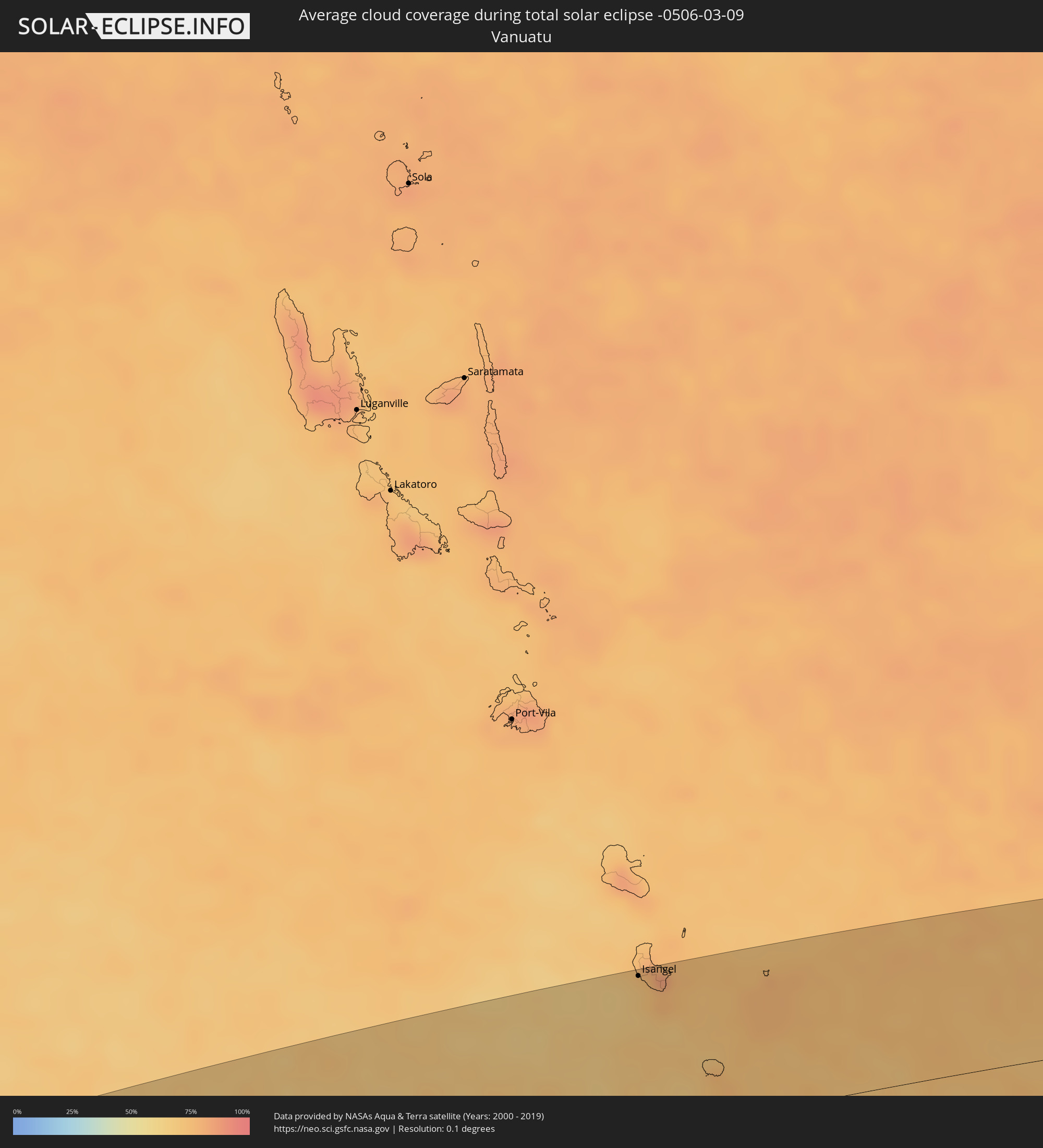
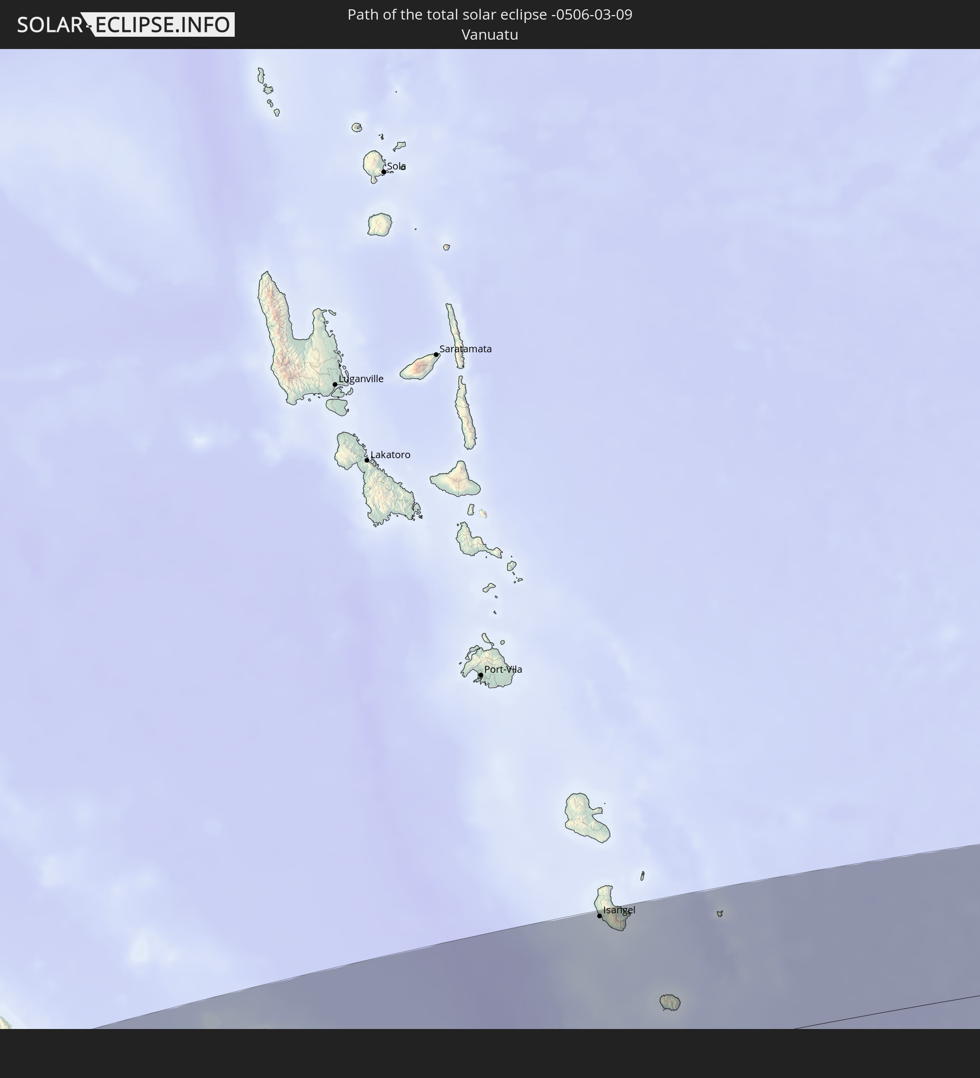 Vanuatu
In den folgenden Ländern ist die Sonnenfinsternis partiell zu sehen


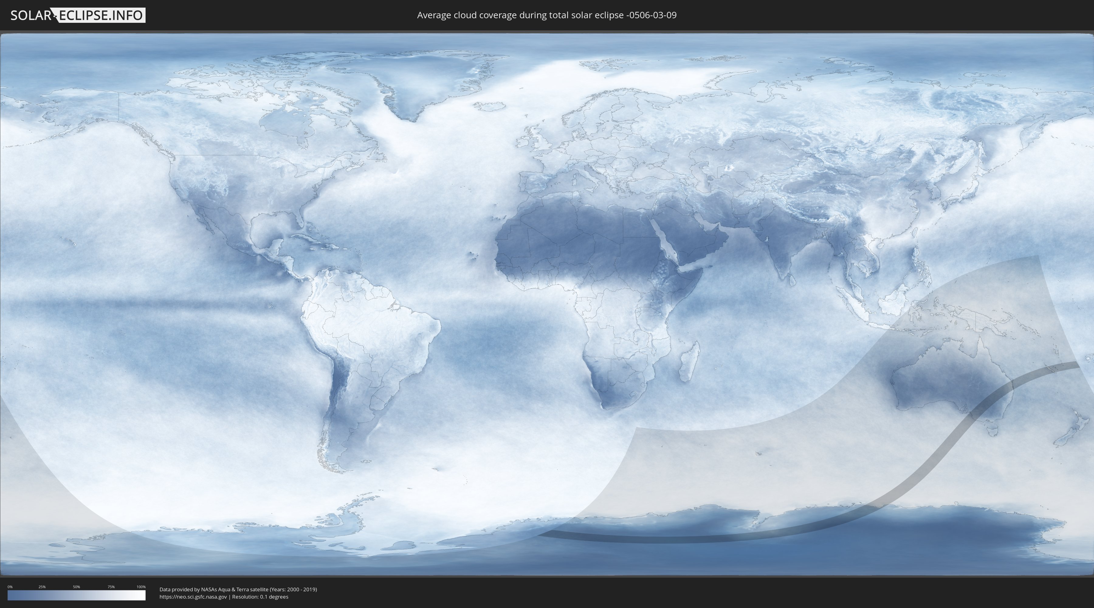
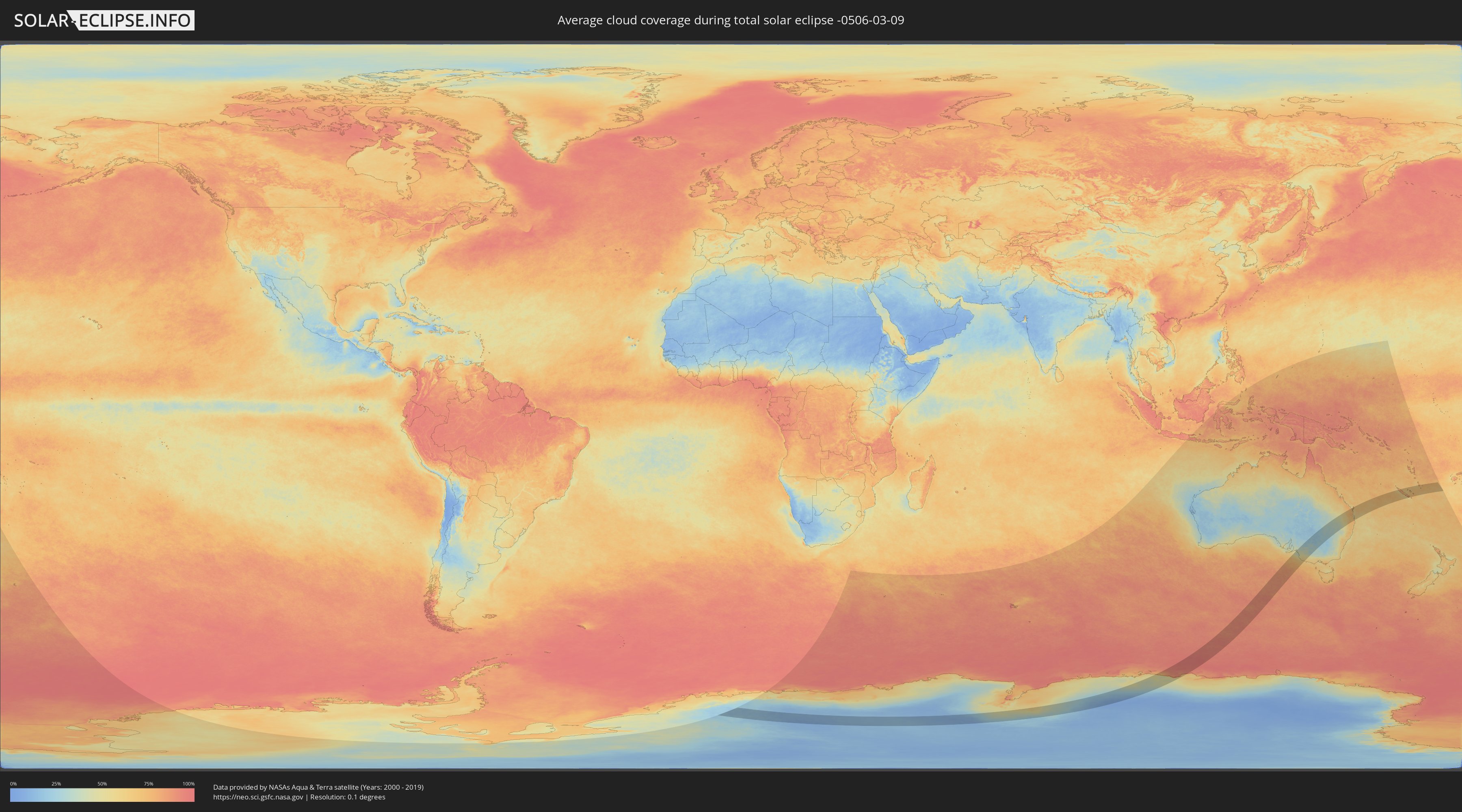
How will be the weather during the total solar eclipse on 03/09/-0506?
Where is the best place to see the total solar eclipse of 03/09/-0506?
The following maps show the average cloud coverage for the day of the total solar eclipse.
With the help of these maps, it is possible to find the place along the eclipse path, which has the best
chance of a cloudless sky.
Nevertheless, you should consider local circumstances and inform about the weather of your chosen
observation site.
The data is provided by NASAs satellites
AQUA and TERRA.
The cloud maps are averaged over a period of 19 years (2000 - 2019).
Detailed country maps
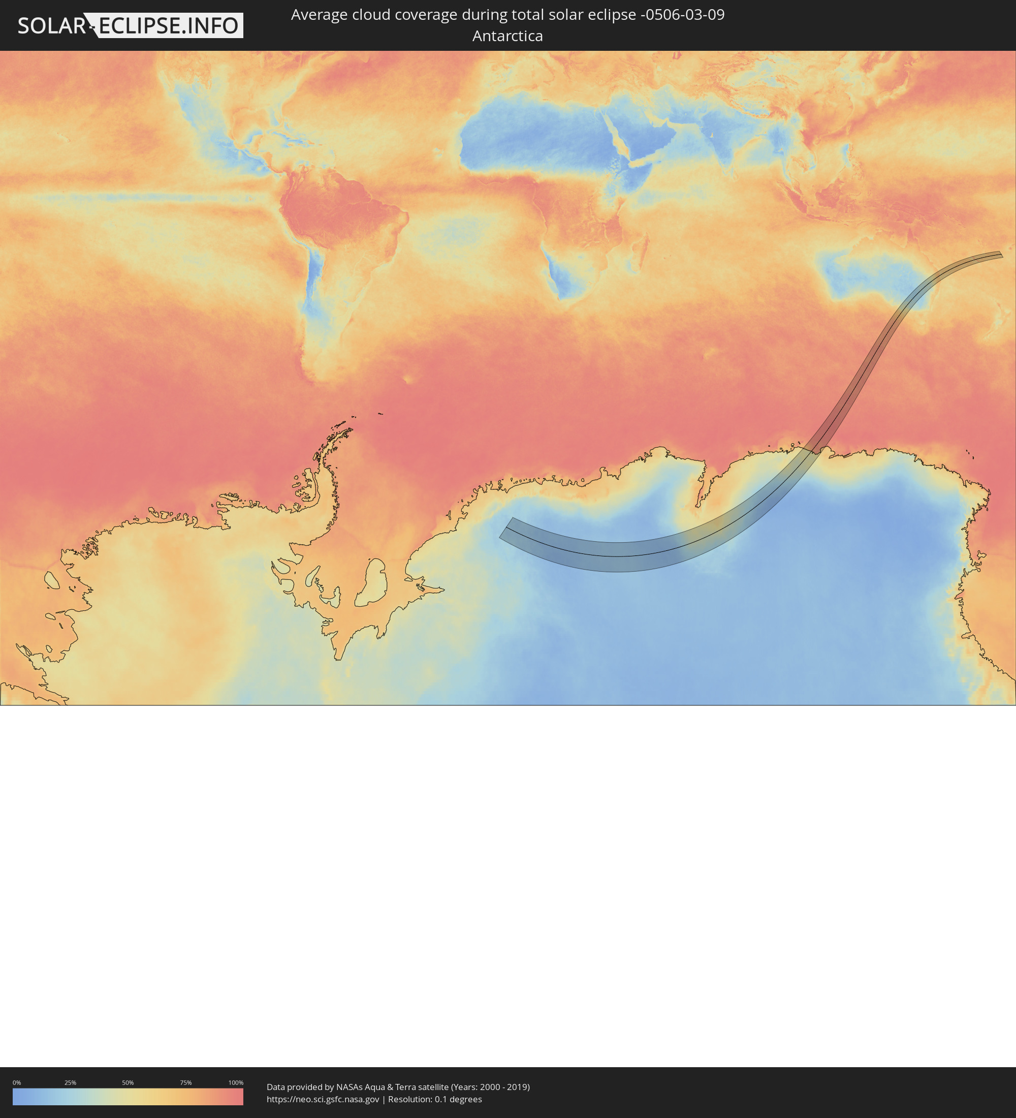 Antarctica
 Australia
 New Caledonia
 Vanuatu
Cities inside the path of the eclipse
The following table shows all locations with a population of more than 5,000 inside the eclipse path. Cities which have more than 100,000 inhabitants are marked bold. A click at the locations opens a detailed map.
| City | Type | Eclipse duration | Local time of max. eclipse | Distance to central line | Ø Cloud coverage |
 Mount Gambier, South Australia
|
total | - | 15:32:31 UTC+09:30 | 108 km | 63% |
|
Mildura, Victoria
|
total | - | 16:10:36 UTC+10:00 | 52 km | 32% |
|
Horsham, Victoria
|
total | - | 16:05:48 UTC+10:00 | 131 km | 43% |
|
Swan Hill, Victoria
|
total | - | 16:09:28 UTC+10:00 | 129 km | 33% |
|
Narrabri, New South Wales
|
total | - | 16:22:59 UTC+10:00 | 144 km | 35% |
|
Moree, New South Wales
|
total | - | 16:24:36 UTC+10:00 | 73 km | 37% |
|
Dalby, Queensland
|
total | - | 16:29:26 UTC+10:00 | 48 km | 59% |
|
Kingaroy, Queensland
|
total | - | 16:30:50 UTC+10:00 | 75 km | 70% |
|
Toowoomba, Queensland
|
total | - | 16:29:06 UTC+10:00 | 25 km | 67% |
|
Rangeville, Queensland
|
total | - | 16:29:04 UTC+10:00 | 29 km | 67% |
|
Warwick, Queensland
|
total | - | 16:27:59 UTC+10:00 | 90 km | 62% |
|
Gatton, Queensland
|
total | - | 16:29:16 UTC+10:00 | 43 km | 69% |
|
Gympie, Queensland
|
total | - | 16:31:50 UTC+10:00 | 63 km | 75% |
|
Maryborough, Queensland
|
total | - | 16:32:58 UTC+10:00 | 122 km | 74% |
|
Brassall, Queensland
|
total | - | 16:29:25 UTC+10:00 | 73 km | 71% |
|
Raceview, Queensland
|
total | - | 16:29:22 UTC+10:00 | 78 km | 73% |
|
Booval, Queensland
|
total | - | 16:29:24 UTC+10:00 | 76 km | 73% |
|
Redbank Plains, Queensland
|
total | - | 16:29:23 UTC+10:00 | 83 km | 74% |
|
Samford Valley, Queensland
|
total | - | 16:29:52 UTC+10:00 | 58 km | 73% |
|
Goodna, Queensland
|
total | - | 16:29:28 UTC+10:00 | 82 km | 74% |
|
Urangan, Queensland
|
total | - | 16:33:29 UTC+10:00 | 135 km | 67% |
|
Springfield, Queensland
|
total | - | 16:29:24 UTC+10:00 | 87 km | 73% |
|
Ferny Hills, Queensland
|
total | - | 16:29:51 UTC+10:00 | 64 km | 73% |
|
Caboolture, Queensland
|
total | - | 16:30:24 UTC+10:00 | 36 km | 59% |
|
Burpengary, Queensland
|
total | - | 16:30:17 UTC+10:00 | 43 km | 63% |
|
Nambour, Queensland
|
total | - | 16:31:12 UTC+10:00 | 6 km | 74% |
|
Taringa, Queensland
|
total | - | 16:29:43 UTC+10:00 | 75 km | 73% |
|
Everton Park, Queensland
|
total | - | 16:29:52 UTC+10:00 | 68 km | 72% |
|
Strathpine, Queensland
|
total | - | 16:30:02 UTC+10:00 | 59 km | 68% |
|
Bridegman Downs, Queensland
|
total | - | 16:29:57 UTC+10:00 | 64 km | 72% |
|
Stafford Heights, Queensland
|
total | - | 16:29:54 UTC+10:00 | 68 km | 72% |
|
Murrumba Downs, Queensland
|
total | - | 16:30:07 UTC+10:00 | 56 km | 68% |
|
Stafford, Queensland
|
total | - | 16:29:52 UTC+10:00 | 70 km | 72% |
|
Chermside West, Queensland
|
total | - | 16:29:55 UTC+10:00 | 68 km | 72% |
|
Brisbane, Queensland
|
total | - | 16:29:46 UTC+10:00 | 76 km | 73% |
|
Windsor, Queensland
|
total | - | 16:29:50 UTC+10:00 | 73 km | 72% |
|
Bracken Ridge, Queensland
|
total | - | 16:30:02 UTC+10:00 | 62 km | 68% |
|
Annerley, Queensland
|
total | - | 16:29:42 UTC+10:00 | 80 km | 73% |
|
Tarragindi, Queensland
|
total | - | 16:29:40 UTC+10:00 | 82 km | 73% |
|
Tewantin, Queensland
|
total | - | 16:31:39 UTC+10:00 | 24 km | 70% |
|
Zillmere, Queensland
|
total | - | 16:29:58 UTC+10:00 | 67 km | 72% |
|
Wavell Heights, Queensland
|
total | - | 16:29:55 UTC+10:00 | 70 km | 72% |
|
Greenslopes, Queensland
|
total | - | 16:29:43 UTC+10:00 | 81 km | 73% |
|
Brighton, Queensland
|
total | - | 16:30:05 UTC+10:00 | 62 km | 58% |
|
Noosaville, Queensland
|
total | - | 16:31:39 UTC+10:00 | 22 km | 60% |
|
Morningside, Queensland
|
total | - | 16:29:48 UTC+10:00 | 78 km | 70% |
|
Camp Hill, Queensland
|
total | - | 16:29:45 UTC+10:00 | 81 km | 70% |
|
Clontarf, Queensland
|
total | - | 16:30:10 UTC+10:00 | 59 km | 58% |
|
Mount Gravatt East, Queensland
|
total | - | 16:29:40 UTC+10:00 | 86 km | 70% |
|
Upper Mount Gravatt, Queensland
|
total | - | 16:29:38 UTC+10:00 | 88 km | 73% |
|
Coolum Beach, Queensland
|
total | - | 16:31:26 UTC+10:00 | 9 km | 61% |
|
Little Mountain, Queensland
|
total | - | 16:31:00 UTC+10:00 | 16 km | 63% |
|
Margate, Queensland
|
total | - | 16:30:11 UTC+10:00 | 59 km | 52% |
|
Mansfield, Queensland
|
total | - | 16:29:41 UTC+10:00 | 87 km | 70% |
|
Scarborough, Queensland
|
total | - | 16:30:16 UTC+10:00 | 56 km | 52% |
|
Logan City, Queensland
|
total | - | 16:29:30 UTC+10:00 | 96 km | 73% |
|
Mooloolaba, Queensland
|
total | - | 16:31:11 UTC+10:00 | 8 km | 64% |
|
Caloundra, Queensland
|
total | - | 16:30:58 UTC+10:00 | 19 km | 63% |
|
Springwood, Queensland
|
total | - | 16:29:34 UTC+10:00 | 95 km | 73% |
|
Waterford West, Queensland
|
total | - | 16:29:26 UTC+10:00 | 102 km | 70% |
|
Bongaree, Queensland
|
total | - | 16:30:30 UTC+10:00 | 47 km | 53% |
|
Tamborine Mountain, Queensland
|
total | - | 16:28:58 UTC+10:00 | 132 km | 72% |
|
Beenleigh, Queensland
|
total | - | 16:29:25 UTC+10:00 | 108 km | 71% |
|
Wellington Point, Queensland
|
total | - | 16:29:51 UTC+10:00 | 89 km | 57% |
|
Cleveland, Queensland
|
total | - | 16:29:47 UTC+10:00 | 94 km | 57% |
|
Oxenford, Queensland
|
total | - | 16:29:10 UTC+10:00 | 131 km | 69% |
|
Gold Coast, Queensland
|
total | - | 16:29:01 UTC+10:00 | 147 km | 62% |
 Koné, North Province
|
total | - | 17:49:08 UTC+11:05 | 73 km | 75% |
|
La Foa, South Province
|
total | - | 17:48:15 UTC+11:05 | 24 km | 68% |
|
Païta, South Province
|
total | - | 17:47:39 UTC+11:05 | 84 km | 74% |
|
Dumbéa, South Province
|
total | - | 17:47:38 UTC+11:05 | 88 km | 73% |
|
Nouméa, South Province
|
total | - | 17:47:27 UTC+11:05 | 102 km | 59% |
|
Mont-Dore, South Province
|
total | - | 17:47:29 UTC+11:05 | 104 km | 66% |
|
Wé, Loyalty Islands
|
total | - | 17:49:28 UTC+11:05 | 23 km | 70% |
|
Tadine, Loyalty Islands
|
total | - | 17:48:34 UTC+11:05 | 61 km | 73% |
 Isangel, Tafea
|
total | - | 17:58:50 UTC+11:13 | 124 km | 72% |