Total solar eclipse of 03/07/-0552
| Day of week: | Sunday |
| Maximum duration of eclipse: | 03m38s |
| Maximum width of eclipse path: | 126 km |
| Saros cycle: | 50 |
| Coverage: | 100% |
| Magnitude: | 1.0374 |
| Gamma: | 0.0541 |
Wo kann man die Sonnenfinsternis vom 03/07/-0552 sehen?
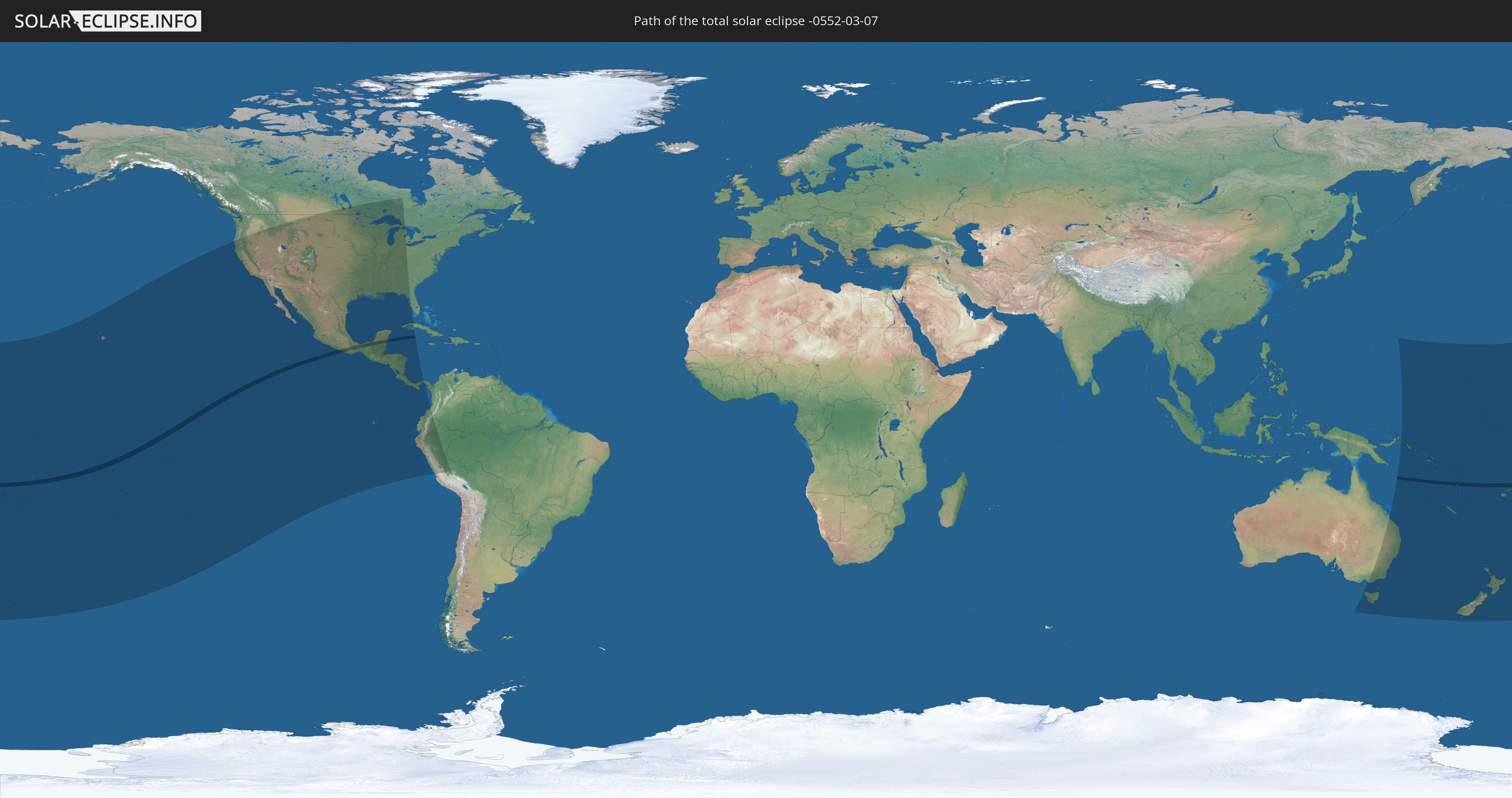
Die Sonnenfinsternis am 03/07/-0552 kann man in 38 Ländern als partielle Sonnenfinsternis beobachten.
Der Finsternispfad verläuft durch 7 Länder. Nur in diesen Ländern ist sie als total Sonnenfinsternis zu sehen.
In den folgenden Ländern ist die Sonnenfinsternis total zu sehen
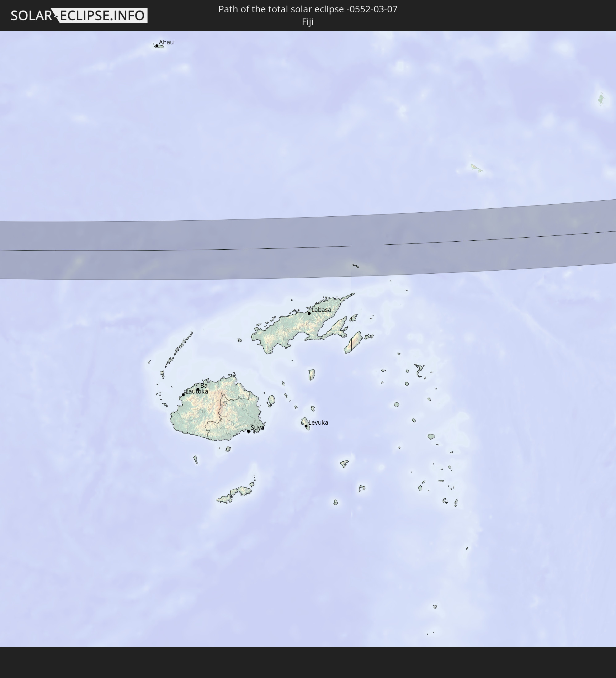 Fiji
Fiji
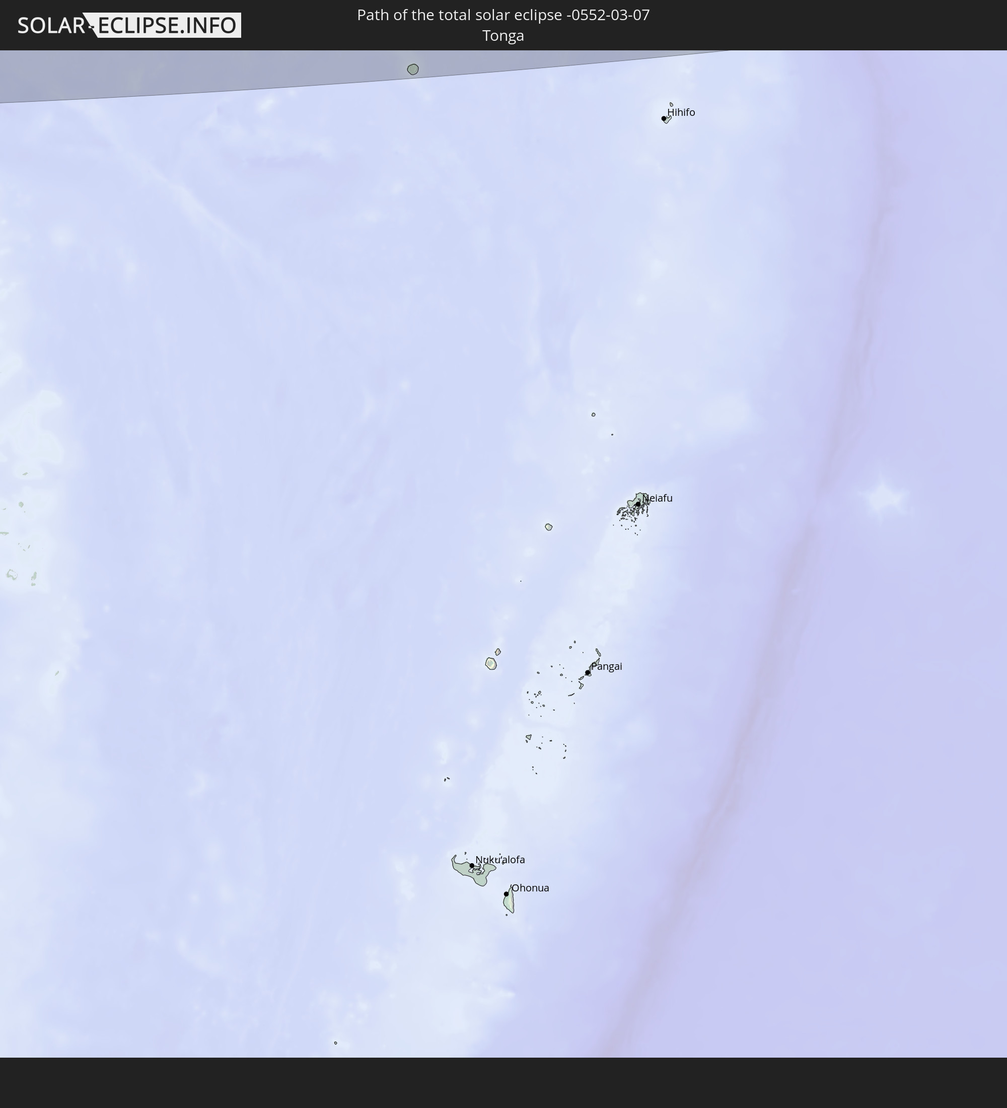 Tonga
Tonga
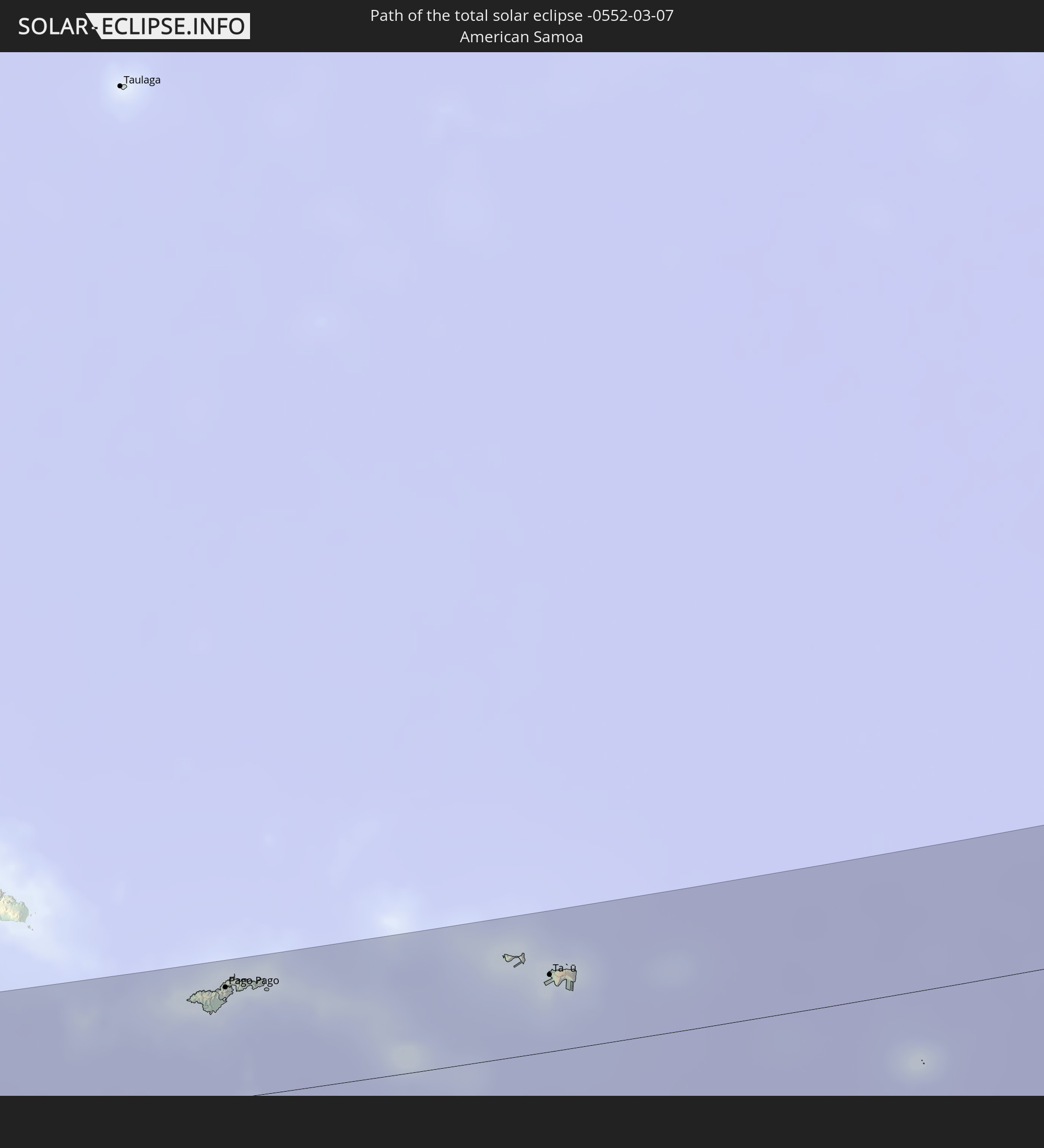 American Samoa
 Cook Islands
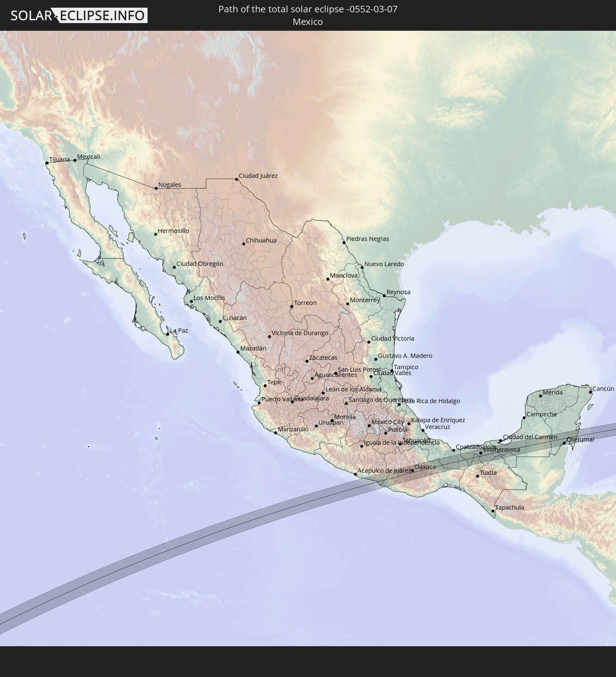 Mexico
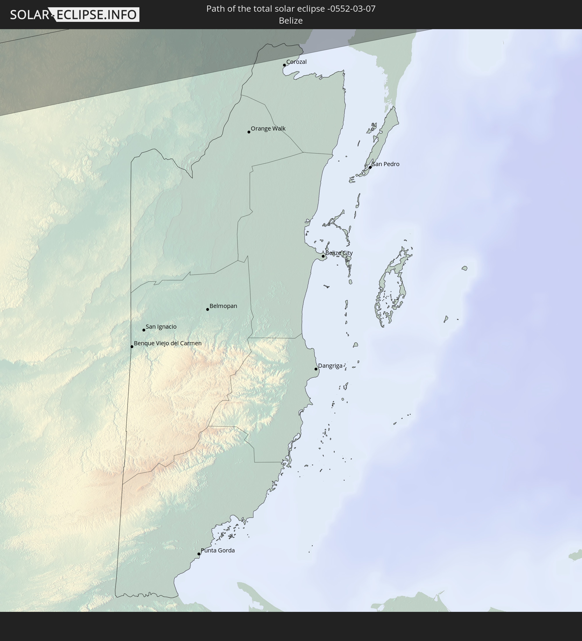 Belize
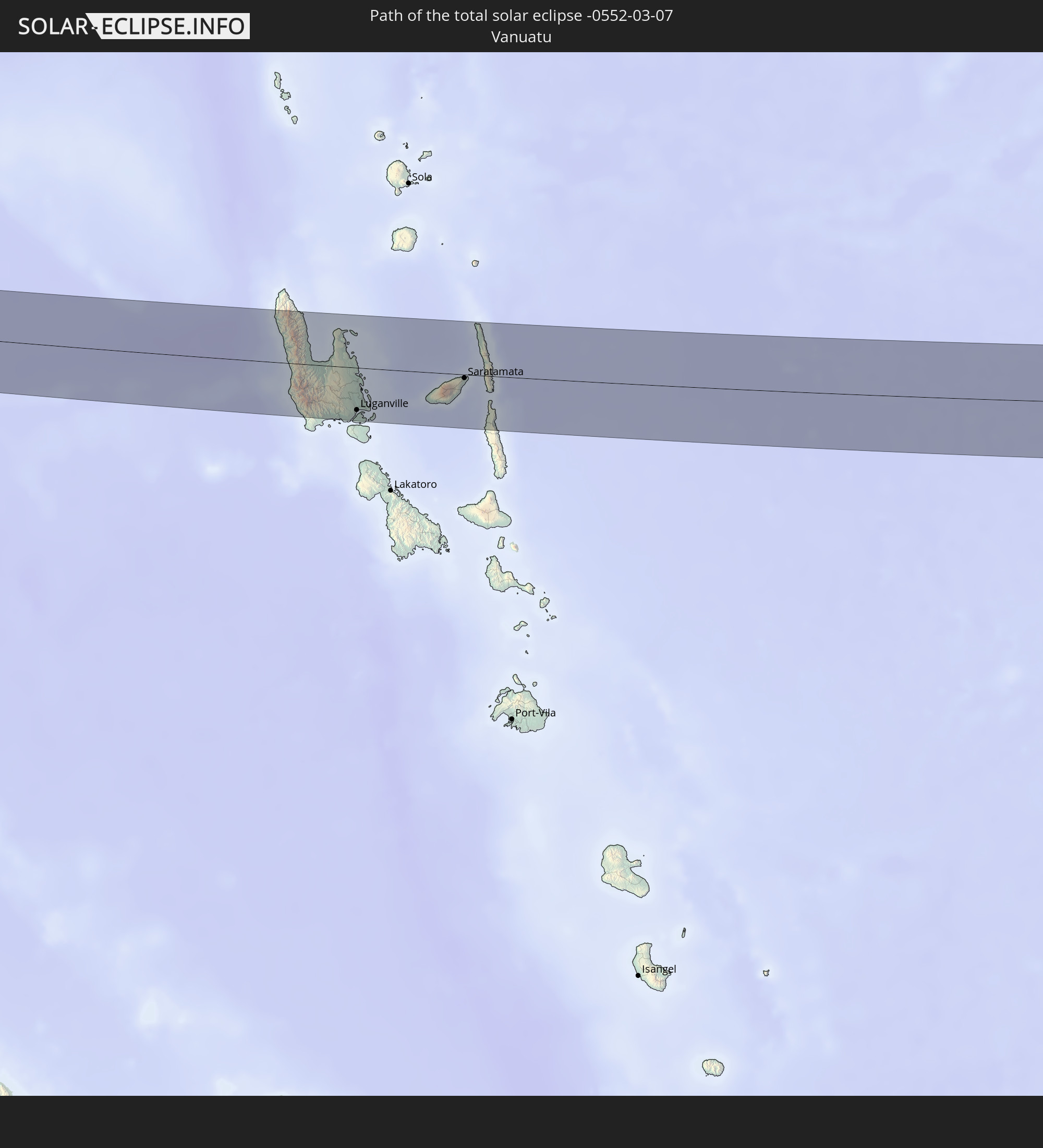 Vanuatu
In den folgenden Ländern ist die Sonnenfinsternis partiell zu sehen
 Fiji
Fiji
 United States
 New Zealand
 United States Minor Outlying Islands
 Wallis and Futuna
 Tonga
Tonga
 Kiribati
 Samoa
Samoa
 Tokelau
 American Samoa
 Niue
Niue
 Cook Islands
 French Polynesia
 Canada
 Pitcairn Islands
 Mexico
 Guatemala
 Ecuador
 El Salvador
 Honduras
 Belize
 Nicaragua
 Costa Rica
 Cuba
Cuba
 Panama
 Colombia
 Cayman Islands
 Peru
Peru
 Australia
 Federated States of Micronesia
 Papua New Guinea
 Solomon Islands
 New Caledonia
 Marshall Islands
 Vanuatu
 Nauru
Nauru
 Norfolk Island
 Tuvalu
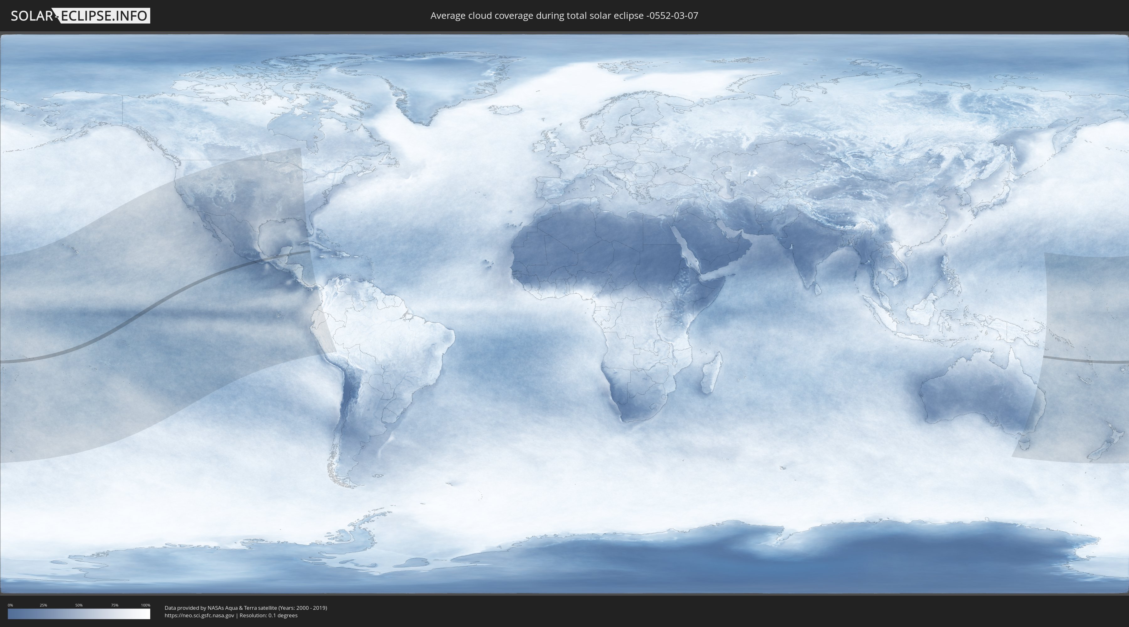
How will be the weather during the total solar eclipse on 03/07/-0552?
Where is the best place to see the total solar eclipse of 03/07/-0552?
The following maps show the average cloud coverage for the day of the total solar eclipse.
With the help of these maps, it is possible to find the place along the eclipse path, which has the best
chance of a cloudless sky.
Nevertheless, you should consider local circumstances and inform about the weather of your chosen
observation site.
The data is provided by NASAs satellites
AQUA and TERRA.
The cloud maps are averaged over a period of 19 years (2000 - 2019).

Detailed country maps
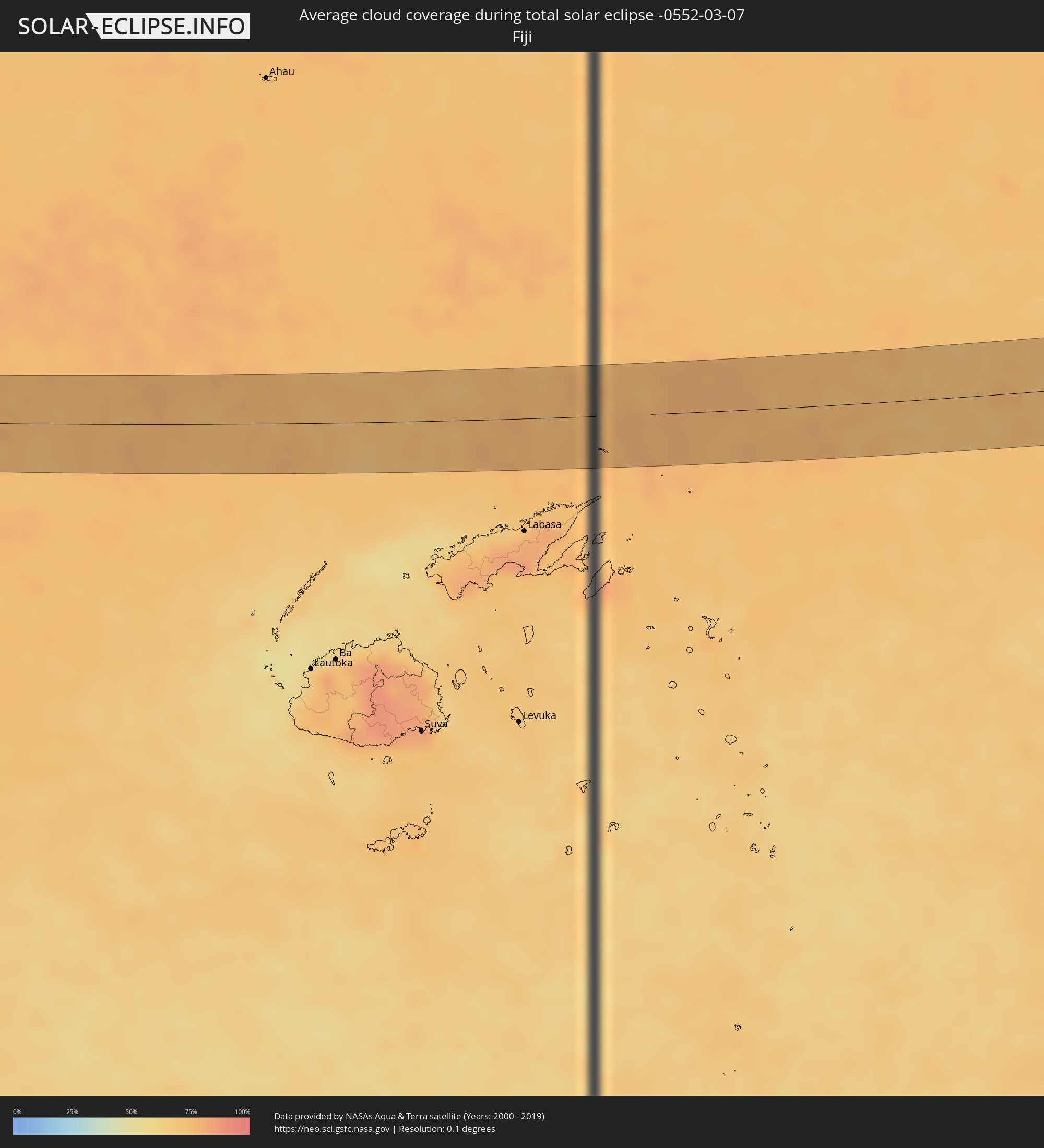 Fiji
Fiji
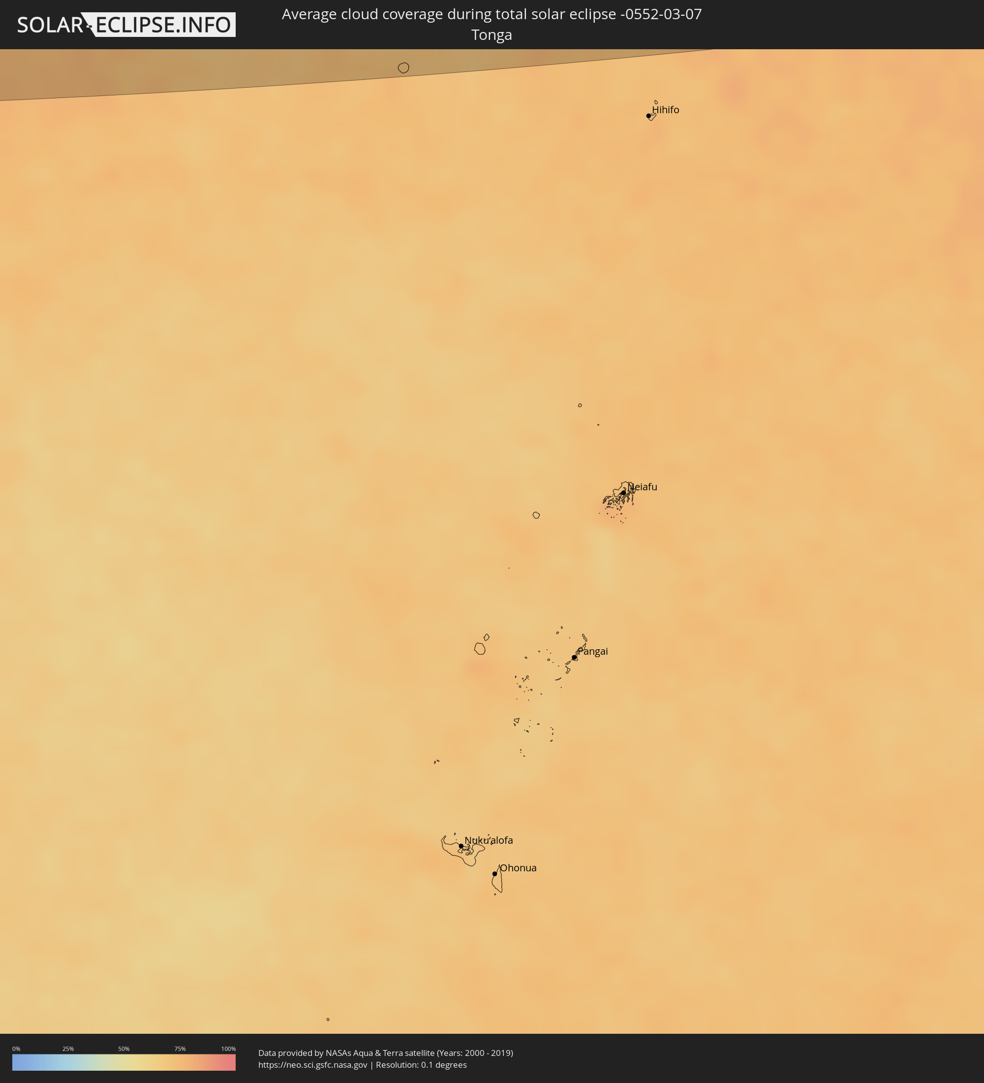 Tonga
Tonga
 American Samoa
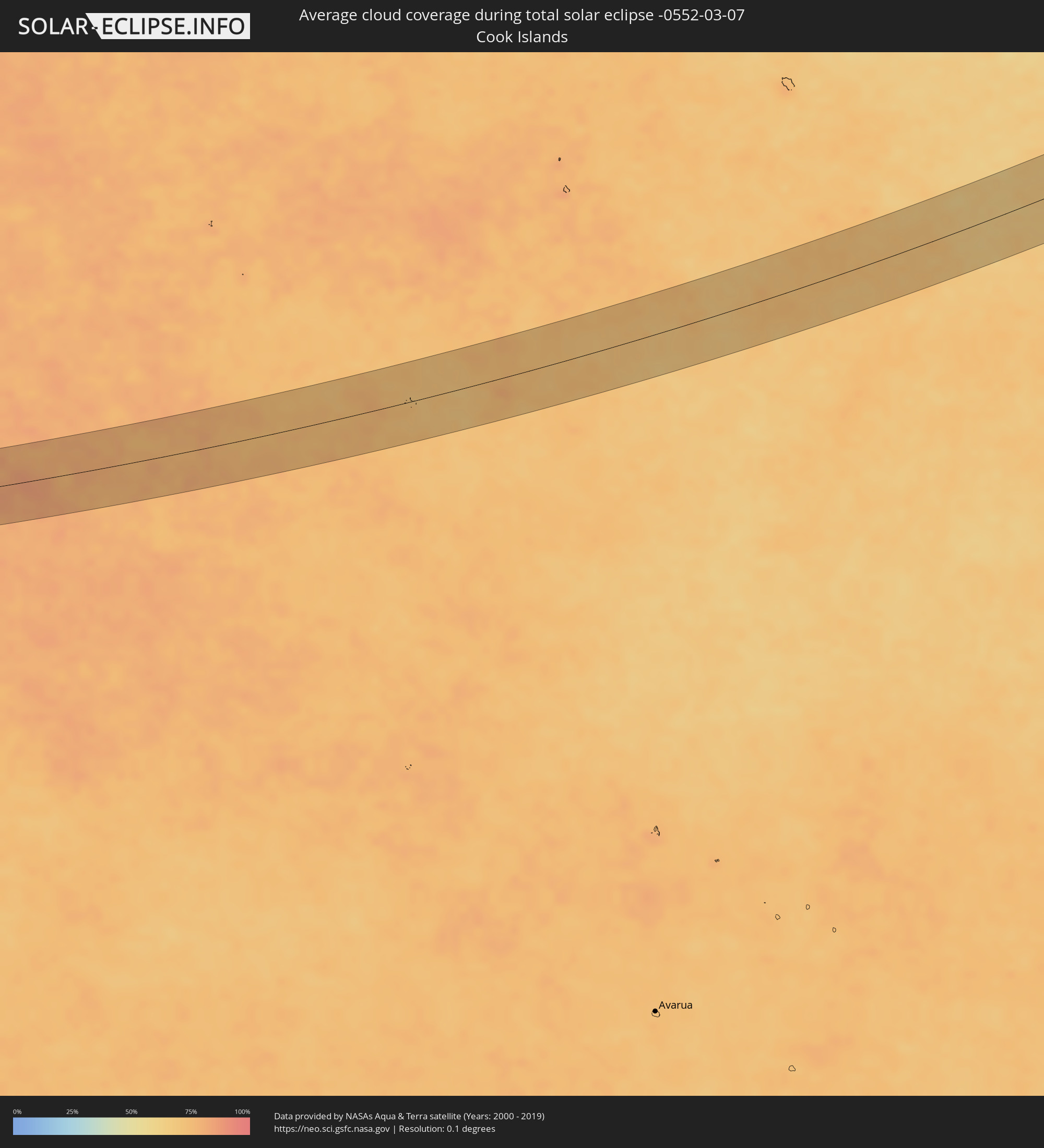 Cook Islands
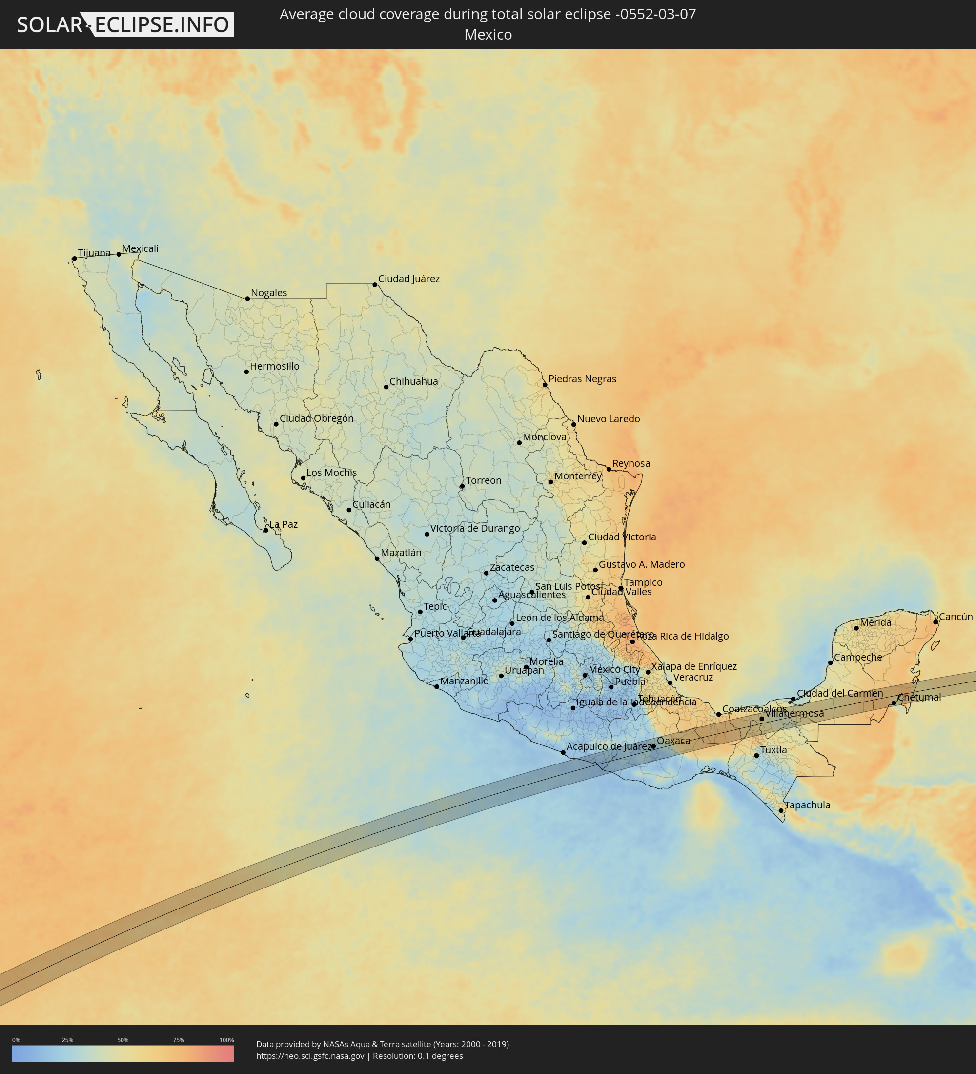 Mexico
 Belize
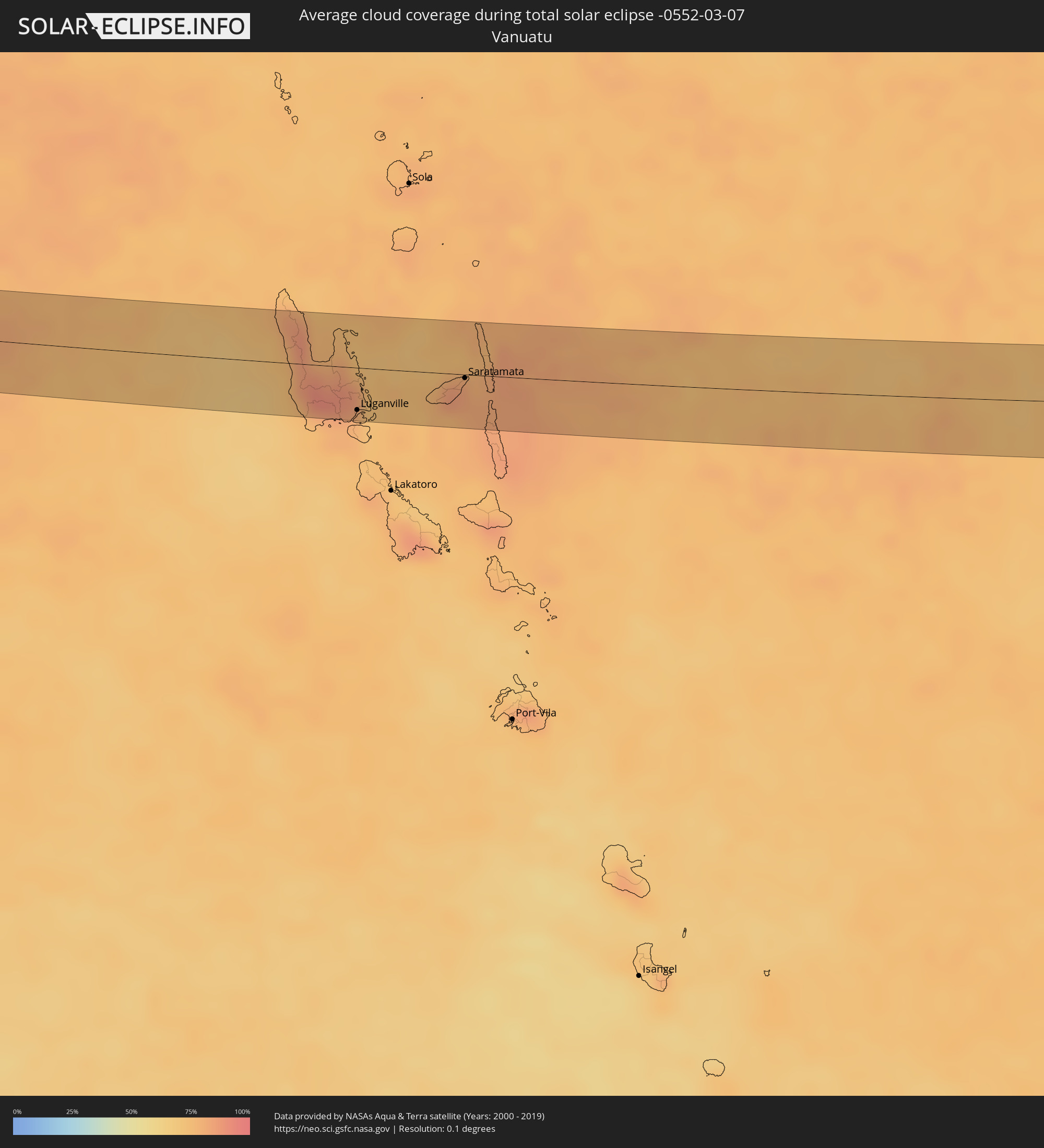 Vanuatu
Cities inside the path of the eclipse
The following table shows all locations with a population of more than 5,000 inside the eclipse path. Cities which have more than 100,000 inhabitants are marked bold. A click at the locations opens a detailed map.
| City | Type | Eclipse duration | Local time of max. eclipse | Distance to central line | Ø Cloud coverage |
|
Tāfuna, Western District
|
total | - | 09:01:27 UTC-11:22 | 38 km | 82% |
|
Pago Pago, Eastern District
|
total | - | 09:01:30 UTC-11:22 | 44 km | 82% |
|
Ta`ū, Manu'a
|
total | - | 09:03:34 UTC-11:22 | 30 km | 81% |
|
Cruz Grande, Guerrero
|
total | - | 16:46:08 UTC-06:36 | 37 km | 16% |
|
Copala, Guerrero
|
total | - | 16:46:11 UTC-06:36 | 21 km | 19% |
|
Marquelia, Guerrero
|
total | - | 16:46:16 UTC-06:36 | 14 km | 18% |
|
San Luis Acatlán, Guerrero
|
total | - | 16:46:23 UTC-06:36 | 36 km | 18% |
|
Cuajinicuilapa de Santa Maria, Guerrero
|
total | - | 16:46:29 UTC-06:36 | 9 km | 14% |
|
Ometepec, Guerrero
|
total | - | 16:46:32 UTC-06:36 | 14 km | 17% |
|
Pinotepa, Oaxaca
|
total | - | 16:46:39 UTC-06:36 | 34 km | 14% |
|
Pinotepa de Don Luis, Oaxaca
|
total | - | 16:46:43 UTC-06:36 | 26 km | 18% |
|
Putla Villa de Guerrero, Oaxaca
|
total | - | 16:46:54 UTC-06:36 | 37 km | 18% |
|
San Francisco Telixtlahuaca, Oaxaca
|
total | - | 16:47:31 UTC-06:36 | 38 km | 19% |
|
Santiago Suchilquitongo, Oaxaca
|
total | - | 16:47:31 UTC-06:36 | 33 km | 19% |
|
Ayoquezco de Aldama, Oaxaca
|
total | - | 16:47:24 UTC-06:36 | 29 km | 17% |
|
San Lorenzo Cacaotepec, Oaxaca
|
total | - | 16:47:32 UTC-06:36 | 17 km | 19% |
|
San Lorenzo Cacaotepec, Oaxaca
|
total | - | 16:47:32 UTC-06:36 | 17 km | 19% |
|
Villa de Etla, Oaxaca
|
total | - | 16:47:33 UTC-06:36 | 26 km | 18% |
|
Zimatlán de Álvarez, Oaxaca
|
total | - | 16:47:29 UTC-06:36 | 11 km | 15% |
|
San Pablo Huixtepec, Oaxaca
|
total | - | 16:47:28 UTC-06:36 | 16 km | 15% |
|
Cuilapan de Guerrero, Oaxaca
|
total | - | 16:47:30 UTC-06:36 | 1 km | 17% |
|
Trinidad Zaachila, Oaxaca
|
total | - | 16:47:30 UTC-06:36 | 6 km | 15% |
|
Villa de Zaachila, Oaxaca
|
total | - | 16:47:31 UTC-06:36 | 3 km | 17% |
|
Santa Cruz Xoxocotlán, Oaxaca
|
total | - | 16:47:32 UTC-06:36 | 5 km | 17% |
|
Oaxaca, Oaxaca
|
total | - | 16:47:33 UTC-06:36 | 9 km | 17% |
|
Vicente Guerrero, Oaxaca
|
total | - | 16:47:32 UTC-06:36 | 6 km | 17% |
|
San Antonio de la Cal, Oaxaca
|
total | - | 16:47:33 UTC-06:36 | 4 km | 17% |
|
Santa Cruz Amilpas, Oaxaca
|
total | - | 16:47:34 UTC-06:36 | 7 km | 17% |
|
Tlalixtac de Cabrera, Oaxaca
|
total | - | 16:47:36 UTC-06:36 | 7 km | 20% |
|
Santa María del Tule, Oaxaca
|
total | - | 16:47:36 UTC-06:36 | 4 km | 16% |
|
Tlacolula de Matamoros, Oaxaca
|
total | - | 16:47:39 UTC-06:36 | 10 km | 15% |
|
San Dionisio Ocotepec, Oaxaca
|
total | - | 16:47:40 UTC-06:36 | 28 km | 17% |
|
San Pablo Villa de Mitla, Oaxaca
|
total | - | 16:47:42 UTC-06:36 | 16 km | 17% |
|
Las Choapas, Veracruz
|
total | - | 16:48:56 UTC-06:36 | 33 km | 67% |
|
Chontalpa, Tabasco
|
total | - | 16:49:08 UTC-06:36 | 8 km | 60% |
|
Huimanguillo, Tabasco
|
total | - | 16:49:12 UTC-06:36 | 8 km | 58% |
|
Cárdenas, Tabasco
|
total | - | 16:49:14 UTC-06:36 | 26 km | 57% |
|
Santa Rosalía, Tabasco
|
total | - | 16:49:15 UTC-06:36 | 35 km | 58% |
|
Cunduacán, Tabasco
|
total | - | 16:49:19 UTC-06:36 | 28 km | 54% |
|
Pueblo Juárez, Chiapas
|
total | - | 16:49:16 UTC-06:36 | 18 km | 63% |
|
Pichucalco, Chiapas
|
total | - | 16:49:15 UTC-06:36 | 34 km | 65% |
|
Luis Gil Pérez, Tabasco
|
total | - | 16:49:20 UTC-06:36 | 5 km | 55% |
|
Jalpa de Méndez, Tabasco
|
total | - | 16:49:23 UTC-06:36 | 37 km | 56% |
|
Anacleto Canabal 2da. Sección, Tabasco
|
total | - | 16:49:22 UTC-06:36 | 15 km | 52% |
|
Nacajuca, Tabasco
|
total | - | 16:49:24 UTC-06:36 | 36 km | 54% |
|
La Selva, Tabasco
|
total | - | 16:49:24 UTC-06:36 | 19 km | 52% |
|
Bosque de Saloya, Tabasco
|
total | - | 16:49:24 UTC-06:36 | 18 km | 52% |
|
Teapa, Tabasco
|
total | - | 16:49:19 UTC-06:36 | 33 km | 63% |
|
La Lima, Tabasco
|
total | - | 16:49:23 UTC-06:36 | 6 km | 52% |
|
Pomoca, Tabasco
|
total | - | 16:49:25 UTC-06:36 | 21 km | 50% |
|
Villahermosa, Tabasco
|
total | - | 16:49:24 UTC-06:36 | 14 km | 50% |
|
Río de Teapa, Tabasco
|
total | - | 16:49:23 UTC-06:36 | 9 km | 52% |
|
Macultepec, Tabasco
|
total | - | 16:49:27 UTC-06:36 | 30 km | 50% |
|
Tacotalpa, Tabasco
|
total | - | 16:49:23 UTC-06:36 | 31 km | 52% |
|
Jalapa, Tabasco
|
total | - | 16:49:24 UTC-06:36 | 18 km | 52% |
|
Tamulte de las Sabanas, Tabasco
|
total | - | 16:49:29 UTC-06:36 | 29 km | 45% |
|
Belén, Tabasco
|
total | - | 16:49:29 UTC-06:36 | 15 km | 49% |
|
Macuspana, Tabasco
|
total | - | 16:49:29 UTC-06:36 | 18 km | 49% |
|
Ciudad Pemex, Tabasco
|
total | - | 16:49:33 UTC-06:36 | 8 km | 45% |
|
Jonuta, Tabasco
|
total | - | 16:49:42 UTC-06:36 | 7 km | 41% |
|
Balancán de Domínguez, Tabasco
|
total | - | 16:49:51 UTC-06:36 | 38 km | 43% |
|
El Triunfo, Tabasco
|
total | - | 16:49:59 UTC-06:36 | 33 km | 52% |
|
Escárcega, Campeche
|
total | - | 16:50:13 UTC-06:36 | 32 km | 51% |
|
Bacalar, Quintana Roo
|
total | - | 17:40:21 UTC-05:47 | 9 km | 59% |
|
Chetumal, Quintana Roo
|
total | - | 17:40:21 UTC-05:47 | 29 km | 43% |
|
Calderitas, Quintana Roo
|
total | - | 17:40:22 UTC-05:47 | 25 km | 49% |
|
Luganville, Sanma
|
total | - | 07:13:34 UTC+11:13 | 34 km | 72% |
|
Saratamata, Penama
|
total | - | 07:14:00 UTC+11:13 | 3 km | 79% |