Total solar eclipse of 10/01/-0563
| Day of week: | Friday |
| Maximum duration of eclipse: | 03m25s |
| Maximum width of eclipse path: | 135 km |
| Saros cycle: | 54 |
| Coverage: | 100% |
| Magnitude: | 1.0402 |
| Gamma: | 0.0905 |
Wo kann man die Sonnenfinsternis vom 10/01/-0563 sehen?
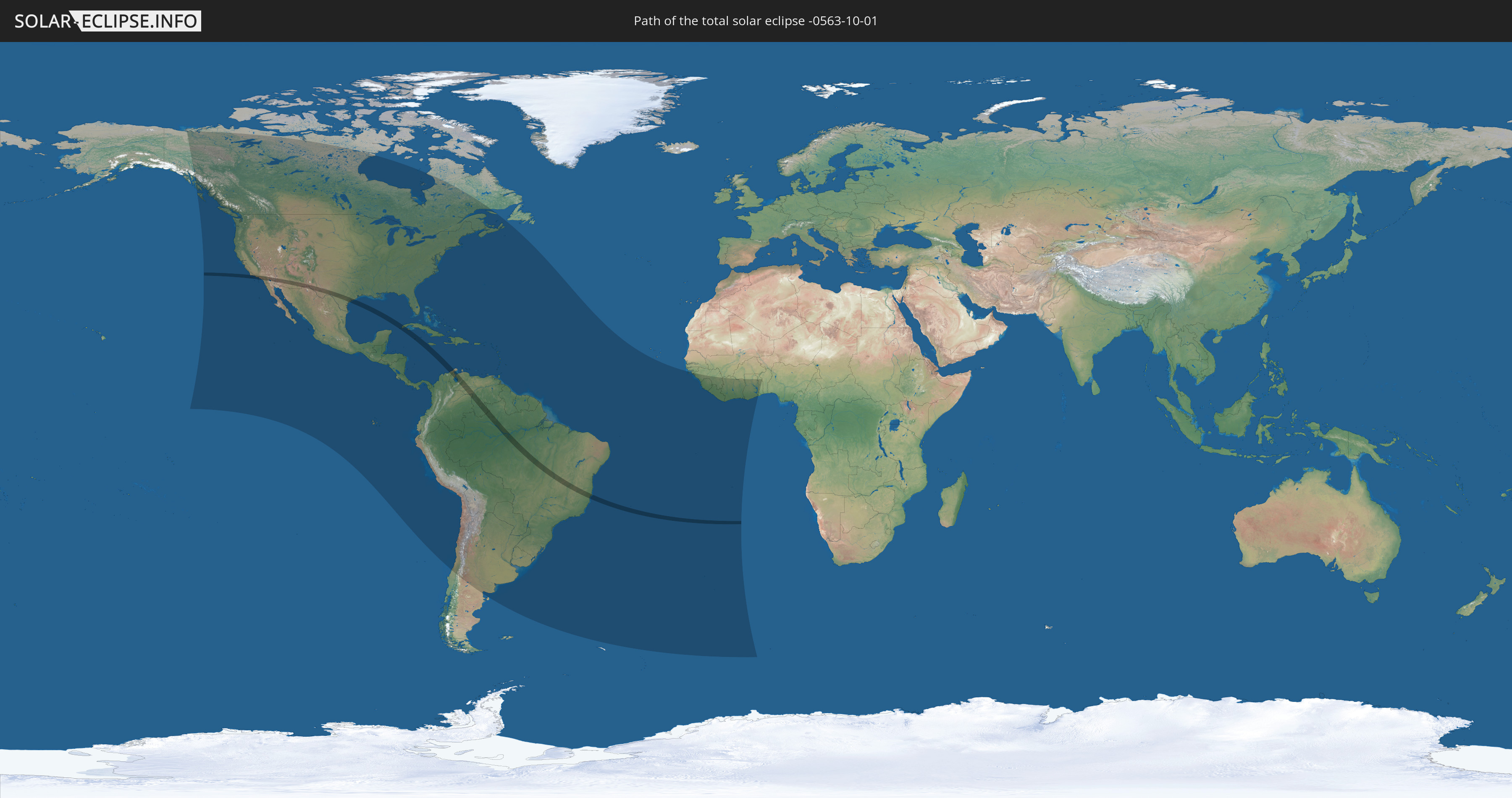
Die Sonnenfinsternis am 10/01/-0563 kann man in 61 Ländern als partielle Sonnenfinsternis beobachten.
Der Finsternispfad verläuft durch 8 Länder. Nur in diesen Ländern ist sie als total Sonnenfinsternis zu sehen.
In den folgenden Ländern ist die Sonnenfinsternis total zu sehen
 United States
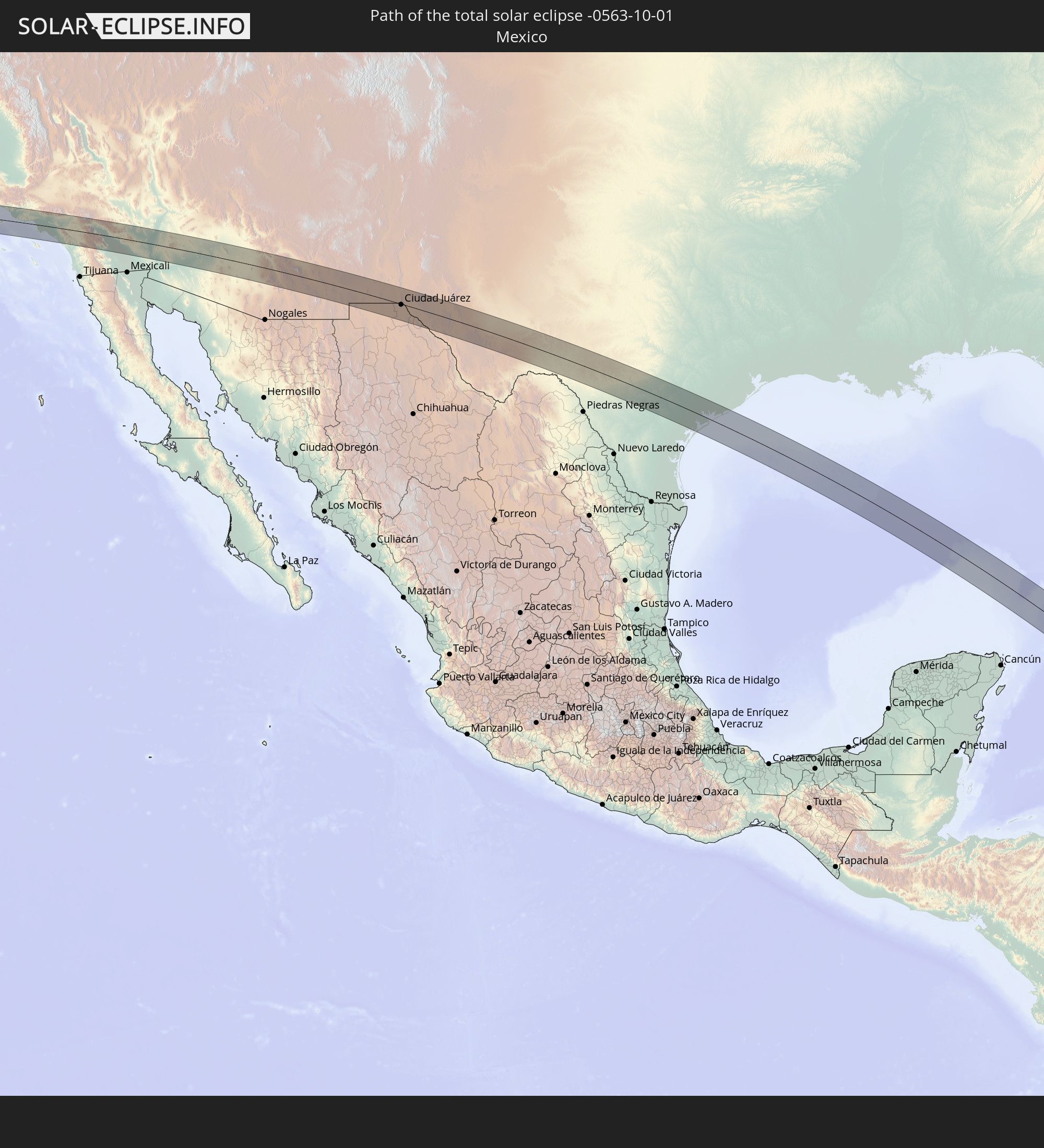 Mexico
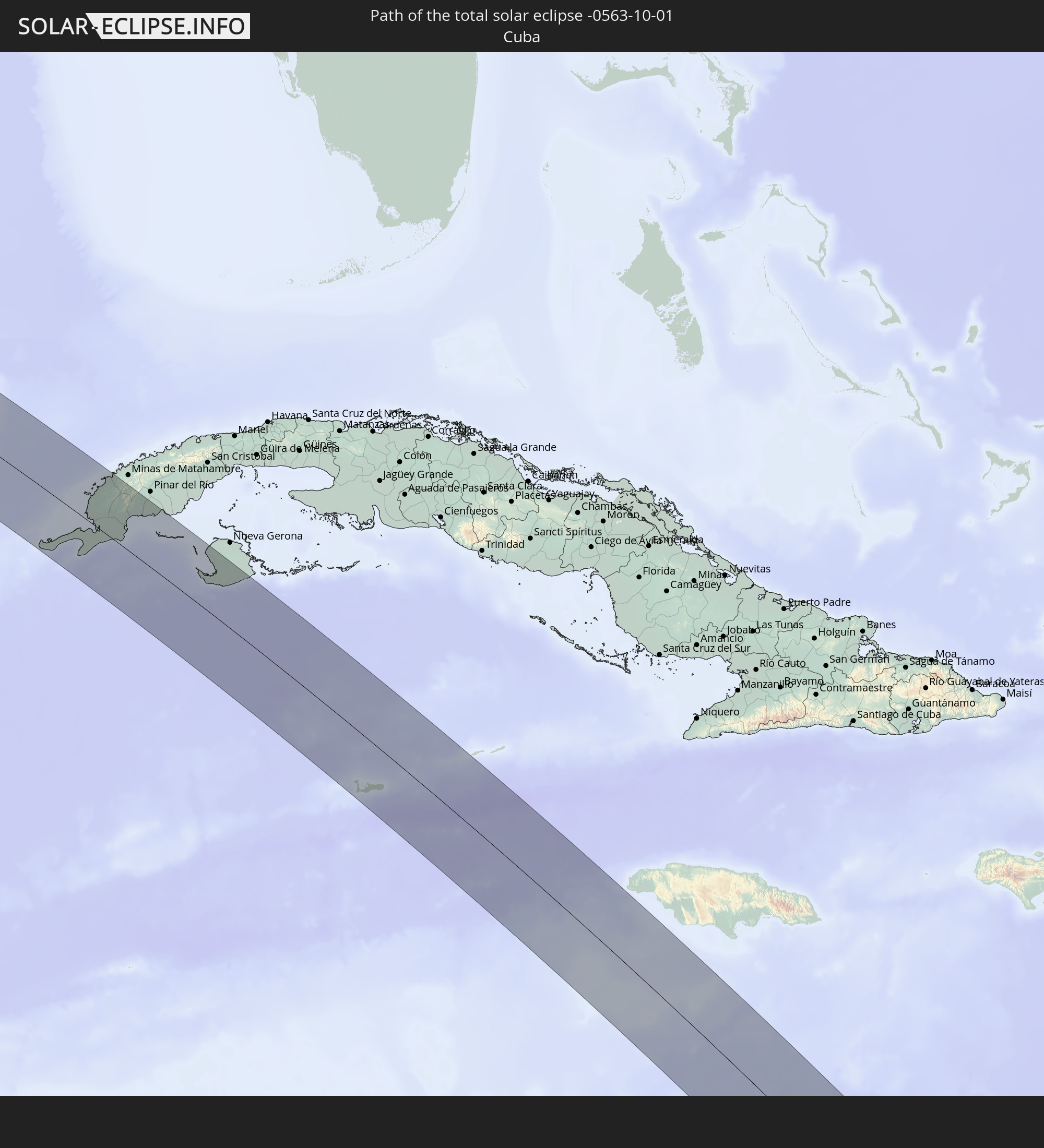 Cuba
Cuba
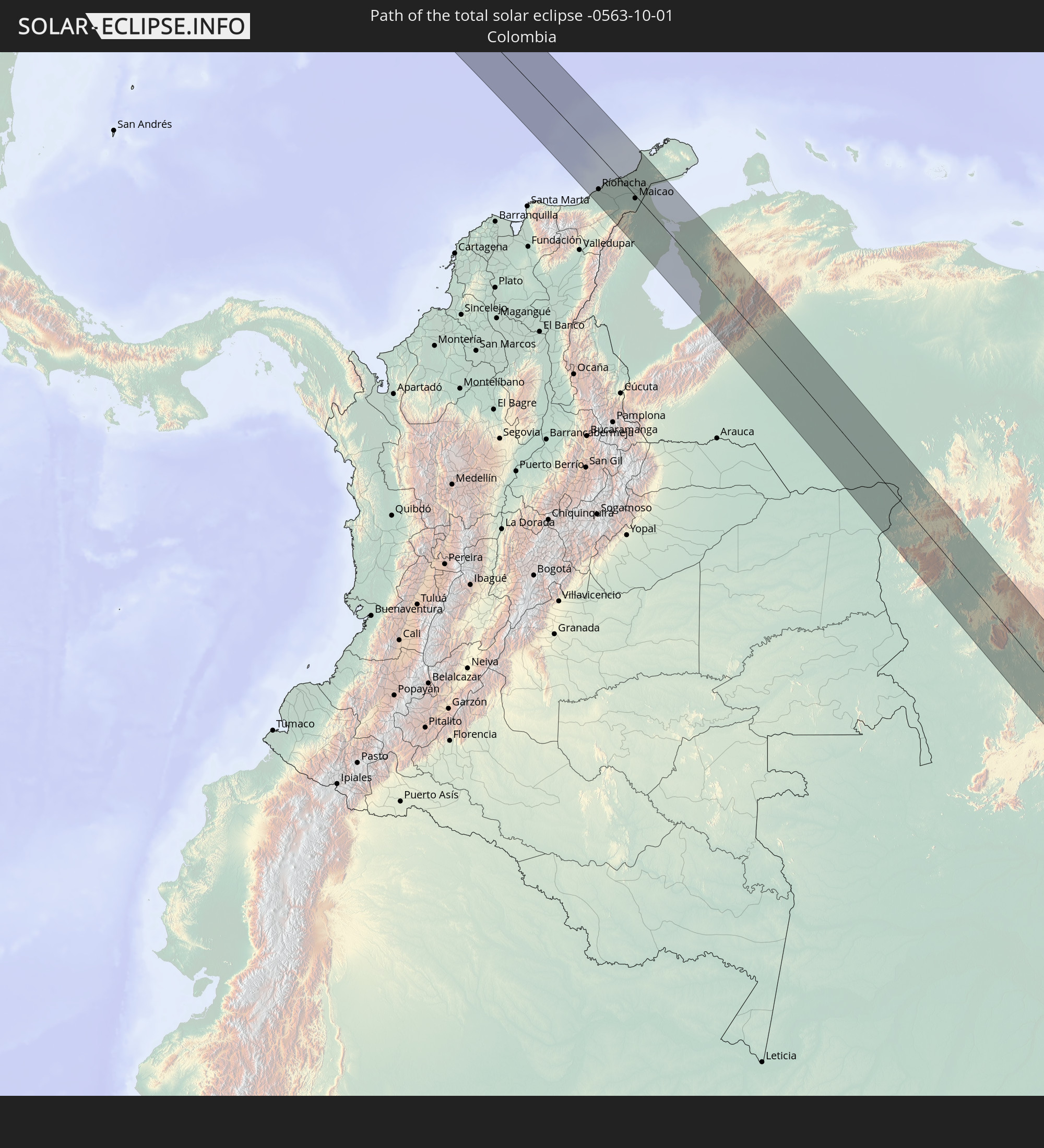 Colombia
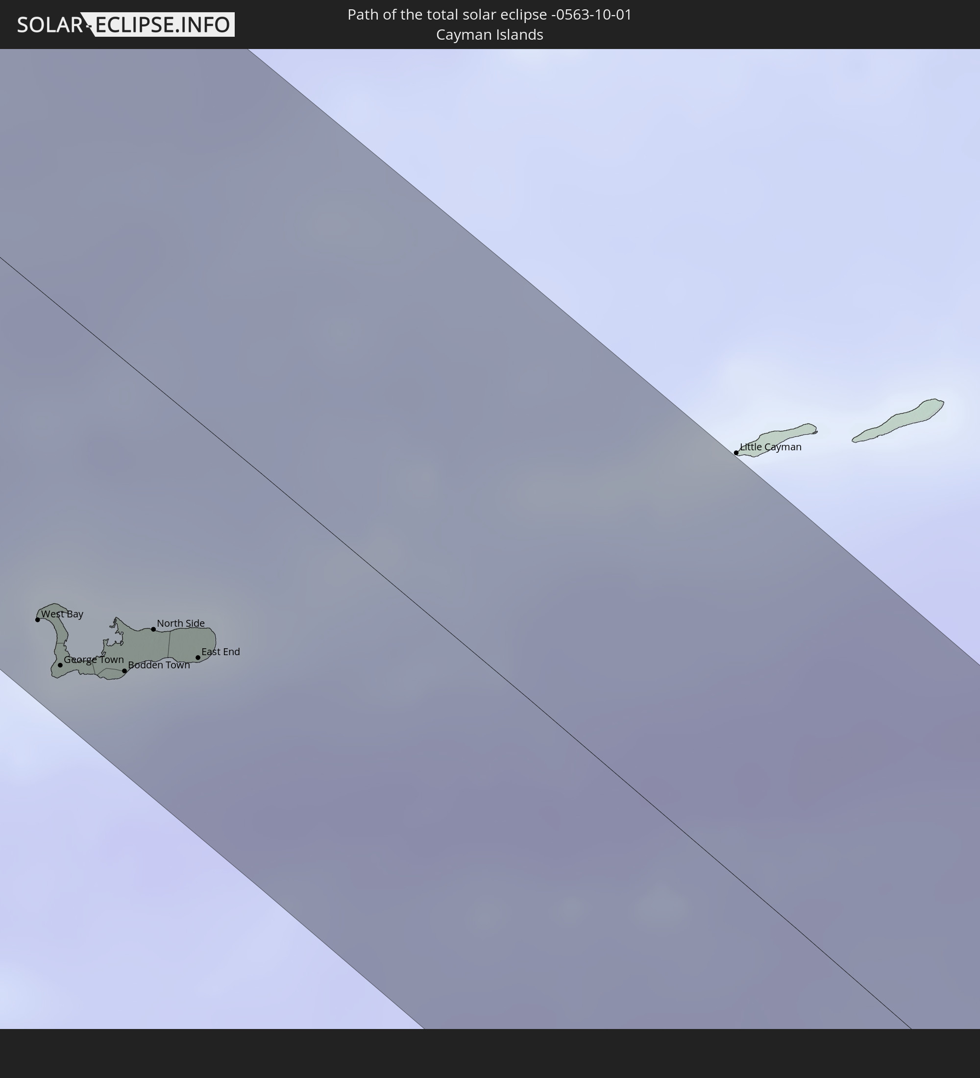 Cayman Islands
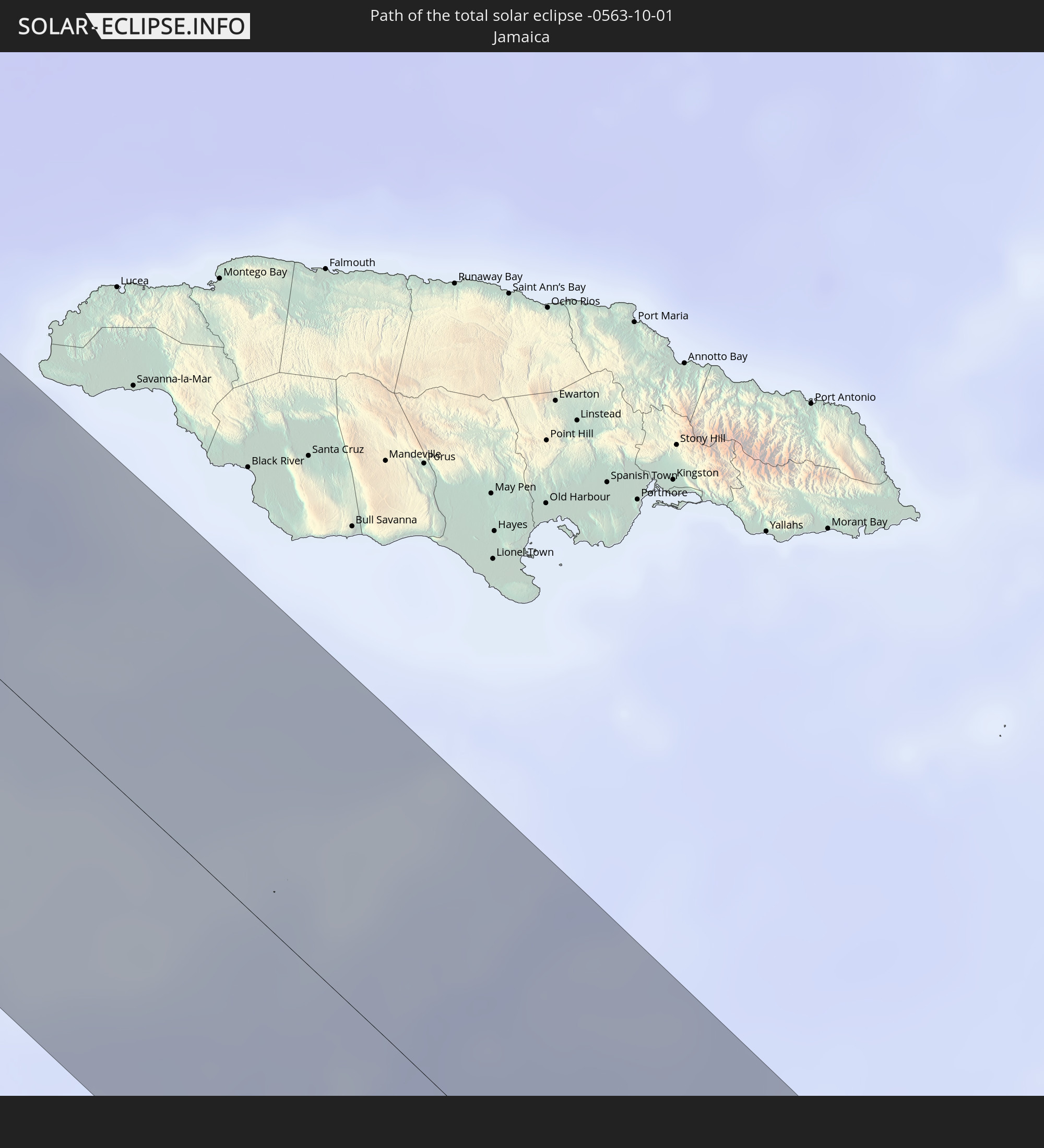 Jamaica
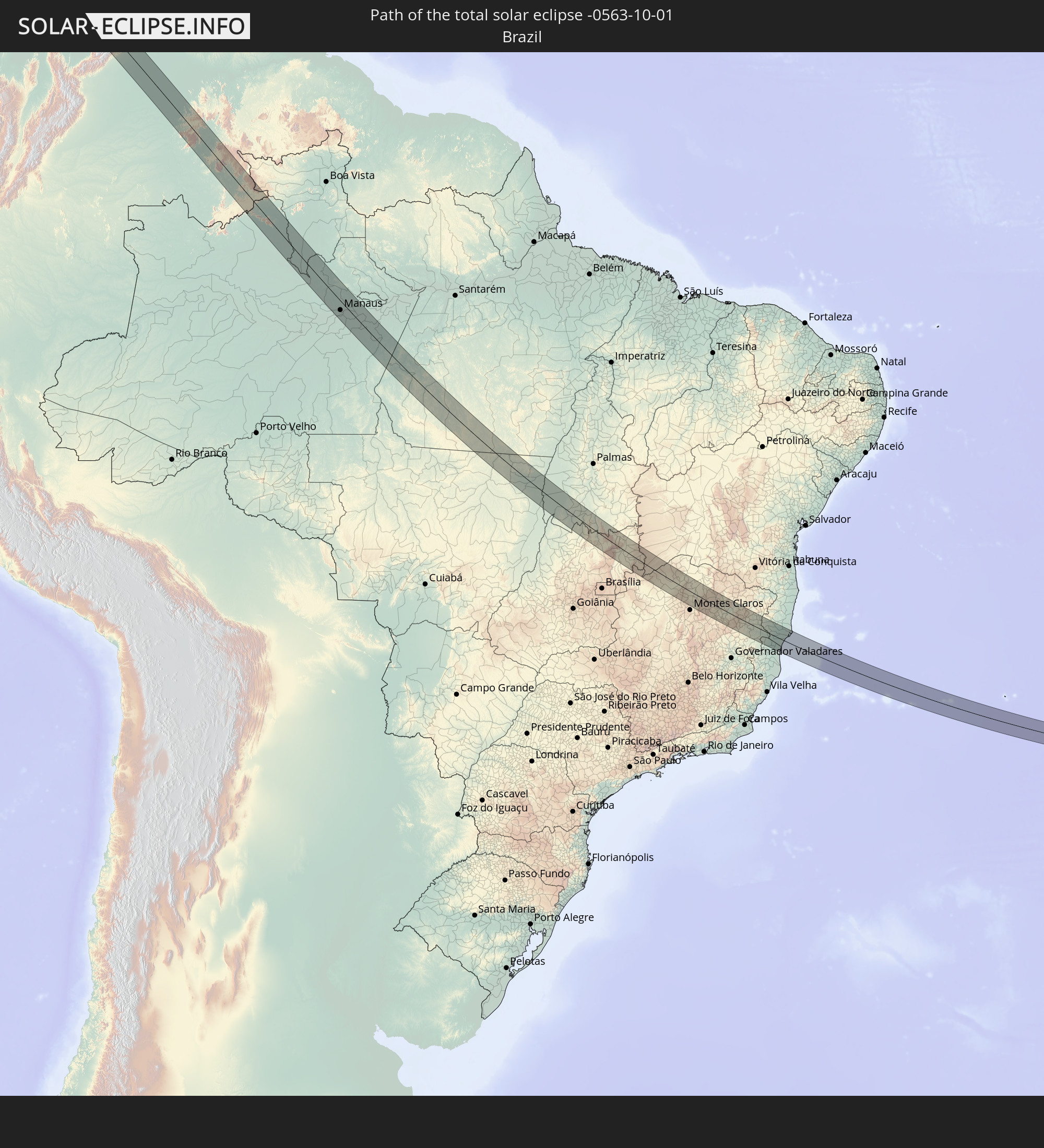 Brazil
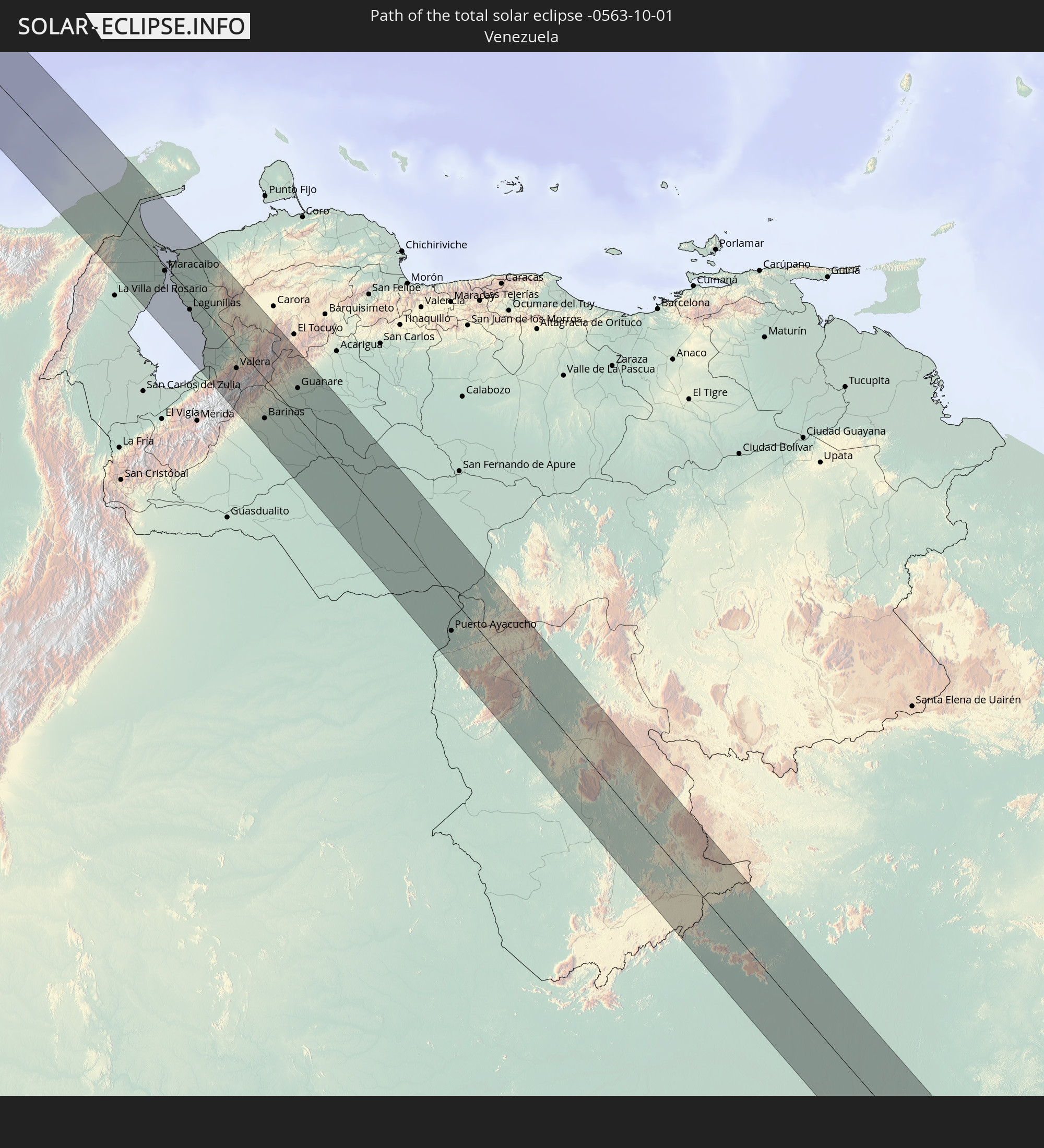 Venezuela
In den folgenden Ländern ist die Sonnenfinsternis partiell zu sehen
 United States
 United States Minor Outlying Islands
 Canada
 Mexico
 Chile
Chile
 Greenland
 Guatemala
 Ecuador
 El Salvador
 Honduras
 Belize
 Nicaragua
 Costa Rica
 Cuba
Cuba
 Panama
 Colombia
 Cayman Islands
 Peru
Peru
 The Bahamas
 Jamaica
 Haiti
Haiti
 Brazil
 Argentina
 Venezuela
 Turks and Caicos Islands
 Dominican Republic
 Aruba
Aruba
 Bolivia
 Puerto Rico
 United States Virgin Islands
 Bermuda
 British Virgin Islands
 Anguilla
 Collectivity of Saint Martin
 Saint Barthélemy
 Saint Kitts and Nevis
 Paraguay
 Antigua and Barbuda
 Montserrat
 Trinidad and Tobago
 Guadeloupe
 Grenada
 Dominica
 Saint Vincent and the Grenadines
 Guyana
 Martinique
 Saint Lucia
 Barbados
 Uruguay
 Suriname
 French Guiana
 Guinea-Bissau
 Guinea
 Saint Helena, Ascension and Tristan da Cunha
 Sierra Leone
 Liberia
 Ivory Coast
 Burkina Faso
 Ghana
Ghana
 Togo
Togo
 Benin
Benin
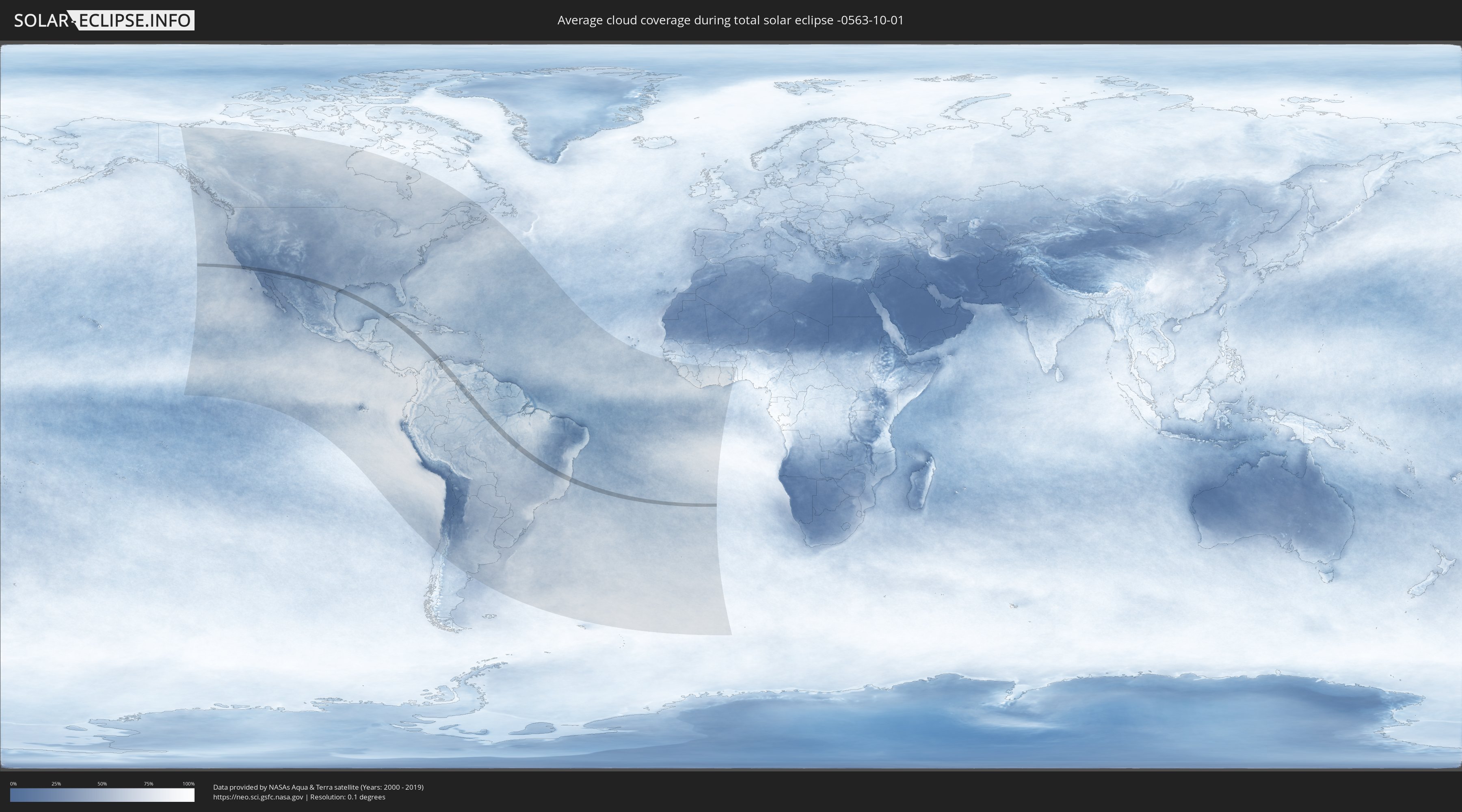
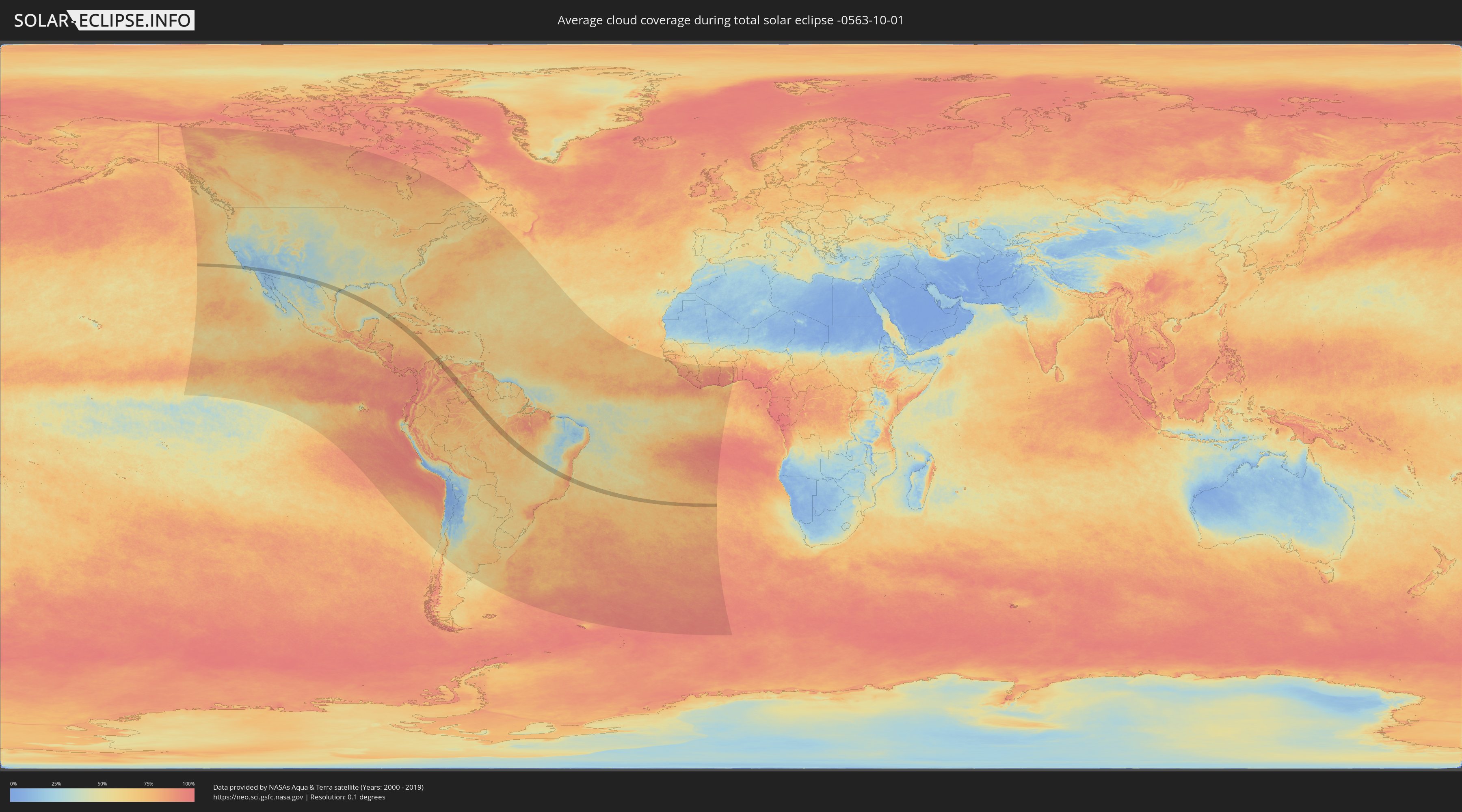
How will be the weather during the total solar eclipse on 10/01/-0563?
Where is the best place to see the total solar eclipse of 10/01/-0563?
The following maps show the average cloud coverage for the day of the total solar eclipse.
With the help of these maps, it is possible to find the place along the eclipse path, which has the best
chance of a cloudless sky.
Nevertheless, you should consider local circumstances and inform about the weather of your chosen
observation site.
The data is provided by NASAs satellites
AQUA and TERRA.
The cloud maps are averaged over a period of 19 years (2000 - 2019).
Detailed country maps
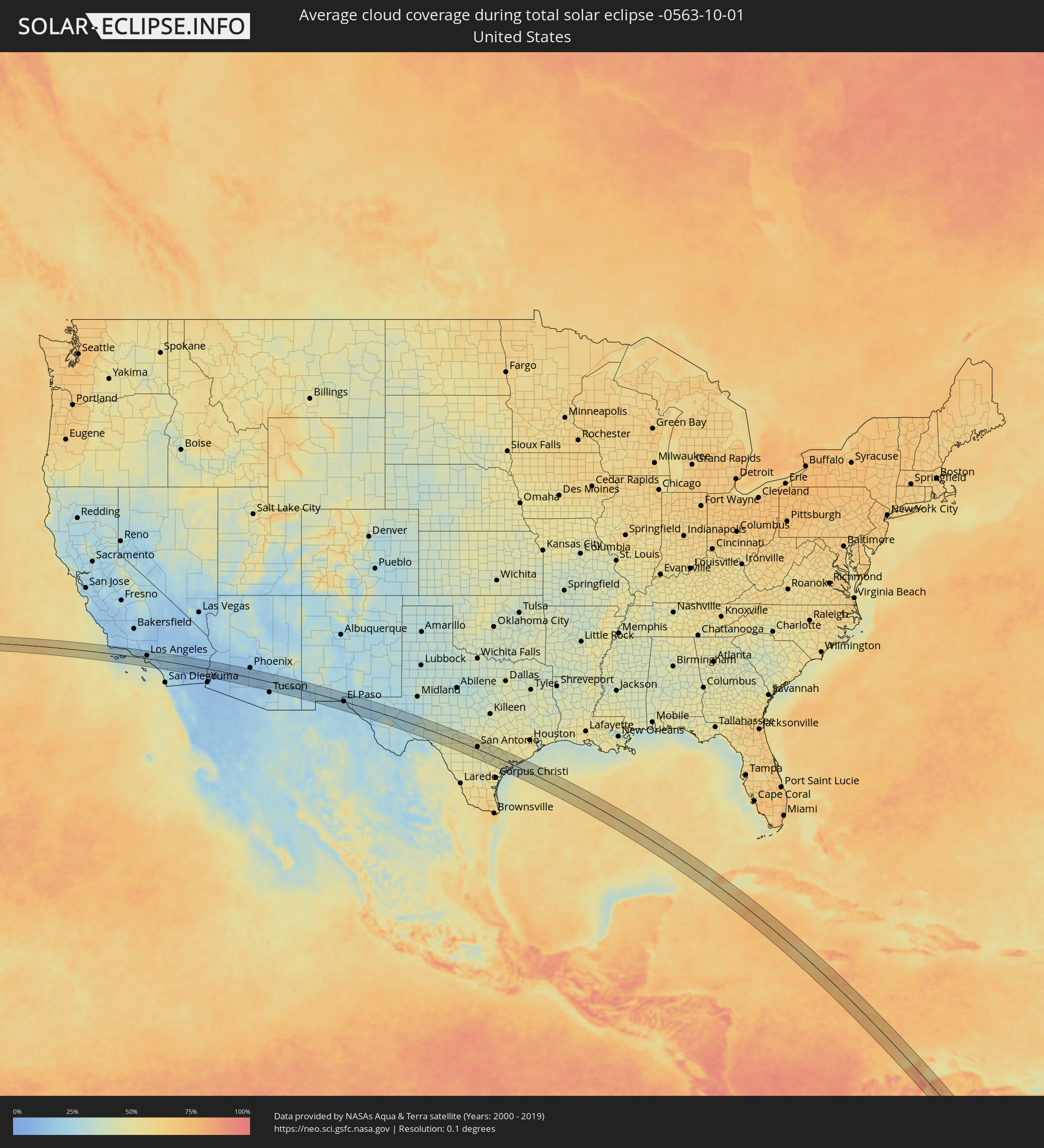 United States
 Mexico
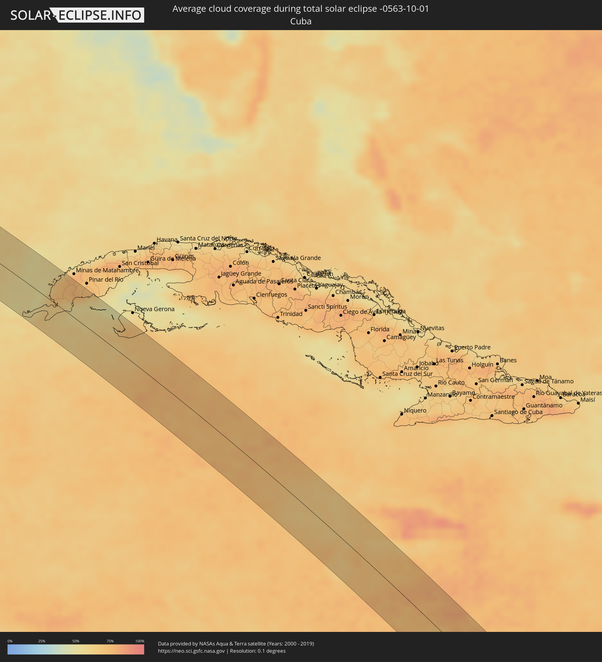 Cuba
Cuba
 Colombia
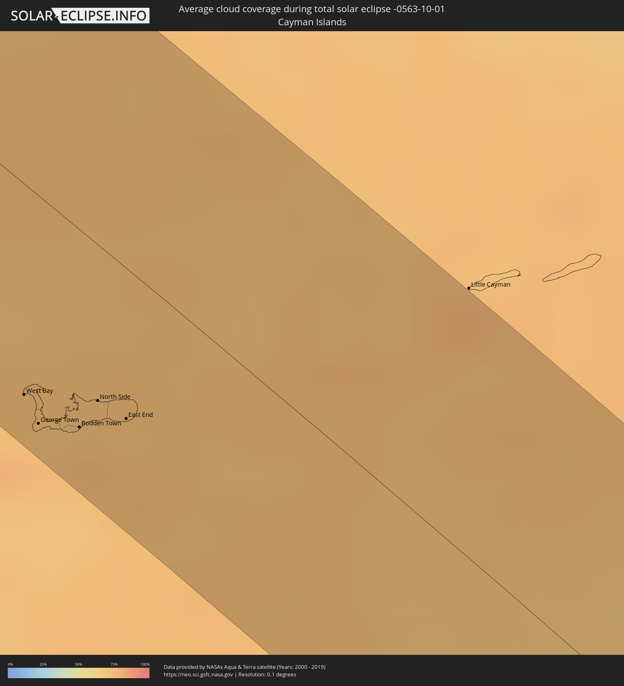 Cayman Islands
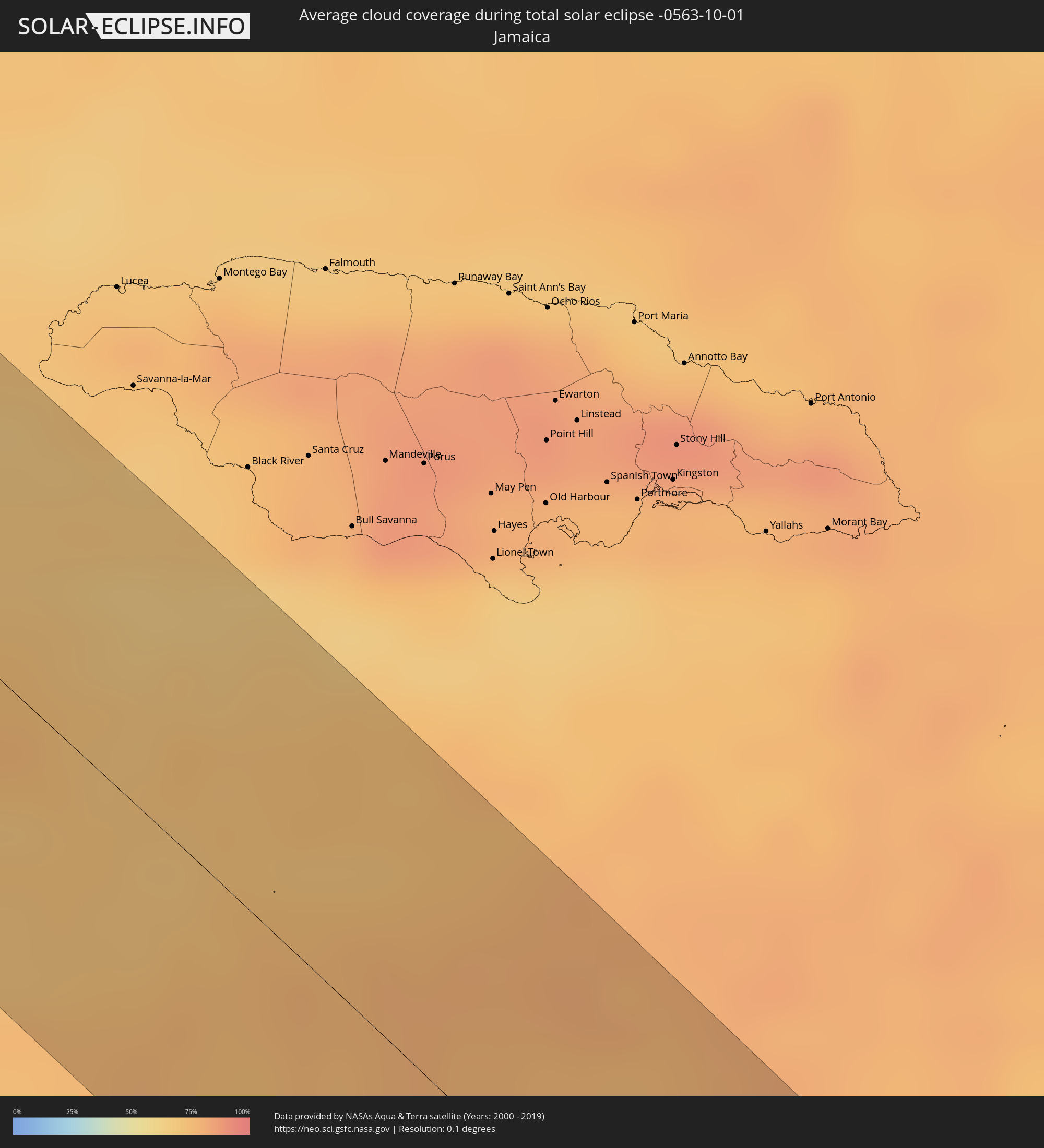 Jamaica
 Brazil
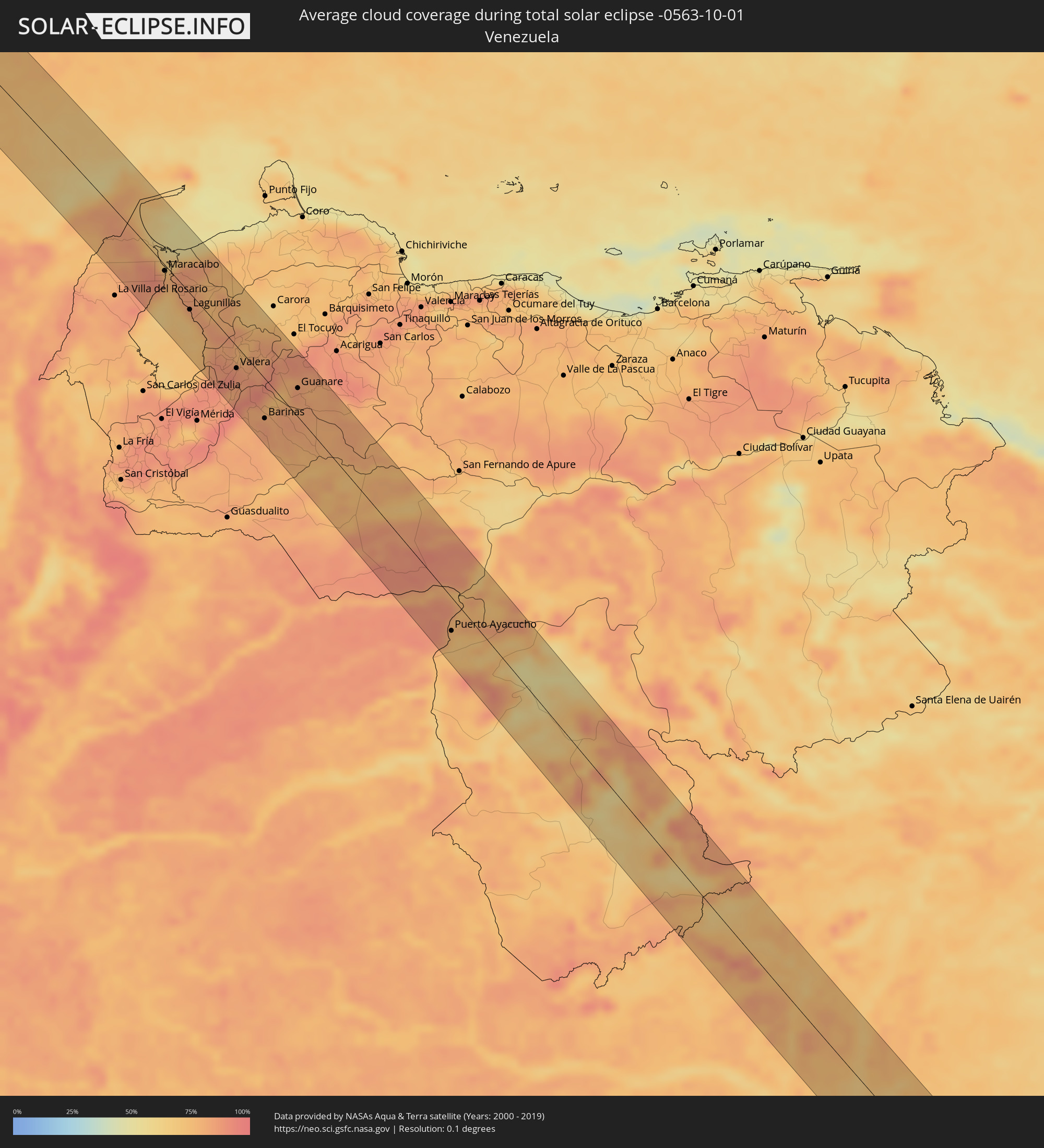 Venezuela
Cities inside the path of the eclipse
The following table shows all locations with a population of more than 5,000 inside the eclipse path. Cities which have more than 100,000 inhabitants are marked bold. A click at the locations opens a detailed map.
| City | Type | Eclipse duration | Local time of max. eclipse | Distance to central line | Ø Cloud coverage |
|
Santa Barbara, California
|
total | - | 06:43:04 UTC-08:00 | 37 km | 32% |
|
Oxnard, California
|
total | - | 06:43:12 UTC-08:00 | 19 km | 33% |
|
Thousand Oaks, California
|
total | - | 06:43:19 UTC-08:00 | 20 km | 21% |
|
Santa Monica, California
|
total | - | 06:43:25 UTC-08:00 | 8 km | 34% |
|
Van Nuys, California
|
total | - | 06:43:26 UTC-08:00 | 27 km | 21% |
|
Torrance, California
|
total | - | 06:43:28 UTC-08:00 | 10 km | 32% |
|
Los Angeles, California
|
total | - | 06:43:30 UTC-08:00 | 15 km | 24% |
|
Long Beach, California
|
total | - | 06:43:30 UTC-08:00 | 16 km | 30% |
|
Downey, California
|
total | - | 06:43:32 UTC-08:00 | 4 km | 26% |
|
El Monte, California
|
total | - | 06:43:34 UTC-08:00 | 20 km | 27% |
|
Huntington Beach, California
|
total | - | 06:43:34 UTC-08:00 | 25 km | 31% |
|
Anaheim, California
|
total | - | 06:43:36 UTC-08:00 | 4 km | 26% |
|
Irvine, California
|
total | - | 06:43:38 UTC-08:00 | 21 km | 27% |
|
Pomona, California
|
total | - | 06:43:40 UTC-08:00 | 22 km | 25% |
|
Mission Viejo, California
|
total | - | 06:43:41 UTC-08:00 | 27 km | 27% |
|
Rancho Cucamonga, California
|
total | - | 06:43:43 UTC-08:00 | 30 km | 22% |
|
Corona, California
|
total | - | 06:43:43 UTC-08:00 | 5 km | 23% |
|
Riverside, California
|
total | - | 06:43:47 UTC-08:00 | 16 km | 21% |
|
San Bernardino, California
|
total | - | 06:43:49 UTC-08:00 | 35 km | 21% |
|
Moreno Valley, California
|
total | - | 06:43:50 UTC-08:00 | 17 km | 21% |
|
Murrieta, California
|
total | - | 06:43:51 UTC-08:00 | 25 km | 20% |
|
Menifee, California
|
total | - | 06:43:52 UTC-08:00 | 5 km | 18% |
|
Hemet, California
|
total | - | 06:43:56 UTC-08:00 | 0 km | 19% |
|
Indio, California
|
total | - | 06:44:13 UTC-08:00 | 8 km | 14% |
|
Avondale, Arizona
|
total | - | 07:45:55 UTC-07:00 | 45 km | 17% |
|
Chandler, Arizona
|
total | - | 07:46:10 UTC-07:00 | 41 km | 16% |
|
San Tan Valley, Arizona
|
total | - | 07:46:21 UTC-07:00 | 35 km | 16% |
|
Puerto Palomas, Chihuahua
|
total | - | 07:43:09 UTC-07:05 | 28 km | 23% |
|
El Paso, Texas
|
total | - | 07:49:34 UTC-07:00 | 0 km | 22% |
|
Ciudad Juárez, Chihuahua
|
total | - | 07:43:55 UTC-07:05 | 2 km | 22% |
|
San Antonio, Texas
|
total | - | 08:56:51 UTC-06:00 | 12 km | 49% |
|
Mantua, Pinar del Río
|
total | - | 09:50:18 UTC-05:29 | 22 km | 71% |
|
Guane, Pinar del Río
|
total | - | 09:50:42 UTC-05:29 | 27 km | 62% |
|
San Luis, Pinar del Río
|
total | - | 09:51:04 UTC-05:29 | 54 km | 71% |
|
West Bay, West Bay
|
total | - | 10:08:29 UTC-05:19 | 50 km | 73% |
|
George Town, George Town
|
total | - | 10:08:39 UTC-05:19 | 54 km | 77% |
|
Bodden Town, Bodden Town
|
total | - | 10:08:51 UTC-05:19 | 47 km | 75% |
|
North Side, North Side
|
total | - | 10:08:50 UTC-05:19 | 37 km | 73% |
|
East End, East End
|
total | - | 10:09:02 UTC-05:19 | 36 km | 75% |
|
Ríohacha, La Guajira
|
total | - | 10:59:19 UTC-04:56 | 45 km | 79% |
|
Albania, La Guajira
|
total | - | 11:00:37 UTC-04:56 | 49 km | 74% |
|
Manaure, La Guajira
|
total | - | 10:59:41 UTC-04:56 | 9 km | 78% |
|
Uribia, La Guajira
|
total | - | 11:00:06 UTC-04:56 | 19 km | 81% |
|
Maicao, La Guajira
|
total | - | 11:00:48 UTC-04:56 | 4 km | 84% |
|
Maracaibo, Zulia
|
total | - | 11:31:55 UTC-04:27 | 6 km | 79% |
|
Santa Rita, Zulia
|
total | - | 11:32:21 UTC-04:27 | 7 km | 74% |
|
Cabimas, Zulia
|
total | - | 11:32:46 UTC-04:27 | 12 km | 79% |
|
Lagunillas, Zulia
|
total | - | 11:33:37 UTC-04:27 | 17 km | 69% |
|
Valera, Trujillo
|
total | - | 11:36:25 UTC-04:27 | 22 km | 87% |
|
Trujillo, Trujillo
|
total | - | 11:36:37 UTC-04:27 | 5 km | 83% |
|
Barinitas, Barinas
|
total | - | 11:37:53 UTC-04:27 | 47 km | 81% |
|
Alto Barinas, Barinas
|
total | - | 11:38:34 UTC-04:27 | 44 km | 85% |
|
Barinas, Barinas
|
total | - | 11:38:33 UTC-04:27 | 40 km | 85% |
|
Guanare, Portuguesa
|
total | - | 11:38:31 UTC-04:27 | 29 km | 83% |
|
Puerto Ayacucho, Amazonas
|
total | - | 11:49:28 UTC-04:27 | 33 km | 76% |
|
Puerto Carreño, Vichada
|
total | - | 11:19:55 UTC-04:56 | 13 km | 74% |
|
Iranduba, Amazonas
|
total | - | 12:46:52 UTC-04:02 | 59 km | 64% |
|
Manaus, Amazonas
|
total | - | 12:46:47 UTC-04:02 | 32 km | 68% |
|
Rio Preto da Eva, Amazonas
|
total | - | 12:46:32 UTC-04:02 | 25 km | 74% |
|
Autazes, Amazonas
|
total | - | 12:49:21 UTC-04:02 | 5 km | 68% |
|
Nova Olinda do Norte, Amazonas
|
total | - | 12:50:03 UTC-04:02 | 16 km | 66% |
|
Alvorada, Tocantins
|
total | - | 14:51:01 UTC-02:34 | 8 km | 63% |
|
Iaciara, Goiás
|
total | - | 14:24:39 UTC-03:06 | 15 km | 50% |
|
Posse, Goiás
|
total | - | 14:25:01 UTC-03:06 | 31 km | 51% |
|
São Francisco, Minas Gerais
|
total | - | 14:29:37 UTC-03:06 | 59 km | 44% |
|
Brasília de Minas, Minas Gerais
|
total | - | 14:30:31 UTC-03:06 | 60 km | 48% |
|
Januária, Minas Gerais
|
total | - | 14:29:43 UTC-03:06 | 13 km | 38% |
|
Mirabela, Minas Gerais
|
total | - | 14:30:57 UTC-03:06 | 51 km | 48% |
|
Barreiro do Jaíba, Minas Gerais
|
total | - | 14:30:55 UTC-03:06 | 42 km | 42% |
|
Francisco Sá, Minas Gerais
|
total | - | 14:32:06 UTC-03:06 | 36 km | 45% |
|
Janaúba, Minas Gerais
|
total | - | 14:31:31 UTC-03:06 | 39 km | 38% |
|
Porteirinha, Minas Gerais
|
total | - | 14:31:49 UTC-03:06 | 60 km | 36% |
|
Salinas, Minas Gerais
|
total | - | 14:33:18 UTC-03:06 | 56 km | 52% |
|
Araçuaí, Minas Gerais
|
total | - | 14:34:23 UTC-03:06 | 1 km | 56% |
|
Novo Cruzeiro, Minas Gerais
|
total | - | 14:35:20 UTC-03:06 | 50 km | 67% |
|
Padre Paraíso, Minas Gerais
|
total | - | 14:35:23 UTC-03:06 | 8 km | 68% |
|
Águas Formosas, Minas Gerais
|
total | - | 14:36:05 UTC-03:06 | 34 km | 72% |
|
Carlos Chagas, Minas Gerais
|
total | - | 14:36:58 UTC-03:06 | 20 km | 79% |
|
Mucurici, Espírito Santo
|
total | - | 14:37:41 UTC-03:06 | 47 km | 80% |
|
Montanha, Espírito Santo
|
total | - | 14:37:54 UTC-03:06 | 44 km | 80% |
|
Nanuque, Minas Gerais
|
total | - | 14:37:37 UTC-03:06 | 14 km | 78% |
|
Itanhém, Bahia
|
total | - | 15:09:23 UTC-02:34 | 54 km | 76% |
|
Medeiros Neto, Bahia
|
total | - | 15:09:45 UTC-02:34 | 38 km | 79% |
|
Mucuri, Bahia
|
total | - | 15:11:18 UTC-02:34 | 2 km | 66% |
|
Nova Viçosa, Bahia
|
total | - | 15:11:18 UTC-02:34 | 26 km | 66% |