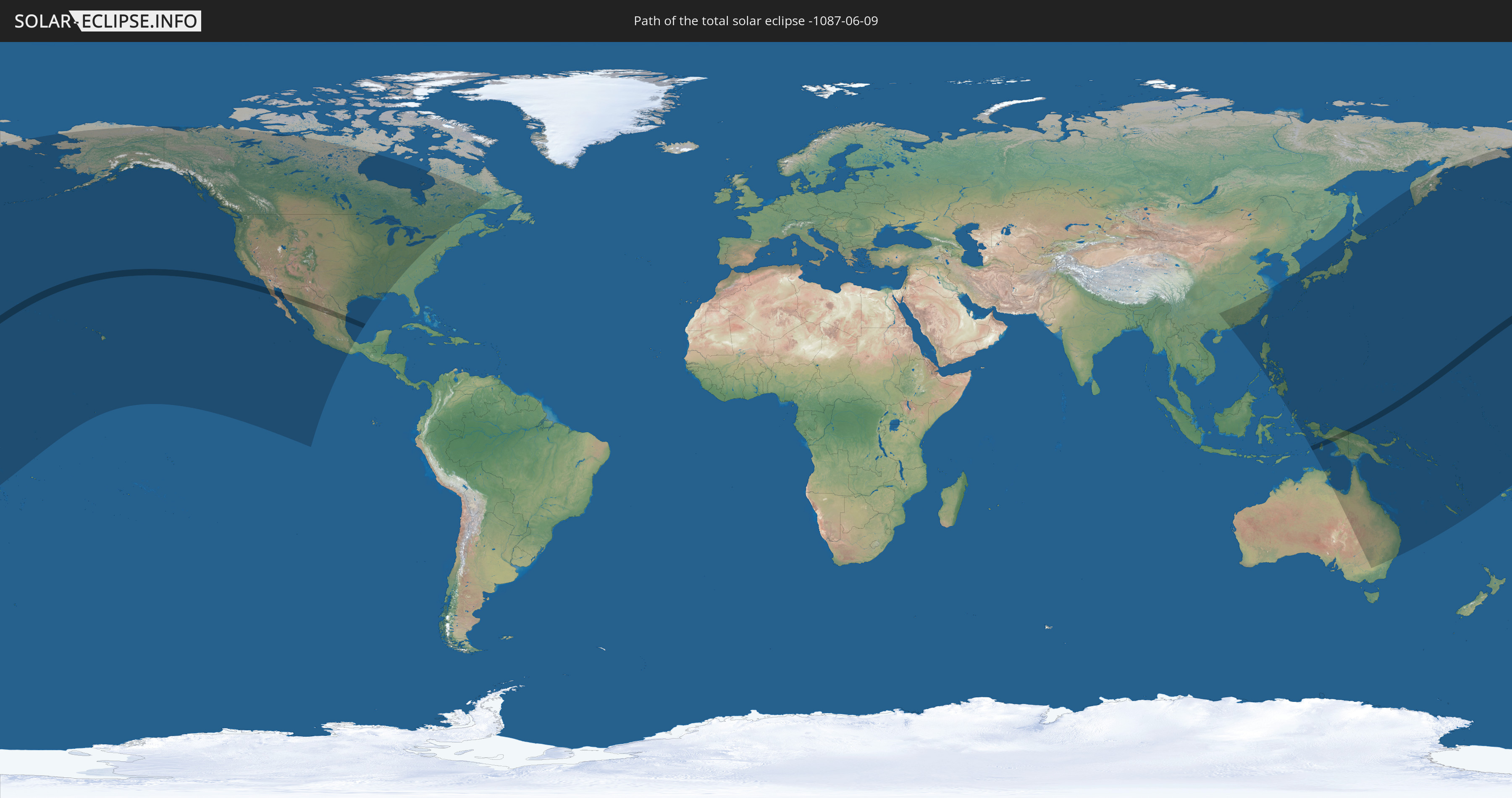
Total solar eclipse of 06/09/-1087
| Day of week: | Wednesday |
| Maximum duration of eclipse: | 04m26s |
| Maximum width of eclipse path: | 170 km |
| Saros cycle: | 39 |
| Coverage: | 100% |
| Magnitude: | 1.0506 |
| Gamma: | 0.1481 |
Wo kann man die Sonnenfinsternis vom 06/09/-1087 sehen?
Die Sonnenfinsternis am 06/09/-1087 kann man in 29 Ländern als partielle Sonnenfinsternis beobachten.
Der Finsternispfad verläuft durch 5 Länder. Nur in diesen Ländern ist sie als total Sonnenfinsternis zu sehen.
In den folgenden Ländern ist die Sonnenfinsternis total zu sehen
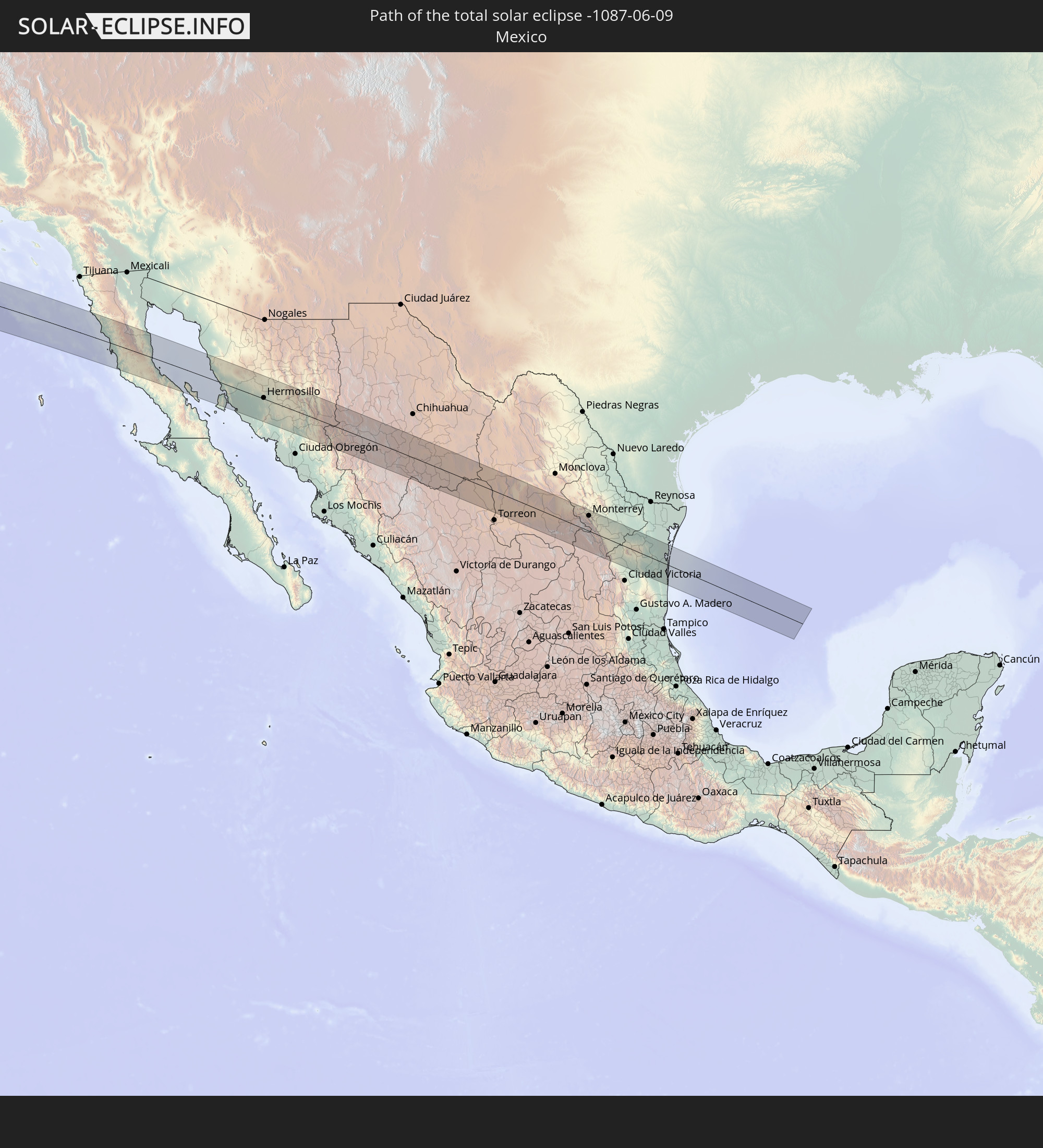 Mexico
 Indonesia
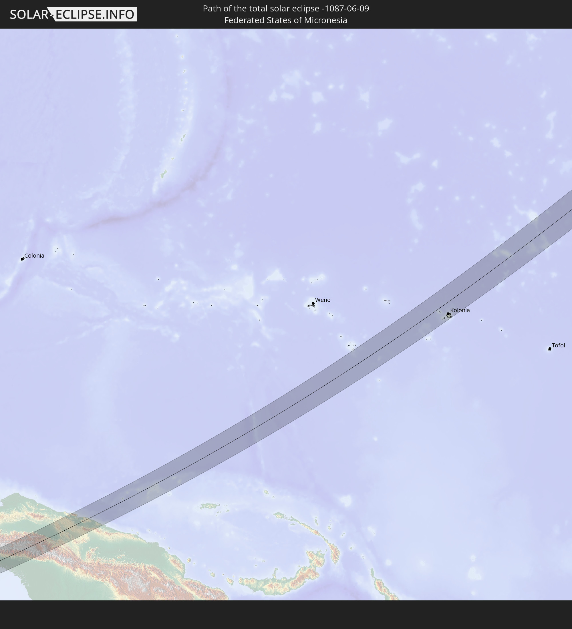 Federated States of Micronesia
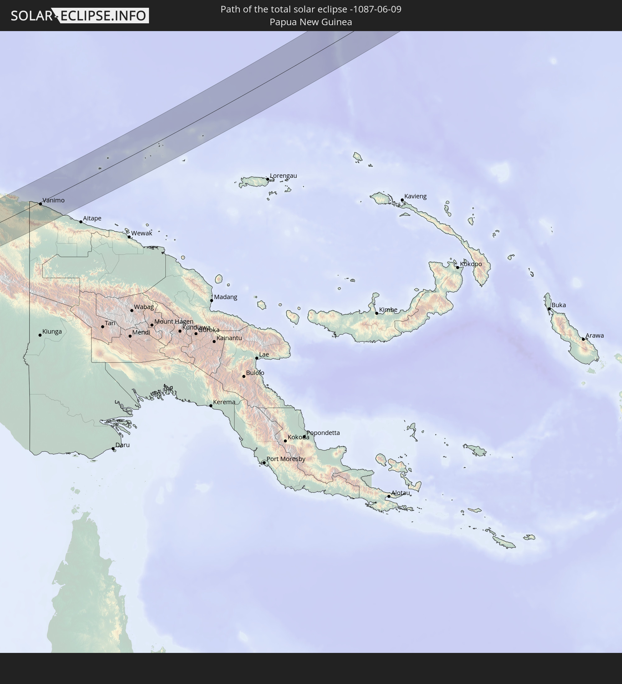 Papua New Guinea
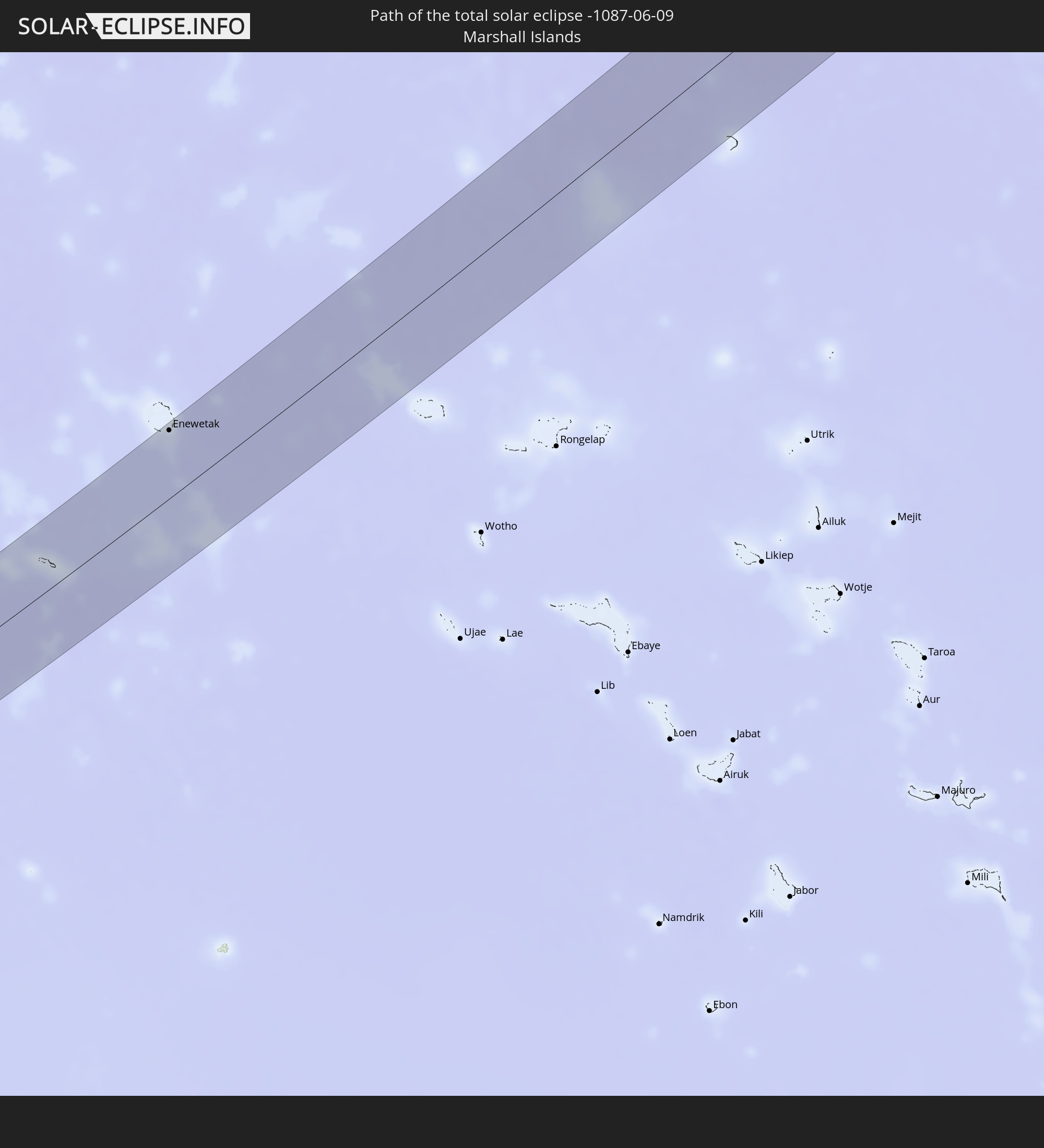 Marshall Islands
In den folgenden Ländern ist die Sonnenfinsternis partiell zu sehen
 Fiji
Fiji
 Russia
 United States
 United States Minor Outlying Islands
 Kiribati
 Tokelau
 Canada
 Mexico
 Greenland
 China
China
 Indonesia
 Australia
 Macau
Macau
 Hong Kong
 Taiwan
 Philippines
 Japan
Japan
 South Korea
 Palau
Palau
 Federated States of Micronesia
 Papua New Guinea
 Guam
Guam
 Northern Mariana Islands
 Solomon Islands
 New Caledonia
 Marshall Islands
 Vanuatu
 Nauru
Nauru
 Tuvalu
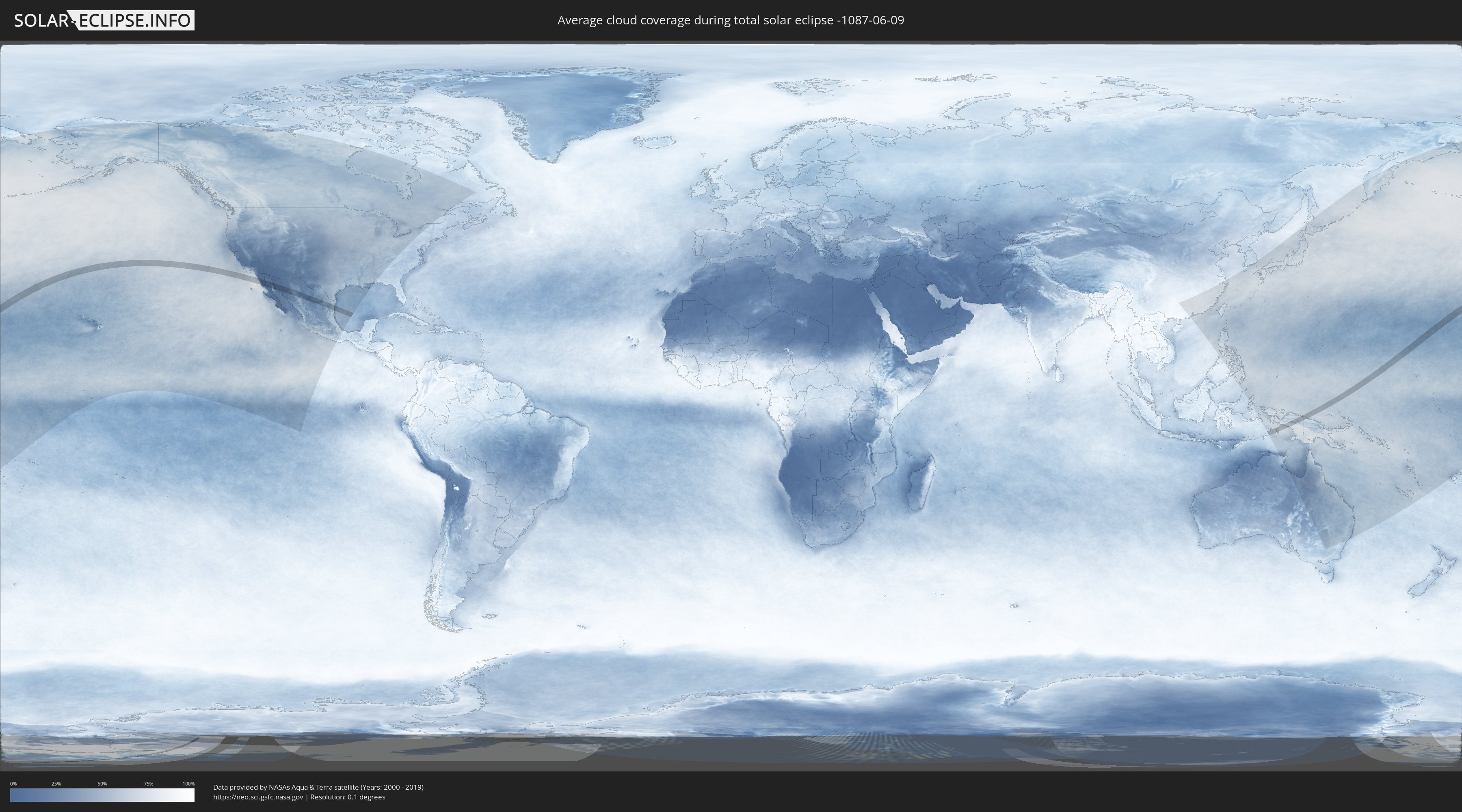
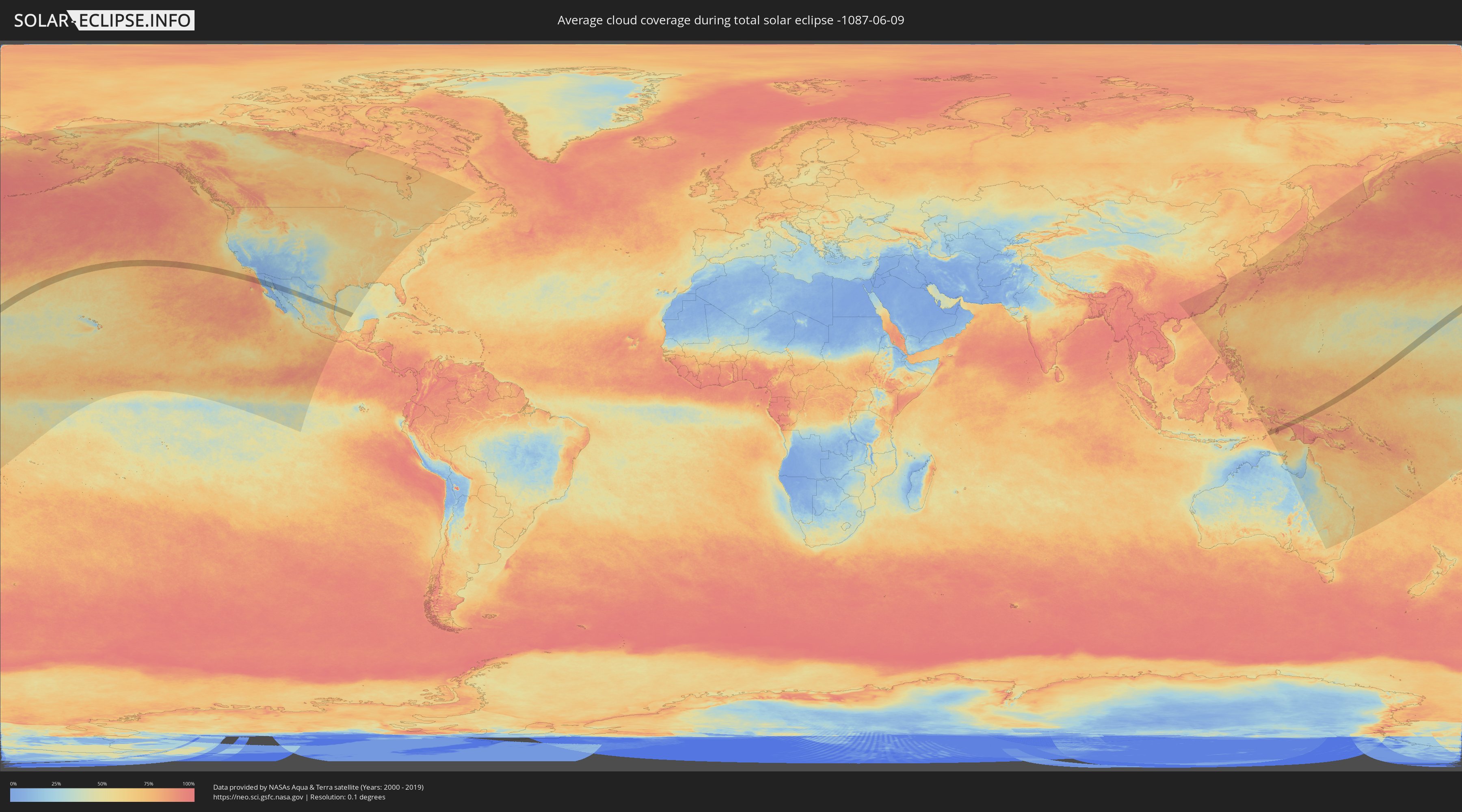
How will be the weather during the total solar eclipse on 06/09/-1087?
Where is the best place to see the total solar eclipse of 06/09/-1087?
The following maps show the average cloud coverage for the day of the total solar eclipse.
With the help of these maps, it is possible to find the place along the eclipse path, which has the best
chance of a cloudless sky.
Nevertheless, you should consider local circumstances and inform about the weather of your chosen
observation site.
The data is provided by NASAs satellites
AQUA and TERRA.
The cloud maps are averaged over a period of 19 years (2000 - 2019).
Detailed country maps
 Mexico
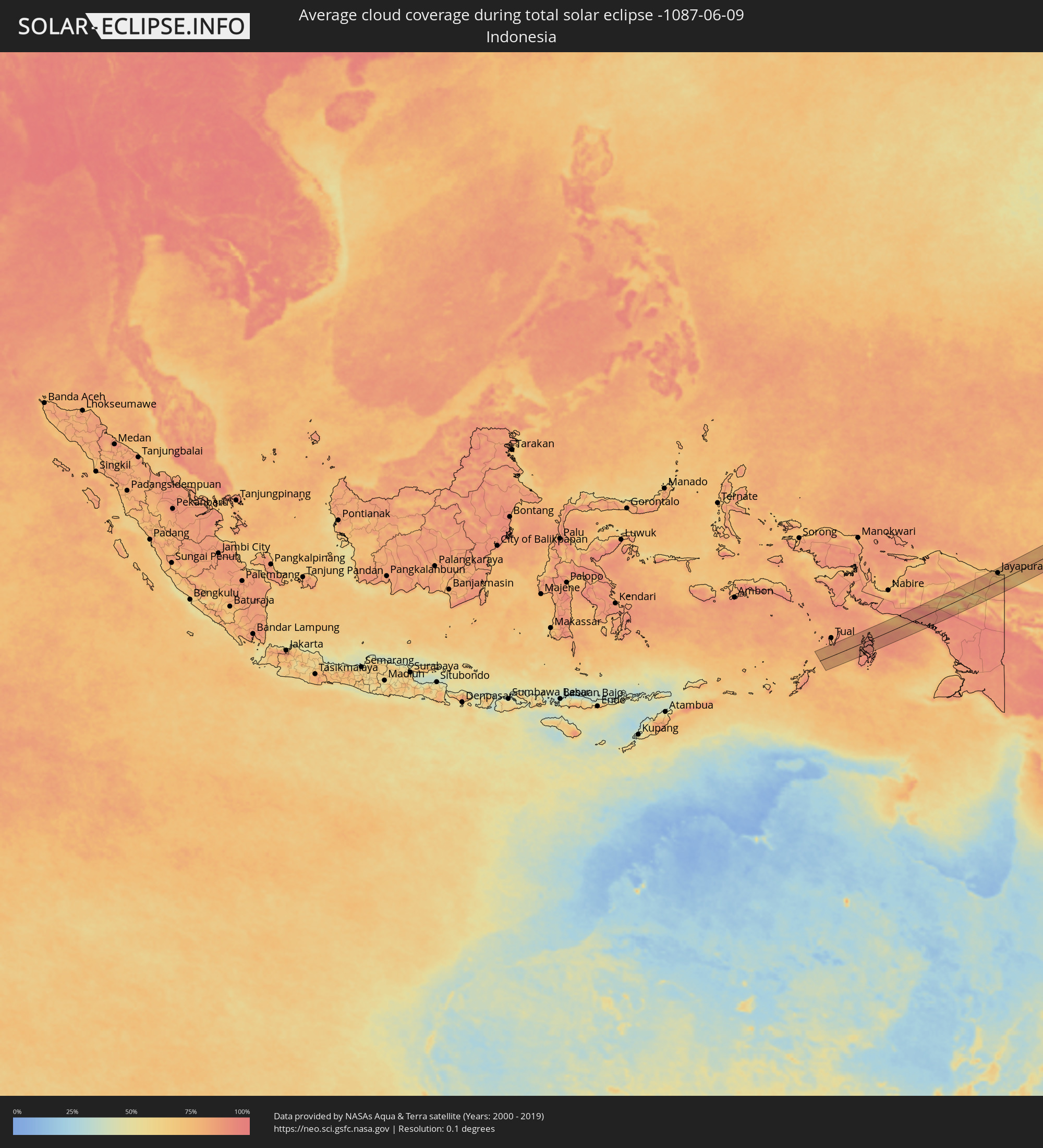 Indonesia
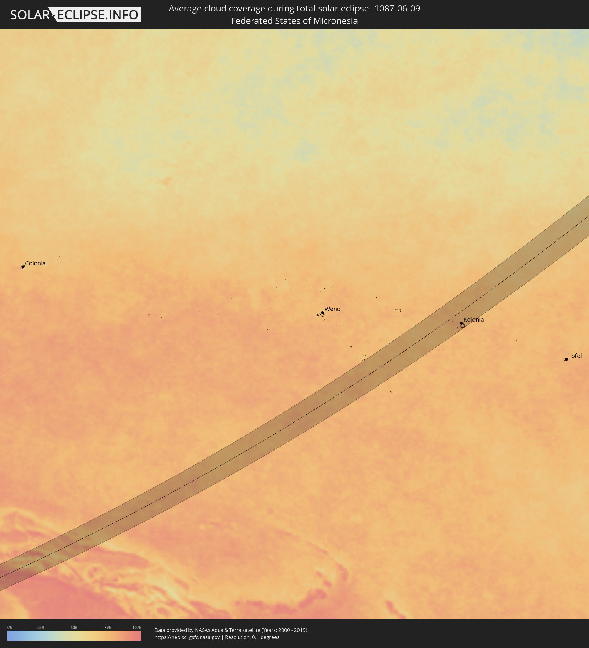 Federated States of Micronesia
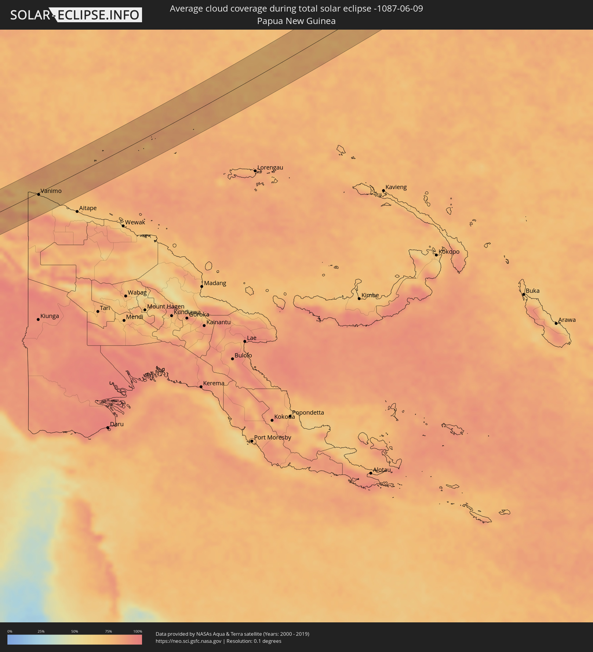 Papua New Guinea
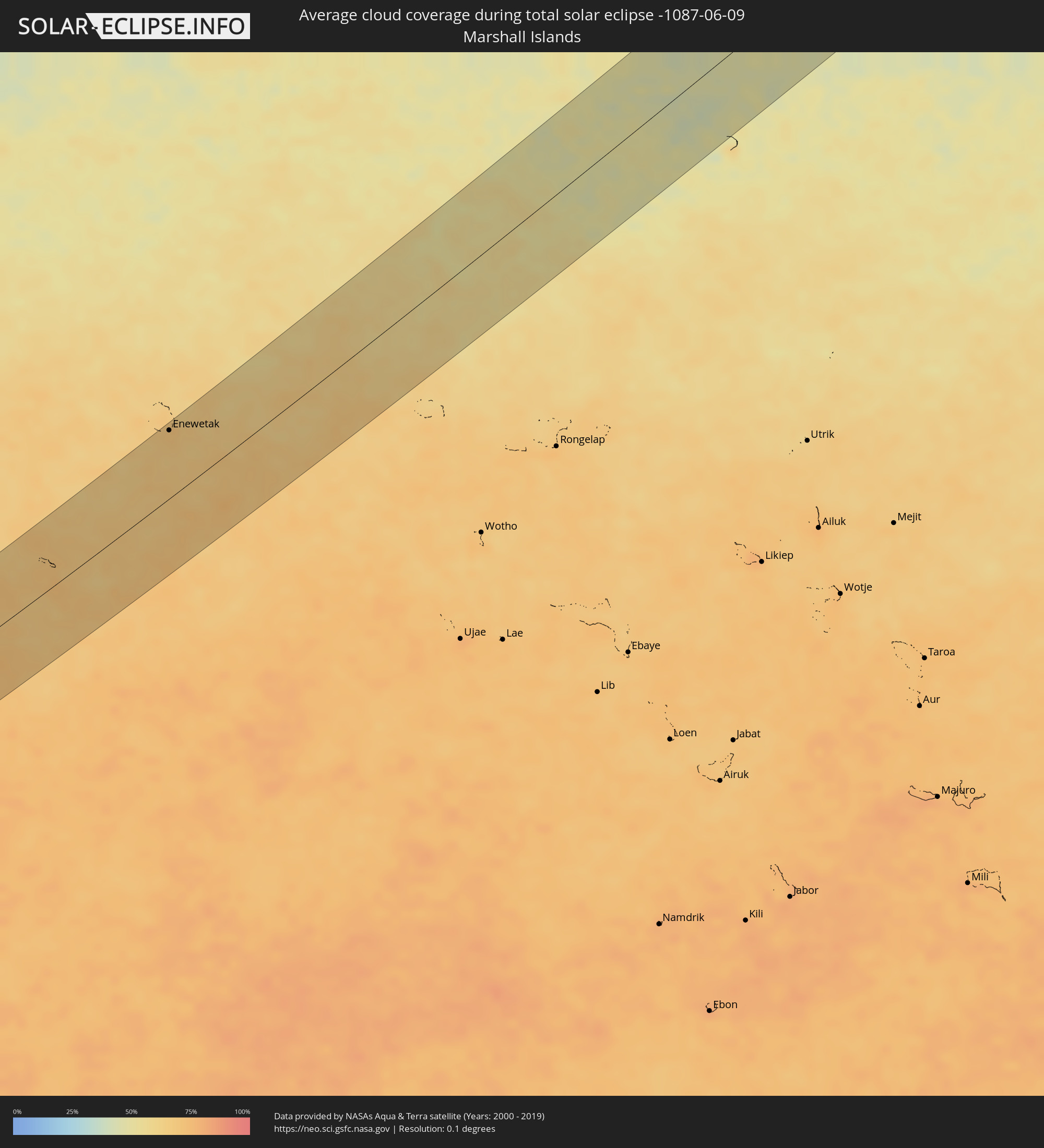 Marshall Islands
Cities inside the path of the eclipse
The following table shows all locations with a population of more than 5,000 inside the eclipse path. Cities which have more than 100,000 inhabitants are marked bold. A click at the locations opens a detailed map.
| City | Type | Eclipse duration | Local time of max. eclipse | Distance to central line | Ø Cloud coverage |
|
Camalú, Baja California
|
total | - | 16:44:50 UTC-07:48 | 17 km | 52% |
|
Emiliano Zapata, Baja California
|
total | - | 16:44:57 UTC-07:48 | 10 km | 34% |
|
Vicente Guerrero, Baja California
|
total | - | 16:44:58 UTC-07:48 | 8 km | 41% |
|
Bahía de Kino, Sonora
|
total | - | 17:12:37 UTC-07:23 | 60 km | 15% |
|
Miguel Alemán (La Doce), Sonora
|
total | - | 17:12:48 UTC-07:23 | 42 km | 11% |
|
Hermosillo, Sonora
|
total | - | 17:12:48 UTC-07:23 | 3 km | 10% |
|
Pesqueira, Sonora
|
total | - | 17:12:37 UTC-07:23 | 34 km | 11% |
|
Santa Bárbara, Chihuahua
|
total | - | 17:34:05 UTC-07:05 | 49 km | 41% |
|
Hidalgo del Parral, Chihuahua
|
total | - | 17:34:02 UTC-07:05 | 31 km | 34% |
|
Ciudad Camargo, Chihuahua
|
total | - | 17:33:36 UTC-07:05 | 65 km | 20% |
|
Bermejillo, Durango
|
total | - | 18:04:05 UTC-06:36 | 61 km | 17% |
|
Tlahualilo de Zaragoza, Durango
|
total | - | 18:03:58 UTC-06:36 | 31 km | 17% |
|
Concordia, Coahuila
|
total | - | 18:04:12 UTC-06:36 | 52 km | 24% |
|
Parras de la Fuente, Coahuila
|
total | - | 18:04:29 UTC-06:36 | 51 km | 31% |
|
Saltillo, Coahuila
|
total | - | 18:04:33 UTC-06:36 | 7 km | 37% |
|
Ramos Arizpe, Coahuila
|
total | - | 18:04:29 UTC-06:36 | 7 km | 30% |
|
Arteaga, Coahuila
|
total | - | 18:04:33 UTC-06:36 | 2 km | 37% |
|
García, Nuevo León
|
total | - | 18:04:19 UTC-06:36 | 49 km | 36% |
|
Valle de Lincoln, Nuevo León
|
total | - | 18:04:20 UTC-06:36 | 52 km | 43% |
|
Parque Industrial Ciudad Mitras, Nuevo León
|
total | - | 18:04:20 UTC-06:36 | 53 km | 45% |
|
Mitras Poniente, Nuevo León
|
total | - | 18:04:21 UTC-06:36 | 52 km | 45% |
|
Monterrey, Nuevo León
|
total | - | 18:04:25 UTC-06:36 | 46 km | 46% |
|
Jardines de la Silla (Jardines), Nuevo León
|
total | - | 18:04:26 UTC-06:36 | 47 km | 52% |
|
Apodaca, Nuevo León
|
total | - | 18:04:22 UTC-06:36 | 61 km | 50% |
|
Monte Kristal, Nuevo León
|
total | - | 18:04:27 UTC-06:36 | 47 km | 52% |
|
Santiago, Nuevo León
|
total | - | 18:04:34 UTC-06:36 | 27 km | 55% |
|
Misión San Pablo, Nuevo León
|
total | - | 18:04:22 UTC-06:36 | 60 km | 53% |
|
Loma la Paz, Nuevo León
|
total | - | 18:04:23 UTC-06:36 | 57 km | 53% |
|
Héctor Caballero, Nuevo León
|
total | - | 18:04:26 UTC-06:36 | 50 km | 52% |
|
Juárez, Nuevo León
|
total | - | 18:04:26 UTC-06:36 | 52 km | 52% |
|
Galeana, Nuevo León
|
total | - | 18:04:56 UTC-06:36 | 31 km | 39% |
|
Allende, Nuevo León
|
total | - | 18:04:39 UTC-06:36 | 17 km | 54% |
|
Cadereyta, Nuevo León
|
total | - | 18:04:28 UTC-06:36 | 50 km | 53% |
|
Montemorelos, Nuevo León
|
total | - | 18:04:43 UTC-06:36 | 16 km | 51% |
|
General Teran, Nuevo León
|
total | - | 18:04:40 UTC-06:36 | 29 km | 49% |
|
Linares, Nuevo León
|
total | - | 18:04:54 UTC-06:36 | 8 km | 45% |
|
La Reforma, Nuevo León
|
total | - | 18:05:00 UTC-06:36 | 23 km | 42% |
|
Santander Jiménez, Tamaulipas
|
total | - | 18:05:14 UTC-06:36 | 30 km | 53% |
|
Abasolo, Tamaulipas
|
total | - | 18:05:19 UTC-06:36 | 42 km | 51% |
|
San Fernando, Tamaulipas
|
total | - | 18:04:51 UTC-06:36 | 48 km | 60% |
|
Abepura, Papua
|
total | - | 06:37:14 UTC+09:22 | 36 km | 71% |
|
Jayapura, Papua
|
total | - | 06:37:17 UTC+09:22 | 38 km | 74% |
|
Vanimo, Sandaun
|
total | - | 07:14:25 UTC+10:00 | 2 km | 74% |
|
Vanimo, Sandaun
|
total | - | 07:14:24 UTC+10:00 | 6 km | 74% |
|
Palikir - National Government Center, Pohnpei
|
total | - | 08:29:42 UTC+11:00 | 53 km | 80% |
|
Kolonia Town, Pohnpei
|
total | - | 08:29:47 UTC+11:00 | 52 km | 82% |
|
Kolonia, Pohnpei
|
total | - | 08:29:47 UTC+11:00 | 52 km | 82% |
|
Enewetak, Enewetak Atoll
|
total | - | 08:39:03 UTC+11:00 | 70 km | 67% |