Total solar eclipse of 03/27/-1186
| Day of week: | Tuesday |
| Maximum duration of eclipse: | 03m23s |
| Maximum width of eclipse path: | 211 km |
| Saros cycle: | 20 |
| Coverage: | 100% |
| Magnitude: | 1.0429 |
| Gamma: | 0.7399 |
Wo kann man die Sonnenfinsternis vom 03/27/-1186 sehen?
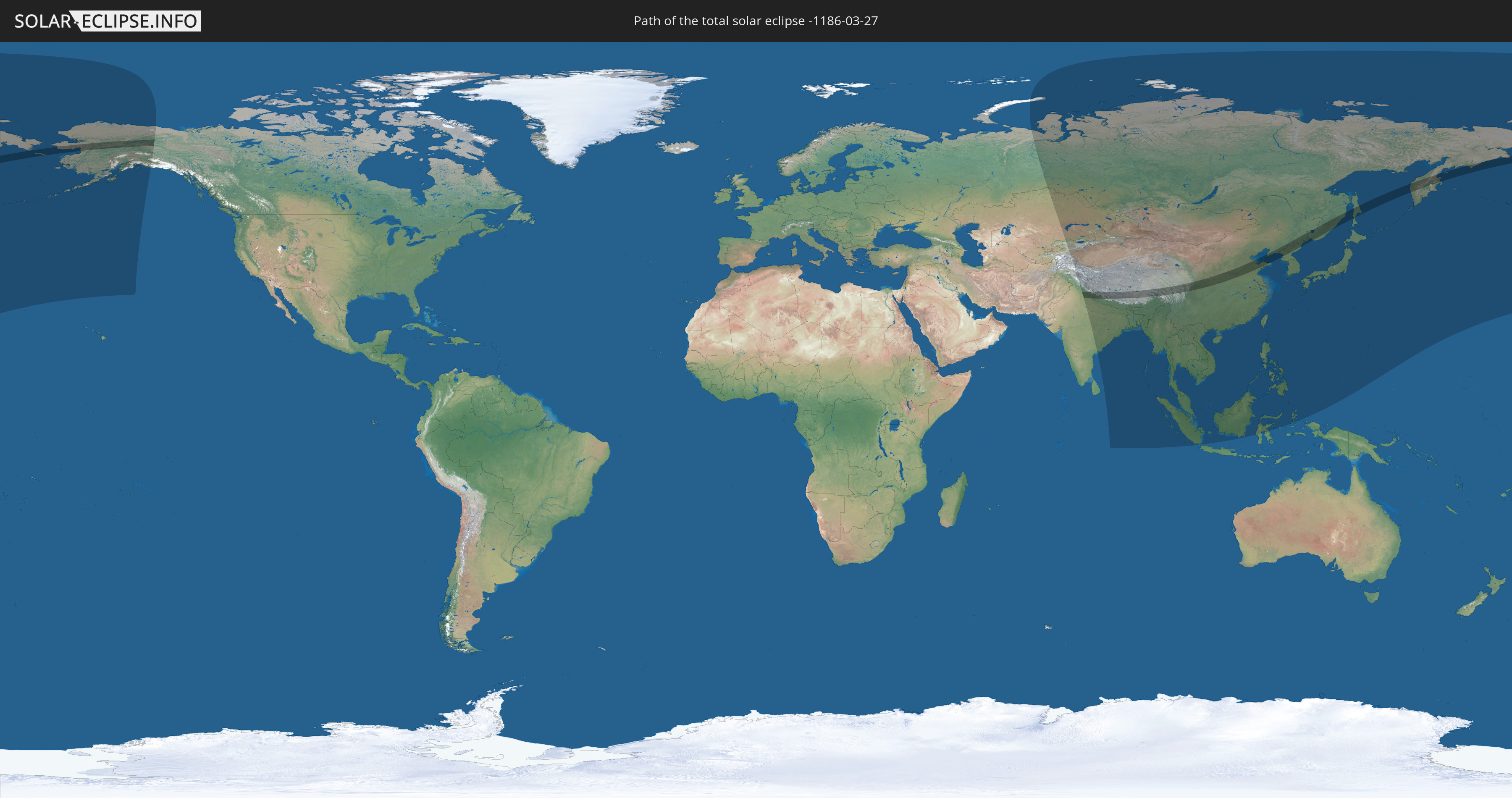
Die Sonnenfinsternis am 03/27/-1186 kann man in 32 Ländern als partielle Sonnenfinsternis beobachten.
Der Finsternispfad verläuft durch 6 Länder. Nur in diesen Ländern ist sie als total Sonnenfinsternis zu sehen.
In den folgenden Ländern ist die Sonnenfinsternis total zu sehen
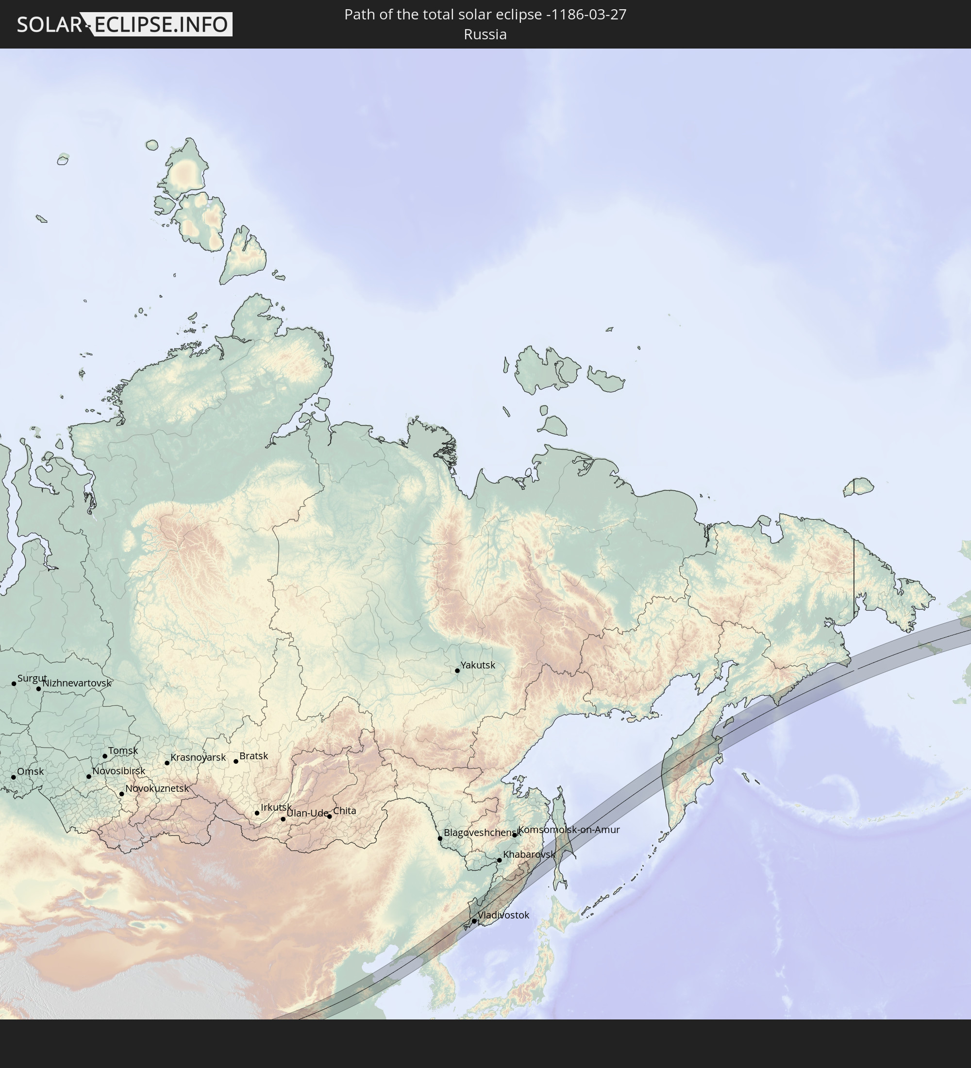 Russia
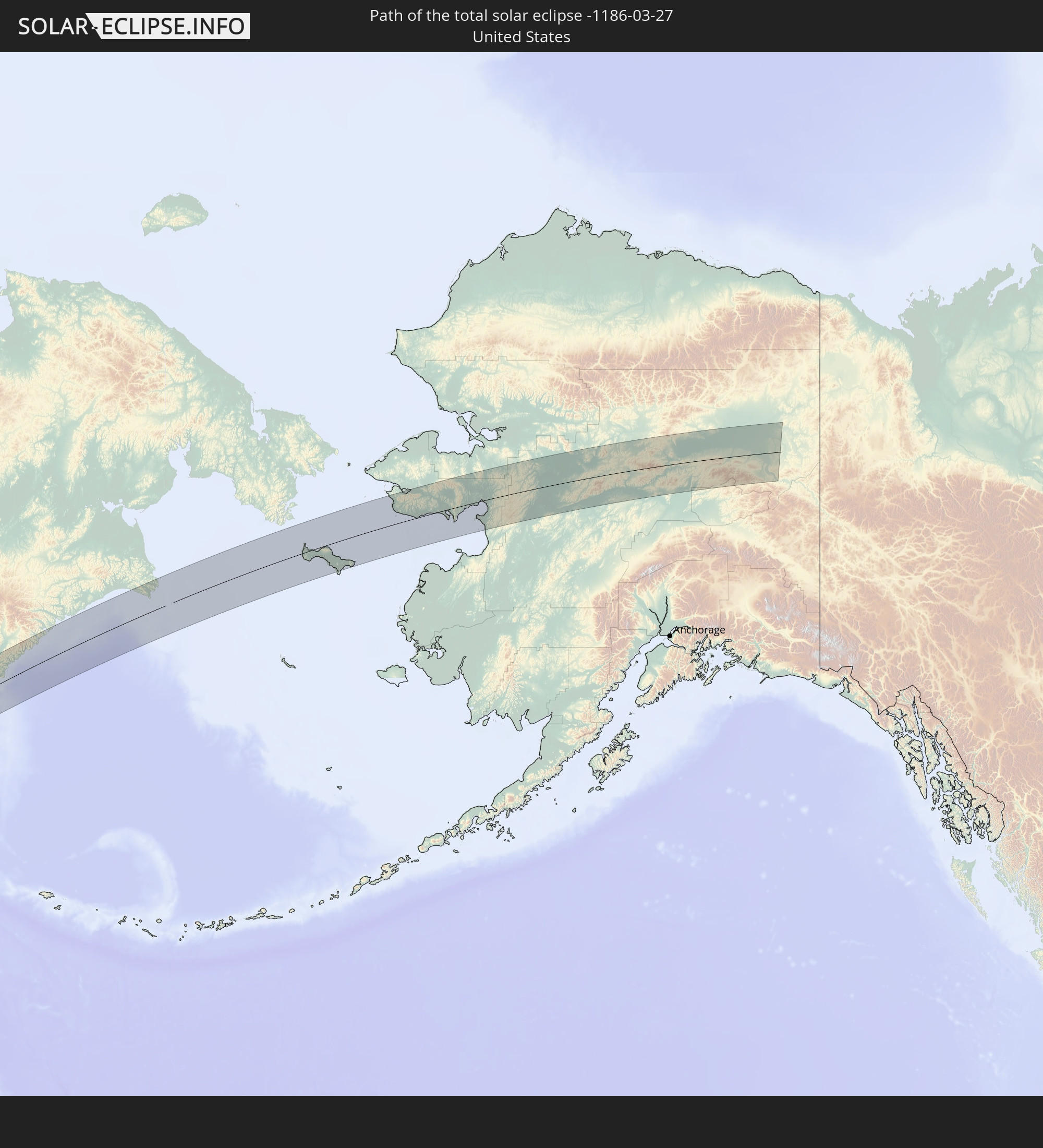 United States
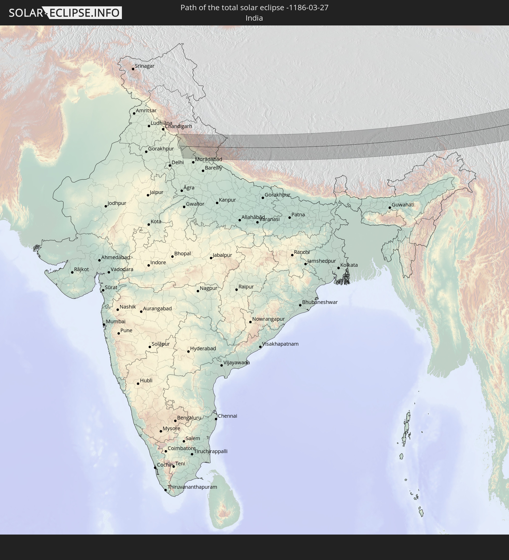 India
India
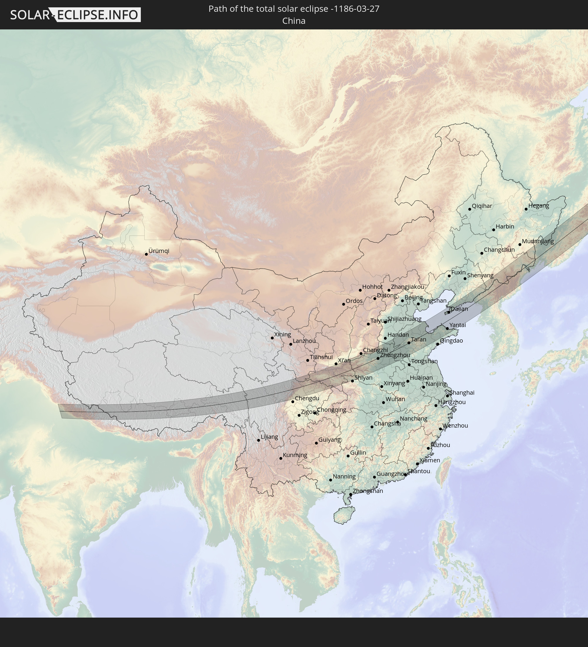 China
China
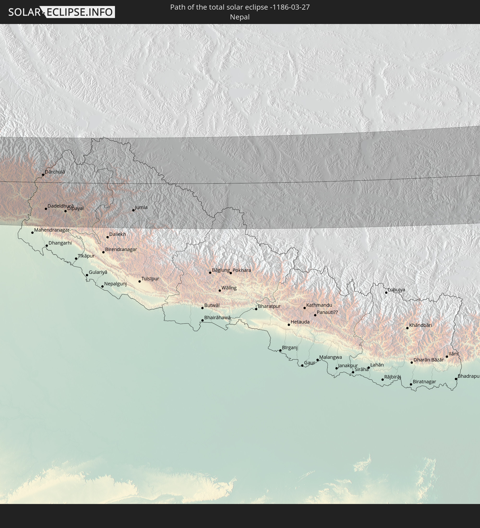 Nepal
Nepal
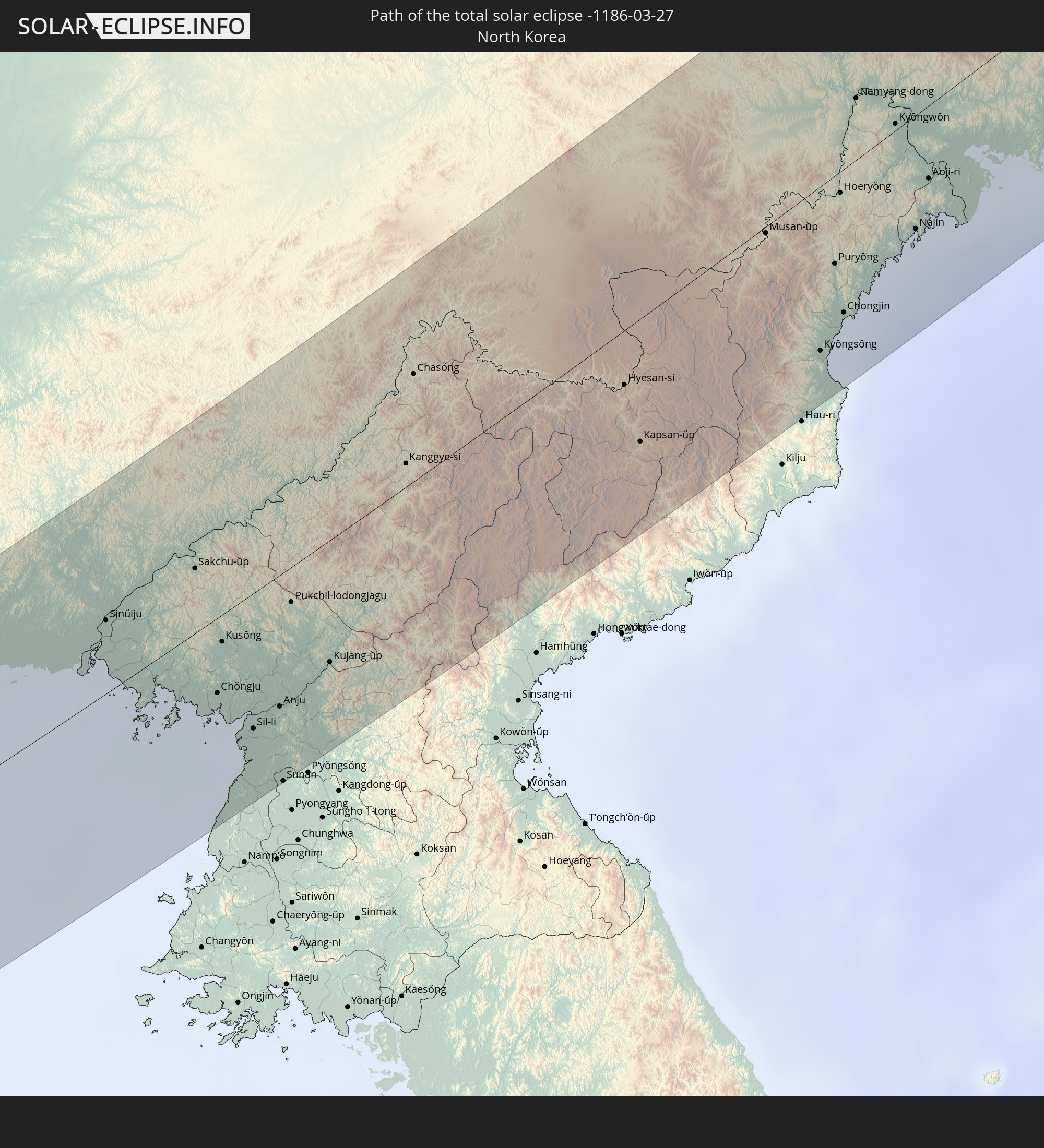 North Korea
In den folgenden Ländern ist die Sonnenfinsternis partiell zu sehen
 Russia
 United States
 United States Minor Outlying Islands
 Kazakhstan
 Pakistan
 India
India
 Kyrgyzstan
 China
China
 Nepal
Nepal
 Mongolia
 Bangladesh
 Bhutan
 Myanmar
 Indonesia
 Thailand
 Malaysia
 Laos
Laos
 Vietnam
 Cambodia
 Singapore
 Macau
Macau
 Hong Kong
 Brunei
 Taiwan
 Philippines
 Japan
Japan
 North Korea
 South Korea
 Palau
Palau
 Federated States of Micronesia
 Guam
Guam
 Northern Mariana Islands
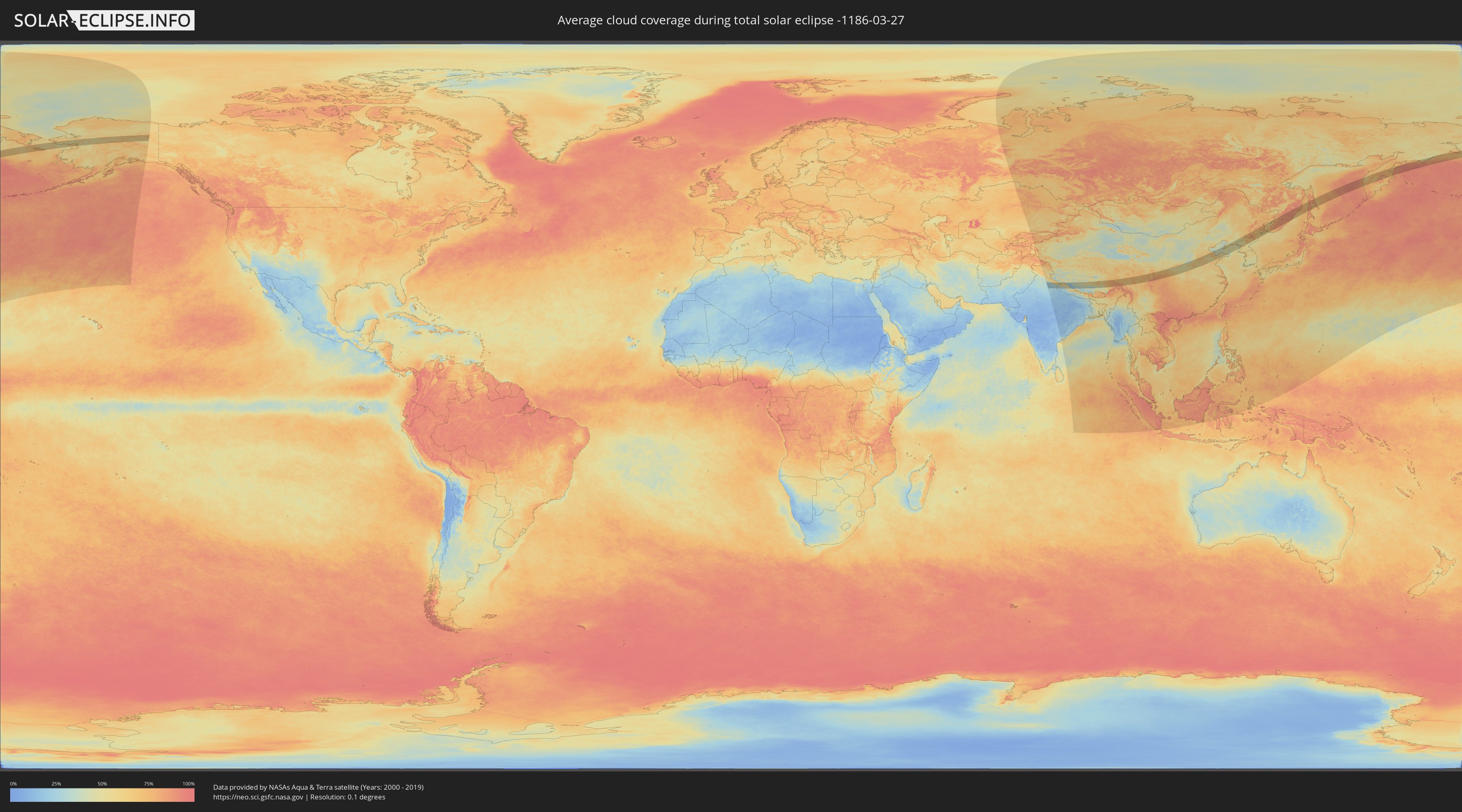
How will be the weather during the total solar eclipse on 03/27/-1186?
Where is the best place to see the total solar eclipse of 03/27/-1186?
The following maps show the average cloud coverage for the day of the total solar eclipse.
With the help of these maps, it is possible to find the place along the eclipse path, which has the best
chance of a cloudless sky.
Nevertheless, you should consider local circumstances and inform about the weather of your chosen
observation site.
The data is provided by NASAs satellites
AQUA and TERRA.
The cloud maps are averaged over a period of 19 years (2000 - 2019).

Detailed country maps
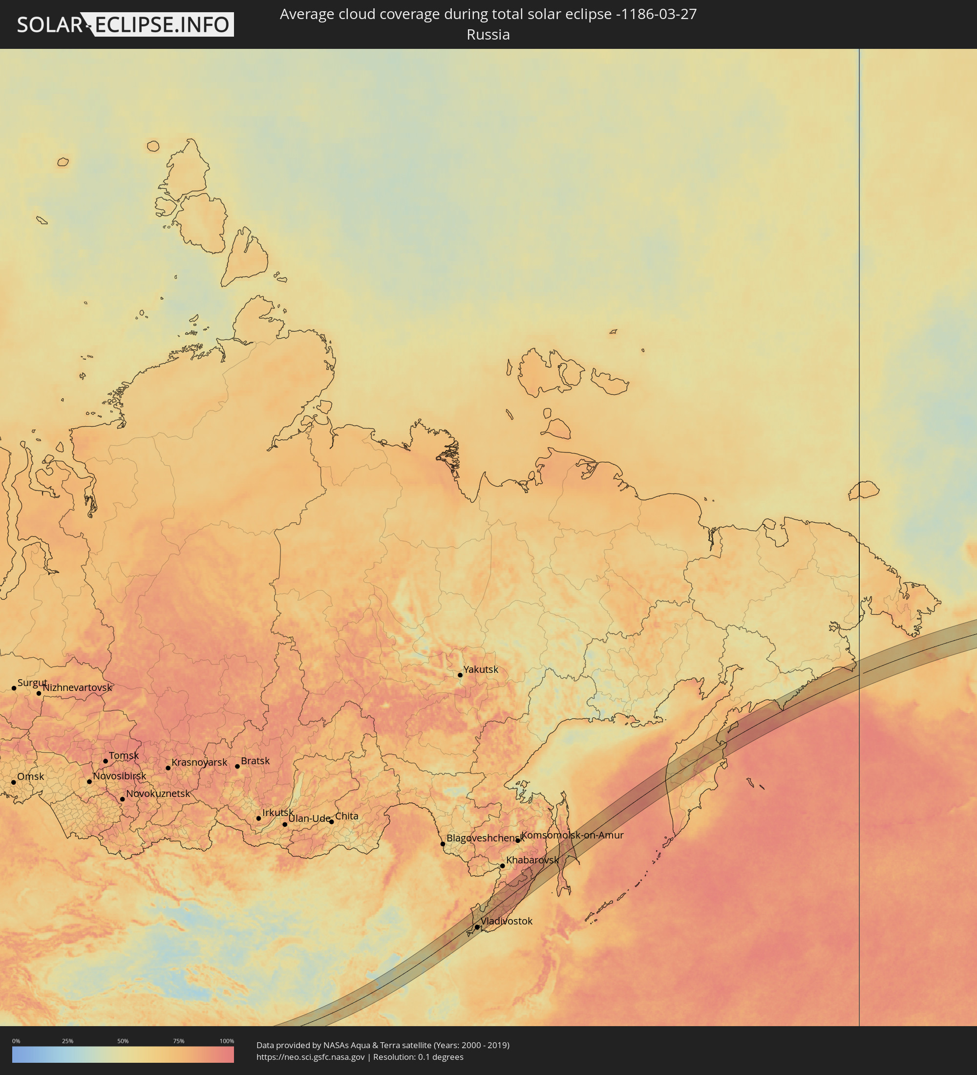 Russia
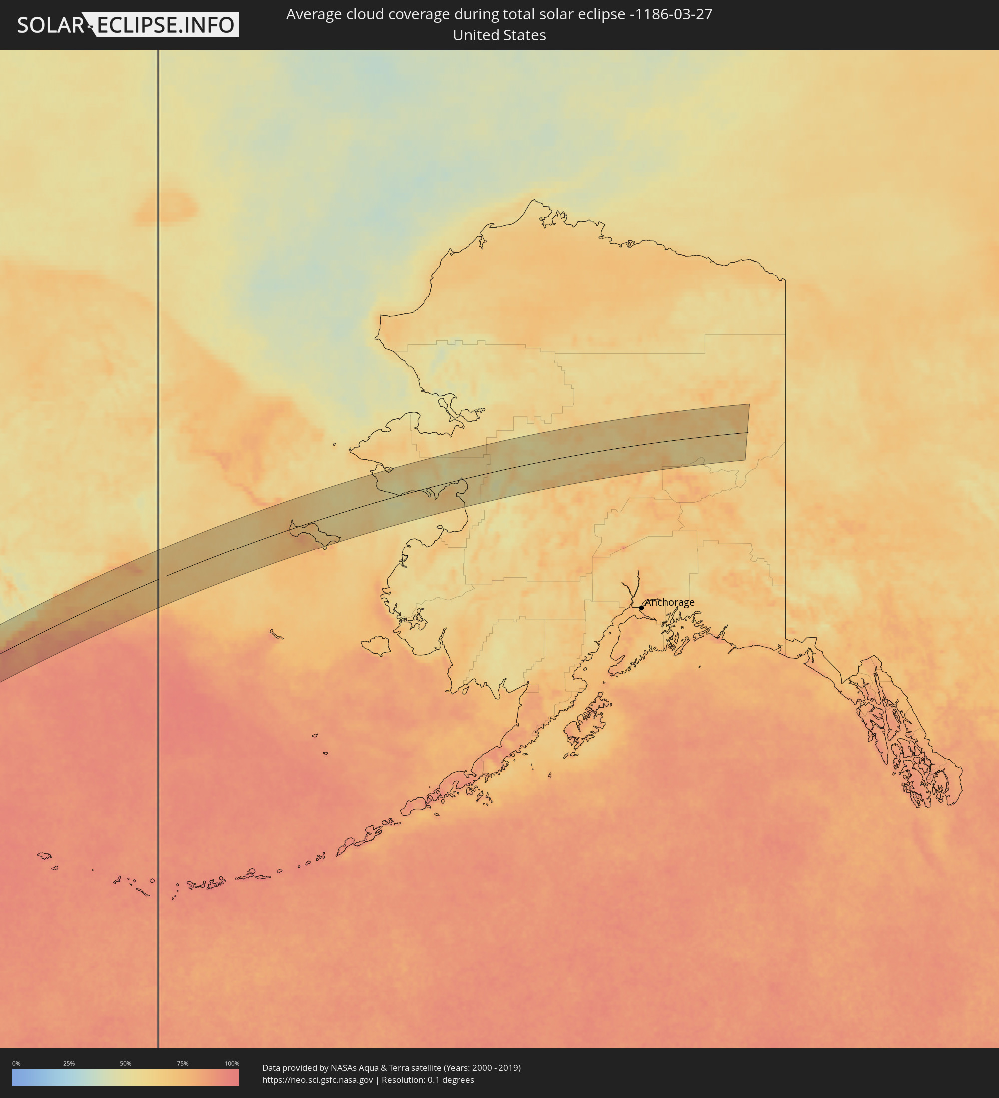 United States
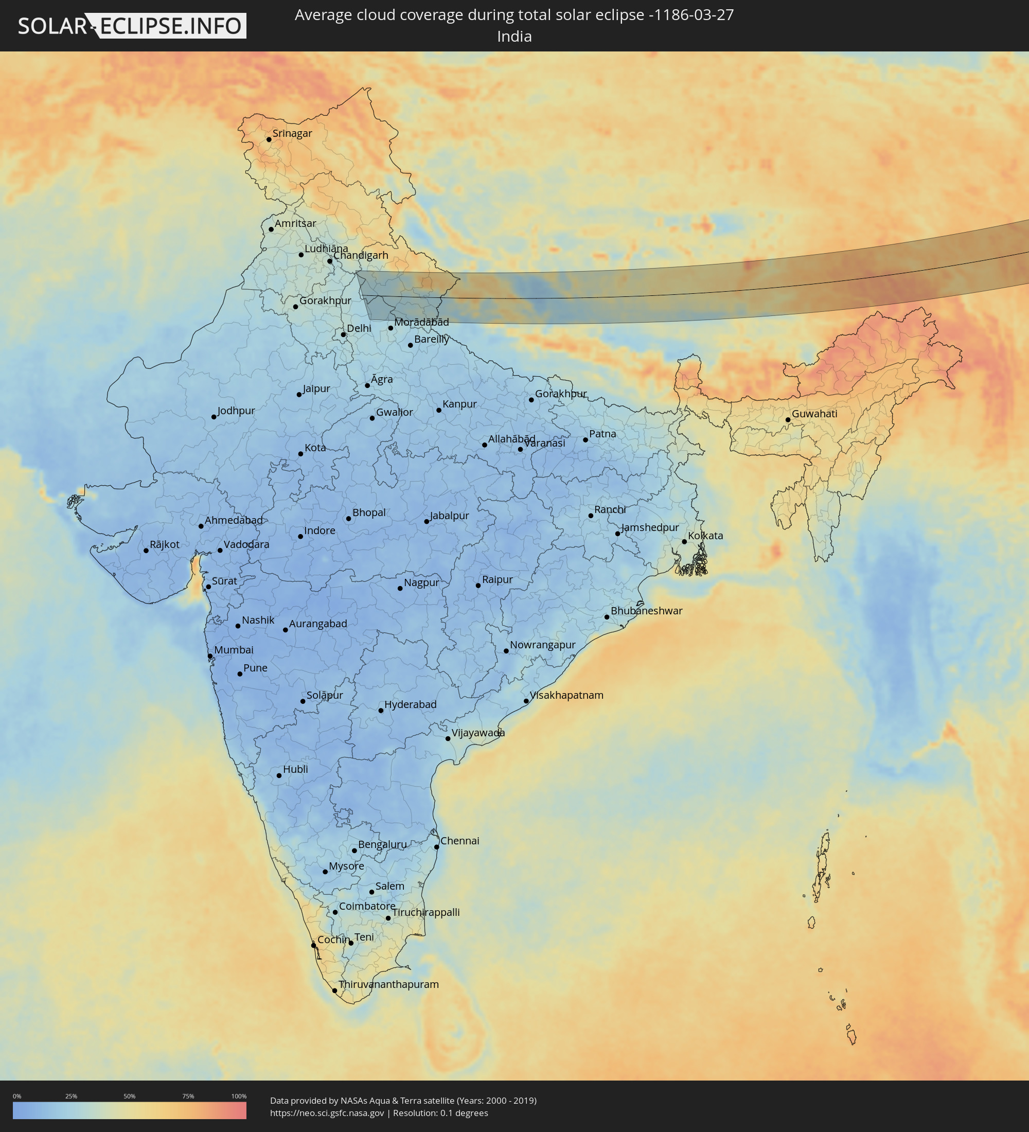 India
India
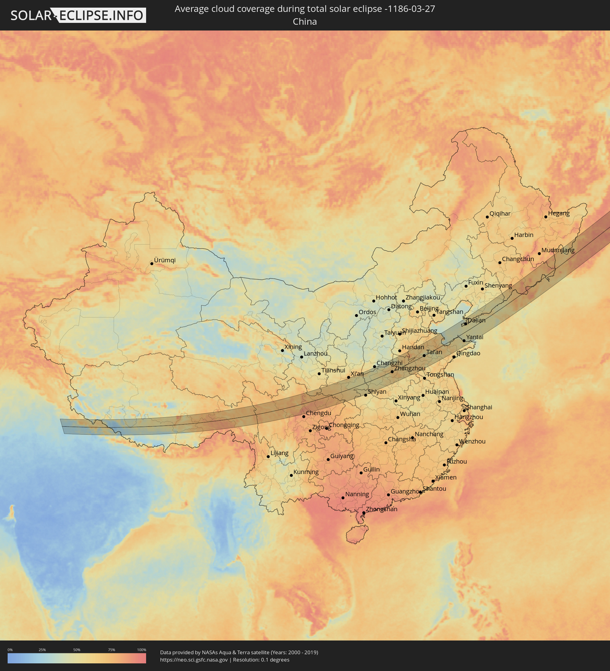 China
China
 Nepal
Nepal
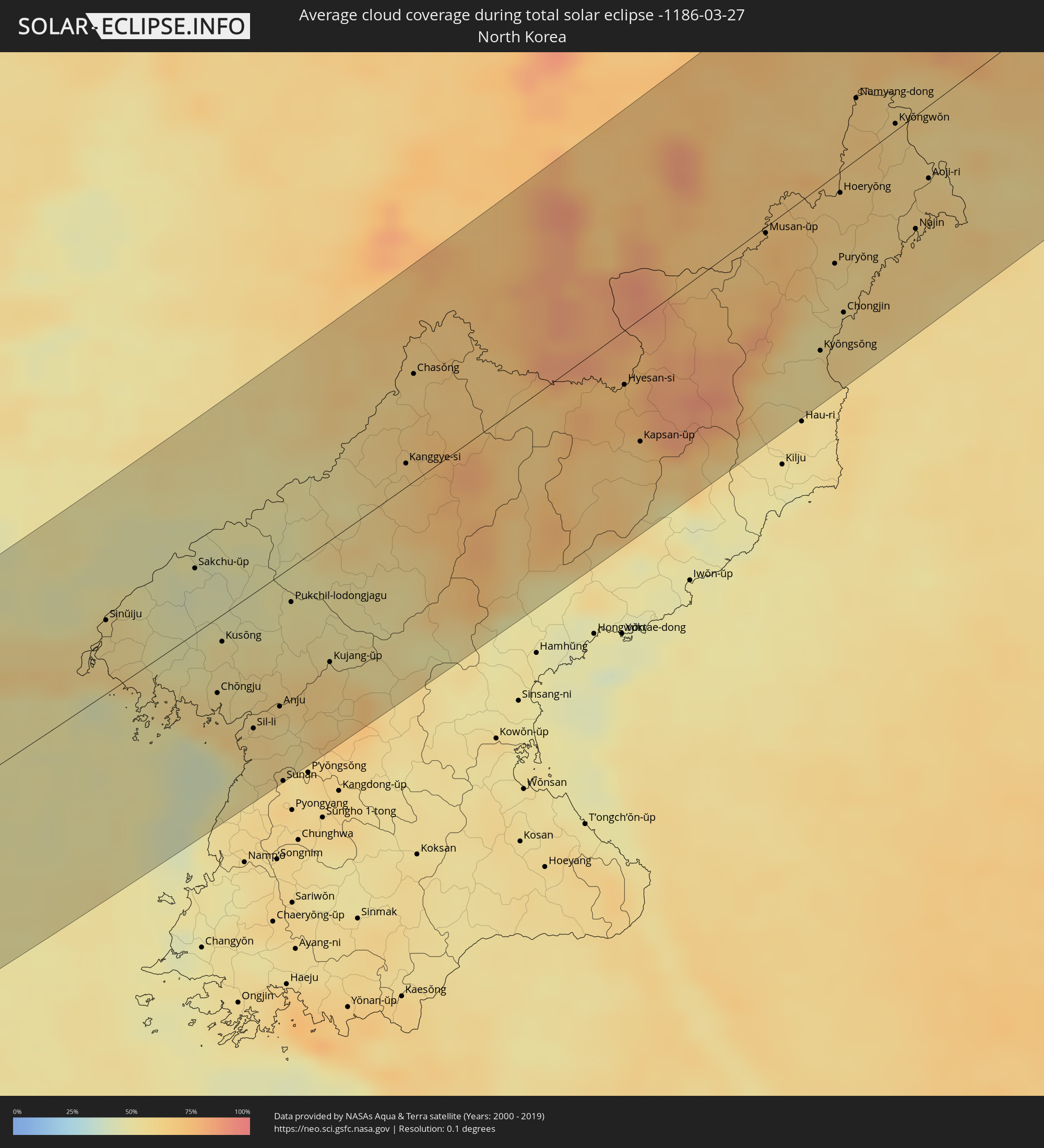 North Korea
Cities inside the path of the eclipse
The following table shows all locations with a population of more than 5,000 inside the eclipse path. Cities which have more than 100,000 inhabitants are marked bold. A click at the locations opens a detailed map.
| City | Type | Eclipse duration | Local time of max. eclipse | Distance to central line | Ø Cloud coverage |
|
Manglaur, Uttarakhand
|
total | - | 06:24:04 UTC+05:21 | 1 km | 26% |
|
Roorkee, Uttarakhand
|
total | - | 06:24:10 UTC+05:21 | 8 km | 26% |
|
Clement Town, Uttarakhand
|
total | - | 06:24:43 UTC+05:21 | 53 km | 31% |
|
Dehra Dūn, Uttarakhand
|
total | - | 06:24:48 UTC+05:21 | 59 km | 31% |
|
Laksar, Uttarakhand
|
total | - | 06:24:02 UTC+05:21 | 5 km | 25% |
|
Mussoorie, Uttarakhand
|
total | - | 06:24:59 UTC+05:21 | 74 km | 34% |
|
Rāipur, Uttarakhand
|
total | - | 06:24:47 UTC+05:21 | 58 km | 30% |
|
Mandāwar, Uttar Pradesh
|
total | - | 06:23:40 UTC+05:21 | 36 km | 25% |
|
Bijnor, Uttar Pradesh
|
total | - | 06:23:30 UTC+05:21 | 46 km | 25% |
|
Haridwar, Uttarakhand
|
total | - | 06:24:18 UTC+05:21 | 23 km | 25% |
|
Kīratpur, Uttar Pradesh
|
total | - | 06:23:42 UTC+05:21 | 31 km | 24% |
|
Jhālu, Uttar Pradesh
|
total | - | 06:23:28 UTC+05:21 | 50 km | 24% |
|
Chāndpur, Uttar Pradesh
|
total | - | 06:23:12 UTC+05:21 | 72 km | 25% |
|
Birbhaddar, Uttarakhand
|
total | - | 06:24:28 UTC+05:21 | 32 km | 26% |
|
Haldaur, Uttar Pradesh
|
total | - | 06:23:24 UTC+05:21 | 55 km | 26% |
|
Rishīkesh, Uttarakhand
|
total | - | 06:24:31 UTC+05:21 | 36 km | 26% |
|
Najībābād, Uttar Pradesh
|
total | - | 06:23:51 UTC+05:21 | 19 km | 25% |
|
Nūrpur, Uttar Pradesh
|
total | - | 06:23:13 UTC+05:21 | 70 km | 24% |
|
Nagīna, Uttar Pradesh
|
total | - | 06:23:37 UTC+05:21 | 37 km | 25% |
|
Tehri, Uttarakhand
|
total | - | 06:24:55 UTC+05:21 | 68 km | 30% |
|
Tājpur, Uttar Pradesh
|
total | - | 06:23:15 UTC+05:21 | 68 km | 26% |
|
Kotdwāra, Uttarakhand
|
total | - | 06:24:02 UTC+05:21 | 3 km | 27% |
|
Sherkot, Uttar Pradesh
|
total | - | 06:23:28 UTC+05:21 | 50 km | 26% |
|
Seohāra, Uttar Pradesh
|
total | - | 06:23:19 UTC+05:21 | 63 km | 24% |
|
Sahaspur, Uttar Pradesh
|
total | - | 06:23:12 UTC+05:21 | 72 km | 25% |
|
Afzalgarh, Uttar Pradesh
|
total | - | 06:23:34 UTC+05:21 | 42 km | 26% |
|
Pauri, Uttarakhand
|
total | - | 06:24:37 UTC+05:21 | 43 km | 28% |
|
Srīnagar, Uttarakhand
|
total | - | 06:24:43 UTC+05:21 | 51 km | 28% |
|
Kālāgarh Project Colony, Uttarakhand
|
total | - | 06:23:41 UTC+05:21 | 32 km | 26% |
|
Jaspur, Uttarakhand
|
total | - | 06:23:25 UTC+05:21 | 54 km | 24% |
|
Thakurdwara, Uttar Pradesh
|
total | - | 06:23:18 UTC+05:21 | 64 km | 25% |
|
Kashipur, Uttarakhand
|
total | - | 06:23:21 UTC+05:21 | 61 km | 26% |
|
Bāzpur, Uttarakhand
|
total | - | 06:23:16 UTC+05:21 | 67 km | 25% |
|
Rāmnagar, Uttarakhand
|
total | - | 06:23:36 UTC+05:21 | 40 km | 26% |
|
Rānikhet, Uttarakhand
|
total | - | 06:23:58 UTC+05:21 | 12 km | 28% |
|
Naini Tāl, Uttarakhand
|
total | - | 06:23:38 UTC+05:21 | 39 km | 31% |
|
Haldwani, Uttarakhand
|
total | - | 06:23:24 UTC+05:21 | 58 km | 25% |
|
Almora, Uttarakhand
|
total | - | 06:23:56 UTC+05:21 | 16 km | 33% |
|
Tanakpur, Uttarakhand
|
total | - | 06:23:15 UTC+05:21 | 73 km | 28% |
|
Pithorāgarh, Uttarakhand
|
total | - | 06:23:58 UTC+05:21 | 16 km | 28% |
|
Dārchulā, Western Region
|
total | - | 06:24:22 UTC+05:21 | 13 km | 28% |
|
Dadeldhurā, Far Western
|
total | - | 06:43:43 UTC+05:41 | 47 km | 35% |
|
Dipayal, Far Western
|
total | - | 06:43:43 UTC+05:41 | 51 km | 26% |
|
Jumla, Mid Western
|
total | - | 06:43:55 UTC+05:41 | 48 km | 33% |
|
Deyang, Sichuan
|
total | - | 09:17:48 UTC+08:00 | 92 km | 83% |
|
Mianyang, Sichuan
|
total | - | 09:18:39 UTC+08:00 | 63 km | 81% |
|
Jiangyou, Sichuan
|
total | - | 09:19:11 UTC+08:00 | 32 km | 82% |
|
Guangyuan, Sichuan
|
total | - | 09:21:26 UTC+08:00 | 10 km | 76% |
|
Hanzhong, Shaanxi
|
total | - | 09:23:47 UTC+08:00 | 43 km | 71% |
|
Ankang, Shaanxi
|
total | - | 09:25:20 UTC+08:00 | 59 km | 61% |
|
Huayin, Shaanxi
|
total | - | 09:29:47 UTC+08:00 | 103 km | 61% |
|
Luoyang, Henan
|
total | - | 09:32:58 UTC+08:00 | 31 km | 63% |
|
Jincheng, Shanxi
|
total | - | 09:34:51 UTC+08:00 | 100 km | 41% |
|
Jiaozuo, Henan
|
total | - | 09:34:56 UTC+08:00 | 58 km | 61% |
|
Pingdingshan, Henan
|
total | - | 09:32:27 UTC+08:00 | 97 km | 59% |
|
Zhengzhou, Henan
|
total | - | 09:34:39 UTC+08:00 | 6 km | 67% |
|
Nangandao, Henan
|
total | - | 09:35:36 UTC+08:00 | 32 km | 64% |
|
Jiangguanchi, Henan
|
total | - | 09:33:48 UTC+08:00 | 76 km | 64% |
|
Hebi, Henan
|
total | - | 09:37:20 UTC+08:00 | 88 km | 51% |
|
Kaifeng, Henan
|
total | - | 09:35:37 UTC+08:00 | 27 km | 69% |
|
Anyang, Henan
|
total | - | 09:37:55 UTC+08:00 | 100 km | 63% |
|
Puyang Chengguanzhen, Henan
|
total | - | 09:38:07 UTC+08:00 | 36 km | 67% |
|
Heze, Shandong
|
total | - | 09:37:58 UTC+08:00 | 29 km | 63% |
|
Liaocheng, Shandong
|
total | - | 09:40:44 UTC+08:00 | 71 km | 70% |
|
Jining, Shandong
|
total | - | 09:39:49 UTC+08:00 | 58 km | 64% |
|
Zoucheng, Shandong
|
total | - | 09:40:21 UTC+08:00 | 74 km | 65% |
|
Jinan, Shandong
|
total | - | 09:42:32 UTC+08:00 | 49 km | 58% |
|
Tai’an, Shandong
|
total | - | 09:41:54 UTC+08:00 | 3 km | 59% |
|
Laiwu, Shandong
|
total | - | 09:42:42 UTC+08:00 | 25 km | 54% |
|
Xintai, Shandong
|
total | - | 09:42:21 UTC+08:00 | 58 km | 57% |
|
Boshan, Shandong
|
total | - | 09:43:26 UTC+08:00 | 5 km | 49% |
|
Zibo, Shandong
|
total | - | 09:44:18 UTC+08:00 | 16 km | 62% |
|
Shengli, Shandong
|
total | - | 09:46:03 UTC+08:00 | 62 km | 63% |
|
Weifang, Shandong
|
total | - | 09:45:42 UTC+08:00 | 38 km | 65% |
|
Gaomi, Shandong
|
total | - | 09:46:09 UTC+08:00 | 98 km | 61% |
|
Laiyang, Shandong
|
total | - | 09:48:36 UTC+08:00 | 84 km | 56% |
|
Yantai, Shandong
|
total | - | 09:50:33 UTC+08:00 | 69 km | 55% |
|
Dalian, Liaoning
|
total | - | 09:53:08 UTC+08:00 | 59 km | 51% |
|
Jinzhou, Liaoning
|
total | - | 09:53:37 UTC+08:00 | 72 km | 53% |
|
Wafangdian, Liaoning
|
total | - | 09:54:54 UTC+08:00 | 107 km | 53% |
|
Weihai, Shandong
|
total | - | 09:51:40 UTC+08:00 | 97 km | 48% |
|
Dandong, Liaoning
|
total | - | 09:59:27 UTC+08:00 | 41 km | 56% |
|
Sinŭiju, P'yŏngan-bukto
|
total | - | 10:22:25 UTC+08:23 | 38 km | 56% |
|
Ŭiju, P'yŏngan-bukto
|
total | - | 10:22:47 UTC+08:23 | 41 km | 57% |
|
Yŏmju-ŭp, P'yŏngan-bukto
|
total | - | 10:22:25 UTC+08:23 | 9 km | 58% |
|
Sakchu-ŭp, P'yŏngan-bukto
|
total | - | 10:23:54 UTC+08:23 | 33 km | 46% |
|
Kwaksan, P'yŏngan-bukto
|
total | - | 10:22:53 UTC+08:23 | 33 km | 59% |
|
Chŏngju, P'yŏngan-bukto
|
total | - | 10:23:06 UTC+08:23 | 39 km | 58% |
|
Panghyŏn-dong, P'yŏngan-bukto
|
total | - | 10:23:27 UTC+08:23 | 22 km | 53% |
|
Kusŏng, P'yŏngan-bukto
|
total | - | 10:23:35 UTC+08:23 | 14 km | 53% |
|
Sil-li, P'yŏngan-namdo
|
total | - | 10:23:13 UTC+08:23 | 70 km | 62% |
|
Sinanju, P'yŏngan-namdo
|
total | - | 10:23:36 UTC+08:23 | 67 km | 59% |
|
Anju, P'yŏngan-namdo
|
total | - | 10:23:43 UTC+08:23 | 67 km | 55% |
|
Sunan, Pyongyang
|
total | - | 10:23:07 UTC+08:23 | 107 km | 60% |
|
Pukchil-lodongjagu, P'yŏngan-bukto
|
total | - | 10:24:45 UTC+08:23 | 18 km | 50% |
|
Yŏngbyŏn, P'yŏngan-bukto
|
total | - | 10:24:15 UTC+08:23 | 56 km | 63% |
|
Kujang-ŭp, P'yŏngan-bukto
|
total | - | 10:24:42 UTC+08:23 | 62 km | 61% |
|
Baishan, Jilin
|
total | - | 10:05:24 UTC+08:00 | 107 km | 67% |
|
Kanggye-si, Chagang-do
|
total | - | 10:27:15 UTC+08:23 | 12 km | 63% |
|
Chasŏng, Chagang-do
|
total | - | 10:28:04 UTC+08:23 | 53 km | 63% |
|
Hyesan-si, Yanggang-do
|
total | - | 10:30:30 UTC+08:23 | 27 km | 73% |
|
Hyesan-dong, Yanggang-do
|
total | - | 10:30:29 UTC+08:23 | 27 km | 73% |
|
Kapsan-ŭp, Yanggang-do
|
total | - | 10:30:14 UTC+08:23 | 61 km | 66% |
|
Sŭngjibaegam, Yanggang-do
|
total | - | 10:31:18 UTC+08:23 | 72 km | 77% |
|
Musan-ŭp, Hamgyŏng-bukto
|
total | - | 10:33:21 UTC+08:23 | 3 km | 71% |
|
Yanji, Jilin
|
total | - | 10:11:46 UTC+08:00 | 43 km | 66% |
|
Kyŏngsŏng, Hamgyŏng-bukto
|
total | - | 10:33:08 UTC+08:23 | 80 km | 55% |
|
Sŭngam-nodongjagu, Hamgyŏng-bukto
|
total | - | 10:33:21 UTC+08:23 | 76 km | 58% |
|
Hoemul-li, Hamgyŏng-bukto
|
total | - | 10:33:01 UTC+08:23 | 97 km | 57% |
|
Nanam, Hamgyŏng-bukto
|
total | - | 10:33:26 UTC+08:23 | 72 km | 58% |
|
Komusan 1-tong, Hamgyŏng-bukto
|
total | - | 10:34:00 UTC+08:23 | 38 km | 60% |
|
Puryŏng, Hamgyŏng-bukto
|
total | - | 10:33:57 UTC+08:23 | 43 km | 60% |
|
Hoeryŏng, Hamgyŏng-bukto
|
total | - | 10:34:32 UTC+08:23 | 10 km | 65% |
|
Chongjin, Hamgyŏng-bukto
|
total | - | 10:33:42 UTC+08:23 | 69 km | 60% |
|
Namyang-dong, Hamgyŏng-bukto
|
total | - | 10:35:25 UTC+08:23 | 29 km | 66% |
|
Onsŏng, Hamgyŏng-bukto
|
total | - | 10:35:38 UTC+08:23 | 24 km | 67% |
|
Kyŏngwŏn, Hamgyŏng-bukto
|
total | - | 10:35:42 UTC+08:23 | 3 km | 61% |
|
Najin, Rason
|
total | - | 10:35:11 UTC+08:23 | 54 km | 63% |
|
Aoji-ri, Hamgyŏng-bukto
|
total | - | 10:35:43 UTC+08:23 | 35 km | 61% |
|
Sŏnbong, Rason
|
total | - | 10:35:29 UTC+08:23 | 51 km | 61% |
|
Ungsang-nodongjagu, Rason
|
total | - | 10:35:36 UTC+08:23 | 53 km | 64% |
|
Pogranichnyy, Primorskiy
|
total | - | 11:04:17 UTC+08:47 | 85 km | 70% |
|
Slavyanka, Primorskiy
|
total | - | 11:02:20 UTC+08:47 | 53 km | 67% |
|
Pokrovka, Primorskiy
|
total | - | 11:04:08 UTC+08:47 | 32 km | 67% |
|
Lipovtsy, Primorskiy
|
total | - | 11:04:35 UTC+08:47 | 49 km | 64% |
|
Tavrichanka, Primorskiy
|
total | - | 11:03:43 UTC+08:47 | 35 km | 83% |
|
Vladivostok, Primorskiy
|
total | - | 11:03:27 UTC+08:47 | 55 km | 67% |
|
Razdol’noye, Primorskiy
|
total | - | 11:04:02 UTC+08:47 | 18 km | 67% |
|
Ussuriysk, Primorskiy
|
total | - | 11:04:27 UTC+08:47 | 3 km | 66% |
|
Vozdvizhenka, Primorskiy
|
total | - | 11:04:34 UTC+08:47 | 11 km | 68% |
|
Vol’no-Nadezhdinskoye, Primorskiy
|
total | - | 11:04:00 UTC+08:47 | 37 km | 68% |
|
Mikhaylovka, Primorskiy
|
total | - | 11:04:43 UTC+08:47 | 12 km | 68% |
|
Kamen’-Rybolov, Primorskiy
|
total | - | 11:05:47 UTC+08:47 | 82 km | 67% |
|
Trudovoye, Primorskiy
|
total | - | 11:04:01 UTC+08:47 | 47 km | 68% |
|
Khorol’, Primorskiy
|
total | - | 11:05:26 UTC+08:47 | 52 km | 66% |
|
Uglovoye, Primorskiy
|
total | - | 11:04:05 UTC+08:47 | 46 km | 68% |
|
Novoshakhtinskiy, Primorskiy
|
total | - | 11:05:06 UTC+08:47 | 12 km | 64% |
|
Artëm, Primorskiy
|
total | - | 11:04:18 UTC+08:47 | 48 km | 66% |
|
Yaroslavskiy, Primorskiy
|
total | - | 11:05:24 UTC+08:47 | 23 km | 66% |
|
Zavodskoy, Primorskiy
|
total | - | 11:04:35 UTC+08:47 | 43 km | 66% |
|
Dunay, Primorskiy
|
total | - | 11:03:56 UTC+08:47 | 98 km | 56% |
|
Bol’shoy Kamen’, Primorskiy
|
total | - | 11:04:16 UTC+08:47 | 78 km | 59% |
|
Fokino, Primorskiy
|
total | - | 11:04:10 UTC+08:47 | 93 km | 57% |
|
Smolyaninovo, Primorskiy
|
total | - | 11:04:39 UTC+08:47 | 67 km | 62% |
|
Chernigovka, Primorskiy
|
total | - | 11:06:08 UTC+08:47 | 21 km | 76% |
|
Spasskoye, Primorskiy
|
total | - | 11:06:51 UTC+08:47 | 33 km | 66% |
|
Spassk-Dal’niy, Primorskiy
|
total | - | 11:06:52 UTC+08:47 | 31 km | 66% |
|
Arsen’yev, Primorskiy
|
total | - | 11:07:05 UTC+08:47 | 30 km | 74% |
|
Lesozavodsk, Primorskiy
|
total | - | 11:08:53 UTC+08:47 | 79 km | 69% |
|
Kirovskiy, Primorskiy
|
total | - | 11:08:33 UTC+08:47 | 42 km | 66% |
|
Dal’nerechensk, Primorskiy
|
total | - | 11:09:54 UTC+08:47 | 103 km | 69% |
|
Chuguyevka, Primorskiy
|
total | - | 11:08:04 UTC+08:47 | 58 km | 82% |
|
Vanino, Khabarovsk Krai
|
total | - | 11:23:06 UTC+08:47 | 75 km | 76% |
|
Zavety Il’icha, Khabarovsk Krai
|
total | - | 11:23:05 UTC+08:47 | 68 km | 78% |
|
Sovetskaya Gavan’, Khabarovsk Krai
|
total | - | 11:23:03 UTC+08:47 | 62 km | 78% |
|
Uglegorsk, Sakhalin
|
total | - | 12:53:11 UTC+10:14 | 8 km | 75% |
|
Shakhtersk, Sakhalin
|
total | - | 12:53:21 UTC+10:14 | 3 km | 75% |
|
Makarov, Sakhalin
|
total | - | 12:53:57 UTC+10:14 | 80 km | 77% |
|
Smirnykh, Sakhalin
|
total | - | 12:54:48 UTC+10:14 | 16 km | 84% |
|
Poronaysk, Sakhalin
|
total | - | 12:54:50 UTC+10:14 | 41 km | 74% |
|
Klyuchi, Kamtsjatka
|
total | - | 13:39:13 UTC+10:34 | 71 km | 73% |