Total solar eclipse of 04/15/-1196
| Day of week: | Tuesday |
| Maximum duration of eclipse: | 06m16s |
| Maximum width of eclipse path: | 252 km |
| Saros cycle: | 29 |
| Coverage: | 100% |
| Magnitude: | 1.0772 |
| Gamma: | -0.1542 |
Wo kann man die Sonnenfinsternis vom 04/15/-1196 sehen?

Die Sonnenfinsternis am 04/15/-1196 kann man in 86 Ländern als partielle Sonnenfinsternis beobachten.
Der Finsternispfad verläuft durch 18 Länder. Nur in diesen Ländern ist sie als total Sonnenfinsternis zu sehen.
In den folgenden Ländern ist die Sonnenfinsternis total zu sehen
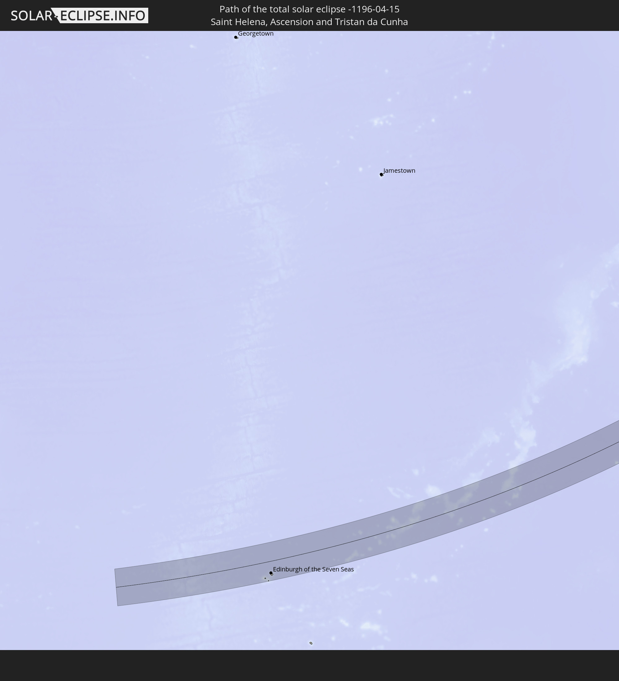 Saint Helena, Ascension and Tristan da Cunha
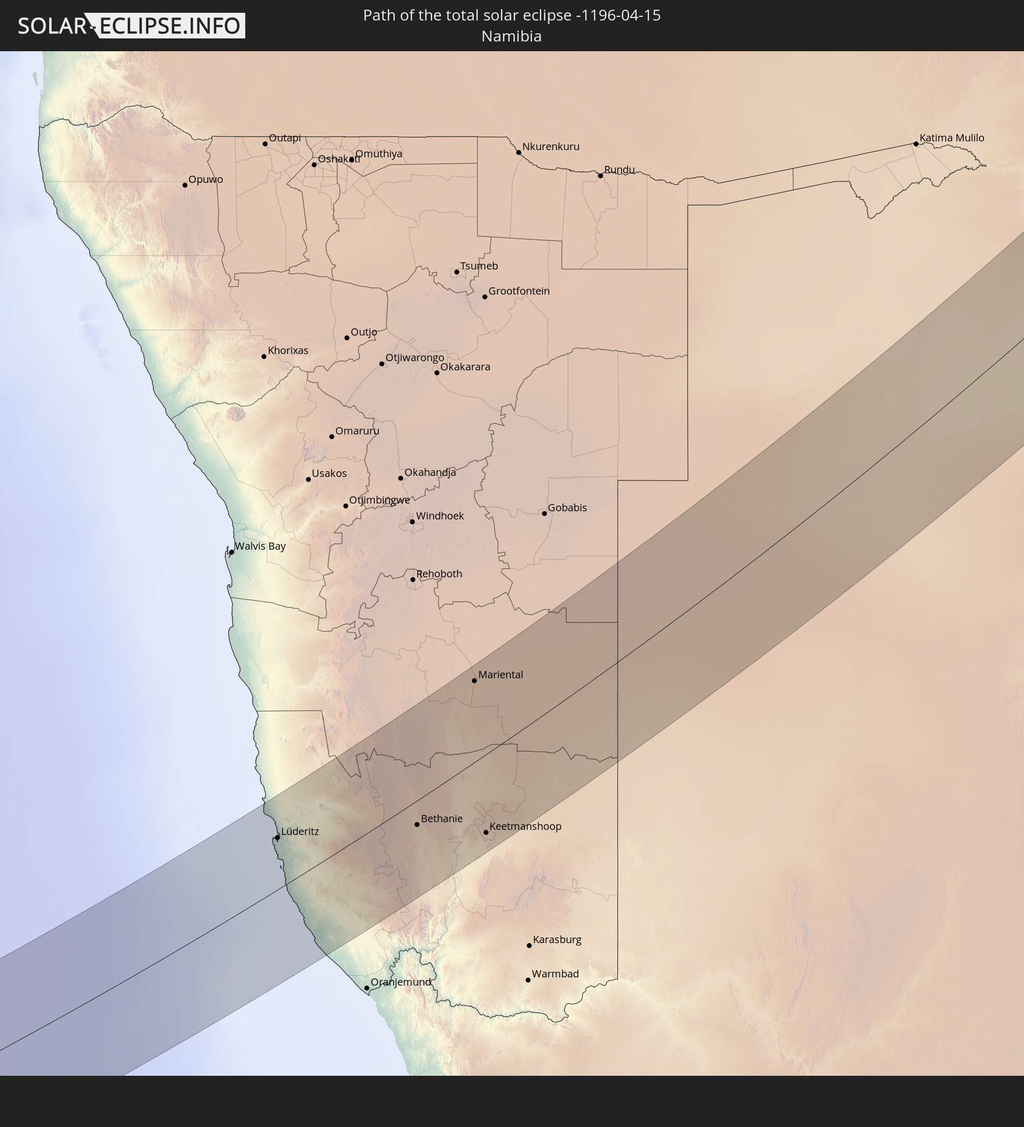 Namibia
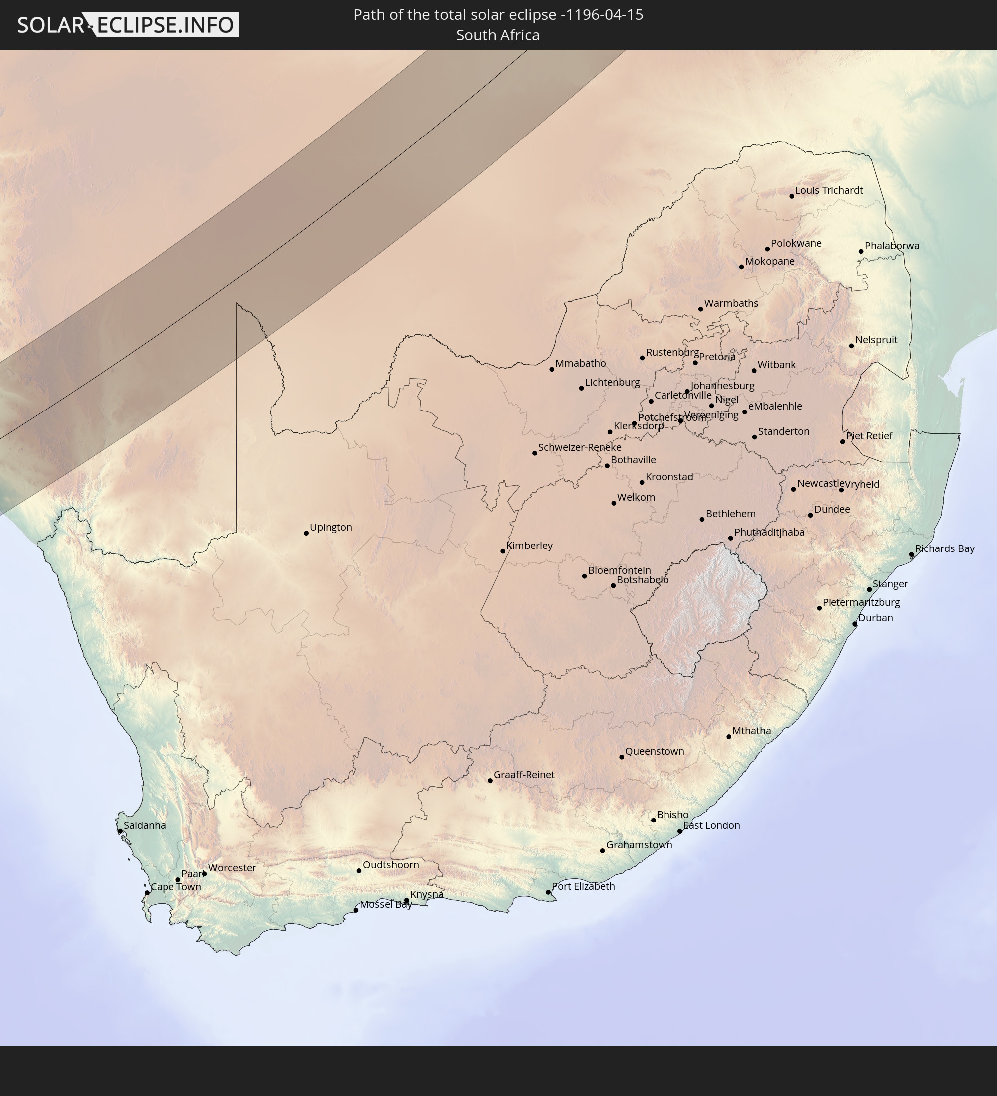 South Africa
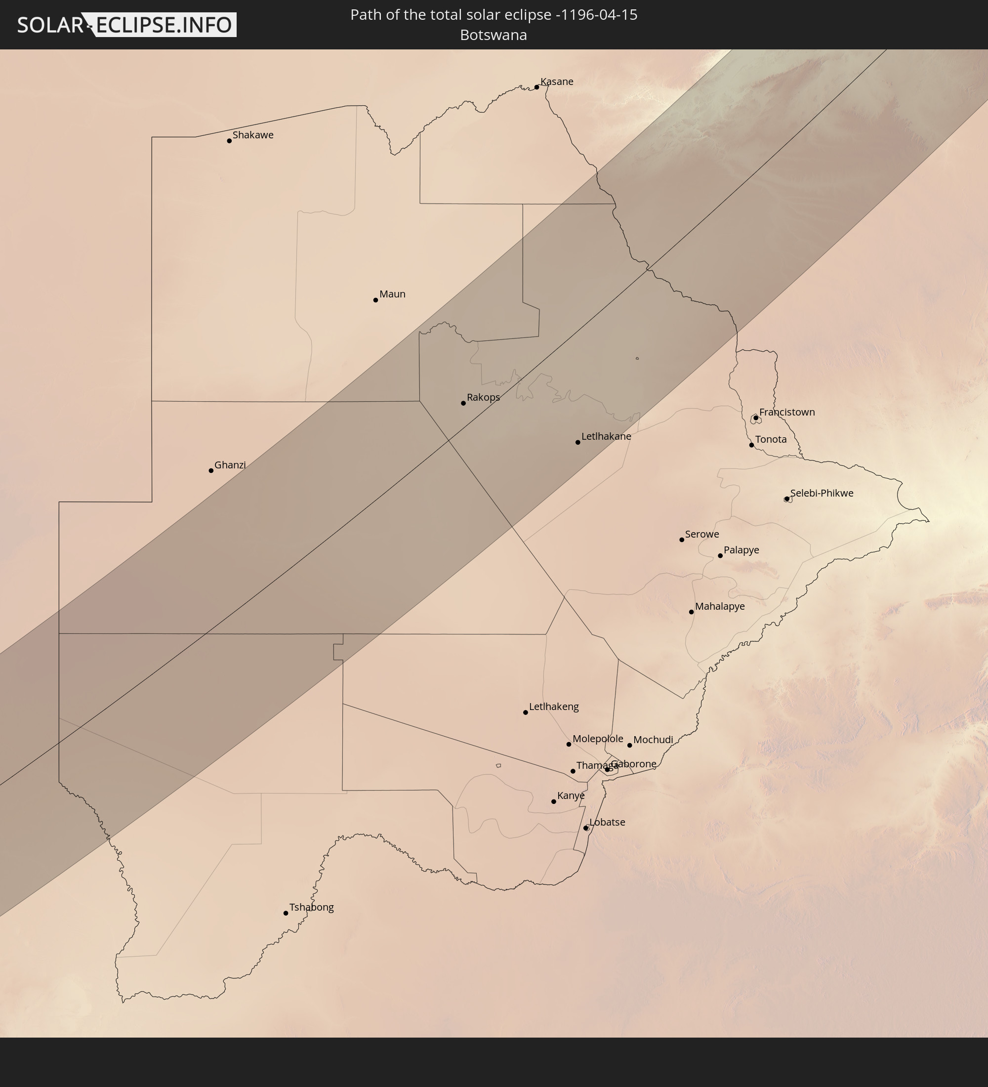 Botswana
 Zambia
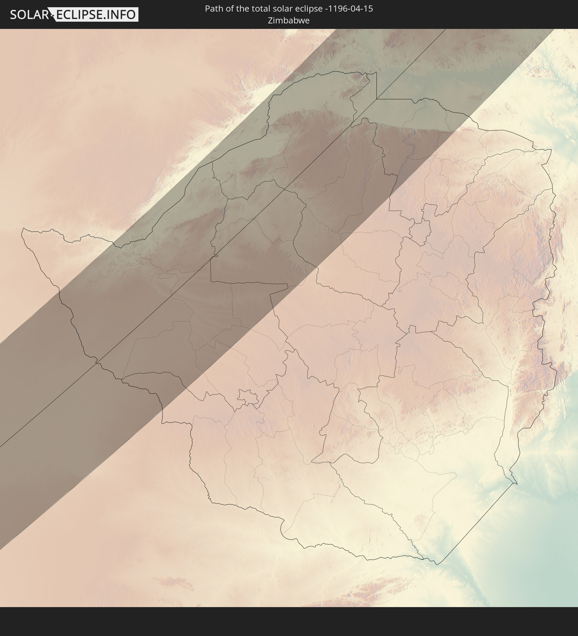 Zimbabwe
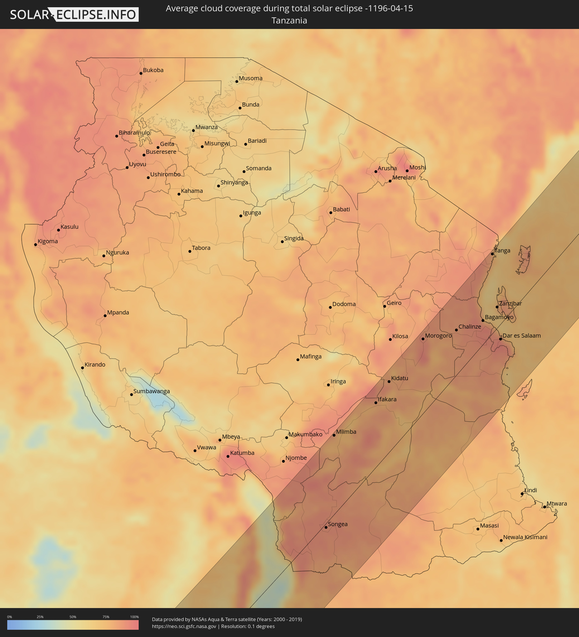
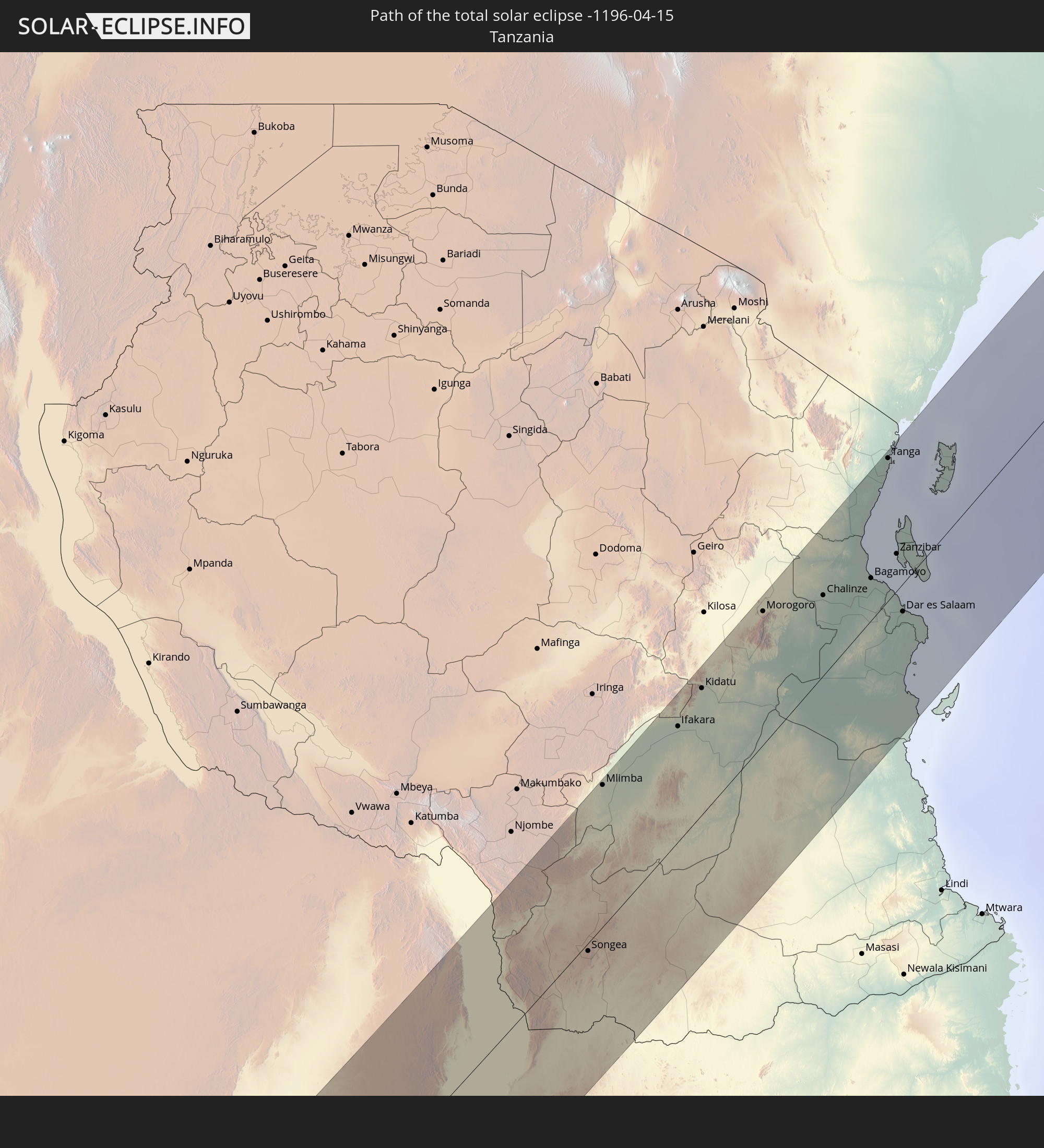 Tanzania
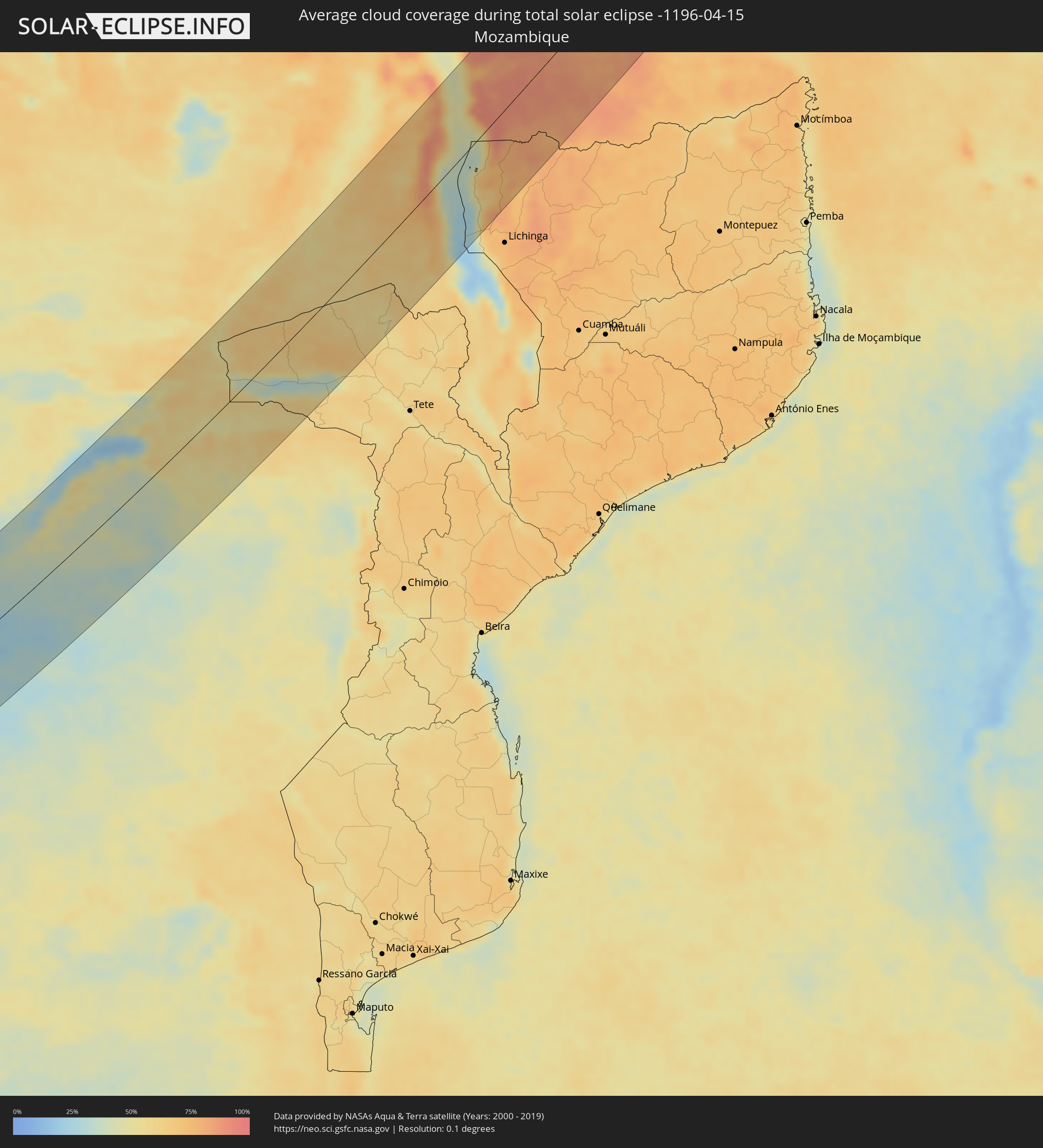
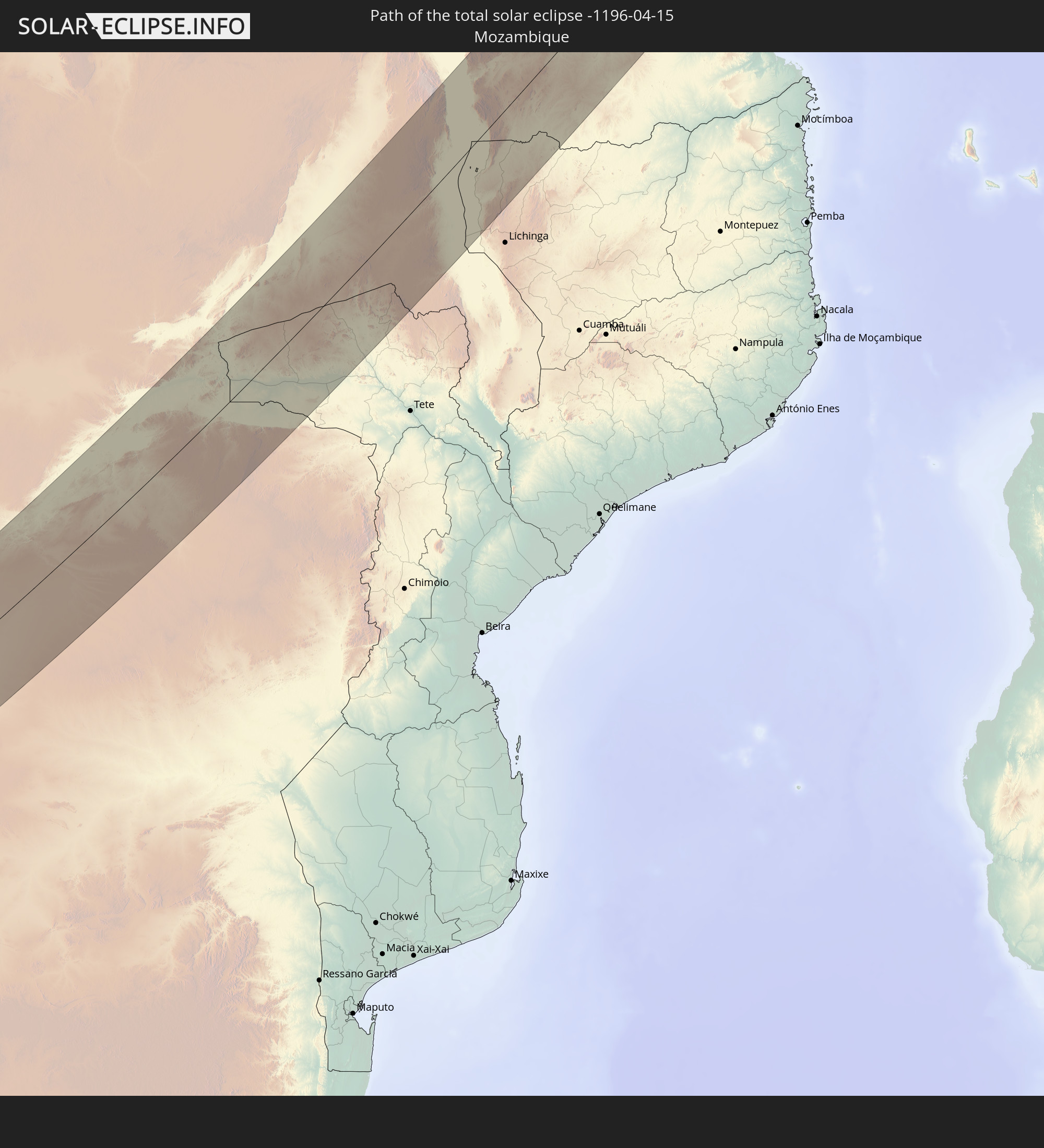 Mozambique
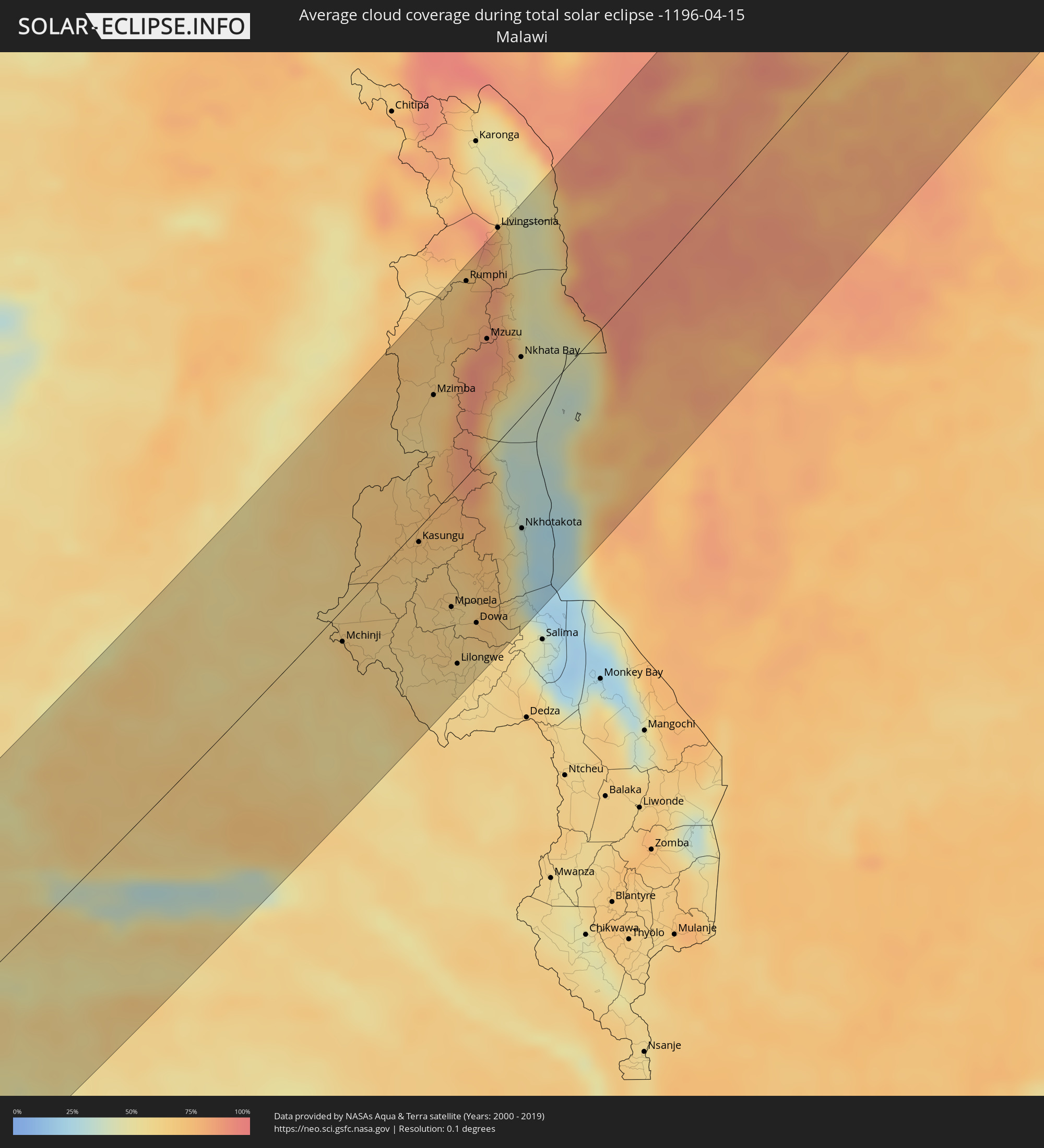
 Malawi
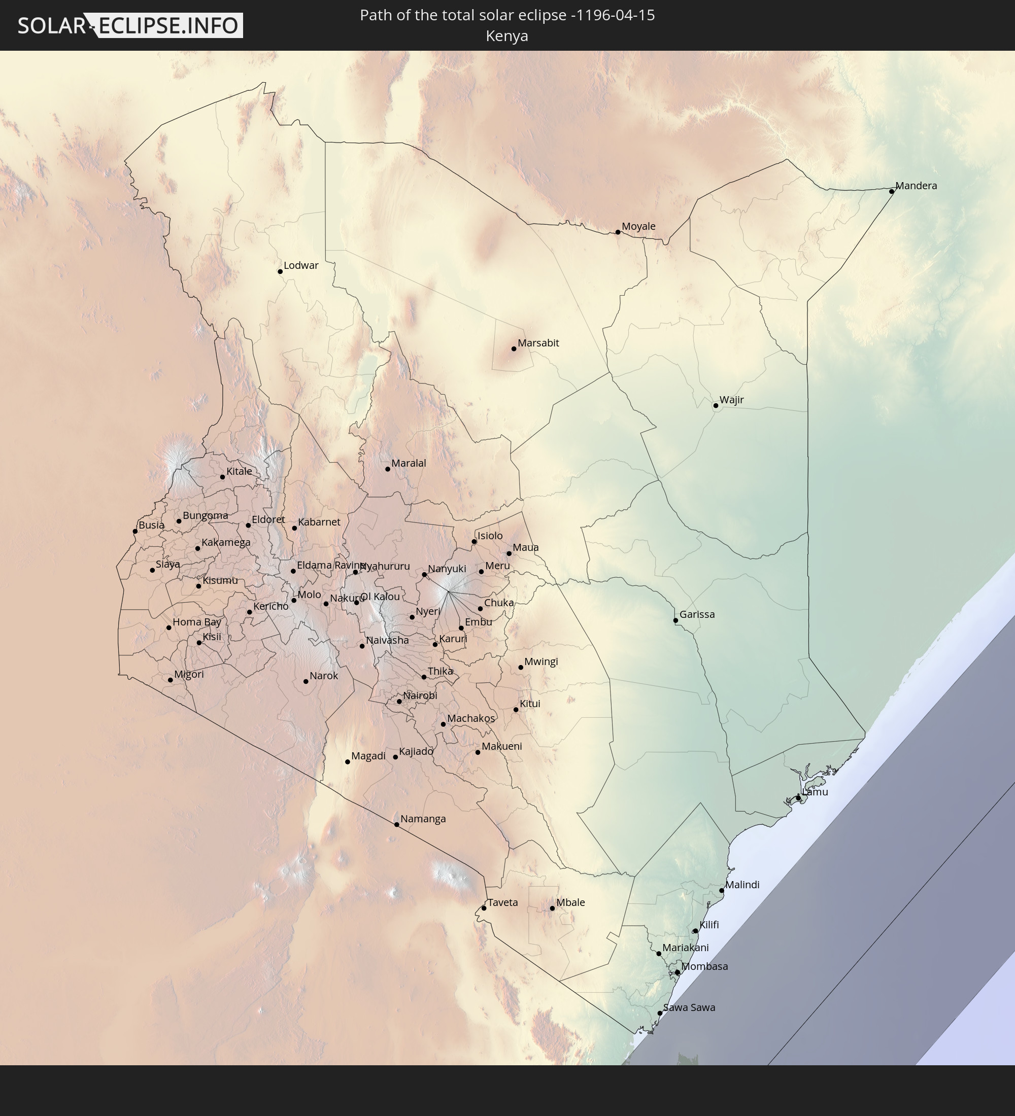 Kenya
Kenya
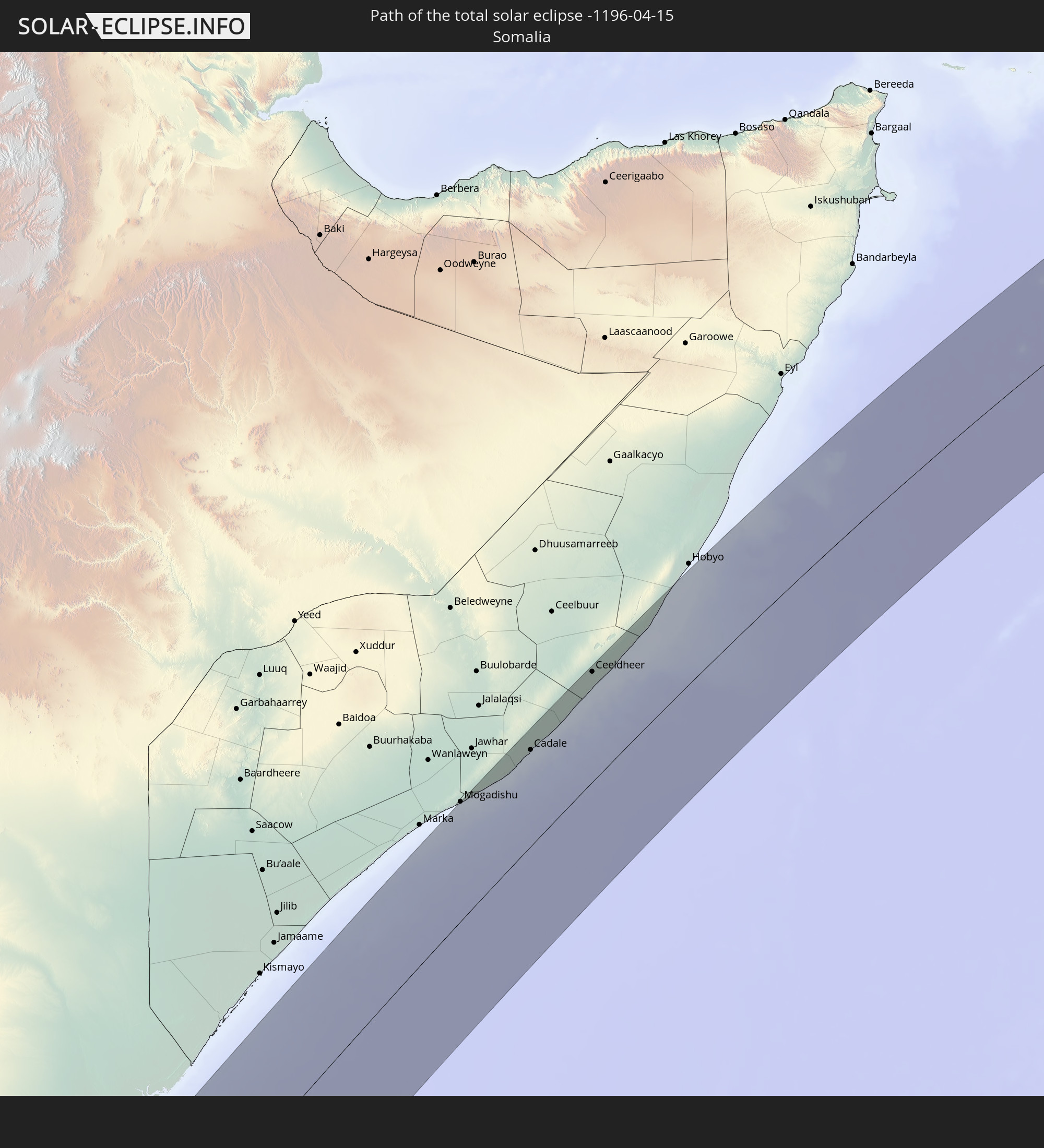 Somalia
 India
India
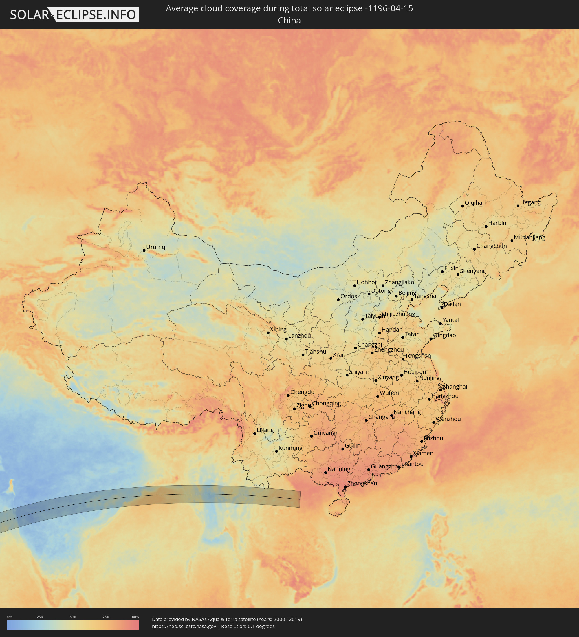
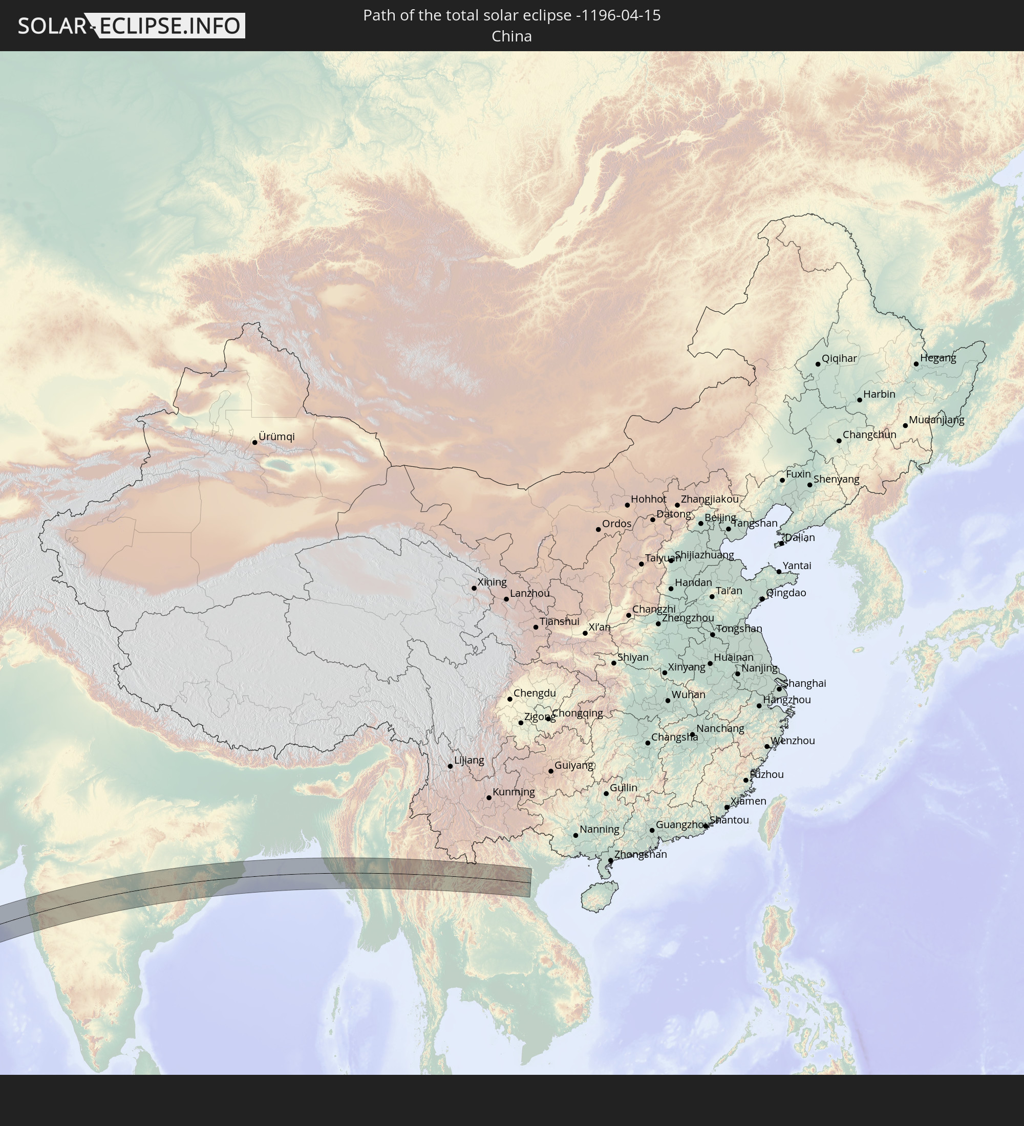 China
China
 Bangladesh
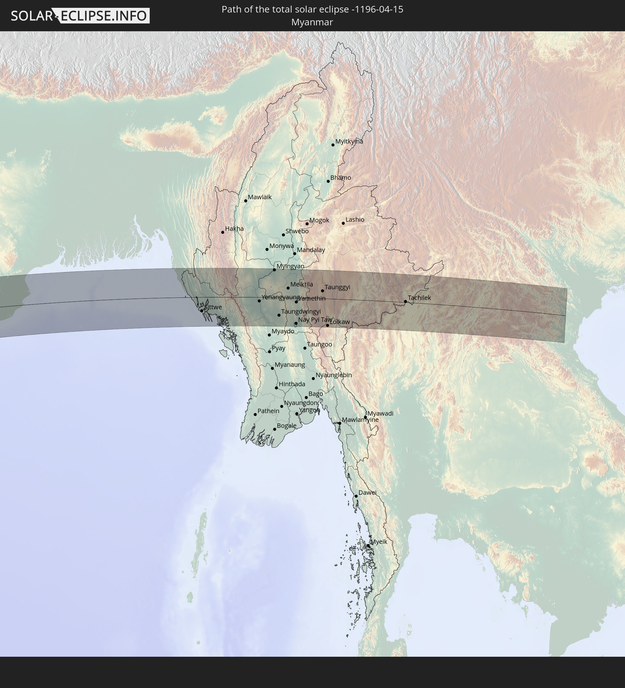 Myanmar
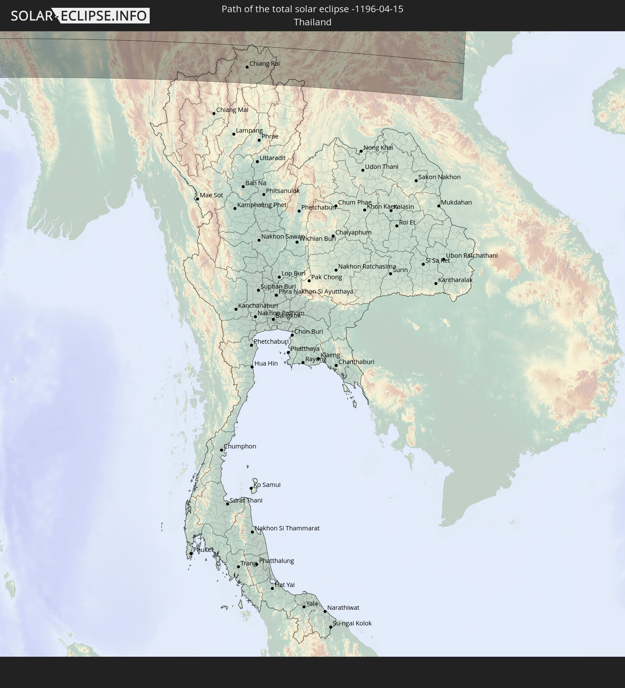 Thailand
 Laos
Laos
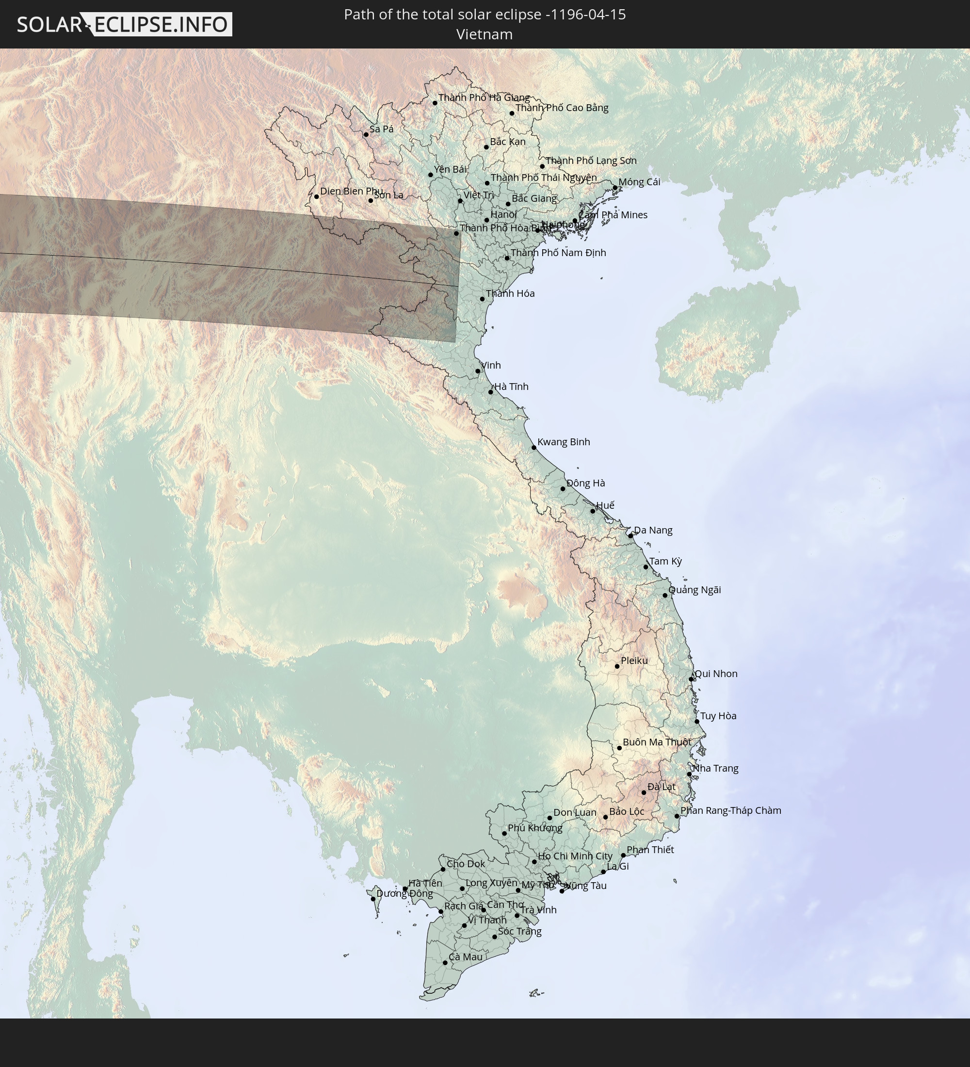 Vietnam
In den folgenden Ländern ist die Sonnenfinsternis partiell zu sehen
 Antarctica
 Russia
 Saint Helena, Ascension and Tristan da Cunha
 Nigeria
 Bouvet Island
 Equatorial Guinea
 São Tomé and Príncipe
 Cameroon
 Gabon
Gabon
 Libya
Libya
 Republic of the Congo
 Angola
 Namibia
 Democratic Republic of the Congo
 Chad
Chad
 Central African Republic
 South Africa
 Botswana
 Sudan
Sudan
 Zambia
 Egypt
Egypt
 Zimbabwe
 Turkey
 Lesotho
 Rwanda
 Burundi
 Tanzania
 Uganda
 Mozambique
 Swaziland
 Malawi
 Ethiopia
 Kenya
Kenya
 State of Palestine
 Israel
 Saudi Arabia
 Jordan
 Lebanon
 Syria
Syria
 Eritrea
 Iraq
Iraq
 Georgia
 French Southern and Antarctic Lands
 Somalia
 Djibouti
 Yemen
Yemen
 Madagascar
 Comoros
 Armenia
 Iran
Iran
 Azerbaijan
 Mayotte
 Seychelles
 Kazakhstan
 Kuwait
 Bahrain
 Qatar
Qatar
 United Arab Emirates
 Oman
Oman
 Turkmenistan
 Réunion
 Uzbekistan
 Mauritius
 Afghanistan
 Pakistan
 Tajikistan
 India
India
 Kyrgyzstan
 British Indian Ocean Territory
 Maldives
 China
China
 Sri Lanka
 Nepal
Nepal
 Mongolia
 Bangladesh
 Bhutan
 Myanmar
 Indonesia
 Cocos Islands
 Thailand
 Malaysia
 Laos
Laos
 Vietnam
 Cambodia
 Singapore
 Christmas Island
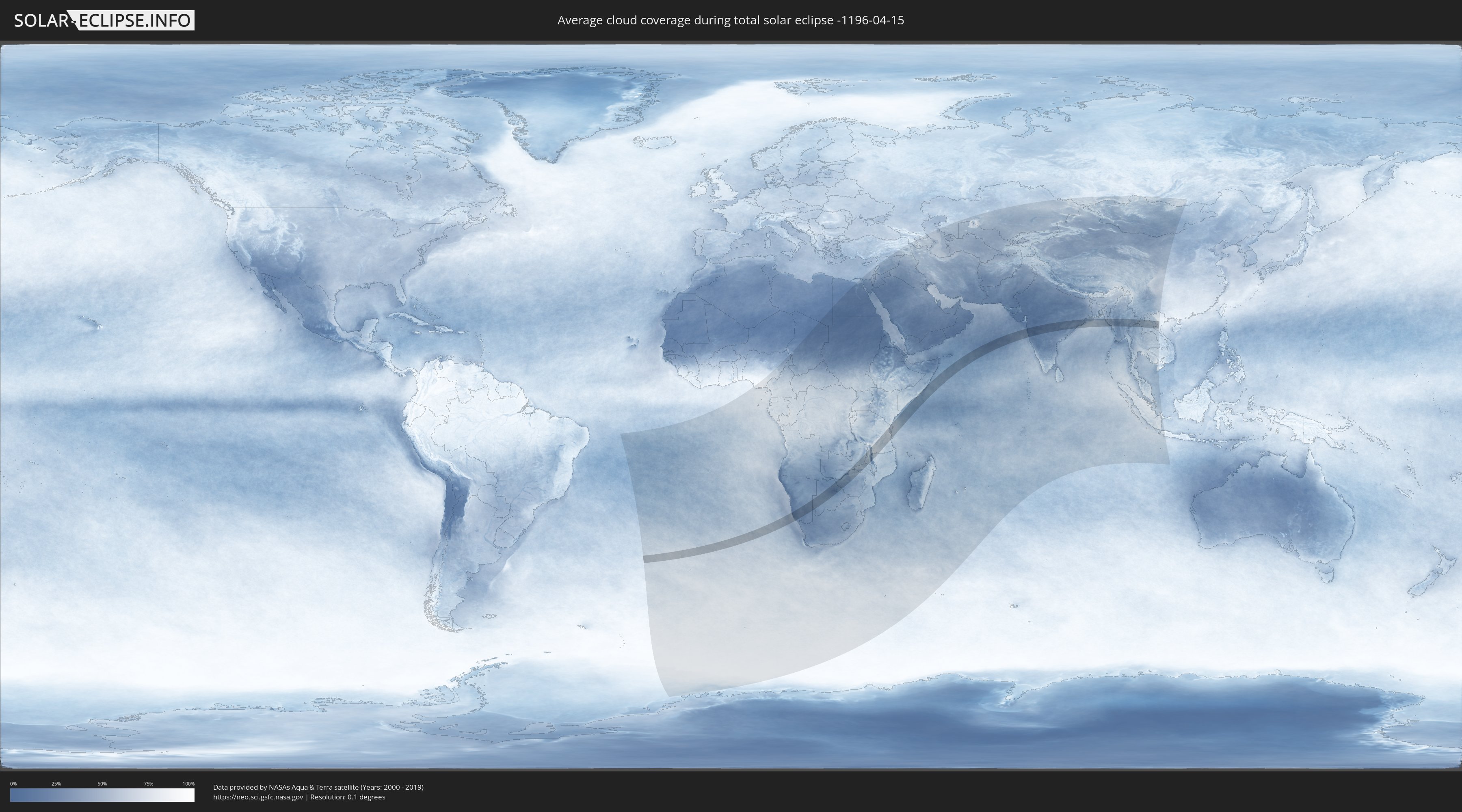
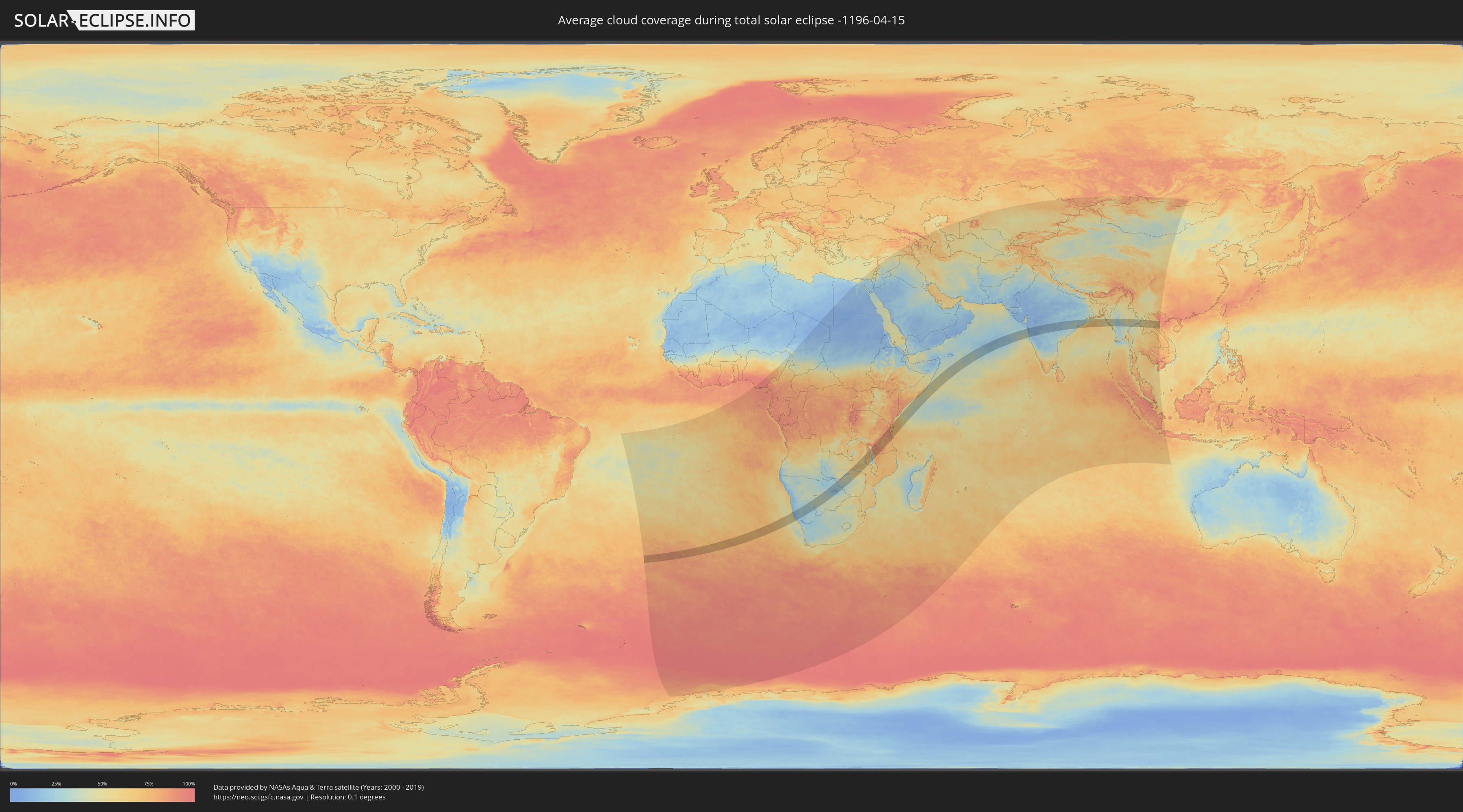
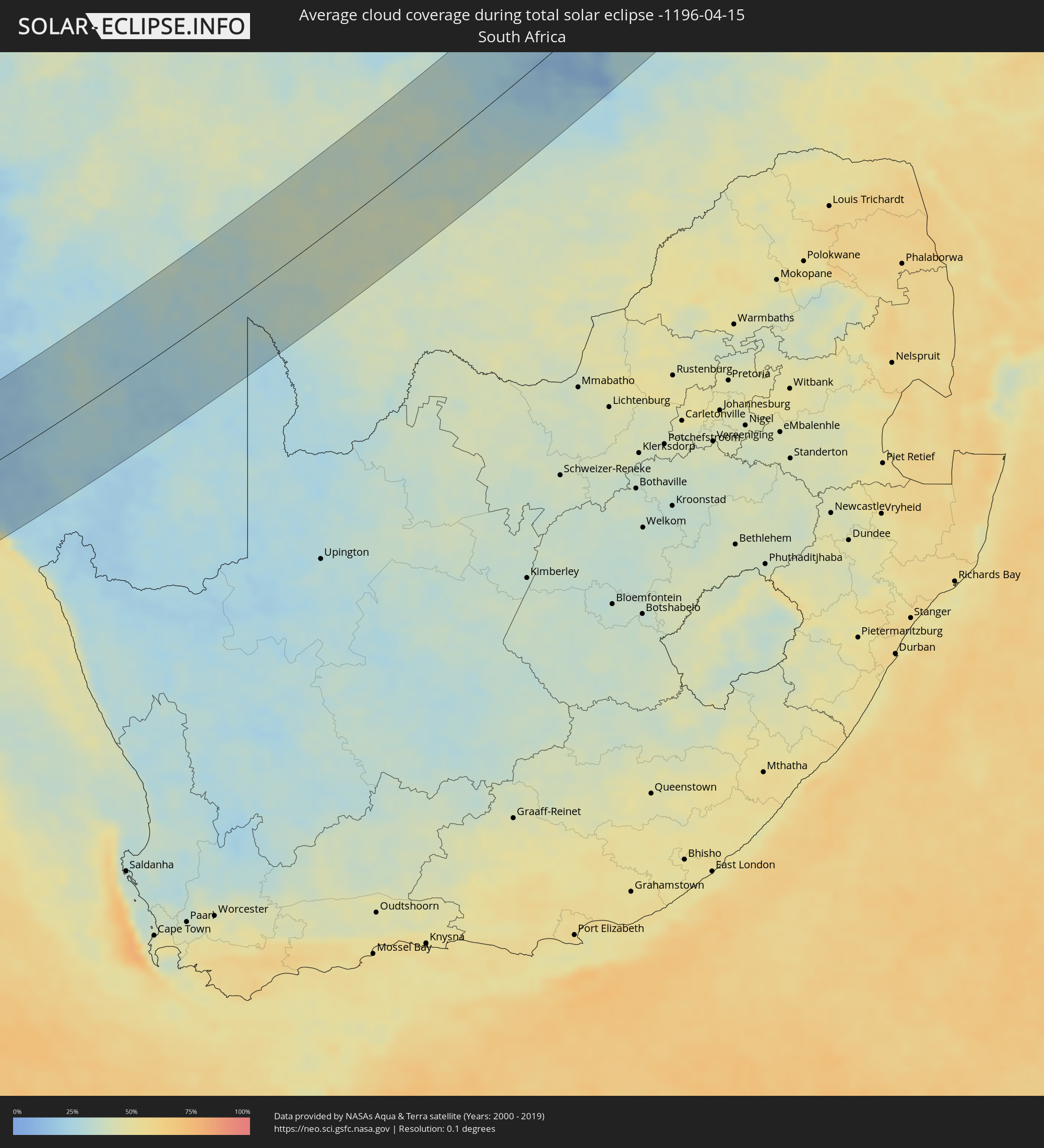
How will be the weather during the total solar eclipse on 04/15/-1196?
Where is the best place to see the total solar eclipse of 04/15/-1196?
The following maps show the average cloud coverage for the day of the total solar eclipse.
With the help of these maps, it is possible to find the place along the eclipse path, which has the best
chance of a cloudless sky.
Nevertheless, you should consider local circumstances and inform about the weather of your chosen
observation site.
The data is provided by NASAs satellites
AQUA and TERRA.
The cloud maps are averaged over a period of 19 years (2000 - 2019).
Detailed country maps
 Saint Helena, Ascension and Tristan da Cunha
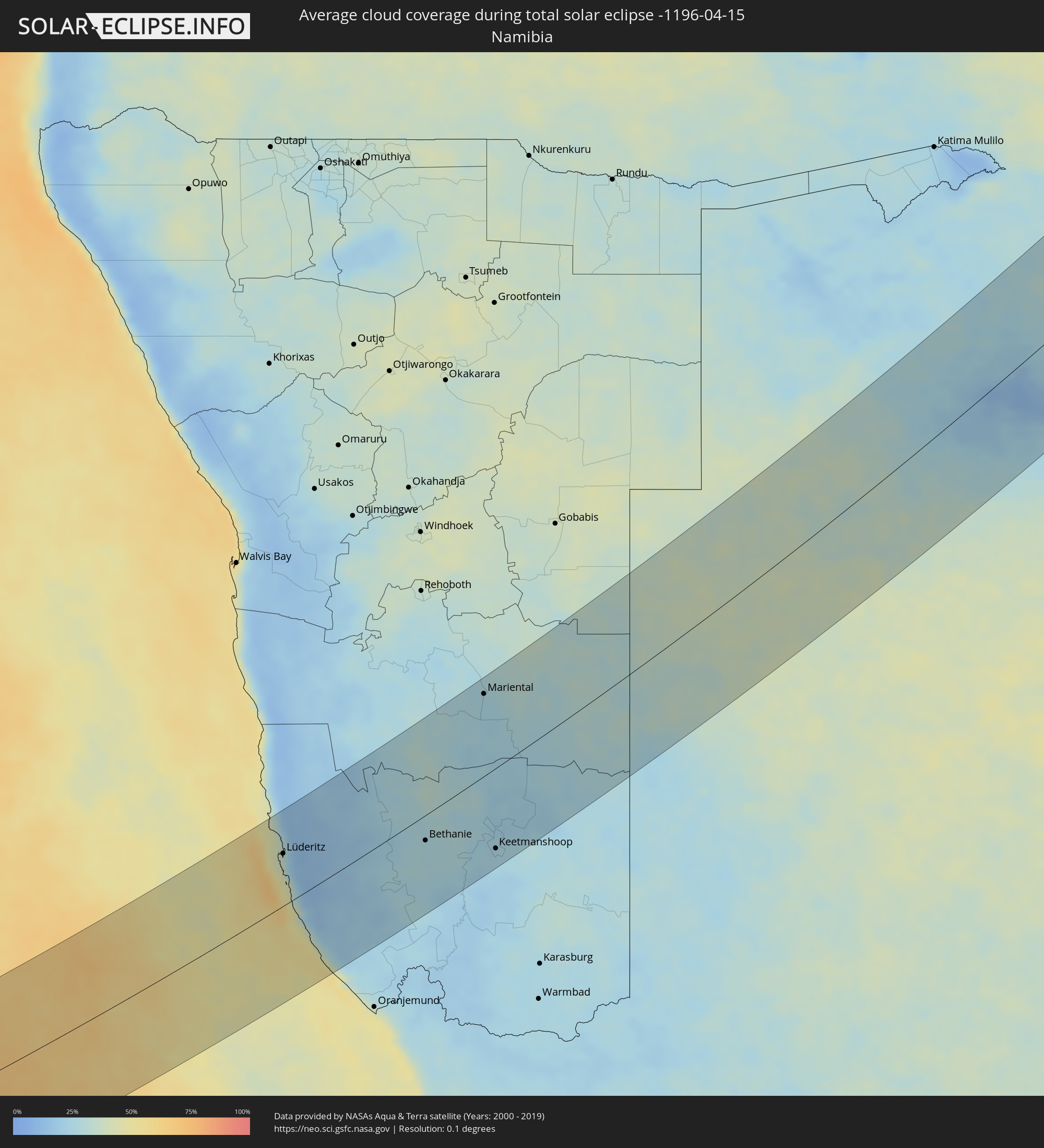 Namibia
 South Africa
 Botswana
 Zambia
 Zimbabwe
 Tanzania
 Mozambique
 Malawi
 Kenya
Kenya
 Somalia
 India
India
 China
China
 Bangladesh
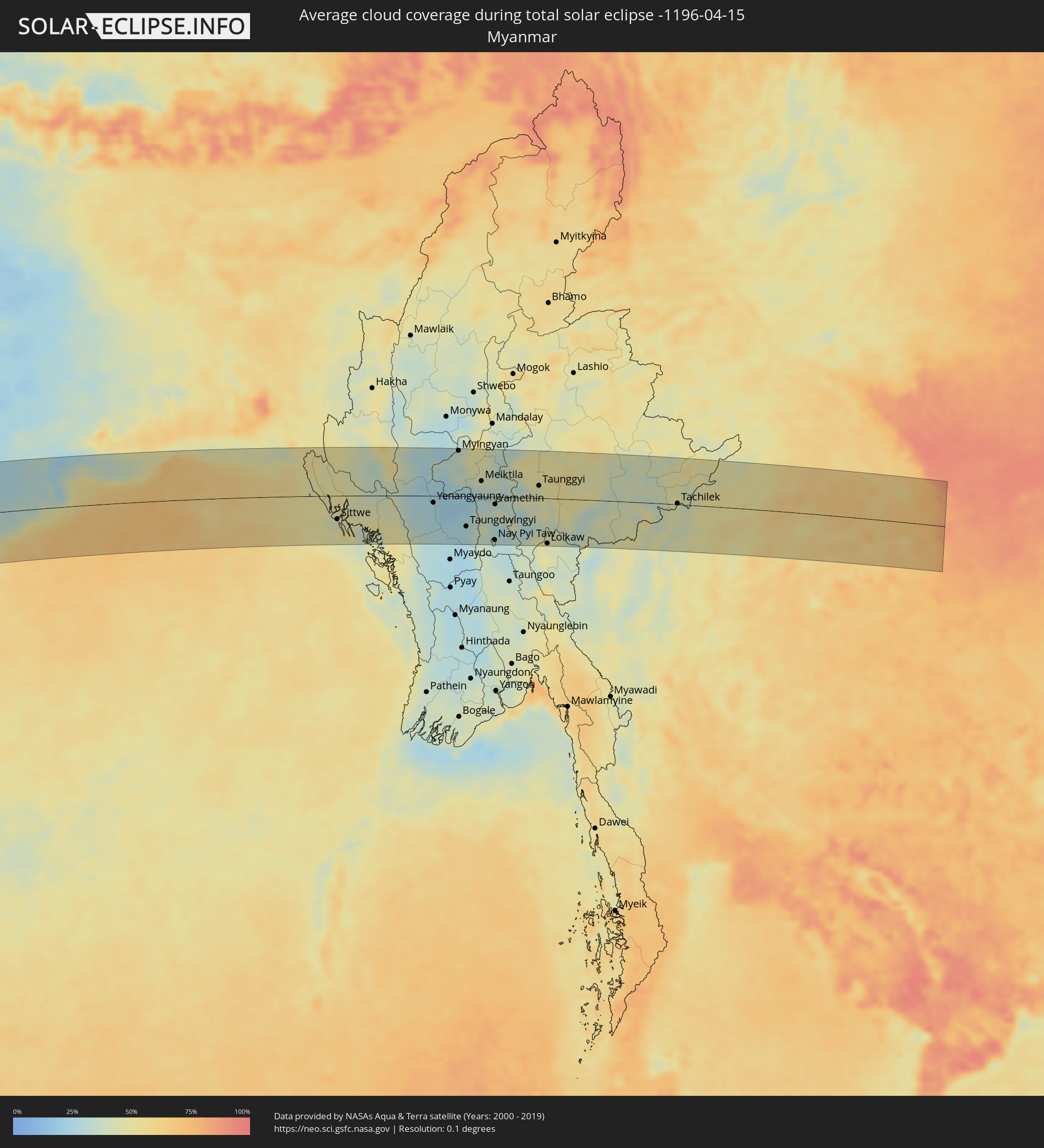 Myanmar
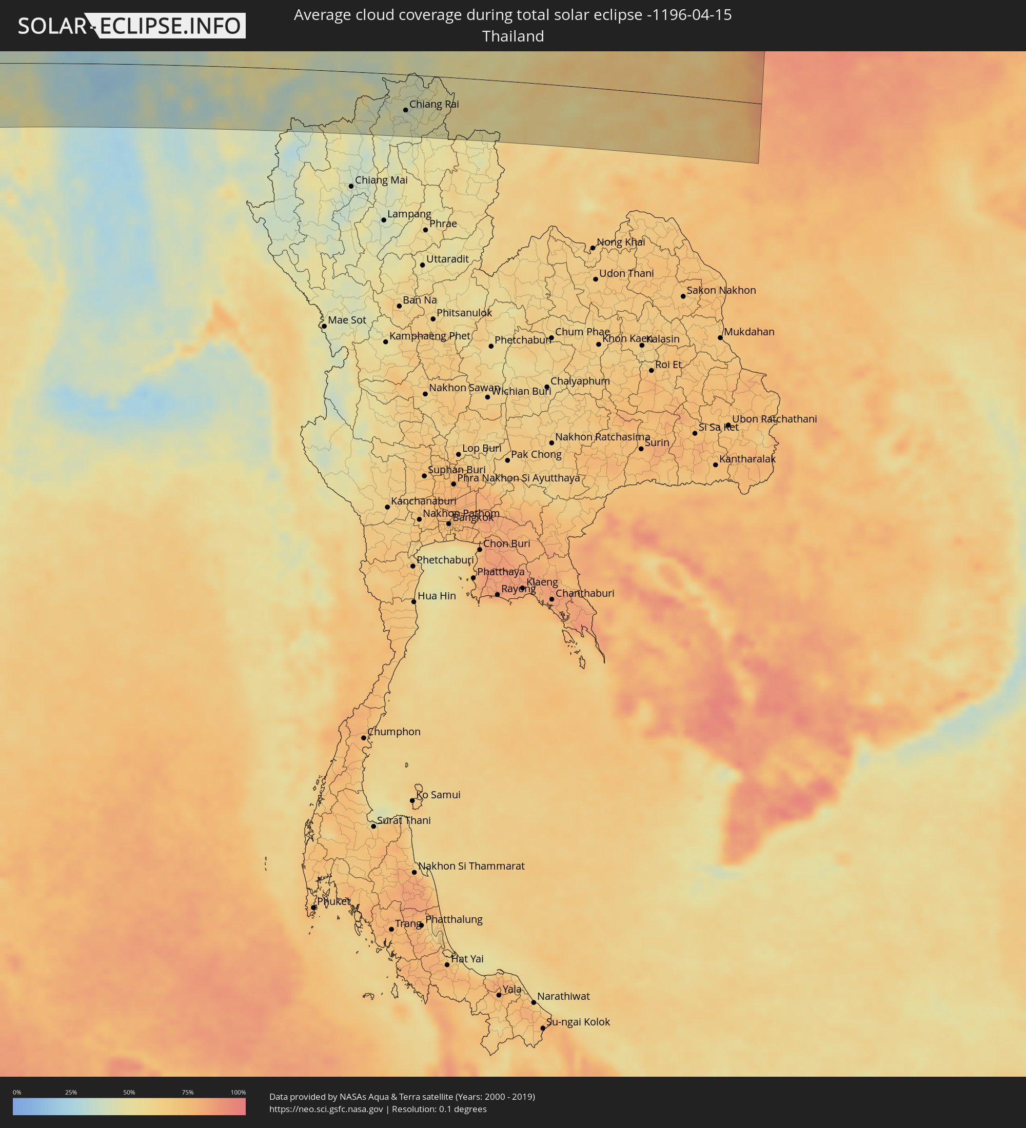 Thailand
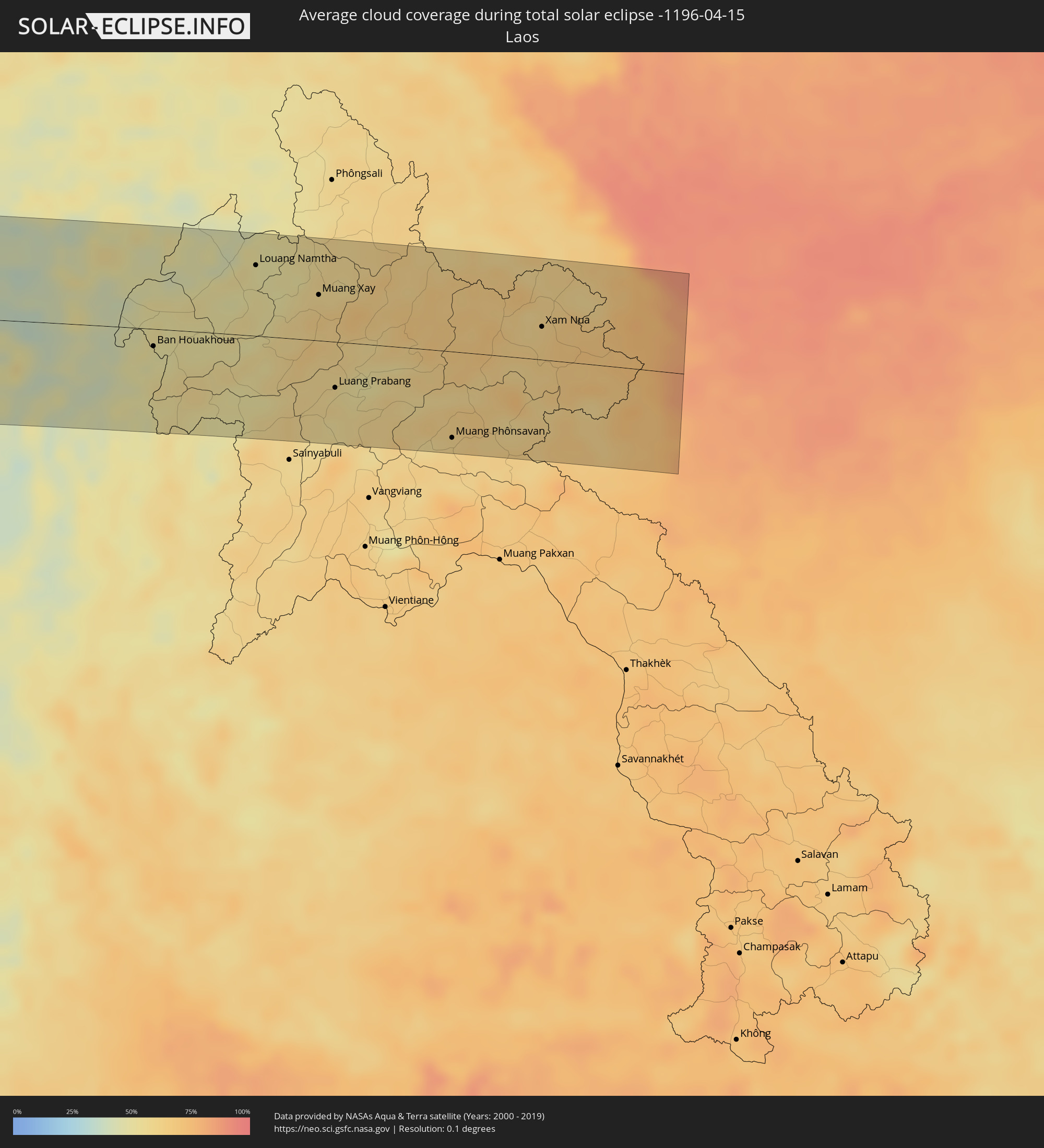 Laos
Laos
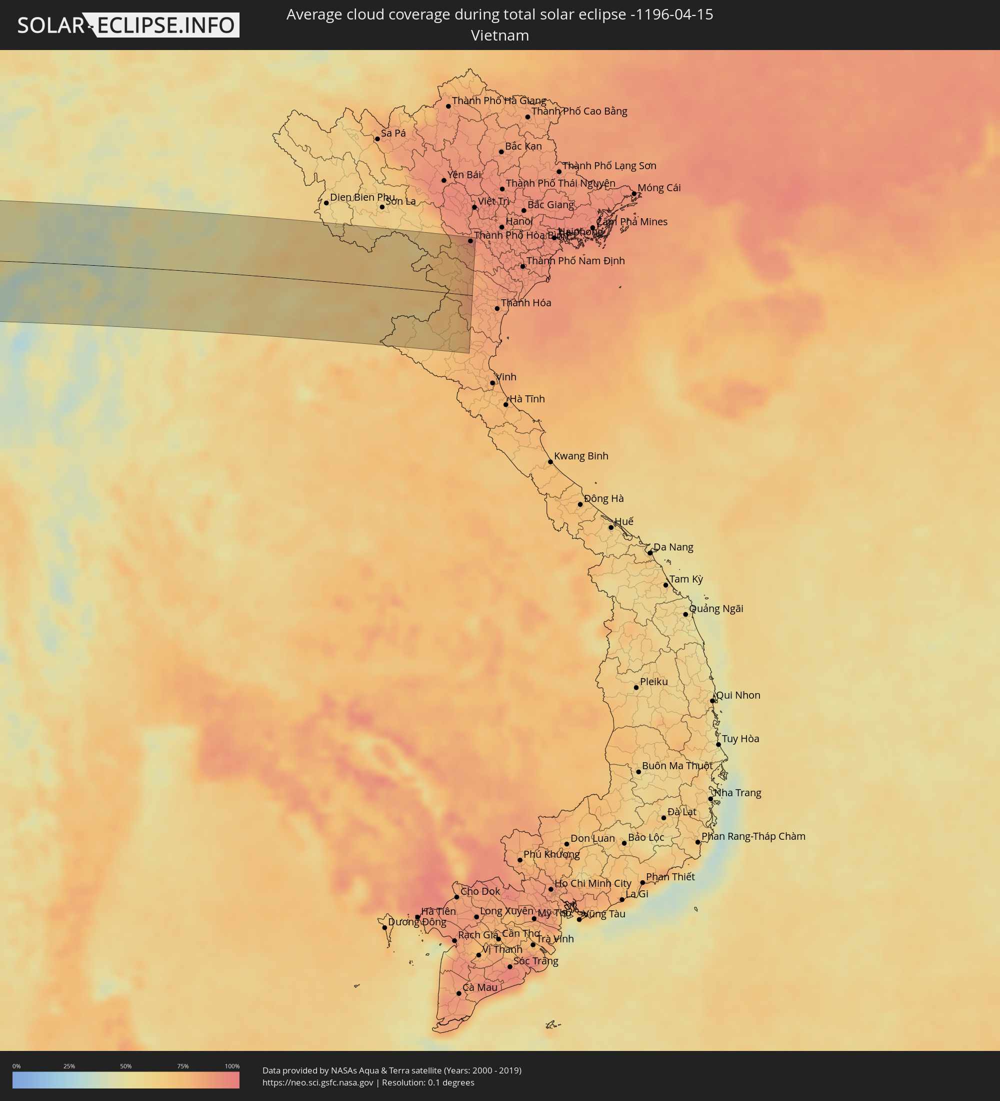 Vietnam
Cities inside the path of the eclipse
The following table shows all locations with a population of more than 5,000 inside the eclipse path. Cities which have more than 100,000 inhabitants are marked bold. A click at the locations opens a detailed map.
| City | Type | Eclipse duration | Local time of max. eclipse | Distance to central line | Ø Cloud coverage |
|
Edinburgh of the Seven Seas, Tristan da Cunha
|
total | - | 07:29:35 UTC-00:16 | 64 km | 86% |
|
Lüderitz, Karas
|
total | - | 09:35:36 UTC+01:30 | 62 km | 21% |
|
Bethanie, Karas
|
total | - | 09:37:51 UTC+01:30 | 29 km | 27% |
|
Mariental, Hardap
|
total | - | 09:40:23 UTC+01:30 | 96 km | 25% |
|
Keetmanshoop, Karas
|
total | - | 09:38:51 UTC+01:30 | 93 km | 24% |
|
Rakops, Central
|
total | - | 10:32:39 UTC+02:10 | 20 km | 20% |
|
Orapa, Central
|
total | - | 10:33:41 UTC+02:10 | 72 km | 23% |
|
Letlhakane, Central
|
total | - | 10:33:51 UTC+02:10 | 96 km | 25% |
|
Sinazongwe, Southern
|
total | - | 10:42:12 UTC+02:10 | 118 km | 25% |
|
Siavonga, Southern
|
total | - | 10:45:11 UTC+02:10 | 85 km | 28% |
|
Petauke, Eastern
|
total | - | 10:52:58 UTC+02:10 | 69 km | 65% |
|
Mchinji, Central Region
|
total | - | 10:56:15 UTC+02:10 | 19 km | 64% |
|
Lundazi, Eastern
|
total | - | 10:59:23 UTC+02:10 | 72 km | 67% |
|
Kasungu, Central Region
|
total | - | 10:58:35 UTC+02:10 | 8 km | 68% |
|
Mzimba, Northern Region
|
total | - | 11:00:47 UTC+02:10 | 68 km | 64% |
|
Mponela, Central Region
|
total | - | 10:58:08 UTC+02:10 | 67 km | 60% |
|
Lilongwe, Central Region
|
total | - | 10:57:27 UTC+02:10 | 103 km | 58% |
|
Rumphi, Northern Region
|
total | - | 11:02:50 UTC+02:10 | 114 km | 76% |
|
Ntchisi, Central Region
|
total | - | 10:58:26 UTC+02:10 | 80 km | 65% |
|
Dowa, Central Region
|
total | - | 10:58:15 UTC+02:10 | 91 km | 63% |
|
Mzuzu, Northern Region
|
total | - | 11:02:17 UTC+02:10 | 67 km | 89% |
|
Nkhata Bay, Northern Region
|
total | - | 11:02:29 UTC+02:10 | 35 km | 56% |
|
Nkhotakota, Central Region
|
total | - | 11:00:07 UTC+02:10 | 65 km | 39% |
|
Songea, Ruvuma
|
total | - | 11:23:26 UTC+02:27 | 7 km | 89% |
|
Mlimba, Morogoro
|
total | - | 11:27:18 UTC+02:27 | 119 km | 78% |
|
Malinyi, Morogoro
|
total | - | 11:27:35 UTC+02:27 | 83 km | 78% |
|
Ifakara, Morogoro
|
total | - | 11:30:06 UTC+02:27 | 96 km | 80% |
|
Kidatu, Morogoro
|
total | - | 11:31:26 UTC+02:27 | 106 km | 81% |
|
Morogoro, Morogoro
|
total | - | 11:34:25 UTC+02:27 | 111 km | 90% |
|
Chalinze, Pwani
|
total | - | 11:36:01 UTC+02:27 | 67 km | 86% |
|
Mvomero, Pwani
|
total | - | 11:37:21 UTC+02:27 | 69 km | 91% |
|
Mlandizi, Pwani
|
total | - | 11:36:35 UTC+02:27 | 31 km | 90% |
|
Bagamoyo, Pwani
|
total | - | 11:37:24 UTC+02:27 | 35 km | 86% |
|
Kibiti, Pwani
|
total | - | 11:34:55 UTC+02:27 | 61 km | 85% |
|
Bungu, Pwani
|
total | - | 11:35:18 UTC+02:27 | 65 km | 84% |
|
Tanga, Tanga
|
total | - | 11:40:31 UTC+02:27 | 119 km | 76% |
|
Zanzibar, Zanzibar Urban/West
|
total | - | 11:38:29 UTC+02:27 | 31 km | 67% |
|
Mkuranga, Pwani
|
total | - | 11:36:36 UTC+02:27 | 40 km | 87% |
|
Dar es Salaam, Dar es Salaam
|
total | - | 11:37:18 UTC+02:27 | 23 km | 90% |
|
Mogadishu, Banaadir
|
total | - | 12:06:37 UTC+02:27 | 127 km | 46% |
|
Cadale, Middle Shabele
|
total | - | 12:09:55 UTC+02:27 | 103 km | 56% |
|
Ceeldheer, Galguduud
|
total | - | 12:13:42 UTC+02:27 | 120 km | 35% |
|
Mumbai, Maharashtra
|
total | - | 16:10:48 UTC+05:21 | 114 km | 18% |
|
Panvel, Maharashtra
|
total | - | 16:11:00 UTC+05:21 | 98 km | 11% |
|
Pune, Maharashtra
|
total | - | 16:11:27 UTC+05:21 | 27 km | 9% |
|
Ahmadnagar, Maharashtra
|
total | - | 16:12:50 UTC+05:21 | 65 km | 11% |
|
Latur, Maharashtra
|
total | - | 16:14:12 UTC+05:21 | 56 km | 21% |
|
Parbhani, Maharashtra
|
total | - | 16:15:00 UTC+05:21 | 34 km | 16% |
|
Nanded, Maharashtra
|
total | - | 16:15:28 UTC+05:21 | 10 km | 16% |
|
Nizāmābād, Telangana
|
total | - | 16:15:53 UTC+05:21 | 60 km | 20% |
|
Karīmnagar, Telangana
|
total | - | 16:16:42 UTC+05:21 | 106 km | 22% |
|
Chānda, Maharashtra
|
total | - | 16:17:45 UTC+05:21 | 56 km | 14% |
|
Rāmgundam, Telangana
|
total | - | 16:17:13 UTC+05:21 | 72 km | 18% |
|
Nowrangapur, Odisha
|
total | - | 16:20:02 UTC+05:21 | 76 km | 23% |
|
Brahmapur, Odisha
|
total | - | 16:21:44 UTC+05:21 | 96 km | 30% |
|
Puri, Odisha
|
total | - | 16:22:39 UTC+05:21 | 52 km | 48% |
|
Bhubaneshwar, Odisha
|
total | - | 16:22:52 UTC+05:21 | 0 km | 30% |
|
Cuttack, Odisha
|
total | - | 16:22:58 UTC+05:21 | 21 km | 31% |
|
Cox’s Bāzār, Chittagong
|
total | - | 16:58:40 UTC+05:53 | 95 km | 45% |
|
Teknāf, Chittagong
|
total | - | 16:58:37 UTC+05:53 | 30 km | 46% |
|
Sittwe, Rakhine
|
total | - | 17:30:06 UTC+06:24 | 50 km | 44% |
|
Chauk, Magway
|
total | - | 17:31:01 UTC+06:24 | 34 km | 26% |
|
Yenangyaung, Magway
|
total | - | 17:30:55 UTC+06:24 | 14 km | 26% |
|
Minbu, Magway
|
total | - | 17:30:50 UTC+06:24 | 46 km | 25% |
|
Magway, Magway
|
total | - | 17:30:50 UTC+06:24 | 50 km | 26% |
|
Pakokku, Magway
|
total | - | 17:31:13 UTC+06:24 | 83 km | 35% |
|
Myingyan, Mandalay
|
total | - | 17:31:20 UTC+06:24 | 97 km | 36% |
|
Taungdwingyi, Magway
|
total | - | 17:31:00 UTC+06:24 | 65 km | 28% |
|
Meiktila, Mandalay
|
total | - | 17:31:20 UTC+06:24 | 33 km | 36% |
|
Nay Pyi Taw, Nay Pyi Taw
|
total | - | 17:31:06 UTC+06:24 | 92 km | 31% |
|
Yamethin, Mandalay
|
total | - | 17:31:18 UTC+06:24 | 16 km | 38% |
|
Pyinmana, Nay Pyi Taw
|
total | - | 17:31:07 UTC+06:24 | 93 km | 30% |
|
Taunggyi, Shan
|
total | - | 17:31:38 UTC+06:24 | 26 km | 44% |
|
Loikaw, Kayah
|
total | - | 17:31:23 UTC+06:24 | 97 km | 42% |
|
Fang, Chiang Mai
|
total | - | 17:49:12 UTC+06:42 | 61 km | 42% |
|
Chiang Rai, Chiang Rai
|
total | - | 17:49:19 UTC+06:42 | 58 km | 40% |
|
Mae Chan, Chiang Rai
|
total | - | 17:49:23 UTC+06:42 | 32 km | 42% |
|
Mae Sai, Chiang Rai
|
total | - | 17:49:27 UTC+06:42 | 1 km | 44% |
|
Tachilek, Shan
|
total | - | 17:49:27 UTC+06:42 | 2 km | 44% |
|
Chiang Saen, Chiang Rai
|
total | - | 17:49:27 UTC+06:42 | 16 km | 42% |
|
Chiang Kham, Phayao
|
total | - | 17:49:18 UTC+06:42 | 98 km | 48% |
|
Chiang Khong, Chiang Rai
|
total | - | 17:49:30 UTC+06:42 | 15 km | 50% |
|
Ban Houayxay, Bokeo Province
|
total | - | 17:49:30 UTC+06:42 | 14 km | 50% |
|
Ban Houakhoua, Bokeo Province
|
total | - | 17:49:30 UTC+06:42 | 17 km | 49% |
|
Louang Namtha, Loungnamtha
|
total | - | 17:49:47 UTC+06:42 | 68 km | 52% |
|
Muang Xay, Oudômxai
|
total | - | 17:49:48 UTC+06:42 | 44 km | 62% |
|
Luang Prabang, Louangphabang
|
total | - | 17:49:39 UTC+06:42 | 44 km | 56% |
|
Muang Phônsavan, Xiangkhoang
|
total | - | 17:49:40 UTC+06:42 | 83 km | 61% |
|
Xam Nua, Houaphan
|
total | - | 17:49:55 UTC+06:42 | 32 km | 63% |
|
Thành Phố Hòa Bình, Hòa Bình
|
total | - | 18:14:38 UTC+07:06 | 89 km | 84% |