Annular solar eclipse of 01/22/-1210
| Day of week: | Sunday |
| Maximum duration of eclipse: | 08m26s |
| Maximum width of eclipse path: | 248 km |
| Saros cycle: | 31 |
| Coverage: | 93.4% |
| Magnitude: | 0.9337 |
| Gamma: | 0.0678 |
Wo kann man die Sonnenfinsternis vom 01/22/-1210 sehen?
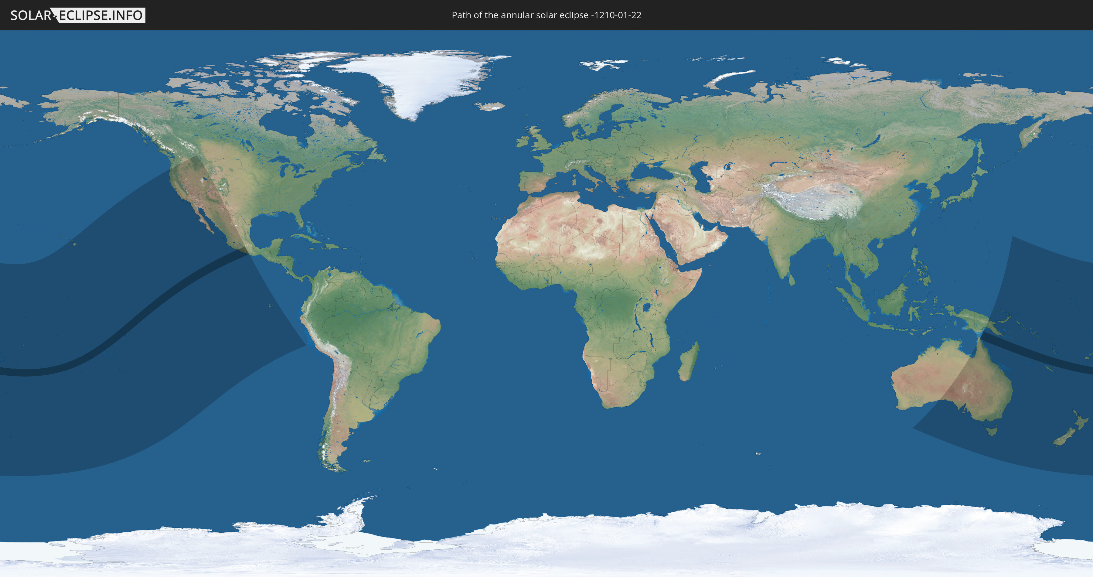
Die Sonnenfinsternis am 01/22/-1210 kann man in 27 Ländern als partielle Sonnenfinsternis beobachten.
Der Finsternispfad verläuft durch 7 Länder. Nur in diesen Ländern ist sie als annular Sonnenfinsternis zu sehen.
In den folgenden Ländern ist die Sonnenfinsternis annular zu sehen
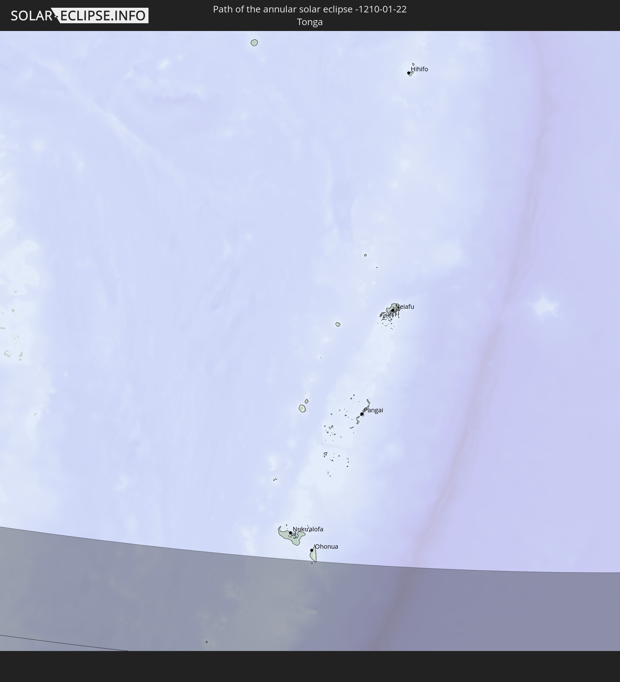 Tonga
Tonga
 Cook Islands
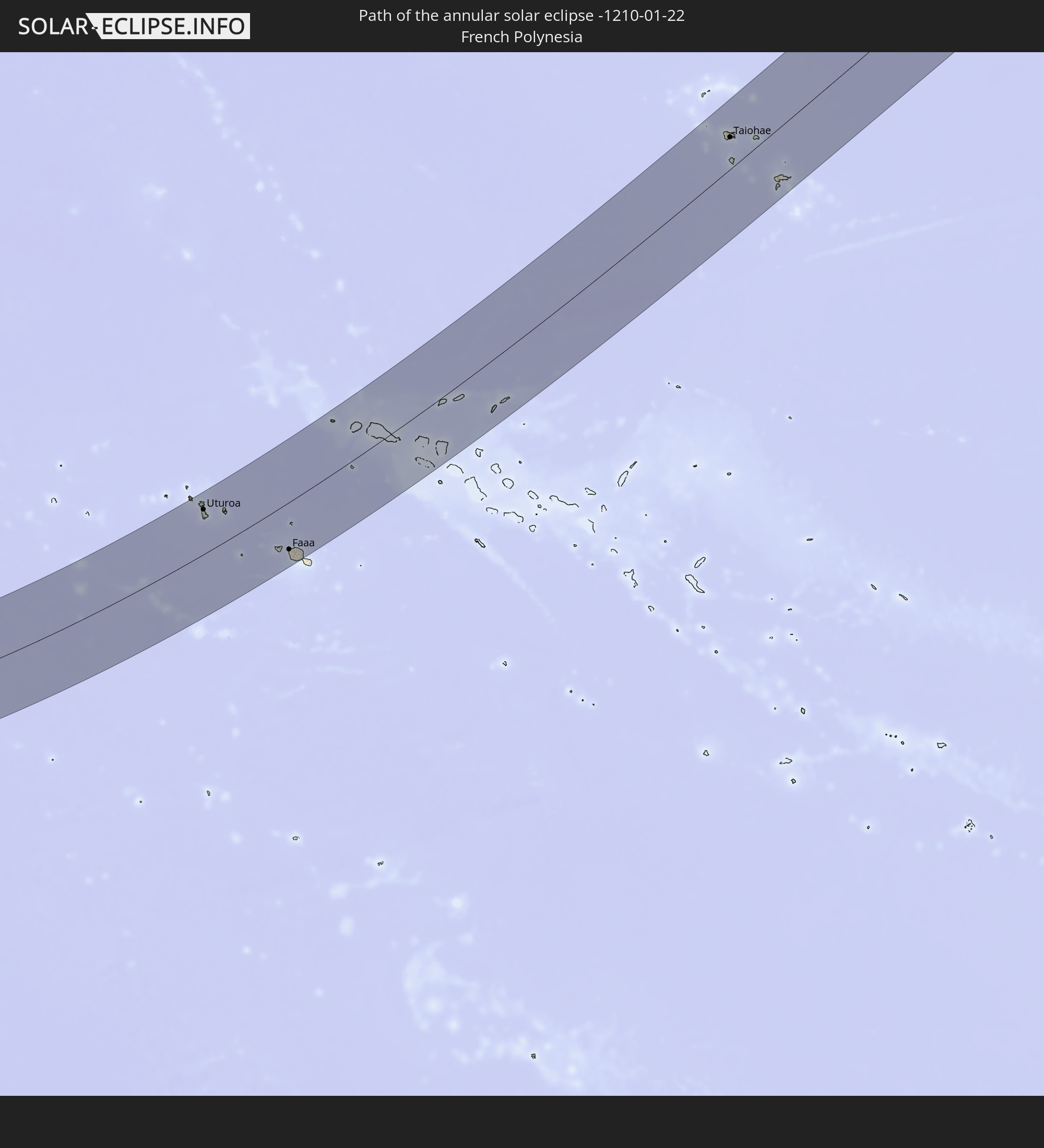 French Polynesia
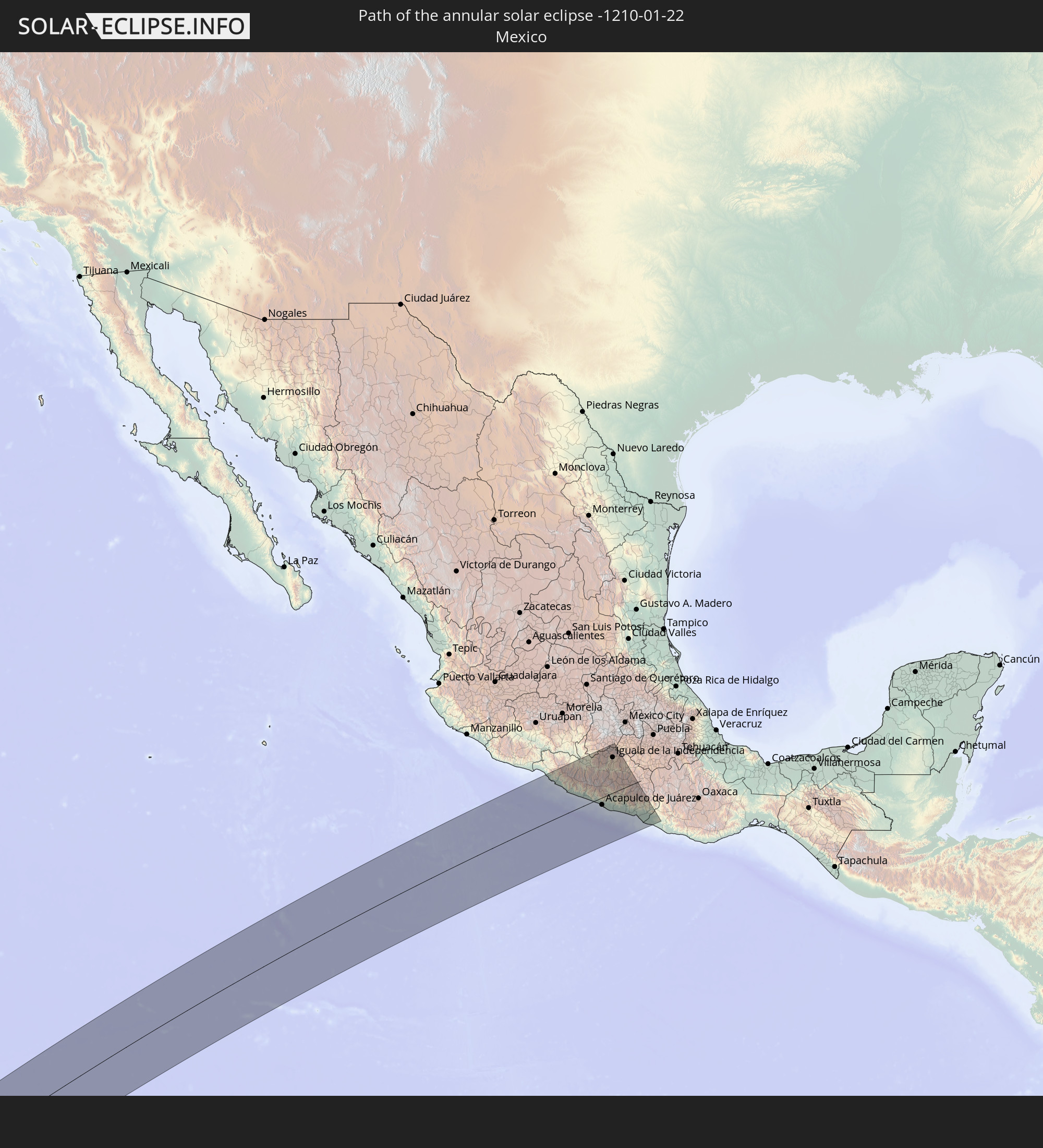 Mexico
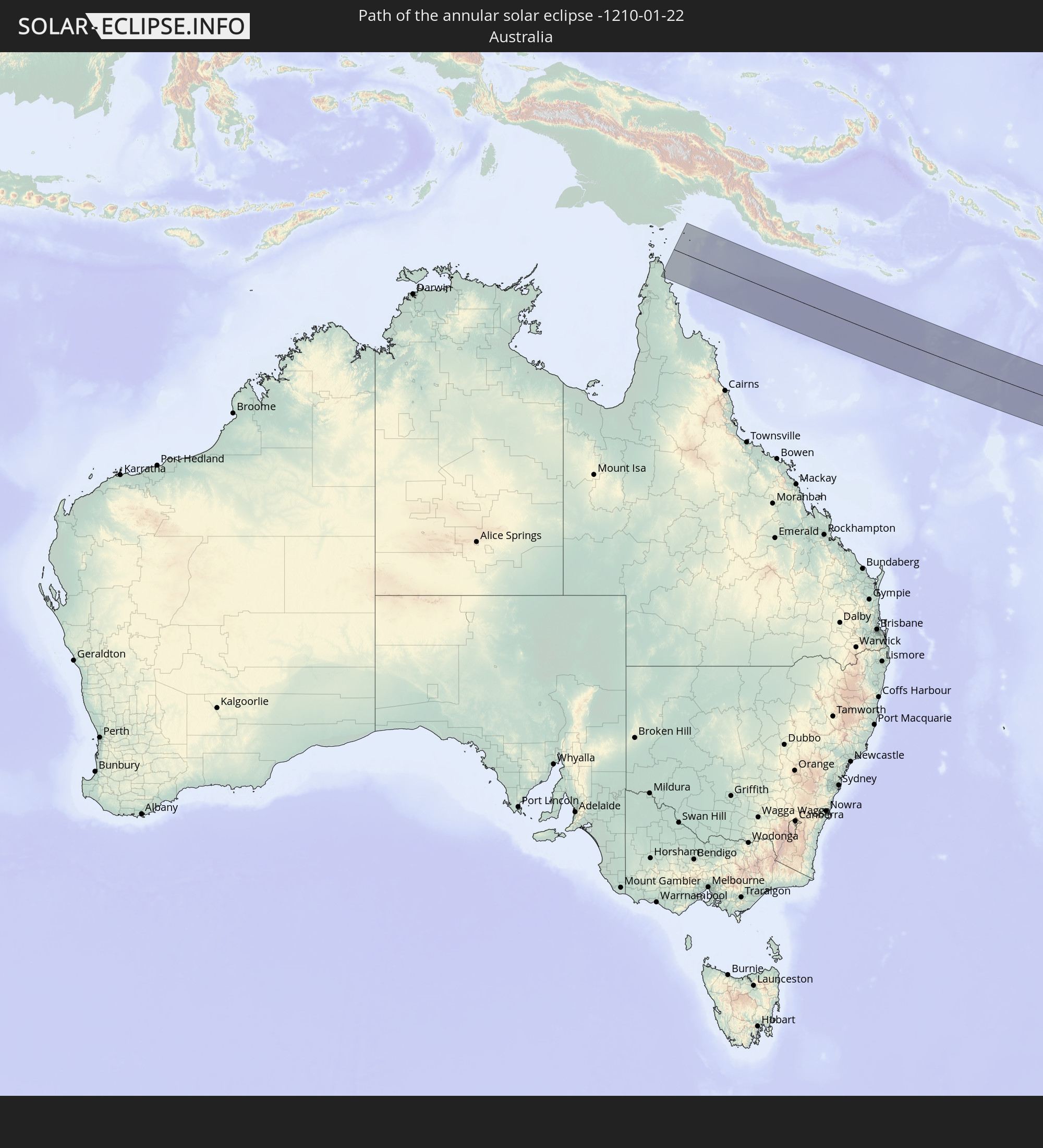 Australia
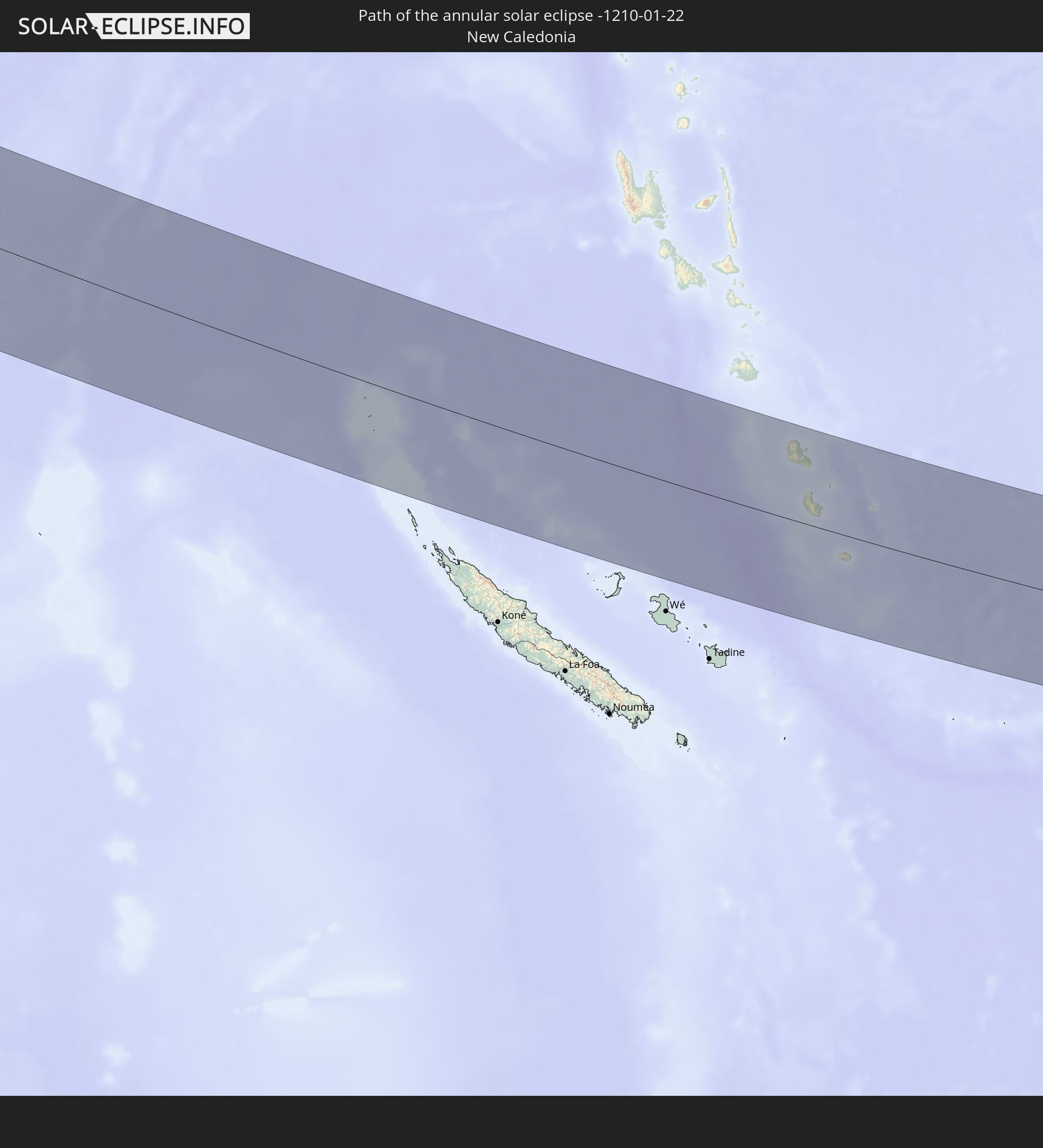 New Caledonia
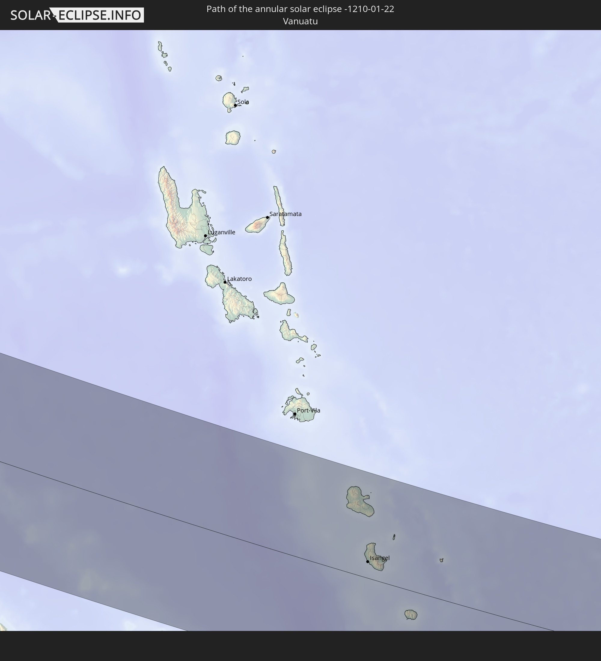 Vanuatu
In den folgenden Ländern ist die Sonnenfinsternis partiell zu sehen
 Fiji
Fiji
 United States
 New Zealand
 United States Minor Outlying Islands
 Wallis and Futuna
 Tonga
Tonga
 Kiribati
 Samoa
Samoa
 Tokelau
 American Samoa
 Niue
Niue
 Cook Islands
 French Polynesia
 Pitcairn Islands
 Mexico
 Chile
Chile
 Ecuador
 Australia
 Federated States of Micronesia
 Papua New Guinea
 Solomon Islands
 New Caledonia
 Marshall Islands
 Vanuatu
 Nauru
Nauru
 Norfolk Island
 Tuvalu
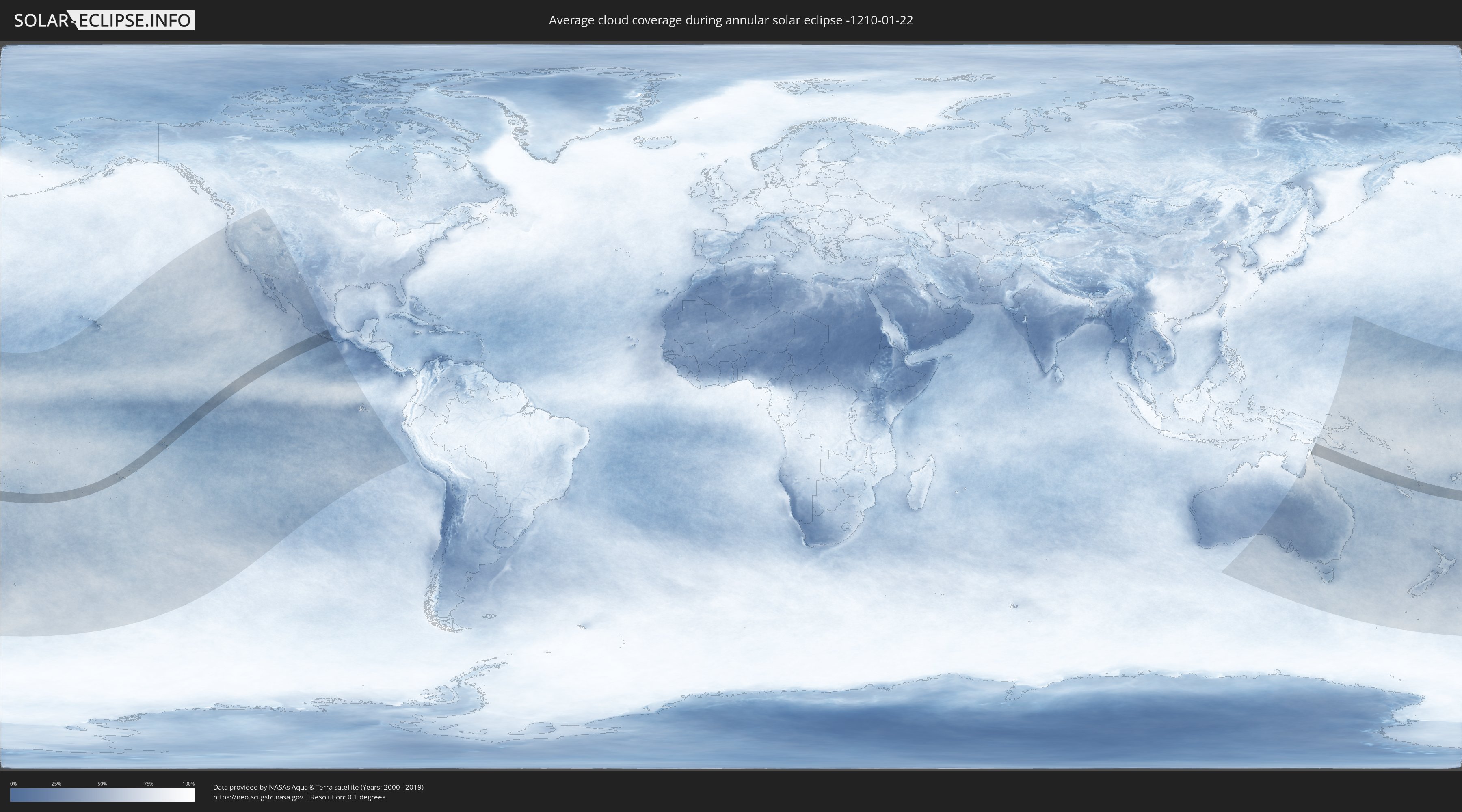
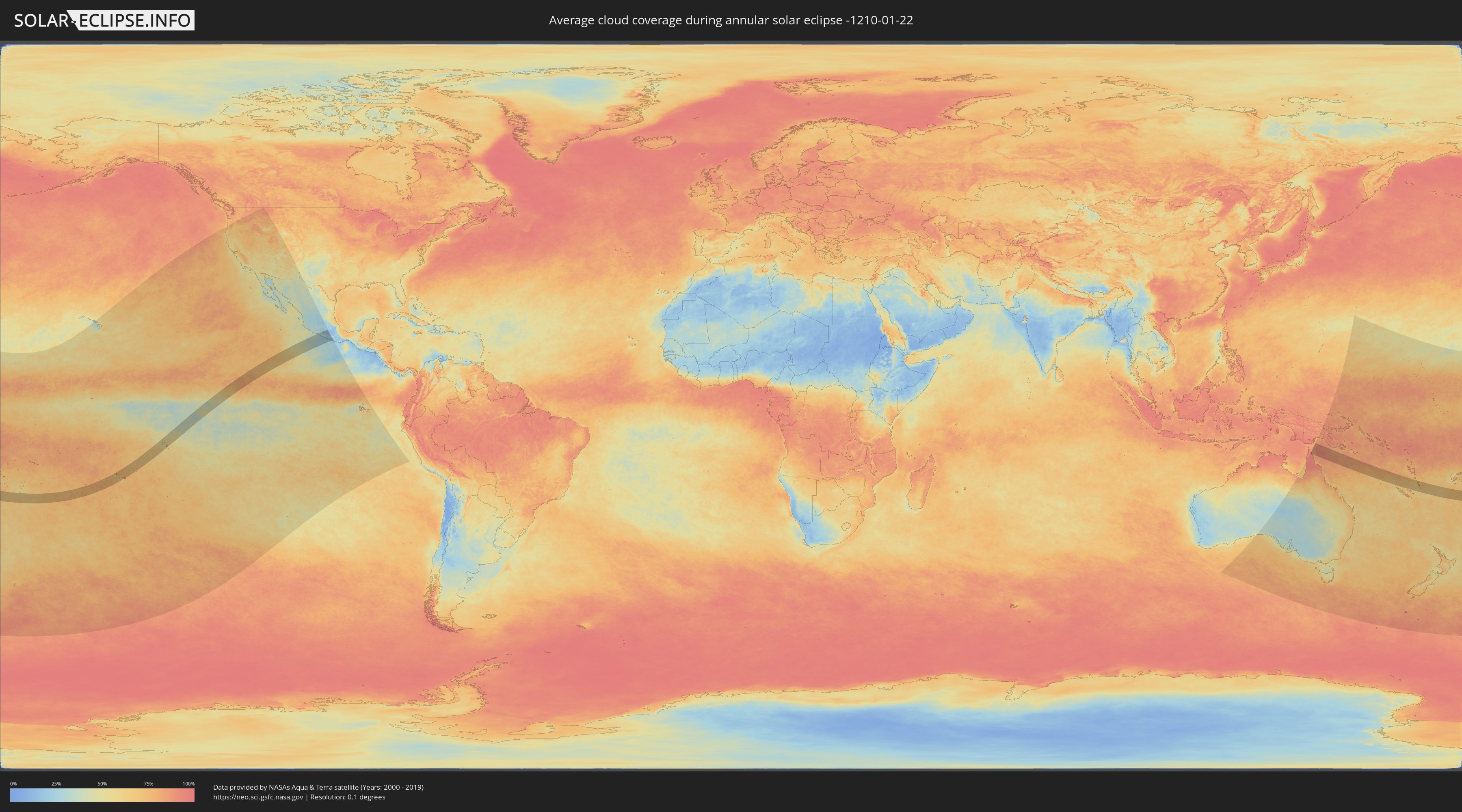
How will be the weather during the annular solar eclipse on 01/22/-1210?
Where is the best place to see the annular solar eclipse of 01/22/-1210?
The following maps show the average cloud coverage for the day of the annular solar eclipse.
With the help of these maps, it is possible to find the place along the eclipse path, which has the best
chance of a cloudless sky.
Nevertheless, you should consider local circumstances and inform about the weather of your chosen
observation site.
The data is provided by NASAs satellites
AQUA and TERRA.
The cloud maps are averaged over a period of 19 years (2000 - 2019).
Detailed country maps
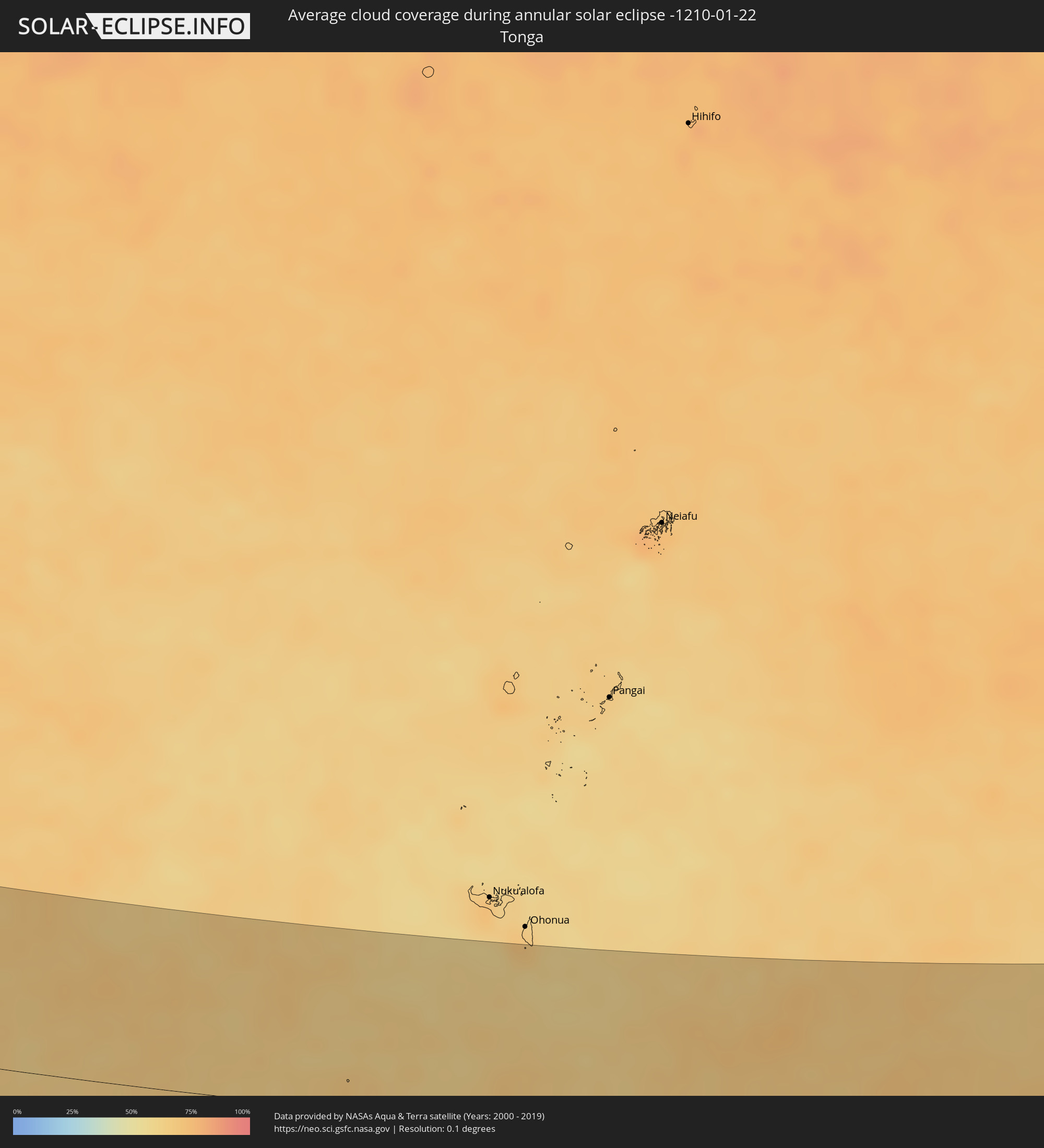 Tonga
Tonga
 Cook Islands
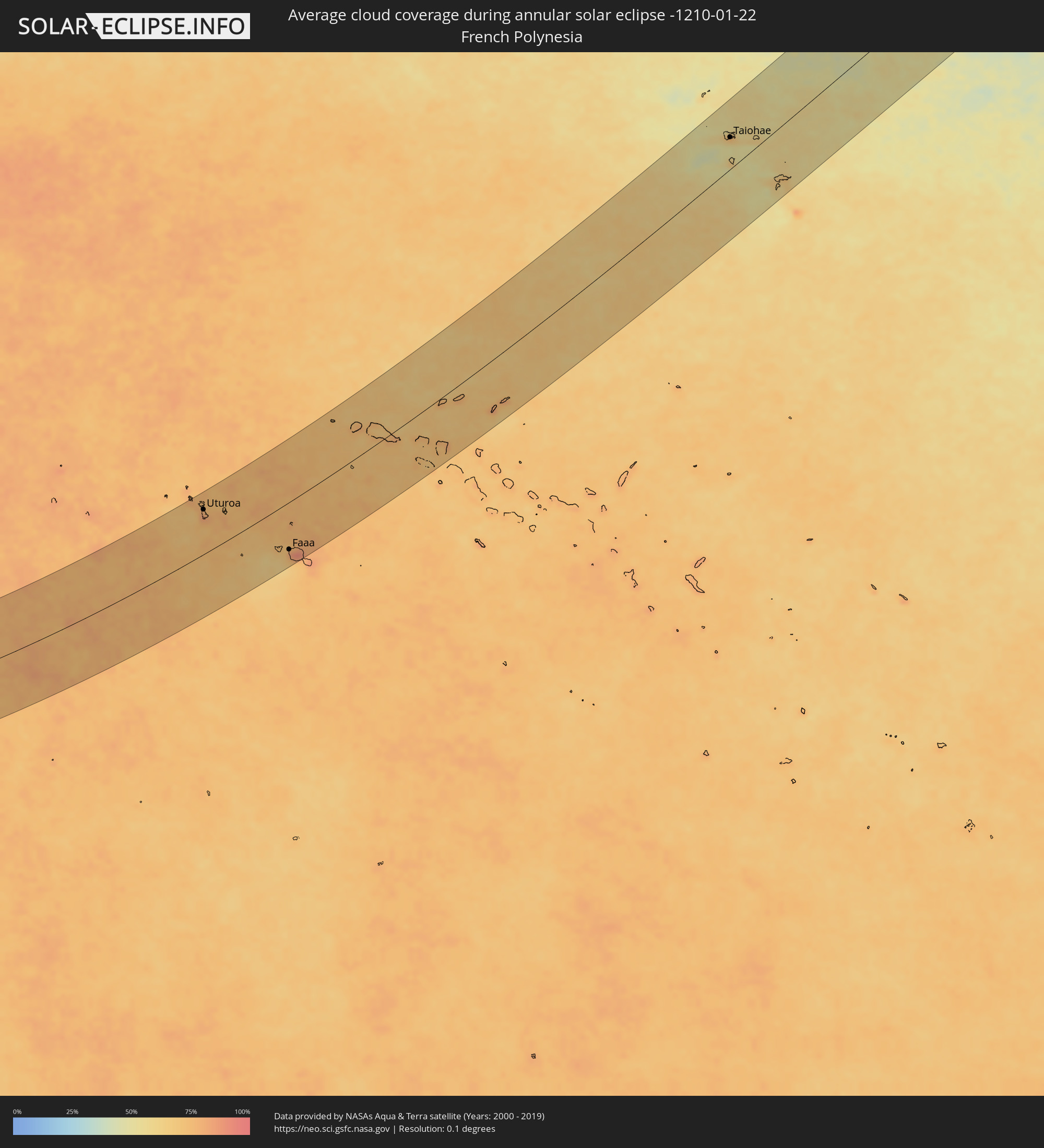 French Polynesia
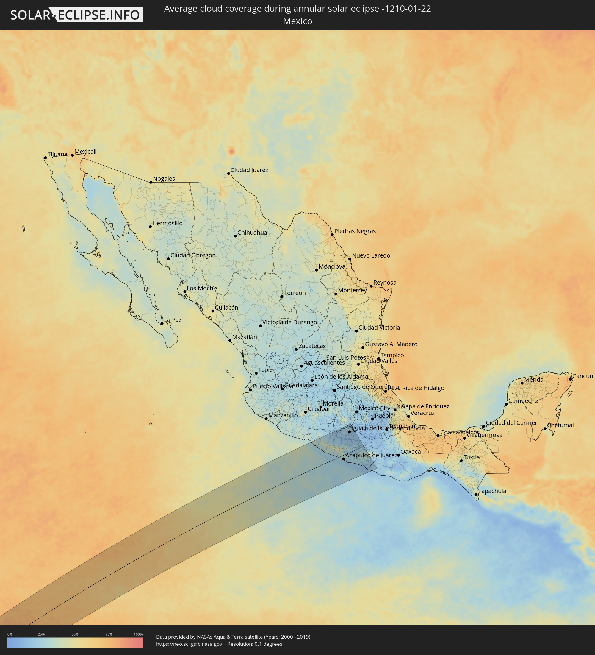 Mexico
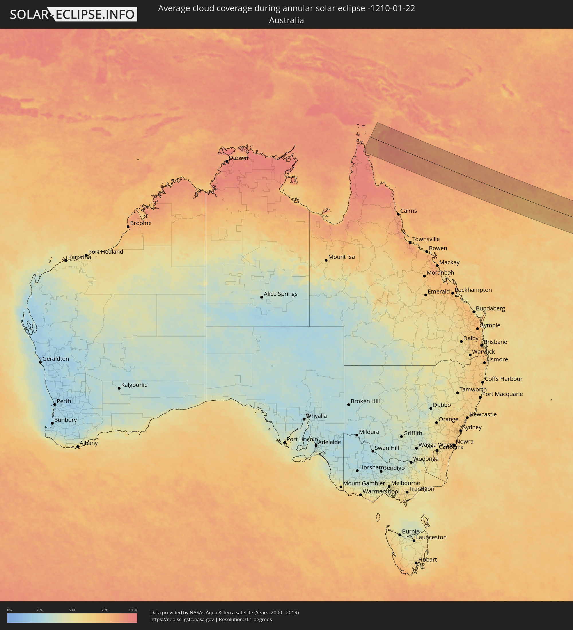 Australia
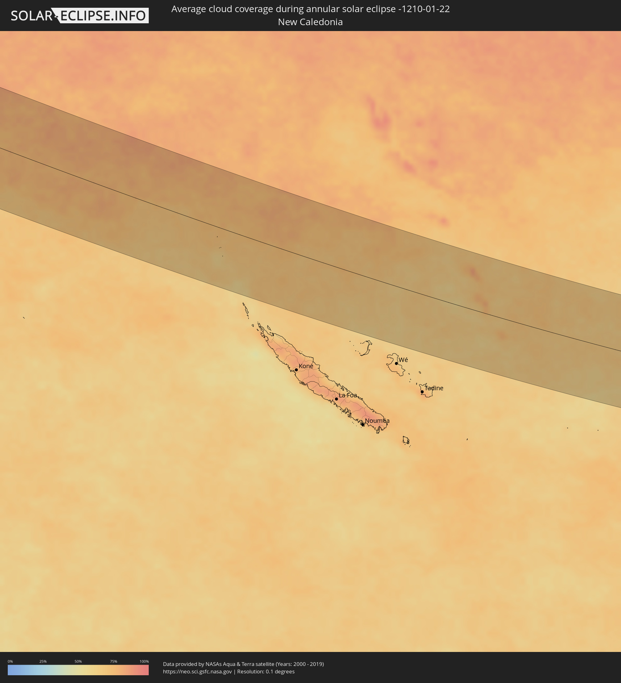 New Caledonia
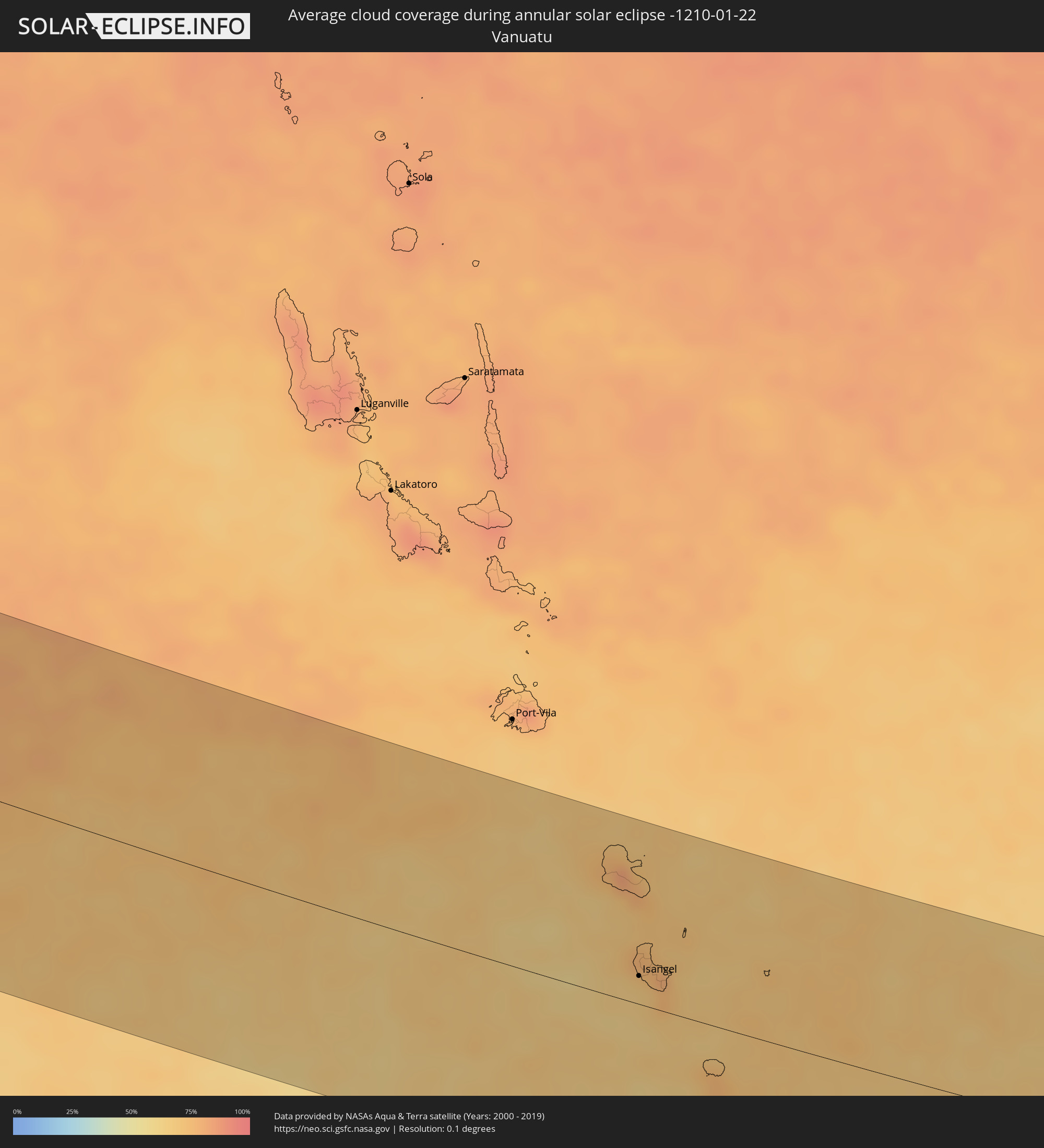 Vanuatu
Cities inside the path of the eclipse
The following table shows all locations with a population of more than 5,000 inside the eclipse path. Cities which have more than 100,000 inhabitants are marked bold. A click at the locations opens a detailed map.
| City | Type | Eclipse duration | Local time of max. eclipse | Distance to central line | Ø Cloud coverage |
|
Avarua
|
annular | - | 11:26:22 UTC-10:30 | 8 km | 78% |
|
Uturoa, Leeward Islands
|
annular | - | 12:32:23 UTC-09:58 | 88 km | 76% |
|
Faaa, Îles du Vent
|
annular | - | 12:36:28 UTC-09:58 | 92 km | 83% |
|
Punaauia, Îles du Vent
|
annular | - | 12:36:18 UTC-09:58 | 100 km | 83% |
|
Paea, Îles du Vent
|
annular | - | 12:36:15 UTC-09:58 | 105 km | 76% |
|
Papeete, Îles du Vent
|
annular | - | 12:36:35 UTC-09:58 | 92 km | 77% |
|
Papao, Îles du Vent
|
annular | - | 12:36:14 UTC-09:58 | 113 km | 70% |
|
Pirae, Îles du Vent
|
annular | - | 22:35:00 UTC+00:00 | 92 km | 80% |
|
Arue, Îles du Vent
|
annular | - | 12:36:50 UTC-09:58 | 94 km | 80% |
|
Mahina, Îles du Vent
|
annular | - | 12:36:53 UTC-09:58 | 94 km | 80% |
|
Taiohae, Îles Marquises
|
annular | - | 13:59:17 UTC-09:18 | 58 km | 67% |
|
Ixtapa, Guerrero
|
annular | - | 17:44:05 UTC-06:36 | 135 km | 29% |
|
San José Ixtapa (Barrio Viejo), Guerrero
|
annular | - | 17:44:05 UTC-06:36 | 137 km | 29% |
|
Ixtapa-Zihuatanejo, Guerrero
|
annular | - | 17:44:04 UTC-06:36 | 129 km | 26% |
|
El Coacoyul, Guerrero
|
annular | - | 17:44:04 UTC-06:36 | 125 km | 25% |
|
San Jeronimito, Guerrero
|
annular | - | 17:44:03 UTC-06:36 | 112 km | 28% |
|
Petatlán, Guerrero
|
annular | - | 17:44:02 UTC-06:36 | 105 km | 24% |
|
El Súchil, Guerrero
|
annular | - | 17:43:56 UTC-06:36 | 46 km | 25% |
|
Técpan de Galeana, Guerrero
|
annular | - | 17:43:56 UTC-06:36 | 45 km | 25% |
|
Tlapehuala, Guerrero
|
annular | - | 17:44:10 UTC-06:36 | 145 km | 19% |
|
Ajuchitlán del Progreso, Guerrero
|
annular | - | 17:44:09 UTC-06:36 | 134 km | 19% |
|
San Jerónimo de Juárez, Guerrero
|
annular | - | 17:43:54 UTC-06:36 | 30 km | 22% |
|
Atoyac de Álvarez, Guerrero
|
annular | - | 17:43:55 UTC-06:36 | 35 km | 27% |
|
Arcelia, Guerrero
|
annular | - | 17:44:10 UTC-06:36 | 142 km | 17% |
|
Coyuca de Benítez, Guerrero
|
annular | - | 17:43:51 UTC-06:36 | 0 km | 25% |
|
Tlacotepec, Guerrero
|
annular | - | 17:44:02 UTC-06:36 | 75 km | 22% |
|
Bajos del Ejido, Guerrero
|
annular | - | 17:43:50 UTC-06:36 | 10 km | 24% |
|
Apaxtla de Castrejón, Guerrero
|
annular | - | 17:44:07 UTC-06:36 | 108 km | 16% |
|
Acapulco de Juárez, Guerrero
|
annular | - | 17:43:48 UTC-06:36 | 23 km | 25% |
|
Teloloapan, Guerrero
|
annular | - | 17:44:09 UTC-06:36 | 129 km | 24% |
|
Kilómetro 30, Guerrero
|
annular | - | 17:43:50 UTC-06:36 | 14 km | 22% |
|
Xaltianguis, Guerrero
|
annular | - | 17:43:51 UTC-06:36 | 7 km | 26% |
|
Chichihualco, Guerrero
|
annular | - | 17:43:59 UTC-06:36 | 49 km | 25% |
|
Taxco de Alarcón, Guerrero
|
annular | - | 17:44:11 UTC-06:36 | 137 km | 23% |
|
Iguala de la Independencia, Guerrero
|
annular | - | 17:44:08 UTC-06:36 | 113 km | 15% |
|
Tierra Colorada, Guerrero
|
annular | - | 17:43:51 UTC-06:36 | 8 km | 23% |
|
Zumpango del Río, Guerrero
|
annular | - | 17:43:58 UTC-06:36 | 42 km | 20% |
|
El Ocotito, Guerrero
|
annular | - | 17:43:52 UTC-06:36 | 1 km | 23% |
|
Chilpancingo, Guerrero
|
annular | - | 17:43:57 UTC-06:36 | 30 km | 21% |
|
Tlamacazapa, Guerrero
|
annular | - | 17:44:09 UTC-06:36 | 127 km | 17% |
|
La Joya, Morelos
|
annular | - | 17:44:11 UTC-06:36 | 142 km | 16% |
|
Tepecoacuilco de Trujano, Guerrero
|
annular | - | 17:44:07 UTC-06:36 | 104 km | 15% |
|
Petaquillas, Guerrero
|
annular | - | 17:43:56 UTC-06:36 | 22 km | 26% |
|
Buenavista de Cuéllar, Guerrero
|
annular | - | 17:44:08 UTC-06:36 | 119 km | 18% |
|
Tixtla de Guerrero, Guerrero
|
annular | - | 17:43:57 UTC-06:36 | 27 km | 23% |
|
San Marcos, Guerrero
|
annular | - | 17:43:45 UTC-06:36 | 51 km | 23% |
|
Atliaca, Guerrero
|
annular | - | 17:43:58 UTC-06:36 | 35 km | 24% |
|
Ciudad de Huitzuco, Guerrero
|
annular | - | 17:44:06 UTC-06:36 | 100 km | 16% |
|
Ciudad de Huitzuco, Guerrero
|
annular | - | 17:44:06 UTC-06:36 | 99 km | 16% |
|
Zitlala, Guerrero
|
annular | - | 17:43:57 UTC-06:36 | 31 km | 20% |
|
Chilapa de Alvarez, Guerrero
|
annular | - | 17:43:56 UTC-06:36 | 21 km | 20% |
|
Cruz Grande, Guerrero
|
annular | - | 17:43:42 UTC-06:36 | 70 km | 20% |
|
Ayutla de los Libres, Guerrero
|
annular | - | 17:43:46 UTC-06:36 | 47 km | 24% |
|
Copalillo, Guerrero
|
annular | - | 17:44:01 UTC-06:36 | 60 km | 16% |
|
Copala, Guerrero
|
annular | - | 17:43:40 UTC-06:36 | 88 km | 18% |
|
Marquelia, Guerrero
|
annular | - | 17:43:39 UTC-06:36 | 98 km | 18% |
|
San Luis Acatlán, Guerrero
|
annular | - | 17:43:42 UTC-06:36 | 78 km | 24% |
|
Malinaltepec, Guerrero
|
annular | - | 17:43:48 UTC-06:36 | 36 km | 36% |
|
Cuajinicuilapa de Santa Maria, Guerrero
|
annular | - | 17:43:35 UTC-06:36 | 126 km | 20% |
|
Ometepec, Guerrero
|
annular | - | 17:43:38 UTC-06:36 | 104 km | 18% |
|
Pinotepa, Oaxaca
|
annular | - | 17:43:31 UTC-06:36 | 155 km | 18% |
|
Isangel, Tafea
|
annular | - | 07:54:44 UTC+11:13 | 21 km | 68% |