Total solar eclipse of 07/16/-1275
| Day of week: | Wednesday |
| Maximum duration of eclipse: | 03m16s |
| Maximum width of eclipse path: | 118 km |
| Saros cycle: | 35 |
| Coverage: | 100% |
| Magnitude: | 1.0347 |
| Gamma: | 0.1255 |
Wo kann man die Sonnenfinsternis vom 07/16/-1275 sehen?
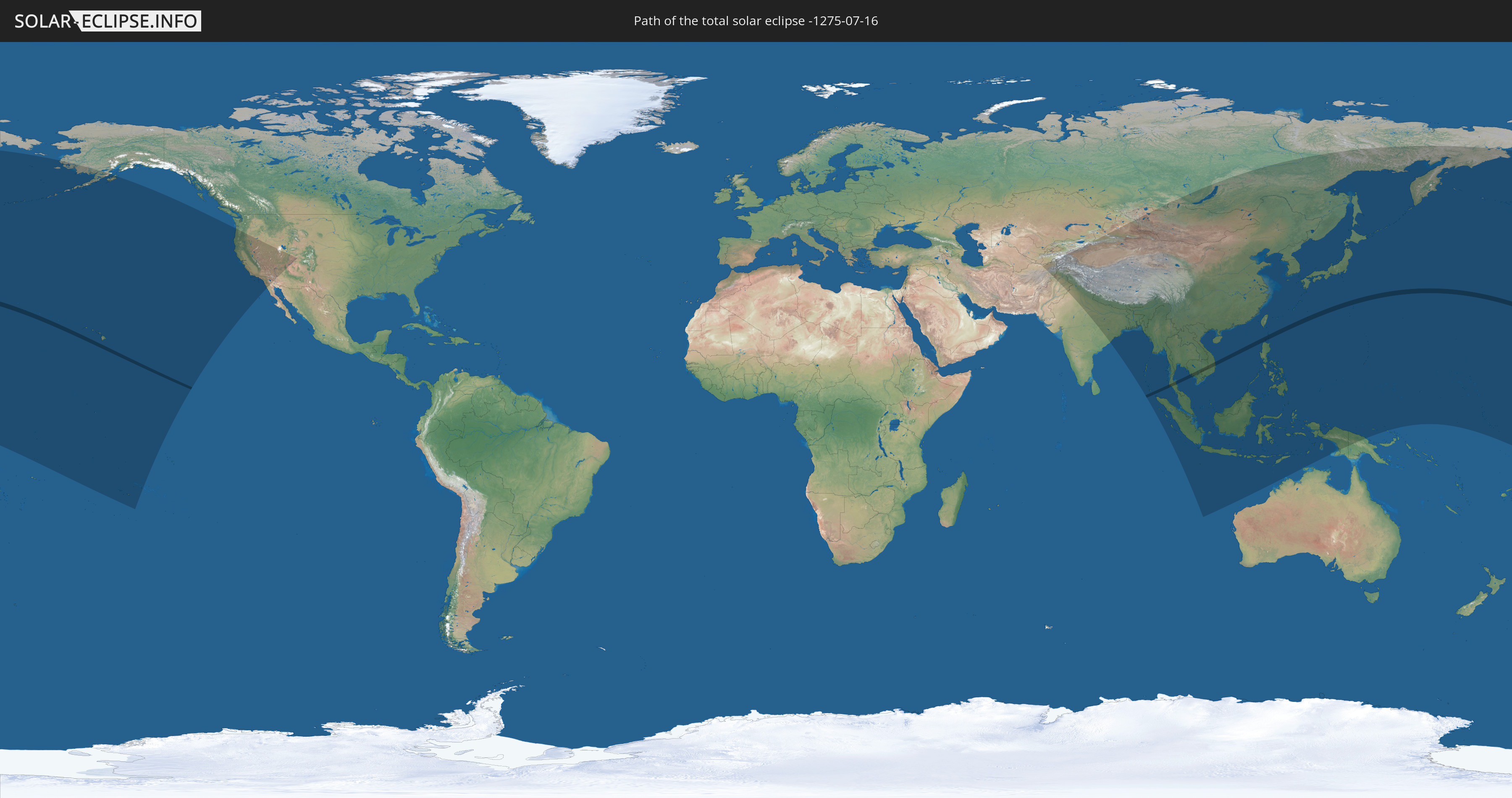
Die Sonnenfinsternis am 07/16/-1275 kann man in 45 Ländern als partielle Sonnenfinsternis beobachten.
Der Finsternispfad verläuft durch 6 Länder. Nur in diesen Ländern ist sie als total Sonnenfinsternis zu sehen.
In den folgenden Ländern ist die Sonnenfinsternis total zu sehen
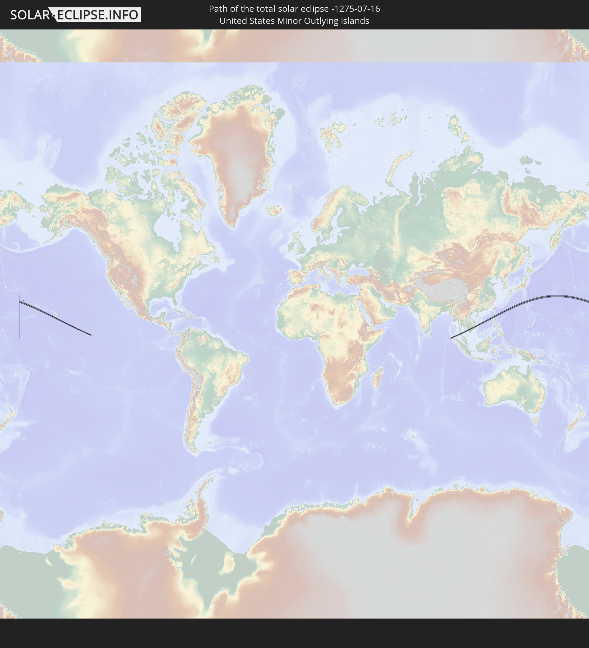 United States Minor Outlying Islands
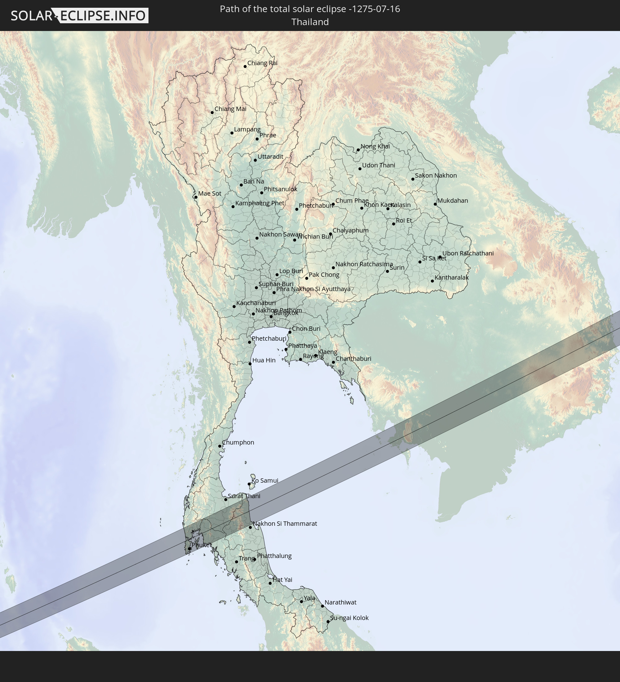 Thailand
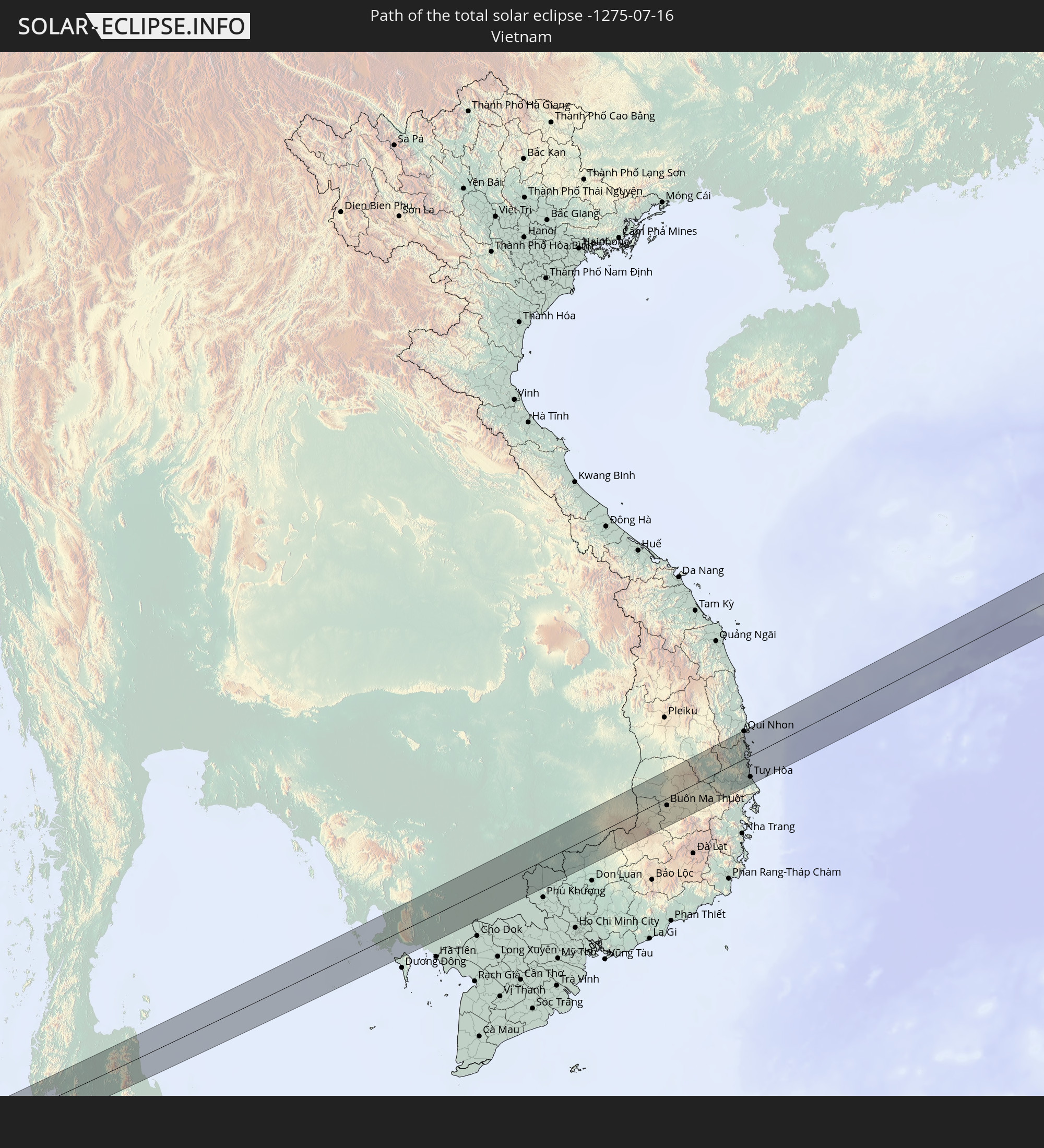 Vietnam
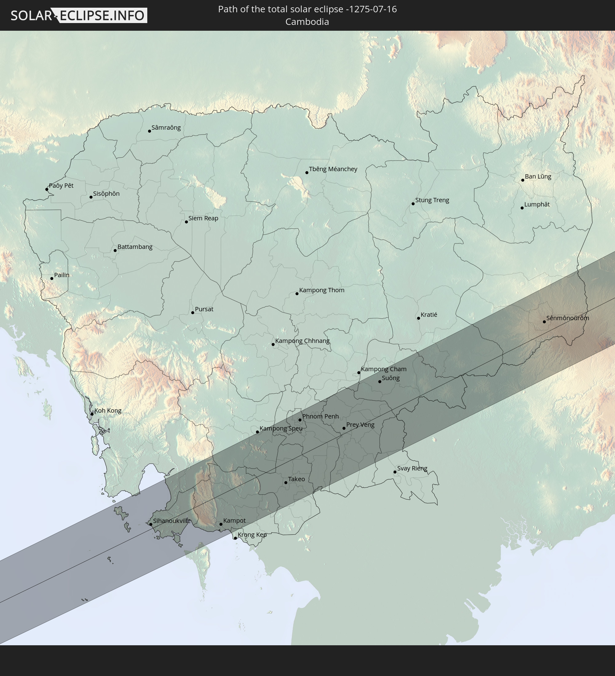 Cambodia
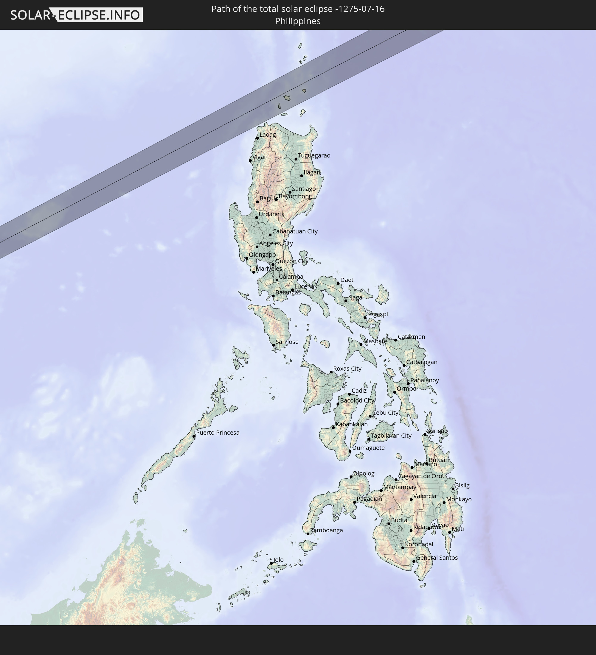 Philippines
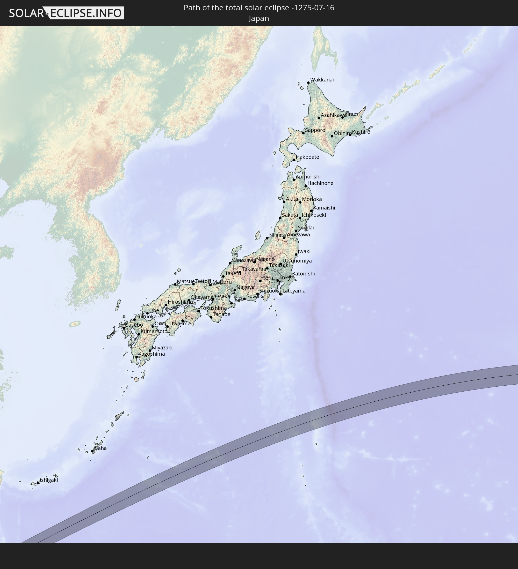 Japan
Japan
In den folgenden Ländern ist die Sonnenfinsternis partiell zu sehen
 Russia
 United States
 United States Minor Outlying Islands
 Kiribati
 Tokelau
 Cook Islands
 French Polynesia
 Mexico
 Kazakhstan
 Afghanistan
 Pakistan
 Tajikistan
 India
India
 Kyrgyzstan
 China
China
 Nepal
Nepal
 Mongolia
 Bangladesh
 Bhutan
 Myanmar
 Indonesia
 Thailand
 Malaysia
 Laos
Laos
 Vietnam
 Cambodia
 Singapore
 Christmas Island
 Australia
 Macau
Macau
 Hong Kong
 Brunei
 Taiwan
 Philippines
 Japan
Japan
 East Timor
 North Korea
 South Korea
 Palau
Palau
 Federated States of Micronesia
 Papua New Guinea
 Guam
Guam
 Northern Mariana Islands
 Marshall Islands
 Nauru
Nauru
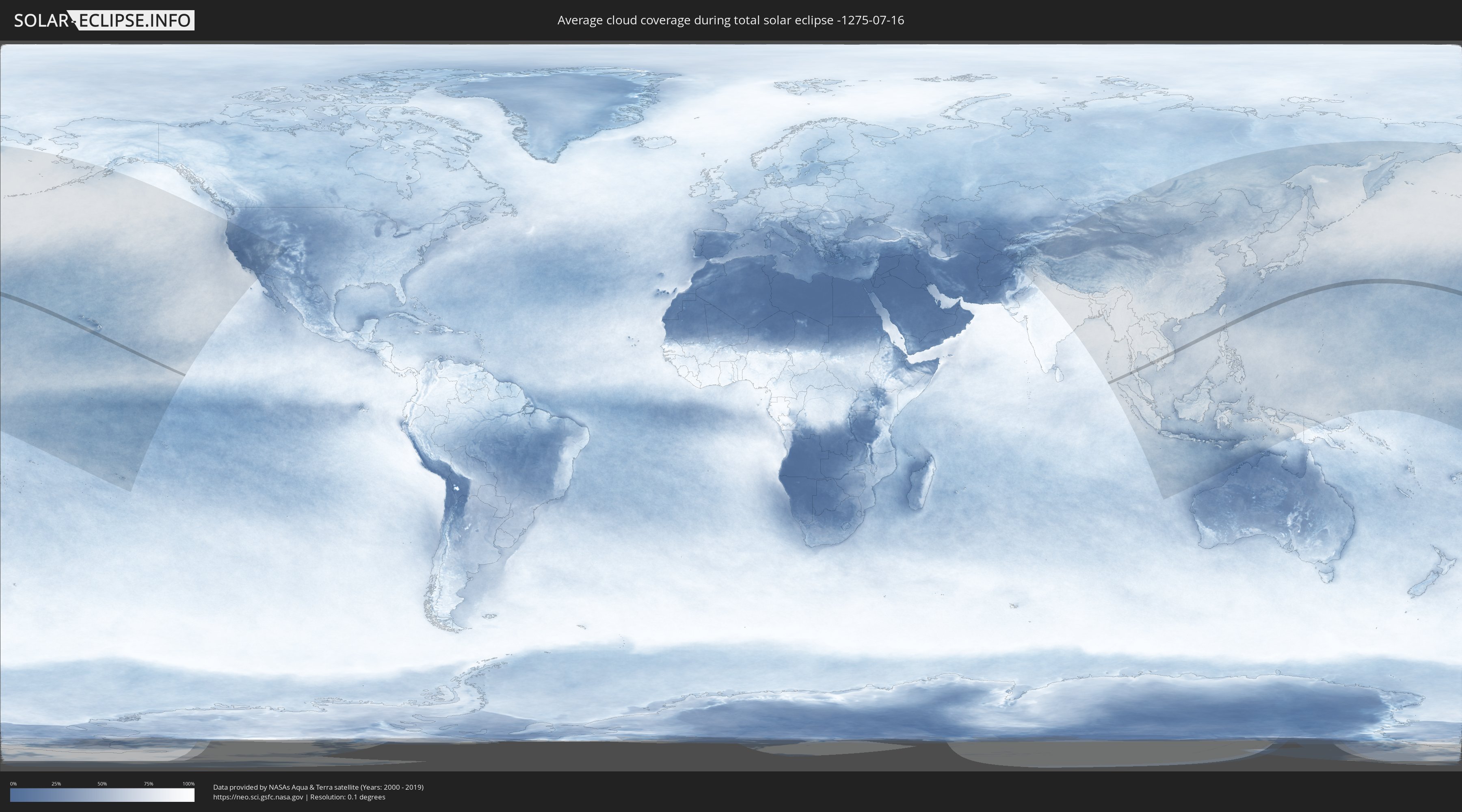
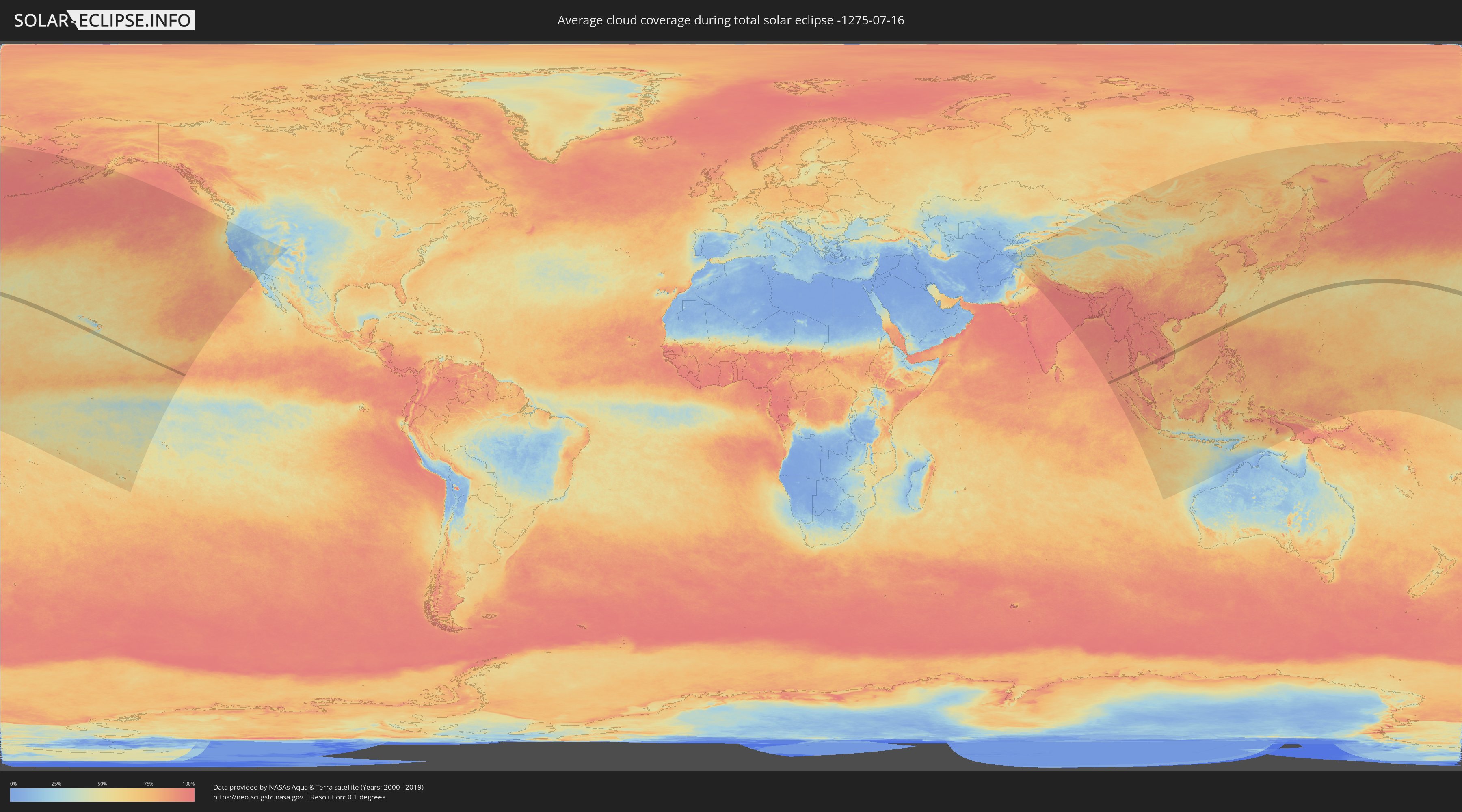
How will be the weather during the total solar eclipse on 07/16/-1275?
Where is the best place to see the total solar eclipse of 07/16/-1275?
The following maps show the average cloud coverage for the day of the total solar eclipse.
With the help of these maps, it is possible to find the place along the eclipse path, which has the best
chance of a cloudless sky.
Nevertheless, you should consider local circumstances and inform about the weather of your chosen
observation site.
The data is provided by NASAs satellites
AQUA and TERRA.
The cloud maps are averaged over a period of 19 years (2000 - 2019).
Detailed country maps
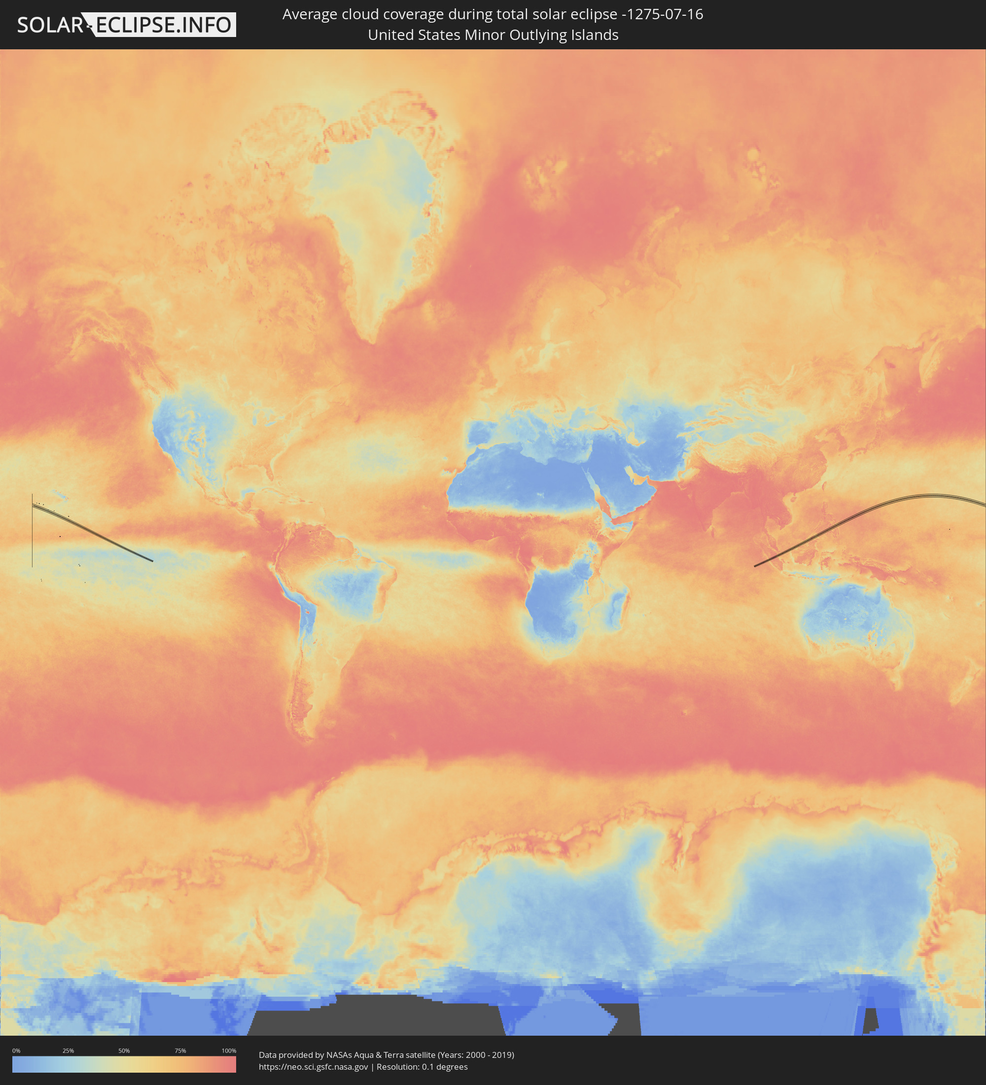 United States Minor Outlying Islands
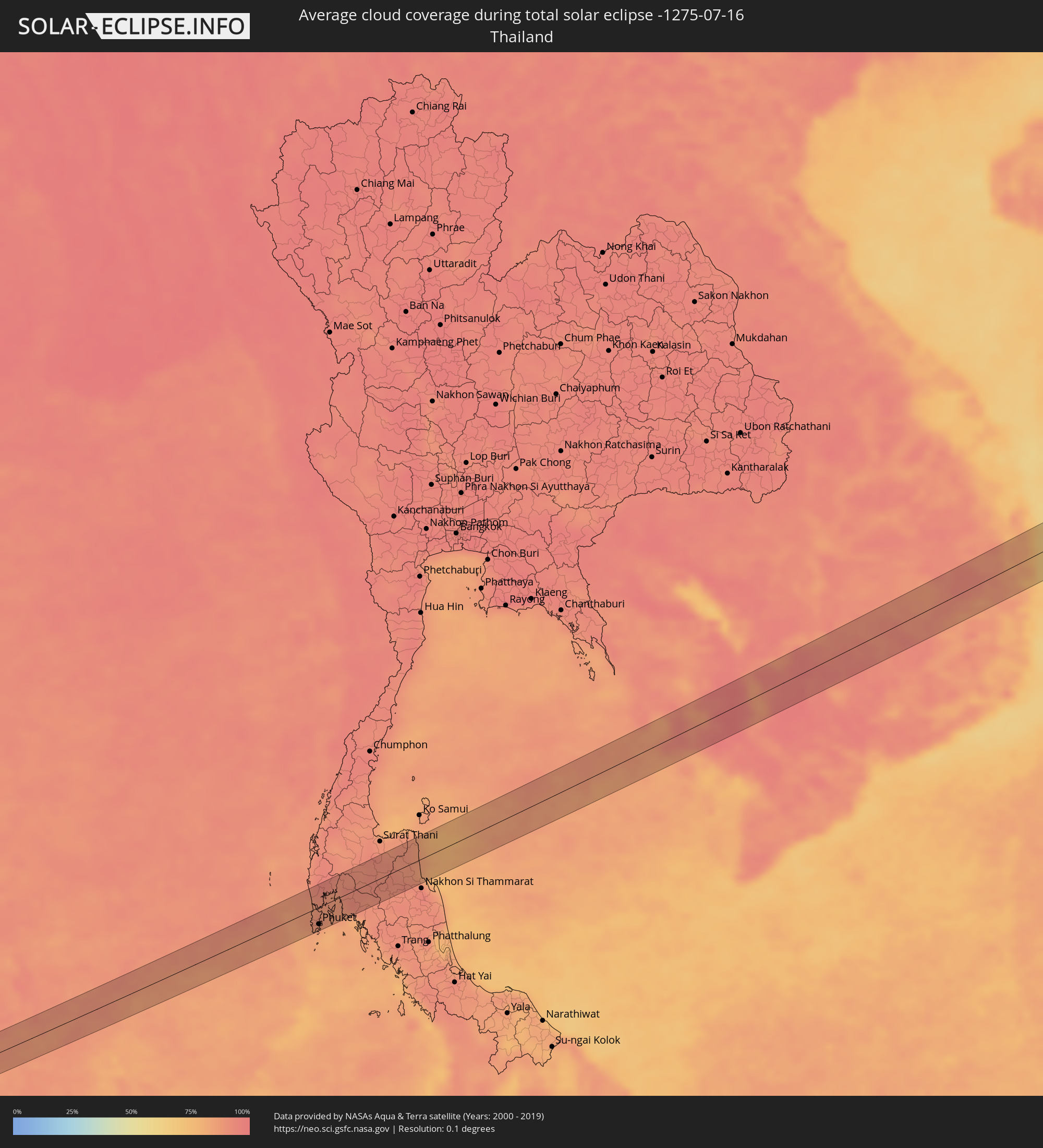 Thailand
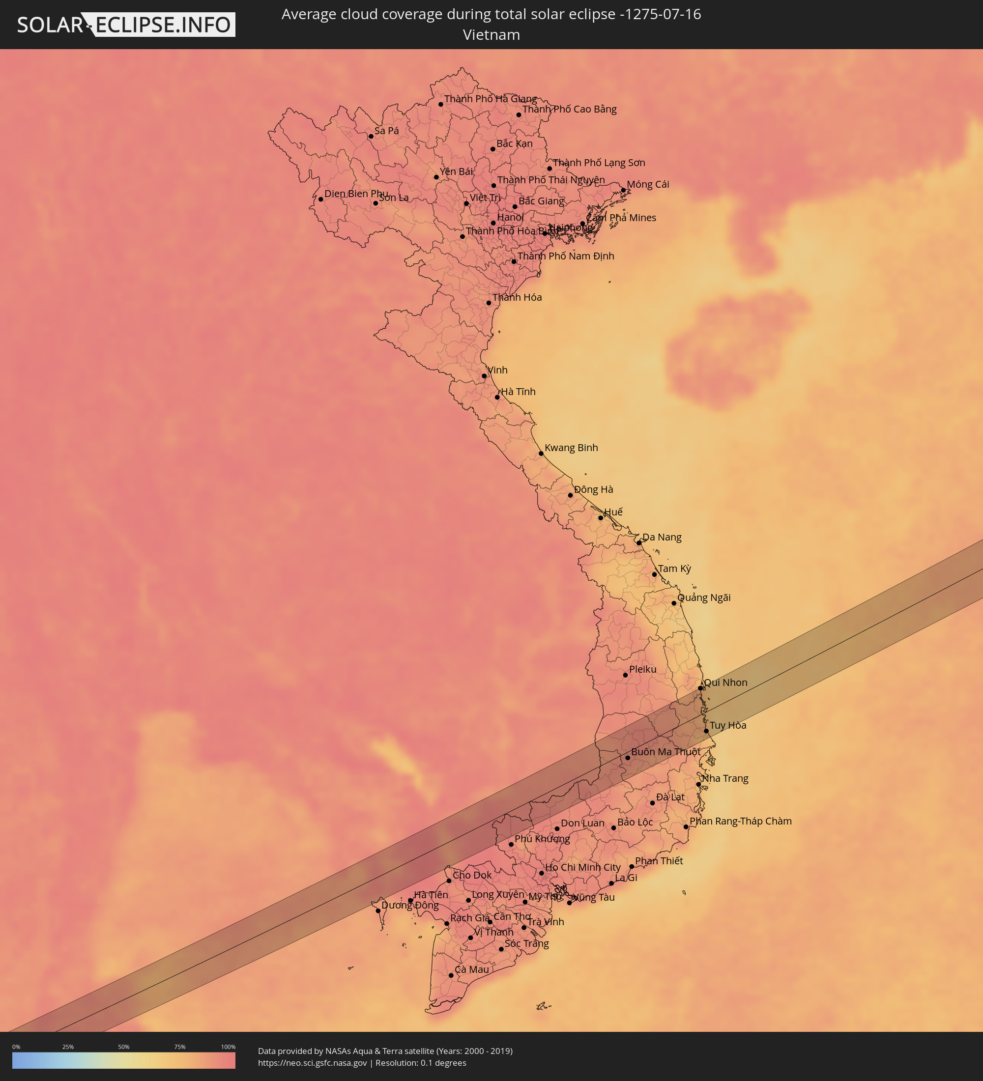 Vietnam
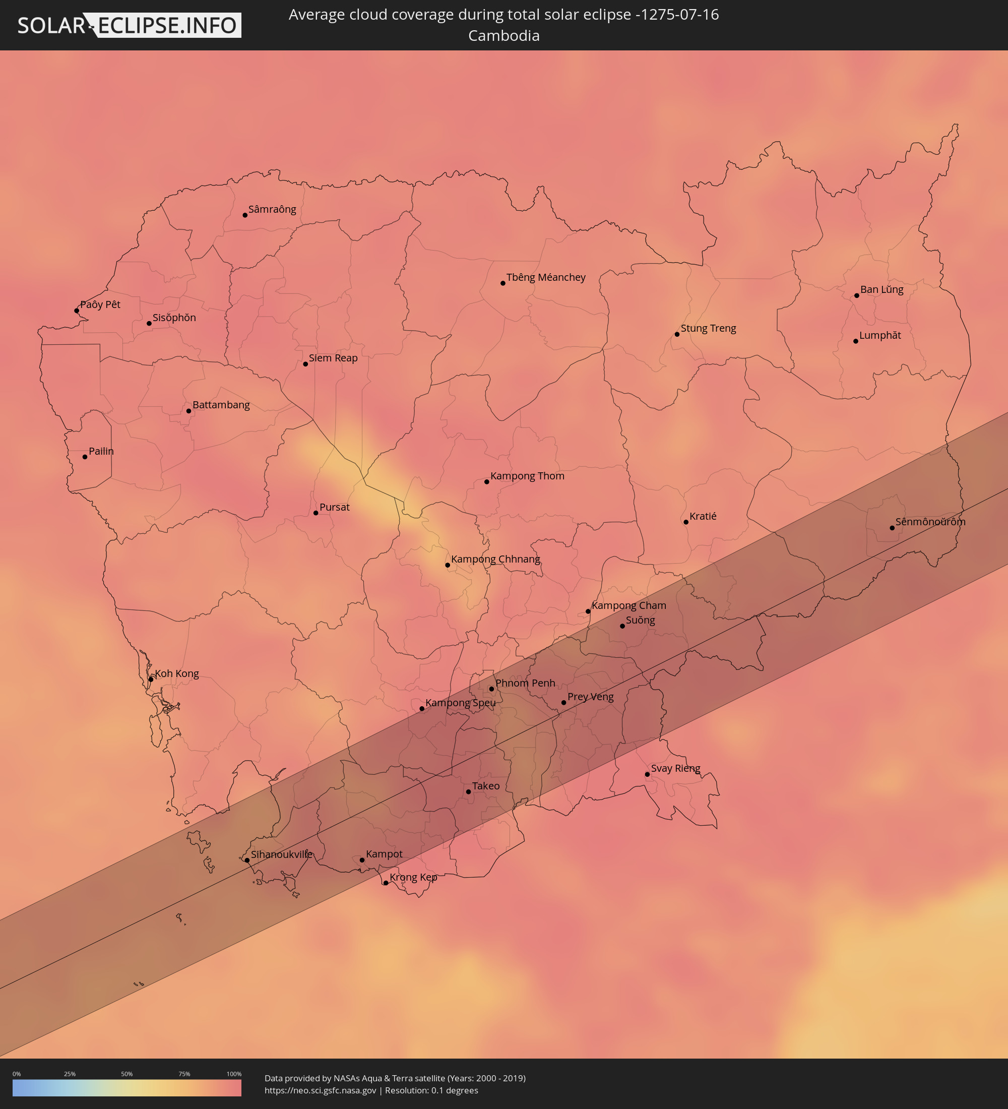 Cambodia
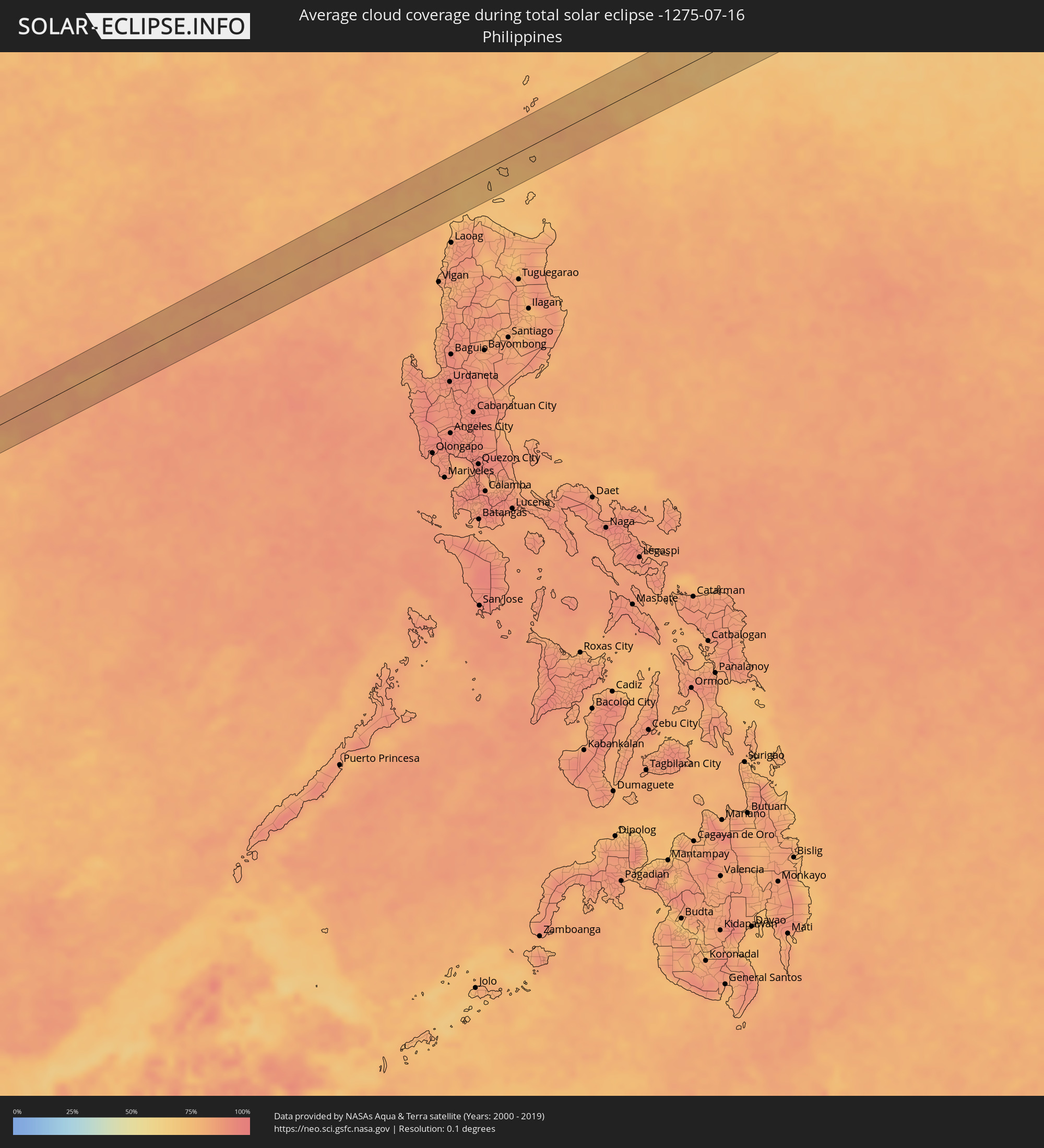 Philippines
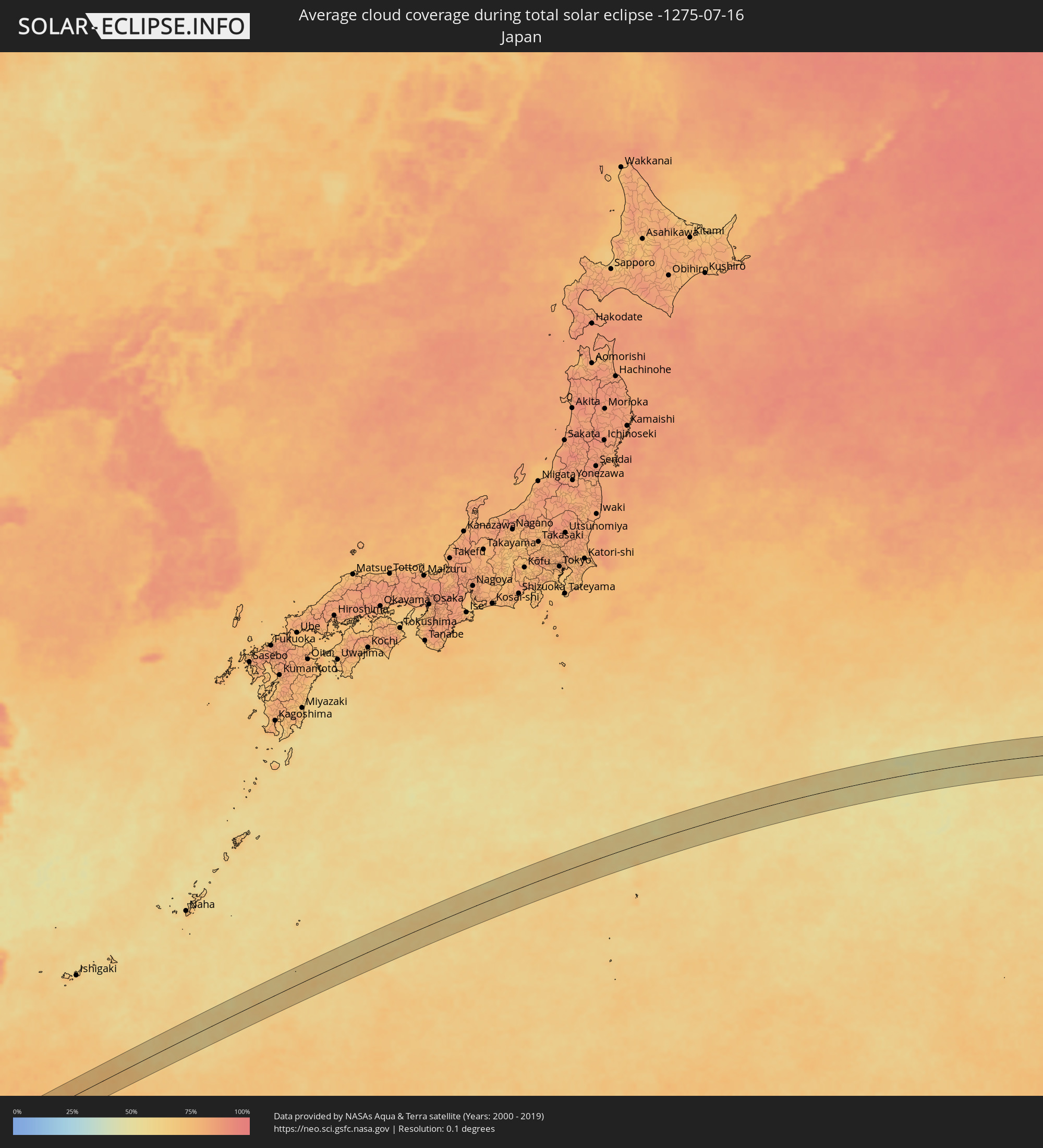 Japan
Japan
Cities inside the path of the eclipse
The following table shows all locations with a population of more than 5,000 inside the eclipse path. Cities which have more than 100,000 inhabitants are marked bold. A click at the locations opens a detailed map.
| City | Type | Eclipse duration | Local time of max. eclipse | Distance to central line | Ø Cloud coverage |
|
Patong, Phuket
|
total | - | 06:19:28 UTC+06:42 | 21 km | 86% |
|
Ban Karon, Phuket
|
total | - | 06:19:26 UTC+06:42 | 26 km | 84% |
|
Rawai, Phuket
|
total | - | 06:19:23 UTC+06:42 | 34 km | 84% |
|
Kathu, Phuket
|
total | - | 06:19:28 UTC+06:42 | 20 km | 86% |
|
Ban Chalong, Phuket
|
total | - | 06:19:26 UTC+06:42 | 28 km | 84% |
|
Wichit, Phuket
|
total | - | 06:19:27 UTC+06:42 | 26 km | 88% |
|
Ban Talat Nua, Phuket
|
total | - | 06:19:27 UTC+06:42 | 26 km | 88% |
|
Ban Ko Kaeo, Phuket
|
total | - | 06:19:29 UTC+06:42 | 21 km | 88% |
|
Phuket, Phuket
|
total | - | 06:19:27 UTC+06:42 | 26 km | 88% |
|
Ban Talat Yai, Phuket
|
total | - | 06:19:27 UTC+06:42 | 27 km | 88% |
|
Ban Ratsada, Phuket
|
total | - | 06:19:28 UTC+06:42 | 24 km | 88% |
|
Phang Nga, Phangnga
|
total | - | 06:19:47 UTC+06:42 | 24 km | 93% |
|
Ban Phru Nai, Phangnga
|
total | - | 06:19:29 UTC+06:42 | 29 km | 86% |
|
Ao Luek, Krabi
|
total | - | 06:19:44 UTC+06:42 | 8 km | 87% |
|
Ban Ao Nang, Phangnga
|
total | - | 06:19:32 UTC+06:42 | 30 km | 85% |
|
Krabi, Krabi
|
total | - | 06:19:32 UTC+06:42 | 32 km | 85% |
|
Nuea Khlong, Krabi
|
total | - | 06:19:32 UTC+06:42 | 36 km | 88% |
|
Chai Buri, Surat Thani
|
total | - | 06:19:46 UTC+06:42 | 1 km | 91% |
|
Ban Na San, Surat Thani
|
total | - | 06:19:59 UTC+06:42 | 20 km | 90% |
|
Wiang Sa, Surat Thani
|
total | - | 06:19:53 UTC+06:42 | 4 km | 91% |
|
Tham Phannara, Nakhon Si Thammarat
|
total | - | 06:19:44 UTC+06:42 | 19 km | 90% |
|
Chawang, Nakhon Si Thammarat
|
total | - | 06:19:45 UTC+06:42 | 24 km | 90% |
|
Sihanoukville, Preah Sihanouk
|
total | - | 06:21:26 UTC+06:42 | 4 km | 85% |
|
Kampot, Kampot
|
total | - | 06:21:32 UTC+06:42 | 28 km | 87% |
|
Phumĭ Véal Srê, Takeo
|
total | - | 06:21:54 UTC+06:42 | 19 km | 97% |
|
Takeo, Takeo
|
total | - | 06:21:55 UTC+06:42 | 19 km | 97% |
|
Phnom Penh, Phnom Penh
|
total | - | 06:22:22 UTC+06:42 | 32 km | 94% |
|
Ta Khmau, Kandal
|
total | - | 06:22:19 UTC+06:42 | 22 km | 87% |
|
Prey Veng, Prey Veng
|
total | - | 06:22:23 UTC+06:42 | 4 km | 91% |
|
Suŏng, Tboung Khmum
|
total | - | 06:22:47 UTC+06:42 | 31 km | 95% |
|
Sênmônoŭrôm, Mondolkiri
|
total | - | 06:23:35 UTC+06:42 | 10 km | 93% |
|
Buôn Ma Thuột, Ðắc Lắk
|
total | - | 06:48:36 UTC+07:06 | 11 km | 91% |
|
Sông Cầu, Phú Yên
|
total | - | 06:49:40 UTC+07:06 | 9 km | 81% |
|
Qui Nhon, Bình Định
|
total | - | 06:49:56 UTC+07:06 | 41 km | 81% |
|
Tuy Hòa, Phú Yên
|
total | - | 06:49:24 UTC+07:06 | 32 km | 75% |