Total solar eclipse of 10/29/-1290
| Day of week: | Friday |
| Maximum duration of eclipse: | 02m14s |
| Maximum width of eclipse path: | 86 km |
| Saros cycle: | 32 |
| Coverage: | 100% |
| Magnitude: | 1.0254 |
| Gamma: | -0.046 |
Wo kann man die Sonnenfinsternis vom 10/29/-1290 sehen?

Die Sonnenfinsternis am 10/29/-1290 kann man in 57 Ländern als partielle Sonnenfinsternis beobachten.
Der Finsternispfad verläuft durch 7 Länder. Nur in diesen Ländern ist sie als total Sonnenfinsternis zu sehen.
In den folgenden Ländern ist die Sonnenfinsternis total zu sehen
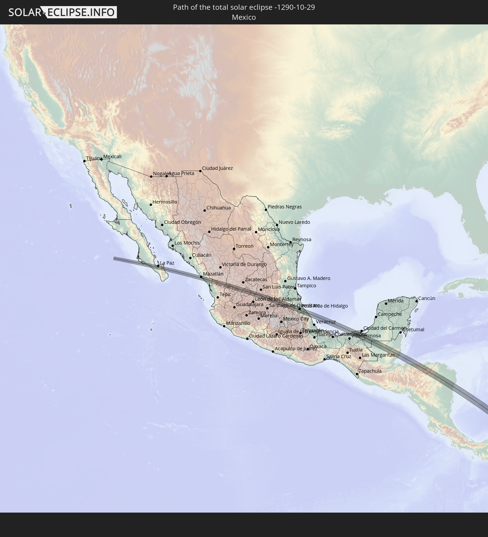 Mexico
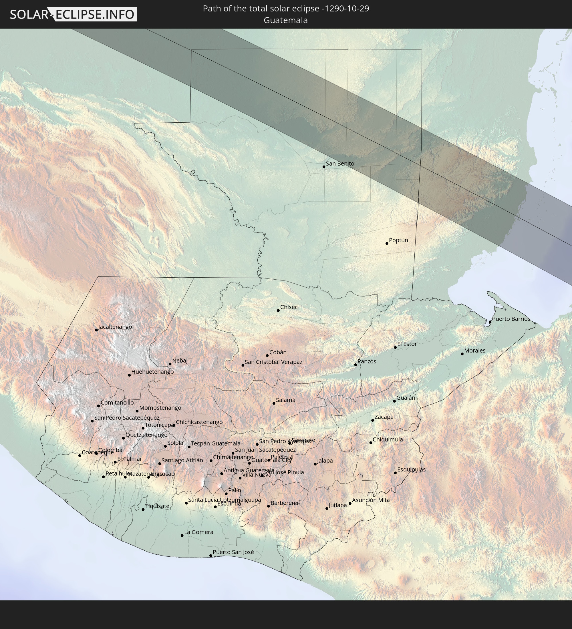 Guatemala
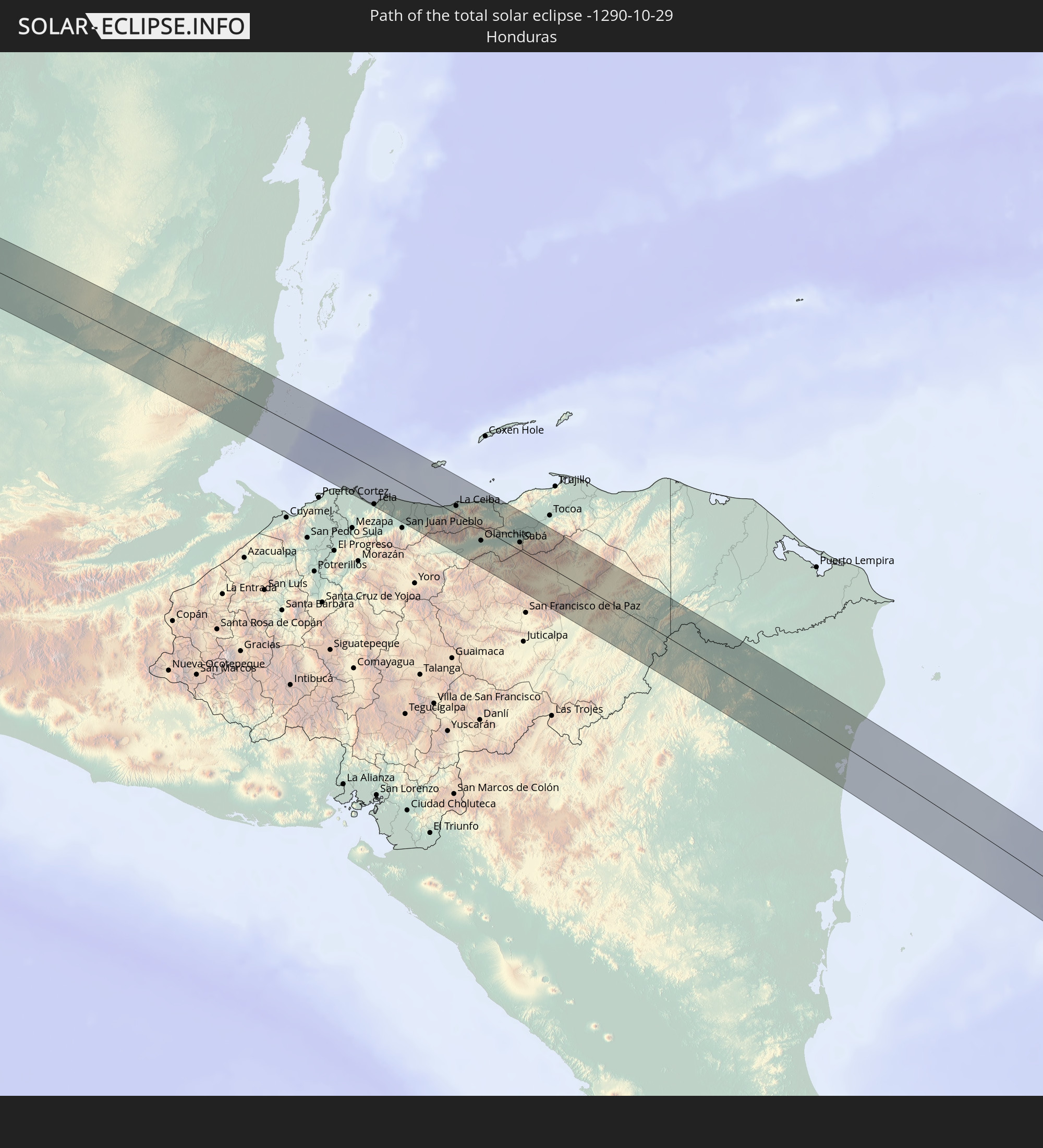 Honduras
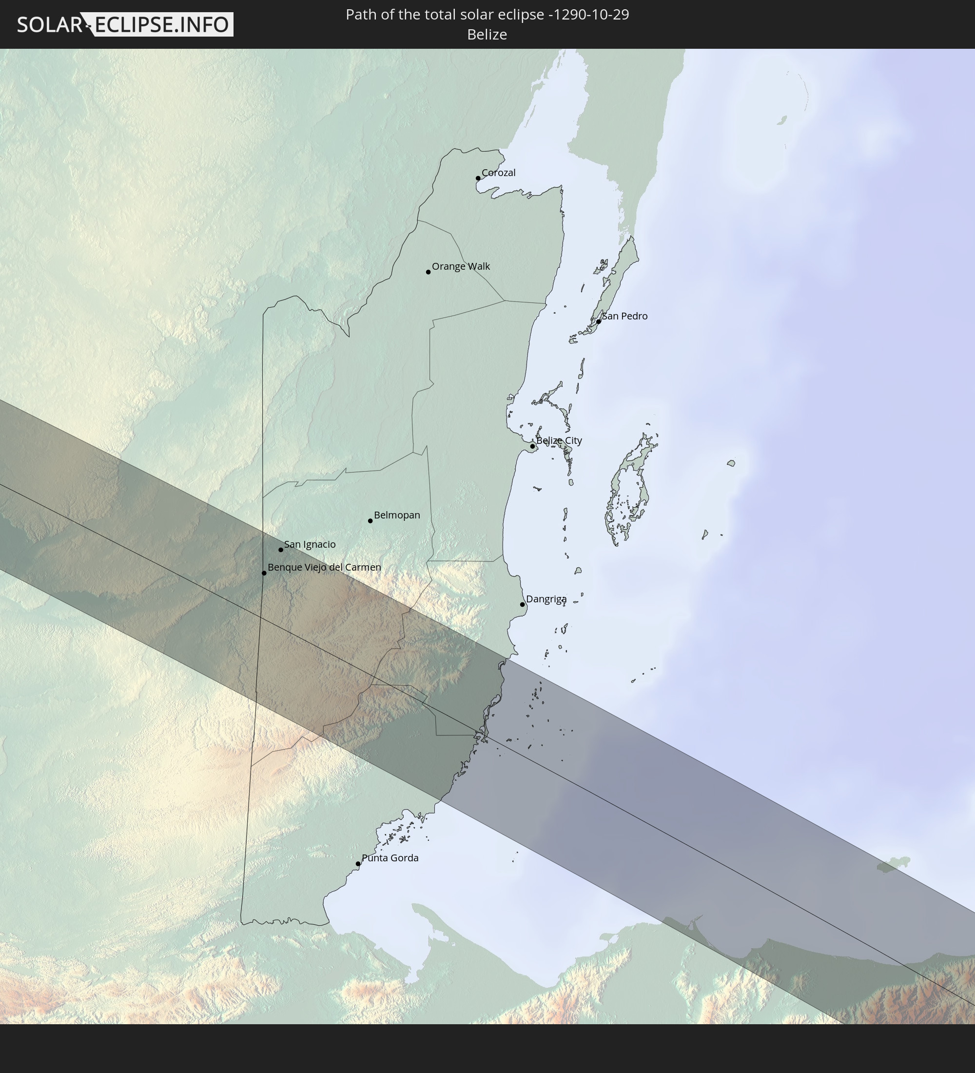 Belize
 Nicaragua
 Colombia
 Brazil
In den folgenden Ländern ist die Sonnenfinsternis partiell zu sehen
 United States
 United States Minor Outlying Islands
 Canada
 Mexico
 Chile
Chile
 Guatemala
 Ecuador
 El Salvador
 Honduras
 Belize
 Nicaragua
 Costa Rica
 Cuba
Cuba
 Panama
 Colombia
 Cayman Islands
 Peru
Peru
 The Bahamas
 Jamaica
 Haiti
Haiti
 Brazil
 Argentina
 Venezuela
 Turks and Caicos Islands
 Dominican Republic
 Aruba
Aruba
 Bolivia
 Puerto Rico
 United States Virgin Islands
 Bermuda
 British Virgin Islands
 Anguilla
 Collectivity of Saint Martin
 Saint Barthélemy
 Saint Kitts and Nevis
 Paraguay
 Antigua and Barbuda
 Montserrat
 Trinidad and Tobago
 Guadeloupe
 Grenada
 Dominica
 Saint Vincent and the Grenadines
 Falkland Islands
 Guyana
 Martinique
 Saint Lucia
 Barbados
 Uruguay
 Suriname
 French Guiana
 South Georgia and the South Sandwich Islands
 Saint Helena, Ascension and Tristan da Cunha
 Bouvet Island
 Equatorial Guinea
 São Tomé and Príncipe
 Gabon
Gabon
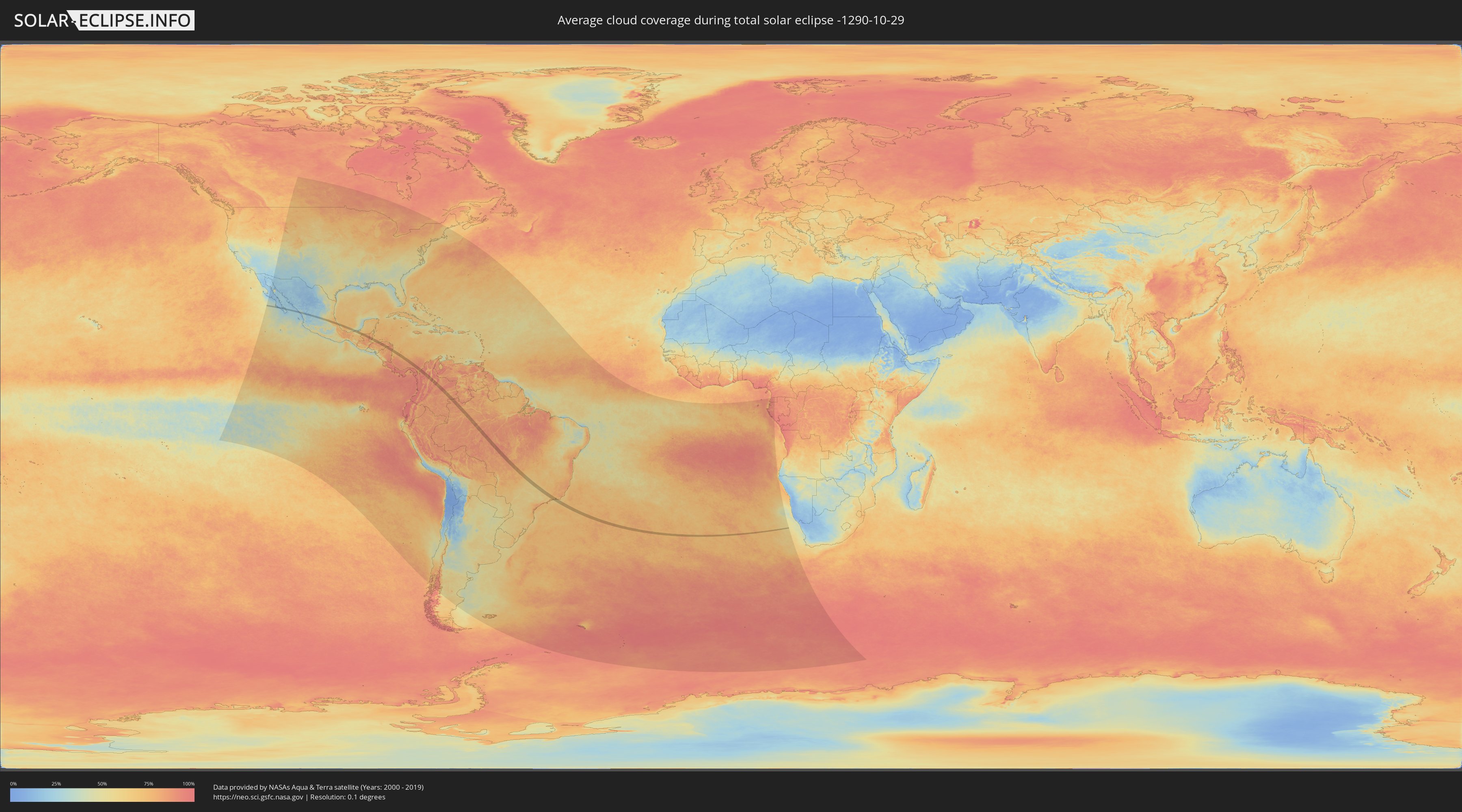
How will be the weather during the total solar eclipse on 10/29/-1290?
Where is the best place to see the total solar eclipse of 10/29/-1290?
The following maps show the average cloud coverage for the day of the total solar eclipse.
With the help of these maps, it is possible to find the place along the eclipse path, which has the best
chance of a cloudless sky.
Nevertheless, you should consider local circumstances and inform about the weather of your chosen
observation site.
The data is provided by NASAs satellites
AQUA and TERRA.
The cloud maps are averaged over a period of 19 years (2000 - 2019).

Detailed country maps
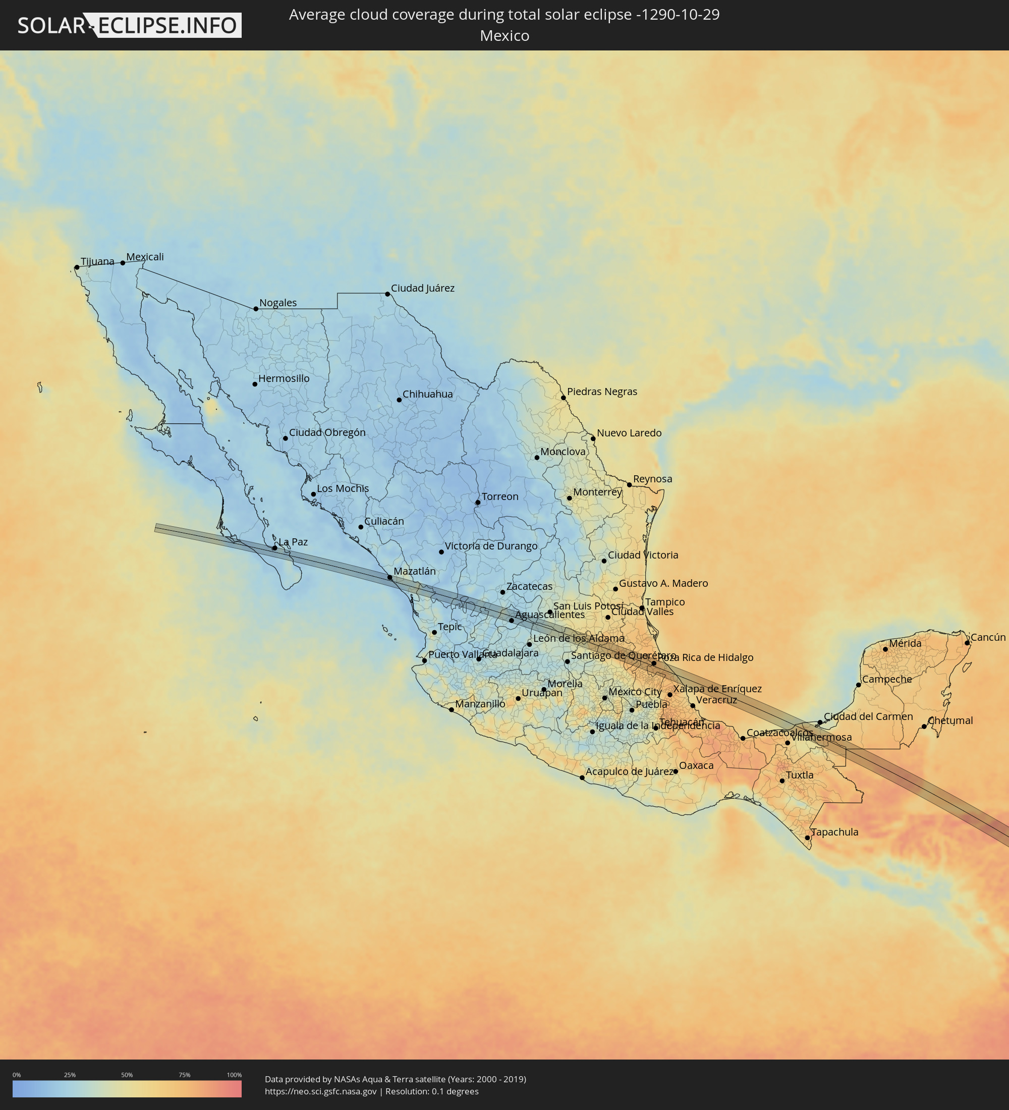 Mexico
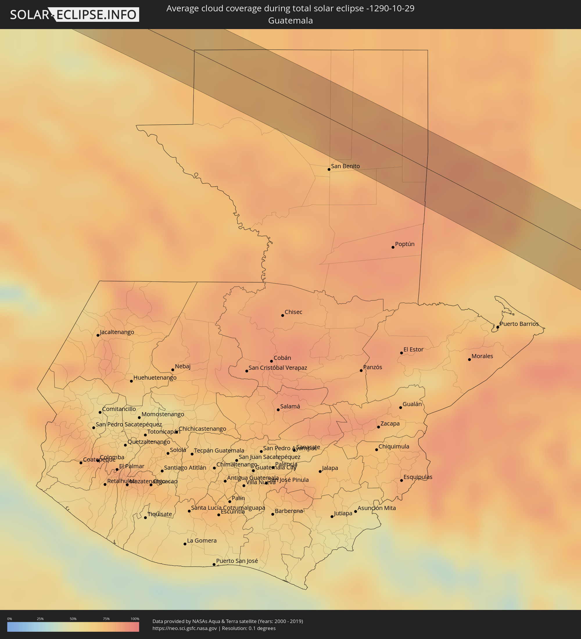 Guatemala
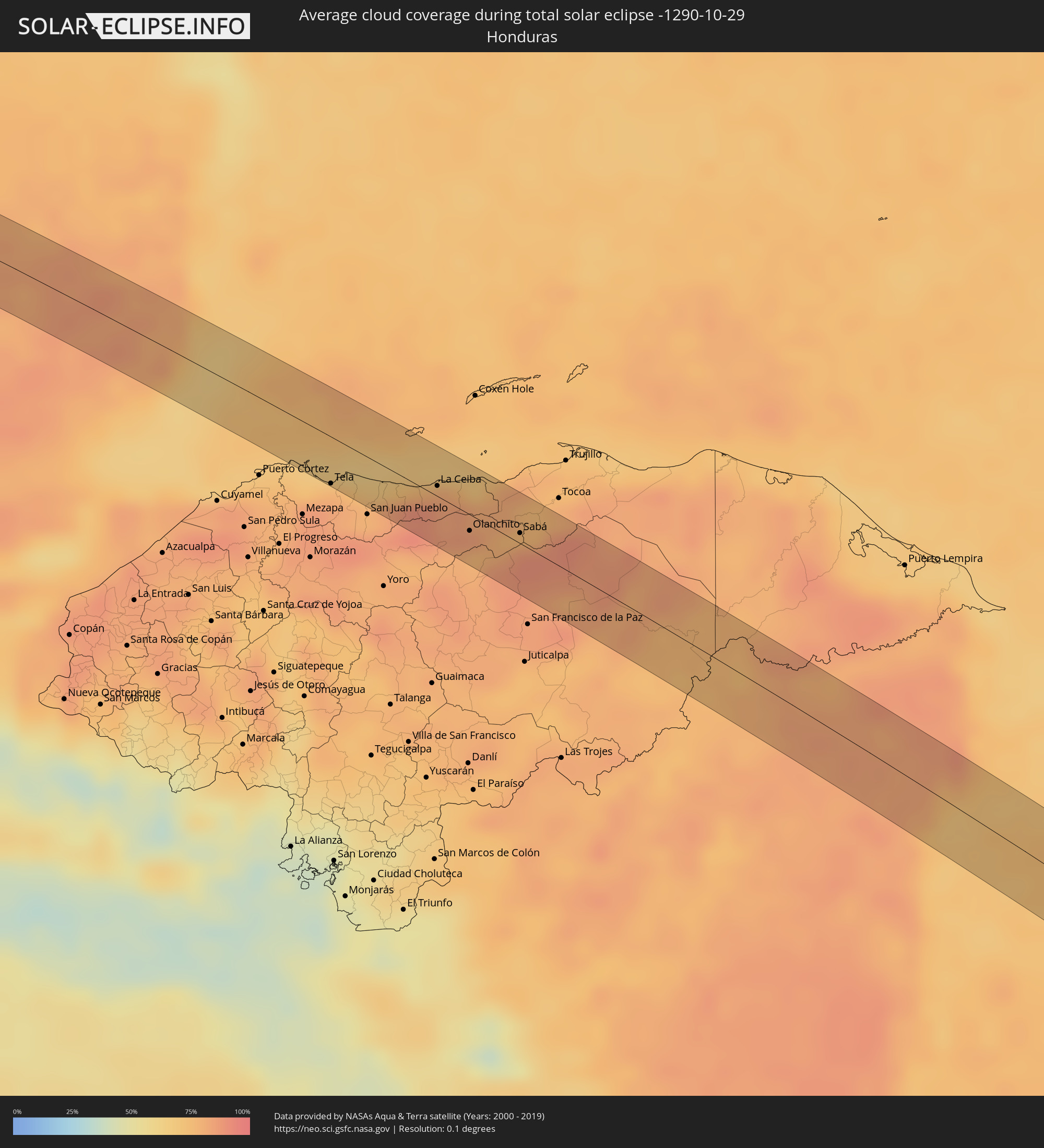 Honduras
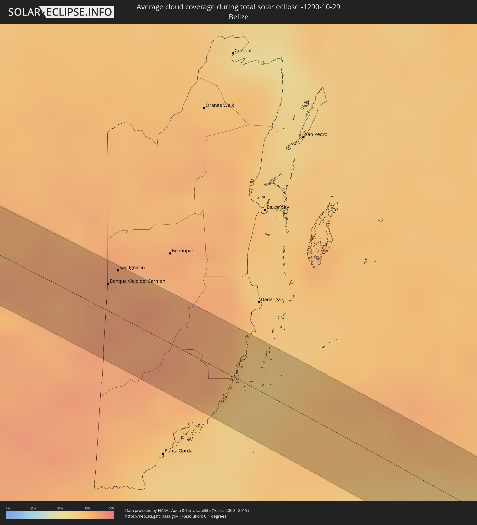 Belize
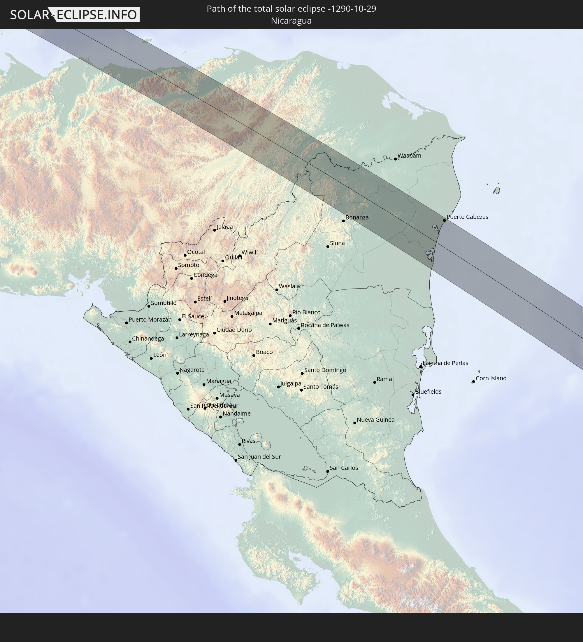
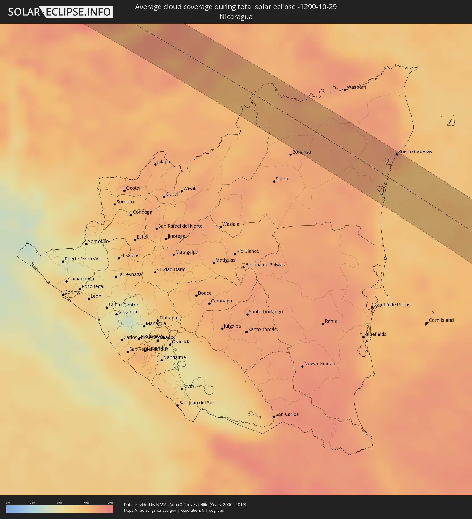 Nicaragua
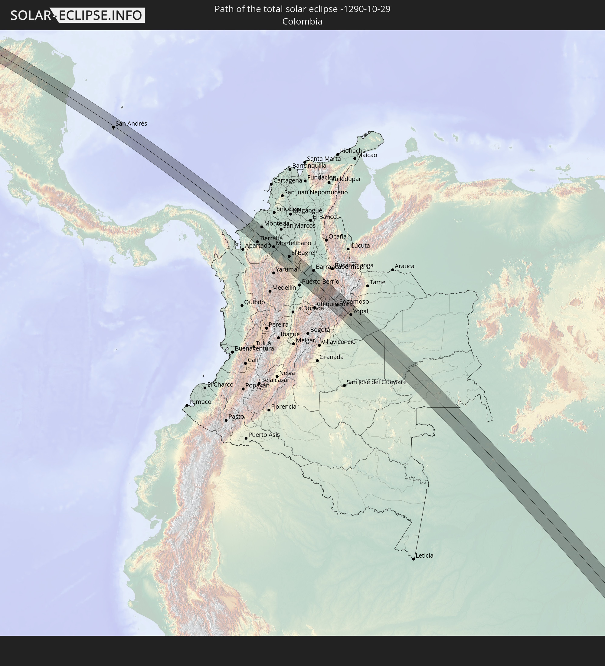
 Colombia
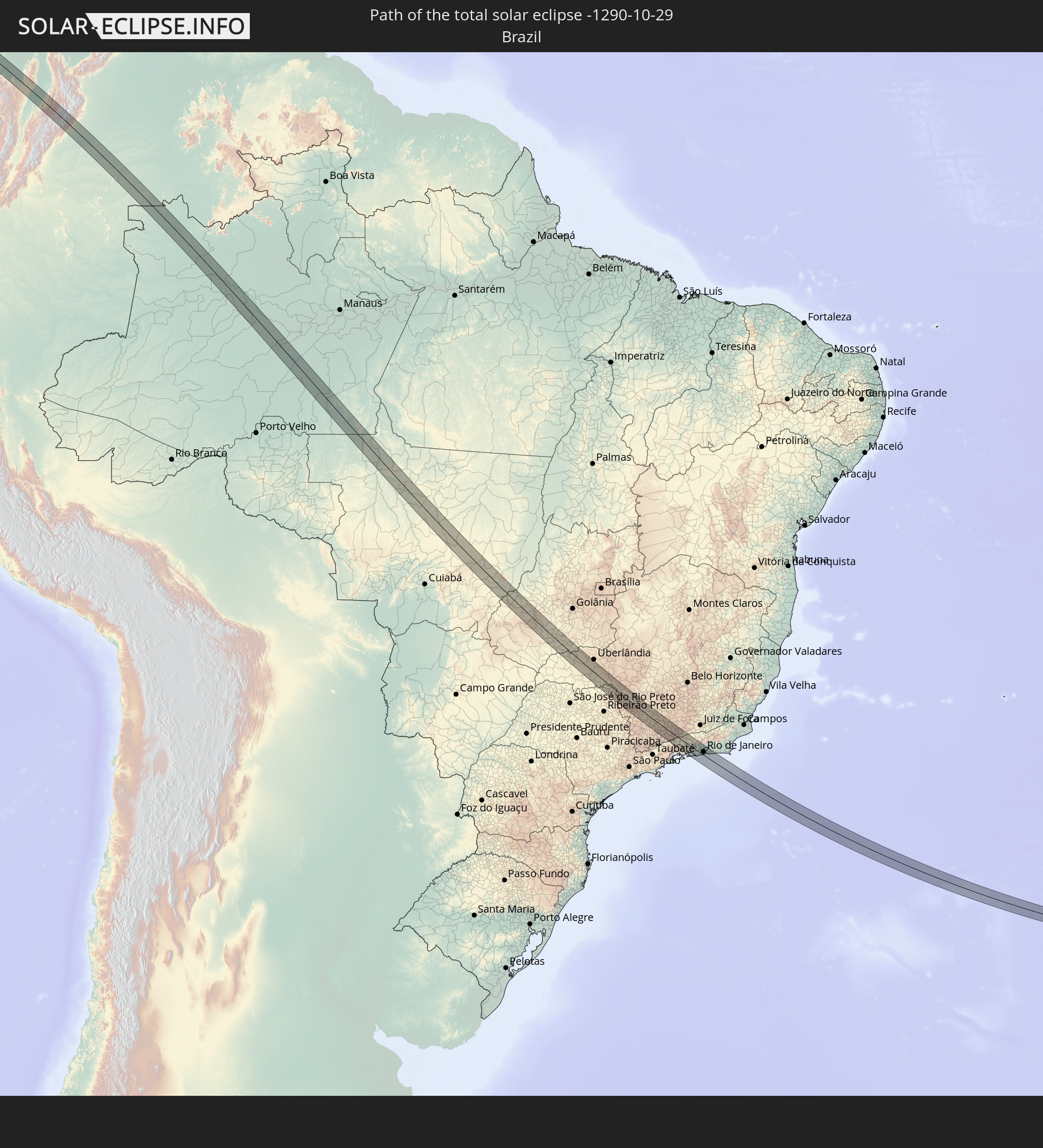
 Brazil
Cities inside the path of the eclipse
The following table shows all locations with a population of more than 5,000 inside the eclipse path. Cities which have more than 100,000 inhabitants are marked bold. A click at the locations opens a detailed map.
| City | Type | Eclipse duration | Local time of max. eclipse | Distance to central line | Ø Cloud coverage |
|
La Paz, Baja California Sur
|
total | - | 06:40:16 UTC-07:05 | 12 km | 22% |
|
Mazatlán, Sinaloa
|
total | - | 06:40:59 UTC-07:05 | 9 km | 20% |
|
Fraccionamiento los Ángeles, Sinaloa
|
total | - | 06:41:00 UTC-07:05 | 6 km | 23% |
|
Villa Unión, Sinaloa
|
total | - | 06:41:01 UTC-07:05 | 9 km | 26% |
|
Escuinapa de Hidalgo, Sinaloa
|
total | - | 06:41:14 UTC-07:05 | 17 km | 20% |
|
Villanueva, Zacatecas
|
total | - | 07:11:07 UTC-06:36 | 16 km | 25% |
|
Rincón de Romos, Aguascalientes
|
total | - | 07:11:19 UTC-06:36 | 20 km | 26% |
|
Jesús Gómez Portugal (Margaritas), Aguascalientes
|
total | - | 07:11:25 UTC-06:36 | 4 km | 24% |
|
Jesús Gómez Portugal, Aguascalientes
|
total | - | 07:11:25 UTC-06:36 | 4 km | 24% |
|
Aguascalientes, Aguascalientes
|
total | - | 07:11:29 UTC-06:36 | 16 km | 23% |
|
Ojuelos de Jalisco, Jalisco
|
total | - | 07:11:41 UTC-06:36 | 4 km | 27% |
|
Ocampo, Guanajuato
|
total | - | 07:11:49 UTC-06:36 | 15 km | 28% |
|
Villa de Reyes, San Luis Potosí
|
total | - | 07:11:55 UTC-06:36 | 19 km | 39% |
|
San Diego de la Unión, Guanajuato
|
total | - | 07:12:05 UTC-06:36 | 14 km | 41% |
|
San Luis de la Paz, Guanajuato
|
total | - | 07:12:17 UTC-06:36 | 20 km | 36% |
|
Jalpan, Querétaro
|
total | - | 07:12:41 UTC-06:36 | 7 km | 62% |
|
Benito Juárez, Hidalgo
|
total | - | 07:13:20 UTC-06:36 | 17 km | 68% |
|
La Ceiba, Veracruz
|
total | - | 07:13:31 UTC-06:36 | 14 km | 69% |
|
Venustiano Carranza, Puebla
|
total | - | 07:13:45 UTC-06:36 | 3 km | 70% |
|
Coatzintla, Veracruz
|
total | - | 07:13:51 UTC-06:36 | 3 km | 74% |
|
Poza Rica de Hidalgo, Veracruz
|
total | - | 07:13:50 UTC-06:36 | 8 km | 74% |
|
Papantla de Olarte, Veracruz
|
total | - | 07:13:56 UTC-06:36 | 4 km | 73% |
|
Gutiérrez Zamora, Veracruz
|
total | - | 07:14:02 UTC-06:36 | 14 km | 65% |
|
Vega de San Marcos, Veracruz
|
total | - | 07:14:15 UTC-06:36 | 9 km | 71% |
|
San Rafael, Veracruz
|
total | - | 07:14:17 UTC-06:36 | 5 km | 71% |
|
Vega de Alatorre, Veracruz
|
total | - | 07:14:28 UTC-06:36 | 14 km | 62% |
|
Frontera, Tabasco
|
total | - | 07:17:29 UTC-06:36 | 1 km | 62% |
|
Jonuta, Tabasco
|
total | - | 07:18:07 UTC-06:36 | 24 km | 51% |
|
Balancán de Domínguez, Tabasco
|
total | - | 07:18:42 UTC-06:36 | 25 km | 58% |
|
Melchor de Mencos, Petén
|
total | - | 07:55:24 UTC-06:02 | 14 km | 84% |
|
Benque Viejo del Carmen, Cayo
|
total | - | 08:04:40 UTC-05:52 | 15 km | 83% |
|
San Ignacio, Cayo
|
total | - | 08:04:38 UTC-05:52 | 26 km | 84% |
|
Tela, Atlántida
|
total | - | 08:10:58 UTC-05:48 | 28 km | 76% |
|
La Ceiba, Atlántida
|
total | - | 08:11:31 UTC-05:48 | 6 km | 78% |
|
Olanchito, Yoro
|
total | - | 08:11:56 UTC-05:48 | 10 km | 79% |
|
Sabá, Colón
|
total | - | 08:12:13 UTC-05:48 | 6 km | 81% |
|
Puerto Cabezas, Atlántico Norte (RAAN)
|
total | - | 08:19:47 UTC-05:45 | 29 km | 78% |
|
San Andrés, Archipiélago de San Andrés, Providencia y Santa Catalina
|
total | - | 09:11:58 UTC-04:56 | 6 km | 75% |
|
San Juan de Urabá, Antioquia
|
total | - | 09:22:38 UTC-04:56 | 10 km | 86% |
|
Arboletes, Antioquia
|
total | - | 09:22:38 UTC-04:56 | 5 km | 86% |
|
Valencia, Córdoba
|
total | - | 09:23:50 UTC-04:56 | 27 km | 88% |
|
Tierralta, Córdoba
|
total | - | 09:24:04 UTC-04:56 | 28 km | 90% |
|
Montería, Córdoba
|
total | - | 09:23:26 UTC-04:56 | 34 km | 92% |
|
Planeta Rica, Córdoba
|
total | - | 09:24:17 UTC-04:56 | 26 km | 93% |
|
Montelíbano, Córdoba
|
total | - | 09:25:09 UTC-04:56 | 1 km | 91% |
|
Caucasia, Antioquia
|
total | - | 09:25:25 UTC-04:56 | 17 km | 82% |
|
Zaragoza, Antioquia
|
total | - | 09:26:35 UTC-04:56 | 1 km | 82% |
|
El Bagre, Antioquia
|
total | - | 09:26:29 UTC-04:56 | 12 km | 80% |
|
San Carlos, Antioquia
|
total | - | 09:26:14 UTC-04:56 | 31 km | 81% |
|
Segovia, Antioquia
|
total | - | 09:27:26 UTC-04:56 | 24 km | 88% |
|
Remedios, Antioquia
|
total | - | 09:27:43 UTC-04:56 | 16 km | 89% |
|
Cimitarra, Santander
|
total | - | 09:29:37 UTC-04:56 | 33 km | 90% |
|
Yondó, Antioquia
|
total | - | 09:28:33 UTC-04:56 | 27 km | 75% |
|
Barrancabermeja, Santander
|
total | - | 09:28:32 UTC-04:56 | 36 km | 77% |
|
Vélez, Santander
|
total | - | 09:30:28 UTC-04:56 | 38 km | 77% |
|
Socorro, Santander
|
total | - | 09:30:16 UTC-04:56 | 30 km | 69% |
|
Paipa, Boyacá
|
total | - | 09:31:35 UTC-04:56 | 16 km | 83% |
|
Duitama, Boyacá
|
total | - | 09:31:37 UTC-04:56 | 6 km | 81% |
|
Santa Rosa de Viterbo, Boyacá
|
total | - | 09:31:36 UTC-04:56 | 2 km | 83% |
|
Sogamoso, Boyacá
|
total | - | 09:31:56 UTC-04:56 | 8 km | 85% |
|
Belén, Boyacá
|
total | - | 09:31:30 UTC-04:56 | 17 km | 89% |
|
Aquitania, Boyacá
|
total | - | 09:32:19 UTC-04:56 | 20 km | 93% |
|
Aguazul, Casanare
|
total | - | 09:33:21 UTC-04:56 | 23 km | 80% |
|
Yopal, Casanare
|
total | - | 09:33:17 UTC-04:56 | 2 km | 79% |
|
Maní, Casanare
|
total | - | 09:34:19 UTC-04:56 | 32 km | 83% |
|
Villanueva, Casanare
|
total | - | 09:33:58 UTC-04:56 | 30 km | 77% |
|
Coari, Amazonas
|
total | - | 10:59:10 UTC-04:02 | 20 km | 82% |
|
Barra do Garças, Mato Grosso
|
total | - | 12:08:25 UTC-03:38 | 12 km | 73% |
|
Santa Helena de Goiás, Goiás
|
total | - | 12:47:22 UTC-03:06 | 23 km | 64% |
|
Ituiutaba, Minas Gerais
|
total | - | 12:51:44 UTC-03:06 | 39 km | 62% |
|
Itumbiara, Goiás
|
total | - | 12:51:12 UTC-03:06 | 24 km | 60% |
|
Uberaba, Minas Gerais
|
total | - | 12:56:05 UTC-03:06 | 1 km | 62% |
|
Igarapava, São Paulo
|
total | - | 12:56:57 UTC-03:06 | 13 km | 55% |
|
Franca, São Paulo
|
total | - | 12:58:28 UTC-03:06 | 34 km | 58% |
|
São Sebastião do Paraíso, Minas Gerais
|
total | - | 12:59:54 UTC-03:06 | 40 km | 59% |
|
Passos, Minas Gerais
|
total | - | 13:00:18 UTC-03:06 | 2 km | 62% |
|
Alfenas, Minas Gerais
|
total | - | 13:02:44 UTC-03:06 | 19 km | 62% |
|
Machado, Minas Gerais
|
total | - | 13:03:11 UTC-03:06 | 39 km | 62% |
|
Campos Gerais, Minas Gerais
|
total | - | 13:02:47 UTC-03:06 | 10 km | 65% |
|
Boa Esperança, Minas Gerais
|
total | - | 13:02:56 UTC-03:06 | 35 km | 65% |
|
Três Pontas, Minas Gerais
|
total | - | 13:03:28 UTC-03:06 | 14 km | 66% |
|
Varginha, Minas Gerais
|
total | - | 13:03:56 UTC-03:06 | 2 km | 67% |
|
Três Corações, Minas Gerais
|
total | - | 13:04:30 UTC-03:06 | 1 km | 68% |
|
São Lourenço, Minas Gerais
|
total | - | 13:05:32 UTC-03:06 | 25 km | 63% |
|
Caxambu, Minas Gerais
|
total | - | 13:05:33 UTC-03:06 | 5 km | 66% |
|
Resende, Rio de Janeiro
|
total | - | 13:07:13 UTC-03:06 | 21 km | 68% |
|
Volta Redonda, Rio de Janeiro
|
total | - | 13:07:57 UTC-03:06 | 5 km | 70% |
|
Barra do Piraí, Rio de Janeiro
|
total | - | 13:08:24 UTC-03:06 | 16 km | 70% |
|
Itaguaí, Rio de Janeiro
|
total | - | 13:09:03 UTC-03:06 | 16 km | 67% |
|
Vassouras, Rio de Janeiro
|
total | - | 13:08:36 UTC-03:06 | 32 km | 69% |
|
Japeri, Rio de Janeiro
|
total | - | 13:08:59 UTC-03:06 | 10 km | 72% |
|
Miguel Pereira, Rio de Janeiro
|
total | - | 13:09:03 UTC-03:06 | 38 km | 72% |
|
Nova Iguaçu, Rio de Janeiro
|
total | - | 13:09:32 UTC-03:06 | 12 km | 72% |
|
Rio de Janeiro, Rio de Janeiro
|
total | - | 13:10:12 UTC-03:06 | 12 km | 66% |
|
Maricá, Rio de Janeiro
|
total | - | 13:10:57 UTC-03:06 | 33 km | 68% |