Annular solar eclipse of 12/02/-1673
| Day of week: | Thursday |
| Maximum duration of eclipse: | 12m00s |
| Maximum width of eclipse path: | 423 km |
| Saros cycle: | 25 |
| Coverage: | 91.4% |
| Magnitude: | 0.9135 |
| Gamma: | 0.6274 |
Wo kann man die Sonnenfinsternis vom 12/02/-1673 sehen?
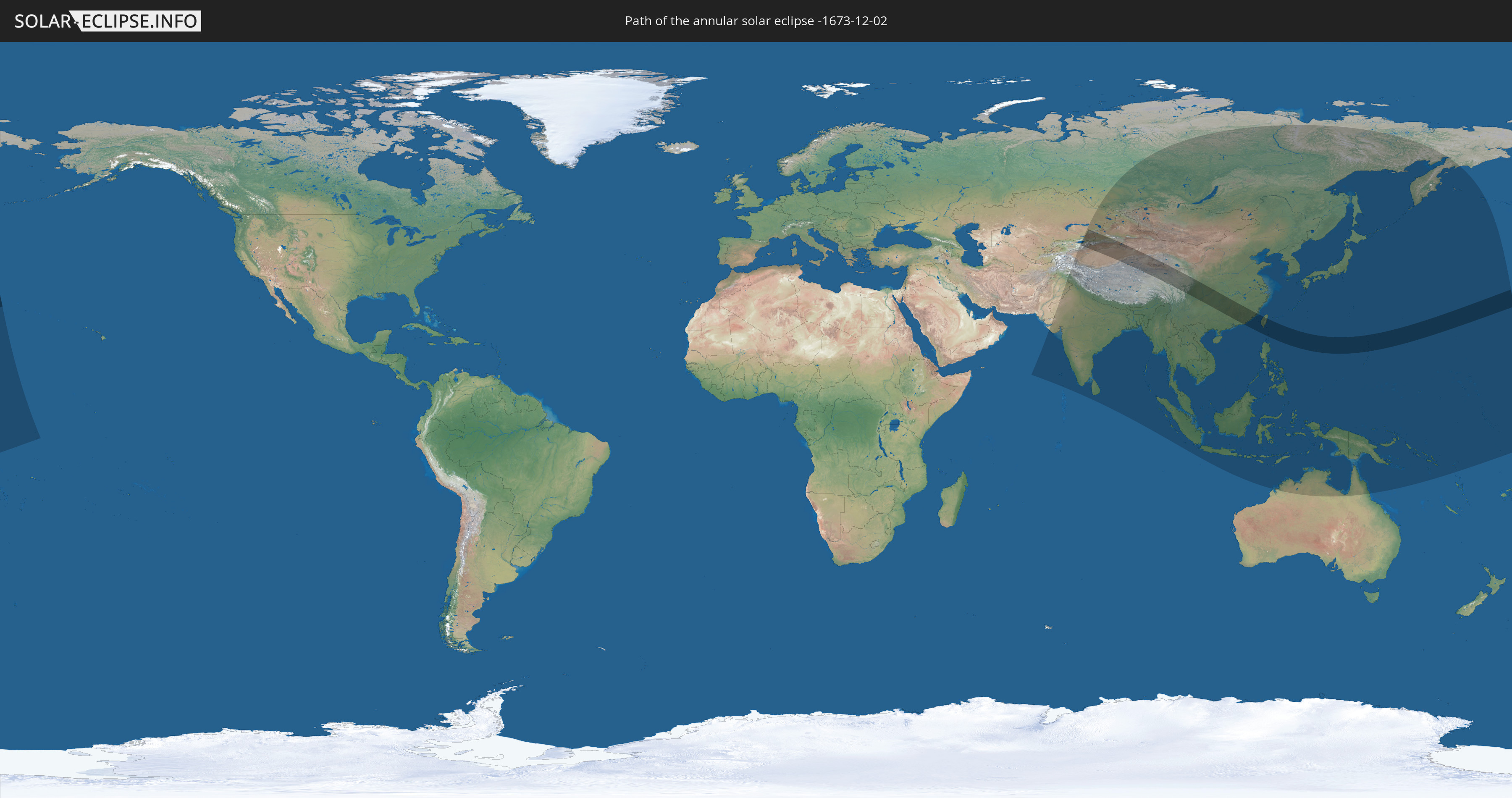
Die Sonnenfinsternis am 12/02/-1673 kann man in 41 Ländern als partielle Sonnenfinsternis beobachten.
Der Finsternispfad verläuft durch 6 Länder. Nur in diesen Ländern ist sie als annular Sonnenfinsternis zu sehen.
In den folgenden Ländern ist die Sonnenfinsternis annular zu sehen
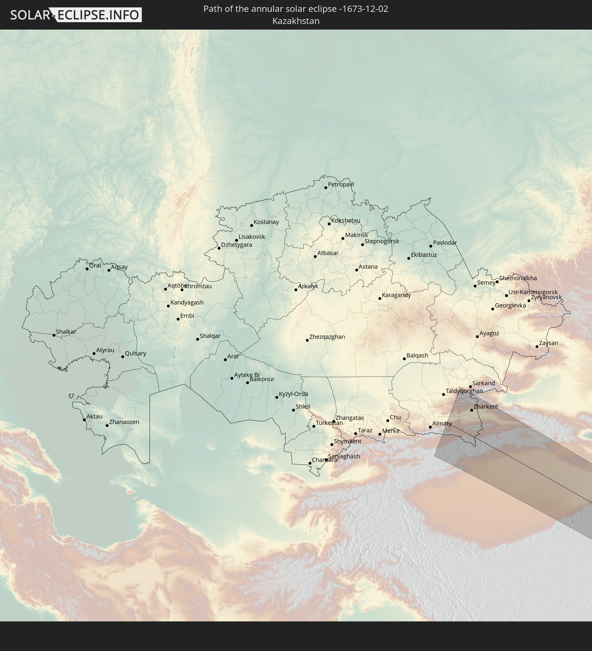 Kazakhstan
 Kyrgyzstan
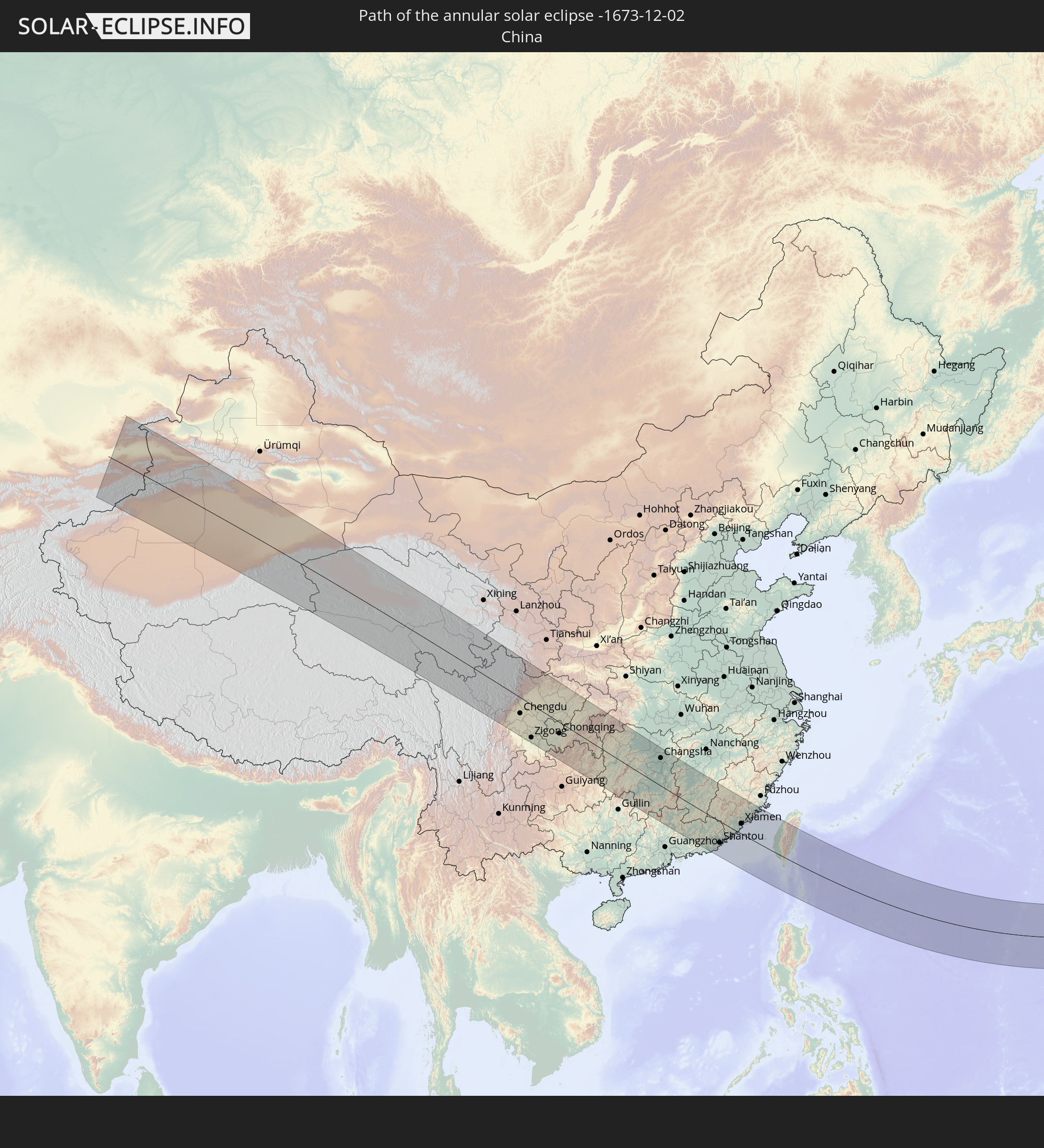 China
China
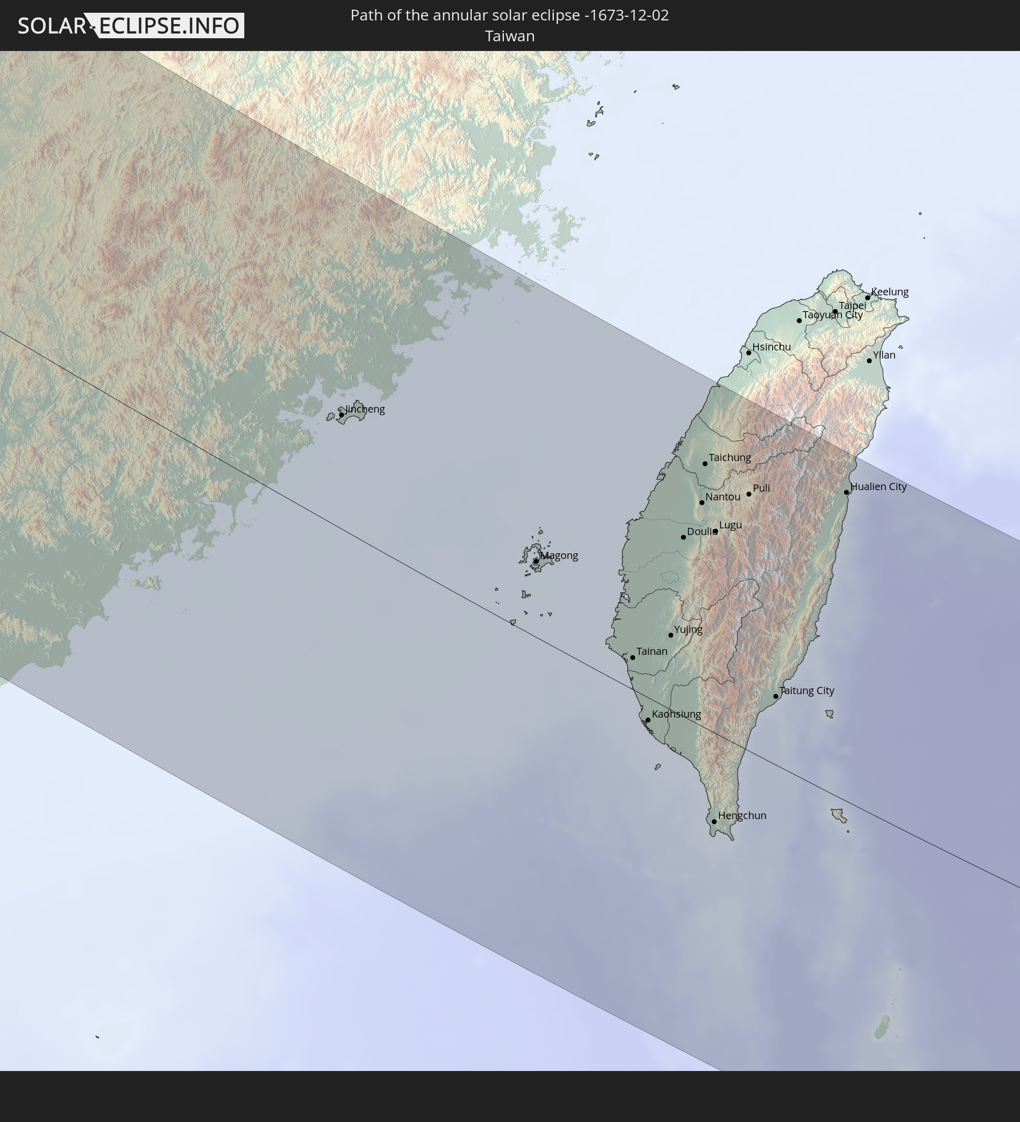 Taiwan
 Philippines
 Northern Mariana Islands
In den folgenden Ländern ist die Sonnenfinsternis partiell zu sehen
 Russia
 United States
 United States Minor Outlying Islands
 Kiribati
 Kazakhstan
 Pakistan
 India
India
 Kyrgyzstan
 China
China
 Sri Lanka
 Nepal
Nepal
 Mongolia
 Bangladesh
 Bhutan
 Myanmar
 Indonesia
 Thailand
 Malaysia
 Laos
Laos
 Vietnam
 Cambodia
 Singapore
 Australia
 Macau
Macau
 Hong Kong
 Brunei
 Taiwan
 Philippines
 Japan
Japan
 East Timor
 North Korea
 South Korea
 Palau
Palau
 Federated States of Micronesia
 Papua New Guinea
 Guam
Guam
 Northern Mariana Islands
 Solomon Islands
 Marshall Islands
 Nauru
Nauru
 Tuvalu
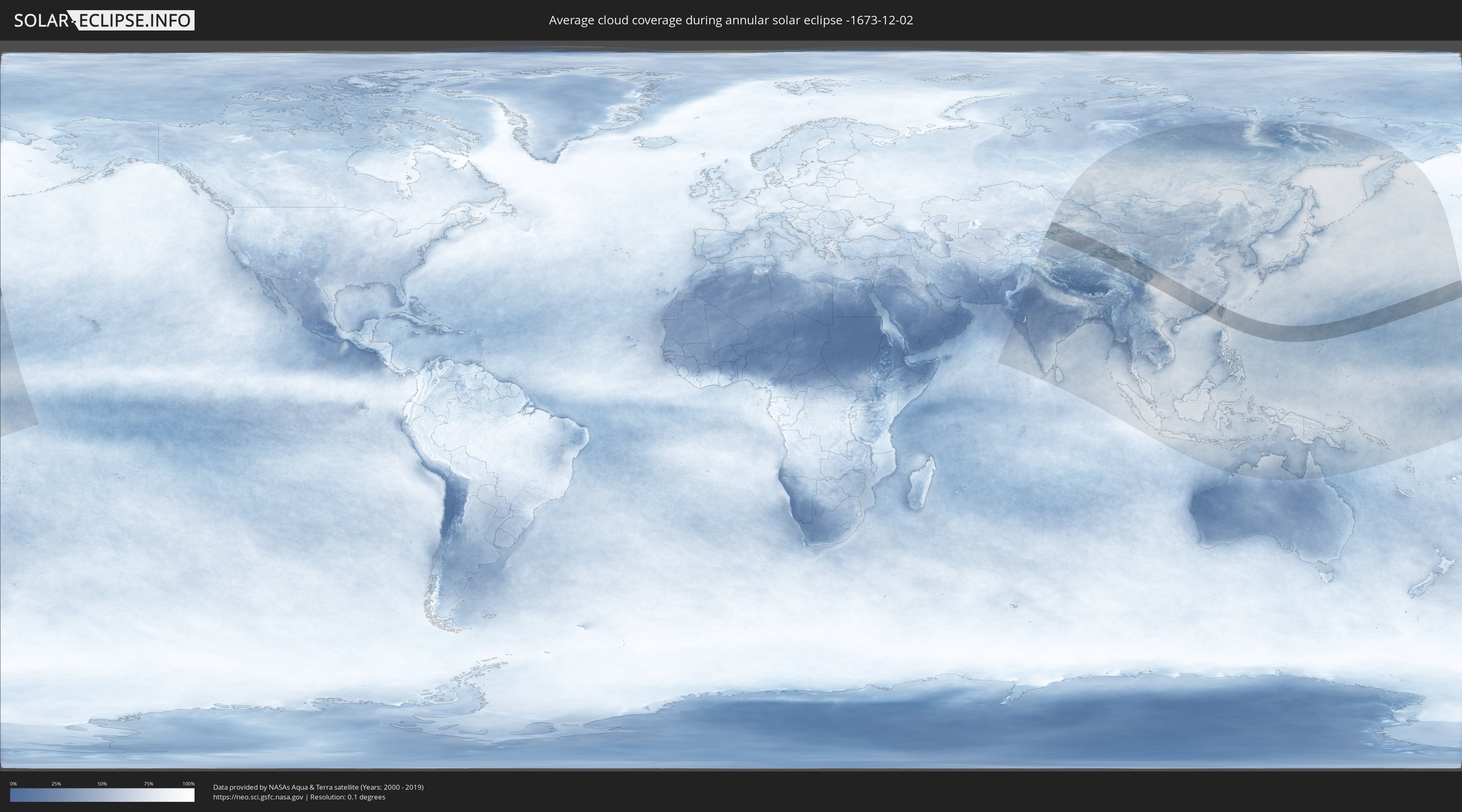
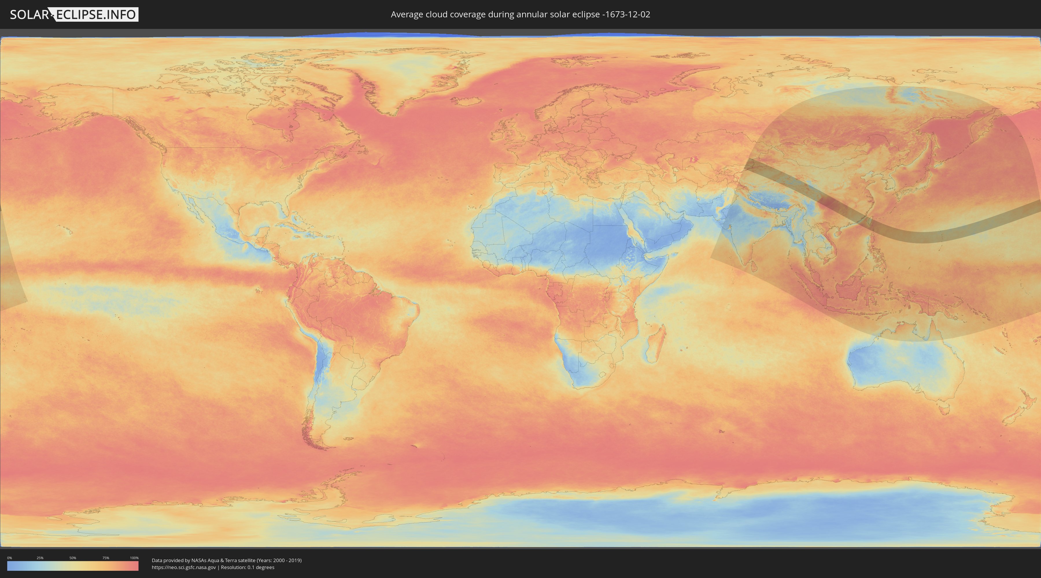
How will be the weather during the annular solar eclipse on 12/02/-1673?
Where is the best place to see the annular solar eclipse of 12/02/-1673?
The following maps show the average cloud coverage for the day of the annular solar eclipse.
With the help of these maps, it is possible to find the place along the eclipse path, which has the best
chance of a cloudless sky.
Nevertheless, you should consider local circumstances and inform about the weather of your chosen
observation site.
The data is provided by NASAs satellites
AQUA and TERRA.
The cloud maps are averaged over a period of 19 years (2000 - 2019).
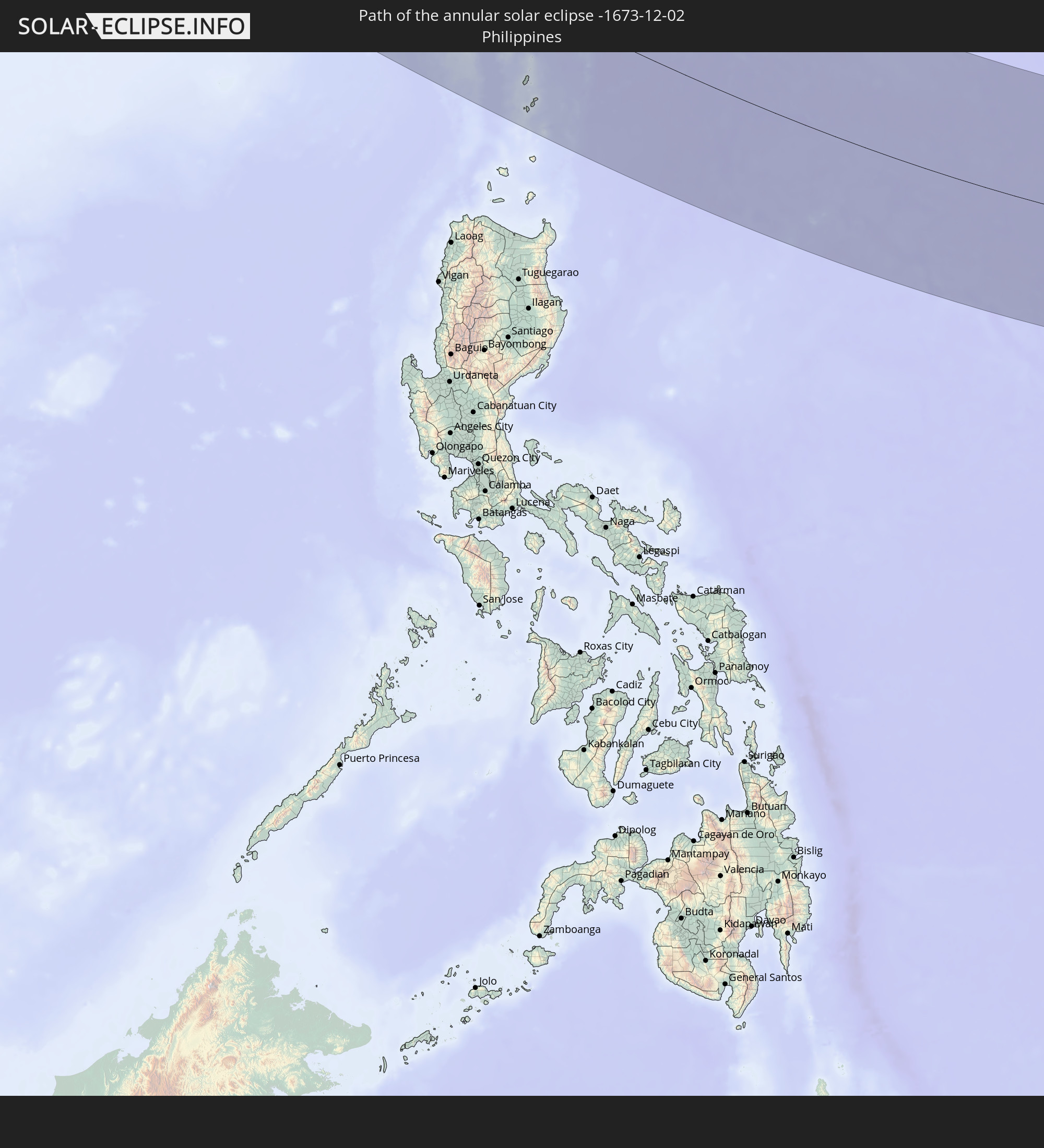
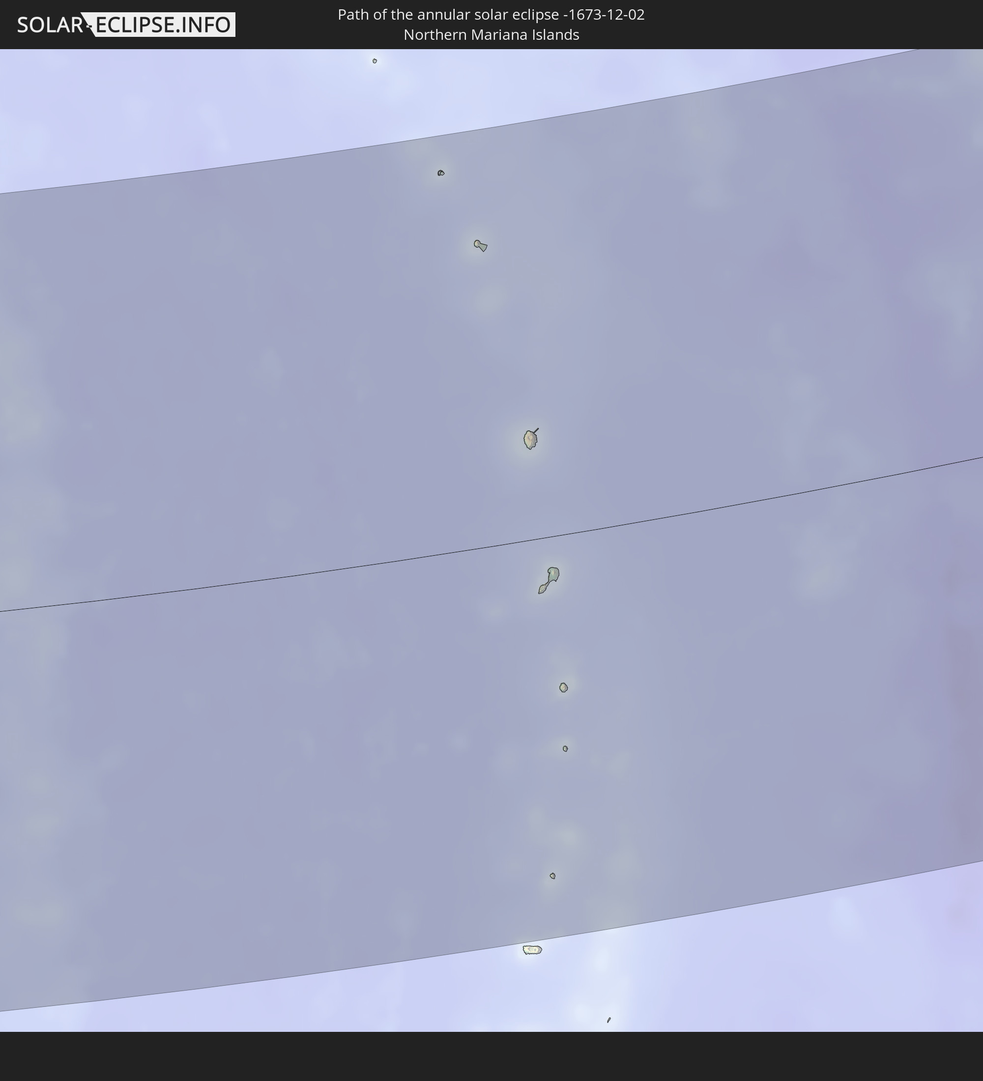
Detailed country maps
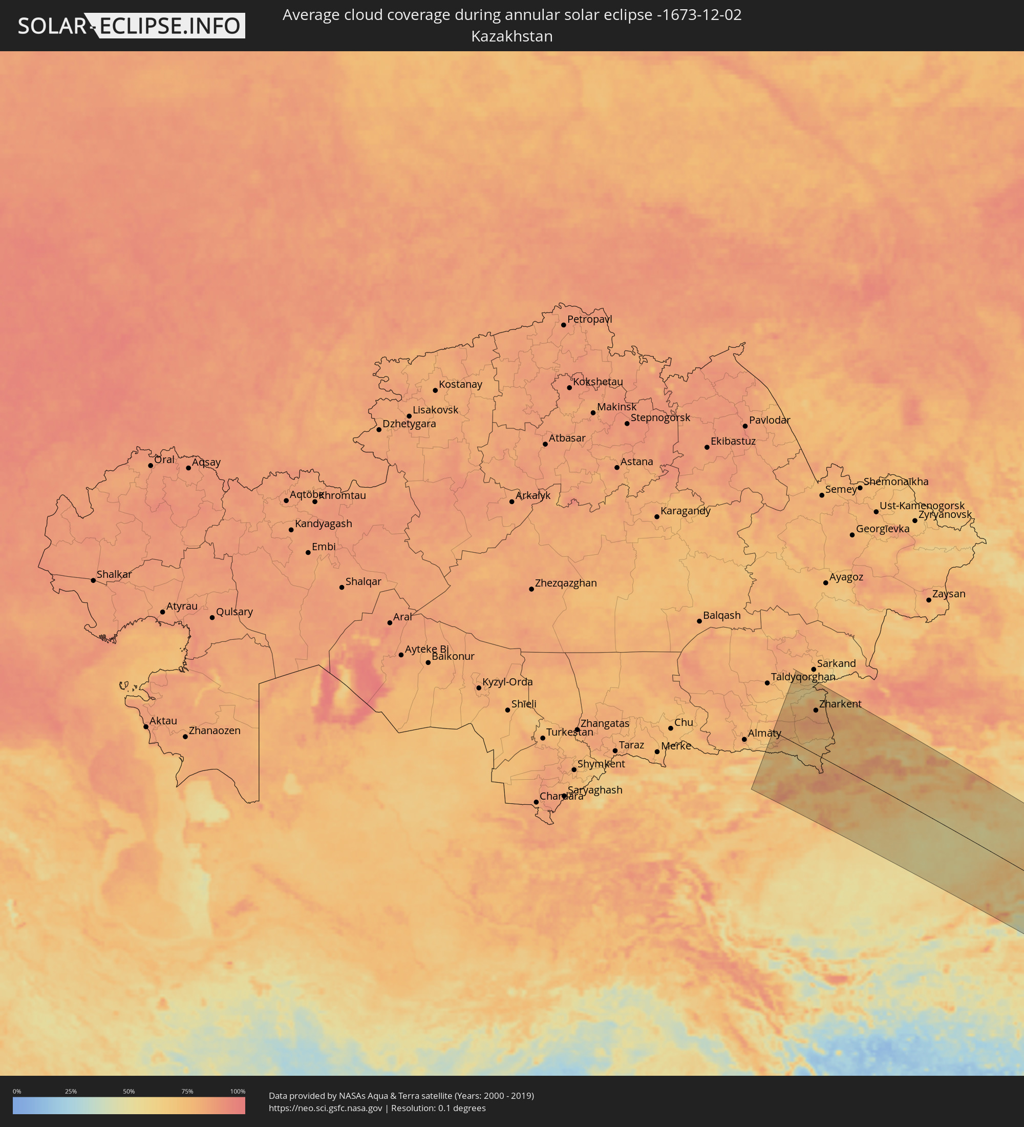 Kazakhstan
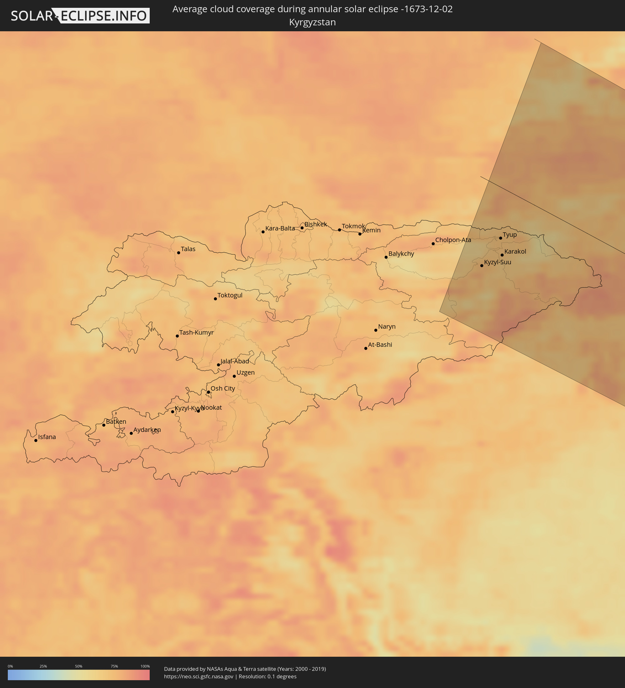 Kyrgyzstan
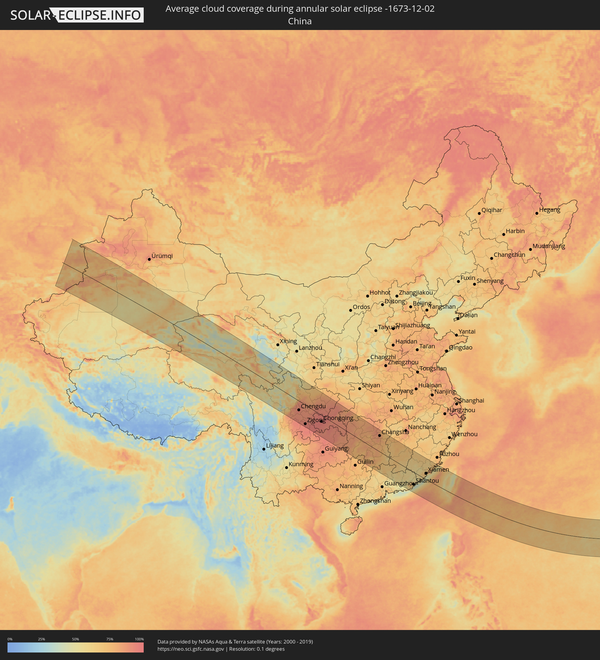 China
China
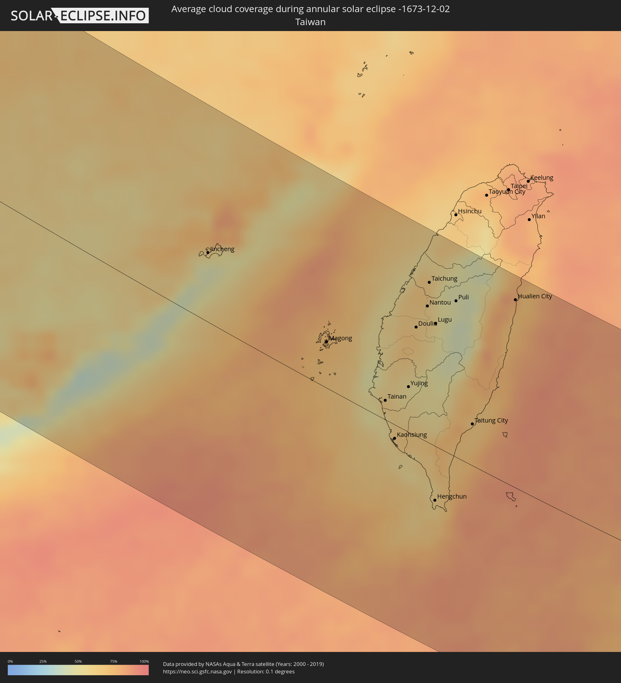 Taiwan
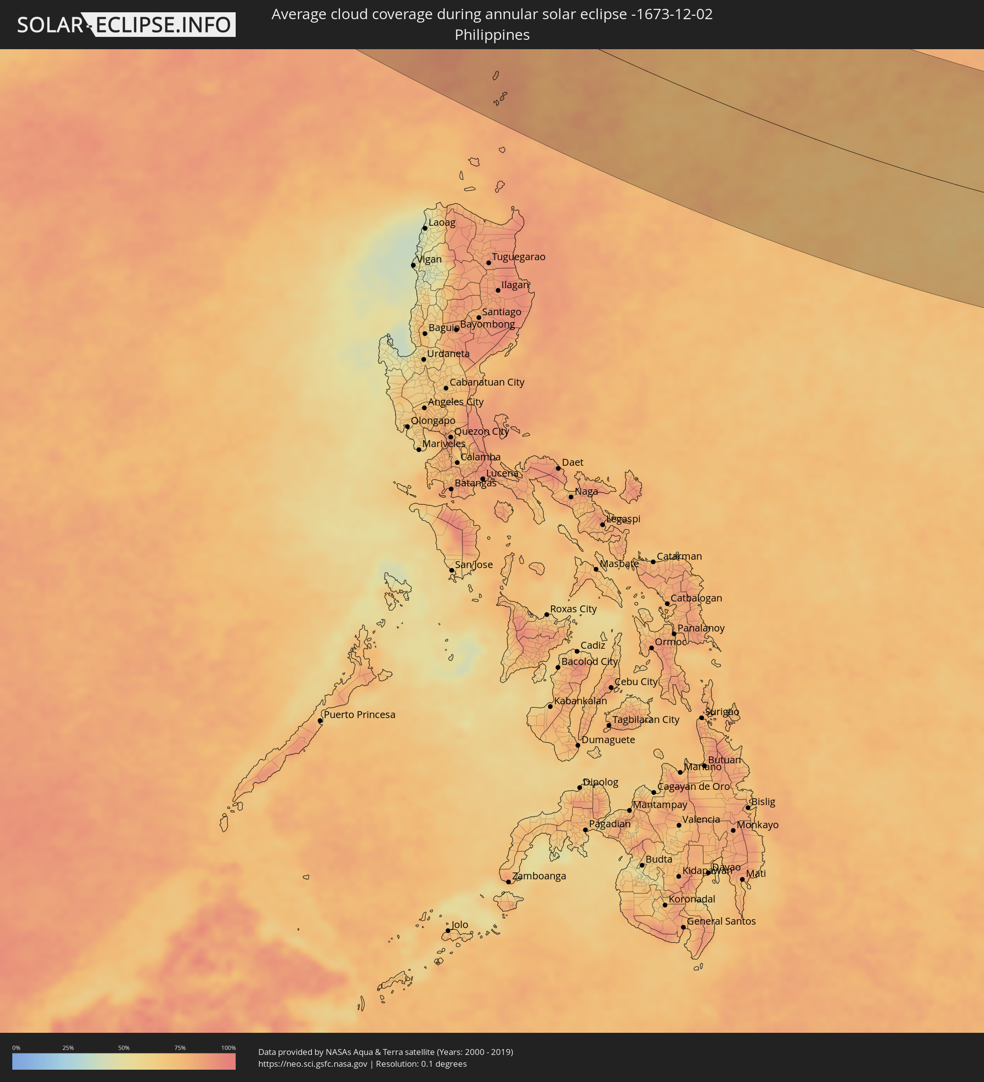 Philippines
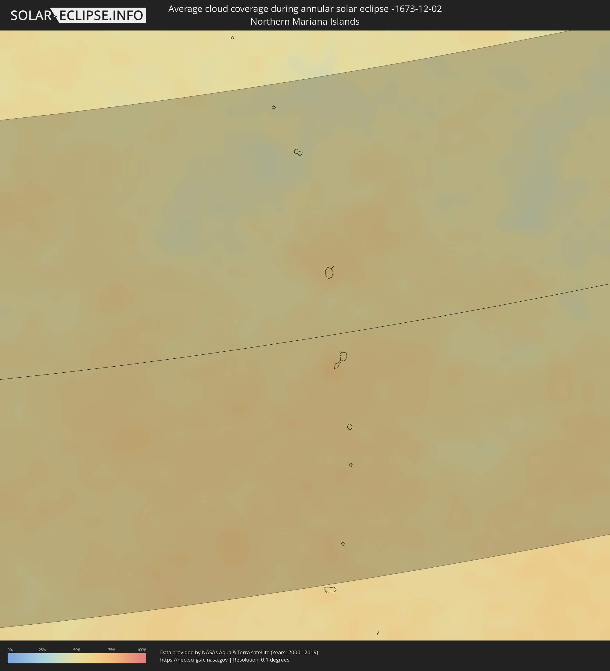 Northern Mariana Islands
Cities inside the path of the eclipse
The following table shows all locations with a population of more than 5,000 inside the eclipse path. Cities which have more than 100,000 inhabitants are marked bold. A click at the locations opens a detailed map.
| City | Type | Eclipse duration | Local time of max. eclipse | Distance to central line | Ø Cloud coverage |
|
Kyzyl-Suu, Issyk-Kul Region
|
annular | - | 06:59:02 UTC+04:58 | 122 km | 79% |
|
Tyup, Issyk-Kul Region
|
annular | - | 06:59:34 UTC+04:58 | 70 km | 71% |
|
Karakol, Issyk-Kul Region
|
annular | - | 06:59:20 UTC+04:58 | 92 km | 70% |
|
Ak-Suu, Issyk-Kul Region
|
annular | - | 06:59:24 UTC+04:58 | 86 km | 68% |
|
Tekeli, Almaty Oblysy
|
annular | - | 06:25:25 UTC+04:21 | 154 km | 64% |
|
Kegen, Almaty Oblysy
|
annular | - | 06:23:41 UTC+04:21 | 8 km | 65% |
|
Zharkent, Almaty Oblysy
|
annular | - | 06:25:13 UTC+04:21 | 134 km | 81% |
|
Aksu, Xinjiang Uyghur Autonomous Region
|
annular | - | 10:00:31 UTC+08:00 | 148 km | 77% |
|
Aral, Xinjiang Uyghur Autonomous Region
|
annular | - | 10:00:25 UTC+08:00 | 172 km | 65% |
|
Korla, Xinjiang Uyghur Autonomous Region
|
annular | - | 10:04:26 UTC+08:00 | 145 km | 73% |
|
Chengdu, Sichuan
|
annular | - | 10:17:55 UTC+08:00 | 81 km | 93% |
|
Deyang, Sichuan
|
annular | - | 10:18:33 UTC+08:00 | 21 km | 92% |
|
Mianyang, Sichuan
|
annular | - | 10:19:08 UTC+08:00 | 26 km | 87% |
|
Zigong, Sichuan
|
annular | - | 10:18:54 UTC+08:00 | 170 km | 94% |
|
Neijiang, Sichuan
|
annular | - | 10:19:26 UTC+08:00 | 133 km | 91% |
|
Guangyuan, Sichuan
|
annular | - | 10:21:23 UTC+08:00 | 175 km | 70% |
|
Nanchong, Sichuan
|
annular | - | 10:21:28 UTC+08:00 | 34 km | 91% |
|
Chongqing, Chongqing
|
annular | - | 10:22:08 UTC+08:00 | 58 km | 96% |
|
Fuling, Chongqing
|
annular | - | 10:23:45 UTC+08:00 | 1 km | 93% |
|
Dazhou, Sichuan
|
annular | - | 10:24:10 UTC+08:00 | 146 km | 88% |
|
Wanxian, Chongqing
|
annular | - | 10:25:47 UTC+08:00 | 154 km | 92% |
|
Fenghuang, Hunan
|
annular | - | 10:28:08 UTC+08:00 | 53 km | 83% |
|
Huaihua, Hunan
|
annular | - | 10:29:01 UTC+08:00 | 67 km | 87% |
|
Changde, Hunan
|
annular | - | 10:32:38 UTC+08:00 | 160 km | 84% |
|
Loudi, Hunan
|
annular | - | 10:33:26 UTC+08:00 | 53 km | 81% |
|
Yiyang, Hunan
|
annular | - | 10:34:08 UTC+08:00 | 151 km | 85% |
|
Hengyang, Hunan
|
annular | - | 10:35:00 UTC+08:00 | 5 km | 82% |
|
Leiyang, Hunan
|
annular | - | 10:35:40 UTC+08:00 | 28 km | 77% |
|
Xiangtan, Hunan
|
annular | - | 10:35:32 UTC+08:00 | 111 km | 84% |
|
Changsha, Hunan
|
annular | - | 10:35:40 UTC+08:00 | 148 km | 84% |
|
Chenzhou, Hunan
|
annular | - | 10:36:13 UTC+08:00 | 76 km | 76% |
|
Zhuzhou, Hunan
|
annular | - | 10:36:08 UTC+08:00 | 122 km | 80% |
|
Shaoguan, Guangdong
|
annular | - | 10:37:50 UTC+08:00 | 143 km | 70% |
|
Guankou, Hunan
|
annular | - | 10:37:15 UTC+08:00 | 178 km | 74% |
|
Pingxiang, Jiangxi
|
annular | - | 10:37:52 UTC+08:00 | 139 km | 72% |
|
Yichun, Jiangxi
|
annular | - | 10:39:11 UTC+08:00 | 188 km | 75% |
|
Ji’an, Jiangxi
|
annular | - | 10:40:47 UTC+08:00 | 150 km | 76% |
|
Hepo, Guangdong
|
annular | - | 10:44:11 UTC+08:00 | 158 km | 50% |
|
Meizhou, Guangdong
|
annular | - | 10:44:35 UTC+08:00 | 60 km | 62% |
|
Jieyang, Guangdong
|
annular | - | 10:45:36 UTC+08:00 | 120 km | 66% |
|
Chaozhou, Guangdong
|
annular | - | 10:46:16 UTC+08:00 | 96 km | 72% |
|
Shantou, Guangdong
|
annular | - | 10:46:39 UTC+08:00 | 119 km | 58% |
|
Huanggang, Guangdong
|
annular | - | 10:47:19 UTC+08:00 | 75 km | 57% |
|
Zhangzhou, Fujian
|
annular | - | 10:48:49 UTC+08:00 | 39 km | 68% |
|
Xiamen, Fujian
|
annular | - | 10:50:03 UTC+08:00 | 58 km | 59% |
|
Jincheng, Fukien
|
annular | - | 10:50:45 UTC+08:00 | 65 km | 45% |
|
Quanzhou, Fujian
|
annular | - | 10:51:19 UTC+08:00 | 125 km | 78% |
|
Putian, Fujian
|
annular | - | 10:52:20 UTC+08:00 | 197 km | 74% |
|
Magong, Taiwan
|
annular | - | 10:54:55 UTC+08:00 | 44 km | 73% |
|
Tainan, Taiwan
|
annular | - | 10:57:08 UTC+08:00 | 19 km | 60% |
|
Kaohsiung, Takao
|
annular | - | 10:57:40 UTC+08:00 | 13 km | 59% |
|
Yujing, Taiwan
|
annular | - | 10:57:50 UTC+08:00 | 44 km | 55% |
|
Douliu, Taiwan
|
annular | - | 10:57:46 UTC+08:00 | 105 km | 67% |
|
Nantou, Taiwan
|
annular | - | 10:58:02 UTC+08:00 | 131 km | 60% |
|
Taichung, Taiwan
|
annular | - | 10:57:59 UTC+08:00 | 155 km | 62% |
|
Zhongxing New Village, Taiwan
|
annular | - | 10:58:05 UTC+08:00 | 136 km | 59% |
|
Hengchun, Taiwan
|
annular | - | 10:59:22 UTC+08:00 | 53 km | 61% |
|
Lugu, Taiwan
|
annular | - | 10:58:24 UTC+08:00 | 119 km | 49% |
|
Puli, Taiwan
|
annular | - | 10:58:58 UTC+08:00 | 151 km | 45% |
|
Taitung City, Taiwan
|
annular | - | 11:00:11 UTC+08:00 | 40 km | 70% |
|
Hualien City, Taiwan
|
annular | - | 11:00:58 UTC+08:00 | 182 km | 76% |
|
Basco, Cagayan Valley
|
annular | - | 11:04:21 UTC+08:00 | 151 km | 84% |