Annular solar eclipse of 10/31/-1746
| Day of week: | Sunday |
| Maximum duration of eclipse: | 05m50s |
| Maximum width of eclipse path: | 180 km |
| Saros cycle: | 15 |
| Coverage: | 95.1% |
| Magnitude: | 0.951 |
| Gamma: | -0.0594 |
Wo kann man die Sonnenfinsternis vom 10/31/-1746 sehen?
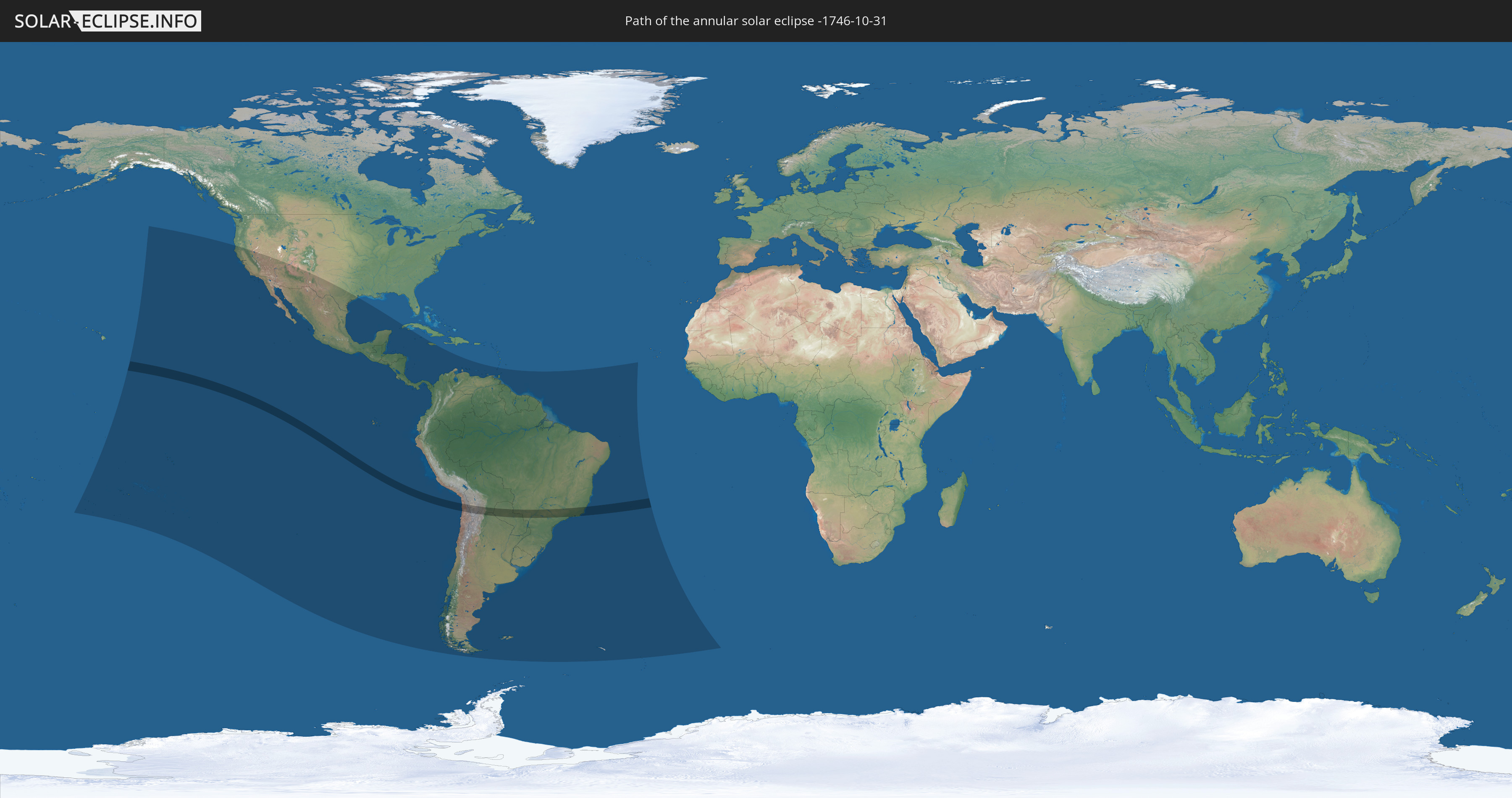
Die Sonnenfinsternis am 10/31/-1746 kann man in 34 Ländern als partielle Sonnenfinsternis beobachten.
Der Finsternispfad verläuft durch 5 Länder. Nur in diesen Ländern ist sie als annular Sonnenfinsternis zu sehen.
In den folgenden Ländern ist die Sonnenfinsternis annular zu sehen
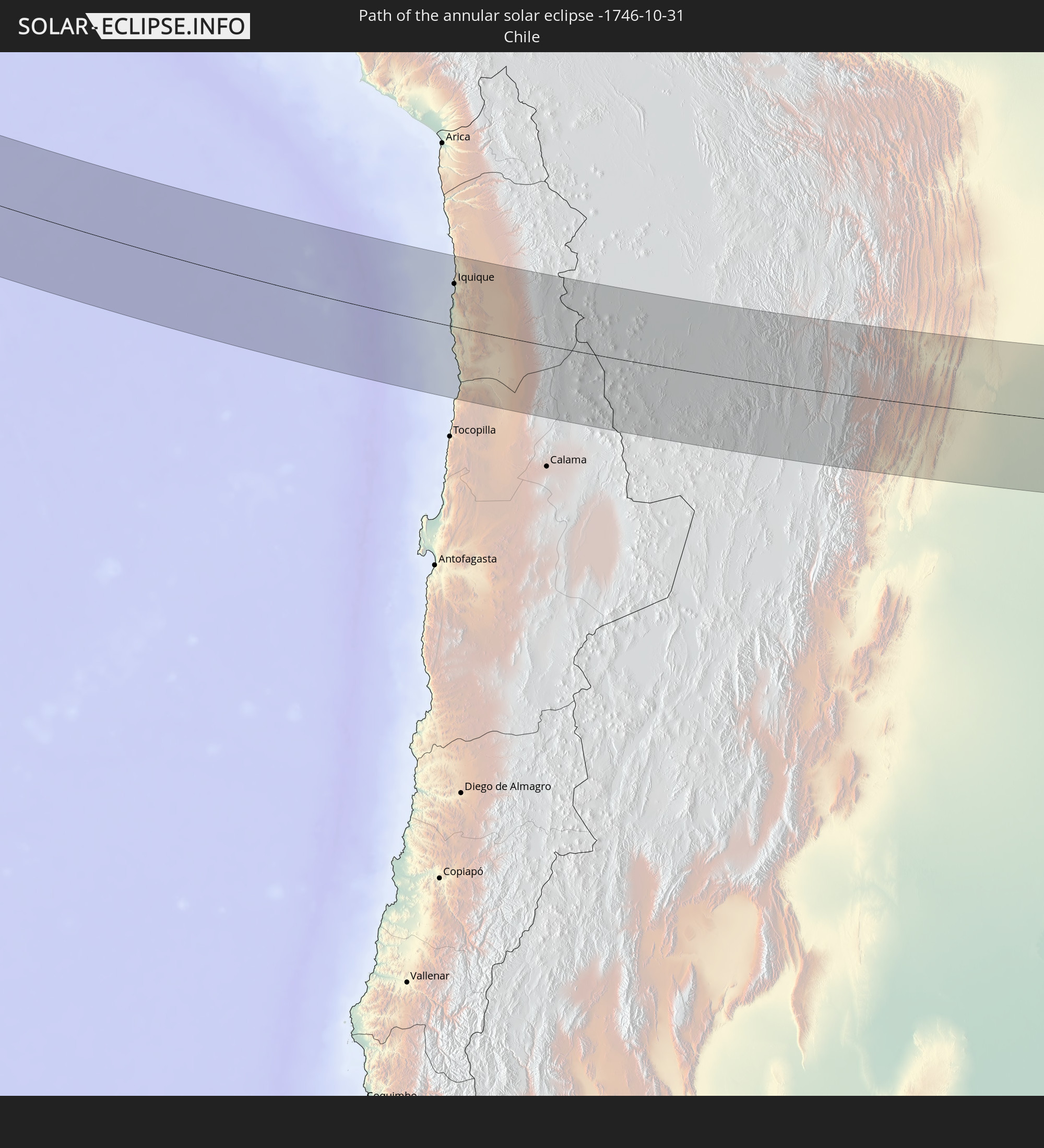 Chile
Chile
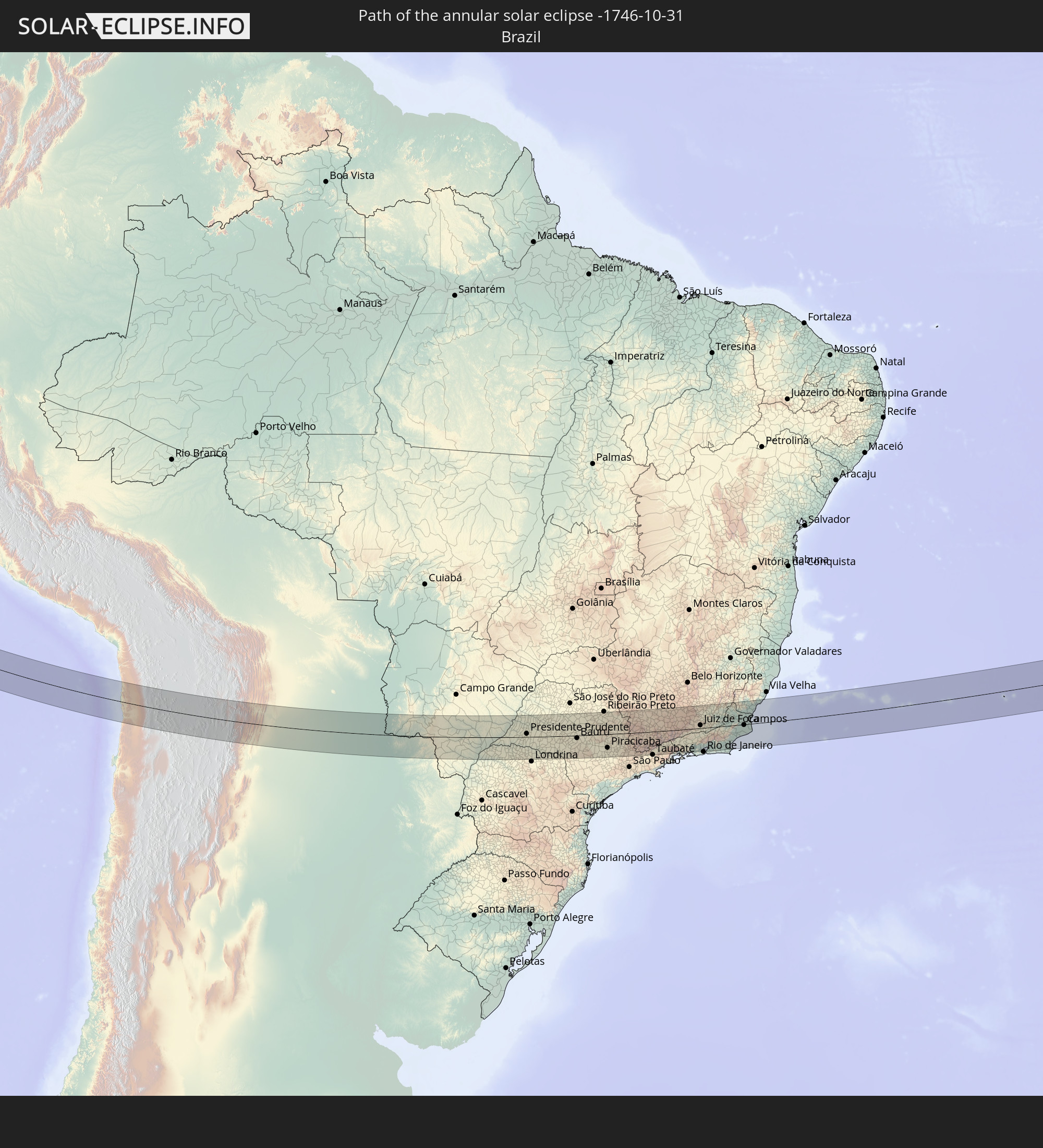 Brazil
 Argentina
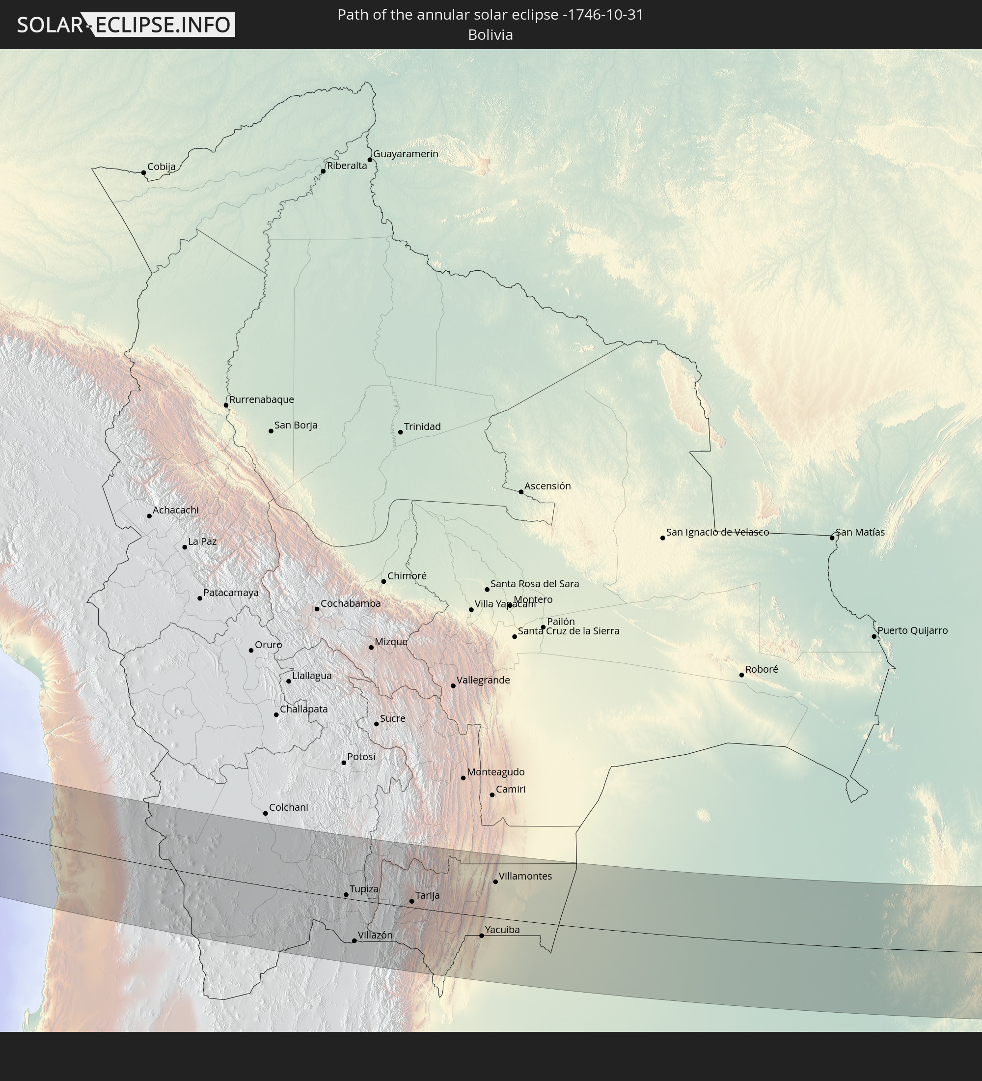 Bolivia
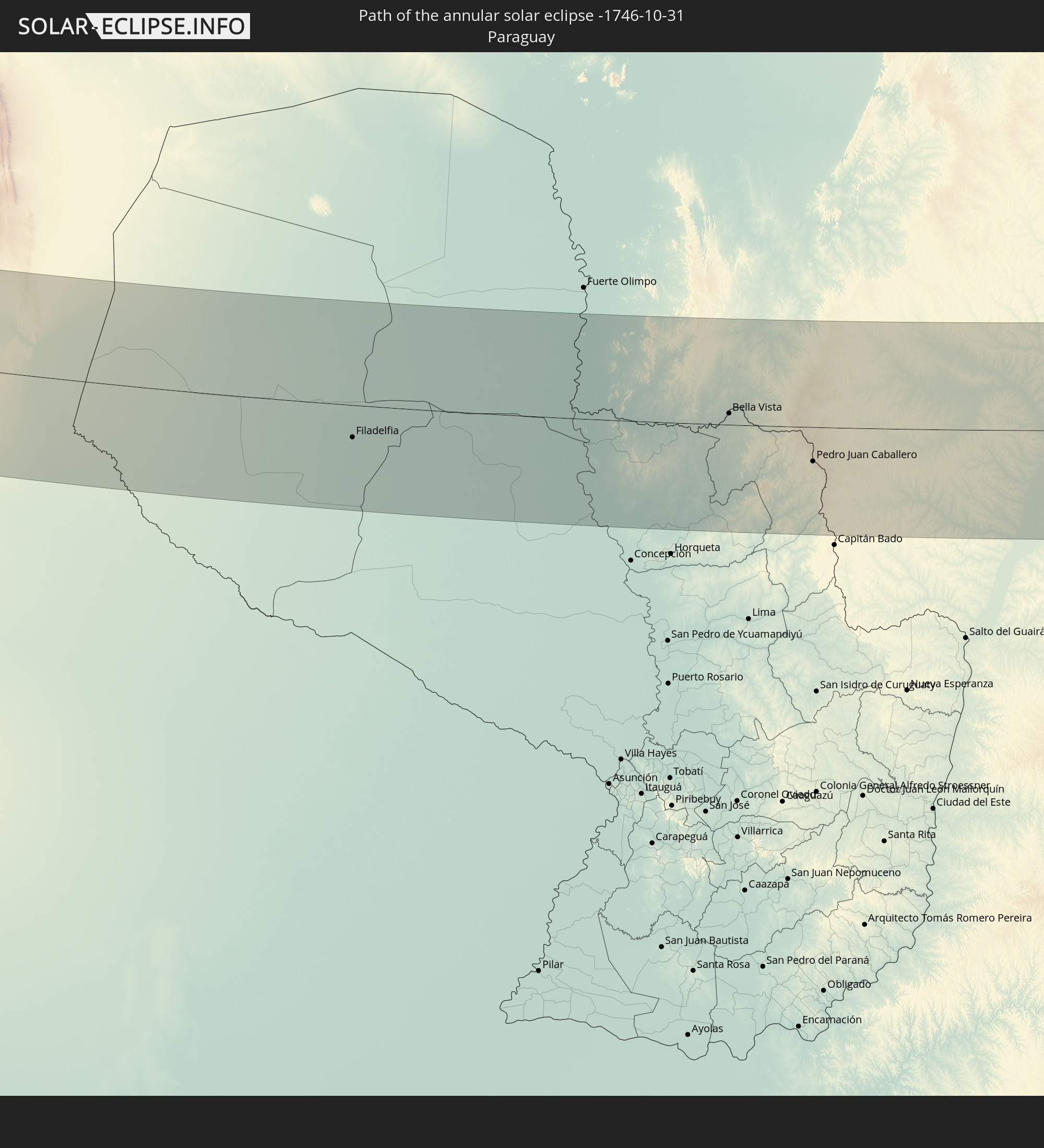 Paraguay
In den folgenden Ländern ist die Sonnenfinsternis partiell zu sehen
 United States
 Kiribati
 Cook Islands
 French Polynesia
 Pitcairn Islands
 Mexico
 Chile
Chile
 Guatemala
 Ecuador
 El Salvador
 Honduras
 Belize
 Nicaragua
 Costa Rica
 Cuba
Cuba
 Panama
 Colombia
 Cayman Islands
 Peru
Peru
 Jamaica
 Brazil
 Argentina
 Venezuela
 Aruba
Aruba
 Bolivia
 Paraguay
 Trinidad and Tobago
 Grenada
 Falkland Islands
 Guyana
 Uruguay
 Suriname
 French Guiana
 South Georgia and the South Sandwich Islands
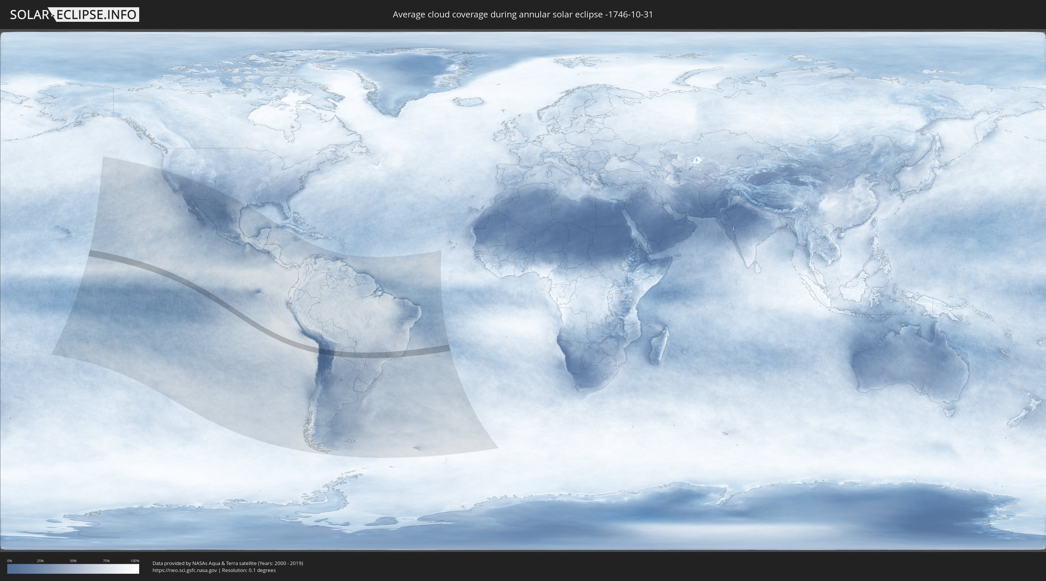
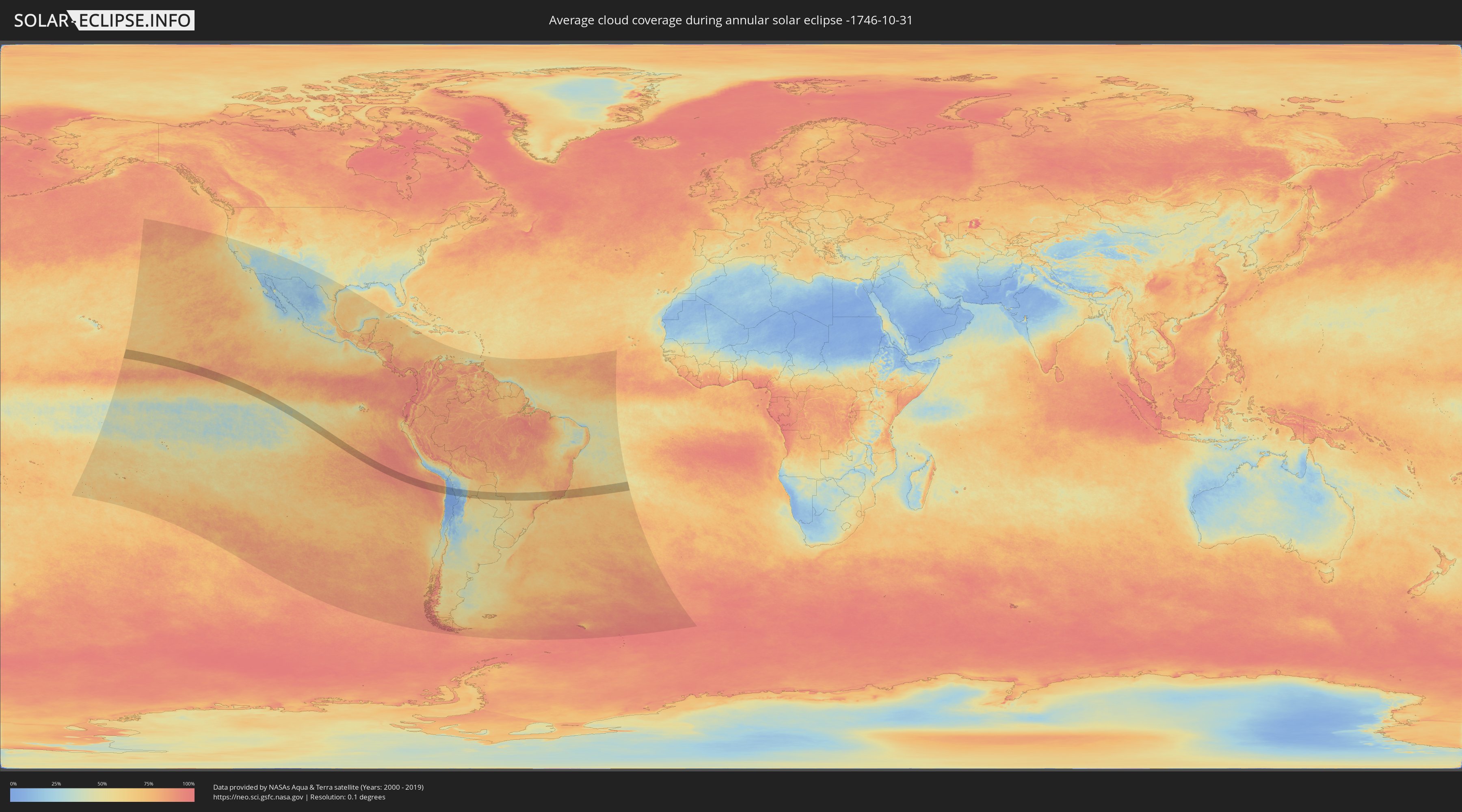
How will be the weather during the annular solar eclipse on 10/31/-1746?
Where is the best place to see the annular solar eclipse of 10/31/-1746?
The following maps show the average cloud coverage for the day of the annular solar eclipse.
With the help of these maps, it is possible to find the place along the eclipse path, which has the best
chance of a cloudless sky.
Nevertheless, you should consider local circumstances and inform about the weather of your chosen
observation site.
The data is provided by NASAs satellites
AQUA and TERRA.
The cloud maps are averaged over a period of 19 years (2000 - 2019).
Detailed country maps
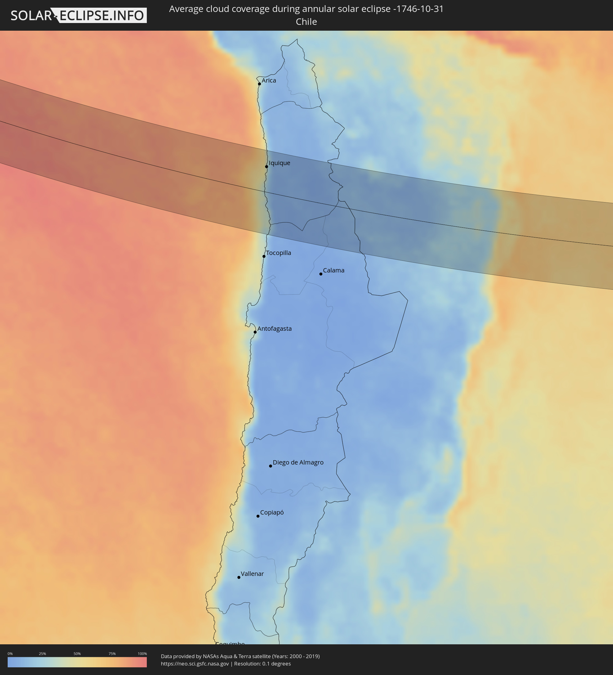 Chile
Chile
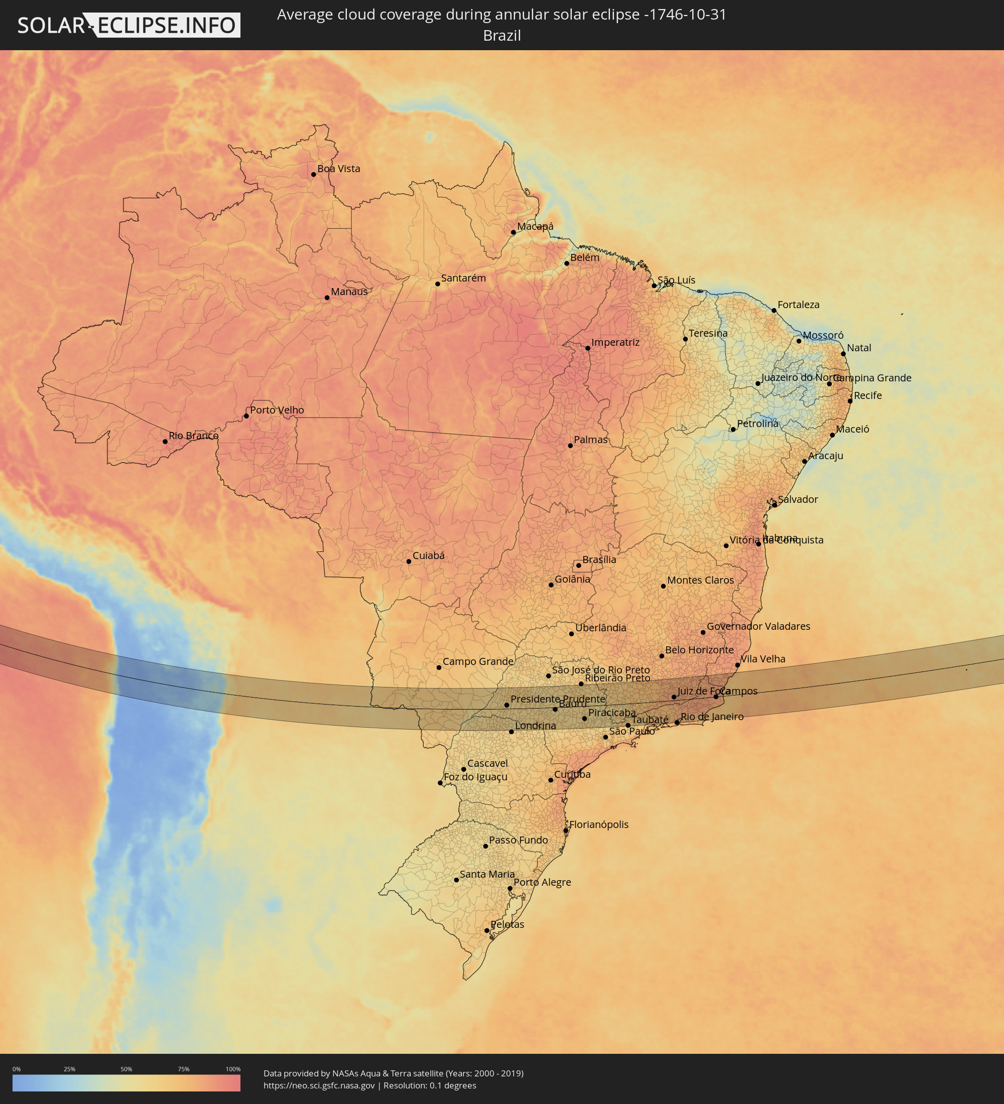 Brazil
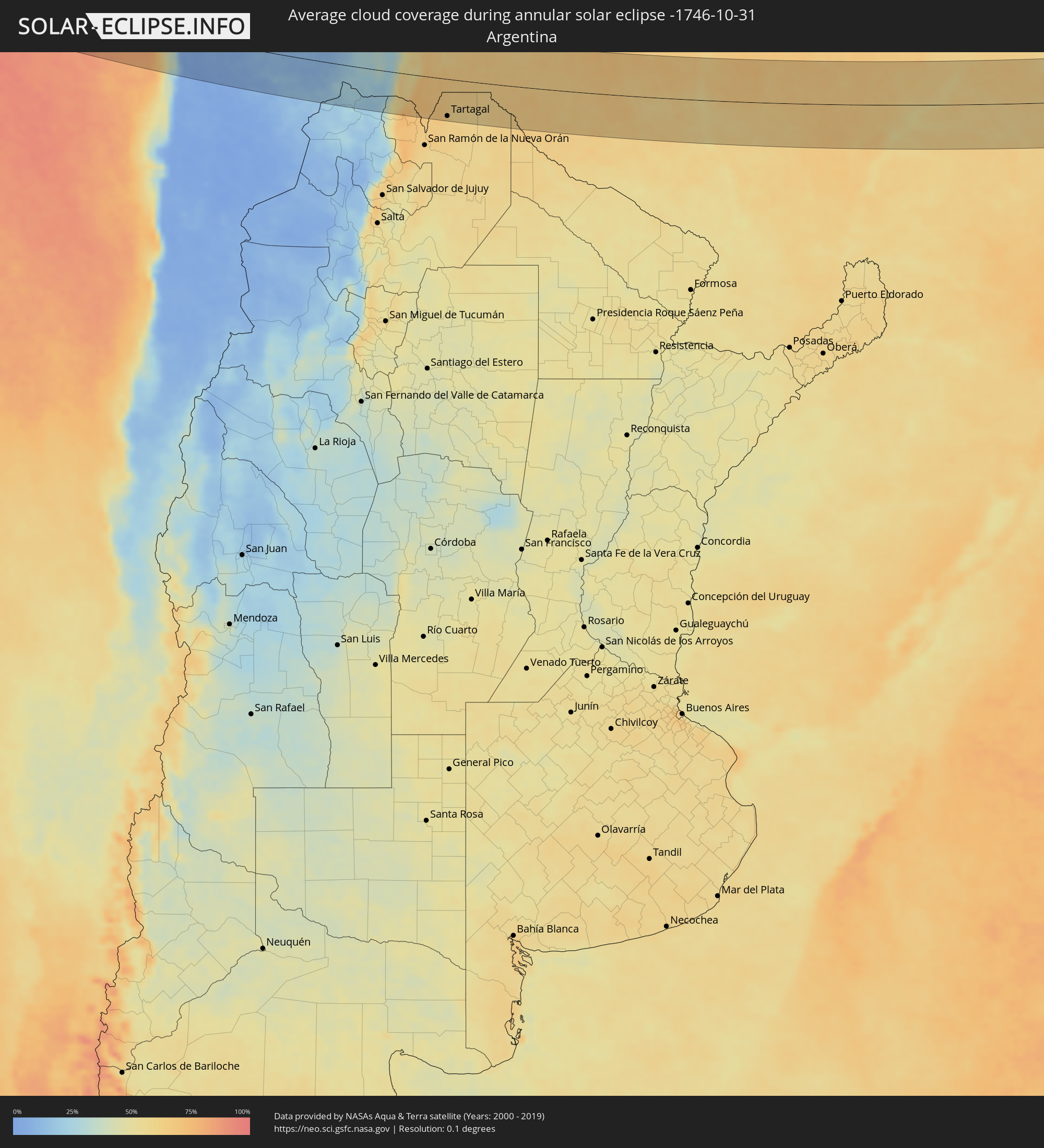 Argentina
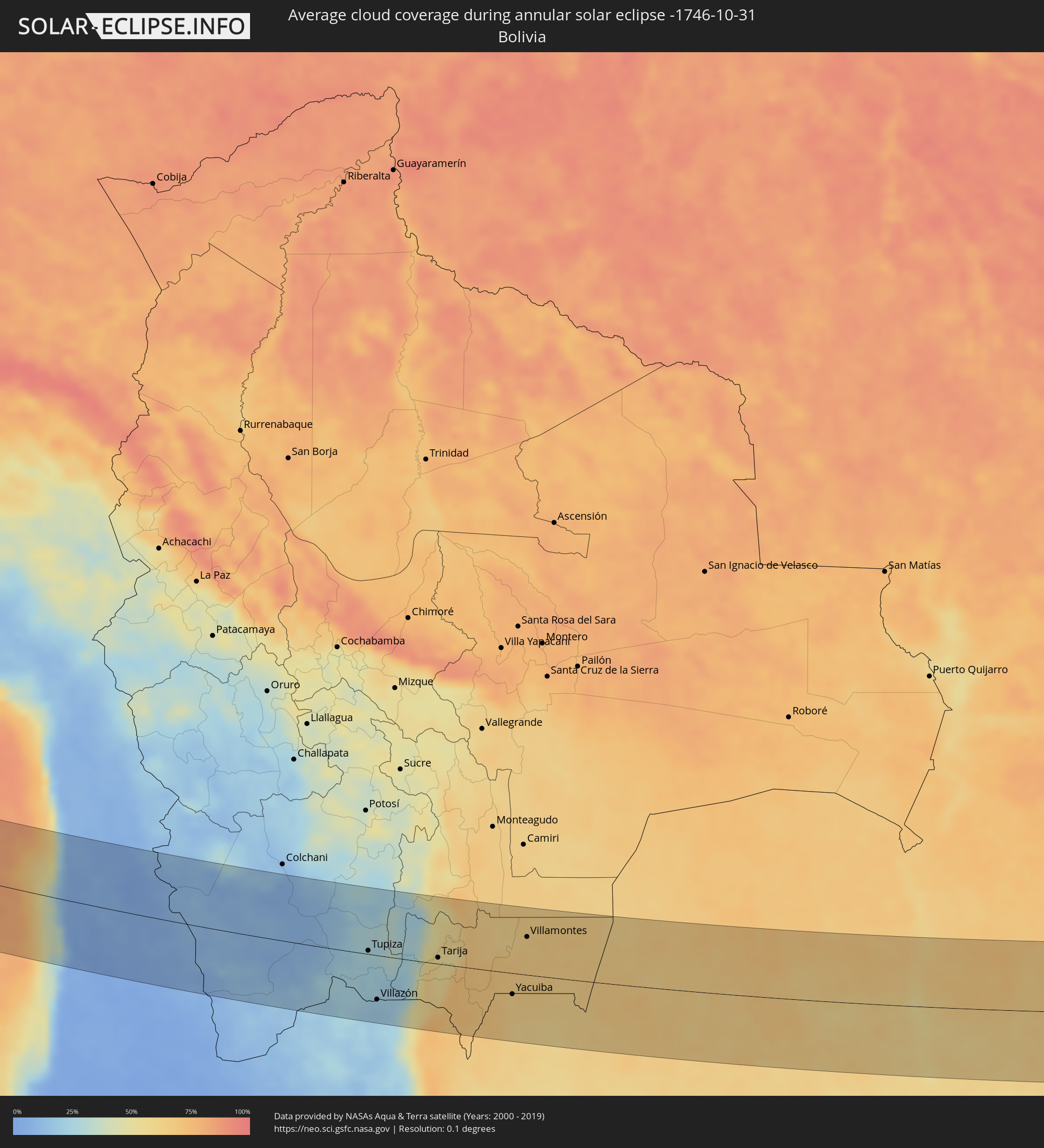 Bolivia
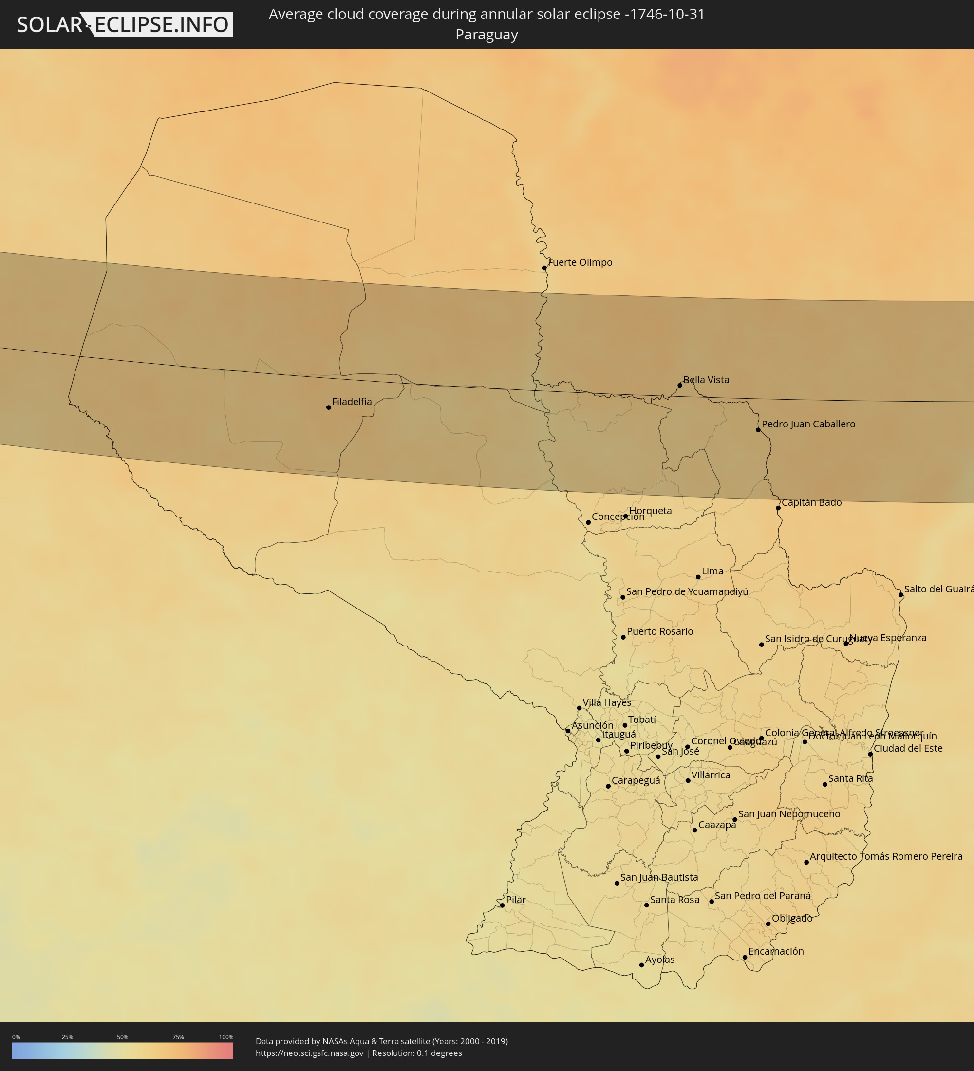 Paraguay
Cities inside the path of the eclipse
The following table shows all locations with a population of more than 5,000 inside the eclipse path. Cities which have more than 100,000 inhabitants are marked bold. A click at the locations opens a detailed map.
| City | Type | Eclipse duration | Local time of max. eclipse | Distance to central line | Ø Cloud coverage |
|
Iquique, Tarapacá
|
annular | - | 14:18:33 UTC-04:42 | 57 km | 26% |
|
Uyuni, Potosí
|
annular | - | 14:36:07 UTC-04:32 | 96 km | 9% |
|
Tupiza, Potosí
|
annular | - | 14:38:42 UTC-04:32 | 5 km | 27% |
|
Villazón, Potosí
|
annular | - | 14:39:06 UTC-04:32 | 64 km | 20% |
|
La Quiaca, Jujuy Province
|
annular | - | 14:54:55 UTC-04:16 | 66 km | 20% |
|
Tarija, Tarija
|
annular | - | 14:40:39 UTC-04:32 | 9 km | 54% |
|
General Enrique Mosconi, Salta Province
|
annular | - | 14:58:22 UTC-04:16 | 96 km | 62% |
|
Tartagal, Salta Province
|
annular | - | 14:58:23 UTC-04:16 | 87 km | 62% |
|
Yacuiba, Tarija
|
annular | - | 14:42:43 UTC-04:32 | 31 km | 62% |
|
Villamontes, Tarija
|
annular | - | 14:42:58 UTC-04:32 | 55 km | 63% |
|
Filadelfia, Boquerón
|
annular | - | 15:30:56 UTC-03:50 | 31 km | 67% |
|
Colonia Menno, Boquerón
|
annular | - | 15:31:17 UTC-03:50 | 32 km | 65% |
|
Bella Vista, Amambay
|
annular | - | 15:36:11 UTC-03:50 | 11 km | 64% |
|
Pedro Juan Caballero, Amambay
|
annular | - | 15:37:13 UTC-03:50 | 33 km | 63% |
|
Dourados, Mato Grosso do Sul
|
annular | - | 15:50:40 UTC-03:38 | 5 km | 65% |
|
Presidente Prudente, São Paulo
|
annular | - | 16:26:44 UTC-03:06 | 15 km | 61% |
|
Assis, São Paulo
|
annular | - | 16:27:40 UTC-03:06 | 46 km | 62% |
|
Marília, São Paulo
|
annular | - | 16:28:13 UTC-03:06 | 2 km | 62% |
|
Bauru, São Paulo
|
annular | - | 16:29:04 UTC-03:06 | 12 km | 60% |
|
Jaú, São Paulo
|
annular | - | 16:29:33 UTC-03:06 | 12 km | 58% |
|
Botucatu, São Paulo
|
annular | - | 16:29:31 UTC-03:06 | 78 km | 62% |
|
Araraquara, São Paulo
|
annular | - | 16:30:00 UTC-03:06 | 42 km | 60% |
|
São Carlos, São Paulo
|
annular | - | 16:30:13 UTC-03:06 | 16 km | 64% |
|
Piracicaba, São Paulo
|
annular | - | 16:30:16 UTC-03:06 | 64 km | 63% |
|
Rio Claro, São Paulo
|
annular | - | 16:30:25 UTC-03:06 | 30 km | 61% |
|
Santa Bárbara d'Oeste, São Paulo
|
annular | - | 16:30:28 UTC-03:06 | 68 km | 61% |
|
Limeira, São Paulo
|
annular | - | 16:30:31 UTC-03:06 | 48 km | 60% |
|
Araras, São Paulo
|
annular | - | 16:30:35 UTC-03:06 | 25 km | 60% |
|
Sumaré, São Paulo
|
annular | - | 16:30:34 UTC-03:06 | 77 km | 58% |
|
Indaiatuba, São Paulo
|
annular | - | 16:30:33 UTC-03:06 | 107 km | 62% |
|
Campinas, São Paulo
|
annular | - | 16:30:43 UTC-03:06 | 87 km | 59% |
|
Mogi-Gaucu, São Paulo
|
annular | - | 16:30:58 UTC-03:06 | 28 km | 57% |
|
Poços de Caldas, Minas Gerais
|
annular | - | 16:31:25 UTC-03:06 | 34 km | 63% |
|
Bragança Paulista, São Paulo
|
annular | - | 16:31:08 UTC-03:06 | 95 km | 58% |
|
Pouso Alegre, Minas Gerais
|
annular | - | 16:31:49 UTC-03:06 | 19 km | 60% |
|
Pindamonhangaba, São Paulo
|
annular | - | 16:32:00 UTC-03:06 | 99 km | 61% |
|
Varginha, Minas Gerais
|
annular | - | 16:32:23 UTC-03:06 | 53 km | 71% |
|
Guaratinguetá, São Paulo
|
annular | - | 16:32:14 UTC-03:06 | 89 km | 60% |
|
Resende, Rio de Janeiro
|
annular | - | 16:32:53 UTC-03:06 | 56 km | 73% |
|
Volta Redonda, Rio de Janeiro
|
annular | - | 16:33:06 UTC-03:06 | 64 km | 74% |
|
Itaguaí, Rio de Janeiro
|
annular | - | 16:33:14 UTC-03:06 | 103 km | 73% |
|
Barbacena, Minas Gerais
|
annular | - | 16:33:41 UTC-03:06 | 77 km | 80% |
|
Nova Iguaçu, Rio de Janeiro
|
annular | - | 16:33:29 UTC-03:06 | 96 km | 77% |
|
Juiz de Fora, Minas Gerais
|
annular | - | 16:33:50 UTC-03:06 | 14 km | 84% |
|
Petrópolis, Rio de Janeiro
|
annular | - | 16:33:44 UTC-03:06 | 70 km | 79% |
|
Teresópolis, Rio de Janeiro
|
annular | - | 16:33:54 UTC-03:06 | 62 km | 83% |
|
Ubá, Minas Gerais
|
annular | - | 16:34:16 UTC-03:06 | 82 km | 78% |
|
Itaboraí, Rio de Janeiro
|
annular | - | 16:33:52 UTC-03:06 | 99 km | 78% |
|
Nova Friburgo, Rio de Janeiro
|
annular | - | 16:34:13 UTC-03:06 | 51 km | 83% |
|
Rio das Ostras, Rio de Janeiro
|
annular | - | 16:34:30 UTC-03:06 | 83 km | 73% |
|
Macaé, Rio de Janeiro
|
annular | - | 16:34:39 UTC-03:06 | 67 km | 72% |
|
Campos, Rio de Janeiro
|
annular | - | 16:35:05 UTC-03:06 | 3 km | 82% |
|
Cachoeiro de Itapemirim, Espírito Santo
|
annular | - | 16:35:27 UTC-03:06 | 95 km | 82% |
|
Guarapari, Espírito Santo
|
annular | - | 16:35:51 UTC-03:06 | 110 km | 74% |