Total solar eclipse of 03/25/-1772
| Day of week: | Sunday |
| Maximum duration of eclipse: | 03m53s |
| Maximum width of eclipse path: | 313 km |
| Saros cycle: | 1 |
| Coverage: | 100% |
| Magnitude: | 1.0583 |
| Gamma: | -0.7985 |
Wo kann man die Sonnenfinsternis vom 03/25/-1772 sehen?

Die Sonnenfinsternis am 03/25/-1772 kann man in 16 Ländern als partielle Sonnenfinsternis beobachten.
Der Finsternispfad verläuft durch 5 Länder. Nur in diesen Ländern ist sie als total Sonnenfinsternis zu sehen.
In den folgenden Ländern ist die Sonnenfinsternis total zu sehen
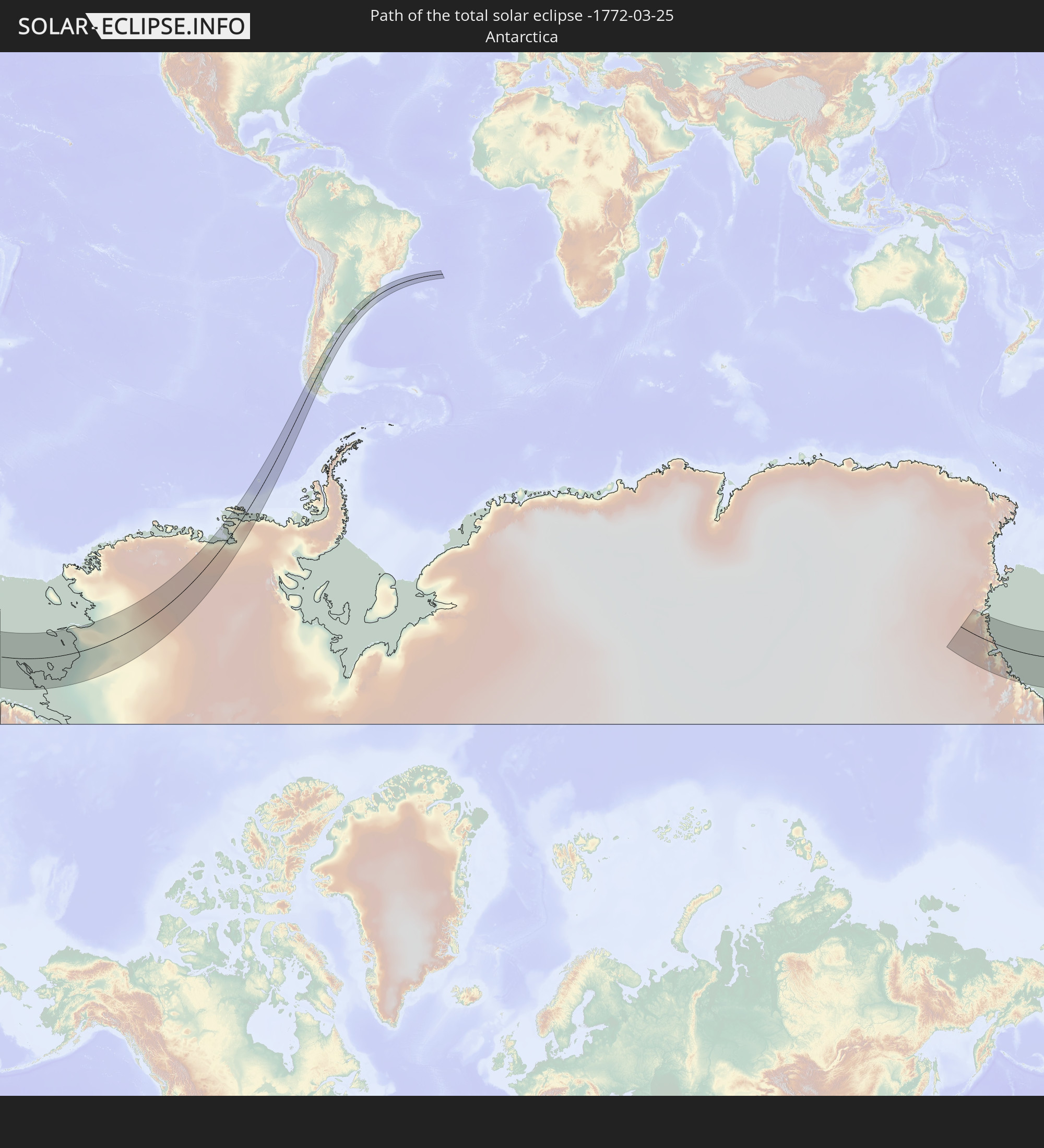 Antarctica
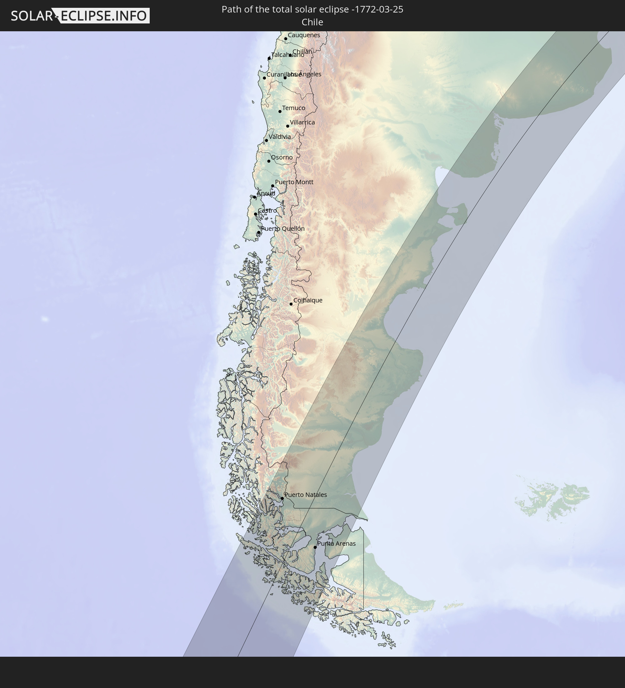 Chile
Chile
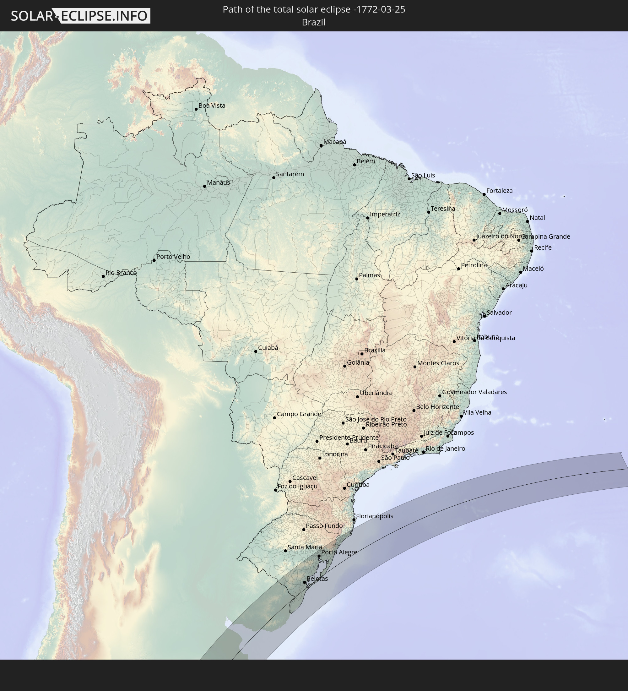 Brazil
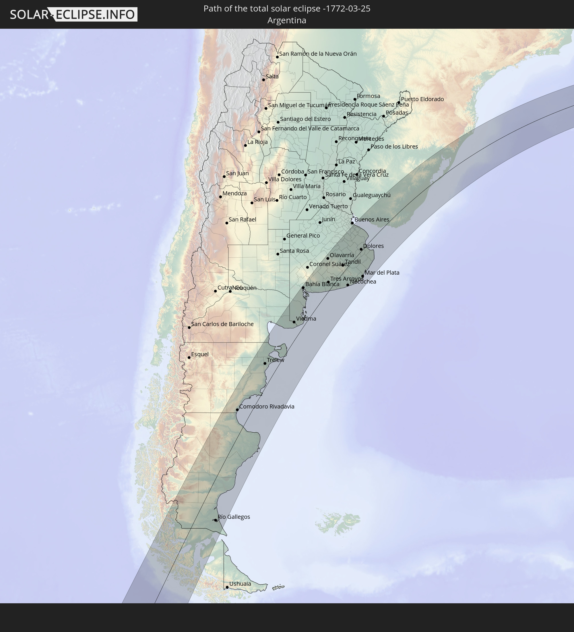 Argentina
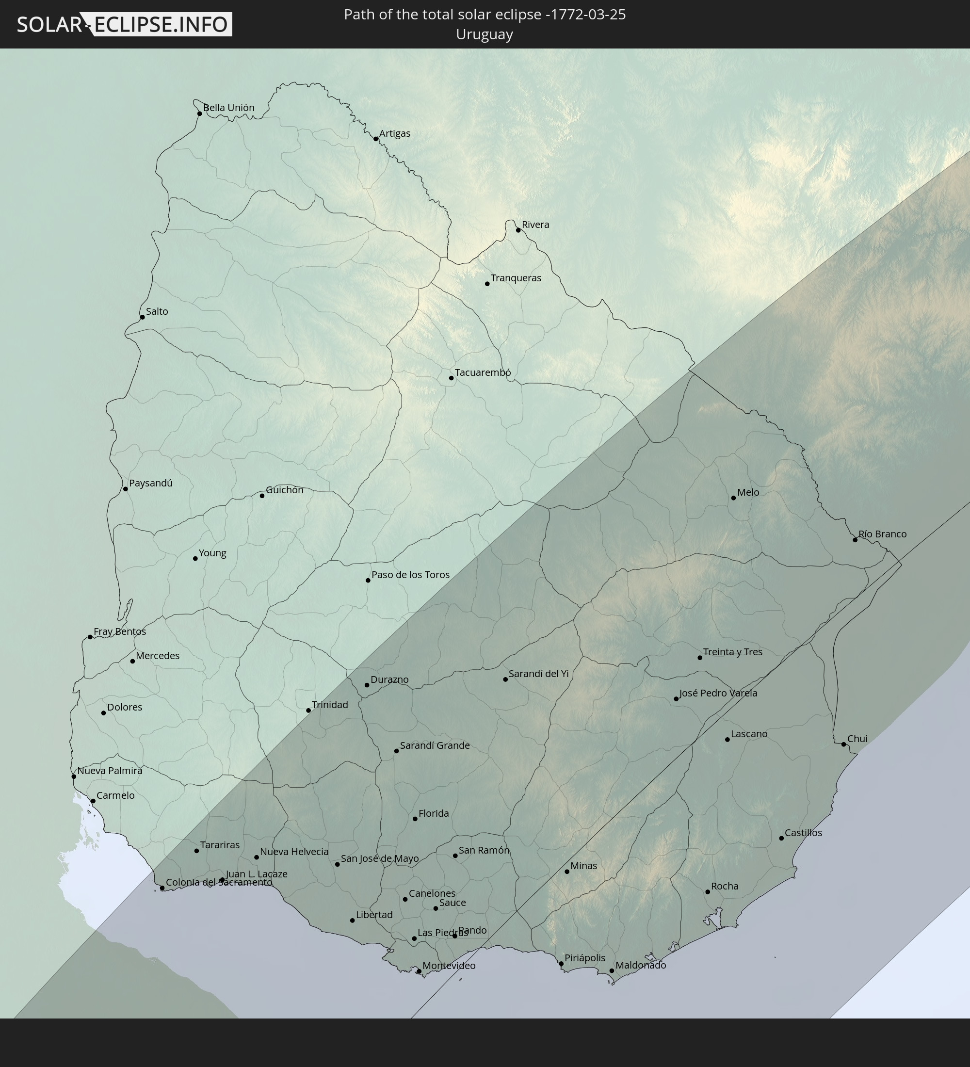 Uruguay
In den folgenden Ländern ist die Sonnenfinsternis partiell zu sehen


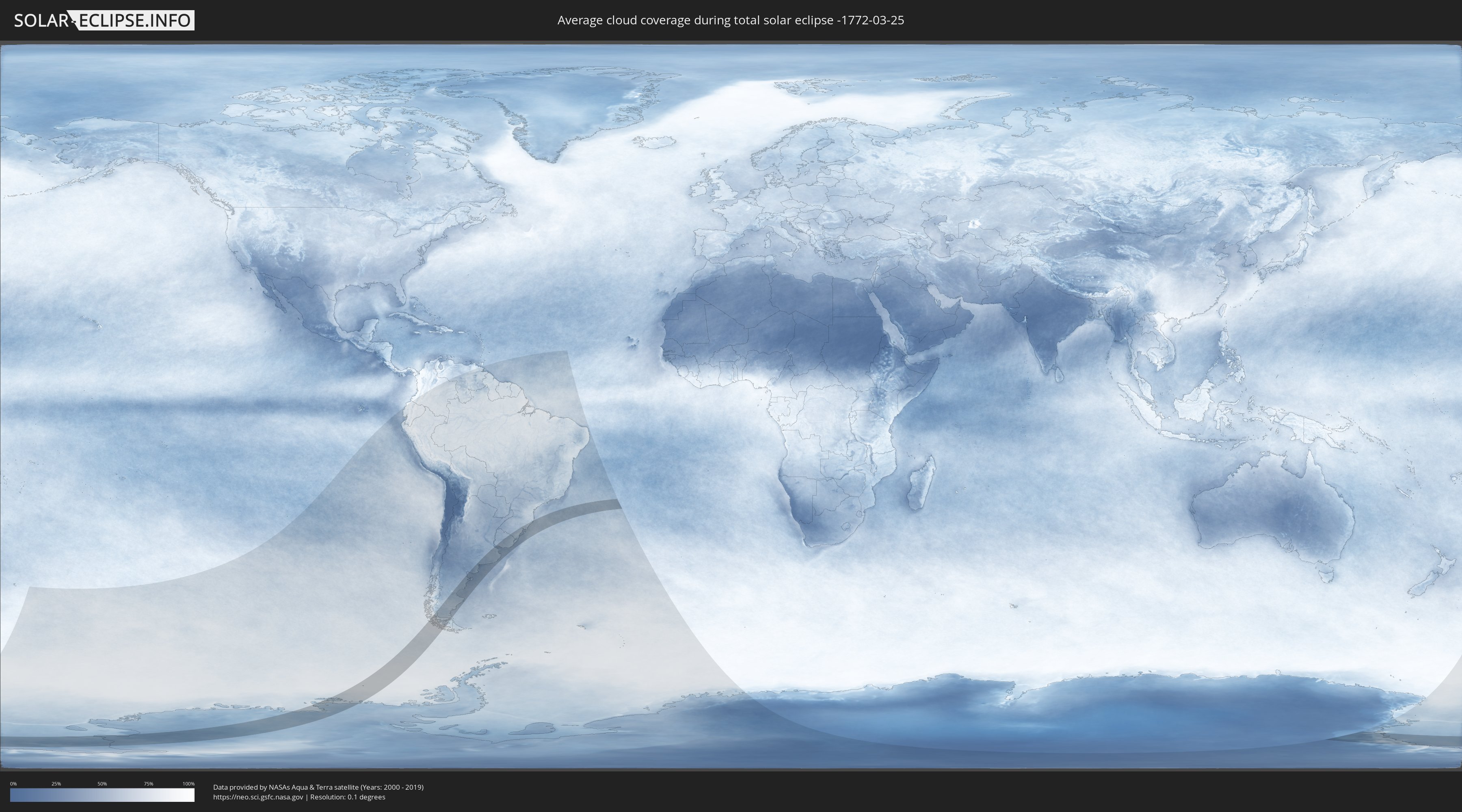
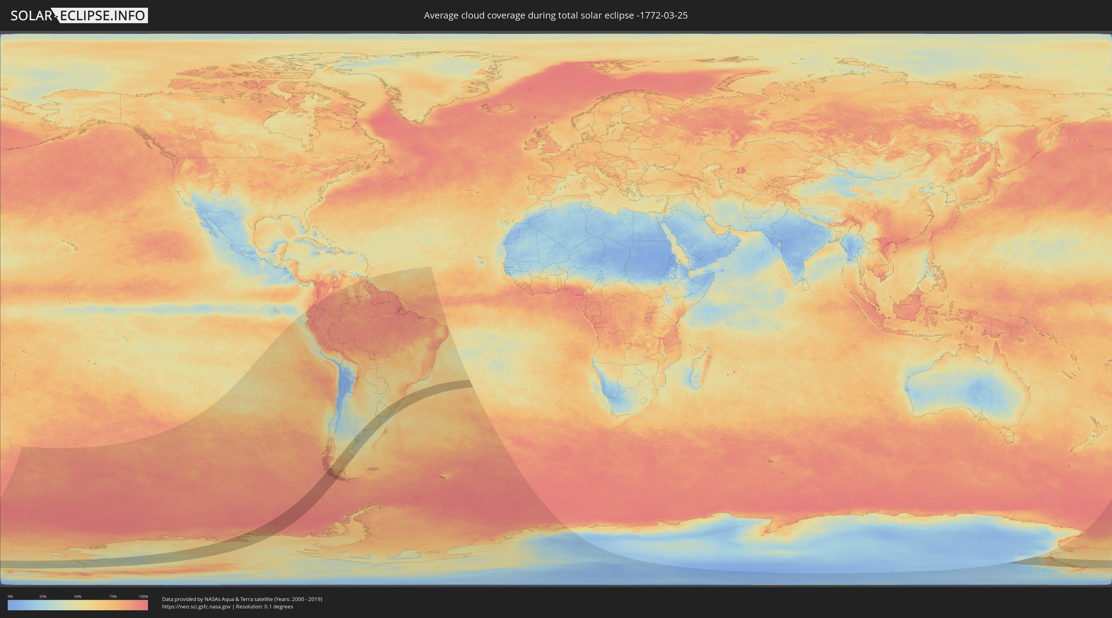
How will be the weather during the total solar eclipse on 03/25/-1772?
Where is the best place to see the total solar eclipse of 03/25/-1772?
The following maps show the average cloud coverage for the day of the total solar eclipse.
With the help of these maps, it is possible to find the place along the eclipse path, which has the best
chance of a cloudless sky.
Nevertheless, you should consider local circumstances and inform about the weather of your chosen
observation site.
The data is provided by NASAs satellites
AQUA and TERRA.
The cloud maps are averaged over a period of 19 years (2000 - 2019).
Detailed country maps
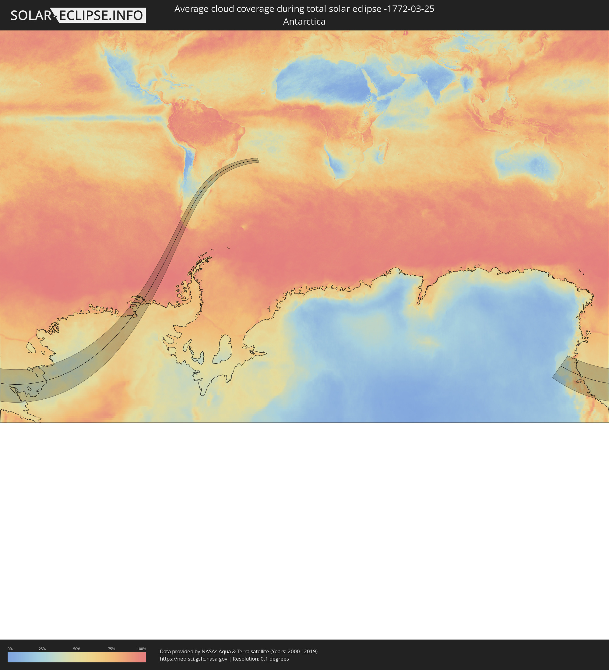 Antarctica
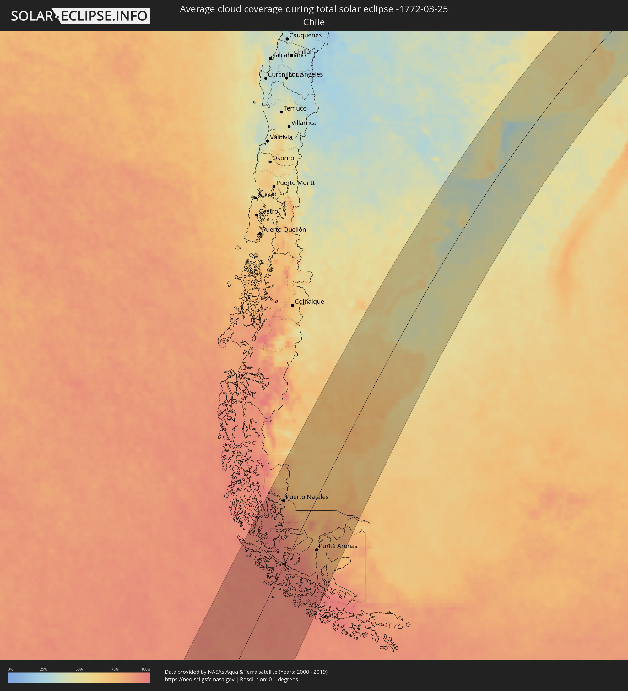 Chile
Chile
 Brazil
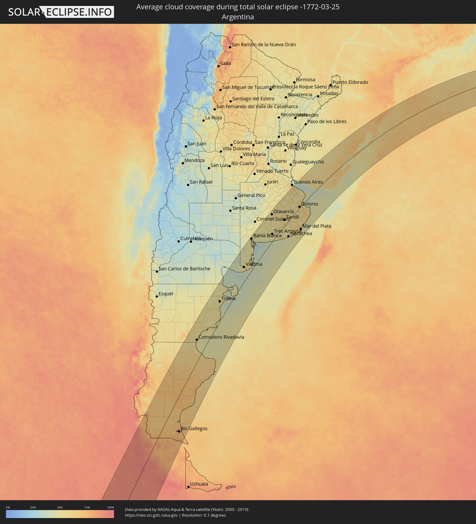 Argentina
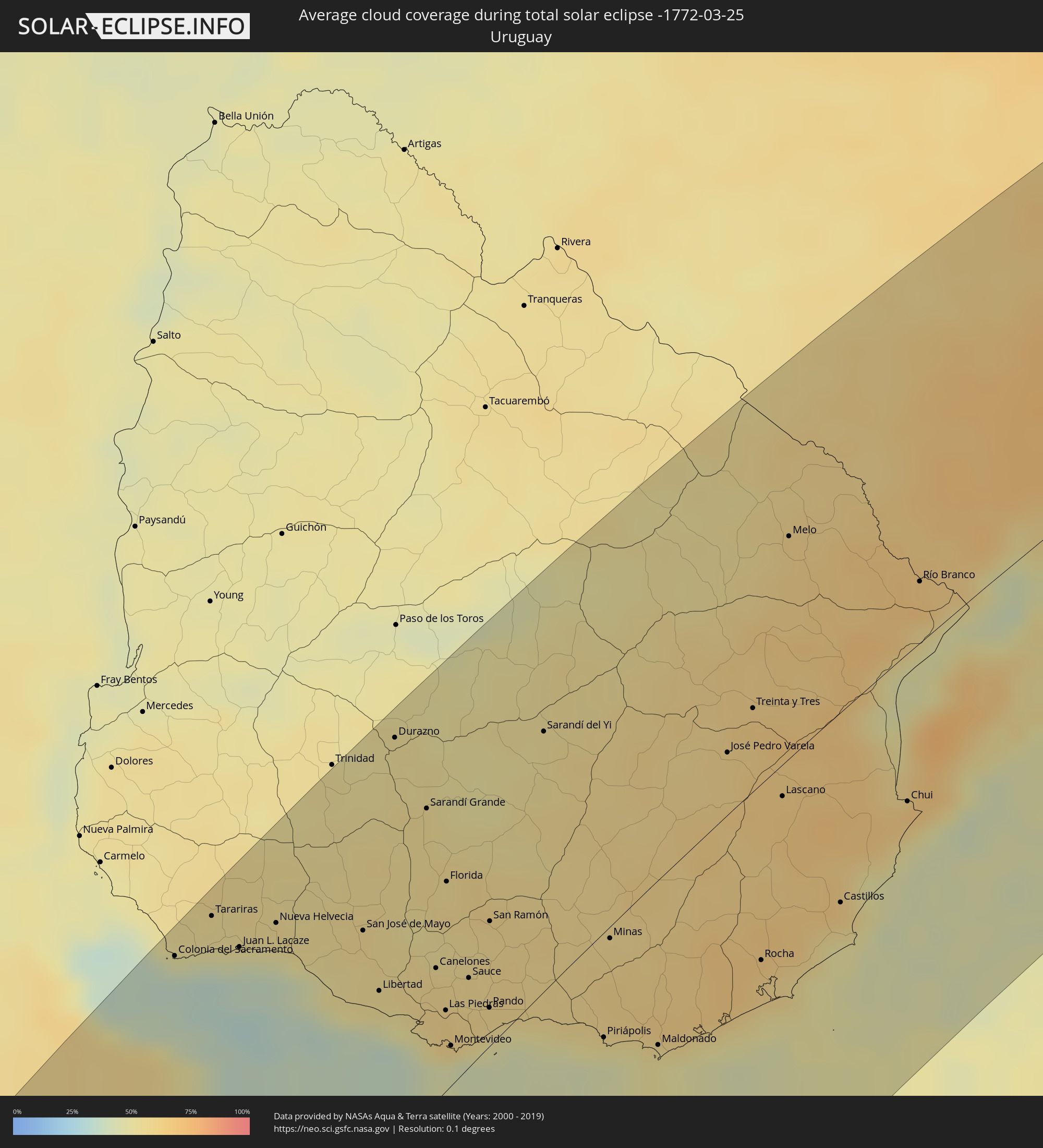 Uruguay
Cities inside the path of the eclipse
The following table shows all locations with a population of more than 5,000 inside the eclipse path. Cities which have more than 100,000 inhabitants are marked bold. A click at the locations opens a detailed map.
| City | Type | Eclipse duration | Local time of max. eclipse | Distance to central line | Ø Cloud coverage |
 Puerto Natales, Magallanes
|
total | - | 14:14:22 UTC-04:42 | 92 km | 80% |
 Yacimiento Río Turbio, Santa Cruz Province
|
total | - | 14:40:43 UTC-04:16 | 92 km | 79% |
|
Río Turbio, Santa Cruz Province
|
total | - | 14:40:47 UTC-04:16 | 93 km | 76% |
|
El Calafate, Santa Cruz Province
|
total | - | 14:42:48 UTC-04:16 | 151 km | 70% |
|
Punta Arenas, Magallanes
|
total | - | 14:13:30 UTC-04:42 | 74 km | 80% |
|
Río Gallegos, Santa Cruz Province
|
total | - | 14:43:29 UTC-04:16 | 105 km | 76% |
|
Las Heras, Santa Cruz Province
|
total | - | 14:52:33 UTC-04:16 | 138 km | 59% |
|
Pico Truncado, Santa Cruz Province
|
total | - | 14:53:00 UTC-04:16 | 59 km | 62% |
|
San Julián, Santa Cruz Province
|
total | - | 14:48:46 UTC-04:16 | 87 km | 66% |
|
Rada Tilly, Chubut Province
|
total | - | 19:11:45 UTC+00:00 | 77 km | 53% |
|
Caleta Olivia, Santa Cruz Province
|
total | - | 14:54:02 UTC-04:16 | 49 km | 54% |
|
Comodoro Rivadavia, Chubut Province
|
total | - | 14:55:07 UTC-04:16 | 79 km | 53% |
|
Puerto Deseado, Santa Cruz Province
|
total | - | 14:53:09 UTC-04:16 | 129 km | 59% |
|
Gaimán, Chubut Province
|
total | - | 15:01:43 UTC-04:16 | 89 km | 57% |
|
Trelew, Chubut Province
|
total | - | 15:01:57 UTC-04:16 | 78 km | 57% |
|
Rawson, Chubut Province
|
total | - | 15:02:03 UTC-04:16 | 61 km | 49% |
|
Puerto Madryn, Chubut Province
|
total | - | 15:03:06 UTC-04:16 | 88 km | 50% |
|
Viedma, Río Negro Province
|
total | - | 15:08:37 UTC-04:16 | 66 km | 53% |
|
Bahía Blanca, Buenos Aires
|
total | - | 15:13:16 UTC-04:16 | 152 km | 52% |
|
Punta Alta, Buenos Aires
|
total | - | 15:13:08 UTC-04:16 | 128 km | 42% |
|
Coronel Dorrego, Buenos Aires
|
total | - | 15:14:06 UTC-04:16 | 84 km | 48% |
|
Olavarría, Buenos Aires
|
total | - | 15:18:25 UTC-04:16 | 144 km | 54% |
|
Tres Arroyos, Buenos Aires
|
total | - | 15:15:35 UTC-04:16 | 38 km | 49% |
|
Azul, Buenos Aires
|
total | - | 15:19:00 UTC-04:16 | 121 km | 54% |
|
Tandil, Buenos Aires
|
total | - | 15:18:32 UTC-04:16 | 32 km | 58% |
|
Necochea, Buenos Aires
|
total | - | 15:16:28 UTC-04:16 | 81 km | 50% |
|
Adrogué, Buenos Aires
|
total | - | 15:23:58 UTC-04:16 | 168 km | 59% |
|
Quilmes, Buenos Aires
|
total | - | 15:24:11 UTC-04:16 | 165 km | 55% |
|
La Plata, Buenos Aires
|
total | - | 15:24:03 UTC-04:16 | 130 km | 58% |
 Colonia del Sacramento, Colonia
|
total | - | 15:56:58 UTC-03:44 | 158 km | 36% |
|
Dolores, Buenos Aires
|
total | - | 15:21:35 UTC-04:16 | 7 km | 59% |
|
Tarariras, Colonia
|
total | - | 15:57:30 UTC-03:44 | 158 km | 52% |
|
Mar del Plata, Buenos Aires
|
total | - | 15:18:26 UTC-04:16 | 123 km | 59% |
|
Juan L. Lacaze, Colonia
|
total | - | 15:57:20 UTC-03:44 | 136 km | 44% |
|
Rosario, Colonia
|
total | - | 15:57:36 UTC-03:44 | 137 km | 52% |
|
Nueva Helvecia, Colonia
|
total | - | 15:57:43 UTC-03:44 | 131 km | 53% |
|
Villa Gesell, Buenos Aires
|
total | - | 15:20:17 UTC-04:16 | 110 km | 53% |
|
Trinidad, Flores
|
total | - | 15:59:25 UTC-03:44 | 168 km | 54% |
|
San Clemente del Tuyú, Buenos Aires
|
total | - | 15:22:12 UTC-04:16 | 60 km | 55% |
|
San José de Mayo, San José
|
total | - | 15:58:01 UTC-03:44 | 94 km | 58% |
|
Libertad, San José
|
total | - | 15:57:32 UTC-03:44 | 64 km | 53% |
|
Durazno, Durazno
|
total | - | 15:59:59 UTC-03:44 | 158 km | 53% |
|
Santa Lucía, Canelones
|
total | - | 15:58:02 UTC-03:44 | 64 km | 57% |
|
Delta del Tigre, San José
|
total | - | 15:57:27 UTC-03:44 | 37 km | 43% |
|
Sarandí Grande, Florida
|
total | - | 15:59:27 UTC-03:44 | 117 km | 55% |
|
Canelones, Canelones
|
total | - | 15:57:59 UTC-03:44 | 51 km | 58% |
|
La Paz, Canelones
|
total | - | 15:57:34 UTC-03:44 | 29 km | 59% |
|
Las Piedras, Canelones
|
total | - | 15:57:37 UTC-03:44 | 31 km | 61% |
|
Progreso, Canelones
|
total | - | 15:57:45 UTC-03:44 | 36 km | 61% |
|
Florida, Florida
|
total | - | 15:58:50 UTC-03:44 | 80 km | 57% |
|
Montevideo, Montevideo
|
total | - | 15:57:19 UTC-03:44 | 15 km | 45% |
|
Sauce, Canelones
|
total | - | 15:58:02 UTC-03:44 | 34 km | 59% |
|
Paso de Carrasco, Canelones
|
total | - | 15:57:30 UTC-03:44 | 10 km | 42% |
|
Joaquín Suárez, Canelones
|
total | - | 15:57:45 UTC-03:44 | 18 km | 57% |
|
Colonia Nicolich, Canelones
|
total | - | 15:57:36 UTC-03:44 | 11 km | 51% |
|
Pando, Canelones
|
total | - | 15:57:50 UTC-03:44 | 15 km | 57% |
|
San Ramón, Canelones
|
total | - | 15:58:39 UTC-03:44 | 48 km | 56% |
|
Sarandí del Yi, Durazno
|
total | - | 16:00:40 UTC-03:44 | 103 km | 54% |
|
Piriápolis, Maldonado
|
total | - | 15:58:02 UTC-03:44 | 41 km | 44% |
|
Minas, Lavalleja
|
total | - | 15:58:59 UTC-03:44 | 5 km | 59% |
|
Pan de Azúcar, Maldonado
|
total | - | 15:58:13 UTC-03:44 | 37 km | 52% |
|
Maldonado, Maldonado
|
total | - | 15:58:11 UTC-03:44 | 65 km | 52% |
|
Punta del Este, Maldonado
|
total | - | 15:58:06 UTC-03:44 | 70 km | 50% |
|
San Carlos, Maldonado
|
total | - | 15:58:24 UTC-03:44 | 58 km | 55% |
|
José Pedro Varela, Lavalleja
|
total | - | 16:01:12 UTC-03:44 | 25 km | 60% |
|
Treinta y Tres, Treinta y Tres
|
total | - | 16:01:43 UTC-03:44 | 34 km | 64% |
|
Rocha, Rocha
|
total | - | 15:59:23 UTC-03:44 | 71 km | 60% |
|
Lascano, Rocha
|
total | - | 16:01:00 UTC-03:44 | 13 km | 65% |
|
Melo, Cerro Largo
|
total | - | 16:03:29 UTC-03:44 | 93 km | 59% |
|
Castillos, Rocha
|
total | - | 16:00:14 UTC-03:44 | 78 km | 57% |
|
Chui, Rocha
|
total | - | 16:01:26 UTC-03:44 | 62 km | 62% |
 Herval, Rio Grande do Sul
|
total | - | 16:43:00 UTC-03:06 | 76 km | 66% |
|
Río Branco, Cerro Largo
|
total | - | 16:03:33 UTC-03:44 | 26 km | 68% |
|
Jaguarão, Rio Grande do Sul
|
total | - | 16:42:00 UTC-03:06 | 28 km | 68% |
|
Santa Vitória do Palmar, Rio Grande do Sul
|
total | - | 16:40:12 UTC-03:06 | 52 km | 65% |
|
Arroio Grande, Rio Grande do Sul
|
total | - | 16:42:47 UTC-03:06 | 39 km | 68% |
|
Canguçu, Rio Grande do Sul
|
total | - | 16:44:36 UTC-03:06 | 88 km | 71% |
|
Encruzilhada do Sul, Rio Grande do Sul
|
total | - | 16:46:16 UTC-03:06 | 154 km | 65% |
|
Pelotas, Rio Grande do Sul
|
total | - | 16:44:06 UTC-03:06 | 35 km | 59% |
|
Rio Grande, Rio Grande do Sul
|
total | - | 16:43:45 UTC-03:06 | 2 km | 61% |
|
São Lourenço do Sul, Rio Grande do Sul
|
total | - | 16:45:04 UTC-03:06 | 50 km | 52% |
|
Butiá, Rio Grande do Sul
|
total | - | 16:47:22 UTC-03:06 | 160 km | 64% |
|
Camaquã, Rio Grande do Sul
|
total | - | 16:46:07 UTC-03:06 | 86 km | 77% |
|
Arroio dos Ratos, Rio Grande do Sul
|
total | - | 16:47:35 UTC-03:06 | 151 km | 63% |
|
São Jerônimo, Rio Grande do Sul
|
total | - | 16:47:48 UTC-03:06 | 161 km | 63% |
|
Triunfo, Rio Grande do Sul
|
total | - | 16:47:50 UTC-03:06 | 162 km | 58% |
|
Charqueadas, Rio Grande do Sul
|
total | - | 16:47:52 UTC-03:06 | 156 km | 64% |
|
Tapes, Rio Grande do Sul
|
total | - | 16:46:40 UTC-03:06 | 78 km | 59% |
|
Guaíba, Rio Grande do Sul
|
total | - | 16:47:44 UTC-03:06 | 125 km | 59% |
|
Portão, Rio Grande do Sul
|
total | - | 16:48:32 UTC-03:06 | 158 km | 68% |
|
Porto Alegre, Rio Grande do Sul
|
total | - | 16:47:56 UTC-03:06 | 127 km | 69% |
|
Esteio, Rio Grande do Sul
|
total | - | 16:48:16 UTC-03:06 | 140 km | 69% |
|
Estância Velha, Rio Grande do Sul
|
total | - | 16:48:40 UTC-03:06 | 159 km | 67% |
|
Ivoti, Rio Grande do Sul
|
total | - | 16:48:47 UTC-03:06 | 164 km | 67% |
|
Sapucaia, Rio Grande do Sul
|
total | - | 16:48:20 UTC-03:06 | 141 km | 69% |
|
Novo Hamburgo, Rio Grande do Sul
|
total | - | 16:48:38 UTC-03:06 | 154 km | 68% |
|
Cachoeirinha, Rio Grande do Sul
|
total | - | 16:48:09 UTC-03:06 | 127 km | 71% |
|
Viamão, Rio Grande do Sul
|
total | - | 16:47:57 UTC-03:06 | 111 km | 69% |
|
Sapiranga, Rio Grande do Sul
|
total | - | 16:48:46 UTC-03:06 | 151 km | 67% |
|
Gravataí, Rio Grande do Sul
|
total | - | 16:48:14 UTC-03:06 | 122 km | 69% |
|
Parobé, Rio Grande do Sul
|
total | - | 16:48:53 UTC-03:06 | 142 km | 62% |
|
Canela, Rio Grande do Sul
|
total | - | 16:49:23 UTC-03:06 | 167 km | 66% |
|
Igrejinha, Rio Grande do Sul
|
total | - | 16:49:00 UTC-03:06 | 145 km | 62% |
|
Taquara, Rio Grande do Sul
|
total | - | 16:48:52 UTC-03:06 | 137 km | 64% |
|
Três Coroas, Rio Grande do Sul
|
total | - | 16:49:07 UTC-03:06 | 150 km | 65% |
|
São Francisco de Paula, Rio Grande do Sul
|
total | - | 16:49:21 UTC-03:06 | 146 km | 72% |
|
Rolante, Rio Grande do Sul
|
total | - | 16:48:59 UTC-03:06 | 126 km | 62% |
|
Osório, Rio Grande do Sul
|
total | - | 16:48:43 UTC-03:06 | 88 km | 62% |
|
Tramandaí, Rio Grande do Sul
|
total | - | 16:48:36 UTC-03:06 | 72 km | 57% |
|
Capão da Canoa, Rio Grande do Sul
|
total | - | 16:49:06 UTC-03:06 | 87 km | 59% |
|
Torres, Rio Grande do Sul
|
total | - | 16:49:59 UTC-03:06 | 111 km | 62% |
|
Sombrio, Santa Catarina
|
total | - | 16:50:26 UTC-03:06 | 126 km | 62% |
|
Araranguá, Santa Catarina
|
total | - | 16:50:49 UTC-03:06 | 136 km | 70% |
|
Forquilhinha, Santa Catarina
|
total | - | 16:51:10 UTC-03:06 | 153 km | 75% |
|
Criciúma, Santa Catarina
|
total | - | 16:51:20 UTC-03:06 | 154 km | 73% |
|
Cocal, Santa Catarina
|
total | - | 16:51:29 UTC-03:06 | 159 km | 73% |
|
Içara, Santa Catarina
|
total | - | 16:51:18 UTC-03:06 | 147 km | 69% |
|
Morro da Fumaça, Santa Catarina
|
total | - | 16:51:28 UTC-03:06 | 149 km | 68% |
|
Jaguaruna, Santa Catarina
|
total | - | 16:51:36 UTC-03:06 | 142 km | 71% |
|
Tubarão, Santa Catarina
|
total | - | 16:51:53 UTC-03:06 | 156 km | 71% |
|
Laguna, Santa Catarina
|
total | - | 16:51:58 UTC-03:06 | 143 km | 63% |
|
Imbituba, Santa Catarina
|
total | - | 16:52:27 UTC-03:06 | 161 km | 64% |