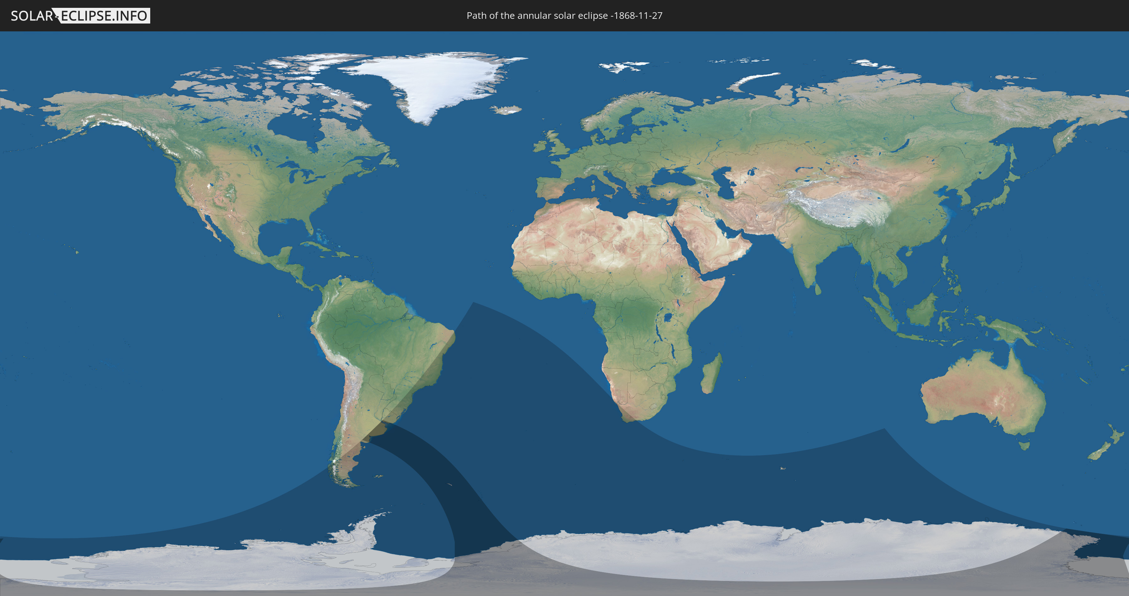
Annular solar eclipse of 11/27/-1868
| Day of week: | Tuesday |
| Maximum duration of eclipse: | 06m55s |
| Maximum width of eclipse path: | 686 km |
| Saros cycle: | 22 |
| Coverage: | 91.1% |
| Magnitude: | 0.9107 |
| Gamma: | -0.8678 |
Wo kann man die Sonnenfinsternis vom 11/27/-1868 sehen?
Die Sonnenfinsternis am 11/27/-1868 kann man in 13 Ländern als partielle Sonnenfinsternis beobachten.
Der Finsternispfad verläuft durch 4 Länder. Nur in diesen Ländern ist sie als annular Sonnenfinsternis zu sehen.
In den folgenden Ländern ist die Sonnenfinsternis annular zu sehen
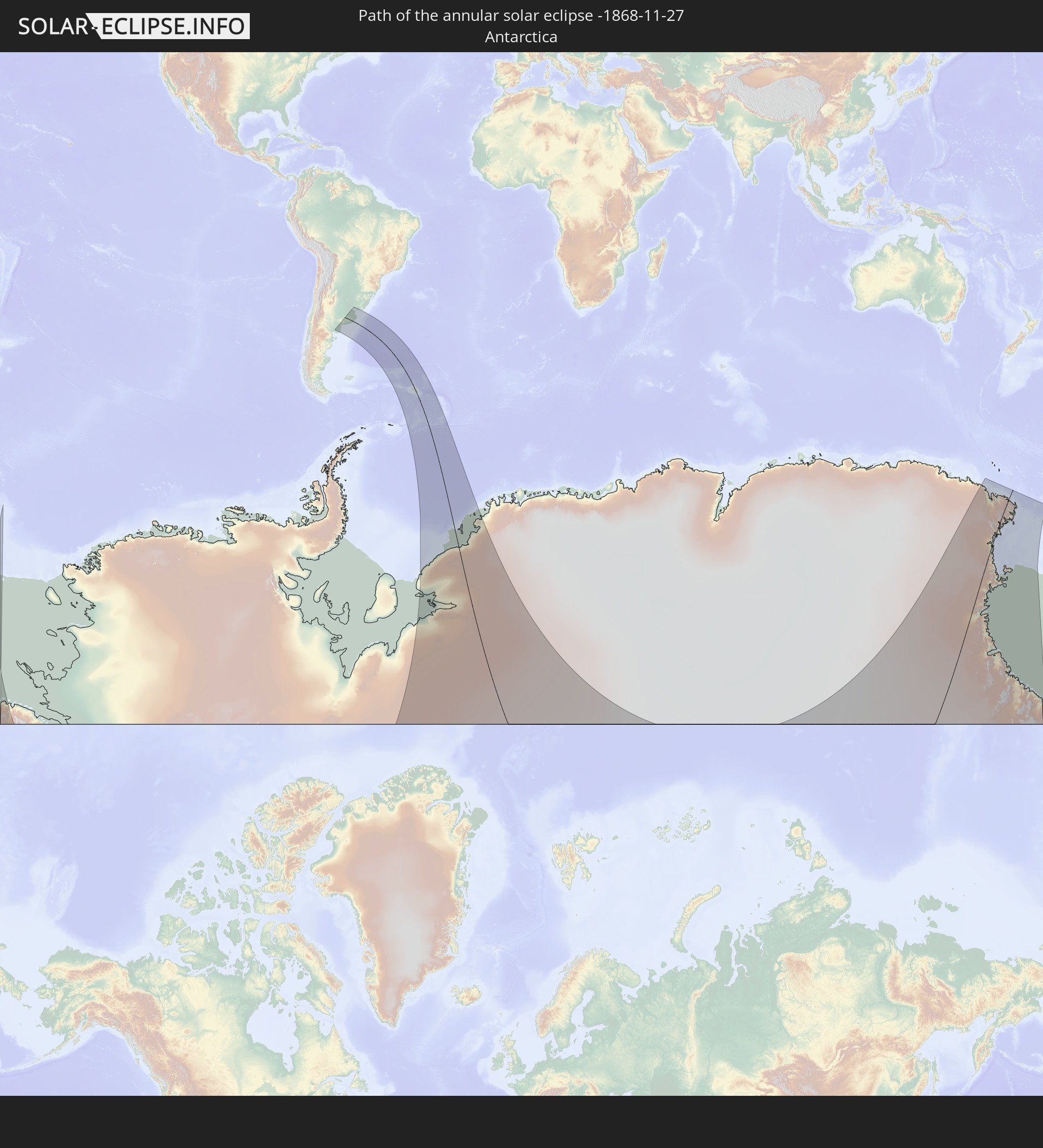 Antarctica
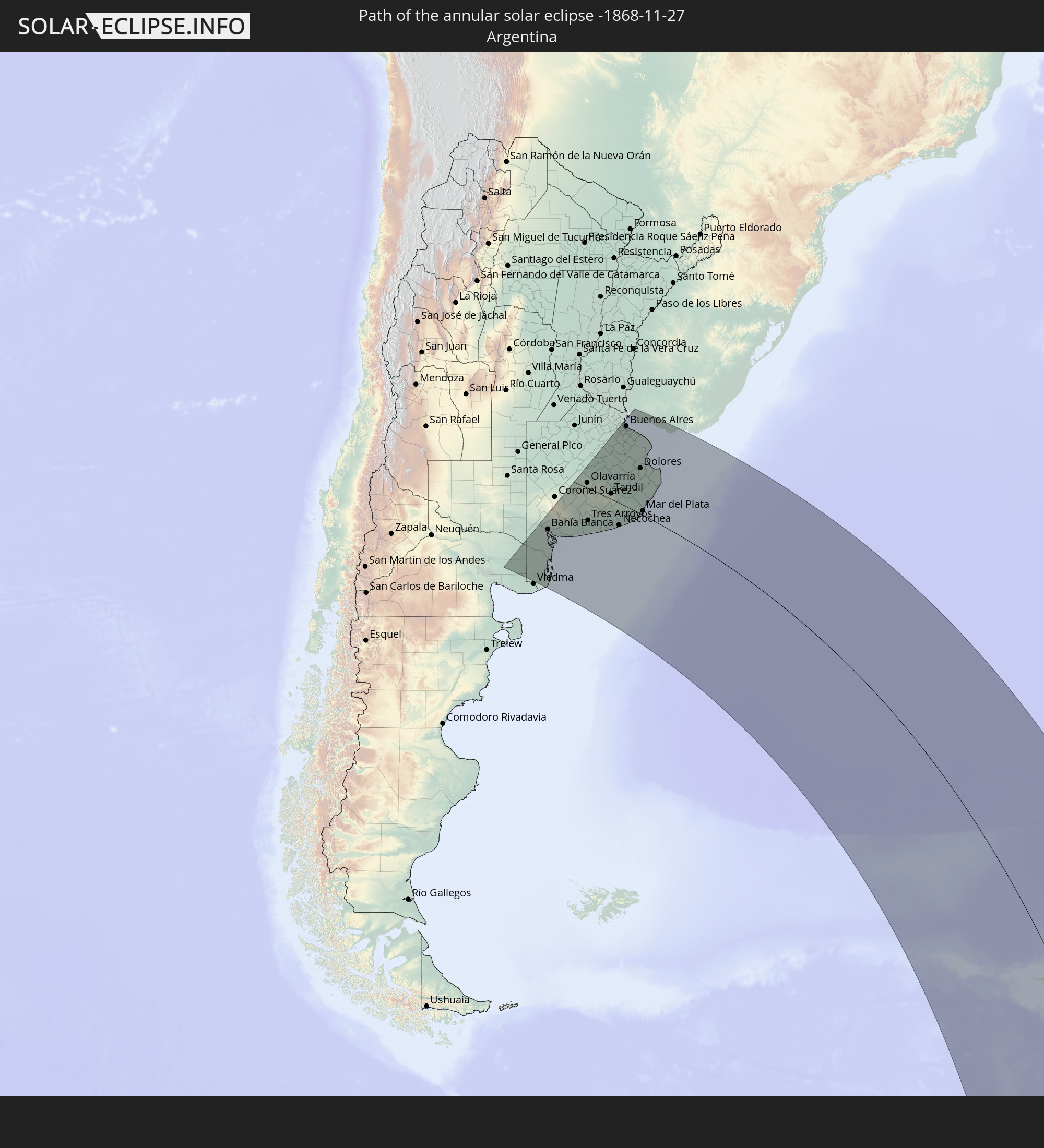 Argentina
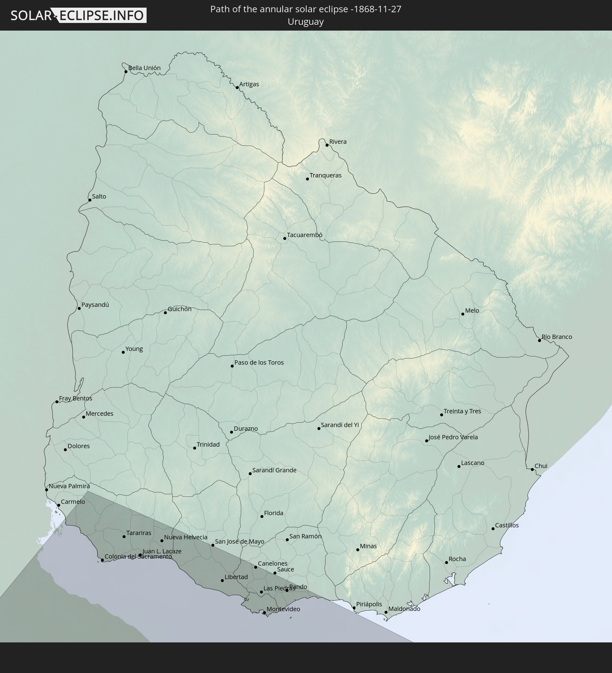 Uruguay
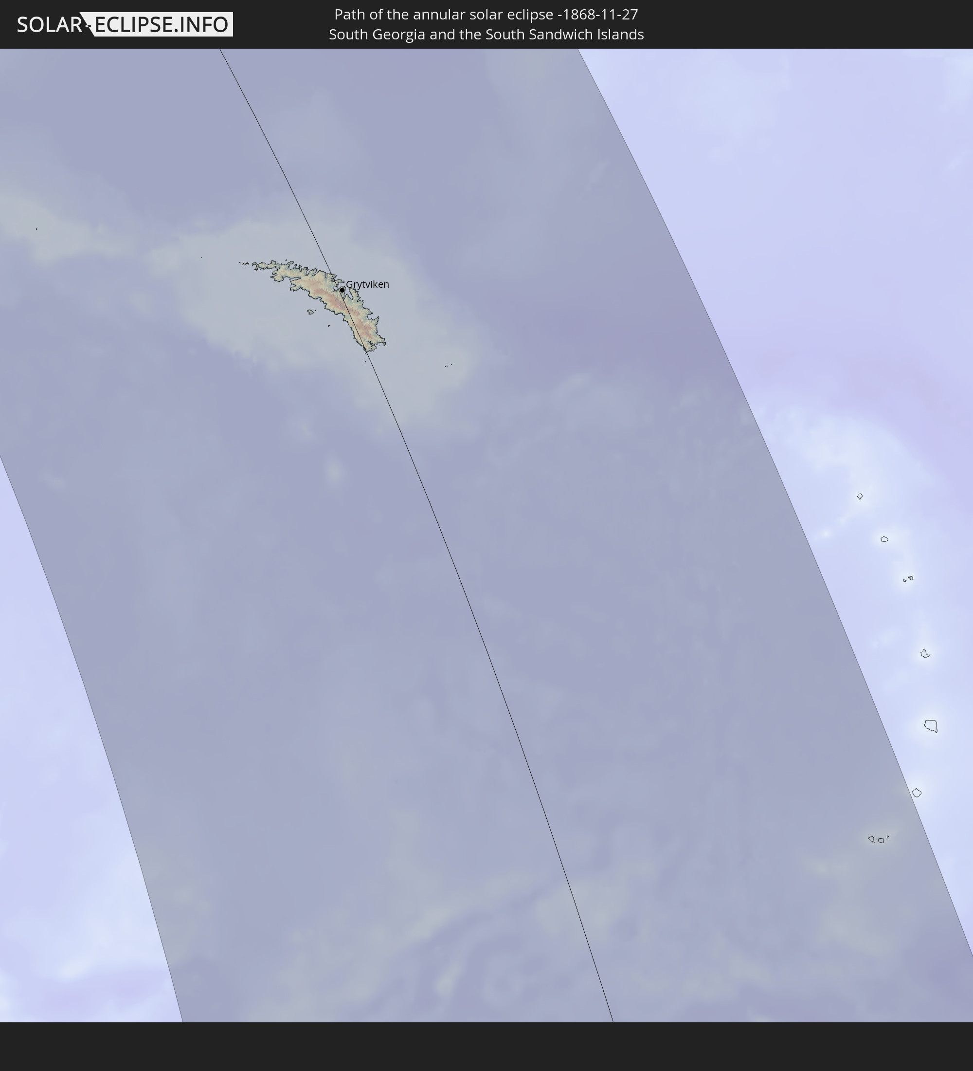 South Georgia and the South Sandwich Islands
In den folgenden Ländern ist die Sonnenfinsternis partiell zu sehen


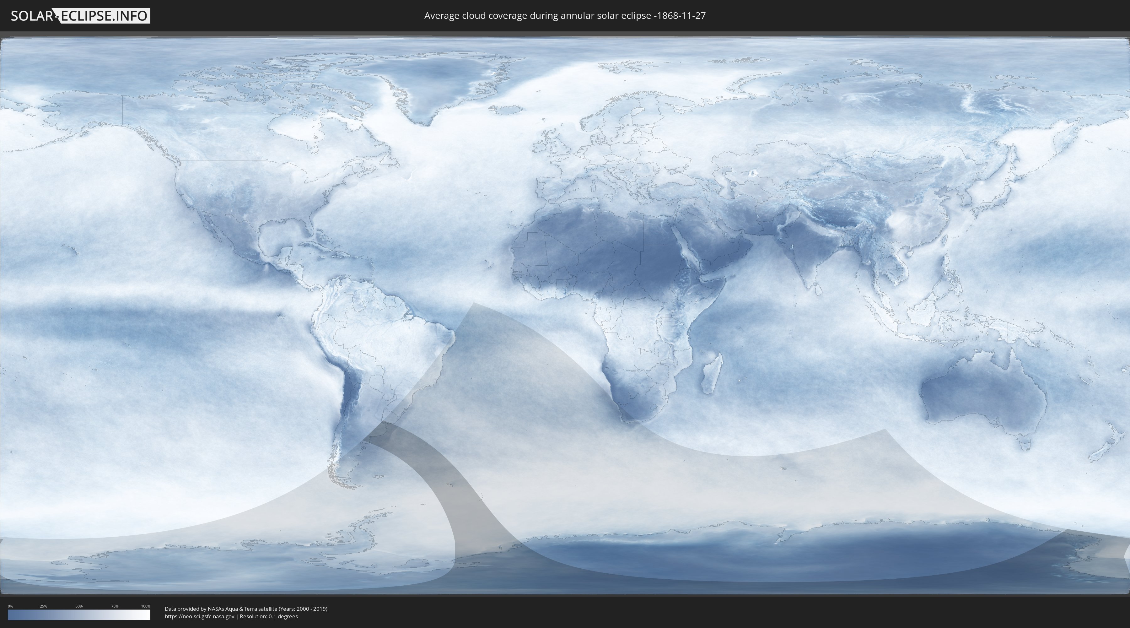
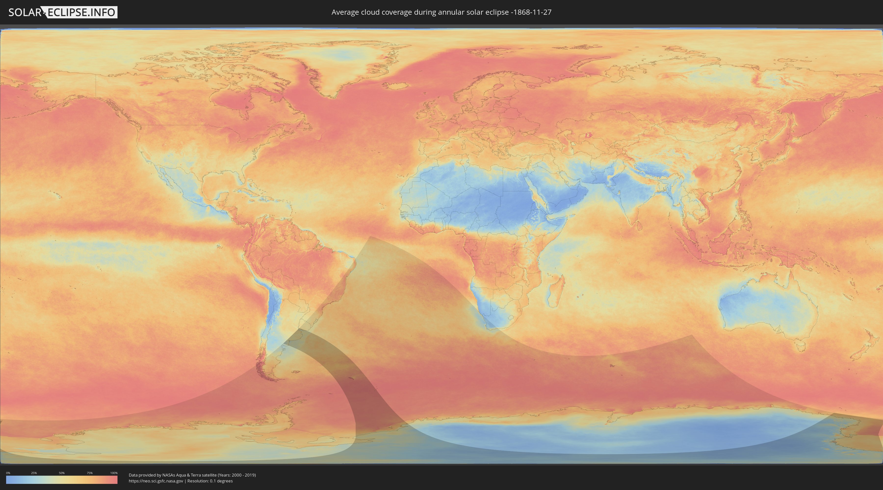
How will be the weather during the annular solar eclipse on 11/27/-1868?
Where is the best place to see the annular solar eclipse of 11/27/-1868?
The following maps show the average cloud coverage for the day of the annular solar eclipse.
With the help of these maps, it is possible to find the place along the eclipse path, which has the best
chance of a cloudless sky.
Nevertheless, you should consider local circumstances and inform about the weather of your chosen
observation site.
The data is provided by NASAs satellites
AQUA and TERRA.
The cloud maps are averaged over a period of 19 years (2000 - 2019).
Detailed country maps
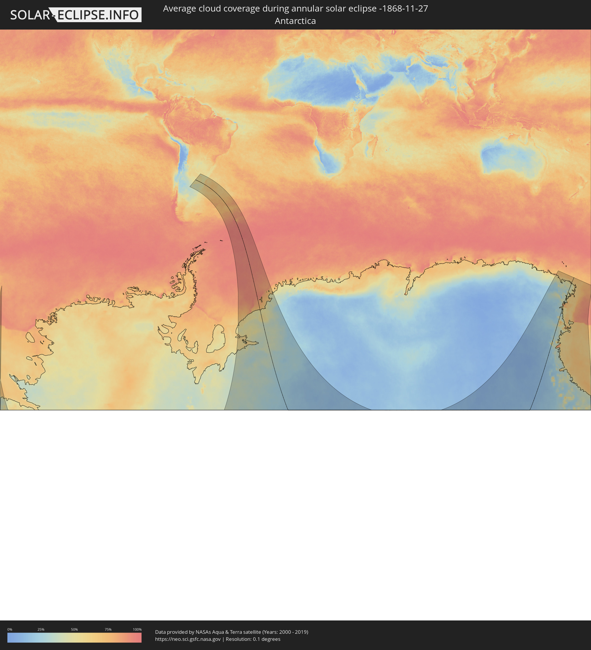 Antarctica
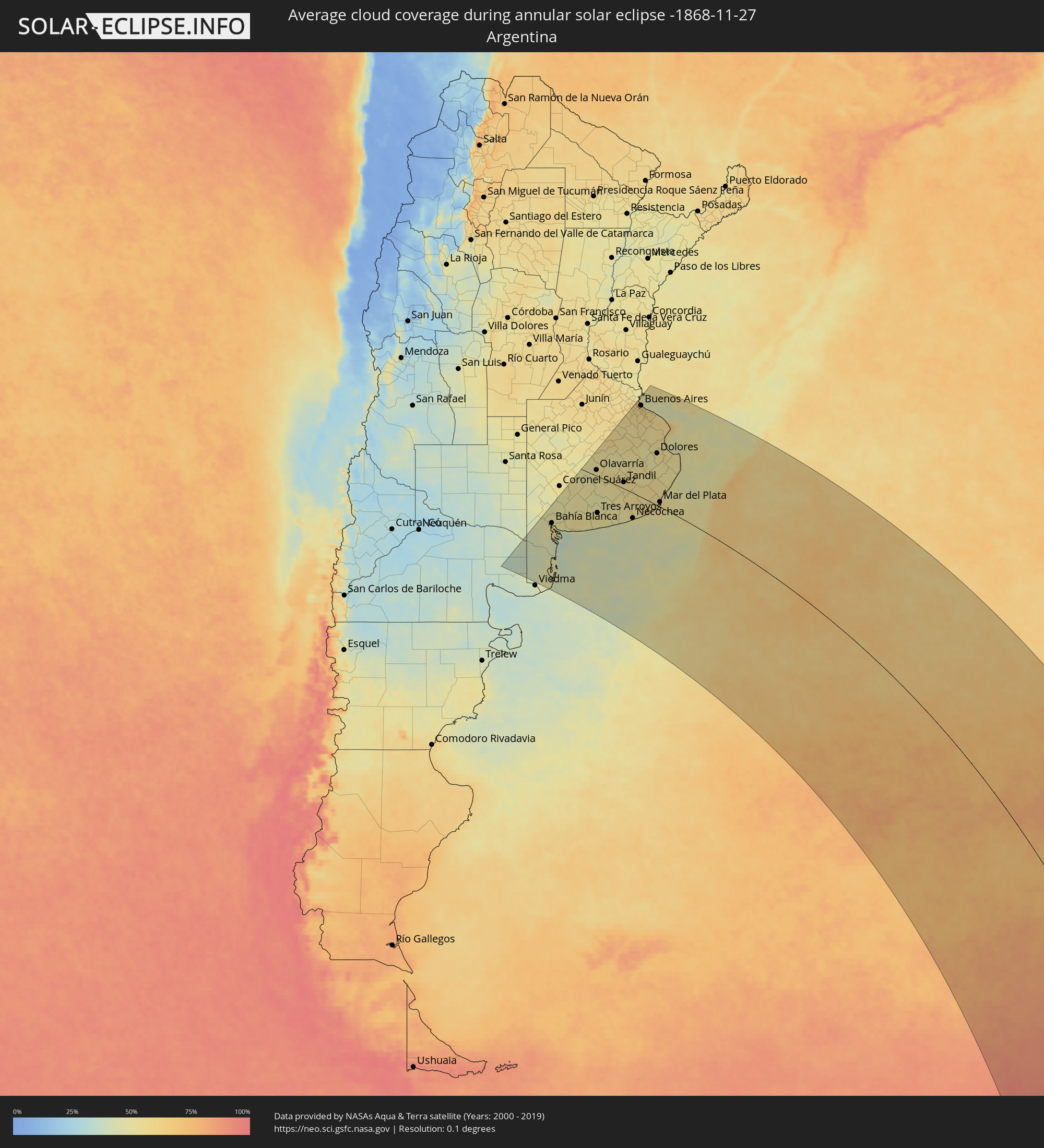 Argentina
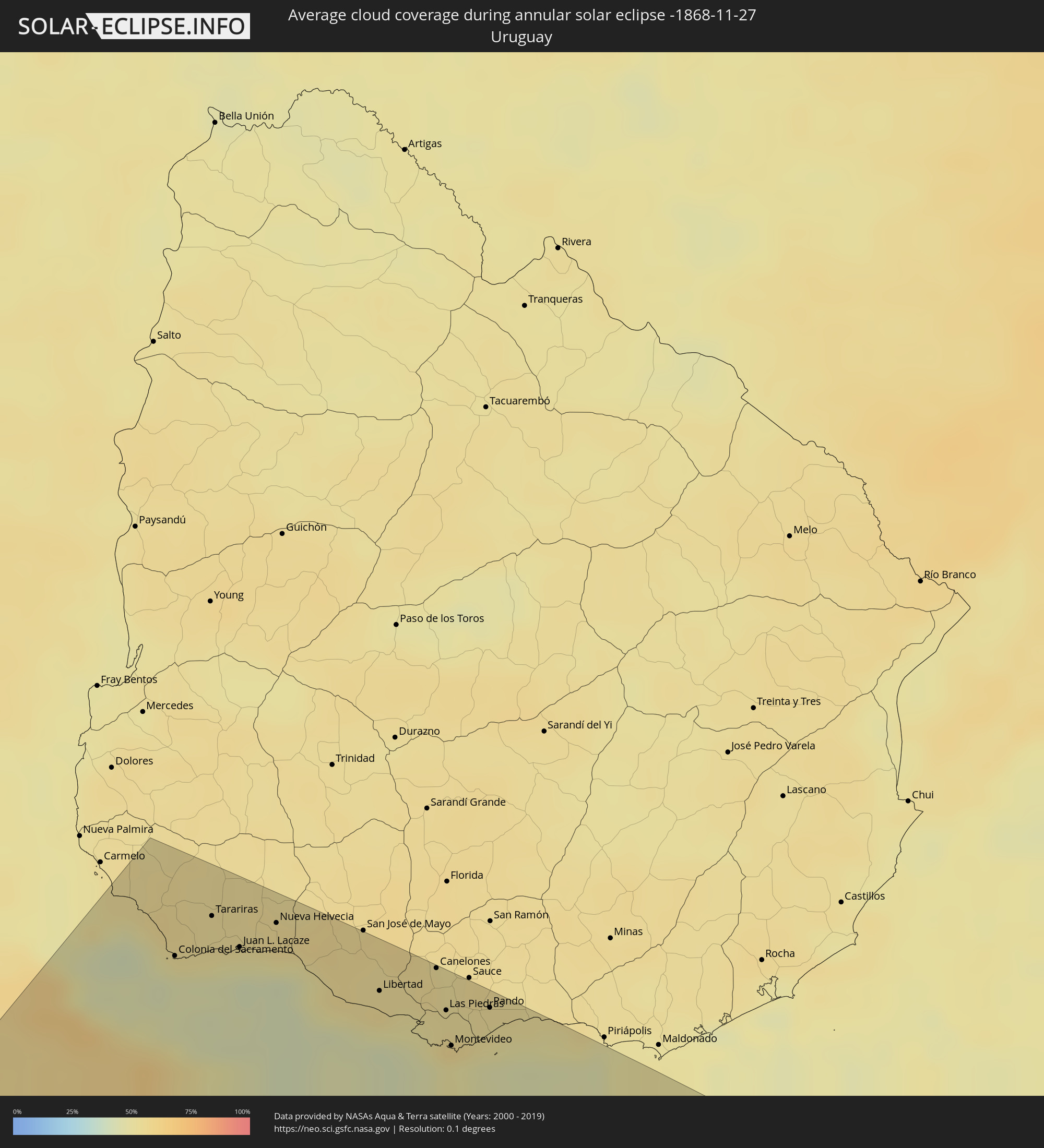 Uruguay
 South Georgia and the South Sandwich Islands
Cities inside the path of the eclipse
The following table shows all locations with a population of more than 5,000 inside the eclipse path. Cities which have more than 100,000 inhabitants are marked bold. A click at the locations opens a detailed map.
| City | Type | Eclipse duration | Local time of max. eclipse | Distance to central line | Ø Cloud coverage |
 Bahía Blanca, Buenos Aires
|
annular | - | 04:46:21 UTC-04:16 | 235 km | 51% |
|
Punta Alta, Buenos Aires
|
annular | - | 04:46:30 UTC-04:16 | 243 km | 46% |
|
Coronel Dorrego, Buenos Aires
|
annular | - | 04:45:52 UTC-04:16 | 200 km | 53% |
|
Olavarría, Buenos Aires
|
annular | - | 04:42:36 UTC-04:16 | 23 km | 54% |
|
Tres Arroyos, Buenos Aires
|
annular | - | 04:44:50 UTC-04:16 | 128 km | 53% |
|
Azul, Buenos Aires
|
annular | - | 04:42:11 UTC-04:16 | 50 km | 52% |
|
Tandil, Buenos Aires
|
annular | - | 04:42:40 UTC-04:16 | 32 km | 55% |
|
Necochea, Buenos Aires
|
annular | - | 04:44:24 UTC-04:16 | 86 km | 47% |
|
Pontevedra, Buenos Aires
|
annular | - | 04:38:33 UTC-04:16 | 299 km | 58% |
|
Morón, Buenos Aires
|
annular | - | 04:38:22 UTC-04:16 | 312 km | 60% |
|
San Isidro, Buenos Aires
|
annular | - | 04:38:03 UTC-04:16 | 333 km | 59% |
|
Villa Santa Rita, Buenos Aires F.D.
|
annular | - | 04:38:14 UTC-04:16 | 321 km | 64% |
|
Villa Lugano, Buenos Aires F.D.
|
annular | - | 04:38:20 UTC-04:16 | 314 km | 61% |
|
Colegiales, Buenos Aires F.D.
|
annular | - | 04:38:10 UTC-04:16 | 326 km | 62% |
|
Adrogué, Buenos Aires
|
annular | - | 04:38:28 UTC-04:16 | 305 km | 61% |
|
Retiro, Buenos Aires F.D.
|
annular | - | 04:38:09 UTC-04:16 | 327 km | 62% |
|
Buenos Aires, Buenos Aires F.D.
|
annular | - | 04:38:11 UTC-04:16 | 324 km | 62% |
|
Quilmes, Buenos Aires
|
annular | - | 04:38:18 UTC-04:16 | 318 km | 63% |
|
La Plata, Buenos Aires
|
annular | - | 04:38:26 UTC-04:16 | 309 km | 64% |
 Colonia del Sacramento, Colonia
|
annular | - | 05:09:38 UTC-03:44 | 360 km | 45% |
|
Dolores, Buenos Aires
|
annular | - | 04:40:25 UTC-04:16 | 179 km | 55% |
|
Tarariras, Colonia
|
annular | - | 05:09:14 UTC-03:44 | 388 km | 53% |
|
Mar del Plata, Buenos Aires
|
annular | - | 04:42:59 UTC-04:16 | 22 km | 58% |
|
Juan L. Lacaze, Colonia
|
annular | - | 05:09:23 UTC-03:44 | 380 km | 48% |
|
Rosario, Colonia
|
annular | - | 05:09:10 UTC-03:44 | 394 km | 53% |
|
Nueva Helvecia, Colonia
|
annular | - | 05:09:06 UTC-03:44 | 399 km | 55% |
|
Villa Gesell, Buenos Aires
|
annular | - | 04:41:34 UTC-04:16 | 113 km | 53% |
|
San Clemente del Tuyú, Buenos Aires
|
annular | - | 04:40:02 UTC-04:16 | 214 km | 52% |
|
Libertad, San José
|
annular | - | 05:09:18 UTC-03:44 | 389 km | 55% |
|
Delta del Tigre, San José
|
annular | - | 05:09:22 UTC-03:44 | 386 km | 46% |
|
Canelones, Canelones
|
annular | - | 05:08:58 UTC-03:44 | 414 km | 55% |
|
La Paz, Canelones
|
annular | - | 05:09:18 UTC-03:44 | 393 km | 56% |
|
Las Piedras, Canelones
|
annular | - | 05:09:15 UTC-03:44 | 396 km | 53% |
|
Progreso, Canelones
|
annular | - | 05:09:09 UTC-03:44 | 403 km | 53% |
|
Montevideo, Montevideo
|
annular | - | 05:09:30 UTC-03:44 | 380 km | 50% |
|
Paso de Carrasco, Canelones
|
annular | - | 05:09:22 UTC-03:44 | 389 km | 49% |
|
Joaquín Suárez, Canelones
|
annular | - | 05:09:10 UTC-03:44 | 403 km | 53% |
|
Colonia Nicolich, Canelones
|
annular | - | 05:09:17 UTC-03:44 | 395 km | 51% |
|
Pando, Canelones
|
annular | - | 05:09:06 UTC-03:44 | 407 km | 53% |
 Grytviken
|
annular | - | 07:27:20 UTC-02:00 | 10 km | 93% |