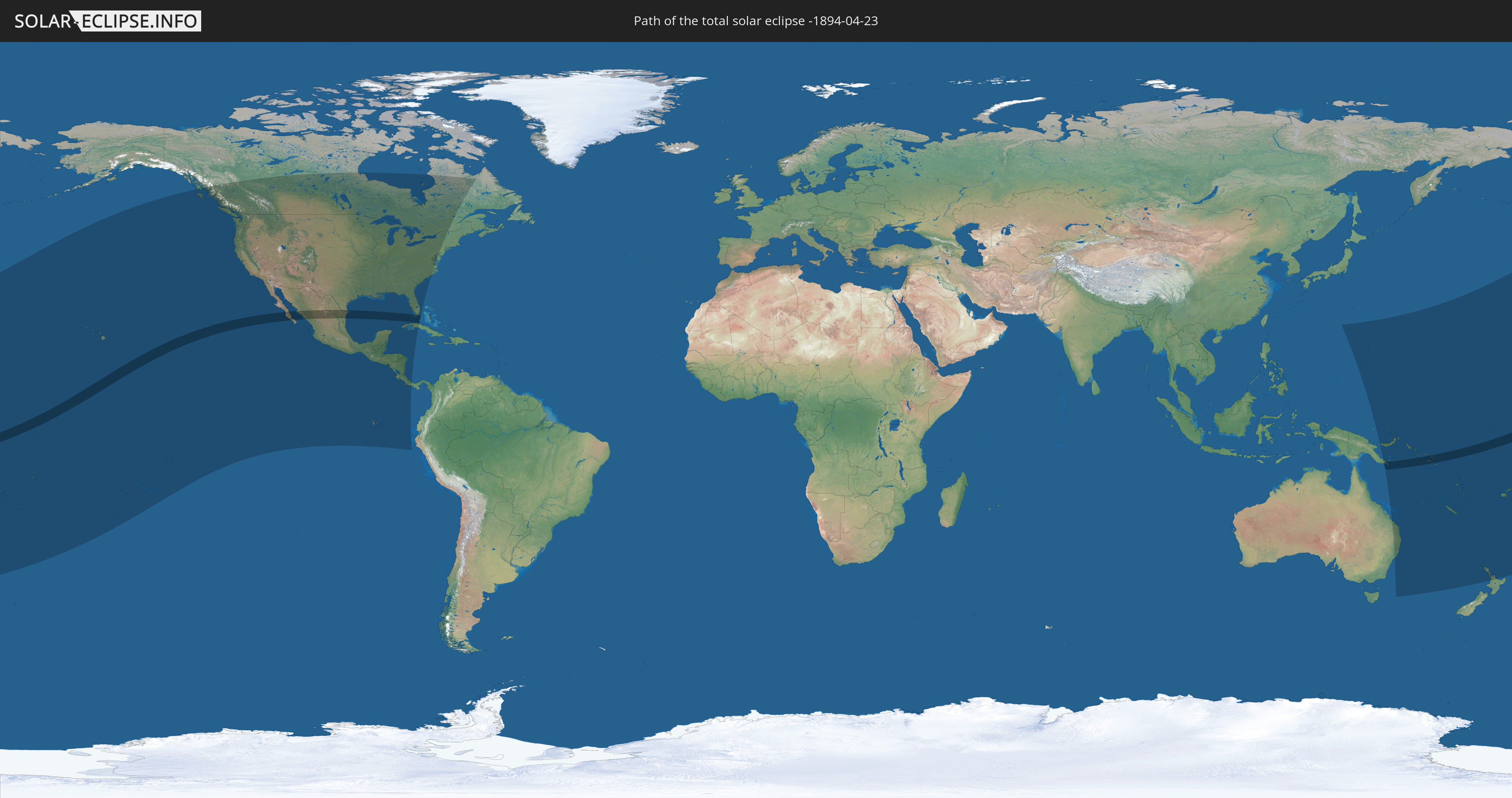
Total solar eclipse of 04/23/-1894
| Day of week: | Wednesday |
| Maximum duration of eclipse: | 06m45s |
| Maximum width of eclipse path: | 251 km |
| Saros cycle: | 8 |
| Coverage: | 100% |
| Magnitude: | 1.077 |
| Gamma: | 0.1144 |
Wo kann man die Sonnenfinsternis vom 04/23/-1894 sehen?
Die Sonnenfinsternis am 04/23/-1894 kann man in 40 Ländern als partielle Sonnenfinsternis beobachten.
Der Finsternispfad verläuft durch 9 Länder. Nur in diesen Ländern ist sie als total Sonnenfinsternis zu sehen.
In den folgenden Ländern ist die Sonnenfinsternis total zu sehen
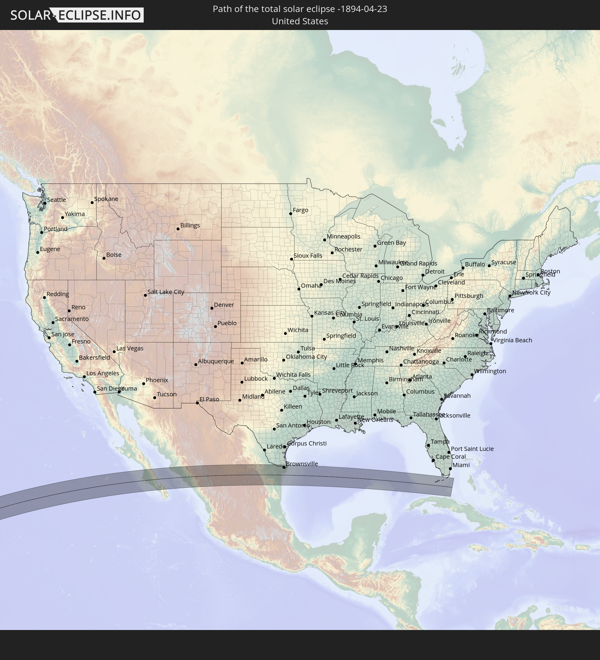 United States
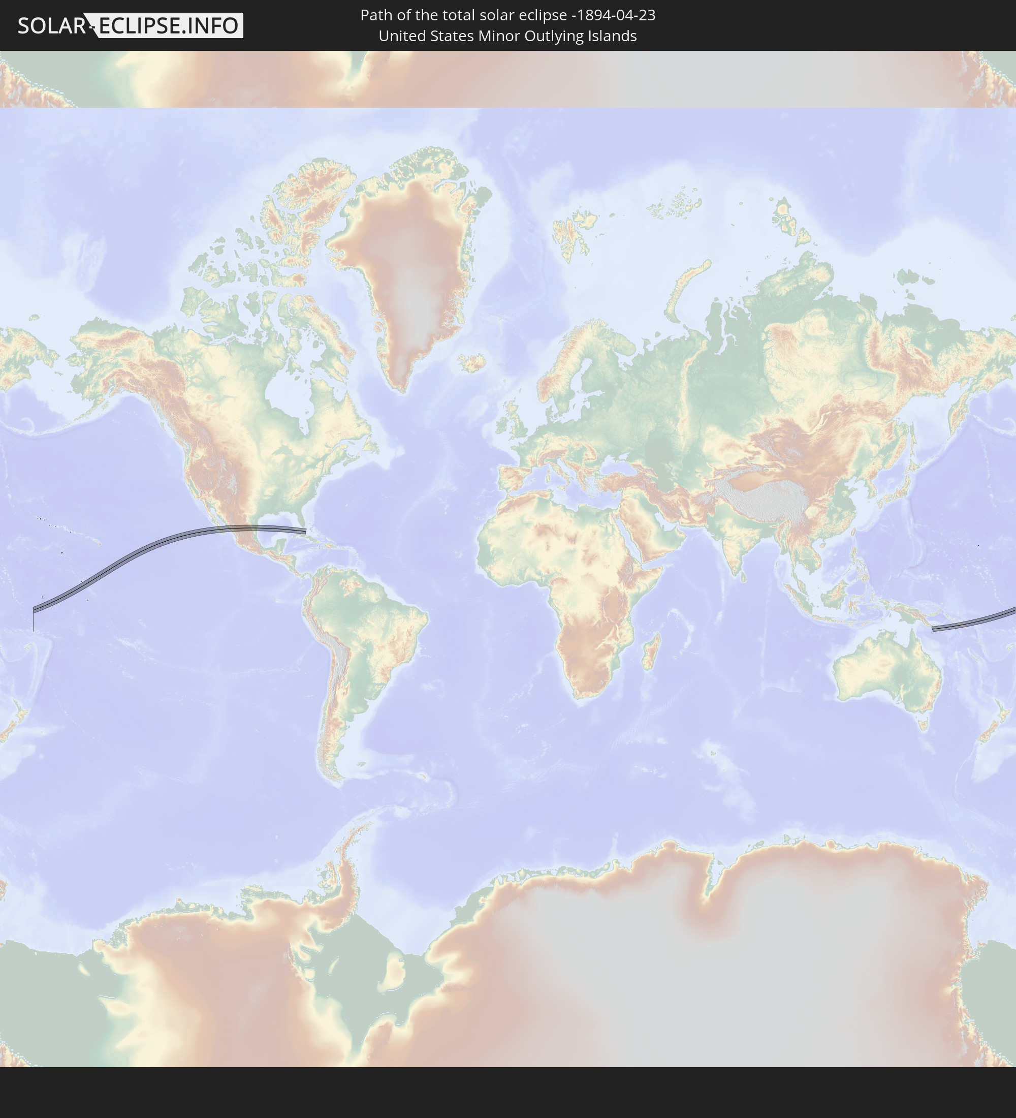 United States Minor Outlying Islands
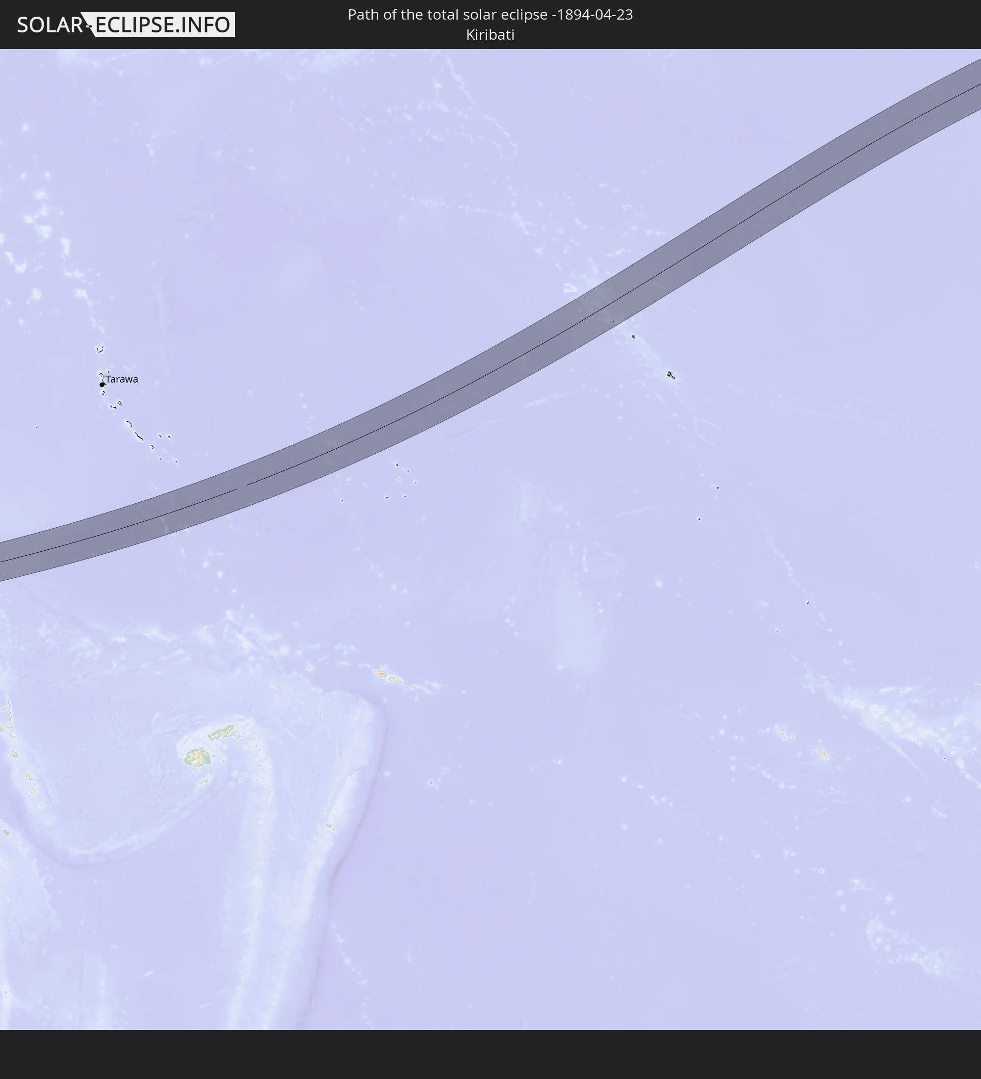 Kiribati
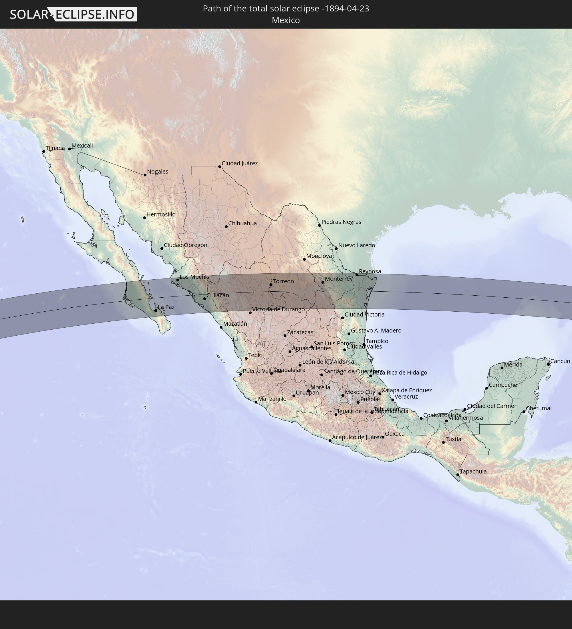 Mexico
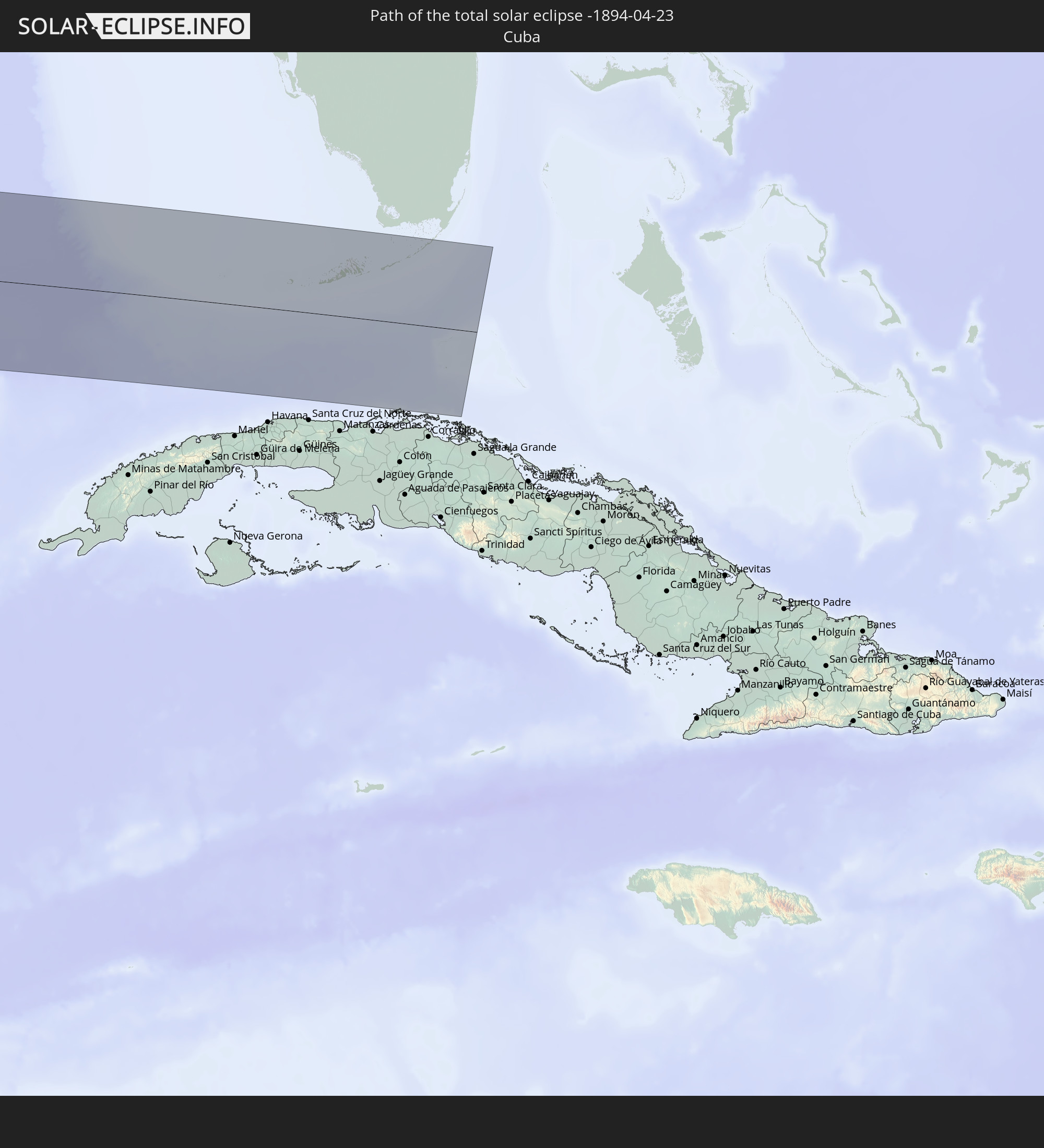 Cuba
Cuba
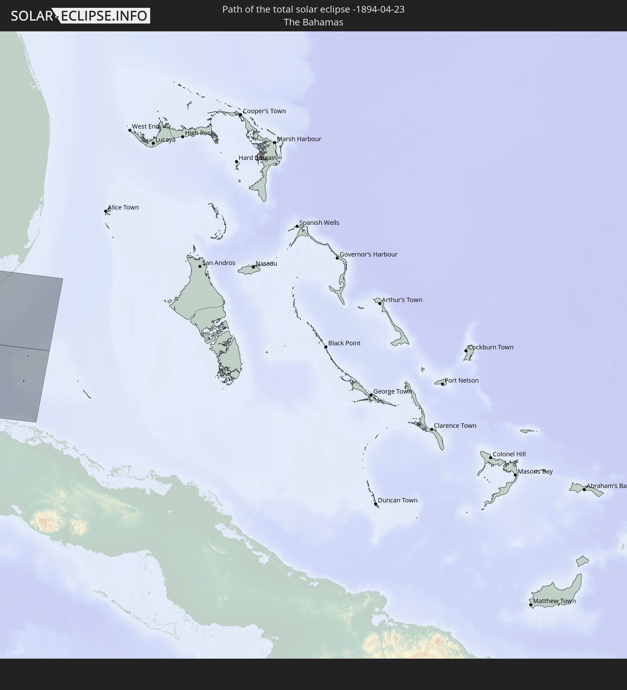 The Bahamas
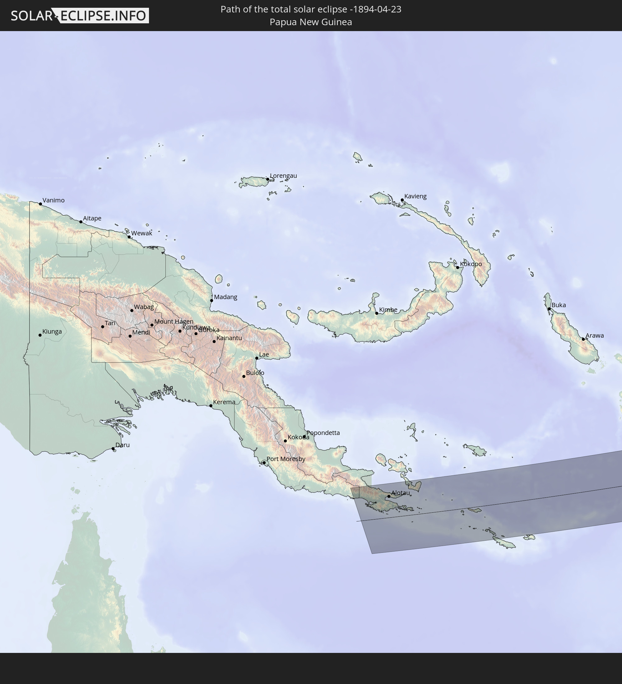 Papua New Guinea
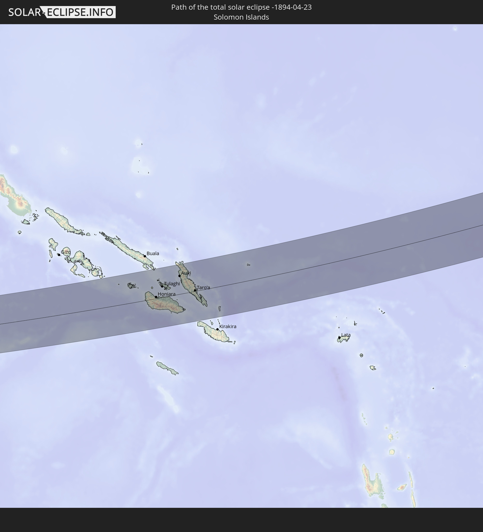 Solomon Islands
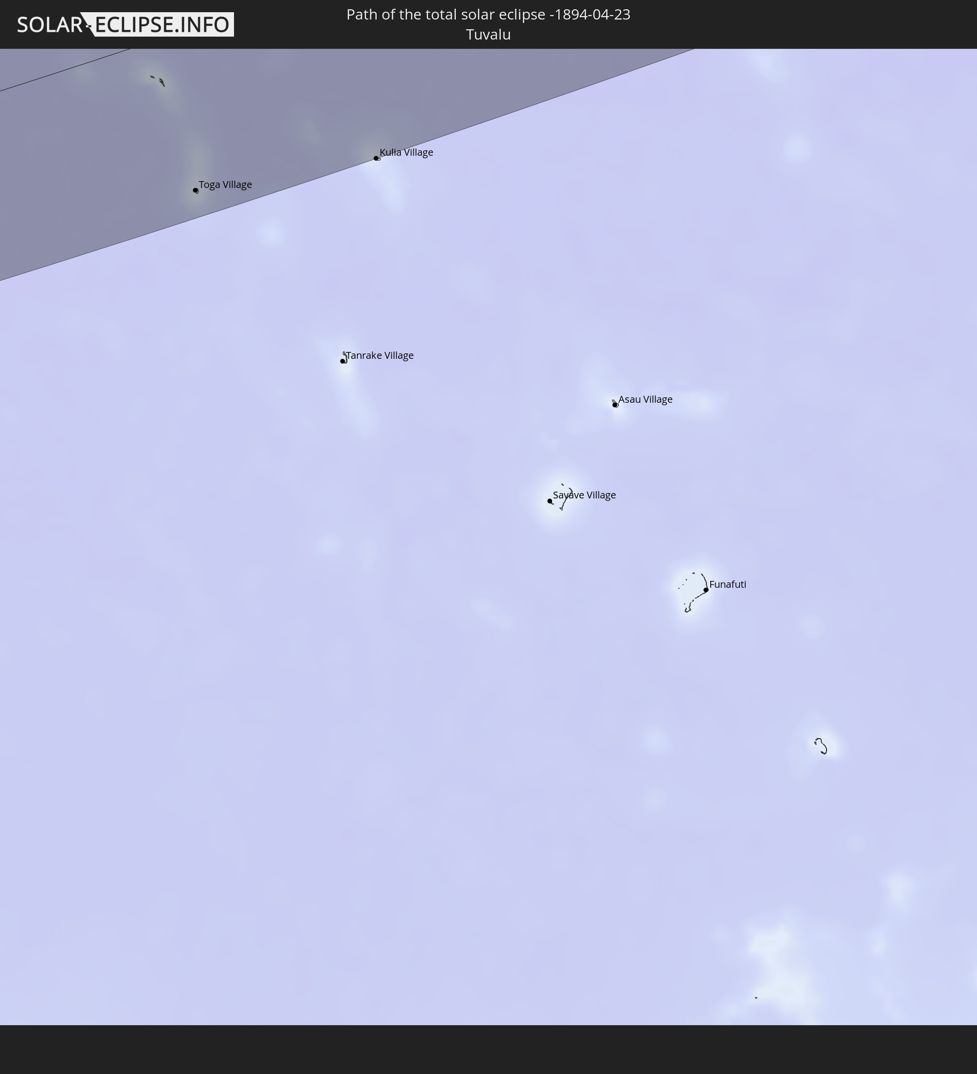 Tuvalu
In den folgenden Ländern ist die Sonnenfinsternis partiell zu sehen
 Fiji
Fiji
 United States
 New Zealand
 United States Minor Outlying Islands
 Wallis and Futuna
 Tonga
Tonga
 Kiribati
 Samoa
Samoa
 Tokelau
 American Samoa
 Niue
Niue
 Cook Islands
 French Polynesia
 Canada
 Mexico
 Greenland
 Guatemala
 Ecuador
 El Salvador
 Honduras
 Belize
 Nicaragua
 Costa Rica
 Cuba
Cuba
 Panama
 Cayman Islands
 The Bahamas
 Australia
 Japan
Japan
 Federated States of Micronesia
 Papua New Guinea
 Guam
Guam
 Northern Mariana Islands
 Solomon Islands
 New Caledonia
 Marshall Islands
 Vanuatu
 Nauru
Nauru
 Norfolk Island
 Tuvalu
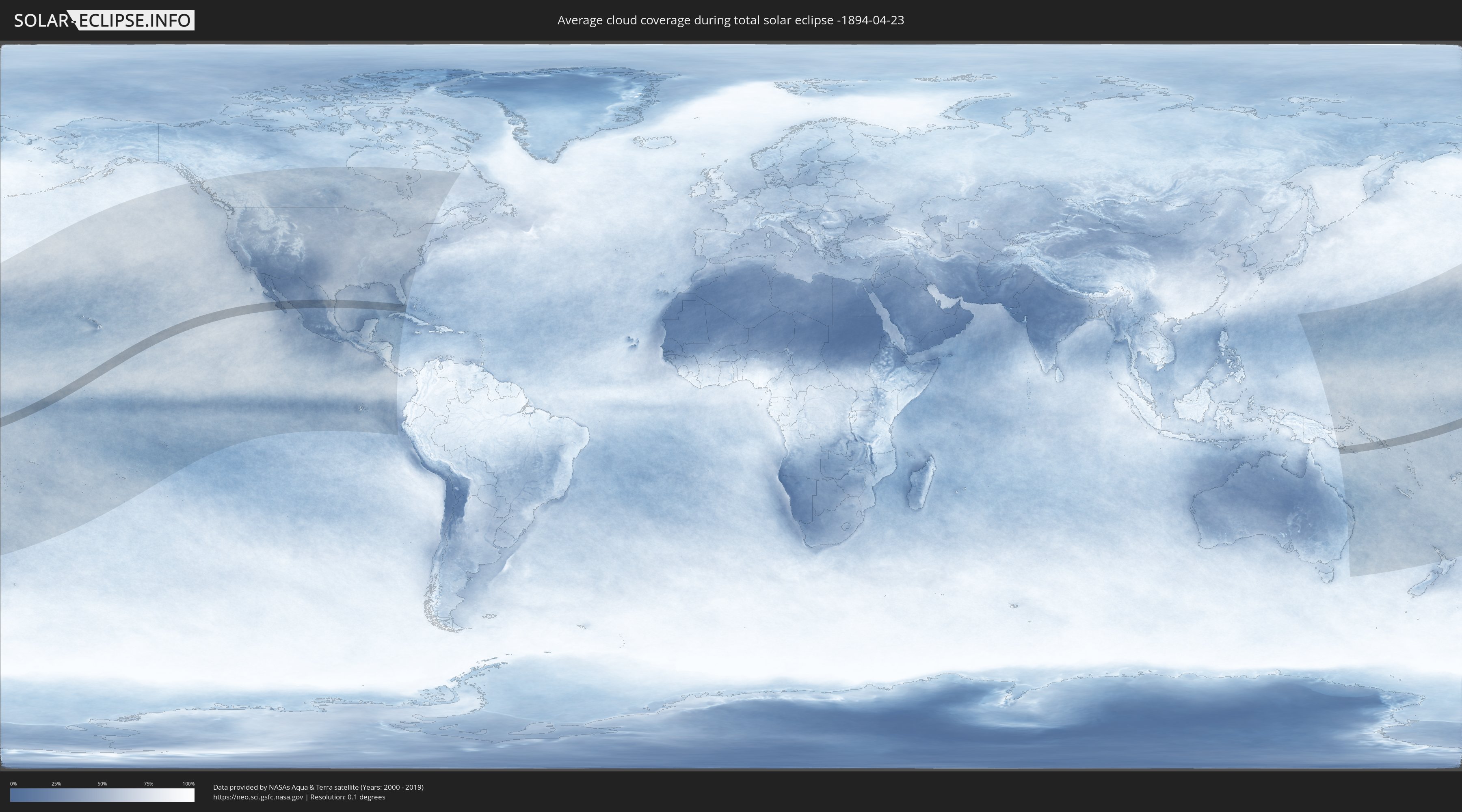
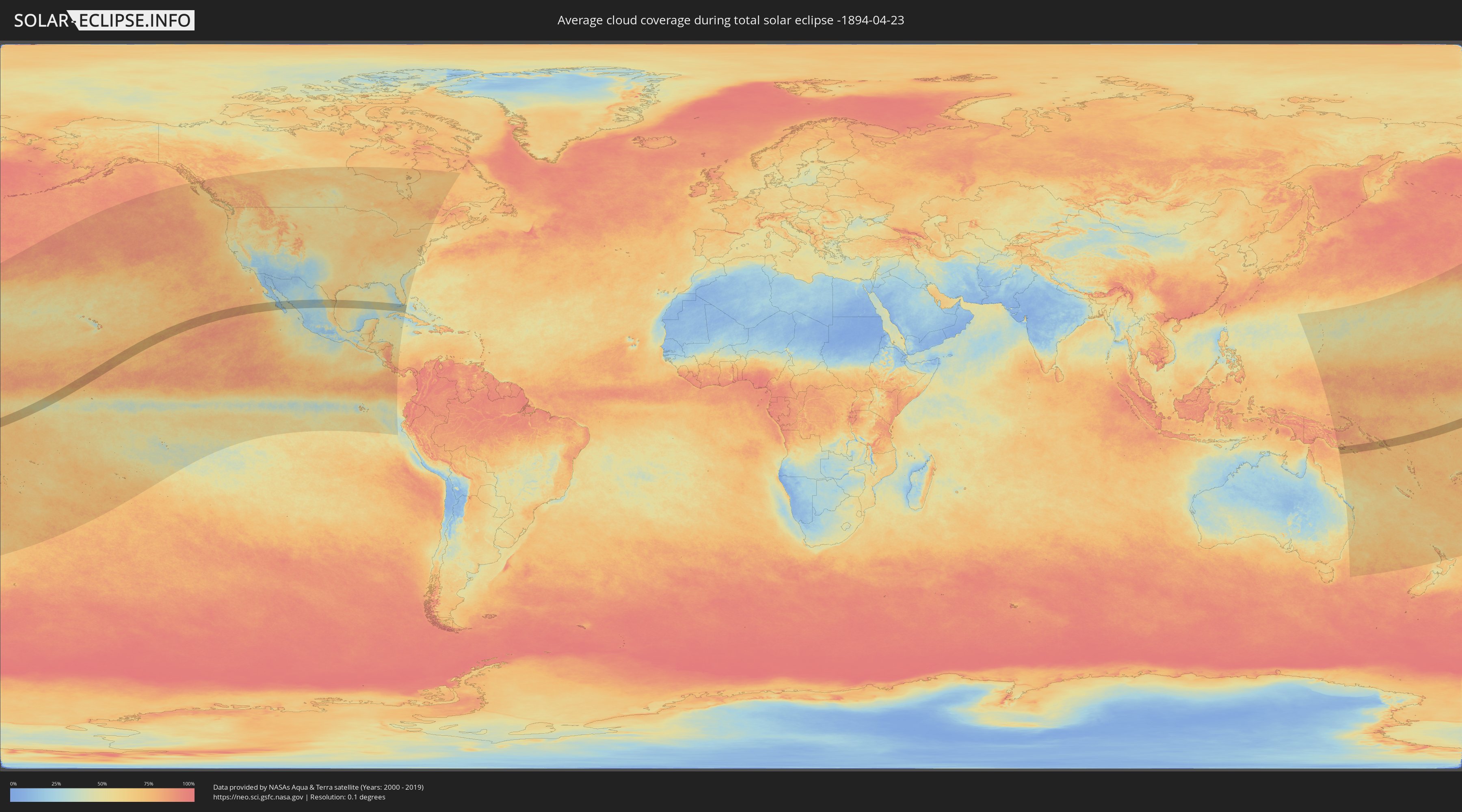
How will be the weather during the total solar eclipse on 04/23/-1894?
Where is the best place to see the total solar eclipse of 04/23/-1894?
The following maps show the average cloud coverage for the day of the total solar eclipse.
With the help of these maps, it is possible to find the place along the eclipse path, which has the best
chance of a cloudless sky.
Nevertheless, you should consider local circumstances and inform about the weather of your chosen
observation site.
The data is provided by NASAs satellites
AQUA and TERRA.
The cloud maps are averaged over a period of 19 years (2000 - 2019).
Detailed country maps
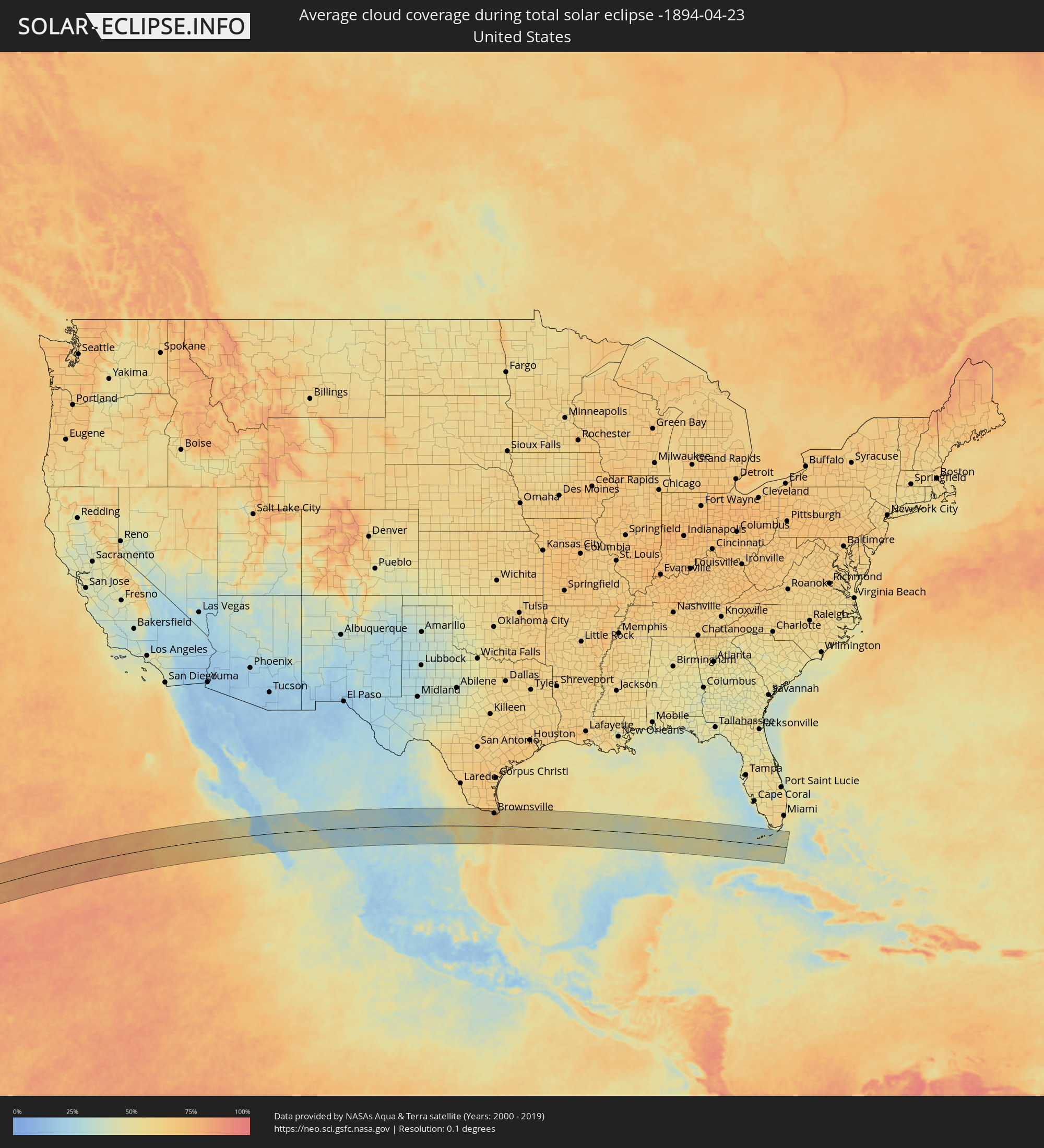 United States
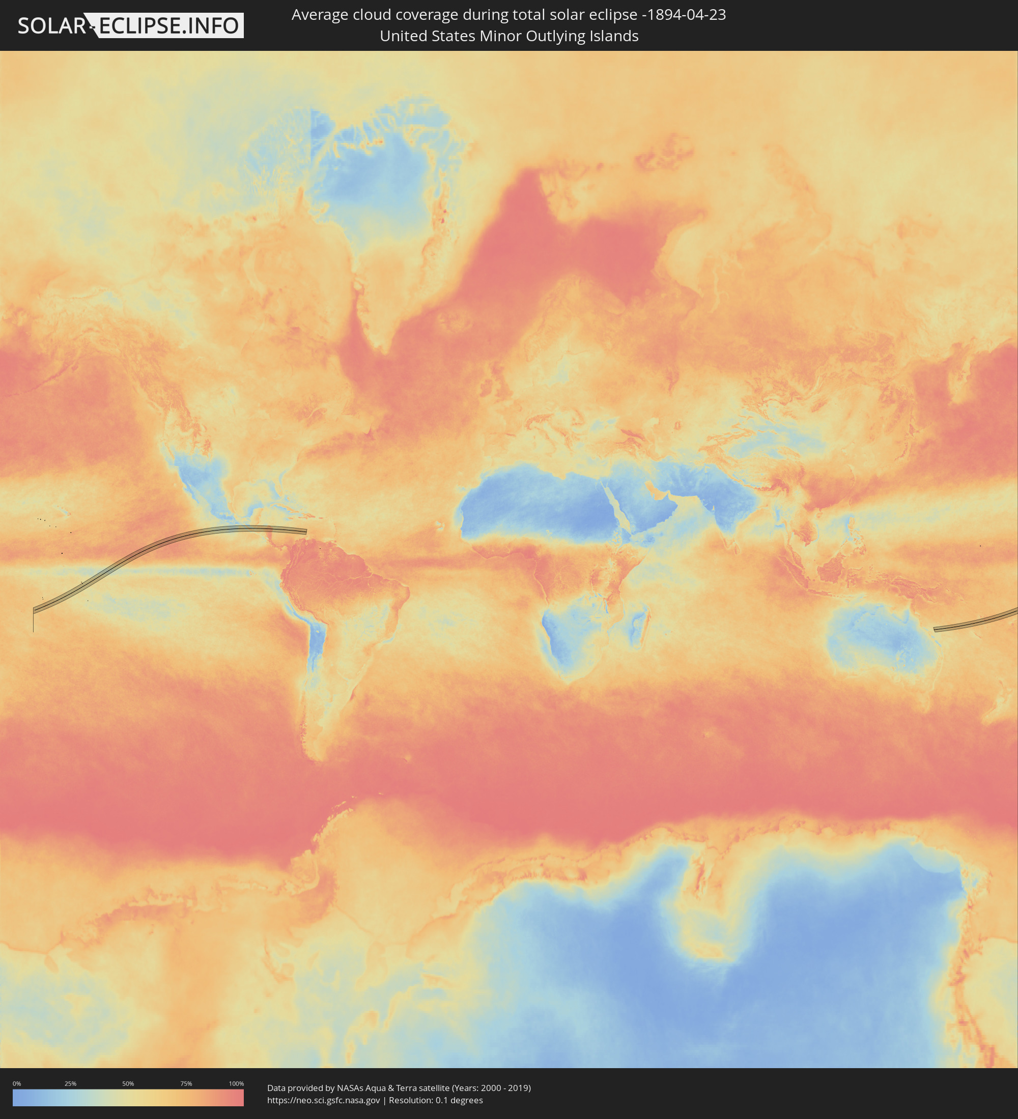 United States Minor Outlying Islands
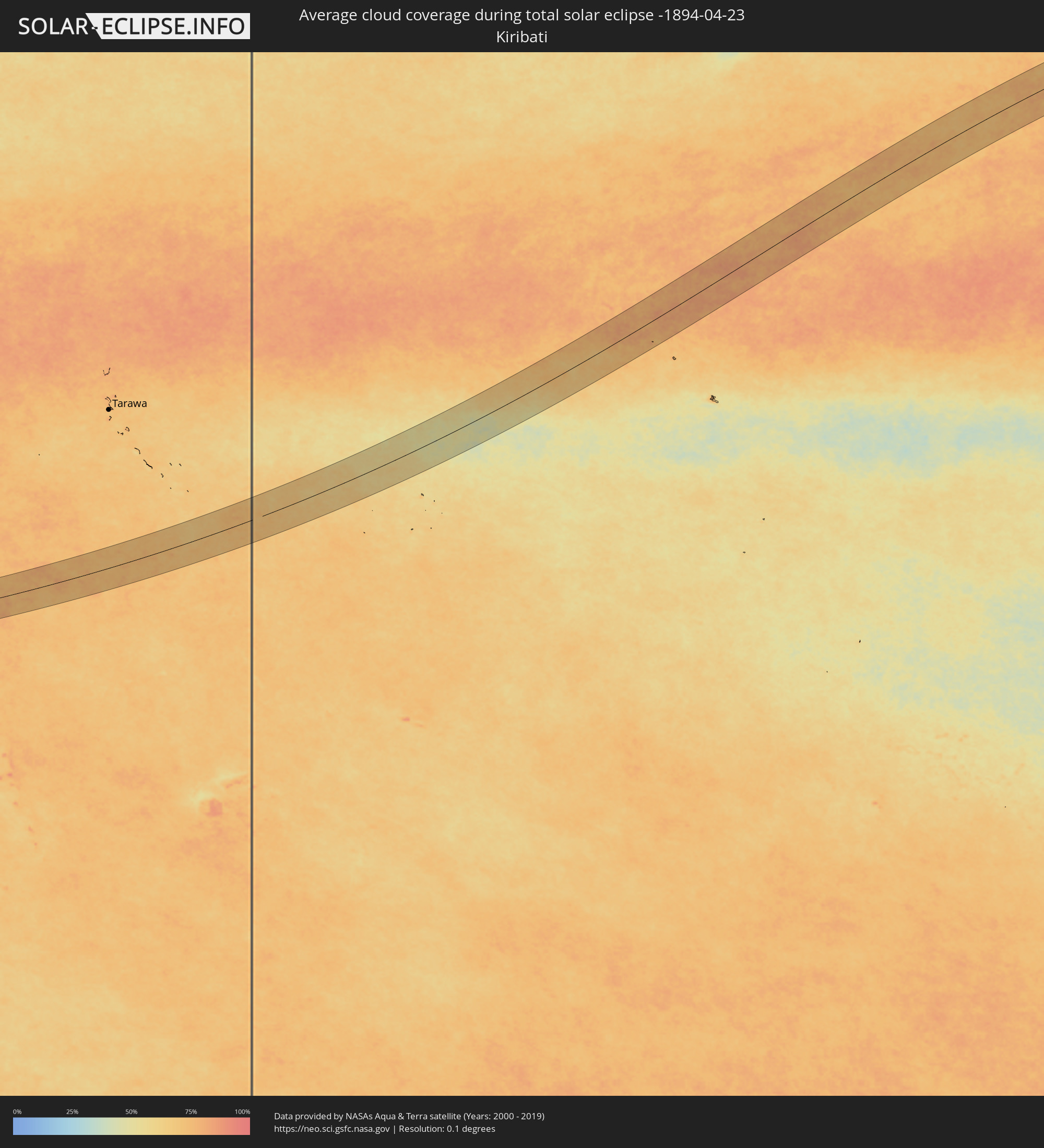 Kiribati
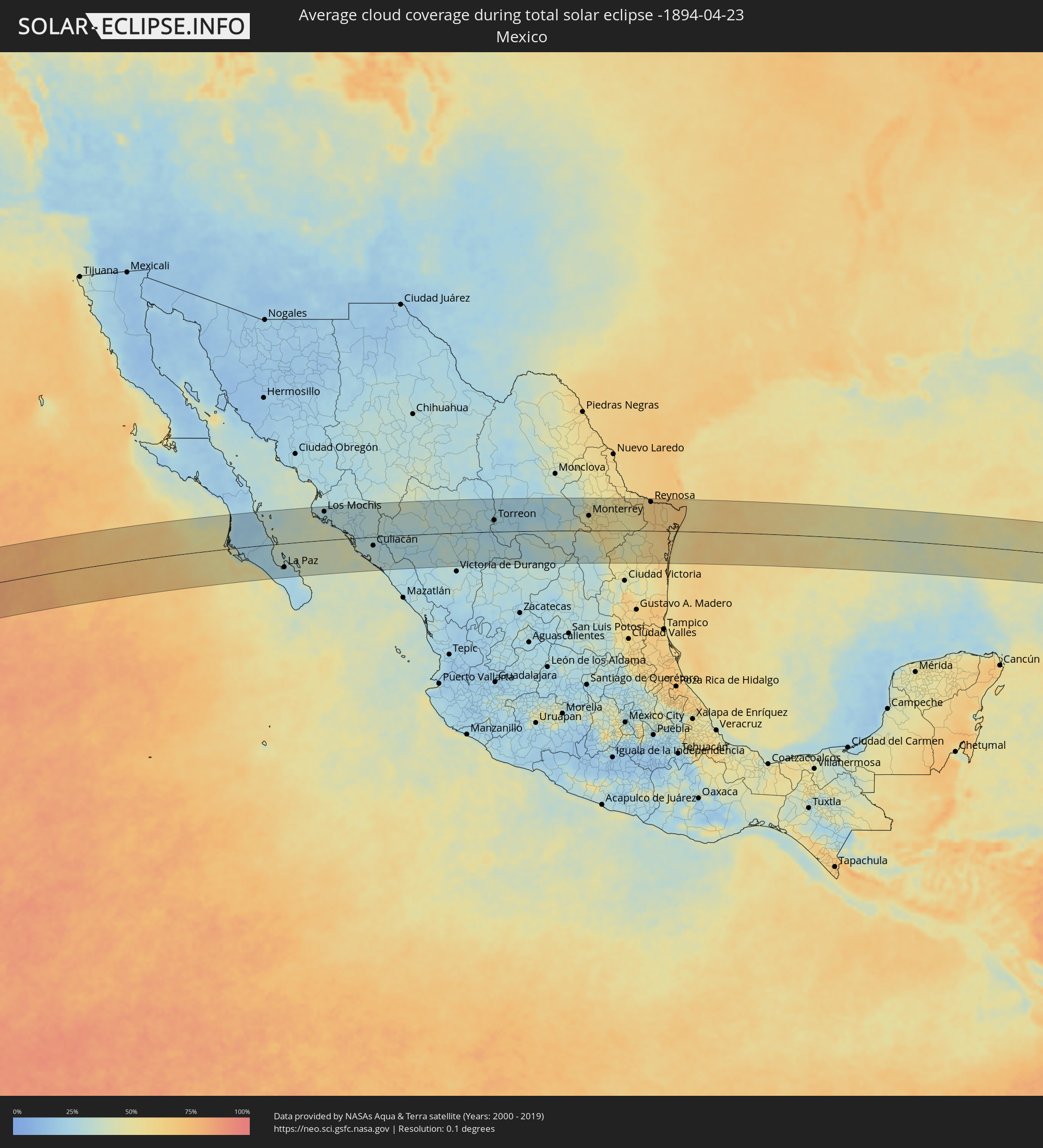 Mexico
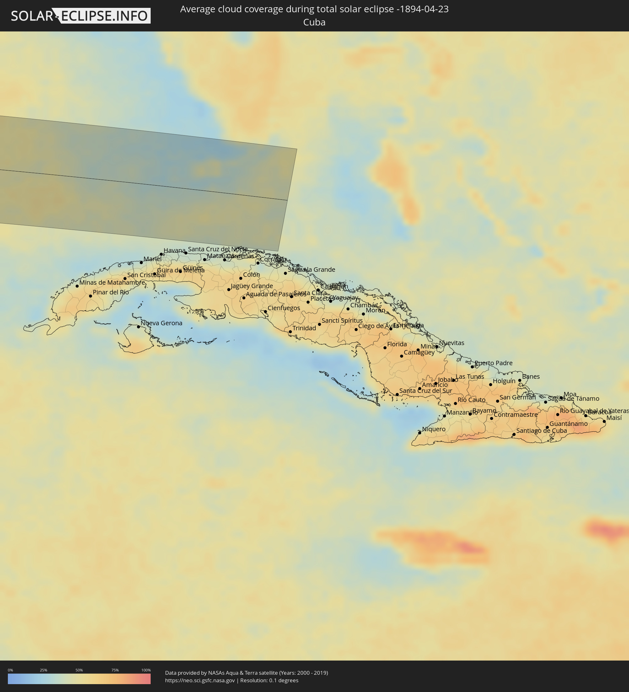 Cuba
Cuba
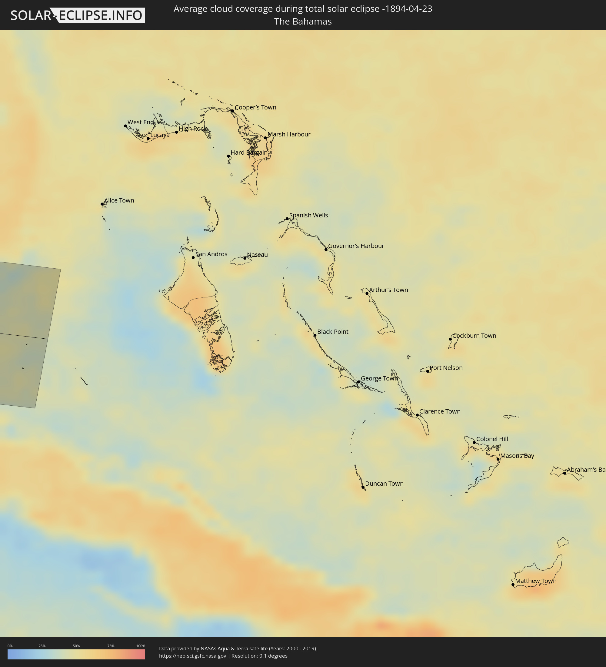 The Bahamas
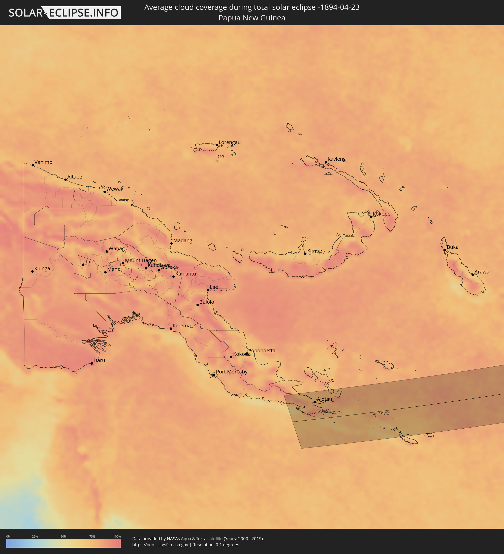 Papua New Guinea
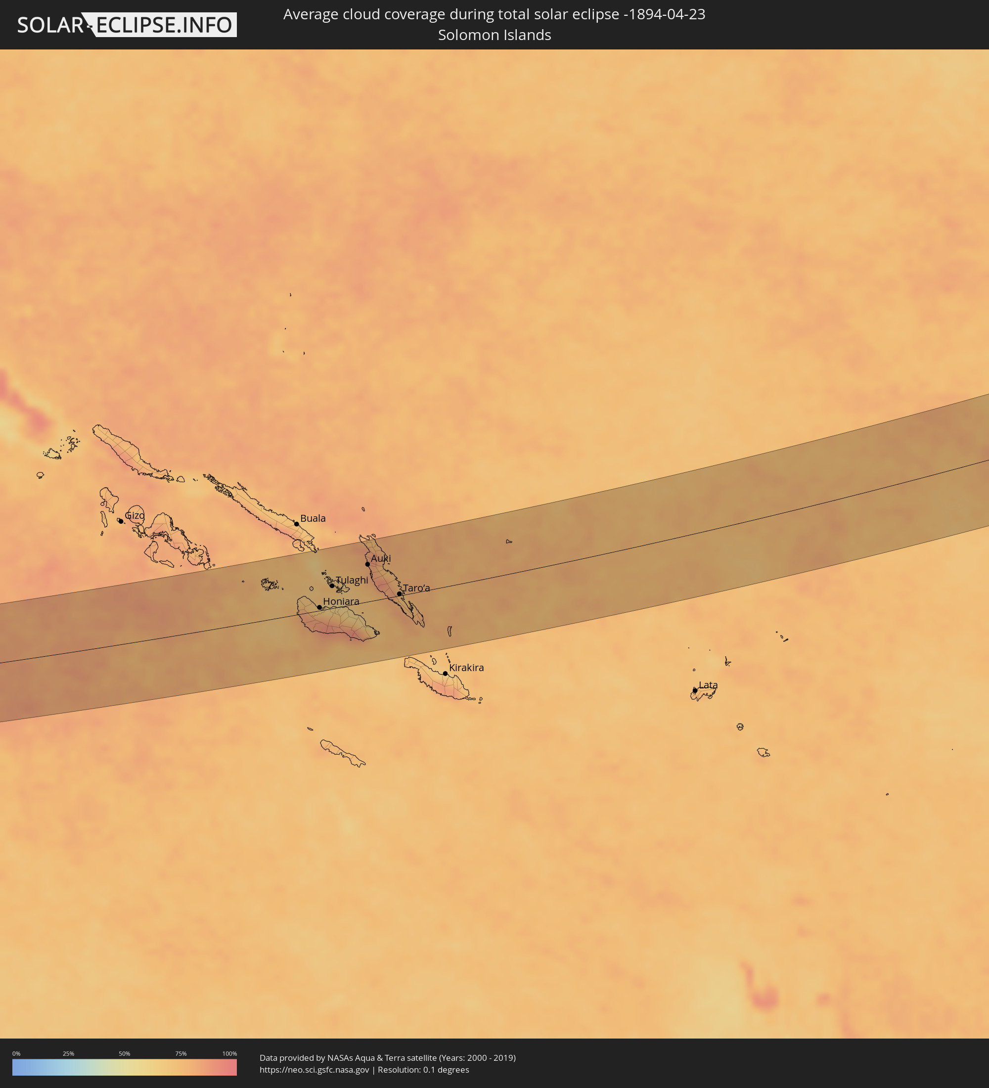 Solomon Islands
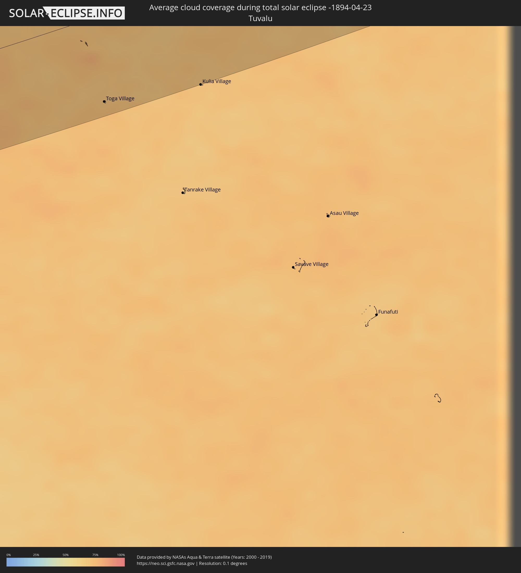 Tuvalu
Cities inside the path of the eclipse
The following table shows all locations with a population of more than 5,000 inside the eclipse path. Cities which have more than 100,000 inhabitants are marked bold. A click at the locations opens a detailed map.
| City | Type | Eclipse duration | Local time of max. eclipse | Distance to central line | Ø Cloud coverage |
|
Ciudad Constitución, Baja California Sur
|
total | - | 16:08:52 UTC-07:05 | 33 km | 21% |
|
La Paz, Baja California Sur
|
total | - | 16:10:25 UTC-07:05 | 79 km | 25% |
|
Ahome, Sinaloa
|
total | - | 16:11:27 UTC-07:05 | 109 km | 29% |
|
Los Mochis, Sinaloa
|
total | - | 16:11:39 UTC-07:05 | 94 km | 26% |
|
Juan Jose Rios, Sinaloa
|
total | - | 16:11:49 UTC-07:05 | 88 km | 28% |
|
Leyva Solano, Sinaloa
|
total | - | 16:12:01 UTC-07:05 | 76 km | 30% |
|
Guasave, Sinaloa
|
total | - | 16:12:11 UTC-07:05 | 65 km | 30% |
|
Guamúchil, Sinaloa
|
total | - | 16:12:35 UTC-07:05 | 50 km | 28% |
|
Navolato, Sinaloa
|
total | - | 16:13:02 UTC-07:05 | 29 km | 32% |
|
Licenciado Benito Juárez (Campo Gobierno), Sinaloa
|
total | - | 16:13:12 UTC-07:05 | 42 km | 30% |
|
Villa de Costa Rica, Sinaloa
|
total | - | 16:13:21 UTC-07:05 | 51 km | 33% |
|
Culiacán, Sinaloa
|
total | - | 16:13:20 UTC-07:05 | 29 km | 28% |
|
El Dorado, Sinaloa
|
total | - | 16:13:24 UTC-07:05 | 81 km | 39% |
|
El Rosario, Sinaloa
|
total | - | 16:13:35 UTC-07:05 | 89 km | 31% |
|
Santiago Papasquiaro, Durango
|
total | - | 16:44:08 UTC-06:36 | 11 km | 30% |
|
San Miguel de Papasquiaro, Durango
|
total | - | 16:44:14 UTC-06:36 | 35 km | 27% |
|
Canatlán, Durango
|
total | - | 16:44:46 UTC-06:36 | 71 km | 30% |
|
Guadalupe Victoria, Durango
|
total | - | 16:45:19 UTC-06:36 | 82 km | 26% |
|
Poanas, Durango
|
total | - | 16:45:29 UTC-06:36 | 64 km | 24% |
|
Torreon, Coahuila
|
total | - | 16:45:41 UTC-06:36 | 38 km | 26% |
|
Juan Aldama, Zacatecas
|
total | - | 16:45:55 UTC-06:36 | 101 km | 29% |
|
Matamoros, Coahuila
|
total | - | 16:45:49 UTC-06:36 | 36 km | 23% |
|
Parras de la Fuente, Coahuila
|
total | - | 16:46:37 UTC-06:36 | 24 km | 32% |
|
Saltillo, Coahuila
|
total | - | 16:47:26 UTC-06:36 | 21 km | 40% |
|
García, Nuevo León
|
total | - | 16:47:37 UTC-06:36 | 64 km | 41% |
|
Mitras Poniente, Nuevo León
|
total | - | 16:47:44 UTC-06:36 | 60 km | 50% |
|
Monterrey, Nuevo León
|
total | - | 16:47:50 UTC-06:36 | 49 km | 50% |
|
Apodaca, Nuevo León
|
total | - | 16:47:55 UTC-06:36 | 58 km | 51% |
|
Fraccionamiento Real Palmas, Nuevo León
|
total | - | 16:47:53 UTC-06:36 | 74 km | 49% |
|
Santiago, Nuevo León
|
total | - | 16:48:00 UTC-06:36 | 21 km | 54% |
|
Allende, Nuevo León
|
total | - | 16:48:07 UTC-06:36 | 4 km | 60% |
|
Cadereyta, Nuevo León
|
total | - | 16:48:04 UTC-06:36 | 38 km | 55% |
|
Montemorelos, Nuevo León
|
total | - | 16:48:15 UTC-06:36 | 6 km | 58% |
|
Hidalgo, Nuevo León
|
total | - | 16:48:14 UTC-06:36 | 69 km | 51% |
|
Linares, Nuevo León
|
total | - | 16:48:30 UTC-06:36 | 42 km | 52% |
|
Reynosa, Tamaulipas
|
total | - | 16:48:57 UTC-06:36 | 95 km | 65% |
|
Hidalgo, Texas
|
total | - | 17:25:33 UTC-06:00 | 97 km | 65% |
|
San Fernando, Tamaulipas
|
total | - | 16:49:20 UTC-06:36 | 42 km | 60% |
|
Río Bravo, Tamaulipas
|
total | - | 16:49:05 UTC-06:36 | 85 km | 66% |
|
Donna, Texas
|
total | - | 17:25:39 UTC-06:00 | 105 km | 67% |
|
Weslaco, Texas
|
total | - | 17:25:41 UTC-06:00 | 104 km | 69% |
|
Progreso, Texas
|
total | - | 17:25:44 UTC-06:00 | 97 km | 68% |
|
Mercedes, Texas
|
total | - | 17:25:44 UTC-06:00 | 103 km | 66% |
|
La Feria, Texas
|
total | - | 17:25:47 UTC-06:00 | 104 km | 67% |
|
Valle Hermoso, Tamaulipas
|
total | - | 16:49:19 UTC-06:36 | 50 km | 61% |
|
San Benito, Texas
|
total | - | 17:25:53 UTC-06:00 | 102 km | 68% |
|
Heroica Matamoros, Tamaulipas
|
total | - | 16:49:26 UTC-06:36 | 74 km | 69% |
|
Brownsville, Texas
|
total | - | 17:26:02 UTC-06:00 | 76 km | 69% |
|
Cameron Park Colonia, Texas
|
total | - | 17:26:01 UTC-06:00 | 84 km | 69% |
|
Cameron Park, Texas
|
total | - | 17:26:01 UTC-06:00 | 83 km | 69% |
|
Los Fresnos, Texas
|
total | - | 17:25:59 UTC-06:00 | 95 km | 69% |
|
Port Isabel, Texas
|
total | - | 17:26:08 UTC-06:00 | 96 km | 68% |
|
Key West, Florida
|
total | - | 18:30:34 UTC-05:00 | 35 km | 33% |
|
Marathon, Florida
|
total | - | 18:30:31 UTC-05:00 | 60 km | 34% |
|
Islamorada, Florida
|
total | - | 18:30:27 UTC-05:00 | 89 km | 37% |
|
Alotau, Milne Bay
|
total | - | 06:06:04 UTC+10:00 | 59 km | 80% |
|
Honiara, Guadalcanal
|
total | - | 06:47:32 UTC+10:39 | 5 km | 70% |
|
Tulaghi, Central Province
|
total | - | 06:47:44 UTC+10:39 | 37 km | 71% |
|
Auki, Malaita
|
total | - | 06:48:03 UTC+10:39 | 62 km | 79% |
|
Taro’a, Choiseul
|
total | - | 06:48:01 UTC+10:39 | 2 km | 75% |
|
Toga Village, Nanumanga
|
total | - | 08:19:33 UTC+12:00 | 97 km | 72% |