Total solar eclipse of 07/24/-1954
| Day of week: | Sunday |
| Maximum duration of eclipse: | 04m51s |
| Maximum width of eclipse path: | 361 km |
| Saros cycle: | 24 |
| Coverage: | 100% |
| Magnitude: | 1.058 |
| Gamma: | -0.8494 |
Wo kann man die Sonnenfinsternis vom 07/24/-1954 sehen?
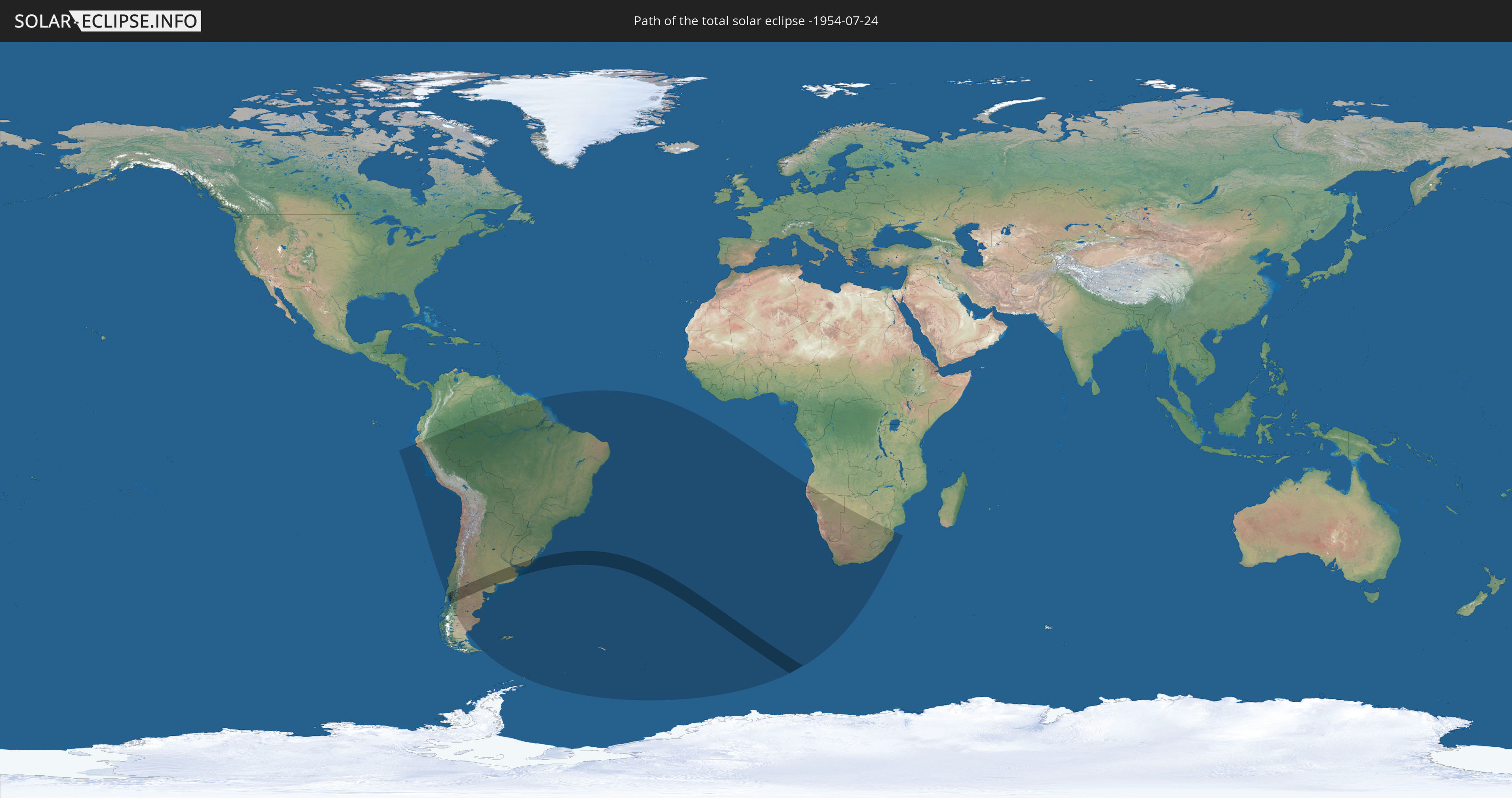
Die Sonnenfinsternis am 07/24/-1954 kann man in 25 Ländern als partielle Sonnenfinsternis beobachten.
Der Finsternispfad verläuft durch 5 Länder. Nur in diesen Ländern ist sie als total Sonnenfinsternis zu sehen.
In den folgenden Ländern ist die Sonnenfinsternis total zu sehen
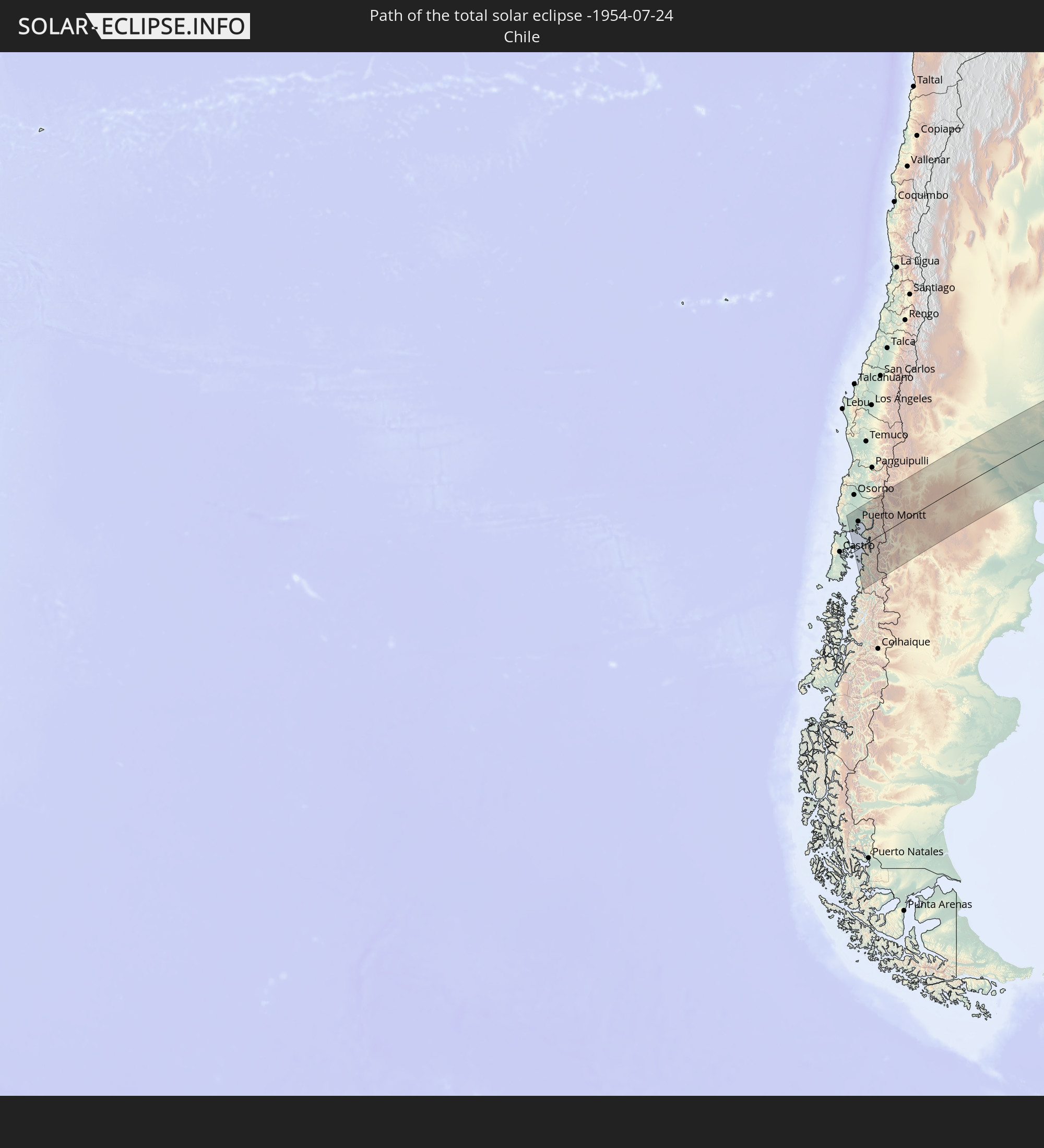 Chile
Chile
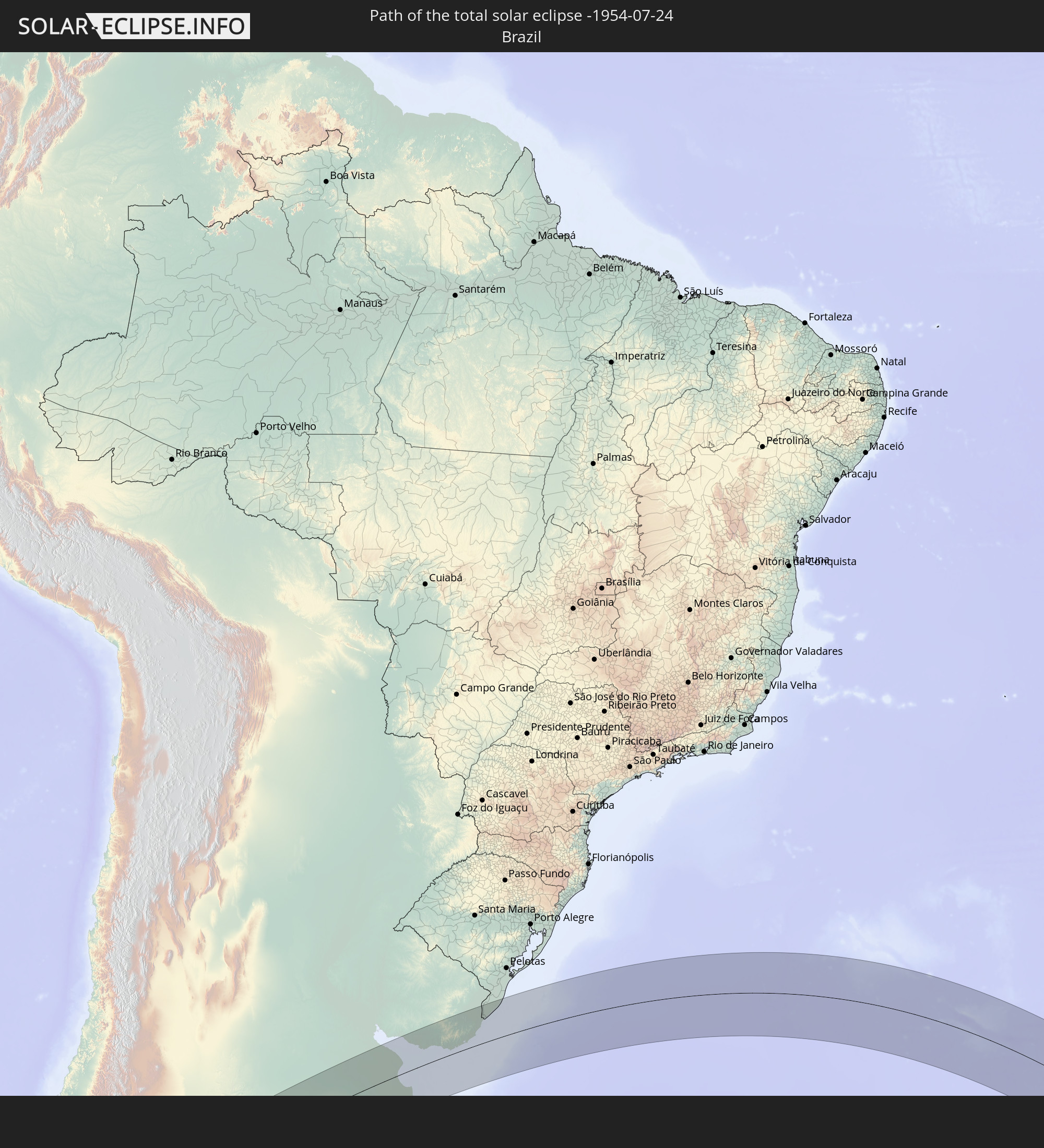 Brazil
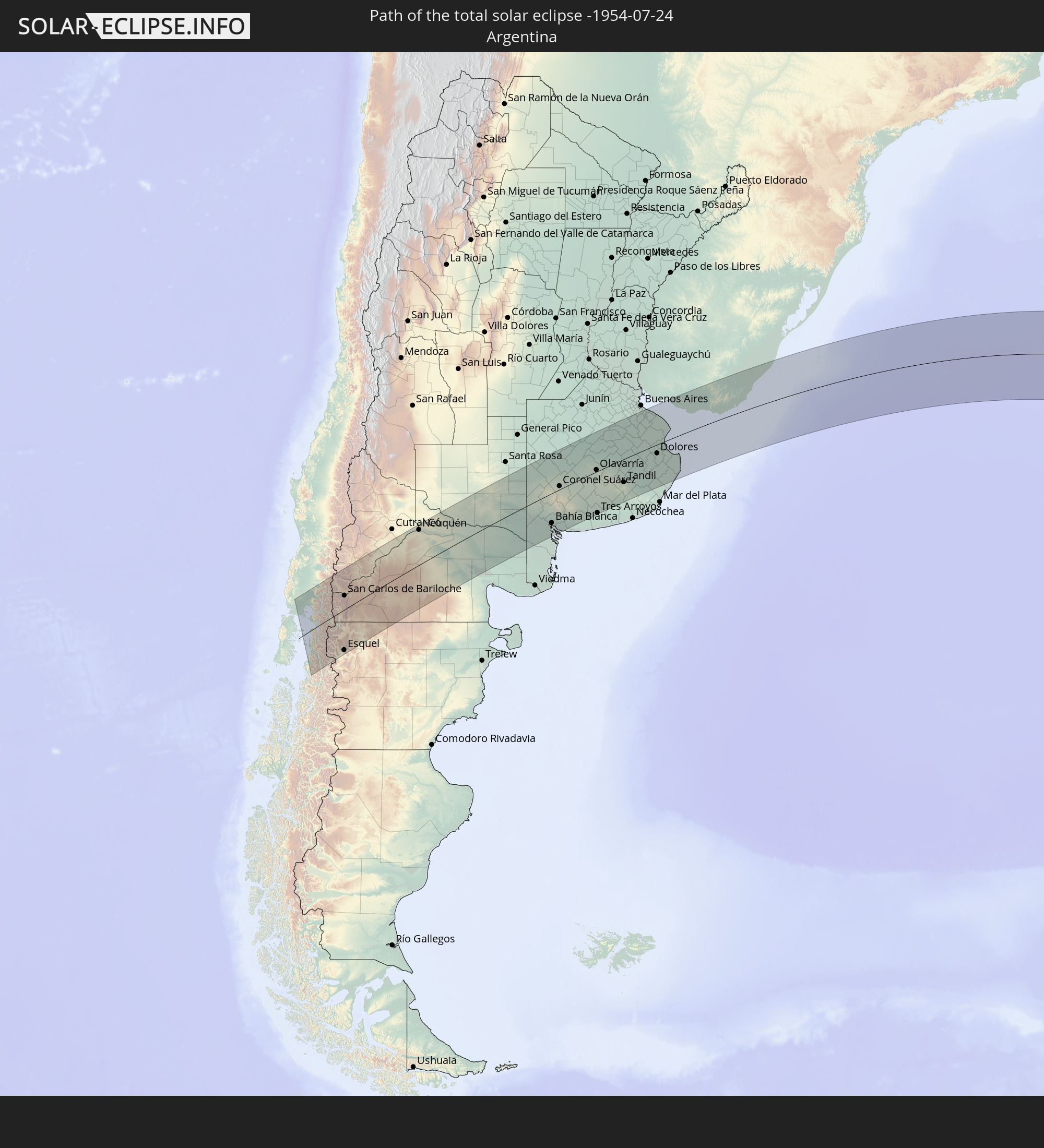 Argentina
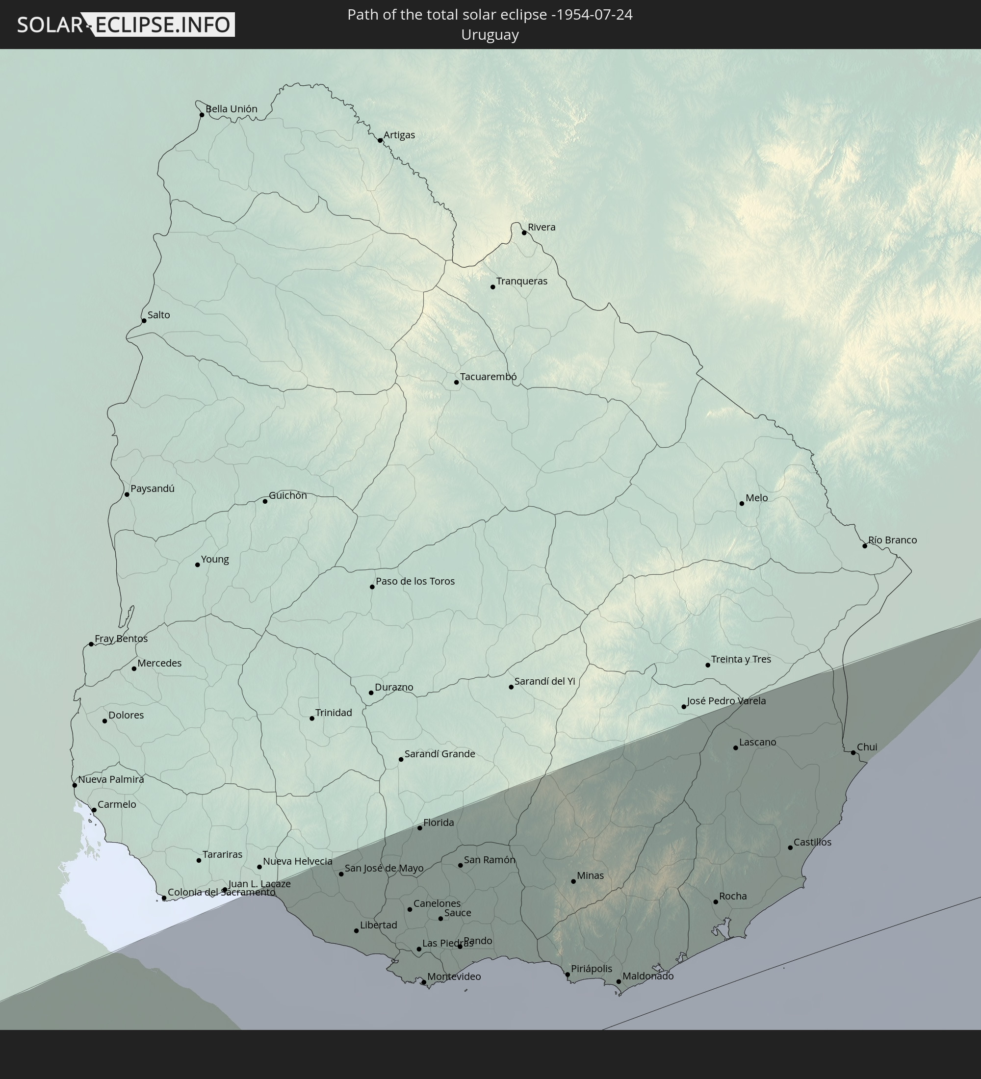 Uruguay
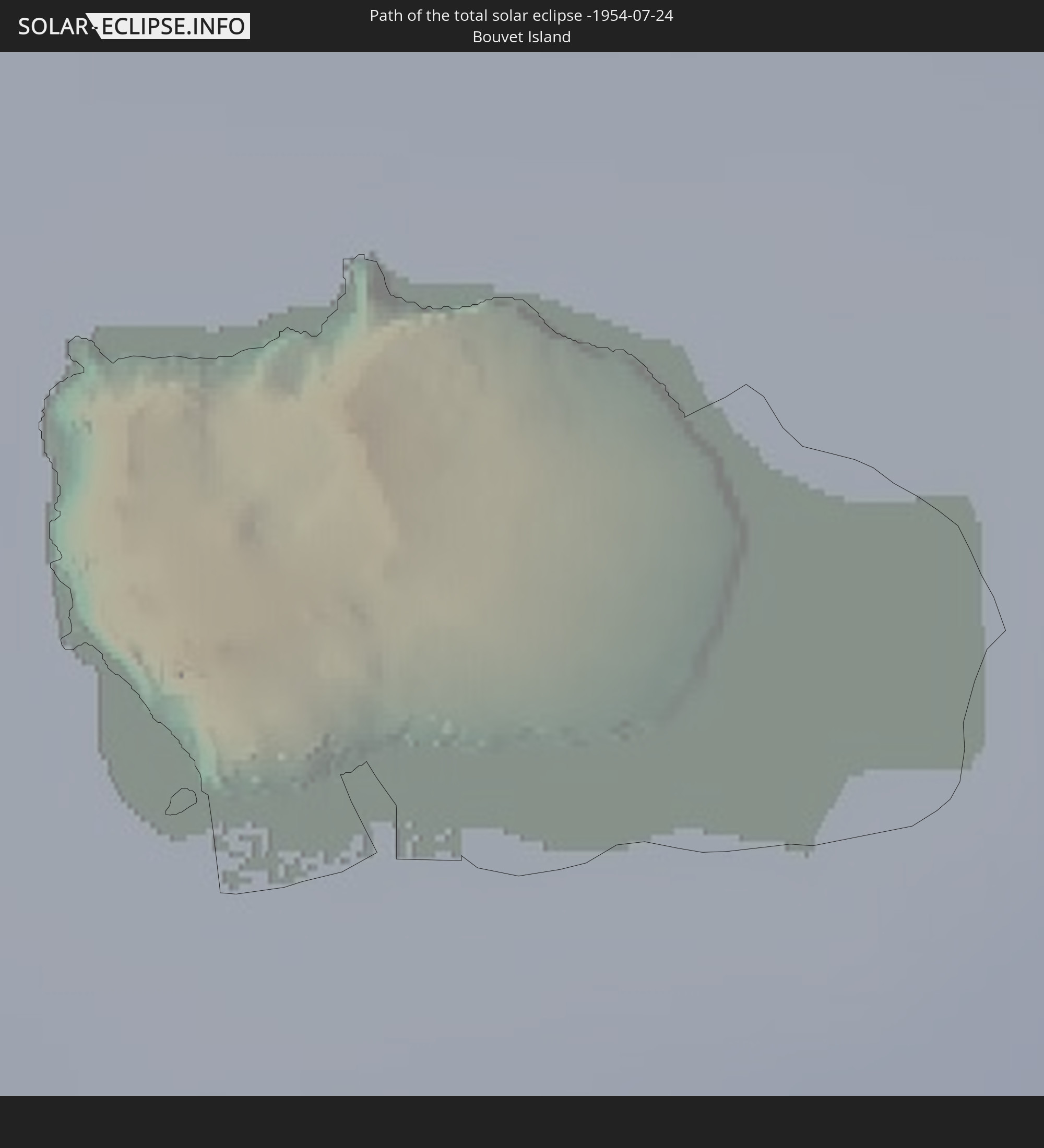 Bouvet Island
In den folgenden Ländern ist die Sonnenfinsternis partiell zu sehen
 Antarctica
 Chile
Chile
 Ecuador
 Colombia
 Peru
Peru
 Brazil
 Argentina
 Venezuela
 Bolivia
 Paraguay
 Falkland Islands
 Guyana
 Uruguay
 Suriname
 French Guiana
 South Georgia and the South Sandwich Islands
 Saint Helena, Ascension and Tristan da Cunha
 Bouvet Island
 Angola
 Namibia
 South Africa
 Botswana
 Lesotho
 Mozambique
 Swaziland
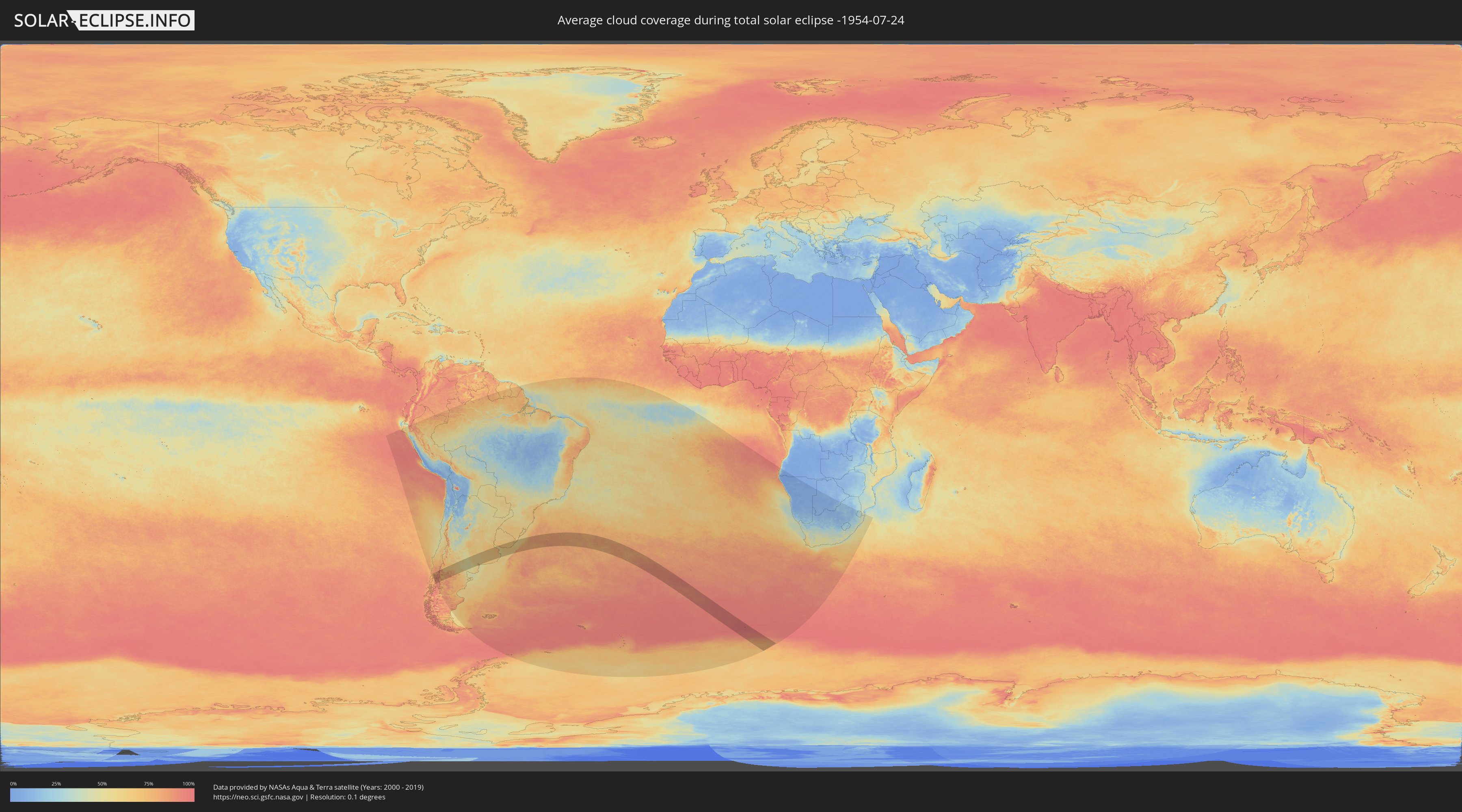
How will be the weather during the total solar eclipse on 07/24/-1954?
Where is the best place to see the total solar eclipse of 07/24/-1954?
The following maps show the average cloud coverage for the day of the total solar eclipse.
With the help of these maps, it is possible to find the place along the eclipse path, which has the best
chance of a cloudless sky.
Nevertheless, you should consider local circumstances and inform about the weather of your chosen
observation site.
The data is provided by NASAs satellites
AQUA and TERRA.
The cloud maps are averaged over a period of 19 years (2000 - 2019).

Detailed country maps
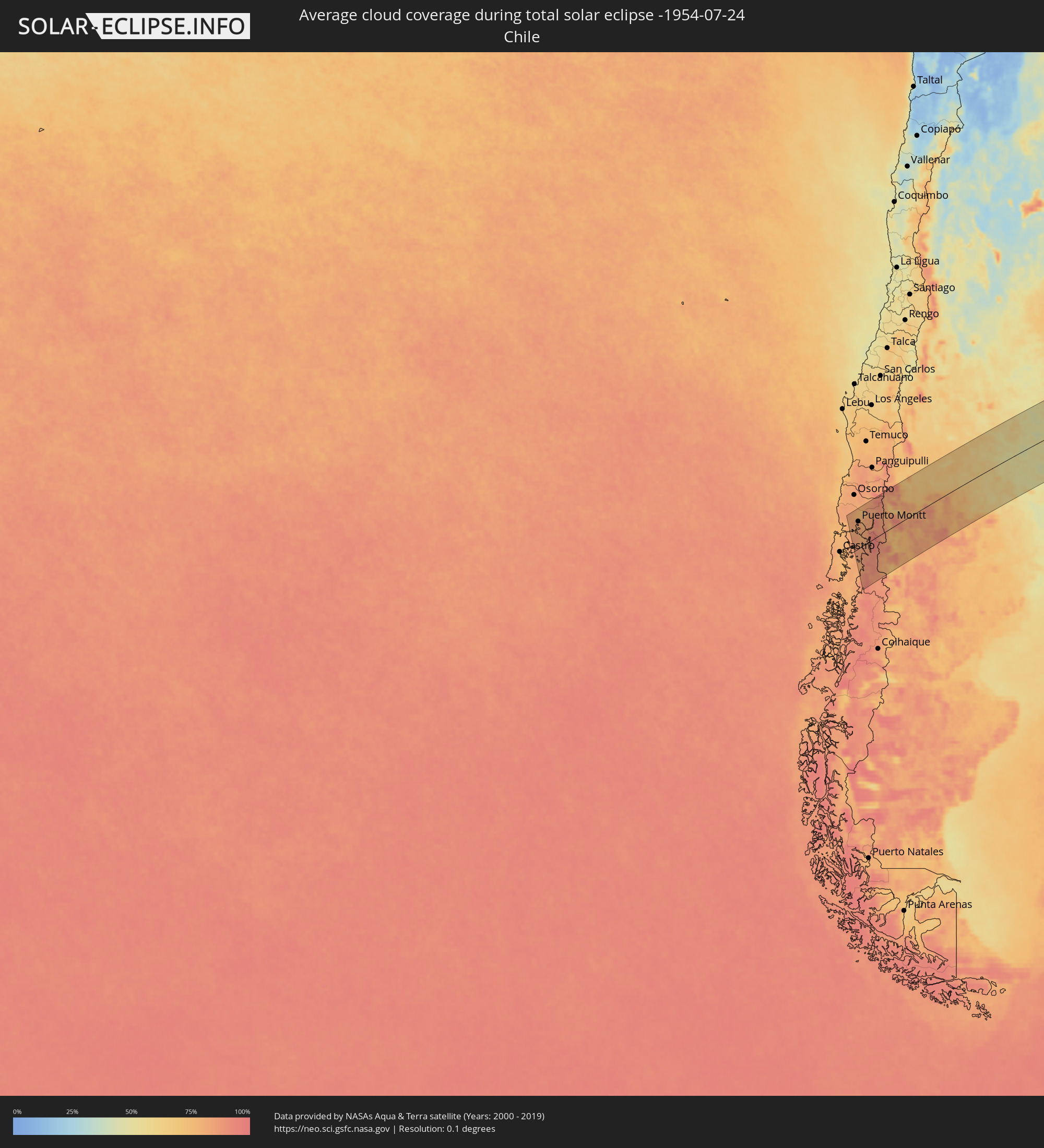 Chile
Chile
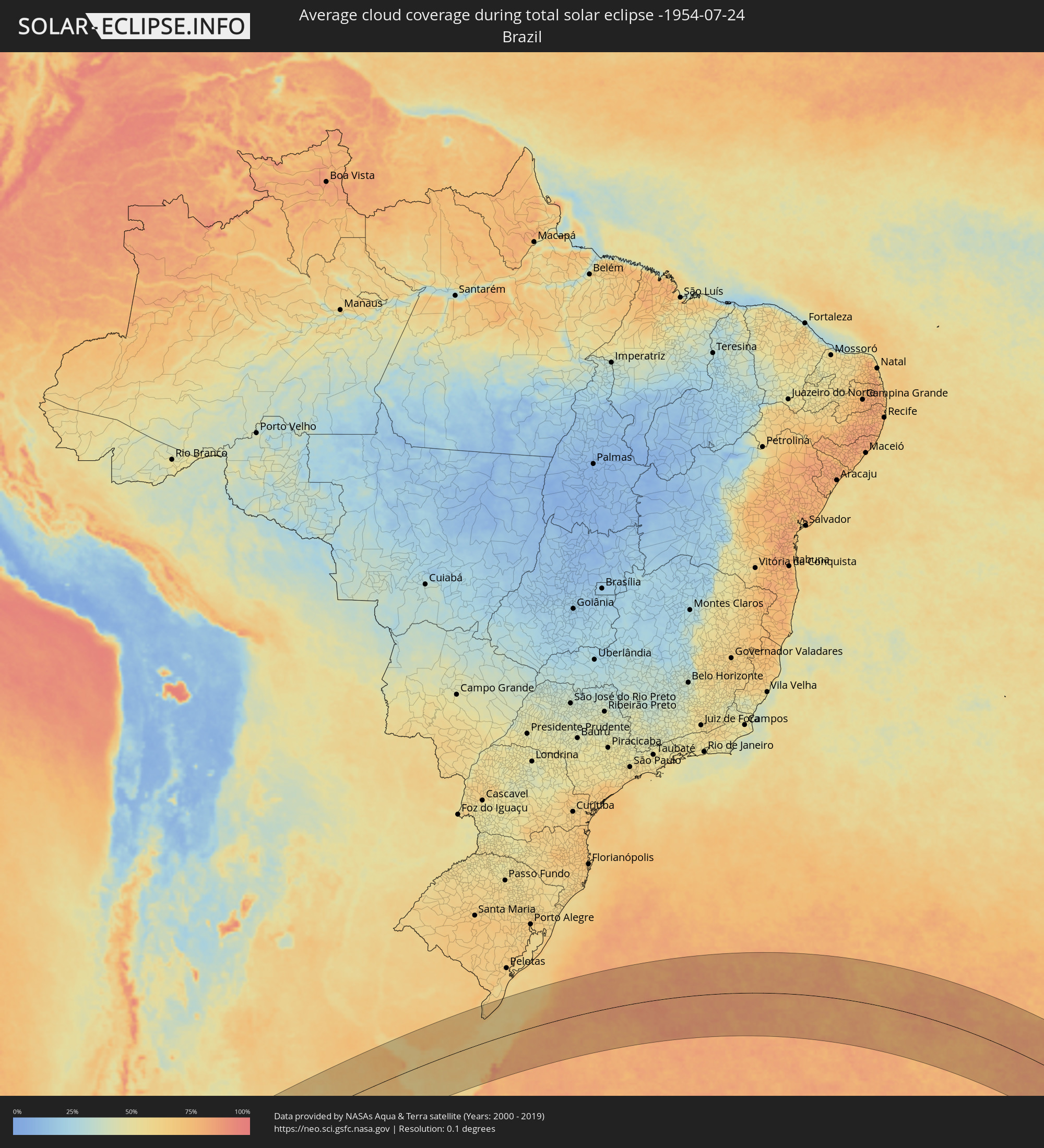 Brazil
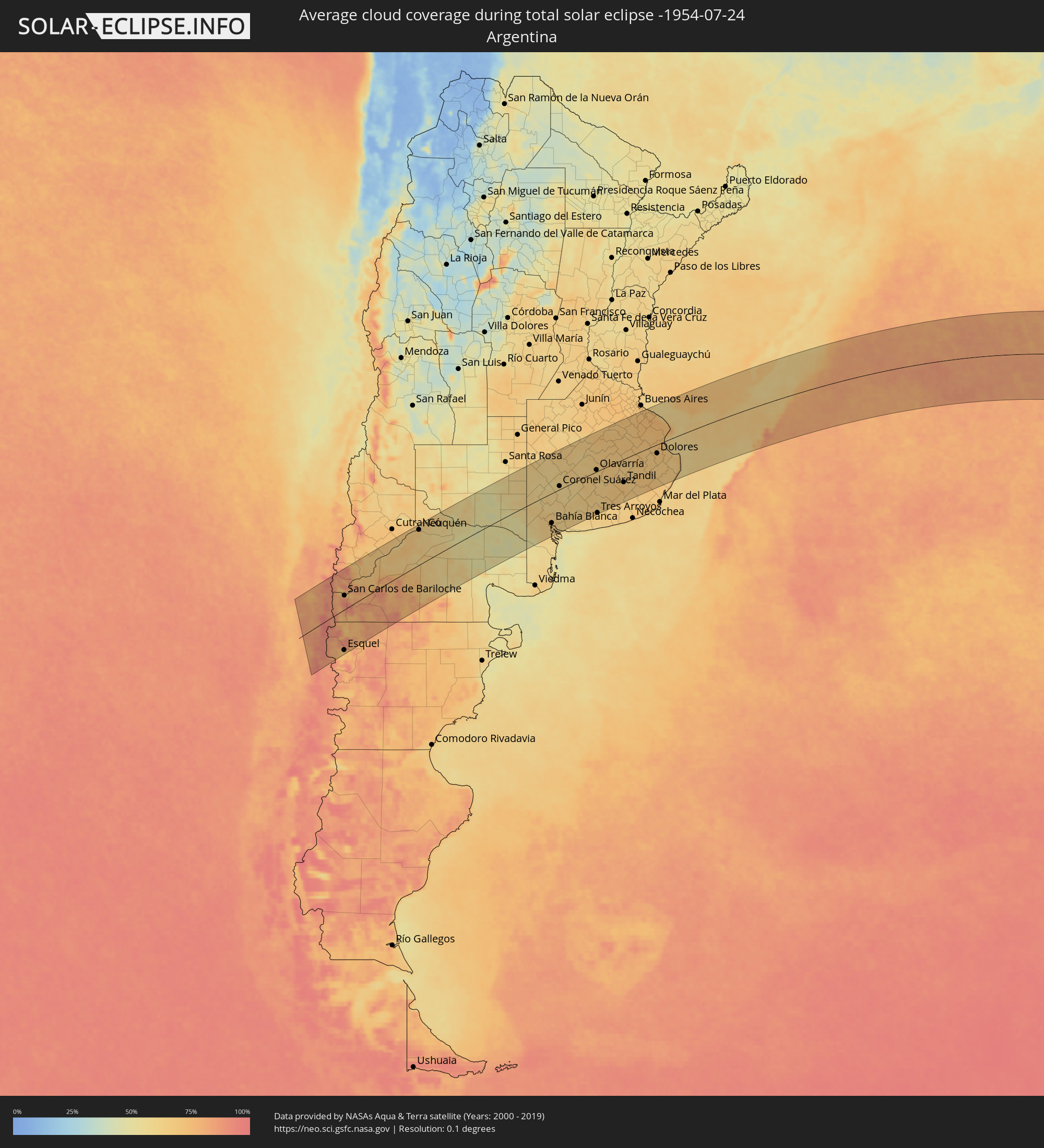 Argentina
 Uruguay
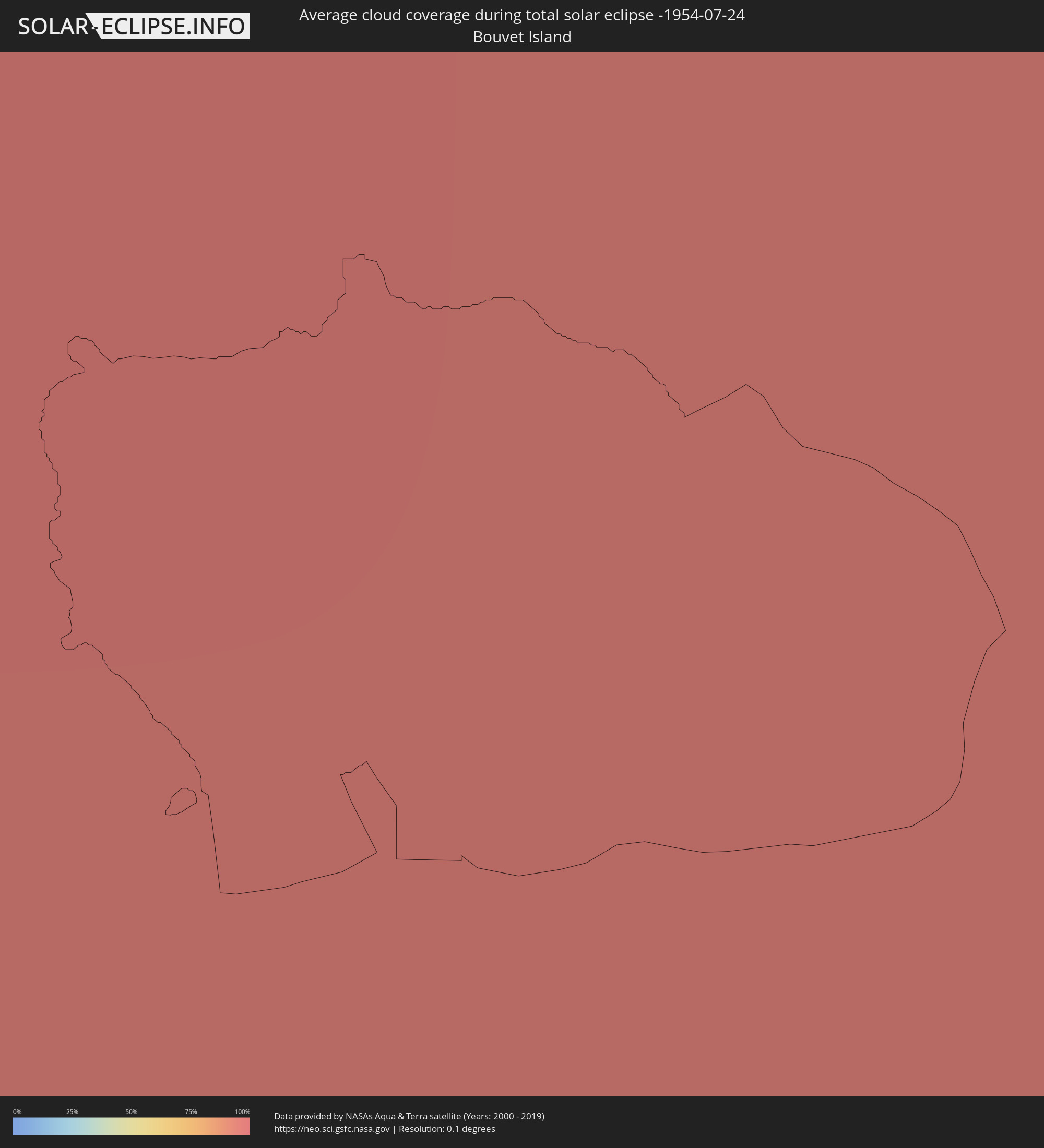 Bouvet Island
Cities inside the path of the eclipse
The following table shows all locations with a population of more than 5,000 inside the eclipse path. Cities which have more than 100,000 inhabitants are marked bold. A click at the locations opens a detailed map.
| City | Type | Eclipse duration | Local time of max. eclipse | Distance to central line | Ø Cloud coverage |
|
Calbuco, Los Lagos
|
total | - | 07:41:02 UTC-04:42 | 64 km | 83% |
|
Frutillar, Los Lagos
|
total | - | 07:40:12 UTC-04:42 | 121 km | 77% |
|
Puerto Varas, Los Lagos
|
total | - | 07:40:31 UTC-04:42 | 100 km | 81% |
|
Puerto Montt, Los Lagos
|
total | - | 07:40:44 UTC-04:42 | 85 km | 83% |
|
Villa La Angostura, Neuquén Province
|
total | - | 08:06:39 UTC-04:16 | 95 km | 74% |
|
El Bolsón, Río Negro Province
|
total | - | 08:08:23 UTC-04:16 | 24 km | 74% |
|
Trevelin, Chubut Province
|
total | - | 08:10:00 UTC-04:16 | 133 km | 70% |
|
Esquel, Chubut Province
|
total | - | 08:09:52 UTC-04:16 | 123 km | 75% |
|
San Carlos de Bariloche, Río Negro Province
|
total | - | 08:07:25 UTC-04:16 | 43 km | 72% |
|
Ingeniero Jacobacci, Río Negro Province
|
total | - | 08:09:01 UTC-04:16 | 51 km | 81% |
|
Senillosa, Neuquén Province
|
total | - | 08:06:48 UTC-04:16 | 124 km | 66% |
|
Plottier, Neuquén Province
|
total | - | 08:06:55 UTC-04:16 | 120 km | 67% |
|
Centenario, Neuquén Province
|
total | - | 08:06:49 UTC-04:16 | 129 km | 65% |
|
Cinco Saltos, Río Negro Province
|
total | - | 08:06:52 UTC-04:16 | 127 km | 65% |
|
Neuquén, Neuquén Province
|
total | - | 08:07:03 UTC-04:16 | 114 km | 67% |
|
Cipolletti, Río Negro Province
|
total | - | 08:07:05 UTC-04:16 | 113 km | 65% |
|
General Fernández Oro, Río Negro Province
|
total | - | 08:07:10 UTC-04:16 | 109 km | 60% |
|
Allen, Río Negro Province
|
total | - | 08:07:17 UTC-04:16 | 102 km | 58% |
|
General Roca, Río Negro Province
|
total | - | 08:07:34 UTC-04:16 | 86 km | 61% |
|
Cervantes, Río Negro Province
|
total | - | 08:07:46 UTC-04:16 | 76 km | 55% |
|
Ingeniero Luis A. Huergo, Río Negro Province
|
total | - | 08:07:56 UTC-04:16 | 67 km | 56% |
|
Villa Regina, Río Negro Province
|
total | - | 08:08:07 UTC-04:16 | 58 km | 57% |
|
Fray Luis Beltrán, Río Negro Province
|
total | - | 08:09:36 UTC-04:16 | 17 km | 53% |
|
Lamarque, Río Negro Province
|
total | - | 08:09:48 UTC-04:16 | 30 km | 51% |
|
Choele Choel, Río Negro Province
|
total | - | 08:09:37 UTC-04:16 | 16 km | 54% |
|
General Acha, La Pampa Province
|
total | - | 08:08:13 UTC-04:16 | 125 km | 51% |
|
Guatraché, La Pampa Province
|
total | - | 08:09:41 UTC-04:16 | 53 km | 61% |
|
Bahía Blanca, Buenos Aires
|
total | - | 08:12:24 UTC-04:16 | 101 km | 67% |
|
Punta Alta, Buenos Aires
|
total | - | 08:12:49 UTC-04:16 | 124 km | 59% |
|
Coronel Suárez, Buenos Aires
|
total | - | 08:11:09 UTC-04:16 | 11 km | 59% |
|
Coronel Dorrego, Buenos Aires
|
total | - | 08:13:30 UTC-04:16 | 140 km | 61% |
|
Olavarría, Buenos Aires
|
total | - | 08:12:18 UTC-04:16 | 6 km | 66% |
|
Tres Arroyos, Buenos Aires
|
total | - | 08:14:14 UTC-04:16 | 144 km | 65% |
|
Azul, Buenos Aires
|
total | - | 08:12:43 UTC-04:16 | 0 km | 67% |
|
Tandil, Buenos Aires
|
total | - | 08:14:18 UTC-04:16 | 82 km | 65% |
|
La Plata, Buenos Aires
|
total | - | 08:12:52 UTC-04:16 | 121 km | 74% |
|
Dolores, Buenos Aires
|
total | - | 08:14:55 UTC-04:16 | 32 km | 69% |
|
San Clemente del Tuyú, Buenos Aires
|
total | - | 08:16:15 UTC-04:16 | 70 km | 67% |
|
San José de Mayo, San José
|
total | - | 08:45:47 UTC-03:44 | 138 km | 72% |
|
Libertad, San José
|
total | - | 08:46:17 UTC-03:44 | 104 km | 71% |
|
Santa Lucía, Canelones
|
total | - | 08:46:23 UTC-03:44 | 116 km | 73% |
|
Delta del Tigre, San José
|
total | - | 08:46:47 UTC-03:44 | 82 km | 67% |
|
Canelones, Canelones
|
total | - | 08:46:37 UTC-03:44 | 105 km | 73% |
|
La Paz, Canelones
|
total | - | 08:46:58 UTC-03:44 | 78 km | 75% |
|
Las Piedras, Canelones
|
total | - | 08:46:57 UTC-03:44 | 81 km | 75% |
|
Progreso, Canelones
|
total | - | 08:46:52 UTC-03:44 | 88 km | 75% |
|
Florida, Florida
|
total | - | 08:46:12 UTC-03:44 | 147 km | 70% |
|
Montevideo, Montevideo
|
total | - | 08:47:12 UTC-03:44 | 62 km | 66% |
|
Sauce, Canelones
|
total | - | 08:46:57 UTC-03:44 | 93 km | 73% |
|
Paso de Carrasco, Canelones
|
total | - | 08:47:20 UTC-03:44 | 62 km | 64% |
|
Joaquín Suárez, Canelones
|
total | - | 08:47:13 UTC-03:44 | 75 km | 73% |
|
Colonia Nicolich, Canelones
|
total | - | 08:47:19 UTC-03:44 | 66 km | 71% |
|
Pando, Canelones
|
total | - | 08:47:18 UTC-03:44 | 74 km | 73% |
|
San Ramón, Canelones
|
total | - | 08:46:48 UTC-03:44 | 118 km | 72% |
|
Piriápolis, Maldonado
|
total | - | 08:48:27 UTC-03:44 | 37 km | 61% |
|
Minas, Lavalleja
|
total | - | 08:47:56 UTC-03:44 | 86 km | 68% |
|
Pan de Azúcar, Maldonado
|
total | - | 08:48:24 UTC-03:44 | 44 km | 66% |
|
Maldonado, Maldonado
|
total | - | 08:48:58 UTC-03:44 | 22 km | 67% |
|
Punta del Este, Maldonado
|
total | - | 08:49:03 UTC-03:44 | 17 km | 67% |
|
San Carlos, Maldonado
|
total | - | 08:48:53 UTC-03:44 | 33 km | 69% |
|
Rocha, Rocha
|
total | - | 08:49:23 UTC-03:44 | 47 km | 67% |
|
Lascano, Rocha
|
total | - | 08:48:38 UTC-03:44 | 128 km | 66% |
|
Castillos, Rocha
|
total | - | 08:49:46 UTC-03:44 | 62 km | 66% |
|
Chui, Rocha
|
total | - | 08:49:48 UTC-03:44 | 103 km | 68% |
|
Chuí, Rio Grande do Sul
|
total | - | 08:49:48 UTC-03:44 | 104 km | 68% |
|
Santa Vitória do Palmar, Rio Grande do Sul
|
total | - | 09:28:08 UTC-03:06 | 119 km | 66% |