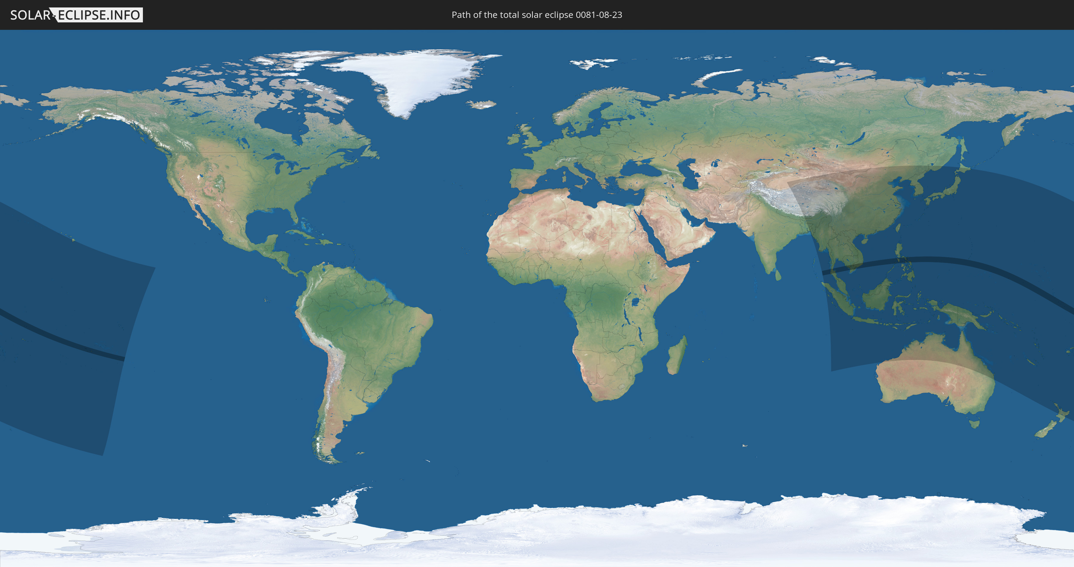
Total solar eclipse of 08/23/0081
| Day of week: | Saturday |
| Maximum duration of eclipse: | 06m08s |
| Maximum width of eclipse path: | 221 km |
| Saros cycle: | 75 |
| Coverage: | 100% |
| Magnitude: | 1.0675 |
| Gamma: | -0.1052 |
Wo kann man die Sonnenfinsternis vom 08/23/0081 sehen?
Die Sonnenfinsternis am 08/23/0081 kann man in 50 Ländern als partielle Sonnenfinsternis beobachten.
Der Finsternispfad verläuft durch 10 Länder. Nur in diesen Ländern ist sie als total Sonnenfinsternis zu sehen.
In den folgenden Ländern ist die Sonnenfinsternis total zu sehen
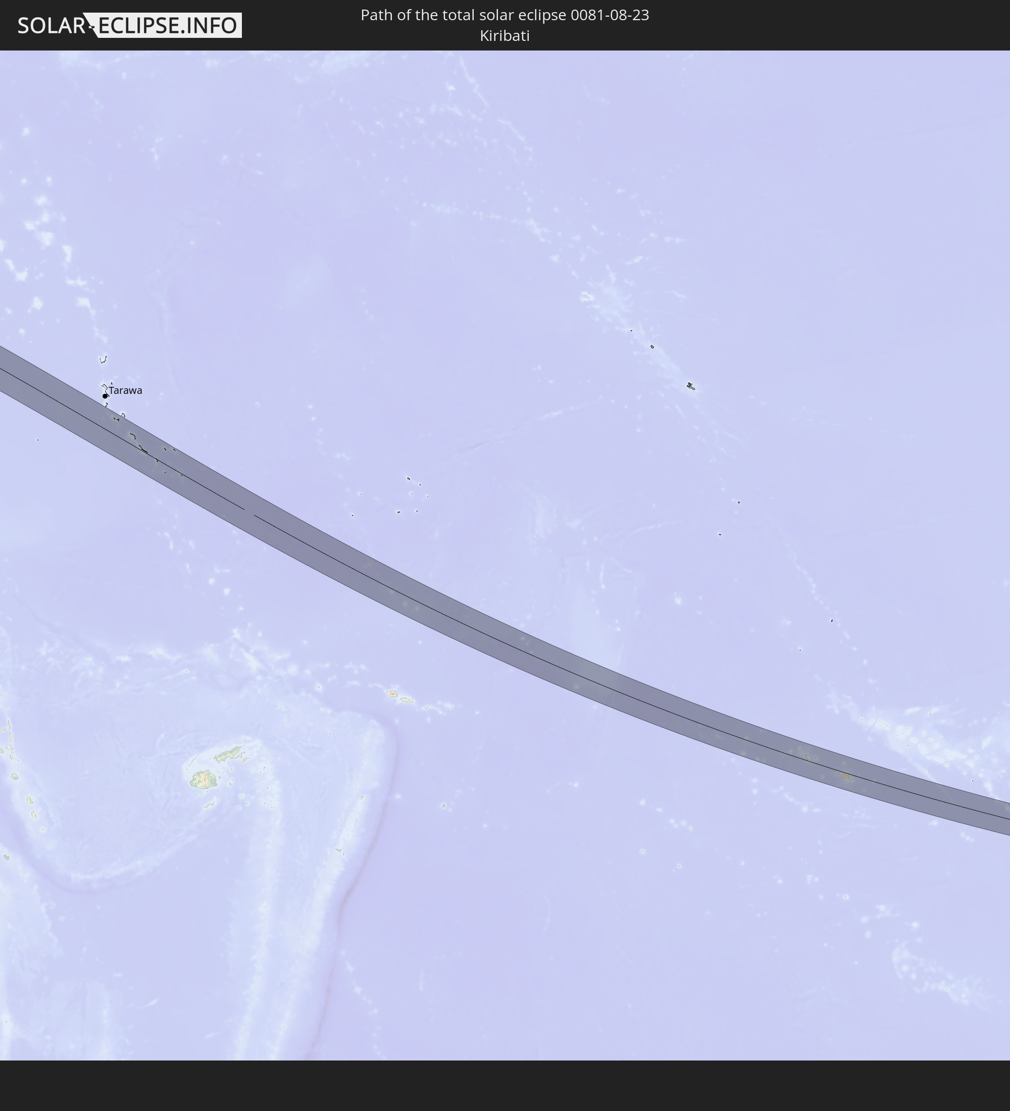 Kiribati
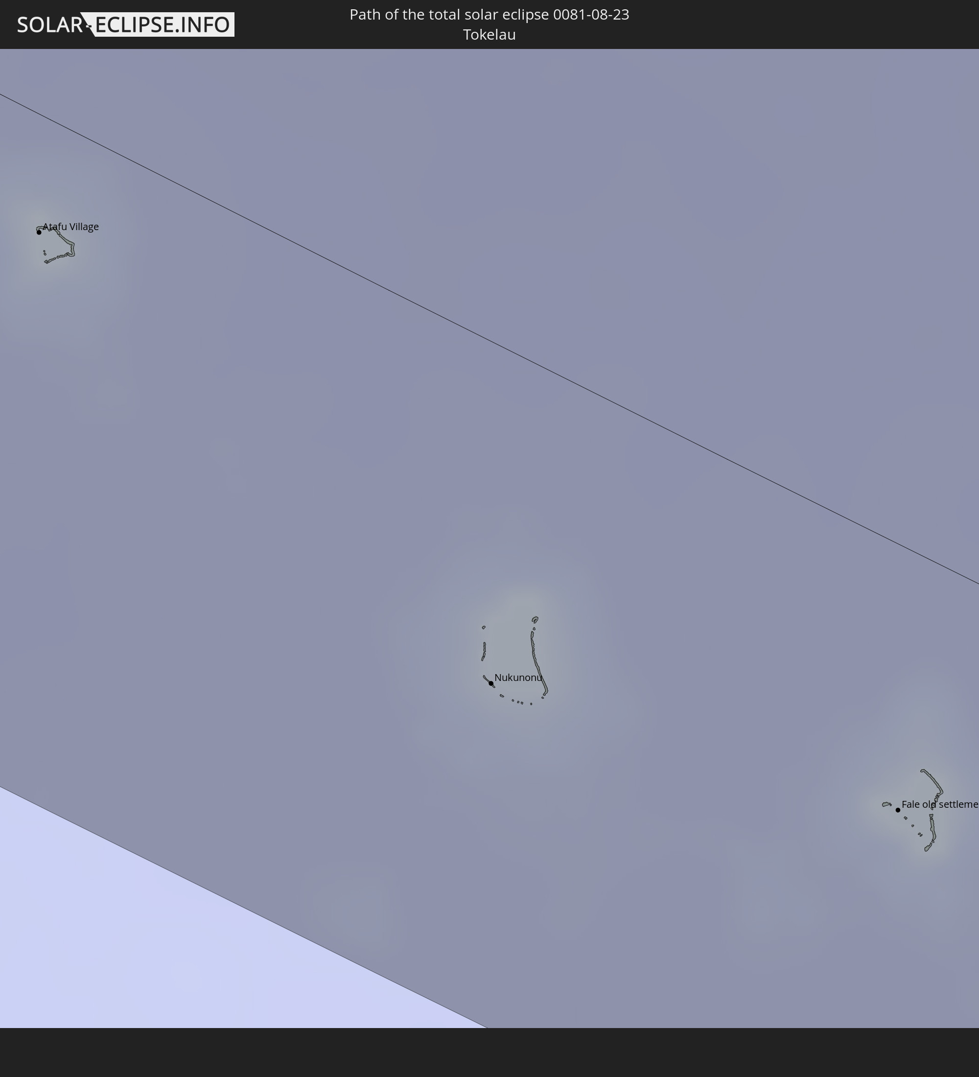 Tokelau
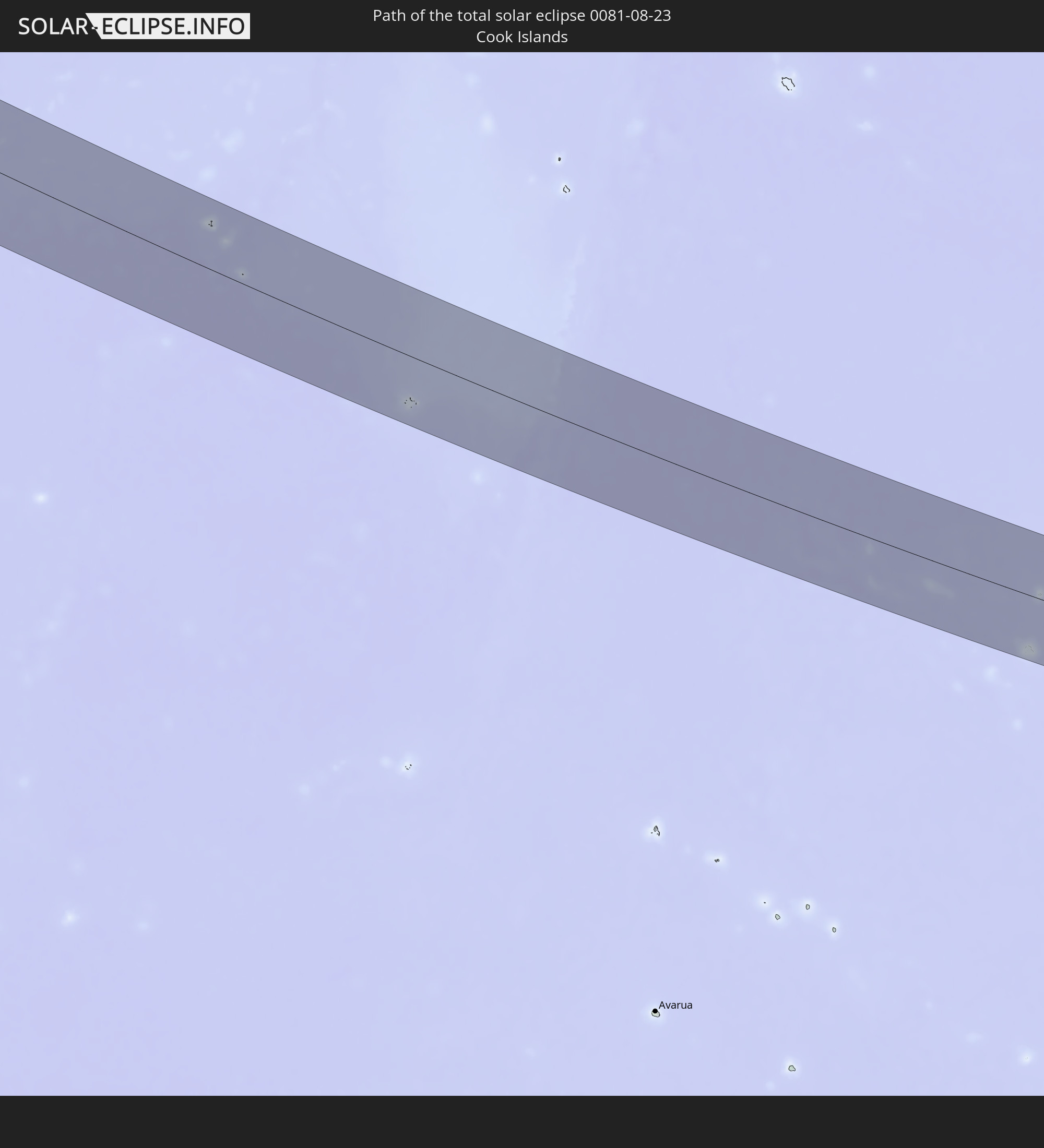 Cook Islands
 French Polynesia
 Myanmar
 Thailand
 Vietnam
 Cambodia
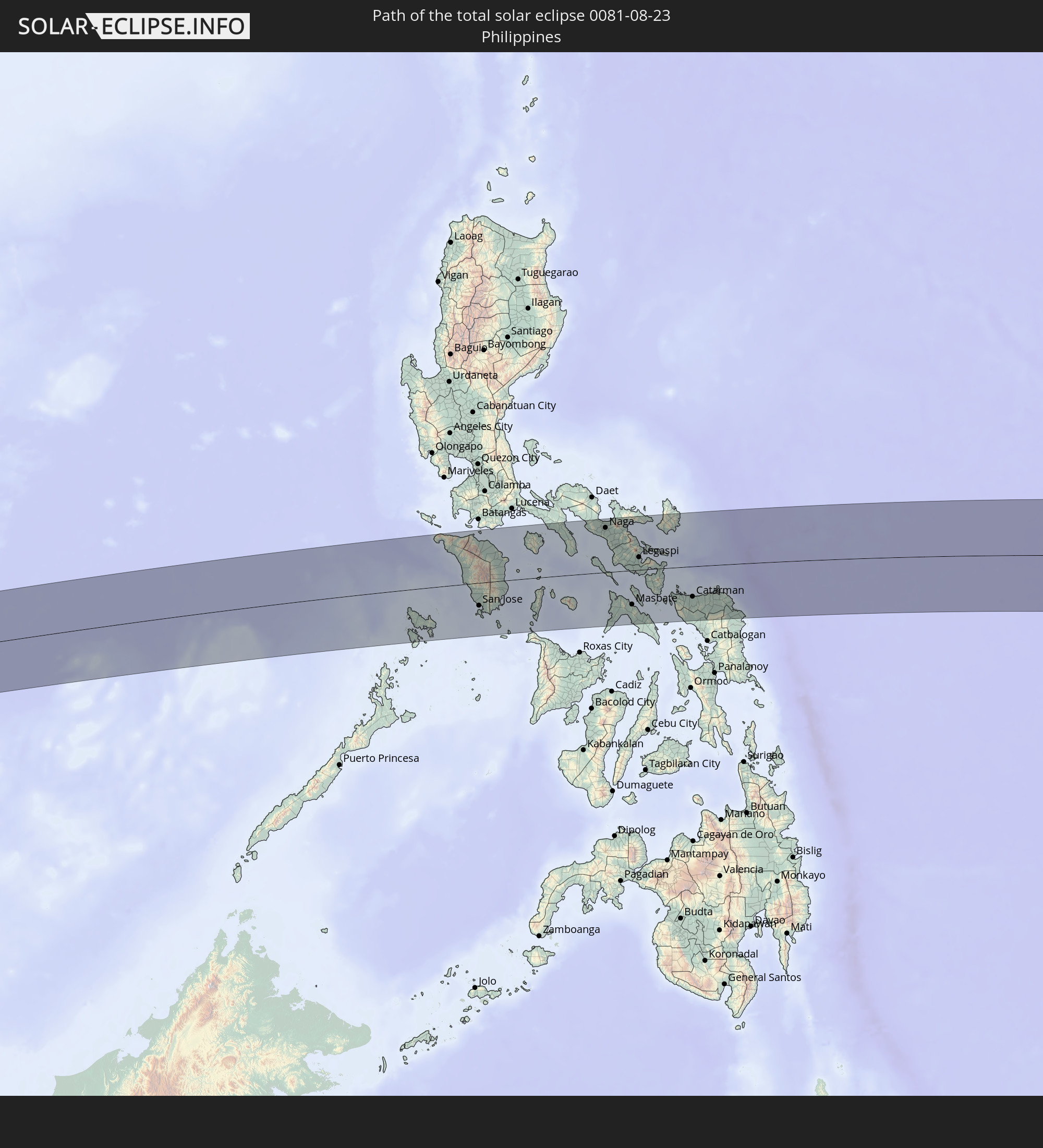 Philippines
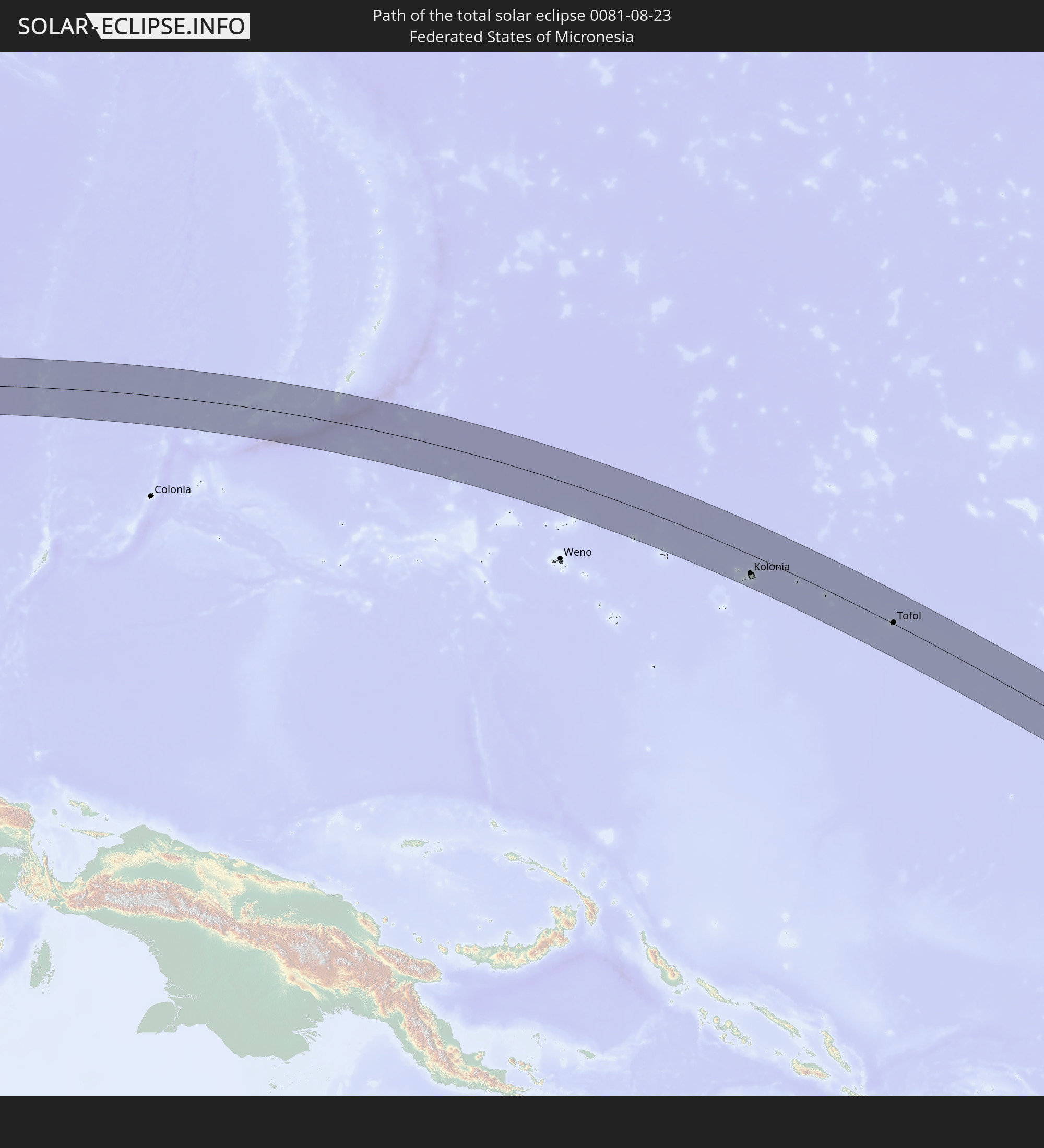 Federated States of Micronesia
In den folgenden Ländern ist die Sonnenfinsternis partiell zu sehen
 Fiji
Fiji
 Russia
 United States
 New Zealand
 United States Minor Outlying Islands
 Wallis and Futuna
 Tonga
Tonga
 Kiribati
 Samoa
Samoa
 Tokelau
 American Samoa
 Niue
Niue
 Cook Islands
 French Polynesia
 India
India
 China
China
 Mongolia
 Bangladesh
 Bhutan
 Myanmar
 Indonesia
 Thailand
 Malaysia
 Laos
Laos
 Vietnam
 Cambodia
 Singapore
 Christmas Island
 Australia
 Macau
Macau
 Hong Kong
 Brunei
 Taiwan
 Philippines
 Japan
Japan
 East Timor
 North Korea
 South Korea
 Palau
Palau
 Federated States of Micronesia
 Papua New Guinea
 Guam
Guam
 Northern Mariana Islands
 Solomon Islands
 New Caledonia
 Marshall Islands
 Vanuatu
 Nauru
Nauru
 Norfolk Island
 Tuvalu
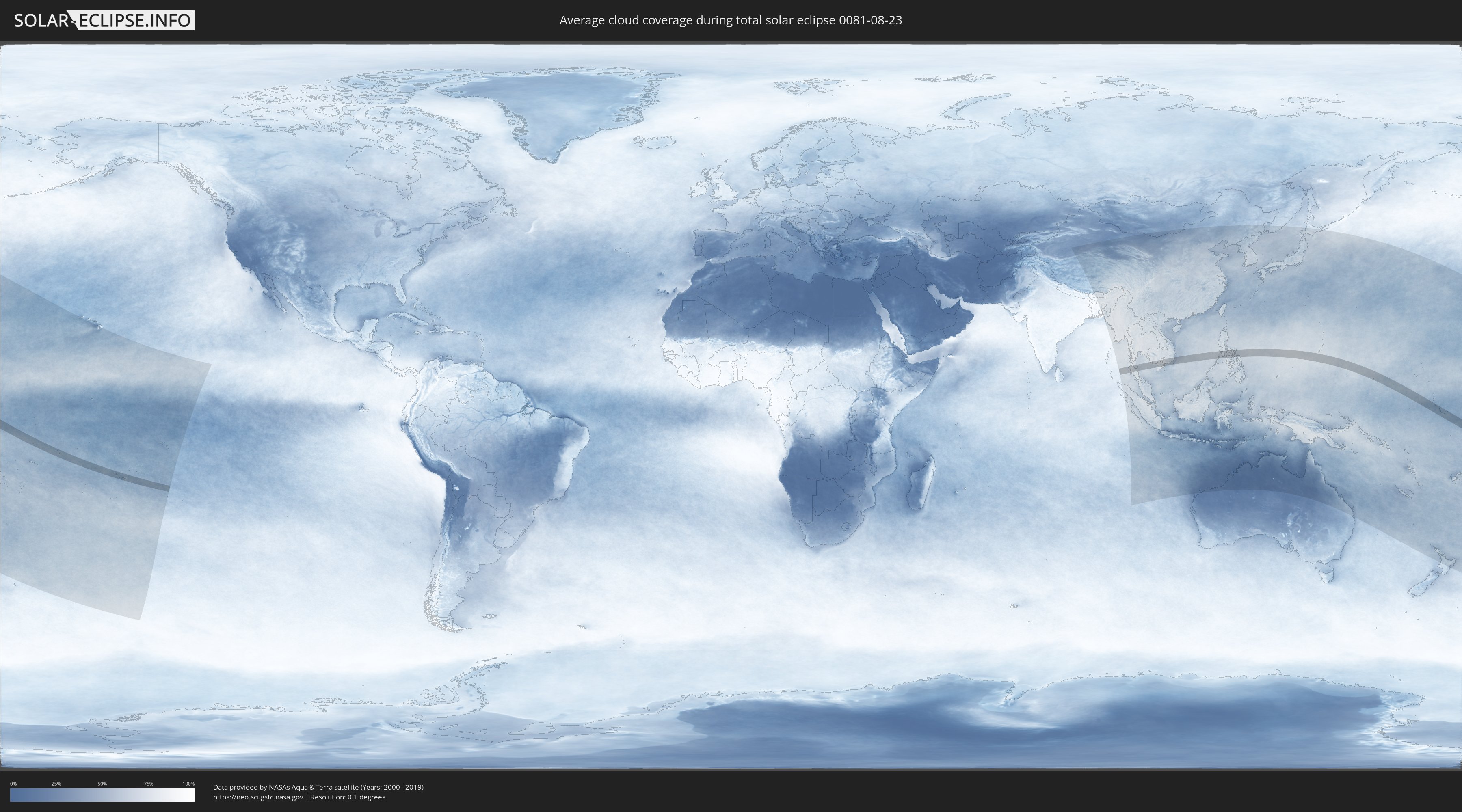
How will be the weather during the total solar eclipse on 08/23/0081?
Where is the best place to see the total solar eclipse of 08/23/0081?
The following maps show the average cloud coverage for the day of the total solar eclipse.
With the help of these maps, it is possible to find the place along the eclipse path, which has the best
chance of a cloudless sky.
Nevertheless, you should consider local circumstances and inform about the weather of your chosen
observation site.
The data is provided by NASAs satellites
AQUA and TERRA.
The cloud maps are averaged over a period of 19 years (2000 - 2019).

Detailed country maps
 Kiribati
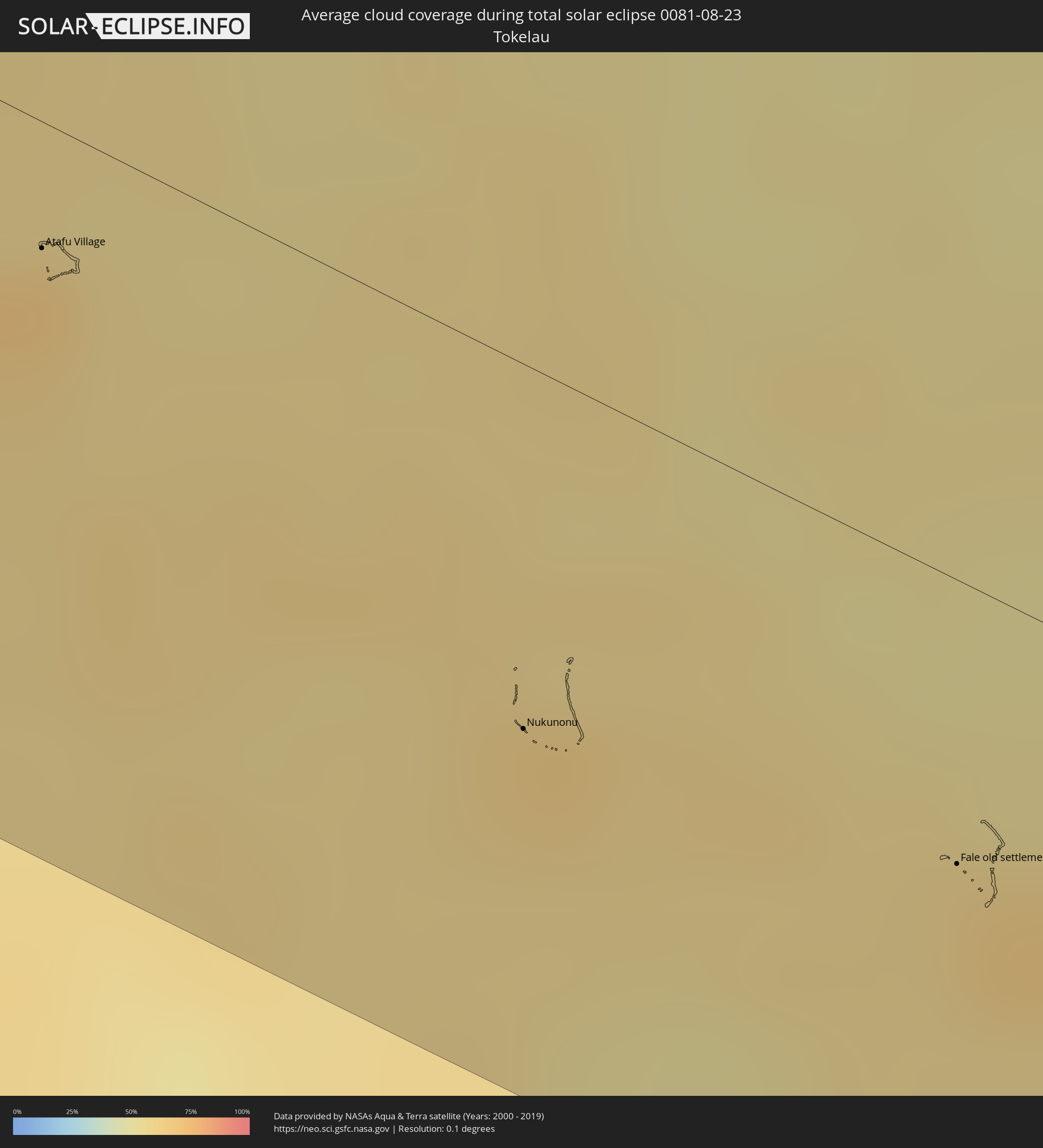 Tokelau
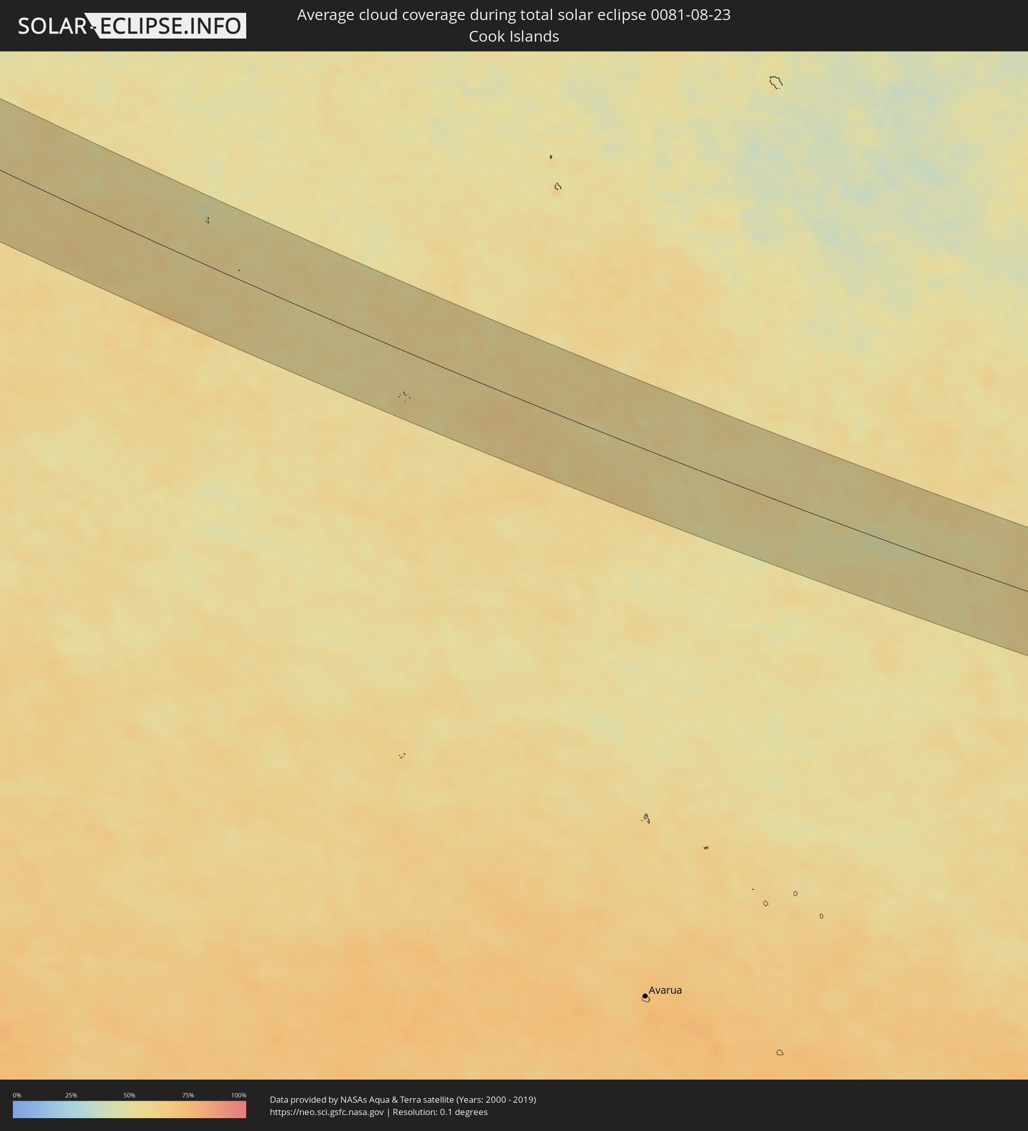 Cook Islands
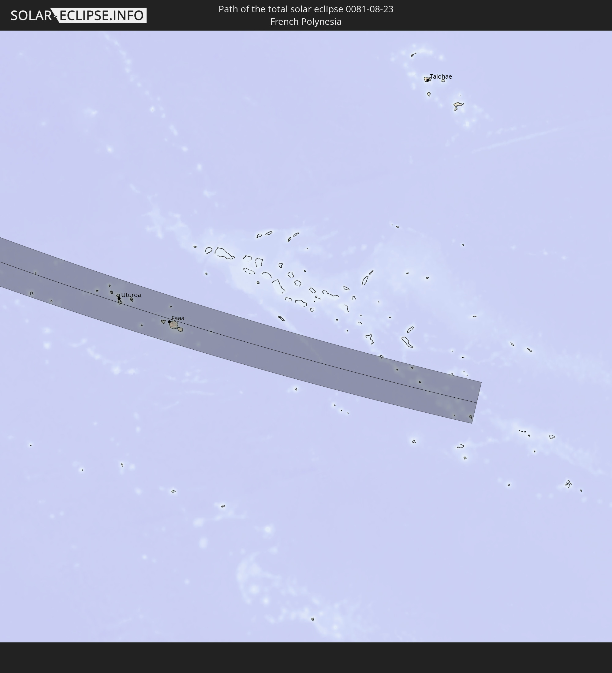
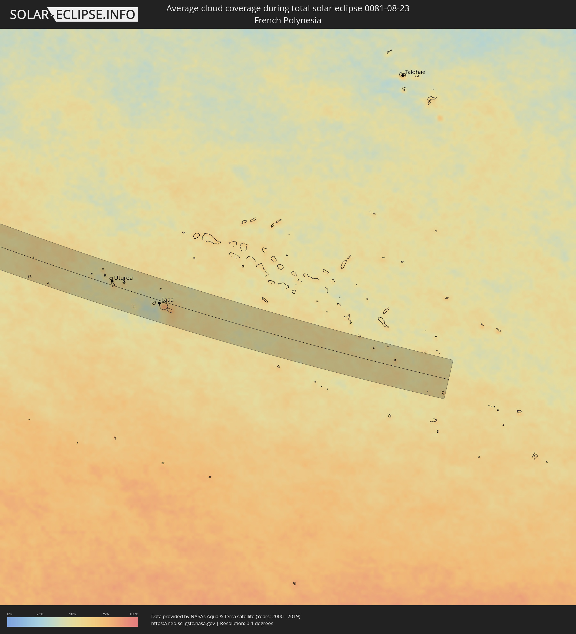 French Polynesia
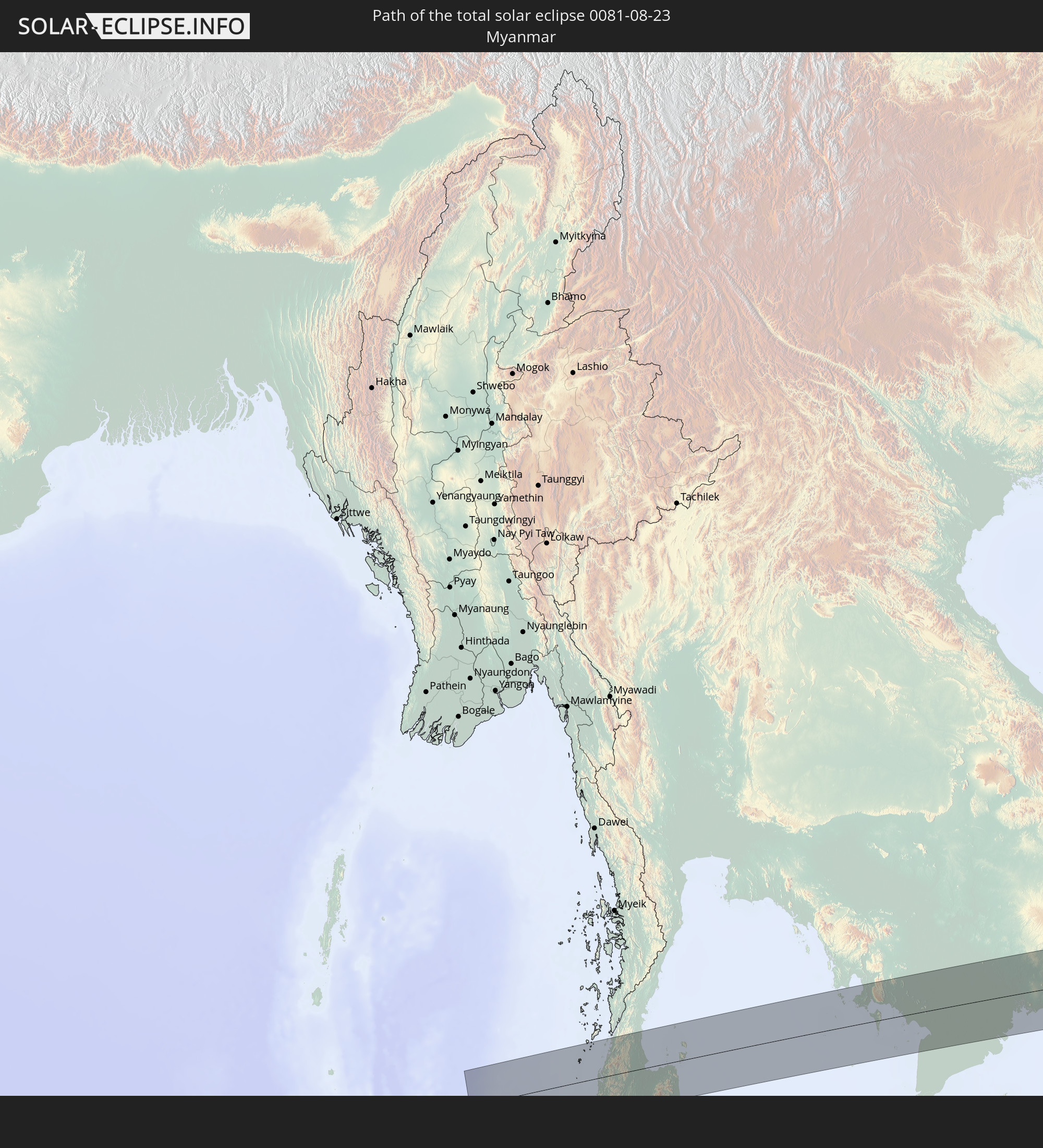
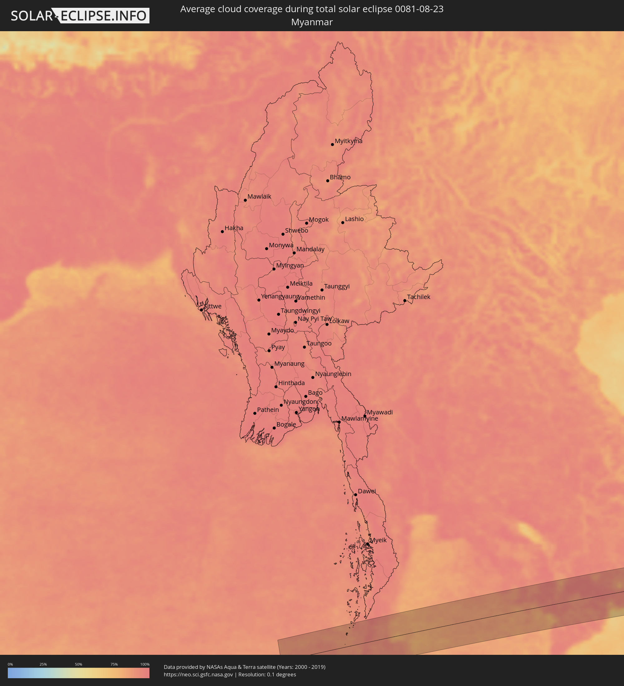 Myanmar
 Thailand
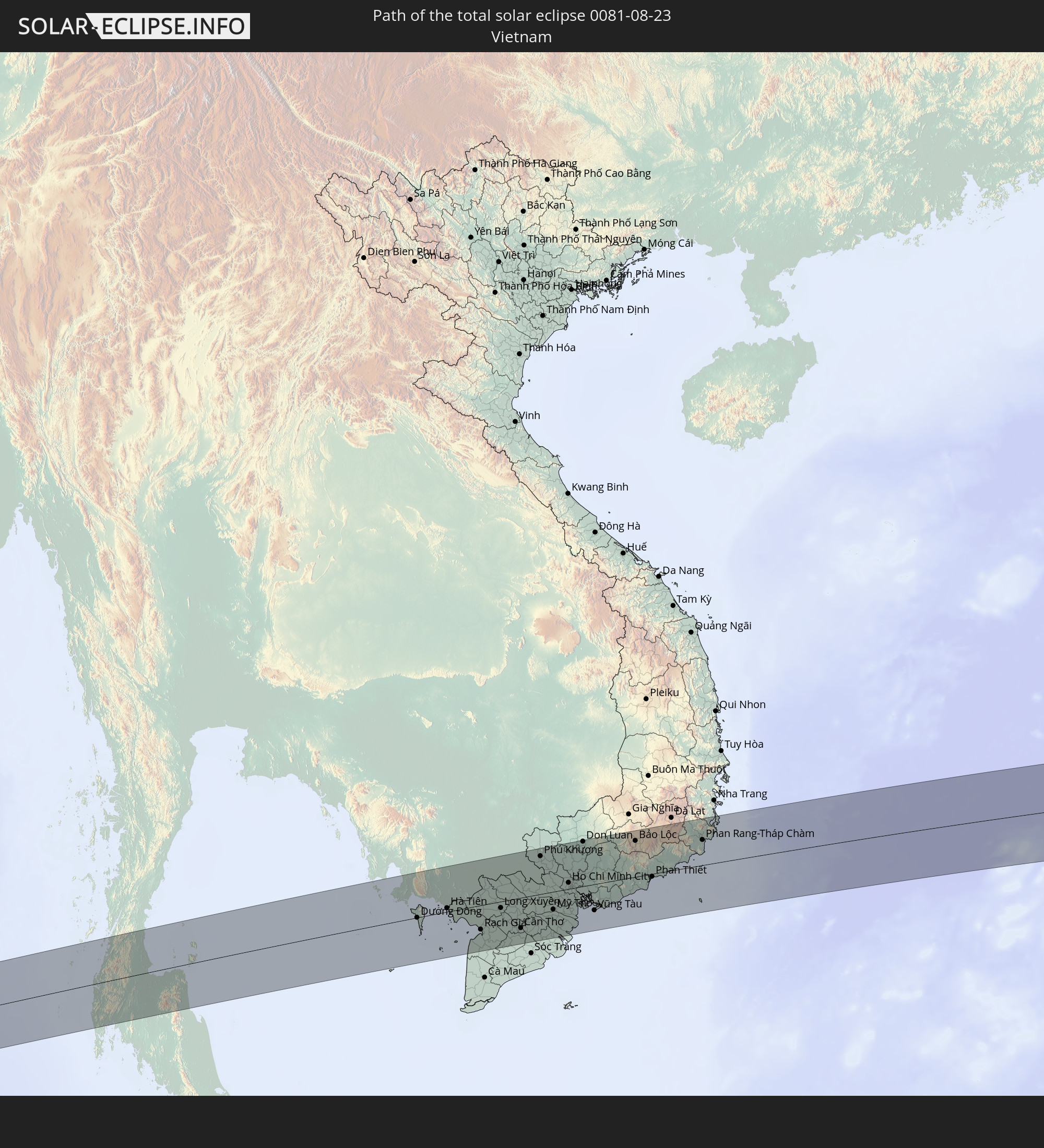
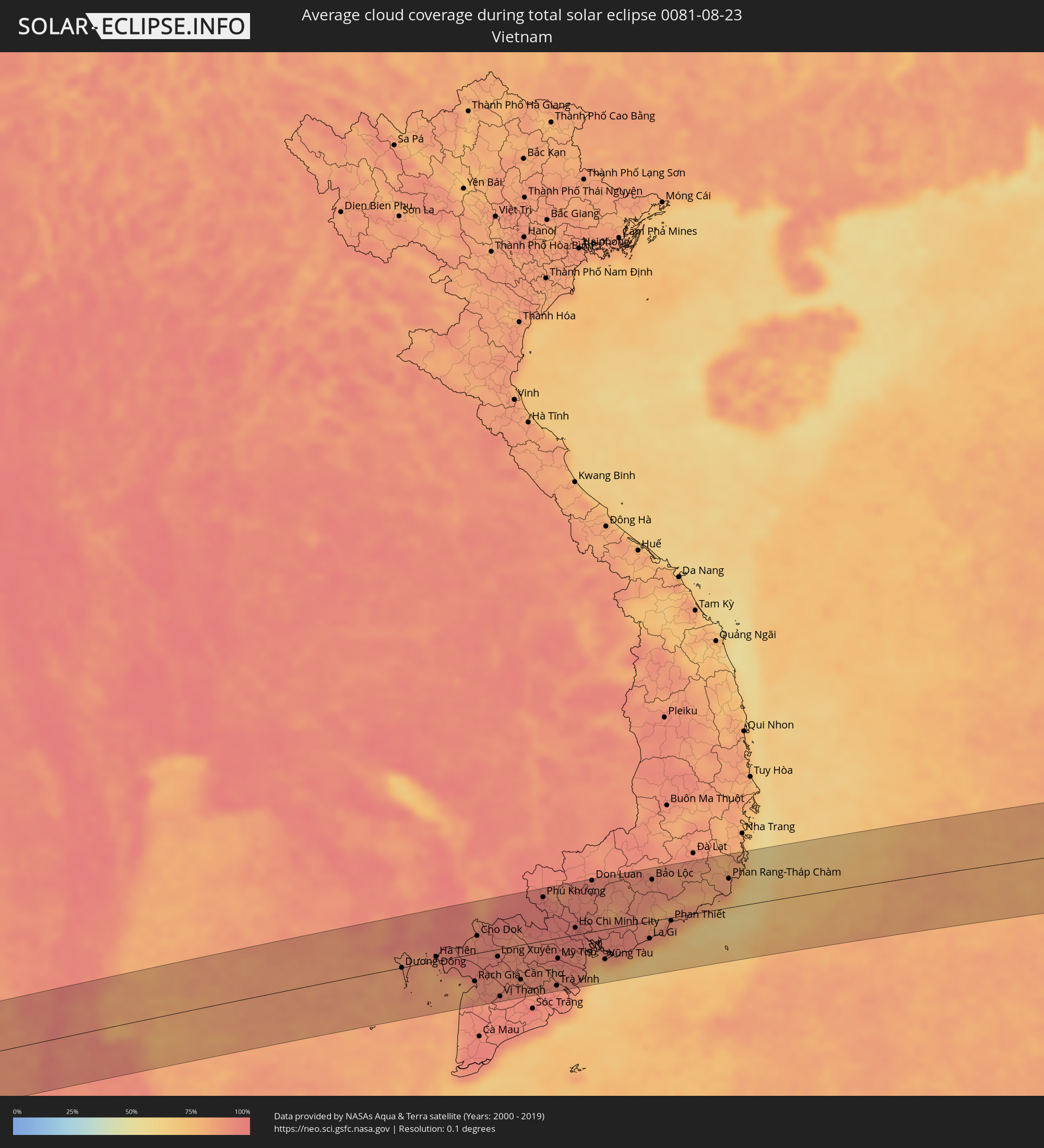 Vietnam
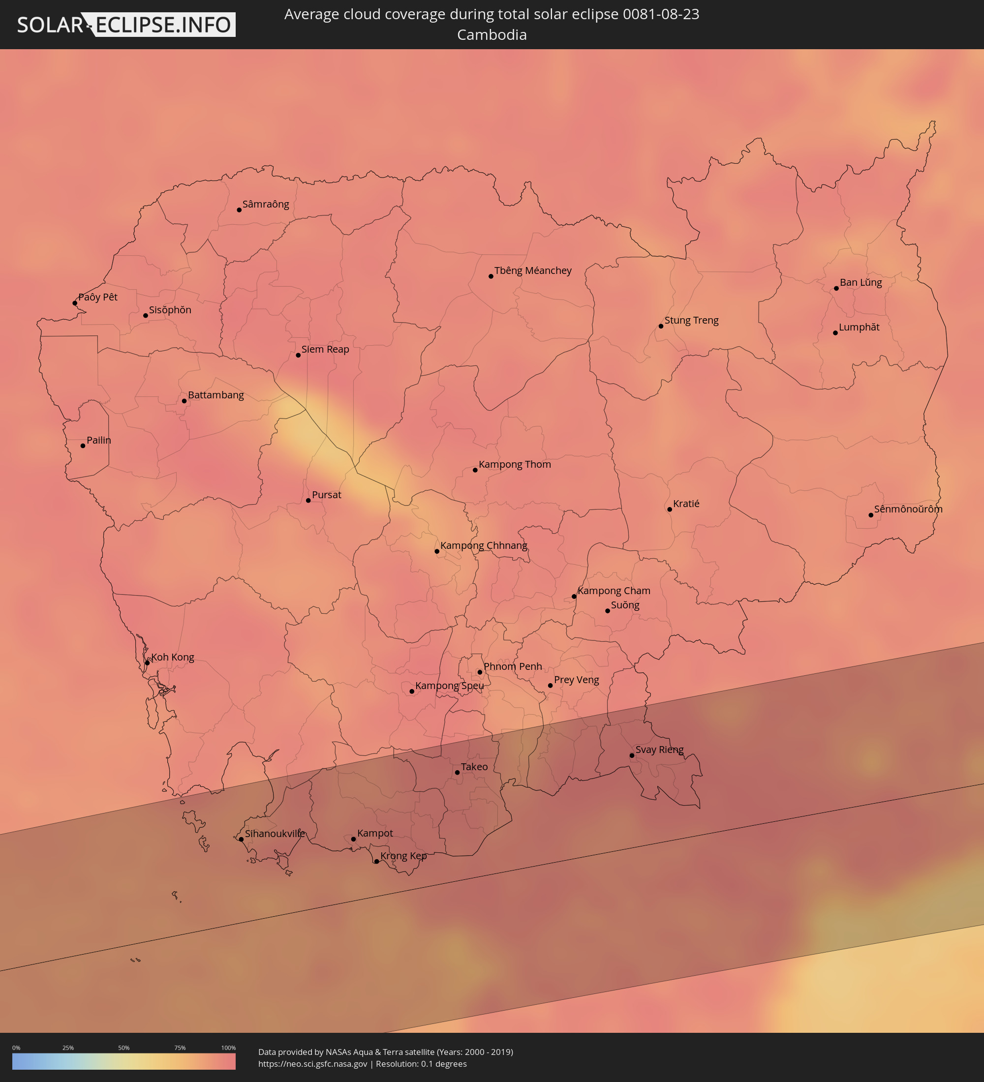 Cambodia
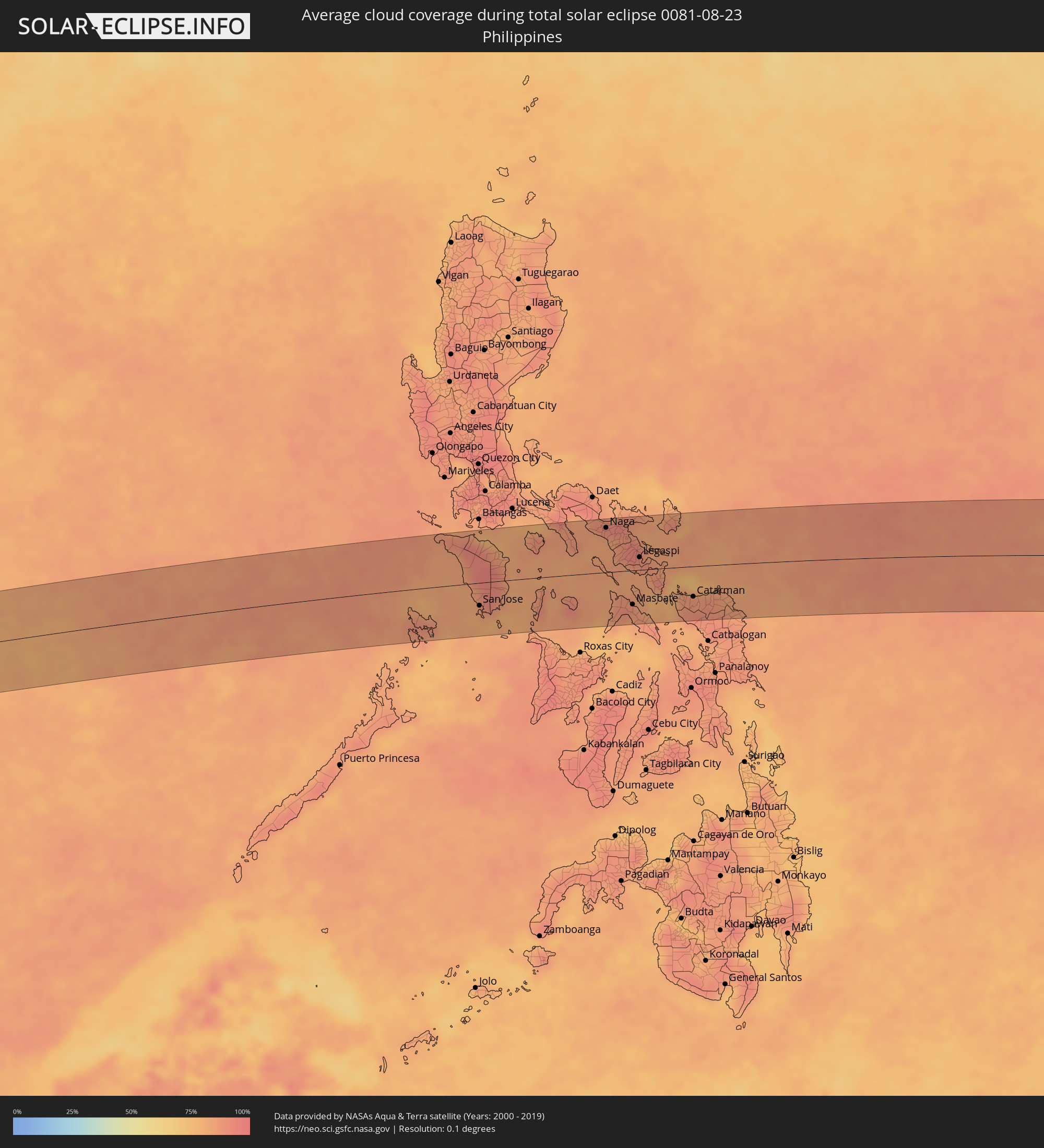 Philippines
 Federated States of Micronesia
Cities inside the path of the eclipse
The following table shows all locations with a population of more than 5,000 inside the eclipse path. Cities which have more than 100,000 inhabitants are marked bold. A click at the locations opens a detailed map.
| City | Type | Eclipse duration | Local time of max. eclipse | Distance to central line | Ø Cloud coverage |
|
Atafu Village, Atafu
|
total | - | 15:30:56 UTC-11:00 | 17 km | 66% |
|
Nukunonu, Nukunonu
|
total | - | 15:32:21 UTC-11:00 | 50 km | 61% |
|
Fale old settlement, Fakaofo
|
total | - | 15:33:17 UTC-11:00 | 39 km | 64% |
|
Uturoa, Leeward Islands
|
total | - | 16:54:50 UTC-09:58 | 15 km | 59% |
|
Faaa, Îles du Vent
|
total | - | 16:55:41 UTC-09:58 | 12 km | 55% |
|
Punaauia, Îles du Vent
|
total | - | 16:55:41 UTC-09:58 | 21 km | 55% |
|
Paea, Îles du Vent
|
total | - | 16:55:42 UTC-09:58 | 26 km | 51% |
|
Papeete, Îles du Vent
|
total | - | 16:55:41 UTC-09:58 | 10 km | 53% |
|
Papao, Îles du Vent
|
total | - | 16:55:43 UTC-09:58 | 32 km | 47% |
|
Pirae, Îles du Vent
|
total | - | 02:53:58 UTC+00:00 | 7 km | 66% |
|
Arue, Îles du Vent
|
total | - | 16:55:42 UTC-09:58 | 6 km | 66% |
|
Mahina, Îles du Vent
|
total | - | 16:55:43 UTC-09:58 | 4 km | 66% |
|
Afaahiti
|
total | - | 16:55:49 UTC-09:58 | 24 km | 64% |
|
Phang Nga, Phangnga
|
total | - | 06:13:49 UTC+06:42 | 73 km | 92% |
|
Ban Nam Yuen, Chumphon
|
total | - | 06:13:51 UTC+06:42 | 75 km | 93% |
|
Lang Suan, Chumphon
|
total | - | 06:13:52 UTC+06:42 | 77 km | 91% |
|
Chaiya, Surat Thani
|
total | - | 06:13:53 UTC+06:42 | 14 km | 91% |
|
Phunphin, Surat Thani
|
total | - | 06:13:53 UTC+06:42 | 17 km | 93% |
|
Surat Thani, Surat Thani
|
total | - | 06:13:54 UTC+06:42 | 16 km | 92% |
|
Ban Na San, Surat Thani
|
total | - | 06:13:54 UTC+06:42 | 54 km | 90% |
|
Wiang Sa, Surat Thani
|
total | - | 06:13:54 UTC+06:42 | 72 km | 92% |
|
Don Sak, Surat Thani
|
total | - | 06:13:56 UTC+06:42 | 5 km | 86% |
|
Ko Samui, Surat Thani
|
total | - | 06:13:59 UTC+06:42 | 13 km | 83% |
|
Ko Pha Ngan, Nakhon Si Thammarat
|
total | - | 06:14:00 UTC+06:42 | 35 km | 81% |
|
Sihanoukville, Preah Sihanouk
|
total | - | 06:14:45 UTC+06:42 | 52 km | 89% |
|
Kampot, Kampot
|
total | - | 06:14:56 UTC+06:42 | 38 km | 87% |
|
Krong Kep, Kep
|
total | - | 06:14:58 UTC+06:42 | 21 km | 85% |
|
Hà Tiên, Kiến Giang
|
total | - | 06:39:37 UTC+07:06 | 7 km | 87% |
|
Phumĭ Véal Srê, Takeo
|
total | - | 06:15:08 UTC+06:42 | 66 km | 95% |
|
Takeo, Takeo
|
total | - | 06:15:08 UTC+06:42 | 67 km | 95% |
|
Rạch Giá, Kiến Giang
|
total | - | 06:39:48 UTC+07:06 | 46 km | 87% |
|
Cho Dok, An Giang
|
total | - | 06:39:50 UTC+07:06 | 29 km | 93% |
|
Long Xuyên, An Giang
|
total | - | 06:39:56 UTC+07:06 | 12 km | 93% |
|
Vị Thanh, Hau Giang
|
total | - | 06:39:57 UTC+07:06 | 79 km | 94% |
|
Cao Lãnh, Đồng Tháp
|
total | - | 06:40:00 UTC+07:06 | 8 km | 91% |
|
Sadek, Đồng Tháp
|
total | - | 06:40:03 UTC+07:06 | 29 km | 89% |
|
Cần Thơ, Cần Thơ
|
total | - | 06:40:03 UTC+07:06 | 58 km | 93% |
|
Svay Rieng, Svay Rieng
|
total | - | 06:15:29 UTC+06:42 | 57 km | 96% |
|
Vĩnh Long, Vĩnh Long
|
total | - | 06:40:07 UTC+07:06 | 38 km | 90% |
|
Tây Ninh, Tây Ninh
|
total | - | 06:40:12 UTC+07:06 | 75 km | 97% |
|
Phú Khương, Tây Ninh
|
total | - | 06:40:13 UTC+07:06 | 72 km | 97% |
|
Trà Vinh, Trà Vinh
|
total | - | 06:40:16 UTC+07:06 | 79 km | 95% |
|
Mỹ Tho, Tiền Giang
|
total | - | 06:40:16 UTC+07:06 | 34 km | 93% |
|
Bến Tre, Bến Tre
|
total | - | 06:40:17 UTC+07:06 | 47 km | 90% |
|
Tân An, Long An
|
total | - | 06:40:18 UTC+07:06 | 16 km | 96% |
|
Củ Chi, Ho Chi Minh City
|
total | - | 06:40:20 UTC+07:06 | 31 km | 96% |
|
Ho Chi Minh City, Ho Chi Minh City
|
total | - | 06:40:23 UTC+07:06 | 12 km | 97% |
|
Thủ Dầu Một, Bình Dương
|
total | - | 06:40:24 UTC+07:06 | 28 km | 95% |
|
Cần Giuộc, Long An
|
total | - | 06:40:24 UTC+07:06 | 13 km | 92% |
|
Biên Hòa, Đồng Nai
|
total | - | 06:40:28 UTC+07:06 | 21 km | 96% |
|
Don Luan, Bình Phước
|
total | - | 06:40:31 UTC+07:06 | 85 km | 93% |
|
Cần Giờ, Ho Chi Minh City
|
total | - | 06:40:31 UTC+07:06 | 40 km | 74% |
|
Vũng Tàu, Bà Rịa-Vũng Tàu
|
total | - | 06:40:34 UTC+07:06 | 50 km | 66% |
|
La Gi, Bình Thuận
|
total | - | 06:40:52 UTC+07:06 | 28 km | 81% |
|
Bảo Lộc, Lâm Đồng
|
total | - | 06:40:54 UTC+07:06 | 68 km | 90% |
|
Phan Thiết, Bình Thuận
|
total | - | 06:41:01 UTC+07:06 | 5 km | 80% |
|
Đinh Văn, Lâm Đồng
|
total | - | 06:41:06 UTC+07:06 | 86 km | 85% |
|
Phan Rang-Tháp Chàm, Ninh Thuận
|
total | - | 06:41:27 UTC+07:06 | 48 km | 81% |
|
Cam Ranh, Khánh Hòa
|
total | - | 06:41:33 UTC+07:06 | 84 km | 76% |
|
Mamburao, Mimaropa
|
total | - | 07:43:32 UTC+08:00 | 60 km | 83% |
|
Sablayan, Mimaropa
|
total | - | 07:43:44 UTC+08:00 | 15 km | 83% |
|
Calintaan, Mimaropa
|
total | - | 07:43:55 UTC+08:00 | 16 km | 82% |
|
San Jose, Mimaropa
|
total | - | 07:44:04 UTC+08:00 | 41 km | 85% |
|
Calapan, Mimaropa
|
total | - | 07:44:09 UTC+08:00 | 75 km | 79% |
|
Bulalacao, Mimaropa
|
total | - | 07:44:22 UTC+08:00 | 47 km | 83% |
|
Mansalay, Mimaropa
|
total | - | 07:44:27 UTC+08:00 | 26 km | 86% |
|
Bansud, Mimaropa
|
total | - | 07:44:28 UTC+08:00 | 12 km | 84% |
|
Pinamalayan, Mimaropa
|
total | - | 07:44:27 UTC+08:00 | 32 km | 84% |
|
Romblon, Mimaropa
|
total | - | 07:45:23 UTC+08:00 | 28 km | 84% |
|
Catanauan, Calabarzon
|
total | - | 07:45:23 UTC+08:00 | 85 km | 85% |
|
Aurora, Calabarzon
|
total | - | 07:45:37 UTC+08:00 | 56 km | 84% |
|
San Narciso, Calabarzon
|
total | - | 07:45:40 UTC+08:00 | 80 km | 87% |
|
Naga, Bicol
|
total | - | 07:46:22 UTC+08:00 | 80 km | 91% |
|
Bula, Bicol
|
total | - | 07:46:30 UTC+08:00 | 63 km | 86% |
|
Iriga City, Bicol
|
total | - | 07:46:39 UTC+08:00 | 58 km | 88% |
|
Pio Duran, Bicol
|
total | - | 07:46:43 UTC+08:00 | 13 km | 85% |
|
Polangui, Bicol
|
total | - | 07:46:45 UTC+08:00 | 42 km | 92% |
|
Goa, Bicol
|
total | - | 07:46:44 UTC+08:00 | 87 km | 90% |
|
Masbate, Bicol
|
total | - | 07:46:59 UTC+08:00 | 62 km | 88% |
|
Tabaco, Bicol
|
total | - | 07:47:02 UTC+08:00 | 47 km | 90% |
|
Legaspi, Bicol
|
total | - | 07:47:04 UTC+08:00 | 23 km | 89% |
|
Bulan, Bicol
|
total | - | 07:47:16 UTC+08:00 | 30 km | 83% |
|
Sorsogon, Bicol
|
total | - | 07:47:23 UTC+08:00 | 2 km | 84% |
|
Irosin, Bicol
|
total | - | 07:47:27 UTC+08:00 | 28 km | 87% |
|
Gubat, Bicol
|
total | - | 07:47:33 UTC+08:00 | 4 km | 85% |
|
Virac, Bicol
|
total | - | 07:47:38 UTC+08:00 | 69 km | 83% |
|
Catarman, Eastern Visayas
|
total | - | 07:48:14 UTC+08:00 | 55 km | 87% |
|
Laoang, Eastern Visayas
|
total | - | 07:48:42 UTC+08:00 | 49 km | 83% |
|
Palikir - National Government Center, Pohnpei
|
total | - | 12:07:14 UTC+11:00 | 69 km | 81% |
|
Kolonia Town, Pohnpei
|
total | - | 12:07:18 UTC+11:00 | 63 km | 82% |
|
Kolonia, Pohnpei
|
total | - | 12:07:18 UTC+11:00 | 63 km | 82% |
|
Tofol, Kosrae
|
total | - | 12:22:49 UTC+11:00 | 5 km | 72% |