Annular solar eclipse of 12/31/0316
| Day of week: | Sunday |
| Maximum duration of eclipse: | 00m58s |
| Maximum width of eclipse path: | 33 km |
| Saros cycle: | 85 |
| Coverage: | 99.2% |
| Magnitude: | 0.9915 |
| Gamma: | 0.4067 |
Wo kann man die Sonnenfinsternis vom 12/31/0316 sehen?
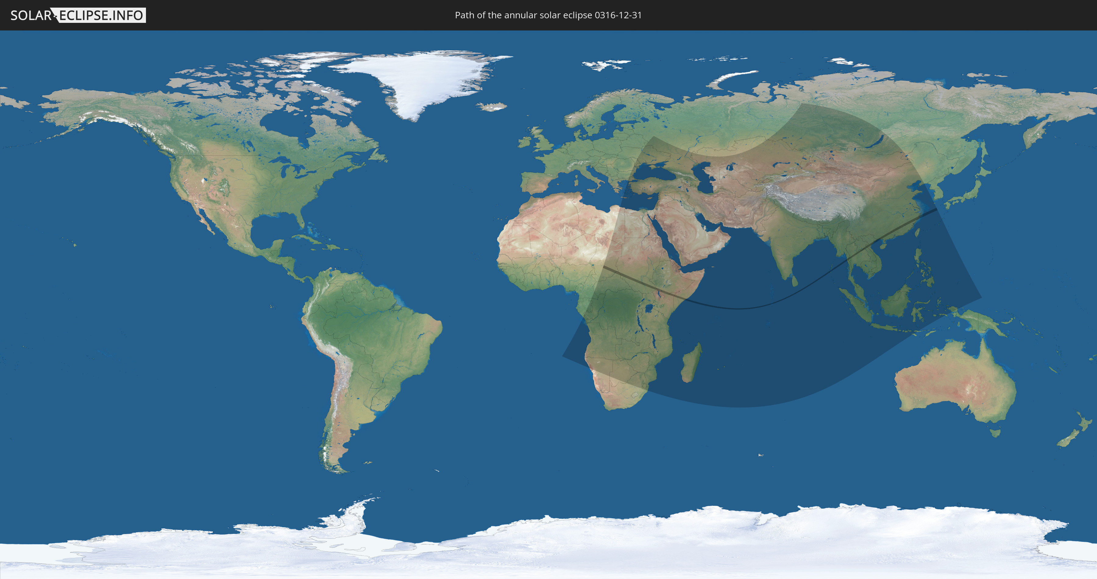
Die Sonnenfinsternis am 12/31/0316 kann man in 95 Ländern als partielle Sonnenfinsternis beobachten.
Der Finsternispfad verläuft durch 14 Länder. Nur in diesen Ländern ist sie als annular Sonnenfinsternis zu sehen.
In den folgenden Ländern ist die Sonnenfinsternis annular zu sehen
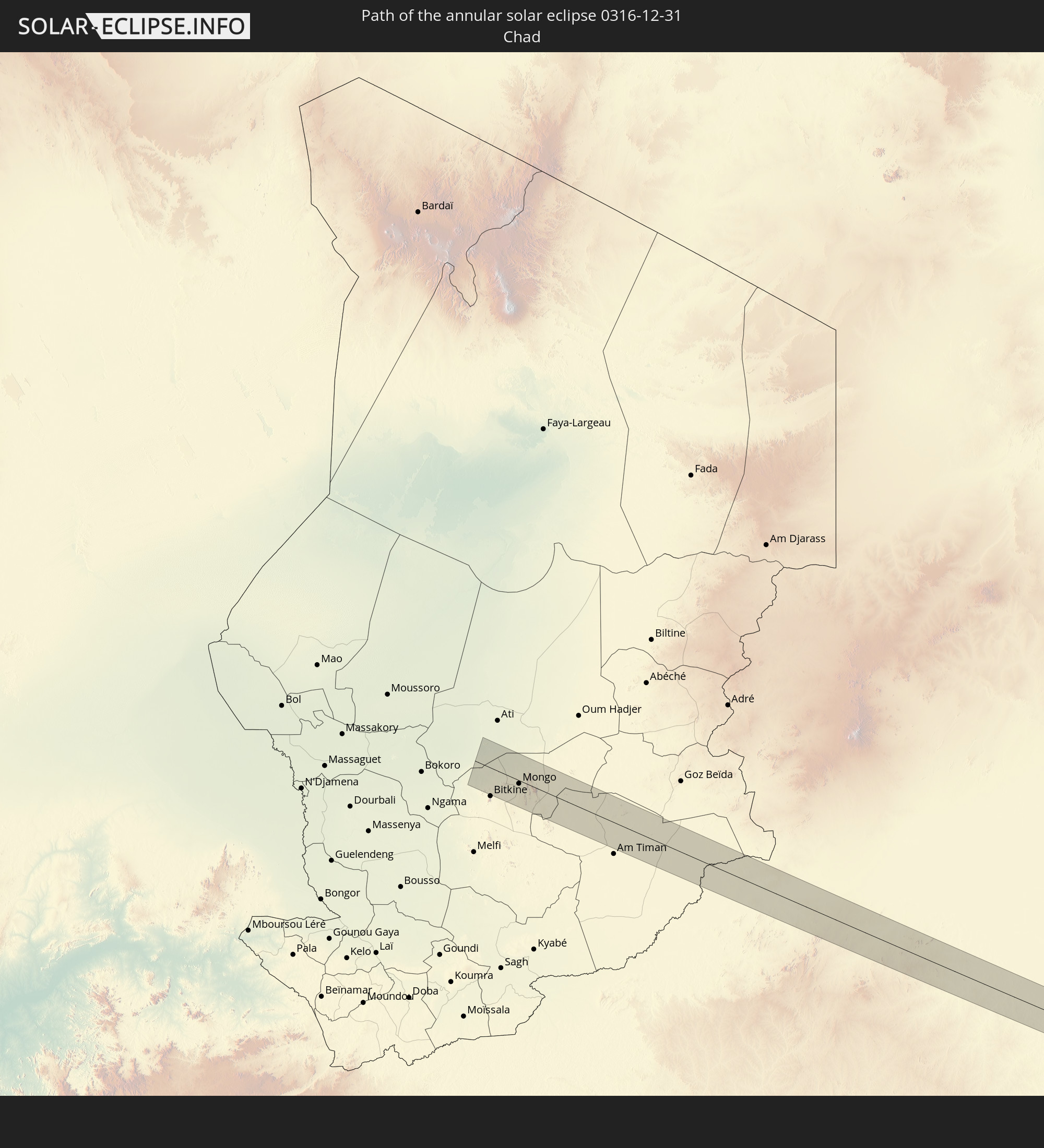 Chad
Chad
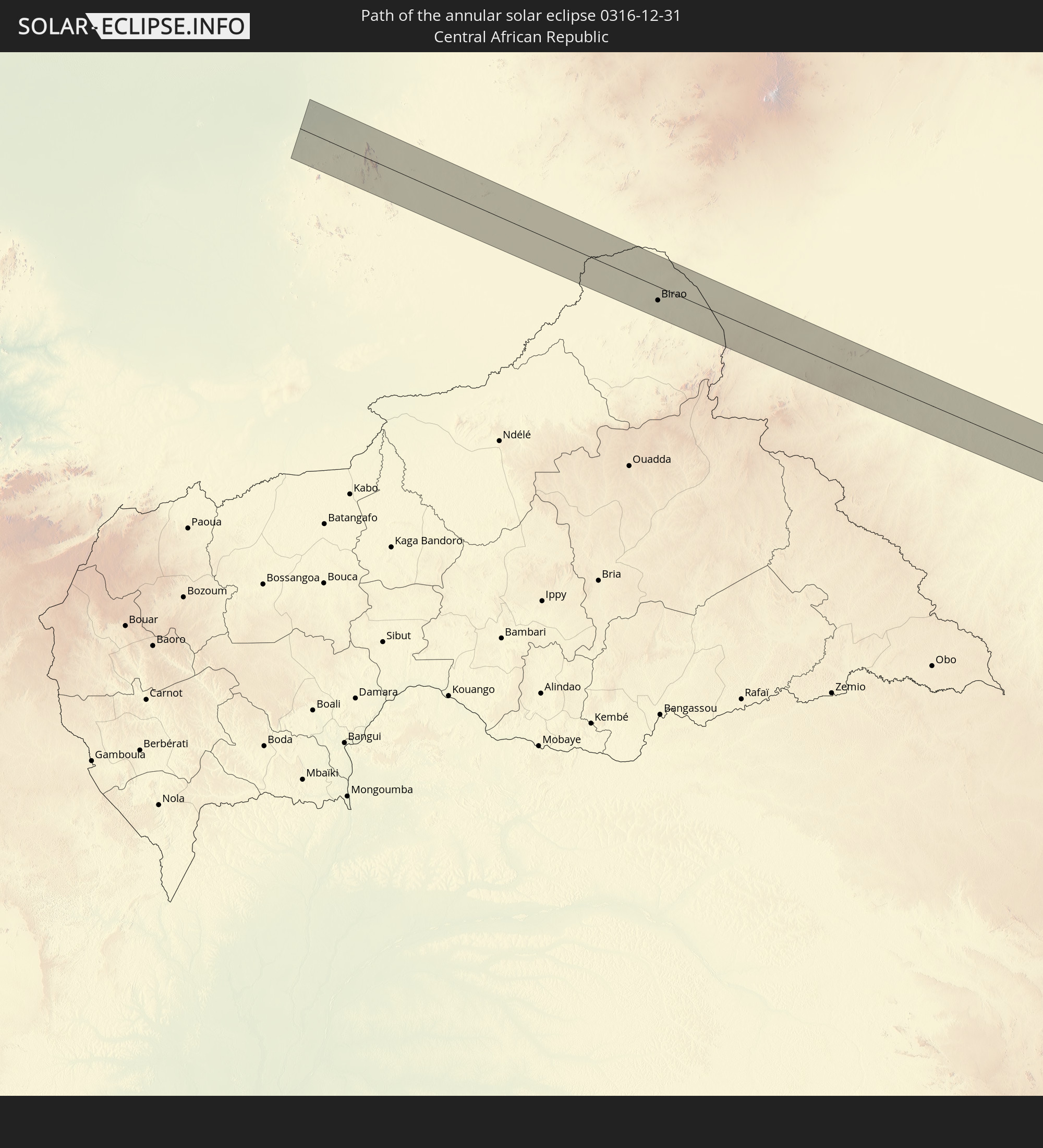 Central African Republic
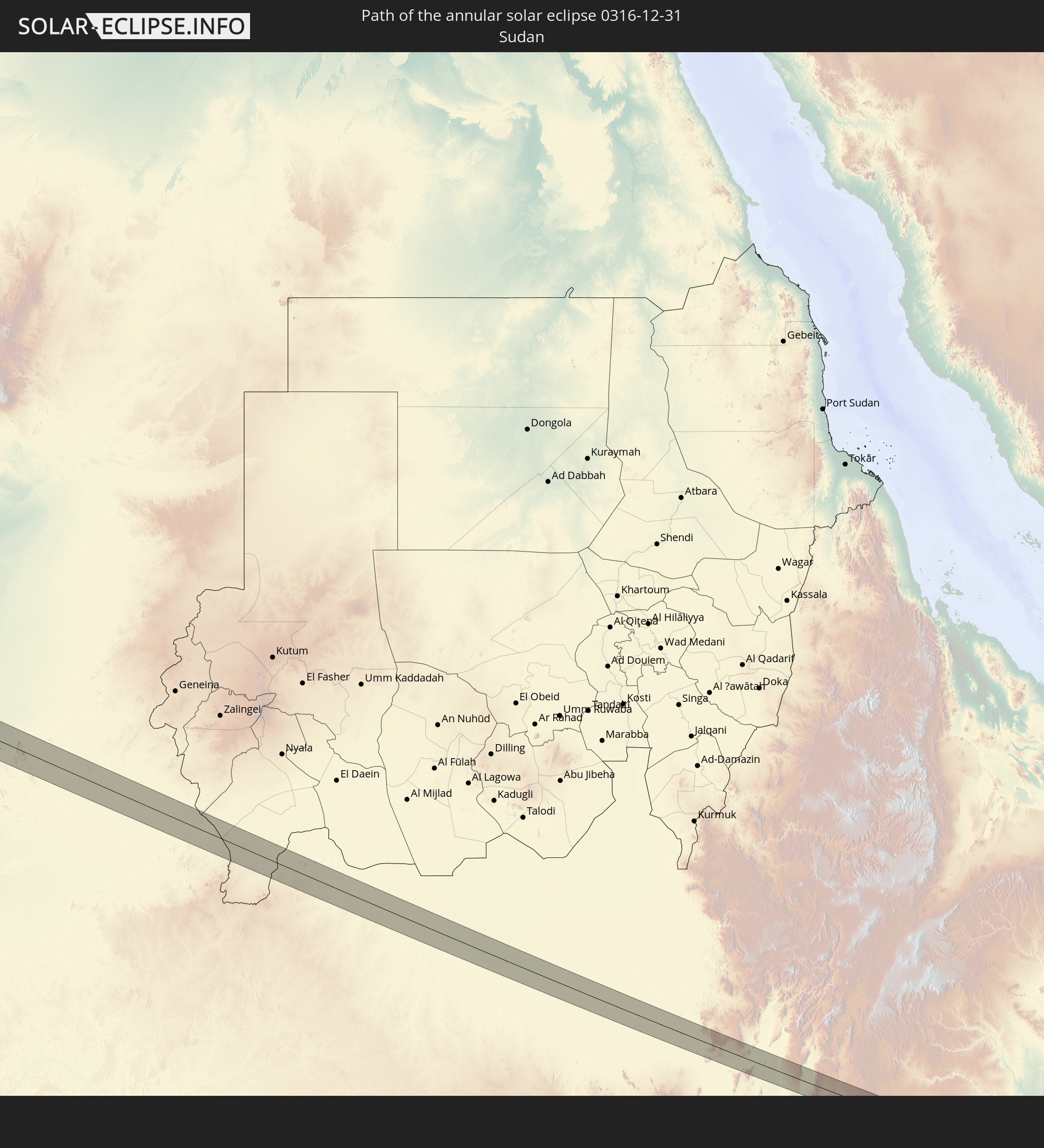 Sudan
Sudan
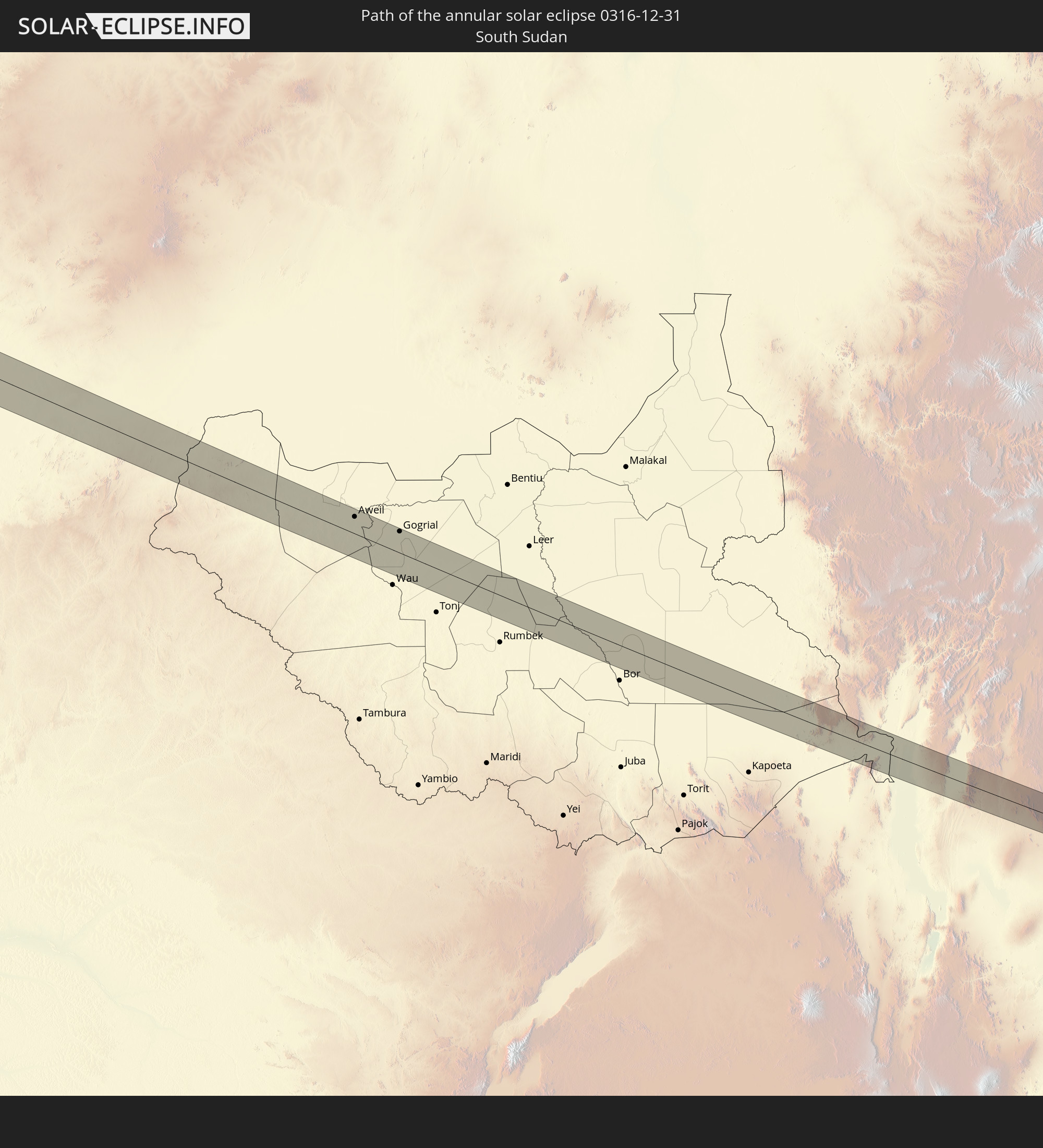 South Sudan
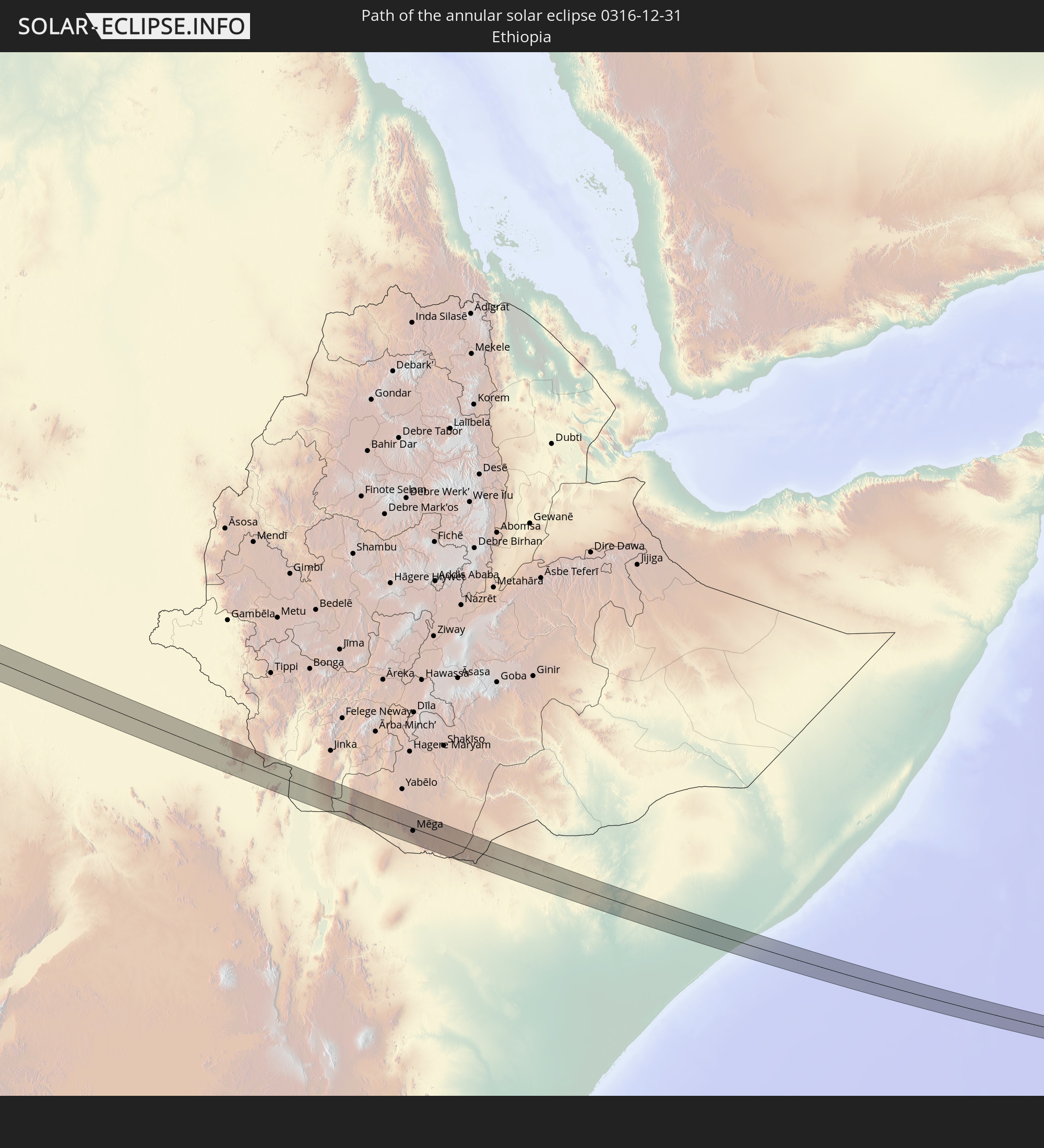 Ethiopia
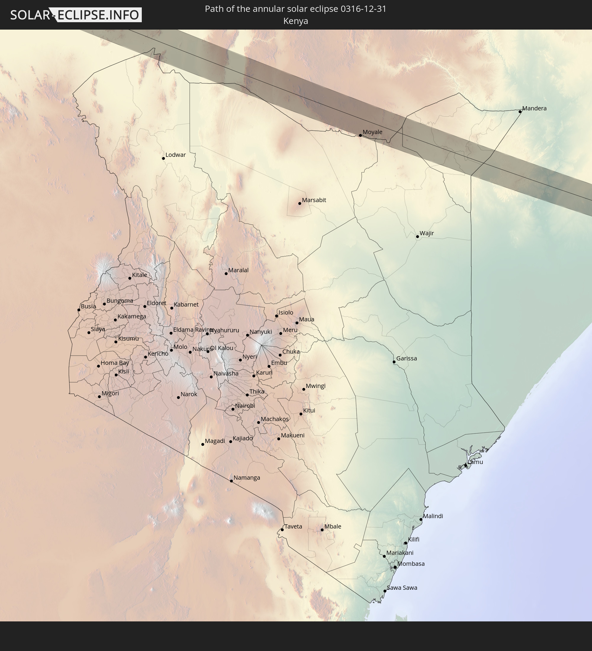 Kenya
Kenya
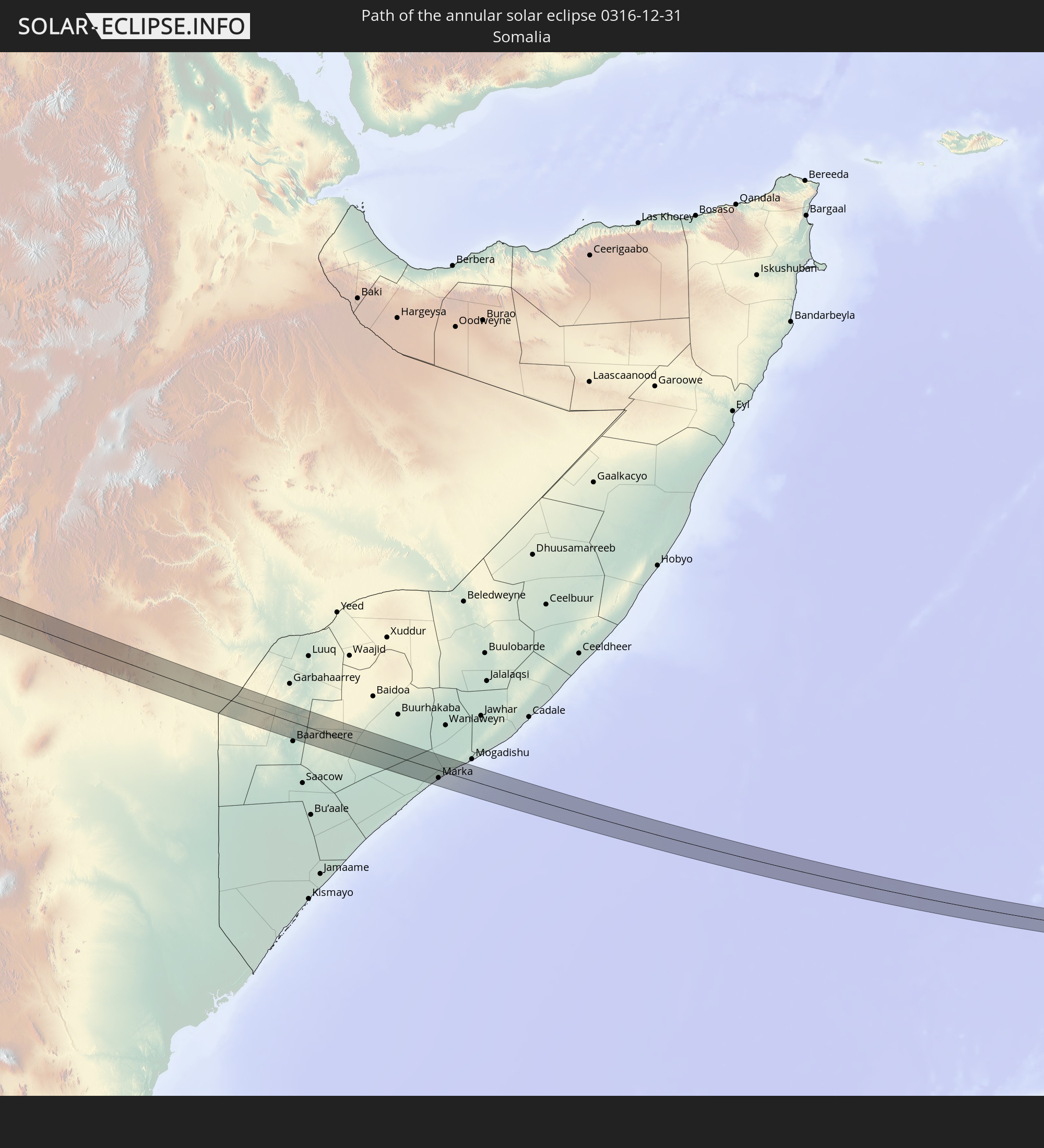 Somalia
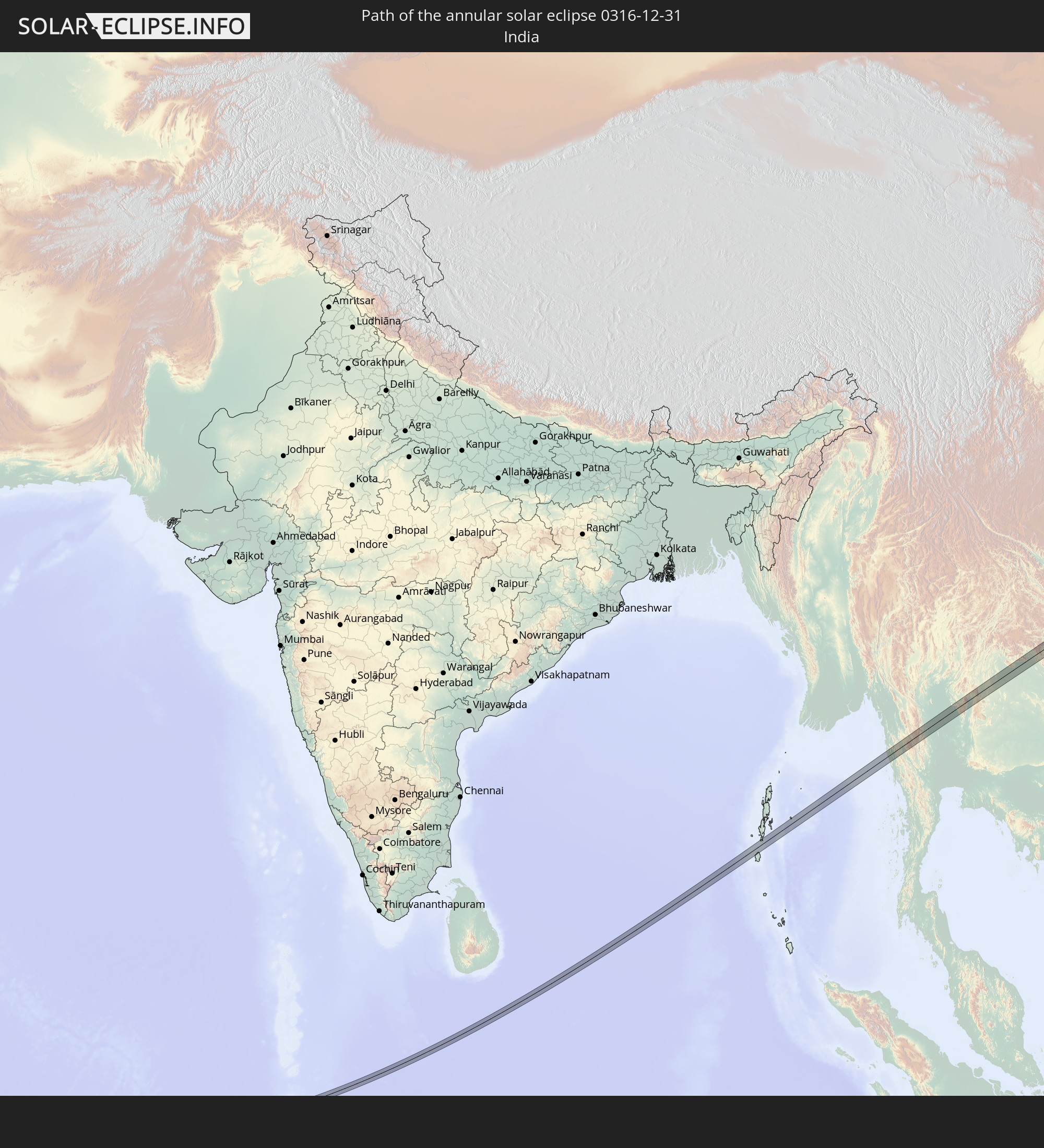 India
India
 Maldives
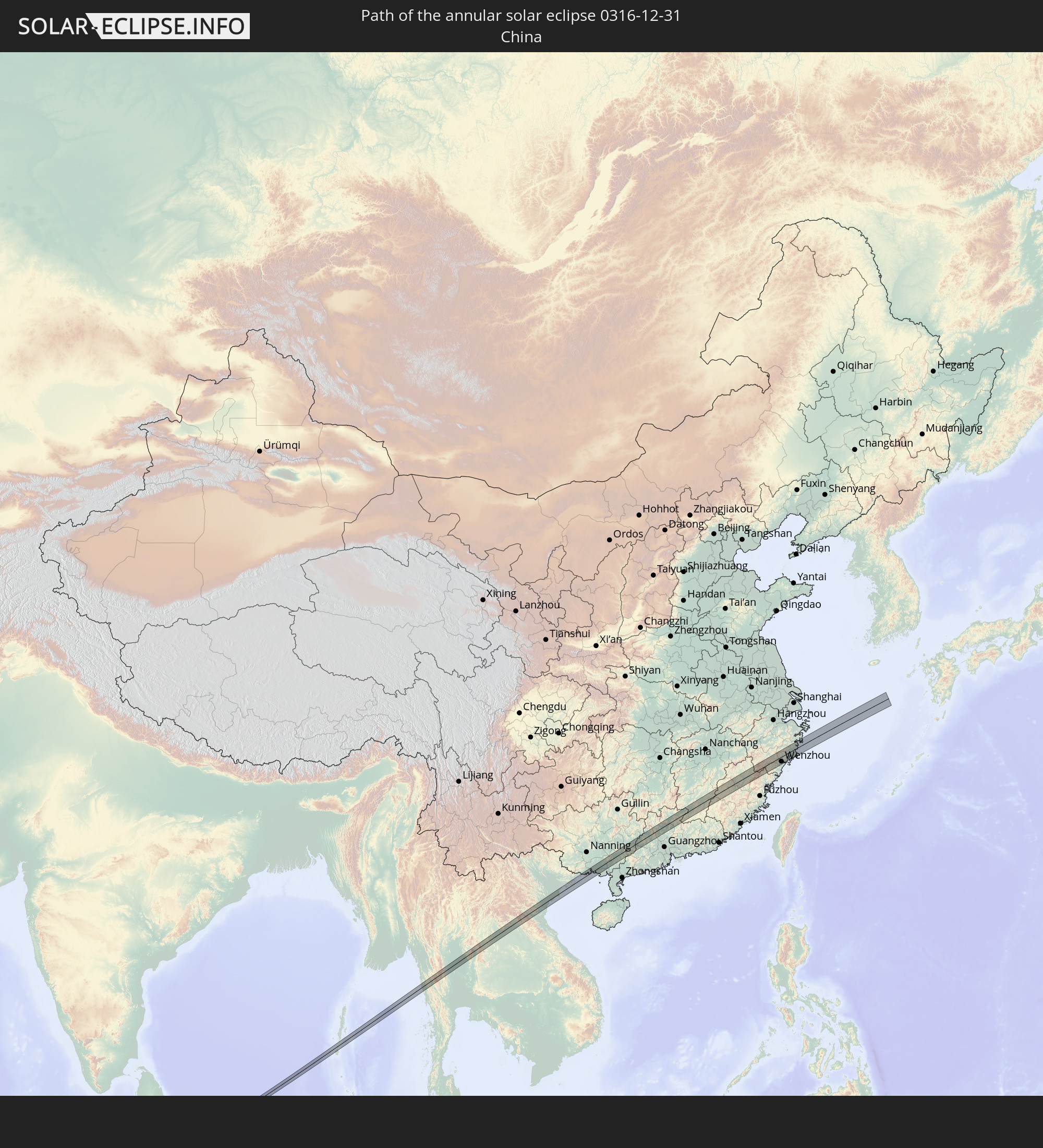 China
China
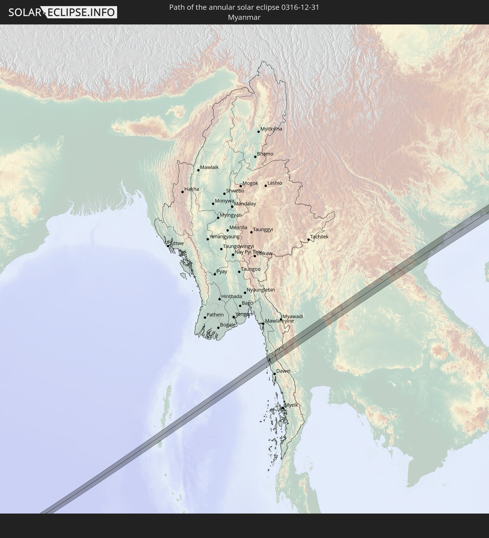 Myanmar
 Thailand
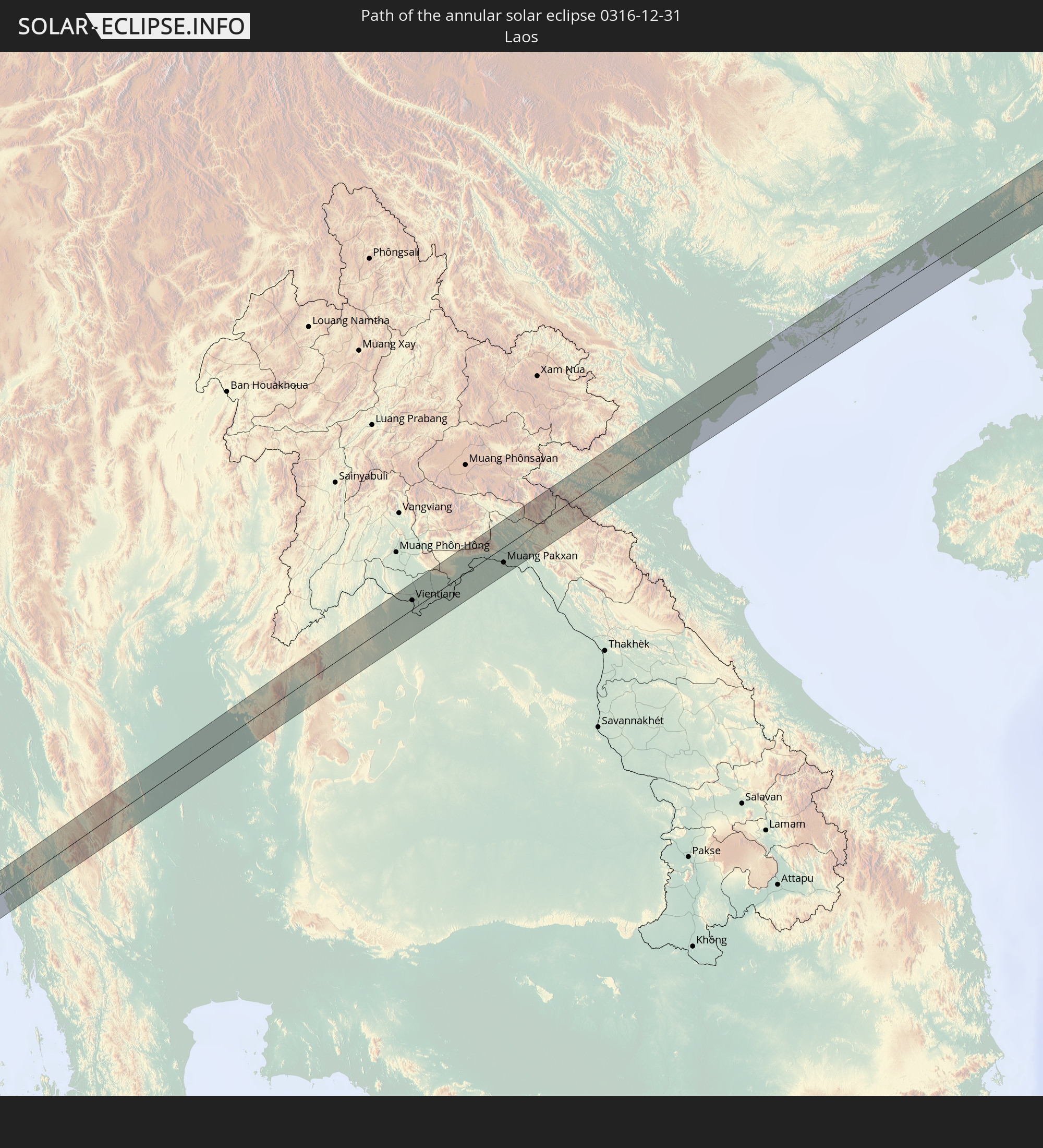 Laos
Laos
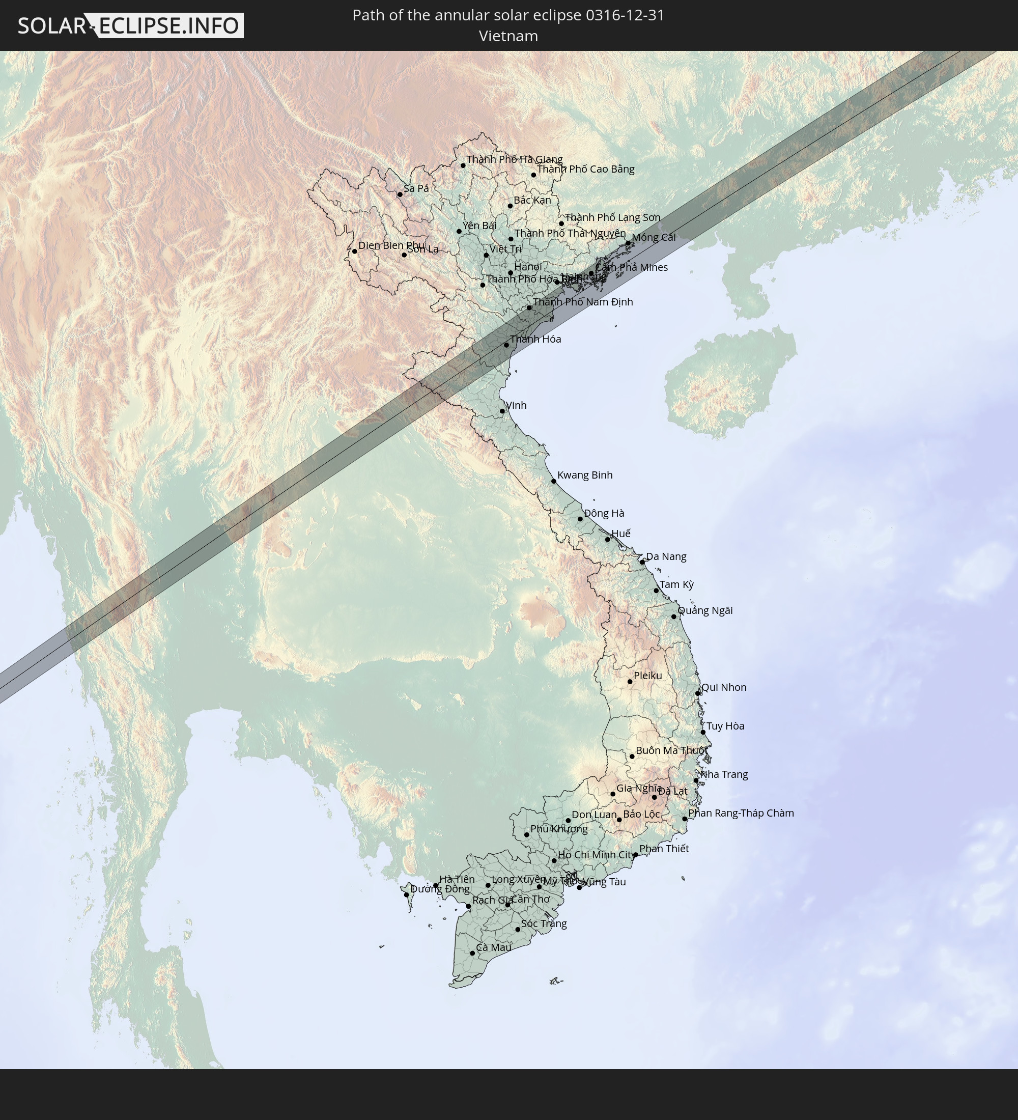 Vietnam
In den folgenden Ländern ist die Sonnenfinsternis partiell zu sehen
 Russia
 Cameroon
 Gabon
Gabon
 Libya
Libya
 Republic of the Congo
 Angola
 Namibia
 Democratic Republic of the Congo
 Chad
Chad
 Central African Republic
 South Africa
 Greece
 Botswana
 Romania
 Sudan
Sudan
 Zambia
 Ukraine
 Bulgaria
 Belarus
 Egypt
Egypt
 Zimbabwe
 Turkey
 Moldova
 Rwanda
 Burundi
 Tanzania
 Uganda
 Mozambique
 Swaziland
 Cyprus
 Malawi
 Ethiopia
 Kenya
Kenya
 State of Palestine
 Israel
 Saudi Arabia
 Jordan
 Lebanon
 Syria
Syria
 Eritrea
 Iraq
Iraq
 Georgia
 French Southern and Antarctic Lands
 Somalia
 Djibouti
 Yemen
Yemen
 Madagascar
 Comoros
 Armenia
 Iran
Iran
 Azerbaijan
 Mayotte
 Seychelles
 Kazakhstan
 Kuwait
 Bahrain
 Qatar
Qatar
 United Arab Emirates
 Oman
Oman
 Turkmenistan
 Réunion
 Uzbekistan
 Mauritius
 Afghanistan
 Pakistan
 Tajikistan
 India
India
 Kyrgyzstan
 British Indian Ocean Territory
 Maldives
 China
China
 Sri Lanka
 Nepal
Nepal
 Mongolia
 Bangladesh
 Bhutan
 Myanmar
 Indonesia
 Cocos Islands
 Thailand
 Malaysia
 Laos
Laos
 Vietnam
 Cambodia
 Singapore
 Christmas Island
 Macau
Macau
 Hong Kong
 Brunei
 Taiwan
 Philippines
 Japan
Japan
 South Korea
 Palau
Palau
 Federated States of Micronesia
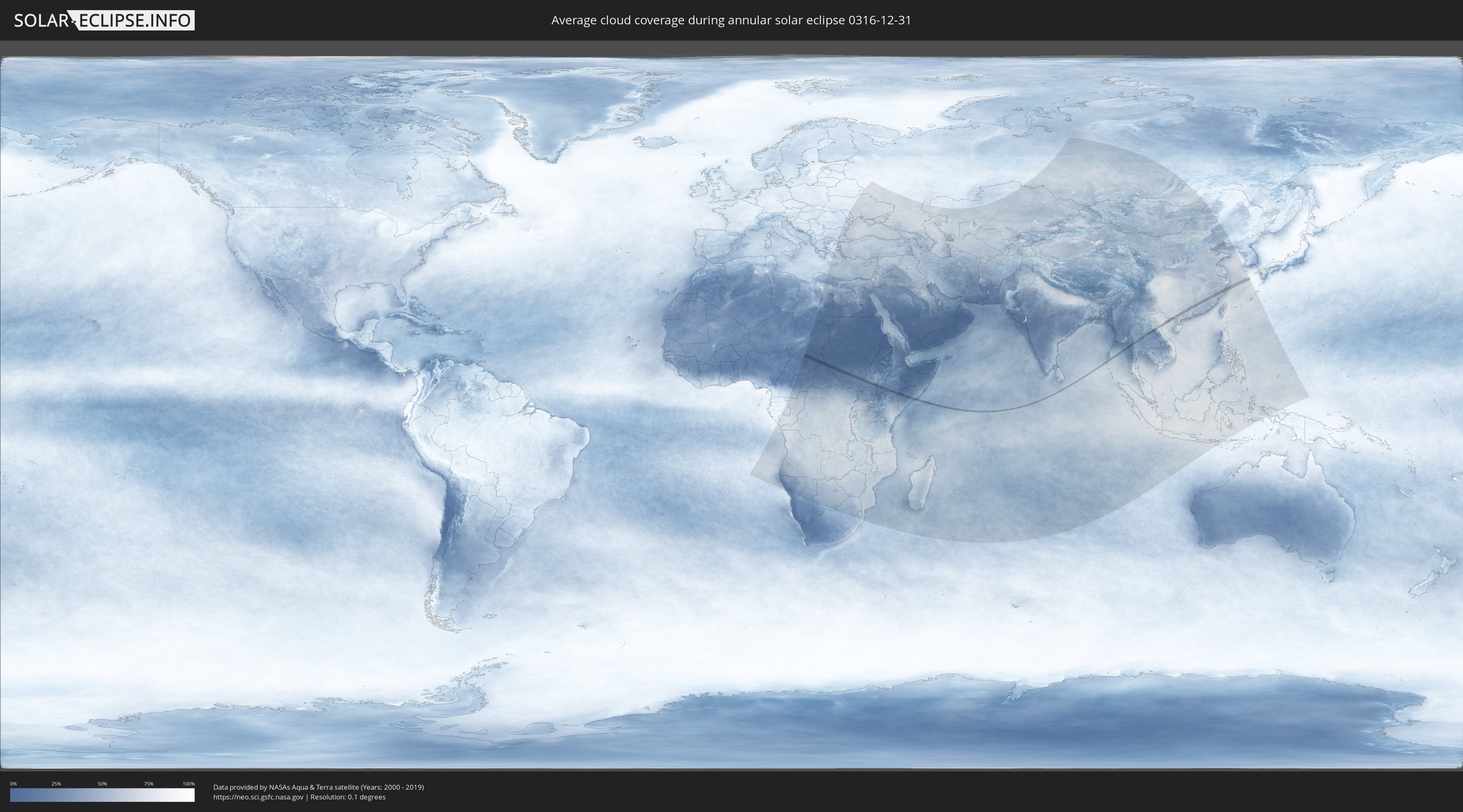
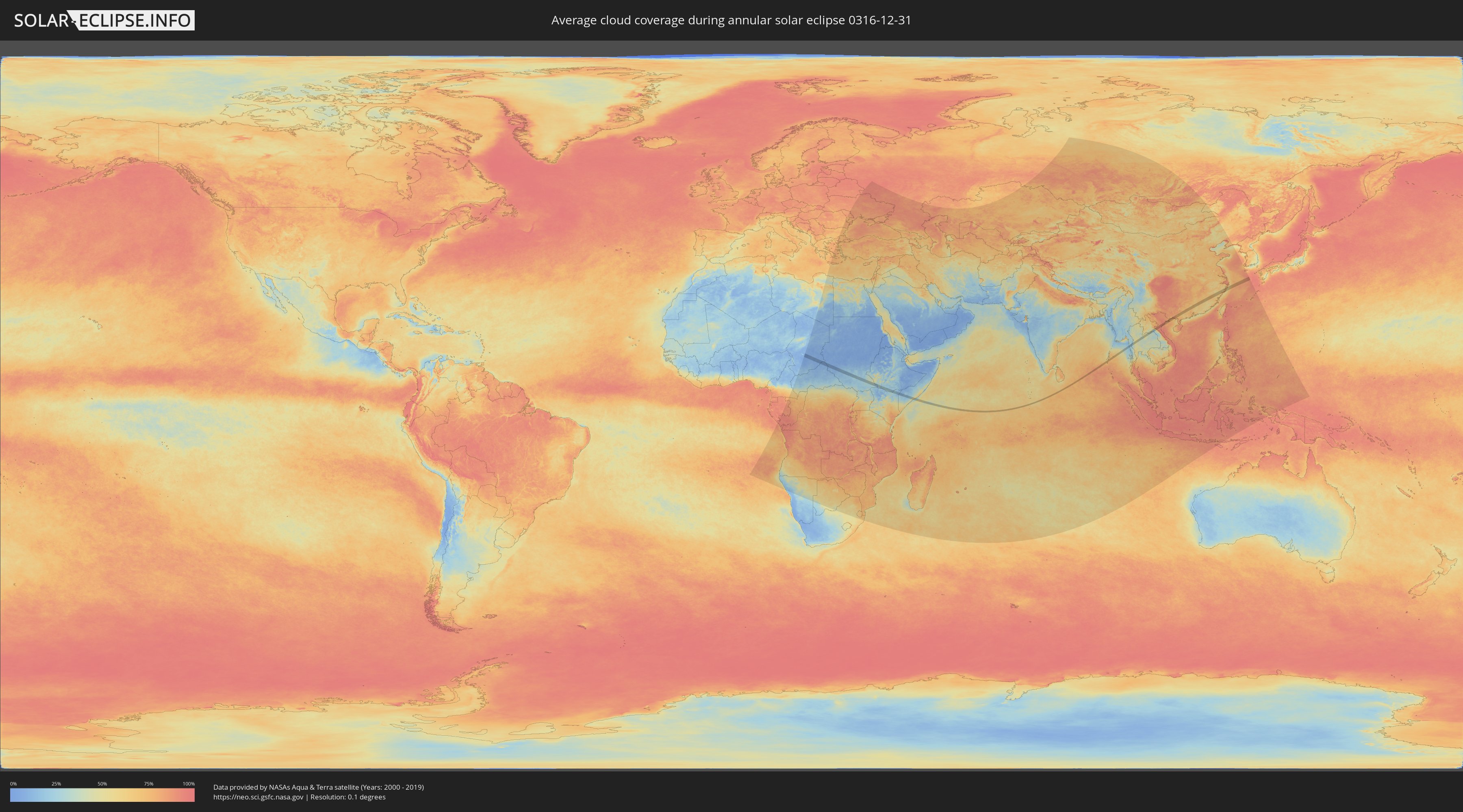
How will be the weather during the annular solar eclipse on 12/31/0316?
Where is the best place to see the annular solar eclipse of 12/31/0316?
The following maps show the average cloud coverage for the day of the annular solar eclipse.
With the help of these maps, it is possible to find the place along the eclipse path, which has the best
chance of a cloudless sky.
Nevertheless, you should consider local circumstances and inform about the weather of your chosen
observation site.
The data is provided by NASAs satellites
AQUA and TERRA.
The cloud maps are averaged over a period of 19 years (2000 - 2019).
Detailed country maps
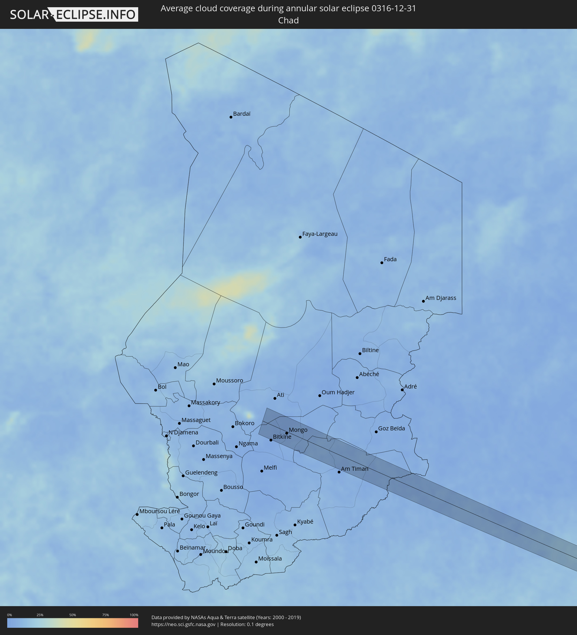 Chad
Chad
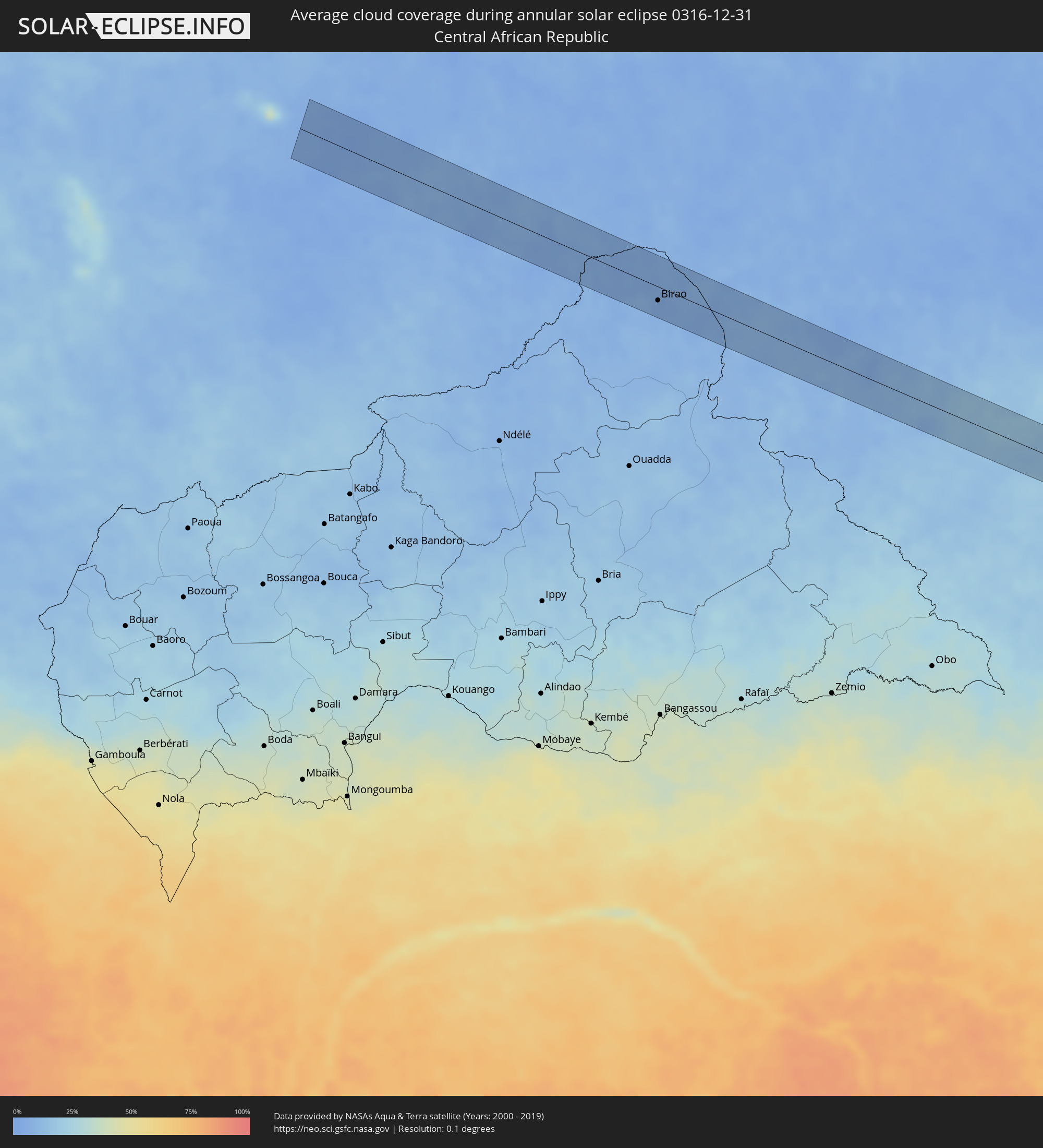 Central African Republic
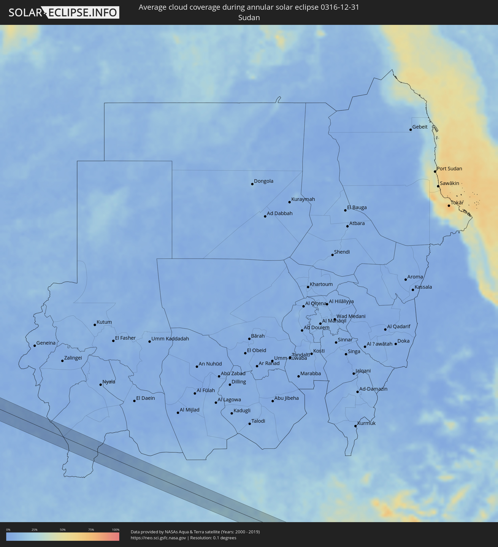 Sudan
Sudan
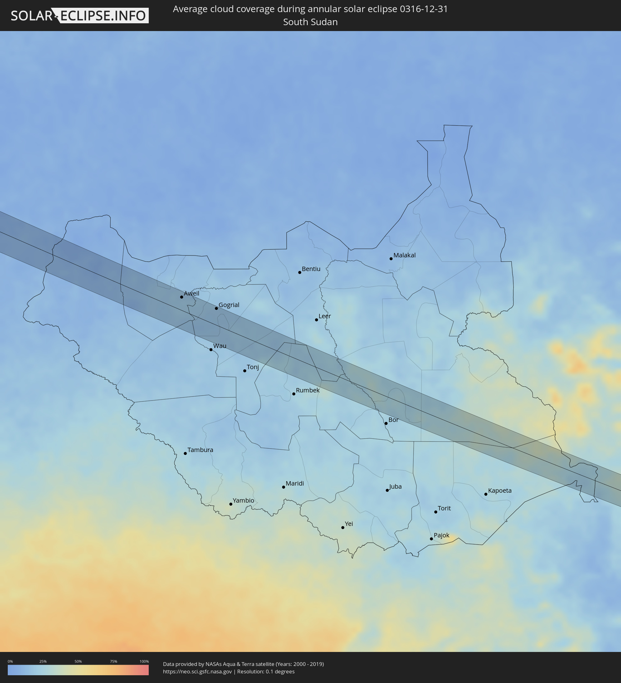 South Sudan
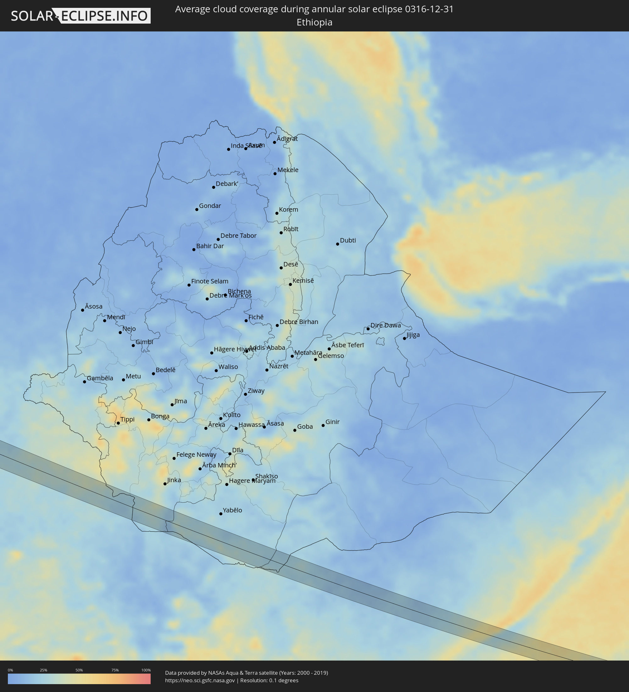 Ethiopia
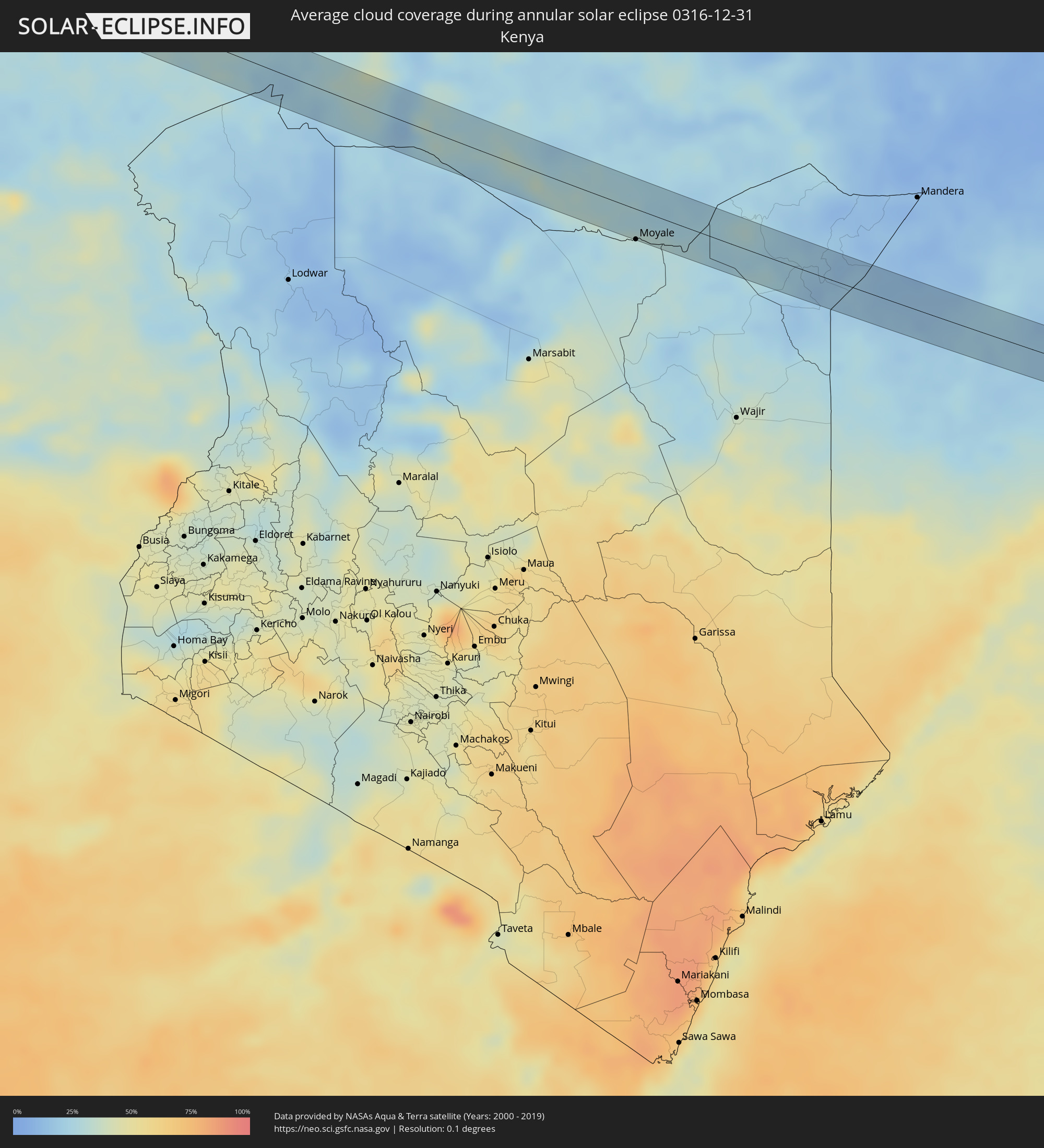 Kenya
Kenya
 Somalia
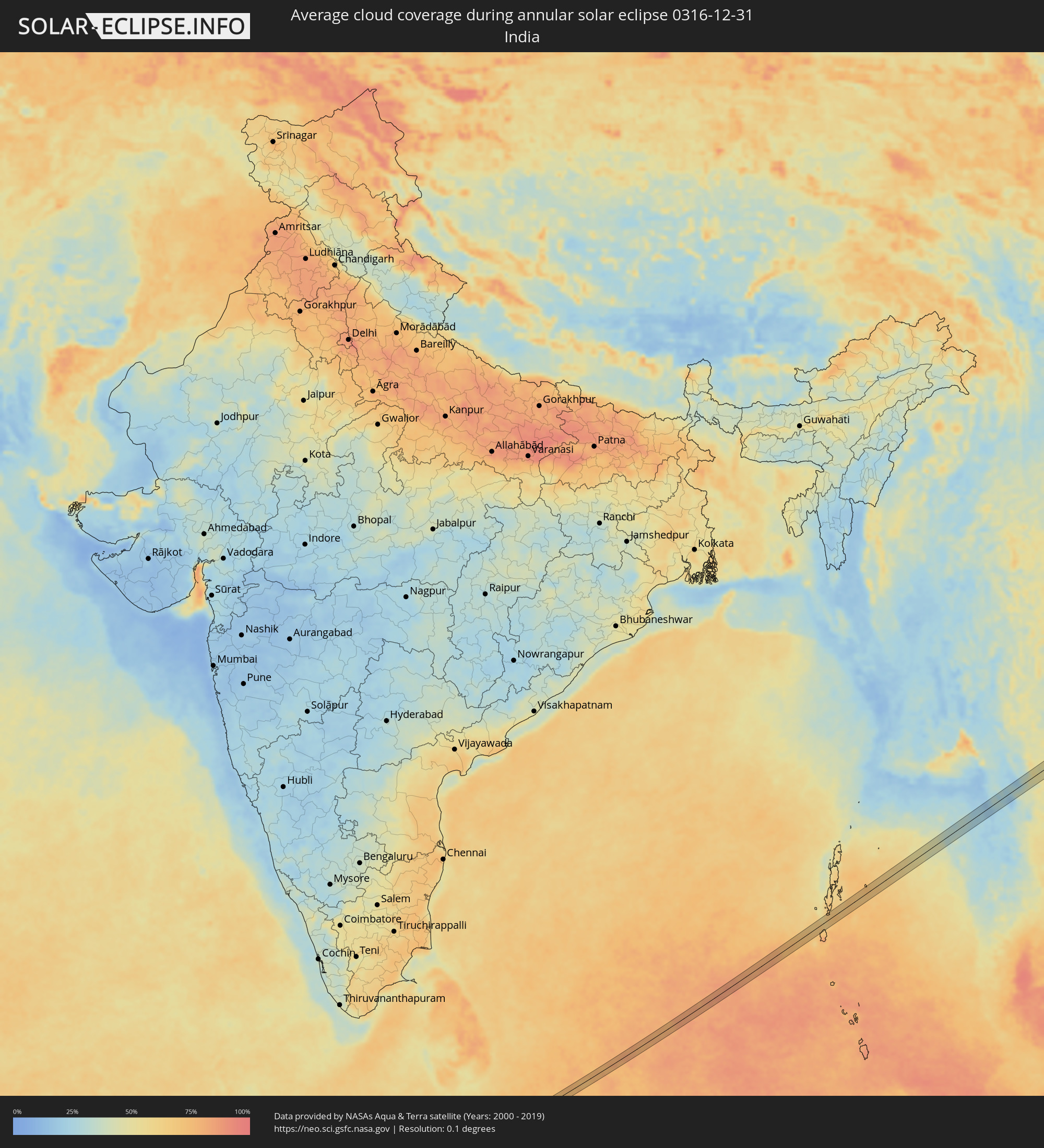 India
India
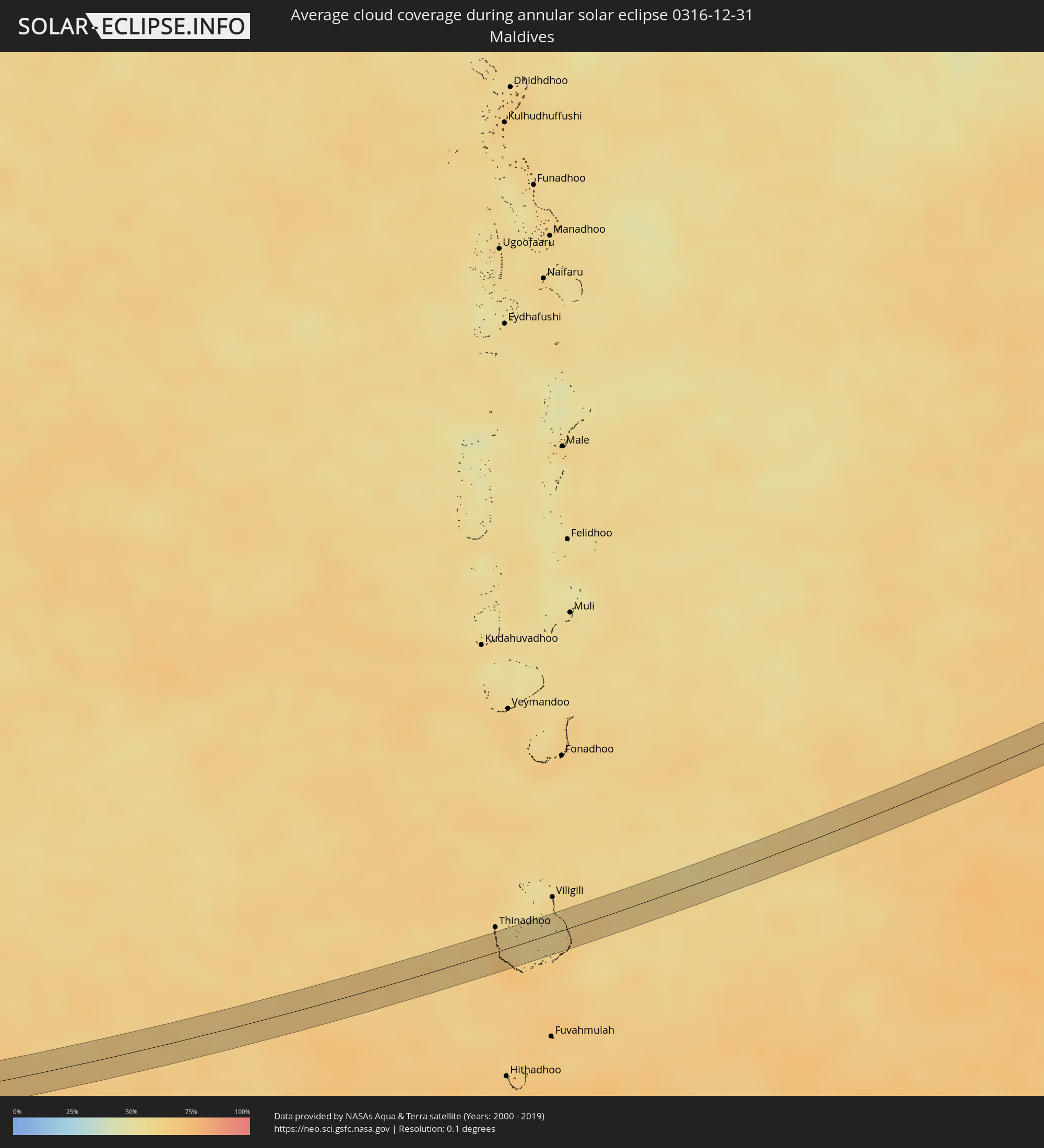 Maldives
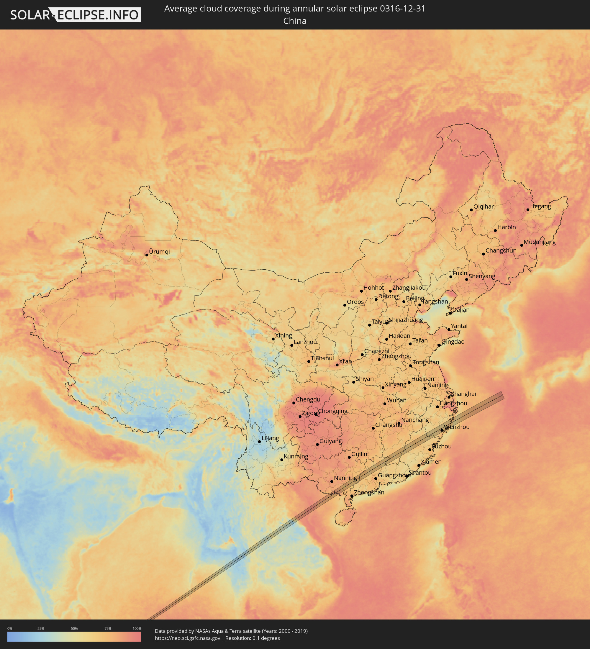 China
China
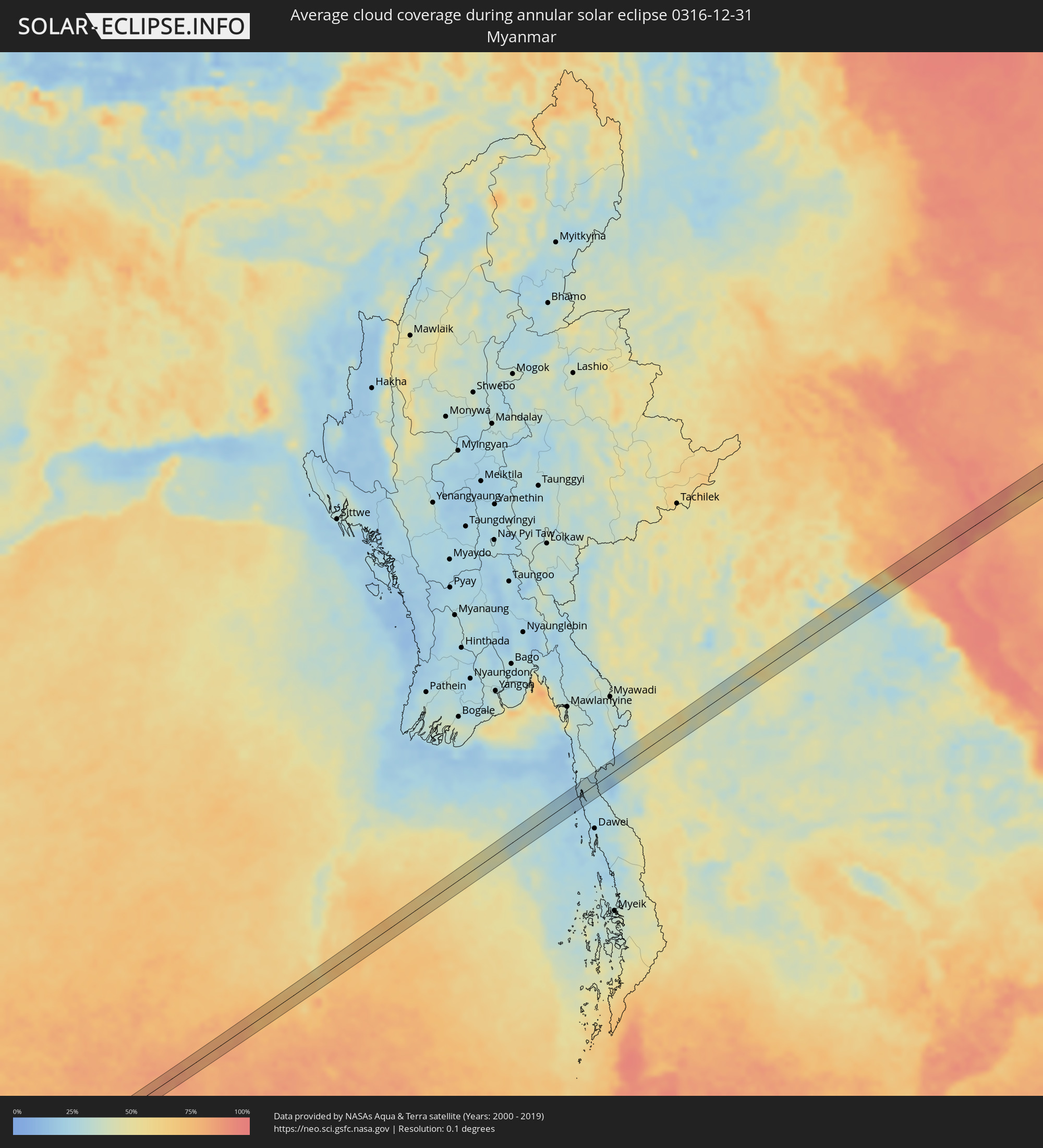 Myanmar
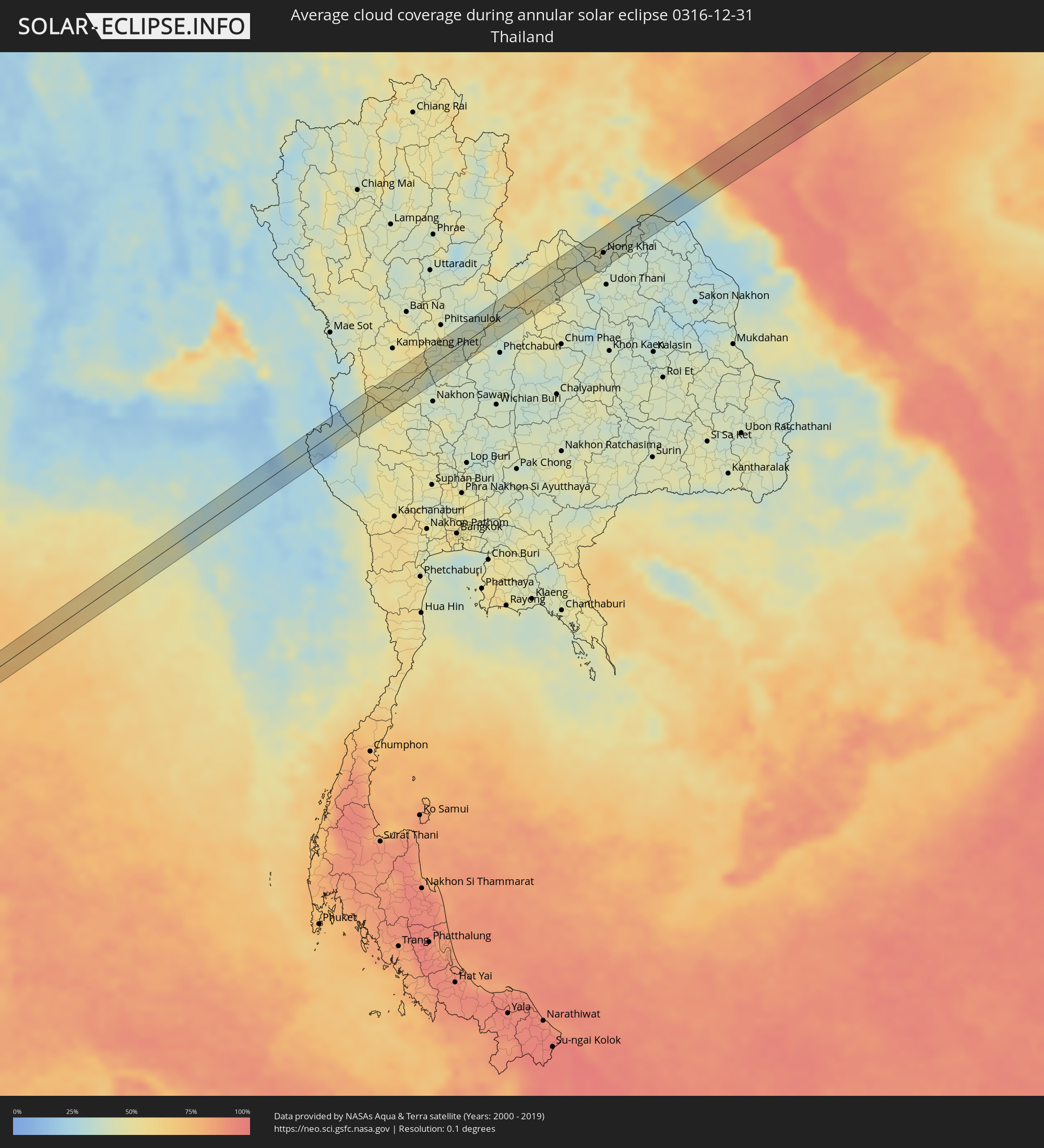 Thailand
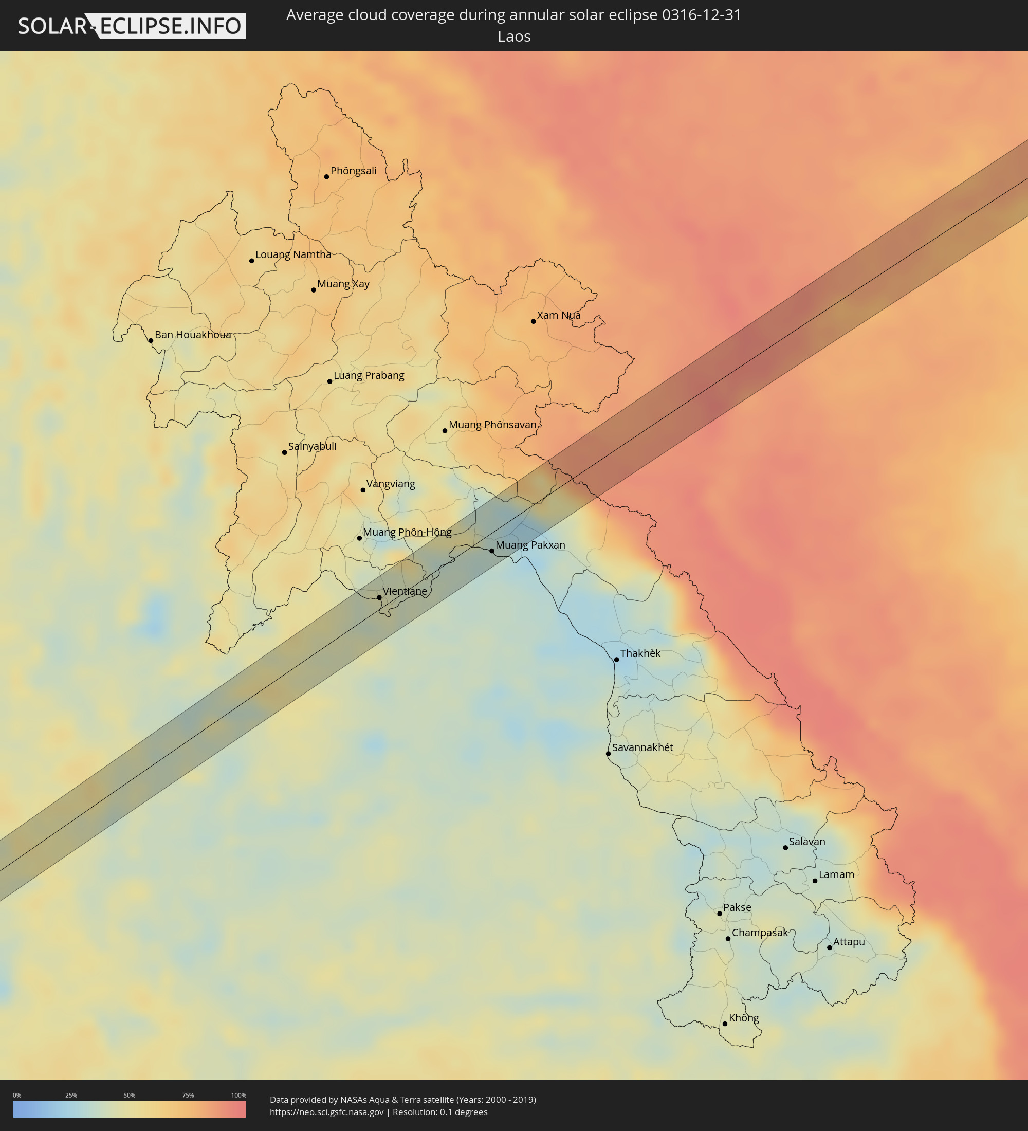 Laos
Laos
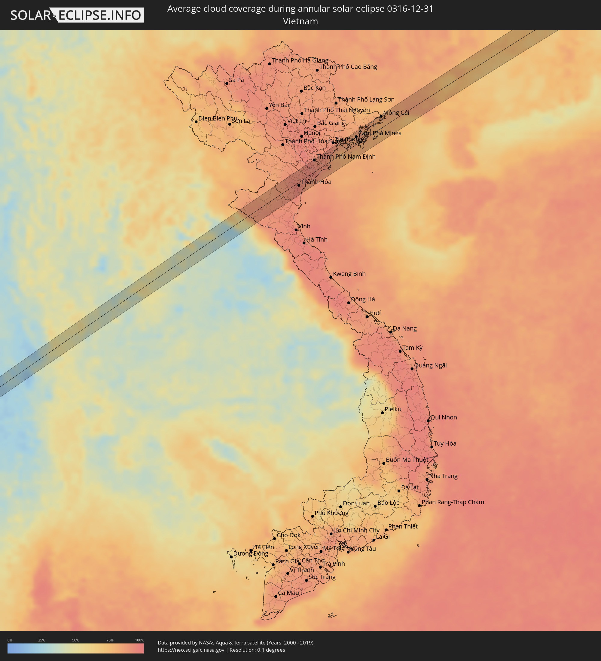 Vietnam
Cities inside the path of the eclipse
The following table shows all locations with a population of more than 5,000 inside the eclipse path. Cities which have more than 100,000 inhabitants are marked bold. A click at the locations opens a detailed map.
| City | Type | Eclipse duration | Local time of max. eclipse | Distance to central line | Ø Cloud coverage |
|
Mongo, Guéra
|
annular | - | 06:17:59 UTC+01:00 | 6 km | 3% |
|
Birao, Vakaga
|
annular | - | 05:31:49 UTC+00:13 | 19 km | 4% |
 Aweil, Northern Bahr al Ghazal
|
annular | - | 07:26:23 UTC+02:06 | 27 km | 18% |
|
Kuacjok, Warrap
|
annular | - | 07:26:35 UTC+02:06 | 5 km | 14% |
|
Gogrial, Warrap
|
annular | - | 07:26:44 UTC+02:06 | 34 km | 16% |
|
Mēga, Oromiya
|
annular | - | 07:55:35 UTC+02:27 | 6 km | 28% |
|
Moyale, Marsabit
|
annular | - | 07:56:25 UTC+02:27 | 32 km | 29% |
|
Qoryooley, Lower Shabeelle
|
annular | - | 08:04:07 UTC+02:27 | 15 km | 49% |
|
Marka, Lower Shabeelle
|
annular | - | 08:04:30 UTC+02:27 | 14 km | 34% |
|
Sangkhla Buri, Kanchanaburi
|
annular | - | 14:57:05 UTC+06:42 | 3 km | 19% |
|
Lat Yao, Nakhon Sawan
|
annular | - | 14:59:22 UTC+06:42 | 25 km | 45% |
|
Khanu Woralaksaburi, Kamphaeng Phet
|
annular | - | 14:59:36 UTC+06:42 | 1 km | 45% |
|
Bang Krathum, Phitsanulok
|
annular | - | 15:00:28 UTC+06:42 | 20 km | 43% |
|
Phichit, Phichit
|
annular | - | 15:00:28 UTC+06:42 | 5 km | 44% |
|
Taphan Hin, Phichit
|
annular | - | 15:00:28 UTC+06:42 | 20 km | 41% |
|
Wang Sai Phun, Phichit
|
annular | - | 15:00:42 UTC+06:42 | 12 km | 39% |
|
Lom Sak, Phetchabun
|
annular | - | 15:01:50 UTC+06:42 | 19 km | 39% |
|
Loei, Loei
|
annular | - | 15:02:45 UTC+06:42 | 17 km | 47% |
|
Wang Saphung, Loei
|
annular | - | 15:02:44 UTC+06:42 | 2 km | 49% |
|
Nam Som, Changwat Udon Thani
|
annular | - | 15:03:27 UTC+06:42 | 15 km | 44% |
|
Tha Bo, Nong Khai
|
annular | - | 15:03:58 UTC+06:42 | 1 km | 40% |
|
Si Chiang Mai, Nong Khai
|
annular | - | 15:04:01 UTC+06:42 | 9 km | 43% |
|
Vientiane, Vientiane
|
annular | - | 15:04:02 UTC+06:42 | 9 km | 43% |
|
Nong Khai, Nong Khai
|
annular | - | 15:04:11 UTC+06:42 | 8 km | 42% |
|
Phon Charoen, Nong Khai
|
annular | - | 15:04:45 UTC+06:42 | 19 km | 38% |
|
Bueng Kan, Changwat Bueng Kan
|
annular | - | 15:05:27 UTC+06:42 | 17 km | 34% |
|
Muang Pakxan, Bolikhamsai Province
|
annular | - | 15:05:27 UTC+06:42 | 16 km | 34% |
|
Thanh Hóa, Thanh Hóa
|
annular | - | 15:32:48 UTC+07:06 | 8 km | 94% |
|
Bỉm Sơn, Thanh Hóa
|
annular | - | 15:32:57 UTC+07:06 | 12 km | 92% |
|
Thành Phố Ninh Bình, Ninh Bình
|
annular | - | 15:33:07 UTC+07:06 | 22 km | 94% |
|
Thành Phố Nam Định, Nam Định
|
annular | - | 15:33:21 UTC+07:06 | 27 km | 92% |
|
Thành Phố Thái Bình, Thái Bình
|
annular | - | 15:33:31 UTC+07:06 | 19 km | 89% |
|
Cát Bà, Hải Phòng
|
annular | - | 15:34:17 UTC+07:06 | 4 km | 77% |
|
Thành Phố Hạ Long, Quảng Ninh
|
annular | - | 15:34:20 UTC+07:06 | 24 km | 83% |
|
Cẩm Phả Mines, Quảng Ninh
|
annular | - | 15:34:34 UTC+07:06 | 17 km | 83% |
|
Móng Cái, Quảng Ninh
|
annular | - | 15:35:17 UTC+07:06 | 26 km | 79% |
|
Qinzhou, Guangxi Zhuang Autonomous Region
|
annular | - | 16:29:16 UTC+08:00 | 31 km | 84% |
|
Lianzhou, Guangxi Zhuang Autonomous Region
|
annular | - | 16:29:45 UTC+08:00 | 30 km | 83% |
|
Yulin, Guangxi Zhuang Autonomous Region
|
annular | - | 16:30:38 UTC+08:00 | 8 km | 75% |
|
Nandu, Guangxi Zhuang Autonomous Region
|
annular | - | 16:31:11 UTC+08:00 | 9 km | 69% |
|
Jinji, Guangxi Zhuang Autonomous Region
|
annular | - | 16:31:12 UTC+08:00 | 26 km | 73% |
|
Wuzhou, Guangxi Zhuang Autonomous Region
|
annular | - | 16:31:35 UTC+08:00 | 24 km | 75% |
|
Ducheng, Guangdong
|
annular | - | 16:31:45 UTC+08:00 | 11 km | 73% |
|
Nanfeng, Guangdong
|
annular | - | 16:31:57 UTC+08:00 | 21 km | 74% |
|
Huaicheng, Guangdong
|
annular | - | 16:32:13 UTC+08:00 | 18 km | 73% |
|
Shaoguan, Guangdong
|
annular | - | 16:33:10 UTC+08:00 | 26 km | 75% |
|
Maba, Guangdong
|
annular | - | 16:33:11 UTC+08:00 | 14 km | 72% |
|
Shixing, Guangdong
|
annular | - | 16:33:28 UTC+08:00 | 15 km | 67% |
|
Xiongzhou, Guangdong
|
annular | - | 16:33:36 UTC+08:00 | 18 km | 66% |
|
Nanping, Fujian
|
annular | - | 16:35:34 UTC+08:00 | 34 km | 71% |
|
Jian’ou, Fujian
|
annular | - | 16:35:34 UTC+08:00 | 3 km | 71% |
|
Wenzhou, Zhejiang
|
annular | - | 16:36:23 UTC+08:00 | 27 km | 68% |
|
Linhai, Zhejiang
|
annular | - | 16:36:19 UTC+08:00 | 33 km | 64% |
|
Huangyan, Zhejiang
|
annular | - | 16:36:26 UTC+08:00 | 7 km | 73% |
|
Wenling, Zhejiang
|
annular | - | 16:36:34 UTC+08:00 | 25 km | 70% |
|
Jiaojiang, Zhejiang
|
annular | - | 16:36:30 UTC+08:00 | 2 km | 75% |