Total solar eclipse of 04/27/0469
| Day of week: | Saturday |
| Maximum duration of eclipse: | 04m52s |
| Maximum width of eclipse path: | 254 km |
| Saros cycle: | 94 |
| Coverage: | 100% |
| Magnitude: | 1.0555 |
| Gamma: | -0.6958 |
Wo kann man die Sonnenfinsternis vom 04/27/0469 sehen?
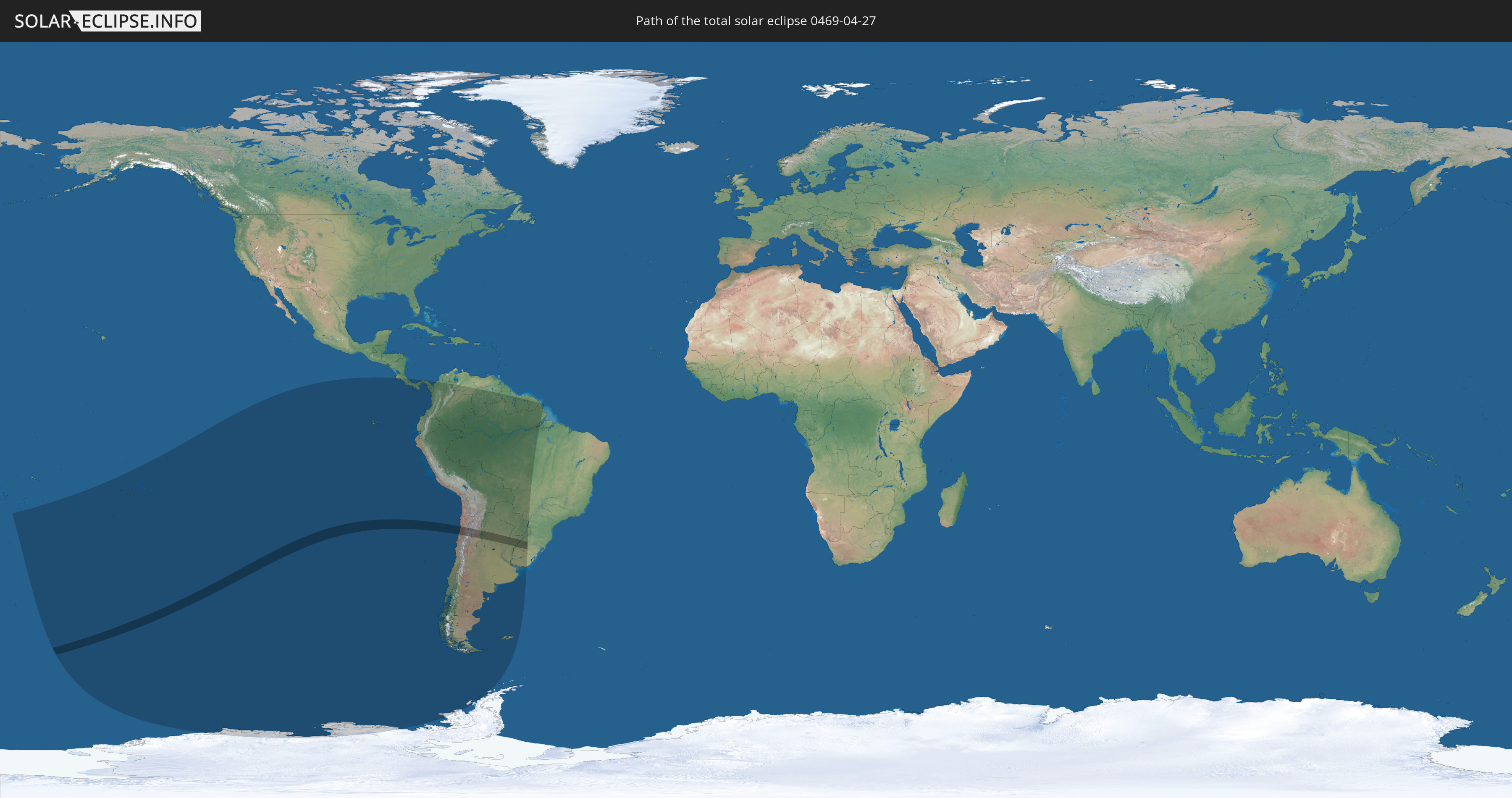
Die Sonnenfinsternis am 04/27/0469 kann man in 22 Ländern als partielle Sonnenfinsternis beobachten.
Der Finsternispfad verläuft durch 4 Länder. Nur in diesen Ländern ist sie als total Sonnenfinsternis zu sehen.
In den folgenden Ländern ist die Sonnenfinsternis total zu sehen
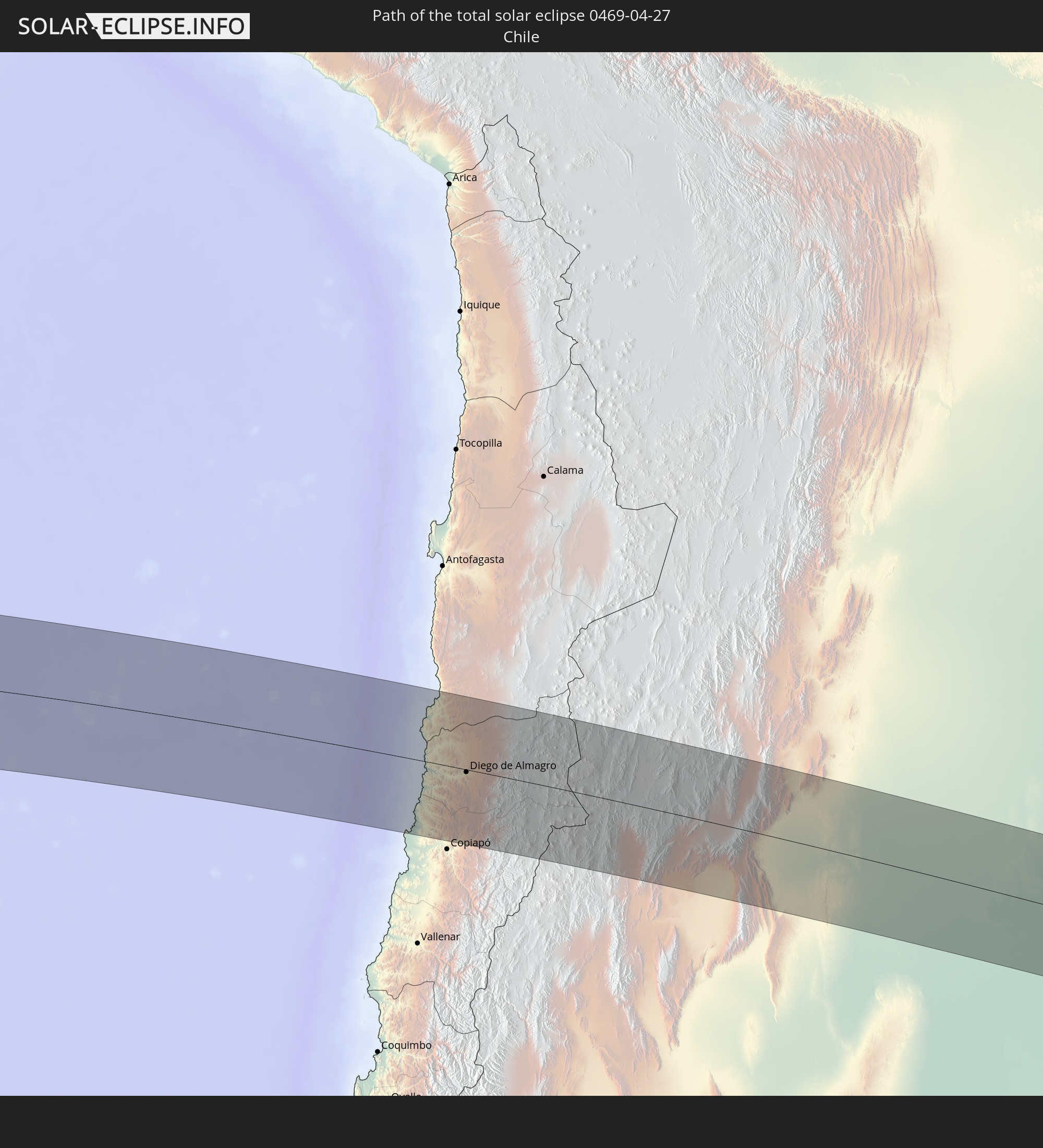 Chile
Chile
 Brazil
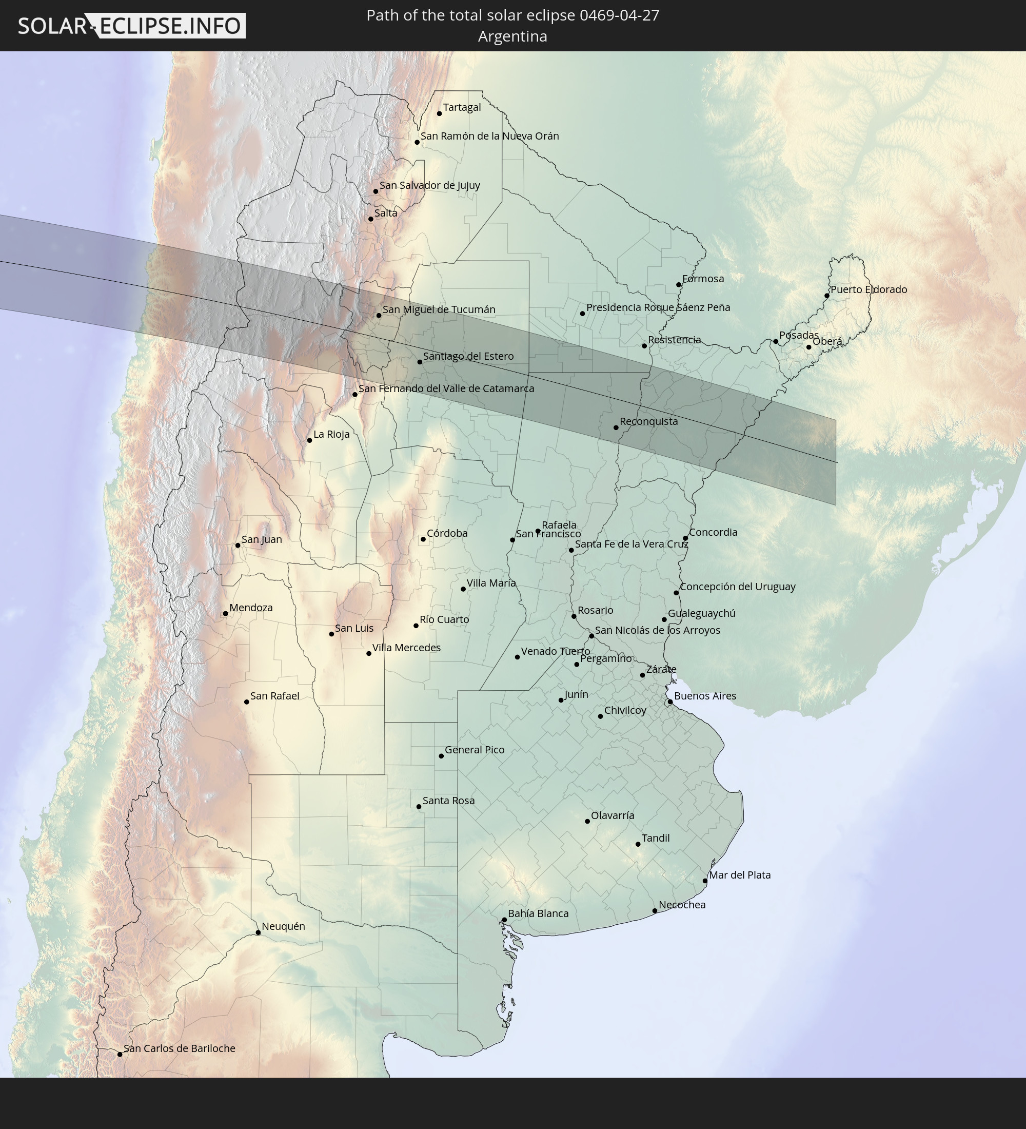 Argentina
 Uruguay
In den folgenden Ländern ist die Sonnenfinsternis partiell zu sehen


How will be the weather during the total solar eclipse on 04/27/0469?
Where is the best place to see the total solar eclipse of 04/27/0469?
The following maps show the average cloud coverage for the day of the total solar eclipse.
With the help of these maps, it is possible to find the place along the eclipse path, which has the best
chance of a cloudless sky.
Nevertheless, you should consider local circumstances and inform about the weather of your chosen
observation site.
The data is provided by NASAs satellites
AQUA and TERRA.
The cloud maps are averaged over a period of 19 years (2000 - 2019).


Detailed country maps
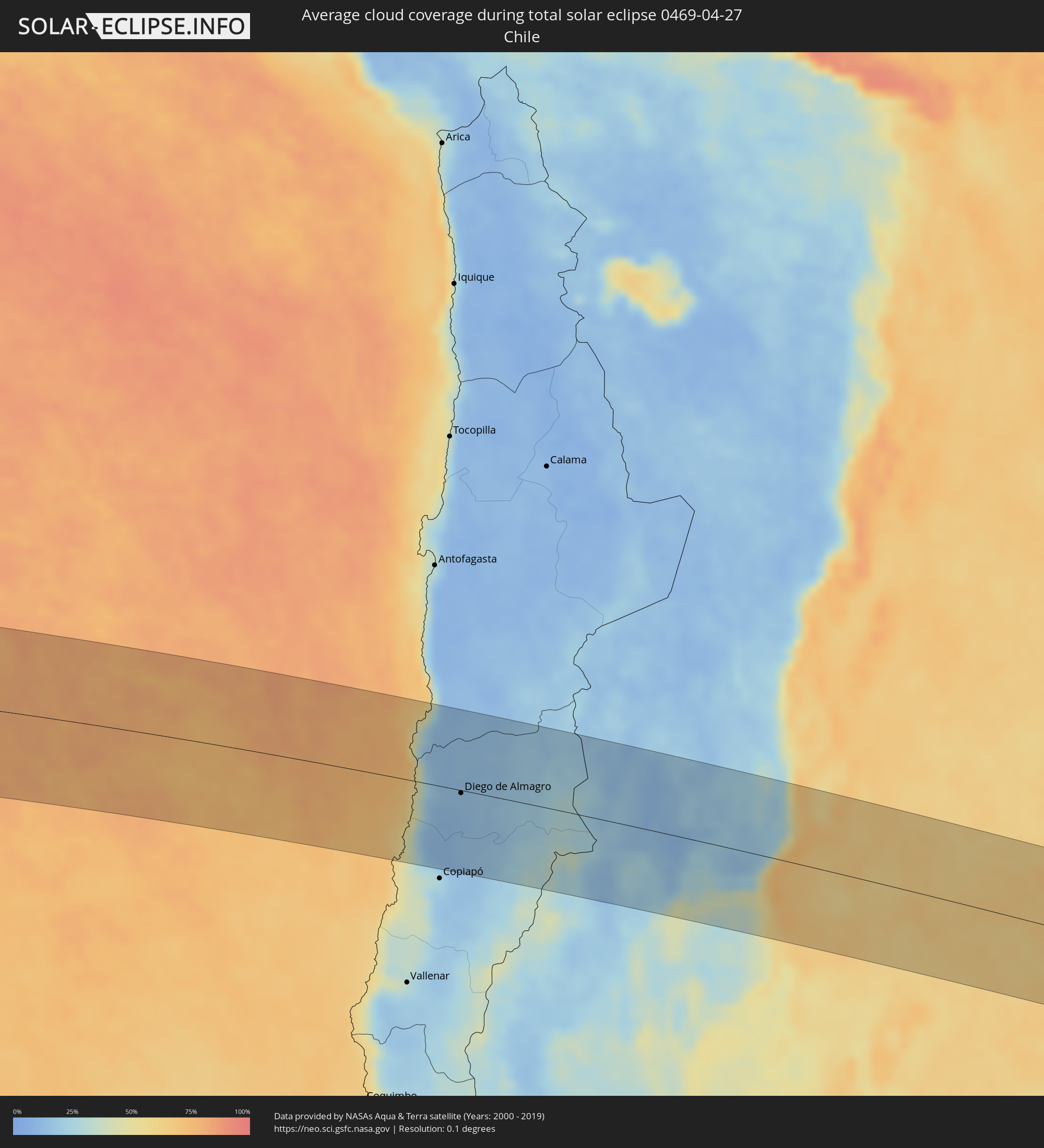 Chile
Chile
 Brazil
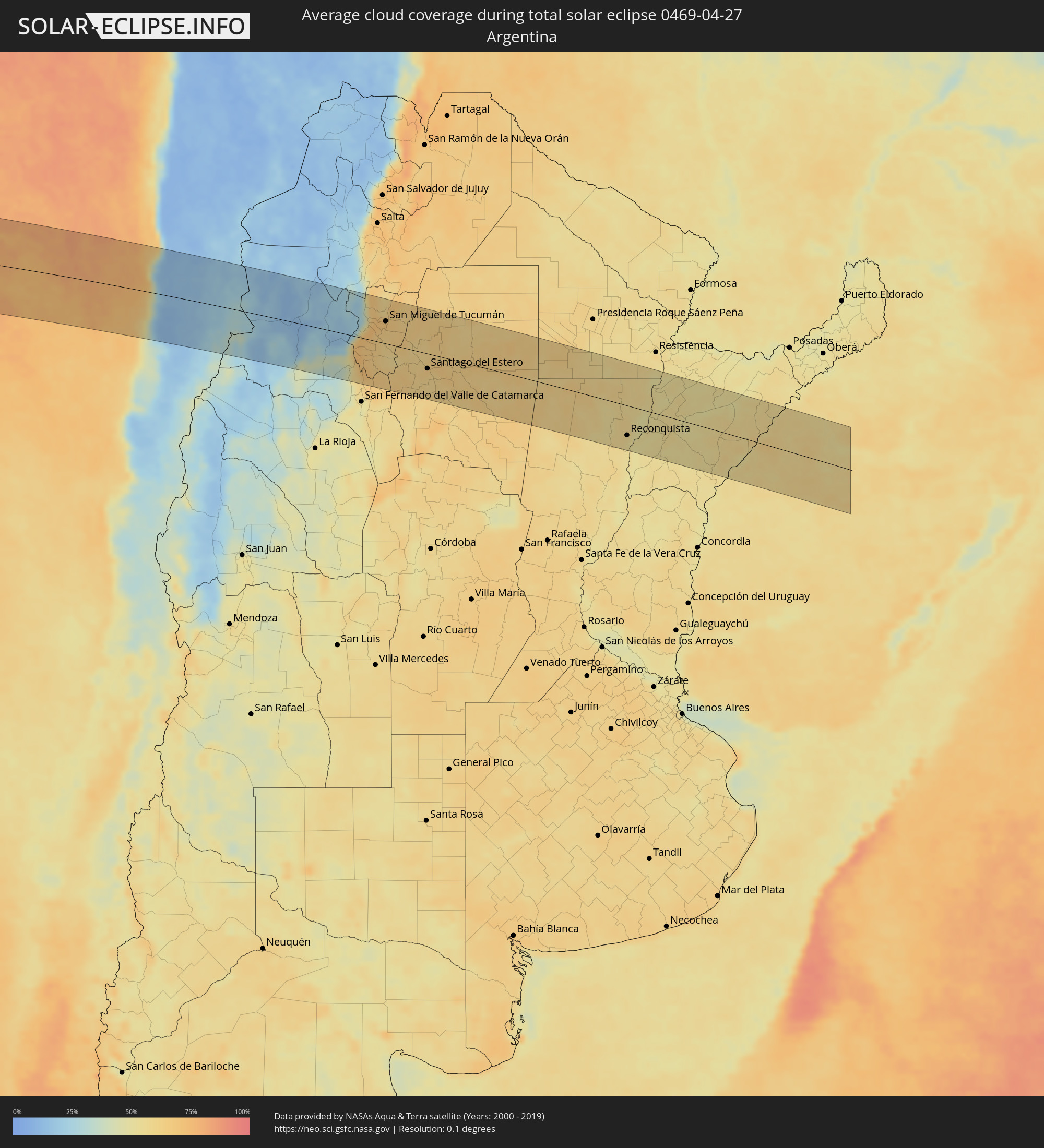 Argentina
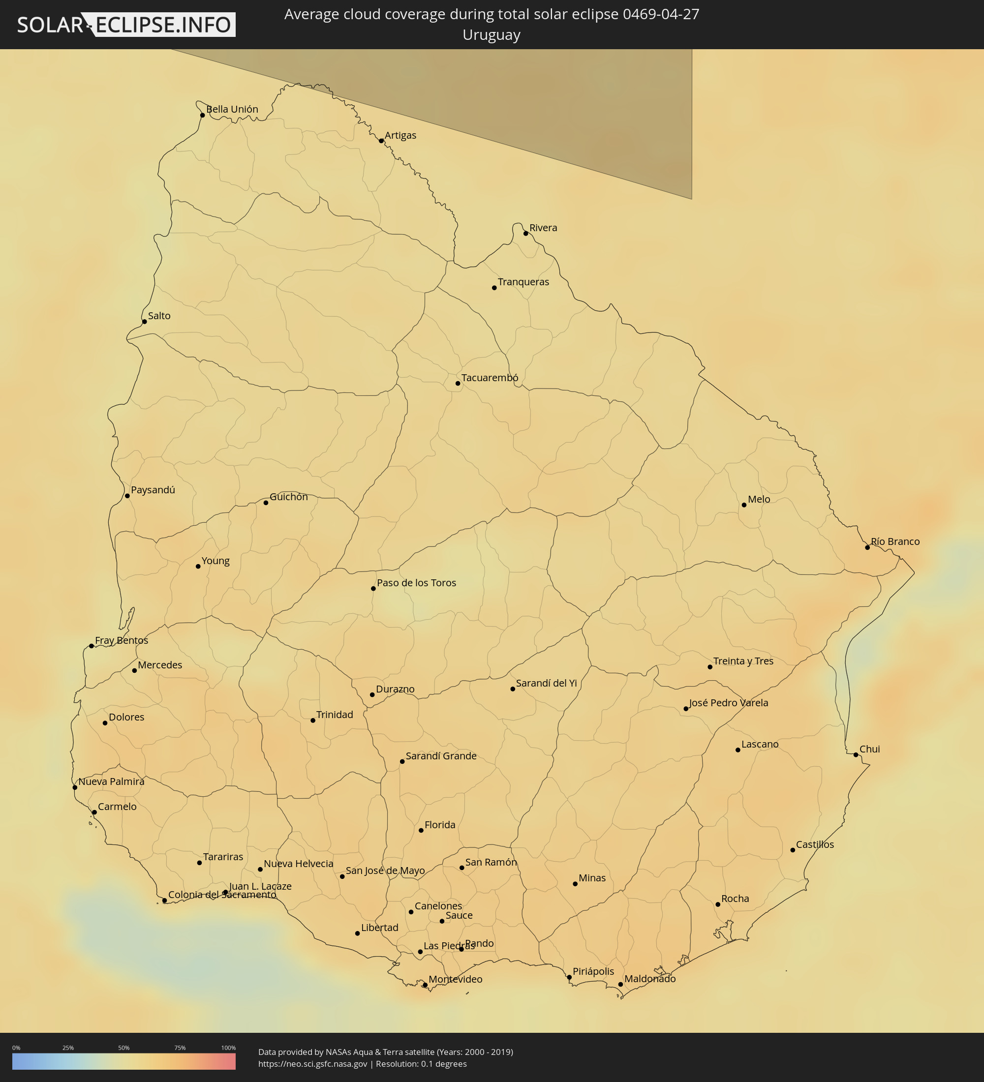 Uruguay
Cities inside the path of the eclipse
The following table shows all locations with a population of more than 5,000 inside the eclipse path. Cities which have more than 100,000 inhabitants are marked bold. A click at the locations opens a detailed map.
| City | Type | Eclipse duration | Local time of max. eclipse | Distance to central line | Ø Cloud coverage |
 Taltal, Antofagasta
|
total | - | 16:12:16 UTC-04:42 | 93 km | 44% |
|
Diego de Almagro, Atacama
|
total | - | 16:11:32 UTC-04:42 | 4 km | 14% |
 Fiambalá, Catamarca Province
|
total | - | 16:38:02 UTC-04:16 | 97 km | 24% |
|
Andalgalá, Catamarca Province
|
total | - | 16:39:10 UTC-04:16 | 59 km | 37% |
|
Aguilares, Tucumán Province
|
total | - | 16:39:53 UTC-04:16 | 25 km | 66% |
|
La Cocha, Tucumán Province
|
total | - | 16:39:30 UTC-04:16 | 62 km | 69% |
|
Los Altos, Catamarca Province
|
total | - | 16:39:14 UTC-04:16 | 89 km | 66% |
|
Monteros, Tucumán Province
|
total | - | 16:40:18 UTC-04:16 | 6 km | 65% |
|
Graneros, Tucumán Province
|
total | - | 16:39:45 UTC-04:16 | 45 km | 63% |
|
Famaillá, Tucumán Province
|
total | - | 16:40:30 UTC-04:16 | 21 km | 64% |
|
Simoca, Tucumán Province
|
total | - | 16:40:17 UTC-04:16 | 1 km | 64% |
|
Yerba Buena, Tucumán Province
|
total | - | 16:40:50 UTC-04:16 | 48 km | 69% |
|
Bella Vista, Tucumán Province
|
total | - | 16:40:36 UTC-04:16 | 25 km | 64% |
|
Tafí Viejo, Tucumán Province
|
total | - | 16:40:59 UTC-04:16 | 59 km | 68% |
|
San Miguel de Tucumán, Tucumán Province
|
total | - | 16:40:54 UTC-04:16 | 50 km | 69% |
|
Alderetes, Tucumán Province
|
total | - | 16:40:58 UTC-04:16 | 52 km | 67% |
|
Termas de Río Hondo, Santiago del Estero Province
|
total | - | 16:40:21 UTC-04:16 | 15 km | 59% |
|
Santiago del Estero, Santiago del Estero Province
|
total | - | 16:40:24 UTC-04:16 | 33 km | 64% |
|
Clodomira, Santiago del Estero Province
|
total | - | 16:40:46 UTC-04:16 | 6 km | 66% |
|
Beltrán, Santiago del Estero Province
|
total | - | 16:40:30 UTC-04:16 | 32 km | 61% |
|
Suncho Corral, Santiago del Estero Province
|
total | - | 16:40:47 UTC-04:16 | 28 km | 63% |
|
Añatuya, Santiago del Estero Province
|
total | - | 16:40:31 UTC-04:16 | 71 km | 62% |
|
Quimilí, Santiago del Estero Province
|
total | - | 16:41:46 UTC-04:16 | 29 km | 64% |
|
Hermoso Campo, Chaco Province
|
total | - | 16:42:25 UTC-04:16 | 58 km | 62% |
|
General Pinedo, Chaco Province
|
total | - | 16:42:47 UTC-04:16 | 91 km | 62% |
|
Santa Sylvina, Chaco Province
|
total | - | 16:42:16 UTC-04:16 | 39 km | 60% |
|
Coronel Du Graty, Chaco Province
|
total | - | 16:42:34 UTC-04:16 | 61 km | 60% |
|
Villa Ángela, Chaco Province
|
total | - | 16:42:48 UTC-04:16 | 77 km | 58% |
|
Malabrigo, Santa Fe Province
|
total | - | 16:41:04 UTC-04:16 | 94 km | 57% |
|
Avellaneda, Santa Fe Province
|
total | - | 16:41:30 UTC-04:16 | 61 km | 57% |
|
Reconquista, Santa Fe Province
|
total | - | 16:41:28 UTC-04:16 | 65 km | 55% |
|
Villa Ocampo, Santa Fe Province
|
total | - | 16:42:24 UTC-04:16 | 14 km | 55% |
|
Goya, Corrientes Province
|
total | - | 16:41:39 UTC-04:16 | 54 km | 53% |
|
Las Toscas, Santa Fe Province
|
total | - | 16:42:36 UTC-04:16 | 31 km | 56% |
|
Santa Lucía, Corrientes Province
|
total | - | 16:41:55 UTC-04:16 | 33 km | 52% |
|
San Lorenzo, Corrientes Province
|
total | - | 16:43:06 UTC-04:16 | 67 km | 53% |
|
Saladas, Corrientes Province
|
total | - | 16:43:01 UTC-04:16 | 58 km | 55% |
|
Perugorría, Corrientes Province
|
total | - | 16:41:43 UTC-04:16 | 58 km | 52% |
|
Mburucuyá, Corrientes Province
|
total | - | 16:43:26 UTC-04:16 | 91 km | 52% |
|
Santa Rosa, Corrientes Province
|
total | - | 16:43:14 UTC-04:16 | 71 km | 53% |
|
Mercedes, Corrientes Province
|
total | - | 16:42:09 UTC-04:16 | 27 km | 54% |
|
Curuzú Cuatiá, Corrientes Province
|
total | - | 16:41:26 UTC-04:16 | 91 km | 54% |
 Uruguaiana, Rio Grande do Sul
|
total | - | 17:52:13 UTC-03:06 | 62 km | 57% |
|
Paso de los Libres, Corrientes Province
|
total | - | 16:41:56 UTC-04:16 | 57 km | 56% |
|
La Cruz, Corrientes Province
|
total | - | 16:42:45 UTC-04:16 | 12 km | 61% |
|
Itaqui, Rio Grande do Sul
|
total | - | 17:53:11 UTC-03:06 | 20 km | 57% |
|
Alvear, Corrientes Province
|
total | - | 16:42:53 UTC-04:16 | 23 km | 57% |
|
São Borja, Rio Grande do Sul
|
total | - | 17:53:55 UTC-03:06 | 85 km | 57% |
|
Alegrete, Rio Grande do Sul
|
total | - | 17:52:40 UTC-03:06 | 29 km | 58% |
|
São Francisco de Assis, Rio Grande do Sul
|
total | - | 17:53:11 UTC-03:06 | 14 km | 55% |
|
Rosário do Sul, Rio Grande do Sul
|
total | - | 17:52:24 UTC-03:06 | 56 km | 61% |
|
Santiago, Rio Grande do Sul
|
total | - | 17:53:41 UTC-03:06 | 59 km | 53% |
|
Cacequi, Rio Grande do Sul
|
total | - | 17:52:53 UTC-03:06 | 13 km | 57% |