Annular solar eclipse of 03/07/0490
| Day of week: | Tuesday |
| Maximum duration of eclipse: | 06m30s |
| Maximum width of eclipse path: | 195 km |
| Saros cycle: | 86 |
| Coverage: | 94.7% |
| Magnitude: | 0.9474 |
| Gamma: | -0.1274 |
Wo kann man die Sonnenfinsternis vom 03/07/0490 sehen?

Die Sonnenfinsternis am 03/07/0490 kann man in 56 Ländern als partielle Sonnenfinsternis beobachten.
Der Finsternispfad verläuft durch 9 Länder. Nur in diesen Ländern ist sie als annular Sonnenfinsternis zu sehen.
In den folgenden Ländern ist die Sonnenfinsternis annular zu sehen
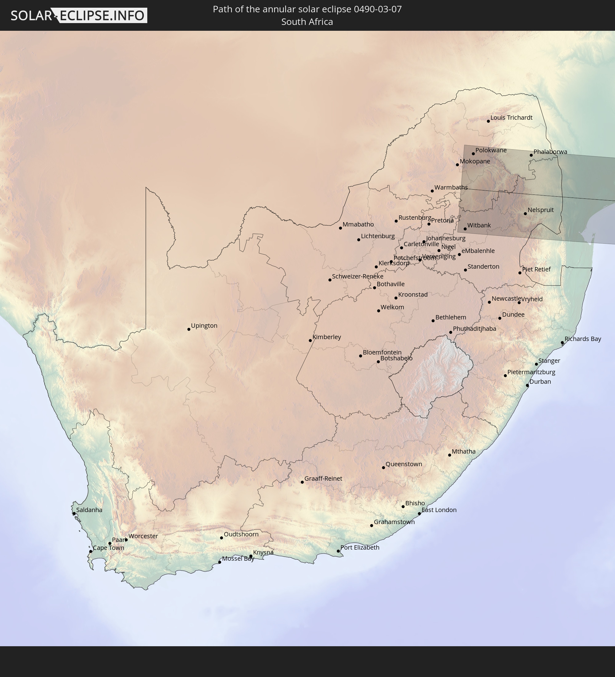 South Africa
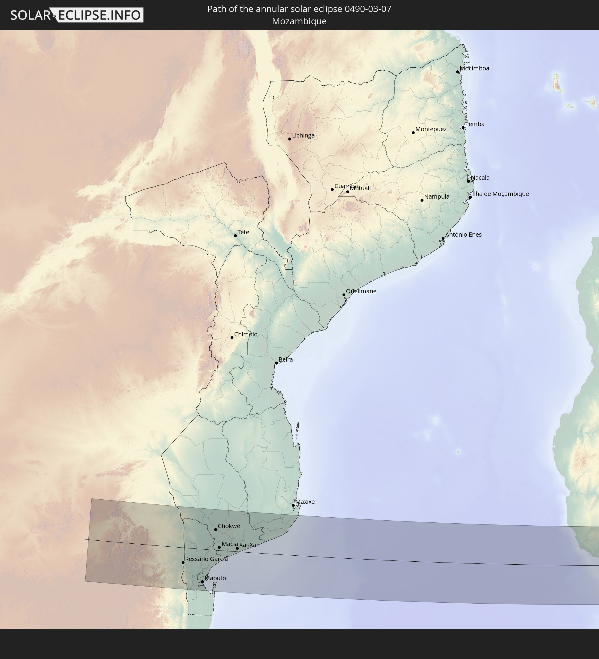 Mozambique
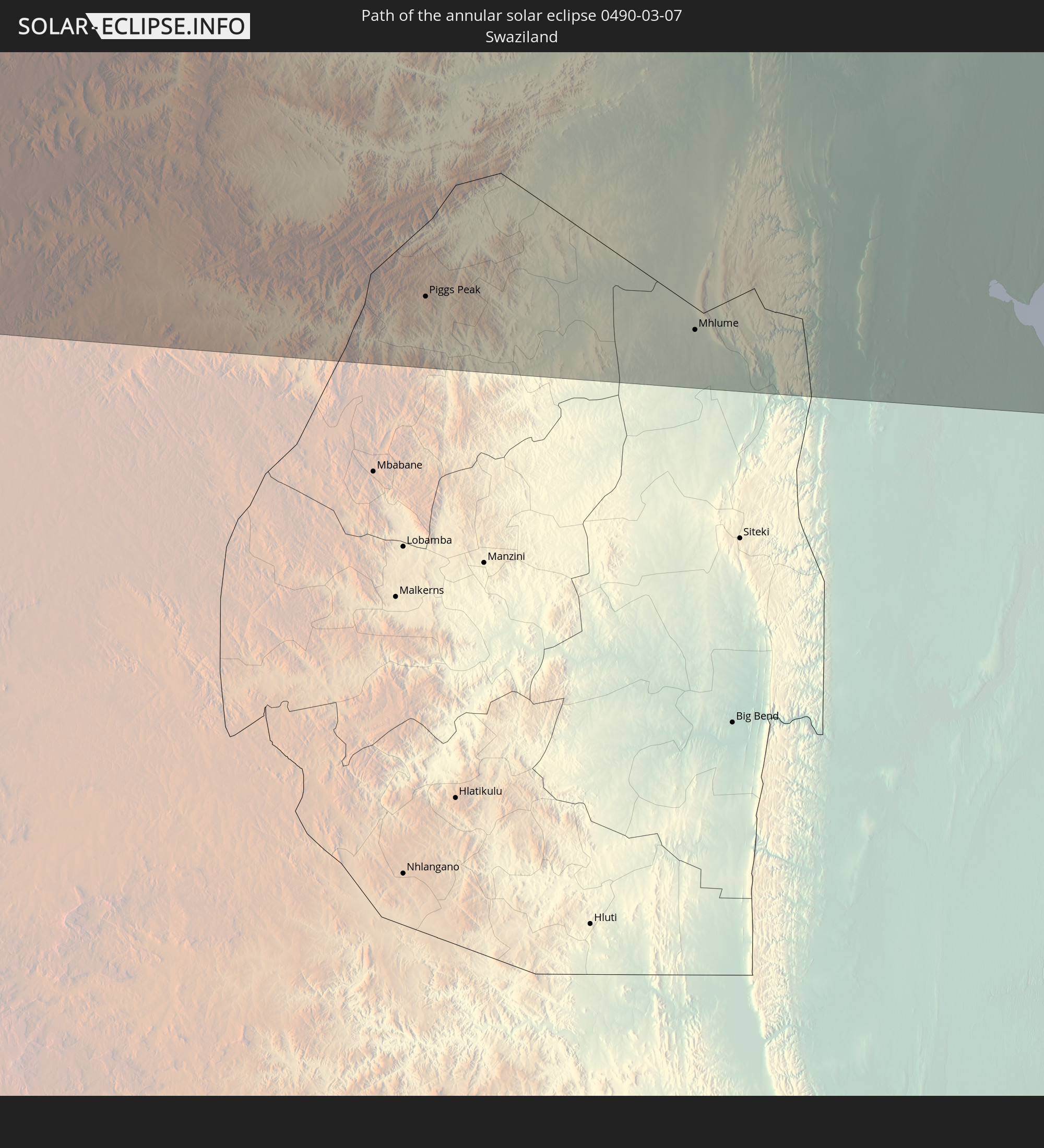 Swaziland
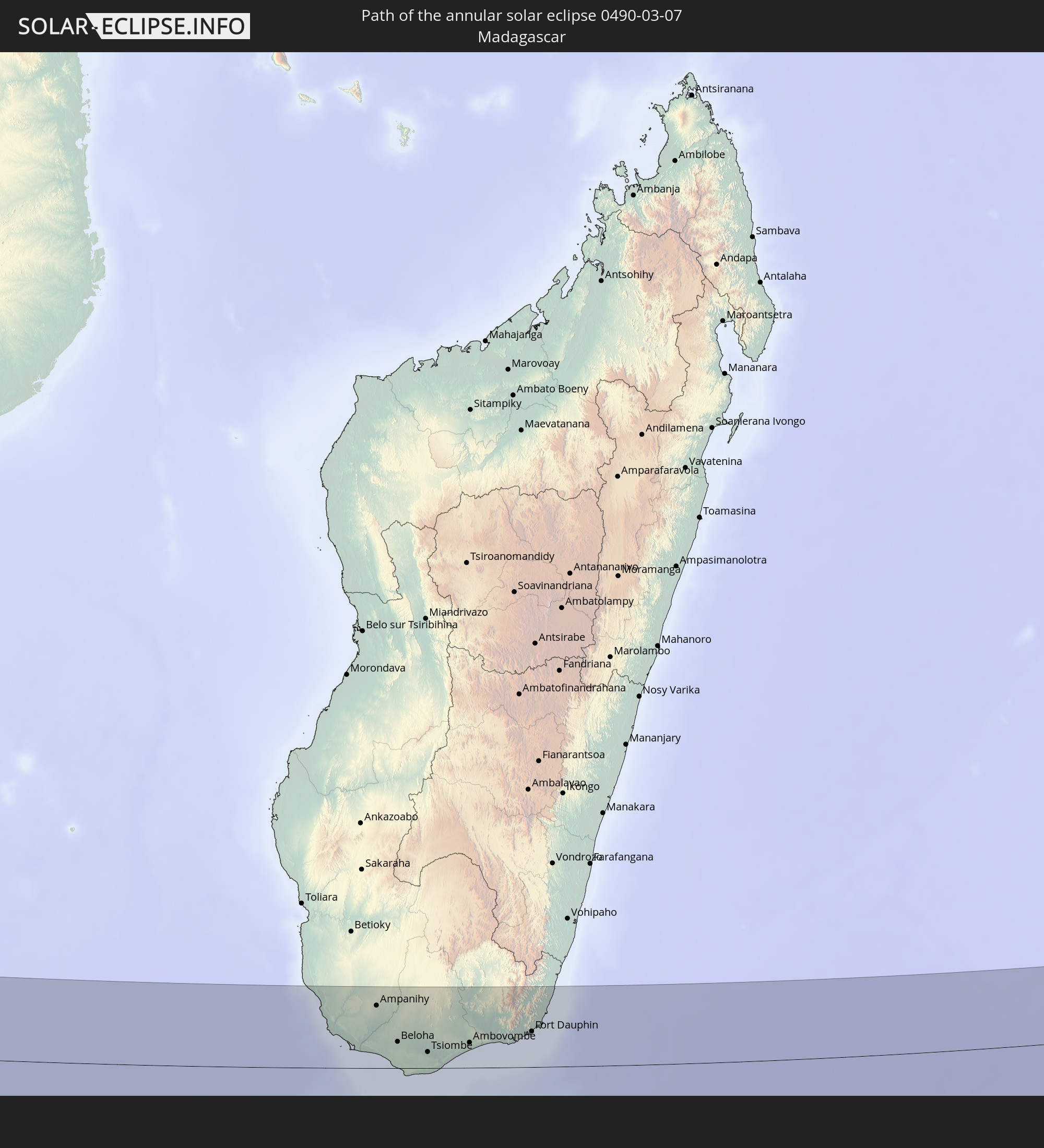 Madagascar
 Indonesia
 Malaysia
 Philippines
 Palau
Palau
 Federated States of Micronesia
In den folgenden Ländern ist die Sonnenfinsternis partiell zu sehen
 Democratic Republic of the Congo
 South Africa
 Zambia
 Zimbabwe
 Lesotho
 Rwanda
 Burundi
 Tanzania
 Uganda
 Mozambique
 Swaziland
 Malawi
 Ethiopia
 Kenya
Kenya
 French Southern and Antarctic Lands
 Somalia
 Madagascar
 Comoros
 Mayotte
 Seychelles
 Réunion
 Mauritius
 India
India
 British Indian Ocean Territory
 Heard Island and McDonald Islands
 Maldives
 China
China
 Sri Lanka
 Bangladesh
 Myanmar
 Indonesia
 Cocos Islands
 Thailand
 Malaysia
 Laos
Laos
 Vietnam
 Cambodia
 Singapore
 Christmas Island
 Australia
 Macau
Macau
 Hong Kong
 Brunei
 Taiwan
 Philippines
 Japan
Japan
 East Timor
 North Korea
 South Korea
 Palau
Palau
 Federated States of Micronesia
 Papua New Guinea
 Guam
Guam
 Northern Mariana Islands
 Solomon Islands
 New Caledonia
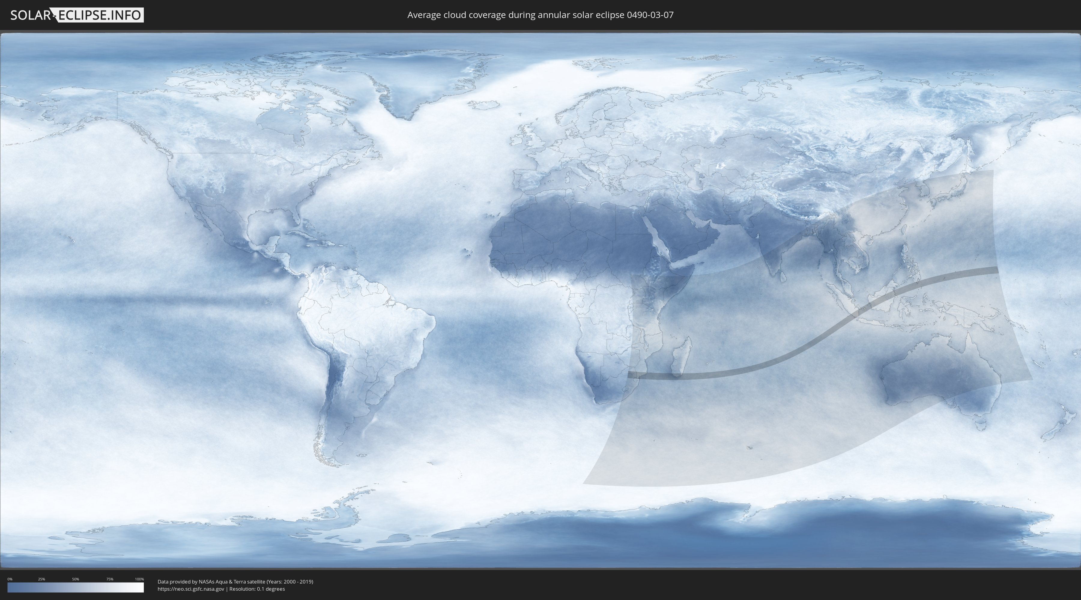
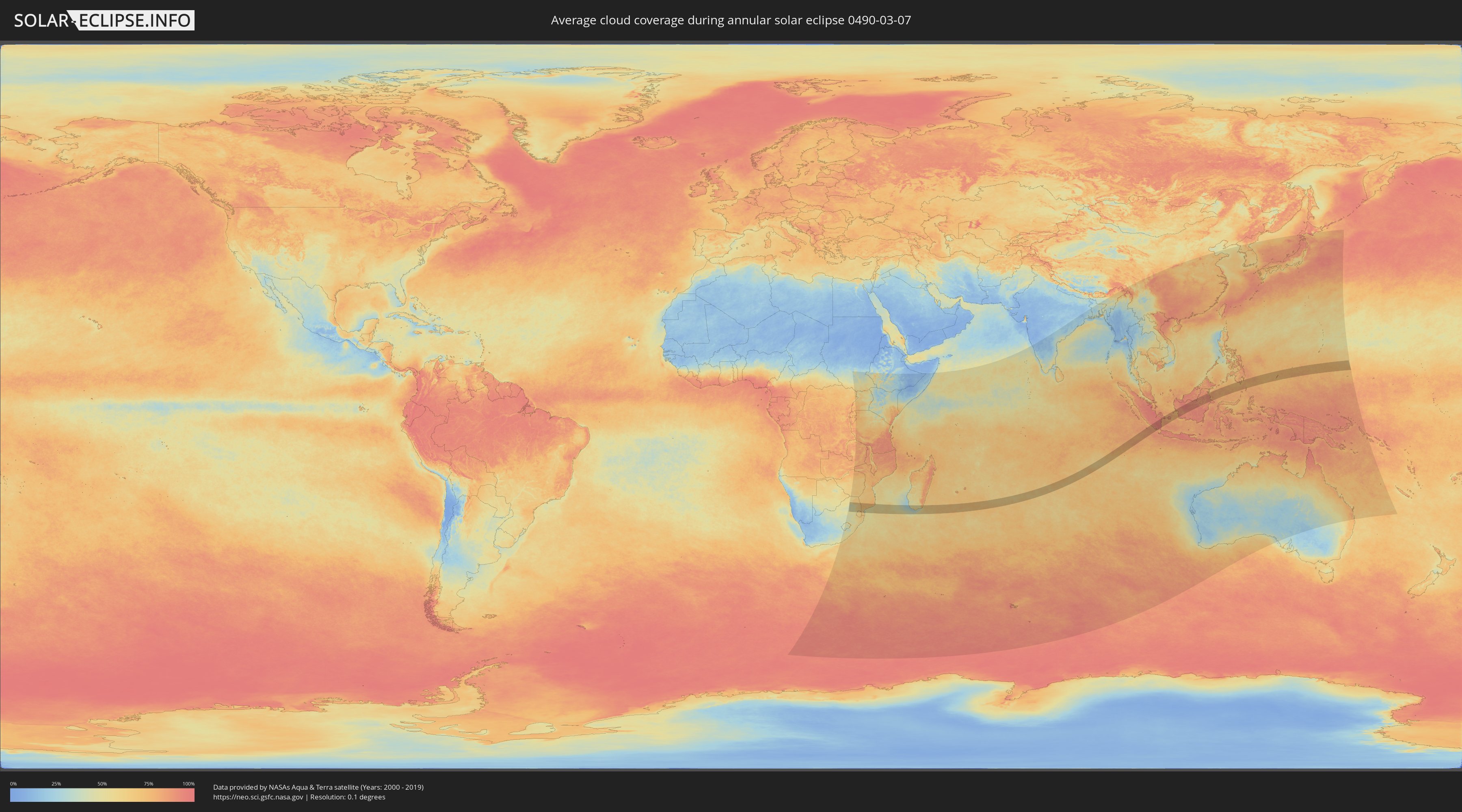
How will be the weather during the annular solar eclipse on 03/07/0490?
Where is the best place to see the annular solar eclipse of 03/07/0490?
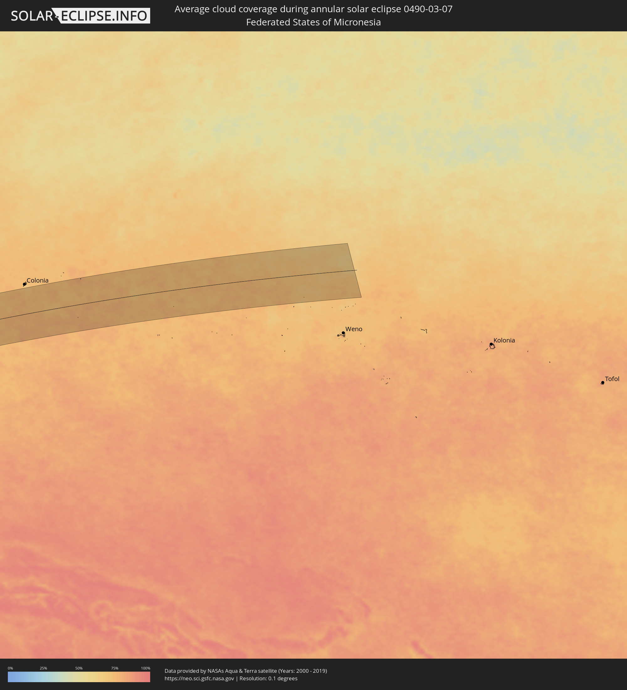
The following maps show the average cloud coverage for the day of the annular solar eclipse.
With the help of these maps, it is possible to find the place along the eclipse path, which has the best
chance of a cloudless sky.
Nevertheless, you should consider local circumstances and inform about the weather of your chosen
observation site.
The data is provided by NASAs satellites
AQUA and TERRA.
The cloud maps are averaged over a period of 19 years (2000 - 2019).
Detailed country maps
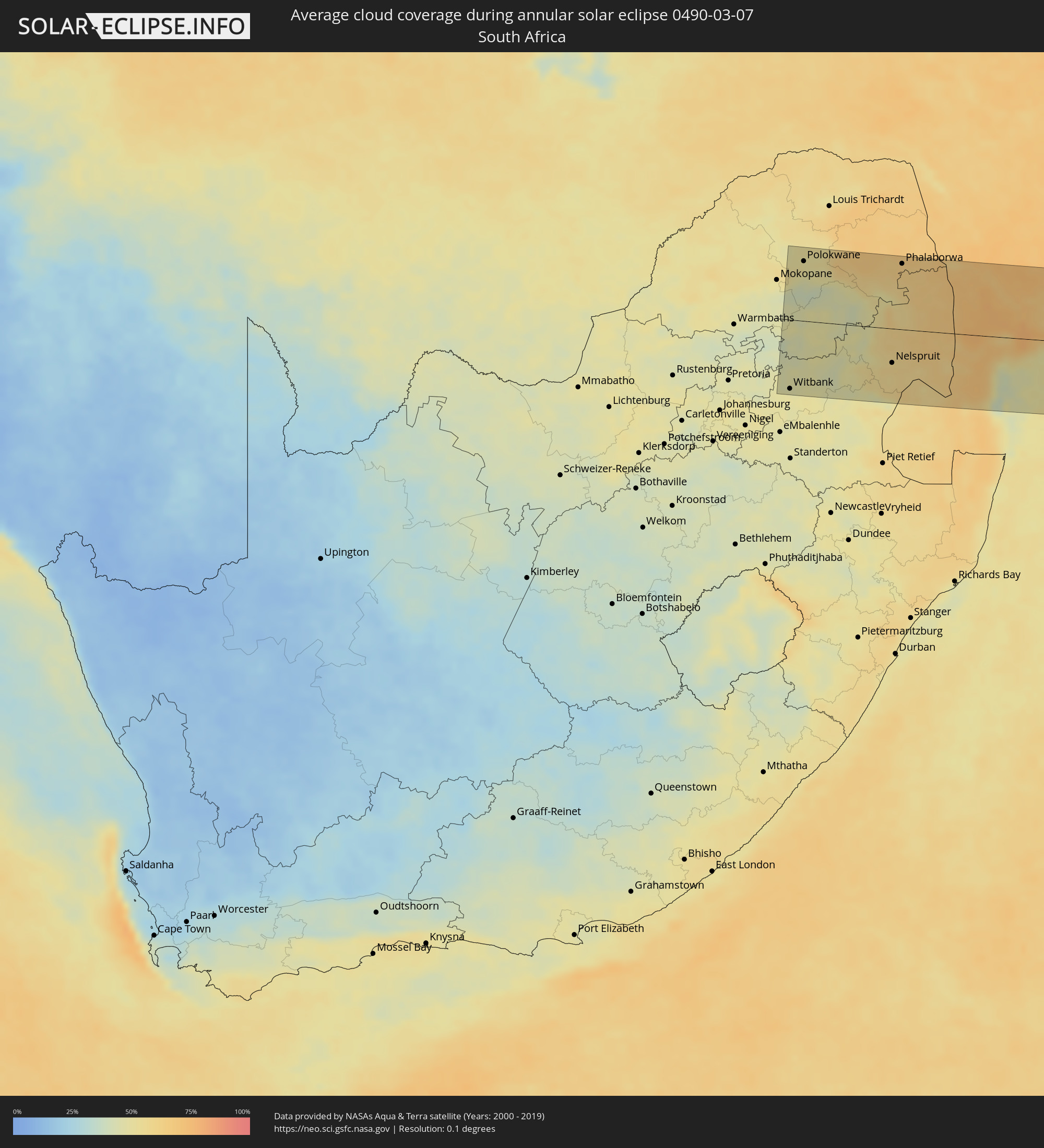 South Africa
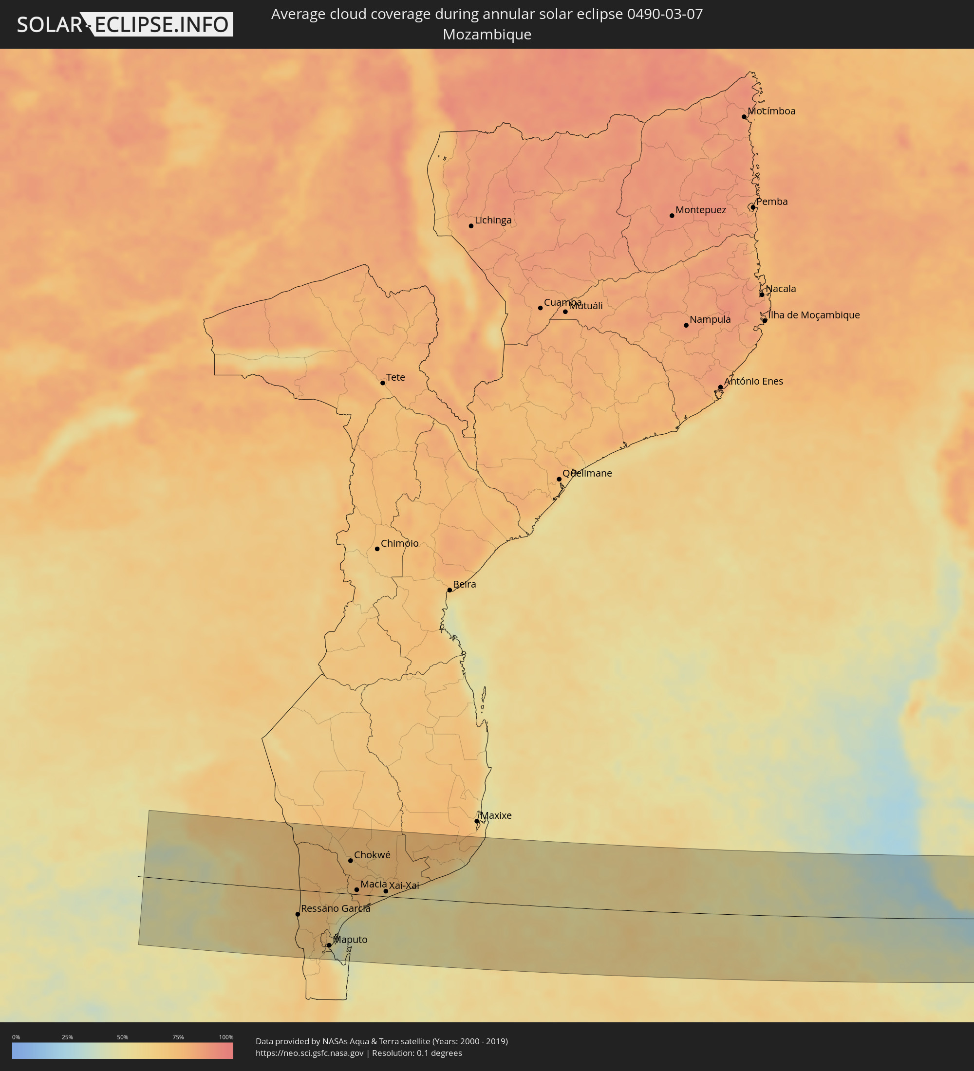 Mozambique
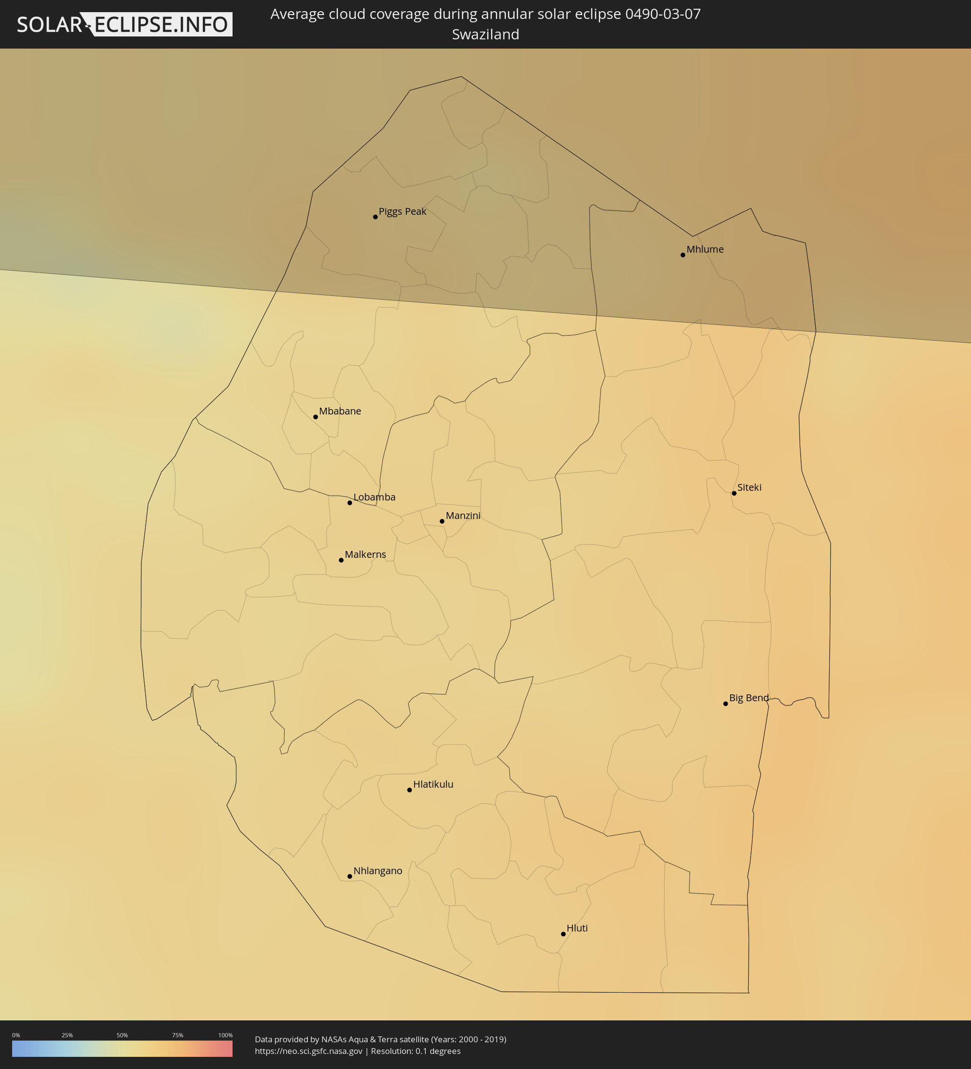 Swaziland
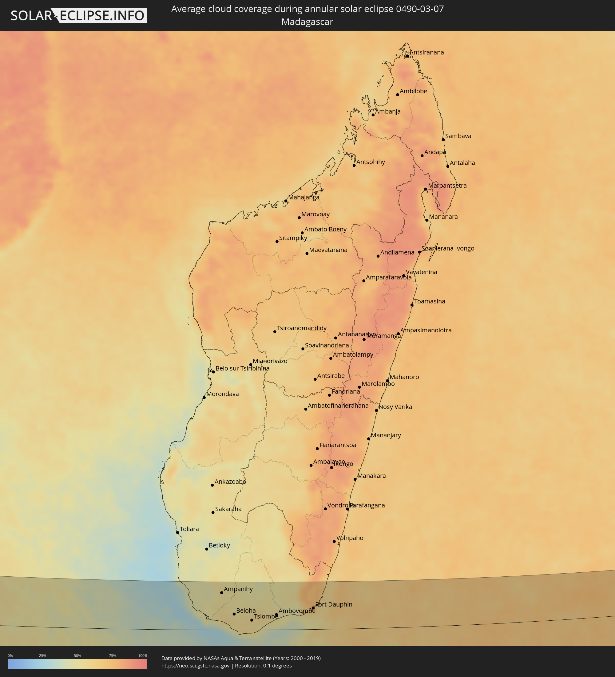 Madagascar
 Indonesia
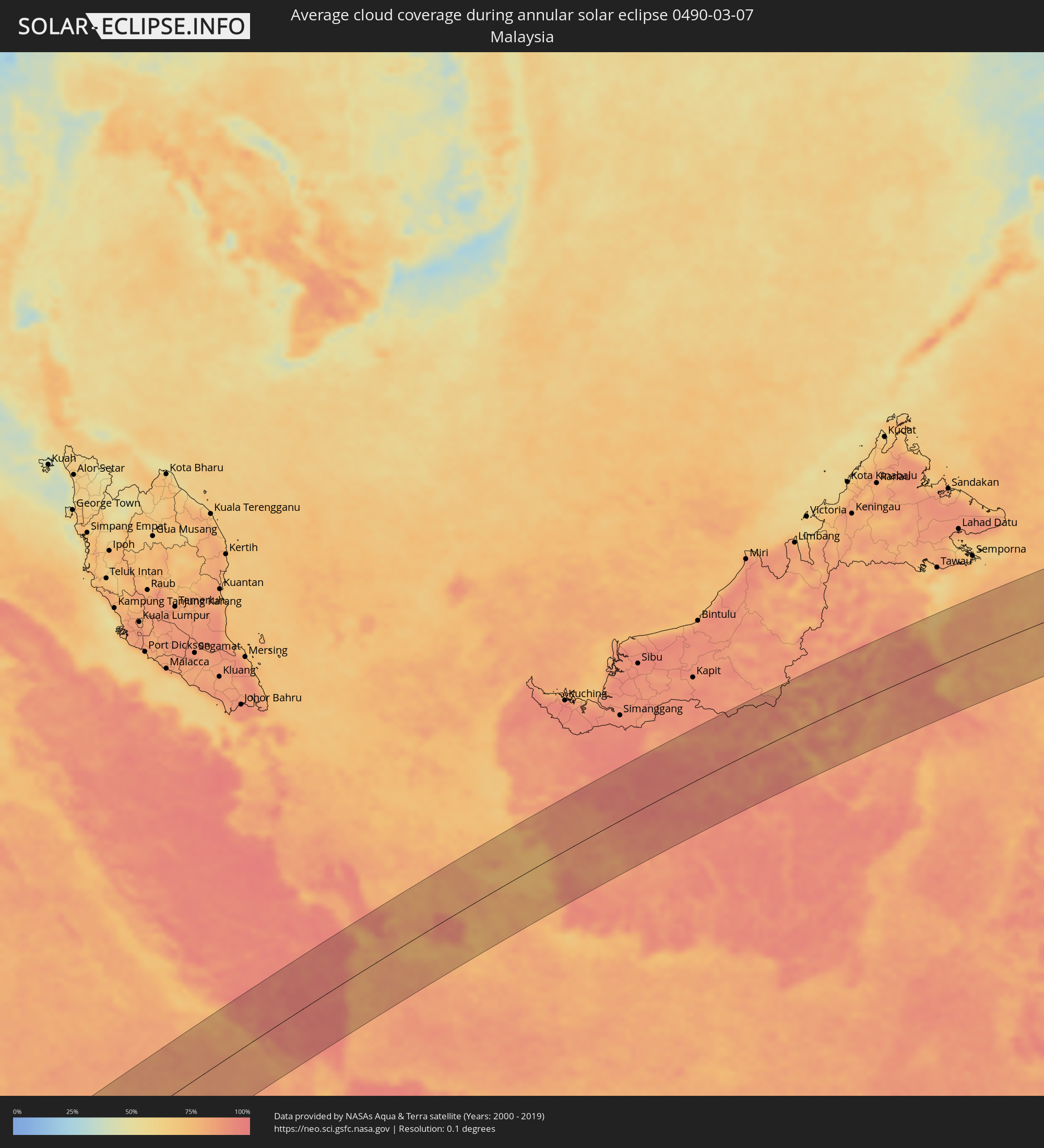 Malaysia
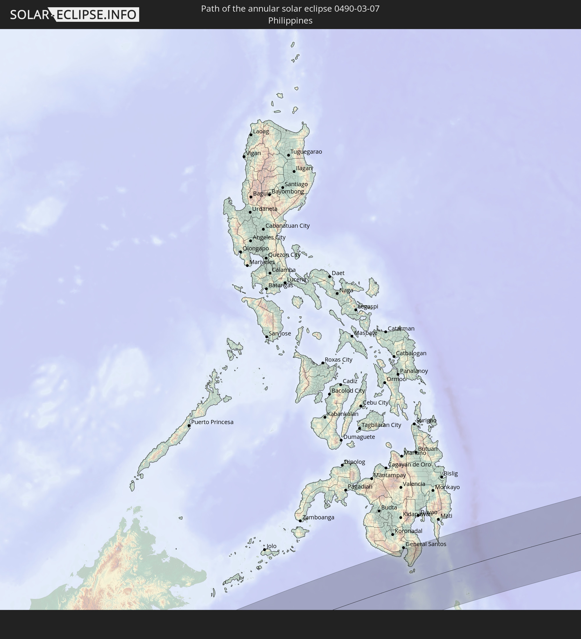
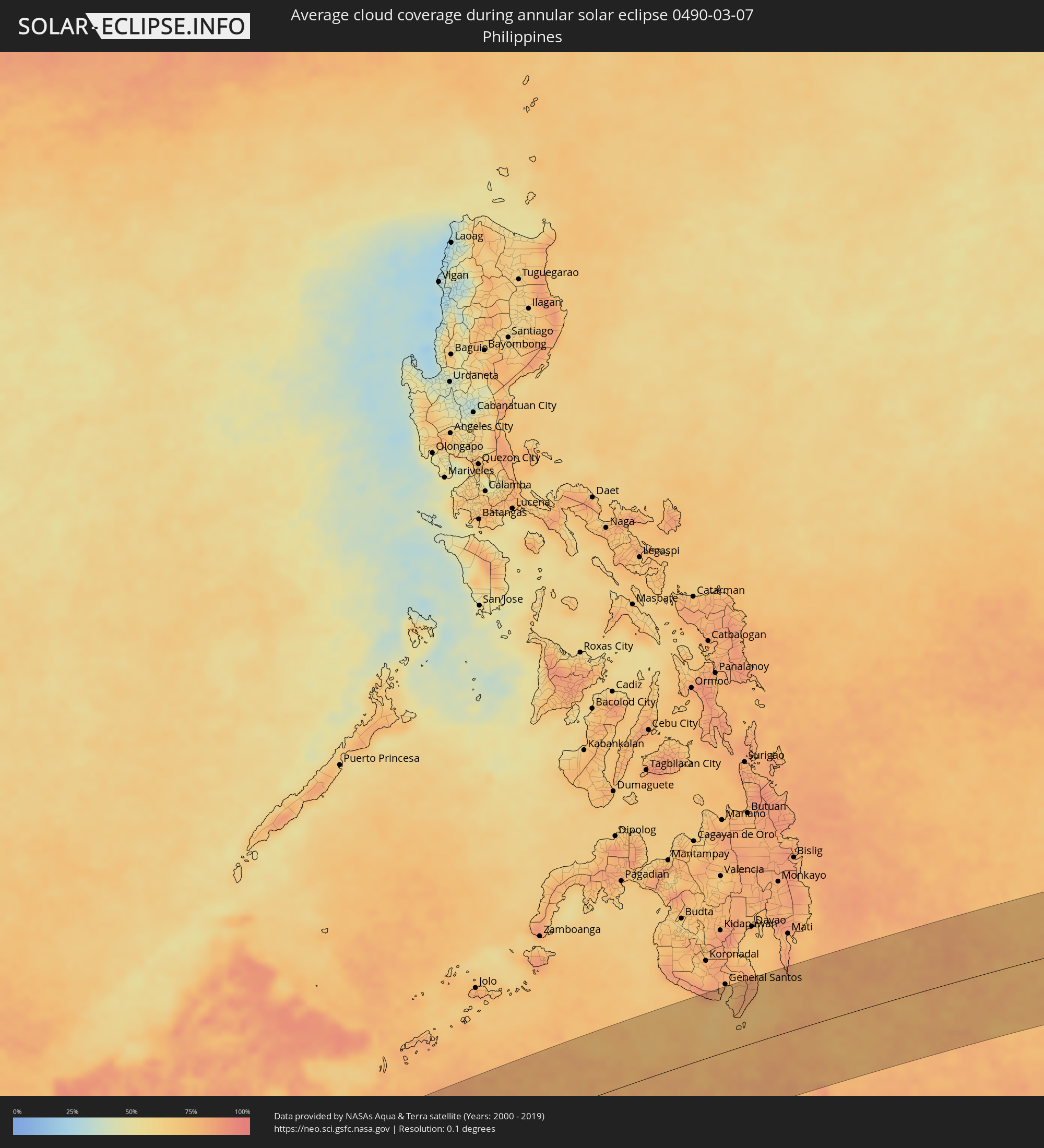 Philippines
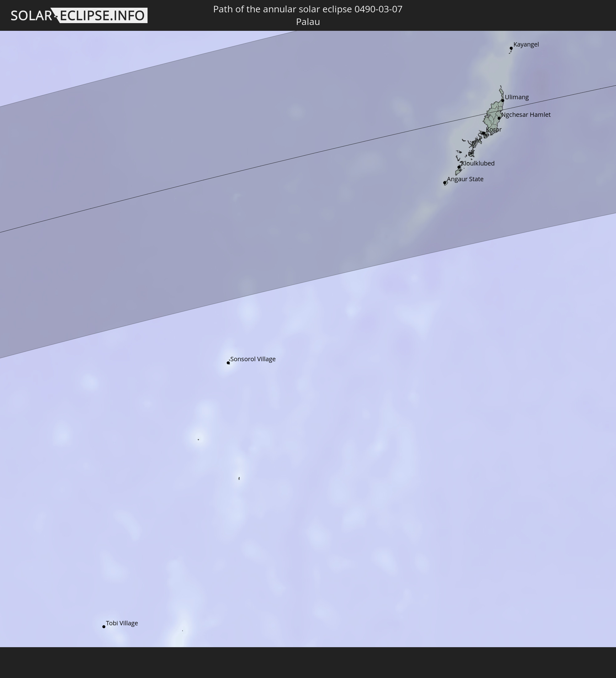
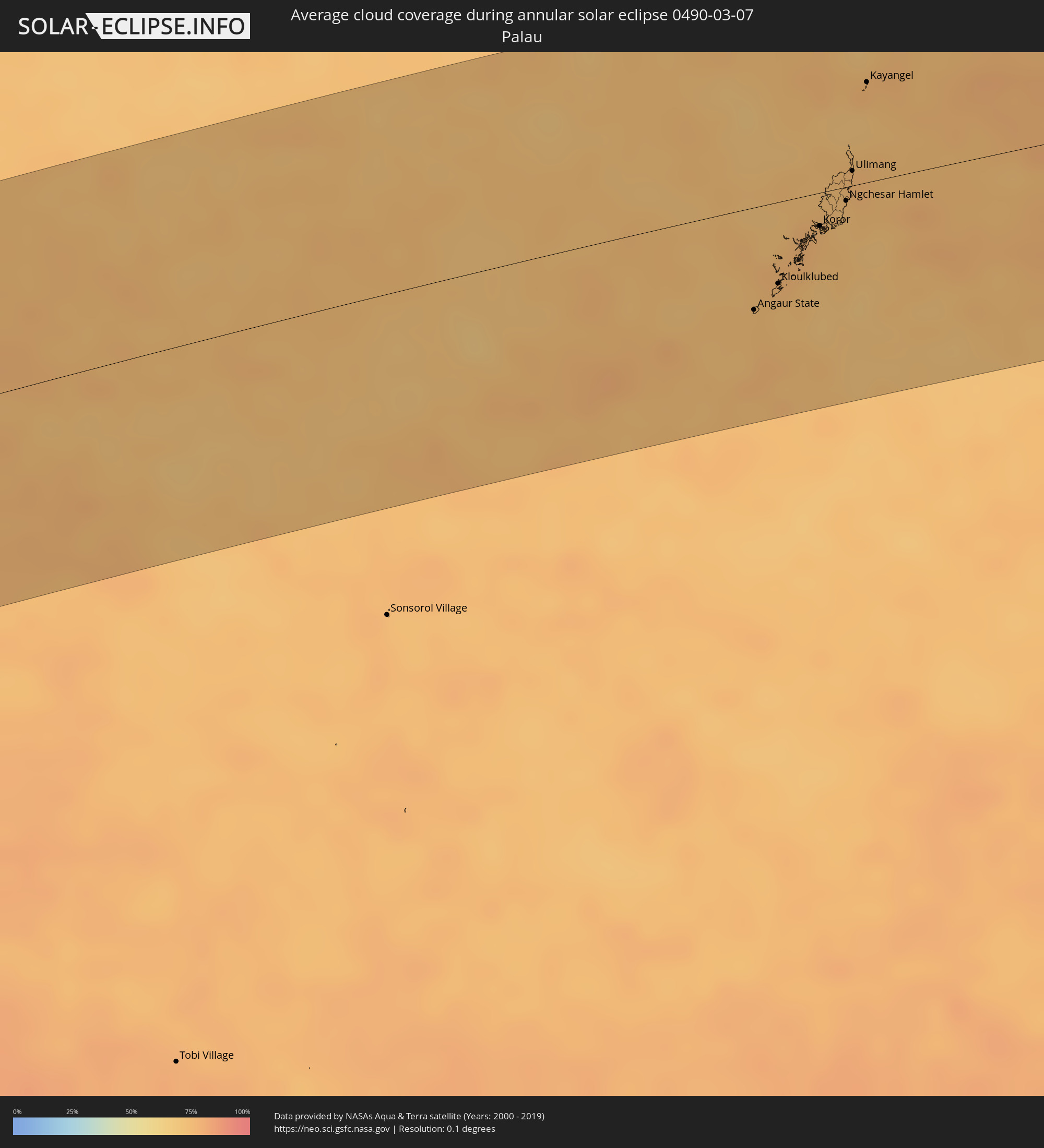 Palau
Palau
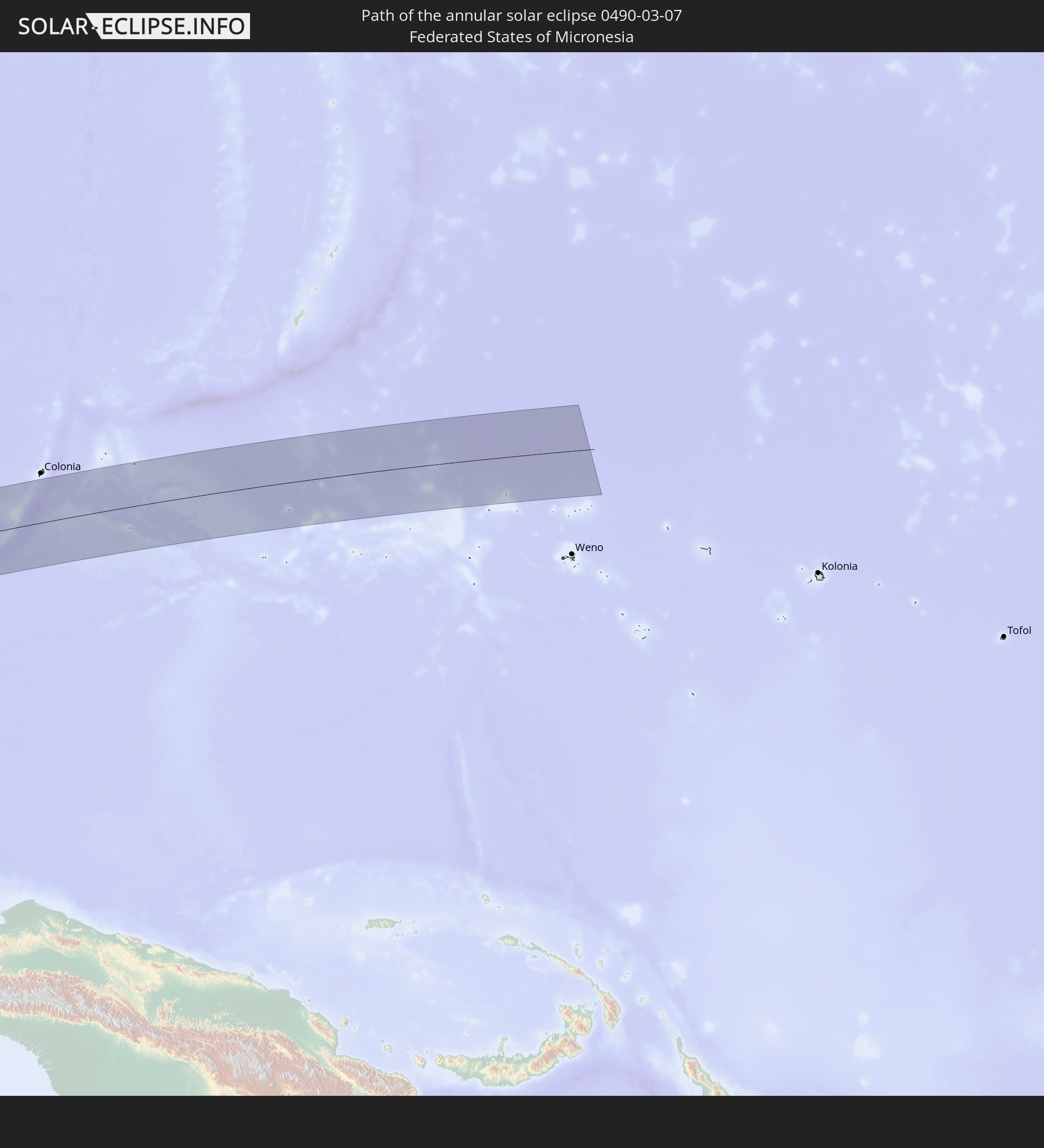
 Federated States of Micronesia
Cities inside the path of the eclipse
The following table shows all locations with a population of more than 5,000 inside the eclipse path. Cities which have more than 100,000 inhabitants are marked bold. A click at the locations opens a detailed map.
| City | Type | Eclipse duration | Local time of max. eclipse | Distance to central line | Ø Cloud coverage |
|
Witbank, Mpumalanga
|
annular | - | 05:37:39 UTC+01:30 | 118 km | 50% |
|
Middelburg, Mpumalanga
|
annular | - | 05:37:37 UTC+01:30 | 105 km | 48% |
|
Polokwane, Limpopo
|
annular | - | 05:36:58 UTC+01:30 | 103 km | 50% |
|
Lebowakgomo, Limpopo
|
annular | - | 05:37:04 UTC+01:30 | 70 km | 43% |
|
Mankoeng, Limpopo
|
annular | - | 05:36:58 UTC+01:30 | 106 km | 49% |
|
Belfast, Mpumalanga
|
annular | - | 05:37:35 UTC+01:30 | 90 km | 44% |
|
Tzaneen, Limpopo
|
annular | - | 05:36:56 UTC+01:30 | 117 km | 63% |
|
Nkowakowa, Limpopo
|
annular | - | 05:36:58 UTC+01:30 | 112 km | 62% |
|
Lydenburg, Mpumalanga
|
annular | - | 05:37:22 UTC+01:30 | 21 km | 45% |
|
Nelspruit, Mpumalanga
|
annular | - | 05:37:31 UTC+01:30 | 58 km | 59% |
|
White River, Mpumalanga
|
annular | - | 05:37:28 UTC+01:30 | 42 km | 58% |
|
Barberton, Mpumalanga
|
annular | - | 05:37:38 UTC+01:30 | 93 km | 62% |
|
Phalaborwa, Limpopo
|
annular | - | 05:37:00 UTC+01:30 | 113 km | 64% |
|
Thulamahashi, Limpopo
|
annular | - | 05:37:15 UTC+01:30 | 27 km | 57% |
|
Piggs Peak, Hhohho
|
annular | - | 05:37:42 UTC+01:30 | 111 km | 55% |
|
Mhlume, Lubombo
|
annular | - | 05:37:46 UTC+01:30 | 113 km | 64% |
|
Komatipoort, Mpumalanga
|
annular | - | 05:37:33 UTC+01:30 | 46 km | 62% |
|
Ressano Garcia, Maputo
|
annular | - | 06:17:53 UTC+02:10 | 47 km | 62% |
|
Matola, Maputo
|
annular | - | 06:18:07 UTC+02:10 | 101 km | 59% |
|
Maputo, Maputo City
|
annular | - | 06:18:07 UTC+02:10 | 100 km | 52% |
|
Chokwé, Gaza
|
annular | - | 06:17:39 UTC+02:10 | 62 km | 69% |
|
Macia, Gaza
|
annular | - | 06:17:50 UTC+02:10 | 8 km | 74% |
|
Chibuto, Gaza
|
annular | - | 06:17:46 UTC+02:10 | 49 km | 65% |
|
Xai-Xai, Gaza
|
annular | - | 06:17:54 UTC+02:10 | 9 km | 53% |
|
Manjacaze, Gaza
|
annular | - | 06:17:49 UTC+02:10 | 48 km | 74% |
|
Ampanihy, Atsimo-Andrefana
|
annular | - | 06:38:26 UTC+02:27 | 91 km | 51% |
|
Tranovaho, Androy
|
annular | - | 06:38:43 UTC+02:27 | 23 km | 53% |
|
Beloha, Androy
|
annular | - | 06:38:44 UTC+02:27 | 38 km | 56% |
|
Beteza, Androy
|
annular | - | 06:38:35 UTC+02:27 | 118 km | 50% |
|
Kopoky, Androy
|
annular | - | 06:38:50 UTC+02:27 | 34 km | 55% |
|
Tsiombe, Androy
|
annular | - | 06:39:01 UTC+02:27 | 23 km | 54% |
|
Ambovombe, Androy
|
annular | - | 06:39:21 UTC+02:27 | 36 km | 51% |
|
Amboasary, Anosy
|
annular | - | 06:39:30 UTC+02:27 | 52 km | 48% |
|
Fort Dauphin, Anosy
|
annular | - | 06:39:53 UTC+02:27 | 52 km | 59% |
|
Kotabumi, Lampung
|
annular | - | 13:54:49 UTC+07:07 | 3 km | 95% |
|
Terbanggi Besar, Lampung
|
annular | - | 13:55:36 UTC+07:07 | 29 km | 96% |
|
Bandar Lampung, Lampung
|
annular | - | 13:54:37 UTC+07:07 | 83 km | 92% |
|
Metro, Lampung
|
annular | - | 13:55:22 UTC+07:07 | 56 km | 95% |
|
Tanjung Pandan, Bangka–Belitung Islands
|
annular | - | 14:05:47 UTC+07:07 | 32 km | 84% |
|
Manggar, Bangka–Belitung Islands
|
annular | - | 14:07:02 UTC+07:07 | 18 km | 83% |
|
Tanjung Selor, North Kalimantan
|
annular | - | 15:25:10 UTC+07:57 | 84 km | 91% |
|
Maasin, Soccsksargen
|
annular | - | 15:42:01 UTC+08:00 | 98 km | 75% |
|
Glan, Soccsksargen
|
annular | - | 15:42:13 UTC+08:00 | 87 km | 71% |
|
Baliton, Soccsksargen
|
annular | - | 15:42:11 UTC+08:00 | 78 km | 72% |
|
Sapu Padidu, Soccsksargen
|
annular | - | 15:42:23 UTC+08:00 | 95 km | 76% |
|
Pangyan, Soccsksargen
|
annular | - | 15:42:12 UTC+08:00 | 71 km | 77% |
|
Lun Pequeño, Soccsksargen
|
annular | - | 15:42:31 UTC+08:00 | 107 km | 72% |
|
Malapatan, Soccsksargen
|
annular | - | 15:42:28 UTC+08:00 | 100 km | 72% |
|
Alabel, Soccsksargen
|
annular | - | 15:42:35 UTC+08:00 | 114 km | 74% |
|
Suyan, Soccsksargen
|
annular | - | 15:42:39 UTC+08:00 | 106 km | 77% |
|
Sarangani, Davao
|
annular | - | 15:42:08 UTC+08:00 | 34 km | 71% |
|
Caburan, Davao
|
annular | - | 15:42:49 UTC+08:00 | 82 km | 74% |
|
Angaur State, Angaur
|
annular | - | 16:51:34 UTC+09:00 | 57 km | 73% |
|
Kloulklubed, Peleliu
|
annular | - | 16:51:45 UTC+09:00 | 46 km | 72% |
|
Koror, Koror
|
annular | - | 16:52:06 UTC+09:00 | 19 km | 74% |
|
Ngchemiangel, Aimeliik
|
annular | - | 16:52:11 UTC+09:00 | 7 km | 75% |
|
Koror Town, Koror
|
annular | - | 16:52:06 UTC+09:00 | 18 km | 74% |
|
Ngereklmadel, Ngatpang
|
annular | - | 16:52:13 UTC+09:00 | 3 km | 75% |
|
Ngetkib, Airai
|
annular | - | 16:52:09 UTC+09:00 | 17 km | 75% |
|
Imeong Hamlet, Ngaremlengui
|
annular | - | 16:52:16 UTC+09:00 | 1 km | 75% |
|
Ngardmau, Ngardmau
|
annular | - | 16:52:21 UTC+09:00 | 8 km | 73% |
|
Ngchesar Hamlet, Ngchesar
|
annular | - | 16:52:17 UTC+09:00 | 8 km | 72% |
|
Melekeok, Melekeok
|
annular | - | 16:52:19 UTC+09:00 | 5 km | 72% |
|
Mengellang, Ngarchelong
|
annular | - | 16:52:27 UTC+09:00 | 16 km | 74% |
|
Ngerkeai, Ngiwal
|
annular | - | 16:52:21 UTC+09:00 | 1 km | 73% |
|
Melekeok Village, Melekeok
|
annular | - | 16:52:19 UTC+09:00 | 6 km | 72% |
|
Ulimang, Ngaraard
|
annular | - | 16:52:25 UTC+09:00 | 8 km | 73% |
|
Kayangel, Kayangel
|
annular | - | 16:52:46 UTC+09:00 | 56 km | 76% |