Total solar eclipse of 03/09/0574
| Day of week: | Wednesday |
| Maximum duration of eclipse: | 03m23s |
| Maximum width of eclipse path: | 218 km |
| Saros cycle: | 97 |
| Coverage: | 100% |
| Magnitude: | 1.0452 |
| Gamma: | 0.7376 |
Wo kann man die Sonnenfinsternis vom 03/09/0574 sehen?
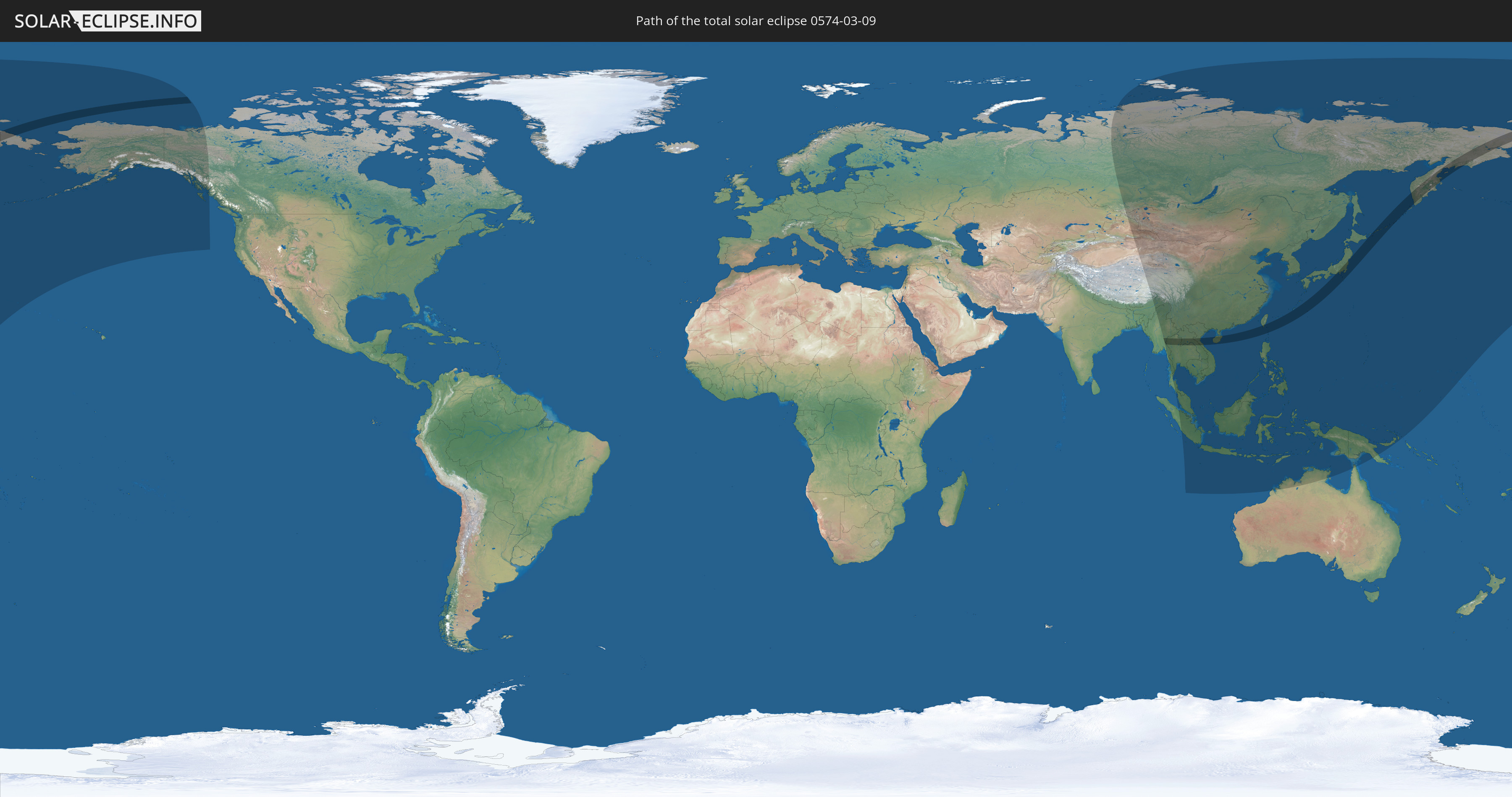
Die Sonnenfinsternis am 03/09/0574 kann man in 32 Ländern als partielle Sonnenfinsternis beobachten.
Der Finsternispfad verläuft durch 9 Länder. Nur in diesen Ländern ist sie als total Sonnenfinsternis zu sehen.
In den folgenden Ländern ist die Sonnenfinsternis total zu sehen
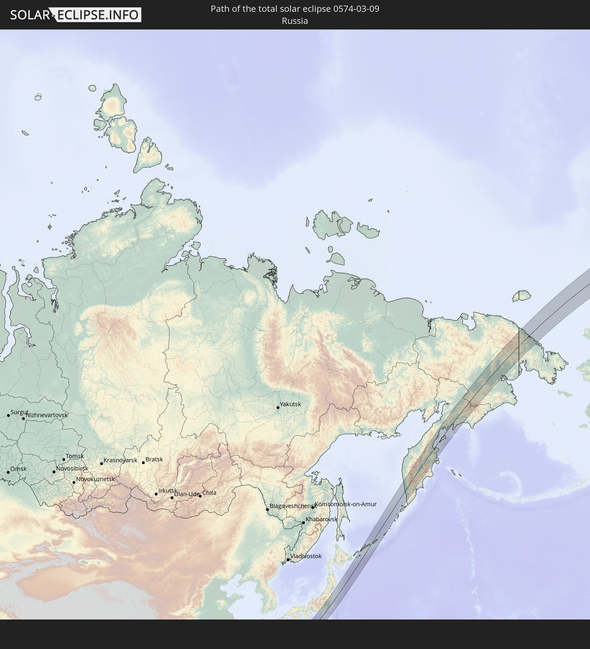 Russia
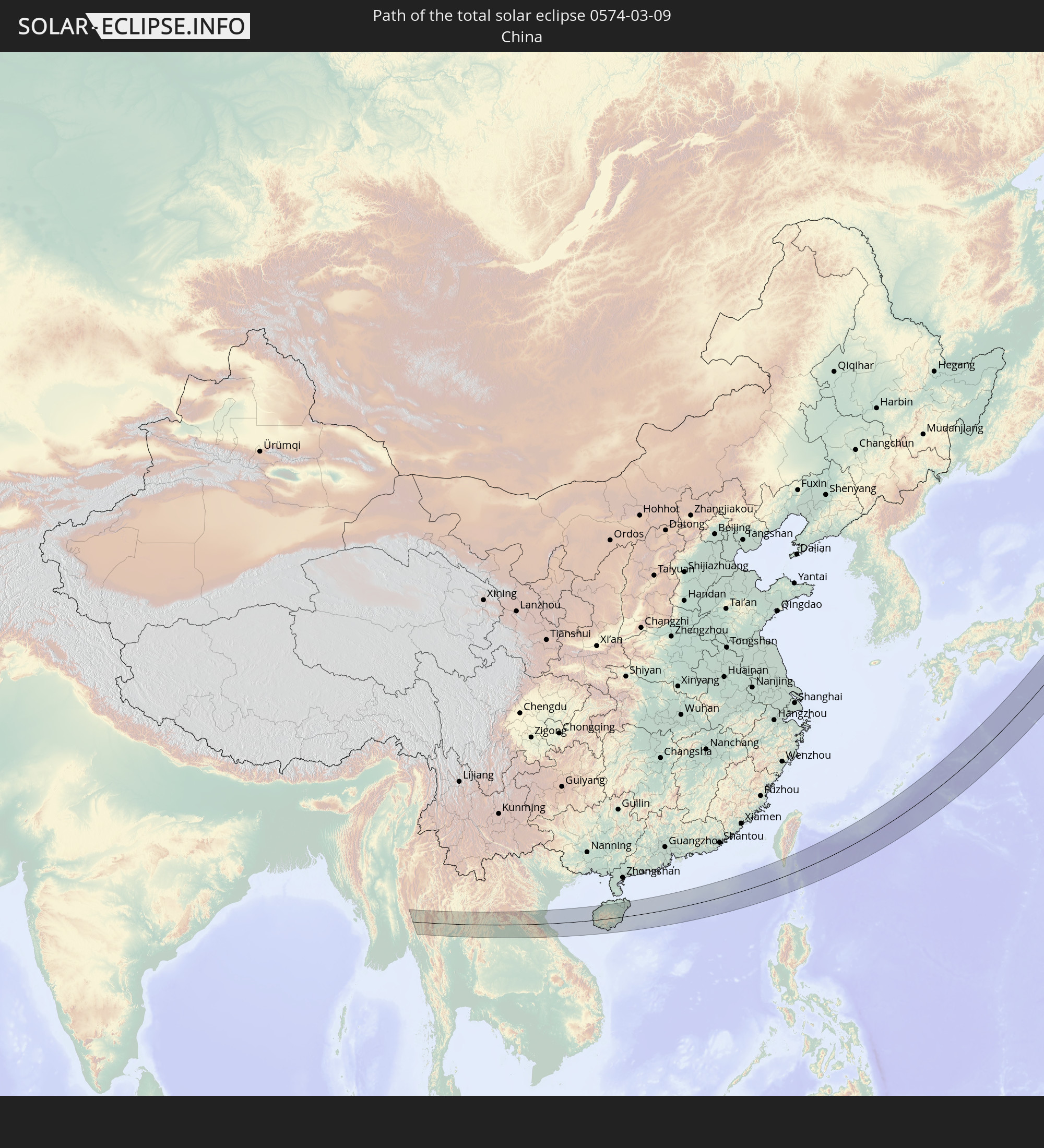 China
China
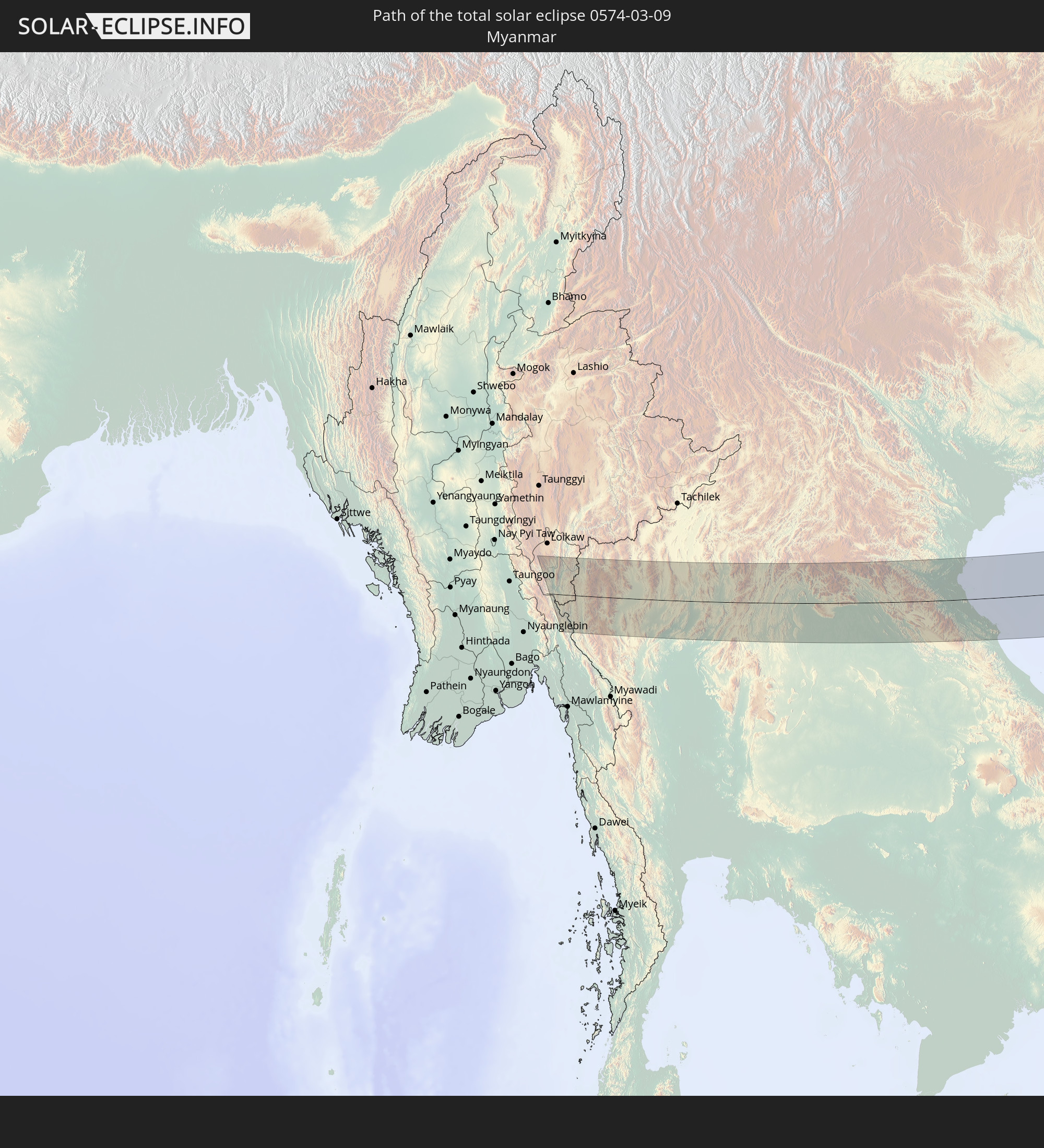 Myanmar
 Thailand
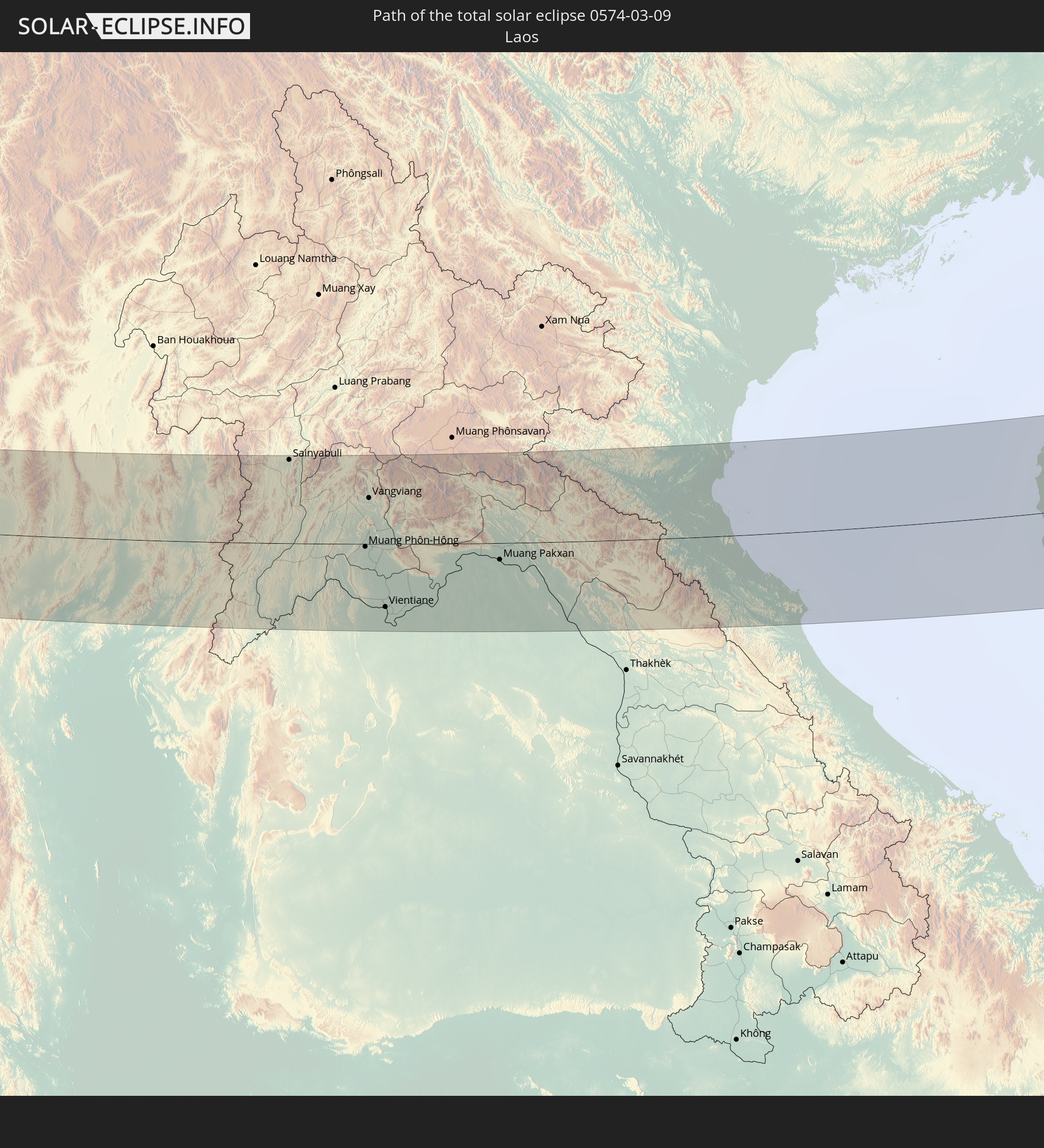 Laos
Laos
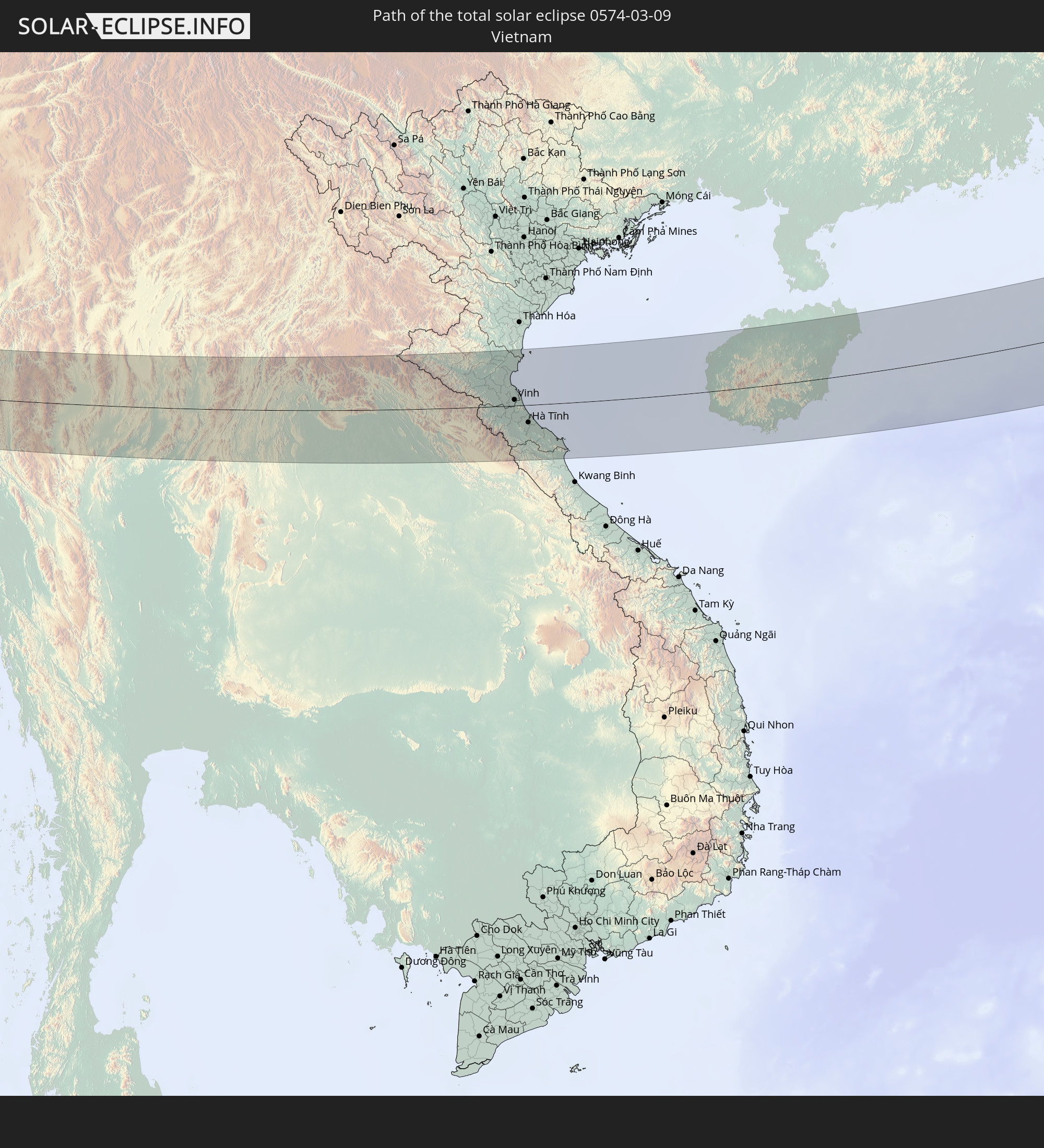 Vietnam
 Taiwan
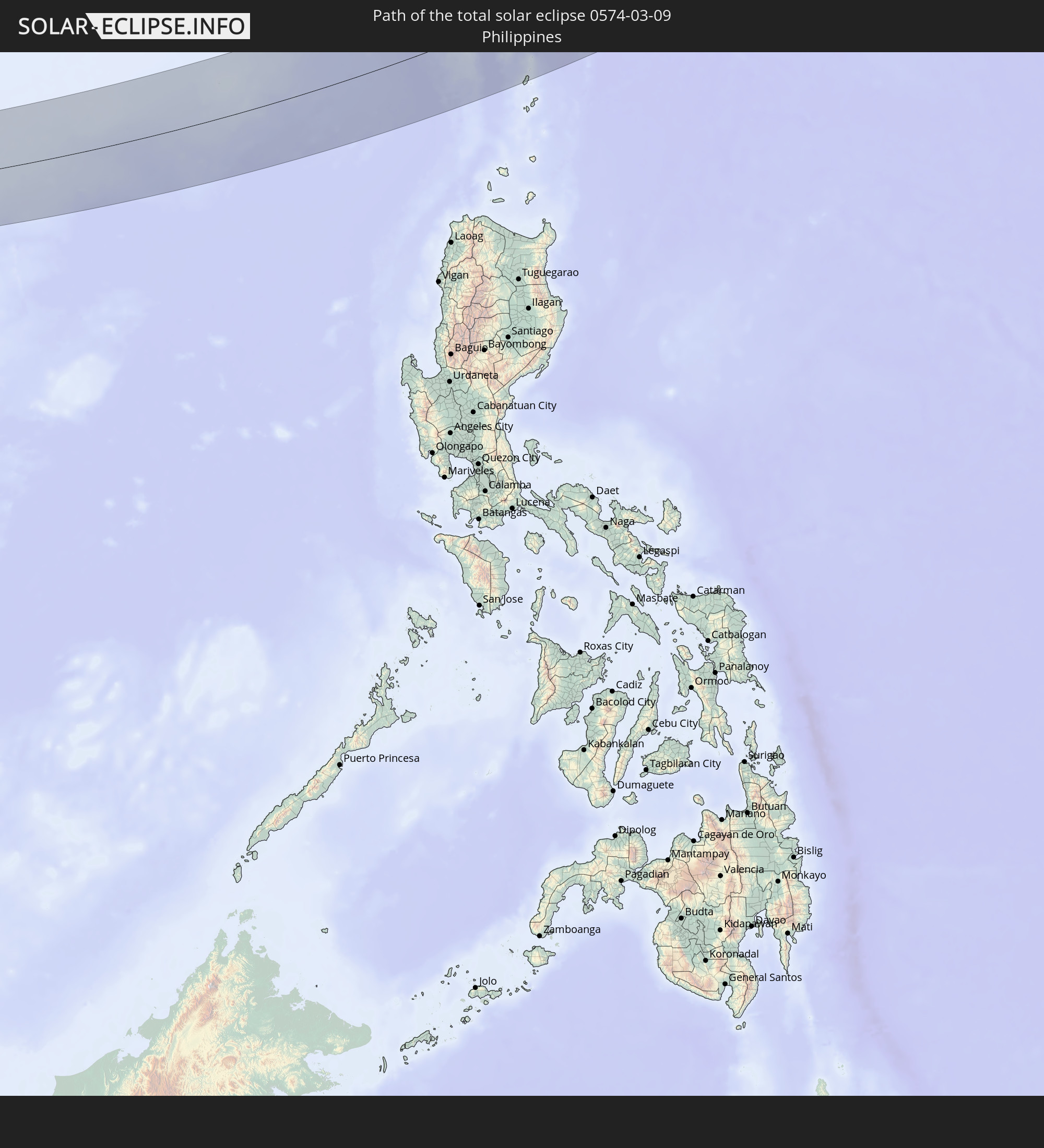 Philippines
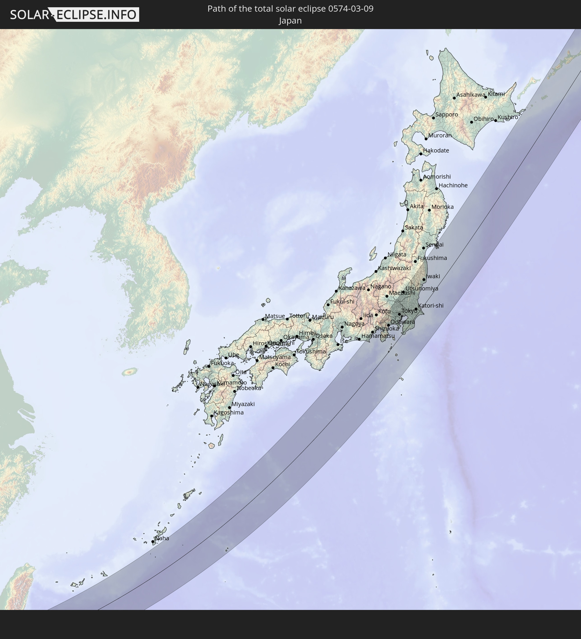 Japan
Japan
In den folgenden Ländern ist die Sonnenfinsternis partiell zu sehen
 Russia
 United States
 United States Minor Outlying Islands
 Canada
 India
India
 China
China
 Mongolia
 Myanmar
 Indonesia
 Thailand
 Malaysia
 Laos
Laos
 Vietnam
 Cambodia
 Singapore
 Christmas Island
 Australia
 Macau
Macau
 Hong Kong
 Brunei
 Taiwan
 Philippines
 Japan
Japan
 East Timor
 North Korea
 South Korea
 Palau
Palau
 Federated States of Micronesia
 Papua New Guinea
 Guam
Guam
 Northern Mariana Islands
 Marshall Islands
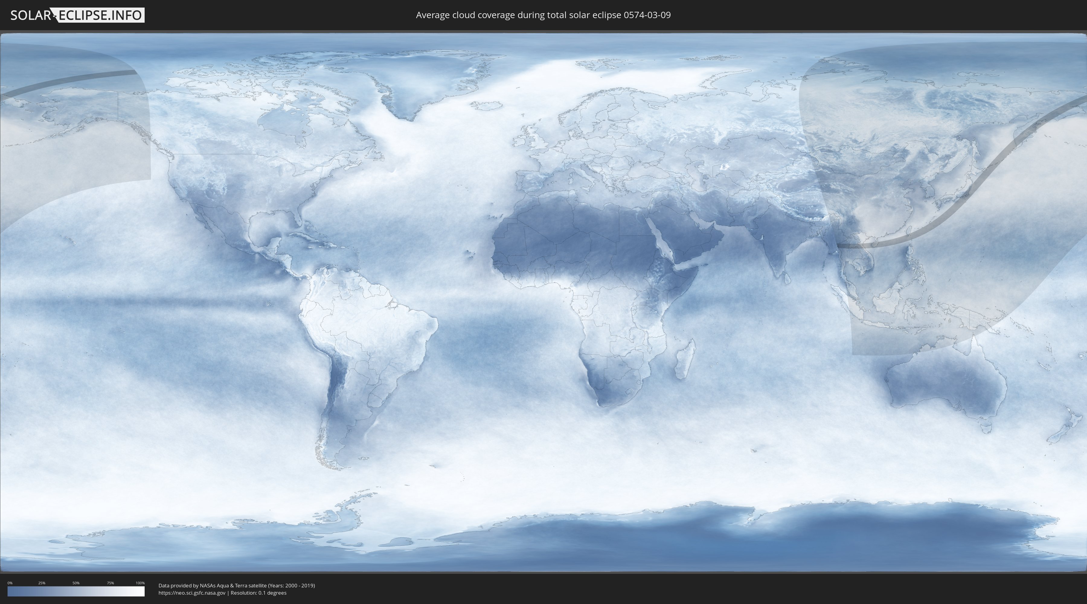
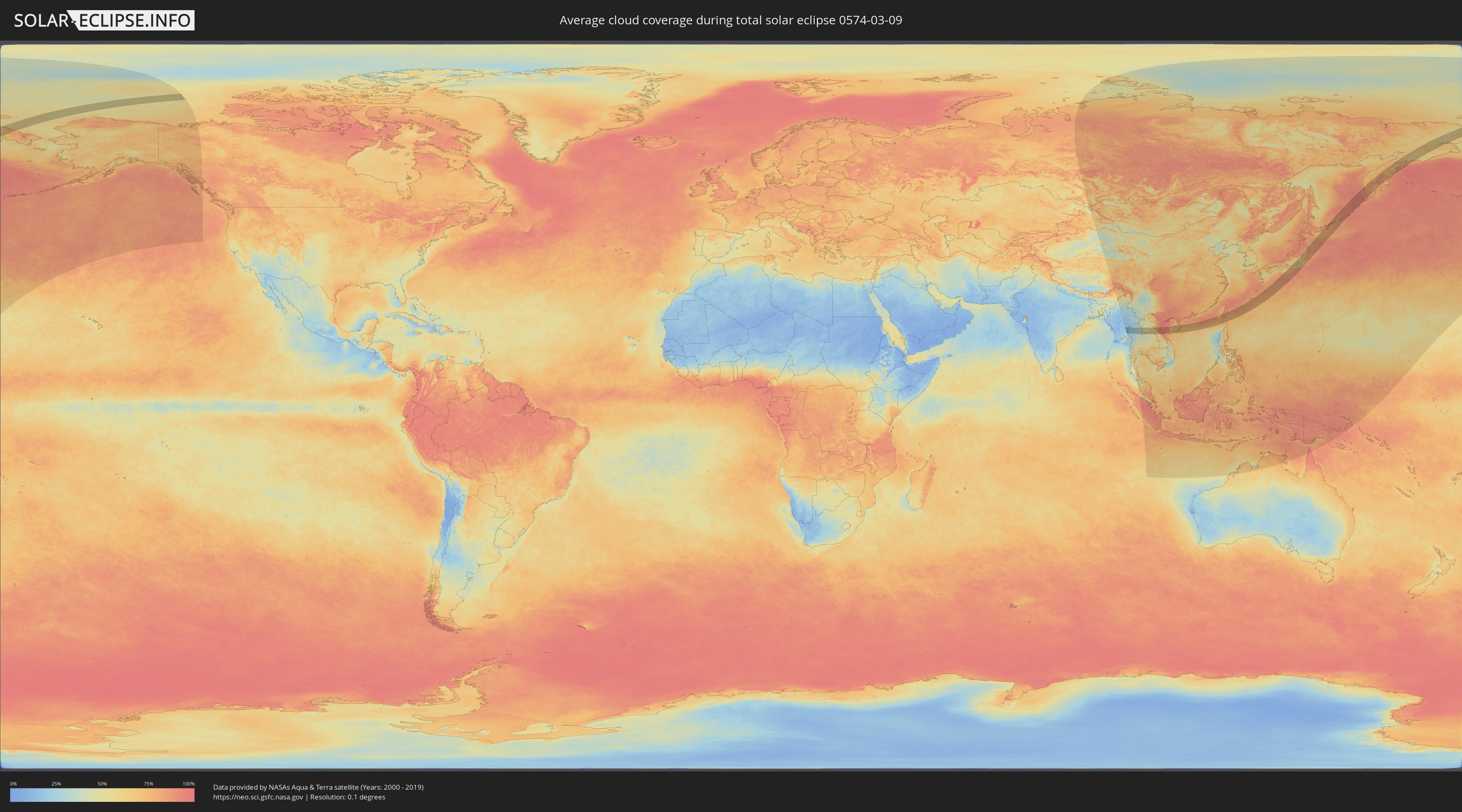
How will be the weather during the total solar eclipse on 03/09/0574?
Where is the best place to see the total solar eclipse of 03/09/0574?
The following maps show the average cloud coverage for the day of the total solar eclipse.
With the help of these maps, it is possible to find the place along the eclipse path, which has the best
chance of a cloudless sky.
Nevertheless, you should consider local circumstances and inform about the weather of your chosen
observation site.
The data is provided by NASAs satellites
AQUA and TERRA.
The cloud maps are averaged over a period of 19 years (2000 - 2019).
Detailed country maps
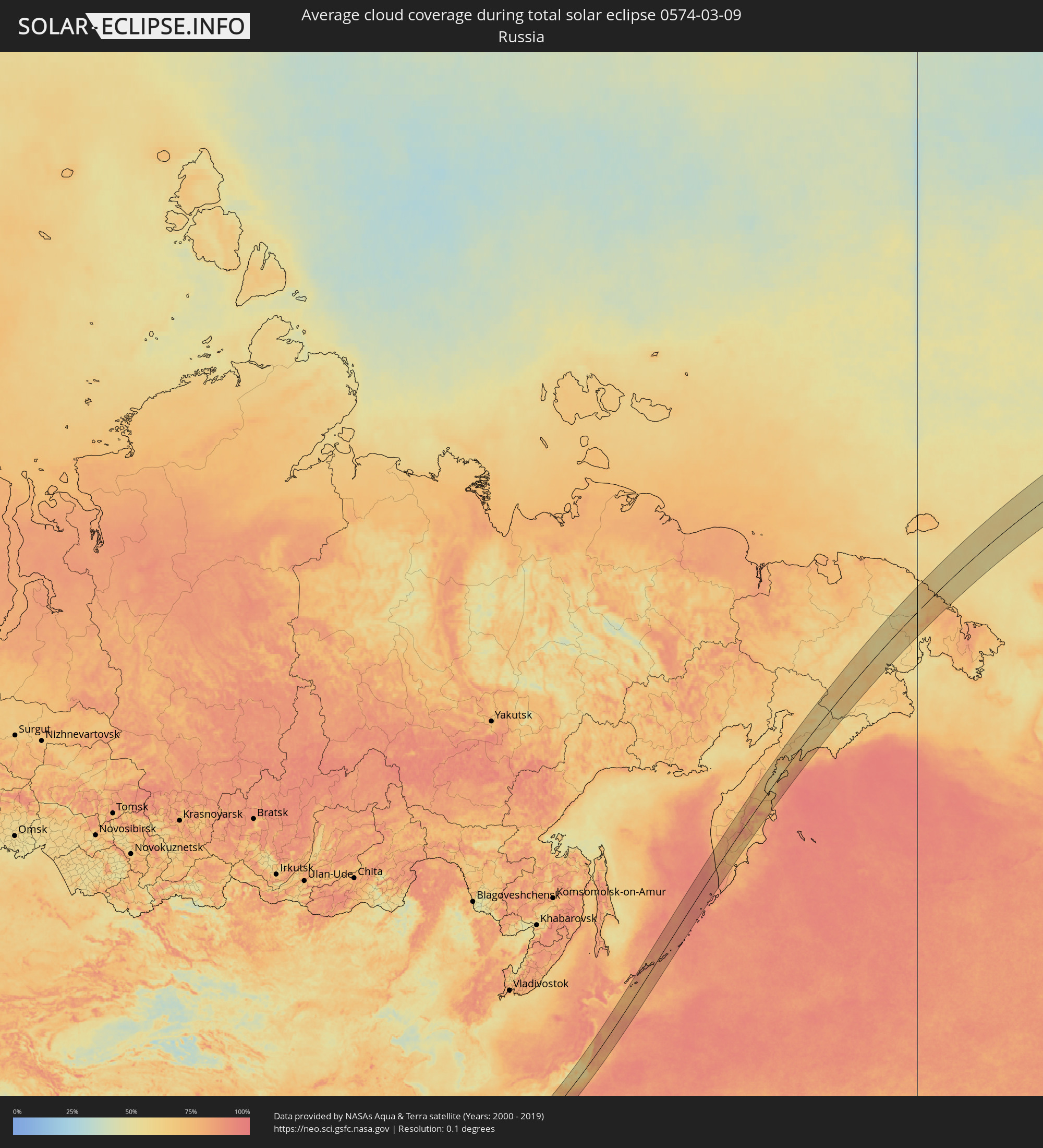 Russia
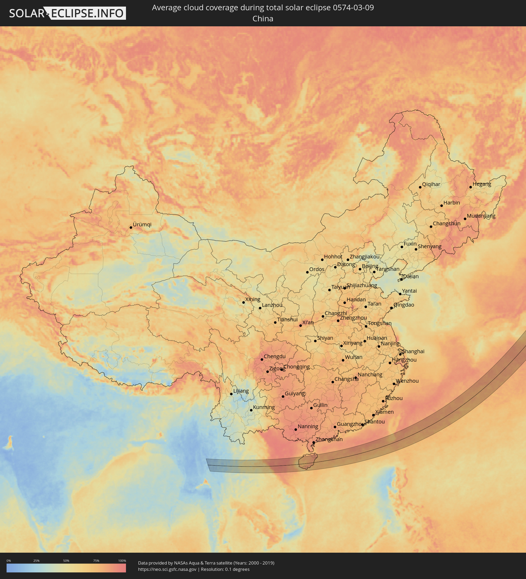 China
China
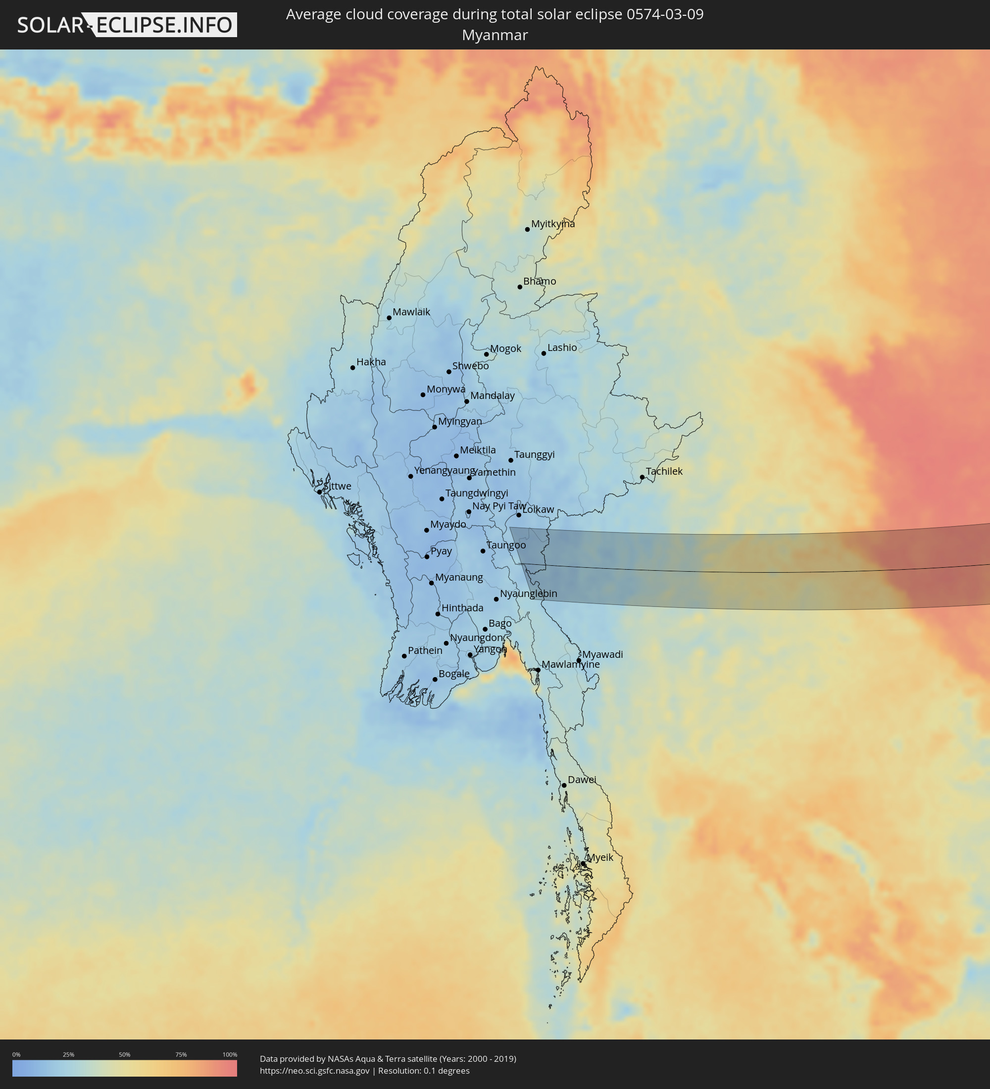 Myanmar
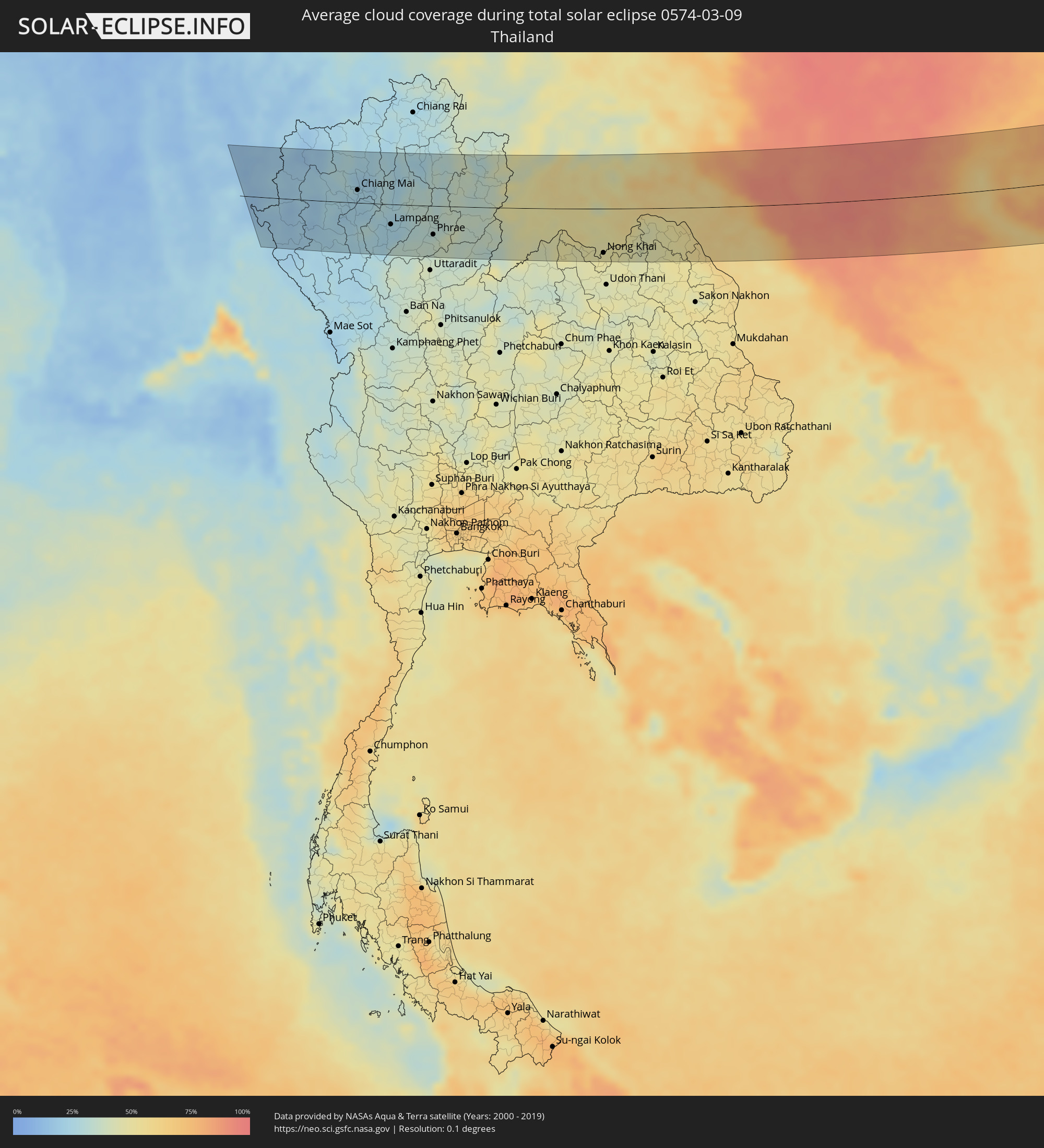 Thailand
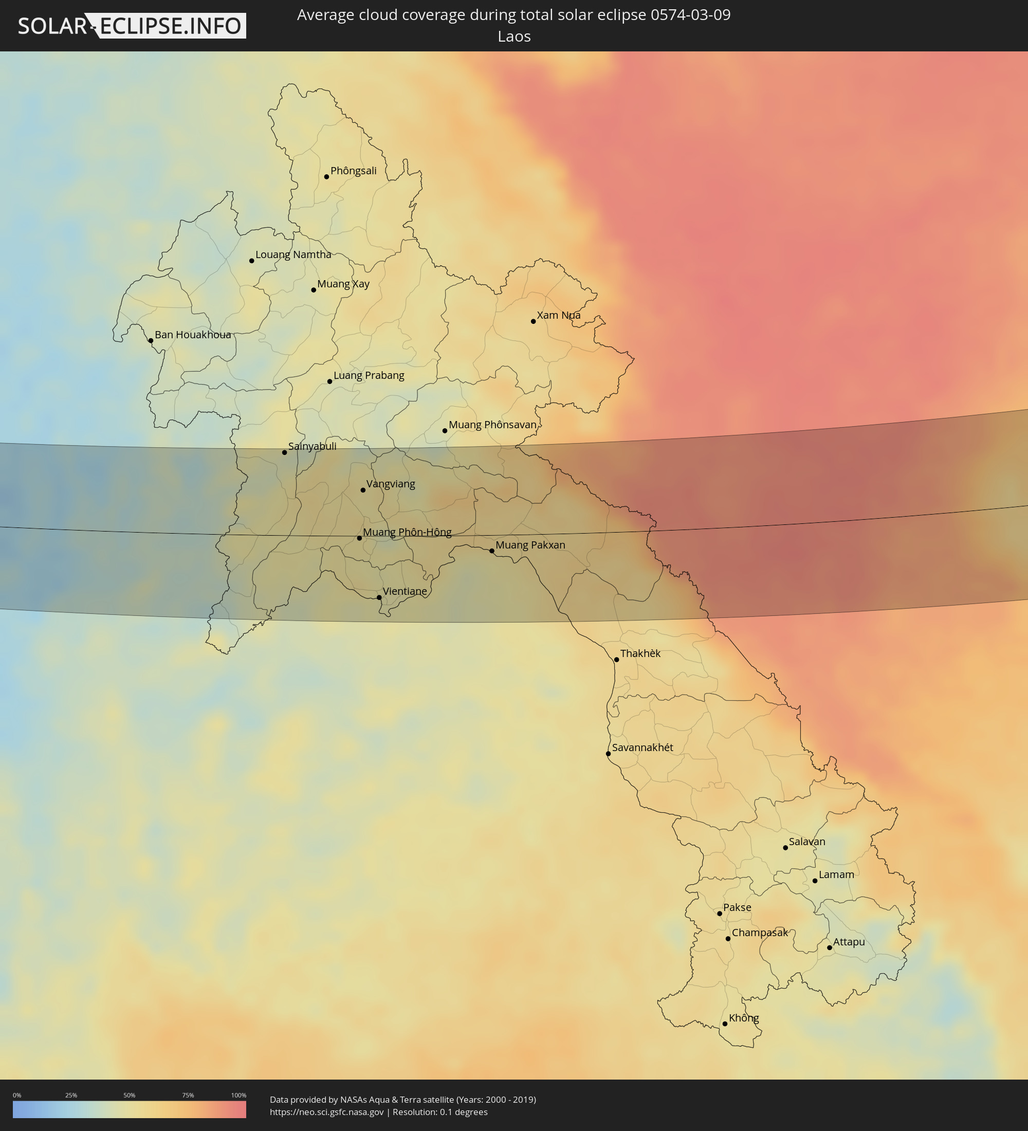 Laos
Laos
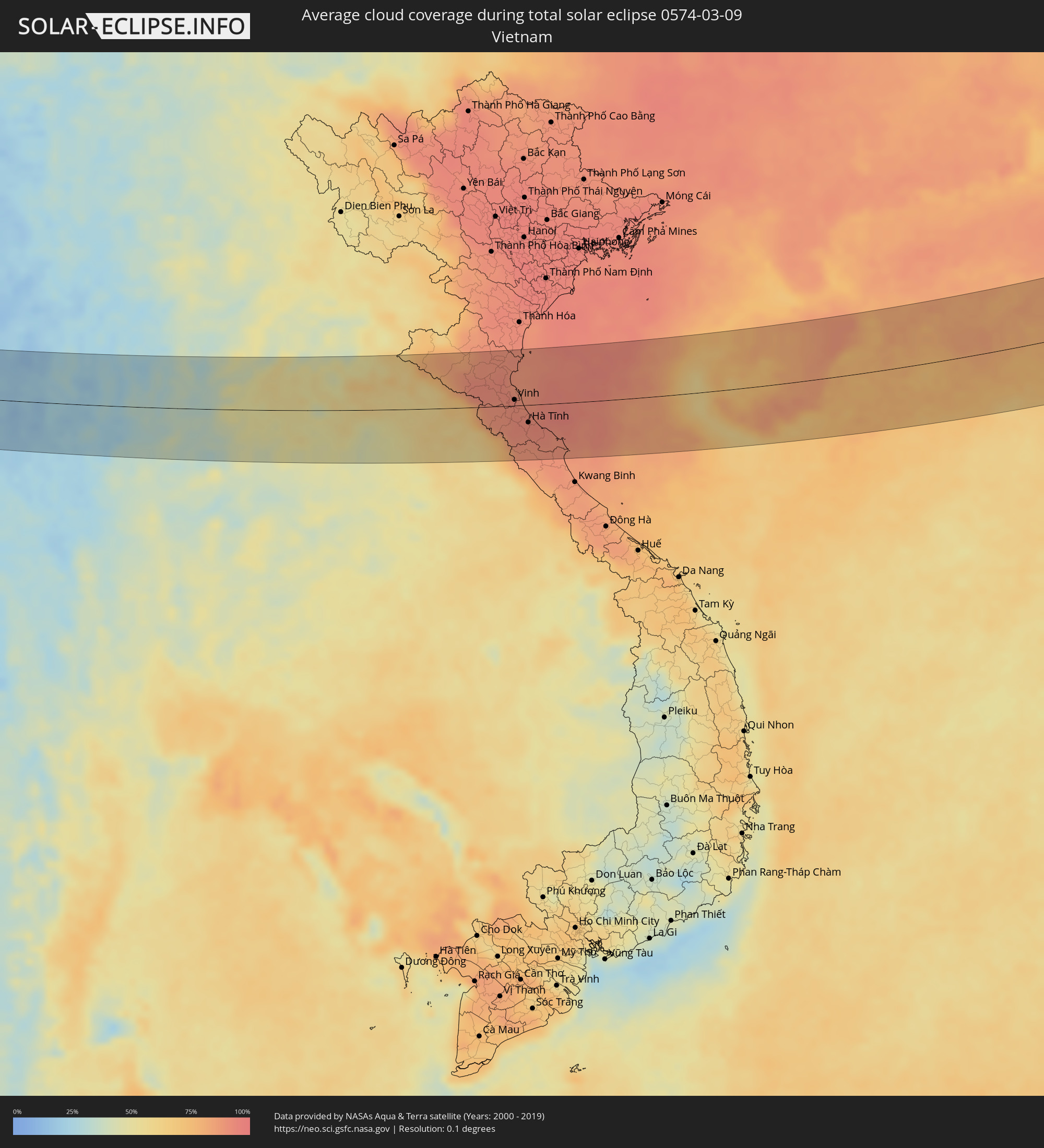 Vietnam
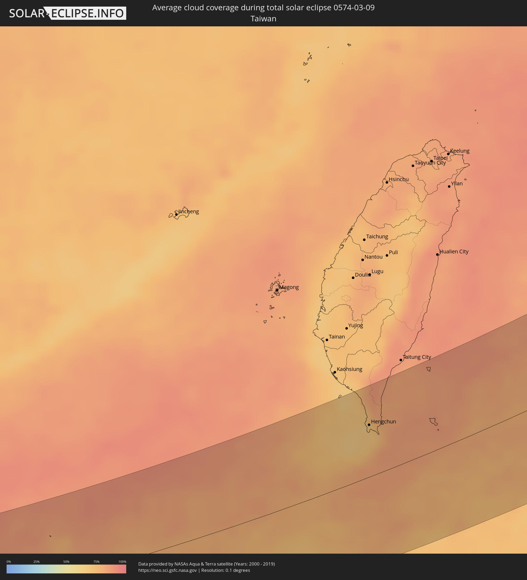 Taiwan
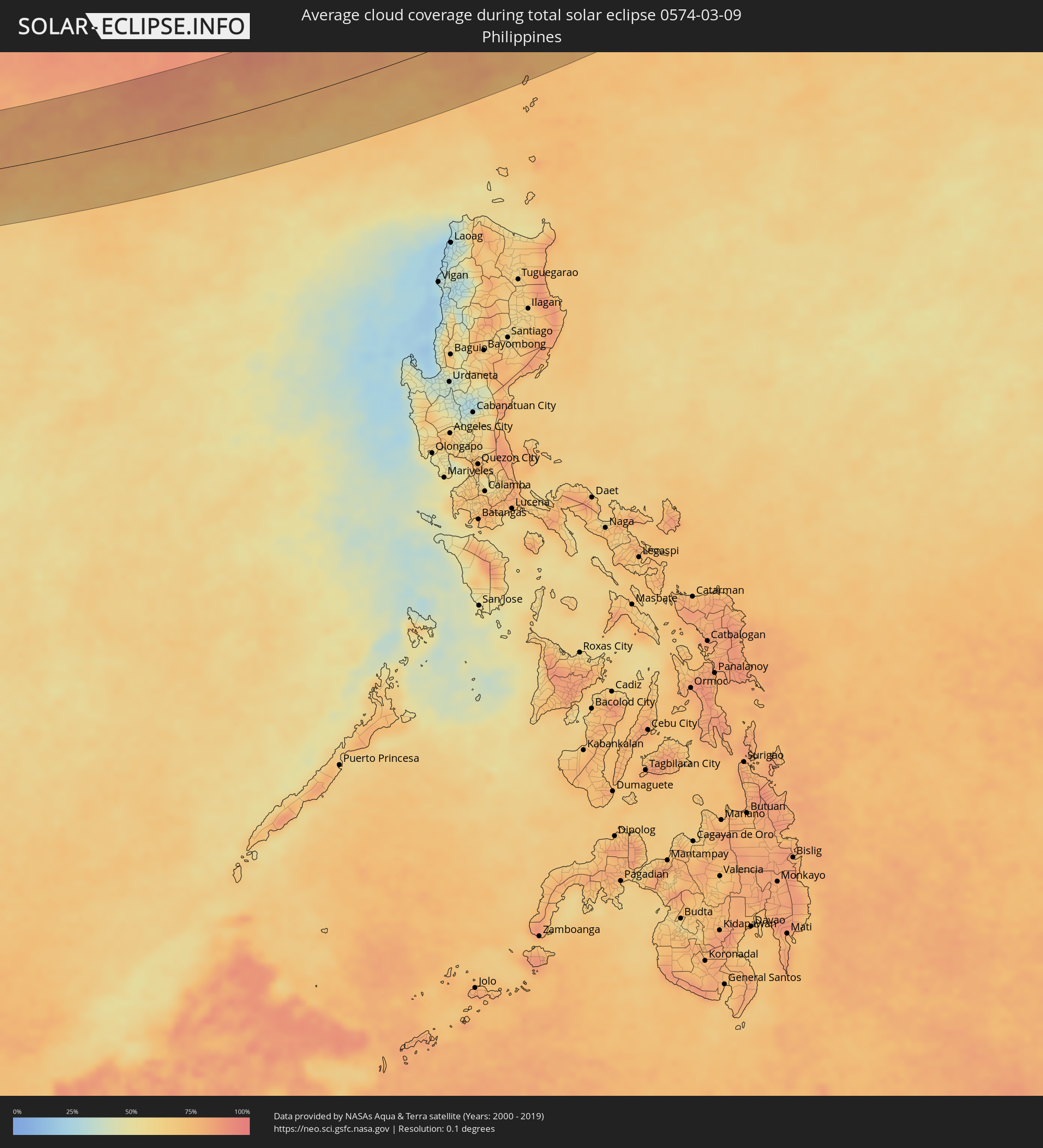 Philippines
 Japan
Japan
Cities inside the path of the eclipse
The following table shows all locations with a population of more than 5,000 inside the eclipse path. Cities which have more than 100,000 inhabitants are marked bold. A click at the locations opens a detailed map.
| City | Type | Eclipse duration | Local time of max. eclipse | Distance to central line | Ø Cloud coverage |
|
Mae Hong Son, Mae Hong Son
|
total | - | 06:30:40 UTC+06:42 | 71 km | 17% |
|
Pa Pae, Mae Hong Son
|
total | - | 06:29:16 UTC+06:42 | 44 km | 18% |
|
Chom Thong, Chiang Mai
|
total | - | 06:29:33 UTC+06:42 | 23 km | 22% |
|
San Pa Tong, Chiang Mai
|
total | - | 06:29:52 UTC+06:42 | 2 km | 22% |
|
Hang Dong, Chiang Mai
|
total | - | 06:29:57 UTC+06:42 | 9 km | 21% |
|
Pa Sang, Lamphun
|
total | - | 06:29:44 UTC+06:42 | 9 km | 22% |
|
Chiang Mai, Chiang Mai
|
total | - | 06:30:06 UTC+06:42 | 21 km | 22% |
|
Lamphun, Lamphun
|
total | - | 06:29:49 UTC+06:42 | 3 km | 21% |
|
San Kamphaeng, Chiang Mai
|
total | - | 06:30:03 UTC+06:42 | 16 km | 23% |
|
Mae Tha, Lamphun
|
total | - | 06:29:41 UTC+06:42 | 15 km | 22% |
|
Lampang, Lampang
|
total | - | 06:29:30 UTC+06:42 | 32 km | 23% |
|
Long, Phrae
|
total | - | 06:29:15 UTC+06:42 | 55 km | 33% |
|
Phayao, Phayao
|
total | - | 06:30:48 UTC+06:42 | 69 km | 25% |
|
Dok Kham Tai, Phayao
|
total | - | 06:30:47 UTC+06:42 | 66 km | 24% |
|
Den Chai, Phrae
|
total | - | 06:29:10 UTC+06:42 | 64 km | 34% |
|
Phrae, Phrae
|
total | - | 06:29:24 UTC+06:42 | 46 km | 34% |
|
Pong, Phayao
|
total | - | 06:30:49 UTC+06:42 | 66 km | 31% |
|
Rong Kwang, Phrae
|
total | - | 06:29:42 UTC+06:42 | 24 km | 32% |
|
Nan, Nan
|
total | - | 06:30:24 UTC+06:42 | 27 km | 32% |
|
Chiang Klang, Nan
|
total | - | 06:31:08 UTC+06:42 | 84 km | 30% |
|
Sainyabuli, Xiagnabouli
|
total | - | 06:31:16 UTC+06:42 | 81 km | 44% |
|
Nam Som, Changwat Udon Thani
|
total | - | 06:29:18 UTC+06:42 | 84 km | 42% |
|
Muang Phôn-Hông, Vientiane Province
|
total | - | 06:30:21 UTC+06:42 | 3 km | 52% |
|
Vangviang, Vientiane Province
|
total | - | 06:30:58 UTC+06:42 | 45 km | 51% |
|
Tha Bo, Nong Khai
|
total | - | 06:29:30 UTC+06:42 | 75 km | 47% |
|
Si Chiang Mai, Nong Khai
|
total | - | 06:29:39 UTC+06:42 | 63 km | 47% |
|
Vientiane, Vientiane
|
total | - | 06:29:40 UTC+06:42 | 62 km | 47% |
|
Nong Khai, Nong Khai
|
total | - | 06:29:35 UTC+06:42 | 72 km | 48% |
|
Phon Charoen, Nong Khai
|
total | - | 06:29:54 UTC+06:42 | 55 km | 45% |
|
Bueng Kan, Changwat Bueng Kan
|
total | - | 06:30:30 UTC+06:42 | 18 km | 50% |
|
Muang Pakxan, Bolikhamsai Province
|
total | - | 06:30:32 UTC+06:42 | 16 km | 50% |
|
Seka, Changwat Bueng Kan
|
total | - | 06:29:58 UTC+06:42 | 67 km | 49% |
|
Yên Vinh, Nghệ An
|
total | - | 06:56:10 UTC+07:06 | 9 km | 92% |
|
Vinh, Nghệ An
|
total | - | 06:56:11 UTC+07:06 | 9 km | 92% |
|
Hà Tĩnh, Hà Tĩnh
|
total | - | 06:55:47 UTC+07:06 | 28 km | 91% |
|
Sanya, Hainan
|
total | - | 07:50:27 UTC+08:00 | 70 km | 68% |
|
Jinjiang, Hainan
|
total | - | 07:52:58 UTC+08:00 | 88 km | 79% |
|
Wanning, Hainan
|
total | - | 07:51:43 UTC+08:00 | 19 km | 80% |
|
Hengchun, Taiwan
|
total | - | 08:04:19 UTC+08:00 | 63 km | 69% |
|
Fujieda, Shizuoka
|
total | - | 09:49:10 UTC+09:00 | 109 km | 53% |
|
Shizuoka, Shizuoka
|
total | - | 09:49:33 UTC+09:00 | 109 km | 53% |
|
Fuji, Shizuoka
|
total | - | 09:50:18 UTC+09:00 | 99 km | 52% |
|
Numazu, Shizuoka
|
total | - | 09:50:25 UTC+09:00 | 81 km | 52% |
|
Odawara, Kanagawa
|
total | - | 09:51:07 UTC+09:00 | 71 km | 60% |
|
Ōme, Tokyo
|
total | - | 09:52:11 UTC+09:00 | 100 km | 57% |
|
Isehara, Kanagawa
|
total | - | 09:51:35 UTC+09:00 | 69 km | 58% |
|
Hachiōji, Tokyo
|
total | - | 09:52:04 UTC+09:00 | 85 km | 55% |
|
Sakado, Saitama
|
total | - | 09:52:42 UTC+09:00 | 101 km | 54% |
|
Machida, Tokyo
|
total | - | 09:52:02 UTC+09:00 | 69 km | 61% |
|
Tokorozawa, Saitama
|
total | - | 09:52:31 UTC+09:00 | 84 km | 65% |
|
Fujisawa, Kanagawa
|
total | - | 09:51:43 UTC+09:00 | 54 km | 58% |
|
Yokohama, Kanagawa
|
total | - | 09:52:07 UTC+09:00 | 47 km | 55% |
|
Saitama, Saitama
|
total | - | 09:52:59 UTC+09:00 | 78 km | 65% |
|
Yokosuka, Kanagawa
|
total | - | 09:51:52 UTC+09:00 | 36 km | 54% |
|
Tokyo, Tokyo
|
total | - | 09:52:38 UTC+09:00 | 61 km | 71% |
|
Sōka, Saitama
|
total | - | 09:53:03 UTC+09:00 | 63 km | 67% |
|
Oyama, Tochigi
|
total | - | 09:53:53 UTC+09:00 | 93 km | 54% |
|
Utsunomiya, Tochigi
|
total | - | 09:54:28 UTC+09:00 | 105 km | 59% |
|
Kisarazu, Chiba
|
total | - | 09:52:25 UTC+09:00 | 23 km | 53% |
|
Kashiwa, Chiba
|
total | - | 09:53:21 UTC+09:00 | 52 km | 58% |
|
Honchō, Chiba
|
total | - | 09:53:04 UTC+09:00 | 40 km | 58% |
|
Tsukuba, Ibaraki
|
total | - | 09:54:07 UTC+09:00 | 65 km | 56% |
|
Chiba, Chiba
|
total | - | 09:53:04 UTC+09:00 | 24 km | 58% |
|
Sakura, Chiba
|
total | - | 09:53:26 UTC+09:00 | 23 km | 55% |
|
Mobara, Chiba
|
total | - | 09:53:00 UTC+09:00 | 1 km | 57% |
|
Mito, Ibaraki
|
total | - | 09:54:52 UTC+09:00 | 49 km | 59% |
|
Hitachi, Ibaraki
|
total | - | 09:55:36 UTC+09:00 | 51 km | 64% |
|
Iwaki, Fukushima
|
total | - | 09:56:43 UTC+09:00 | 63 km | 66% |
|
Yelizovo, Kamtsjatka
|
total | - | 12:15:11 UTC+10:34 | 89 km | 72% |
|
Klyuchi, Kamtsjatka
|
total | - | 12:19:57 UTC+10:34 | 21 km | 78% |