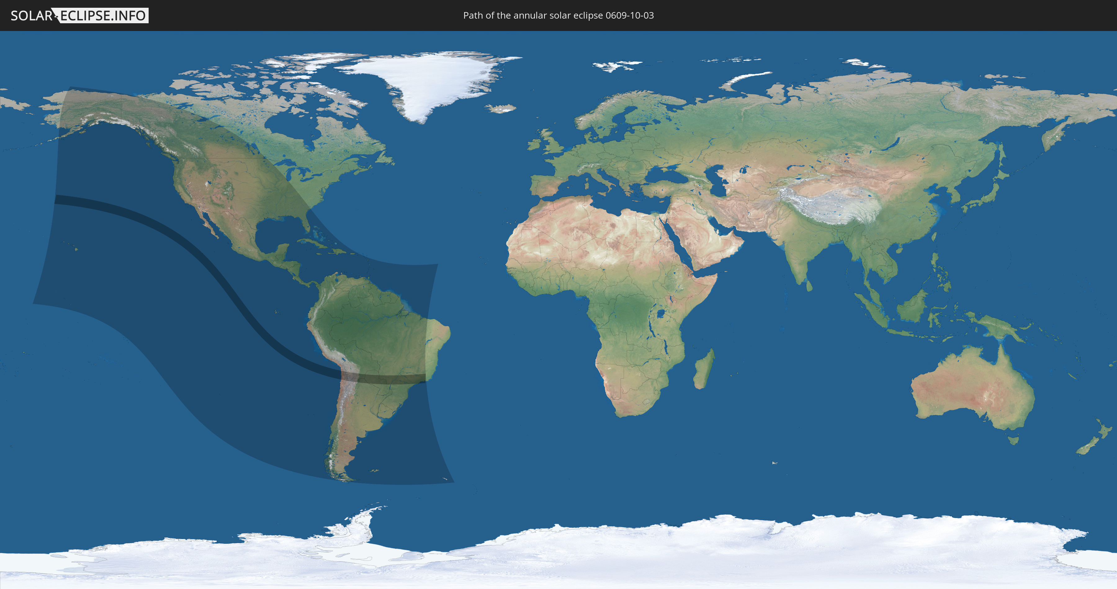
Annular solar eclipse of 10/03/0609
| Day of week: | Tuesday |
| Maximum duration of eclipse: | 08m09s |
| Maximum width of eclipse path: | 265 km |
| Saros cycle: | 92 |
| Coverage: | 93% |
| Magnitude: | 0.9298 |
| Gamma: | 0.1201 |
Wo kann man die Sonnenfinsternis vom 10/03/0609 sehen?
Die Sonnenfinsternis am 10/03/0609 kann man in 50 Ländern als partielle Sonnenfinsternis beobachten.
Der Finsternispfad verläuft durch 5 Länder. Nur in diesen Ländern ist sie als annular Sonnenfinsternis zu sehen.
In den folgenden Ländern ist die Sonnenfinsternis annular zu sehen
 Chile
Chile
 Brazil
 Argentina
 Bolivia
 Paraguay
In den folgenden Ländern ist die Sonnenfinsternis partiell zu sehen
 United States
 United States Minor Outlying Islands
 Kiribati
 Canada
 Pitcairn Islands
 Mexico
 Chile
Chile
 Guatemala
 Ecuador
 El Salvador
 Honduras
 Belize
 Nicaragua
 Costa Rica
 Cuba
Cuba
 Panama
 Colombia
 Cayman Islands
 Peru
Peru
 The Bahamas
 Jamaica
 Haiti
Haiti
 Brazil
 Argentina
 Venezuela
 Turks and Caicos Islands
 Dominican Republic
 Aruba
Aruba
 Bolivia
 Puerto Rico
 United States Virgin Islands
 British Virgin Islands
 Saint Kitts and Nevis
 Paraguay
 Antigua and Barbuda
 Montserrat
 Trinidad and Tobago
 Guadeloupe
 Grenada
 Dominica
 Saint Vincent and the Grenadines
 Falkland Islands
 Guyana
 Martinique
 Saint Lucia
 Barbados
 Uruguay
 Suriname
 French Guiana
 South Georgia and the South Sandwich Islands
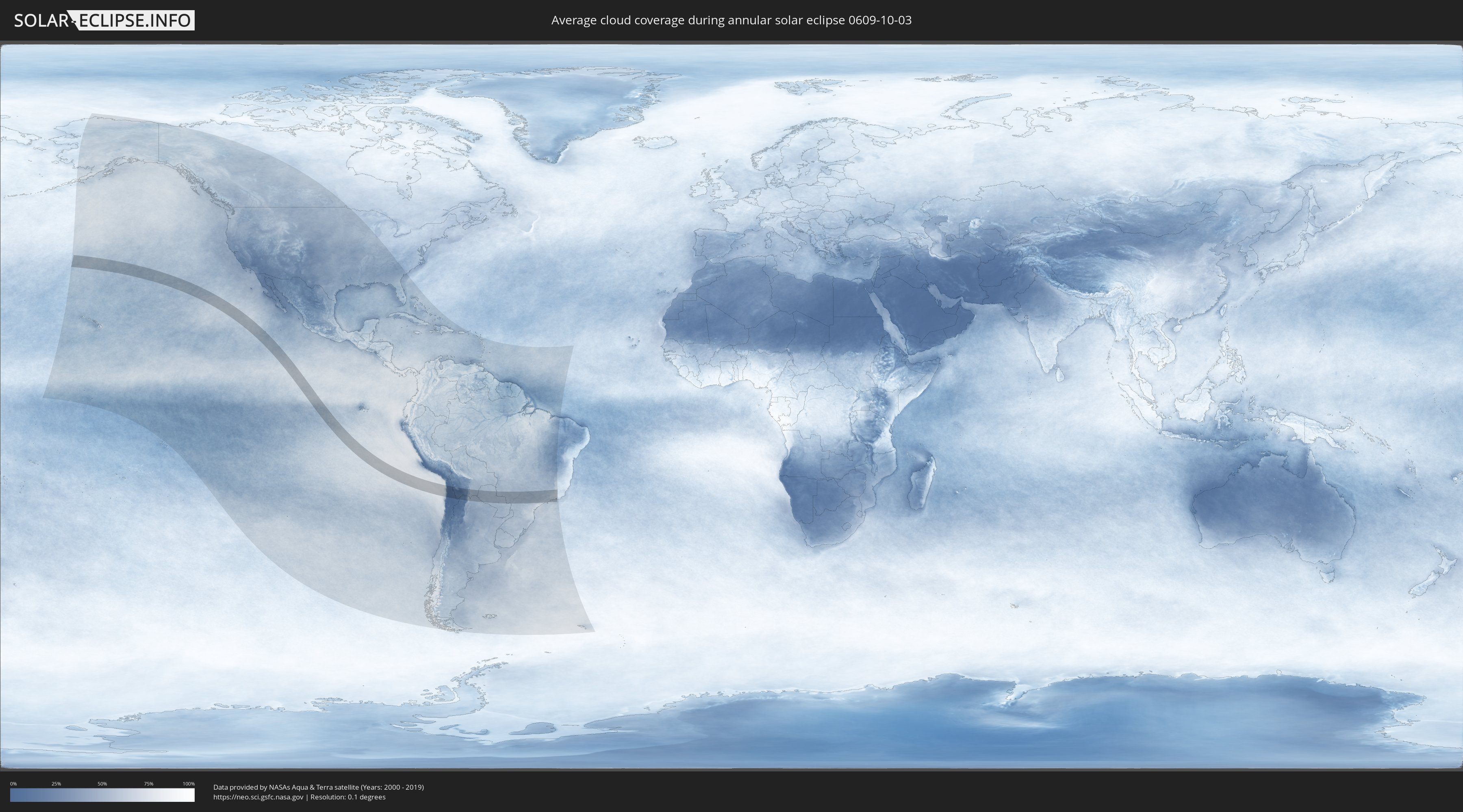
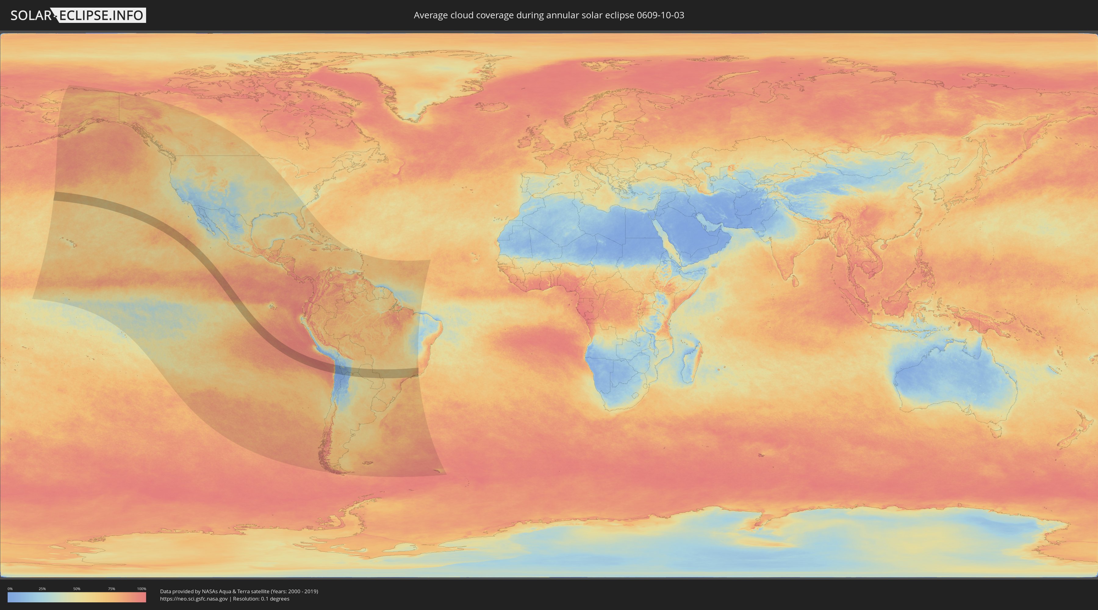
How will be the weather during the annular solar eclipse on 10/03/0609?
Where is the best place to see the annular solar eclipse of 10/03/0609?
The following maps show the average cloud coverage for the day of the annular solar eclipse.
With the help of these maps, it is possible to find the place along the eclipse path, which has the best
chance of a cloudless sky.
Nevertheless, you should consider local circumstances and inform about the weather of your chosen
observation site.
The data is provided by NASAs satellites
AQUA and TERRA.
The cloud maps are averaged over a period of 19 years (2000 - 2019).
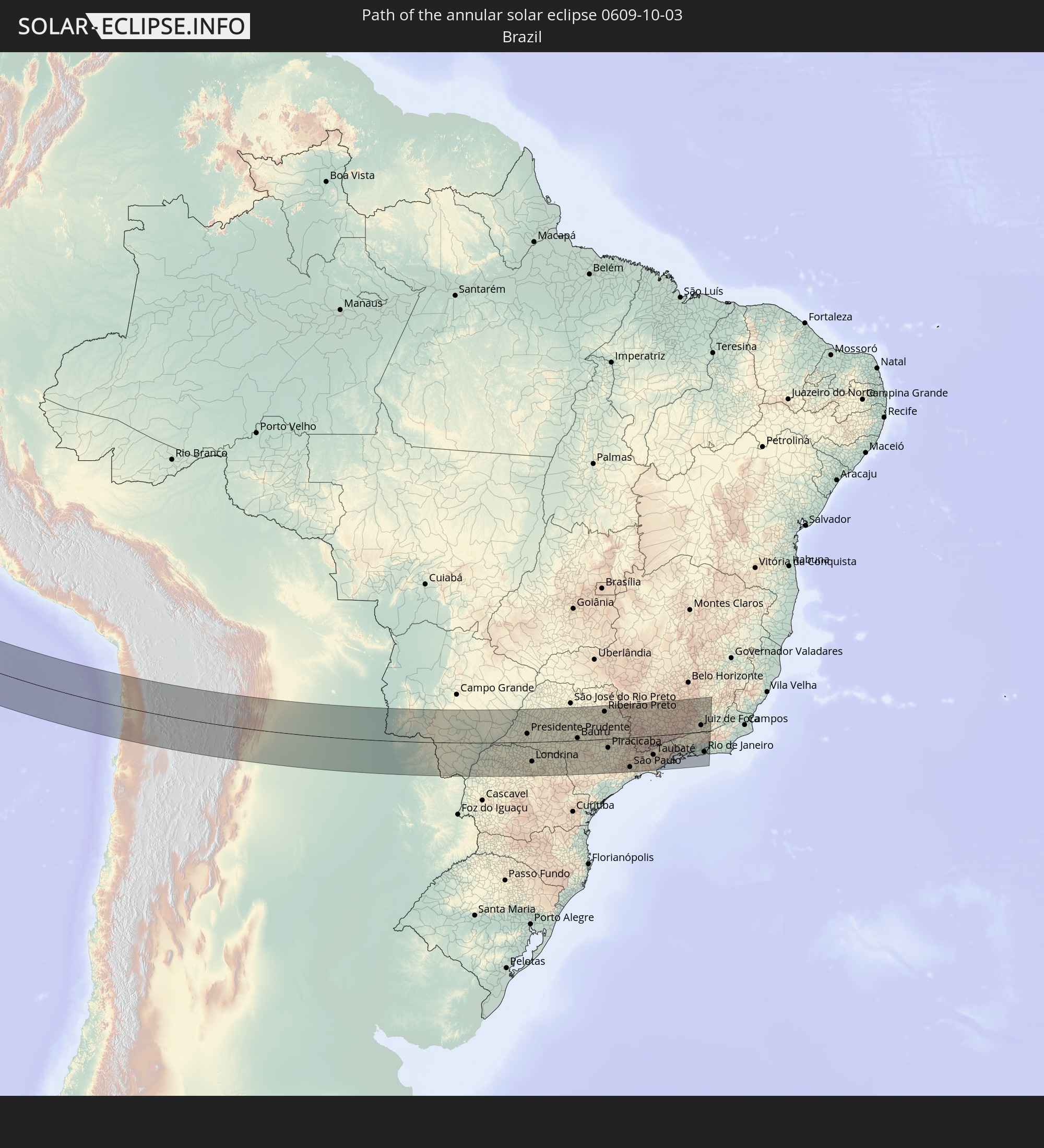
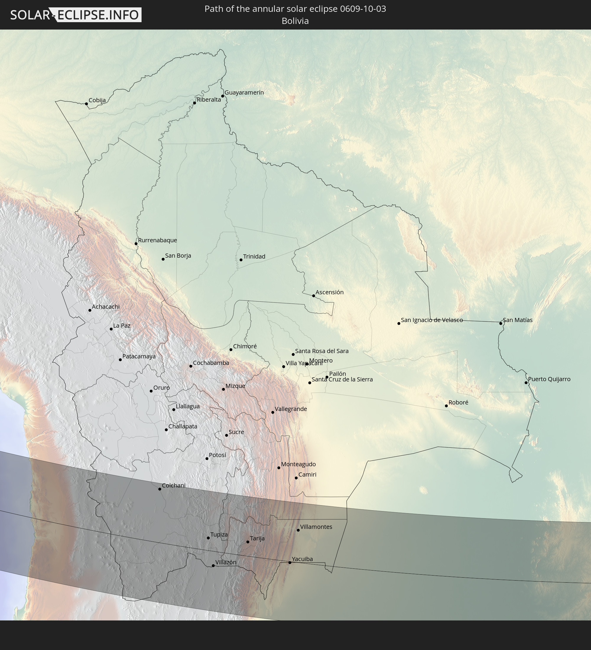
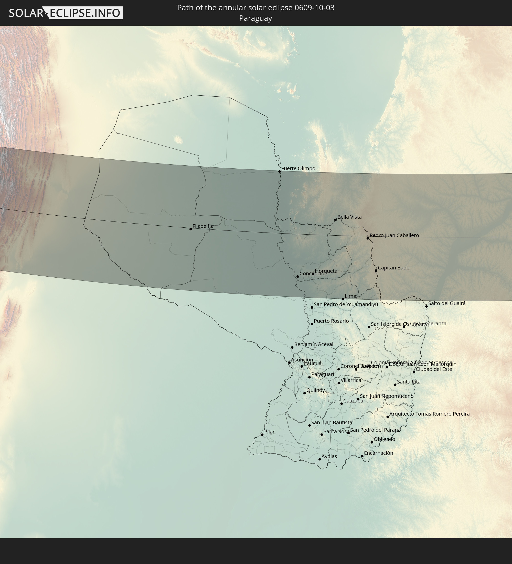
Detailed country maps
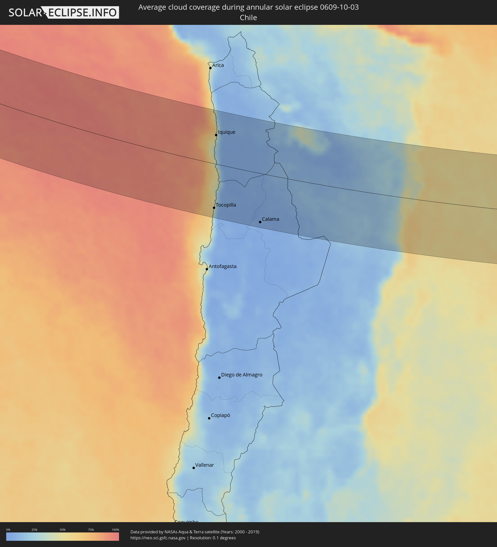 Chile
Chile
 Brazil
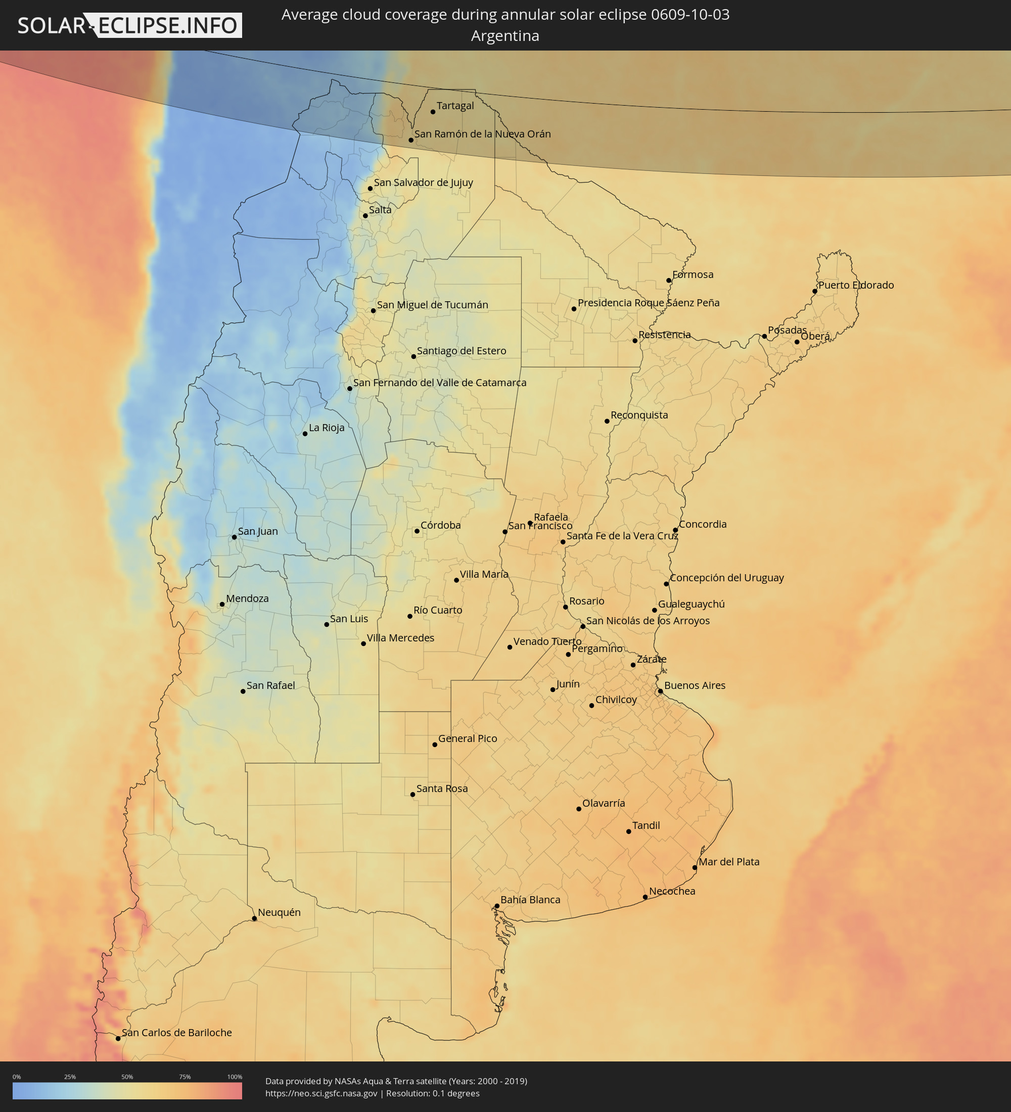 Argentina
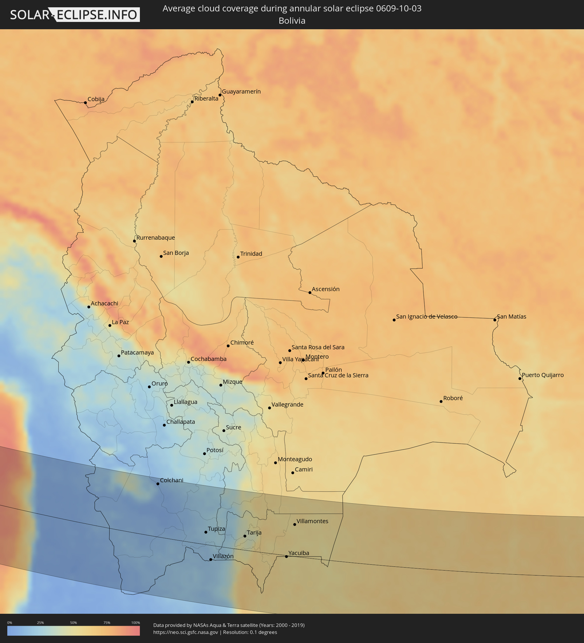 Bolivia
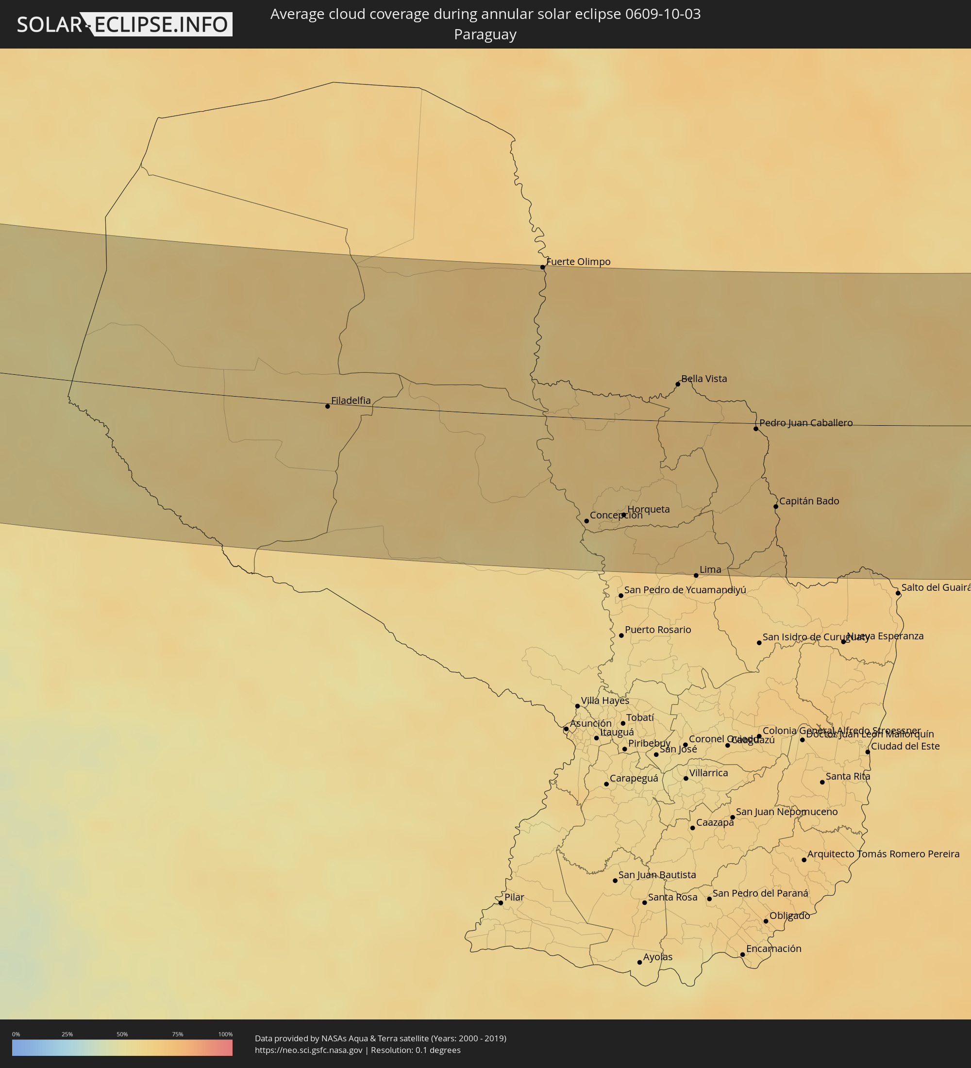 Paraguay
Cities inside the path of the eclipse
The following table shows all locations with a population of more than 5,000 inside the eclipse path. Cities which have more than 100,000 inhabitants are marked bold. A click at the locations opens a detailed map.
| City | Type | Eclipse duration | Local time of max. eclipse | Distance to central line | Ø Cloud coverage |
|
Tocopilla, Antofagasta
|
annular | - | 15:51:22 UTC-04:42 | 124 km | 38% |
|
Iquique, Tarapacá
|
annular | - | 15:50:03 UTC-04:42 | 81 km | 31% |
|
Calama, Antofagasta
|
annular | - | 15:52:55 UTC-04:42 | 137 km | 4% |
|
Colchani, Potosí
|
annular | - | 16:03:40 UTC-04:32 | 137 km | 9% |
|
Uyuni, Potosí
|
annular | - | 16:03:52 UTC-04:32 | 121 km | 6% |
|
Tupiza, Potosí
|
annular | - | 16:05:31 UTC-04:32 | 31 km | 22% |
|
Abra Pampa, Jujuy Province
|
annular | - | 16:22:02 UTC-04:16 | 109 km | 15% |
|
Villazón, Potosí
|
annular | - | 16:05:59 UTC-04:32 | 38 km | 17% |
|
La Quiaca, Jujuy Province
|
annular | - | 16:21:48 UTC-04:16 | 39 km | 17% |
|
Tarija, Tarija
|
annular | - | 16:06:26 UTC-04:32 | 36 km | 42% |
|
San Ramón de la Nueva Orán, Salta Province
|
annular | - | 16:23:22 UTC-04:16 | 136 km | 55% |
|
Embarcación, Salta Province
|
annular | - | 16:23:35 UTC-04:16 | 141 km | 55% |
|
General Enrique Mosconi, Salta Province
|
annular | - | 16:23:32 UTC-04:16 | 69 km | 55% |
|
Tartagal, Salta Province
|
annular | - | 16:23:30 UTC-04:16 | 61 km | 56% |
|
Yacuiba, Tarija
|
annular | - | 16:07:33 UTC-04:32 | 4 km | 52% |
|
Villamontes, Tarija
|
annular | - | 16:07:20 UTC-04:32 | 82 km | 52% |
|
Filadelfia, Boquerón
|
annular | - | 16:52:15 UTC-03:50 | 4 km | 63% |
|
Colonia Menno, Boquerón
|
annular | - | 16:52:24 UTC-03:50 | 5 km | 63% |
|
Fuerte Olimpo, Alto Paraguay
|
annular | - | 16:53:03 UTC-03:50 | 154 km | 62% |
|
Concepción, Concepción
|
annular | - | 16:54:06 UTC-03:50 | 106 km | 58% |
|
Horqueta, Concepción
|
annular | - | 16:54:17 UTC-03:50 | 99 km | 62% |
|
Bella Vista, Amambay
|
annular | - | 16:54:11 UTC-03:50 | 38 km | 60% |
|
Pedro Juan Caballero, Amambay
|
annular | - | 16:54:41 UTC-03:50 | 6 km | 64% |
|
Capitán Bado, Amambay
|
annular | - | 16:54:59 UTC-03:50 | 86 km | 66% |
|
Dourados, Mato Grosso do Sul
|
annular | - | 17:07:13 UTC-03:38 | 32 km | 58% |
|
Maringá, Paraná
|
annular | - | 17:40:34 UTC-03:06 | 103 km | 57% |
|
Presidente Prudente, São Paulo
|
annular | - | 17:40:27 UTC-03:06 | 40 km | 60% |
|
Londrina, Paraná
|
annular | - | 17:40:47 UTC-03:06 | 92 km | 61% |
|
Araçatuba, São Paulo
|
annular | - | 17:40:30 UTC-03:06 | 140 km | 57% |
|
Marília, São Paulo
|
annular | - | 17:40:53 UTC-03:06 | 26 km | 59% |
|
Bauru, São Paulo
|
annular | - | 17:41:06 UTC-03:06 | 11 km | 54% |
|
Araraquara, São Paulo
|
annular | - | 17:41:11 UTC-03:06 | 64 km | 63% |
|
Itapetininga, São Paulo
|
annular | - | 17:41:31 UTC-03:06 | 136 km | 67% |
|
São Carlos, São Paulo
|
annular | - | 17:41:17 UTC-03:06 | 38 km | 60% |
|
Ribeirão Preto, São Paulo
|
annular | - | 17:41:07 UTC-03:06 | 131 km | 60% |
|
Piracicaba, São Paulo
|
annular | - | 17:41:27 UTC-03:06 | 42 km | 58% |
|
Rio Claro, São Paulo
|
annular | - | 17:41:25 UTC-03:06 | 8 km | 61% |
|
Sorocaba, São Paulo
|
annular | - | 17:41:36 UTC-03:06 | 130 km | 67% |
|
Santa Bárbara d'Oeste, São Paulo
|
annular | - | 17:41:30 UTC-03:06 | 47 km | 59% |
|
Limeira, São Paulo
|
annular | - | 17:41:28 UTC-03:06 | 26 km | 58% |
|
Itu, São Paulo
|
annular | - | 17:41:36 UTC-03:06 | 104 km | 63% |
|
Sumaré, São Paulo
|
annular | - | 17:41:32 UTC-03:06 | 55 km | 59% |
|
Indaiatuba, São Paulo
|
annular | - | 17:41:35 UTC-03:06 | 85 km | 64% |
|
Campinas, São Paulo
|
annular | - | 17:41:35 UTC-03:06 | 66 km | 61% |
|
Mogi-Gaucu, São Paulo
|
annular | - | 17:41:30 UTC-03:06 | 7 km | 58% |
|
Cotia, São Paulo
|
annular | - | 17:41:42 UTC-03:06 | 144 km | 72% |
|
Jundiaí, São Paulo
|
annular | - | 17:41:39 UTC-03:06 | 98 km | 64% |
|
Osasco, São Paulo
|
annular | - | 17:41:42 UTC-03:06 | 137 km | 69% |
|
Francisco Morato, São Paulo
|
annular | - | 17:41:41 UTC-03:06 | 110 km | 68% |
|
São Paulo, São Paulo
|
annular | - | 17:41:44 UTC-03:06 | 140 km | 68% |
|
São Bernardo do Campo, São Paulo
|
annular | - | 17:41:45 UTC-03:06 | 157 km | 74% |
|
Poços de Caldas, Minas Gerais
|
annular | - | 17:41:27 UTC-03:06 | 55 km | 64% |
|
Bragança Paulista, São Paulo
|
annular | - | 17:41:39 UTC-03:06 | 74 km | 64% |
|
Itaquaquecetuba, São Paulo
|
annular | - | 17:41:45 UTC-03:06 | 135 km | 69% |
|
Mogi das Cruzes, São Paulo
|
annular | - | 17:41:47 UTC-03:06 | 140 km | 70% |
|
Jacareí, São Paulo
|
annular | - | 17:41:46 UTC-03:06 | 118 km | 67% |
|
São José dos Campos, São Paulo
|
annular | - | 17:41:46 UTC-03:06 | 104 km | 67% |
|
Taubaté, São Paulo
|
annular | - | 17:41:46 UTC-03:06 | 90 km | 67% |
|
Angra dos Reis, Rio de Janeiro
|
annular | - | 17:41:52 UTC-03:06 | 98 km | 76% |
|
Volta Redonda, Rio de Janeiro
|
annular | - | 17:41:49 UTC-03:06 | 46 km | 75% |
|
Nova Iguaçu, Rio de Janeiro
|
annular | - | 17:41:52 UTC-03:06 | 78 km | 72% |
|
Juiz de Fora, Minas Gerais
|
annular | - | 17:41:44 UTC-03:06 | 31 km | 80% |
|
Rio de Janeiro, Rio de Janeiro
|
annular | - | 17:41:53 UTC-03:06 | 97 km | 67% |
|
Petrópolis, Rio de Janeiro
|
annular | - | 17:41:50 UTC-03:06 | 53 km | 74% |