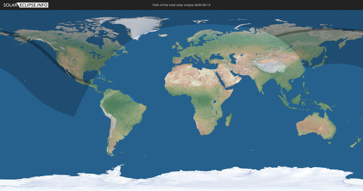
Total solar eclipse of 08/14/0630
| Day of week: | Saturday |
| Maximum duration of eclipse: | 04m13s |
| Maximum width of eclipse path: | 278 km |
| Saros cycle: | 84 |
| Coverage: | 100% |
| Magnitude: | 1.0631 |
| Gamma: | 0.6751 |
Wo kann man die Sonnenfinsternis vom 08/14/0630 sehen?
Die Sonnenfinsternis am 08/14/0630 kann man in 12 Ländern als partielle Sonnenfinsternis beobachten.
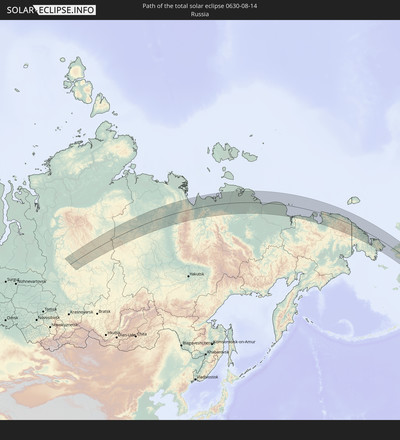
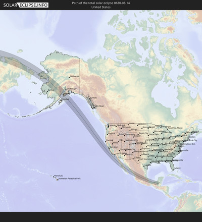
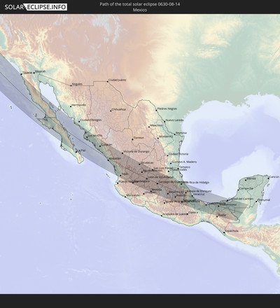
Der Finsternispfad verläuft durch 4 Länder. Nur in diesen Ländern ist sie als total Sonnenfinsternis zu sehen.
In den folgenden Ländern ist die Sonnenfinsternis total zu sehen
In den folgenden Ländern ist die Sonnenfinsternis partiell zu sehen
How will be the weather during the total solar eclipse on 08/14/0630?
Where is the best place to see the total solar eclipse of 08/14/0630?
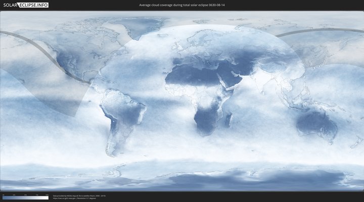
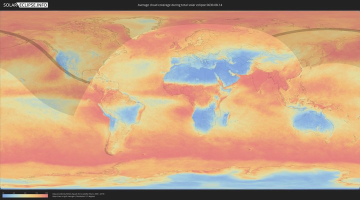
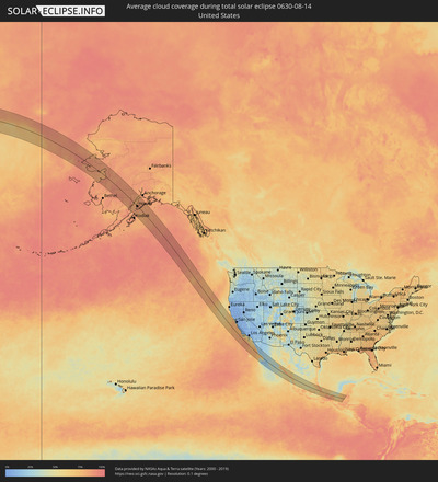
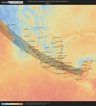
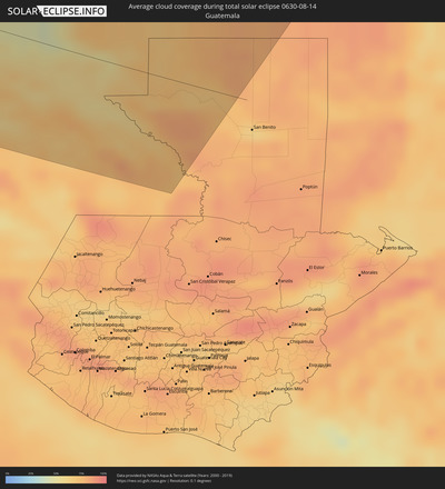
The following maps show the average cloud coverage for the day of the total solar eclipse.
With the help of these maps, it is possible to find the place along the eclipse path, which has the best
chance of a cloudless sky.
Nevertheless, you should consider local circumstances and inform about the weather of your chosen
observation site.
The data is provided by NASAs satellites
AQUA and TERRA.
The cloud maps are averaged over a period of 19 years (2000 - 2019).
Detailed country maps
Cities inside the path of the eclipse
The following table shows all locations with a population of more than 5,000 inside the eclipse path. Cities which have more than 100,000 inhabitants are marked bold. A click at the locations opens a detailed map.
| City | Type | Eclipse duration | Local time of max. eclipse | Distance to central line | Ø Cloud coverage |
 Homer, Alaska
|
total | - | 12:39:39 UTC-10:00 | 3 km | 84% |
 Kalifornsky, Alaska
|
total | - | 12:39:05 UTC-10:00 | 69 km | 78% |
 Kenai, Alaska
|
total | - | 12:38:59 UTC-10:00 | 81 km | 79% |
 Sterling, Alaska
|
total | - | 12:39:26 UTC-10:00 | 98 km | 84% |
 Pacific Grove, California
|
total | - | 15:44:25 UTC-08:00 | 134 km | 47% |
 Monterey, California
|
total | - | 15:44:28 UTC-08:00 | 134 km | 47% |
 Seaside, California
|
total | - | 15:44:29 UTC-08:00 | 137 km | 47% |
 Marina, California
|
total | - | 15:44:22 UTC-08:00 | 146 km | 46% |
 Cambria, California
|
total | - | 15:46:55 UTC-08:00 | 115 km | 43% |
 Morro Bay, California
|
total | - | 15:47:26 UTC-08:00 | 119 km | 27% |
 Los Osos, California
|
total | - | 15:47:33 UTC-08:00 | 118 km | 27% |
 Templeton, California
|
total | - | 15:47:11 UTC-08:00 | 140 km | 8% |
 Paso Robles, California
|
total | - | 15:47:02 UTC-08:00 | 146 km | 6% |
 Atascadero, California
|
total | - | 15:47:19 UTC-08:00 | 140 km | 8% |
 San Luis Obispo, California
|
total | - | 15:47:42 UTC-08:00 | 125 km | 14% |
 Pismo Beach, California
|
total | - | 15:47:58 UTC-08:00 | 114 km | 45% |
 Grover Beach, California
|
total | - | 15:48:02 UTC-08:00 | 114 km | 45% |
 Oceano, California
|
total | - | 15:48:04 UTC-08:00 | 112 km | 45% |
 Arroyo Grande, California
|
total | - | 15:48:03 UTC-08:00 | 115 km | 45% |
 Guadalupe, California
|
total | - | 15:48:20 UTC-08:00 | 106 km | 43% |
 Nipomo, California
|
total | - | 15:48:16 UTC-08:00 | 118 km | 21% |
 Vandenberg Village, California
|
total | - | 15:48:53 UTC-08:00 | 98 km | 25% |
 Lompoc, California
|
total | - | 15:49:01 UTC-08:00 | 92 km | 26% |
 Orcutt, California
|
total | - | 15:48:37 UTC-08:00 | 110 km | 10% |
 Santa Maria, California
|
total | - | 15:48:27 UTC-08:00 | 115 km | 12% |
 Solvang, California
|
total | - | 15:49:17 UTC-08:00 | 107 km | 12% |
 Isla Vista, California
|
total | - | 15:49:47 UTC-08:00 | 117 km | 51% |
 Goleta, California
|
total | - | 15:49:46 UTC-08:00 | 121 km | 51% |
 Santa Barbara, California
|
total | - | 15:49:52 UTC-08:00 | 127 km | 52% |
 Montecito, California
|
total | - | 15:49:52 UTC-08:00 | 132 km | 52% |
 Carpinteria, California
|
total | - | 15:50:00 UTC-08:00 | 135 km | 48% |
 Ventura, California
|
total | - | 15:50:21 UTC-08:00 | 141 km | 43% |
 Oxnard Shores, California
|
total | - | 15:50:33 UTC-08:00 | 140 km | 45% |
 Port Hueneme, California
|
total | - | 15:50:39 UTC-08:00 | 141 km | 55% |
 Oxnard, California
|
total | - | 15:50:34 UTC-08:00 | 145 km | 45% |
 El Rio, California
|
total | - | 15:50:30 UTC-08:00 | 148 km | 45% |
 Rosarito, Baja California
|
total | - | 16:06:58 UTC-07:48 | 144 km | 24% |
 Ensenada, Baja California
|
total | - | 16:08:04 UTC-07:48 | 134 km | 28% |
 Ciudad Constitución, Baja California Sur
|
total | - | 17:04:02 UTC-07:05 | 145 km | 30% |
 Huatabampo, Sonora
|
total | - | 16:43:25 UTC-07:23 | 136 km | 48% |
 Los Mochis, Sinaloa
|
total | - | 17:03:26 UTC-07:05 | 79 km | 70% |
 Guasave, Sinaloa
|
total | - | 17:03:55 UTC-07:05 | 87 km | 79% |
 Guamúchil, Sinaloa
|
total | - | 17:04:10 UTC-07:05 | 99 km | 76% |
 Culiacán, Sinaloa
|
total | - | 17:05:20 UTC-07:05 | 78 km | 76% |
 Mazatlán, Sinaloa
|
total | - | 17:07:53 UTC-07:05 | 35 km | 55% |
 Tepic, Nayarit
|
total | - | 17:10:36 UTC-07:05 | 118 km | 73% |
 Victoria de Durango, Durango
|
total | - | 17:35:57 UTC-06:36 | 142 km | 38% |
 Guadalajara, Jalisco
|
total | - | 17:40:57 UTC-06:36 | 130 km | 73% |
 Tonalá, Jalisco
|
total | - | 17:41:00 UTC-06:36 | 128 km | 60% |
 Jerez de García Salinas, Zacatecas
|
total | - | 17:38:06 UTC-06:36 | 88 km | 46% |
 Ocotlán, Jalisco
|
total | - | 17:41:24 UTC-06:36 | 135 km | 55% |
 Tepatitlán de Morelos, Jalisco
|
total | - | 17:40:44 UTC-06:36 | 86 km | 63% |
 Víctor Rosales, Zacatecas
|
total | - | 17:37:40 UTC-06:36 | 132 km | 51% |
 Zacatecas, Zacatecas
|
total | - | 17:37:56 UTC-06:36 | 118 km | 53% |
 La Barca, Jalisco
|
total | - | 17:41:29 UTC-06:36 | 129 km | 50% |
 Arandas, Jalisco
|
total | - | 17:40:54 UTC-06:36 | 78 km | 62% |
 San Juan de los Lagos, Jalisco
|
total | - | 17:40:08 UTC-06:36 | 35 km | 51% |
 Aguascalientes, Aguascalientes
|
total | - | 17:39:14 UTC-06:36 | 43 km | 51% |
 La Piedad, Michoacán
|
total | - | 17:41:24 UTC-06:36 | 101 km | 53% |
 Lagos de Moreno, Jalisco
|
total | - | 17:39:59 UTC-06:36 | 7 km | 49% |
 San Francisco del Rincón, Guanajuato
|
total | - | 17:40:27 UTC-06:36 | 37 km | 46% |
 Pénjamo, Guanajuato
|
total | - | 17:41:17 UTC-06:36 | 79 km | 48% |
 León de los Aldama, Guanajuato
|
total | - | 17:40:18 UTC-06:36 | 18 km | 53% |
 Silao, Guanajuato
|
total | - | 17:40:33 UTC-06:36 | 20 km | 47% |
 Irapuato, Guanajuato
|
total | - | 17:40:56 UTC-06:36 | 44 km | 46% |
 Guanajuato, Guanajuato
|
total | - | 17:40:27 UTC-06:36 | 27 km | 53% |
 Valle de Santiago, Guanajuato
|
total | - | 17:41:19 UTC-06:36 | 59 km | 47% |
 Salamanca, Guanajuato
|
total | - | 17:41:04 UTC-06:36 | 41 km | 44% |
 Morelia, Michoacán
|
total | - | 17:42:16 UTC-06:36 | 130 km | 64% |
 Uriangato, Guanajuato
|
total | - | 17:41:40 UTC-06:36 | 86 km | 54% |
 Santa Cruz de Juventino Rosas, Guanajuato
|
total | - | 17:40:58 UTC-06:36 | 28 km | 40% |
 San Luis Potosí, San Luis Potosí
|
total | - | 17:38:51 UTC-06:36 | 128 km | 53% |
 Cortazar, Guanajuato
|
total | - | 17:41:12 UTC-06:36 | 46 km | 44% |
 Dolores Hidalgo Cuna de la Independencia Nacional, Guanajuato
|
total | - | 17:40:15 UTC-06:36 | 30 km | 51% |
 Salvatierra, Guanajuato
|
total | - | 17:41:34 UTC-06:36 | 65 km | 53% |
 Celaya, Guanajuato
|
total | - | 17:41:08 UTC-06:36 | 37 km | 43% |
 San Miguel de Allende, Guanajuato
|
total | - | 17:40:35 UTC-06:36 | 27 km | 58% |
 Acámbaro, Guanajuato
|
total | - | 17:41:48 UTC-06:36 | 76 km | 57% |
 Ciudad Hidalgo, Michoacán
|
total | - | 17:42:15 UTC-06:36 | 105 km | 68% |
 San Luis de la Paz, Guanajuato
|
total | - | 17:40:02 UTC-06:36 | 68 km | 55% |
 Santiago de Querétaro, Querétaro
|
total | - | 17:41:01 UTC-06:36 | 16 km | 45% |
 Heróica Zitácuaro, Michoacán
|
total | - | 17:42:36 UTC-06:36 | 121 km | 74% |
 San Juan del Río, Querétaro
|
total | - | 17:41:17 UTC-06:36 | 10 km | 53% |
 Toluca, México
|
total | - | 17:42:45 UTC-06:36 | 111 km | 62% |
 Huixquilucan, México
|
total | - | 17:42:37 UTC-06:36 | 88 km | 72% |
 Tepeji de Ocampo, Hidalgo
|
total | - | 17:41:53 UTC-06:36 | 41 km | 55% |
 Ciudad López Mateos, México
|
total | - | 17:42:19 UTC-06:36 | 61 km | 57% |
 Cuernavaca, Morelos
|
total | - | 17:43:12 UTC-06:36 | 130 km | 56% |
 Ixmiquilpan, Hidalgo
|
total | - | 17:41:06 UTC-06:36 | 37 km | 45% |
 Teoloyucan, México
|
total | - | 17:42:06 UTC-06:36 | 41 km | 57% |
 Tlalpan, Mexico City
|
total | - | 17:42:42 UTC-06:36 | 88 km | 67% |
 Mexico City, Mexico City
|
total | - | 17:42:31 UTC-06:36 | 73 km | 59% |
 Yautepec, Morelos
|
total | - | 17:43:14 UTC-06:36 | 126 km | 57% |
 Ecatepec, México
|
total | - | 17:42:15 UTC-06:36 | 52 km | 57% |
 Tizayuca, Hidalgo
|
total | - | 17:41:57 UTC-06:36 | 27 km | 58% |
 Santa María Chimalhuacán, México
|
total | - | 17:42:30 UTC-06:36 | 70 km | 58% |
 Cuautla Morelos, Morelos
|
total | - | 17:43:20 UTC-06:36 | 129 km | 53% |
 San Miguel Xico Viejo, México
|
total | - | 17:42:42 UTC-06:36 | 82 km | 65% |
 Chiautla, México
|
total | - | 17:42:20 UTC-06:36 | 55 km | 62% |
 Amecameca, México
|
total | - | 17:42:53 UTC-06:36 | 89 km | 77% |
 Pachuca de Soto, Hidalgo
|
total | - | 17:41:33 UTC-06:36 | 28 km | 55% |
 San Martin Texmelucan de Labastida, Puebla
|
total | - | 17:42:38 UTC-06:36 | 65 km | 50% |
 Atlixco, Puebla
|
total | - | 17:43:08 UTC-06:36 | 99 km | 55% |
 Huejutla de Reyes, Hidalgo
|
total | - | 17:40:08 UTC-06:36 | 133 km | 66% |
 Tulancingo, Hidalgo
|
total | - | 17:41:34 UTC-06:36 | 26 km | 59% |
 Puebla, Puebla
|
total | - | 17:42:56 UTC-06:36 | 76 km | 56% |
 Tlaxcala, Tlaxcala
|
total | - | 17:42:34 UTC-06:36 | 47 km | 60% |
 Huauchinango, Puebla
|
total | - | 17:41:25 UTC-06:36 | 54 km | 73% |
 Amozoc de Mota, Puebla
|
total | - | 17:42:55 UTC-06:36 | 72 km | 59% |
 Zacatlán, Puebla
|
total | - | 17:41:44 UTC-06:36 | 27 km | 61% |
 Xicotepec de Juárez, Puebla
|
total | - | 17:41:16 UTC-06:36 | 65 km | 74% |
 Huamantla, Tlaxcala
|
total | - | 17:42:33 UTC-06:36 | 43 km | 57% |
 Poza Rica de Hidalgo, Veracruz
|
total | - | 17:40:52 UTC-06:36 | 109 km | 86% |
 Tehuacán, Puebla
|
total | - | 17:43:36 UTC-06:36 | 105 km | 58% |
 Teziutlan, Puebla
|
total | - | 17:41:49 UTC-06:36 | 37 km | 79% |
 Papantla de Olarte, Veracruz
|
total | - | 17:40:58 UTC-06:36 | 106 km | 86% |
 Perote, Veracruz
|
total | - | 17:42:08 UTC-06:36 | 28 km | 69% |
 Tlapacoyan, Veracruz
|
total | - | 17:41:36 UTC-06:36 | 59 km | 79% |
 Orizaba, Veracruz
|
total | - | 17:43:03 UTC-06:36 | 54 km | 72% |
 Martínez de la Torre, Veracruz
|
total | - | 17:41:27 UTC-06:36 | 77 km | 84% |
 Córdoba, Veracruz
|
total | - | 17:42:59 UTC-06:36 | 50 km | 69% |
 Xalapa de Enríquez, Veracruz
|
total | - | 17:42:08 UTC-06:36 | 24 km | 73% |
 Veracruz, Veracruz
|
total | - | 17:42:29 UTC-06:36 | 27 km | 70% |
 Tuxtepec, Oaxaca
|
total | - | 17:43:53 UTC-06:36 | 101 km | 72% |
 San Andres Tuxtla, Veracruz
|
total | - | 17:43:16 UTC-06:36 | 32 km | 82% |
 Acayucan, Veracruz
|
total | - | 17:43:50 UTC-06:36 | 75 km | 86% |
 Minatitlan, Veracruz
|
total | - | 17:43:43 UTC-06:36 | 55 km | 79% |
 Coatzacoalcos, Veracruz
|
total | - | 17:43:31 UTC-06:36 | 40 km | 79% |
 Agua Dulce, Veracruz
|
total | - | 17:43:27 UTC-06:36 | 27 km | 85% |
 Las Choapas, Veracruz
|
total | - | 17:43:44 UTC-06:36 | 48 km | 85% |
 Cárdenas, Tabasco
|
total | - | 17:43:28 UTC-06:36 | 24 km | 77% |
 Comalcalco, Tabasco
|
total | - | 17:43:06 UTC-06:36 | 30 km | 75% |
 Villahermosa, Tabasco
|
total | - | 17:43:23 UTC-06:36 | 9 km | 62% |
 Palenque, Chiapas
|
total | - | 17:43:44 UTC-06:36 | 27 km | 60% |
 Ciudad del Carmen, Campeche
|
total | - | 17:42:19 UTC-06:36 | 101 km | 43% |
 Tenosique de Pino Suárez, Tabasco
|
total | - | 17:43:38 UTC-06:36 | 17 km | 63% |
