Annular solar eclipse of 06/16/0847
| Day of week: | Sunday |
| Maximum duration of eclipse: | 00m42s |
| Maximum width of eclipse path: | 34 km |
| Saros cycle: | 89 |
| Coverage: | 99.4% |
| Magnitude: | 0.9937 |
| Gamma: | -0.757 |
Wo kann man die Sonnenfinsternis vom 06/16/0847 sehen?
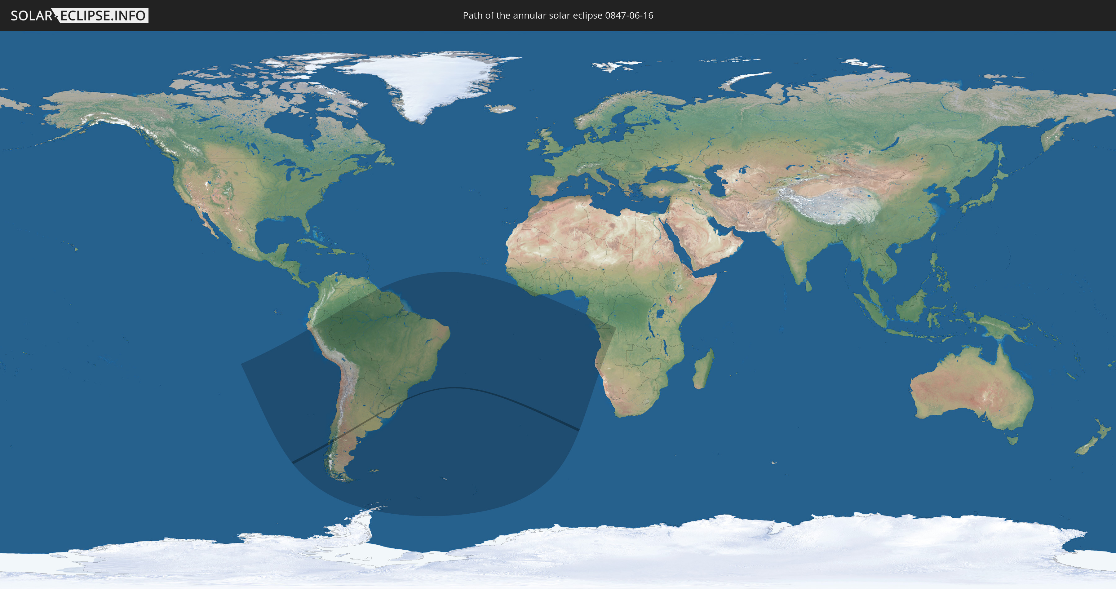
Die Sonnenfinsternis am 06/16/0847 kann man in 25 Ländern als partielle Sonnenfinsternis beobachten.
Der Finsternispfad verläuft durch 4 Länder. Nur in diesen Ländern ist sie als annular Sonnenfinsternis zu sehen.
In den folgenden Ländern ist die Sonnenfinsternis annular zu sehen
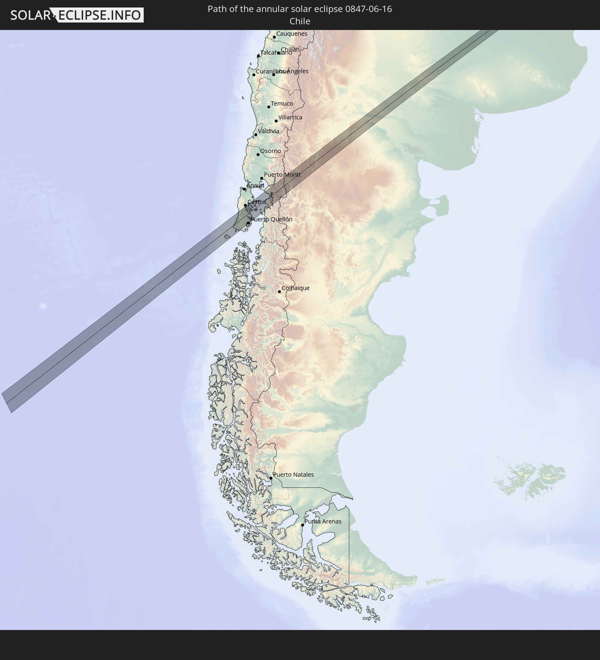 Chile
Chile
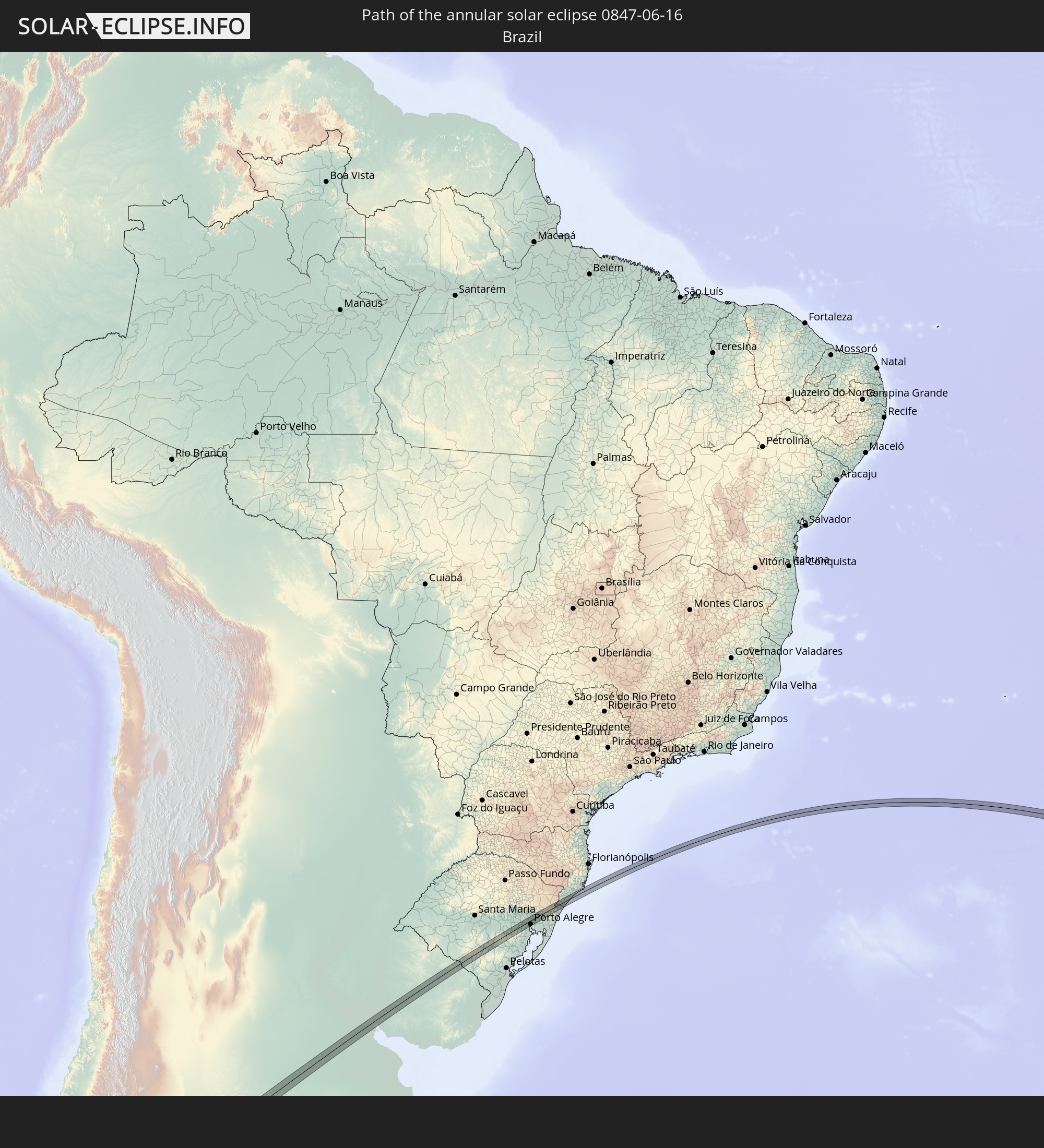 Brazil
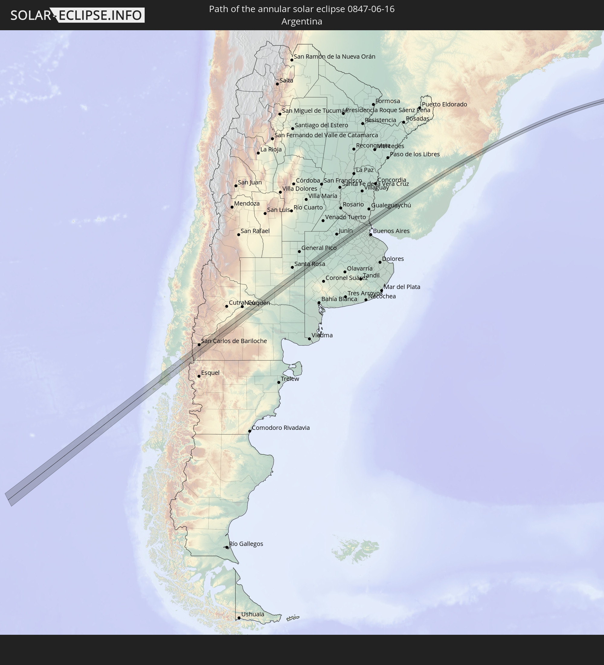 Argentina
 Uruguay
In den folgenden Ländern ist die Sonnenfinsternis partiell zu sehen
 Antarctica
 Chile
Chile
 Colombia
 Peru
Peru
 Brazil
 Argentina
 Venezuela
 Bolivia
 Paraguay
 Falkland Islands
 Guyana
 Uruguay
 Suriname
 French Guiana
 South Georgia and the South Sandwich Islands
 Saint Helena, Ascension and Tristan da Cunha
 Sierra Leone
 Liberia
 Ivory Coast
 Equatorial Guinea
 Gabon
Gabon
 Republic of the Congo
 Angola
 Namibia
 Democratic Republic of the Congo
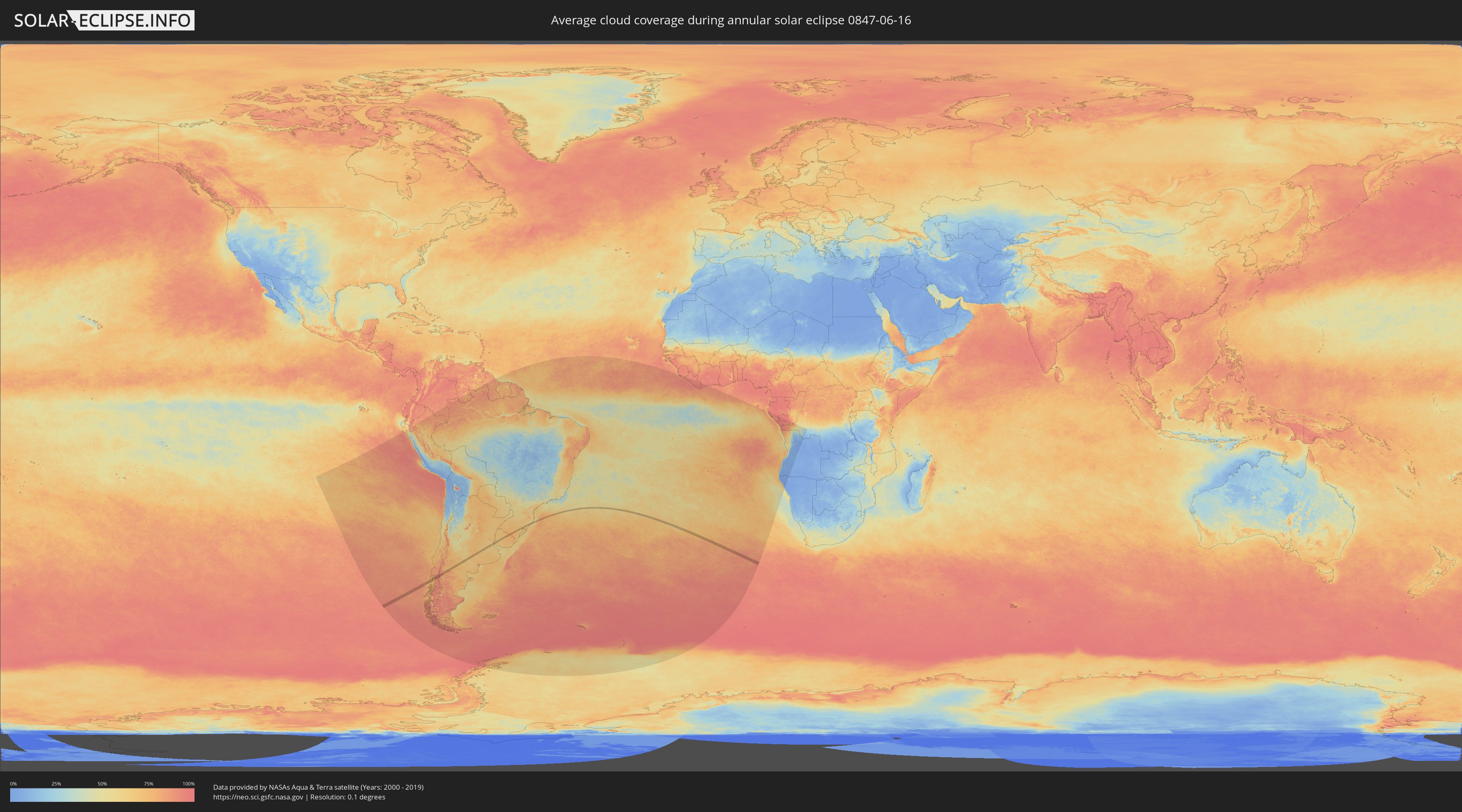
How will be the weather during the annular solar eclipse on 06/16/0847?
Where is the best place to see the annular solar eclipse of 06/16/0847?
The following maps show the average cloud coverage for the day of the annular solar eclipse.
With the help of these maps, it is possible to find the place along the eclipse path, which has the best
chance of a cloudless sky.
Nevertheless, you should consider local circumstances and inform about the weather of your chosen
observation site.
The data is provided by NASAs satellites
AQUA and TERRA.
The cloud maps are averaged over a period of 19 years (2000 - 2019).

Detailed country maps
 Chile
Chile
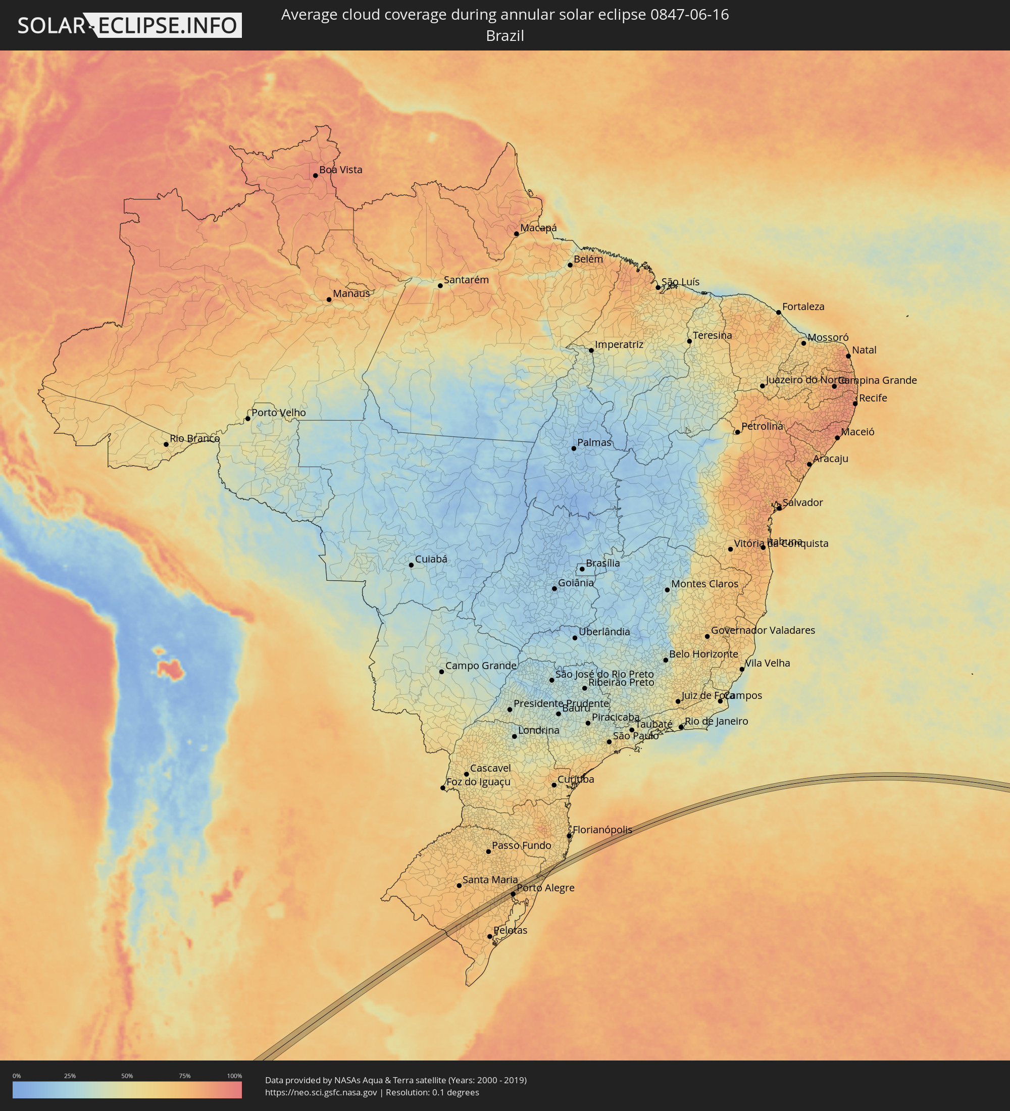 Brazil
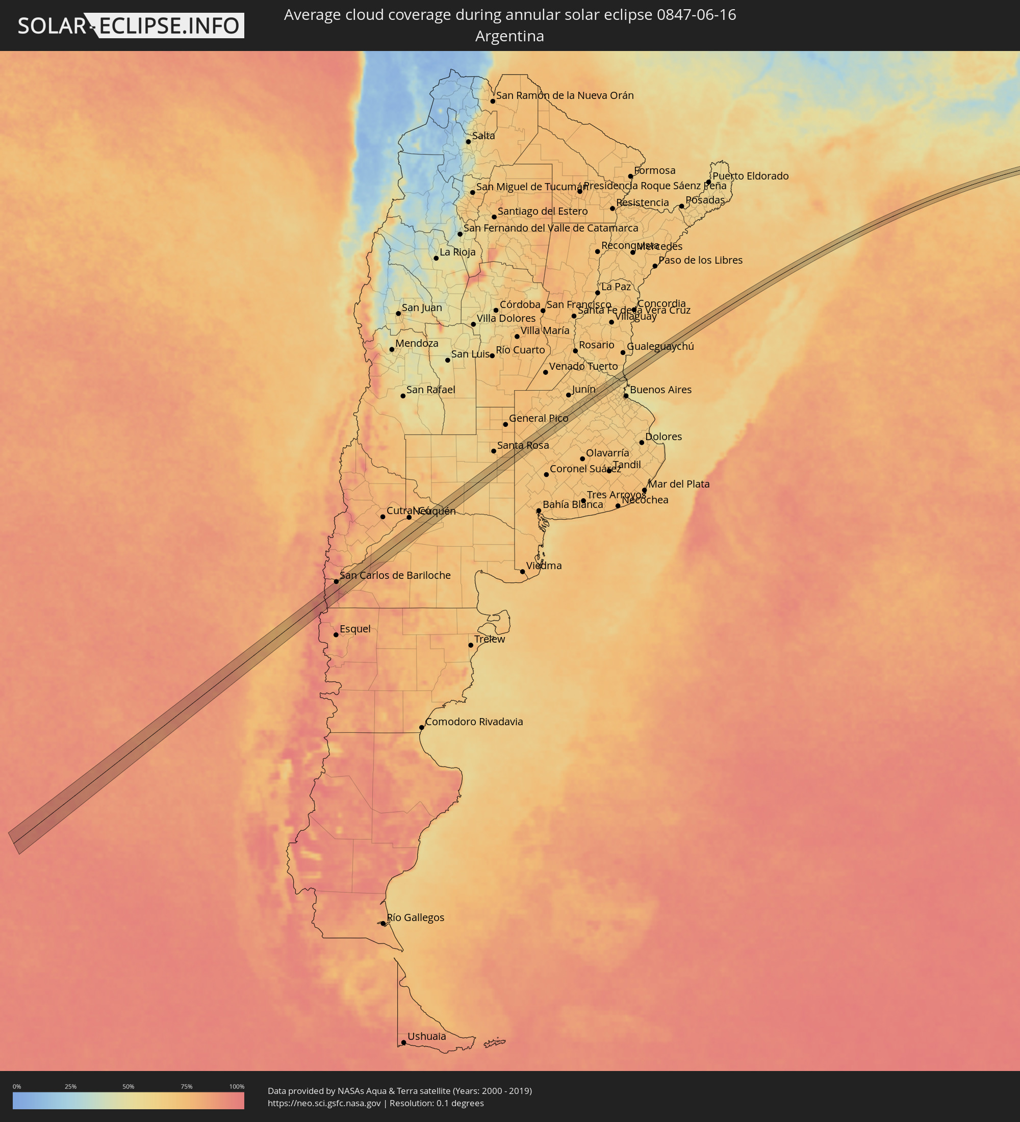 Argentina
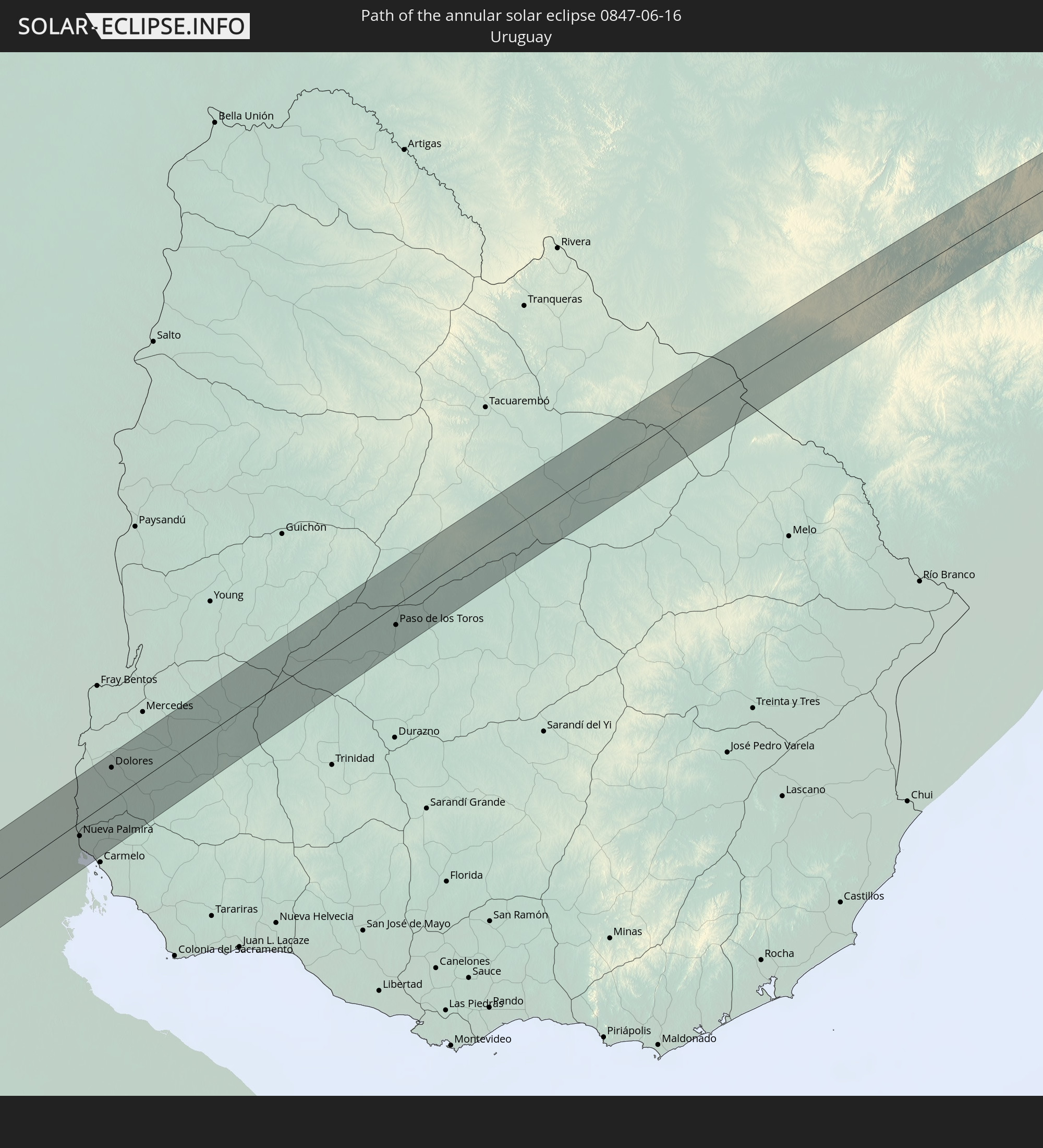
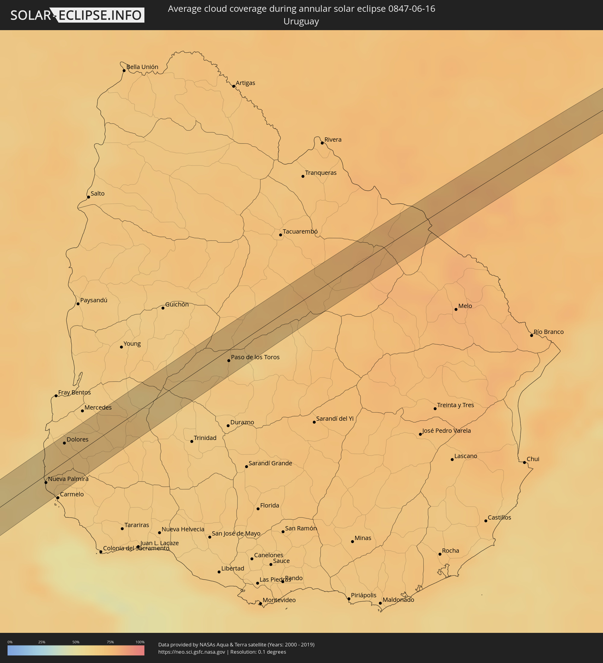 Uruguay
Cities inside the path of the eclipse
The following table shows all locations with a population of more than 5,000 inside the eclipse path. Cities which have more than 100,000 inhabitants are marked bold. A click at the locations opens a detailed map.
| City | Type | Eclipse duration | Local time of max. eclipse | Distance to central line | Ø Cloud coverage |
|
Chonchi, Los Lagos
|
annular | - | 09:03:58 UTC-04:42 | 20 km | 73% |
|
San Carlos de Bariloche, Río Negro Province
|
annular | - | 09:31:32 UTC-04:16 | 24 km | 81% |
|
General Roca, Río Negro Province
|
annular | - | 09:34:52 UTC-04:16 | 17 km | 71% |
|
Cervantes, Río Negro Province
|
annular | - | 09:35:09 UTC-04:16 | 6 km | 71% |
|
Ingeniero Luis A. Huergo, Río Negro Province
|
annular | - | 09:35:23 UTC-04:16 | 5 km | 70% |
|
Villa Regina, Río Negro Province
|
annular | - | 09:35:38 UTC-04:16 | 16 km | 70% |
|
General Acha, La Pampa Province
|
annular | - | 09:38:19 UTC-04:16 | 7 km | 64% |
|
Nueve de Julio, Buenos Aires
|
annular | - | 09:43:45 UTC-04:16 | 18 km | 66% |
|
Chivilcoy, Buenos Aires
|
annular | - | 09:45:09 UTC-04:16 | 14 km | 64% |
|
Zárate, Buenos Aires
|
annular | - | 09:46:48 UTC-04:16 | 6 km | 62% |
|
Campana, Buenos Aires
|
annular | - | 09:46:57 UTC-04:16 | 4 km | 64% |
|
Nueva Palmira, Colonia
|
annular | - | 10:19:55 UTC-03:44 | 6 km | 61% |
|
Dolores, Soriano
|
annular | - | 10:20:13 UTC-03:44 | 15 km | 68% |
|
Paso de los Toros, Tacuarembó
|
annular | - | 10:23:35 UTC-03:44 | 9 km | 66% |
|
Bagé, Rio Grande do Sul
|
annular | - | 11:07:09 UTC-03:06 | 5 km | 76% |
|
Encruzilhada do Sul, Rio Grande do Sul
|
annular | - | 11:10:53 UTC-03:06 | 0 km | 69% |
|
Butiá, Rio Grande do Sul
|
annular | - | 11:12:16 UTC-03:06 | 13 km | 69% |
|
Arroio dos Ratos, Rio Grande do Sul
|
annular | - | 11:12:51 UTC-03:06 | 5 km | 71% |
|
São Jerônimo, Rio Grande do Sul
|
annular | - | 11:12:52 UTC-03:06 | 16 km | 71% |
|
Triunfo, Rio Grande do Sul
|
annular | - | 11:12:53 UTC-03:06 | 18 km | 69% |
|
Charqueadas, Rio Grande do Sul
|
annular | - | 11:13:07 UTC-03:06 | 12 km | 72% |
|
Guaíba, Rio Grande do Sul
|
annular | - | 11:13:51 UTC-03:06 | 18 km | 67% |
|
Portão, Rio Grande do Sul
|
annular | - | 11:14:06 UTC-03:06 | 18 km | 70% |
|
Porto Alegre, Rio Grande do Sul
|
annular | - | 11:14:06 UTC-03:06 | 15 km | 68% |
|
Canoas, Rio Grande do Sul
|
annular | - | 11:14:13 UTC-03:06 | 6 km | 70% |
|
Esteio, Rio Grande do Sul
|
annular | - | 11:14:14 UTC-03:06 | 0 km | 70% |
|
Sapucaia, Rio Grande do Sul
|
annular | - | 11:14:19 UTC-03:06 | 1 km | 71% |
|
São Leopoldo, Rio Grande do Sul
|
annular | - | 11:14:20 UTC-03:06 | 8 km | 71% |
|
Novo Hamburgo, Rio Grande do Sul
|
annular | - | 11:14:23 UTC-03:06 | 15 km | 70% |
|
Cachoeirinha, Rio Grande do Sul
|
annular | - | 11:14:27 UTC-03:06 | 13 km | 70% |
|
Sapiranga, Rio Grande do Sul
|
annular | - | 11:14:42 UTC-03:06 | 13 km | 69% |
|
Gravataí, Rio Grande do Sul
|
annular | - | 11:14:42 UTC-03:06 | 17 km | 70% |
|
Parobé, Rio Grande do Sul
|
annular | - | 11:15:08 UTC-03:06 | 6 km | 68% |
|
Igrejinha, Rio Grande do Sul
|
annular | - | 11:15:15 UTC-03:06 | 9 km | 68% |
|
Taquara, Rio Grande do Sul
|
annular | - | 11:15:16 UTC-03:06 | 1 km | 68% |
|
Três Coroas, Rio Grande do Sul
|
annular | - | 11:15:18 UTC-03:06 | 14 km | 66% |
|
São Francisco de Paula, Rio Grande do Sul
|
annular | - | 11:15:48 UTC-03:06 | 11 km | 64% |
|
Rolante, Rio Grande do Sul
|
annular | - | 11:15:48 UTC-03:06 | 9 km | 67% |
|
Torres, Rio Grande do Sul
|
annular | - | 11:18:02 UTC-03:06 | 18 km | 67% |
|
Sombrio, Santa Catarina
|
annular | - | 11:18:21 UTC-03:06 | 2 km | 65% |
|
Araranguá, Santa Catarina
|
annular | - | 11:18:42 UTC-03:06 | 10 km | 69% |