Total solar eclipse of 09/04/1187
| Day of week: | Friday |
| Maximum duration of eclipse: | 04m05s |
| Maximum width of eclipse path: | 267 km |
| Saros cycle: | 102 |
| Coverage: | 100% |
| Magnitude: | 1.0585 |
| Gamma: | 0.7044 |
Wo kann man die Sonnenfinsternis vom 09/04/1187 sehen?

Die Sonnenfinsternis am 09/04/1187 kann man in 117 Ländern als partielle Sonnenfinsternis beobachten.
Der Finsternispfad verläuft durch 22 Länder. Nur in diesen Ländern ist sie als total Sonnenfinsternis zu sehen.
In den folgenden Ländern ist die Sonnenfinsternis total zu sehen
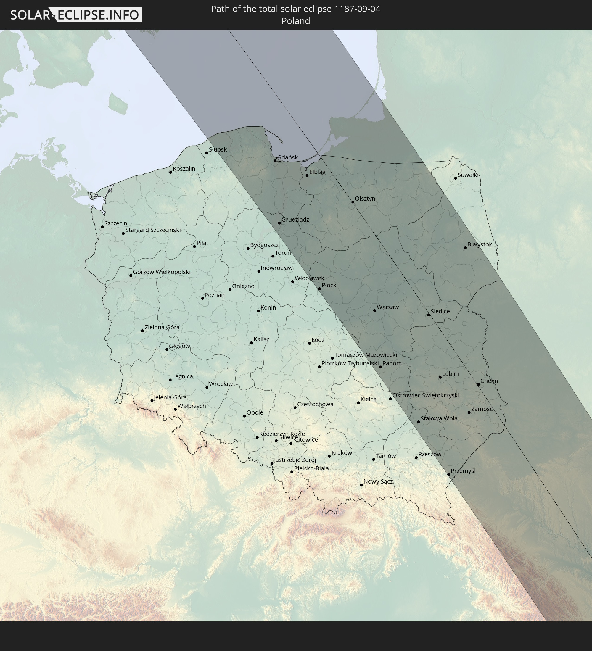
 Russia
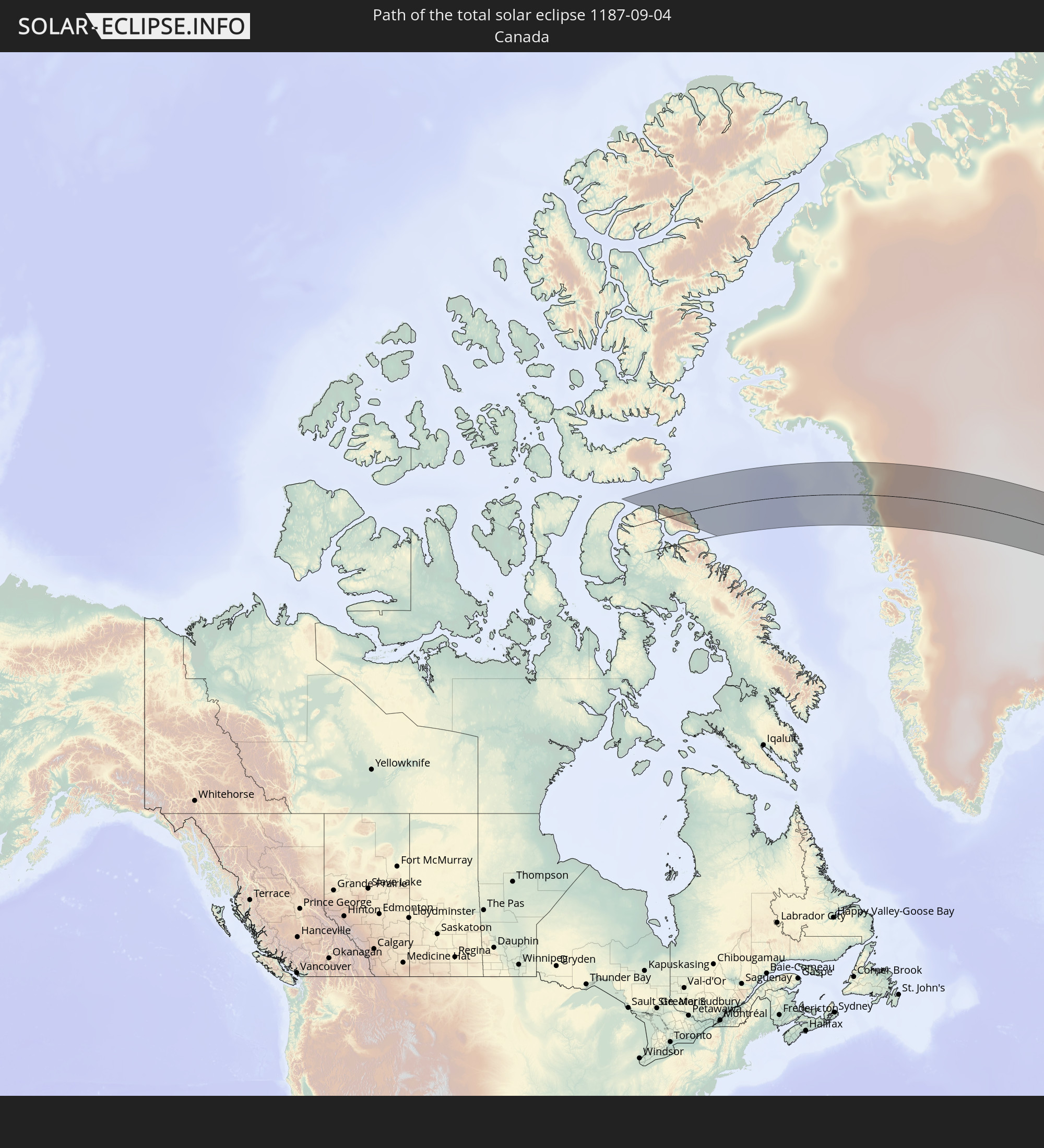 Canada
 Greenland
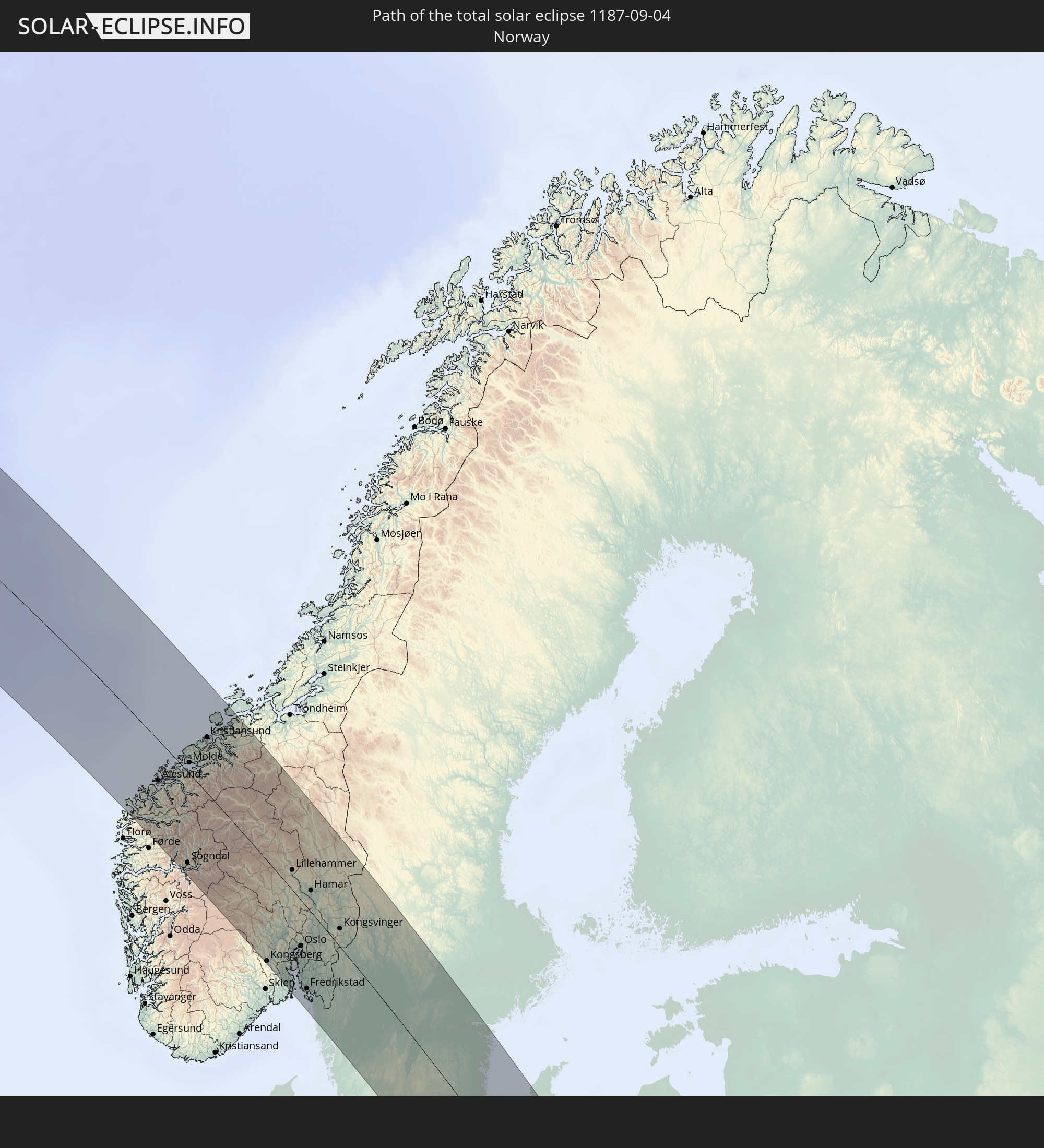 Norway
 Sweden
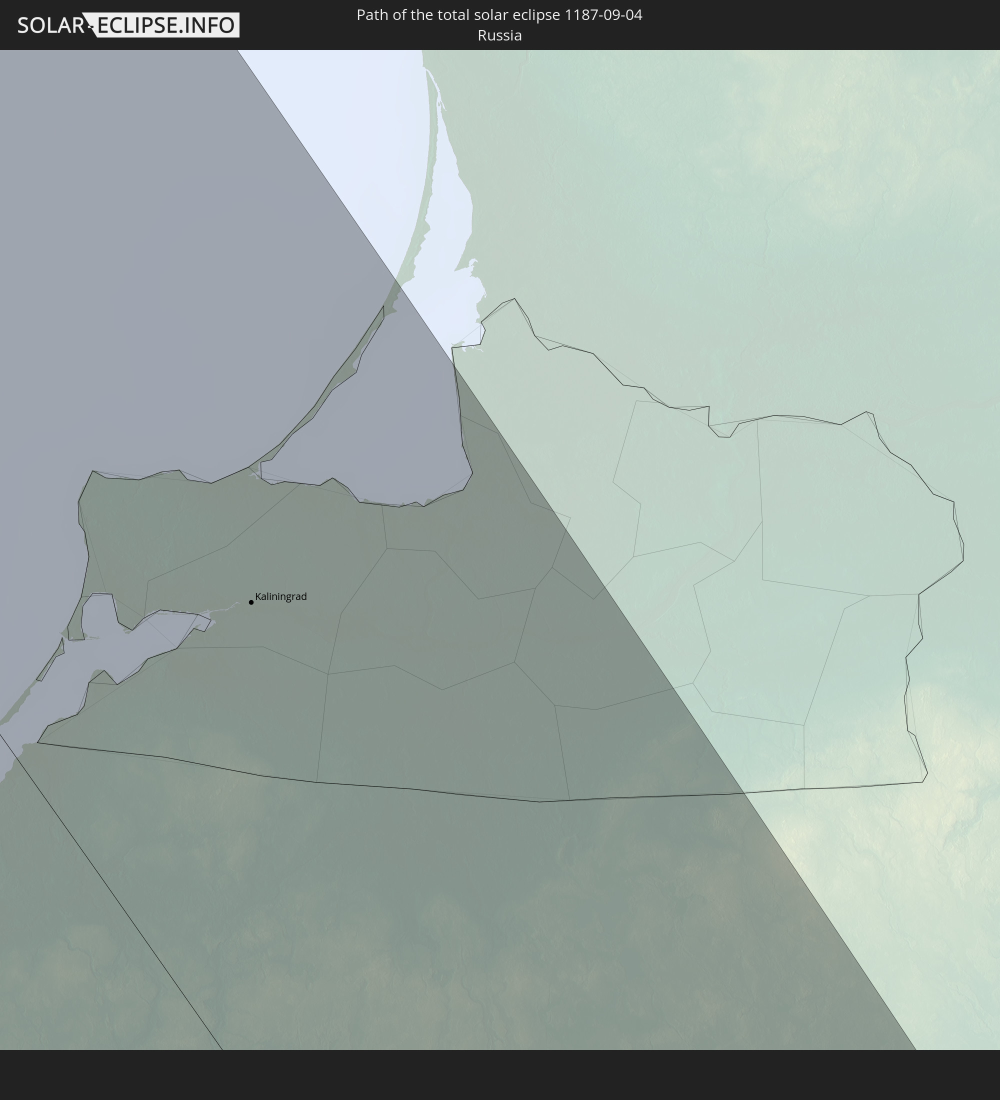
 Poland
 Romania
 Lithuania
 Ukraine
 Belarus
 Turkey
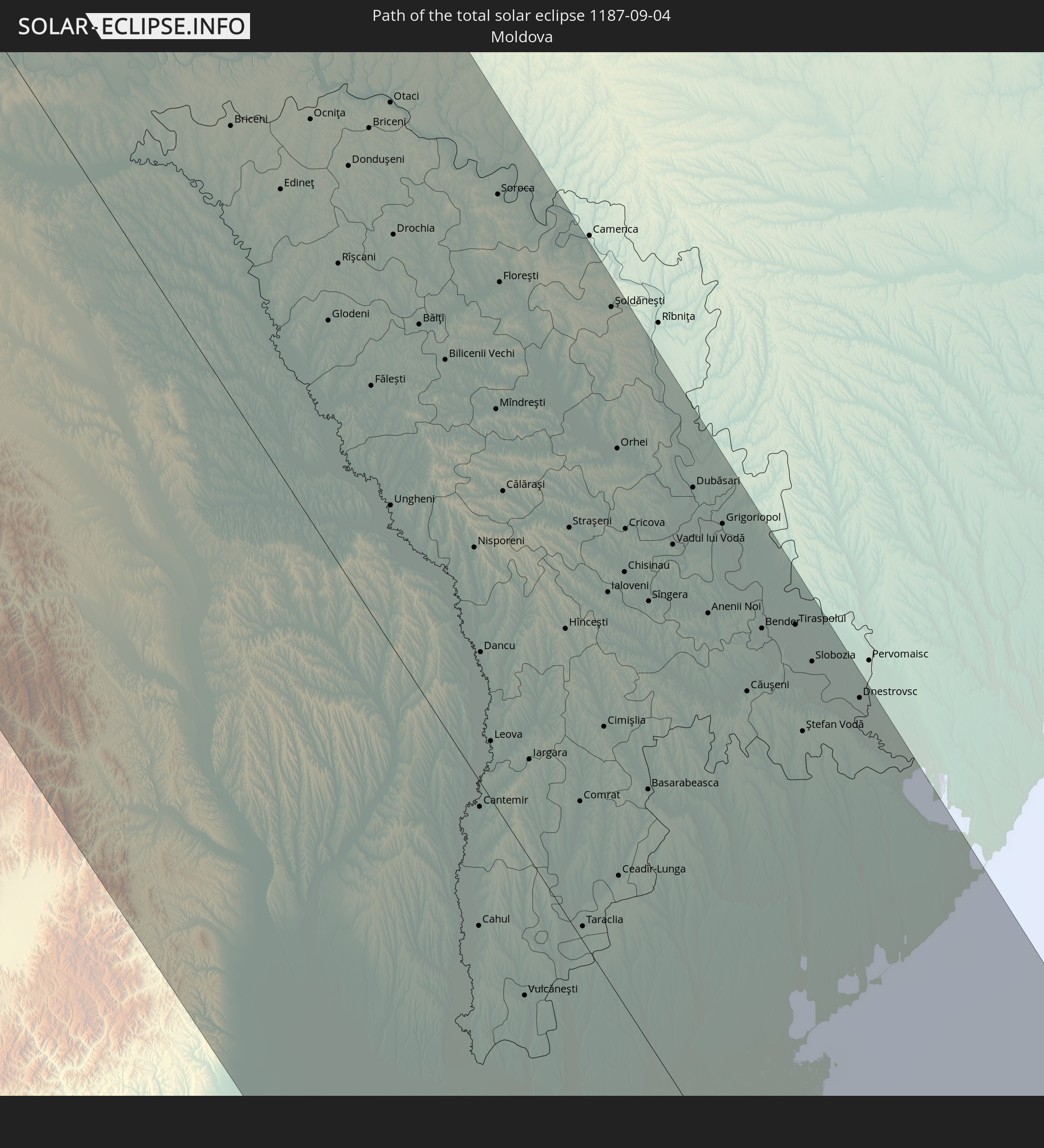 Moldova
 Saudi Arabia
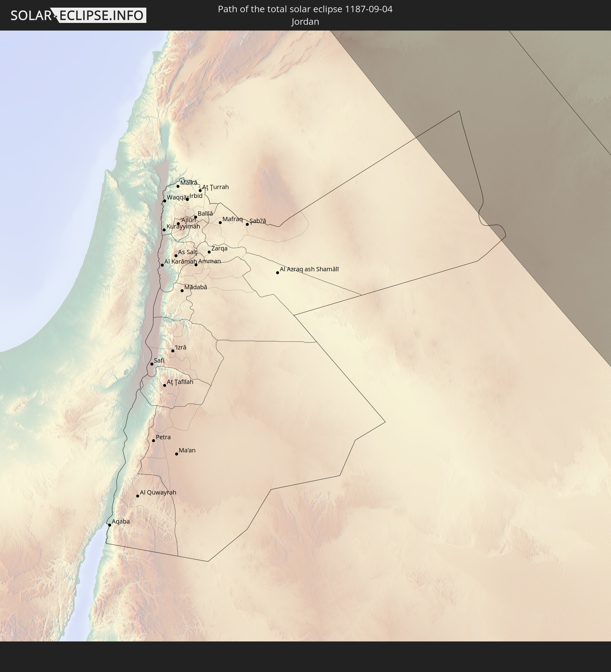 Jordan
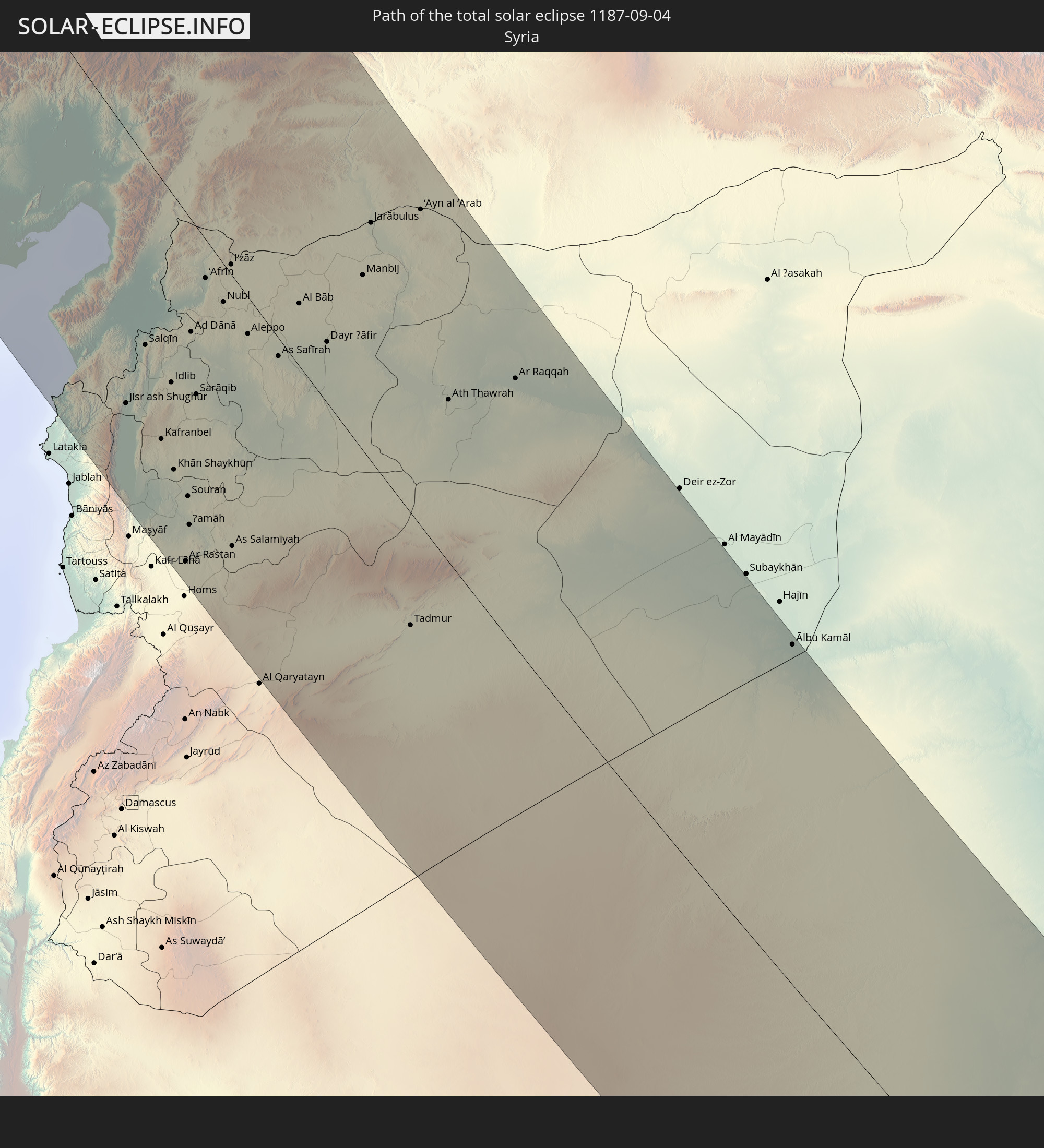 Syria
Syria
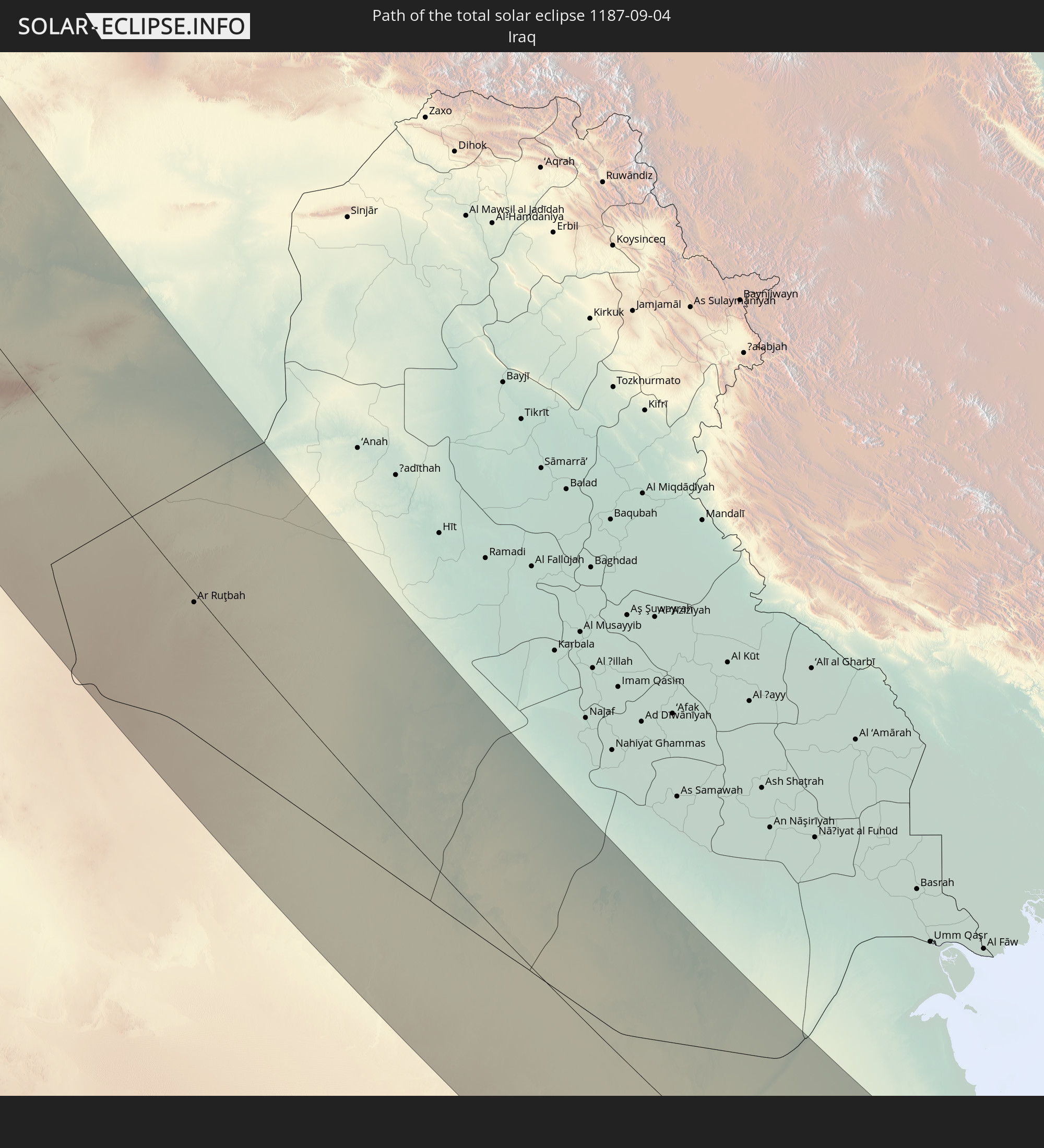 Iraq
Iraq
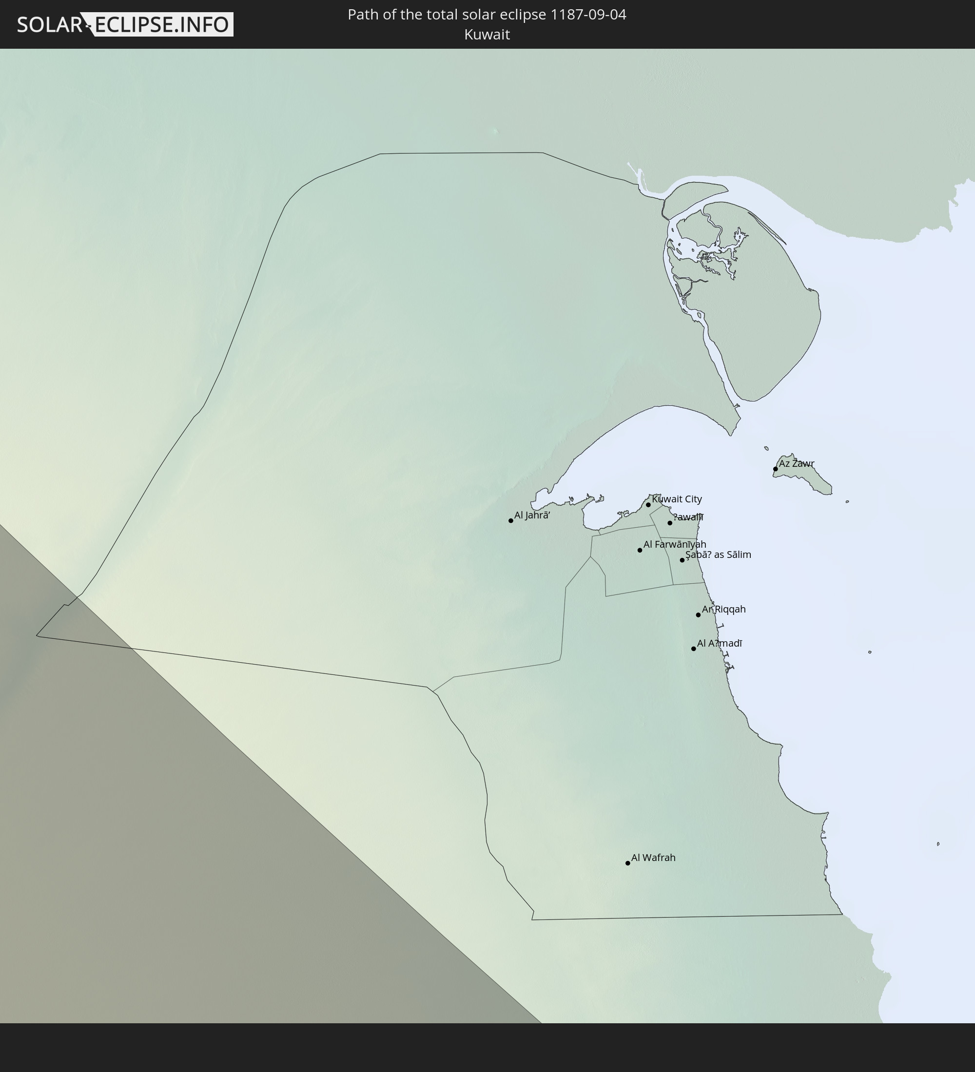 Kuwait
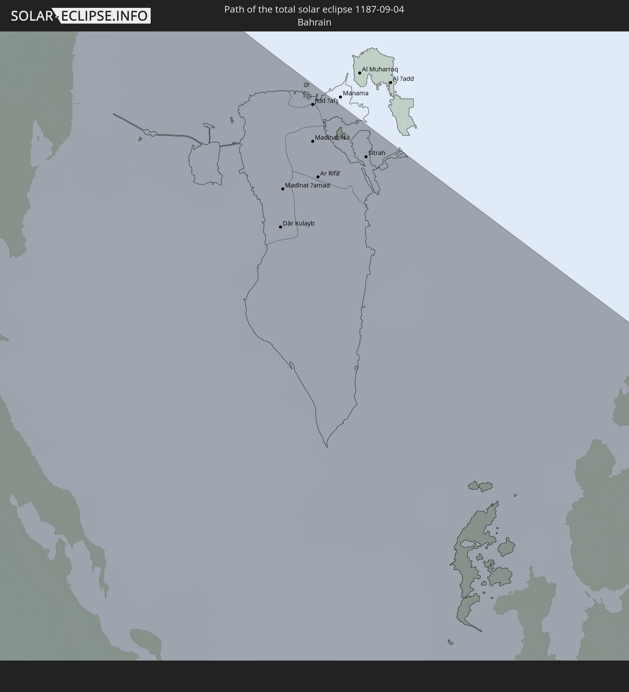 Bahrain
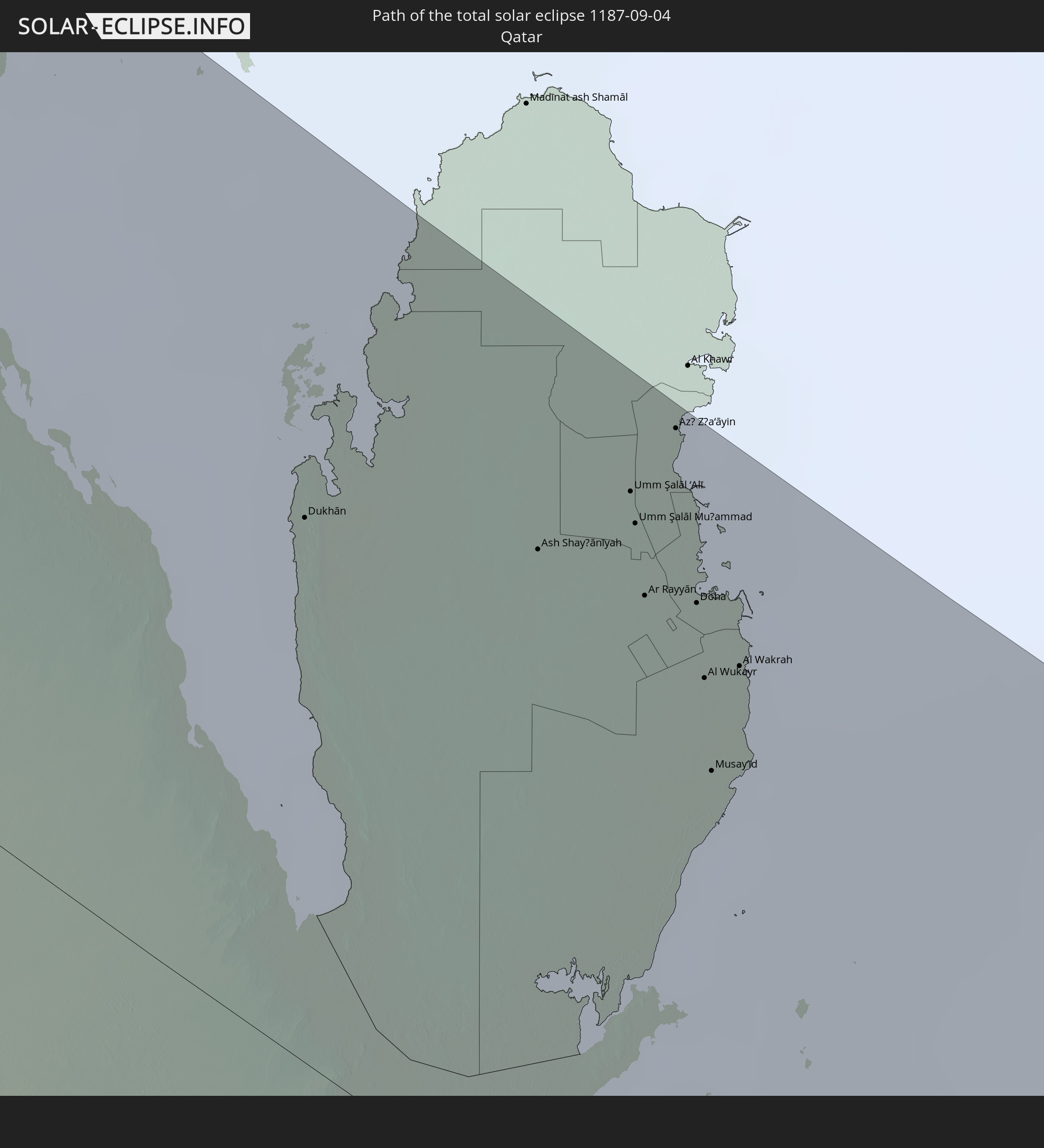 Qatar
Qatar
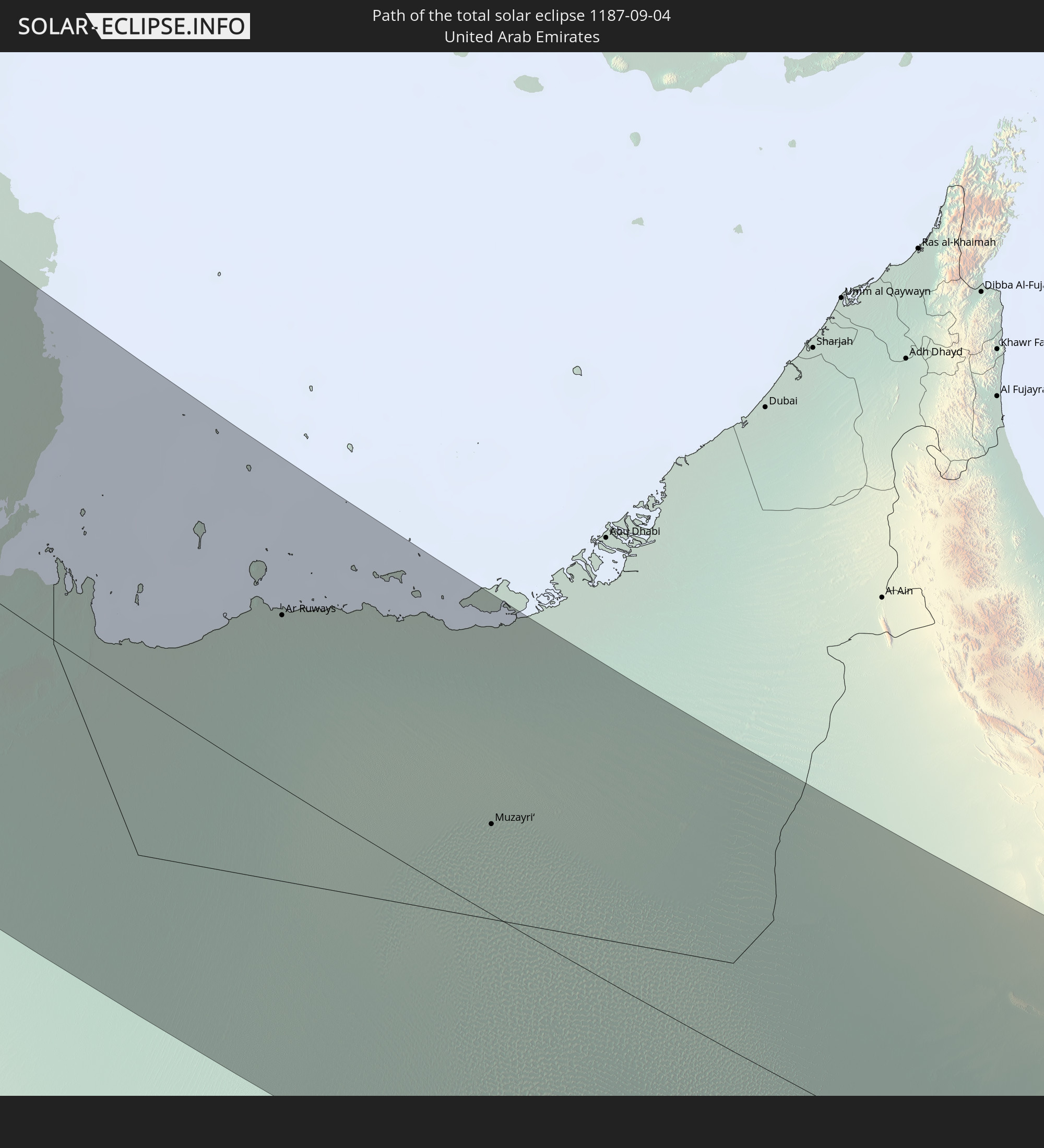 United Arab Emirates
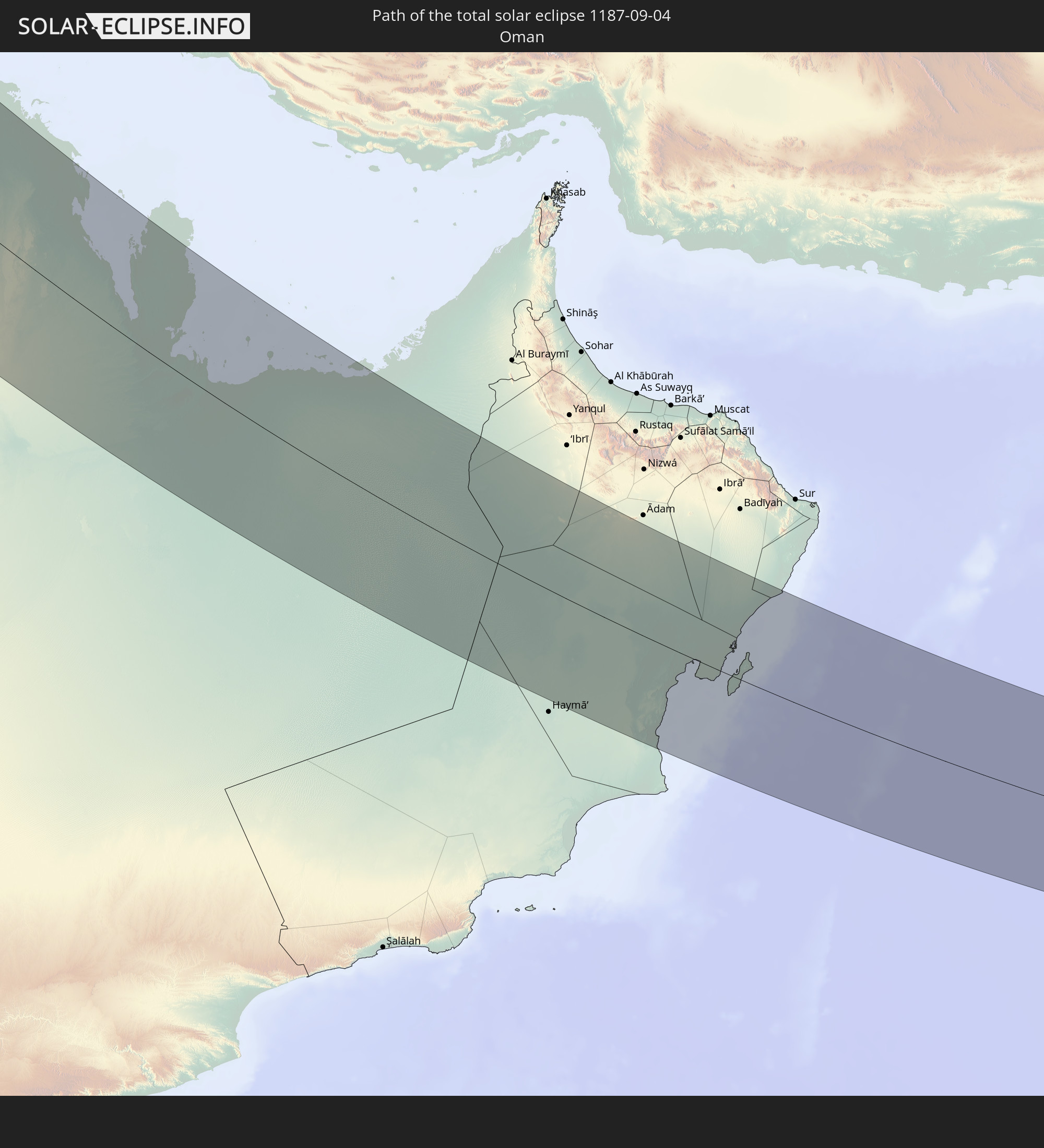 Oman
Oman
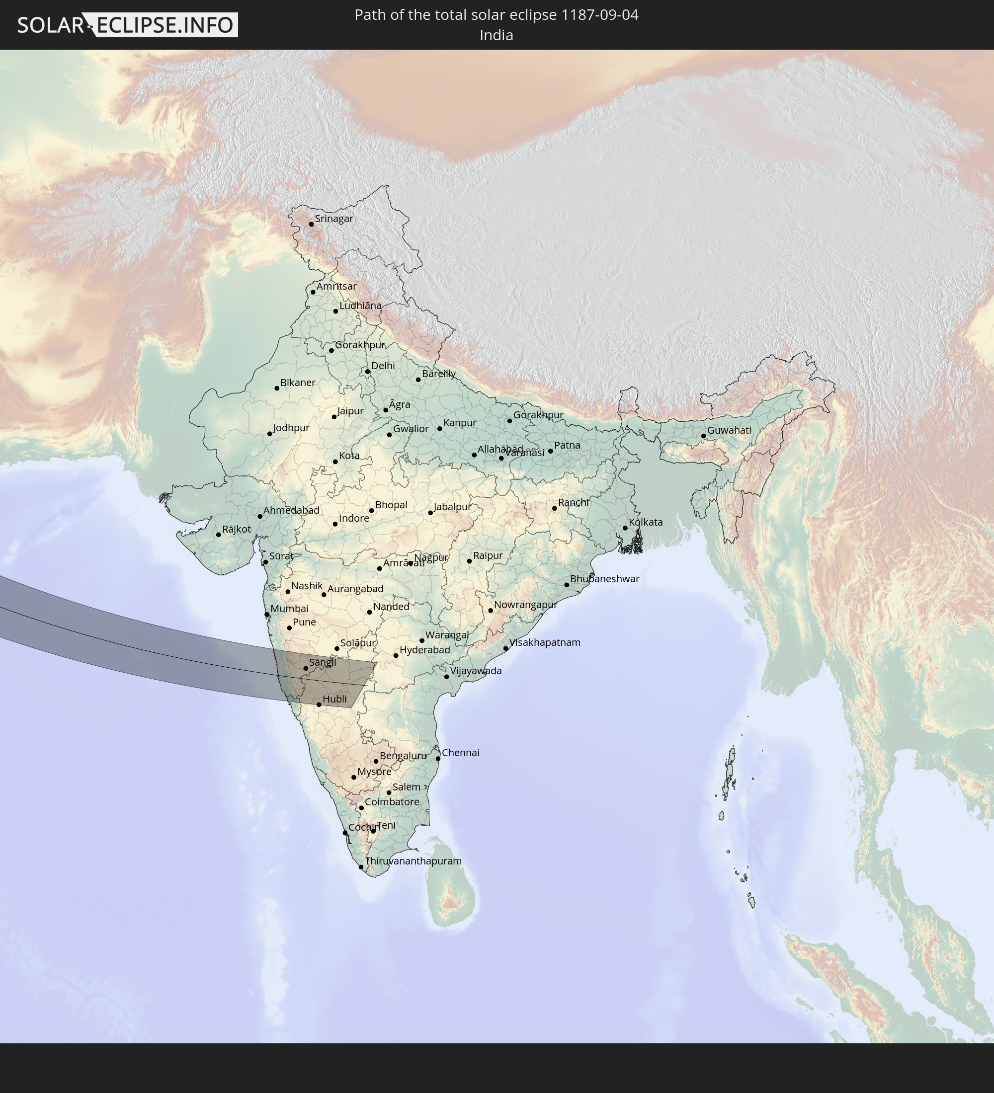 India
India
In den folgenden Ländern ist die Sonnenfinsternis partiell zu sehen
 Russia
 Canada
 Greenland
 Saint Pierre and Miquelon
 Portugal
 Iceland
 Spain
Spain
 Morocco
 Mali
Mali
 Republic of Ireland
 Svalbard and Jan Mayen
 Algeria
 United Kingdom
 Faroe Islands
 Gibraltar
 France
 Isle of Man
 Guernsey
 Jersey
 Niger
Niger
 Andorra
 Belgium
 Nigeria
 Netherlands
 Norway
 Luxembourg
 Germany
 Switzerland
 Italy
Italy
 Monaco
 Tunisia
 Denmark
 Cameroon
 Libya
Libya
 Liechtenstein
 Austria
 Sweden
 Republic of the Congo
 Czechia
 Democratic Republic of the Congo
 San Marino
 Vatican City
 Slovenia
 Chad
Chad
 Croatia
 Poland
 Malta
Malta
 Central African Republic
 Bosnia and Herzegovina
 Hungary
 Slovakia
 Montenegro
 Serbia
 Albania
 Åland Islands
 Greece
 Romania
 Republic of Macedonia
 Finland
 Lithuania
 Latvia
 Estonia
 Sudan
Sudan
 Zambia
 Ukraine
 Bulgaria
 Belarus
 Egypt
Egypt
 Turkey
 Moldova
 Rwanda
 Burundi
 Tanzania
 Uganda
 Mozambique
 Cyprus
 Malawi
 Ethiopia
 Kenya
Kenya
 State of Palestine
 Israel
 Saudi Arabia
 Jordan
 Lebanon
 Syria
Syria
 Eritrea
 Iraq
Iraq
 Georgia
 French Southern and Antarctic Lands
 Somalia
 Djibouti
 Yemen
Yemen
 Madagascar
 Comoros
 Armenia
 Iran
Iran
 Azerbaijan
 Mayotte
 Seychelles
 Kazakhstan
 Kuwait
 Bahrain
 Qatar
Qatar
 United Arab Emirates
 Oman
Oman
 Turkmenistan
 Uzbekistan
 Mauritius
 Afghanistan
 Pakistan
 Tajikistan
 India
India
 Kyrgyzstan
 Maldives
 China
China
 Nepal
Nepal
 Mongolia
How will be the weather during the total solar eclipse on 09/04/1187?
Where is the best place to see the total solar eclipse of 09/04/1187?
The following maps show the average cloud coverage for the day of the total solar eclipse.
With the help of these maps, it is possible to find the place along the eclipse path, which has the best
chance of a cloudless sky.
Nevertheless, you should consider local circumstances and inform about the weather of your chosen
observation site.
The data is provided by NASAs satellites
AQUA and TERRA.
The cloud maps are averaged over a period of 19 years (2000 - 2019).


Detailed country maps
 Russia
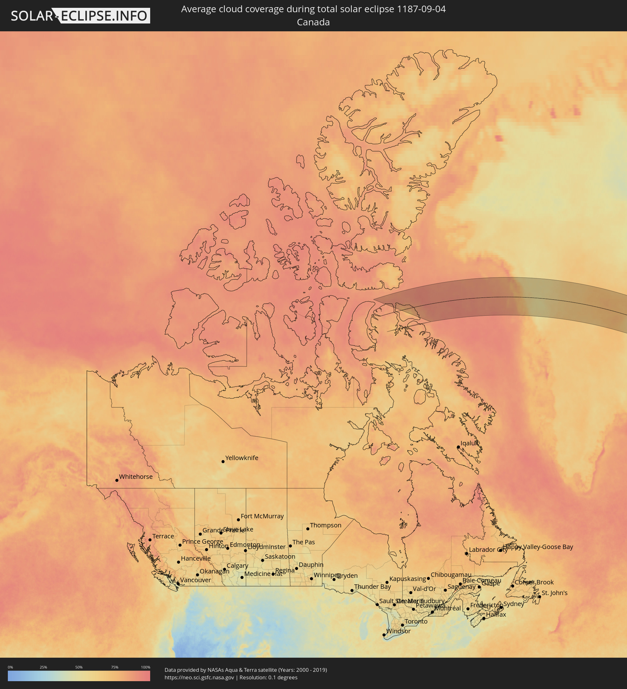 Canada
 Greenland
 Norway
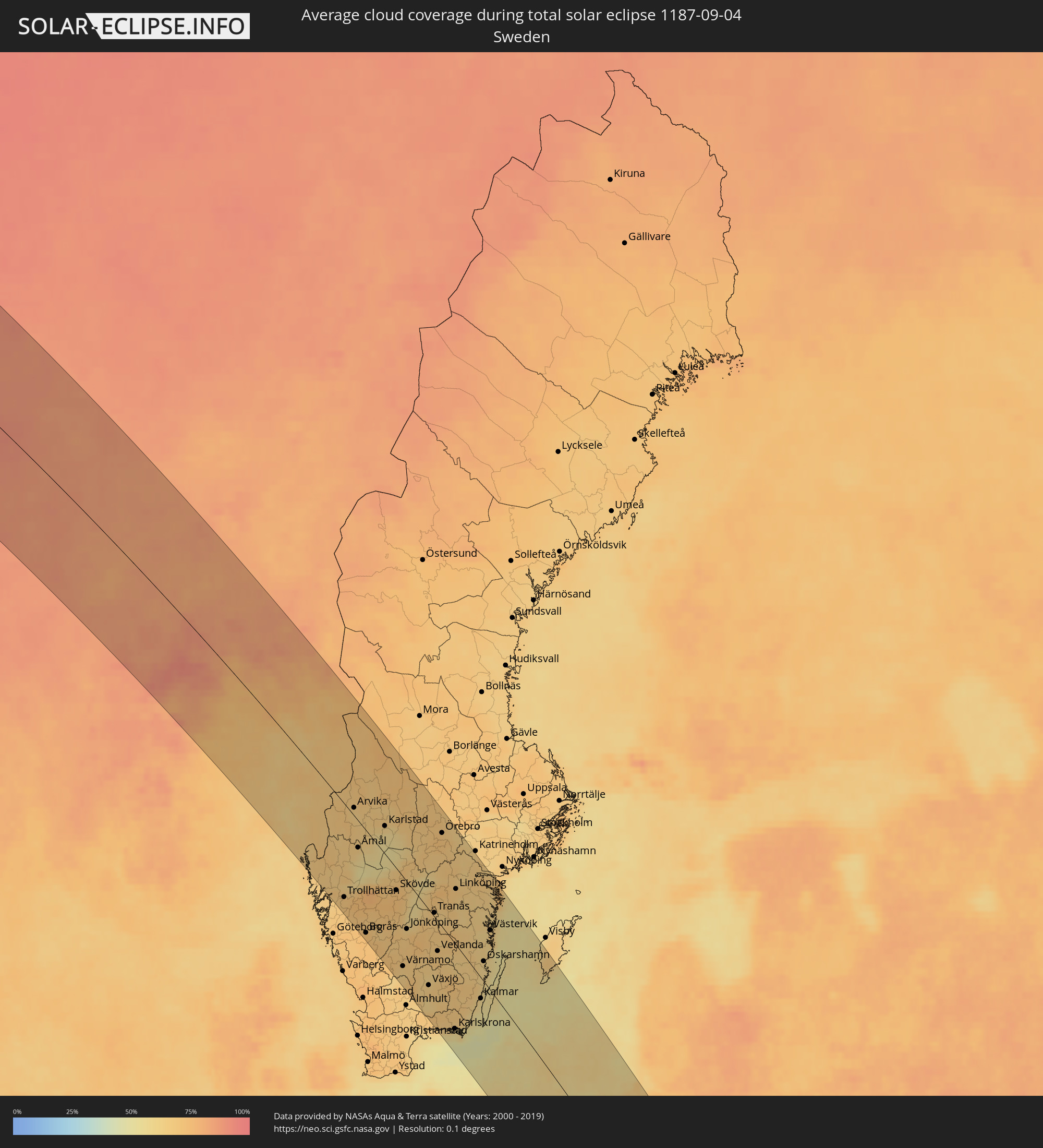 Sweden
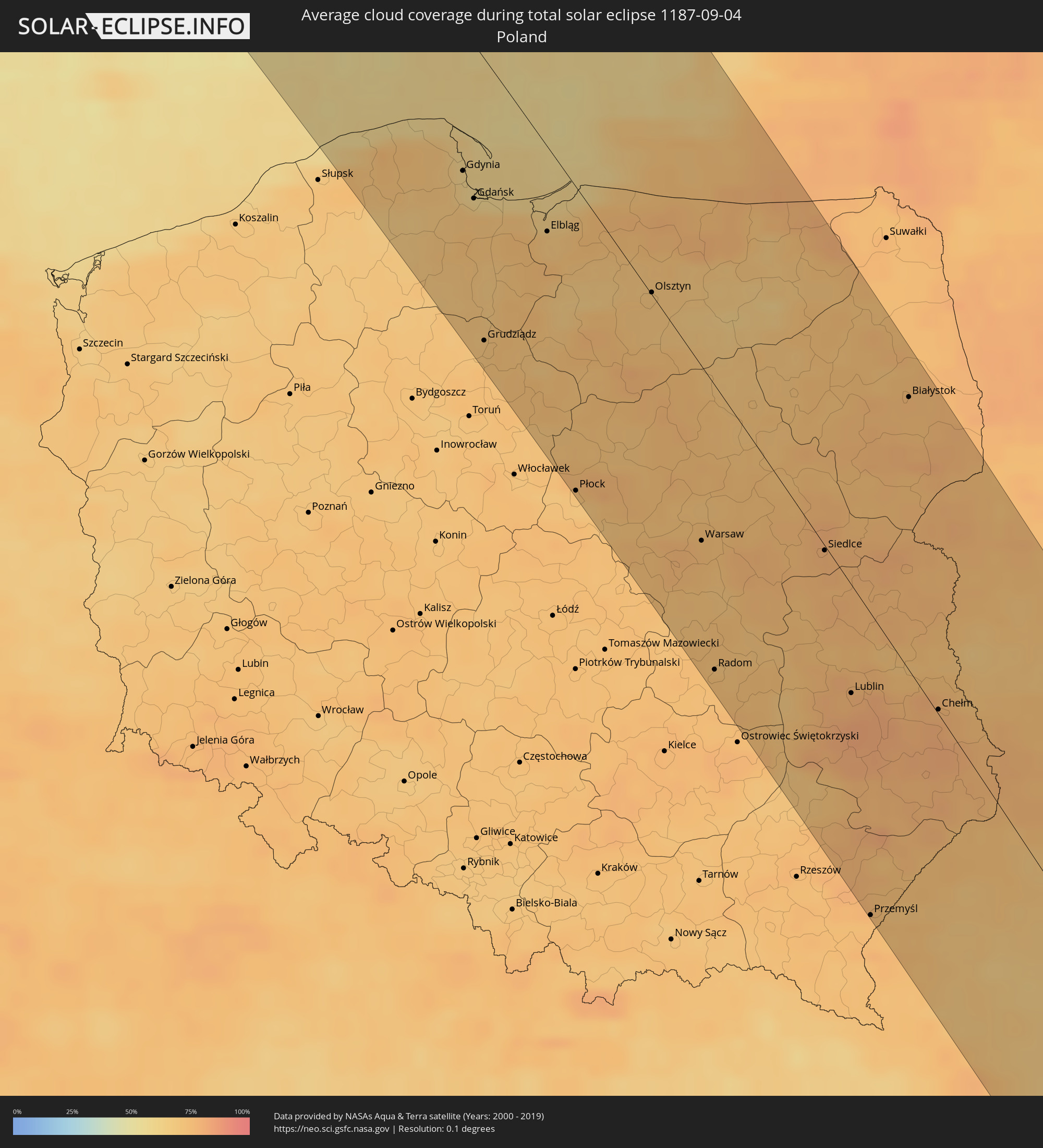 Poland
 Romania
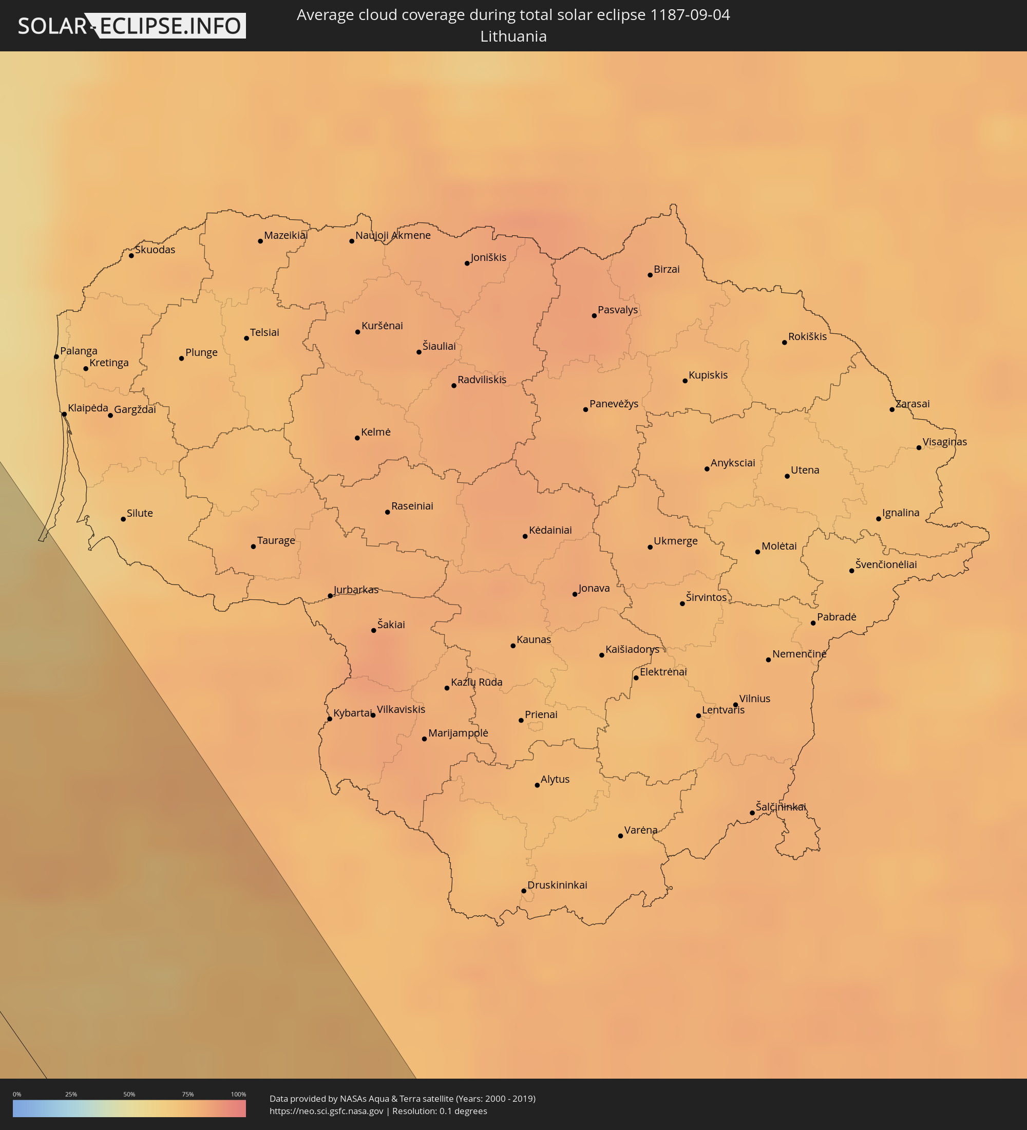 Lithuania
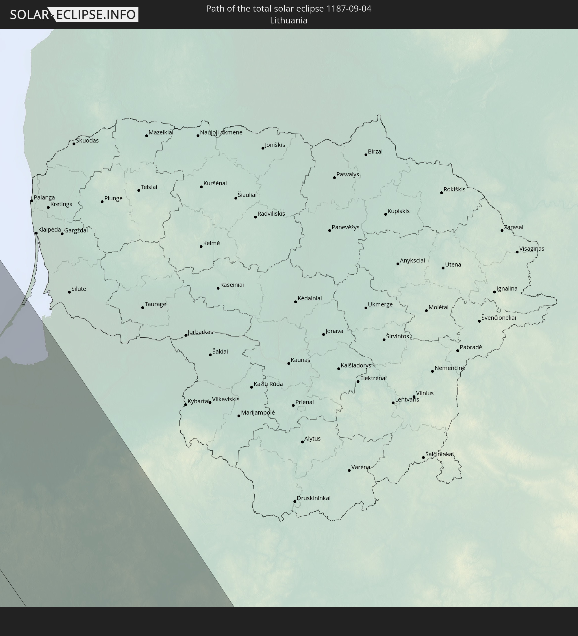
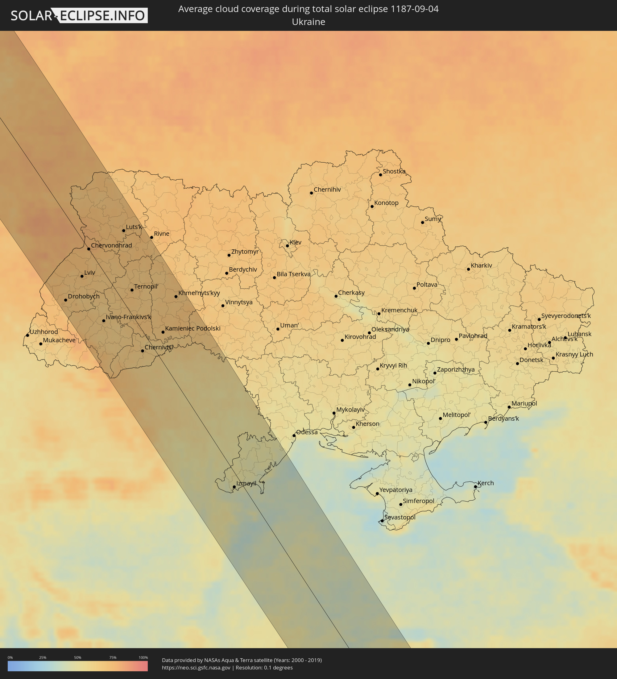 Ukraine
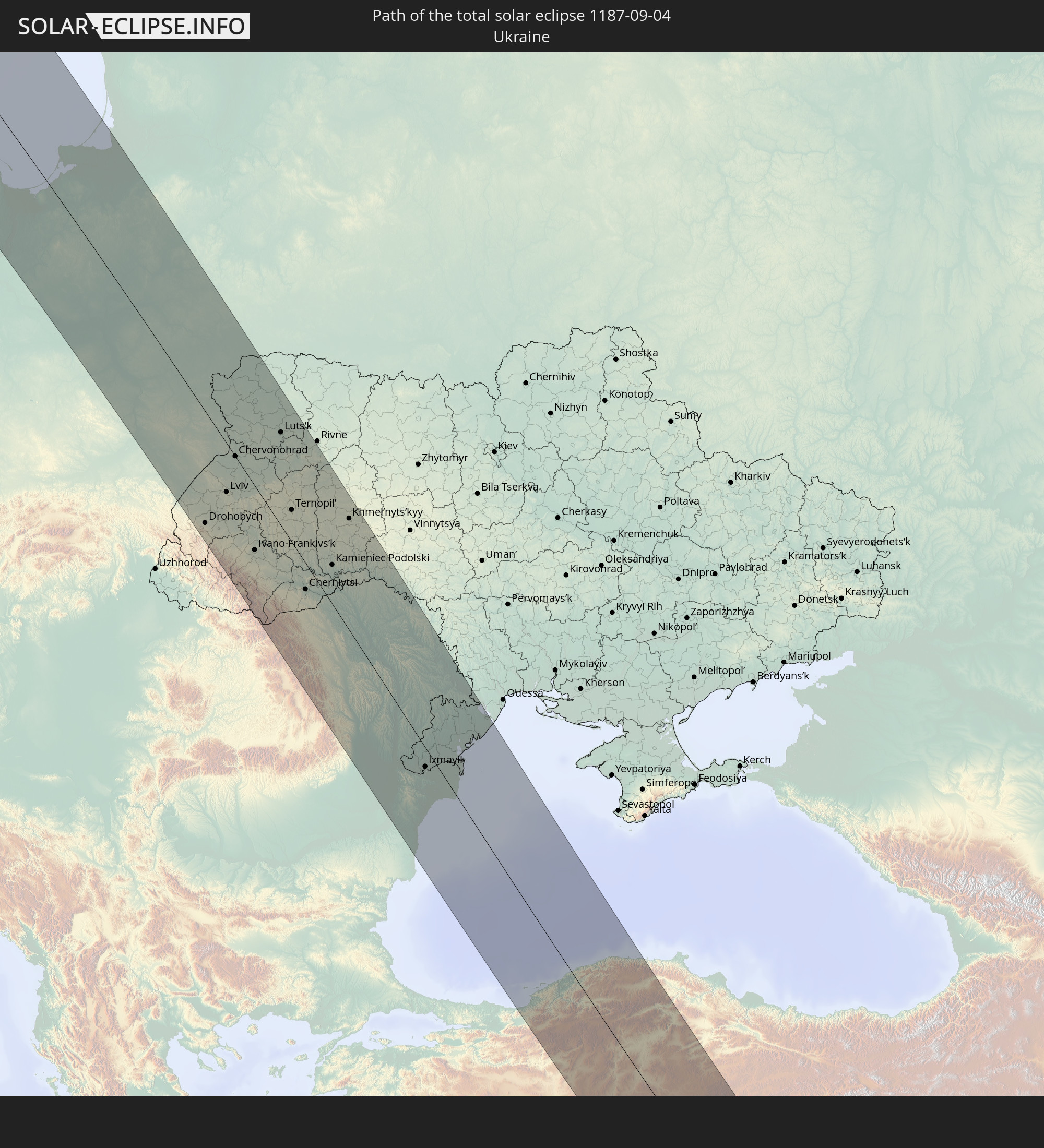
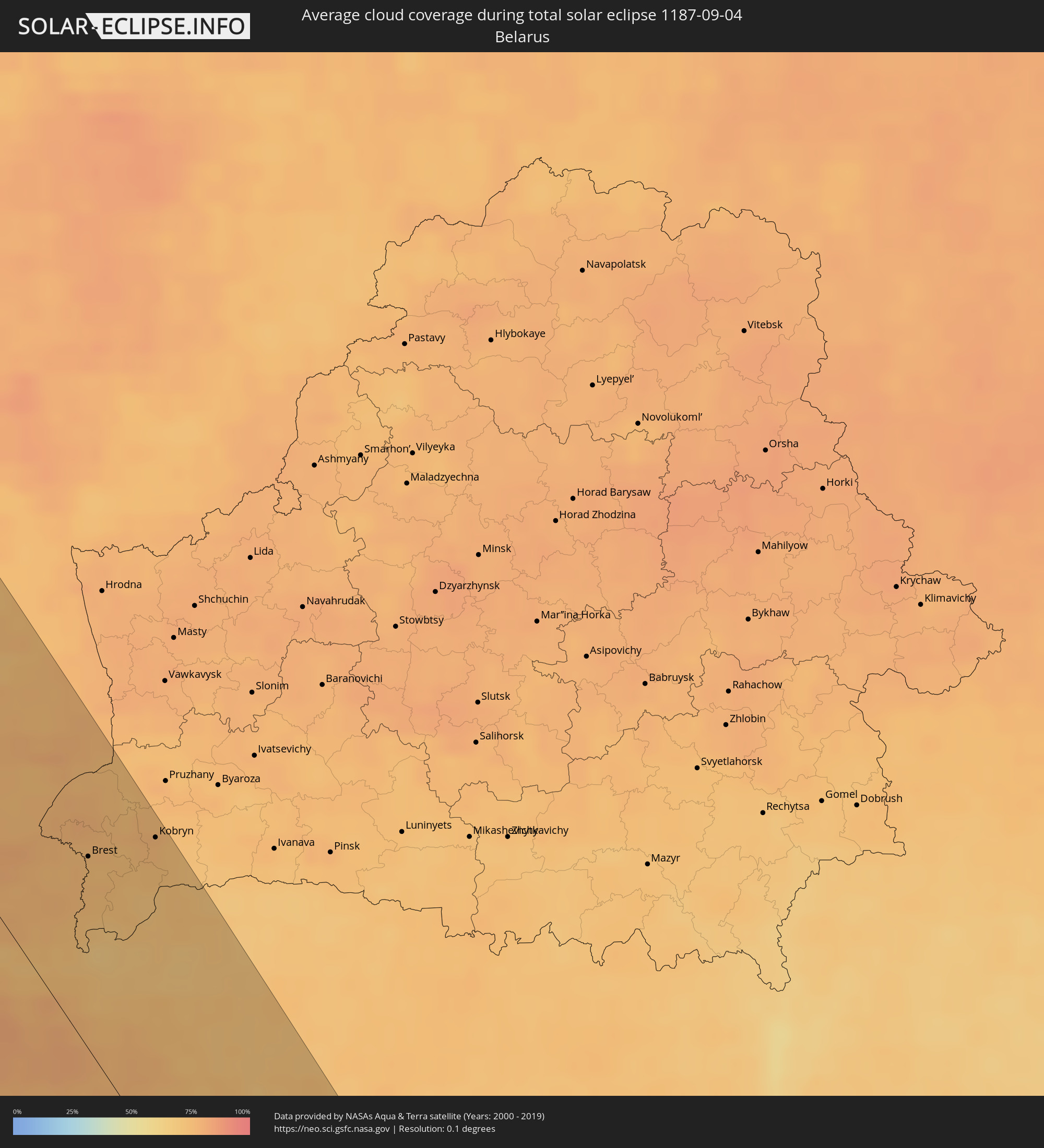 Belarus
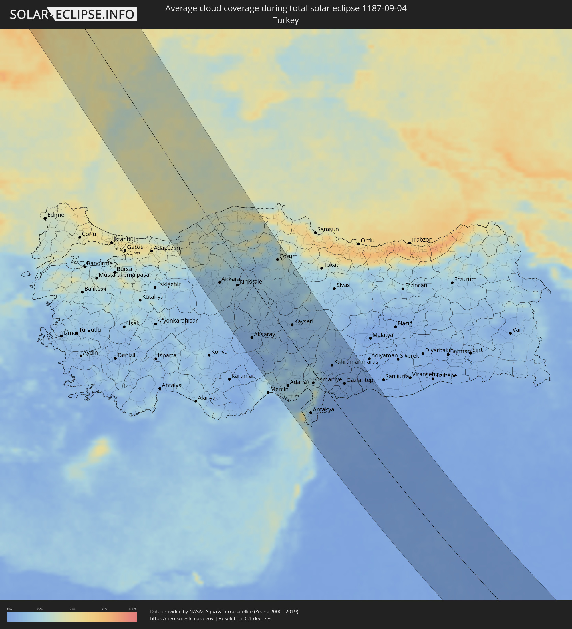 Turkey
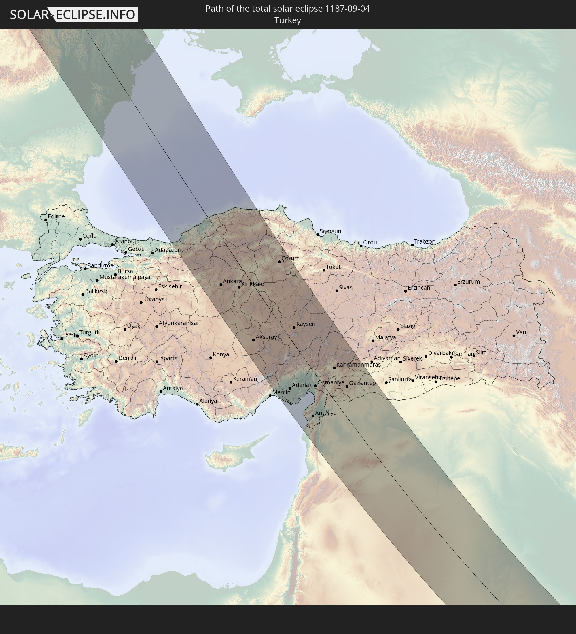
 Moldova
 Saudi Arabia
 Jordan
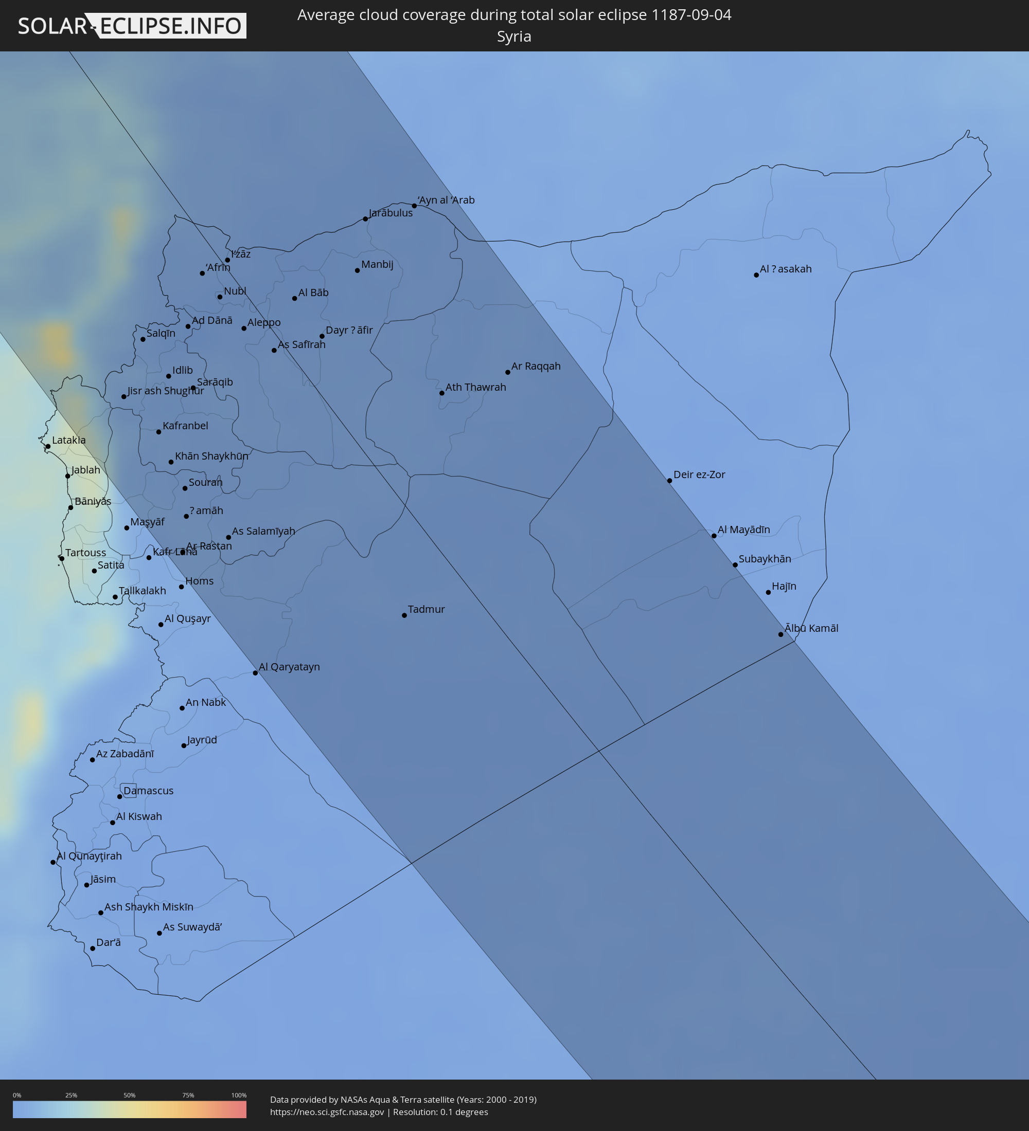 Syria
Syria
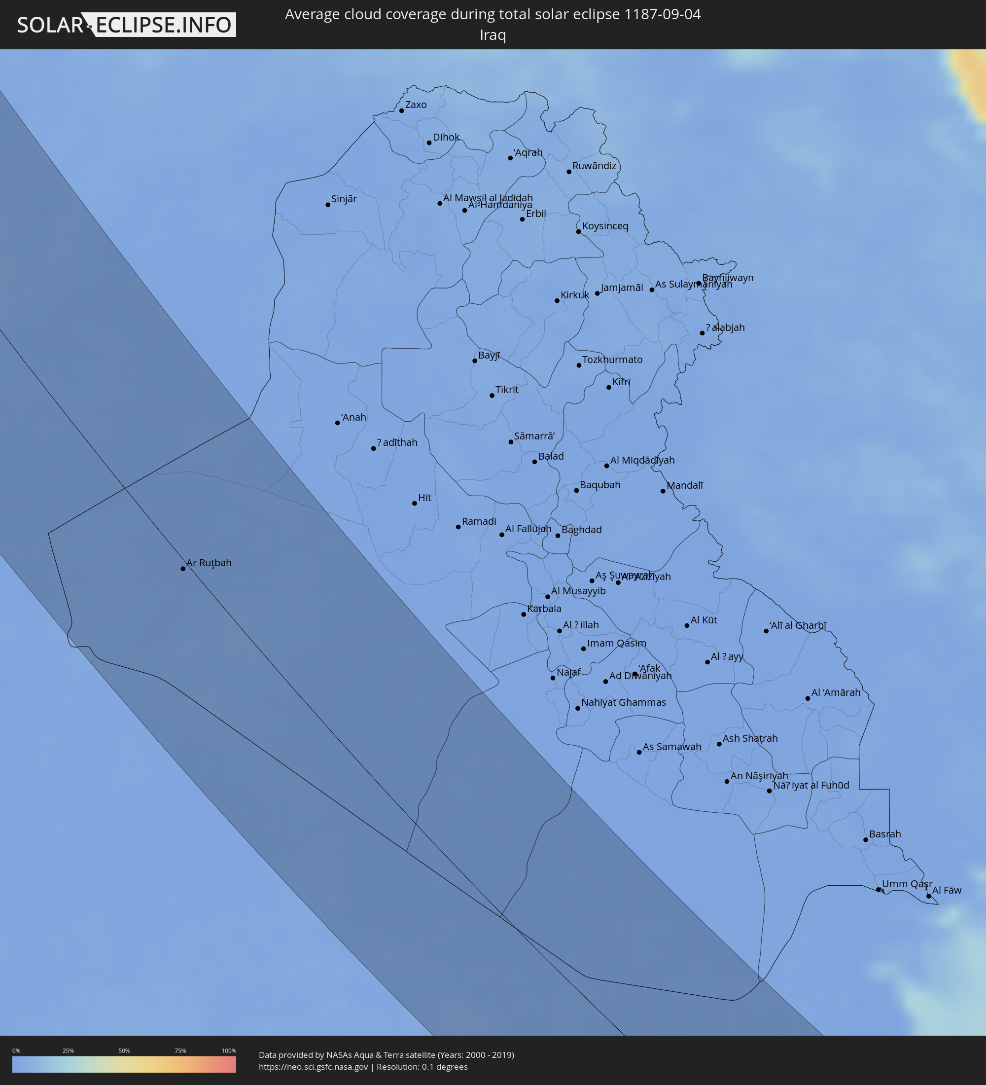 Iraq
Iraq
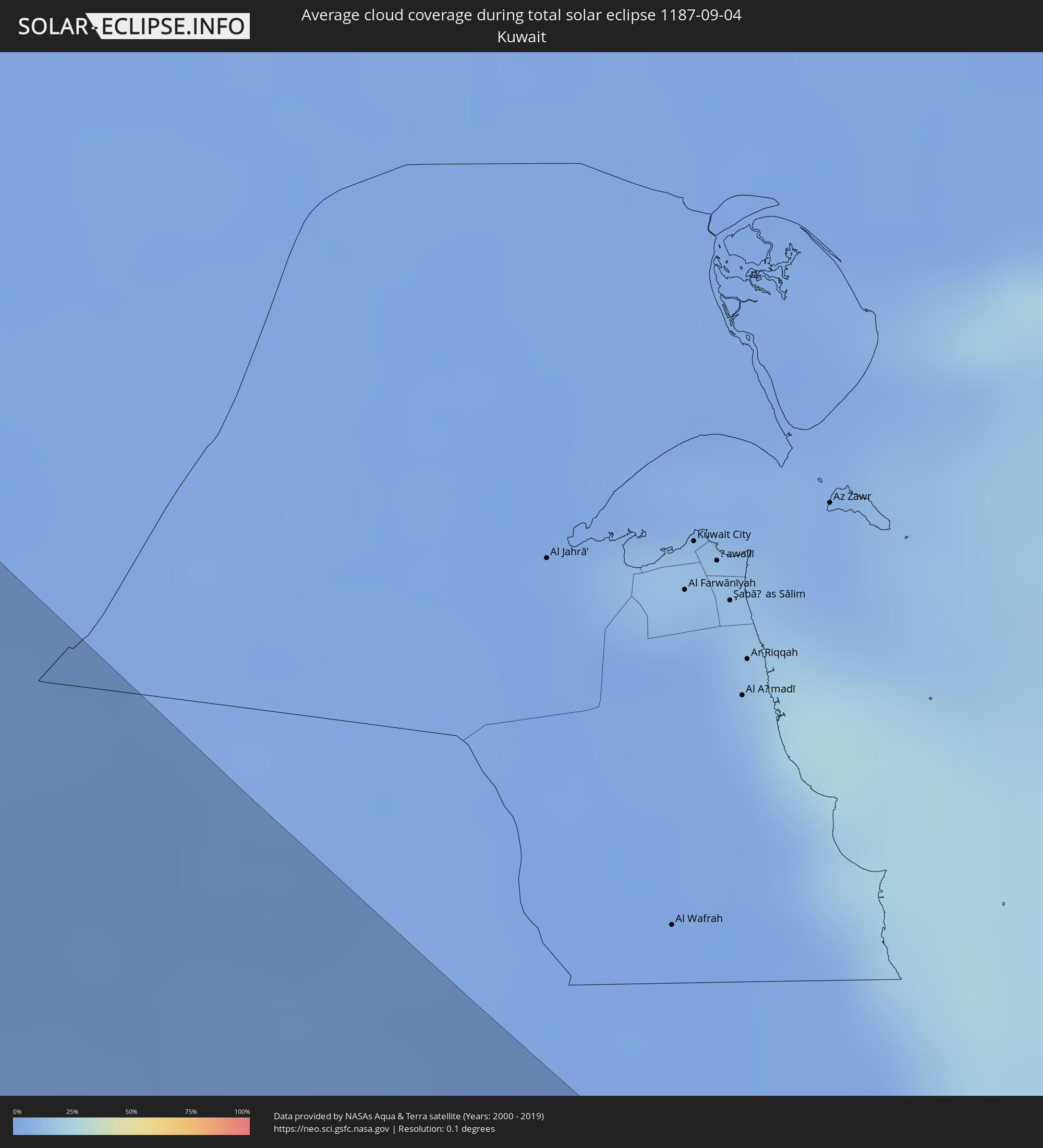 Kuwait
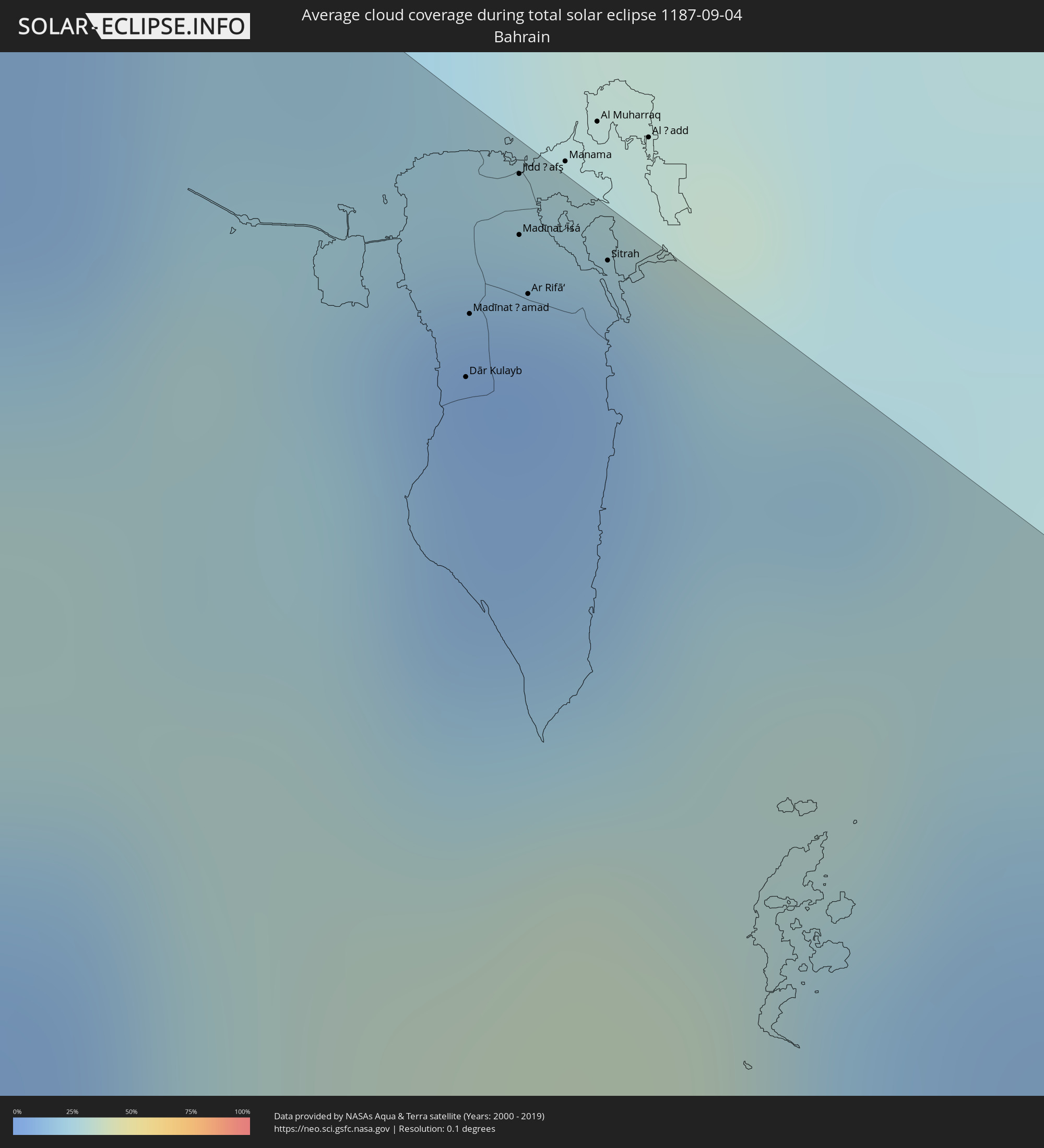 Bahrain
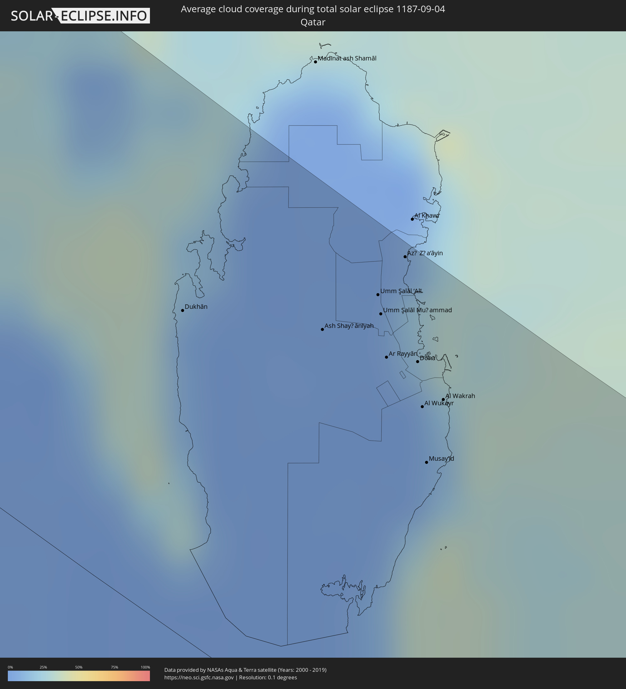 Qatar
Qatar
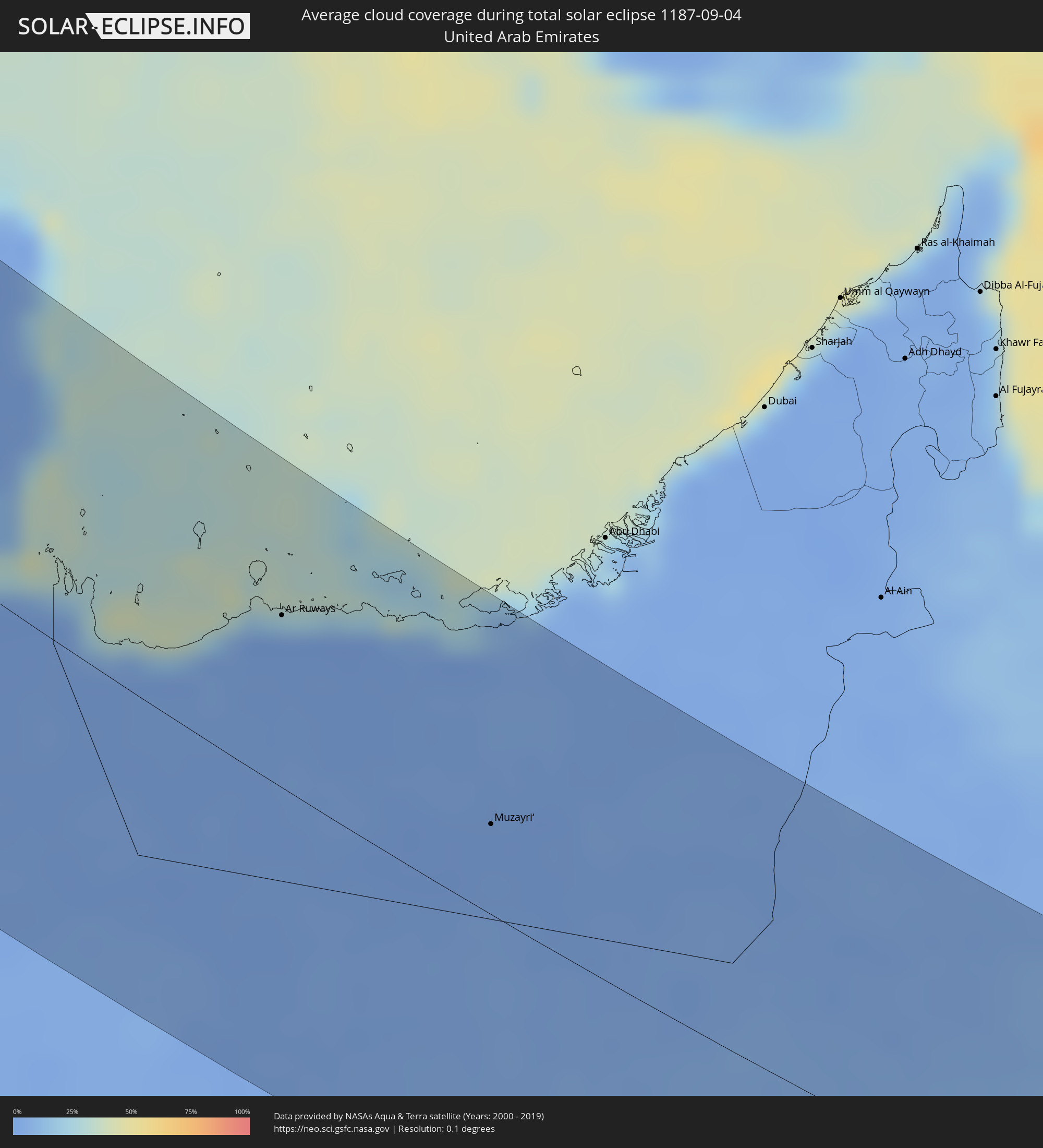 United Arab Emirates
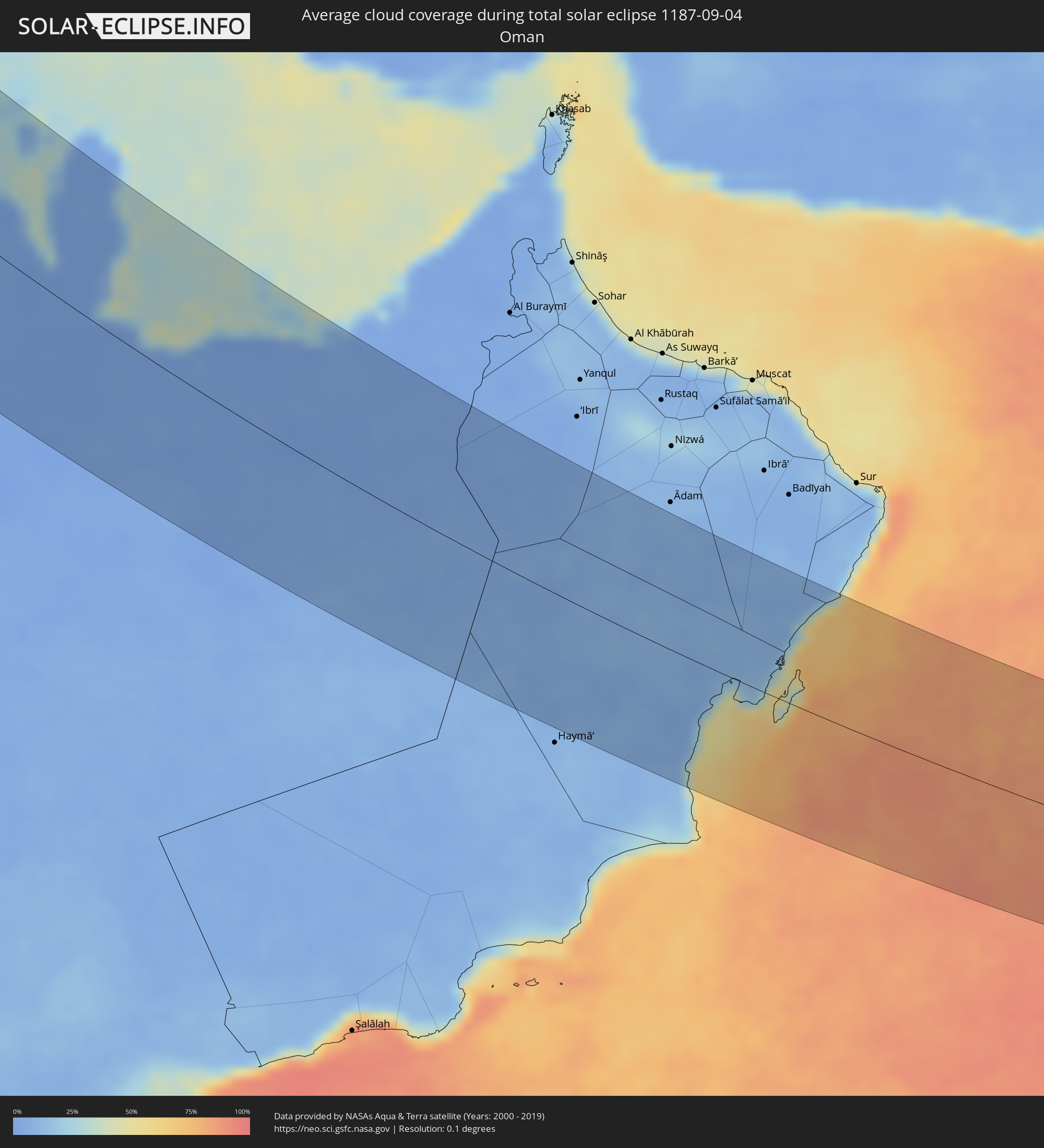 Oman
Oman
 India
India
Cities inside the path of the eclipse
The following table shows all locations with a population of more than 5,000 inside the eclipse path. Cities which have more than 100,000 inhabitants are marked bold. A click at the locations opens a detailed map.
| City | Type | Eclipse duration | Local time of max. eclipse | Distance to central line | Ø Cloud coverage |
|
Ålesund, Møre og Romsdal
|
total | - | 11:50:50 UTC+01:00 | 45 km | 85% |
|
Molde, Møre og Romsdal
|
total | - | 11:51:33 UTC+01:00 | 12 km | 83% |
|
Kristiansund, Møre og Romsdal
|
total | - | 11:51:51 UTC+01:00 | 62 km | 82% |
|
Kongsberg, Buskerud
|
total | - | 11:55:17 UTC+01:00 | 116 km | 66% |
|
Drammen, Buskerud
|
total | - | 11:55:45 UTC+01:00 | 88 km | 66% |
|
Tønsberg, Vestfold
|
total | - | 11:56:14 UTC+01:00 | 114 km | 64% |
|
Lillehammer, Oppland
|
total | - | 11:55:09 UTC+01:00 | 23 km | 71% |
|
Moss, Østfold
|
total | - | 11:56:22 UTC+01:00 | 91 km | 62% |
|
Gjøvik, Oppland
|
total | - | 11:55:32 UTC+01:00 | 9 km | 68% |
|
Oslo, Oslo
|
total | - | 11:56:08 UTC+01:00 | 52 km | 67% |
|
Fredrikstad, Østfold
|
total | - | 11:56:45 UTC+01:00 | 95 km | 66% |
|
Hamar, Hedmark
|
total | - | 11:55:52 UTC+01:00 | 25 km | 66% |
|
Halden, Østfold
|
total | - | 11:57:15 UTC+01:00 | 81 km | 66% |
|
Uddevalla, Västra Götaland
|
total | - | 11:58:19 UTC+01:00 | 113 km | 66% |
|
Trollhättan, Västra Götaland
|
total | - | 11:58:42 UTC+01:00 | 102 km | 69% |
|
Borås, Västra Götaland
|
total | - | 11:59:46 UTC+01:00 | 112 km | 72% |
|
Karlstad, Värmland
|
total | - | 11:59:01 UTC+01:00 | 30 km | 62% |
|
Skövde, Västra Götaland
|
total | - | 12:00:06 UTC+01:00 | 23 km | 71% |
|
Jönköping, Jönköping
|
total | - | 12:00:53 UTC+01:00 | 51 km | 64% |
|
Växjö, Kronoberg
|
total | - | 12:02:18 UTC+01:00 | 83 km | 65% |
|
Motala, Östergötland
|
total | - | 12:01:06 UTC+01:00 | 41 km | 65% |
|
Örebro, Örebro
|
total | - | 12:00:39 UTC+01:00 | 99 km | 70% |
|
Karlskrona, Blekinge
|
total | - | 12:03:44 UTC+01:00 | 94 km | 60% |
|
Linköping, Östergötland
|
total | - | 12:01:45 UTC+01:00 | 60 km | 69% |
|
Norrköping, Östergötland
|
total | - | 12:02:07 UTC+01:00 | 98 km | 68% |
|
Kalmar, Kalmar
|
total | - | 12:04:02 UTC+01:00 | 23 km | 58% |
|
Gdynia, Pomeranian Voivodeship
|
total | - | 12:32:24 UTC+01:24 | 55 km | 64% |
|
Gdańsk, Pomeranian Voivodeship
|
total | - | 12:32:42 UTC+01:24 | 60 km | 66% |
|
Grudziądz, Kujawsko-Pomorskie
|
total | - | 12:33:47 UTC+01:24 | 112 km | 71% |
|
Elbląg, Warmian-Masurian Voivodeship
|
total | - | 12:33:43 UTC+01:24 | 33 km | 69% |
|
Płock, Masovian Voivodeship
|
total | - | 12:35:54 UTC+01:24 | 121 km | 69% |
|
Baltiysk, Kaliningrad
|
total | - | 12:09:41 UTC+01:00 | 26 km | 58% |
|
Mamonovo, Kaliningrad
|
total | - | 12:09:55 UTC+01:00 | 15 km | 61% |
|
Yantarnyy, Kaliningrad
|
total | - | 12:09:28 UTC+01:00 | 41 km | 60% |
|
Svetlyy, Kaliningrad
|
total | - | 12:09:53 UTC+01:00 | 39 km | 64% |
|
Svetlogorsk, Kaliningrad
|
total | - | 12:09:37 UTC+01:00 | 57 km | 69% |
|
Pionerskiy, Kaliningrad
|
total | - | 12:09:40 UTC+01:00 | 61 km | 60% |
|
Zelenogradsk, Kaliningrad
|
total | - | 12:09:55 UTC+01:00 | 75 km | 59% |
|
Olsztyn, Warmian-Masurian Voivodeship
|
total | - | 12:35:17 UTC+01:24 | 1 km | 71% |
|
Kaliningrad, Kaliningrad
|
total | - | 12:10:14 UTC+01:00 | 61 km | 71% |
|
Gur’yevsk, Kaliningrad
|
total | - | 12:10:15 UTC+01:00 | 70 km | 71% |
|
Bagrationovsk, Kaliningrad
|
total | - | 12:10:44 UTC+01:00 | 48 km | 74% |
|
Warsaw, Masovian Voivodeship
|
total | - | 12:37:42 UTC+01:24 | 70 km | 74% |
|
Gvardeysk, Kaliningrad
|
total | - | 12:10:52 UTC+01:00 | 86 km | 73% |
|
Polessk, Kaliningrad
|
total | - | 12:10:40 UTC+01:00 | 102 km | 66% |
|
Radom, Masovian Voivodeship
|
total | - | 12:38:54 UTC+01:24 | 115 km | 72% |
|
Ozërsk, Kaliningrad
|
total | - | 12:12:07 UTC+01:00 | 122 km | 77% |
|
Siedlce, Masovian Voivodeship
|
total | - | 12:39:09 UTC+01:24 | 2 km | 78% |
|
Lublin, Lublin Voivodeship
|
total | - | 12:40:39 UTC+01:24 | 44 km | 78% |
|
Przemyśl, Subcarpathian Voivodeship
|
total | - | 12:42:51 UTC+01:24 | 124 km | 74% |
|
Białystok, Podlasie
|
total | - | 12:38:52 UTC+01:24 | 107 km | 74% |
|
Chełm, Lublin Voivodeship
|
total | - | 12:41:46 UTC+01:24 | 2 km | 79% |
|
Drohobych, Lviv
|
total | - | 13:22:21 UTC+02:02 | 108 km | 70% |
|
Brest, Brest
|
total | - | 13:06:44 UTC+01:50 | 73 km | 74% |
|
Kamyanyets, Brest
|
total | - | 13:06:29 UTC+01:50 | 99 km | 77% |
|
Zhabinka, Brest
|
total | - | 13:06:57 UTC+01:50 | 98 km | 74% |
|
Lviv, Lviv
|
total | - | 13:22:14 UTC+02:02 | 47 km | 69% |
|
Malaryta, Brest
|
total | - | 13:07:33 UTC+01:50 | 77 km | 74% |
|
Chervonohrad, Lviv
|
total | - | 13:21:42 UTC+02:02 | 0 km | 71% |
|
Kobryn, Brest
|
total | - | 13:07:18 UTC+01:50 | 118 km | 75% |
|
Kalush, Ivano-Frankivsk
|
total | - | 13:23:48 UTC+02:02 | 77 km | 67% |
|
Kovel’, Volyn
|
total | - | 13:21:05 UTC+02:02 | 78 km | 71% |
|
Ivano-Frankivs’k, Ivano-Frankivsk
|
total | - | 13:24:19 UTC+02:02 | 62 km | 66% |
|
Kolomyya, Ivano-Frankivsk
|
total | - | 13:25:15 UTC+02:02 | 66 km | 63% |
|
Luts’k, Volyn
|
total | - | 13:22:23 UTC+02:02 | 88 km | 70% |
|
Ternopil’, Ternopil
|
total | - | 13:24:23 UTC+02:02 | 31 km | 70% |
|
Chernivtsi, Chernivtsi
|
total | - | 13:26:37 UTC+02:02 | 25 km | 63% |
|
Suceava, Suceava
|
total | - | 13:10:18 UTC+01:44 | 46 km | 61% |
|
Piatra Neamţ, Neamţ
|
total | - | 13:11:29 UTC+01:44 | 85 km | 63% |
|
Kamieniec Podolski, Khmelnytskyi
|
total | - | 13:26:45 UTC+02:02 | 38 km | 67% |
|
Botoşani, Botoşani
|
total | - | 13:10:35 UTC+01:44 | 13 km | 58% |
|
Bacău, Bacău
|
total | - | 13:12:42 UTC+01:44 | 70 km | 53% |
|
Roman, Neamţ
|
total | - | 13:12:10 UTC+01:44 | 47 km | 59% |
|
Khmel’nyts’kyy, Khmelnytskyi
|
total | - | 13:26:06 UTC+02:02 | 108 km | 67% |
|
Focșani, Vrancea
|
total | - | 13:14:23 UTC+01:44 | 106 km | 48% |
|
Edineţ, Raionul Edineţ
|
total | - | 13:21:15 UTC+01:55 | 52 km | 61% |
|
Iaşi, Iaşi
|
total | - | 13:12:32 UTC+01:44 | 10 km | 54% |
|
Bârlad, Vaslui
|
total | - | 13:14:05 UTC+01:44 | 42 km | 52% |
|
Vaslui, Vaslui
|
total | - | 13:13:32 UTC+01:44 | 13 km | 54% |
|
Ungheni, Ungheni
|
total | - | 13:23:18 UTC+01:55 | 26 km | 55% |
|
Bălţi, Bălţi
|
total | - | 13:22:35 UTC+01:55 | 67 km | 59% |
|
Brăila, Brăila
|
total | - | 13:16:00 UTC+01:44 | 81 km | 46% |
|
Galaţi, Galaţi
|
total | - | 13:15:47 UTC+01:44 | 65 km | 46% |
|
Cahul, Cahul
|
total | - | 13:25:49 UTC+01:55 | 28 km | 48% |
|
Soroca, Raionul Soroca
|
total | - | 13:22:22 UTC+01:55 | 113 km | 61% |
|
Straşeni, Strășeni
|
total | - | 13:24:18 UTC+01:55 | 73 km | 53% |
|
Constanţa, Constanța
|
total | - | 13:18:33 UTC+01:44 | 105 km | 44% |
|
Comrat, Găgăuzia
|
total | - | 13:25:42 UTC+01:55 | 26 km | 51% |
|
Tulcea, Tulcea
|
total | - | 13:17:06 UTC+01:44 | 33 km | 43% |
|
Orhei, Orhei
|
total | - | 13:24:09 UTC+01:55 | 102 km | 55% |
|
Ceadîr-Lunga, Găgăuzia
|
total | - | 13:26:17 UTC+01:55 | 23 km | 49% |
|
Izmayil, Odessa
|
total | - | 13:34:31 UTC+02:02 | 19 km | 43% |
|
Chisinau, Chişinău
|
total | - | 13:24:48 UTC+01:55 | 81 km | 49% |
|
Dubăsari, Teleneşti
|
total | - | 13:24:43 UTC+01:55 | 116 km | 54% |
|
Căuşeni, Căuşeni
|
total | - | 13:26:00 UTC+01:55 | 95 km | 48% |
|
Tiraspolul, Stînga Nistrului
|
total | - | 13:25:55 UTC+01:55 | 121 km | 52% |
|
Zonguldak, Zonguldak
|
total | - | 13:39:26 UTC+01:56 | 59 km | 37% |
|
Ankara, Ankara
|
total | - | 13:43:25 UTC+01:56 | 81 km | 21% |
|
Kırıkkale, Kırıkkale
|
total | - | 13:44:17 UTC+01:56 | 40 km | 17% |
|
Aksaray, Aksaray
|
total | - | 13:47:36 UTC+01:56 | 97 km | 9% |
|
Tarsus, Mersin
|
total | - | 13:51:18 UTC+01:56 | 129 km | 17% |
|
Çorum, Çorum
|
total | - | 13:44:36 UTC+01:56 | 106 km | 26% |
|
Adana, Adana
|
total | - | 13:51:37 UTC+01:56 | 93 km | 22% |
|
Kayseri, Kayseri
|
total | - | 13:48:33 UTC+01:56 | 30 km | 15% |
|
Antakya, Hatay
|
total | - | 13:54:03 UTC+01:56 | 86 km | 8% |
|
İskenderun, Hatay
|
total | - | 13:53:20 UTC+01:56 | 59 km | 27% |
|
Osmaniye, Osmaniye
|
total | - | 13:52:30 UTC+01:56 | 22 km | 24% |
|
Idlib, Idlib
|
total | - | 14:23:21 UTC+02:25 | 70 km | 3% |
|
Ar Rastan, Homs
|
total | - | 14:25:23 UTC+02:25 | 130 km | 5% |
|
Ḩamāh, Hama
|
total | - | 14:25:01 UTC+02:25 | 115 km | 5% |
|
Kahramanmaraş, Kahramanmaraş
|
total | - | 13:52:16 UTC+01:56 | 60 km | 3% |
|
I‘zāz, Aleppo
|
total | - | 14:22:33 UTC+02:25 | 4 km | 2% |
|
As Salamīyah, Hama
|
total | - | 14:25:34 UTC+02:25 | 101 km | 4% |
|
Aleppo, Aleppo
|
total | - | 14:23:25 UTC+02:25 | 14 km | 3% |
|
As Safīrah, Aleppo
|
total | - | 14:23:52 UTC+02:25 | 7 km | 4% |
|
Gaziantep, Gaziantep
|
total | - | 13:53:45 UTC+01:56 | 59 km | 3% |
|
Al Bāb, Aleppo
|
total | - | 14:23:28 UTC+02:25 | 23 km | 2% |
|
Manbij, Aleppo
|
total | - | 14:23:38 UTC+02:25 | 65 km | 2% |
|
Tadmur, Homs
|
total | - | 14:27:45 UTC+02:25 | 43 km | 1% |
|
Ath Thawrah, Ar-Raqqah
|
total | - | 14:25:35 UTC+02:25 | 62 km | 2% |
|
Ar Raqqah, Ar-Raqqah
|
total | - | 14:25:50 UTC+02:25 | 103 km | 3% |
|
Ar Ruţbah, Anbar
|
total | - | 15:05:09 UTC+02:57 | 6 km | 1% |
|
Ālbū Kamāl, Deir ez-Zor
|
total | - | 14:30:40 UTC+02:25 | 139 km | 1% |
|
‘Ar‘ar, Northern Borders
|
total | - | 15:19:09 UTC+03:06 | 103 km | 1% |
|
Al Qayşūmah, Eastern Province
|
total | - | 15:28:55 UTC+03:06 | 40 km | 1% |
|
Al Hufūf, Eastern Province
|
total | - | 15:37:06 UTC+03:06 | 7 km | 2% |
|
Al Qurayn, Eastern Province
|
total | - | 15:36:55 UTC+03:06 | 19 km | 3% |
|
Al Jubayl, Eastern Province
|
total | - | 15:37:06 UTC+03:06 | 15 km | 2% |
|
Al Munayzilah, Eastern Province
|
total | - | 15:37:08 UTC+03:06 | 14 km | 2% |
|
Abqaiq, Eastern Province
|
total | - | 15:36:08 UTC+03:06 | 64 km | 2% |
|
Aţ Ţaraf, Eastern Province
|
total | - | 15:37:13 UTC+03:06 | 16 km | 2% |
|
Umm as Sāhik, Eastern Province
|
total | - | 15:35:00 UTC+03:06 | 142 km | 2% |
|
Al Awjām, Eastern Province
|
total | - | 15:35:11 UTC+03:06 | 136 km | 2% |
|
Tārūt, Eastern Province
|
total | - | 15:35:14 UTC+03:06 | 142 km | 8% |
|
Dammam, Eastern Province
|
total | - | 15:35:32 UTC+03:06 | 134 km | 2% |
|
Khobar, Eastern Province
|
total | - | 15:35:54 UTC+03:06 | 127 km | 12% |
|
Dār Kulayb, Southern Governorate
|
total | - | 15:55:46 UTC+03:26 | 126 km | 10% |
|
Madīnat Ḩamad, Central Governorate
|
total | - | 15:55:41 UTC+03:26 | 130 km | 10% |
|
Jidd Ḩafş, Manama
|
total | - | 15:55:31 UTC+03:26 | 142 km | 8% |
|
Madīnat ‘Īsá, Southern Governorate
|
total | - | 15:55:36 UTC+03:26 | 138 km | 8% |
|
Ar Rifā‘, Southern Governorate
|
total | - | 15:55:41 UTC+03:26 | 134 km | 10% |
|
Sitrah, Manama
|
total | - | 15:55:42 UTC+03:26 | 140 km | 10% |
|
Dukhān, Baladīyat ar Rayyān
|
total | - | 15:57:08 UTC+03:26 | 85 km | 10% |
|
Ash Shayḩānīyah, Baladīyat ar Rayyān
|
total | - | 15:57:32 UTC+03:26 | 106 km | 2% |
|
Umm Şalāl ‘Alī, Baladīyat Umm Şalāl
|
total | - | 15:57:29 UTC+03:26 | 125 km | 4% |
|
Umm Şalāl Muḩammad, Baladīyat Umm Şalāl
|
total | - | 15:57:35 UTC+03:26 | 120 km | 3% |
|
Ar Rayyān, Baladīyat ar Rayyān
|
total | - | 15:57:49 UTC+03:26 | 110 km | 1% |
|
Az̧ Z̧a‘āyin, Baladīyat az̧ Z̧a‘āyin
|
total | - | 15:57:20 UTC+03:26 | 140 km | 18% |
|
Doha, Baladīyat ad Dawḩah
|
total | - | 15:57:54 UTC+03:26 | 115 km | 4% |
|
Al Wukayr, Al Wakrah
|
total | - | 15:58:09 UTC+03:26 | 104 km | 2% |
|
Musay‘īd, Al Wakrah
|
total | - | 15:58:26 UTC+03:26 | 90 km | 19% |
|
Al Wakrah, Al Wakrah
|
total | - | 15:58:09 UTC+03:26 | 110 km | 15% |
|
Ar Ruways, Abu Dhabi
|
total | - | 16:15:51 UTC+03:41 | 75 km | 2% |
|
Muzayri‘, Abu Dhabi
|
total | - | 16:18:11 UTC+03:41 | 40 km | 1% |
|
Ratnagiri, Maharashtra
|
total | - | 18:13:18 UTC+05:21 | 43 km | 86% |
|
Kolhāpur, Maharashtra
|
total | - | 18:13:41 UTC+05:21 | 24 km | 92% |
|
Ichalkaranji, Maharashtra
|
total | - | 18:13:41 UTC+05:21 | 26 km | 93% |
|
Belgaum, Karnataka
|
total | - | 18:14:46 UTC+05:21 | 66 km | 93% |
|
Sāngli, Maharashtra
|
total | - | 18:13:28 UTC+05:21 | 46 km | 92% |
|
Gokak, Karnataka
|
total | - | 18:14:20 UTC+05:21 | 27 km | 91% |
|
Rabkavi, Karnataka
|
total | - | 18:13:56 UTC+05:21 | 11 km | 92% |
|
Gadag, Karnataka
|
total | - | 18:15:14 UTC+05:21 | 99 km | 91% |
|
Bagalkot, Karnataka
|
total | - | 18:14:16 UTC+05:21 | 14 km | 90% |
|
Bijapur, Karnataka
|
total | - | 18:13:27 UTC+05:21 | 57 km | 88% |
|
Hospet, Karnataka
|
total | - | 18:15:22 UTC+05:21 | 108 km | 87% |
|
Gangāwati, Karnataka
|
total | - | 18:15:09 UTC+05:21 | 89 km | 90% |
|
Sindhnūr, Karnataka
|
total | - | 18:14:42 UTC+05:21 | 49 km | 93% |