Total solar eclipse of 07/15/1292
| Day of week: | Tuesday |
| Maximum duration of eclipse: | 06m17s |
| Maximum width of eclipse path: | 295 km |
| Saros cycle: | 105 |
| Coverage: | 100% |
| Magnitude: | 1.0692 |
| Gamma: | -0.645 |
Wo kann man die Sonnenfinsternis vom 07/15/1292 sehen?
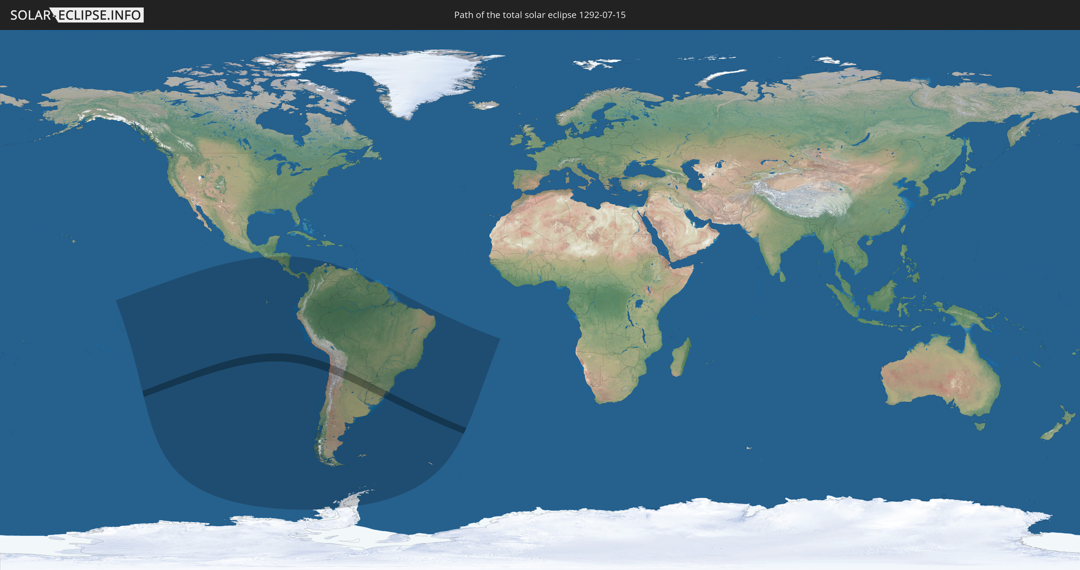
Die Sonnenfinsternis am 07/15/1292 kann man in 23 Ländern als partielle Sonnenfinsternis beobachten.
Der Finsternispfad verläuft durch 6 Länder. Nur in diesen Ländern ist sie als total Sonnenfinsternis zu sehen.
In den folgenden Ländern ist die Sonnenfinsternis total zu sehen
 Chile
Chile
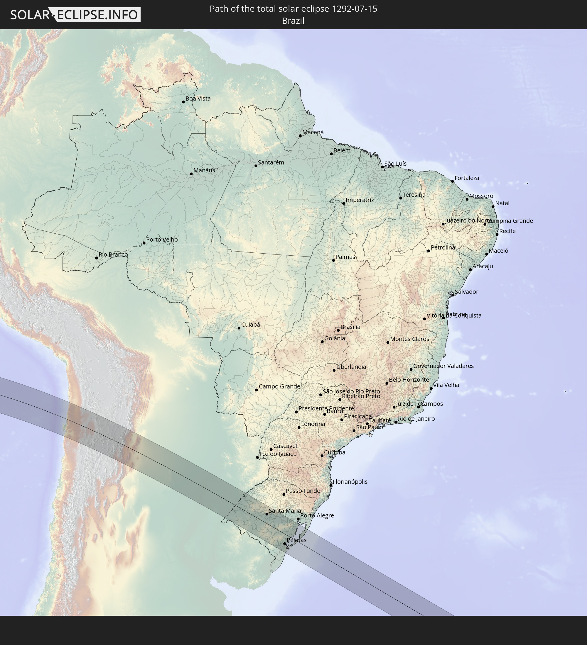 Brazil
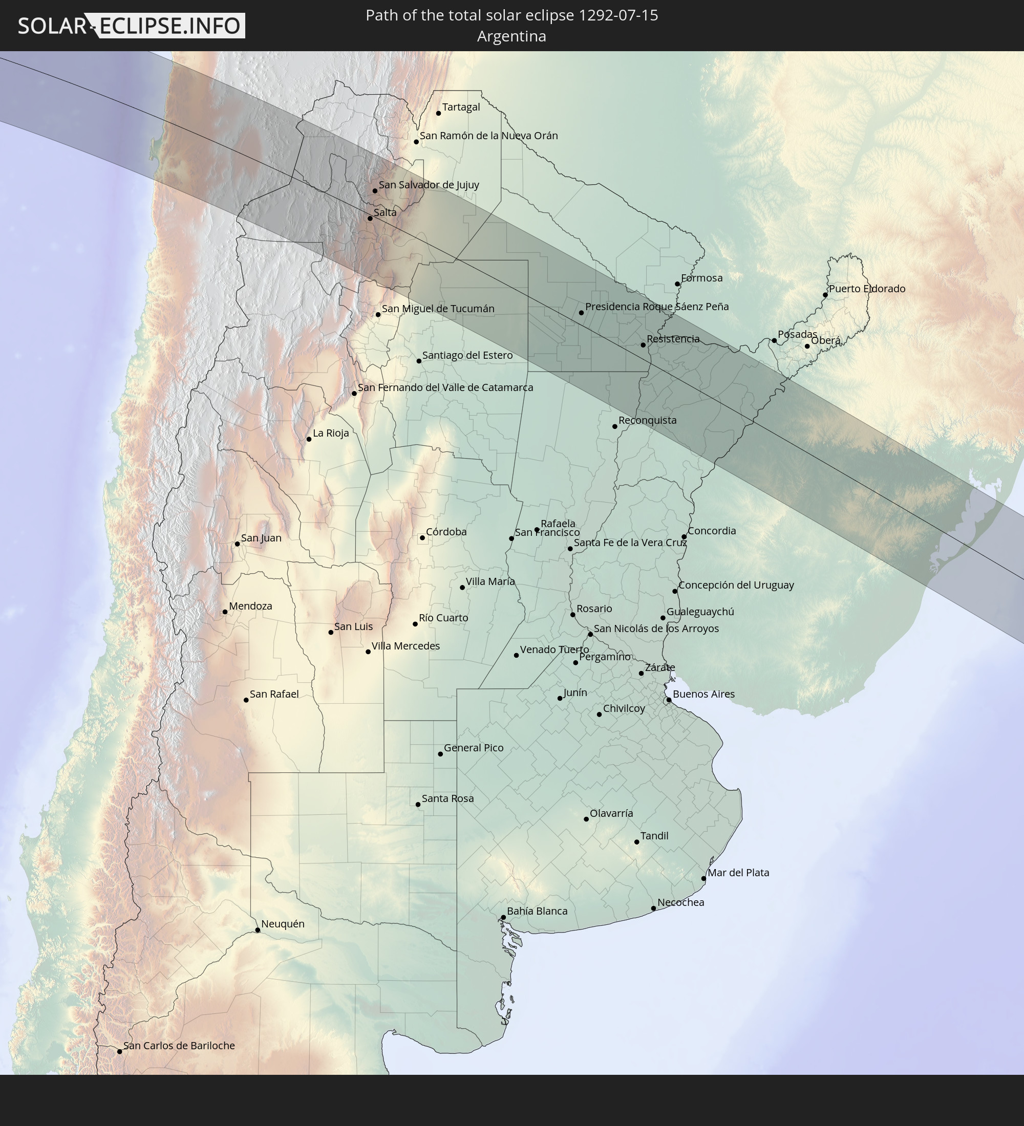 Argentina
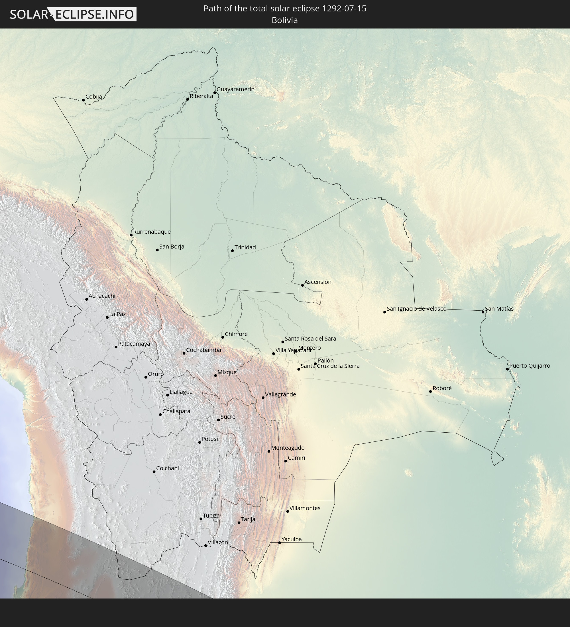 Bolivia
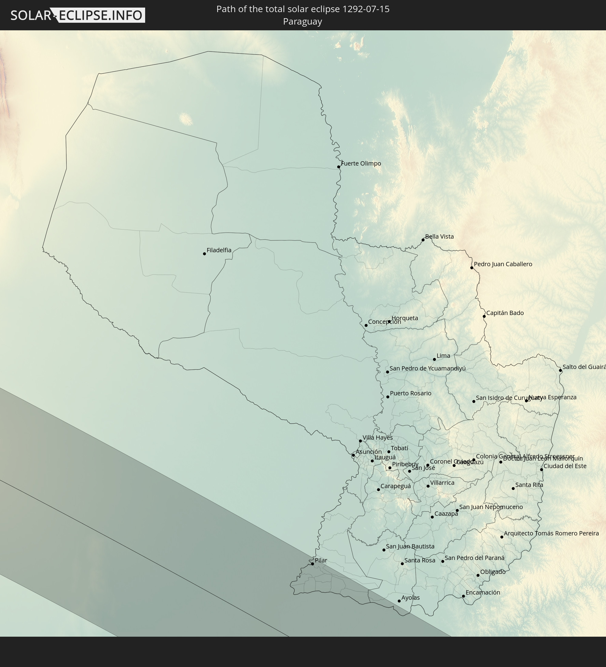 Paraguay
 Uruguay
In den folgenden Ländern ist die Sonnenfinsternis partiell zu sehen


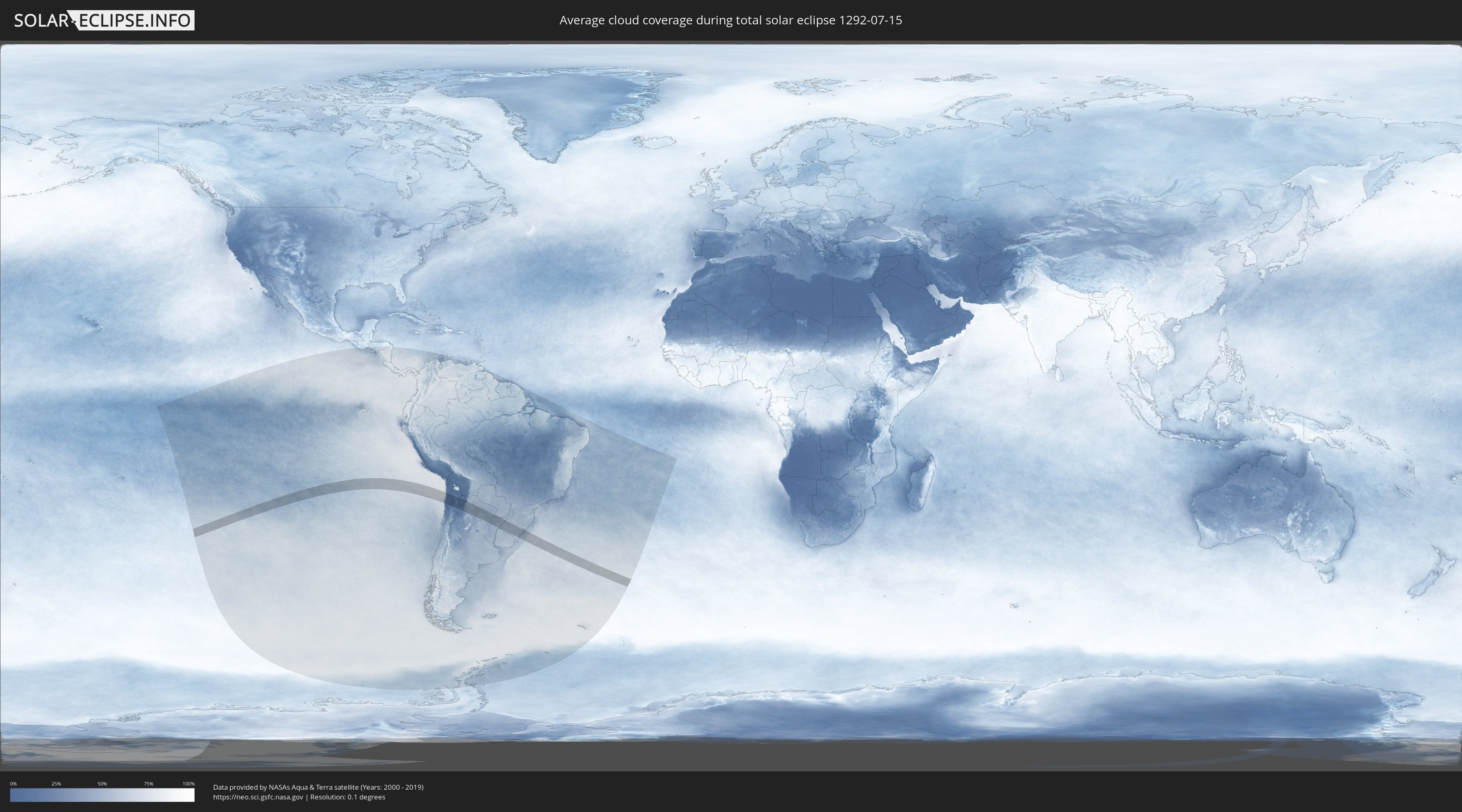
How will be the weather during the total solar eclipse on 07/15/1292?
Where is the best place to see the total solar eclipse of 07/15/1292?
The following maps show the average cloud coverage for the day of the total solar eclipse.
With the help of these maps, it is possible to find the place along the eclipse path, which has the best
chance of a cloudless sky.
Nevertheless, you should consider local circumstances and inform about the weather of your chosen
observation site.
The data is provided by NASAs satellites
AQUA and TERRA.
The cloud maps are averaged over a period of 19 years (2000 - 2019).

Detailed country maps
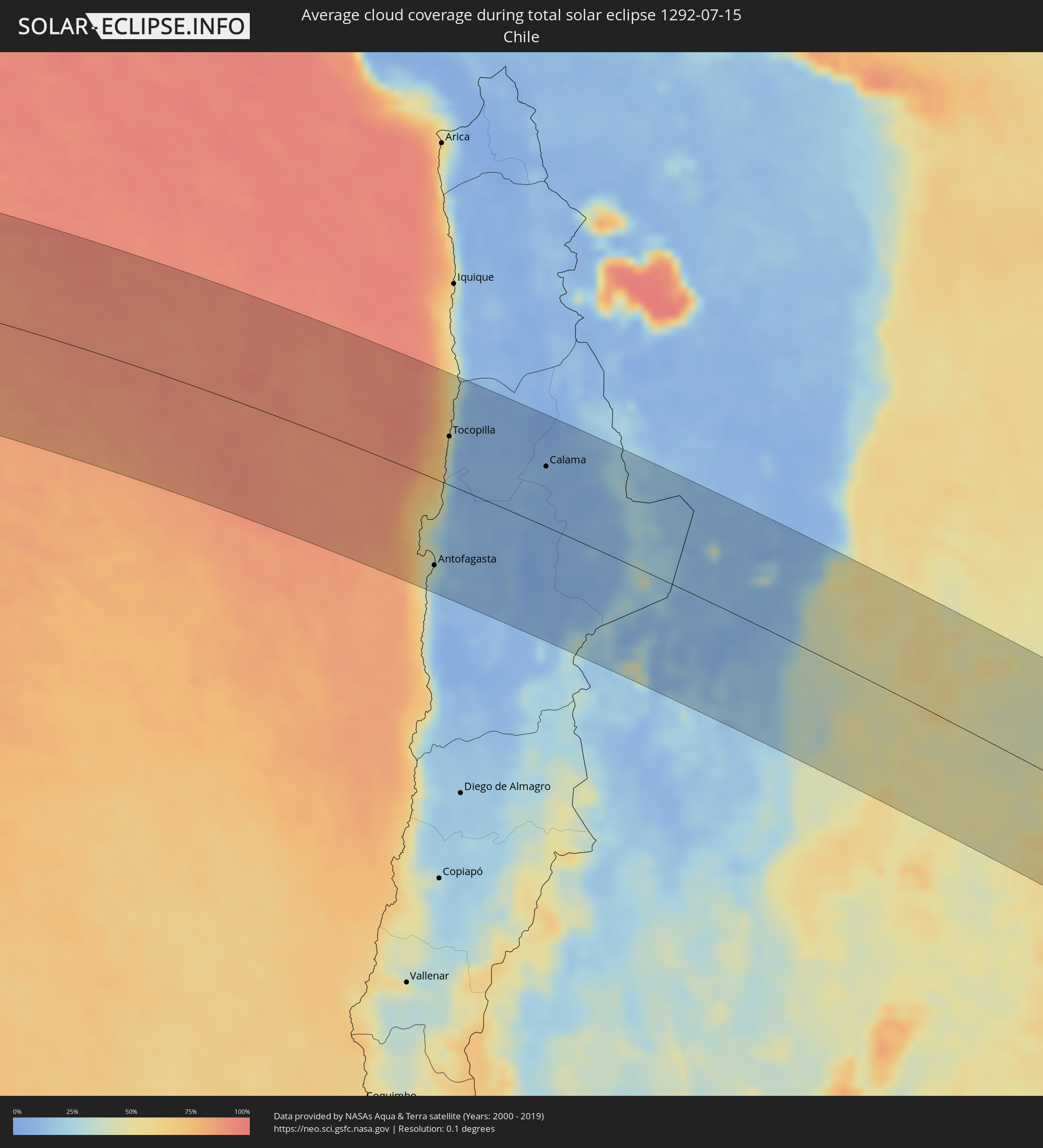 Chile
Chile
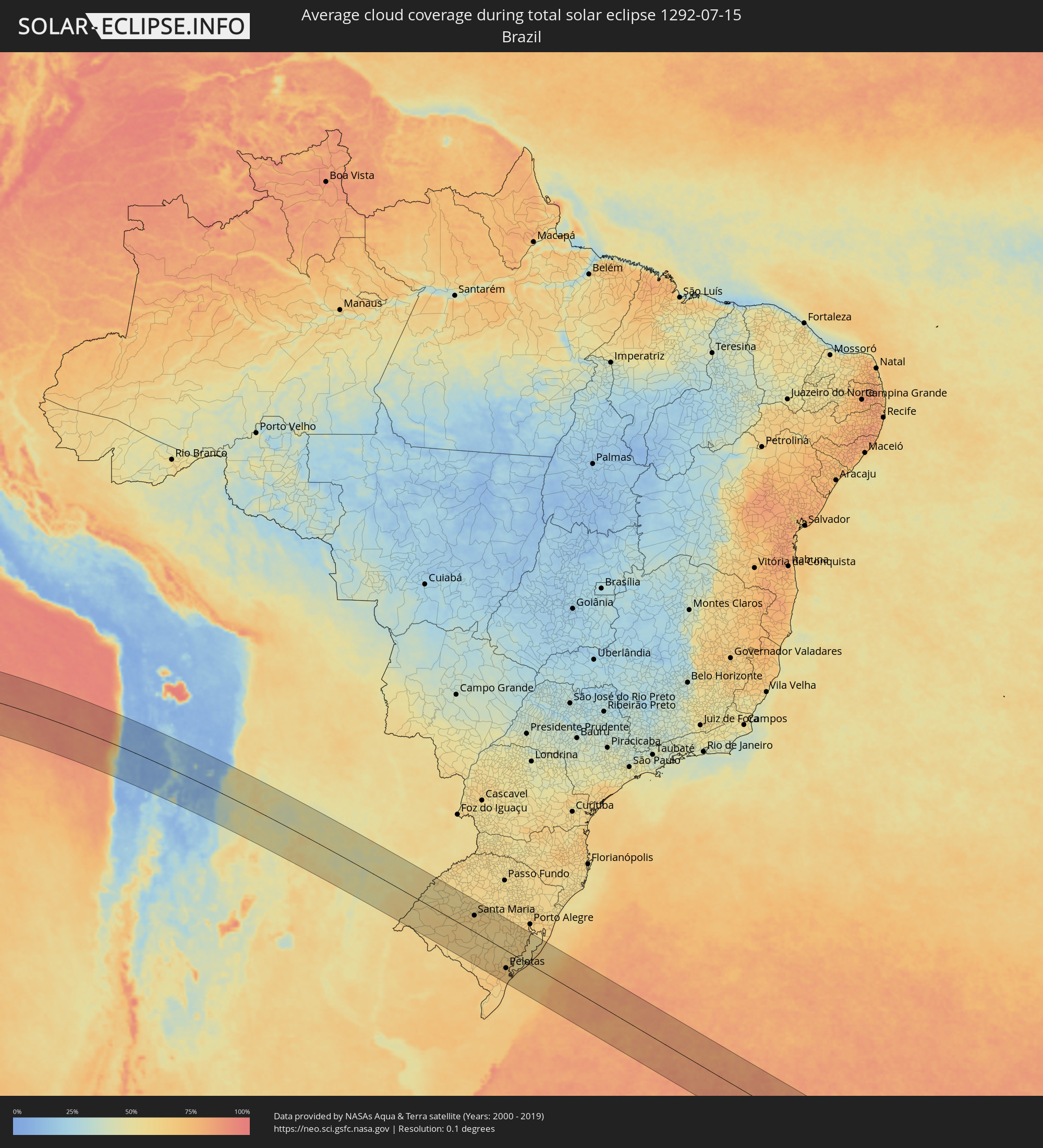 Brazil
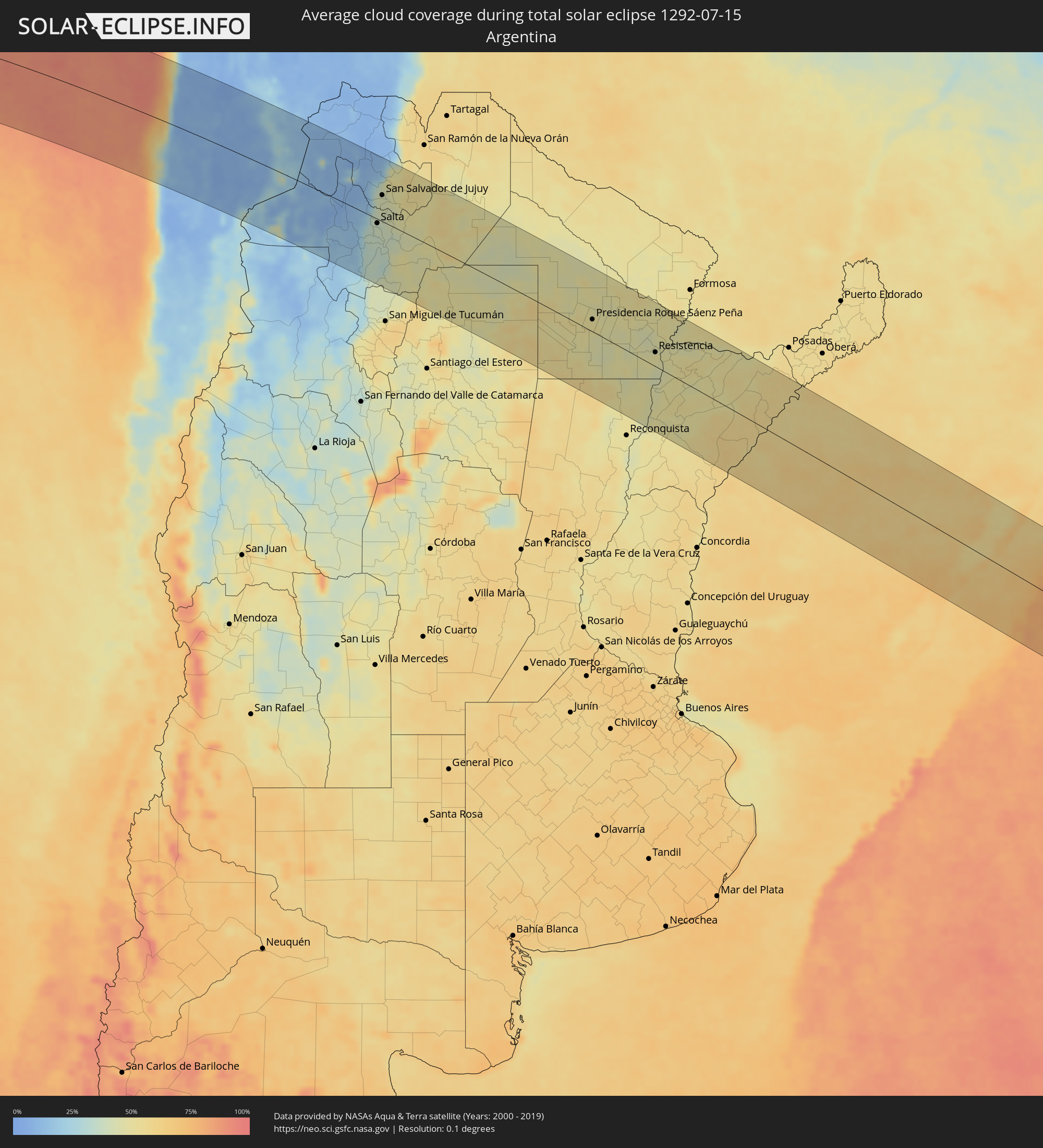 Argentina
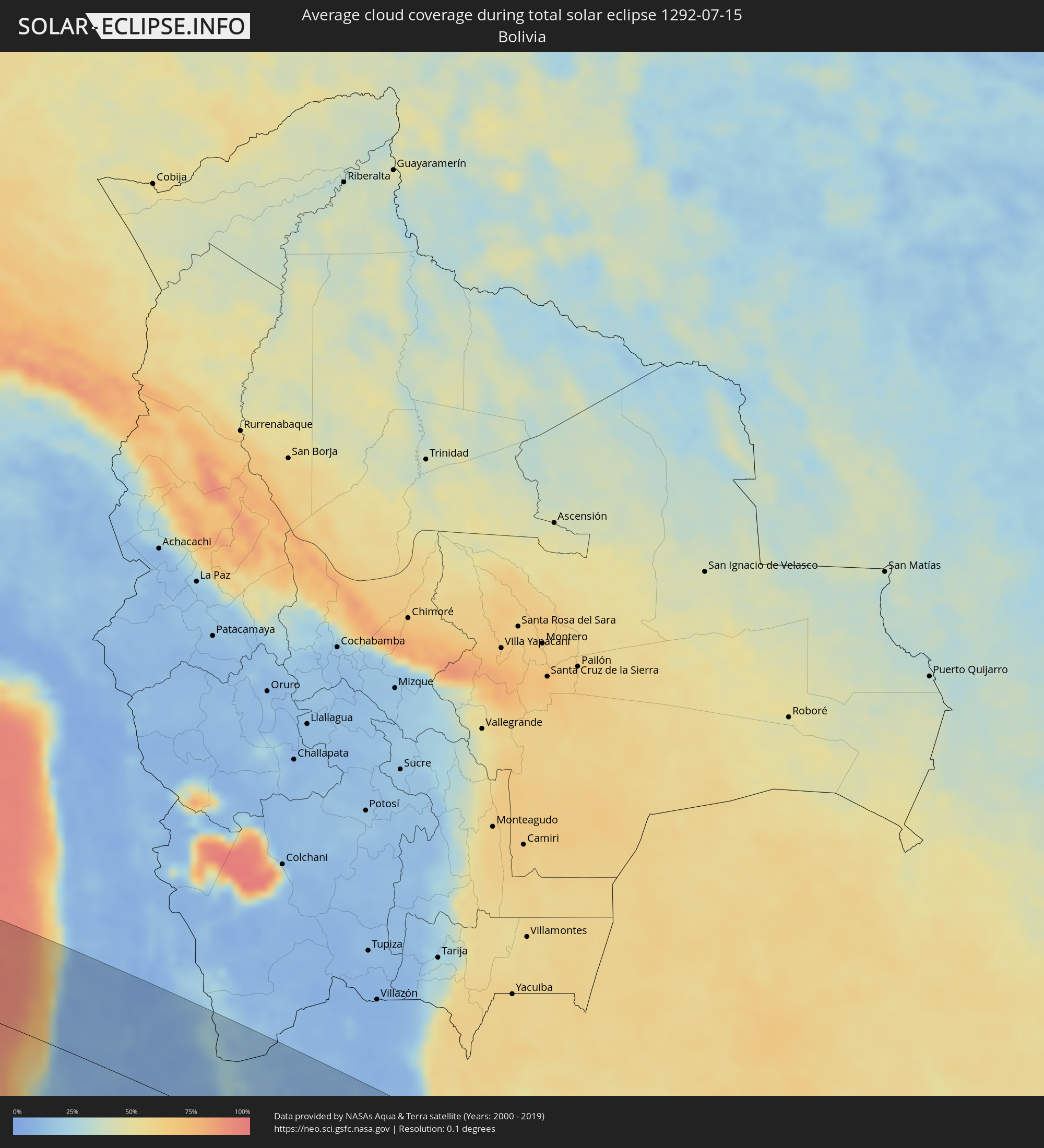 Bolivia
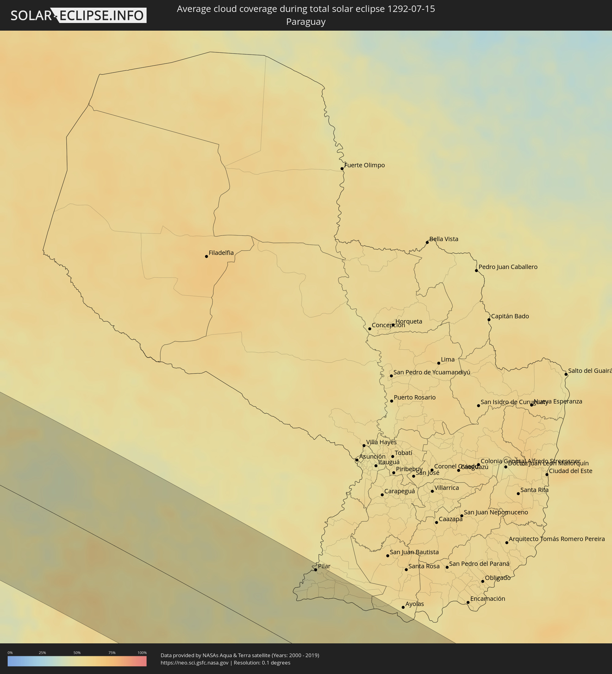 Paraguay
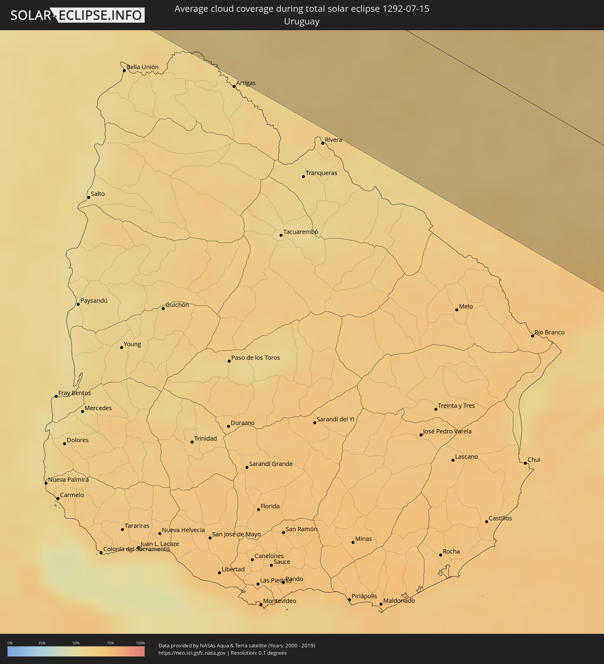 Uruguay
Cities inside the path of the eclipse
The following table shows all locations with a population of more than 5,000 inside the eclipse path. Cities which have more than 100,000 inhabitants are marked bold. A click at the locations opens a detailed map.
| City | Type | Eclipse duration | Local time of max. eclipse | Distance to central line | Ø Cloud coverage |
 Antofagasta, Antofagasta
|
total | - | 12:48:56 UTC-04:42 | 107 km | 26% |
|
Tocopilla, Antofagasta
|
total | - | 12:48:58 UTC-04:42 | 61 km | 44% |
|
Calama, Antofagasta
|
total | - | 12:52:20 UTC-04:42 | 74 km | 8% |
 Chicoana, Salta Province
|
total | - | 13:27:02 UTC-04:16 | 46 km | 36% |
|
El Carril, Salta Province
|
total | - | 13:27:08 UTC-04:16 | 41 km | 36% |
|
Salta, Salta Province
|
total | - | 13:27:16 UTC-04:16 | 9 km | 40% |
|
San Salvador de Jujuy, Jujuy Province
|
total | - | 13:27:26 UTC-04:16 | 55 km | 42% |
|
San Pedro, Jujuy Province
|
total | - | 13:28:26 UTC-04:16 | 71 km | 50% |
|
Fraile Pintado, Jujuy Province
|
total | - | 13:28:32 UTC-04:16 | 103 km | 52% |
|
Libertador General San Martín, Jujuy Province
|
total | - | 13:28:32 UTC-04:16 | 117 km | 55% |
|
El Galpón, Salta Province
|
total | - | 13:29:04 UTC-04:16 | 34 km | 47% |
|
Las Lajitas, Salta Province
|
total | - | 13:29:53 UTC-04:16 | 54 km | 50% |
|
Joaquín V. González, Salta Province
|
total | - | 13:30:05 UTC-04:16 | 17 km | 50% |
|
El Quebrachal, Salta Province
|
total | - | 13:30:22 UTC-04:16 | 3 km | 49% |
|
Apolinario Saravia, Salta Province
|
total | - | 13:30:25 UTC-04:16 | 90 km | 54% |
|
Taco Pozo, Chaco Province
|
total | - | 13:32:07 UTC-04:16 | 6 km | 47% |
|
General Pinedo, Chaco Province
|
total | - | 13:36:21 UTC-04:16 | 68 km | 52% |
|
Charata, Chaco Province
|
total | - | 13:36:33 UTC-04:16 | 53 km | 54% |
|
Pampa del Infierno, Chaco Province
|
total | - | 13:36:34 UTC-04:16 | 17 km | 50% |
|
Santa Sylvina, Chaco Province
|
total | - | 13:36:38 UTC-04:16 | 111 km | 55% |
|
Las Breñas, Chaco Province
|
total | - | 13:36:46 UTC-04:16 | 36 km | 50% |
|
Corzuela, Chaco Province
|
total | - | 13:36:59 UTC-04:16 | 17 km | 49% |
|
Coronel Du Graty, Chaco Province
|
total | - | 13:37:05 UTC-04:16 | 86 km | 53% |
|
Campo Largo, Chaco Province
|
total | - | 13:37:15 UTC-04:16 | 4 km | 51% |
|
Villa Ángela, Chaco Province
|
total | - | 13:37:29 UTC-04:16 | 66 km | 54% |
|
San Bernardo, Chaco Province
|
total | - | 13:37:30 UTC-04:16 | 38 km | 49% |
|
Castelli, Chaco Province
|
total | - | 13:37:41 UTC-04:16 | 98 km | 54% |
|
Presidencia Roque Sáenz Peña, Chaco Province
|
total | - | 13:38:03 UTC-04:16 | 25 km | 51% |
|
Tres Isletas, Chaco Province
|
total | - | 13:38:04 UTC-04:16 | 68 km | 50% |
|
Villa Berthet, Chaco Province
|
total | - | 13:38:05 UTC-04:16 | 24 km | 46% |
|
Quitilipi, Chaco Province
|
total | - | 13:38:29 UTC-04:16 | 27 km | 48% |
|
Machagai, Chaco Province
|
total | - | 13:38:49 UTC-04:16 | 29 km | 47% |
|
Pampa del Indio, Chaco Province
|
total | - | 13:39:05 UTC-04:16 | 120 km | 52% |
|
Presidencia de la Plaza, Chaco Province
|
total | - | 13:39:13 UTC-04:16 | 32 km | 45% |
|
El Colorado, Formosa Province
|
total | - | 13:40:08 UTC-04:16 | 122 km | 53% |
|
Villa Ocampo, Santa Fe Province
|
total | - | 13:40:04 UTC-04:16 | 89 km | 50% |
|
General José de San Martín, Chaco Province
|
total | - | 13:40:12 UTC-04:16 | 101 km | 52% |
|
Las Toscas, Santa Fe Province
|
total | - | 13:40:15 UTC-04:16 | 72 km | 50% |
|
Santa Lucía, Corrientes Province
|
total | - | 13:40:29 UTC-04:16 | 126 km | 48% |
|
Puerto Tirol, Chaco Province
|
total | - | 13:40:40 UTC-04:16 | 32 km | 48% |
|
Resistencia, Chaco Province
|
total | - | 13:40:50 UTC-04:16 | 28 km | 48% |
|
Puerto Vilelas, Chaco Province
|
total | - | 13:40:55 UTC-04:16 | 25 km | 47% |
|
San Lorenzo, Corrientes Province
|
total | - | 13:41:12 UTC-04:16 | 27 km | 49% |
|
La Leonesa, Chaco Province
|
total | - | 13:41:24 UTC-04:16 | 83 km | 50% |
|
Saladas, Corrientes Province
|
total | - | 13:41:27 UTC-04:16 | 32 km | 52% |
|
San Luis del Palmar, Corrientes Province
|
total | - | 13:41:39 UTC-04:16 | 44 km | 49% |
 Pilar, Ñeembucú
|
total | - | 14:08:18 UTC-03:50 | 119 km | 49% |
|
Mburucuyá, Corrientes Province
|
total | - | 13:42:12 UTC-04:16 | 8 km | 49% |
|
Santa Rosa, Corrientes Province
|
total | - | 13:42:23 UTC-04:16 | 8 km | 51% |
|
Mercedes, Corrientes Province
|
total | - | 13:42:21 UTC-04:16 | 95 km | 54% |
 Uruguaiana, Rio Grande do Sul
|
total | - | 14:54:21 UTC-03:06 | 103 km | 61% |
|
Paso de los Libres, Corrientes Province
|
total | - | 13:44:01 UTC-04:16 | 99 km | 58% |
|
La Cruz, Corrientes Province
|
total | - | 13:44:53 UTC-04:16 | 25 km | 59% |
|
Itaqui, Rio Grande do Sul
|
total | - | 14:55:23 UTC-03:06 | 16 km | 56% |
|
Santo Tomé, Corrientes Province
|
total | - | 13:46:02 UTC-04:16 | 64 km | 55% |
|
Gobernador Ingeniero Valentín Virasoro, Corrientes Province
|
total | - | 13:46:07 UTC-04:16 | 113 km | 57% |
|
São Borja, Rio Grande do Sul
|
total | - | 14:56:25 UTC-03:06 | 55 km | 54% |
|
Alegrete, Rio Grande do Sul
|
total | - | 14:56:34 UTC-03:06 | 43 km | 62% |
|
São Francisco de Assis, Rio Grande do Sul
|
total | - | 14:57:43 UTC-03:06 | 12 km | 62% |
|
Rosário do Sul, Rio Grande do Sul
|
total | - | 14:57:55 UTC-03:06 | 46 km | 64% |
|
Santiago, Rio Grande do Sul
|
total | - | 14:58:13 UTC-03:06 | 59 km | 56% |
|
Cacequi, Rio Grande do Sul
|
total | - | 14:58:09 UTC-03:06 | 5 km | 61% |
|
Dom Pedrito, Rio Grande do Sul
|
total | - | 14:58:07 UTC-03:06 | 104 km | 61% |
|
São Gabriel, Rio Grande do Sul
|
total | - | 14:58:51 UTC-03:06 | 25 km | 63% |
|
São Pedro do Sul, Rio Grande do Sul
|
total | - | 14:59:15 UTC-03:06 | 51 km | 63% |
|
Bagé, Rio Grande do Sul
|
total | - | 14:58:56 UTC-03:06 | 110 km | 64% |
|
Tupanciretã, Rio Grande do Sul
|
total | - | 14:59:55 UTC-03:06 | 120 km | 59% |
|
Santa Maria, Rio Grande do Sul
|
total | - | 14:59:50 UTC-03:06 | 63 km | 63% |
|
Júlio de Castilhos, Rio Grande do Sul
|
total | - | 15:00:08 UTC-03:06 | 113 km | 60% |
|
São Sepé, Rio Grande do Sul
|
total | - | 15:00:05 UTC-03:06 | 29 km | 60% |
|
Caçapava do Sul, Rio Grande do Sul
|
total | - | 15:00:07 UTC-03:06 | 1 km | 60% |
|
Pinheiro Machado, Rio Grande do Sul
|
total | - | 14:59:59 UTC-03:06 | 98 km | 64% |
|
Cachoeira do Sul, Rio Grande do Sul
|
total | - | 15:01:10 UTC-03:06 | 73 km | 62% |
|
Candelária, Rio Grande do Sul
|
total | - | 15:01:25 UTC-03:06 | 114 km | 59% |
|
Canguçu, Rio Grande do Sul
|
total | - | 15:01:06 UTC-03:06 | 47 km | 62% |
|
Encruzilhada do Sul, Rio Grande do Sul
|
total | - | 15:01:35 UTC-03:06 | 42 km | 57% |
|
Rio Pardo, Rio Grande do Sul
|
total | - | 15:01:57 UTC-03:06 | 103 km | 61% |
|
Pelotas, Rio Grande do Sul
|
total | - | 15:01:29 UTC-03:06 | 67 km | 67% |
|
Rio Grande, Rio Grande do Sul
|
total | - | 15:01:45 UTC-03:06 | 80 km | 65% |
|
São Lourenço do Sul, Rio Grande do Sul
|
total | - | 15:02:09 UTC-03:06 | 10 km | 61% |
|
Butiá, Rio Grande do Sul
|
total | - | 15:02:32 UTC-03:06 | 110 km | 61% |
|
Camaquã, Rio Grande do Sul
|
total | - | 15:02:33 UTC-03:06 | 47 km | 64% |
|
Tapes, Rio Grande do Sul
|
total | - | 15:03:12 UTC-03:06 | 84 km | 61% |