Annular solar eclipse of 01/09/1293
| Day of week: | Friday |
| Maximum duration of eclipse: | 11m36s |
| Maximum width of eclipse path: | 312 km |
| Saros cycle: | 110 |
| Coverage: | 91.9% |
| Magnitude: | 0.9185 |
| Gamma: | 0.1233 |
Wo kann man die Sonnenfinsternis vom 01/09/1293 sehen?

Die Sonnenfinsternis am 01/09/1293 kann man in 50 Ländern als partielle Sonnenfinsternis beobachten.
Der Finsternispfad verläuft durch 5 Länder. Nur in diesen Ländern ist sie als annular Sonnenfinsternis zu sehen.
In den folgenden Ländern ist die Sonnenfinsternis annular zu sehen
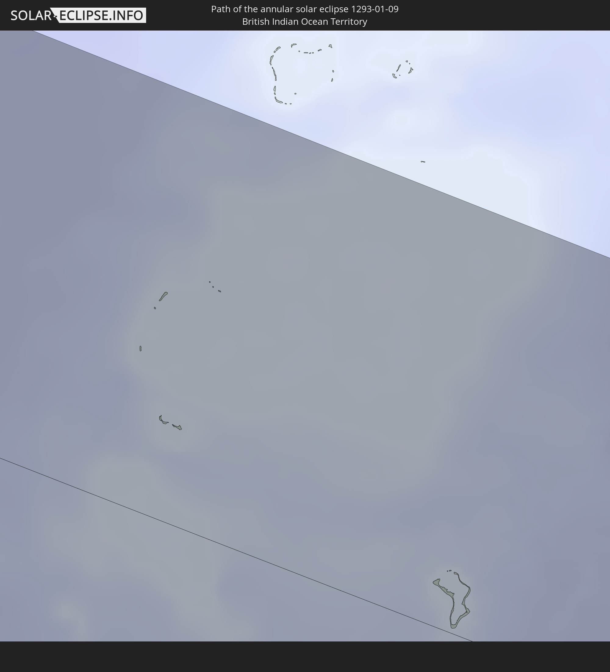 British Indian Ocean Territory
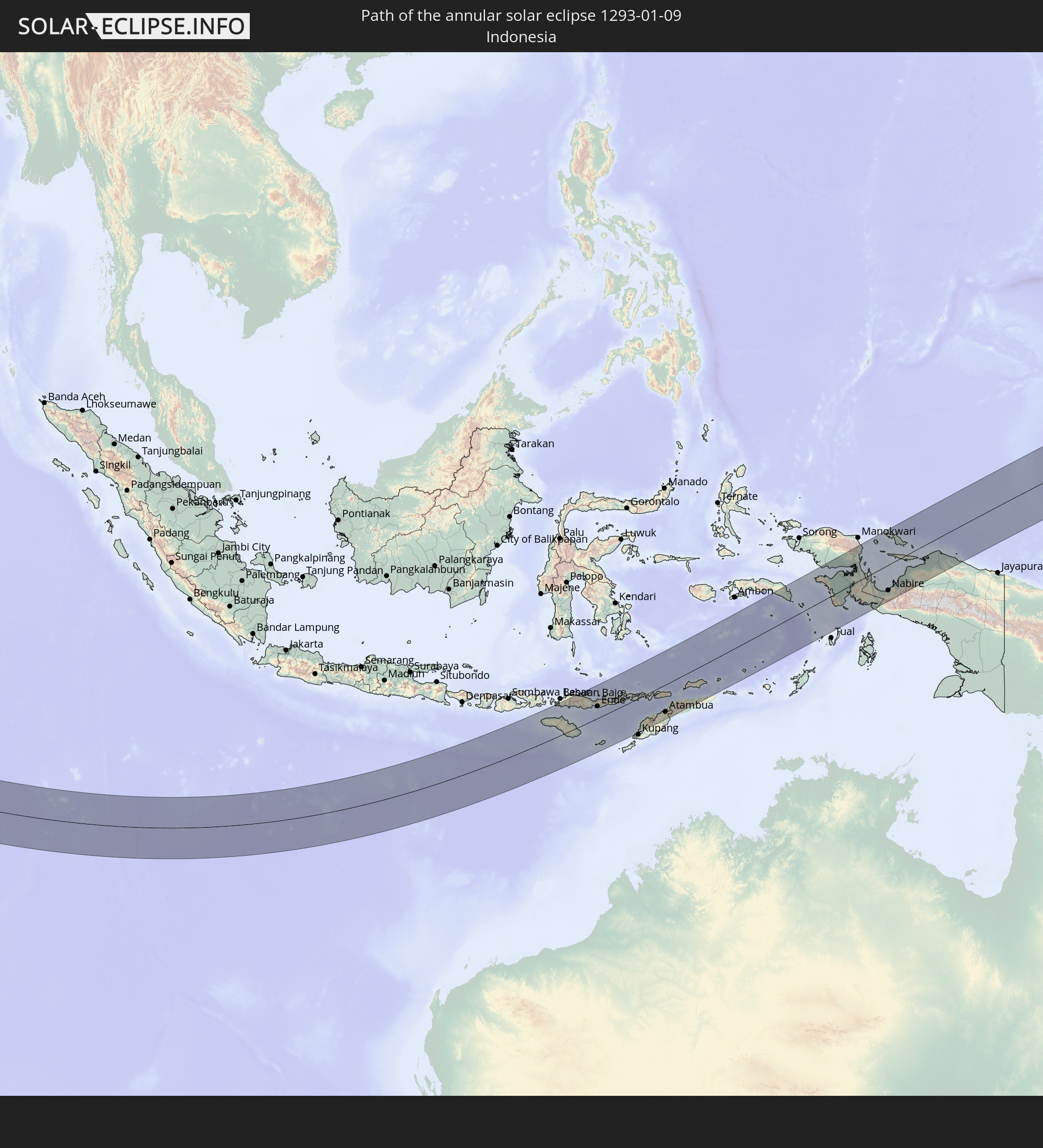 Indonesia
 East Timor
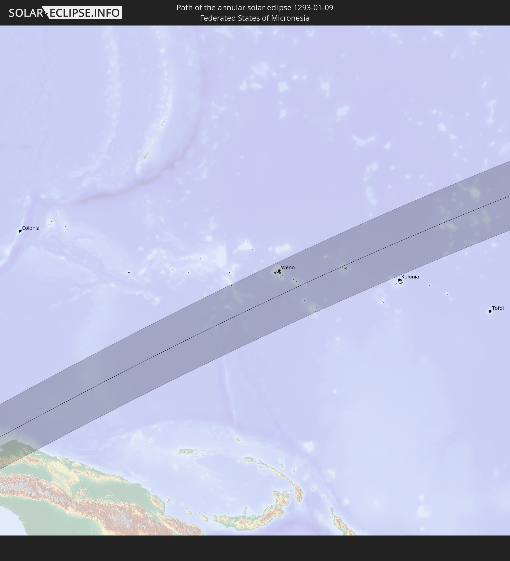 Federated States of Micronesia
 Marshall Islands
In den folgenden Ländern ist die Sonnenfinsternis partiell zu sehen
 Fiji
Fiji
 Kiribati
 South Africa
 Mozambique
 French Southern and Antarctic Lands
 Yemen
Yemen
 Madagascar
 Comoros
 Iran
Iran
 Mayotte
 Seychelles
 Oman
Oman
 Réunion
 Mauritius
 Afghanistan
 Pakistan
 India
India
 British Indian Ocean Territory
 Maldives
 China
China
 Sri Lanka
 Bangladesh
 Myanmar
 Indonesia
 Cocos Islands
 Thailand
 Malaysia
 Laos
Laos
 Vietnam
 Cambodia
 Singapore
 Christmas Island
 Australia
 Macau
Macau
 Hong Kong
 Brunei
 Taiwan
 Philippines
 Japan
Japan
 East Timor
 Palau
Palau
 Federated States of Micronesia
 Papua New Guinea
 Guam
Guam
 Northern Mariana Islands
 Solomon Islands
 New Caledonia
 Marshall Islands
 Vanuatu
 Nauru
Nauru
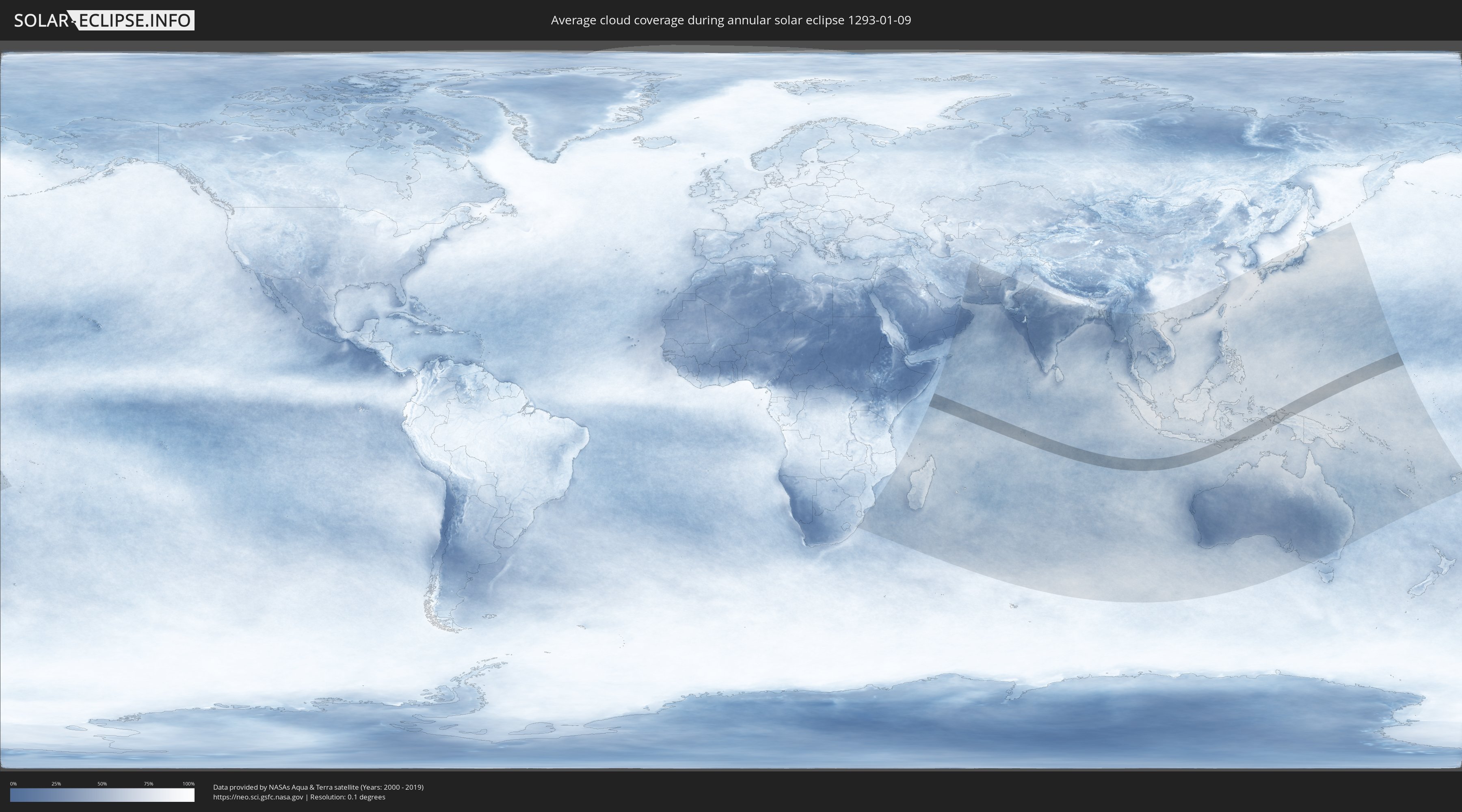
How will be the weather during the annular solar eclipse on 01/09/1293?
Where is the best place to see the annular solar eclipse of 01/09/1293?
The following maps show the average cloud coverage for the day of the annular solar eclipse.
With the help of these maps, it is possible to find the place along the eclipse path, which has the best
chance of a cloudless sky.
Nevertheless, you should consider local circumstances and inform about the weather of your chosen
observation site.
The data is provided by NASAs satellites
AQUA and TERRA.
The cloud maps are averaged over a period of 19 years (2000 - 2019).

Detailed country maps
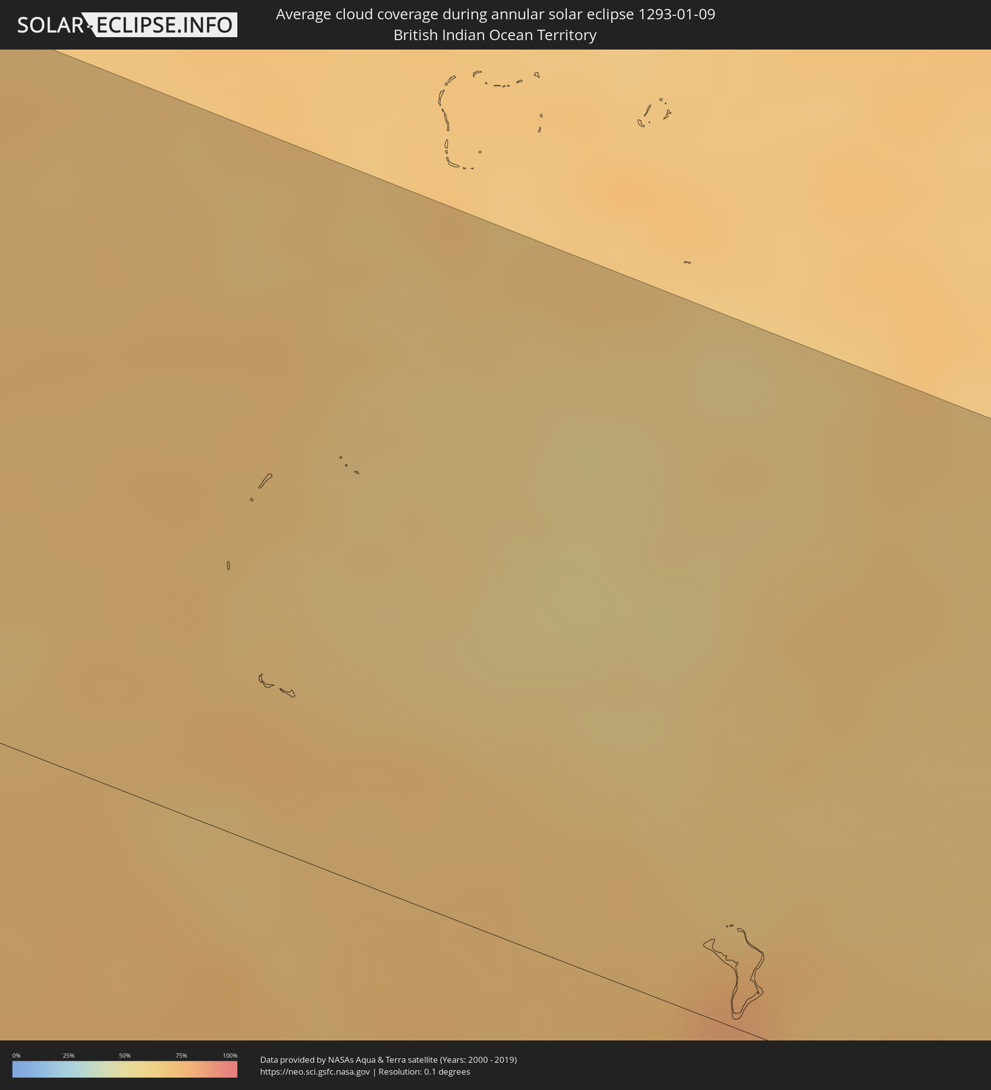 British Indian Ocean Territory
 Indonesia
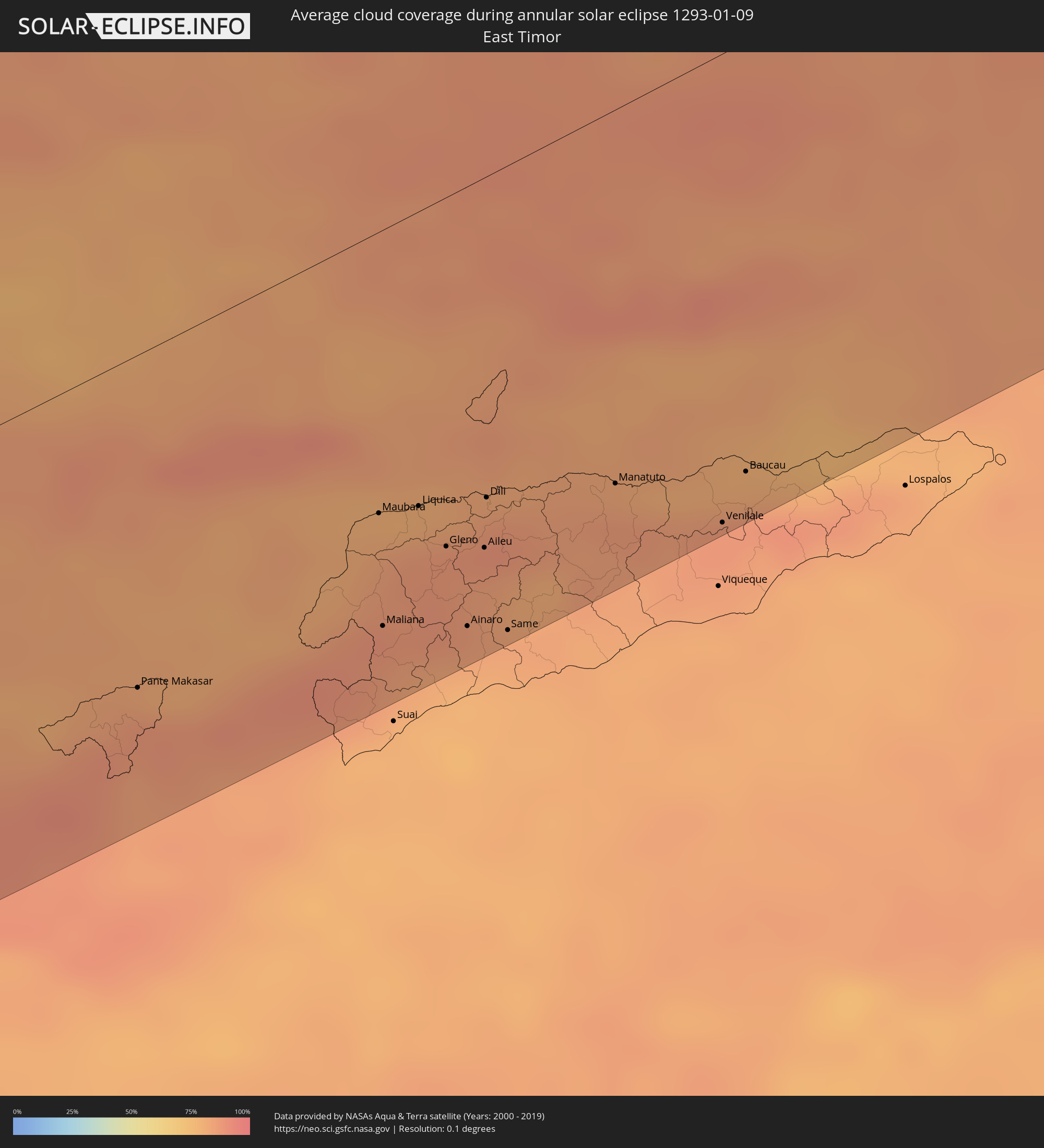 East Timor
 Federated States of Micronesia
 Marshall Islands
Cities inside the path of the eclipse
The following table shows all locations with a population of more than 5,000 inside the eclipse path. Cities which have more than 100,000 inhabitants are marked bold. A click at the locations opens a detailed map.
| City | Type | Eclipse duration | Local time of max. eclipse | Distance to central line | Ø Cloud coverage |
|
Waingapu, East Nusa Tenggara
|
annular | - | 13:40:51 UTC+07:57 | 39 km | 89% |
|
Ruteng, East Nusa Tenggara
|
annular | - | 13:42:53 UTC+07:57 | 135 km | 93% |
|
Ende, East Nusa Tenggara
|
annular | - | 13:46:13 UTC+07:57 | 56 km | 84% |
|
Maumere, East Nusa Tenggara
|
annular | - | 13:48:08 UTC+07:57 | 52 km | 86% |
|
Pante Makasar, Oecusse
|
annular | - | 14:18:07 UTC+08:22 | 112 km | 87% |
|
Kefamenanu, East Nusa Tenggara
|
annular | - | 13:53:18 UTC+07:57 | 141 km | 86% |
|
Atambua, East Nusa Tenggara
|
annular | - | 13:54:51 UTC+07:57 | 127 km | 90% |
|
Maubara, Liquiçá
|
annular | - | 14:21:04 UTC+08:22 | 94 km | 82% |
|
Maliana, Bobonaro
|
annular | - | 14:20:35 UTC+08:22 | 132 km | 87% |
|
Liquica, Liquiçá
|
annular | - | 14:21:27 UTC+08:22 | 99 km | 85% |
|
Gleno, Ermera District
|
annular | - | 14:21:31 UTC+08:22 | 117 km | 87% |
|
Ainaro, Ainaro
|
annular | - | 14:21:20 UTC+08:22 | 147 km | 81% |
|
Aileu, Aileu
|
annular | - | 14:21:50 UTC+08:22 | 124 km | 84% |
|
Dili, Díli
|
annular | - | 14:22:05 UTC+08:22 | 107 km | 89% |
|
Same, Manufahi
|
annular | - | 14:21:40 UTC+08:22 | 155 km | 81% |
|
Manatuto, Manatuto
|
annular | - | 14:23:15 UTC+08:22 | 125 km | 86% |
|
Venilale, Baucau
|
annular | - | 14:23:59 UTC+08:22 | 156 km | 87% |
|
Baucau, Baucau
|
annular | - | 14:24:24 UTC+08:22 | 144 km | 88% |
|
Nabire, Papua
|
annular | - | 15:49:08 UTC+09:22 | 119 km | 79% |
|
Weno, Chuuk
|
annular | - | 16:49:56 UTC+10:00 | 128 km | 82% |
|
Enewetak, Enewetak Atoll
|
annular | - | 17:53:30 UTC+11:00 | 66 km | 68% |