Total solar eclipse of 03/20/1643
| Day of week: | Friday |
| Maximum duration of eclipse: | 04m02s |
| Maximum width of eclipse path: | 186 km |
| Saros cycle: | 114 |
| Coverage: | 100% |
| Magnitude: | 1.0479 |
| Gamma: | 0.5271 |
Wo kann man die Sonnenfinsternis vom 03/20/1643 sehen?
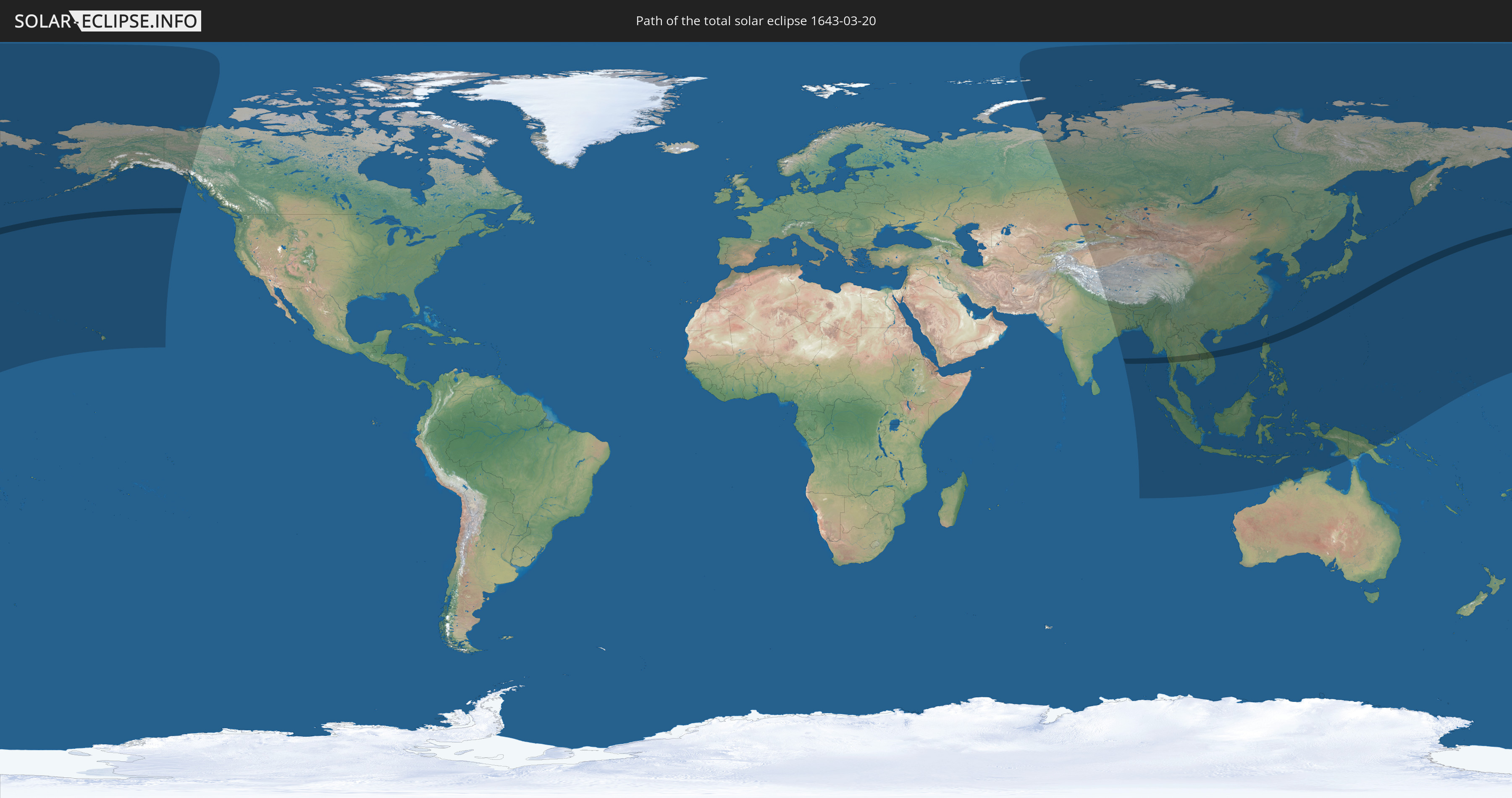
Die Sonnenfinsternis am 03/20/1643 kann man in 38 Ländern als partielle Sonnenfinsternis beobachten.
Der Finsternispfad verläuft durch 7 Länder. Nur in diesen Ländern ist sie als total Sonnenfinsternis zu sehen.
In den folgenden Ländern ist die Sonnenfinsternis total zu sehen
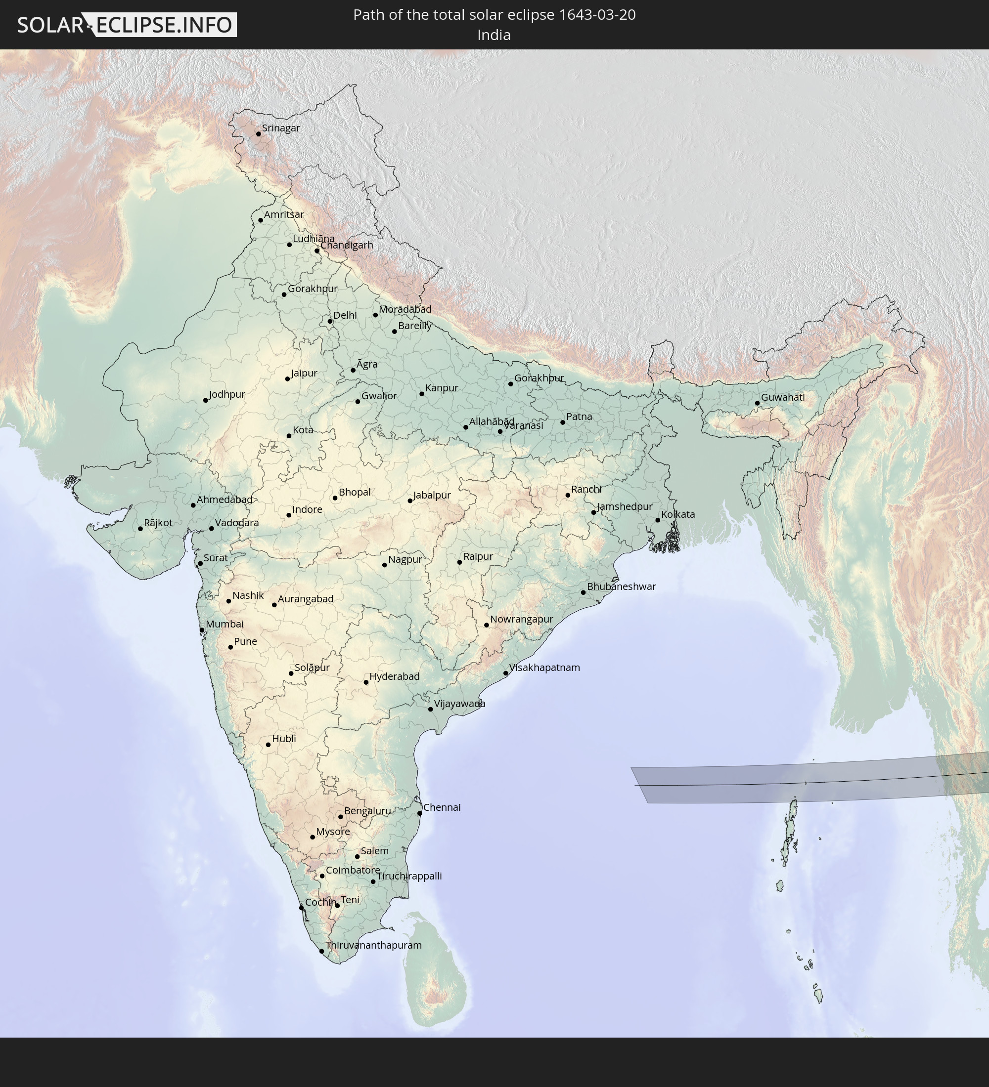 India
India
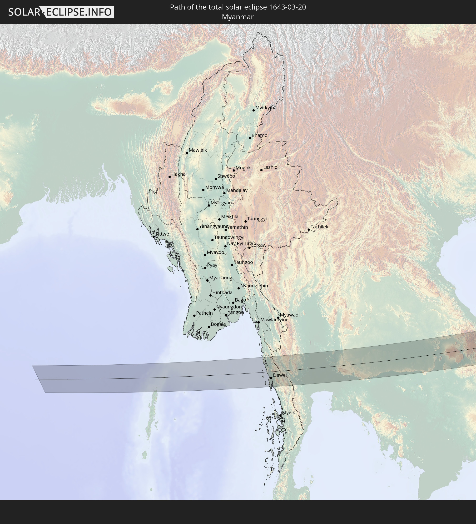 Myanmar
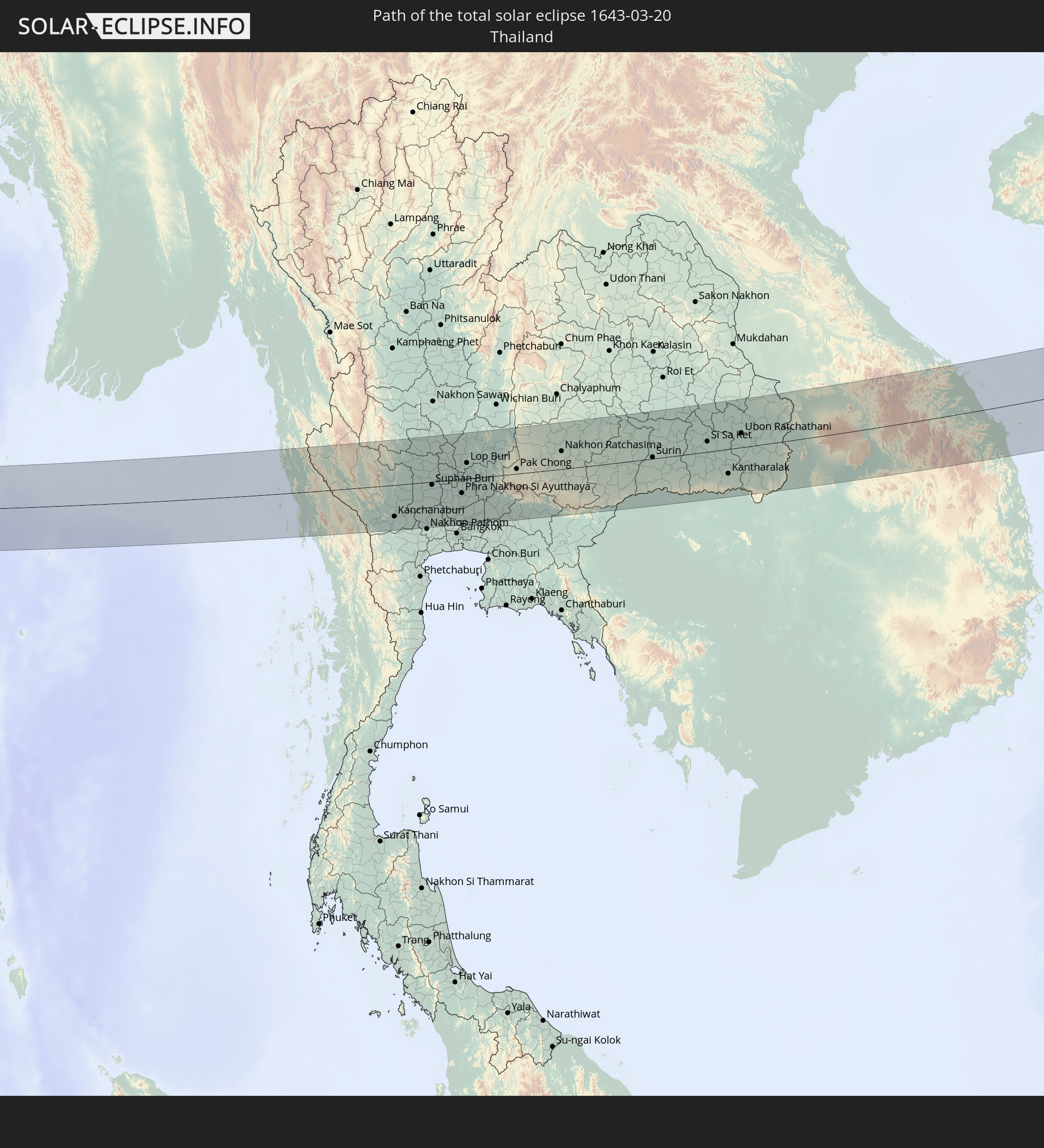 Thailand
 Laos
Laos
 Vietnam
 Cambodia
 Philippines
In den folgenden Ländern ist die Sonnenfinsternis partiell zu sehen
 Russia
 United States
 United States Minor Outlying Islands
 Canada
 Kazakhstan
 India
India
 Kyrgyzstan
 China
China
 Nepal
Nepal
 Mongolia
 Bangladesh
 Bhutan
 Myanmar
 Indonesia
 Cocos Islands
 Thailand
 Malaysia
 Laos
Laos
 Vietnam
 Cambodia
 Singapore
 Christmas Island
 Australia
 Macau
Macau
 Hong Kong
 Brunei
 Taiwan
 Philippines
 Japan
Japan
 East Timor
 North Korea
 South Korea
 Palau
Palau
 Federated States of Micronesia
 Papua New Guinea
 Guam
Guam
 Northern Mariana Islands
 Marshall Islands
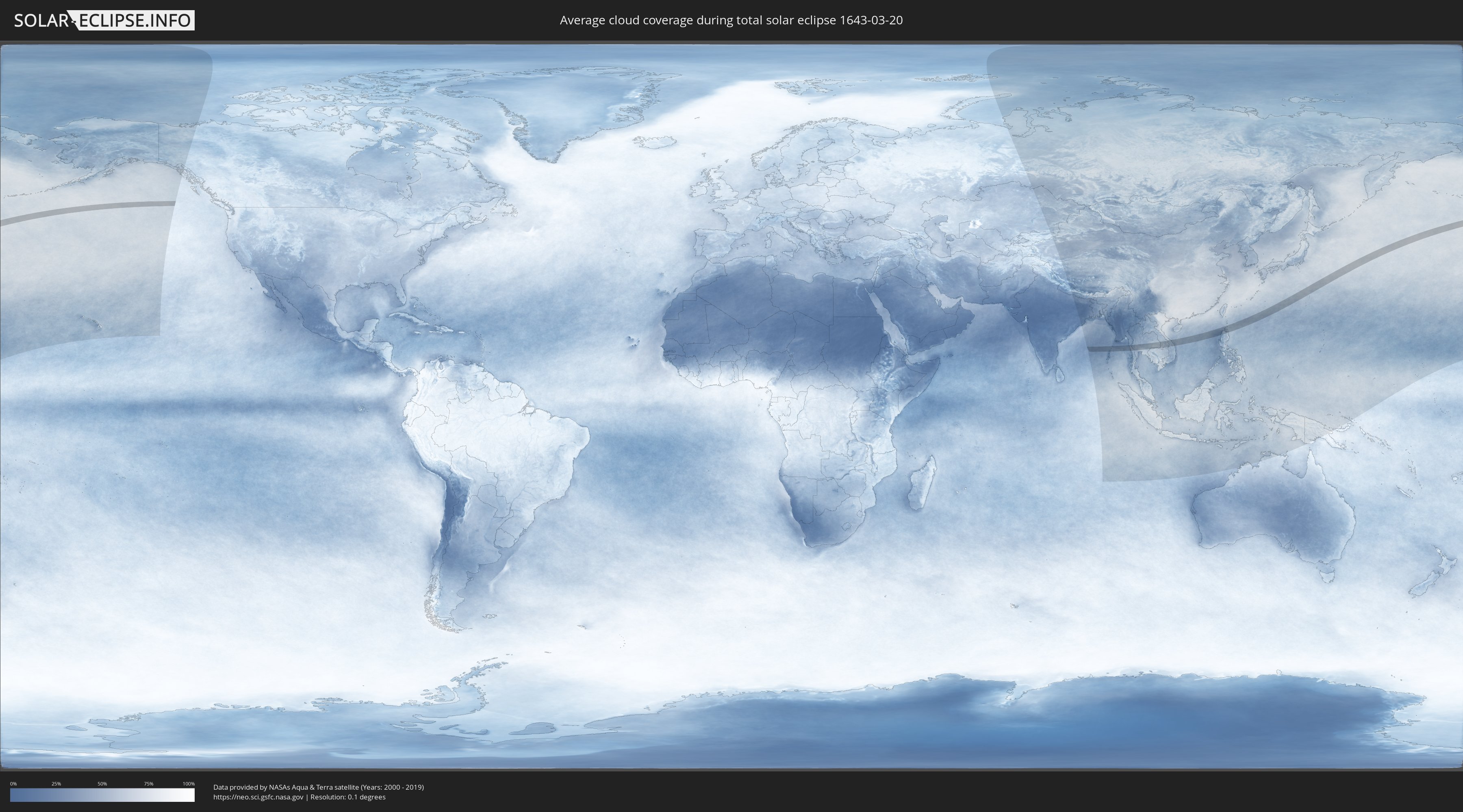
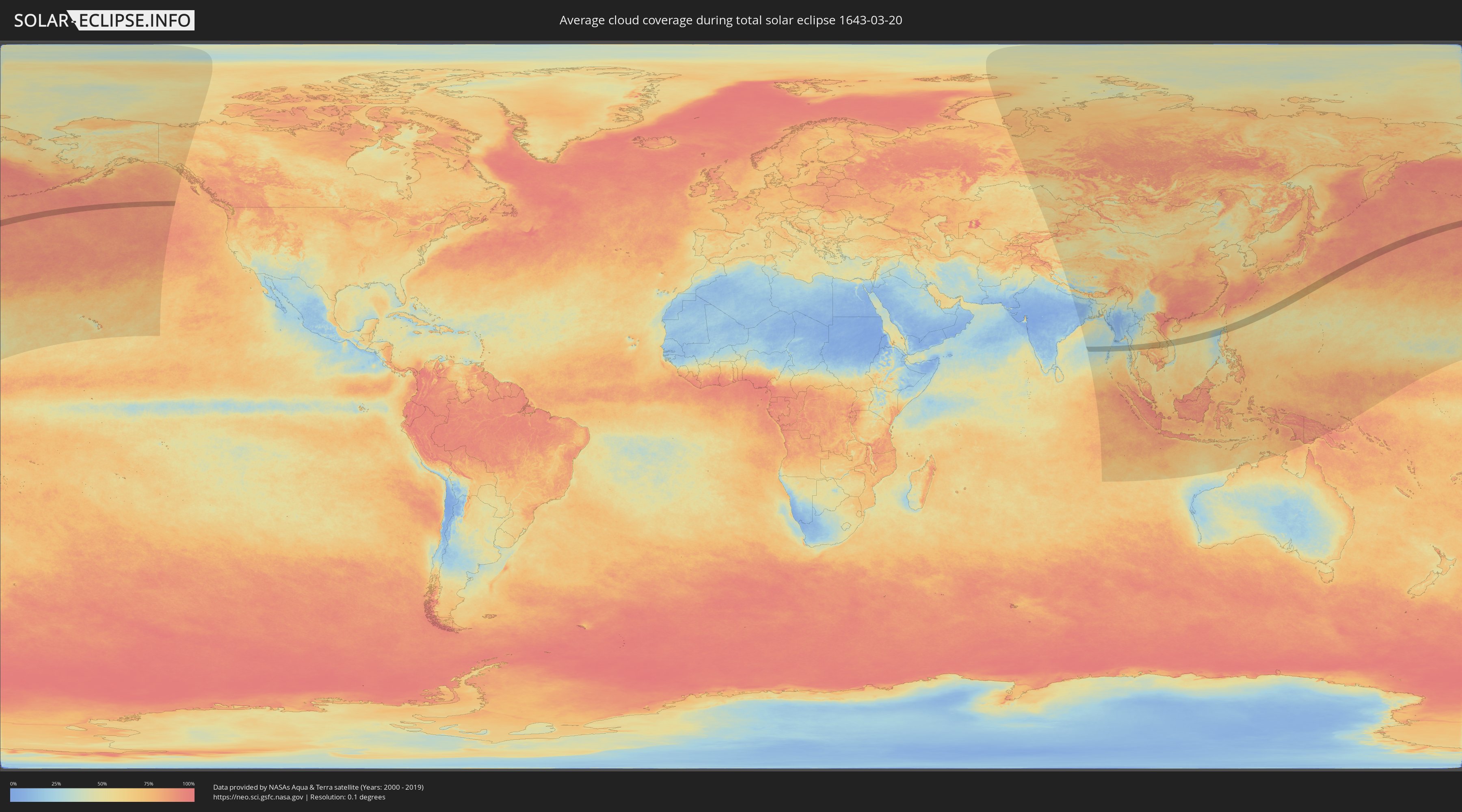
How will be the weather during the total solar eclipse on 03/20/1643?
Where is the best place to see the total solar eclipse of 03/20/1643?
The following maps show the average cloud coverage for the day of the total solar eclipse.
With the help of these maps, it is possible to find the place along the eclipse path, which has the best
chance of a cloudless sky.
Nevertheless, you should consider local circumstances and inform about the weather of your chosen
observation site.
The data is provided by NASAs satellites
AQUA and TERRA.
The cloud maps are averaged over a period of 19 years (2000 - 2019).
Detailed country maps
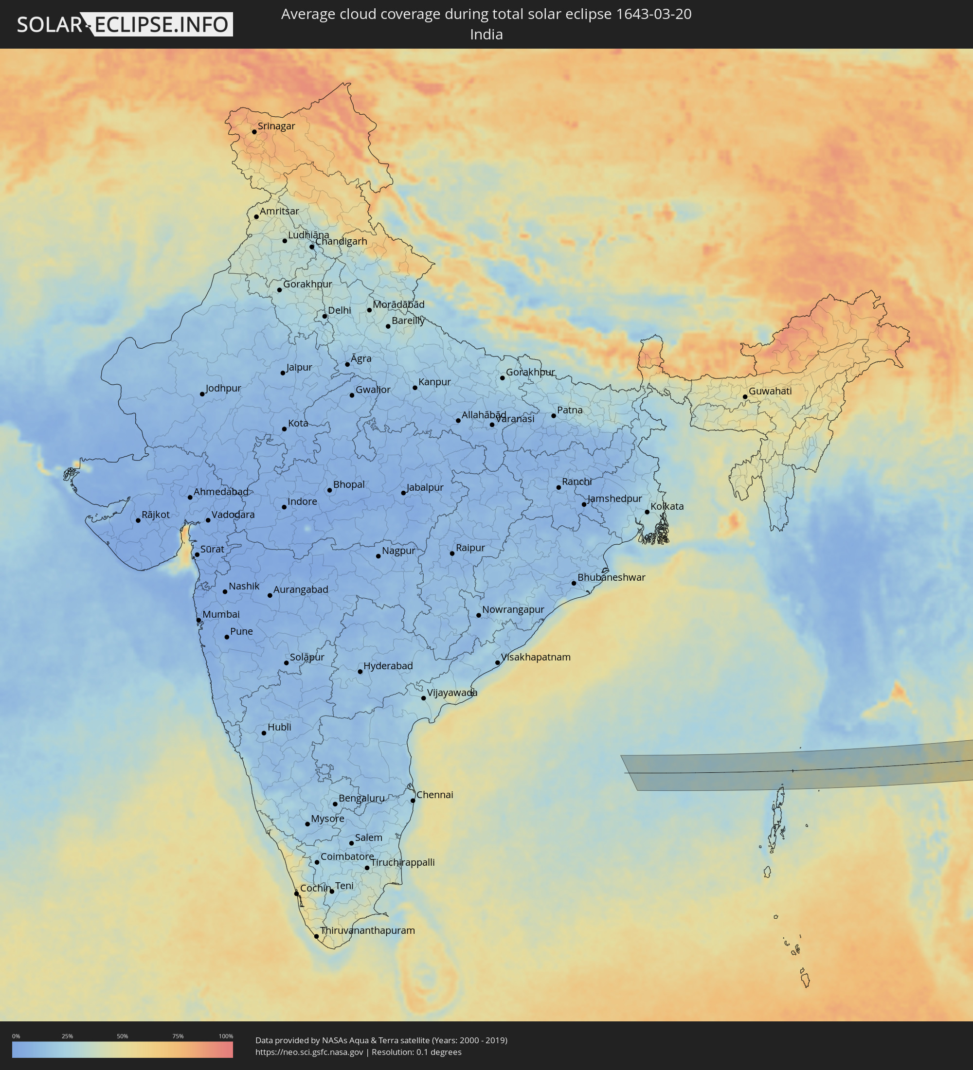 India
India
 Myanmar
 Thailand
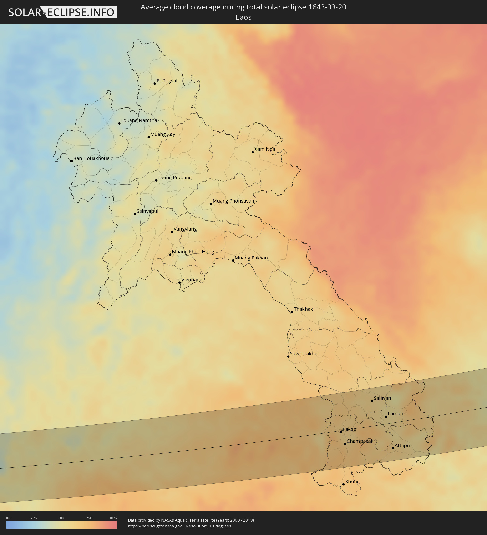 Laos
Laos
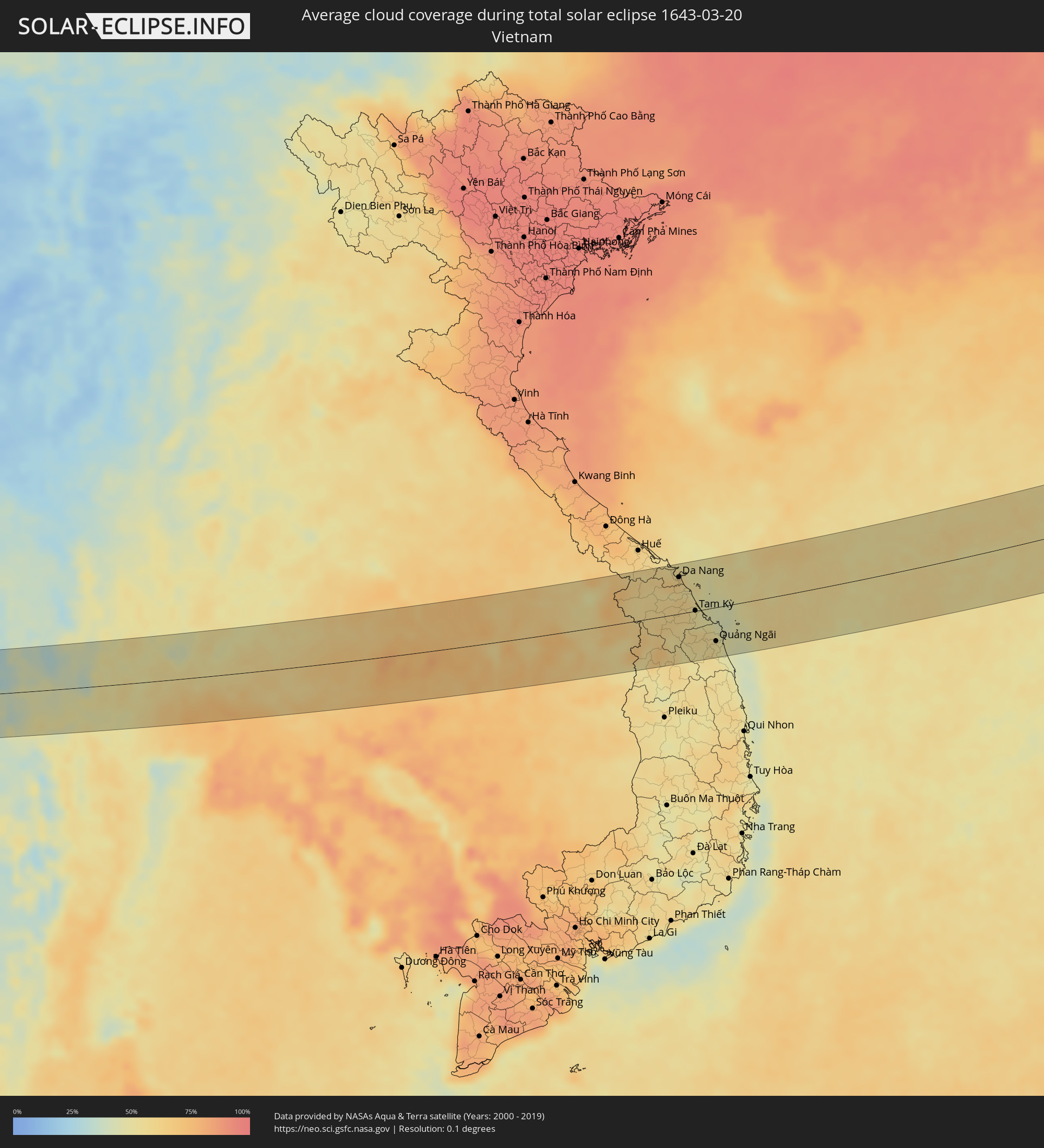 Vietnam
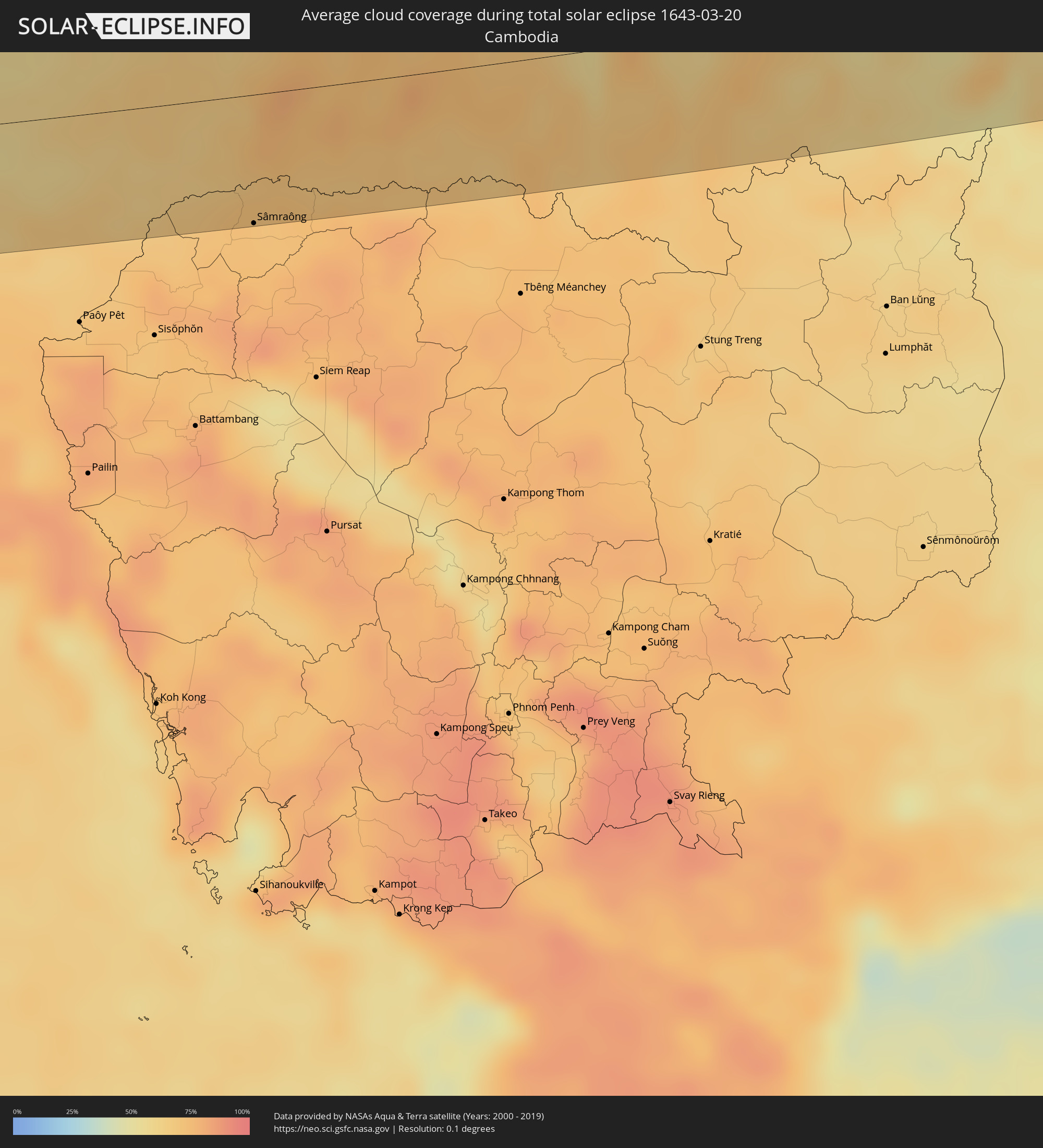 Cambodia
 Philippines
Cities inside the path of the eclipse
The following table shows all locations with a population of more than 5,000 inside the eclipse path. Cities which have more than 100,000 inhabitants are marked bold. A click at the locations opens a detailed map.
| City | Type | Eclipse duration | Local time of max. eclipse | Distance to central line | Ø Cloud coverage |
|
Dawei, Tanintharyi
|
total | - | 06:44:38 UTC+06:24 | 32 km | 45% |
|
Bo Phloi, Kanchanaburi
|
total | - | 07:02:41 UTC+06:42 | 16 km | 51% |
|
Kanchanaburi, Kanchanaburi
|
total | - | 07:02:21 UTC+06:42 | 52 km | 49% |
|
Tha Maka, Kanchanaburi
|
total | - | 07:02:19 UTC+06:42 | 65 km | 50% |
|
Suphan Buri, Suphan Buri
|
total | - | 07:03:06 UTC+06:42 | 5 km | 56% |
|
Bang Len, Nakhon Pathom
|
total | - | 07:02:38 UTC+06:42 | 56 km | 63% |
|
Wiset Chaichan, Ang Thong
|
total | - | 07:03:20 UTC+06:42 | 6 km | 53% |
|
Phak Hai, Phra Nakhon Si Ayutthaya
|
total | - | 07:03:11 UTC+06:42 | 9 km | 58% |
|
Sing Buri, Sing Buri
|
total | - | 07:03:41 UTC+06:42 | 38 km | 53% |
|
Pak Kret, Nonthaburi
|
total | - | 07:02:39 UTC+06:42 | 71 km | 68% |
|
Phra Nakhon Si Ayutthaya, Phra Nakhon Si Ayutthaya
|
total | - | 07:03:10 UTC+06:42 | 23 km | 66% |
|
Khlong Luang, Pathum Thani
|
total | - | 07:02:53 UTC+06:42 | 55 km | 73% |
|
Lop Buri, Lop Buri
|
total | - | 07:03:42 UTC+06:42 | 26 km | 55% |
|
Tha Ruea, Phra Nakhon Si Ayutthaya
|
total | - | 07:03:28 UTC+06:42 | 1 km | 56% |
|
Ban Lam Luk Ka, Pathum Thani
|
total | - | 07:02:50 UTC+06:42 | 67 km | 73% |
|
Phra Phutthabat, Sara Buri
|
total | - | 07:03:41 UTC+06:42 | 16 km | 54% |
|
Nong Khae, Sara Buri
|
total | - | 07:03:17 UTC+06:42 | 27 km | 69% |
|
Saraburi, Sara Buri
|
total | - | 07:03:31 UTC+06:42 | 6 km | 62% |
|
Chai Badan, Lop Buri
|
total | - | 07:04:23 UTC+06:42 | 65 km | 48% |
|
Nakhon Nayok, Nakhon Nayok
|
total | - | 07:03:17 UTC+06:42 | 46 km | 74% |
|
Prachin Buri, Prachin Buri
|
total | - | 07:03:11 UTC+06:42 | 65 km | 72% |
|
Pak Chong, Nakhon Ratchasima
|
total | - | 07:03:57 UTC+06:42 | 8 km | 56% |
|
Amphoe Sikhiu, Nakhon Ratchasima
|
total | - | 07:04:19 UTC+06:42 | 26 km | 57% |
|
Nakhon Ratchasima, Nakhon Ratchasima
|
total | - | 07:04:35 UTC+06:42 | 29 km | 57% |
|
Chok Chai, Nakhon Ratchasima
|
total | - | 07:04:21 UTC+06:42 | 2 km | 56% |
|
Khon Buri, Nakhon Ratchasima
|
total | - | 07:04:09 UTC+06:42 | 22 km | 60% |
|
Non Sung, Nakhon Ratchasima
|
total | - | 07:04:55 UTC+06:42 | 51 km | 57% |
|
Nang Rong, Buriram
|
total | - | 07:04:34 UTC+06:42 | 16 km | 64% |
|
Buriram, Buriram
|
total | - | 07:05:09 UTC+06:42 | 20 km | 66% |
|
Surin, Surin
|
total | - | 07:05:14 UTC+06:42 | 2 km | 67% |
|
Sâmraông, Ŏtâr Méanchey
|
total | - | 07:04:26 UTC+06:42 | 75 km | 72% |
|
Si Sa Ket, Sisaket
|
total | - | 07:06:00 UTC+06:42 | 17 km | 72% |
|
Kantharalak, Sisaket
|
total | - | 07:05:38 UTC+06:42 | 40 km | 68% |
|
Ubon Ratchathani, Changwat Ubon Ratchathani
|
total | - | 07:06:27 UTC+06:42 | 23 km | 68% |
|
Det Udom, Changwat Ubon Ratchathani
|
total | - | 07:06:12 UTC+06:42 | 17 km | 67% |
|
Phibun Mangsahan, Changwat Ubon Ratchathani
|
total | - | 07:06:42 UTC+06:42 | 18 km | 63% |
|
Pakse, Champasak
|
total | - | 07:06:55 UTC+06:42 | 4 km | 65% |
|
Champasak, Champasak
|
total | - | 07:06:42 UTC+06:42 | 30 km | 67% |
|
Salavan, Salavan
|
total | - | 07:08:04 UTC+06:42 | 52 km | 60% |
|
Lamam, Xékong
|
total | - | 07:07:53 UTC+06:42 | 14 km | 59% |
|
Attapu, Attapu
|
total | - | 07:07:15 UTC+06:42 | 55 km | 61% |
|
Da Nang, Đà Nẵng
|
total | - | 07:34:25 UTC+07:06 | 60 km | 62% |
|
Hội An, Quảng Nam
|
total | - | 07:34:16 UTC+07:06 | 37 km | 54% |
|
Tam Kỳ, Quảng Nam
|
total | - | 07:34:00 UTC+07:06 | 1 km | 52% |
|
Quảng Ngãi, Quảng Ngãi
|
total | - | 07:33:41 UTC+07:06 | 55 km | 53% |
|
Bantay, Ilocos
|
total | - | 08:42:35 UTC+08:00 | 90 km | 39% |
|
Cabugao, Ilocos
|
total | - | 08:42:59 UTC+08:00 | 70 km | 45% |
|
Batac City, Ilocos
|
total | - | 08:43:31 UTC+08:00 | 46 km | 36% |
|
San Nicolas, Ilocos
|
total | - | 08:43:43 UTC+08:00 | 35 km | 32% |
|
Laoag, Ilocos
|
total | - | 08:43:46 UTC+08:00 | 32 km | 32% |
|
Bacarra, Ilocos
|
total | - | 08:43:52 UTC+08:00 | 27 km | 29% |
|
Pasuquin, Ilocos
|
total | - | 08:44:00 UTC+08:00 | 19 km | 29% |
|
Sarrat, Ilocos
|
total | - | 08:43:46 UTC+08:00 | 38 km | 32% |
|
Vintar, Ilocos
|
total | - | 08:43:53 UTC+08:00 | 31 km | 32% |
|
Dingras, Ilocos
|
total | - | 08:43:46 UTC+08:00 | 46 km | 43% |
|
Claveria, Cagayan Valley
|
total | - | 08:45:02 UTC+08:00 | 6 km | 50% |
|
Cabaritan East, Cagayan Valley
|
total | - | 08:45:19 UTC+08:00 | 40 km | 47% |
|
Ballesteros, Cagayan Valley
|
total | - | 08:45:21 UTC+08:00 | 41 km | 47% |
|
Lasam, Cagayan Valley
|
total | - | 08:44:57 UTC+08:00 | 81 km | 53% |
|
Aparri, Cagayan Valley
|
total | - | 08:45:26 UTC+08:00 | 52 km | 43% |
|
Magapit, Cagayan Valley
|
total | - | 08:45:09 UTC+08:00 | 76 km | 58% |
|
Magapit, Aguiguican, Cagayan Valley
|
total | - | 08:45:07 UTC+08:00 | 79 km | 58% |
|
Gonzaga, Cagayan Valley
|
total | - | 08:45:47 UTC+08:00 | 74 km | 56% |
|
Santa Ana, Cagayan Valley
|
total | - | 08:46:19 UTC+08:00 | 58 km | 53% |