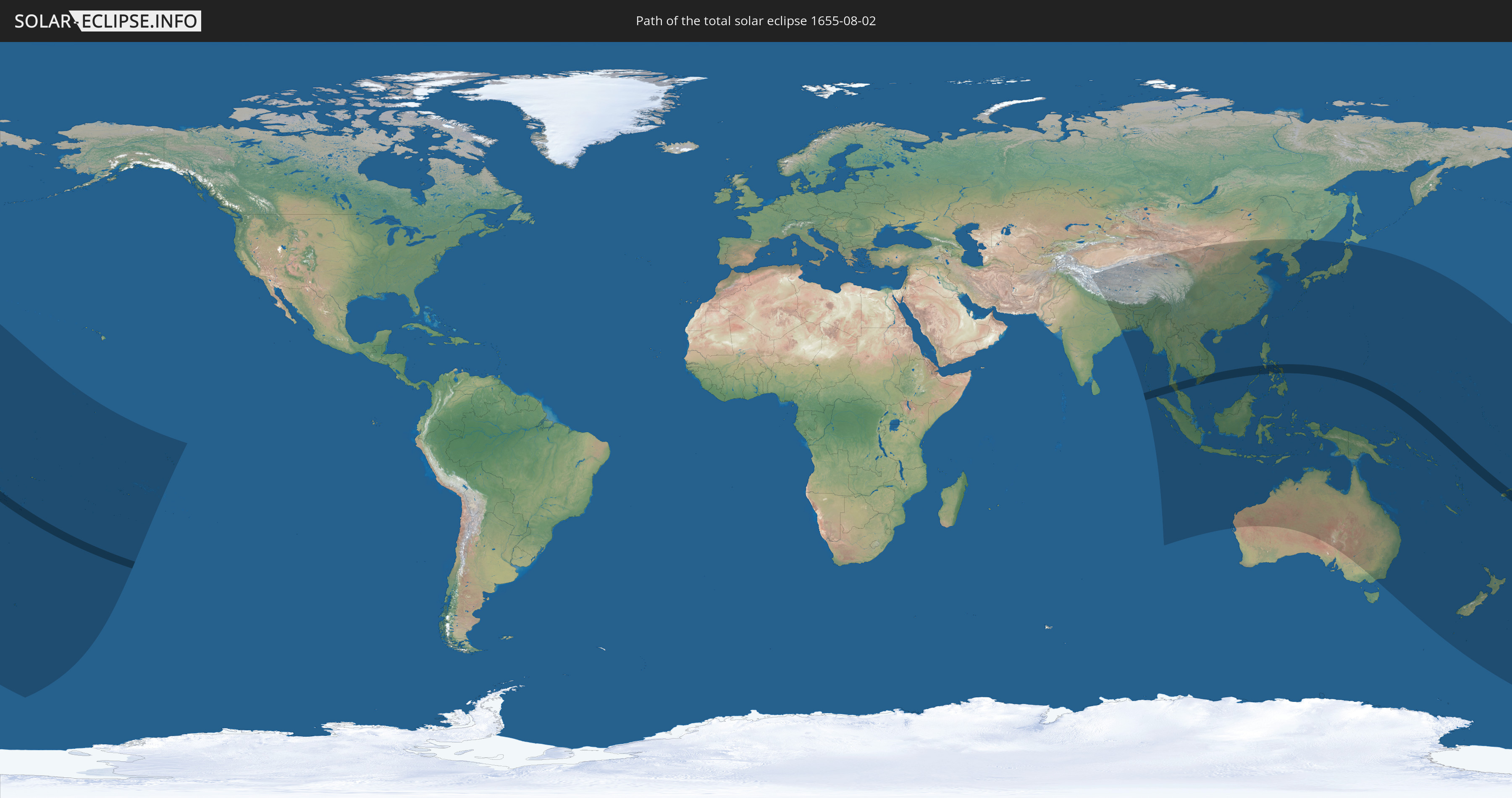
Total solar eclipse of 08/02/1655
| Day of week: | Monday |
| Maximum duration of eclipse: | 06m28s |
| Maximum width of eclipse path: | 247 km |
| Saros cycle: | 130 |
| Coverage: | 100% |
| Magnitude: | 1.0735 |
| Gamma: | -0.2625 |
Wo kann man die Sonnenfinsternis vom 08/02/1655 sehen?
Die Sonnenfinsternis am 08/02/1655 kann man in 50 Ländern als partielle Sonnenfinsternis beobachten.
Der Finsternispfad verläuft durch 8 Länder. Nur in diesen Ländern ist sie als total Sonnenfinsternis zu sehen.
In den folgenden Ländern ist die Sonnenfinsternis total zu sehen
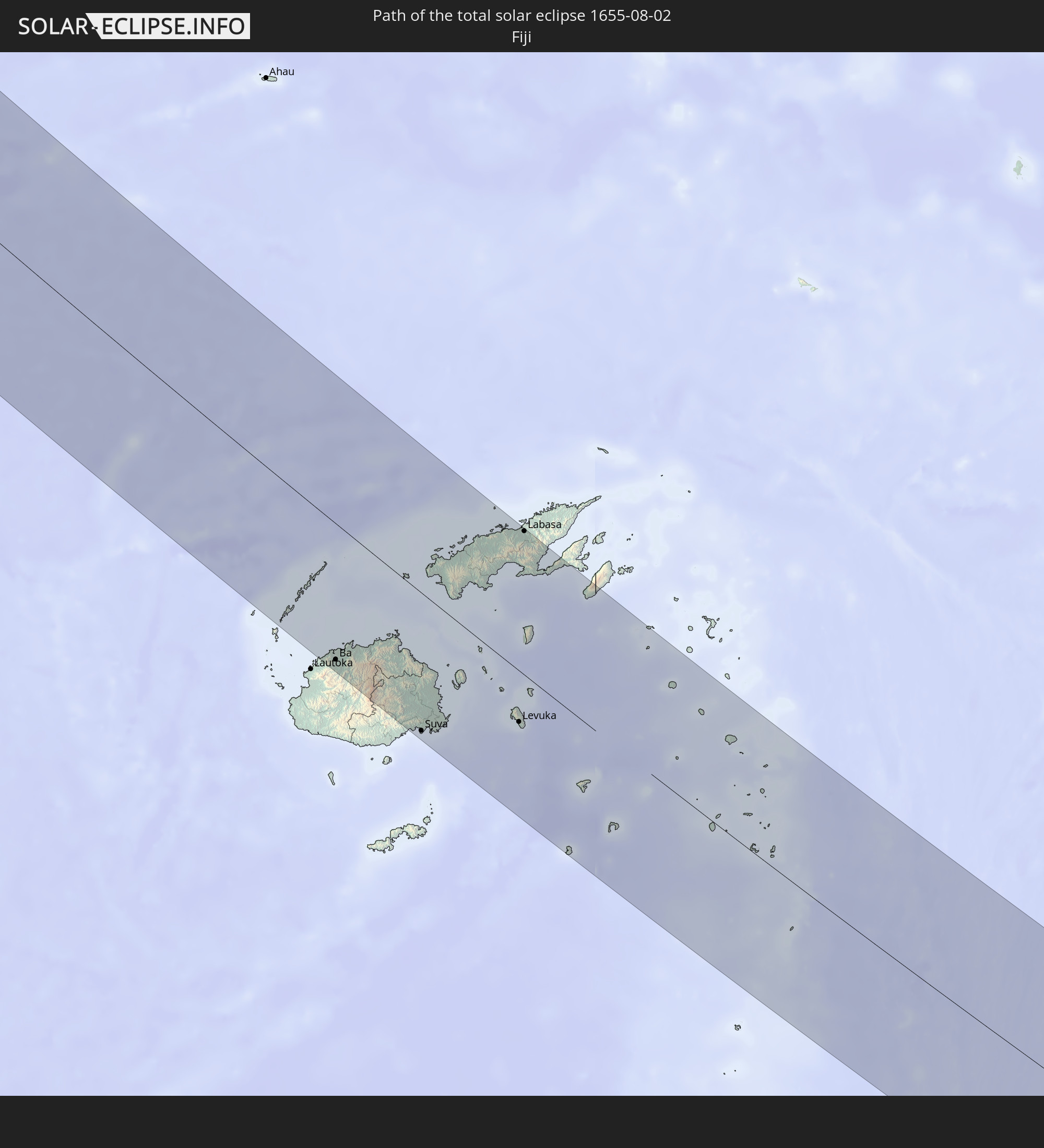 Fiji
Fiji
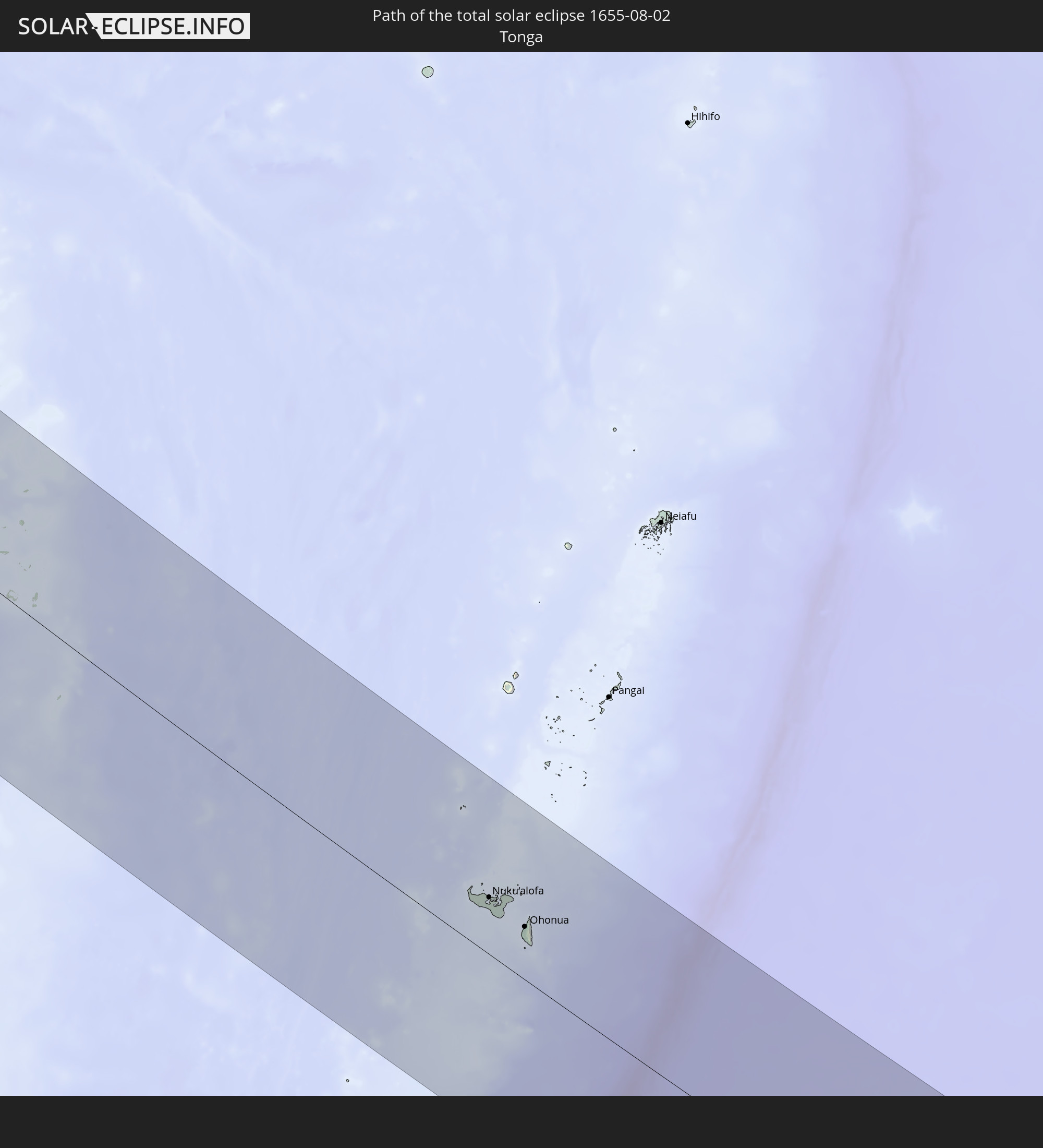 Tonga
Tonga
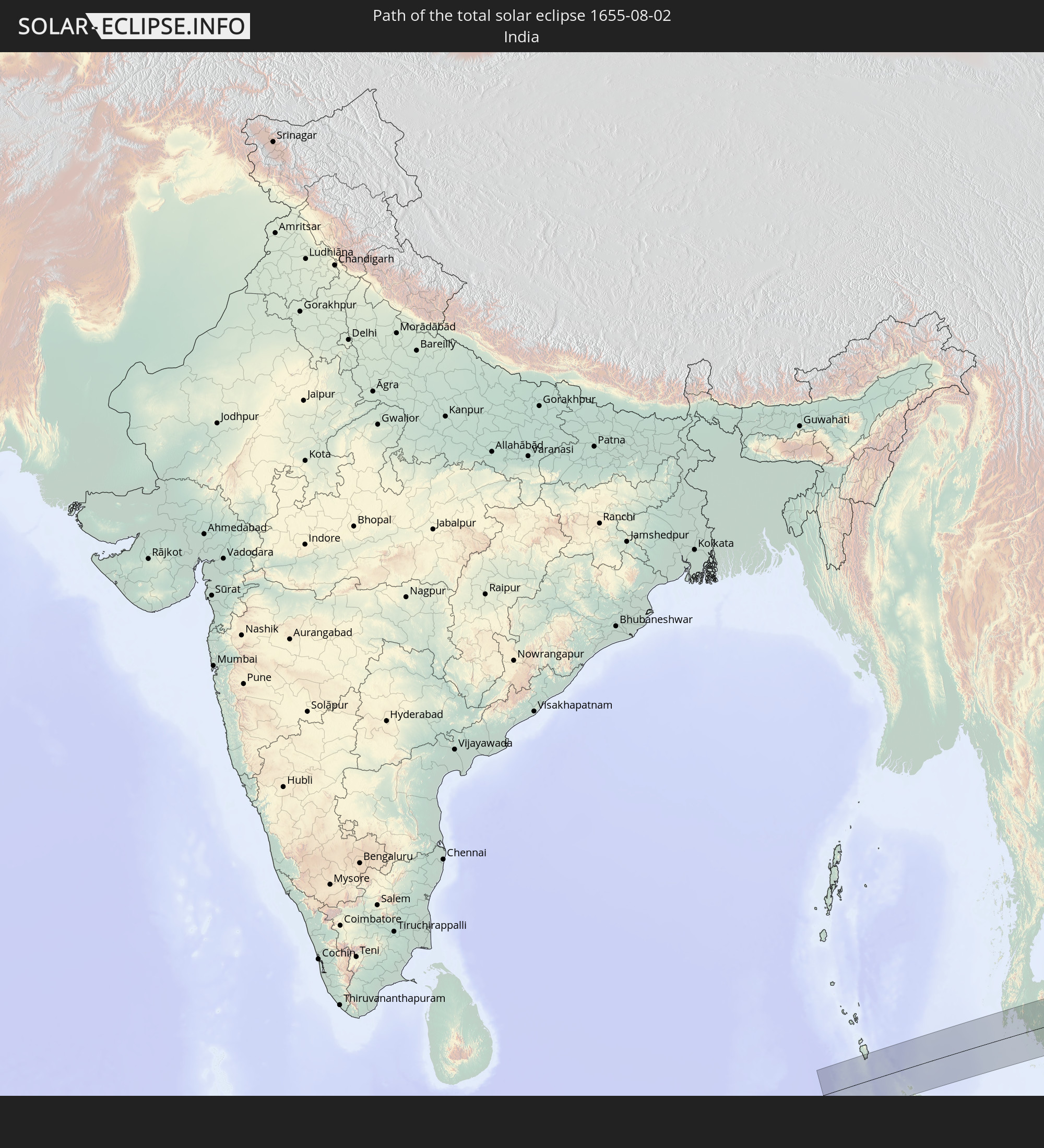 India
India
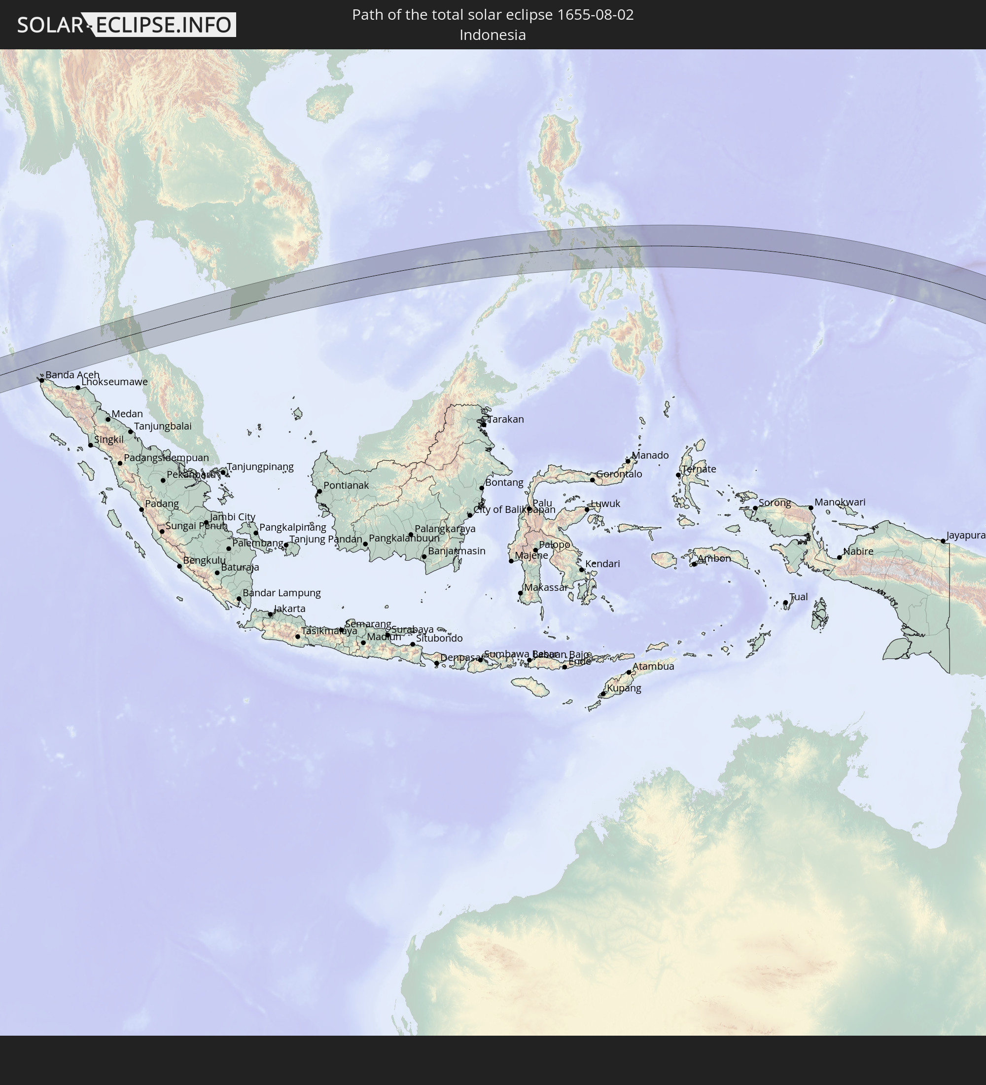 Indonesia
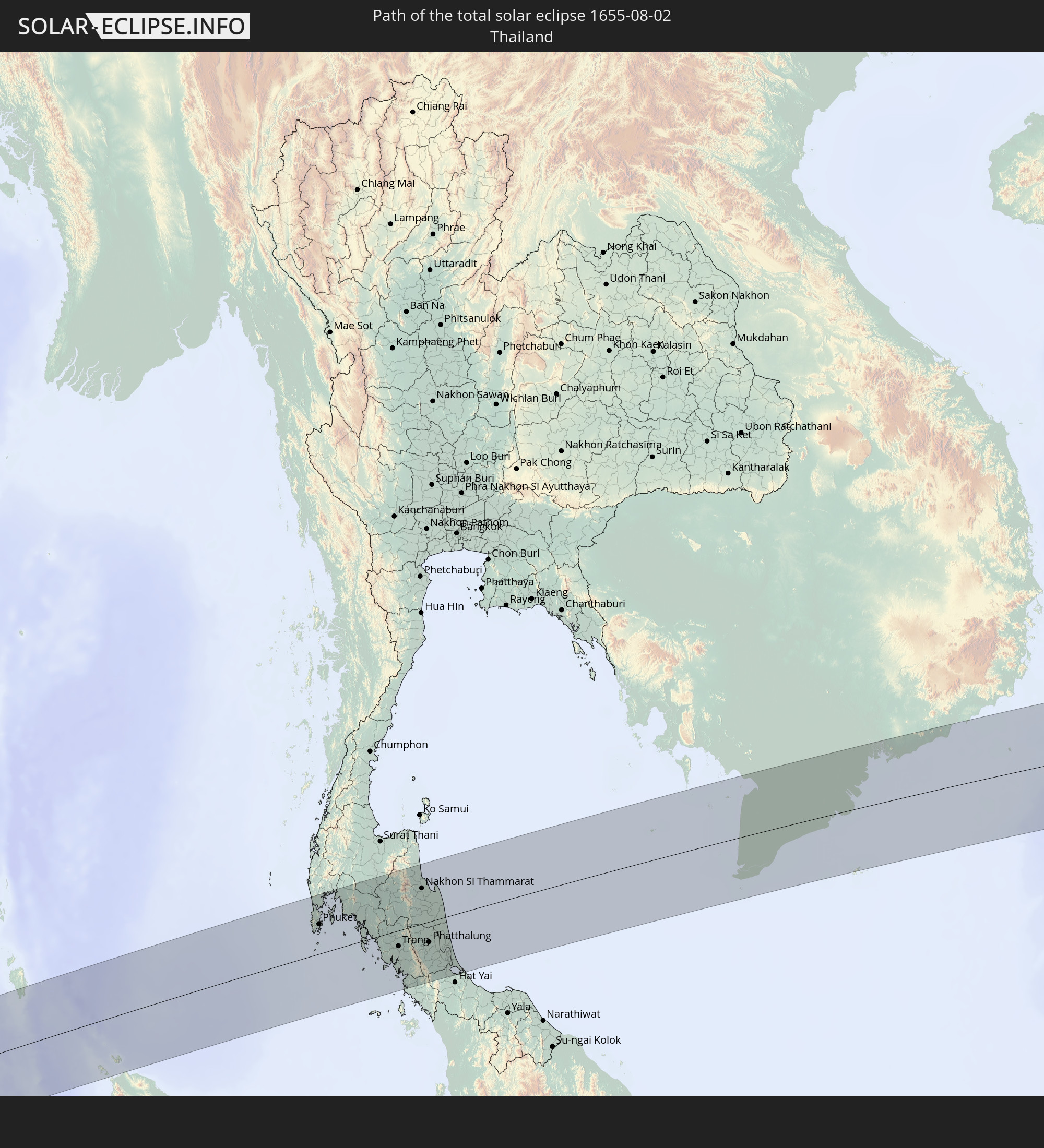 Thailand
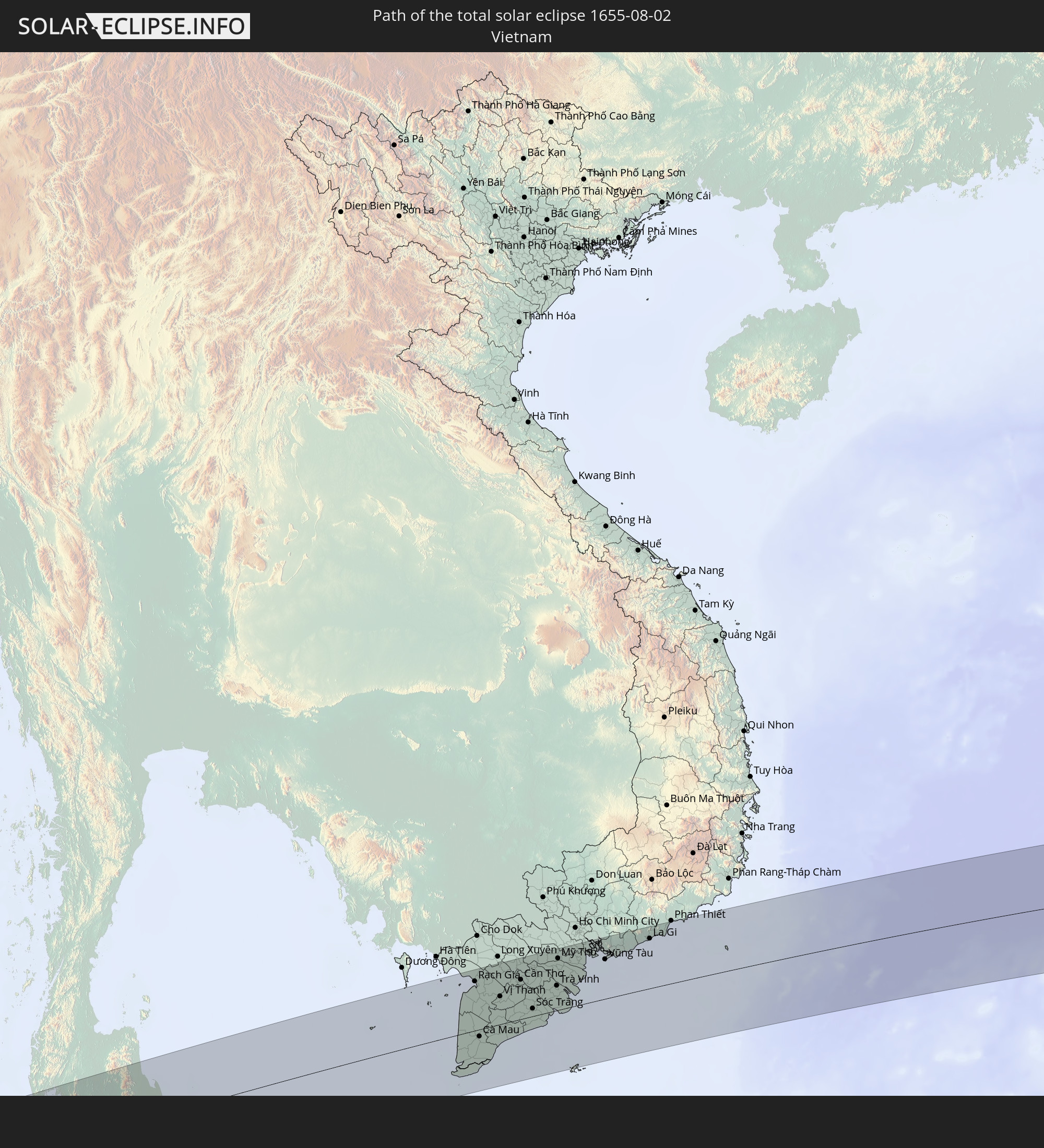 Vietnam
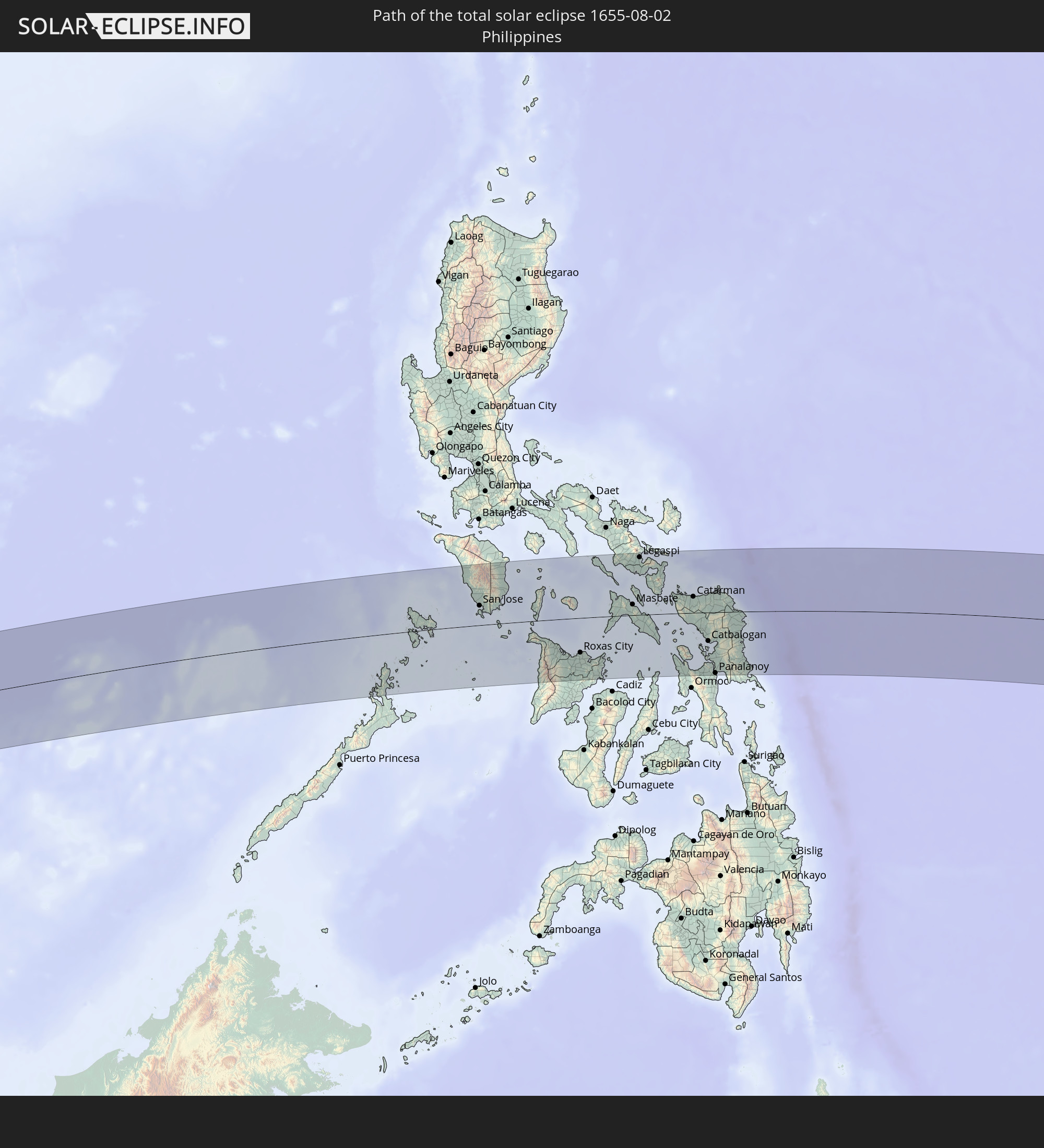 Philippines
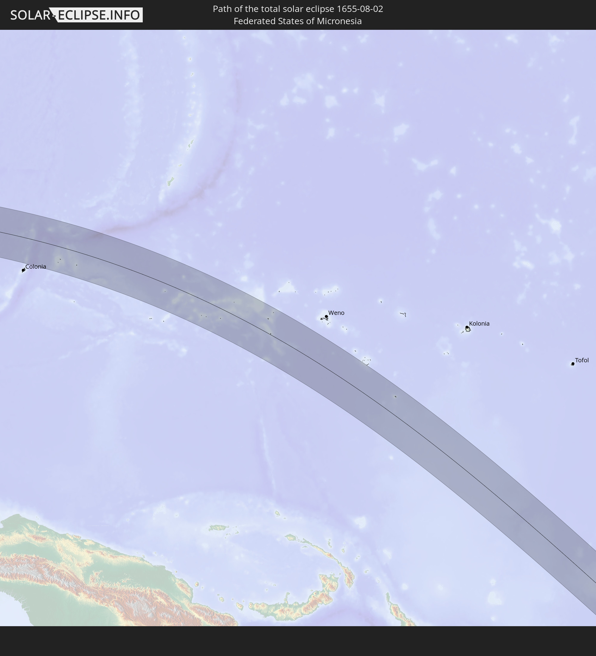 Federated States of Micronesia
In den folgenden Ländern ist die Sonnenfinsternis partiell zu sehen
 Fiji
Fiji
 Russia
 New Zealand
 United States Minor Outlying Islands
 Wallis and Futuna
 Tonga
Tonga
 Kiribati
 Samoa
Samoa
 Tokelau
 American Samoa
 Niue
Niue
 Cook Islands
 French Polynesia
 India
India
 China
China
 Nepal
Nepal
 Bangladesh
 Bhutan
 Myanmar
 Indonesia
 Cocos Islands
 Thailand
 Malaysia
 Laos
Laos
 Vietnam
 Cambodia
 Singapore
 Christmas Island
 Australia
 Macau
Macau
 Hong Kong
 Brunei
 Taiwan
 Philippines
 Japan
Japan
 East Timor
 North Korea
 South Korea
 Palau
Palau
 Federated States of Micronesia
 Papua New Guinea
 Guam
Guam
 Northern Mariana Islands
 Solomon Islands
 New Caledonia
 Marshall Islands
 Vanuatu
 Nauru
Nauru
 Norfolk Island
 Tuvalu
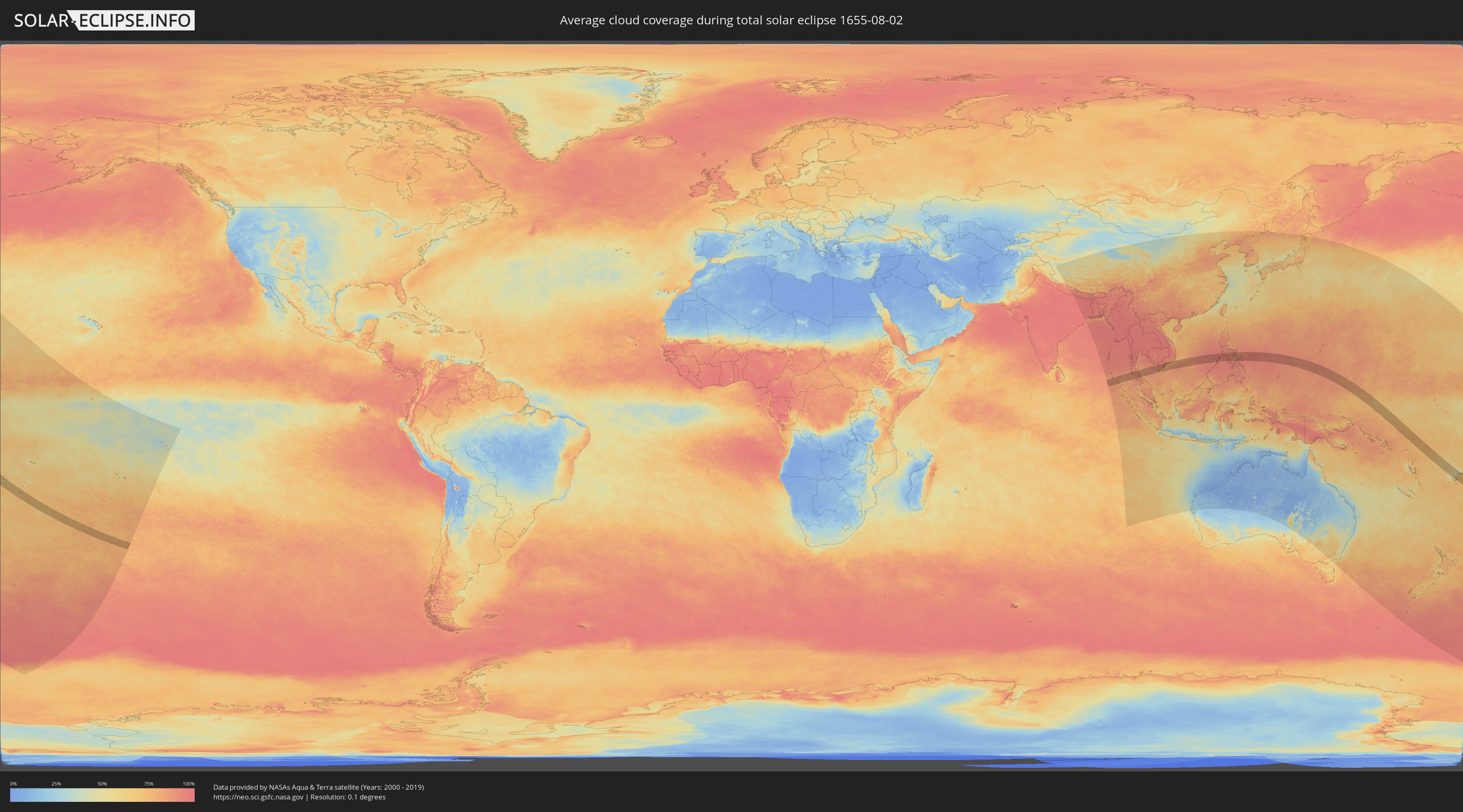
How will be the weather during the total solar eclipse on 08/02/1655?
Where is the best place to see the total solar eclipse of 08/02/1655?
The following maps show the average cloud coverage for the day of the total solar eclipse.
With the help of these maps, it is possible to find the place along the eclipse path, which has the best
chance of a cloudless sky.
Nevertheless, you should consider local circumstances and inform about the weather of your chosen
observation site.
The data is provided by NASAs satellites
AQUA and TERRA.
The cloud maps are averaged over a period of 19 years (2000 - 2019).

Detailed country maps
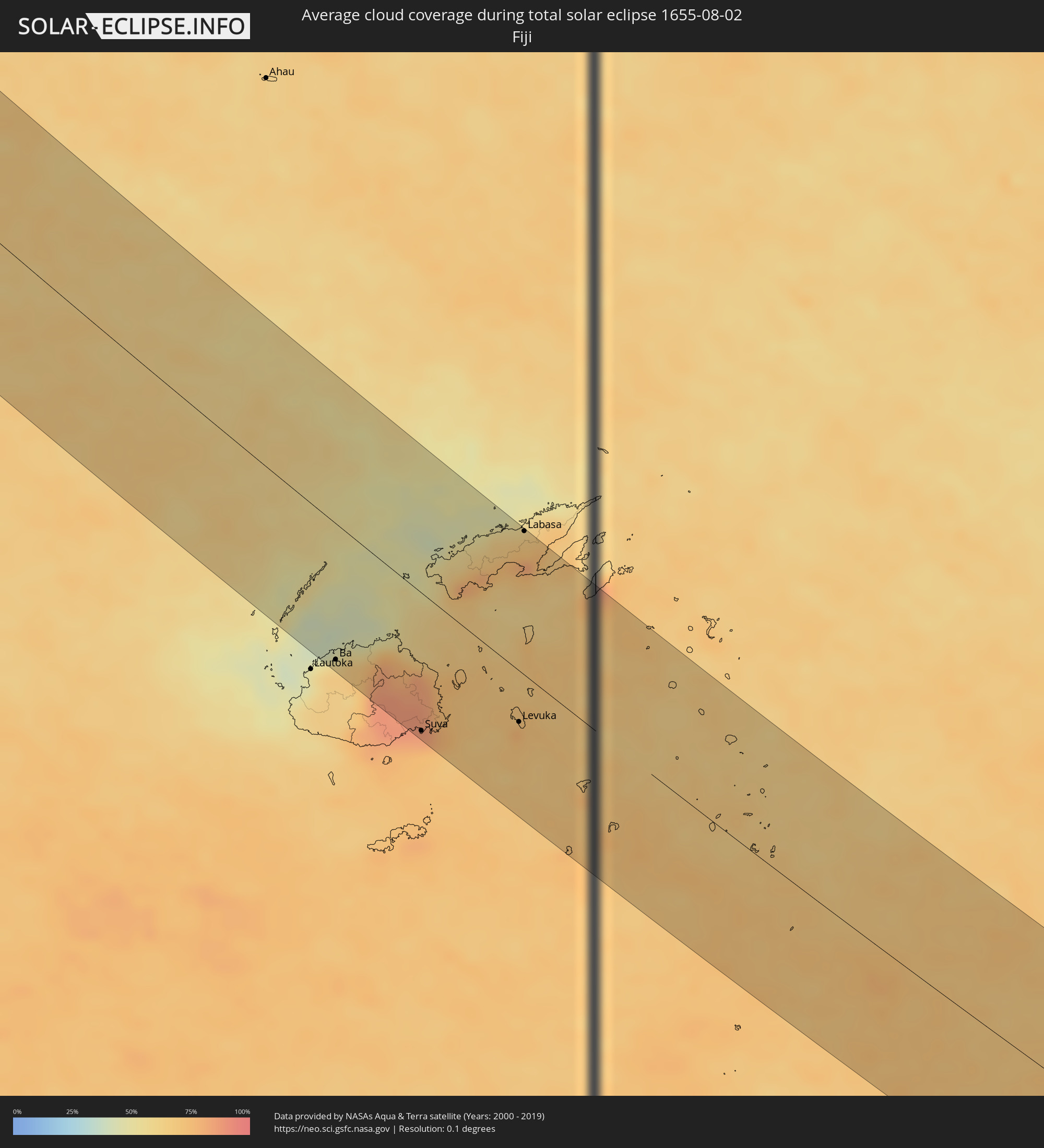 Fiji
Fiji
 Tonga
Tonga
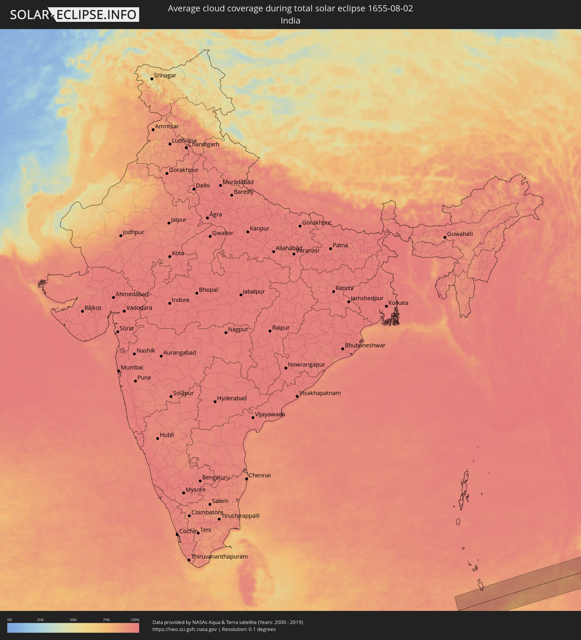 India
India
 Indonesia
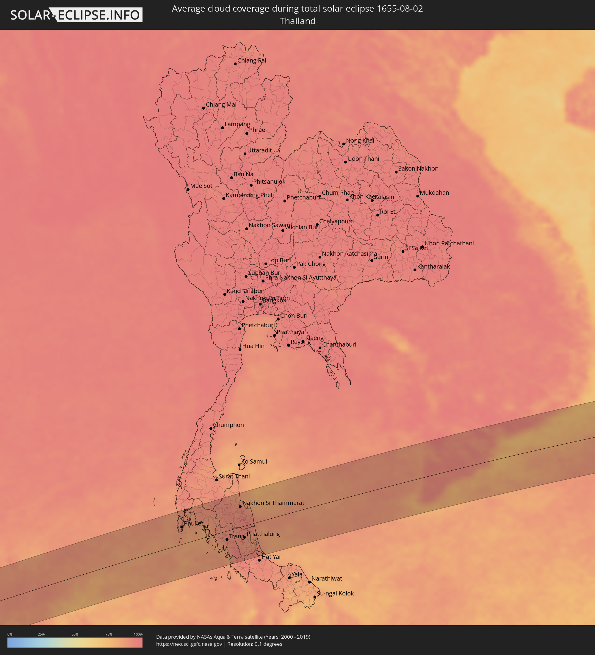 Thailand
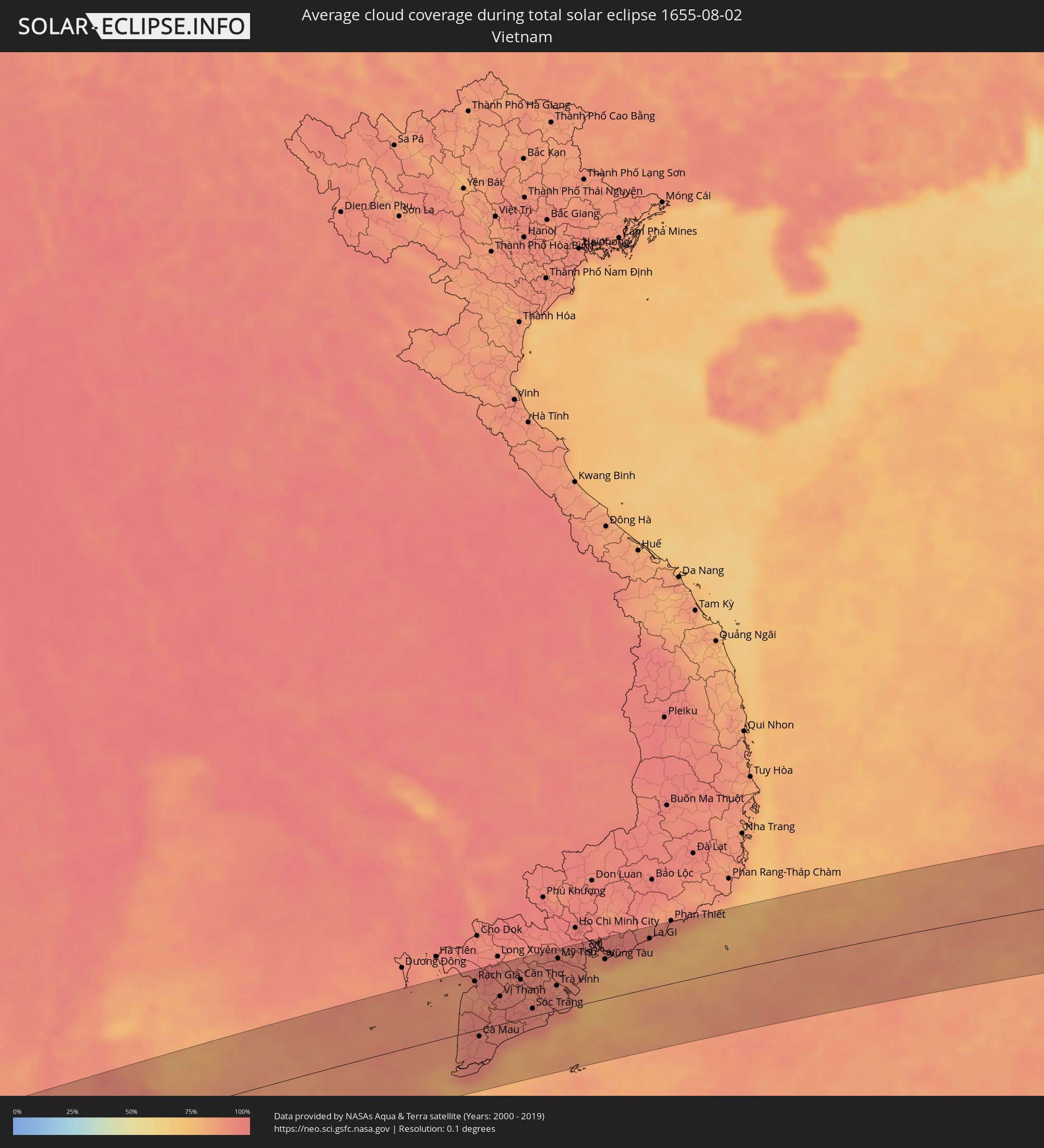 Vietnam
 Philippines
 Federated States of Micronesia
Cities inside the path of the eclipse
The following table shows all locations with a population of more than 5,000 inside the eclipse path. Cities which have more than 100,000 inhabitants are marked bold. A click at the locations opens a detailed map.
| City | Type | Eclipse duration | Local time of max. eclipse | Distance to central line | Ø Cloud coverage |
|
Nuku‘alofa, Tongatapu
|
total | - | 15:13:05 UTC+12:20 | 34 km | 74% |
|
‘Ohonua, ʻEua
|
total | - | 15:13:26 UTC+12:20 | 31 km | 72% |
|
Sabang, Aceh
|
total | - | 06:55:52 UTC+07:07 | 66 km | 76% |
|
Patong, Phuket
|
total | - | 06:30:59 UTC+06:42 | 52 km | 87% |
|
Ban Karon, Phuket
|
total | - | 06:30:59 UTC+06:42 | 46 km | 86% |
|
Rawai, Phuket
|
total | - | 06:31:00 UTC+06:42 | 38 km | 86% |
|
Kathu, Phuket
|
total | - | 06:30:59 UTC+06:42 | 53 km | 87% |
|
Ban Chalong, Phuket
|
total | - | 06:31:00 UTC+06:42 | 45 km | 86% |
|
Wichit, Phuket
|
total | - | 06:31:00 UTC+06:42 | 48 km | 88% |
|
Ban Talat Nua, Phuket
|
total | - | 06:31:00 UTC+06:42 | 48 km | 88% |
|
Ban Ko Kaeo, Phuket
|
total | - | 06:31:00 UTC+06:42 | 53 km | 88% |
|
Phuket, Phuket
|
total | - | 06:31:00 UTC+06:42 | 48 km | 88% |
|
Ban Talat Yai, Phuket
|
total | - | 06:31:01 UTC+06:42 | 47 km | 88% |
|
Ban Ratsada, Phuket
|
total | - | 06:31:00 UTC+06:42 | 50 km | 88% |
|
Ban Phru Nai, Phangnga
|
total | - | 06:31:03 UTC+06:42 | 49 km | 83% |
|
Ao Luek, Krabi
|
total | - | 06:31:01 UTC+06:42 | 90 km | 87% |
|
Ban Ao Nang, Phangnga
|
total | - | 06:31:06 UTC+06:42 | 52 km | 86% |
|
Krabi, Krabi
|
total | - | 06:31:07 UTC+06:42 | 51 km | 86% |
|
Nuea Khlong, Krabi
|
total | - | 06:31:09 UTC+06:42 | 48 km | 86% |
|
Saladan, Krabi
|
total | - | 06:31:15 UTC+06:42 | 2 km | 82% |
|
Chai Buri, Surat Thani
|
total | - | 06:31:06 UTC+06:42 | 88 km | 89% |
|
Ko Lanta, Krabi
|
total | - | 06:31:17 UTC+06:42 | 12 km | 83% |
|
Tham Phannara, Nakhon Si Thammarat
|
total | - | 06:31:13 UTC+06:42 | 73 km | 91% |
|
Chawang, Nakhon Si Thammarat
|
total | - | 06:31:15 UTC+06:42 | 71 km | 92% |
|
Kantang, Trang
|
total | - | 06:31:26 UTC+06:42 | 39 km | 84% |
|
Trang, Trang
|
total | - | 06:31:26 UTC+06:42 | 26 km | 92% |
|
Huai Yot, Trang
|
total | - | 06:31:24 UTC+06:42 | 1 km | 90% |
|
Thung Song, Nakhon Si Thammarat
|
total | - | 06:31:21 UTC+06:42 | 37 km | 93% |
|
Ron Phibun, Nakhon Si Thammarat
|
total | - | 06:31:24 UTC+06:42 | 34 km | 93% |
|
Nakhon Si Thammarat, Nakhon Si Thammarat
|
total | - | 06:31:24 UTC+06:42 | 57 km | 93% |
|
Phatthalung, Phatthalung
|
total | - | 06:31:35 UTC+06:42 | 33 km | 90% |
|
Pak Phanang, Nakhon Si Thammarat
|
total | - | 06:31:29 UTC+06:42 | 41 km | 88% |
|
Ranot, Songkhla
|
total | - | 06:31:38 UTC+06:42 | 24 km | 85% |
|
Ban Mai, Songkhla
|
total | - | 06:31:50 UTC+06:42 | 92 km | 89% |
|
Songkhla, Songkhla
|
total | - | 06:31:52 UTC+06:42 | 94 km | 88% |
|
Rạch Giá, Kiến Giang
|
total | - | 06:57:58 UTC+07:06 | 81 km | 89% |
|
Cà Mau, Cà Mau
|
total | - | 06:58:10 UTC+07:06 | 11 km | 94% |
|
Vị Thanh, Hau Giang
|
total | - | 06:58:14 UTC+07:06 | 46 km | 94% |
|
Thành phố Bạc Liêu, Bạc Liêu
|
total | - | 06:58:28 UTC+07:06 | 14 km | 90% |
|
Sadek, Đồng Tháp
|
total | - | 06:58:18 UTC+07:06 | 93 km | 92% |
|
Cần Thơ, Cần Thơ
|
total | - | 06:58:22 UTC+07:06 | 65 km | 91% |
|
Sóc Trăng, Sóc Trăng
|
total | - | 06:58:33 UTC+07:06 | 13 km | 93% |
|
Vĩnh Long, Vĩnh Long
|
total | - | 06:58:26 UTC+07:06 | 83 km | 91% |
|
Ấp Tân Ngãi, Bến Tre
|
total | - | 06:58:37 UTC+07:06 | 73 km | 90% |
|
Trà Vinh, Trà Vinh
|
total | - | 06:58:42 UTC+07:06 | 41 km | 95% |
|
Mỹ Tho, Tiền Giang
|
total | - | 06:58:39 UTC+07:06 | 85 km | 94% |
|
Bến Tre, Bến Tre
|
total | - | 06:58:40 UTC+07:06 | 72 km | 89% |
|
Cần Giờ, Ho Chi Minh City
|
total | - | 06:59:00 UTC+07:06 | 75 km | 82% |
|
Vũng Tàu, Bà Rịa-Vũng Tàu
|
total | - | 06:59:06 UTC+07:06 | 65 km | 76% |
|
Thành Phố Bà Rịa, Bà Rịa-Vũng Tàu
|
total | - | 06:59:07 UTC+07:06 | 79 km | 90% |
|
La Gi, Bình Thuận
|
total | - | 06:59:29 UTC+07:06 | 82 km | 89% |
|
Coron, Mimaropa
|
total | - | 08:04:37 UTC+08:00 | 5 km | 93% |
|
Sablayan, Mimaropa
|
total | - | 08:05:06 UTC+08:00 | 92 km | 91% |
|
Calintaan, Mimaropa
|
total | - | 08:05:24 UTC+08:00 | 60 km | 92% |
|
San Jose, Mimaropa
|
total | - | 08:05:39 UTC+08:00 | 35 km | 95% |
|
Bulalacao, Mimaropa
|
total | - | 08:06:02 UTC+08:00 | 30 km | 91% |
|
Mansalay, Mimaropa
|
total | - | 08:06:06 UTC+08:00 | 51 km | 93% |
|
Bansud, Mimaropa
|
total | - | 08:06:00 UTC+08:00 | 89 km | 91% |
|
Pinamalayan, Mimaropa
|
total | - | 08:05:57 UTC+08:00 | 109 km | 91% |
|
Pandan, Western Visayas
|
total | - | 08:07:18 UTC+08:00 | 41 km | 93% |
|
Romblon, Mimaropa
|
total | - | 08:07:14 UTC+08:00 | 50 km | 91% |
|
Kalibo (poblacion), Western Visayas
|
total | - | 08:07:42 UTC+08:00 | 47 km | 93% |
|
Dao, Western Visayas
|
total | - | 08:08:17 UTC+08:00 | 84 km | 95% |
|
Roxas City, Western Visayas
|
total | - | 08:08:18 UTC+08:00 | 63 km | 93% |
|
Pilar, Western Visayas
|
total | - | 08:08:42 UTC+08:00 | 75 km | 91% |
|
Ajuy, Western Visayas
|
total | - | 08:08:52 UTC+08:00 | 111 km | 92% |
|
Estancia, Western Visayas
|
total | - | 08:08:57 UTC+08:00 | 80 km | 89% |
|
Pio Duran, Bicol
|
total | - | 08:08:45 UTC+08:00 | 93 km | 88% |
|
Masbate, Bicol
|
total | - | 08:09:17 UTC+08:00 | 19 km | 92% |
|
Legaspi, Bicol
|
total | - | 08:09:09 UTC+08:00 | 104 km | 94% |
|
Bulan, Bicol
|
total | - | 08:09:32 UTC+08:00 | 52 km | 91% |
|
Sorsogon, Bicol
|
total | - | 08:09:35 UTC+08:00 | 85 km | 91% |
|
Daanbantayan, Central Visayas
|
total | - | 08:10:21 UTC+08:00 | 108 km | 91% |
|
Irosin, Bicol
|
total | - | 08:09:46 UTC+08:00 | 54 km | 93% |
|
Gubat, Bicol
|
total | - | 08:09:48 UTC+08:00 | 78 km | 90% |
|
Naval, Eastern Visayas
|
total | - | 08:10:48 UTC+08:00 | 74 km | 91% |
|
Calbayog City, Eastern Visayas
|
total | - | 08:10:53 UTC+08:00 | 19 km | 90% |
|
Catarman, Eastern Visayas
|
total | - | 08:10:46 UTC+08:00 | 29 km | 92% |
|
Carigara, Eastern Visayas
|
total | - | 08:11:22 UTC+08:00 | 104 km | 93% |
|
Catbalogan, Eastern Visayas
|
total | - | 08:11:29 UTC+08:00 | 52 km | 91% |
|
Panalanoy, Eastern Visayas
|
total | - | 08:11:55 UTC+08:00 | 111 km | 91% |
|
Laoang, Eastern Visayas
|
total | - | 08:11:20 UTC+08:00 | 36 km | 87% |
|
Gamay, Eastern Visayas
|
total | - | 08:11:51 UTC+08:00 | 15 km | 88% |
|
Borongan, Eastern Visayas
|
total | - | 08:12:26 UTC+08:00 | 72 km | 91% |
|
Dolores, Eastern Visayas
|
total | - | 08:12:19 UTC+08:00 | 24 km | 91% |
|
Ba, Western
|
total | - | 14:38:36 UTC+11:55 | 101 km | 59% |
|
Suva, Central
|
total | - | 14:40:02 UTC+11:55 | 102 km | 82% |
|
Levuka, Eastern
|
total | - | 14:41:00 UTC+11:55 | 38 km | 72% |
|
Labasa, Northern
|
total | - | 14:39:41 UTC+11:55 | 108 km | 68% |