Annular solar eclipse of 08/14/1757
| Day of week: | Sunday |
| Maximum duration of eclipse: | 04m36s |
| Maximum width of eclipse path: | 467 km |
| Saros cycle: | 141 |
| Coverage: | 94.1% |
| Magnitude: | 0.9407 |
| Gamma: | 0.8807 |
Wo kann man die Sonnenfinsternis vom 08/14/1757 sehen?
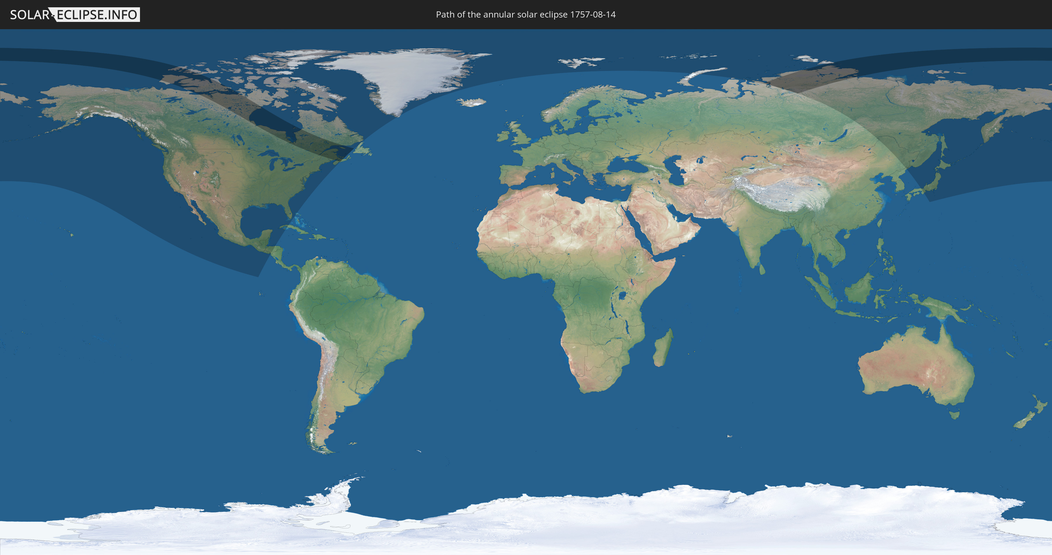
Die Sonnenfinsternis am 08/14/1757 kann man in 16 Ländern als partielle Sonnenfinsternis beobachten.
Der Finsternispfad verläuft durch 3 Länder. Nur in diesen Ländern ist sie als annular Sonnenfinsternis zu sehen.
In den folgenden Ländern ist die Sonnenfinsternis annular zu sehen
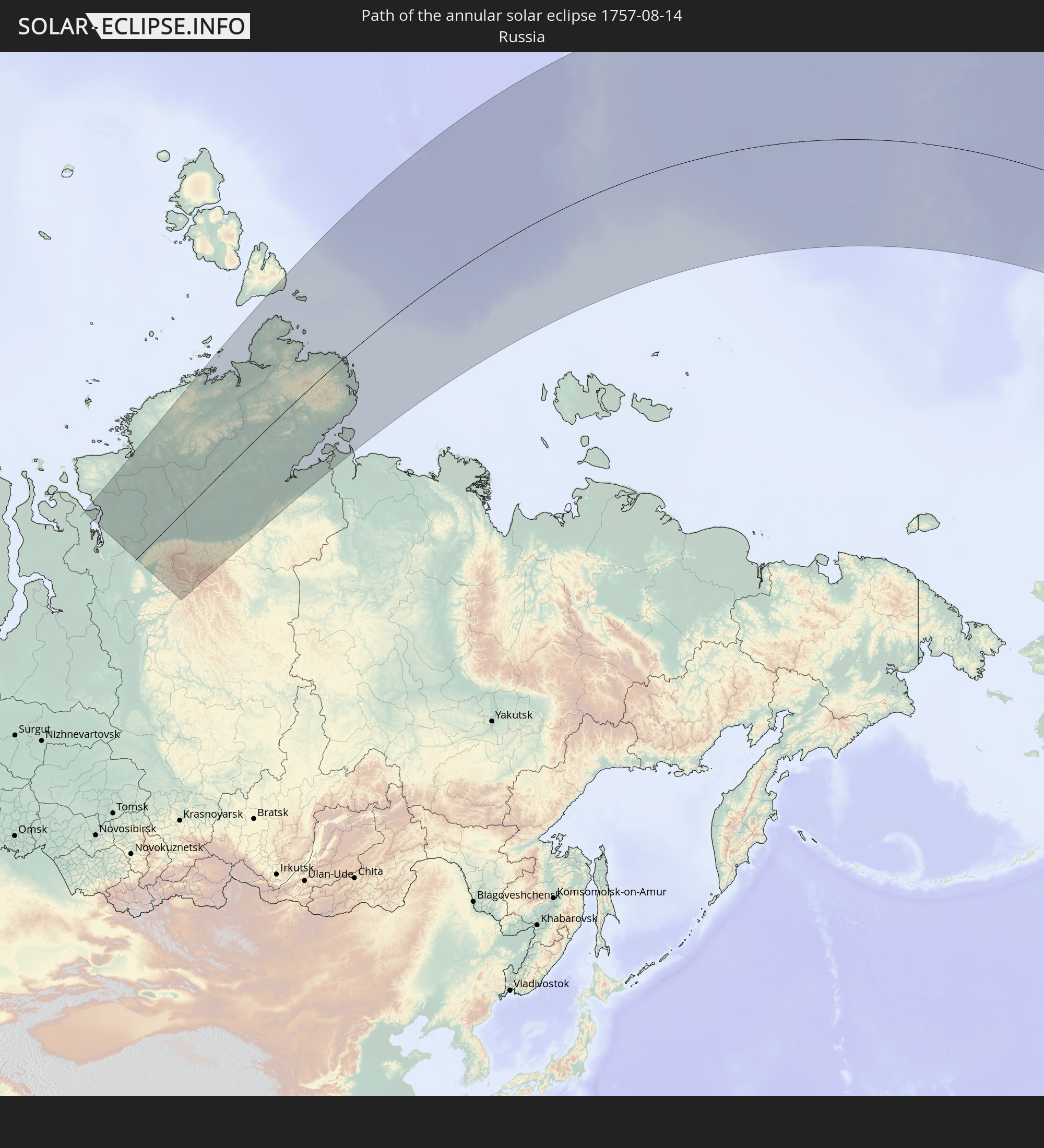 Russia
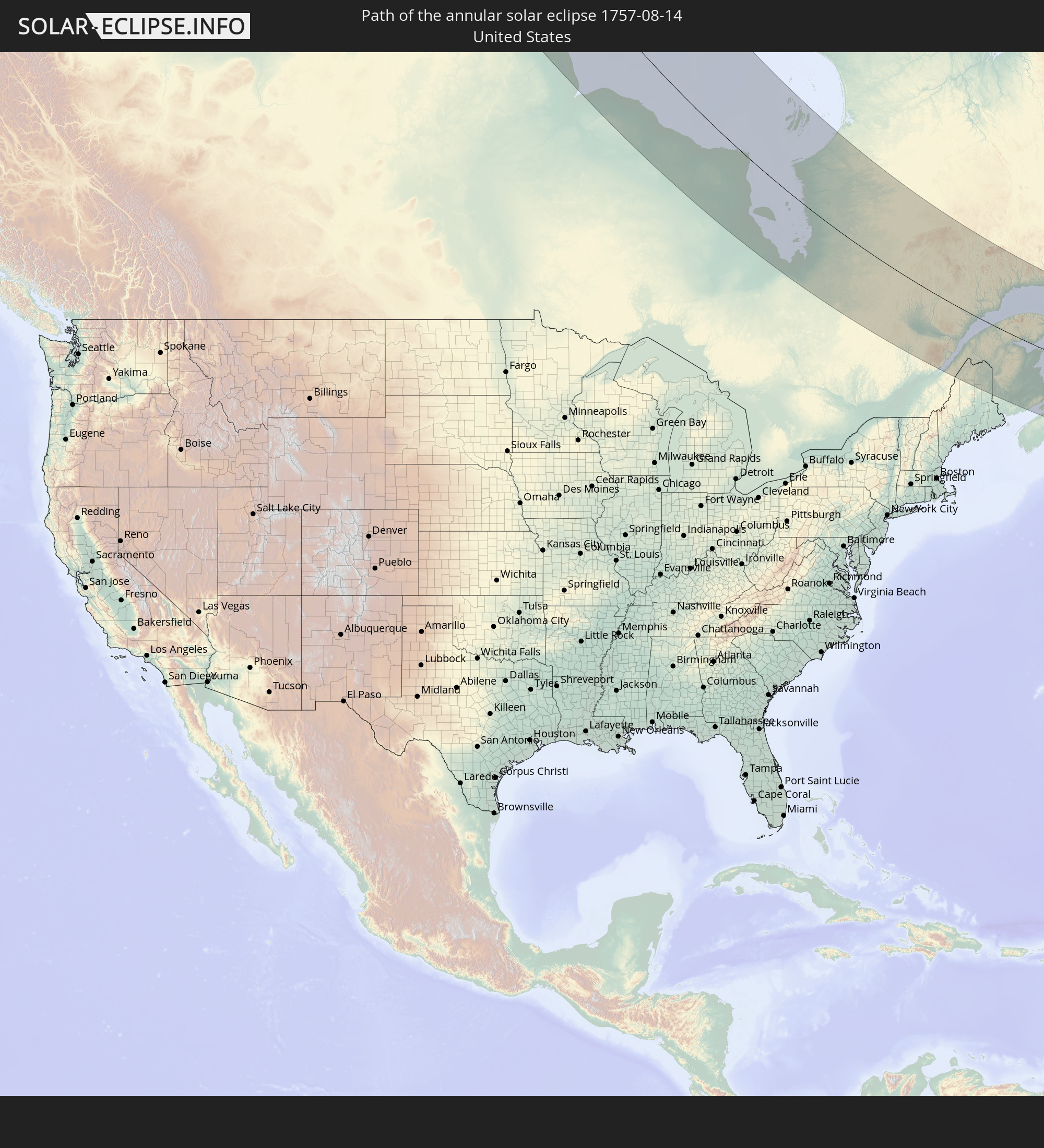 United States
 Canada
In den folgenden Ländern ist die Sonnenfinsternis partiell zu sehen


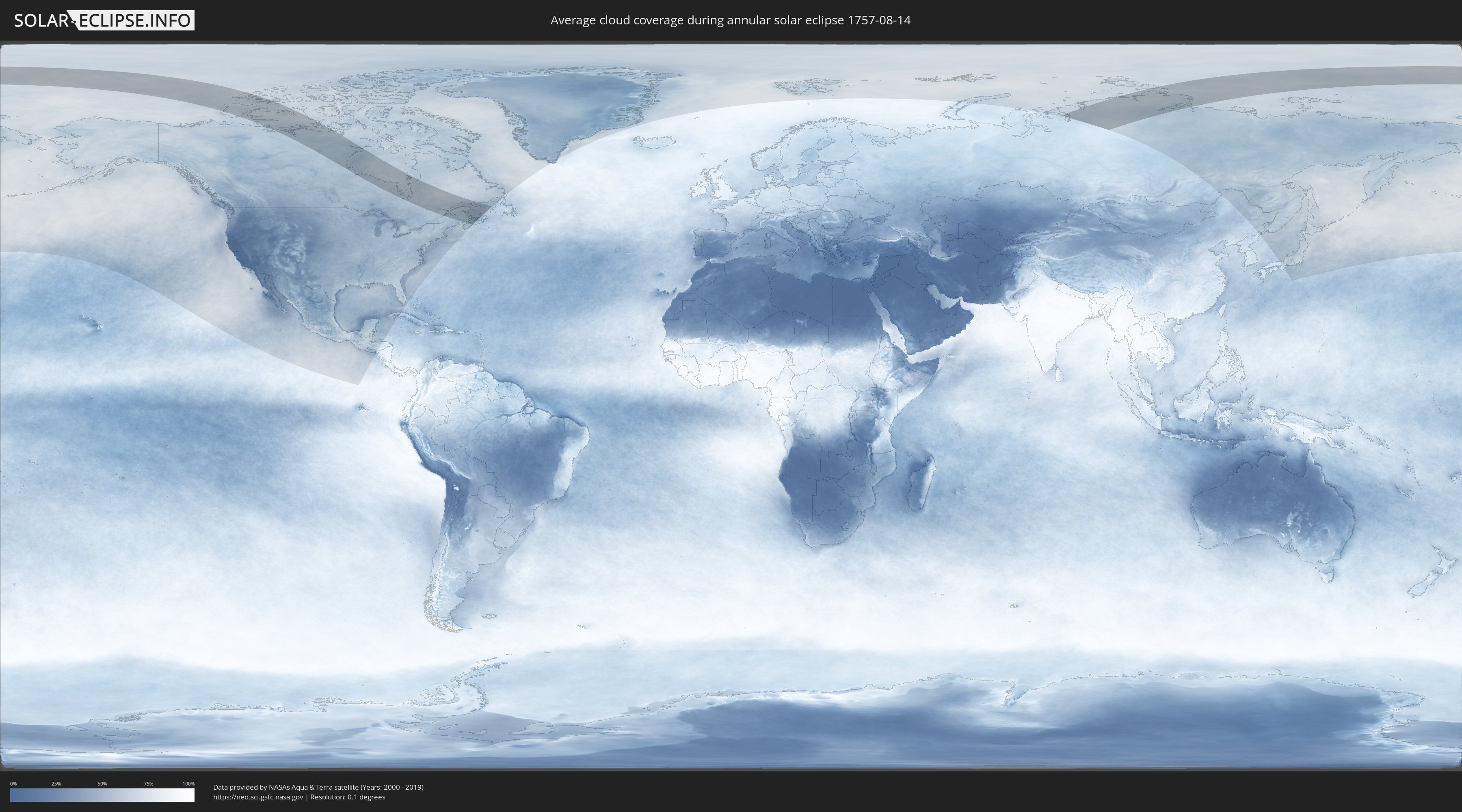
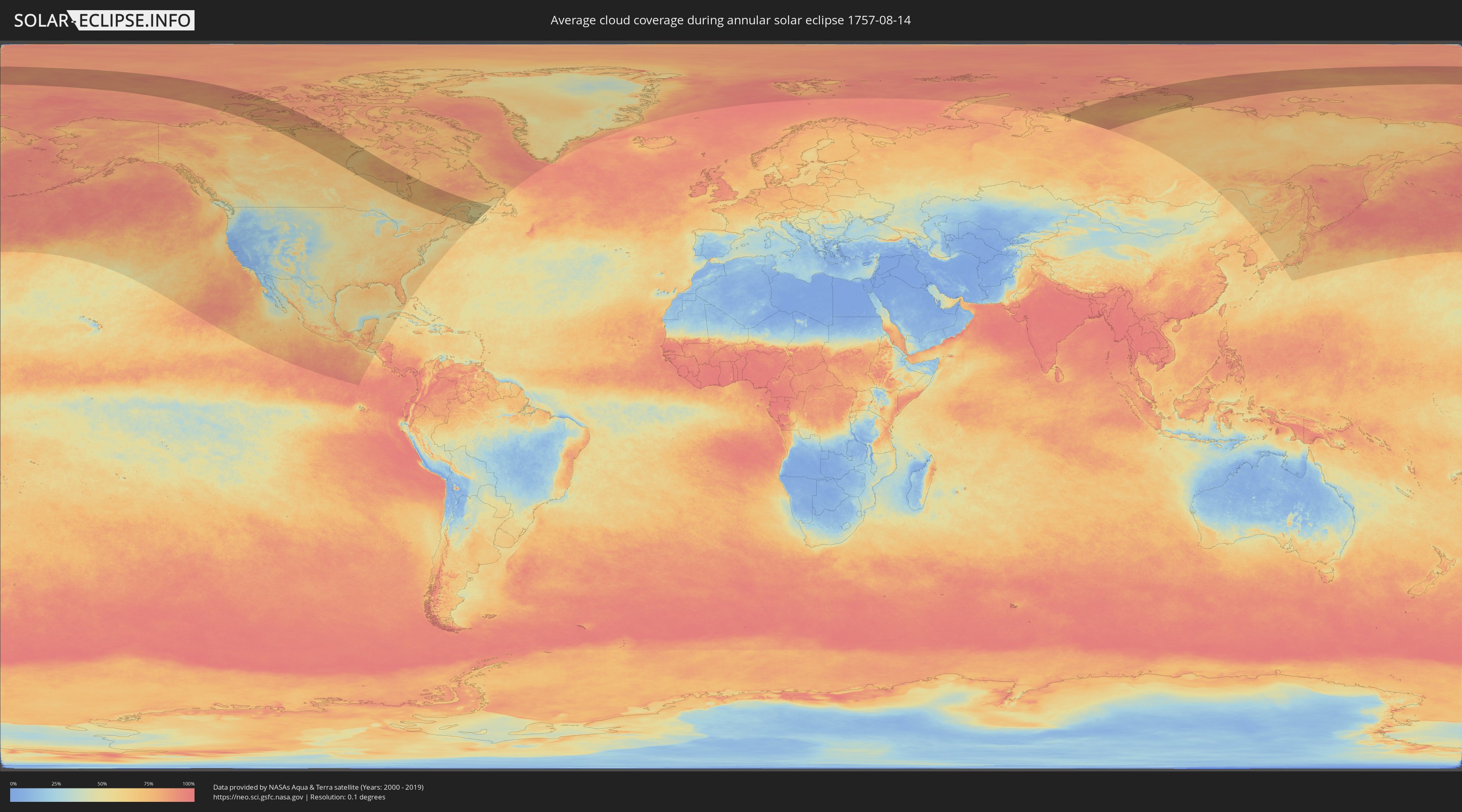
How will be the weather during the annular solar eclipse on 08/14/1757?
Where is the best place to see the annular solar eclipse of 08/14/1757?
The following maps show the average cloud coverage for the day of the annular solar eclipse.
With the help of these maps, it is possible to find the place along the eclipse path, which has the best
chance of a cloudless sky.
Nevertheless, you should consider local circumstances and inform about the weather of your chosen
observation site.
The data is provided by NASAs satellites
AQUA and TERRA.
The cloud maps are averaged over a period of 19 years (2000 - 2019).
Detailed country maps
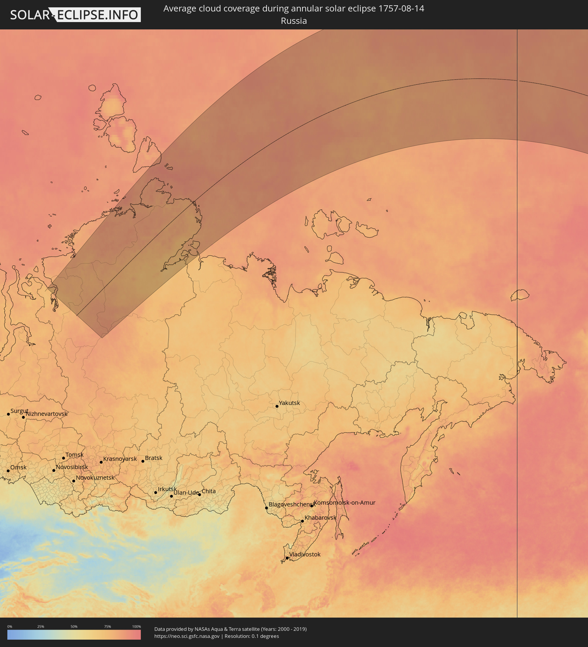 Russia
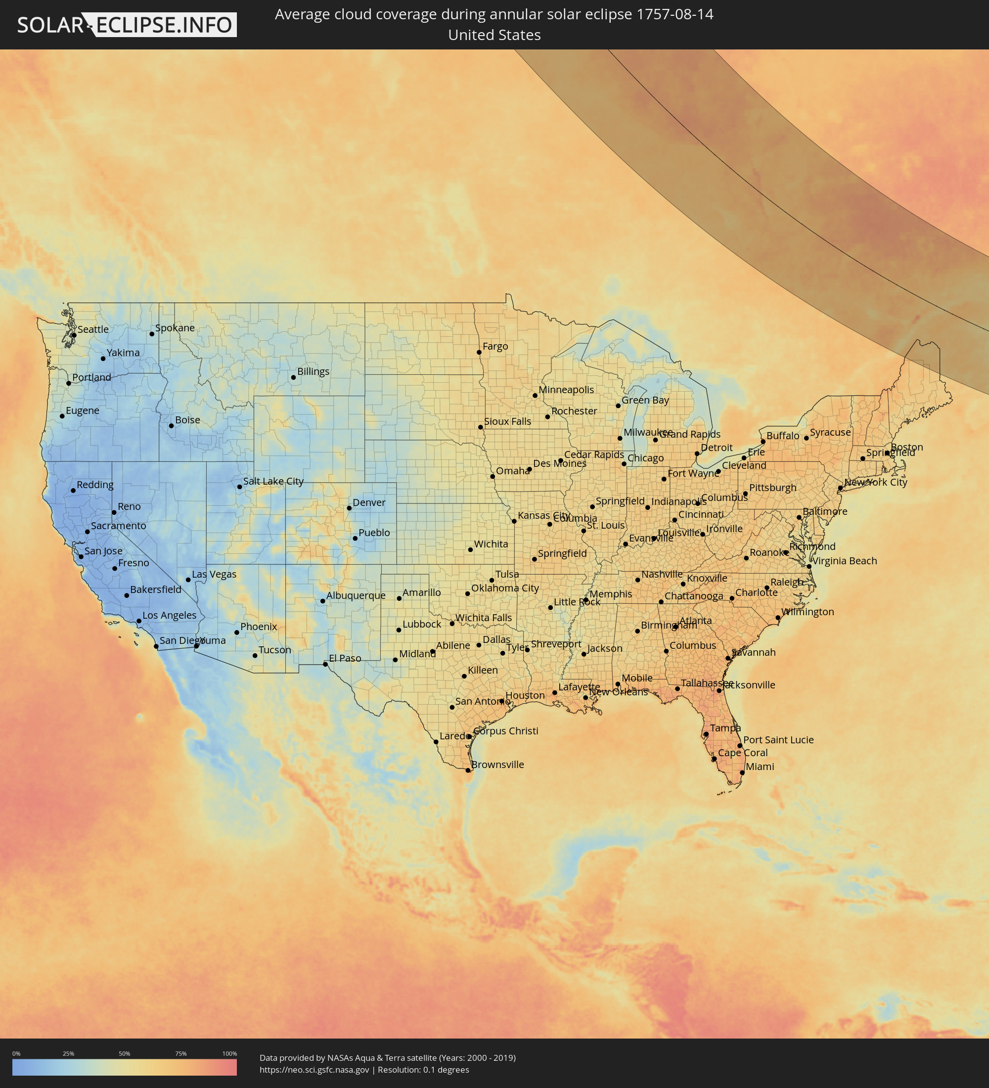 United States
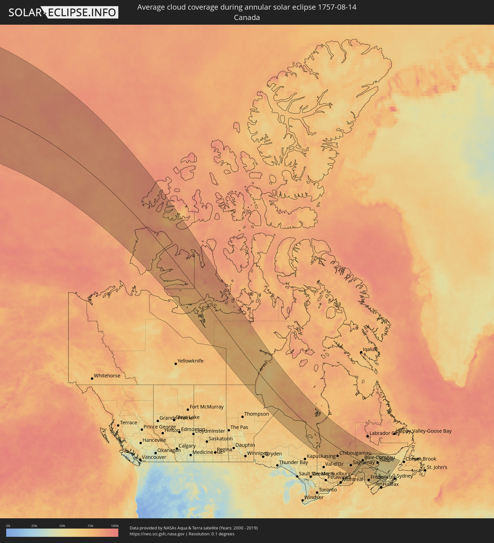 Canada
Cities inside the path of the eclipse
The following table shows all locations with a population of more than 5,000 inside the eclipse path. Cities which have more than 100,000 inhabitants are marked bold. A click at the locations opens a detailed map.
| City | Type | Eclipse duration | Local time of max. eclipse | Distance to central line | Ø Cloud coverage |
 Chibougamau, Quebec
|
annular | - | 18:10:32 UTC-05:00 | 125 km | 72% |
|
Saint-Félicien, Quebec
|
annular | - | 18:12:29 UTC-05:00 | 177 km | 65% |
|
Roberval, Quebec
|
annular | - | 18:12:40 UTC-05:00 | 180 km | 64% |
|
Dolbeau-Mistassini, Quebec
|
annular | - | 18:12:02 UTC-05:00 | 147 km | 64% |
|
Pont Rouge, Quebec
|
annular | - | 18:11:59 UTC-05:00 | 140 km | 65% |
|
Alma, Quebec
|
annular | - | 18:12:29 UTC-05:00 | 157 km | 64% |
|
Jonquière, Quebec
|
annular | - | 18:12:38 UTC-05:00 | 156 km | 70% |
|
Saguenay, Quebec
|
annular | - | 18:12:36 UTC-05:00 | 149 km | 71% |
|
Montmagny, Quebec
|
annular | - | 18:14:57 UTC-05:00 | 273 km | 57% |
|
Baie-Saint-Paul, Quebec
|
annular | - | 18:14:09 UTC-05:00 | 226 km | 65% |
|
La Malbaie, Quebec
|
annular | - | 18:13:42 UTC-05:00 | 193 km | 65% |
|
Rivière-du-Loup, Quebec
|
annular | - | 18:13:15 UTC-05:00 | 155 km | 59% |
|
Rimouski, Quebec
|
annular | - | 18:11:54 UTC-05:00 | 60 km | 64% |
|
Edmundston, New Brunswick
|
annular | - | 18:59:16 UTC-04:14 | 160 km | 64% |
|
Mont-Joli, Quebec
|
annular | - | 18:11:35 UTC-05:00 | 34 km | 60% |
|
Baie-Comeau, Quebec
|
annular | - | 18:10:29 UTC-05:00 | 33 km | 63% |
 Presque Isle, Maine
|
annular | - | 18:14:44 UTC-05:00 | 220 km | 67% |
|
Caribou, Maine
|
annular | - | 18:14:26 UTC-05:00 | 201 km | 64% |
|
Matane, Quebec
|
annular | - | 18:10:59 UTC-05:00 | 15 km | 60% |
|
Amqui, Quebec
|
annular | - | 18:11:35 UTC-05:00 | 27 km | 67% |
|
Port-Cartier, Quebec
|
annular | - | 18:08:44 UTC-05:00 | 154 km | 71% |
|
Campbellton, New Brunswick
|
annular | - | 18:57:43 UTC-04:14 | 43 km | 64% |
|
Fredericton, New Brunswick
|
annular | - | 19:01:07 UTC-04:14 | 252 km | 66% |
|
Sainte-Anne-des-Monts, Quebec
|
annular | - | 18:10:11 UTC-05:00 | 75 km | 61% |
|
Oromocto, New Brunswick
|
annular | - | 19:01:14 UTC-04:14 | 257 km | 66% |
|
Sept-Îles, Quebec
|
annular | - | 18:08:19 UTC-05:00 | 186 km | 70% |
|
Bathurst, New Brunswick
|
annular | - | 18:58:02 UTC-04:14 | 51 km | 65% |
|
Miramichi, New Brunswick
|
annular | - | 18:58:57 UTC-04:14 | 105 km | 62% |
|
Lutes Mountain, New Brunswick
|
annular | - | 19:00:11 UTC-04:14 | 178 km | 63% |
|
Moncton, New Brunswick
|
annular | - | 19:00:13 UTC-04:14 | 180 km | 62% |
|
Dieppe, New Brunswick
|
annular | - | 19:00:12 UTC-04:14 | 179 km | 61% |
|
Chandler, Quebec
|
annular | - | 18:10:54 UTC-05:00 | 54 km | 59% |
|
Kentville, Nova Scotia
|
annular | - | 19:01:43 UTC-04:14 | 276 km | 61% |
|
Gaspé, Quebec
|
annular | - | 18:10:02 UTC-05:00 | 110 km | 60% |
|
Sackville, New Brunswick
|
annular | - | 19:00:20 UTC-04:14 | 185 km | 56% |
|
Amherst, Nova Scotia
|
annular | - | 19:00:24 UTC-04:14 | 190 km | 57% |
|
Summerside, Prince Edward Island
|
annular | - | 18:59:21 UTC-04:14 | 120 km | 55% |
|
Truro, Nova Scotia
|
annular | - | 19:00:46 UTC-04:14 | 211 km | 60% |
|
Charlottetown, Prince Edward Island
|
annular | - | 18:59:21 UTC-04:14 | 117 km | 60% |